Improving Surface-based Data Quality through Improved Standardization of Practice and Procedures In Situ Observation Experience & Regional Needs
|
|
|
- Ronald Terry
- 5 years ago
- Views:
Transcription

1 Improving Surface-based Data Quality through Improved Standardization of Practice and Procedures In Situ Observation Experience & Regional Needs Dr. Li Bai China Meteorological Administration Dec.2014
2 Outline CMA Integrated Observation System Layout CMA s Experience in Quality Control of Surface-based Observation Data Suggestions from CMA
3 CMA Integrated Observation System Layout


4 Surface observation network operated by CMA CMA s surface-based observation have three levels ; So far, CMA has established a surface observation network consisting of about First level is reference climate stations, and the second level is basic synoptic stations; the third automatic level is general weather meteorological stations of various stations. elements. Above the ground stations are maintained by someone but they are automatic observation stations. in addition, CMA also establish about meso-scale automatic weather stations Total:2419 stations 143 reference climate stations 684 basic synoptic stations 1592 meteorological observing stations 120 upper-air observing stations 4


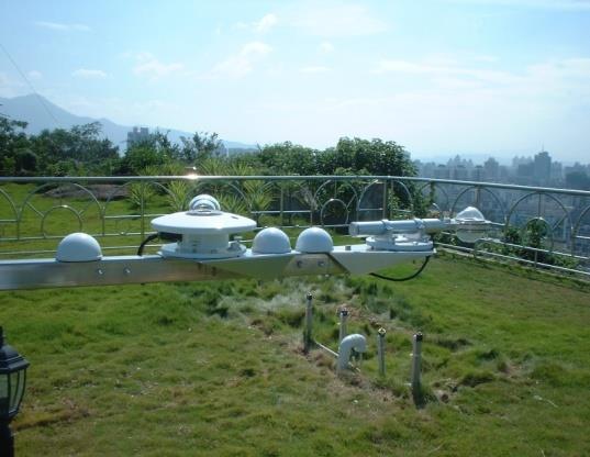


5 Observation elements for automatic weather stations Temperature and humidity Precipitation Evaporation Ground temperature Radiation Terminal for data processing


6 L-band automatic sounding Detection instrument:750g balloon with L-band radiosonde Surface instrument:l-band secondary radar Auxiliary instrument:based test box, hydrogen production equipment by electrolysis Transmitted signal Balloon and radiosonde Returned signal Radar system Data processing system


7 CINRAD Network CMA operates a network of 216 weather radars, 123 of which are S-band and 93 are C-band. And CMA plans to upgrade it to dual-polarization network in the next 10 years. S-band C-band

8 CINRAD Maintenance System Two-Level Management : National and Provincial level managment Three-Level Maintenance : National, Provincial and Radar site three levels

9 Wind Profiler Radar Network in China Plan to build 186 wind profilers, most of which have a detection height of 8km. Site interval of km in east, central and south of china where are frequent heavy rainfall, strong convection, and haze. Establish four regional experiment networks to meet operational requirements and technological development. (By four regional experiment networks,to establish standards, operational procedures etc.) Beijing Tianjin- Hebei Network Four Experiment network Yangtze River Delta Network Sichuan Tibet Network Pearl River Delta Network
10 CMA s Experience in Quality Control of Surface-based Observation Data


11 1. Standardizations on surface observations Actions We establish Instrument Requirements Definition which standardizes the main performances, technical specifications, function requirements, etc., of the meteorological instruments, meanwhile, we set strict examination before they are put into use. Function and benefit Standardize meteorological instruments, which makes management and training easier We establish Data Dictionary which standardize the variable name, device status name, communication protocol, data format and so on during data transfer. Standardize communication which makes the system stable and easy to use We establish a Device Controller which allows all instruments in a station to be accessed and controlled by the standardized interface and control instruction Standardize integrated system which makes the station more flexible
, establishes rules and regulations to")


12 1. Standardizations on surface observations Actions An organization, named National Technical Committee 346 on Basic Information of Meteorology of Standardization Administration of China(SAC/TC346), establishes rules and regulations to standardize meteorological operations in China. Function and benefit Effective and authoritative SAC/TC346 enable effective work on standardization in China A software named Integrated Surface Observing System (ISOS) enables observer to finish their daily routines, and the software is applied to all stations. A standardized data quality control system is widely used which contains checks for value, temporal consistency, spatial consistency, internal consistency, extended quality control, human interface and so on. Easier and fewer error ISOS standardize work as system monitoring, operation managing, equipment maintenance, etc. Reliable Sophisticated data QC at sensor, station, data center and national data processing center produces more reliable datasets


13 2. Standardizations on Weather Radar Establishing standardized test and calibration procedure is important to ensure data comparability and consistency for weather radar observation network. For example, radar constant includes key parameters in transmitter, receiver, antenna and should be monitored and calibrated at the end of every volume scan.
14 2. Standardizations on Weather Radar As ground-based observation network develops towards remote measuring and remote sensing, therefore,standardized test and calibration is becoming more and more important for improving radar data quality. For example, standard calibration nodes should be selected and monitored during radar operation Block diagram of radar calibration unit in China
15 3. Standardizations on Wind Profiler Establish unified and standardized quality control(qc) workflow for wind profilers: Ensuring consistency and accuracy of the wind profiler data. Providing different QC data to various users and application nodes. For example, precipitation influences the accuracy of wind measured by wind profiler radar. For NWP, precipitation interference should be rejected. But for weather diagnosis, precipitation and wind information should be retained. Operational QC workflow for wind profiler radar in China

 than before(upper).")
16 3. Standardizations on Wind Profiler Different observation data have various quality control methods for different application nodes. For some information, they should be eliminated in some application node while need to be maintained in another application node. Demonstration of bimodal spectrum identification QC technology of wind profiler radar in precipitation. The wind direction in green box is more consistent and reasonable after QC(lower) than before(upper). Super-refraction(red circle) for weather radar observation before(left) and after (right) quality control. For example: Super refraction echo can be used to analyze weather conditions such as atmospheric stratification but it must be removed in quantitative estimates of precipitation


17 4. Standardizations on Metadata Establish unified metadata standards for weather radars and wind profilers in order to improve data quality. For example, metadata such as radar coordinates, elevation, main configuration parameters, observation mode, data processing and quality control method, etc will have a significant impact on observation data quality.


18 5. Standardizations on Operational Monitoring We have established Atmospheric Observing System Operating and Monitoring-ASOM platform. Up to now, ASOM can monitoring the integrated meteorological observation equipments as follow: Radar Radiosonde WPR AWS Lightning 172 CINRADs 120 Upper-air stations 40 Wind profiler radar 2418 National Surface AWS 601 GPS/MET 315 Lightning stations 1866 Soil moisture Station

19 5. Standardizations on Operational Monitoring As the status information is very important evidence for establishing data quality control methods, we should consider it as a crucial index for equipment performance. Transmitted pulse Rfsignal BIT control Antenna/feeder system Echo signal For example, by monitoring the variations in transmitted power of weather radar, we can judge radar performance and analyze its effect on observation data quality. BIT Launch Receiver Raw data servomechanism BIT control BIT Fiber Monitorin Optical fiber Data processing and display Radar monitoring points design

20 5. Standardizations on Operational Monitoring UPPER-AIR DATA station Provincial National 1 STATION LOCATION CHECK 2 PLAUSIBLE VALUE CHECK 3 INTERNAL CONSISTENCY CHECK 4 TIME CONSISTENCY CHECK 5 STATISTICS CHECK 6 VERTICAL CONSISTENCY CHECK 7 HORIZONTAL CONSISTENCY CHECK 8 COMPLEX QUALITY ANALYSIS These diagrams depict quality control flowcharts for surface and upper-air observation data. Observing Station QC Data files Format check and station parameter check Feedback Upload Climatic threshold or allowance value check Station extreme value check Provincial Department QC Internal consistency check Feedback Upload Temporal consistency check National Department QC Spatial consistency check Manmachine interactive check


21 6. The Benefit and Achievement on Operational Monitoring Establish standard and unified software system - Operational Monitoring - Help Desk and Hotline - Operational Evaluation - Information Release As you can see, the operational availability for radar and AWS in China improves greatly year by year.


 Statistics in 2013: Radar abnormal data: 30000;")


22 6. The Benefit and Achievement on Operational Monitoring / 通用格式 / 通用格式 / 通用格式 / 通用格式 / 通用格式 / 通用格式 / 通用格式 / 通用格式 / 通用格式 / 通用格式 / 通用格式 Radar 天气雷达自动站 AWS Sounding 探空系统 failure 设备故障 Abnormal 产品异常 Data 数据错误 error Format 报文异常 err 国家级台站自动气象站年运行评估详情 AWS Data Quality Effect Factor ratio in 2013 We also conduct statistical analysis and evaluation for observation data quality 缺报, 2101, 34% 数据错误, 4145, 66% None 缺报时间 (h) file Error 数据错误时间 data (h) Statistics in 2013: Radar abnormal data: 30000; National surface AWS error data: 4145 Upper-air sounding failure: 8 Sounding Temp. and Wind Velocity Data Err in 2013 时次 ( h ) 自动站各厂家数据质量统计情况 Different Type AWS Data Quality analysis in 无锡所 Vaisala 中国华云广东中环天仪长春厂 厂家 None file Format err Data err 数据报文缺报时次 报文格式错误时次 观测数据错误时次
23 Suggestions from CMA
24 Suggestions from CMA 1. Establishing operational status information standards for surface-based observation instrument and equipment, can improve the observation data quality, and hence should be made as an important performance index for instrument and equipment themselves. It is necessary to establish status information standards and specifications for various ground-based observation instrument and equipment, in order to improve data quality. As status information is important evidence for establishing data quality control methods, we should consider the instrument and equipment outputs as crucial indexes for their performance. 2. Establishing standardized equipment test and calibration is important to ensure data comparability and consistency for observation network. As ground-based observation network develops towards remote measuring and remote sensing, standardized test and calibration is becoming more and more important for improving data quality.
25 Suggestions from CMA 3. Establishing unified and standardized quality control methods for observation data in various application nodes is important to improve data availability and accuracy. Different observation data have various quality control methods for different applications. For some information, they should be eliminated in some application node while need to be maintained in another application node, such as interference of precipitation on wind profiler, and super-refraction for weather radar observation.
26 Suggestions from CMA 4. Establishing metadata standards for the surface-based remote sensing observation network (such as weather radar network, wind profiler radar network, prospective microwave radiometer network, etc.) is an important foundation for improving data quality of surface-based observation. With the development of integrated meteorological observation network towards the direction of remote sensing technology, a large number of surface-based remote sensing equipment and instrument will enter the integrated meteorological observation network in future. To make and establish unified and standardized metadata standards of surface-based remote sensing observation, not only relates to the observation data quality, but also affect applications in weather forecast operation and numerical forecast model. For weather radar network, basic information such as radar coordinates, elevation, main configuration parameters and observation mode, data processing and quality control methods and so on, all of these will have a significant impact on the quality of weather radar observation data. Therefore, under the background of global weather radar data exchange, CIMO should make and establish a unified standard in order to ensure reliability and standardization of surface-based remote sensing observation data from different countries and further promote the application of surface-based remote sensing data in meteorological operations, especially in the numerical forecast model.
27 Thank you for your attention!
Emerging Needs, Challenges and Response Strategy
 Emerging Needs, Challenges and Response Strategy Development of Integrated Observing Systems in China JIAO Meiyan Deputy Administrator China Meteorological Administration September 2011 Geneva Outline
Xinhua Liu National Meteorological Center (NMC) of China Meteorological Administration (CMA)
 of China Meteorological Administration (CMA)") The short-time forecasting and nowcasting technology of severe convective weather for aviation meteorological services in China Xinhua Liu National Meteorological Center (NMC) of China Meteorological Administration
The short-time forecasting and nowcasting technology of severe convective weather for aviation meteorological services in China Xinhua Liu National Meteorological Center (NMC) of China Meteorological Administration
2012 Typhoon Activity Prediction
 2012 Typhoon Activity Prediction Published by Shanghai Typhoon Institute of China Meteorological Administration 4 May 2012 Prediction of 2012 Northwest Pacific Basin and South China Sea Tropical Cyclone
QUALITY MANAGEMENT IN SURFACE, CLIMATE AND UPPER-AIR OBSERVATIONS IN CHINA
 China JMA/WMO Workshop on Quality Management in Surface, Climate and Upper-air Observations in RA II (Asia) Tokyo, Japan 27-30 July 2010 Doc. Country (.VII.2010) QUALITY MANAGEMENT IN SURFACE, CLIMATE
The Vaisala AUTOSONDE AS41 OPERATIONAL EFFICIENCY AND RELIABILITY TO A TOTALLY NEW LEVEL.
 The Vaisala AUTOSONDE AS41 OPERATIONAL EFFICIENCY AND RELIABILITY TO A TOTALLY NEW LEVEL. Weather Data Benefit For Society The four most important things about weather prediction are quality, reliability,
OPAG on Integrated Observing Systems. Workshop to Improve the Usefulness of Operational Radiosonde Data. (Submitted by the Secretariat)
") WORLD METEOROLOGICAL ORGANIZATION COMMISSION FOR BASIC SYSTEMS CBS MANAGEMENT GROUP Fourth session Langen, Germany, 13-16 October 2003 Distr.: RESTRICTED CBS/MG-IV/Doc. 3.1(5) (24.IX.2003) ITEM: 3.1 ENGLISH
WORLD METEOROLOGICAL ORGANIZATION COMMISSION FOR BASIC SYSTEMS CBS MANAGEMENT GROUP Fourth session Langen, Germany, 13-16 October 2003 Distr.: RESTRICTED CBS/MG-IV/Doc. 3.1(5) (24.IX.2003) ITEM: 3.1 ENGLISH
2011 Typhoon Activity Prediction
 2011 Typhoon Activity Prediction Published by Shanghai Typhoon Institute of China Meteorological Administration April 21th, 2011 Prediction of 2011 Northwest Pacific Basin and South China Sea Tropical
* * * Table (1) Table (2)
 Table (2)") A step Forward to Atomize the Sudan Meteorological Authority (SMA) Net work Y.S. Odan Surface Instruments Department Tel: 00249 912220246 E-mail yaseen@ersad.gov.sd Abstract AWS has been introduced to
A step Forward to Atomize the Sudan Meteorological Authority (SMA) Net work Y.S. Odan Surface Instruments Department Tel: 00249 912220246 E-mail yaseen@ersad.gov.sd Abstract AWS has been introduced to
Techniques of Severe Convective Weather Comprehensive Monitoring
 Techniques of Severe Convective Weather Comprehensive Monitoring Yongguang Zheng, Lin Yinjing, Zhu Wenjian, Lan Yu, Tang Wenyuan, Zhang Xiaoling, Mao Dongyan, Zhou Qingliang, Zhang Zhigang Severe Weather
Development of Tropical cyclone objective analysis technique based on FY serial satellite data
 2 nd International Workshop On Satellite Analysis of Tropical Cyclones (IWSATC-2) Update on Objective Satellite-Based TC Analysis Methods 18 February 2016 Honolulu, Hawaii, USA Development of Tropical
Updates on Chinese Meteorological Satellite Programs
 6 th Asia/Oceania Meteorological Satellite Users Conference Updates on Chinese Meteorological Satellite Programs Caiying Wei Deputy director-general of NSMC National Satellite Meteorological Center (NSMC)
Progress on GCOS-China CMA IOS Development Plan ( ) PEI, Chong Department of Integrated Observation of CMA 09/25/2017 Hangzhou, China
 PEI, Chong Department of Integrated Observation of CMA 09/25/2017 Hangzhou, China") Progress on GCOS-China CMA IOS Development Plan (2016-2020) PEI, Chong Department of Integrated Observation of CMA 09/25/2017 Hangzhou, China 1. Progress on GCOS-China 1 Organized GCOS-China GCOS-China
Progress on GCOS-China CMA IOS Development Plan (2016-2020) PEI, Chong Department of Integrated Observation of CMA 09/25/2017 Hangzhou, China 1. Progress on GCOS-China 1 Organized GCOS-China GCOS-China
HY-2A Satellite User s Guide
 National Satellite Ocean Application Service 2013-5-16 Document Change Record Revision Date Changed Pages/Paragraphs Edit Description i Contents 1 Introduction to HY-2 Satellite... 1 2 HY-2 satellite data
Surveying,Mapping and Geoinformation Services System for the Major Natural Disasters Emergency Management in China
 Surveying,Mapping and Geoinformation Services System for the Major Natural Disasters Emergency Management in China 21 February 2013, Bangkok, Thailand Contents 2 1 2 3 4 Working Mechanism Geoinformation
1 Introduction. Station Type No. Synoptic/GTS 17 Principal 172 Ordinary 546 Precipitation
 Use of Automatic Weather Stations in Ethiopia Dula Shanko National Meteorological Agency(NMA), Addis Ababa, Ethiopia Phone: +251116639662, Mob +251911208024 Fax +251116625292, Email: Du_shanko@yahoo.com
and soils characterizing would be defined.
 Working out of the basic network for monitoring of natural and climatic processes in Siberia M.V. Kabanov, V.V. Zuev, V.А. Krutikov Institute of Monitoring of Climatic and Ecological Systems SB RAS, Tomsk,
Quality assurance for sensors at the Deutscher Wetterdienst (DWD)
") Quality assurance for sensors at the Deutscher Wetterdienst (DWD) Quality assurance / maintenance / calibration Holger Dörschel, Dr Tilman Holfelder WMO International Conference on Automatic Weather Stations
Quality assurance for sensors at the Deutscher Wetterdienst (DWD) Quality assurance / maintenance / calibration Holger Dörschel, Dr Tilman Holfelder WMO International Conference on Automatic Weather Stations
Research on Lightning Warning with SAFIR Lightning Observation and Meteorological detection Data in Beijing-Hebei Areas
 Research on Lightning Warning with SAFIR Lightning Observation and Meteorological detection Data in Beijing-Hebei Areas Meng Qing 1 Zhang Yijun 1 Yao Wen 1 Zhu Xiaoyan 1 He Ping 1 Lv Weitao 1 Ding Haifang
Research on Lightning Nowcasting and Warning System and Its Application
 Research on Lightning Nowcasting and Warning System and Its Application Wen Yao Chinese Academy of Meteorological Sciences Beijing, China yaowen@camscma.cn 2016.07 1 CONTENTS 1 2 3 4 Lightning Hazards
SOME STEP OF QUALITY CONTROL OF UPPER-AIR NETWORK DATA IN CHINA. Zhiqiang Zhao
 SOME STEP OF QUALITY CONTROL OF UPPER-AIR NETWORK DATA IN CHINA Zhiqiang Zhao China Meteorological Administration (CMA) 46, Zhongguancun Nandajie, Beijing, 100081,China Tel: 8610-68407362, Fax: 8610-62179786,
APPENDIX 2 OVERVIEW OF THE GLOBAL PRECIPITATION MEASUREMENT (GPM) AND THE TROPICAL RAINFALL MEASURING MISSION (TRMM) 2-1
 AND THE TROPICAL RAINFALL MEASURING MISSION (TRMM) 2-1") APPENDIX 2 OVERVIEW OF THE GLOBAL PRECIPITATION MEASUREMENT (GPM) AND THE TROPICAL RAINFALL MEASURING MISSION (TRMM) 2-1 1. Introduction Precipitation is one of most important environmental parameters.
APPENDIX 2 OVERVIEW OF THE GLOBAL PRECIPITATION MEASUREMENT (GPM) AND THE TROPICAL RAINFALL MEASURING MISSION (TRMM) 2-1 1. Introduction Precipitation is one of most important environmental parameters.
The Status Report of FY-2F
 Seventh Session of the Expert Team on Satellite Utilization and Products The Status Report of FY-2F Presented by Xiang Fang National Satellite Meteorological Center (NSMC) China Meteorological Administration
SWAN The Operational System for Nowcasting and Very-short Range Forecast in CMA
 SWAN The Operational System for Nowcasting and Very-short Range Forecast in CMA National Meteorological Center (NMC) China Meteorological Administration (CMA) Mao Dongyan, Zheng Yuanyuan, Zhou Kanghui
Guidelines on Quality Control Procedures for Data from Automatic Weather Stations
 Guidelines on Quality Control Procedures for Data from Automatic Weather Stations Igor Zahumenský Slovak Hydrometeorological Institute SHMI, Jeséniova 17, 833 15 Bratislava, Slovakia Tel./Fax. +421 46
The current status of FY-3D. (Submitted by Xiang Fang, CMA) Summary and Purpose of Document
 Summary and Purpose of Document") WORLD METEOROLOGICAL ORGANIZATION COMMISSION FOR BASIC SYSTEMS OPEN PROGRAMME AREA GROUP ON INTEGRATED OBSERVING SYSTEMS INTER-PROGRAMME EXPERT TEAM ON SATELLITE UTILIZATION AND PRODUCTS FOURTH SESSION
WORLD METEOROLOGICAL ORGANIZATION COMMISSION FOR BASIC SYSTEMS OPEN PROGRAMME AREA GROUP ON INTEGRATED OBSERVING SYSTEMS INTER-PROGRAMME EXPERT TEAM ON SATELLITE UTILIZATION AND PRODUCTS FOURTH SESSION
REQUIREMENTS FOR WEATHER RADAR DATA. Review of the current and likely future hydrological requirements for Weather Radar data
 WORLD METEOROLOGICAL ORGANIZATION COMMISSION FOR BASIC SYSTEMS OPEN PROGRAMME AREA GROUP ON INTEGRATED OBSERVING SYSTEMS WORKSHOP ON RADAR DATA EXCHANGE EXETER, UK, 24-26 APRIL 2013 CBS/OPAG-IOS/WxR_EXCHANGE/2.3
Assessment and selection of regional automatic weather stations. in China based on RRR principle of WMO
 Assessment and selection of regional automatic weather stations in China based on RRR principle of WMO Guo Jianxia 1, Pei Chong 1, Zhang Wenlong 2,Xue Zhengzheng 3, KangJiaqi 1, Shao Changliang 1, Chen
Performance of Radar Wind Profilers, Radiosondes, and Surface Flux Stations at the Southern Great Plains (SGP) Cloud and Radiation Testbed (CART) Site
 Cloud and Radiation Testbed (CART) Site") Performance of Radar Wind Profilers, Radiosondes, and Surface Flux Stations at the Southern Great Plains (SGP) Cloud and Radiation Testbed (CART) Site R. L. Coulter, B. M. Lesht, M. L. Wesely, D. R. Cook,
Performance of Radar Wind Profilers, Radiosondes, and Surface Flux Stations at the Southern Great Plains (SGP) Cloud and Radiation Testbed (CART) Site R. L. Coulter, B. M. Lesht, M. L. Wesely, D. R. Cook,
BUFR Table D List of common sequences
 BUFR Table D List of common sequences F X Category of sequences Identifier NONE Category 01 Location and identification sequences (Temperature and humidity instrumentation) 3 01 130 0 03 002 Generic type
Introductions to RIC-Beijing. NAN Xuejing, CUI Xiai Meteorological Observation Center China Meteorological Administration March,2018
 Introductions to RIC-Beijing NAN Xuejing, CUI Xiai China Meteorological Administration March,2018 Contents 1. China Meteorological Administration (CMA) Organization 2. (MOC) Functional Structure Responsibilities
WLS70: A NEW COMPACT DOPPLER WIND LIDAR FOR BOUNDARY LAYER DYNAMIC STUDIES.
 WLS70: A NEW COMPACT DOPPLER WIND LIDAR FOR BOUNDARY LAYER DYNAMIC STUDIES. VALIDATION RESULTS AND INTERCOMPARISON IN THE FRAME OF THE 8TH CIMO-WMO CAMPAIGN. S. Lolli 1, L.Sauvage 1, M. Boquet 1, 1 Leosphere,
Ground-based temperature and humidity profiling using microwave radiometer retrievals at Sydney Airport.
 Ground-based temperature and humidity profiling using microwave radiometer retrievals at Sydney Airport. Peter Ryan Bureau of Meteorology, Melbourne, Australia Peter.J.Ryan@bom.gov.au ABSTRACT The aim
Progress and Plan of China Xilinhot GRUAN works. Zhao Peitao Meteorological Observation Center (MOC) of CMA
 of CMA") Progress and Plan of China Xilinhot GRUAN works Zhao Peitao Email: peitaozhao@163.com Meteorological Observation Center (MOC) of CMA 2017-6-14 1 Strategic work plan 2 Operation level progress 3 Technical
Progress and Plan of China Xilinhot GRUAN works Zhao Peitao Email: peitaozhao@163.com Meteorological Observation Center (MOC) of CMA 2017-6-14 1 Strategic work plan 2 Operation level progress 3 Technical
WegenerNet: A new climate station network in Eastern Styria/Austria for monitoring weather and climate at 1 km-scale resolution
 Session GI 2 Atmosphere, Ocean, Meteorological Instruments and Ocean Observatory Instrumentation ; EGU General Assembly 2008; 13-18 Apr 2008, Vienna, Austria. WegenerNet: A new climate station network
Comparison of Vaisala Radiosondes RS41 and RS92 WHITE PAPER
 Comparison of Vaisala Radiosondes RS41 and RS92 WHITE PAPER Table of Contents CHAPTER 1 Introduction... 4 CHAPTER 2 Key Improvements in RS41... 5 CHAPTER 3 RS41 and RS92 Comparison Tables... 6 CHAPTER
REPORTS OF CHAIRS. Report of the Chair ET-ORS. (Submitted by Li Bai on Behalf of CIMO Expert Team on Operational Remote-Sensing)
") WORLD METEOROLOGICAL ORGANIZATION CBS/ET-SBRSO-2 & CIMO/ET-ORS- 1/Doc.2.2 JOINT MEETING OF (14.Xl.2011) CBS EXPERT TEAM ON SURFACE-BASED REMOTELY- SENSED OBSERVATIONS (Second Session) AND ITEM : 2.2 CIMO
WORLD METEOROLOGICAL ORGANIZATION CBS/ET-SBRSO-2 & CIMO/ET-ORS- 1/Doc.2.2 JOINT MEETING OF (14.Xl.2011) CBS EXPERT TEAM ON SURFACE-BASED REMOTELY- SENSED OBSERVATIONS (Second Session) AND ITEM : 2.2 CIMO
Remote sensing of haze aerosol over eastern China
 ISALSaRS'17, USTC, 21-June-2017 China University of Mining and Technology Remote sensing of haze aerosol over eastern China Qin Kai( 秦凯 ), CUMT ( 中国矿业大学 ) Wu Lixin, CSU( 中南大学 ) Wong Mansing, Hong Kong
Wind Resource Assessment Practical Guidance for Developing A Successful Wind Project
 December 11, 2012 Wind Resource Assessment Practical Guidance for Developing A Successful Wind Project Michael C Brower, PhD Chief Technical Officer Presented at: What We Do AWS Truepower partners with
THE CLIMATE INFORMATION MODULE
 Climate Information and Prediction Services (CLIPS) -Curriculum- THE CLIMATE INFORMATION MODULE designed by Dipl.-Met. Peer Hechler Deutscher Wetterdienst P.O. Box 10 04 65 63004 Offenbach Germany THE
QualiMET 2.0. The new Quality Control System of Deutscher Wetterdienst
 QualiMET 2.0 The new Quality Control System of Deutscher Wetterdienst Reinhard Spengler Deutscher Wetterdienst Department Observing Networks and Data Quality Assurance of Meteorological Data Michendorfer
通量数据质量控制的理论与方法 理加联合科技有限公司
 通量数据质量控制的理论与方法 理加联合科技有限公司 通量变量 Rn = LE + H + G (W m -2 s -1 ) 净辐射 潜热 感热 地表热 通量 通量 通量 通量 Fc (mg m -2 s -1 ) 二氧化碳通量 τ [(kg m s -1 ) m -2 s -1 ] 动量通量 质量控制 1. 概率统计方法 2. 趋势法 3. 大气物理依据 4. 测定实地诊断 5. 仪器物理依据 '
Specifications for a Reference Radiosonde for the GCOS Reference. Upper-Air Network (GRUAN)
") Specifications for a Reference Radiosonde for the GCOS Reference Upper-Air Network (GRUAN) By the Working Group on Atmospheric Reference Observations (WG-ARO) Final Version, October 2008 1. Introduction
Specifications for a Reference Radiosonde for the GCOS Reference Upper-Air Network (GRUAN) By the Working Group on Atmospheric Reference Observations (WG-ARO) Final Version, October 2008 1. Introduction
Operational Applications of Awos Network in Turkey
 Operational Applications of Awos Network in Turkey by Soner Karatas Turkish State Meteorological Service Electronic Observing Systems Division Kütükcü Alibey Cad. No:4 06120 Kalaba-Ankara-TURKEY Tel:+90-312-302
Data Quality Assurance System. Hong Kong, China
 INtegrated Meteorological Data Quality Assurance System (INDAS) in Hong Kong, China JMA/WMO Workshop on Quality Management in Surface, Climate and Upper-air Observations in RA II, Tokyo, 27-30 July 2010
ABSTRACT 3 RADIAL VELOCITY ASSIMILATION IN BJRUC 3.1 ASSIMILATION STRATEGY OF RADIAL
 REAL-TIME RADAR RADIAL VELOCITY ASSIMILATION EXPERIMENTS IN A PRE-OPERATIONAL FRAMEWORK IN NORTH CHINA Min Chen 1 Ming-xuan Chen 1 Shui-yong Fan 1 Hong-li Wang 2 Jenny Sun 2 1 Institute of Urban Meteorology,
Introduction to upper air measurements with radiosondes and other in situ observing systems. John Nash, C. Gaffard,R. Smout and M.
 Introduction to upper air measurements with radiosondes and other in situ observing systems John Nash, C. Gaffard,R. Smout and M. Smees Observation Development, Met Office, Exeter Integrated Ground-based
Country Report. India Meteorolog. gical ldepartment
 Country Report India Meteorolog gical ldepartment by M K Gupta Scientist-E India Meteorological Department Pun ne Historic cal facts Modest beginning in 1875 Progressively expanded its infrastructure for
Xueshun Shen Minghuan Wang Chinese Academy of Meteorological Sciences China Meteorological Administration Feng Xiao Tokyo Inst. of Tech.
 Application of a high-resolution conservative advection scheme to GRAPES meso-scale scale model Xueshun Shen Minghuan Wang Chinese Academy of Meteorological Sciences China Meteorological Administration
The first tropospheric wind profiler observations of a severe typhoon over a coastal area in South China
 The first tropospheric wind profiler observations of a severe typhoon over a coastal area in South China Lei Li, 1 Pak Wai Chan, 2 Honglong Yang, 1 Rong Zong, 1 Xia Mao, 1 Yin Jiang 1 and Hongbo Zhuang
Improvements in the Upper-Air Observation Systems in Japan
 Improvements in the Upper-Air Observation Systems in Japan Masahito Ishihara, Masanori Chiba, Yasushi Izumikawa, Nobuyuki Kinoshita, and Naoki Tsukamoto Japan Meteorological Agency, 1-3-4 Otemachi, Chiyoda-ku,
Exploitation of ground based GPS for Climate and Numerical Weather Prediction applications COST action 716
 Exploitation of ground based GPS for Climate and Numerical Weather Prediction applications COST action 716 COST Objectives and status of COST 716 Overview of work packages / projects Near real-time demonstration
Regional Flash Flood Guidance and Early Warning System
 WMO Training for Trainers Workshop on Integrated approach to flash flood and flood risk management 24-28 October 2010 Kathmandu, Nepal Regional Flash Flood Guidance and Early Warning System Dr. W. E. Grabs
SURF Progresses Contents
 SURF Progresses Contents 1 5th Workshop: June 21-23, 2017 2 SURF-2016 Summer Experiment 3 Preliminary results 4 Future plan (1) 5 th Workshop: June 21-23, 2017 SURF WS-5: Structure I. New Science Reports
IMS4 ARWIS. Airport Runway Weather Information System. Real-time data, forecasts and early warnings
 Airport Runway Weather Information System Real-time data, forecasts and early warnings Airport Runway Weather Information System FEATURES: Detection and prediction of runway conditions Alarms on hazardous
Land Data Assimilation for operational weather forecasting
 Land Data Assimilation for operational weather forecasting Brett Candy Richard Renshaw, JuHyoung Lee & Imtiaz Dharssi * *Centre Australian Weather and Climate Research Contents An overview of the Current
Intelligent Sensor Management for Brewing Processes
 Intelligent Sensor Management for Brewing Processes Intelligent Sensor Management Intelligent Sensor Management, or simply ISM, is a digital technology for in-line process analytical systems that enhances
Interpretation of Polar-orbiting Satellite Observations. Atmospheric Instrumentation
 Interpretation of Polar-orbiting Satellite Observations Outline Polar-Orbiting Observations: Review of Polar-Orbiting Satellite Systems Overview of Currently Active Satellites / Sensors Overview of Sensor
Asian THORPEX Implementation Plan
 Asian THORPEX Implementation Plan 1. Introduction This document is to describe the Implementation Plan of the Asian THORPEX, that the Asian THORPEX Regional Committee (ARC) approves. THORPEX was established
A new operational medium-range numerical weather forecast system of CHINA. NWPD/NMC/CMA (Beijing,CHINA)
") A new operational medium-range numerical weather forecast system of CHINA NWPD/NMC/CMA (Beijing,CHINA) Organizational Chart of CMA NSMC (National Satellite Meteorological Center) NCC (National Climate
A new operational medium-range numerical weather forecast system of CHINA NWPD/NMC/CMA (Beijing,CHINA) Organizational Chart of CMA NSMC (National Satellite Meteorological Center) NCC (National Climate
Data Short description Parameters to be used for analysis SYNOP. Surface observations by ships, oil rigs and moored buoys
 3.2 Observational Data 3.2.1 Data used in the analysis Data Short description Parameters to be used for analysis SYNOP Surface observations at fixed stations over land P,, T, Rh SHIP BUOY TEMP PILOT Aircraft
The WMO Integrated Global Observing System (WIGOS), current status and planned regional activities
, current status and planned regional activities") The WMO Integrated Global Observing System (WIGOS), current status and planned regional activities Dr. Lars Peter Riishojgaard WMO Secretariat, Geneva Outline Introduction to WIGOS WMO The Rolling Review
The WMO Integrated Global Observing System (WIGOS), current status and planned regional activities Dr. Lars Peter Riishojgaard WMO Secretariat, Geneva Outline Introduction to WIGOS WMO The Rolling Review
scale Observational Systems in Japan Meteorological Agency
 Meso scale scale Observational Systems in Japan Meteorological Agency WWRP Working Group on Mesoscale Weather Forecasting Research March 17, 2008 JMA Headquarters, Tokyo Kenji AKAEDA Observations Division,
THE RAINWATER HARVESTING SYMPOSIUM 2015
 THE RAINWATER HARVESTING SYMPOSIUM 2015 Remote Sensing for Rainwater Harvesting and Recharge Estimation under Data Scarce Conditions Taye Alemayehu Ethiopian Institute of Water Resources, Metameta Research
Country Report for Japan (Submitted by Kenji Akaeda, Japan Meteorological Agency)
") Japan JMA/WMO Workshop on Quality Management in Surface, Climate and Upper-air Observations in RA II (Asia) Tokyo, Japan 27 30 July 2010 Doc. Japan (10.VII.2010) Country Report for Japan (Submitted by
Japan JMA/WMO Workshop on Quality Management in Surface, Climate and Upper-air Observations in RA II (Asia) Tokyo, Japan 27 30 July 2010 Doc. Japan (10.VII.2010) Country Report for Japan (Submitted by
AUTOMATION OF OBSERVING NETWORK IN BMKG
 Agency for Meteorology, Climatology, and Geophysics of the Republic of Indonesia AUTOMATION OF OBSERVING NETWORK IN BMKG Agung Saifulloh Majid, G.S. Budhi Dharmawan, Damianus Tri Heryanto, Untung Merdijanto
Galileo Galilei ( ) Title page of Galileo's Dialogue concerning the two chief world systems, published in Florence in February 1632.
 Title page of Galileo's Dialogue concerning the two chief world systems, published in Florence in February 1632.") Special Relativity Galileo Galilei (1564-1642) Title page of Galileo's Dialogue concerning the two chief world systems, published in Florence in February 1632. 2 Galilean Transformation z z!!! r ' = r
Special Relativity Galileo Galilei (1564-1642) Title page of Galileo's Dialogue concerning the two chief world systems, published in Florence in February 1632. 2 Galilean Transformation z z!!! r ' = r
Application of Internet+ Field Survey Technology in China s Land Management
 Application of Internet+ Field Survey Technology in China s Land Management Zheng Yu,China Land Surveying and Planning Institute, Land Survey Agency Key words: Internet+, Field Survey, Land Management
Development of 3D Variational Assimilation System for ATOVS Data in China
 Development of 3D Variational Assimilation System for ATOVS Data in China Xue Jishan, Zhang Hua, Zhu Guofu, Zhuang Shiyu 1) Zhang Wenjian, Liu Zhiquan, Wu Xuebao, Zhang Fenyin. 2) 1) Chinese Academy of
Annex I to Resolution 6.2/2 (Cg-XVI) Approved Text to replace Chapter B.4 of WMO Technical Regulations (WMO-No. 49), Vol. I
 Approved Text to replace Chapter B.4 of WMO Technical Regulations (WMO-No. 49), Vol. I") Annex I to Resolution 6.2/2 (Cg-XVI) Approved Text to replace Chapter B.4 of WMO Technical Regulations (WMO-No. 49), Vol. I TECHNICAL REGULATIONS VOLUME I General Meteorological Standards and Recommended
Annex I to Resolution 6.2/2 (Cg-XVI) Approved Text to replace Chapter B.4 of WMO Technical Regulations (WMO-No. 49), Vol. I TECHNICAL REGULATIONS VOLUME I General Meteorological Standards and Recommended
AN OVERVIEW OF THE TVA METEOROLOGICAL DATA MANAGEMENT PROGRAM
 AN OVERVIEW OF THE TVA METEOROLOGICAL DATA MANAGEMENT PROGRAM NUMUG June 30, 2005 Wayne Hamberger lwhamber@tva.gov (865) 632-4222 Background and Recent Information TVA meteorological data management program
Climate & Earth System Science. Introduction to Meteorology & Climate. Chapter 05 SOME OBSERVING INSTRUMENTS. Instrument Enclosure.
 Climate & Earth System Science Introduction to Meteorology & Climate MAPH 10050 Peter Lynch Peter Lynch Meteorology & Climate Centre School of Mathematical Sciences University College Dublin Meteorology
Application Status and Prospect of Microwave Remote Sensing
 2017 International Conference on Computing, Communications and Automation(I3CA 2017) Application Status and Prospect of Microwave Remote Sensing Cheng Lele, Yan Xinsui, Zhou Mengqiu, Zhou Yongqin, Wang
Quality assurance for sensors at the Deutscher Wetterdienst (DWD)
") Paper submitted to ICAWS 2017: Topic 3 Sustainability of the measurements: Calibration, intercomparisons, laboratory and field performance tests, quality assurance and control assessment for traceable
Paper submitted to ICAWS 2017: Topic 3 Sustainability of the measurements: Calibration, intercomparisons, laboratory and field performance tests, quality assurance and control assessment for traceable
2 nd Cryonet-Asia Worskshop Salekhard, Russian Federation (2-5 February 2016)
") WMO 2 nd Cryonet-Asia Worskshop Salekhard, Russian Federation (2-5 February 2016) WMO Rolling Review of Requirements (RRR) Etienne Charpentier Chief, WMO Observing Systems Division WMO; Name of Department
WMO 2 nd Cryonet-Asia Worskshop Salekhard, Russian Federation (2-5 February 2016) WMO Rolling Review of Requirements (RRR) Etienne Charpentier Chief, WMO Observing Systems Division WMO; Name of Department
MANAGEMENT OF THE NIEMEN RIVER BASIN WITH ACCOUNT OF ADAPTATION TO CLIMATE CHANGE. Hydro-meteorological Monitoring System
 MANAGEMENT OF THE NIEMEN RIVER BASIN WITH ACCOUNT OF ADAPTATION TO CLIMATE CHANGE Hydro-meteorological Monitoring System Draft Interim Report Milestone 1 Giovanni Crema 18 October 2012 Scope of work assessment
BIAN ZEQIANG Senior Engineer National Center for Meteorological Metrology Meteorological Observation Cent China Meteorological Administration
 Introduction of RIC-Beijing BIAN ZEQIANG Senior Engineer National Center for Meteorological Metrology Meteorological Observation Cent China Meteorological Administration Outline 1. China Meteorology Administration
Application of microwave radiometer and wind profiler data in the estimation of wind gust associated with intense convective weather
 Application of microwave radiometer and wind profiler data in the estimation of wind gust associated with intense convective weather P W Chan 1 and K H Wong 2 1 Hong Kong Observatory, 134A Nathan Road,
THE METEOROLOGICAL DATA QUALITY MANAGEMENT OF THE ROMANIAN NATIONAL SURFACE OBSERVATION NETWORK
 THE METEOROLOGICAL DATA QUALITY MANAGEMENT OF THE ROMANIAN NATIONAL SURFACE OBSERVATION NETWORK Ioan Ralita, Ancuta Manea, Doina Banciu National Meteorological Administration, Romania Ionel Dragomirescu
Correcting Real Time Automatic Weather Stations Data Through Quality Checks and Analysis
 Correcting Real Time Automatic Weather Stations Data Through Quality Checks and Analysis Sd. Thouseef Ahmed Shoaib and Syed Nayab Rasool Andhra Pradesh State Development Planning Society, Hyderabad Email:
Based on the city sub-domain scale model to study the meteorological environment of Xinjiekou district,nanjing. Reporter: Chen Jingyi
 Based on the city sub-domain scale model to study the meteorological environment of Xiniekou district,naning Reporter: Chen Jingyi 2015.7.10 1 Outline Study purpose The city sub-domain scale model (CSSM1.0)
Checklist Templates for Direct Observation and Oral Assessments (AMOB)
") Checklist Templates for Direct Observation and Oral Assessments (AMOB) Competency Assessment System Hong Kong Observatory Hong Kong, China Prepared By: Signed Approved By: Signed Date: 20/08/2012 Date:
Checklist Templates for Direct Observation and Oral Assessments (AMOB) Competency Assessment System Hong Kong Observatory Hong Kong, China Prepared By: Signed Approved By: Signed Date: 20/08/2012 Date:
Modeling effects of changes in diffuse radiation on light use efficiency in forest ecosystem. Wei Nan
 Modeling effects of changes in diffuse radiation on light use efficiency in forest ecosystem Wei Nan 2018.05.04 1 Outline 1. Background 2. Material and methods 3. Results & Discussion 4. Conclusion 2 1
Introduction to the College of DuPage NEXLAB Website
 Introduction to the College of DuPage NEXLAB Website The purpose of this lab is to familiarize yourself with our website so that you will have an easier time following along in class and will be able to
Components of uncertainty in measurements by means of AWS
 Components of uncertainty in measurements by means of AWS G. Coppa, F. Sanna, C. Musacchio, A. Merlone INRiM Istituto Nazionale di Ricerca Metrologica Outline Metrology and Meteorology Uncertainty in temperature
AUTOMATIC MONITORING OF BOUNDARY LAYER STRUCTURES WITH CEILOMETER ABSTRACT
 AUTOMATIC MONITORING OF BOUNDARY LAYER STRUCTURES WITH CEILOMETER Christoph Münkel 1, Reijo Roininen 1 Vaisala GmbH, Schnackenburgallee 1d, 55 Hamburg, Germany Phone +9 89 1, Fax +9 89 11, E-mail christoph.muenkel@vaisala.com
The current status of FY-3D
 The current status of FY-3D Xiang Fang National Satellite Meteorological Center, China Meteorological Administration (NSMC/CMA) OUTLINE Overview Key instruments onboard FY-3D Products and data service
Instrument Cross-Comparisons and Automated Quality Control of Atmospheric Radiation Measurement Data
 Instrument Cross-Comparisons and Automated Quality Control of Atmospheric Radiation Measurement Data S. Moore and G. Hughes ATK Mission Research Santa Barbara, California Introduction Within the Atmospheric
Recent Improvement of Integrated Observation Systems in JMA
 Recent Improvement of Integrated Observation Systems in JMA Mr Osamu Suzuki and Mr Yoshihiko Tahara Japan Meteorological Agency 1-3-4 Otemachi, Chiyoda-ku, Tokyo 100-8122, Japan Tel: +81-3-3212-8341, Fax:
AN INTERNATIONAL SOLAR IRRADIANCE DATA INGEST SYSTEM FOR FORECASTING SOLAR POWER AND AGRICULTURAL CROP YIELDS
 AN INTERNATIONAL SOLAR IRRADIANCE DATA INGEST SYSTEM FOR FORECASTING SOLAR POWER AND AGRICULTURAL CROP YIELDS James Hall JHTech PO Box 877 Divide, CO 80814 Email: jameshall@jhtech.com Jeffrey Hall JHTech
REPORT ON CHINA NEAR-GOOS Delayed Mode DataBase (CDMDB)
") Sixteenth Session of the IOC/WESTPAC Coordinating Committee for the North-East Asian Regional-Global Ocean Observing System (NEAR-GOOS-CC-XVI) REPORT ON CHINA NEAR-GOOS Delayed Mode DataBase (CDMDB) Yu
Sixteenth Session of the IOC/WESTPAC Coordinating Committee for the North-East Asian Regional-Global Ocean Observing System (NEAR-GOOS-CC-XVI) REPORT ON CHINA NEAR-GOOS Delayed Mode DataBase (CDMDB) Yu
WeatherHawk Weather Station Protocol
 WeatherHawk Weather Station Protocol Purpose To log atmosphere data using a WeatherHawk TM weather station Overview A weather station is setup to measure and record atmospheric measurements at 15 minute
MSC Monitoring Renewal Project. CMOS 2012 Montreal, Quebec Thursday, May 31 Martin Elie on behalf of Dave Wartman
 MSC Monitoring Renewal Project CMOS 2012 Montreal, Quebec Thursday, May 31 Martin Elie on behalf of Dave Wartman Presentation Overview Context Monitoring Renewal Components Conclusions Q & A Page 2 Context
Monitoring Extreme Weather Events. February 8, 2010
 Monitoring Extreme Weather Events February 8, 2010 Extensive network of over 800 stations across the Prairies Good coverage across entire agriculture production region Network of networks strategy includes
BUFR Table D - List of common sequences
 BUFR Table D - List of common sequences Category of sequences 3 00 BUFR table entries sequences 3 01 Location and identification sequences 3 02 Meteorological sequences common to surface data 3 03 Meteorological
Introduction to SMAP. ARSET Applied Remote Sensing Training. Jul. 20,
 National Aeronautics and Space Administration ARSET Applied Remote Sensing Training http://arset.gsfc.nasa.gov @NASAARSET Introduction to SMAP Jul. 20, 2016 www.nasa.gov Outline 1. Mission objectives 2.
Steve Colwell. British Antarctic Survey
 Global Climate Observing System (GCOS) Steve Colwell British Antarctic Survey Goal and Structure of GCOS The Goal of GCOS is to provide continuous, reliable, comprehensive data and information on the state
A 3DVAR Land Data Assimilation Scheme: Part 2, Test with ECMWF ERA-40
 A 3DVAR Land Data Assimilation Scheme: Part 2, Test with ECMWF ERA-40 Lanjun Zou 1 * a,b,c Wei Gao a,d Tongwen Wu b Xiaofeng Xu b Bingyu Du a,and James Slusser d a Sino-US Cooperative Center for Remote
5.1 Use of the Consensus Reference Concept for Testing Radiosondes. Joe Facundo and Jim Fitzgibbon, Office of Operational Systems,
 5. Use of the Consensus Reference Concept for Testing Radiosondes Joe Facundo and Jim Fitzgibbon, Office of Operational Systems, Silver Spring, Maryland and Sterling, Virginia. INTRODUCTION The U. S. has
Operational Perspectives on Hydrologic Model Data Assimilation
 Operational Perspectives on Hydrologic Model Data Assimilation Rob Hartman Hydrologist in Charge NOAA / National Weather Service California-Nevada River Forecast Center Sacramento, CA USA Outline Operational
Abstract. Introduction
 Advanced Microwave System For Measurement of ABL Thermal Stratification in Polar Region V.V. Folomeev*, E.N. Kadygrov*, E.A. Miller*, V.V. Nekrasov*, A.N. Shaposhnikov*, A.V. Troisky** * Central aerological