A Reformulation of the Logistic Growth Equation Model (LGEM) for Ensemble and Extended Range Intensity Prediction
|
|
|
- Allen Cooper
- 5 years ago
- Views:
Transcription


1 A Reformulation of the Logistic Growth Equation Model (LGEM) for Ensemble and Extended Range Intensity Prediction Mark DeMaria NOAA/NESDIS, Fort Collins, CO Andrea Schumacher and Kate Musgrave CIRA/CSU, Fort Collins, CO HFIP Conference Call August 7, 2013
2 Outline Ensemble intensity forecast limitations Overview of operational LGEM LGEM reformulation More physics, less predictors New MPI calculation SST cooling algorithm Modification of fitting technique Plans for ensemble and long range prediction 2
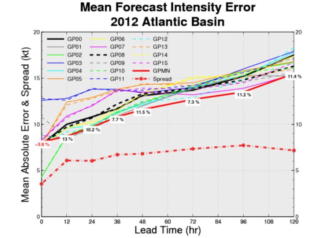
3 Atlantic Intensity Model Skill

4 Spread-Error Relationships ICON and Global-SPICE 4
5 5
6 Operational LGEM Intensity Model dv/dt = V - (V/V mpi ) n V (A) (B) V mpi = Maximum Potential Intensity estimate = Max wind growth rate β, n = empirical constants = 1/24 hr, 2.5 Steady State Solution: V s = V mpi (β/ ) 1/n 6


7 V mpi Used in LGEM Atlantic East/Central Pacific V mpi = f(sst) + 1.5c
8 Estimation of LGEM Growth Rate ( ) = a 0 + a 1 x 1 + a 2 x 2 + a 19 x 19 predictors x i include: 1. Climatology 2. Persistence 3. V max (t=0) 4. %GOES pixels < -20 o C 5. Steering layer pressure 6. Zonal storm motion 7. Ocean heat content 8. SST 9. T at 200 hpa 10. T at 250 hpa 11. e of sfc parcel - e of env hpa env shear 13. Shear direction 14. Shear*sin(lat) 15. Shear from other levels km 850 hpa vorticity km 200 hpa divergence 18. GFS vortex tendency 19. Low-level T advection 8


9 Hurricane Adrian (EP012011) 9
10 Bister and Emanuel (2002) MPI V mpi 2 = (T s /T o )(C k /C D )[CAPE*-CAPE] m T s = Sea Surface Temperature T o = Outflow temperature C k /C D = Surface exchange coefficient ratio CAPE = Convective Available Potential Energy of eyewall parcel CAPE* = Value of CAPE for RH=100% at the surface 10

11 Calculation of CAPE Assumptions: Pseudo-adiabatic process Neglect condensate weight No entrainment Neglect ice phase Neglect friction 11
12 Generalized CAPE From Equations for Spherical Air Parcel dw dt = g T v T v μ T c g c E + c D v R w 2 dm dt = Mwc E R dμ dt = wc E R μ μ μ c 1 M dm = c E dz R, C E=0.1, R=500 m Mass doubles in ~5km ds dt = wc E R s s w = parcel vertical velocity μ = Total water mixing ratio = μ v + μ c M = parcel mass R = parcel radius s = moist entropy density T v, μ v, μ c diagnosed from μ, s using Ooyama (1990) formulation (includes ice phase) 12
13 Vertical Velocity Profiles with Reversible Thermodynamics CAPE=2158 J/kg CAPE=3893 J/kg CAPE=1130 J/kg J. Dunion non-sal mean tropical sounding 13

14 CAPE Sensitivity to Entrainment Coefficient CAPE=231 J/kg CAPE=2158 J/kg 14
15 MPI for Hurricane Adrian (2011) Base Parcel Model: R(0) = 500 m, Precip e-fold time= 300 s, ice=1 15
16 Entrainment Coefficient Variability Choose entrainment coefficient so LGEM intensity tendency best matches observed tendency Specify, β, n, Choose C E to minimize (dv/dt) LGEM -(dv/dt) obs Parameterize optimal entrainment coefficient in terms of storm environment (shear, etc) 16
17 Optimal Entrainment Coefficient EP Over-Water Cases Median C E = 0.03 Parcel mass increases by ~50% in 10 km 17
18 LGEM forecasts for Hurricane Adrian tuned to new MPI Operational New Formulation: = constant = 1/36 hr C E = a*shear 18
19 V mpi for Optimized Adrian Case 19
20 SST Cooling Algorithm Based on I-I lin (2012) Pre-storm ocean parameters from satellite altimetry, NCODA analysis and SST files SST Depth of mixed layer Depth of 26 o isotherm Depth of 20 o isotherm Inner core SST from mixing ocean T profile down to D core D core = f(c), c=storm translation speed 20
21 Ocean T Profile and SST Cooling Hurricane Earl 18 UTC 28 Aug 2010 SST = 29.2 o C D26 = 131m DML = 64 m D20 = 256 m 21
22 Additional Physical Factors Baroclinic energy, ET transition Rely on GFS model Lat < 30 o N MPI = MPI BE Lat > 30 o N MPI = Max(MPI BE, GFS vmax ) Initial storm organization Fit model to full storm life cycles without t=0 variables (GOES, V(-12)-V(0), etc) Adjust global based on GOES and recent storm history Phase out adjustment with forecast time (t) = G + A e - t 22
23 Summary of Reformulated LGEM dv/dt = V - (V/V mpi ) n V V mpi from Bister and Emanuel formula, but with ice phase and entrainment added to CAPE calculation C E = e 0 + e 1 S + e 2 shear SST from mixed temperature profile, D core = d 0 + d 1 c V mpi from GFS model at high latitudes if > BE formula = Max wind growth rate = G + A e - t New LGEM: 9 free Parameters: β, n, e 0, e 1,e 2, d 0,d 1 G, Operational LGEM: 401 free parameters (β, n, 399 coefficients) 23
24 Reassignment of LGEM ( ) Coefficients 1. Climatology 2. Persistence 3. V max (t=0) 4. %GOES pixels < -20 o C 5. Steering layer pressure 6. Zonal storm motion 7. Ocean heat content 8. SST 9. T at 200 hpa 10. T at 250 hpa 11. e of sfc parcel - e of env hpa env shear 13. Shear direction 14. Shear*sin(lat) 15. Shear from other levels km 850 hpa vorticity km 200 hpa divergence 18. GFS vortex tendency 19. Low-level T advection ( 2)-( 5) are in A term ( 6)-( 8) are in SST cooling algorithm ( 9)-(15) are in new MPI calculation (16)-(19) accounted for by using GFS for V mpi at high latitudes 24
25 Applications of Reformulated LGEM Extended range prediction coefficient not time dependent so model can be run for any length Ensemble intensity prediction Perturbations to physics and input Physics through parcel model and SST cooling Can be run with multiple tracks and parent models Initial real-time tests late Aug
Satellite Applications to Hurricane Intensity Forecasting
 Satellite Applications to Hurricane Intensity Forecasting Christopher J. Slocum - CSU Kate D. Musgrave, Louie D. Grasso, and Galina Chirokova - CIRA/CSU Mark DeMaria and John Knaff - NOAA/NESDIS Center
A Simplified Dynamical System for Tropical Cyclone Intensity Prediction
 68 M O N T H L Y W E A T H E R R E V I E W VOLUME 137 A Simplified Dynamical System for Tropical Cyclone Intensity Prediction MARK DEMARIA NOAA/NESDIS, Fort Collins, Colorado (Manuscript received 27 December
Operational and Statistical Prediction of Rapid Intensity Change. Mark DeMaria and Eric Blake, NCEP/NHC John Kaplan, AOML/HRD
 Operational and Statistical Prediction of Rapid Intensity Change Mark DeMaria and Eric Blake, NCEP/NHC John Kaplan, AOML/HRD Outline Evaluation of NHC forecasts and deterministic models for rapid intensification
Motivation & Goal. We investigate a way to generate PDFs from a single deterministic run
 Motivation & Goal Numerical weather prediction is limited by errors in initial conditions, model imperfections, and nonlinearity. Ensembles of an NWP model provide forecast probability density functions
Tropical cyclone simulations and predictions with GFDL s prototype global cloud resolving model
 Tropical cyclone simulations and predictions with GFDL s prototype global cloud resolving model S.-J. Lin and GFDL model development teams NOAA/Geophysical Fluid Dynamics Laboratory Workshop on High-Resolution
NHC Ensemble/Probabilistic Guidance Products
 NHC Ensemble/Probabilistic Guidance Products Michael Brennan NOAA/NWS/NCEP/NHC Mark DeMaria NESDIS/STAR HFIP Ensemble Product Development Workshop 21 April 2010 Boulder, CO 1 Current Ensemble/Probability
28th Conference on Hurricanes and Tropical Meteorology, 28 April 2 May 2008, Orlando, Florida.
 P2B. TROPICAL INTENSITY FORECASTING USING A SATELLITE-BASED TOTAL PRECIPITABLE WATER PRODUCT Mark DeMaria* NOAA/NESDIS/StAR, Fort Collins, CO Jeffery D. Hawkins Naval Research Laboratory, Monterey, CA
Annual Number of Peer Reviewed Articles with Hurricane or Tropical Cyclone in their Titles, according to Meteorological and Geoastrophysical
 Hurricanes and Climate Kerry Emanuel Program in Atmospheres, Oceans, and Climate MIT Program Potential Intensity Role of potential ti li intensity it in storm intensity it Role of potential intensity in
GFDL Hurricane Model Ensemble Performance During the 2012 Hurricane Season
 GFDL Hurricane Model Ensemble Performance During the 2012 Hurricane Season Tim Marchok (NOAA / GFDL) Matt Morin (DRC HPTG / GFDL) Morris Bender (NOAA / GFDL) HFIP Team Telecon 12 December 2012 Acknowledgments:
Thermodynamic and Flux Observations of the Tropical Cyclone Surface Layer
 Thermodynamic and Flux Observations of the Tropical Cyclone Surface Layer 1. INTRODUCTION Alex M. Kowaleski and Jenni L. Evans 1 The Pennsylvania State University, University Park, PA Understanding tropical
Lectures on Tropical Cyclones
 Lectures on Tropical Cyclones Chapter 1 Observations of Tropical Cyclones Outline of course Introduction, Observed Structure Dynamics of Mature Tropical Cyclones Equations of motion Primary circulation
Tropical Storm List
 Tropical Storm Email List http://tstorms.org/ tropical-storms@tstorms.org Tropical-Storms is a mailing list only for those who are professionally active in either the research or forecasting of tropical
Inner core dynamics: Eyewall Replacement and hot towers
 Inner core dynamics: Eyewall Replacement and hot towers FIU Undergraduate Hurricane Internship Lecture 4 8/13/2012 Why inner core dynamics is important? Current TC intensity and structure forecasts contain
Lec 10: Interpreting Weather Maps
 Lec 10: Interpreting Weather Maps Case Study: October 2011 Nor easter FIU MET 3502 Synoptic Hurricane Forecasts Genesis: on large scale weather maps or satellite images, look for tropical waves (Africa
Hurricanes are intense vortical (rotational) storms that develop over the tropical oceans in regions of very warm surface water.
 storms that develop over the tropical oceans in regions of very warm surface water.") Hurricanes: Observations and Dynamics Houze Section 10.1. Holton Section 9.7. Emanuel, K. A., 1988: Toward a general theory of hurricanes. American Scientist, 76, 371-379 (web link). http://ww2010.atmos.uiuc.edu/(gh)/guides/mtr/hurr/home.rxml
Hurricanes: Observations and Dynamics Houze Section 10.1. Holton Section 9.7. Emanuel, K. A., 1988: Toward a general theory of hurricanes. American Scientist, 76, 371-379 (web link). http://ww2010.atmos.uiuc.edu/(gh)/guides/mtr/hurr/home.rxml
REPORT DOCUMENTATION PAGE N Improving Tropical Cyclone Intensity Forecasting with Theoretically-Based Statistical Models
 REPORT DOCUMENTATION PAGE Form Approved OMB No. 0704-0188 The public reporting burden for this collection of lnfonnation is estimated to average 1 hour per response, including the time for reviewing Instructions,
Intensity of North Indian Ocean Tropical Cyclones
 Chapter 6 Intensity of North Indian Ocean Tropical Cyclones 6.1 Introduction Intensity of tropical cyclones is dependent on several parameters both thermodynamic and dynamic. It includes thermodynamic
Hurricane Science Tutorial. Kerry Emanuel Lorenz Center, MIT
 Hurricane Science Tutorial Kerry Emanuel Lorenz Center, MIT Why Should You Care? Forecasting Much progress in social science of response to warnings, requests to evacuate, etc. Forecasters are ambassadors
Have a better understanding of the Tropical Cyclone Products generated at ECMWF
 Objectives Have a better understanding of the Tropical Cyclone Products generated at ECMWF Learn about the recent developments in the forecast system and its impact on the Tropical Cyclone forecast Learn
Tropical Cyclone Formation: Results
 Tropical Cyclone Formation: Results from PREDICT (PRE Depression Investigation of Cloud systems in the Tropics) collaborator on this presentation: Dave Ahijevych (NCAR) Chris Davis National Center for
Improving Tropical Cyclone Guidance Tools by Accounting for Variations in Size
 Improving Tropical Cyclone Guidance Tools by Accounting for Variations in Size John A. Knaff 1, Mark DeMaria 1, Scott P. Longmore 2 and Robert T. DeMaria 2 1 NOAA Center for Satellite Applications and
A Statistical-Dynamical Seasonal Forecast of US Landfalling TC Activity
 A Statistical-Dynamical Seasonal Forecast of US Landfalling TC Activity Johnny Chan and Samson K S Chiu Guy Carpenter Asia-Pacific Climate Impact Centre City University of Hong Kong Research sponsored
Hurricanes: Their physics and relationship to climate. Kerry Emanuel Massachusetts Institute of Technology
 Hurricanes: Their physics and relationship to climate Kerry Emanuel Massachusetts Institute of Technology Topics Overview of Tropical Cyclones Tropical Cyclone Physics What have TCs been like in the past,
Adiabatic expansion Isothermal compression Adiabatic compression
 Tropical Cyclones: Steady State Physics 1 Energy Production 2 Carnot Theorem: Maximum efficiency results from a pa rticular energy e cycle: Isothermal expansion Adiabatic expansion Isothermal compression
Tropical Cyclones: Steady State Physics
 Tropical Cyclones: Steady State Physics Energy Production Carnot Theorem: Maximum efficiency results from a particular energy cycle: Isothermal expansion Adiabatic expansion Isothermal compression Adiabatic
THE PENNSYLVANIA STATE UNIVERSITY THE GRADUATE SCHOOL COLLEGE OF EARTH AND MINERAL SCIENCES
 THE PENNSYLVANIA STATE UNIVERSITY THE GRADUATE SHOOL OLLEGE OF EARTH AND MINERAL SIENES SENSITIVITY OF TROPIAL YLONE POTENTIAL INTENSITY TO OBSERVED NEAR-SURFAE ONDITIONS A Thesis in Meteorology by Alexander
Atmosphere-Ocean Interaction in Tropical Cyclones
 Atmosphere-Ocean Interaction in Tropical Cyclones Isaac Ginis University of Rhode Island Collaborators: T. Hara, Y.Fan, I-J Moon, R. Yablonsky. ECMWF, November 10-12, 12, 2008 Air-Sea Interaction in Tropical
Fernando Prates. Evaluation Section. Slide 1
 Fernando Prates Evaluation Section Slide 1 Objectives Ø Have a better understanding of the Tropical Cyclone Products generated at ECMWF Ø Learn the recent developments in the forecast system and its impact
The 2009 Hurricane Season Overview
 The 2009 Hurricane Season Overview Jae-Kyung Schemm Gerry Bell Climate Prediction Center NOAA/ NWS/ NCEP 1 Overview outline 1. Current status for the Atlantic, Eastern Pacific and Western Pacific basins
Radiance Data Assimilation with an EnKF
 Radiance Data Assimilation with an EnKF Zhiquan Liu, Craig Schwartz, Xiangyu Huang (NCAR/MMM) Yongsheng Chen (York University) 4/7/2010 4th EnKF Workshop 1 Outline Radiance Assimilation Methodology Apply
Genesis Parameters, Genesis Thresholds, and Mid-Level Humidity
 Genesis Parameters, Genesis Thresholds, and Mid-Level Humidity Michael G. McGauley and David S. Nolan Rosenstiel School of Marine and Atmospheric Science University of Miami Miami, Florida, USA This work
The Operational Challenges of Forecasting TC Intensity Change in the Presence of Dry Air and Strong Vertical Shear
 The Operational Challenges of Forecasting TC Intensity Change in the Presence of Dry Air and Strong Vertical Shear Jamie R. Rhome,* and Richard D. Knabb NOAA/NWS/NCEP/Tropical Prediction Center/National
Impacts of the Lower Stratosphere on the Development of Intense Tropical Cyclones
 Article Impacts of the Lower Stratosphere on the Development of Intense Tropical Cyclones Zachary Moon 1,2 ID and Chanh Kieu 1, * 1 Department of Earth and Atmospheric Sciences, Indiana University, Bloomington,
非静力学 4 次元変分法. Kosuke Ito
 The 3 rd Research Meeting of Ultrahigh Precision Meso Scale Weather Prediction Kobe, Japan 2013/03/21 / 非静力学 4 次元変分法 データ同化システムの高度化 Development of nonhydrostatic meso 4D VAR dt data assimilation il system
A Tropical Cyclone Genesis Parameter for the Tropical Atlantic
 219 A Tropical Cyclone Genesis Parameter for the Tropical Atlantic MARK DEMARIA NESDIS/ORA, Fort Collins, Colorado JOHN A. KNAFF AND BERNADETTE H. CONNELL Cooperative Institute for Research in the Atmosphere,
Structure & Intensity Change: Future Directions IWTC VI, Topic 1
 Structure & Intensity Change: Future Directions IWTC VI, Topic 1 Chair: Rob Rogers Rapporteurs Environmental Impacts (J. Evans) Inner Core Impacts (E. Ritchie) Oceanic Impacts (N. Shay) Observational Capabilities
A Preliminary Exploration of the Upper Bound of Tropical Cyclone Intensification
 A Preliminary Exploration of the Upper Bound of Tropical Cyclone Intensification Jonathan L. Vigh (NCAR/RAL) Kerry Emanuel (MIT) Mrinal K. Biswas (NCAR/RAL) Eric A. Hendricks (Naval Postgraduate School)
Probabilistic Prediction of Tropical Cyclone Intensity from a. Multiple-Linear Regression Model. Adam H. Sobel 2,3
 Generated using version 3.2 of the official AMS L A TEX template 1 Probabilistic Prediction of Tropical Cyclone Intensity from a 2 Multiple-Linear Regression Model 3 Chia-Ying Lee, Michael K. Tippett,
An analysis of Hurricane Edouard SST sensitivity runs by HWRF in a neutral-shear environment
 An analysis of Hurricane Edouard SST sensitivity runs by HWRF in a neutral-shear environment Pat Fitzpatrick 3, Yee Lau 3, Jili Dong 1,2, Lin Zhu 1,2, Hyun-Sook Kim 1,2, Avichal Mehra 1 1 NOAA/NWS/NCEP/EMC,
COAMPS-TC 2015 Version, Performance, and Future Plans
 COAMPS-TC 2015 Version, Performance, and Future Plans James D. Doyle, R. Hodur 1, J. Moskaitis, S. Chen, E. Hendricks 2, H. Jin, Y. Jin, A. Reinecke, S. Wang Naval Research Laboratory, Monterey, CA 1 IES/SAIC,
Advancements in Operations and Research on Hurricane Modeling and Ensemble Prediction System at EMC/NOAA
 Advancements in Operations and Research on Hurricane Modeling and Ensemble Prediction System at EMC/NOAA Zhan Zhang and Vijay Tallapragada EMC/NCEP/NOAA/DOC Acknowledgements: HWRF Team Members at EMC,
2012 AHW Stream 1.5 Retrospective Results
 2012 AHW Stream 1.5 Retrospective Results Ryan D. Torn, Univ. Albany, SUNY Chris Davis, Wei Wang, Jimy Dudhia, Tom Galarneau, Chris Snyder, James Done, NCAR/NESL/MMM Overview Since participation in HFIP
A Revised Tropical Cyclone Rapid Intensification Index for the Atlantic and Eastern North Pacific Basins
 220 W E A T H E R A N D F O R E C A S T I N G VOLUME 25 A Revised Tropical Cyclone Rapid Intensification Index for the Atlantic and Eastern North Pacific Basins JOHN KAPLAN NOAA/AOML/Hurricane Research
Hurricane Intensity: Governing Factors and Forecasting Challenges. EAS 470 Final Paper Allison Wing
 Hurricane Intensity: Governing Factors and Forecasting Challenges EAS 470 Final Paper Allison Wing Tropical cyclones are undoubtedly among the mostly deadly and destructive natural phenomena found on Earth
TOWARDS A BETTER UNDERSTANDING OF AND ABILITY TO FORECAST THE WIND FIELD EXPANSION DURING THE EXTRATROPICAL TRANSITION PROCESS
 P1.17 TOWARDS A BETTER UNDERSTANDING OF AND ABILITY TO FORECAST THE WIND FIELD EXPANSION DURING THE EXTRATROPICAL TRANSITION PROCESS Clark Evans* and Robert E. Hart Florida State University Department
Energy Production, Frictional Dissipation, and Maximum Intensity of a Numerically Simulated Tropical Cyclone*
 JANUARY 2010 W A N G A N D X U 97 Energy Production, Frictional Dissipation, and Maximum Intensity of a Numerically Simulated Tropical Cyclone* YUQING WANG AND JING XU International Pacific Research Center,
Ensemble Prediction Systems
 Ensemble Prediction Systems Eric Blake National Hurricane Center 7 March 2017 Acknowledgements to Michael Brennan 1 Question 1 What are some current advantages of using single-model ensembles? A. Estimates
TC STRUCTURE GUIDANCE UPDATES
 TC STRUCTURE GUIDANCE UPDATES FROM NESDIS (CO)/CIRA Status and update for the multi-platform tropical cyclone wind analysis (MTCSWA) New microwave-sounder-based intensity and structure estimates New method
地球系统科学前沿讲座 台风研究现状和问题 林岩銮
 地球系统科学前沿讲座 台风研究现状和问题 林岩銮 2013.3.18 Satellite image of Hurricane Floyd approaching the east coast of Florida in 1999. The image has been digitally enhanced to lend a three-dimensional perspective. Credit:
A pseudo-ensemble hybrid data assimilation system for HWRF
 A pseudo-ensemble hybrid data assimilation system for HWRF Xuyang Ge UCAR visiting postdoctoral scientist at PSU/NCEP Contributors: Fuqing Zhang and Yonghui Weng (PSU) Mingjing Tong and Vijay Tallapragada
The Maritime Continent as a Prediction Barrier
 The Maritime Continent as a Prediction Barrier for the MJO Augustin Vintzileos EMC/NCEP SAIC Points to take back home. Forecast of the MJO is at, average, skillful for lead times of up to circa 2 weeks.
Dynamics of the Extratropical Response to Tropical Heating
 Regional and Local Climate Modeling and Analysis Research Group R e L o C l i m Dynamics of the Extratropical Response to Tropical Heating (1) Wegener Center for Climate and Global Change (WegCenter) and
Track sensitivity to microphysics and radiation
 Track sensitivity to microphysics and radiation Robert Fovell and Yizhe Peggy Bu, UCLA AOS Brad Ferrier, NCEP/EMC Kristen Corbosiero, U. Albany 11 April 2012 rfovell@ucla.edu 1 Background WRF-ARW, including
Isentropic Analysis. Much of this presentation is due to Jim Moore, SLU
 Isentropic Analysis Much of this presentation is due to Jim Moore, SLU Utility of Isentropic Analysis Diagnose and visualize vertical motion - through advection of pressure and system-relative flow Depict
The Evolution and Use of Objective Forecast Guidance at NHC
 The Evolution and Use of Objective Forecast Guidance at NHC James L. Franklin Branch Chief, Hurricane Specialist Unit National Hurricane Center 2010 EMC/MMM/DTC Workshop 1 Hierarchy of TC Track Models
The Impact of air-sea interaction on the extratropical transition of tropical cyclones
 The Impact of air-sea interaction on the extratropical transition of tropical cyclones Sarah Jones Institut für Meteorologie und Klimaforschung Universität Karlsruhe / Forschungszentrum Karlsruhe 1. Introduction
TC/PR/RB Lecture 3 - Simulation of Random Model Errors
 TC/PR/RB Lecture 3 - Simulation of Random Model Errors Roberto Buizza (buizza@ecmwf.int) European Centre for Medium-Range Weather Forecasts http://www.ecmwf.int Roberto Buizza (buizza@ecmwf.int) 1 ECMWF
Impact of GPS RO Data on the Prediction of Tropical Cyclones
 Impact of GPS RO Data on the Prediction of Tropical Cyclones Ying-Hwa Kuo, Hui Liu, UCAR Ching-Yuang Huang, Shu-Ya Chen, NCU Ling-Feng Hsiao, Ming-En Shieh, Yu-Chun Chen, TTFRI Outline Tropical cyclone
The Maximum Potential Intensity of Tropical Cyclones
 2519 The Maximum Potential Intensity of Tropical Cyclones GREG J. HOLLAND Bureau of Meteorology Research Centre, Melbourne, Australia (Manuscript received 28 November 1994, in final form 26 February 1997)
Effects of Convective Heating on Movement and Vertical Coupling of Tropical Cyclones: A Numerical Study*
 3639 Effects of Convective Heating on Movement and Vertical Coupling of Tropical Cyclones: A Numerical Study* LIGUANG WU ANDBIN WANG Department of Meteorology, School of Ocean and Earth Science and Technology,
HWRF Ocean: MPIPOM-TC
 HWRF v3.7a Tutorial Nanjing, China, December 2, 2015 HWRF Ocean: MPIPOM-TC Ligia Bernardet NOAA SRL Global Systems Division, Boulder CO University of Colorado CIRS, Boulder CO Acknowledgement Richard Yablonsky
Energy Production, Frictional Dissipation, and Maximum Intensity. of a Numerically Simulated Tropical Cyclone
 Energy Production, Frictional Dissipation, and Maximum Intensity of a Numerically Simulated Tropical Cyclone Yuqing Wang 1 and Jing Xu International Pacific Research Center and Department of Meteorology
Tropical cyclones in ver/cal shear: dynamic, kinema/c, and thermodynamic aspects of intensity modification
 Tropical cyclones in ver/cal shear: dynamic, kinema/c, and thermodynamic aspects of intensity modification Michael Riemer 1, Michael T. Montgomery 2,3, Mel E. Nicholls 4 1 Johannes Gutenberg-Universität,
40-115kn and DT 2.5 to 7.0 kn in 24 hours!
 Intensity forecasting TCs can change intensity rapidly TC Ernie 2017 Rapid Intensification 1/27 40-115kn and DT 2.5 to 7.0 kn in 24 hours! TCs can change intensity rapidly 2/27 Gwenda 1999 Rapid Weakening
Self-Stratification of Tropical Cyclone Outflow. Part II: Implications for Storm Intensification
 988 J O U R N A L O F T H E A T M O S P H E R I C S C I E N C E S VOLUME 69 Self-Stratification of Tropical Cyclone Outflow. Part II: Implications for Storm Intensification KERRY EMANUEL Program in Atmospheres,
Forecasting Hurricane Intensity: Lessons from Application of the Coupled Hurricane Intensity Prediction System (CHIPS)
") Forecasting Hurricane Intensity: Lessons from Application of the Coupled Hurricane Intensity Prediction System (CHIPS) Coupled Model Design Atmospheric Component: (from Emanuel, 1995) Gradient and hydrostatic
Forecasting Hurricane Intensity: Lessons from Application of the Coupled Hurricane Intensity Prediction System (CHIPS) Coupled Model Design Atmospheric Component: (from Emanuel, 1995) Gradient and hydrostatic
HWRF Surface Layer Thermodynamics Evaluation. Eric W. Uhlhorn and Joseph J. Cione HFIP Hurricane Modeling Workshop September 2012
 HWRF Surface Layer Thermodynamics Evaluation Eric W. Uhlhorn and Joseph J. Cione HFIP Hurricane Modeling Workshop 17-18 September 2012 Special thanks. HRD HWRF modeling team Gopal, Xuejin Zhang, Thiago
1. Introduction. In following sections, a more detailed description of the methodology is provided, along with an overview of initial results.
 7B.2 MODEL SIMULATED CHANGES IN TC INTENSITY DUE TO GLOBAL WARMING Kevin A. Hill*, Gary M. Lackmann, and A. Aiyyer North Carolina State University, Raleigh, North Carolina 1. Introduction The impact of
Hurricane potential intensity from an energetics point of view
 Q. J. R. Meteorol. Soc. (2004), 130, pp. 2629 2648 doi: 10.1256/qj.03.65 Hurricane potential intensity from an energetics point of view By WEIXING SHEN, National Centers for Environmental Prediction, Camp
1C.4 TROPICAL CYCLONE TORNADOES: SYNOPTIC SCALE INFLUENCES AND FORECASTING APPLICATIONS
 1C.4 TROPICAL CYCLONE TORNADOES: SYNOPTIC SCALE INFLUENCES AND FORECASTING APPLICATIONS Daniel J. Cecil and Lori A. Schultz University of Alabama in Huntsville, Huntsville, AL, 35805 1. INTRODUCTION Several
Quantifying the Role of Tropospheric Relative Humidity on the Development of Tropical Cyclones
 Quantifying the Role of Tropospheric Relative Humidity on the Development of Tropical Cyclones 1 R., 2 B. Ríos-Berríos Tang and S. S. 1University of Puerto Rico at Mayagüez 1Significant Opportunities in
Exploring the Use of Dynamical Weather and Climate Models for Risk Assessment
 Exploring the Use of Dynamical Weather and Climate Models for Risk Assessment James Done Willis Research Network Fellow National Center for Atmospheric Research Boulder CO, US Leverages resources in the
ARW/EnKF performance for the 2009 Hurricane Season
 ARW/EnKF performance for the 2009 Hurricane Season Ryan D. Torn, Univ. at Albany, SUNY Chris Davis, Steven Cavallo, Chris Snyder, Wei Wang, James Done, NCAR/MMM 4 th EnKF Workshop 8 April 2010, Rensselaerville,
Tropical Cyclone Genesis: What we know, and what we don t!
 Tropical Cyclone Genesis: What we know, and what we don t! Allison Wing! NSF Postdoctoral Research Fellow! Lamont-Doherty Earth Observatory! Columbia University! Overview! Climatology! What We Know! Theories!
Q.1 The most abundant gas in the atmosphere among inert gases is (A) Helium (B) Argon (C) Neon (D) Krypton
 Helium (B) Argon (C) Neon (D) Krypton") Q. 1 Q. 9 carry one mark each & Q. 10 Q. 22 carry two marks each. Q.1 The most abundant gas in the atmosphere among inert gases is (A) Helium (B) Argon (C) Neon (D) Krypton Q.2 The pair of variables that
Q. 1 Q. 9 carry one mark each & Q. 10 Q. 22 carry two marks each. Q.1 The most abundant gas in the atmosphere among inert gases is (A) Helium (B) Argon (C) Neon (D) Krypton Q.2 The pair of variables that
Tropical Cyclone Genesis and Sudden Changes of Track and Intensity in the Western Pacific
 Tropical Cyclone Genesis and Sudden Changes of Track and Intensity in the Western Pacific PI: Bin Wang Co-PI: Yuqing Wang and Tim Li Department of Meteorology and International Pacific Research Center
Applications Development and Diagnostics (ADD) Team Summary Part 2
 Team Summary Part 2") Applications Development and Diagnostics (ADD) Team Summary Part 2 Mark DeMaria, NOAA/NESDIS HFIP Annual Review Meeting Nov. 8-9, 2011, Miami, FL Input from: Chris Davis, James Doyle, Thomas Galarneau,
Applications Development and Diagnostics (ADD) Team Summary Part 2 Mark DeMaria, NOAA/NESDIS HFIP Annual Review Meeting Nov. 8-9, 2011, Miami, FL Input from: Chris Davis, James Doyle, Thomas Galarneau,
Effect of the Initial Vortex Structure on Intensification of a Numerically Simulated Tropical Cyclone
 April Journal 2018 of the Meteorological Society of Japan, Vol. J. 96, XU No. and 2, Y. pp. WANG 111 126, 2018 111 DOI:10.2151/jmsj.2018-014 Effect of the Initial Vortex Structure on Intensification of
Numerical Weather Prediction: Data assimilation. Steven Cavallo
 Numerical Weather Prediction: Data assimilation Steven Cavallo Data assimilation (DA) is the process estimating the true state of a system given observations of the system and a background estimate. Observations
C. Reynolds, E. Satterfield, and C. Bishop, NRL Monterey, CA
 Using Initial State and Forecast Temporal Variability to Evaluate Model Behavior C. Reynolds, E. Satterfield, and C. Bishop, NRL Monterey, CA Forecast error attribution useful for system development. Methods
Tropical Cyclone Intensification
 Tropical Cyclone Intensification Theories for tropical cyclone intensification and structure CISK (Charney and Eliassen 1964) Cooperative Intensification Theory (Ooyama 1969). WISHE (Emanuel 1986, Holton
Examination of Tropical Cyclogenesis using the High Temporal and Spatial Resolution JRA-25 Dataset
 Examination of Tropical Cyclogenesis using the High Temporal and Spatial Resolution JRA-25 Dataset Masato Sugi Forecast Research Department, Meteorological Research Institute, Japan Correspondence: msugi@mri-jma.go.jp
9C.4 IMPROVING TROPICAL CYCLONE TRACK AND INTENSITY FORECASTING WITH JPSS IMAGER AND SOUNDER DATA
 9C.4 IMPROVING TROPICAL CYCLONE TRACK AND INTENSITY FORECASTING WITH JPSS IMAGER AND SOUNDER DATA Galina Chirokova * CIRA/CSU, Fort Collins, CO, USA Mark DeMaria NOAA/NWS/NCEP/NHC, Miami, FL, USA Robert
16th AMS Conference on Satellite Meteorology and Oceanography, Jan , 2009, Phoenix, AZ 1
 P. APPLICATIONS OF LIGHTNING OBSERVATIONS TO TROPICAL CYCLONE INTENSITY FORECASTING Mark DeMaria* NOAA/NESDIS/StAR, Fort Collins, CO Robert T. DeMaria CIRA/Colorado State University, Fort Collins, CO.
A Deterministic Rapid Intensification Aid
 AUGUST 2011 S A M P S O N E T A L. 579 A Deterministic Rapid Intensification Aid CHARLES R. SAMPSON Naval Research Laboratory, Monterey, California JOHN KAPLAN NOAA/AOML/Hurricane Research Division, Miami,
Subtropical and Hybrid Systems IWTC VII Topic 1.6
 Subtropical and Hybrid Systems IWTC VII Topic 1.6 John R. Gyakum Department of Atmospheric and Oceanic Sciences McGill University, Montreal Canada Working group: John L. Beven II, Lance F. Bosart, Fermin
Hurricane: an organized tropical storm system featuring vigorous convection and sustained winds in excess of 64 knots (74 mph)
") Hurricane: an organized tropical storm system featuring vigorous convection and sustained winds in excess of 64 knots (74 mph) The storms have different names, depending on where they form: Western Hemisphere:
Hurricane: an organized tropical storm system featuring vigorous convection and sustained winds in excess of 64 knots (74 mph) The storms have different names, depending on where they form: Western Hemisphere:
Kevin E Trenberth NCAR
 Attribution of Recent Increases in Atlantic Hurricane Activity Kevin E Trenberth NCAR Issues for detection and attribution of changes in hurricanes What has happened? How good is the observational record?
Dynamical Statistical Seasonal Prediction of Atlantic Hurricane Activity at NCEP
 Dynamical Statistical Seasonal Prediction of Atlantic Hurricane Activity at NCEP Hui Wang, Arun Kumar, Jae Kyung E. Schemm, and Lindsey Long NOAA/NWS/NCEP/Climate Prediction Center Fifth Session of North
( ) = 1005 J kg 1 K 1 ;
 = 1005 J kg 1 K 1 ;") Problem Set 3 1. A parcel of water is added to the ocean surface that is denser (heavier) than any of the waters in the ocean. Suppose the parcel sinks to the ocean bottom; estimate the change in temperature
Problem Set 3 1. A parcel of water is added to the ocean surface that is denser (heavier) than any of the waters in the ocean. Suppose the parcel sinks to the ocean bottom; estimate the change in temperature
AMERICAN METEOROLOGICAL SOCIETY
 AMERICAN METEOROLOGICAL SOCIETY Journal of the Atmospheric Sciences EARLY ONLINE RELEASE This is a preliminary PDF of the author-produced manuscript that has been peer-reviewed and accepted for publication.
Tropical Cyclone Formation/Structure/Motion Studies
 Tropical Cyclone Formation/Structure/Motion Studies Patrick A. Harr Department of Meteorology Naval Postgraduate School Monterey, CA 93943-5114 phone: (831) 656-3787 fax: (831) 656-3061 email: paharr@nps.edu
MJO modeling and Prediction
 MJO modeling and Prediction In-Sik Kang Seoul National University, Korea Madden & Julian Oscillation (MJO) index Composite: OLR & U850 RMM index based on Leading PCs of Combined EOF (OLR, U850, U200) P-1
Hurricane Structure: Theory and Diagnosis
 Hurricane Structure: Theory and Diagnosis 7 March, 2016 World Meteorological Organization Workshop Chris Landsea Chris.Landsea@noaa.gov National Hurricane Center, Miami Outline Structure of Hurricanes
Evaluating a Genesis Potential Index with Community Climate System Model Version 3 (CCSM3) By: Kieran Bhatia
 By: Kieran Bhatia") Evaluating a Genesis Potential Index with Community Climate System Model Version 3 (CCSM3) By: Kieran Bhatia I. Introduction To assess the impact of large-scale environmental conditions on tropical cyclone
Evaluating a Genesis Potential Index with Community Climate System Model Version 3 (CCSM3) By: Kieran Bhatia I. Introduction To assess the impact of large-scale environmental conditions on tropical cyclone
Ensemble Prediction Systems
 Ensemble Prediction Systems Eric S. Blake & Michael J. Brennan National Hurricane Center 8 March 2016 Acknowledgements to Rick Knabb and Jessica Schauer 1 Why Aren t Models Perfect? Atmospheric variables
An Observational Study of Environmental Influences on the Intensity Changes of Typhoons Flo (1990) and Gene (1990)
 and Gene (1990)") 3003 An Observational Study of Environmental Influences on the Intensity Changes of Typhoons Flo (1990) and Gene (1990) CHUN-CHIEH WU ANDHSIU-JU CHENG Department of Atmospheric Sciences, National Taiwan
3003 An Observational Study of Environmental Influences on the Intensity Changes of Typhoons Flo (1990) and Gene (1990) CHUN-CHIEH WU ANDHSIU-JU CHENG Department of Atmospheric Sciences, National Taiwan
THE EXTRATROPICAL TRANSITION OF TYPHOON WINNIE (1997): SELF-AMPLIFICATION AFTER LANDFALL
: SELF-AMPLIFICATION AFTER LANDFALL") THE EXTRATROPICAL TRANSITION OF TYPHOON WINNIE (1997): SELF-AMPLIFICATION AFTER LANDFALL Chih-Shin Liu *1,2 and George Tai-Jen Chen 2 1 Weather Forecast Center, Central Weather Bureau, 2 Department of
THE EXTRATROPICAL TRANSITION OF TYPHOON WINNIE (1997): SELF-AMPLIFICATION AFTER LANDFALL Chih-Shin Liu *1,2 and George Tai-Jen Chen 2 1 Weather Forecast Center, Central Weather Bureau, 2 Department of
Ensemble TC Track/Genesis Products in
 Ensemble TC Track/Genesis Products in Parallel @NCO Resolution Members Daily Frequency Forecast Length NCEP ensemble (AEMN-para) GFS T574L64-33km(12/02/15) 20+1_CTL 00, 06, 12, 18 UTC 16 days (384hrs)
THE IMPACT OF SATELLITE-DERIVED WINDS ON GFDL HURRICANE MODEL FORECASTS
 THE IMPACT OF SATELLITE-DERIVED WINDS ON GFDL HURRICANE MODEL FORECASTS Brian J. Soden 1 and Christopher S. Velden 2 1) Geophysical Fluid Dynamics Laboratory National Oceanic and Atmospheric Administration