Forest Hydrology: The Japanese Experience
|
|
|
- Brooke Daniel
- 5 years ago
- Views:
Transcription


1 Forest Hydrology: The Japanese Experience Roy C. Sidle Professor of Geography Sustainability Research Centre University of the Sunshine Coast Queensland, Australia
2 FFPRI, Tsukuba, Hokkaido PWRI, Tsukuba Tokushima University FFPRI, Tsukuba University of Tsukuba Niigata University PWRI, Tsukuba Tokushima University Tokyo Kyoto University, DPRI Chiba University Shinshu University Shizuoka University Mie University Kagoshima University Tokyo University Geological Survey of Japan JR Railways Disclaimer this presentation is not comprehensive and highly influenced by my personal affiliations in Japan


3 What have been some of the driving forces in forest hydrology research in Japan? The inextricable relationship between hydrology and landslides, giving rise to the new science of hydrogeomorphology Ongoing issues of maintaining forest productivity, whilst protecting against flood and sediment hazards Flood and sediment hazard assessment and control Historical devastation of native forests in granitic areas Need for better management of degraded hinoki forests
4 Research development and progress in forest hydrology & hydrogeomorphology in Japan Early work of Professors Tsukamoto and Okunishi Early development of the variable source area concept Process-based linkages amongst topography, flow pathways, and landslide initiation Hillslope channel interactions Basic concepts of hydrogeomorphology This pioneering research inspired detailed studies in: Geomorphic hollows Suzuki, Kuboto, and others Preferential flow/pipeflow in forested catchments Hydrologic conditions that trigger different types of landslides Landslide debris flow linkages
; and Kirkby (1969) Subsurface runoff was considered the dominant process that contributed to stormflow in")
5 Variable source area concept Increasing Wetness Variable Source Area Concept Based on work of Tsukamoto (1961, 1963); Hewlett & Hibbert (1963, 1967); and Kirkby (1969) Subsurface runoff was considered the dominant process that contributed to stormflow in streams

6 Saturated overland flow (SOF) Research in an agricultural catchment in Vermont (Dunne and Black, 1970) showed that SOF was the primary source of storm runoff Later work by Tanaka (1982, 1988) in the forested Hachioji Experimental Basin in Japan showed that SOF was discontinuous and accounted for up to only 7% of total storm discharge Nevertheless, riparian areas are important sources of rapid overland flow, but their contribution to runoff depends on their spatial extent findings from Hitachi Ohta Experimental Watershed, Japan

7 Effect of soil properties and geomorphology on subsurface flow and groundwater response Effects of soil physical properties on shallow groundwater response Tani, Kayane Effect of topography and slope position on shallow groundwater response and storm runoff, particularly hollows Tsukamoto & Ohta, Suzuki, Kubota, Terajima & Moroto, Tsuboyama et al.


8 Hydrogeomorphic Concept of Headwater Stormflow Generation Hitachi Ohta Dynamic catchment responses during storms Saturation overland flow in narrow riparian corridor Non-linear expansion of preferential flow pathways Rapid response of hollows after a threshold of water storage Progressive wetting of lower hillslopes by subsurface drainage Strong implications for forest management

9 Pioneering Research on Macropore/Pipeflow/Preferential Flow Earlier research by Kitahara, Tanaka, Narioka, Tsukamoto and Ohta, & Terajima Kitahara s work is significant as it some of the first research on: Detailed mapping of macropore systems in the field Studies of hydraulics of macropores Related pipeflow to throughflow at the hillslope scale
 by Maruyama, Noguchi, Terajima, Tsutsumi, Kosugi, and Tsuboyama et al.")
10 Later work on preferential flow/pipeflow in steep forested catchments Uchida showed that several major pipes exuded large amounts of flow during large storms Such large pipes monitored by Kitahara, Terajima, and Uchida appear to be intimately connected with the drainage network of hollows i.e. a kind of subsurface channel More recent preferential flow studies (including modeling) by Maruyama, Noguchi, Terajima, Tsutsumi, Kosugi, and Tsuboyama et al. from Uchida et al. (1999)


11 Understanding dynamic preferential flow network behavior at the hillslope scale Staining tests Hydrometric measurements of macropore flow Tracer tests Linking findings to hillslope scale 1 Self-organizing behavior Studies by Tsuboyama, Noguchi, Hosoda & Sidle in Hitachi Ohta Experimental Watershed 8 Top soil Mineral soil Bed rock
 runoff Volcanic basins: more stable Granitic basins: most stable")
12 Influence of catchment geology on runoff generation Early work by Shimizu showed catchment lithology strongly affected runoff response: Sedimentary basins: most flashy (variable) runoff Volcanic basins: more stable Granitic basins: most stable runoff
 K1 Type B talus Type A talus Shale catchments had lower drainage density than granite catchments Lateral subsurface stormflow is")

13 Comparison of discharge and drainage density from shale and granite forest catchments (Onda et al.) K1 Type B talus Type A talus Shale catchments had lower drainage density than granite catchments Lateral subsurface stormflow is much more common in granitic catchments, yielding greater runoff during storms compared to shale catchments Springs were more common in shale catchments & occurred at K6 higher elevations due to the dominance of vertical subsurface recharge Yotagiri watershed (Granite) Koshibu watershed (Shale)
 differ for different lithologies")
14 Distinguishes between effects of forest management/removal and land degradation Degradation at Tanakmi Mtn. began as early as the 7 th Century with culling of large trees to build temples Thresholds (tipping-points) differ for different lithologies from Tani et al., 2012 Hydro. Process.

15 Other significant contributions from Japanese scientists to forest hydrology Tracer investigations to separate recession flow of hydrographs Using temperature under a snow cover to separate the runoff into surface and subsurface flow Natural isotope tracers to identify storm runoff sources and residence times Using Si, DOC, etc. to assess rain-runoff lags & bedrock seepage The importance of slope position on subsurface water accretion in zero-order basins and slopes Unsaturated zone phenomena related to rapid water table response to rain Hillslope response to rainfall storm runoff Contributors include: Ohte, Katsuyama, Asano, Kabeya, Uchida, Tsuboyama, Kubota, Tsujimura, Haga, Fujimoto, Muraoko, Hirata, Kobayashi, Terajima, Tanaka, Kayane, Kaihotsu, Tani, Kosugi...


16 The long-term experimental catchment studies in Japan Mie University Experimental Forest Takaragawa Experimental Watershed Strengths generally overcome weaknesses, especially when nested studies are conducted Hitachi Ohta Experimental Watershed


 Long-term investigations related to thinning of plantations Incorporating forest management")
17 What are some management issues related to forest hydrology that urgently need to be addressed in Japan? Cumulative land use effects we know little about these effects on runoff and water quality How are upstream impacts translated downstream? - i.e., scaling issues Forest roads/trails and their affect on hydrology? (and at what scales?) Long-term investigations related to thinning of plantations Incorporating forest management practices into parsimonious models Effects of forest management practices on hydrogeomorphic processes that influence landslidedebris flow linkages

18 A few parting observations: When I first came to Japan in 1991, a big impression was that forest hydrologists were engaged in detailed process-based investigations and were not so quick to jump onto bandwagons of new politically-driven research coming out of US or Europe. While this is changing, good process-based research needs to continue and must be applied at larger spatial scales and longer temporal scales and in models. We need to develop fundamental knowledge about why processes change with scale not just using statistical approaches This is a big challenge for the next generation of forest hydrologists & without this field-based knowledge it will be difficult to improve on existing models & we will be stuck in the same old cycle of small scale process understanding vs. large scale empirical hydrology predictions


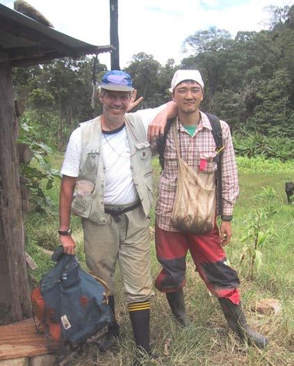


19 Acknowledging some of the younger Japanese talent that I have had the pleasure of working with in my career

20 Domo arigato gozaimasu
Hillslope Hydrology Q 1 Q Understand hillslope runoff processes. 2. Understand the contribution of groundwater to storm runoff.
 Objectives Hillslope Hydrology Streams are the conduits of the surface and subsurface runoff generated in watersheds. SW-GW interaction needs to be understood from the watershed perspective. During a storm
Towards a better process representation of catchment hydrology in conceptual runoff modelling
 Towards a better process representation of catchment hydrology in conceptual runoff modelling Jan Seibert, Jeff McDonnell Oregon State University, Department of Forest Engineering, Corvallis OR 97331,
Development and application of a simple hydrogeomorphic model for headwater catchments
 WATER RESOURCES RESEARCH, VOL. 47, W00H13, doi:10.1029/2011wr010662, 2011 Development and application of a simple hydrogeomorphic model for headwater catchments Roy C. Sidle, 1 Keewook Kim, 1 Yoshio Tsuboyama,
Hydrogeomorphological characteristics of a zero-order basin
 Erosion and Sedimentation m the Pacific Rim (Proceedings of the Corvallis Symposium, August, 1987). IAHS Pubi. no. 165. Hydrogeomorphological characteristics of a zero-order basin INTRODUCTION YOSHINORI
Role of upslope soil pore pressure on lateral subsurface storm flow dynamics
 WATER RESOURCES RESEARCH, VOL. 40,, doi:10.1029/2003wr002139, 2004 Role of upslope soil pore pressure on lateral subsurface storm flow dynamics Taro Uchida, 1 Yuko Asano, 2 and Takahisa Mizuyama Graduate
CHARACTERISTICS OF RAIN INFILTRATION IN SOIL LAYERS ON THE HILLSLOPE BEHIND IMPORTANT CULTURAL ASSET
 International Journal of GEOMATE, June, 216, Vol. 1, Issue 22, pp.219-2115 Geotec., Const. Mat. & Env., ISSN: 2186-2982(Print), 2186-299(Online), Japan CHARACTERISTICS OF RAIN INFILTRATION IN SOIL LAYERS
Monitoring Headwater Streams for Landscape Response to
 Monitoring Headwater Streams for Landscape Response to Climate Change Matthew Connor, PhD Connor nvironmental, nc. www.oe-i.com icom Healdsburg, California verview Headwater stream geomorphology Response
Seepage area and rate of bedrock groundwater discharge at a granitic unchanneled hillslope
 WATER RESOURCES RESEARCH, VOL. 39, NO. 1, 1018, doi:10.1029/2002wr001298, 2003 Seepage area and rate of bedrock groundwater discharge at a granitic unchanneled hillslope Taro Uchida, Yuko Asano, Nobuhito
Forest Hydrology: Lect. 9. Contents. Runoff, soil water and infiltration
 Forest Hydrology: Lect. 9 Contents Runoff, soil water and infiltration Learning objectives:. - Hillslope runoff generation processes; - Dynamics of runoff generation processes; - Hortonian and Dunnian
The role of lateral pipe flow in hillslope runoff response: an intercomparison of non-linear hillslope response
 Journal of Hydrology 311 (25) 117 133 www.elsevier.com/locate/jhydrol The role of lateral pipe flow in hillslope runoff response: an intercomparison of non-linear hillslope response Taro Uchida a, *, Ilja
FE 537. Catchment Modeling. Oregon State University
 Catchment Modeling This section An experimentalist s s view of models and their development in catchment hydrology Example of a model that captures dominant runoff processes Using our new process knowledge
Functional intercomparison of hillslopes and small catchments by examining water source, flowpath and mean residence time
 Journal of Hydrology (26) 327, 627 642 available at www.sciencedirect.com journal homepage: www.elsevier.com/locate/jhydrol Functional intercomparison of hillslopes and small catchments by examining water
Using Weather and Climate Information for Landslide Prevention and Mitigation
 Using Weather and Climate Information for Landslide Prevention and Mitigation Professor Roy C. Sidle Disaster Prevention Research Institute Kyoto University, Japan International Workshop on Climate and
Stream Geomorphology. Leslie A. Morrissey UVM July 25, 2012
 Stream Geomorphology Leslie A. Morrissey UVM July 25, 2012 What Functions do Healthy Streams Provide? Flood mitigation Water supply Water quality Sediment storage and transport Habitat Recreation Transportation
8 Current Issues and Research on Sediment Movement in the River Catchments of Japan
 8 Current Issues and Research on Sediment Movement in the River Catchments of Japan YUTAKA ICHIKAWA INTRODUCTION Prediction of sediment movement is one of the challenging tasks in water-related research.
Each basin is surrounded & defined by a drainage divide (high point from which water flows away) Channel initiation
 Channel initiation") DRAINAGE BASINS A drainage basin or watershed is defined from a downstream point, working upstream, to include all of the hillslope & channel areas which drain to that point Each basin is surrounded &
DRAINAGE BASINS A drainage basin or watershed is defined from a downstream point, working upstream, to include all of the hillslope & channel areas which drain to that point Each basin is surrounded &
Dan Miller + Kelly Burnett, Kelly Christiansen, Sharon Clarke, Lee Benda. GOAL Predict Channel Characteristics in Space and Time
 Broad-Scale Models Dan Miller + Kelly Burnett, Kelly Christiansen, Sharon Clarke, Lee Benda GOAL Predict Channel Characteristics in Space and Time Assess Potential for Fish Use and Productivity Assess
Threshold relations in subsurface stormflow: 1. A 147-storm analysis of the Panola hillslope
 WATER RESOURCES RESEARCH, VOL. 42, W241, doi:1.129/24wr3778, 26 Threshold relations in subsurface stormflow: 1. A 147-storm analysis of the Panola hillslope H. J. Tromp-van Meerveld 1,2 and J. J. McDonnell
Effects of bedrock permeability on hillslope and riparian groundwater dynamics in a weathered granite catchment
 WATER RESOURCES RESEARCH, VOL. 41,, doi:10.1029/2004wr003275, 2005 Effects of bedrock permeability on hillslope and riparian groundwater dynamics in a weathered granite catchment Masanori Katsuyama and
Remote Sensing and GIS Applications for Hilly Watersheds SUBASHISA DUTTA DEPARTMENT OF CIVIL ENGINEERING IIT GUWAHATI
 Remote Sensing and GIS Applications for Hilly Watersheds SUBASHISA DUTTA DEPARTMENT OF CIVIL ENGINEERING IIT GUWAHATI Deciding Alternative Land Use Options in a Watershed Using GIS Source: Anita Prakash
The role of near-stream riparian zones in the hydrology of steep upland catchments
 Hydrology, Water Resources and Ecology in Headwaters (Proceedings of the HeadWater'98 Conference held at Meran/Merano, Italy, April 1998). IAHS Publ. no. 248, 1998. 17^ The role of near-stream riparian
Threshold behavior in a fissured granitic catchment in southern China: 2. Modeling and uncertainty analysis
 WATER RESOURCES RESEARCH, VOL. 49, 2536 2551, doi:10.1002/wrcr.20193, 2013 Threshold behavior in a fissured granitic catchment in southern China: 2. Modeling and uncertainty analysis Congsheng Fu, 1,2
3/3/2013. The hydro cycle water returns from the sea. All "toilet to tap." Introduction to Environmental Geology, 5e
 Introduction to Environmental Geology, 5e Running Water: summary in haiku form Edward A. Keller Chapter 9 Rivers and Flooding Lecture Presentation prepared by X. Mara Chen, Salisbury University The hydro
The Effects of Hydraulic Structures on Streams Prone to Bank Erosion in an Intense Flood Event: A Case Study from Eastern Hokkaido
 Symposium Proceedings of the INTERPRAENENT 2018 in the Pacific Rim The Effects of Hydraulic Structures on Streams Prone to Bank Erosion in an Intense Flood Event: A Case Study from Eastern Hokkaido Daisuke
The roles of channels and hillslopes in rainfall-runoff lag times during. intense storms in a steep catchment
 The roles of channels and hillslopes in rainfall-runoff lag times during intense storms in a steep catchment Yuko ASANO*1, Taro UCHIDA*2 *1The University of Tokyo, Hinoda, Saitama, Japan, e-mail: yasano@uf.a.u-tokyo.ac.jp.
Effects of Bedrock Groundwater and Geological Structure on Hydrological Processes in Mountainous Watersheds
 Effects of Bedrock Groundwater and Geological Structure on Hydrological Processes in Mountainous Watersheds Naoya MASAOKA 1,*, Ken ichirou KOSUGI 1,2, Masanori KATSUYAMA, Takahisa MIZUYAMA 1, Shusuke MIYATA
Relative importance of slope material properties and timing of rainfall for the occurrence of landslides
 International Journal of Erosion Control Engineering, Vol. 1, No., 8 Relative importance of slope material properties and timing of rainfall for the occurrence of landslides Daizo TSUTSUMI 1 and Masaharu
River Response. Sediment Water Wood. Confinement. Bank material. Channel morphology. Valley slope. Riparian vegetation.
 River Response River Response Sediment Water Wood Confinement Valley slope Channel morphology Bank material Flow obstructions Riparian vegetation climate catchment vegetation hydrological regime channel
Need of Proper Development in Hilly Urban Areas to Avoid
 Need of Proper Development in Hilly Urban Areas to Avoid Landslide Hazard Dr. Arvind Phukan, P.E. Cosultant/Former Professor of Civil Engineering University of Alaska, Anchorage, USA RI District Governor
Journal of Hydrology
 Journal of Hydrology xxx (2010) xxx xxx Contents lists available at ScienceDirect Journal of Hydrology journal homepage: www.elsevier.com/locate/jhydrol Hillslope threshold response to rainfall: (1) A
Detection of Collapse Position in Mountainous Slope by Underground Sound Method
 Annuals of Disas. Prev. Res. Inst., Kyoto Univ., No. 48C, 2005 Detection of Collapse Position in Mountainous Slope by Underground Sound Method Yasuyuki TADA *, Masaharu FUJITA, Daizou TSUTSUMI, Takenobu
OBJECTIVES. Fluvial Geomorphology? STREAM CLASSIFICATION & RIVER ASSESSMENT
 STREAM CLASSIFICATION & RIVER ASSESSMENT Greg Babbit Graduate Research Assistant Dept. Forestry, Wildlife & Fisheries Seneca Creek, Monongahela National Forest, West Virginia OBJECTIVES Introduce basic
Aquifer an underground zone or layer of sand, gravel, or porous rock that is saturated with water.
 Aggradation raising of the streambed by deposition that occurs when the energy of the water flowing through a stream reach is insufficient to transport sediment conveyed from upstream. Alluvium a general
Debris flow: categories, characteristics, hazard assessment, mitigation measures. Hariklia D. SKILODIMOU, George D. BATHRELLOS
 Debris flow: categories, characteristics, hazard assessment, mitigation measures Hariklia D. SKILODIMOU, George D. BATHRELLOS Natural hazards: physical phenomena, active in geological time capable of producing
10th Asian Regional Conference of IAEG (2015)
") Characteristics of shallow landslides, soil layer structure and soil properties on hillslopes underlain by granite and hornfels cases from the disaster on 20 August 2014 at Hiroshima, Japan Takuma WATAKABE
Characteristics of shallow landslides, soil layer structure and soil properties on hillslopes underlain by granite and hornfels cases from the disaster on 20 August 2014 at Hiroshima, Japan Takuma WATAKABE
Characteristics of Step-Pool Morphology in the Mountain Streams of Japan
 Disaster Mitigation of Debris Flows, Slope Failures and Landslides 379 Characteristics of Step-Pool Morphology in the Mountain Streams of Japan Tatsuya Okazaki, 1) Yutaka Gonda, 2) Yohei Nishii 3) and
WATER ON AND UNDER GROUND. Objectives. The Hydrologic Cycle
 WATER ON AND UNDER GROUND Objectives Define and describe the hydrologic cycle. Identify the basic characteristics of streams. Define drainage basin. Describe how floods occur and what factors may make
Sustainable Forest Management in Watersheds
 Sustainable Forest Management in Watersheds UBC FRST 555 August 27, 2015 Kim Green, P.Geo., PhD Apex Geoscience Consultants Ltd Outline - Forests and Watersheds Scaling up from stand to watershed-level
Surface Processes Focus on Mass Wasting (Chapter 10)
") Surface Processes Focus on Mass Wasting (Chapter 10) 1. What is the distinction between weathering, mass wasting, and erosion? 2. What is the controlling force in mass wasting? What force provides resistance?
Surface Processes Focus on Mass Wasting (Chapter 10) 1. What is the distinction between weathering, mass wasting, and erosion? 2. What is the controlling force in mass wasting? What force provides resistance?
UGRC 144 Science and Technology in Our Lives/Geohazards
 UGRC 144 Science and Technology in Our Lives/Geohazards Flood and Flood Hazards Dr. Patrick Asamoah Sakyi Department of Earth Science, UG, Legon College of Education School of Continuing and Distance Education
The role of bedrock topography on subsurface storm flow
 WATER RESOURCES RESEARCH, VOL. 38, NO. 12, 1269, doi:10.1029/2001wr000872, 2002 The role of bedrock topography on subsurface storm flow Jim Freer, 1 J. J. McDonnell, 2 K. J. Beven, 1 N. E. Peters, 3 D.
EFFICIENCY OF THE INTEGRATED RESERVOIR OPERATION FOR FLOOD CONTROL IN THE UPPER TONE RIVER OF JAPAN CONSIDERING SPATIAL DISTRIBUTION OF RAINFALL
 EFFICIENCY OF THE INTEGRATED RESERVOIR OPERATION FOR FLOOD CONTROL IN THE UPPER TONE RIVER OF JAPAN CONSIDERING SPATIAL DISTRIBUTION OF RAINFALL Dawen YANG, Eik Chay LOW and Toshio KOIKE Department of
The River Restoration Centre therrc.co.uk. Understanding Fluvial Processes: supporting River Restoration. Dr Jenny Mant
 The River Restoration Centre therrc.co.uk Understanding Fluvial Processes: supporting River Restoration Dr Jenny Mant Jenny@therrc.co.uk Understanding your catchment Hydrology Energy associated with the
RANGE AND ANIMAL SCIENCES AND RESOURCES MANAGEMENT - Vol. II - Catchment Management A Framework for Managing Rangelands - Hugh Milner
 CATCHMENT MANAGEMENT A FRAMEWORK FOR MANAGING RANGELANDS Hugh Milner International Water Management Consultant, Australia Keywords: Rangeland management; catchments and watersheds; catchment management
Rivers T. Perron
 1 Rivers T. Perron 12.001 After our discussions of large-scale topography, how we represent topography in maps, and how topography interacts with geologic structures, you should be frothing at the mouth
Climate change and natural disasters, Athens, Greece October 31, 2018
 Flood early warning systems: operational approaches and challenges Climate change and natural disasters, Athens, Greece October 31, 2018 Athens, October 31, 2018 Marco Borga University of Padova, Italy
The impact of hill land clearance and urbanization on runoff and sediment yield of small catchments in Pulau Pinang, Malaysia
 Human Impact on Erosion and Sedimentation (Proceedings of Rabat Symposium S6, April 1997). IAHS Publ. no. 245, 1997 91 The impact of hill land clearance and urbanization on runoff and sediment yield of
Landslides & Debris Flows
 T.#Perron# #12.001# #Landslides#&#Debris#Flows# 1# Landslides & Debris Flows Many geologic processes, including those shaping the land surface, are slowacting, involving feedbacks that operate over many
A combined model of sediment production, supply and transport
 doi:10.5194/piahs-367-357-2015 Sediment Dynamics from the Summit to the Sea 357 (Proceedings of a symposium held in New Orleans, Louisiana, USA, 11 14 December 2014) (IAHS Publ. 367, 2014). A combined
2 Development of a Physically Based Hydrologic Model of the Upper Cosumnes Basin
 2 Development of a Physically Based Hydrologic Model of the Upper Cosumnes Basin 2.1 Introduction The physically based watershed hydrologic model, WEHY (watershed environmental hydrology) model (Kavvas
Runoff generation in a steep, soil-mantled landscape
 WATER RESOURCES RESEARCH, VOL. 38, NO. 9, 1168, doi:10.1029/2001wr000822, 2002 Runoff generation in a steep, soil-mantled landscape David R. Montgomery Department of Earth and Space Sciences, University
The Interaction Between Trees and the Landscape Through Debris Flows
 The Interaction Between Trees and the Landscape Through Debris Flows Stephen T. Lancaster 1, Shannon K. Hayes 1, and Gordon E. Grant 2 1. Dept. of Geosciences, Oregon State University (slancast@fsl.orst.edu)
A review of the evolving perceptual model of hillslope owpaths at the Maimai catchments, New Zealand
 Journal of Hydrology 257 (2002) 1±26 Review A review of the evolving perceptual model of hillslope owpaths at the Maimai catchments, New Zealand Brian L. McGlynn a,b, *, Jeffrey J. McDonnel b, Dean D.
ENGINEERING HYDROLOGY
 ENGINEERING HYDROLOGY Prof. Rajesh Bhagat Asst. Professor Civil Engineering Department Yeshwantrao Chavan College Of Engineering Nagpur B. E. (Civil Engg.) M. Tech. (Enviro. Engg.) GCOE, Amravati VNIT,
 12 10 8 6 4 2 0 40-50 50-60 60-70 70-80 80-90 90-100 Fresh Water What we will cover The Hydrologic Cycle River systems Floods Groundwater Caves and Karst Topography Hot springs Distribution of water in
A distributed runoff model for flood prediction in ungauged basins
 Predictions in Ungauged Basins: PUB Kick-off (Proceedings of the PUB Kick-off meeting held in Brasilia, 2 22 November 22). IAHS Publ. 39, 27. 267 A distributed runoff model for flood prediction in ungauged
APPROACH TO THE SPANISH WATER ORGANISATION IMPROVING FLOOD HAZARD MAPPING, LAWS AND AUTHORITIES COORDINATION
 "Workshop On Land Use Planning And Water Management, With Focus On Flood Risk Management Oslo, Norway. Wednesday 31 January and Thursday 1 February 2007 APPROACH TO THE SPANISH WATER ORGANISATION IMPROVING
Hydrological and geomorphological studies of debris slides on forested hillslopes in Japan
 Recen r evelopmerits in the Explanation andi'redictiori oferosiori a~rd Sedirnerrr Yield (roceedings of the Exeter Symposium. July 1982). IAHS ubl. no. 137. Hydrological and geomorphological studies of
Which map shows the stream drainage pattern that most likely formed on the surface of this volcano? A) B)
 B)") 1. When snow cover on the land melts, the water will most likely become surface runoff if the land surface is A) frozen B) porous C) grass covered D) unconsolidated gravel Base your answers to questions
1. When snow cover on the land melts, the water will most likely become surface runoff if the land surface is A) frozen B) porous C) grass covered D) unconsolidated gravel Base your answers to questions
How much water can a watershed store?
 1 2 3 4 5 6 7 8 9 10 11 12 13 14 15 16 17 18 19 20 21 22 23 24 25 26 27 28 29 30 31 32 33 A manuscript for submission to the Special Issue of Hydrological Processes: S170 Measurements and modeling of storage
GEOMORPHIC CHANGES OF A LANDSLIDE DAM BY OVERTOPPING EROSION
 DOI: 10.4408/IJEGE.2011-03.B-087 GEOMORPHIC CHANGES OF A LANDSLIDE DAM BY OVERTOPPING EROSION K. Yoshino (*), T. Uchida (*), T. shimizu (*) & K. Tamura (*) (*) Incorporated Administrative Agency, Public
How Do Human Impacts and Geomorphological Responses Vary with Spatial Scale in the Streams and Rivers of the Illinois Basin?
 How Do Human Impacts and Geomorphological Responses Vary with Spatial Scale in the Streams and Rivers of the Illinois Basin? Bruce Rhoads Department of Geography University of Illinois at Urbana-Champaign
Flood modelling and impact of debris flow in the Madarsoo River, Iran
 Monitoring, Simulation, Prevention and Remediation of Dense and Debris Flows 69 Flood modelling and impact of debris flow in the Madarsoo River, Iran S. Tjerry 1, O. Z. Jessen 2, K. Morishita 3 & H. G.
A Hydrogeological Study for the Hiroshima August 2014 Disaster
 10th Asian Regional Conference of IAEG (2015) A Hydrogeological Study for the Hiroshima August 2014 Disaster Tomoaki KAYAKI, Seisuke MIYAZAKI, Kazuyuki MUKAI, Mitsunobu TERAMOTO and Sung Gi HU (Study Group
Discussion of Response of a residual soil slope to rainfall 1
 979 DISCUSSION / DISCUSSION Discussion of Response of a residual soil slope to rainfall 1 Ana C. Londono Received 22 January 2006. Accepted 15 June 2006. Published on the NRC Research Press Web site at
(2004)
") 2004 4 2005 3 2004 5 63-71 2004 51 667-678 (2004) 5 81-86 2004 99-101 2004 51 653-654 2004 36 41-50 (2004) 5 41-50 2004 47 B 863-869 2004 78 147-159 113 495-511 5 109-114 2004 5 87-97 2004, 5, 21-28 2004
2004 4 2005 3 2004 5 63-71 2004 51 667-678 (2004) 5 81-86 2004 99-101 2004 51 653-654 2004 36 41-50 (2004) 5 41-50 2004 47 B 863-869 2004 78 147-159 113 495-511 5 109-114 2004 5 87-97 2004, 5, 21-28 2004
Geog Lecture 19
 Geog 1000 - Lecture 19 Fluvial Geomorphology and River Systems http://scholar.ulethbridge.ca/chasmer/classes/ Today s Lecture (Pgs 346 355) 1. What is Fluvial Geomorphology? 2. Hydrology and the Water
Lecture Outlines PowerPoint. Chapter 5 Earth Science 11e Tarbuck/Lutgens
 Lecture Outlines PowerPoint Chapter 5 Earth Science 11e Tarbuck/Lutgens 2006 Pearson Prentice Hall This work is protected by United States copyright laws and is provided solely for the use of instructors
7 Flood Prediction in Japan and the Need for Guidelines for Flood Runoff Modelling
 7 Flood Prediction in Japan and the Need for Guidelines for Flood Runoff Modelling YASUTO TACHIKAWA, ROSHAN K. SHRESTHA & TAKAHIRO SAYAMA FLOOD DISASTER AND FLOOD RUNOFF MODELLING IN JAPAN About 5% of
[Penumaka, 7(1): January-March 2017] ISSN Impact Factor
![[Penumaka, 7(1): January-March 2017] ISSN Impact Factor](/thumbs/95/124653515.jpg "[Penumaka, 7(1): January-March 2017] ISSN Impact Factor") INTERNATIONAL JOURNAL OF ENGINEERING SCIENCES &MANAGEMENT HYDROGEOMORPHOLOGY OF CHEVELLA BASIN, RANGA REDDY DISTRICT, TELANGANA STATE Penumaka Ramesh* 1 & Podila Sankara Pitchaiah 2 * 1&2 Department of
INTERNATIONAL JOURNAL OF ENGINEERING SCIENCES &MANAGEMENT HYDROGEOMORPHOLOGY OF CHEVELLA BASIN, RANGA REDDY DISTRICT, TELANGANA STATE Penumaka Ramesh* 1 & Podila Sankara Pitchaiah 2 * 1&2 Department of
THE CASPAR CREEK EXPERIMENTAL WATERSHED. Thomas Lisle, Hydrologist Pacific Southwest Forest and Range Experiment Station Arcata, Califorina
 THE CASPAR CREEK EXPERIMENTAL WATERSHED Thomas Lisle, Hydrologist Pacific Southwest Forest and Range Experiment Station Arcata, Califorina The Caspar Creek Experimental Watershed was set up as a traditional
Determination of the geomorphological instantaneous unit hydrograph using tracer experiments in a headwater basin
 Hydrology, Water Resources and Ecology in Headwaters (Proceedings of the HeadWater'98 Conference held at Meran/Merano, Italy, April 1998). 1AHS Publ. no. 248, 1998. 327 Determination of the geomorphological
ENVIRONMENTAL GEOSCIENCE UNIFORM SYLLABUS
 ENVIRONMENTAL GEOSCIENCE UNIFORM SYLLABUS The Association of Professional Engineers and Geoscientists of the Province of British Columbia Note: 1. This Syllabus May Be Subject To Change 2. These Courses
Erosion Surface Water. moving, transporting, and depositing sediment.
 + Erosion Surface Water moving, transporting, and depositing sediment. + Surface Water 2 Water from rainfall can hit Earth s surface and do a number of things: Slowly soak into the ground: Infiltration
Towards a process-oriented HRU-concept in SWAT: Catchment-related control on baseflow and storage of landscape units in medium to large river basins.
 Towards a process-oriented HRU-concept in SWAT: Catchment-related control on baseflow and storage of landscape units in medium to large river basins. Martin Volk 1), J.G. Arnold 2), P.M. Allen 3), Pei-Yu
Deep-Seated Landslides and Landslide Dams Characteristics Caused by Typhoon Talas at Kii Peninsula, Japan
 Deep-Seated Landslides and Landslide Dams Characteristics Caused by Typhoon Talas at Kii Peninsula, Japan Hefryan Sukma KHARISMALATRI*,1, Hitomi KIKUCHI 1, Yoshiharu ISHIKAWA 1, Takashi GOMI 1, Katsushige
STUDY GUIDE FOR CONTENT MASTERY. Surface Water Movement
 Surface Water SECTION 9.1 Surface Water Movement In your textbook, read about surface water and the way in which it moves sediment. Complete each statement. 1. An excessive amount of water flowing downslope
The last three sections of the main body of this report consist of:
 Threatened and Endangered Species Geological Hazards Floodplains Cultural Resources Hazardous Materials A Cost Analysis section that provides comparative conceptual-level costs follows the Environmental
Relationship between catchment scale and the spatial variability of stream discharge and chemistry in a catchment with multiple geologies
 Hydrological Research Letters 7(2), 12 17 (2013) Published online in J-STAGE (www.jstage.jst.go.jp/browse/hrl). doi: 10.3178/HRL.7.12 Relationship between catchment scale and the spatial variability of
Governing Rules of Water Movement
 Governing Rules of Water Movement Like all physical processes, the flow of water always occurs across some form of energy gradient from high to low e.g., a topographic (slope) gradient from high to low
Analysis of coarse sediment connectivity in semiarid river channels
 Sediment Transfer tlirongh the Fluviai System (Proceedings of a symposium held in Moscow, August 2004). IAHS Publ. 288, 2004 269 Analysis of coarse sediment connectivity in semiarid river channels J. M.
Advanced /Surface Hydrology Dr. Jagadish Torlapati Fall 2017 MODULE 2 - ROUTING METHODS
 Routing MODULE - ROUTING METHODS Routing is the process of find the distribution of flow rate and depth in space and time along a river or storm sewer. Routing is also called Flow routing or flood routing.
Flash Flood Guidance System On-going Enhancements
 Flash Flood Guidance System On-going Enhancements Hydrologic Research Center, USA Technical Developer SAOFFG Steering Committee Meeting 1 10-12 July 2017 Jakarta, INDONESIA Theresa M. Modrick Hansen, PhD
RECENT RESEARCH in hillslope hydrology suggests that
 Published online December 16, 2005 Saturated and Unsaturated Hydraulic Conductivities and Water Retention Characteristics of Weathered Granitic Bedrock Shin ya Katsura,* Ken ichirou Kosugi, Nobuhiro Yamamoto,
Rates of gully erosion along Pikes Peak Highway, Colorado, USA
 Landform Analysis, Vol. 17: 75 80 (2011) Rates of gully erosion along Pikes Peak Highway, Colorado, USA Harry A. Katz 1, J. Michael Daniels 1, Sandra E. Ryan 2 1 Department of Geography, University of
THROUGHFLOW ON HILLSLOPES AND ITS RELATION TO THE STREAM HYDROGRAPH
 Hydrological Sciences Journal ISSN: 0020-6024 (Print) (Online) Journal homepage: http://www.tandfonline.com/loi/thsj18 THROUGHFLOW ON HILLSLOPES AND ITS RELATION TO THE STREAM HYDROGRAPH D. R. WEYMAN To
Physiographic zones. and water quality
 Southland Physiographic zones bedrock/hill country Technical information Physiographic zones are part of the Water and Land 2020 & Beyond project that aims to maintain and improve water quality in the
Effect of spatial heterogeneity of runoff generation mechanisms on the scaling behavior of event runoff responses in a natural river basin
 WATER RESOURCES RESEARCH, VOL. 47, W00H08, doi:10.1029/2010wr009712, 2011 Effect of spatial heterogeneity of runoff generation mechanisms on the scaling behavior of event runoff responses in a natural
EFFECTS OF RIPARIAN RETENTION (IN WATERSHEDS) ON ALLUVIAL FANS
 ON ALLUVIAL FANS") EFFECTS OF RIPARIAN RETENTION (IN WATERSHEDS) ON ALLUVIAL FANS TIM GILES GEOMORPHOLOGIST FLNRO EFFECTS OF RIPARIAN RETENTION (IN WATERSHEDS) ON ALLUVIAL FANS Description of alluvial fans Three case studies
EFFECTS OF RIPARIAN RETENTION (IN WATERSHEDS) ON ALLUVIAL FANS TIM GILES GEOMORPHOLOGIST FLNRO EFFECTS OF RIPARIAN RETENTION (IN WATERSHEDS) ON ALLUVIAL FANS Description of alluvial fans Three case studies
Watershed concepts for community environmental planning
 Purpose and Objectives Watershed concepts for community environmental planning Dale Bruns, Wilkes University USDA Rural GIS Consortium May 2007 Provide background on basic concepts in watershed, stream,
Localized bedrock aquifer distribution explains discharge from a headwater catchment
 WATER RESOURCES RESEARCH, VOL. 47, W07530, doi:10.1029/2010wr009884, 2011 Localized bedrock aquifer distribution explains discharge from a headwater catchment Ken ichirou Kosugi, 1 Masamitsu Fujimoto,
Objectives: After completing this assignment, you should be able to:
 Data Analysis Assignment #1 Evaluating the effects of watershed land use on storm runoff Assignment due: 21 February 2013, 5 pm Objectives: After completing this assignment, you should be able to: 1) Calculate
Surface Water and Stream Development
 Surface Water and Stream Development Surface Water The moment a raindrop falls to earth it begins its return to the sea. Once water reaches Earth s surface it may evaporate back into the atmosphere, soak
Diego Burgos. Geology 394. Advisors: Dr. Prestegaard. Phillip Goodling
 Sediment Transport into an Urban Tributary Junction Diego Burgos Geology 394 Advisors: Dr. Prestegaard Phillip Goodling 1 Abstract Tributary junctions are an important component of stream morphology and
Dynamique des rivières. res
 Dynamique des rivières res 1 Rivers are enormously diverse size: varies by many orders of magnitude geometry: highly variable substrate: bedrock or sediment sediment type: sediment size ranges from mud
Floodplain modeling. Ovidius University of Constanta (P4) Romania & Technological Educational Institute of Serres, Greece
 Romania & Technological Educational Institute of Serres, Greece") Floodplain modeling Ovidius University of Constanta (P4) Romania & Technological Educational Institute of Serres, Greece Scientific Staff: Dr Carmen Maftei, Professor, Civil Engineering Dept. Dr Konstantinos
Floodplain modeling Ovidius University of Constanta (P4) Romania & Technological Educational Institute of Serres, Greece Scientific Staff: Dr Carmen Maftei, Professor, Civil Engineering Dept. Dr Konstantinos
Section 4: Model Development and Application
 Section 4: Model Development and Application The hydrologic model for the Wissahickon Act 167 study was built using GIS layers of land use, hydrologic soil groups, terrain and orthophotography. Within
Gateway Trail Project
 Gateway Trail Project Debris Flow Hazard Assessment By: Juan de la Fuente April 30, 2010 Background- On April 22, 2010, the Shasta-Trinity National Forest (Mt. Shasta-McCloud Unit) requested a geologic
A STUDY ON DEBRIS FLOW DEPOSITION BY THE ARRANGEMENT OF SABO DAM
 Annual Journal of Hydraulic Engineering, JSCE, Vol.57, 2013, February A STUDY ON DEBRIS FLOW DEPOSITION BY THE ARRANGEMENT OF SABO DAM Namgyun Kim 1, Hajime NAKAGAWA 2, Kenji KAWAIKE 3, and Hao ZHANG 4
Assessment of the Incidence of Landslides Using Numerical Information
 PAPER Assessment of the Incidence of Landslides Using Numerical Information Atsushi HASEGAWA Takehiro OHTA, Dr. Sci. Assistant Senior Researcher, Senior Researcher, Laboratory Head, Geology Laboratory,