ARCHITECTURE AND TIMING OF GOLD MINERALISATION AT THE GOLDEN MILE GOLD DEPOSIT, KALGOORLIE, WESTERN AUSTRALIA
|
|
|
- Christal McCarthy
- 5 years ago
- Views:
Transcription
1 1 ARCHITECTURE AND TIMING OF GOLD MINERALISATION AT THE GOLDEN MILE GOLD DEPOSIT, KALGOORLIE, WESTERN AUSTRALIA Louis Gauthier 1, Steffen Hagemann 1 and Francois Robert 2 1 Centre for Global Metallogeny, The University of Western Australia, Crawley, WA, 6009,Australia 2 Barrick Gold Corporation, Level 10, 2 Mill St, Perth, WA, 6000, Australia ABSTRACT In this contribution, surface and underground mapping combined with geochemistry and compilation of previous work has led to an improved understanding of the structural framework of the Golden Mile deposit. The relative timing of multiple hydrothermal events, including the Fimiston gold telluride mineralisation event, is constrained relative to deformation events and the intrusion of multiple sets of dykes. Abrupt changes in thickness, composition and in the internal magmatic layering of the Golden Mile Dolerite and the Paringa Basalt indicate the presence of early syn-volcanic faults, which have an important control on the architecture of the Golden Mile deposit. The upright Kalgoorlie anticlinal axis overprints a major synvolcanic growth fault, which formed the original eastern margin of the Golden Mile Dolerite. Geochemistry confirms the equivalence of the Golden Mile and Aberdare dolerites across the late stage Adelaide Fault, and establishes the regional continuity of the NNW trending, upright, and shallow south plunging Kalgoorlie syncline-anticline pair, which dominates the structural architecture of the Golden Mile. The Lake View syncline, occurring in the southern part of the Golden Mile, and in continuity with the Kalgoorlie anticline is truncated by the Golden Mile Fault indicating that the initiation of the GMF postdates the development of the Kalgoorlie syncline-anticline pair. The presence of the Lake View South syncline east of the GMF does not support the interpretation of the GMF as a thrust and the Kalgoorlie anticline as an overturned hangingwall anticline. A regional steeply west dipping NNW foliation overprints the Kalgoorlie syncline-anticline pair. This fabric is axial planar to the Boomerang anticline which folds the GMF and Kalgoorlie syncline-anticline pair. A swarm of feldspar porphyry dykes transects both limbs of the Kalgoorlie fold pair and are in turn overprinted by the regional NNW trending foliation. The feldspar porphyry dykes are also overprinted by Fimiston style gold mineralisation consisting of narrow, vertically and laterally extensive lodes (>1200m vertical and > 1000m along strike) of carbonate-quartzpyrite breccias, quartz veins and carbonate-quartz-pyrite disseminations. The feldspar porphyry dykes and the Fimiston lodes are spatially associated and share common
2 2 orientations (Main N140 ο /80 ο W, Caunter N115 ο /65 ο W and Cross Lode N050 ο /85 ο N-S). Hornblende porphyry dykes, also sharing the same orientations, cross cut the feldspar porphyry dykes and the Fimiston lodes and are also overprinted by the regional NNW trending foliation. This NW regional foliation is preferentially developed within weak layers such as mudstone beds and strongly sericite-rich Fimiston lode selvedges. The constant orientation of the NW-trending foliation in lode selvedges across a wide range of lode orientations, including the NE-trending Cross Lodes and the shallow-dipping Caunter lodes, provides clear evidence that the foliation overprints the lode selvedges rather than being related to shearing synchronous with lode formation. The NW regional foliation is associated with localised small-scale folds and faults of Fimiston veins, which is consistent with NE-SW shortening. Some steeply east dipping NNW trending faults occurring in the footwall of the GMF display pre-lode reverse slip and post-lode dextral slip as indicated by the larger offset on the stratigraphy than on the Fimiston lodes. In addition, some feldspar porphyry dykes are emplaced within these faults. A conjugate network of shallow dipping, reverse faults, generally post-dates these steep faults. Quartz-carbonate veins and breccias are locally associated with the late steeply dipping, and shallow dipping fault sets. Where these veins cut the Fimiston lodes, they contain fragments of Fimiston lodes showing random orientation of the foliation in alteration selvedges. This implies that these veins and some of the shallow dipping reverse faults and steeply east dipping reverse-dextral faults postdate the regional NNW trending foliation. This Study establishes the Fimiston stage gold mineralisation as an upright array of narrow lodes that funnels upwards within the Golden Mile Dolerite and overprint both limbs of the early upright Kalgoorlie fold pair. The lodes are in turn, transected by hornblende porphyry dykes, overprinted by the regional trending NNW steeply dipping regional foliation and dissected by steep reverse and dextral faults. Mt-Charlotte-type coarse-grained quartz carbonate and scheelite veins cross cut Fimiston lodes and are associated with a late set of fractures post dating the regional NW trending foliation. INTRODUCTION The Golden Mile gold deposit is located within the southern portion of the Norseman Wiluna Greenstone belt, within the eastern portion of the late Archean Yilgarn craton in Western Australia (c Ga; fig. 1). The Golden Mile deposit has been in near continuous production for 110 years, having produced over 50 million ounces of gold and still hosting over 12 million ounces of reserves. Although, the Golden Mile deposit has been the object of numerous previous high quality studies over the last 100 years, several basic aspects of the deposit relating to its genesis, structural setting and the relative and absolute timing of the Golden Mile gold
3 3 mineralisation remain contentious. Several different interpretations of the relative timing of the Fimiston gold mineralisation event (the main ore stage at the Golden Mile deposit) have been proposed, influenced by diverging interpretations of the basic structural architecture of the deposit. The interpretations of the relative timing for Fimiston Gold mineralisation can be synthesised in two groups. The first argues for a late tectonic timing for the Fimiston gold mineralisation in association with dominantly reverse or strike slip fault arrays (Boulter et al., 1987, Mueller et al., 1987, Swager 1989). These studies recognise the structural complexity of the Golden Mile deposit but argue for a progressive compressional or transpressional deformation regime to explain the deformation overprint on the Fimiston lodes and the clearly later cross cutting Mt-Charlotte style quartz-carbonate vein gold mineralisation. The second group advocates an early timing for Fimiston gold mineralisation. This group emphasises that several sets of faults and a penetrative foliation dissect and overprint the Fimiston Lodes (Clout, 1989, Bateman et al. 2001). Previous studies also document a wide range of diverging interpretations of the relative chronology of structural elements present at the Golden Mile deposit (Boulter et al. 1987, Mueller et al. 1987, Swager et al. 1989, Clout et al., 1990, Bateman et al. 2001). The structural framework of the Golden Mile deposit is generally well constrained in terms of the location of the main structural features and their geometric relationships (Stillwell, 1929, Gustafson and Miller, 1937, Finucane, 1948, Campbell, 1953, Woodall, 1965). However, key interpretations of fault kinematics are still poorly defined. There is also disagreement on the interpretation of some of the main structures a the Golden Mile deposit, which include the Golden Mile fault, the Kalgoorlie syncline-anticline fold pair and the smaller scale Lake View and Brownhill synclines (Gustafson and Miller, 1937, Campbell, 1953, Woodall, 1965, Swager et al. 1989, Clout, 1989). The relatively recent recognition that the Golden Mile Dolerite, the main host of the Golden Mile deposit, is a layered mafic tholeiitic sill, with ten distinctive magmatic units allowed a much better control on the measurement of fault offsets within the deposit (Travis et al. 1971). Although the host stratigraphy of the Golden Mile is well documented, there is still controversy on the nature and correlation of mafic sills, particularly across the major Kalgoorlie syncline-anticline (Travis et al. 1971, Clout et al., 1990, Bateman et al. 2001). An extensive geochemical database accumulated over the last ten years in widely spaced deep drill holes allows a much better definition of the stratigraphy of mafic to ultramafic flows and the correlation of these mafic sills (Swe, 1994, Bateman et al. 2001). The correlation of these mafic sills and of other stratigraphic markers across major folds and faults has important implications for the interpretation of the local structural framework. The major and trace element geochemistry has allowed the definition of important
4 4 new marker units within the Paringa Basalt sequence not otherwise identifiable. It has also highlighted a wider compositional range in the Paringa Basalt than previously recognised (Bateman et al, 2001, Redman and Keays, 1985). The internal layering of the Golden Mile Dolerite is geochemically distinctive as documented by Travis et. al. (1971). In addition, this study outlines that within individual magmatic layers consistent fractionation trends are defined by variations in trace and major elements content. The lateral geochemical variations, and variation in the geometry of the Golden Mile Dolerite documented by Travis et al. (1971), are also better constrained in terms of spatial distribution and relationships with structural elements. The spatial relationship between the Golden Mile Dolerite and other mafic sills is also better documented. This integrated study is based on detailed underground and open pit mapping focussed on key locations throughout the Golden Mile deposit, complemented by core relogging, compilation of previous mapping, and the interpretation of an extensive geochemical database. The focus of this work is unravelling the relative timing of structural events at the Golden Mile deposit and thereby better constraining the relative timing of the Fimiston gold mineralisation event. Furthermore, some absolute timing constraints were established from this work. A better definition of the chronology of structural events at the Golden Mile generates an improved definition of the structural architecture and controlling structures for Fimiston stage gold mineralisation. The first part of this paper documents important advances in the understanding of the Golden Mile volcanic stratigraphy and of the associated mafic sills. Furthermore, an outline of important textural aspects of later sets of cross cutting dykes is also documented. These advances lead to the refinement of the structural framework of the Golden Mile deposit. In addition, an improved documentation of the Fimiston gold mineralisation paragenesis is presented and sets the scene for a more integrated geological framework. The second part of the paper documents the structural framework of the deposit with emphasis on the documentation of field relationships, which constrain the relative chronology of the Fimiston gold mineralisation event. An interpretation of the main structural elements including kinematics of major structures is also presented. Finally, the geological setting of the main structural, magmatic and hydrothermal events characterising the Golden Mile deposit are integrated in a coherent temporal framework. STRATIGRAPHY Geological setting The Golden Mile gold deposit occurs in the Kalgoorlie Terrane, within the southern portion of the, Norseman-Wiluna Greenstone Belt, at the greenschist metamorphic grade (Fig. 1). The stratigraphy of the Kalgoorlie Terrane consists of a lower basalt, a thick komatiitic flow sequence overlain by basalt and a thick sequence of intermediate to felsic
5 5 volcaniclastic rocks (Swager, 1997). This stratigraphic sequence was later intruded by mafic tholeiitic and komatiitic sills (Witt, 1995). This stratigraphic succession summarised in Table 1, is well established and has been previously described by several authors (Campbell, 1953, Travis et al. 1971, Clout, 1989, Bateman et al. 2001). This stratigraphic sequence was broadly deposited between 2708 /- 7Ma and 2681 /- 5 Ma (Nelson, 1997). Younger sedimentary bassins, occurring along major faults or synclines, unconformably overly the greenstone sequence. These are characterised by conglomerates and coarse sandstones (Swager, 1997, Krapez et al. 2001). The Greenstone belt is folded by tight upright north-northwest trending folds and dissected by northwest to north-northwest reverse and strike slip faults. Granitic intrusions occurring within the Greenstone belt are divided through field relationships in two categories, pre-folding and post folding (Witt, 1997). The post folding intrusions are further sub-divided as syn-tectonic and late tectonic. The Golden Mile deposit is dominantly hosted by the Golden Mile Dolerite, a mafic tholeiitic layered sill approximately 600 to 750m in thickness. The Golden Mile Dolerite was emplaced at a major lithological contact between the Black Flag Group sequence consisting dominantly of fine grained clastic sediments and intermediate volcanics and an underlying sequence of mafic to ultramafic volcanic flows and co-magmatic sub volcanic sills (Table 1). Thin interflow sediments consisting of finely bedded mudstone and siltstone occur in association with major break in volcanism throughout the sequence of volcanic flows and form important marker units. Paringa Basalt The Paringa Basalt sequence consists of a 400 to 700m thick accumulation of basaltic flows grading from a high magnesium basalt (>10wt% MgO, anhydrous basis) with ubiquitous variolitic and local spinifex textures at the base, to a gradually more fractionated tholeiitic basalt (3 to 10wt% MgO; Bateman et al. 2001). The upper portion of the Paringa Basalt is characterised by pillow and flow breccia textures with a general increase of interflow sedimentary rocks consisting of finely bedded black shale. Redman and Keays (1985) discriminated the Paringa Basalt as part of a siliceous high magnesium series basalt, based on relatively high SiO2 and incompatible element contents. The Paringa Basalt displays a gradual fractionation trend with increasingly more evolved compositions towards the stratigraphic top, characterised by an increase in incompatible elements such as, zirconium, titanium, aluminum, vanadium and iron and a decrease in compatible element content such as magnesium, nickel and chrome (Fig. 2). The top 50 to 300m section of the Paringa Basalt sequence consists of a high iron tholeiite, in sharp contact with the underlying tholeiitic basalt. The contact is commonly
6 6 marked by a finely bedded black shale horizon, generally 1 to 5 m in thickness. In the Brownhill syncline area this stratigraphic marker was historically referred to as the lower slate unit (Tomich, 1974). The high iron tholeiite is characterised by a high content of TiO2 (1.5 to 1.8wt%), Fe2O3 (14 to 16 wt%), Zr (100 to 130 ppm), P2O5 (0.2 to 0.25 wt%) and low MgO (3 to 5wt%). The high iron tholeiite also displays a normal fractionation trend (Fig. 2). In the Eastern Lode Domain, where the upper part of the Paringa Basalt sequence is well documented, the thickness of the high iron tholeiite varies markedly from the southern portion, where it is approximately 300m in thickness, compared with the northern portion, which is approximately 50m in thickness. The thicker section of high iron tholeiite in the south includes the co-magmatic Eureka Dolerite sill of approximately 100m in thickness. The change in thickness of the high iron tholeiite is sharp and occurs between sections 47330mN and 48170mn (fig. 3). The high iron tholeiite and associated Eureka Dolerite sill also occur on the western limb of the Kalgoorlie syncline where their combined thickness is approximately 100 to 200 m. In the Eastern Lode Domain, the 50m thick high iron tholeiite, underlying the Golden Mile Dolerite, hosts the bulk of the economic Fimiston lodes, occurring within the Paringa Basalt (Travis et al. 1971). Two recently drilled deep holes within the Eastern Lode Domain, intersected a wide section of high magnesium basalt in the lower portion of the Paringa Basalt, directly overlying the Williamstown dolerite (10 to 16wt% MgO). This is in contrast to other drill holes intersecting the lower part of the Paringa Basalt stratigraphy in contact with the Williamstown Dolerite, further north, which were typically characterised by basalts with up to approximately 8wt% MgO. The high magnesium basalts and the more evolved overlying tholeiitic basalts form a continuous fractionation trend on geochemical variation diagrams implying that they are comagmatic (Fig. 2). The change in slope on the MgO vs Al2O3 diagram suggests a change in fractionation phases at this point, between the high magnesium basalt and the tholeiitic basalt, possibly olivine to pyroxenes. The gradual fractionation trend of the Paringa Basalt, documented by several generally immobile elements such as zirconium, vanadium and titanium, constitutes a good indicator of the younging direction of the Paringa Basalt sequence. This allows to precisely locate the axis of the Kalgoorlie anticline in several deep drill holes drilled from SW to NE through the Kalgoorlie anticline (Fig. 4). In these deep drill holes, the anticlinal axis is marked by an inflection in the gradual fractionation trends along down hole geochemical diagrams (Fig. 5).
7 7 Golden Mile Dolerite The Golden Mile Dolerite is a differentiated layered tholeiitic mafic sill of approximately 650 to 750m in thickness (Travis et al. 1971, Witt 1995). The intrusion extends for approximately 25km along strike, it is emplaced along the contact between the Paringa Basalt and Black Flag Group (Fig. 6). The emplacement of the Golden Mile Dolerite along a major lithological discontinuity is a typical feature for large mafic sills (Petraske et al. 1978). The Golden Mile Dolerite presents a differentiation pattern, including the development of magmatic phase layering, typical of layered mafic intrusions of initial bulk tholeiitic basaltic composition (McBirney, 1984). The magmatic phase layering of the Golden Mile Dolerite is broadly comparable to the Skaergard intrusion for instance, although the Golden Mile Dolerite is significantly thinner (McBirney et al., 1979). The Golden Mile Dolerite has well-developed chill margins of 10 to 20m thickness along both the upper and lower contacts, in the Golden Mile deposit area (Travis et al. 1971). This is evidence that the Golden Mile Dolerite is emplaced along the Black Flag Group, Paringa Basalt contact and that the Black Flag Group does not uncomformably overly the Golden Mile Dolerite. The Golden Mile Dolerite presents a pattern of crystallisation progressing from the roof (Unit 9) and floor (Unit 2 to 7) towards the more fractionated granophyric unit occurring towards the centre of the intrusion (Unit 8). It presents a pattern of iron and incompatible element enrichment, including silica, as the magma becomes progressively more fractionated, typical of mafic tholeiitic layered intrusions (McBirney, 1984). The Golden Mile intrusion was subdivided in 10 units based on petrographic and geochemical characteristics (Travis et al, 1971). The Golden Mile Dolerite units are distinctive geochemically and can be recognised very well using selected immobile major and trace elements (Travis et al, 1971). In addition, consistent fractionation trends within units 6, 7, 8 and 9 make these units particularly good stratigraphic markers and useful indicators of younging direction. Geochemical Characteristics of the Golden Mile Dolerite Units Travis et al. (1971) have documented the major and trace element variation in the various magmatic layers of the Golden Mile Dolerite. However this documentation was from a section 5km south from the Golden Mile deposit, where the Golden Mile Dolerite is thinner and less well differentiated. Furthermore, the internal geochemical variations within individual magmatic layers of the Golden Mile Dolerite has not been well documented in the past. The characteristic geochemical composition and fractionation trends of the Golden Mile Dolerite units, is illustrated graphically using a composite down hole geochemical profile
8 8 of some of the less mobile major and trace elements, in association with Fimiston gold mineralisation (Golding and Wilson, 1983). Hole CTGD008, and JUGD010 display a complete section through the Western Lode Domain of the Golden Mile Dolerite and are used to illustrate the characteristics of the various units (Fig. 7). The major element concentration is presented on a volatile free basis. Some of the selected elements such as vanadium and chrome display strong enrichment in association with the immediate selvedges of the Fimiston lodes. However, they are largely immobile in the more distal alteration zones from which they were sampled in these drill holes (Clout, 1989, Golding and Wilson, 1983). The petrographic characteristics of the individual units of the Golden Mile Dolerite have been well documented in the past and are only briefly reviewed in the following description of the Golden Mile Units (Travis et al. 1971, Swe, 1994, Bateman et al. 2001). The lower units, 2 and 3, are olivine and pyroxene cumulates, characterised by high nickel and chrome content (Cr ppm, Ni ppm). They also have low zirconium, titanium and vanadium concentrations (Fig. 7). Unit 2 has a higher olivine concentration, whereas unit 3 is dominantly pyroxene bearing. However, these two units grade into one another. Because these units and the chill margin at the base of the Golden Mile Dolerite (unit 1) are fairly narrow and given the spacing of the geochemical sampling (10 to 20 m) they have been treated as one unit in the geochemical profile (Fig. 7). Units 4 and 5 are pyroxene phyric to leuco-gabbros dominated by pyroxenes and plagioclase. These units are characterised by flat geochemical profiles with low titanium, zirconium and vanadium content (Fig. 7). Chrome and nickel display enrichment towards the base of unit 4. These two units are geochemically similar and do not have a clear contact between them. Unit 6 marks the onset of magnetite crystallisation and displays a very sharp contact with unit 5. It is fine grained sub-ophitic to weakly granophyric in texture and is characterised by the presence of 10 to 15% fine-grained magnetite (Swe, 1994). Unit 6 is characterised by a very high vanadium content, typically forming a flat plateau (V 600 to 1200 ppm). Nickel and chrome typically display a small peak at the base of this unit and decrease to very low levels towards the top of the unit (Ni 50 5 ppm, Cr 50 5 ppm). Titanium displays a gradual enrichment trend towards the top of the unit, which mimics the trend for iron (Fig. 7). Copper also displays a strong enrichment coinciding with the lower contact of this unit. Copper displays overall a very similar pattern to Vanadium (Cu ppm in Unit 6 vs 20 to 50ppm in unit 5). The strong vanadium and copper enrichment in this unit is independent of secondary hydrothermal alteration as these enrichment patterns occur consistently within and outside of the Golden Mile deposit area within Unit 6, and this enrichment is interpreted as a magmatic feature. Furthermore, copper does not display significant enrichment within the Fimiston lodes or associated alteration selvedges (Golding and Wilson, 1983).
9 9 Unit 7 is characterised by a fine grained sub-ophitic texture. It contains coarse pegmatitic bands, generally a few meters in thickness, compositionally similar to unit 8. This unit is characterised by a trend of decreasing vanadium and increasing titanium towards the top of the unit (Fig. 7). Nickel, chrome and copper are very low and zirconium increases gradually towards the top of the unit. Unit 8 is a coarse grained granophyric unit, very rich in magnetite (10-15wt%). This unit is characterised by a high content of incompatible elements such as zirconium, phosphorous, and titanium and low, vanadium, chrome, nickel and copper (Fig. 7). Unit 8 was further subdivided in two sub-units, Unit 8a and Unit 8b (Travis et al. 1971). U8a occurring at the top, is more siliceous, less iron and titanium rich than U8b and of more restricted distribution. Unit 8a occurs sporadically within the western limb of the Kalgoorlie syncline and is the host of the Mt-Charlotte quartz-vein stockwork gold deposit. This unit also hosts several other smaller quartz-stockwork style occurrences along a roughly 12km strike length (Travis et al. 1971). Unit 8a has not been documented within the eastern limb of the Kalgoorlie syncline. Unit 9 is medium to coarse grained near the contact with U8, it is mostly sub-ophitic in texture to locally granophyric where it grades into unit 8. Unit 9 displays a gradual enrichment in zirconium, titanium and vanadium towards unit 8 (Fig. 7). This unit has relatively elevated chrome and nickel at the top, in association with the upper chill margin (unit 10). These elements display a gradual depletion trend towards the bottom of unit 9. Unit 9 has consistently higher vanadium, zirconium and titanium content than units 4 and 5 (Fig. 7). Vanadium typically displays a strong enrichment in Unit 9 near the contact with Unit 8. Unit 10 is the fine grained chill margin at the top of the Golden Mile dolerite. This unit is geochemically similar to the top of unit 9 but with higher nickel and chrome values. Synthesis This study confirms that the internal units of the Golden Mile Dolerite are geochemically distinct and display a normal differentiation trend consistent with the gradual cooling of a thick mafic tholeiitic sill (Swe, 1994). The more fractionated granophyric unit 8 occurs towards the centre of the intrusion whereas more primitive cumulates occur at the base (unit 2 and 3). Unit 9, displays a gradual fractionation trend grading from the more primitive roof of the intrusion towards the more fractionated unit 8 at the core of the intrusion. The basal units display the same fractionation trend grading from primitive units at the floor of the intrusion towards unit 8. However, the basal units are also characterised by magmatic layering. The middle units of the Golden Mile dolerite (U6, 7 and 8) display a marked enrichment in iron resulting in the crystallisation of abundant magnetite. The initial
10 10 crystallisation of magnetite, occurring in unit 6, concentrates elements with a strong partition coefficient with magnetite (Rollinson, 1993). The elements concentrated include vanadium, nickel and chrome. The same phenomenon occurs, to a lesser extent, at the base of unit 9 resulting also in a strong vanadium enrichment. These elements concentrated in unit 6, display a strong depletion in units 7 and 8, which are the last to crystallise (Fig. 7). The trend of strong vanadium enrichment associated with the onset of magnetite crystallisation and the subsequent vanadium depletion in the magmatic layers crystallised later is typical in mafic tholeiitic layered intrusions (Jang et al. 2001). Units 7 and 8 have the highest abundance of magnetite and titanium bearing oxides as documented by the titanium profile. Eureka Dolerite The Eureka Dolerite is a 100 to 200 m thick sill occurring towards the top of the Paringa Basalt sequence (Fig. 4). This sill is characterised by a fine to medium grained ophitic texture with chlorite clots (after pyroxene) mantled by carbonates (Bateman et al. 2001). In addition, thin granophyric layers with quartz crystals occur towards the top of the thicker part of this sill. This intrusion occurs within, and is geochemically similar, to the high iron tholeiite unit of the Paringa Basalt (Fig 8). The spatial association and geochemical similarity with the high iron tholeiite unit of the Paringa Basalt suggests that the Eureka Dolerite is a sub-volcanic sill, co-magmatic with the Paringa Basalt. This implies that the emplacement of the Eureka Dolerite pre-dates the emplacement of the Golden Mile Dolerite. The Eureka Dolerite displays a normal gradual fractionation trend with the top being more fractionated and relatively more enriched in incompatible elements such as: zirconium, titanium, vanadium and phosphorous. The Eureka Dolerite is also geochemically distinct from the Golden Mile Dolerite as it generally has a higher content of incompatible elements (Fig. 9). Spatial distribution The Eureka Dolerite occurs in the western limb of the Kalgoorlie syncline where it has been previously identified as the Federal Dolerite (Fig. 4; Clout et al. 1990). However, it is the equivalent to the Eureka Dolerite having a similar stratigraphic position, geochemical composition and magmatic textures (Swe, 1994, Bateman et al. 2001). The Eureka Dolerite also occurs in the eastern limb of the Kalgoorlie anticline, where it forms the contact between the Paringa Basalt and Black Flag Beds (Fig, 10). The Eureka Dolerite also occurs towards the top of the Paringa Basalt, in the southern part of the Golden Mile deposit, in the western limb of the Kalgoorlie anticline (Fig 10). In all three locations the Eureka Dolerite is geochemically similar and varies in thickness from 100 to 200m (Fig. 8). The 200m thick dolerite intrusion in the eastern limb of the Kalgoorlie anticline occurring between the Paringa Basalt and Black Flag Beds is the Eureka Dolerite (Clout, 1989). This dolerite sill is structurally juxtaposed with the thicker Golden Mile Dolerite
11 11 occurring on the western limb of the Kalgoorlie anticline (Fig. 4 and 10). The Fractionation trend of the Eureka Dolerite in this location indicates an eastward younging direction, which is consistent with a position in the eastern limb of the Kalgoorlie anticline. In that location, The Eureka Dolerite overlies the tholeiitic portion of the Paringa Basalt without the occurrence of high iron tholeiites. The stratigraphy of the eastern limb of the Kalgoorlie anticline implies that the Golden Mile Dolerite terminates in association with the Kalgoorlie anticline axis, implying that it overprints an early fault. Golden Mile Dolerite and Paringa Basalt, lateral variations Golden Mile Dolerite West limb vs East limb of the Kalgoorlie syncline The Golden Mile Dolerite is a large differentiated mafic intrusion with important lateral variations in terms of thickness, internal magmatic layering and geochemistry (Travis et al. 1971). The Golden Mile Dolerite in the western and eastern limb of the Kalgoorlie syncline, within the Golden Mile deposit area, present significant differences in the thickness of magmatic layers (Fig. 3). In both limbs the overall thickness of the Golden Mile Dolerite is roughly the same ( m). The thickness of the granophyric unit 8 and the magnetiterich Unit 6 and 7 are also approximately the same (U8= m, U6 and 7=150m). In addition, the mineralogy and geochemical composition of individual magmatic layers are also broadly the same in both limbs of the syncline. However, in the eastern limb of the syncline the roof section of the Golden Mile Dolerite (Unit 9) is significantly thicker (350 m) than the floor section (U6-7=150m, Unit 1 to 5= 100m). Whereas, in the western limb of the syncline the roof section (U9=250m) is significantly thinner than the floor section (U1 to 5=250m, U6 and 7=150 m). In addition, has noted above the occurrence of unit 8a is restricted to the western limb of the Kalgoorlie syncline and has not been documented in the eastern limb. Lateral variation north vs south end of the Eastern Lode Domain The Golden Mile Dolerite, in the eastern limb of the Kalgoorlie syncline, displays a moderate thinning from 750m at the northern end of the Eastern Lode Domain to approximately 650m at the southern end. This decrease in thickness of the Golden Mile Dolerite affects mostly the middle units 6 and 7, which decrease in aggregate thickness from 150m to 50m. This thinning of the Golden Mile Dolerite occurs roughly between sections 47600mN and mn, which is significantly north of the Adelaide fault and obviously not associated. This change in thickness of the Golden Mile Dolerite occurs roughly at the same location than the abrupt change in thickness of the high iron tholeiite within the upper Paringa Basalt (Fig. 3). In addition these abrupt changes in thickness of these units occur in association with the northern termination of the Lake View syncline (Fig. 4). The abrupt changes in thickness of the Golden Mile Dolerite and of the underlying Paringa Basalt are quite possibly controlled by an early syn-volcanic structure. This structure,
12 12 although poorly constrained in terms of location, may have had an important control in the location and geometry of the Lake View syncline as well. Lateral variation east-west in the Eastern Lode Domain - Kalgoorlie anticline Within the eastern Lode Domain the Golden Mile Dolerite also displays a gradual thinning and a gradual lensing out of magmatic layers eastward, towards the Kalgoorlie anticlinal hinge. Within close proximity to the Kalgoorlie anticlinal hinge, the Golden Mile Dolerite consists of unit 9 in direct contact with units 2 to 5, without the magnetite rich middle units (U6, 7 and 8). These lateral variations within the Eastern Lode Domain Golden Mile Dolerite are observable in the southern portion of the Golden Mile deposit where the Golden Mile Dolerite occurs in continuity with the Eureka Dolerite in the Kalgoorlie anticlinal hinge (Fig. 4). Further north this same position is above the current erosional level. The Kalgoorlie anticline is interpreted to be formed at the location of a major normal growth fault representing the eastern edge of the Golden Mile Dolerite, based on the following evidence: (1) the absence of the Golden Mile Dolerite in the eastern limb of the Kalgoorlie anticline, (2) the gradual thinning and lensing out of the internal units of the Golden Mile Dolerite close to the Kalgoorlie anticline hinge and, (3) the thicker roof section in the Golden Mile Dolerite of the Eastern Lode Domain. The geometry of the eastern margin of the Golden Mile Dolerite and the associated lateral variations in the magmatic layering are broadly comparable to the margins of the Skaergaard intrusion, which were recently interpreted to be structurally controlled (Nielsen, 2004). The lateral variations within the Golden Mile Dolerite in the Eastern Lode Domain have led recent workers to separate the Golden Mile Dolerite in two distinct intrusions, the Golden Mile Dolerite, and the Aberdare Dolerite to the south (Clout, 1989, Swe, 1994). The two distinct dolerites were interpreted to be tectonically juxtaposed by the Adelaide fault (Clout, 1989; Swe, 1994). This interpretation had important implications in terms of the interpretation of the structural architecture of the Golden Mile deposit (Bateman et. al., 2001). This study reveals instead a gradual southward attenuation of the fractionation and resulting magmatic layering of the Golden Mile Dolerite unrelated to the Adelaide fault. Drill holes north and south of the Adelaide fault, display similar telescoped and poorly developed internal units 6 to 8. Furthermore, the internal layering of the Golden Mile Dolerite is consistent across the Adelaide fault as documented in several drill holes (Fig. 10). This illustrates that the variation in the fractionation of the Golden Mile Dolerite is gradual from north to south and there is no clear contact between the well-differentiated Golden Mile Dolerite in the north and the less well fractionated Golden Mile Dolerite in the south. This confirms the continuity of the Golden Mile Dolerite south of the Adelaide fault and into the Aberdare Dolerite domain as previously interpreted by Travis et al. (1971).
13 13 Black Flag Group The Black Flag Group constitutes a thick sequence of intermediate to felsic volcanics with associated volcaniclastics, interbedded with quartzo-feldspathic siltstone and sandstone (Swager et al., 1992). Although the Black Flag Group is in excess of 1 km thick, this sequence is regionally not well documented as it is poorly exposed and is characterised by a low endowment of gold and base metals. The Black Flag Group has been recently separated in at least two separate sequences separated by a major unconformity (Krapez, 2001). The older sequence is characterised by fine-grained clastic sediments and intermediate volcanics, which were dated at approximately 2681Ma (Nelson 1997). This sequence is unconformably overlain by conglomerates and sandstones with a minimum age of 2656Ma based on detrital zircons (Krapez et al. 2001). These conglomerates contain well-rounded clasts of feldspar porphyry and are also cut by feldspar porphyry dykes (Ong, 1994). In the Golden Mile deposit area, the base of the Black Flag Group consists of Black Mudstone inter-bedded with siltstone and sandstone beds (Ong, 1994). These deep water clastic sediments are similar to the interflow black mudstones, which are inter-bedded with the upper part of the Paringa Basalt and associated sub-volcanic sills. These interflow sediments are increasingly abundant and thicker towards the top of the Paringa Basalt in association with the waning stages of the mafic volcanism. Therefore, this contact between the Black Flag Group and the underlying Paringa Basalt, at the Golden Mile deposit, is transitional rather than unconformity related (Krapez et al. 2001). East of the Golden Mile deposit, a fine to medium grained greywacke, possibly volcaniclastic in nature, of at least 200m true thickness overlies the basal mudstone unit of the Black Flag Group (Fig. 11). To the south of the Golden Mile deposit the geology of the Black Flag Group sequence is complex. A 100 to 400m thick, composite feldspar porphyry dyke occurs roughly along the trace of the Kalgoorlie syncline (Fig. 6). This steeply west dipping feldspar porphyry intrusion cuts through the folded mafic volcanic, Golden Mile Dolerite and overlying Black Flag Group sequence (Fig. 12). This large feldspar porphyry dyke is composite in nature and contains several high level textures which have led previous workers to interpret this discordant intrusion as a felsic volcanic unit (Morris and Witt, 1997, Ong, 1994). Wide zones of intrusive breccias, occur mainly along the margins of the large feldspar porphyry intrusion. Furthermore, smaller associated feldspar porphyry dykes commonly display peperitic textures along the contacts with the black shale (Ong, 1994). These zones of intrusive brecciation within the lower Black Flag Group have been documented as extrusive and/or sedimentary in nature in the past (Ong, 1994, Golding, 1985). Further to the south along the trace of the Kalgoorlie syncline and spatially associated with feldspar porphyry intrusions, unconformity-related conglomerates and associated coarse
14 14 grained sandstones have been mapped (Fig. 6). These younger conglomerates contain clasts of Golden Mile Dolerite and of feldspar porphyry dykes. Golden Mile dykes Dykes form a volumetrically minor component of the Golden Mile deposit host lithologies. However, their close spatial relationship with the Fimiston gold bearing lodes has long been recognised (Stillwell, 1929). These dykes provide important relative and absolute timing constrain for the multiple structural and hydrothermal events at the Golden Mile (e.g. Mueller at al. 1987). In addition, they are important structural markers to unravel the motion of major faults. Four main types of dykes are recognised at the Golden Mile deposit, they are in chronological order: (1) Fine-grained mafic dykes, occurring in Black Flag Group, (2) feldspar porphyry dykes, the most volumetrically important category, (3) Hornblende porphyry dykes and, (4) lamprophyres. Fine-grained Mafic dykes Mafic dykes are fine grained, chloritic and commonly contain vesicular chill margins. They have been documented within the lower black shale portion of the Black Flag Group sediments. The contact between these dykes and sediments is very irregular and commonly peperitic in nature (Fig 13a). These dykes are commonly strongly sericite ankerite altered, within the Golden Mile deposit, which tends to give them a more siliceous aspect. They have been previously described within the feldspar porphyry dyke category. However clear cross cutting relationships indicate that the feldspar porphyry dykes cross-cut these early finegrained mafic dykes (Fig. 14). The common peperitic contact of these mafic dykes with the Black Flag sediments suggests a relatively high level of emplacement within wet and poorly consolidated sediments. These dykes are documented in core only and their geometry is poorly constrained. At this stage, these fine grained mafic dykes have been only documented within the Black Flag Group sediments and not within the later Golden Mile Dolerite sill. This fact combined with the common peperitic contacts of the dykes, suggest a possible syn-volcanic timing of emplacement and association with the waning stages of the Paringa Basalt volcanism. Feldspar porphyry dykes The feldspar porphyry dykes contain generally 10 to 40% plagioclase phenocrysts 2 to 10 mm in size and 1 to 10% small rounded quartz phenocrysts within a fine grained quartzo-feldspathic groundmass. These dykes also contain trace to 10% hornblende
15 15 phenocrysts. The plagioclase phenocryst content is highly variable and glomeroporphyritic textures are locally developed. The feldspar porphyry dykes typically contain 1 to 10% finegrained chloritic xenoliths ranging in size from a few millimeters to greater than 50mm. The xenoliths are particularly abundant at the margins of the dykes and in some feldspar porphyry dykes a gradual gradation is observed into intrusive breccia facies, consisting of wall rock fragments within a feldspar porphyry matrix (Fig. 13c). The feldspar porphyry dykes within the Golden Mile deposit are pervasively sericite carbonate altered and variably hematitic. Small intrusive breccias commonly occur in close proximity to the feldspar porphyry dyke contacts. The contacts of the feldspar porphyry dykes are commonly irregular and peperitic where intruding into mudstone of the Black Flag Group or interflow sediments in the Paringa Basalt (Fig. 14; Ong, 1994). The feldspar porphyry dykes are intermediate to felsic, calc-alkaline in composition. The feldspar porphyry dykes are particularly abundant within the Black Flag Group sediment wedge separating the Eastern and Western lode Domain (Fig. 4). There is also two main large feldspar porphyry dykes occurring within the Eastern Lode Domain, which are continuous along strike for at least 2km, and down dip for at least 1.5km. These two dykes vary in thickness from 5 to 20m and are dissected by numerous late faults. Another large feldspar porphyry dyke, 100 to 200m in thickness occurs south of the Golden Mile Deposit (Fig. 6). In addition, numerous smaller feldspar porphyry dykes occur in the Eastern and Western Lode Domains. The feldspar porphyry dykes present several textures, which suggest that they were intruded at high levels, these include: 1- Porphyritic texture. 2- Peperitic textures and local fluidal breccias, where intruded within mudstones. 3- Common intrusive breccia facies. 4- Ubiquitous presence of 1 to 10% xenoliths. Intrusive breccia facies The intrusive breccias occur typically at the margin of large feldspar porphyry dykes, or as small individual breccias commonly occurring close to a larger coherent feldspar porphyry dyke. These breccias occur within all the host rocks present at the Golden Mile and typically grade from angular jig saw fit of feldspar porphyry clasts within the host rock matrix to more heterolithic and matrix supported breccias. Some exotic fragments documented within these breccias have traveled up to 600m away from their source. A 100 to 200m thick feldspar porphyry intrusion occurring south of the Golden Mile deposit provides a good example of intrusive breccia facies, which commonly occur at the margin of the feldspar porphyry dykes. This feldspar porphyry intrusion displays a gradual
16 16 increase in xenolith content towards its margins, grading into a 10 to 20 m thick intrusive breccia at the contacts with the Golden Mile Dolerite (Fig. 12). The xenoliths also increase gradually in size towards the contacts and consist dominantly of angular strongly chloritised and epidotised Golden Mile Dolerite clasts. The intrusive breccia is characterised by angular fragments of feldspar porphyry and host Golden Mile Dolerite intermixed (fig. 13c). The feldspar porphyry breccia also contains exotic fragments. The relative timing of the intrusive porphyry breccias as contemporaneous with the feldspar porphyry dyke emplacement is supported by the occurrence of such a breccia on the Perseverance level 20, along the margin of a large feldspar porphyry dyke, east of the dyke lode (Fig. 15). The feldspar porphyry dyke occurs within the Paringa Basalt and an intrusive breccia is developed within a 1m thick bed of interflow black shale along the margin of the feldspar porphyry dyke. The intrusive breccia displays a clear evolution from a jig saw puzzle fit of clasts at its margin to a matrix-supported breccia with angular fragments of Feldspar porphyry within fine-grained wall-rock matrix (Fig. 16a). This intrusive breccia is itself cross cut by a later feldspar porphyry dyke, texturally and mineralogically similar to the larger feldspar porphyry dyke (Fig. 16b). The close timing relationship between the intrusive breccia and the emplacement of the later cross cutting feldspar porphyry dyke supports the interpretation of this breccia being intrusive in nature rather than tectonic. A porphyry dyke breccia, cross cutting the Paringa Basalt, occurs within a few meters of a thick feldspar porphyry dyke. This breccia consists of 80% feldspar porphyry dyke fragments, which themselves contain 10% coarse-grained plagioclase phenocrysts, within a chloritic matrix. The fragments vary in shape from well rounded to angular with a jigsaw fit of clasts with adjacent fragments (Fig. 16c). The breccia also contains a few exotic fragments. These consist dominantly of fine grained chloritic basalt but also include, pyrrhotite rich high magnesium basalt clasts, similar to the lower portion of the Paringa Basalt sequence and very strongly sericitised felsic clasts strongly flattened in the foliation plane (Fig. 16c). The strain-state of the breccia is moderate, there is a good foliation within the chloritic groundmass and the feldspar porphyry fragments display weak flattening and alignment along the foliation plane. The exotic clasts suggest that some sericitic alteration and pyrhotite mineralisation within the Paringa Basalt pre-dates the emplacement of the feldspar porphyry dykes and by extension the Fimiston Gold event. Magmatic breccia vs cataclasite The intrusive breccias, common at the margin of the feldspar porphyry dykes, were interpreted as cataclasites by Clout (1989). The following evidence indicates that the porphyry breccias are magmatic in nature and document a shallow level of emplacement: 1) The breccias display weak to moderate strain state, flattening of clasts is common but generally without evidence of clast rotation and the weak strain state of the surrounding
17 17 wall rock is also inconsistent with a tectonic breccia. 2) The brecciation is temporally closely associated with the emplacement of the feldspar porphyry dykes as documented by mutually cross cutting relationships. 3) The intrusive breccias at the margins of large dykes commonly display a gradation from feldspar porphyry, rich in xenoliths to intrusive breccia at the margin of the dykes. 4) The common occurrence of exotic fragments within the breccia, with in some cases fragments having traveled at least 600m upward is consistent with the interpretation of a magmatic breccia. Magmatic breccia vs extrusive facies in the Black Flag Beds The large Feldspar porphyry intrusion occurring to the south of the Golden Mile deposit has a particularly wide breccia facies associated with its contacts (10-20m). In drill holes where this intrusion cross cuts the Black Flag Beds and the top part of the Golden Mile Dolerite previous workers have interpreted these breccia facies as extrusive in nature (Golding, 1979, 1985; Ong, 1994). However, more recent drilling clearly document this intrusion as a steep west dipping dyke cross cutting the Golden Mile Dolerite (Fig. 12). In addition, the presence of peperitic brecciation at the margin of some feldspar porphyry dykes intruding the Black Flag Group mudstones was also used as evidence of these being extrusive in nature (Ong, 94). However, a feldspar porphyry dyke with peperitic margins, documented undergroud within the Black Flag Group sediments, is clearly discordant to bedding planes and of similar orientation to other feldspar porphyry dykes (Fig. 14). Hornblende porphyry dykes The hornblende porphyry dykes are generally 1 to 5 m in thickness and are less abundant than the feldspar porphyry dykes (Stillwell, 1929). The Hornblende Porphyry Dykes generally contain 10 to 40% hornblende phenocrysts 2 to 10 mm in size, commonly aligned along the NW penetrative foliation planes. The dykes also contain 5 to10% plagioclase phenocrysts and 1 to 10% round quartz phenocrysts. Within the Golden Mile deposit, these dykes are ubiquitously altered to an assemblage of carbonate and sericite. The hornblende phenocrysts are completely replaced by carbonate chlorite oxides. The hornblende porphyry dykes have an alkaline affinity as indicated by their enrichment in incompatible elements such as P2O5, Zr and Y (Fig. 17). This is evidence that these dykes were formed by a distinct magmatic event from the earlier feldspar porphyry dykes of calk-alkaline affinity. FIMISTON GOLD MINERALISATION A good understanding of the nature of the Fimiston-style gold mineralisation is important to correctly determine the timing of the gold mineralisation relative to the various structural elements. The Fimiston-style mineralisation is characterised by a complex paragenetic evolution and also by mineralogical and textural zonations within individual lodes
18 18 (Clout, 1989). The Golden Mile ore-system is very large, consisting of many hundreds of individual lodes, and has been exploited over an extended period of time. Therefore, unravelling the complexity of this ore-system is not a simple task. In addition to the complex paragenesis of the Fimiston gold event itself, other temporally distinct hydrothermal events clearly pre-date and post-date the Fimiston gold event and are also documented within the Golden Mile deposit. For instance, the late stage Mt-Charlotte style quartz-carbonate vein stockwork, itself a major gold mineralisation event, clearly post dates the Fimiston gold mineralisation event (Clout et al., 1990, Bateman et. al. 2001). In the Golden Mile deposit itself, the Drysdale and Golden Pike quartz-carbonate vein stockworks, are Mt-Charlotte type quartz-carbonate vein stockworks which clearly cross cut the Fimiston lodes (Clout, 1989). This highlights that each mineralisation event has to be well characterised in order to avoid confusion in assessing the relative chronology of their respective emplacement. Fimiston Lode geometric characteristics The Fimiston lodes form narrow, generally less than 2m thick, vertically and laterally extensive lodes (up to 1200m vertical and >1000m along strike). The vertical continuity of currently uneconomic lode extensions has been documented down to 1.8km vertical depth. These Fimiston lodes occur in three principal orientations: Main N140 /80 W, Caunter N115 /55 to 80 W and Cross Lodes N050 /90 to 80 N-S, both in the Western and Eastern Lode domains (Finucane, 1948). The Main and Caunter lodes are the dominant sets both in the Western and Eastern Lode Domains. The lodes in the Western Lode Domain display good lateral and vertical continuity whereas lodes in the Eastern Lode Domain are segmented by numerous steep reverse faults. The lodes in the Western and Eastern Lode Domains form a funnel shaped array, which is sub-vertical in the Western Lode Domain and steeply west dipping in the Eastern Lode Domain (Fig. 18). In the Western Lode Domain, the Fimiston lodes form a sub-vertical network 1.6 km in strike length and up to 1.1 km in vertical extent. The lodes occur mainly within the steeply west dipping Unit 9 of the Golden Mile Dolerite, bounded by the Black Flag Group on the Eastern side and Unit 8 on the Western side (Fig. 4). The core of the Western Lode Domain is spatially associated with a bend in the Golden Mile Fault, from a strike of 135 N in the northern part of the Western Lode Domain to 120 N in the southern part (Fig. 4). The Lodes themselves occur within a roughly 135 N striking envelope. Furthermore, in sections the lodes are also associated with a jog in the Golden Mile fault from sub-vertically dipping near surface, to 80 west dipping at deeper levels. The lodes themselves display the same jog in their dip from sub-vertical near surface to 80 west dipping at deeper levels (Fig 18). The main lodes of the Western Lode Domain occur in close proximity and partly within the Black Flag Group mudstone, the lodes being gradually smaller and lower grade away from the Black Flag Group (Larcombe, 1912). The high grade portion of the giant Great Boulder #4 Lode displays a clear spatial relationship with the contact between Unit 9 and the
19 19 Black Flag Group (Fig. 19, Larcombe, 1912). The lodes of the Western Lode Domain display a clear vertical zonation in gold grade. This is well illustrated by Lode #4, where the gold grades decrease markedly from the bonanza grades at the top 400m of the system to subeconomic gold grades below the 1100m level (Larcombe, 1912, Clout, 1989; Fig. 19). As the Western Lodes consist of a sub-vertical array of lodes within a sub-vertical host rock sequence, this vertical zonation in gold grades is unlikely to be lithologically controlled. In the Eastern Lode Domain, the lodes form a steeply west dipping network extending for 3km along strike. The alteration and gold mineralisation associated with the Eastern Lodes extends for a further 10 km to the NNW where it comprises several smaller gold deposits such as the Croesus Mine and Mt Percy deposit. The lode array within the Eastern Lode Domain has a pronounced funnel shape, which is controlled by the shallow western dip of the Golden Mile Dolerite (Fig. 18). The Fimiston lodes and the associated proximal alteration forms a mineralisation envelope approximately 200 to 300m wide in the Paringa Basalt, under the Golden Mile Dolerite, and blows out to a m wide zone of mineralisation within the overlying Golden Mile Dolerite (Fig. 11). The lodes themselves are steeply west dipping and the economic portion is generally limited to the Golden Mile Dolerite and extends rarely more than 50 to 100m below, in the Paringa Basalt (Woodall, 1965). In the Eastern Lode Domain the lodes are strongly discordant to the shallow dipping stratigraphy and stratigraphic contacts have a clear influence on the location of high grade ore shoots within lodes. Fimiston lode paragenesis STAGE 1, Early iron-carbonate magnetite haematite quartz veins and breccias The earliest stage of the Fimiston paragenesis consists of widespread carbonate-rich breccias and veins. This early carbonate-rich alteration event does not host significant gold grades and pre-dates the introduction of the main gold bearing stages of the Fimiston paragenesis (Bartram, 1969). The carbonate breccias are particularly well developed within the more competent units of the Golden Mile Dolerite, the granophyric Unit 8 and Unit 7. The carbonate breccias and veins display a clear spatial association with the later stage Fimiston lodes. However the zones of carbonate brecciation form broad envelopes, several tens of meters wide, which are cross cut by the narrow Fimiston lodes. Clear cross-cutting relationships indicate that the Fimiston lodes post-date the carbonate brecciation and are not synchronous (Fig. 20a). The carbonate breccias have jig saw puzzle style textures typical of hydrothermal breccias. The mineralogy of the breccia-fill material ranges from iron-carbonate dominant in wide zones of hydrothermal brecciation to narrower zones of ankerite quartz magnetite haematite breccias and veins with locally well-developed infill textures (Fig. 20b). The magnetite content is variable and locally massive magnetite bands up to a few centimeters in thickness occur within these breccias. These early carbonate breccias grade locally into black heamatite-rich breccias with the same textural characteristics and temporal relationships (Fig. 20c). Magnetite and quartz magnetite veins, which are part of this
20 20 paragenetic stage, display a spatial relationship with the feldspar porphyry dykes. These veins also display mutually cross cutting relationships with the feldspar porphyry dykes and associated magmatic breccias indicating a contemporaneous development (Fig. 20d and 20e). Fimiston lode stages The Fimiston lode paragenetic stages display close spatial and temporal relationships and are part of a complex evolving system (Clout, 1989). As such they tend to overlap and form complex mutually cross-cutting relationships. In addition, mineralogical zonations associated with alteration and mineralisation within the Fimiston lodes are also complex (Clout, 1989). The aggregate or in some cases only one of the following Fimiston paragenetic stage is referred to as a Fimiston Lode. High gold grades and abundant tellurides are associated with these three stages of the Fimiston paragenesis. Stage 2 - Disseminated pyrite sericite quartz carbonate tourmaline The early stage of the Fimiston lode paragenesis consists of finely disseminated pyrite quartz sericite carbonate and locally pyrite veinlets. The pyrite forms concentration of 10 to 20wt% generally, but locally up to 50wt% and occurs as broadly disseminated zones or concentrated in narrow veinlets forming stockworks. These zones of pyrite-rich disseminations are also commonly concentrated in pillow rims and flow breccia matrix within the Paringa Basalt (Fig. 20f). Zones of pyrite-rich disseminations dominate the Fimiston lodes within the Paringa Basalt and to a lesser extent within Unit 8 of the Golden Mile Dolerite where they form relatively broad zones in association with Fimiston lodes. These zones of pyrite dissemination have typically gold grades ranging from 1 to 10 g/t, although locally high gold grades are associated with pyrite tourmaline veinlets. This gold mineralisation stage is characterised by a high silver to gold ratio (commonly Ag>Au), which contrasts with the last two stages of the Fimiston paragenesis, which have high gold to silver ratios (Fig. 20f). Tourmaline is commonly associated with the pyrite-rich veins and zones of disseminations (Fig. 20g). The pyrite-rich disseminations generally grade outward into zones of sericite iron carbonate alteration with lower concentrations of pyrite (1-5wt%). Magnetite is commonly associated with the margins of these zones of pyrite dissemination. The margins of these zones of pyrite-rich disseminations are similar in mineralogy and mode of occurrence to the selvedges formed along the later stage quartz veinlets and laminated quartz-carbonate veins. However, they form a distinct ore occurrence group and field relationships indicate that they pre-date the former.
21 21 Stage 2a, Green leader style (roescoelite alteration) The green leader-type ore consists of disseminated pyrite gold tellurides within roscoelite-rich alteration zones (Stillwell, 1929; Scantelburry, 1984). Tourmaline is also commonly associated with this mineralisation style. This stage of Fimiston mineralisation represents a sub-set of the disseminated pyrite stage (Clout, 1989). This ore-type forms ore shoots of bonanza gold grades, the Oroya lode (2.1 Moz gold at average grade of 31 g/t gold) and the Duck Pond ore shoot (Ave grade of 1245 g/t gold) being the most famous. These ore shoots formed in association and towards the top of typical Fimiston type lodes (Clout, 1989). Both the Oroya and Duck Pond ore-shoots formed flat lying cigar-shaped lenses, which are controlled by the intersection between a steeply west dipping Fimiston lode and shallow dipping lithological contacts. In both cases these ore shoots underly black shales. The Duck Pond ore shoot is clearly a part and forms a zonation within the giant Lake View lode (Clout, 1989). It is spatially associated with the infold of Black Flag Beds in the Lake View syncline, although not formed directly in contact with the black shales (Clout, 1989). For the Oroya lode, a local fault jog associated with shallow west dipping thrust faults has been advocated as an important control (Stillwell, 1929). However, this shallow dipping thrust fault set is ubiquitously late-stage throughout the Golden Mile and invariably offsets Fimiston lodes elsewhere (e.g. Wells, 1969). This relationship has led Bateman et al. (2001) to propose a later timing for the formation of the Oroya lode compared to the Fimiston mineralisation event. Stage 3 - Quartz (/-carbonate) veinlets and breccias Arrays of Quartz veinlets, generally 5mm to 20mm in thickness form stockworks within Fimiston lodes. These veinlets locally grade into thicker breccias, commonly containing mineralised wall rock fragments (Fig. 20h). These veinlets and breccias display narrow pyrite sericite iron carbonate alteration selvedges grading outward to sericite iron carbonate. These veinlets and breccias host high grades of gold with associated tellurides, and they generally form the high grade portion of lodes. The quartz veinlets have well-developed comb textures and the quartz breccias display a range of infill textures. The veinlets are dominated by quartz but also contain carbonate occurring as discreet bands within the veins and breccias. Anhydrite has also been reported as a locally important infill component of these veinlets and breccias (Clout, 1989). The quartz veinlets clearly cross cut pyrite-rich zones establishing a clear paragenetic sequence (Fig. 20g and 23a). Stage 4 - Banded quartz-carbonate veins Banded quartz-carbonate veins, generally 2 to 10cm in thickness form the latest part of the Fimiston paragenesis. These veins are commonly oriented in orientations close to the typical cross lode orientations (Ave 238 /65 W and 22 /59 E) and also in Caunter lode
22 22 orientations (Ave 108 /77 W; Fig. 21). These banded veins cross cut the two previous stages of the Fimiston lode paragenetic sequence. The veins display fine alternating bands of quartz and carbonates with locally pyrite concentrated along individual bands. These veins display variably well-developed selvedges of pyrite sericite carbonates, and gold grades correlate well with the amount of pyrite associated with these veins. The gold grade in these veins is highly variable and these veins are commonly barren at the periphery of the deposit. Controls on the mineralisation styles The Fimiston lodes consist predominantly of zones of replacement characterised by brecciation and fracture filling rather than being part of ductile shear zones, as previously described (Boulter, 1987). There is typically little or no displacement associated with the lodes, unless transposed by later shear zones (Fig. 22). Furthermore, the lodes commonly occur in zones of low strain. Within the Paringa Basalt, pillows and flow breccia textures are commonly well preserved within lodes and form strain markers indicative of low strain state (fig. 23a and 23b). The nature and distribution of the various Fimiston paragenetic stages and the associated gold grade is strongly controlled by the nature of the host lithology. In addition, lithological contacts form an important locus of mineralisation. Within the Paringa Basalt the Fimiston gold mineralisation consists predominantly of the stage 2, disseminated pyrite with quartz and carbonate grading to pyrite quartz carbonate breccias, associated with carbonate sericite alteration selvedges. The mineralisation is commonly concentrated in pillow rims and flow breccia matrix (Fig. 20f). In contrast, in the Golden Mile Dolerite, quartz veinlets and quartz breccia stockworks occur widely throughout the Fimiston lodes and host the bulk of the high grade gold mineralisation (Fig. 20 h and 20i). As a result of the host rock control on the distribution of the paragenetic stages, gold mineralisation in the Paringa Basalt tends to have a high silver to gold ratio (Ag>Au), whereas gold mineralisation in the Golden Mile Dolerite has dominantly a high gold to silver ratio (Fig. 24). Furthermore, the gold mineralisation in the Paringa Basalt tends to be sub-economic and the bulk of the economic gold mineralisation is hosted in the Golden Mile Dolerite (Woodall, 1965). In the black mudstone of the Black Flag Group the Fimiston lodes consist dominantly of wide zones of quartz veins and breccias hosting generally low gold grades (Fig. 25 and b). Within the feldspar porphyry dykes Fimiston lode mineralisation consists dominantly of disseminated pyrite with sericite quartz carbonate alteration and also with generally low gold grades. High grade ore shoots within Fimiston lodes commonly occur along the intersection of lodes with lithological contacts. These ore shoots are steeply south plunging where west dipping Fimiston lodes oriented west-northwest to northwest intersect steeply west dipping lithological contacts. This is the case in the Western Lode Domain where steeply south
23 23 plunging high grade ore shoots occur along the contact between the Golden Mile Dolerite and Black Flag Group (Fig. 19). In the Eastern Lode Domain steeply south plunging high grade ore shoots occur at the intersection of Fimiston lodes with the contacts between the Golden Mile Dolerite and feldspar porphyry dykes (Larcombe, 1927). Shallow south plunging ore shoots occur in the Eastern Lode Domain at the intersection of steeply southwest dipping lodes and shallow west dipping stratigraphic contacts. This is the case of the spectacular Duck Pond and Oroya ore shoots as outlined above. The Federal lode also provides a good example of a sub-horizontal ore shoot formed at the contact between Paringa Basalt and overlying black shale in the Brownhill syncline area (Fig. 22). This sub-horizontal ore shoot occurs where the steeply southwest dipping Federal lodes blow out in a large ore shoot below a black shale horizon within the Paringa Basalt. Post Fimiston hydrothermal events Syn to post northwest foliation The various sets of late veins which cross cut the Fimiston lodes are also separated from the Fimiston lodes by a NE-SW directed bulk shortening event with an associated northwest trending steeply west dipping foliation, which overprints the Fimiston mineralisation stage. Coarse Carbonate veins Sub-vertical barren coarse-grained carbonate veins are ubiquitous throughout the Golden Mile deposit area and are also a widely distributed regional feature. These veins are associated with the steep reverse faults and clearly cross cut Fimiston Lodes (Fig. 26). Mt-Charlotte type quartz-carbonate veins Mt-Charlotte type Quartz-carbonate veins occur in the Golden Mile deposit mostly within the most competent Unit 8 of the Golden Mile Dolerite and also within feldspar porphyry dykes. Two concentrations of these veins forming stockworks oriented dominantly north-south, steeply west dipping and sub-horizontal to shallow west dipping, occur along the Golden Pike fault within Unit 8 in the Western Lode Domain, the Golden Pike and Drysdale stockwork (Clout et al., 1990). These Mt-Charlotte type veins consist of coarse quartz carbonate sheelite with pyrite sericite iron carbonate selvedges (Ridley and Mengler, 2000). STRUCTURAL ARCHITECTURE The relative chronology of folding and shearing at the Golden Mile was unravelled based on field relationships. The Golden Mile is characterised by two main phases of compressive deformation, the first one, referred regionally as D2, is responsible for regional scale, upright NNE to NE trending folds (Swager, 1997). The second one, D3 is responsible for bulk northeast-southwest shortening associated with a penetrative steeply west dipping
24 24 cleavage, folding and sinistral and reverse shear zones. The last deformation event, D4 is responsible for dextral transcurrent faulting. This framework is broadly consistent with the regional scale structural documentations of Swager, (1997). However, at the mine scale a wide variety of interpretations on the nature and relative chronology of individual structures present at the Golden Mile deposit have been proposed (Bateman and Haggeman, 2004; Swager, 1989, Clout, 1989, Boulter et. al., 1987). The relative chronology of the Golden Mile structures, as documented by this study, is summarised in Table 3. The field evidence for overprinting relationships and for the shear zone kinematics is discussed systematically for each set of structures in this section. REGIONAL SCALE, FOLDS - Kalgoorlie syncline anticline fold pair Major and trace element geochemistry, presented in the first part of this paper, has established the equivalence of the Golden Mile and Aberdare Dolerites across the late stage Adelaide Fault. On the basis of the gradational geochemical variations in the Golden Mile Dolerite sill across the fault, the regional continuity of the Golden Mile dolerite is established (Travis et al. 1971). In turn, this establishes the regional continuity of the north-northwest trending, upright and shallow south-plunging Kalgoorlie syncline-anticline pair (Fig. 6), which dominates the structural architecture of the Golden Mile (Woodall 1965, Travis et al. 1971). The Kalgoorlie syncline is an asymmetric fold the western limb is overturned being 80 west dipping, whereas the eastern limb is approximately 30 west dipping, after removing the offset of the late reverse faults. The Kalgoorlie anticline is a doubly plunging fold, plunging approximately 20 south in the Golden Mile deposit area, which results in progressively older units exposed along its axis towards the north-northwest. However, further to the north the fold plunges northward (Fig. 6). The axial plane of the Kalgoorlie anticline dips approximately 80 west in the Golden Mile deposit area and also further to the north (Fig. 11). The Golden Mile deposit is spatially associated with a bend in the strike of the axial trace of the Kalgoorlie syncline-anticline pair from north-northwest striking to the south of the Golden Mile deposit to northwest striking at the Golden Mile deposit and further northward (Fig. 6). The dip of the western limb of the Kalgoorlie syncline is approximately 75 east dipping, within the north-northwest trending portion of the syncline and, 80 west dipping at the Golden Mile deposit and northward (Fig. 6). In the Golden Mile deposit area and northward, the hinge of the Kalgoorlie syncline is offset by the Golden Mile fault (Woodall, 1965). However, the hinge of the Kalgoorlie syncline is preserved approximately 2 km south of the Golden Mile deposit, and was intersected by drilling as documented by Travis et al. (1971). In that section, the synclinal hinge consists of a 12m interval of Black Flag Group consisting of finely bedded black shales and sandstones. The Black Flag Group is in contact with Unit 10 of the Golden Mile Dolerite (Chill margin) on both contacts. The other units of the Golden Mile Dolerite have a distribution into
25 25 progressively lower units of the Golden Mile Dolerite on either side of the fold hinge, consistent with a syncline (Travis et al. 1971). The strain-state of the Black Flag Group is weak, even at the eastern contact of the Black Flag Group sediments with the Golden Mile Dolerite, which is the typical position of the Golden Mile Fault. Along the contact the Black Flag Group, consists of Black shale, massive and weakly strained (Fig. 27). A conglomeratic sandstone bed occurring 50cm from the Eastern contact of the Black Flag Group with the Golden Mile Dolerite displays clasts slightly stretched into the foliation planes but these do not display rotation that would be indicative of non-coaxial strain (Fig. 27). Furthermore, delicate clasts of black shale are stretched but are still coherent and more resistant sandstone clasts have aspect ratios of approximately 2 to 1 which indicates only a weak to moderate strain-state. Smaller scale folds occur on the western limb of the Kalgoorlie Anticline within the Eastern Lode Domain of the Golden Mile Deposit area (Fig. 28). The Paringa Anticline and the Brownhill Syncline occur at the northern end of the Eastern Lode Domain and the Lake View Syncline at the southern end (Gustafson & Miller 1937). These folds form a set of conical en echelon synclines, with their axial trace parallel to the Kalgoorlie anticlinal axis (Campbell, 1958; Fig. 28). The Lake View syncline axial trace plunges steeply southward, whereas the axial trace of the Brownhill syncline plunges gently southward. The location of the termination and relay of these two right hand, en echelon synclines corresponds with the core of the Eastern Lode Domain (Gustafson & Miller 1937, Campbell, 1958; Fig. 37). Furthermore, the Lake View and the Oroya Lodes, two of the most prolific lodes of the Eastern Lode Domain, each having gold endowment exceeding 2 million ounces of gold, occur in close association with the axial trace of the Lake View and Brown Hill synclines respectively. Therefore, the en-echelon fold geometry of the Eastern Lode Domain is an important local control on the location of the Fimiston Lodes (Gustafson & Miller 1937). These second order folds are spatially associated with the bend in the axial trace of the first order Kalgoorlie syncline-anticline fold pair (Fig. 6). The presence of these second order en-echelon synclines, combined with the change in dip of the western limb of the Kalgoorlie syncline in association with the bend of the folds axis trace, suggests that this bend is an early feature, which may have controlled the geometry of the folds. The Lake View syncline, exposed in the southern part of Super-pit, is defined by the occurrence of Black Flag Group sediments consisting of interbedded mudstone and siltstones defining a tight syncline within the Golden Mile Dolerite (Fig. 29). Individual beds within the Black Flag Group may be traced continuously across the hinge of the syncline. Furthermore, the upper chill margin of the Golden Mile Dolerite, Unit 10, underlies the Black Flag Group. The syncline is also well documented within the underlying Golden Mile Dolerite (Fig. 10). The reversal of the younging direction within Unit 9 of the Golden Mile Dolerite, from the western to the eastern hinge of the fold, is indicated by a reversal of the geochemical fractionation. In addition, Unit 8 occurs along the Golden Mile Fault and
26 26 displays a continuous section from Unit 8 to Unit 10, as confirmed by major and trace element geochemistry, indicating an eastern younging sequence consistent with the presence of the geometry of the Lake View syncline (Fig. 10). In the pit wall exposure of the Lake View syncline, the regional penetrative steeply west dipping northwest foliation cuts both limbs of the fold with the same anti-clockwise discordant relationship, indicating that the fabric post-dates the fold (Fig. 29). This establishes that this fold is early and likely synchronous with the Kalgoorlie syncline-anticline given that they have sub-parallel fold axis. BOOMERANG ANTICLINE The Boomerang anticline is a regional scale fold occurring approximately 10 km north-northwest of the Golden Mile deposit (Fig. 6). The Boomerang anticline refolds the Kalgoorlie anticline-syncline pair and the Golden Mile Fault. The axial trace of the Boomerang anticline is parallel to the steeply west dipping penetrative northwest foliation which overprints the earlier folds at the Golden Mile. Faults The geometry and location of the various fault sets occurring at the Golden Mile deposit is generally well established (Gustafson and Miller, 1937, Finucane, 1941, Woodall, 1965, Clout, 1989, Bateman et al. 2001). Emphasis is given in this study on the relative chronology of the main fault sets and their kinematics. The fault movements were measured, where possible, by resolving the offset of at least two planar surfaces of different orientations. These planar surfaces consist of stratigraphic contacts, other fault planes, dykes or lodes. Golden Mile fault - relationship to Kalgoorlie anticline-syncline pair In the Golden Mile deposit area and further north-northeast, the Golden Mile Fault, a steeply west dipping fault with a substantial normal displacement, offsets the hinge of the Kalgoorlie syncline (Fig. 4; Woodall 1965). In the Golden Mile deposit area, the Golden Mile Fault forms the eastern contact of a narrow band of Black Flag Group sediments consisting of finely bedded mudstone and sandstones, dipping 85W, with the Golden Mile Dolerite, dipping 30W and younging westward (Figs 4 and 10). The Golden Mile Fault itself, is an early fault as it is folded by the Boomerang anticline. The narrow wedge of Back Flag Group sediments, occurring in the core of the Kalgoorlie syncline, is a weak lithological layer, wedged between two competent blocks of Golden Mile Dolerite on either sides (Figs 10 and 11). As such it is a favourable site for the development of multiple generations of faults which record a complex kinematic history (Clout, 1989).
27 27 Within the Black Flag Group sediments well preserved younging indicators such as graded bedding, flames and load casts, near the western contact with the Golden Mile Dolerite indicate east younging direction, consistent with a position on the western limb of the Kalgoorlie syncline. Furthermore, within the Black Flag Group sediments small-scale upright folds with subvertical axial planes were mapped (Fig. 30). These folds are overprinted by the steeply west dipping northwest cleavage, which is clearly discordant to the axial plane of the folds, establishing that they are early folds. The western contact of the Black Flag Group sediments with the Golden Mile Dolerite is an intrusive contact as indicated by the wide and consistent chill margin occurring within the Golden Mile Dolerite (Travis et al. 1972). The narrow infold of Black Flag Group sediments is intruded by numerous steeply west dipping feldspar porphyry dykes sub-parallel to the trace of the Golden Mile Fault (Stillwell, 1929). These feldspar porphyry dykes are discordant to the Black Flag Group sediment bedding planes and of consistent orientation with the feldspar porphyry dykes occurring in other lithological units throughout the Golden Mile deposit (Fig. 16). Several steeply east and west dipping reverse faults occur within the Black Flag sediment wedge. In addition, later shallow dipping reverse faults commonly transect the Golden Mile Dolerite and the Black Flag sediment wedge with generally modest offset. One major late fault, which occurs systematically near the centre of the Black Flag Group sediments, extends over at least 2 km of strike length throughout the Golden Mile Deposit. This fault, characterised by a 30 cm to 1 m thick zone of graphitic fault gauge displays a dextral sense of movement as indicated by the sense of rotation of small drag folds and also slickensides in the fault planes (Fig 31). Furthermore, the stretching lineations within this N320 /85 west dipping fault plane are consistently sub-horizontal. This fault contains quartzcarbonate veins completely dislocated and boudinaged, which suggests a complex history of repeated movement (Robert and Poulsen, 2001). A set of steeply east-dipping reverse faults occurs to the northeast of the Golden Mile Fault, within the Eastern Lode Domain. Several of these faults have dominantly reverse offsets of several hundred meters and merge into the Golden Mile Fault. Therefore, The reverse movement on these late faults is likely transferred onto the Golden Mile Fault plane. As such, a component of movement of the Golden Mile Fault is likely associated with these late reverse faults. The fact that the Golden Mile Fault systematically truncates the Fimiston lodes is consistent with the fact that these steep reverse faults consistently offset the Fimiston lodes (Bateman and Haggeman, 2004). Where the Golden Mile Fault offsets Fimiston lodes it displays an apparent dextral movement in plan view consistent with the reverse movement on the Steep east dipping reverse faults (Fig. 32). The Golden Mile Fault has been interpreted as an early thrust fault, pre dating the regional tilting of the stratigraphy by upright folding (Clout, 1989; Swager, 1989). In addition, the Kalgoorlie anticline was interpreted as an associated overturned hangingwall thrust ramp (Swager, 1989). This interpretation was made on the basis of the Kalgoorlie syncline lacking
28 28 a fold closure and the Black Flag Group sediments in the core of the Kalgoorlie syncline maintaining a constant thickness throughout the Golden Mile deposit and down to a vertical depth of at least 1.5km (Clout, 1990). Other evidence included the fact that the Golden Mile Fault has a parallel strike to its hanging wall stratigraphy and that it juxtaposes increasingly older stratigraphic sequences to the north (Bateman et. al. 2001). However, the Golden Mile Fault truncates the Lake View Syncline indicating that the initiation of the Golden Mile Fault postdates the development of this early upright fold (Fig. 28). The trace of the Kalgoorlie anticline axial plane, now precisely defined by several deep drill holes, is also not parallel with the Golden Mile Fault. This is evident in the Golden Mile deposit area between section and 46500, where the Golden Mile Fault is not affected by the late Golden Pike and Adelaide faults (Fig. 28). The same discordant relationship between the Kalgoorlie anticline and the Golden Mile Fault applies at the regional scale, after removing the effect of late faults (Woodall and Travis, 1966). This relationship does not support the interpretation of the Golden Mile Fault as a thrust and the Kalgoorlie anticline as an overturned hangingwall anticline (Swager 1989). The dip of the axial trace of the Kalgoorlie anticline (80 W) is shallower than the dip of the Golden Mile fault (85 W). As a result, because the axial trace of the Kalgoorlie anticline plunges southward (20 ), it becomes progressively closer to the Golden Mile Fault to the north-northwest as previously documented (Woodall and Travis, 1966; Fig 6). Furthermore, the presence of the early Lake View and Brown Hill Synclines in the Eastern Lode Domain, on the western limb of the Kalgoorlie anticline is not consistent with the Kalgoorlie anticline being a trust ramp (Fig. 28). The progressively older stratigraphy exposed to the north-northwest along the trace of the Kalgoorlie anticline is explained by the southern plunge of the Kalgoorlie anticline and does not require the Golden Mile Fault to be an early trust fault (Woodall, 1965). Boulder fault relationship to Golden Mile Fault The Golden Mile Deposit occurs in close proximity to the regional scale Boulder Lefroy fault (Fig. 6). Several Gold deposits within the southern portion of the Norseman Wiluna Greenstone belt, between Kambalda and Kalgoorlie, display a spatial association with this fault (Phillips et al. 1996). In addition, the Golden Mile deposit is located at a major bend in the strike of the Boulder fault. This regional scale sub-vertical structure is oriented north-northwest south of the Golden Mile deposit and northwest to the north of the deposit (Fig. 6). The Boulder Fault is sub-vertical and is interpreted as a sinistral strike slip fault with a displacement of approximately 12km (Swager, 1989). The Boulder fault truncates the Boomerang anticline. This establishes the Boulder fault as a later fault than the Golden Mile fault.
29 29 Steep Reverse shears A network of northwest to north-northwest trending reverse shear zones, dominantly steeply northeast dipping offset the stratigraphy, porphyry dykes and Fimiston lodes. The main component of movement on these shears is northeast block up, wether the shears are steeply northeast or southwest dipping. These shears are concentrated in the northwest portion of the Eastern Lode Domain, where they display a strong spatial relationship with the Fimiston lodes (Fig. 28). The Australia East, Kalgoorlie, Kalgoorlie North, A and C faults are the main shears of this set. These shears are part of complex arrays of shears with smaller associated displacement within this shear network. Most of these individual shears are narrow zones characterised by several centimetre-scale shear planes over a 1 to 2 m width. Within this set of shear zones, the shears closer to the Golden Mile fault ( A and C ) have the most extensive displacement. These shears are sub-vertical to steeply west dipping at their northwest end. The shears further northeast from the Golden Mile fault have lesser displacement and are steeply northeast dipping (Kalgoorlie and Australia East faults). Resolving the movement of the main shear zones using pierce points in a longitudinal section in the plane of the shear, with markers of different orientations (stratigraphy, Fimiston lodes and dykes) yield consistently dominant reverse movements with only a minor strike slip component. The component of strike slip and the associated shallow plunging lineations and slickensides is interpreted to reflect a late increment of strike slip reactivating the dominantly reverse shears. The shears have consistent apparent dextral offset of lodes in plan view. However, a sub-vertical northeast oriented Hornblende porphyry dyke occurring in the Perseverance area of the mine displays only minor sinistral offset in plan view where truncated by the steep east dipping shears (Fig. 14). These reverse shears ubiquitously cross cut Fimiston lodes. Most of the shears have similar offset on the stratigraphy, lodes and dykes. However, the A and C shears, which are sub-vertical and steeply south-west dipping at their north-western end, display a significantly larger component of motion on the stratigraphy than the lodes and dykes. A and C faults The A and C shears are located northeast of the Golden Mile fault and are subvertical to 80 east dipping at their south end and steeply west dipping at their northern end. These two shears occur in close proximity and merge into one another along strike to the north. Furthermore, these shears are sub-parallel and close to the Golden Mile Fault and merge with the Golden Mile Fault at their southern end. The considerable movement on these shears is transferred into the Golden Mile fault.
30 30 The total displacement of shears A and C was measured using the displacement of the contact between Golden Mile Dolerite and Paringa Basalt and the displacement of the Perseverance lode as markers. As these two shears are in close proximity and merge into one another northward the combined displacement of the two shears was measured. The total displacement on these two shears is 425m of reverse movement and 175m of dextral offset. Although these shears display a dominant reverse offset they also have a significant component of strike slip as well. The total strike slip estimated by Finucane (1941) on the two combined shears was a similar displacement of 160m. However, the dip slip component was underestimated because the location of the Paringa basalt/golden Mile Dolerite contact on either side of the shears was not known at the time. The A and C shears merge into one shear at the northern end, where it becomes steeply northwest dipping. There, the combined A shear offsets a Caunter lode by approximately 200m of reverse movement. However, the displacement of the stratigraphy is still approximately 400m of dip slip. This documents that these shears were clearly active at the time of Fimiston Lode mineralisation. Furthermore, as noted by Finucane (1941), The C shear transects the sub-vertical #2 cross lode with no apparent displacement in plan view, which suggests either a near perfect reverse sense of movement or that Cross lode #2 postdates part of the shearing history (Fig. 14). Although the exact offset on Cross lode #2 cannot be reconciled, clearly the emplacement of cross lode #2 post dates at least the dextral component of motion on the C shear. Kalgoorlie Shear The Kalgoorlie shear, one of the most extensive shear zones of this set, displays a 175 m reverse offset on the stratigraphy, feldspar porphyry dykes and Fimiston lodes. The component of strike slip is less than 10m, which is probably within the margin of error of the measurement of the offset. West dipping lodes and dykes display an apparent dextral offset in plan view, in association with this shear (Fig. 14). Australia East Shear Zone The Australia East shear zone is also essentially a reverse shear. The northeast trending, subvertical Lake View Hornblende porphyry dyke is offset by the shear and displays only a minor apparent sinistral movement in association with the shear (Fig. 34). The offset on the stratigraphy combined with the offset of this dyke indicates a reverse movement of 120m and a 10 to 20m sinistral component of movement. Shallow dipping reverse shears A conjugate network of shallow dipping, reverse shear zones, post-dates the steep reverse shear zones and also offset Fimiston Lodes. These shears are ubiquitous throughout the Golden Mile and are particularly well documented in the Western Lode Domain due to
31 31 the absence of the steeper reverse shears (Wells 1964). These reverse shears are generally 30 to 45 west and east dipping, the west dipping set being dominant (Ridley and Mengler, 2000). The reverse displacement associated with these shears is generally in the order of a few meters to a few tens of meters at the most. These shallow reverse shears commonly have quartz veins and quartz breccias associated with them, where cross cutting competent units (Ridley and Mengler, 2000). At Mt-Charlotte, the late North-South to North-Northeast steep dextral strike slip faults, clearly cross cut the set of shallow dipping reverse shears (Ridley and Mengler, 2000). The shallow dipping reveerse shears display mutually cross cutting relationship with the Mt-Charlotte quartz-carbonate vein stockwork (Clout et al. 1990, Ridley and Mengler, 2000). Late Strike slip faults North-south to north-northeast, sub-vertical strike slip faults form a regionally significant fault set (Fig. 6). These late strike slip faults form the latest set of faults at the Golden Mile and clearly post-date Fimiston lodes. One of these, the Hannans Star Fault, dextrally offsets the Morrisson lode, part of the Western Lode System, by approximately 40 m. The Hannans Star Fault also offsets the Adelaide Fault. The Adelaide Fault is a regional-scale, north-northwest, steeply west dipping dextral fault, which terminates in a north-northeast trending, 70 west dipping releasing bend, in the southeastern part of the Eastern Lode Domain (Fig. 28). This fault consists of approximately 1m of sericitic and carbonate-rich fault gauge. The Australia East Fault, a steeply east dipping reverse fault offsetting the Fimiston Lodes, is itself cross cut and offset by the Adelaide Fault (Fig. 10). This clearly establishes the Adelaide fault as a late structure. In the releasing bend, the Adelaide Fault displays a dominantly normal movement with an offset of approximately 300 m. Further to the south-east the fault presents a dominantly dextral offset. Golden Pike fault The Golden Pike fault is a major north-northwest structure dipping approximately 60 to 70W and offsetting the Boulder and Golden Mile faults. The Drysdale fault is an associated splay with similar orientation and a much smaller offset. The displacement of the Golden Pike fault is complex and cannot be easily reconciled using the offset of the Boulder fault and of stratigraphic contacts. This highlights that the Golden Pike structure is complex and possibly consists of more than one fault segment. The fault clearly has a dextral component of movement as it offset dextrally the vertical Boulder Fault by approximately 500m (Fig. 4). However, the offset on the stratigraphy is much greater and requires approximately 2 km of reverse movement. RELATIVE TIMING RELATIONSHIPS
32 32 The relative chronology of structural, magmatic and hydrothermal events at the Golden Mile deposit is summarised in Table 3. The key relationships, which provide timing constraints on the relative timing and setting of Fimiston gold mineralisation are emphasised below. Relative timing of the feldspar Porphyry dykes The feldspar porphyry dykes and the Fimiston lodes are spatially associated, and share three common orientations (Main N140 /80 W, Caunter N115 /65 W and Cross Lodes N050 /85 N-S). The hornblende porphyry dykes, of mafic alkaline affinity, are less abundant than the feldspar porphyry dykes and also share the same set of orientations. A swarm of feldspar porphyry and hornblende porphyry dykes, centered on the Golden Mile deposit, transect both limbs of the Kalgoorlie fold pair, indicating that they were emplaced after this regional folding event and most likely in an upright position (Fig. 40; Golding 1978, Mueller et al. 1987). The feldspar porphyry and hornblende porphyry dykes are of consistent orientation, steeply west dipping and oriented north-northwest, whether cutting through the sub-vertical western limb of the Kalgoorlie syncline or the shallow west dipping eastern limb (Fig. 40). This angular relationship precludes the possibility of the feldspar porphyry dykes having been emplaced in a sub-horizontal position and having subsequently been rotated to their current upright position. Furthermore, as the Fimiston lodes consistently cross cut the feldspar porphyry dykes, this relationship indicates that the Fimiston lodes post-date the upright folding event and were also most likely formed in their current upright orientation (Fig. 14; Larcombe, 1927, Stillwell, 1929). The feldspar porphyry and hornblende porphyry dykes are in turn overprinted by the regional north-northwest trending foliation. In addition, Fimiston lode mineralisation is favourably developed along the margin of the feldspar porphyry dykes as they provide an important rheological contrast. The feldspar porphyry dykes locally cut quartz magnetite pyrite veins, which are part of the early stage of the Fimiston paragenesis (Figs 20d and e). These magnetite-rich veins and also magnetite carbonate veins are spatially associated with the feldspar porphyry dykes. These veinlets display mutually cross cutting relationships with the feldspar porphyry dykes and associated intrusive breccias, which suggests a contemporaneous emplacement. These observations, combined with the spatial association of the feldspar porphyry dykes with the Fimiston lodes and their common emplacement in structures of the same orientations indicate a probable close temporal relationship between the porphyry dykes and the Fimiston lodes. NE-SW bulk shortening overprinting the Fimiston lodes
33 33 A steeply west-dipping, northwest-trending foliation (Ave N140 /80 W) overprints the Kalgoorlie syncline-anticline pair and the smaller-scale folds. This fabric is axial planar to the second-generation Boomerang anticline, situated 10 km northwest of the Golden Mile deposit, which folds both the Golden Mile Fault and the Kalgoorlie syncline-anticline pair. Bulk NE-SW directed shortening associated with the penetrative northwest trending and steeply west dipping penetrative foliation overprints the Fimiston Lodes (Clout, 1989, Swager, 1989). The amount of bulk shortening within the Golden Mile Dolerite is generally modest as this unit acts as a competent body. Nonetheless, the strain associated with this bulk shortening event is partitioned and higher rates of shortening occur in favourably oriented weak lithological layers. These include the Black Flag Beds and sericite-rich Fimiston lodes of west-northwest to northwest orientation. The Fimiston lodes form complex zones of rheological contrasts. Quartz veinlets, quartz breccias and thicker laminated quartz-carbonate veins have well-developed alteration selvedges consisting of sericite pyrite carbonate at their margin. The sericitic alteration selvedges form layers that are markedly less competent than the wall rock. However, the quartz veinlets, breccias and laminated quartz-carbonate veins form layers that are more competent than their sericitic alteration selvedges. As a consequence of this layer anisotropy, the weak sericite pyrite rich alteration selvedges associated with the lodes is favourably overprinted by an intense penetrative northwest foliation steeply west dipping (Fig. 35). Whereas, in the less altered, chloritic wall rock of the Golden Mile Dolerite the same fabric is only faintly developed. The constant orientation of the northwest-trending foliation in lode selvedges across a wide range of lode orientations, including the northeast-trending Cross Lodes and the moderately-dipping Caunter Lodes, provides clear evidence that the foliation overprints the lode selvedges rather than being related to shearing synchronous with lode formation (Fig. 36). Cross lodes are parallel to the direction of bulk shortening. They typically display buckling consistent with a weak rate of shortening. Furthermore, the northwest trending foliation is effectively orthogonal to the cross lodes (Fig. 37). Caunter Lodes are oriented at a relatively shallow angle to the direction of bulk shortening, as a result they consistently display S-shaped buckled folds. The northwest regional foliation is axial planar to these buckle folds of Fimiston lodes, which is consistent with the northeast-southwest bulk shortening (Fig. 38). The main lodes are perpendicular to the direction of bulk shortening and as such their orientation is not significantly modified by the bulk-shortening event. The rate of internal shortening of the lodes is a function of their orientation, the style of mineralisation and the intensity of the sericitic alteration. The amount of shortening in the Cross lodes, given their orientation parallel to the direction of shortening, is basically equal to
34 34 the bulk shortening of the surrounding wall rock and is ubiquitously weak within the Golden Mile Dolerite. However, Caunter lodes and Main lodes oriented at shallow angle and perpendicular to the direction of shortening tend to display much higher rates of internal shortening than the surrounding wall rock. This is particularly the case for lodes characterised by intense zones of sericite-pyrite mineralisation. Within some of these lodes, extensional quartz veins, perpendicular to the lode and clearly cross cutting the lode are strongly buckled. These quartz veins form strain markers indicative of a high rate of shortening in the lodes and further clearly establish that the bulk shortening post-dates the formation of the lodes (Fig. 39). Steep reverse faults offsetting Fimiston lodes The Fimiston lodes are dissected, in the Eastern lode Domain, by numerous steeply east to west dipping discreet reverse shear zones oriented N300 to 330 and 75 E to 80 W but dominantly east dipping. These shear zones are generally 10 to 100 cm in width comprising several narrow shear planes associated with intense local foliation. These shears offset the Fimiston lodes with a dominantly reverse sense of motion. In plan view the lodes typically display an apparent dextral sense of offset. The Cross Lodes are oriented perpendicular to these shears and tend to be abruptly cut with only minimal transposition of the lodes in close proximity to the shears. The Caunter Lodes and Main Lodes occur at fairly shallow angle to the cross cutting shears and tend to display transposition within these shear zones. In cross section the shallow west dipping Caunter lodes and steep west dipping Caunter and Main lodes display clear offsets on the steeply east dipping shears associated with rotation of the lodes and transposition within the orientation of these shear zones. Furthermore, the shear zones commonly contain boudins of lode material (Clout, 1989). Hornblende Porphyry dykes - relationship to Fimiston lodes The hornblende porphyry dykes cross cut the feldspar porphyry dykes and locally clearly cut the Fimiston lodes (Fig. 16). The penetrative northwest foliation is well developed within the hornblende porphyry dykes. In addition, these dykes clearly record the bulk shortening associated with the penetrative northwest fabric. For instance, the Morrisson dyke mapped in the Morrisson pit, displays a tight S shaped fold with outward pointing cusps in the fold hinge and intense development of the fabric, which is axial planar to the fold axis (Fig. 38). In addition, sinistral shearing occurs along the western margin of the dyke. These features are all consistent with the transposition of a dyke with lower competency than the host rock within a bulk shortening regime (Talbot and Sokoutis, 1992, Hanmer and Pashler, 1990). This also suggests that the pervasive carbonate-sericite alteration of the hornblende porphyry dyke pre-dates the northeast-southwest shortening event. At least three distinctive hornblende porphyry dykes were documented as cross
35 35 cutting Fimiston Lode mineralisation, thereby providing a constraint on the timing of Fimiston gold mineralisation. Phantom hornblende porphyry dyke A 1m thick hornblende porphyry dyke located at the southern end of the Phantom lodes on level 20, oriented 135 N and 54 W cross cuts a laminated quartz-carbonate vein, which is part of the stage 4 of the Fimiston vein paragenesis (Fig. 41). The dyke is intensely altered and overprinted by the penetrative northwest fabric. The vein oriented at 28 N 85 W is buckled and nearby banded Quartz-carbonate veins, part of the same vein-set, contain abundant pyrite within sericite-carbonate selvedges and returned appreciable gold grades associated with tellurium, which is typical of Fimiston-style gold mineralisation (Fig. 42). Lake View hornblende porphyry dyke The 1 to 2m thick Lake View hornblende porphyry dyke is oriented 040 N 80 SE, which is a similar orientation to the Cross Lodes (Fig. 36). This orientation is approximately orthogonal to the Main lode and Caunter lode orientations. This hornblende porphyry dyke is strongly carbonate and sericite altered and overprinted by the penetrative northwest foliation. The steep east dipping reverse and shallow dipping reverse shear zones offset the dyke. The dyke cross cuts the Lake View lode on level 20 (Fig. 14). This dyke is documented from level 1 to level 20 of the Lake View set of historical level plans, where it was mapped as cross cutting several other lodes. Morrisson hornblende porphyry dyke The Morrisson hornblende porphyry dyke occurs within the southern portion of the Western Lode Domain in close proximity to the Morrisson Lode (Fig. 38). The dyke, 2 to 5 m in width, is oriented N W. This dyke cuts through the Morrisson lode as documented in the Morrisson pit and historical level plan from the same level (Fig 43). The fact that the hornblende porphyry dykes are strongly carbonate sericite altered and share a common set of orientations with the Fimiston Lodes suggests that they may be close in timing. This interpretation is further supported by the presence of a syn-mineral intrusive breccia dyke occurring close to the top of Great Boulder Lode #4, within the Western Lode Domain. The breccia consists of a fine grained mafic matrix of prismatic hornblende and biotite within a dark green carbonatised groundmass compositionally similar to the hornblende porphyry dykes (Fig. 44). This intrusive breccia contains angular and heterolithic fragments, comprising several fragments of Black Flag Beds sediments, including some sulphide-rich and also white cherty fragments. Wall rock fragments of Unit 9 from the Golden Mile Dolerite constitute the dominant type of clasts. Some of these are pervasively carbonatised, contain disseminated pyrite and carbonate veinlets. The breccia also contains
36 36 one large (3 cm) fragment of typical Fimiston lode selvedge (sericite pyrite carbonate; Fig. 44). The breccia is itself overprinted by a penetrative foliation, resulting in a clear alignment of the clasts, carbonate alteration, a quartz-carbonate vein and sericite pyrite alteration which is the typical Fimiston style alteration. These features strongly suggest that this breccia is contemporaneous with Fimiston Lodes. Another small mafic dyke displays similar characteristics of an intra-mineral dyke (Fig. 45). The dark chloritic dyke cross-cuts a smaller felsic dyke and contains clasts of the earlier felsic dyke. The mafic dyke also contains a clast of pyrite tourmaline, which is typical of the Fimiston Stage 2 paragenesis. The mafic dyke is itself cross cut by a small banded quartzcarbonate vein with narrow sericitepyrite selvedges, which is typical of the Fimiston Stage 3 paragenetic sequence. Late stage quartz-carbonate veins and Mt-Charlotte veins Barren carbonate veins and later Mt-Charlotte style quartz carbonate sheelite veins and breccias, are associated with the late steeply dipping, and shallow dipping reverse fault sets (Ridley and Mengler 2000). These veins and breccias consistently cut the Fimiston lodes (Clout, 1989). The late quartz breccia veins locally contain foliated wall rock fragments of Fimiston lodes and sericite-rich wall rock with randomly-oriented foliation (Fig. 46). This implies that these late veins and some of the shallow dipping reverse faults and steeply dipping reverse faults postdate the regional northwest trending foliation. Furthermore, the Mt- Charlotte style veins at the Golden Mile are clearly not affected by the northeast-southwest directed shortening event (Fig. 47). This is evidence that the Fimiston and Mt-Charlotte gold mineralisation events are separated by a compressional deformation episode. Late lamprophyre dykes A few late lamprophyre dykes, up to 2 m in thickness, have been documented at the Golden Mile. These lamprophyre dykes are late tectonic and post date the northeastsouthwest shortening event associated with the penetrative northwest foliation. The field evidence of this relative timing relationship is as follows: A small lamprophyre dyke cross cuts a carbonate vein which itself contains randomly oriented altered wall rock fragments with a penetrative foliation (Fig. 48). The lamprophyre dykes cross cut Fimiston mineralisation and are not affected by Fimiston-stage alteration as opposed to the hornblende porphyry dykes. Such a late lamprophyre dyke was previously documented to cross-cut the Oroya lode (Mueller et al. 1987). This dyke was documented to be unaltered except for a thin crust along its margin and contains no significant K2O (K2O = 0.15wt%). This is significant, as the Oroya lode is characterised by intense roscoelite alteration and substantial associated K2O enrichment (Clout, 1989).
37 37 Absolute timing relationships The timing of gold mineralisation associated with Fimiston-style lodes is constrained by pre-ore upright feldspar porphyry dykes, which themselves post-date the regional folding event, and syn to post-ore hornblende porphyry dykes, which themselves pre-date the regional northwest penetrative fabric (Fig. 49). The pre-ore feldspar porphyry dykes at the Golden Mile deposit has been dated at 2676 /- 3 Ma by U Pb TIMS on zircons. This age was obtained from a sample of a 20m thick feldspar porphyry dyke occurring on level 20 of the Lake View mine (Fig. 14). The west branch of the Australia East Lode clearly cross cuts this dyke on the Lake View level plan, establishing that it pre-dates the Fimiston gold mineralisation. Furthermore, the sample was taken at a location where the feldspar porphyry dyke is hosted by the Paringa Basalt, which underlies the Golden Mile Dolerite. This mitigates the possibility that xenocrystic zircons from the Golden Mile Dolerite would be present in the sample. This age obtained from the feldspar porphyry dyke is consistent with that of other feldspar porphyry dykes in the Kalgoorlie region (e.g /- 3 Ma at Mt Charlotte, Yeats et al. 1999; 2675 /- 8 Ma at the Golden Mile, Clout, 1989; 2676 /- 4 at Kanowna Belle and 2678 /- 8 Ma at Kambalda, Krapez et al. 2000). However, this age is within error of the age of the Golden Mile Dolerite, 2675 /- 2Ma (Woods 1997). Furthermore, more detailed work at Kanowna Belle has defined that magmatic overgrowth on zircons yielded a much younger age of 2655 /- 6 Ma (Ross et al. 2001). This clearly establishes the 2675 Ma age of the feldspar porphyry at Kanowna Belle as a xenocrystic age. In addition, the structural and paragenetic field relationships documented in this paper suggest that the feldspar porphyry dykes and hornblende porphyry dykes at Fimiston should be relatively close in age. A hornblende porphyry dyke of alkaline affinity, which clearly cross cuts a Fimistonstage banded quartz-carbonate vein, was dated by U-Pb TIMS on zircons at 2663 /-11 Ma (Fig. 41). This age, although imprecise, constrains the minimum age of Fimiston gold mineralisation effectively at 2652Ma. The northwest regional foliation overprints the hornblende porphyry dyke, which indicates that the associated northeast-southwest directed shortening event post-dates the emplacement of the hornblende porphyry dykes. A lamprophyre dyke cross cutting the Oroya lode was dated at 2638 /- 6 Ma (McNaughton et al. 2001). This dyke clearly dissects the Oroya lode and is itself offset by the Hanging wall shear (Mueller et al. 1987). The lamprophyre dyke was not affected by the pervasive green muscovite alteration characterising the Oroya lode as indicated by its low
38 38 K2O content (0.15%; Mueller et. al. 1987). This suggests that the dyke post-dates the overall Fimiston mineralisation and alteration event. As documented above, this late lamprophyre dyke, post-dates the northeastsouthwest directed bulk shortening event. The 2638 /-6 Ma age of the lamprophyre dyke provides a minimum age constraint on this shortening event, which itself overprints the Fimiston mineralisation event. This deformation event is therefore bracketed between 2638 /- 6 Ma and 2663 /- 11 Ma, the age of the hornblende porphyry cutting a Fimiston vein and itself overprinted by the northwest foliation. The distinctive ages of the hornblende porphyry and lamprophyre dykes outlines two temporally separate mafic alkaline magmatic event, one closely associated with Fimiston lode mineralisation and the second much later and unrelated. DISCUSSION Timing of gold mineralisation and implications The chronology of structural events, documented in this paper, is summarised in Table 3. This study indicates that the relative timing of the formation of Fimiston lodes is bracketed by two distinct compressional deformation events. The first deformation event is responsible for the upright north-northwest directed folding of the host sequence and predates gold mineralisation. The second deformation event characterised by bulk northeastsothwest shortening, reverse faulting, north-northeast upright folding and sinistral faulting, post-dates the gold mineralisation event. Furthermore, high level feldspar porphyry dykes and later hornblende porphyry dykes sharing the same set of structural orientations with the Fimiston lodes further bracket this gold mineralisation event. Both sets of dykes are overprinted by the penetrative northwest foliation characteristic of the second compressional deformation event and dissect the upright north-northwest trending folds, which characterise the first deformation event. The feldspar porphyry dykes pre-date the Fimiston lode mineralisation (Larcombe, 1927). However, the early stages of the Fimiston paragenesis consisting of magnetite quartz pyrite veins and breccias is contemporaneous with the feldspar porphyry dykes as indicated by mutually cross-cutting relationships. The hornblende porphyry dykes cross cut the feldspar porphyry dykes and locally the Fimiston lodes. These hornblende porphyry dykes are themselves strongly altered and are possibly contemporaneous with the late stages of Fimiston mineralisation. Small mafic intrusive breccias with abundant small hornblende crystals in their matrix are syn-fimiston mineralisation in timing and are further evidence of the close temporal relationship between mafic alkaline magmatism and Fimiston type mineralisation.
39 39 This study establishes a minimum age for Fimiston gold mineralisation significantly older than the previously documented 2636 Ma by McNaugthon et al (2663 /- 11Ma). This age lies within error with conglomerates and sandstones, which uncomformably overly the older Black Flag Group sequence (Krapez et al. 2001). These conglomerates contain fragments of feldspar porphyry dykes and are also cut by feldspar porphyry dykes, suggesting that the emplacement of these dykes was coheval with sedimentation (Ong, 1994). This is further evidence of the shallow level of emplacement of these feldspar porphyry dykes. Clasts of feldspar porphyry dykes in these conglomerates were dated at 2662 /- xyz (Dunphy and McNaughton 2002). Small elongate slivers of these conglomerates occur in association with the Kalgoorlie syncline, discontinuously over a 10 km strike length, south of the Golden Mile deposit (fig. 6). These conglomerates are similar to the Temiskaming-type conglomerates, which display a well documented spatial relationship to gold deposits in the Abitibi Archean Greenstone belt, in Northern Canada (Robert, 1999). Fimiston gold mineralisation model The fact that the Fimiston lodes are bracketed by two sets of high level dykes suggests that the Fimiston lodes were formed at relatively high levels themselves, as previously suggested (Clout, 1989). The ubiquitous infill textures characterising Fimiston veins and breccias and the vertical zonation of the Fimiston gold mineralisation, particularly evident in the Western Lode Domain, further supports this interpretation (Clout, 1989). The Gold mineralisation in the Western Lode Domain, displays a clear decrease in grade with depth, as exemplified by the Boulder Main Lode (Larcombe, 1912; Fig. 19). Within this lode as in other lodes of the Western Lode Domain, the economic portion extends vertically for approximately 1 km. Within this economic envelope the top 400m or so contained very high gold grades (>30 g/t), whereas decreasing gold grades characterise the lower levels. Nonetheless the extensive vertical extent of the Fimiston gold mineralisation and the associated sericite carbonate alteration is not consistent with typical epithermal systems (xyz). Furthermore, the mineralogical zonations typical of boiling zones in epithermal systems are not documented at the Golden Mile (Shackelton, 2001). However, numerous geological features of the Golden Mile deposit documented in this paper and also in previous studies share many characteristics of alkaline-related gold deposits (Jensen et. al. 2000, Robert 2001, Richard 2001). These include: 1- Fimiston lodes consisting of pyrite disseminations within sericite carbonate alteration envelopes and stockworks of quartz veinlets and breccias. 2- Extensive sericite carbonate alteration associated with gold lodes, with vanadiumrich micas in proximal alteration zones (Clout, 1989; Golding and xyz, 1984). 3- Approximately 1 km vertical extent of the economic gold mineralisation.
40 40 4- Fimiston lodes are spatially associated with and share the same set of orientations with high level porphyritic dykes evolving in composition from felsic calc-alkaline to mafic alkaline. 5- Early carbonate alteration and mineralisation event pre-dating the main gold event. 6- High tellurium and mercury content (Hg > 1 g/t and Te > Au; Clout, 1989). 7- Temporal and vertical evolution from silver-rich (Ag > Au) to silver-poor (Au >>> Ag) gold mineralisation. 8- Dykes associated with a variety of styles of magmatic and hydrothermal breccias documenting a high level of emplacement and high associated fluid content. 9- Magnetite, haematite, roescolite and local anhydrite closely associated with the mineralisation and documenting a moderate to high oxidation states (Clout, 1989). 10- Spatial association with conglomerates of similar age to the porphyry dykes spatially and temporally associated with the lodes, possibly documenting a favourable erosional level. Controls on the location of the Golden Mile Deposit This study establishes the importance at the Golden Mile of early syn-volcanic faults in the control of the location of later folds and the overall structural architecture. As noted earlier, the Golden Mile is spatially associated with a bend in the trace of the Kalgoorlie syncline-anticline and also in the trend of the feldspar porphyry dykes (Fig. 6). The porphyry dykes south of the Golden Mile are large and oriented north-northeast, whereas the feldspar porphyry dykes at the Golden Mile are small, more numerous and oriented northeast. Within the Golden Mile, feldspar porphyry dykes are concentrated in the Kalgoorlie syncline and display a spatial relationship with the location of the western lodes (Fig. 6). The maximum thickness of feldspar porphyry dykes within the core of the Kalgoorlie syncline displays a shallow south plunge (Fig. 6). This shallow plunge documents the direction of maximum extension of the feldspar porphyry dykes, which likely approximates the sigma 2 orientation of the stress field (Sibson, 1999). A sub-horizontal sigma 2 being characteristic of a dominantly extensional setting. It is suggested that the Golden Mile Deposit is located at a jog where extension is dominantly orthogonal to the south and becomes angular at the location of the deposit. The orientation of extension being approximated by the orientation of the feldspar porphyry dykes (xyz and Sibson, 1999). The Fimiston lodes are spatially associated with the formation of an array of steep normal faults, the majority of which were later inverted as late reverse faults in association with the second compressional event. CONCLUSIONS This study significantly advances the understanding of the stratigraphic setting of the Golden Mile deposit. This in turn, allows a better documentation of the structural setting of the deposit. The Paringa Basalt was sub-divided two sub-units consisting of a tholeiitic basalt
41 41 displaying a gradual fractionation in sharp contact with an overlying high Iron tholeiite unit. This contact marked by a sharp change in geochemical composition of the basalt forms a new and important marker horizon within the otherwise visually monotonous basaltic sequence. The Kalgoorlie anticline was documented as being located at the site of an early growth fault, which formed the original eastern margin of the Golden Mile Dolerite. This structure juxtaposes the Golden Mile Dolerite with the Eureka Dolerite on either sides of the Kalgoorlie anticline. The Eureka Dolerite is a thinner dolerite of identical composition to the high iron tholeiite and as such likely a sub-volcanic sill. The Fimiston paragenetic sequence was better documented, with four distinct paragenetic stages identified: Stage 1 consists of ankerite magnetite hematite quartz breccias and veins. Stage 2 consists of pyrite tourmaline disseminations and veinlets associated with sericite carbonate pyrite magnetite alteration and high gold, silver and tellurium grades. Stage 3 consists of quartz veinlets and breccias with sericite pyrite carbonate alteration selvedges and high gold and tellurium grades. Stage 4 consists of banded quartz carbonate veins with selvedges of sericite carbonate pyrite and variable gold and tellurium grades. Detailed field observations in the Golden Mile clearly indicate that the Golden Mile fault offsets the upright Kalgoorlie syncline and the smaller scale Lake View syncline. Furthermore, the presence of the early en-echelon Lake View and Brownhill synclines on the western limb of the Kalgoorlie anticline is not consistent with that anticline being and overturned thrust ramp. Feldspar porphyry dykes, Fimiston lodes and hornblende porphyry dykes share a common set of orientations and are display a close spatial association. The feldspar porphyry dykes dissect the upright Kalgoorlie syncline-anticline fold pair and display consistent orientations whether truncating the sub-vertical west limb of the Kalgoorlie syncline or the shallow west dipping eastern limb of the Kalgoorlie syncline. Therefore, the feldspar porphyry dykes post-date the Kalgoorlie syncline-anticline and were likely emplaced in their current upright position. In turn, the Fimiston lodes systematically cut the feldspar porphyry dykes and were also likely emplaced in their current upright position. Fimiston gold mineralisation overprints the upright Kalgoorlie anticline-syncline fold pair but formed prior to the regional NE-SW shortening event. This is indicated by a penetrative northwest trending, steeply west dipping foliation overprinting a wide range of Fimiston lode orientations with a consistent orientation. Furthermore, the minimum age of Fimiston gold mineralisation (2661 /- 11Ma) is constrained by a hornblende porphyry dyke clearly cross cutting Fimiston mineralisation.
42 42 References Bateman R.J., Hagemann S.G., McCuaig T.C. & Swager C.P., 2001, Protracted gold mineralisation throughout Archean orogenesis in the Kalgoorlie camp, Yilgarn craton, Western Australia: structural, mineralogical, and geochemical evolution: Geological Survey Of Western Australia Record 2001/17, Bateman R.J., Costa, S., Swe, T., Lambert, D., 2001, Archean mafic magmatism in the Kalgoorlie area of the Yilgarn craton, Western Australia: a geochemical and Nd study of the petrogenetic and tectonic evolution of a greenstone belt, Precambrian Reasearch, 108, Boulter C.A., Fotios M.G. & Phillips G.N., 1987, The Golden Mile, Kalgoorlie: A giant gold deposit localized in ductile shear zones by structurally induced infiltration of an auriferous metamorphic fluid, Economic Geology, 82, Campbell J.D., 1953, The structure of the Kalgoorlie Goldfield, 5th Emp. Min. Metall Congr., Melbourne, The Australian Institute of Mining and Metallurgy, Campbell J.D., 1958, En echelon folding, Economic Geology, 53, Clout J.M.F., 1989, Structural and isotopic studies of the Golden Mile Gold-Telluride deposit, Kalgoorlie, W.A.: unpubl PhD Thesis, Monash University. Clout J.M.F., Cleghorn J.H. & Eaton P.C., 1990, Geology of the Kalgoorlie goldfield, in Geology of the mineral deposits of Australia and Papua New Guinea (Ed. F.E. Hughes), Finucane K.J., 1941, East dipping strike slip faults on the Boulder belt, Kalgoorlie, Proceedings of the Australian Institute of Mining and Metallurgy, 124, Finucane K. J. 1948, Ore distribution and lode structures in the Kalgoorlie Goldfield, Proceedings of the Australian Institute of Mining and Metallurgy, , Golding L.Y., 1985, The nature of the Golden Mile Dolerite south-east of Kalgoorlie, Western Australia, Australian Journal of Earth Sciences, 32, Golding L.Y., 1978, Mineralogy, geochemistry and origin of the Kalgoorlie gold deposits, Western Australia. Upubl. Ph.D. Thesis, University of Melbourne. Golding S. D. and A. F. Wilson 1983, Geochemical and stable isotope studies of the No. 4 lode, Kalgoorlie, Western Australia, Economic Geology, 78, Gustafson J.K. & Miller F.S., 1937, Kalgoorlie geology reinterpreted, Proceedings of the Australian Institute of Mining and Metallurgy, 106, Jensen E.P. and Barton, M.D., 2000, Gold deposits related to alkaline magmatism, SEG Reviews, 13, Jang Y.D., Naslund, H.R., and McBirney, A.R., 2001, The differentiation trend of the Skaergaard intrusion and the timing of magnetite crystallization: iron enrichment revisited, Earth and Sciences Planetary Letters, 189, Krapez B., Brown, S.J.A. Hand J., Barley M.E. & Cas R.A.F., 2000, Age constraints on recycled crustal and supracrustal sources of Archean metasedimentary sequences, Eastern Goldfields province, Western Australia: evidence from SHRIMP zircon dating, Tectonophysics, 322,
43 43 Larcombe, C. O. G., 1927, The future development of the Kalgoorlie Goldfield, Proc. Australas. Instit. Min. Metall., 67, Mueller A.G., Harris L.B. & Lungan A., 1988, Structural control of greenstone-hosted gold mineralisation by transcurrent shearing: A new interpretation of the Kalgoorlie mining district, Western Australia, Ore Geology Reviews, 3, Nielson, F.D., 2004, The shape and volume of the Skaergaard Intrusion, Greenland: Implication for mass balance and bulk composition, Journal of Petrology, 45, Nelson D.R., 1997, Evolution of the Archean granite-greenstone terranes of the Eastern Goldfields, Western Australia: SHRIMP U-Pb zircon constraints, Precambrian Research, 83, Ong L., 1994, A study of the Archean Black Flag Beds in the Kalgoorlie area, Western Australia, Unpubl. Honours Thesis, Monash University. Phillips G. N., Groves D.I., Kerrich, R., 1996, Factors in the formation of the giant Kalgoorlie gold deposit, Ore Geology Reviews, 10, Redman B.A. & Keays R.R., 1985, Archean basic volcanism in the eastern goldfields province, Yilgarn block, Western Australia, Precambrian Reasearch, 30, Ridley J., Mengler F., 2000, Lithological and structural controls on the form and setting of vein stockwork orebodies at the Mount Charlotte Gold Deposit, Kalgoorlie, Economic Geology, 95, Ross A.A., Barley, M.E., Ridley, J.R., McNaughton, N.J. 2001, Two generations of gold mineralisation at the Kanowna Belle gold mine, Yilgarn craton. Cassidy et. Al. (eds.), 4 th international archean symposium 2001, Extended abstracts, AGSO Geoscience Australia, Record 2001/37. Scantlebury G. M. (1983), The characterization and origin of the gold lodes in and around the Brownhill syncline, Golden Mile, Kalgoorlie, Unpubl. Honours thesis, University of Western Australia. Stillwell F. L., 1929, Geology and ore deposits of the Boulder Belt, Kalgoorlie. Bulletin W.A. Geological Survey, Report 94, 110p. Swager C.P., 1989, Structure of Kalgoorlie greenstones regional deformation history and implications for the structural setting of the Golden Mile gold deposits: Western Australia Geological Survey, Report 25, Swager C.P., Witt, W.K., Griffin, T.J., Ahmat, A.L., Hunter, W.M., McGoldrick, P.J. & Wyche, S., 1992, Late Archean granite-greenstones of the Kalgoorlie terrane, Yilgarn craton, Western Australia, UWA, Departement of Geology and University extension publication 22, Swager C.P., 1997, Tectono-stratigraphy of late Archean greenstone terranes in the southern Eastern Goldfields, Western Australia, Precambrian Reasearch, 83, Swe T. K., 1994, Lithogeochemical discriminants for identification of mafic intrusives in the Kalgoorlie sequence, Unpubl MSc thesis, Curtin University, Perth. Talbot C.J. & Sokoutis D., 1992, The importance of incompetence, Geology, 20, Travis G.A., Woodall R. W. & Bartram G.D., 1971, The geology of the Kalgoorlie Goldfield, in Symposium on Archean Rocks (Ed. Glover, J.E.), Geol. Soc. Austr. Spec. Publ., 3:
44 44 Tomich, S. A., 1974, A new look at Kalgoorlie Golden Mile geology, Proc. Australas. Instit. Min. Metall, 251, Wells A.A., 1964, Western Lode structures and southward extensions on the Boulder Mining Belt, Proceedings of the Australian Institute of Mining and Metallurgy, 211, Witt W.K., 1995, Tholeiitic and high-mg mafic/ultramafic sills in the Eastern Goldfields Province, Western Australia: implications for tectonic settings, Australian Journal of Earth Sciences 42, Woodall R.W., 1965, Structure of the Kalgoorlie Goldfield, in Geology of Australian Ore deposits (Ed. McAndrew, J.) (8th Commonwealth Mining and Metallurgical Congress: Melbourne; and the Australasian Institute of Mining and Metallurgy: Melbourne). Woods B.K., 1997, Petrogenesis and geochronology of felsic dykes in the Kalgoorlie terrane, Kalgoorlie, Western Australia: Curtin University of Technology, Perth, Unpubl BSc Honours thesis. Yeats C.J., McNaughton N.J., Ruettger D., Bateman R., Groves D.I., Harris J.L. & Kohler E., 1999, Evidence of diachroneous Archean lode gold mineralisation in the Yilgarn Craton, Western Australia: a SHRIMP U-Pb study of intrusive rocks: Econ. Geol, 94, FIGURE CAPTIONS Figure 1 Regional geology of the southern portion of the Norseman-Wiluna late Archean Greenstone belt. Figure 2 Variation diagrams of the Paringa Basalt displaying the gradual fractionation trend of the tholeiitic basalt and the sharp geochemical contrast with the overlying high iron tholeiite. Figure 3 Sketch sections of the Golden Mile pre- Kalgoorlie syncline anticline displaying the presence of an early normal fault forming the eastern margin of the Golden Mile Dolerite. The sections also display the changes in thickness and internal layering of the Golden Mile Dolerite towards this early fault. Furthermore, there is a sharp change in thickness of the high iron tholeiite unit of the Paringa Basalt between the two sections suggesting the presence of another early fault. Figure 4 Surface map of the Golden Mile geology. Figure 5
45 45 Down hole geochemical profile displaying the inflection of the fractionation trends which marks the location of the Kalgoorlie anticlinal axis. Figure 6 Regional geology map of the Kalgoorlie mining camp. Figure 7 Typical geochemical profile of the Golden Mile Dolerite from diamond drill holes CTGD008 and JUGD010 on sections and 48000, through the Western limb of the Kalgoorlie syncline. Figure 8 Geochemical diagrams of incompatible immobile elements documenting the consistent composition of the Eureka Dolerite from locations on the western limb, eastern limb of the Kalgoorlie syncline and the eastern limb of the Kalgoorlie anticline. In addition the diagrams display the identical geochemical composition of the Eureka Dolerite with the high iron tholeiite unit of the Paringa Basalt. Figure 9 Cross Section 47330mN which illustrates the location of the Eureka Dolerite within the high iron tholeiite portion of the Paringa basalt in the western limb of the Kalgoorlie anticline and the location of the Eureka Dolerite in the eastern limb of the Kalgoorlie anticline. Figure 10 Geochemical diagram of incompatible immobile elements displaying the different geochemical composition of the Eureka Dolerite compared to the Golden Mile Dolerite. The diagram also illustrates the fractionation of the Golden Mile Dolerite, the Grnophyric Unit 8 being the most fractionated unit of the Golden Mile Dolerite. Figure 11 Cross section 48590mN, which illustrates the location of drill hole BAGD001 which documents the presence of the Eureka Dolerite in the east dipping eastern limb of the Kalgoorlie anticline. This hole also allows a documentation of the lower 200m section of the Black Flag Group stratigraphy. Figure 12 Cross section 46130mN, which displays a large sub-vertical feldspar porphyry dyke cutting through the shallow west dipping Golden Mile Dolerite and overlying Black Flag Group sediments. Figure 13 a)fine grained mafic dyke displaying peperitic contacts with black mudstone, which is part of the Black Flag Group.
46 46 b) Feldspar porphyry dyke cross cutting the fine grained mafic dyke. c) Intrusive breccia facies occurring at the margin of the large feldspar porphyry dyke displayed on section 46130mN. Figure 14 Plan of Perseverance level 20, in the hearth of the Eastern Lode Domain, which displays a feldspar porphyry dyke clearly cut by the west branch of the Australia East (AE) lode. It also displays the northeast trending sub-vertical Lake View hornblende porphyry dyke which cuts through the Lake View lode and displays sinistral offsets on the steeply east dipping shears. Lodes, such as the AE lode, display apparent dextral movement in association with these same shears. Figure 15 a) Feldspar porphyry breccia with jig saw puzzle fit of clasts within a matrix of mudstone b) Same feldspar porphyry breccia cross cut by another feldspar porphyry dyke, establishing the early nature of the breccia. c) Feldspar porphyry breccia with exotic clasts, fine grained chloritic with disseminated pyrhotite and strongly sericitic. Figure 16 Sketch map of the north-west wall of underground drive on level 20, northeast of the Chaffers shaft at the southwestern end of the interval of Black Flag Group in the Kalgoorlie syncline. Feldspar porphyry dyke displaying peperitic contact with finely bedded mudstone. The feldspar porphyry dyke is itself cut by a hornblende porphyry dyke. Figure 17 Discriminant diagram for the hornblende porphyry dykes documenting their alkaline affinity. Figure 18 Cross section 48120mN, documenting the funnel shaped geometry of the Fimiston lodes in the Western and Eastern Lode Domain. Also notice the change in dip of the Fimiston lodes in the Western Lode Domain from vertical near surface to steeply west dipping at greater depth. Figure 19 Vertical longitudinal section of the Great Boulder Lode #4 in the Western Lode Domain, displaying the relationship of the high grade ore shoots with the contact between the Black Flag Group and the Golden Mile Dolerite, also the vertical zonation of the gold grades. Figure 20 a) Carbonate breccia cut by Fimiston quartz veinlet with pyritic selvedges (stage 3), Morrisson pit ramp,
47 47 b) Carbonate breccia with magnetite and quartz infill, cut by pyrite stringers (stage 2) and late Mt-Charlotte stage coarse quartz-carbonate vein (Sample 2285) c) Magnetite quartz vein cut by feldspar porphyry dyke, sample from the Phantom Lode area, level 20 Eastern Lode Domain, d) magnetite carbonate vein cut by a feldspar porphyry breccia occurring near the margin of a large feldspar porphyry dyke in the northern part of the Eastern Lode Domain, e) disseminated pyrite concentrated in Paringa Basalt flow breccia matrix, sample from the Caunter #6 lode, level 20, northern part of the Eastern Lode Domain (Au=4.5 g/t, Ag=15g/t, Te= 16g/t), f) pyritetourmaline vein (stage 2) cut by gold telluride rich quartz veinlets (stage 3), g) quartz veinlets (stage 3) with well developed selvedges of pyrite sericite carbonates grading outward to sericite carbonates, h) quartz veinlet with wall rock fragments (stage 3) cutting early magnetite veinlet and small carbonate breccias (stage 1). Figure 21 Fimiston lode orientations and orientation of the stage 4 banded quartz-carbonate veins. Figure 22 Detailled cross section of Brownhill syncline area, on section mn, modified from Scantelburry (1984). Figure 23 a) Disseminated pyrite tourmaline concentrated in basaltic flow breccia and small quartz veinlets, note the very low strain state (Au=xy g/t, Ag=xyz g/t, Te = xyz g/t), b) Sample from the Lewis lode in the Brownhill syncline area, consisting of syngenetic pyrite hosted in a mudstone within a peperitic breccia. the rounded pyritic framboid documents a very low strain state, gold is associated with very small quartz fractures cross cutting the syngenetic pyritic mudstone. Figure 24 Au/Ag ratios for the Golden Mile Dolerite and Paringa Basalts highlighting that the Au to Ag ratio in the Golden Mile Dolerite is consistently >>1, whereas in the Paringa Basalt the same ratio is dominantly < 1. Figure 25
48 48 a) Typical Fimiston lode hosted in Black Flag Mudstone, the lode consists of a 2m wide quartz breccia, view of the northwest wall, drive in the Entreprise shaft area at level 20. b) Fimiston Quartz breccia hosted in the Black Flag mudstone, Lode #3 of the Western Lode Domain. Figure 26 a) Late coarse carbonate veins, subvertical cutting moderately west dipping Fimiston lode mineralisation, Lake View West Branch Lode, level 20. b) Coarse carbonate breccia cross cutting Fimston lode. Figure 27 a) Eastern contact of Black Flag Group sediments in the core of the Kalgoorlie syncline with the Golden Mile Dolerite. Note the low strain state consistent with the interpretation of a syncline (travis et al. 1971), b) Small band of conglomerate 30cm from the contact between the Black Flag Group and the Golden Mile Dolerite. Note the low strain state of the conglomerate with only a weak foliation evident by the alignment of the clasts. Figure 28 Structural map of the Golden Mile with schematic sections illustrating the fold geometry and the relationship with the Golden Mile Fault. The steep reverse faults are note represented on the sketch sections. Figure 29 Lake View syncline, the dark gray material consists of finely bedded mudstone part of the Black Flag Group and the brown rock on either side is the Golden Mile Dolerite. Individual beds of the mudstone can be followed continuously from one limb of the syncline to the other, through the hinge establishing the synclinal geometry. The steeply west dipping northwest foliation overprints both limbs of the syncline clearly documenting that it is a later fabric. Figure 30 Small upright syncline within the Black Flag Group in the core of the Kalgoorlie syncline. The northwest, steeply west dipping foliation overprints the fold and is discordant to the fold s axial plane, establishing that the foliation post-dates this fold. Figure 31 Graphitic fault gauge and rotation of drag folds indicating a dextral sense of motion, Dextral fault in the Black Flag Group core of the Kalgoorlie syncline, main drive north-east of the Chaffers shaft, level 20. Figure 32
49 49 Level plan showing the apparent dextral offset of the xyz cross lode at the contact with the Golden Mile Fault. Figure 33 Steep west dipping reverse fault, the movement being indicated by the sigmoidal quartz vein, in the Black Flag Group in the core of the Kalgoorlie syncline, eastern main drive north-east of the Chaffers shaft, level 20. Figure 34 Perseverance level 1, showing the relationship between the Australia East fault and the northeast trending Lake View hornblende porphyry dyke (redrafted from historical level plan). Figure 35 Cross section view of dyke lode looking northwest, the sub-vertical foliation is well developed within the alteration selvedges of the 55W dipping Fimiston quartz veins. Figure 36 Synthesis of Fimiston lode relationship with overprinting NE-SW bulk shortening and later cross cutting reverse faults. Figure 37 View of the back of Cross Lode #2 on level 20, looking towards northeast, the northwest foliation is well developed in the lode selvedges and is orthogonal to the lode. The lode is buckled at the northeast end and is truncated by a reverse fault at the southwest end. Figure 38 Sketch map of the Morrisson lode, in the ramp of the Morrisson pit, S shaped folding of the lode, small Fimiston veinlets at the margin and also the hornblende porphyry dyke. The northwest foliation is axial planar to the fold axis. The hornblende porphyry is very strongly foliated. Figure 39 View of the back of a large stope within the Dyke Lode, on level 20, banded quartz vein cutting the quartz pyrite carbonate lode breccia, itsef cross cut by an extensional quartz vein. The quartz vein is strongly buckled which documents a large component of northeastsouthwest shortening. Figure 40 Cross Section with some of the larger feldspar and hornblende porphyry dyke projected. The orientation of the feldspar porphyry dykes is consistent in the Western and Eastern Lode Domain, where the dykes cross cut steeply west dipping and shallow west
50 50 dipping stratigraphy. This relationship indicates that the dykes cross cut the upright folds and were likely emplaced in their current upright position. Figure 41 Hornblende porphyry dyke cross cutting banded quartz-carbonate vein, part of the stage 4 of the Fimiston paragenesis. This dyke provides a clear time marker for the minimum age of emplacement of the Fimiston vein (Phantom lode area, Level 20). Figure 42 Banded quartz vein, buckled with foliation well developed in the serictepyrite rich selvedges. This vein is parallel and approximately 30m north of the vein cut by the Hornblende porphyry dyke (Au = xyz g/t, Ag = xyz g/t, Te= xyz g/t). Figure 43 Redrafted historical level plan of the Morrisson lode showing the Morrisson hornblende porphyry dyke cross cutting the Morrisson lode. Figure 44 Intrusive breccia, the matrix consist of biotite and hornblende, heterolithic and angular clasts are dominantly of wall rock Golden Mile Dolerite unit 9 and of Black Flag Group sediments. Note several fragments strongly sericitecarbonatepyrite altered. The breccia is itself locally overprinted by pervasive carbonatesericite alteration. Figure 45 Late sub-horizontal quartz vein breccia containing clasts of the Australia East lode showing randomly oriented foliation which indicates that the vein post date the penetrative northwest foliation. Figure 46 Small early carbonate magnetite vein strongly buckled and sub-parallel Mt-Charlotte stage quartz vein with typical sericite carbonate pyrite sevedges. The Mt-Charlotte stage vein displays no evidence of deformation contrary to the earlier carbonate magnetite vein even though they are of the same orientation. This is evidence that the Mt-Charlotte vein post-date the NE-SW shortening event. Figure 47 Small lamprophyre dyke cutting a carbonate vein which itself contain altered wall rock fragments with randomly oriented penetrative fabric. This is evidence that this lamprophyre post-date the penetrative northwest foliation contrary to the earlier hornblende porphyry dykes. Figure 48
51 Schematic diagram of timing relationships. 51
52 Table 1 Kalgoorlie stratigraphy Unit Thickness Lithology Description (m) Black Flag Group >1000 Deep water clastic sediments Lower sequence of mudstone-siltone Intermediate to felsic volcaniclastics and volcanics followed by volcaniclastic mudstone to sandstone Conglomerates and sandstones Unconformable lower contact, contains clasts of Golden Mile Dolerite and feldspar porphyry dykes Golden Mile Dolerite Layered mafic tholeiitic sill Emplaced at the contact between Black Flag Group and underlying mafic to ultramafic volcanic sequence Paringa Basalt Basalts Pillowed, flow breccias and massive flows, lower high magnesian basalt variolitic, upper basalts more fractionated, upper unit of high iron tholeiite Eureka Dolerite Differentiated gabbroic sill Subvolcanic sill, co-magmatic with high iron tholeiite unit of the Paringa basalt Williamstown Dolerite Differentiated gabbroic sill Sub-volcanic sill, bimodal composition lower ultramafic unit and upper gabbroic unit, grades laterally into extrusive facies. Kapai slate 1-20 finely bedded mudstone Black sulphide-rich mudstone Devon Consol Basalt 200 High magnesium basalt Variolitic texture, pillowed, flow breccias to massive flows. Hannans Lake >700 Ultramafic sequence Komatiitic flows ranging from picrites to peridotites. Serpentinite Only the upper part occurs in the Kalgoorlie camp. modified from Clout, 1990
53 Table 2 Summary of deformation events at the Golden Mile Deformation style Structures Key timing constraints References Extension Syn-volcanic normal faults Control the emplacement of the Woods, 1999 Emplacement of mafic-ultramafic flows and sills Golden Mile Dolerite (2675 /- 2 Ma) syn-volcanic normal fault in the Kalgoorlie anticlinal axis ENE compression Upright folds with NNE plunging fold axis Kalgoorlie syncline-anticline fold the Witt and Davy, 1997 Golden Mile Dolerite (2675 /- 2 Ma). Dissected by feldspar porphyry dykes (2676 /- 3 Ma?) ENE Extension Normal faults Golden Mile fault cuts upright Kalgoorlie fold pair Woodall, 1965 and is refolded by the Boomergang anticline Feldspar porphyry and hornblende Hornblende porphyry dyke cutting Fimiston lode porphyry dykes 2662 /- 11 Ma This study Fimiston lodes temporally bracketed by the two sets of dykes and sharing common orientations Unconformity related conglomerate bassins Contain feldspar porphyry clast dated at 2661 Ma Kassidy et al minimum age from detrital zircons 2656 Ma Krapez et al NE-SW compression Bulk NE-SW shortening, penetrative NW Penetrative NW foliation overprints Fimiston lodes Clout, 1989, Swager, 1989 steeply west dipping foliation and dykes Folding Boomerang anticline Steep reverse faults (inversion of normal Offset Fimiston lodes with dominantly reverse faults?) movement, some faults display evidence of movement pre-dating Fimiston lode emplacement NW to NNW sinistral strike slip faults Boulder fault truncates the Boomerang anticline shallow dipping reverse faults Mutually cross-cutting relationship with Mt-Charlotte Clout, 1990 quartz-carbonate vein stockwork Ridley and Mengler, 2000 Lamprophyre cut by a shallow dipping reverse shear Mueller et. al (2636 /- 6 Ma) Transcurrent dextral N-S to NE dextral faults Adelaide fault, cross cuts steep reverse faults strike slip Mount Charlotte fault offsets shallow dipping Clout et al., 1990, reverse faults Ridley and Mengler, 2000
54 Paddington Kanowna Belle Mt Pleasant Kundana Mt Charlotte N Golden Mile (>60MOz Au) 10 km New Celebration Gold deposits Major faults/shear zones Granitoid Clastic sedimentary rocks Dominantly felsic volcaniclastic sedimentary rocks Dominantly feldsic volcanic rocks St. Ives Gold Camp Dominantly mafic rocks Dominantly ultramafic rocks Figure 1
55 MgO (%) 8.00 High Iron Tholeiite Tholeiitic Basalt High MgO Basalt "transitional" Al2O3 (%) High iron Tholeiite Tholeiitic Basalt High MgO Basalt transitional Zr (ppm) TiO2 (%) Fe2O3 (%) High Iron Tholeiite Tholeiitic Basalt High MgO Basalt MgO (%) Figure 2
56 m W 400m 100m m 100m W K Syncline Golden Mile Fault GMD Western Domain GMD Eastern Domain U9-10 A U8 B U6-7 U1-5 U8 U6-7 EUREKA HIGH IRON THOLEIITE PARINGA BASALT K Syncline Golden Mile Fault GMD Western Domain GMD Eastern Domain U9-10 U8 A B U6-7 U1-5 U8 U6-7 U1-5 HIGH IRON THOLEIITE U9-10 U1-5 U9-10 K Anticline K Anticline BLACK FLAG BEDS EUREKA PARINGA BASALT Fractionation trend S47030mN BLACK FLAG BEDS EUREKA PARINGA BASALT Fractionation trend E E 200m 200m PARINGA BASALT S48170mN Figure 3
57 52000N N 22000E 51000N 50000N 21000E 0 1km 49000N Fimiston Lodes Faults Fold axis FP dyke Black Flag beds Golden Mile Dolerite Unit 8 Eureka Dolerite Paringa Basalt Williamstown Dolerite Devon Consols Basalt Hannan s Komatiites 48000N 47000N 18000E 19000E 46000N 20000E Figure 4
58 60 FED0001 PB Ni (ppm) Zr (ppm) SiO2 (%) TiO2 (%) V (ppm) Kalgoorlie Anticline axis Depth (m)
59 20000mE 60000mN 55000mN N Golden Mile Gold mineralisation Footprint 60000mN 50000mN 55000mN 45000mN 0 2km 4km Golden Mile deposit Faults Fold axis 50000mN Conglomerate, sandstones Granitoid Feldspar porphyry Golden Mile Dolerite Unit 8 Black Flag Beds Black Shale Dolerite Paringa Basalt Williamstown Dolerite Devon Consols Basalt Hannans Lake Serpentinite 45000mN 40000mN 10000mE 40000mN 20000mE Figure 6
60 CTGD008 CTGD008 SiO2 (%) TiO2 (%) Fe2O3 (%) V (ppm) Ni (ppm) 1000 DCB U3 U4 U5 U6 U7 U8 U P2O5 (%) Au (ppm) As (ppm) Cu (ppm) Zr (ppm) DCB U3 U4 U5 U6 U7 U8 U Depth (m) Depth (m) Figure 7
61 EUREKA DOLERITE EUREKA DOLERITE P2O5 (%) Paringa Basalt High Iron Tholeiite Eureka Kal Anticline W limb "Eureka Kal Anticline E limb Eureka Kal Syncline W limb TiO2 (%) Paringa Basalt High Iron Tholeiite Eureka Kal Anticline W limb "Eureka Kal Anticline E limb Eureka Kal Syncline W limb Zr (ppm) Zr (ppm) Figure 8
62 GOLDEN MILE VS EUREKA DOLERITE 0.3 P2O5 (%) GMD U1 to U5 GMD U6 to U7 GMD U8 GMD U9 Eureka_W limb Kal Syncline Eureka E limb Kal anticline Zr (ppm) Figure 9
63 800mRL 400mRL ALGD004 CHGD004 LSGD003 LSGD002 REGD001 Morrisson Lode Lake View South Lode #1 Lode #3 Lode #2 Lode #4 Lode U9 U mRL U1-5 High Fe Tholeiite U mRL U1-5 U6-7 High Fe Tholeiite KALGOORLIE ANTICLINE U1-5 ADELAIDE FAULT -1200mRL U1-5 U6-7 U mE 18800mE 19200mE 19600mE 20000mE 20400mE Paringa basalt Golden Mile dolerite Golden Mile dolerite U8 Black Flag sediments Eureka dolerite Stope Fimiston ore envelope Faults CROSS SECTION 47330mN 0 200m 400m Figure 10
64 -200mRL -600mRL -800mRL -1000mRL 1200mRL 800mRL 400mRL CSGD018 ENGD mE ORGD mE 20600mE 20800mE BAGD mE -400mRL U6-7 U mRL U4-5 U mRL KALGOORLIE ANTICLINE U mE HMB 19400mE 19800mE 20200mE -1600mRL 18600mE 19000mE Paringa basalt Golden Mile dolerite Golden Mile dolerite U mE Black Flag and Kapai sediments Williamstown dolerite Devon Consol basalt 19800mE Stope Feldspar porphyry 20200mE Main Fimiston ore envelope Faults 20600mE 21000mE CROSS SECTION 48590mN 21400mE -2000mRL 0 200m 400m Figure 11
65 LNGD mE LNGD006 ADGD003 U mRL High Fe Tholeiite U1-5 U9 U8 U7-800mRL ADELAIDE FAULT KALGOORLIE ANTICLINE -1200mRL U9 U10 B 18800mE 19200mE 19600mE 20000mE 20400mE Paringa basalt Golden Mile dolerite Golden Mile dolerite U8 Black Flag sediments FP intrusion EpClMt alteration Faults CROSS SECTION 46130mN 0 200m 400m Figure 12
66 26S 7N 65W 68W 66W N140 N148 N148 68W 78W 84W N110 N128 N140 75E 80E 78E 73E 22E N N333 N S 16S 90 N S Hornblende porphyry Quartz veins carbonate veins Laminated quartzpyrite vein Feldspar porphyry Finely bedded mudstone and sandstone S2 Foliation Bedding Younging Mineral lineation Plunge of fold axis Fault 1m 2m 0 26S S N Figure 14
67 Perseverance Level mRL N FP Dyke HP Dyke Lode Paringa basalt Golden Mile Dolerite Fault m Figure 15 Kalgoorlie Fault AE LODE AE LODE, W BRANCH mE DYKE LODE mE mE 48100mN LAKE VIEW LODE mE 70 A Fault 48200mN 65 CROSS LODE # C Fault 48400mN 48300mN


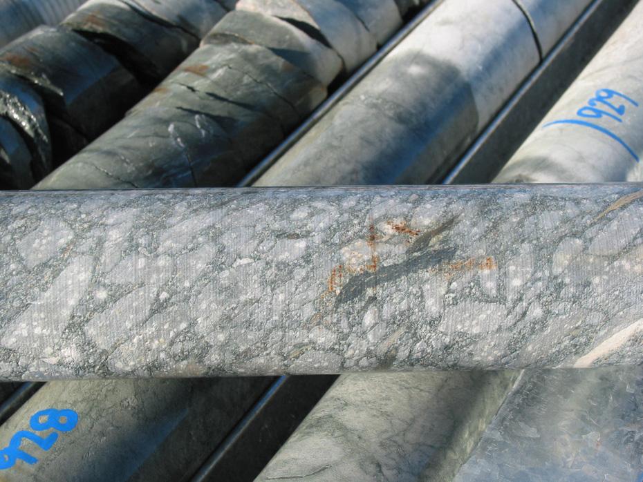
68 a) b) c) Figure 16
69 Golden Mile Dykes P2O5 (%) Feldspar porphyry Hornblende porphyry Zr (ppm) Figure 17
70 800mRL 400mRL CTGD013A 19400mE 20000mE -400mRL U6-7 U mRL AE Fault KALGOORLIE ANTICLINE U6-7 U mRL C Fault 18600mE 19000mE Paringa basalt Golden Mile dolerite Golden Mile dolerite U mE Black Flag and Kapai sediments Williamstown dolerite Devon Consol basalt Stope Feldspar porphyry 19800mE Main Fimiston ore envelope Faults 20200mE CROSS SECTION 48170mN 20600mE 0 200m 400m Figure 18
71 -400mRL -800mRL -1200mRL -400mRL -800mRL MAIN SHAFT U9 U8 HS FAULT -1200mRL 48600mN 48200mN 47800mN BLACK FLAG GMD U mN 47000mN ADELAIDE FAULT 46600mN #4 Ore Zone > 1oz/t gold Fault LONGITUDINAL SECTION GREAT BOULDER MAIN LODE (#4) 0 500m 1000m Figure 19
 e) f)")


72 a) b) c) d) e) f) Figure 20


73 h) g) i) Figure 20
74 B Lodes GOLDEN MILE DOLERITE -100m Oroya Hangingwall lode Oroya lode -200m Lewis lode 711 lode High Iron Tholeiite -300m Lower Slates Federal lodes PARINGA BASALT AUSTRALIA EAST FAULT -400m 909 Lodes -258m Federal Lodes -285m Stope Outline Figure 22


75 a) b) Figure 23
76 ENGD Ag (ppm) 9 6 "GMD EAST" "Paringa basalt" Au (ppm) Figure 24
 Figure")

77 50cm a) b) Figure 25

78 Figure 26

79 W E GMD BF GMD Figure 27
80 T T AE Fault N S49370mN S49130mN Golden Pike Fault Adelaide Fault Hannans Star Fault S48590mN Boulder Fault 48590mE S48170mN 0 1km T Fimiston Lodes Younging Reverse faults Normal faults Strike slip faults T Golden Mile Fault Kalgoorlie anticline 20 O S47630mN S47330mN Fold axis S47090mN Figure 28

81 NE Trace of S2 Trace of S2 NE Black Flag Black Flag Beds Beds SW SW Bedding Bedding Fold axis Fold axis Figure 29

82 SW NE S2 FOLD AIS 30cm Figure 30


83 S2 S2 30 cm Figure 35
84 SUMMARY OF STRUCTURAL RELATIONSHIPS ASSOCIATED WITH FIMISTON ORE ZONES W 80-90S E W 75-85W 140 FIMISTON LODES N S2 FOLIATION REVERSE SHEAR ZONES COAIAL STRAIN MARKERS Figure 36

85 S2 30 cm Figure 37

86 MORRISSON PIT RAMP -140m RL N S Sketch 3 Sketch Sketch 4 Morrisson Lode GMD U7 S2 Cleavage HP Dyke Vein orientation Carbonate veins Trace of S2 Fimiston Quartz-Pyrite stringers 0 Late quartz-carbonate veins 2 4m Figure 38

87 S2 30 cm Figure 39
88 mRL FP Western Lode Domain N FP Eastern Lode Domain N -800mRL -1200mRL N=62 (contours at: 2,4,8,12,16%) Equal area projection, lower hemisphere Poles to FP contacts 18400mE 18800mE Paringa basalt Golden Mile dolerite Golden Mile dolerite U mE Black Flag and Kapai sediments Williamstown dolerite Devon Consol basalt Stope Feldspar porphyry N=149 (contours at: 2,4,8,12,16%) Equal area projection, lower hemisphere Poles to FP contacts Main Fimiston ore envelope Faults 19600mE 20000mE CROSS SECTION 48170mN 20400mE 0 200m 400m Figure 40

89 LEVEL 20, -667m RL, SOUTH OF PHANTOM LODE, EASTERN LODE DOMAIN N FP Dyke Sericitised margin 135 CHP Dyke 54 Sketch m S2 Cleavage 85 GMD U Fault Laminated carbonate vein Quartz vein Sketch 6 Quartz- Carbonate-Py vein 290 Sketch Sketch 8 85W 138N GMD U8 Sketch 5 Sketch Figure 41

90 S2 Figure 42
91 200W Level Plan, Hannans Star -100m RL 2900S 2700S 2800S Redrawn from original level plan Figure 43

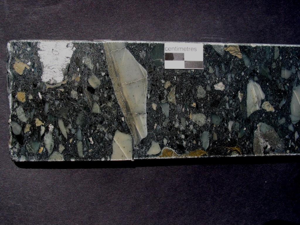
92 Figure 44

93 Figure 45

94 Figure 46
Gidji Lake formation -
 Gidji Lake formation - Key Stratigraphic marker for World Class Gold Deposits of Kalgoorlie Presentation to CSIRO - July 2017 Please reference this document if the slides, figures or concepts are to be
Drill locations for the 2015 program are highlighted in the geology map below.
 2015 Exploration Program The exploration program plan at KSM for 2015 was designed to improve the understanding of block cave targets and support engineering/environmental aspects of development scenarios.
it AUSIMM COBAR MINING SEMINAR
 Straits Resources Limited it AUSIMM COBAR MINING SEMINAR Brownfields Exploration at Girilambone: Understanding the Mineralised Systems August 2010 Phil Shields / Phil Jones LOCATION TRITTON OPERATIONS
Lands Parcels in IOL CO-20
 Lands Parcels in IOL CO-20 1 CO-20 The Izok Corridor Lupin - multi-million ounce past gold production (3.6 million oz of gold at average grade of 9.3 g/t Au) Approximately 1 million ounces of undeveloped
MACRORYTHMIC GABBRO TO GRANITE CYCLES OF CLAM COVE VINALHAVEN INTRUSION, MAINE
 MACRORYTHMIC GABBRO TO GRANITE CYCLES OF CLAM COVE VINALHAVEN INTRUSION, MAINE NICK CUBA Amherst College Sponsor: Peter Crowley INTRODUCTION The rocks of the layered gabbro-diorite unit of the Silurian
Geology of Quesnel and Stikine terranes and associated porphyry deposits. Jim Logan Paul Schiarizza
 Geology of Quesnel and Stikine terranes and associated porphyry deposits Jim Logan Paul Schiarizza Quesnel and Stikine terranes Major cordilleran terranes characterized by similar Late Triassic Early Jurassic
MINERAL DEPOSITS OF THE COBAR BASIN
 MINERAL DEPOSITS OF THE COBAR BASIN 360 hard rock deposits in Cobar Basin Cu, Au, Ag, Pb, Zn combinations and quartz-au veins Cobar 23 major deposits in Cobar Basin World class Endeavor mine World class
GEOLOGICAL INVESTIGATION IN THE ISLAND LAKE GREENSTONE BELT, NORTHWESTERN SUPERIOR PROVINCE, MANITOBA (PARTS OF NTS 53E/15 & 16) GS-18
 GS-18") GS-18 GEOLOGICAL INVESTIGATION IN THE ISLAND LAKE GREENSTONE BELT, NORTHWESTERN SUPERIOR PROVINCE, MANITOBA (PARTS OF NTS 53E/15 & 16) by S. Lin, H.D.M. Cameron, E.C. Syme and F. Corfu 1 Lin, S., Cameron,
GS-18 GEOLOGICAL INVESTIGATION IN THE ISLAND LAKE GREENSTONE BELT, NORTHWESTERN SUPERIOR PROVINCE, MANITOBA (PARTS OF NTS 53E/15 & 16) by S. Lin, H.D.M. Cameron, E.C. Syme and F. Corfu 1 Lin, S., Cameron,
ARGENTINE FRONTIER RESOURCES INC (AFRI) SALTA EXPLORACIONES SA (SESA)
 SALTA EXPLORACIONES SA (SESA)") ARGENTINE FRONTIER RESOURCES INC (AFRI) SALTA EXPLORACIONES SA (SESA) LA SARITA IOCG-Porphyry Copper-Gold August 2006 La Sarita Cateo 2 La Sarita - bleached center is Taca Taca Arriba. The hematite zone
ARGENTINE FRONTIER RESOURCES INC (AFRI) SALTA EXPLORACIONES SA (SESA) LA SARITA IOCG-Porphyry Copper-Gold August 2006 La Sarita Cateo 2 La Sarita - bleached center is Taca Taca Arriba. The hematite zone
Geology, Alteration and. Petrogenesis
 The Mutooroo Copper Deposit: Geology, Alteration and Petrogenesis Graham S. Teale Consultant t Andrew T. Price Havilah Resources NL The speaker would like to thank Havilah Resources NL for the opportunity
Plate tectonics, rock cycle
 Dikes, Antarctica Rock Cycle Plate tectonics, rock cycle The Rock Cycle A rock is a naturally formed, consolidated material usually composed of grains of one or more minerals The rock cycle shows how one
Block: Igneous Rocks. From this list, select the terms which answer the following questions.
 Geology 12 Name: Mix and Match: Igneous Rocks Refer to the following list. Block: porphyritic volatiles mafic glassy magma mixing concordant discontinuous reaction series igneous vesicular partial melting
SUPPLEMENT DR1: SAMPLE DESCRIPTION
 GSA DATA REPOSITORY 2013218 Yunxing Xue et al. SUPPLEMENT DR1: SAMPLE DESCRIPTION Three gold deposits from the EGST and one from Abitibi belt have been selected for this study. Bellerophon, Wallaby, and
For personal use only EXPLORATION UPDATE MARCH 2015
 EXPLORATION UPDATE MARCH 2015 ACQUISITION OF THE ORA BANDA SOUTH GOLD PROJECT CANEGRASS GOLD PROJECT UPDATE ASX RELEASE 20 MARCH 2015 Siburan Resources Limited (ASX: SBU, Siburan) advices that the company
Mine Scale Constrained Geophysical Inversion; A Case Study at the Darlot-Centenary Gold Mine
 Page 1 Mine Scale Constrained Geophysical Inversion; A Case Study at the Darlot-Centenary Gold Mine Sarah Monoury, SRK Consulting, Ben Jupp, SRK Consulting and Andrew Foley, Gold Fields This article was
GS-17. Summary. Previous work. Regional setting. Introduction. Geology
 GS-17 Geology, structure and mineralization of the Ore Fault property, Bird River greenstone belt, southeastern Manitoba (parts of NTS 52L5NE and 52L6NW) by L.A. Murphy 1 and P. Theyer Murphy, L.A. and
Copperstone Technical Report Update on 2018 Drilling Campaign
 2018 Copperstone Technical Report Update on 2018 Drilling Campaign Chris McKnight Copperstone Resources AB 5/16/2018 Highlights Mineralisation consisting of interspersed chalcopyrite veins (assay results
Exploring in the last frontier: Skarn mineralisation, Attunga District, NSW
 BROVEY MAPPING SERVICES Exploring in the last frontier: Skarn mineralisation, Attunga District, NSW Latest exploration findings and interpretations Nancy Vickery, Joshua Leigh and Michael Oates Outline
Quaternary clays alluvial sands of the Shepparton Formation overlie the basement rocks.
 NAGAMBIE GOLDFIELD Regional Geological Setting The Nagambie Project is located within the Melbourne Structural Zone of Victoria. The lithologies range in age from the Upper Silurian Broadford Formation
CAMBRIAN INTRUSION-RELATED COPPER MINERALISATION AT THE THOMAS CREEK PROSPECT, SOUTHWESTERN TASMANIA
 CAMBRIAN INTRUSION-RELATED COPPER MINERALISATION AT THE THOMAS CREEK PROSPECT, SOUTHWESTERN TASMANIA UN I VF.RS TTY OF TASMANIA By Robert Reid (B.Sc. Hons) A thesis submitted in partial fulfillment of
Chapter 4 Rocks & Igneous Rocks
 Chapter 4 Rocks & Igneous Rocks Rock Definition A naturally occurring consolidated mixture of one or more minerals e.g, marble, granite, sandstone, limestone Rock Definition Must naturally occur in nature,
REGOLITH GEOCHEMISTRY OF THE NORTH KIMBERLEY, WESTERN AUSTRALIA: A STRONG PROXY FOR BEDROCK
 REGOLITH GEOCHEMISTRY OF THE NORTH KIMBERLEY, WESTERN AUSTRALIA: A STRONG PROXY FOR BEDROCK Paul A. Morris 1 1 Geological Survey of Western Australia, 100 Plain Street, East Perth 6004, Western Australia;
GEOLOGY OF THE NICOLA GROUP BETWEEN MISSEZULA LAKE AND ALLISON LAKE
 GEOLOGY OF THE NICOLA GROUP BETWEEN MISSEZULA LAKE AND ALLISON LAKE (92H/15E. 10E1 By V. A. Preto INTRODUCTION Mapping was continued southward from the area covered in 1973 and an additional 55 square
3. GEOLOGY. 3.1 Introduction. 3.2 Results and Discussion Regional Geology Surficial Geology Mine Study Area
 3. GEOLOGY 3.1 Introduction This chapter discusses the baseline study of the geology and mineralization characteristics of the mine study area. The study consolidates existing geological data and exploration
SECOND DRILL HOLE IHAD2 INTERSECTS MINERALIZED TAPLEY HILL FORMATION AND MINERALIZED BASEMENT IRON FORMATION
 Suite 304, 22 St Kilda Road St Kilda Vic 3182 Ph: +61 3 9692 7222; Fax: +61 3 9529 8057 For Immediate Release 14 th September 2007 SECOND DRILL HOLE IHAD2 INTERSECTS MINERALIZED TAPLEY HILL FORMATION AND
MEMO. TO: Dennis Lapoint CC: FROM: Eriaan Wirosono DATE: April, 20 th 2014 SUBJECT: Exploration activity report March-April 2014_EW
 TO: Dennis Lapoint CC: FROM: Eriaan Wirosono DATE: April, 20 th 2014 SUBJECT: Exploration activity report March-April 2014_EW MEMO 1. Highlights and Productivity Overview pan sampling on target Areas 1
predictive iscovery Why is the gold where it is? redictive mineral ineral discovery pmd CRC
 The Y2 project (2001-2004) Time-space evolution of the Yilgarn Craton: implications for geodynamics Kevin Cassidy and the Y2 team Reduced D Risk through Improved Targeting ineral d Why is the gold where
Evaluating the Intrusion-Related Model for the Archean Low-Grade, High- Tonnage Côté Gold Au(-Cu) Deposit
 Deposit") Evaluating the Intrusion-Related Model for the Archean Low-Grade, High- Tonnage Côté Gold Au(-Cu) Deposit L.R. Katz, D.J. Kontak, Laurentian University, B. Dubé, V. McNicoll, Geological Survey of Canada
Evaluating the Intrusion-Related Model for the Archean Low-Grade, High- Tonnage Côté Gold Au(-Cu) Deposit L.R. Katz, D.J. Kontak, Laurentian University, B. Dubé, V. McNicoll, Geological Survey of Canada
Bulyanhulu: Anomalous gold mineralisation in the Archaean of Tanzania. Claire Chamberlain, Jamie Wilkinson, Richard Herrington, Ettienne du Plessis
 Bulyanhulu: Anomalous gold mineralisation in the Archaean of Tanzania Claire Chamberlain, Jamie Wilkinson, Richard Herrington, Ettienne du Plessis Atypical Archaean gold deposits Groves et al., 2003 Regional
Regional geology map showing drill holes completed to date and hole RZDDH10 08 in progress, IP Chargeability anomalies hatched.
 Alteration Haloes Alteration facies in the Suarez-Misahuallí basin on the east side of the Rio Zarza gold project are complex, as they oerlap in time and space, are the result of weathering, diagenetic,
CSA Mine Observations Applied to the Development of Regional Exploration Models
 CSA Mine Observations Applied to the Development of Regional Exploration Models 1 Introduction Recent work completed by the geology team has resulted in an improved understanding of the CSA mine system
What is Mt Carlton? Fredrik Sahlström, Zhaoshan Chang, Paul Dirks, Antonio Arribas, Isaac Corral. GSQ seminar Townsville, 7 December 2017
 Fredrik Sahlström, Zhaoshan Chang, Paul Dirks, Antonio Arribas, Isaac Corral GSQ seminar Townsville, 7 December 2017 What is Mt Carlton? An Early Permian high sulfidation epithermal (HS) deposit in NE
POTENTIAL OF THE DONGWE COPPER GOLD PROJECT
 POTENTIAL OF THE DONGWE COPPER GOLD PROJECT By Nathan Sabao, P.Geo. September 2015 1 TABLE OF CONTENTS Page 1.0 EXECUTIVE SUMMARY 1 2.0 LOCATION 2 3.0 ACCESS 2 4.0 GEOLOGY 3 5.0 PREVIOUS DRILLING 5 6.0
Igneous Rock Classification, Processes and Identification Physical Geology GEOL 100
 Igneous Rock Classification, Processes and Identification Physical Geology GEOL 100 Ray Rector - Instructor Major Concepts 1) Igneous rocks form directly from the crystallization of a magma or lava 2)
GY111 Earth Materials Practice Final Exam
 I. True/False Questions: circle a T for true or F for false (10% total -or- 0.5 per) 1. (T F) The Uranium used in nuclear power plants may explode if not controlled properly. 2. (T F) Natural Gas is an
THE GEOLOGY OF THE ENDEAVOR MINE: AN UPDATE
 THE GEOLOGY OF THE ENDEAVOR MINE: AN UPDATE Peter Nicholson, Vanadis Mares and Don Endeavor Operations Pty Ltd, via Louth Road, Cobar, NSW 2835. Key Words: zinc, lead, silver, Cobar, geology Introduction
Queensland Mining Corporation Limited
 Queensland Mining Corporation Limited ABN 61 109 962 469 ASX Release 29 th July 2011 Drilling Commenced at Duck Creek Copper-Gold Project, Cloncurry, North-west Queensland Highlights RC drilling has commenced
INTRODUCTION REGIONAL GEOLOGY. N. St-Jean 1, L. Hunt 1 and R.L. Sherlock 1
 37. Preliminary Results from Mapping a New Exposure of the Basal Unconformity Between the Hearst and Larder Lake Assemblages, Skead Township, Northeastern Ontario N. St-Jean 1, L. Hunt 1 and R.L. Sherlock
East Kambalda (Aztec Dome) Review & IM (Sale Document)
 Review & IM (Sale Document)") ASX Announcement 3 December 2013 ABN: 45 116 153 514 ASX: TMX East Kambalda (Aztec Dome) Review & IM (Sale Document) East Kambalda (Aztec Dome) Review & IM (Sale Document) As part of Terrain Minerals Ltd
ASX Announcement 3 December 2013 ABN: 45 116 153 514 ASX: TMX East Kambalda (Aztec Dome) Review & IM (Sale Document) East Kambalda (Aztec Dome) Review & IM (Sale Document) As part of Terrain Minerals Ltd
Earth Science - Lab #11 Geologic Time
 Earth Science - Lab #11 Geologic Time Page # Below are standard geologic symbols for the 3 main categories of rocks. Although these symbols are not universal, they are generally accepted by most geologists
Petrological Studies by Terry Leach at the North Carlin Trend, Nevada. Keith Bettles October 17, 2008
 Petrological Studies by Terry Leach at the North Carlin Trend, Nevada Keith Bettles October 17, 2008 North Carlin Trend From 1999 to 2003 Terry Leach studied the Betze and Meikle ore bodies for Barrick
GLY 155 Introduction to Physical Geology, W. Altermann. Grotzinger Jordan. Understanding Earth. Sixth Edition
 Grotzinger Jordan Understanding Earth Sixth Edition Chapter 4: IGNEOUS ROCKS Solids from Melts 2011 by W. H. Freeman and Company Chapter 4: Igneous Rocks: Solids from Melts 1 About Igneous Rocks Igneous
COPPERSTONE RESOURCES AB INTERCEPTS ZONE OF CHALCOPYRITE-ARSENOPYRITE- BORNITE MINERALIZATION AT SVARTLIDEN IN FIRST DEEP DRILLHOLE FROM 720m-810m
 COPPERSTONE RESOURCES AB INTERCEPTS ZONE OF CHALCOPYRITE-ARSENOPYRITE- BORNITE MINERALIZATION AT SVARTLIDEN IN FIRST DEEP DRILLHOLE FROM 720m-810m In mid-january 2017 Copperstone Resource published a geological
New gold discovery in the Paleoproterozoic Mauken greenstone belt
 New gold discovery in the Paleoproterozoic Mauken greenstone belt Mauken greenstone belt The Paleoproterozoic Mauken greenstone belt is situated in an unexplored and untested terrain in Northern Norway.
The Cobalt Rainbow. Airborne geophysical maps show that a north trending aeromagnetic high suggests further undiscovered mineralisation.
 The Cobalt Rainbow The property is located on Greenstone Creek, approximately 4.8 kilometres south west of the creek mouth. The property is located about 24 km due west of Campbell River, in the east-central
SQUARE POST PROJECT CHARTERS TOWERS NORTH QUEENSLAND AUSTRALIA
 SQUARE POST PROJECT CHARTERS TOWERS NORTH QUEENSLAND AUSTRALIA Square Post - Summary PROJECT DETAILS - SQUARE POST The Square Post exploration permit (EPM 18510) contains two styles of mineralisation:
THE SOURCE AND TIMING OF GOLD IN OROGENIC GOLD DEPOSITS - A CASE STUDY FROM THE GIANT BENDIGO DEPOSIT. IMPLICATION FOR EXPLORATION I. GOLDBERG, G.
 THE SOURCE AND TIMING OF GOLD IN OROGENIC GOLD DEPOSITS - A CASE STUDY FROM THE GIANT BENDIGO DEPOSIT. IMPLICATION FOR EXPLORATION I. GOLDBERG, G. ABRAMSON & V. LOS IONEX Pty Ltd, AUSTRALIA 1 Despite differences
Mishi Lake Gold Property Mishibishu Lake Area, Wawa
 Mishi Lake Gold Property Mishibishu Lake Area, Wawa Location, Accessibility, Infrastructure and Local Resources The property is located 40 km west of Wawa, Ontario, in the Mishibishu Lake Area, Sault Ste.
Anthill Resources Yukon - An Update on the Einarson Project
 Anthill Resources Yukon - An Update on the Einarson Project The Eastern Extension of a Carlin-type Gold Trend in the Selwyn Basin Anthill Resources Ltd Yukon Claim Holdings Over 2400 km 2 Property Location
WAMUNYU EDWARD MUREITHI I13/2358/2007
 WAMUNYU EDWARD MUREITHI I13/2358/2007 Olkaria geothermal area is situated south of Lake Naivasha on the floor of the southern segment of the Kenya rift. The geology of the Olkaria Geothermal area is subdivided
Practice Test Rocks and Minerals. Name. Page 1
 Name Practice Test Rocks and Minerals 1. Which rock would be the best source of the mineral garnet? A) basalt B) limestone C) schist D) slate 2. Which mineral is mined for its iron content? A) hematite
Which sample best shows the physical properties normally associated with regional metamorphism? (1) A (3) C (2) B (4) D
 A (3) C (2) B (4) D") 1 Compared to felsic igneous rocks, mafic igneous rocks contain greater amounts of (1) white quartz (3) pink feldspar (2) aluminum (4) iron 2 The diagram below shows how a sample of the mineral mica breaks
1 Compared to felsic igneous rocks, mafic igneous rocks contain greater amounts of (1) white quartz (3) pink feldspar (2) aluminum (4) iron 2 The diagram below shows how a sample of the mineral mica breaks
Essentials of Geology, 11e
 Essentials of Geology, 11e Igneous Rocks and Intrusive Activity Chapter 3 Instructor Jennifer Barson Spokane Falls Community College Geology 101 Stanley Hatfield Southwestern Illinois College Characteristics
DISCOVERY OF MINERALISED PORPHYRY & MAGNETITE-COPPER-GOLD AT KAMARANGAN
 MEDUSA MINING LIMITED ABN: 60 099 377 849 Unit 7, 11 Preston Street Como WA 6152 PO Box 860 Canning Bridge WA 6153 Telephone: +618-9367 0601 Facsimile: +618-9367 0602 Email: admin@medusamining.com.au Internet:
FIRST YEAR ASSESSMENT REPORT PROSPECTING LICENCE 16512M MARYSTOWN AREA, BURIN PENINSULA NTS 1M/3
 FIRST YEAR ASSESSMENT REPORT OF PROSPECTING ON LICENCE 16512M MARYSTOWN AREA, BURIN PENINSULA NTS 1M/3 BY NATHANIEL NOEL MSc. FOR E. MICHELE NOEL MINERAL LICENCES: 16512 M WORK CONDUCTED: MID-SEPTEMBER
Archean Terranes. Archean Rocks. Southeastern Africa. West Greenland. Kaapvaal Craton. Ancient Gneiss Complex
 Archean Terranes Archean Rocks Chapter 15A >2.5 Gy old Younger supracrustal sequences Greenstone belts Calc-alkaline metavolcanic rocks Older gneiss complexes Quartzo-feldspathic rocks Tonalites and migmatites
7 Sedimentation and tectonics at a mid- Ordovician to Silurian active margin
 80 Mountain Building in Scotland 7 Sedimentation and tectonics at a mid- Ordovician to Silurian active margin 7.1 Introduction In mid-ordovician to Silurian times, the Grampian mountains underwent exhumation,
Rocks Rock- A group of minerals, glass, mineroid bound together in some way.
 Rocks Rock- A group of minerals, glass, mineroid bound together in some way. All rocks fit into one of three categories: Igneous- formed by the cooling and hardening of hot molten rock Sedimentary- formed
GY111 Earth Materials Practice Final Exam
 I. True/False Questions: circle a T for true or F for false (10% total -or- 0.5 per) (Correct answer in red) 1. (T F) The Uranium used in nuclear power plants may explode if not controlled properly. 2.
Chapter 10. Chapter Rocks and the Rock Cycle. Rocks. Section 1 Rocks and the Rock Cycle
 Chapter 10 Rocks 1 Chapter 10 Section 1 Rocks and the Rock Cycle 2 10.1 Rocks and the Rock Cycle Magma is the parent material for all rocks. Once the magma cools and hardens, many changes can occur. Geology:
LINGIG PORPHYRY COPPER DISCOVERY
 MEDUSA MINING LIMITED ABN: 60 099 377 849 Unit 7, 11 Preston Street Como WA 6152 PO Box 860 Canning Bridge WA 6153 Telephone: 618-9367 0601 Facsimile: 618-9367 0602 Email: admin@medusamining.com.au Internet:
Name Class Date. In your textbook, read about the nature of igneous rocks. Use each of the terms below just once to complete the following statements.
 CHAPTER 5 Igneous Rocks SECTION 5.1 What are igneous rocks? In your textbook, read about the nature of igneous rocks. Use each of the terms below just once to complete the following statements. basaltic
GEOLOGY AND GEOCHRONOLOGY OF THE ISLAND LAKE GREENSTONE BELT, NORTHWESTERN SUPERIOR PROVINCE by J. Parks 1, S. Lin 1, M.T. Corkery and D.W.
 GS-17 GEOLOGY AND GEOCHRONOLOGY OF THE ISLAND LAKE GREENSTONE BELT, NORTHWESTERN SUPERIOR PROVINCE by J. Parks 1, S. Lin 1, M.T. Corkery and D.W. Davis 2 Parks, J., Lin, S., Corkery, M.T. and Davis, D.W.
Student Name: College: Grade:
 Student Name: College: Grade: Physical Geology Laboratory IGNEOUS MINERALS AND ROCKS IDENTIFICATION - INTRODUCTION & PURPOSE: In this lab you will learn to identify igneous rocks in hand samples from their
Answers: Internal Processes and Structures (Isostasy)
") Answers: Internal Processes and Structures (Isostasy) 1. Analyse the adjustment of the crust to changes in loads associated with volcanism, mountain building, erosion, and glaciation by using the concept
Answers: Internal Processes and Structures (Isostasy) 1. Analyse the adjustment of the crust to changes in loads associated with volcanism, mountain building, erosion, and glaciation by using the concept
ES Chap 5 & 6: Rocks
 ES Chap 5 & 6: Rocks Objectives 1. Identify and explain characteristics of igneous rocks. This means that if I am given an igneous rock I: a. Can use grain size to identify a rock as intrusive, extrusive,
Review - Unit 2 - Rocks and Minerals
 Review - Unit 2 - Rocks and Minerals Base your answers to questions 1 and 2 on the diagram below, which shows the results of three different physical tests, A, B, and C, that were performed on a mineral.
The MAPLE BAY PROJECT Copper Silver - Gold
 The MAPLE BAY PROJECT Copper Silver - Gold Good grade and tonnage potential within close proximity to Tidewater The Maple Bay Copper Silver Gold Project covers highly favourable geological host rocks of
JOSH LEIGH Project Exploration Geologist June ASX Code AIV
 COALSTOUN AND BOOUBYJAN Porphyry Copper-Gold Complexes, their structural setting, geology and geochemistry Joshua Leigh 1, Doug Young 2, Jose Veracruz 3, Paul Ashley 3 - ( 1 ActivEX Limited, 2 Consultant,
TECHNICAL REPORT: REGIONAL GEOLOGY AND TECTONICS Resume. Huachon Project, Cerro de Pasco departments, Peru. By: AFC Logistic SAC
 TECHNICAL REPORT: REGIONAL GEOLOGY AND TECTONICS Resume Huachon Project, Cerro de Pasco departments, Peru By: AFC Logistic SAC December 2016 1. INTRODUCTION GPM Metals Peru, in its portfolio of generating
Mineral Exploration Research Centre, Harquail School of Earth Sciences, Laurentian University, Sudbury, Ontario, P3E 2C6, Canada
 Volcanic stratigraphy and intrusions in the Renault Dufresnoy and Duprat Montbray formations: implications for metal endowment in the lower Blake River group, Rouyn-Noranda, Quebec Jonathan Sutton, Harold
COMPOSITIONAL TERMS: FELSIC : light colored INTERMEDIATE : medium shades MAFIC : dark colored ULTRAMAFIC : rare (composition of the mantle)
") GEOLOGY 306 Laboratory NAME: Instructor: TERRY J. BOROUGHS SECTION: Common Rocks (Chapter 2) For this assignment, you will require: a streak plate, glass plate, magnet, dilute hydrochloric (HCl) acid,
GEOLOGY 306 Laboratory NAME: Instructor: TERRY J. BOROUGHS SECTION: Common Rocks (Chapter 2) For this assignment, you will require: a streak plate, glass plate, magnet, dilute hydrochloric (HCl) acid,
Magmatic Ore Deposits:
 Magmatic Ore Deposits: A number of processes that occur during cooling and crystallization of magmatic bodies can lead to the separation and concentration of minerals. 1- Pegmatites 2- Layered intrusions
Lomalampi. Mineral deposit type. Dimension. Holder history Previous holders:
 Mineral Deposit Report Page 1 OF 11 20.2.2019 Lomalampi Occurence type: prospect Commodity Rank Total Total production Total resource Importance measure group metal 1 1,16 t 1,16 t Small deposit nickel
WITH GOLD MINERALIZATION AT CAROLIN MINE (92H/11)
") ELEMENT ZONING ASSOCIATED WITH GOLD MINERALIZATION AT CAROLIN MINE (92H/11) By G. E. Rey Ministry of Energy, Mines and Petroleum ReS0urt:eS and R.J.E. Niels Carolin Mines Ltd. INTRODUCTION The Carolin
ELEMENT ZONING ASSOCIATED WITH GOLD MINERALIZATION AT CAROLIN MINE (92H/11) By G. E. Rey Ministry of Energy, Mines and Petroleum ReS0urt:eS and R.J.E. Niels Carolin Mines Ltd. INTRODUCTION The Carolin
NAME HOMEWORK ASSIGNMENT #3 MATERIAL COVERS CHAPTERS 8, 9, 10, 11
 NAME HOMEWORK ASSIGNMENT #3 MATERIAL OVERS HAPTERS 8, 9, 10, 11 Assignment is due the beginning of the class period on November 23, 2004. Answers for each chapter will be discussed in class, as Exam #3
VECTORING VOLCANOGENIC MASSIVE SULPHIDE MINERALIZATION AT THE RAINDROP ZONE, SNOW LAKE (NTS 63K16), MANITOBA by G.H. Gale
, MANITOBA by G.H. Gale") GS-8 VECTORING VOLCANOGENIC MASSIVE SULPHIDE MINERALIZATION AT THE RAINDROP ZONE, SNOW LAKE (NTS 63K16), MANITOBA by G.H. Gale Gale, G.H. 2002: Vectoring volcanogenic massive sulphide mineralization at
GS-8 VECTORING VOLCANOGENIC MASSIVE SULPHIDE MINERALIZATION AT THE RAINDROP ZONE, SNOW LAKE (NTS 63K16), MANITOBA by G.H. Gale Gale, G.H. 2002: Vectoring volcanogenic massive sulphide mineralization at
A review of the large Red Dragon prospect was completed following the 2011 field season, the
 ASX / MEDIA RELEASE ST GEORGE MINING LIMITED ASX: SGQ ACN 139 308 973 Level 1, 115 Cambridge Street PO Box 1305, West Leederville WA 6007 www.stgeorgemining.com.au Phone +618 9322 6600 Facsimile +618 9322
Earth Science Chapter 6 Rocks
 Earth Science Chapter 6 Rocks I. Rocks and the Rock Cycle * Material that makes up the solid part of the Earth. * Made of a variety of different combinations of minerals and organic matter. A. Three Major
Summary of Rover Metals Geologic Mapping Program at the Up Town Gold Project, Northwest Territories
 October 13, 2017 Summary of Rover Metals Geologic Mapping Program at the Up Town Gold Project, Northwest Territories Vancouver, British Columbia, Canada - Rover Metals Corp., Rover, is pleased to provide
CHAMPION BEAR RESOURCES
 CHAMPION BEAR RESOURCES EXPLORING ADVANCED STAGE PRECIOUS METAL PROPERTIES IN ONTARIO Exploration Update January 2011 Forward Looking Statements This exploration update contains forward looking statements
Rheological controls on the geometry of the Currawong VHMS Deposit, Lachlan Fold Belt, Victoria, SE Australia
 PACRIM 2015 Conference Paper Number: 16.00 Rheological controls on the geometry of the Currawong VHMS Deposit, Lachlan Fold Belt, Victoria, SE Australia T.G. Blenkinsop 1, D. Macklin 2 and R. Hammond 3
ASX RELEASE REVIEW OF GLANDORE DATA TO DEFINE DRILL PROGRAM
 ASX RELEASE 4 April 2007 REVIEW OF GLANDORE DATA TO DEFINE DRILL PROGRAM The Directors of Hemisphere Resources Limited ( Hemisphere or the Company ) are pleased to announce that a review has been conducted
Petrogenetic Constraints at Mount Rainier Volcano, Washington
 Petrogenetic Constraints at Mount Rainier Volcano, Washington S. C. Kuehn and P. R. Hooper, Department of Geology, Washington State University, Pullman, WA A. E. Eggers and C. Kerrick, Department of Geology,
Igneous Rocks. Sedimentary Rocks. Metamorphic Rocks
 Name: Date: Igneous Rocks Igneous rocks form from the solidification of magma either below (intrusive igneous rocks) or above (extrusive igneous rocks) the Earth s surface. For example, the igneous rock
DETAILED STRUCTURAL ANALYSIS OF THE JOHNSON SHEAR ZONE IN THE WEST GEMMELL LAKE AREA (NTS 64C/11) by C.J. Beaumont-Smith and C.D.
 by C.J. Beaumont-Smith and C.D.") GS-13 DETAILED STRUCTURAL ANALYSIS OF THE JOHNSON SHEAR ZONE IN THE WEST GEMMELL LAKE AREA (NTS 64C/11) by C.J. Beaumont-Smith and C.D. Edwards 1 Beaumont-Smith, C.J. and Edwards, C.D. 2000: Detailed structural
GS-13 DETAILED STRUCTURAL ANALYSIS OF THE JOHNSON SHEAR ZONE IN THE WEST GEMMELL LAKE AREA (NTS 64C/11) by C.J. Beaumont-Smith and C.D. Edwards 1 Beaumont-Smith, C.J. and Edwards, C.D. 2000: Detailed structural
Structural geology and gold metallogeny of the New Britannia mine area, Snow Lake, Manitoba
 Structural geology and gold metallogeny of the New Britannia mine area, Snow Lake, Manitoba Chris Beaumont-Smith Manitoba Geological Survey Boundary zone New Britannia Trans-Hudson Orogen 50 km 100 km
PETROGENESIS OF A SERIES OF MAFIC SHEETS WITHIN THE VINALHAVEN PLUTON, VINALHAVEN ISLAND, MAINE
 PETROGENESIS OF A SERIES OF MAFIC SHEETS WITHIN THE VINALHAVEN PLUTON, VINALHAVEN ISLAND, MAINE DANIEL HAWKINS Western Kentucky University Research Advisor: Andrew Wulff INTRODUCTION Round Point, in the
predictive mineral discovery*cooperative Research Centre A legacy for mineral exploration science Mineral Systems Q1 Architecture
 Mineral Systems Q1 Architecture 1 Key Parameter Mineral System Exploration is reflected in scale-dependent translation A. Gradient in hydraulic potential B. Permeability C. Solubility sensitivity to P,
Magmatic-Hydrothermal Gold Systems in the Archean of Northern Ontario, Canada: Examples of Syenite-Associated and Porphyry-Type Au-(Cu) Deposits
 Deposits") Magmatic-Hydrothermal Gold Systems in the Archean of Northern Ontario, Canada: Examples of Syenite-Associated and Porphyry-Type Au-(Cu) Deposits By Dr. Daniel J. Kontak Department of Earth Sciences Laurentian
Magmatic-Hydrothermal Gold Systems in the Archean of Northern Ontario, Canada: Examples of Syenite-Associated and Porphyry-Type Au-(Cu) Deposits By Dr. Daniel J. Kontak Department of Earth Sciences Laurentian
University of New Brunswick, P.O. Box 4400, Fredericton, New Brunswick, E3B 5A3 51
 GS-11 PRELIMINARY STRUCTURAL ANALYSIS OF THE AGASSIZ METALLOTECT NEAR THE MACLELLAN AND DOT LAKE GOLD DEPOSITS, LYNN LAKE GREENSTONE BELT (PARTS OF NTS 64C/14, /15) by G. Ma 1, C.J. Beaumont-Smith and
entire 1.5 meter drift width
 GOLD HILL SUMMARY In 1864 gold fever struck in the south Kootenays east of Cranbrook, British Columbia as placer gold was discovered in the Wild Horse River. What followed was everything one can imagine
Stop 2 - aitik cu-au-ag mine. Roger Nordin Boliden Mineral AB, Boliden, Sweden. Christina Wanhainen Luleå University of Technology, Luleå, Sweden
 Stop 2 - aitik cu-au-ag mine Roger Nordin Boliden Mineral AB, Boliden, Sweden Christina Wanhainen Luleå University of Technology, Luleå, Sweden Riikka Aaltonen Boliden Mineral AB, Boliden, Sweden The Aitik
Uncovering The Riches of the Abitibi Greenstone Belt of Canada
 1 TSX.V: ALZ June 2016 Uncovering The Riches of the Abitibi Greenstone Belt of Canada The Haultain Gold Discovery The Abitibi Greenstone Belt & Gold 170+ million oz of gold produced to date from more than
Distortion Effects of Faults on Gravity Worm Strings Robin O Leary
 Distortion Effects of Faults on Gravity Worm Strings Robin O Leary Problem Can upward continued gravity anomaly worm strings be used as a tool to determine the dip direction of an offsetting structure
WEST MCARTHUR UPDATE April 17, Table 1: Winter 2018 Drill Hole Summary
 WEST MCARTHUR UPDATE April 17, 2018. Table 1: Winter 2018 Drill Hole Summary WMA044: Sooty pyrite alteration is disseminated along local beds and coats local fractures between 401.2 m and 724 metres. A
"When Gregor Samsa woke up one morning from unsettling dreams, he found himself changed into a monstrous bug. Metamorphosis, by Franz Kafka
 Metamorphosis "When Gregor Samsa woke up one morning from unsettling dreams, he found himself changed into a monstrous bug. Metamorphosis, by Franz Kafka Metamorphism The transformation of rock by temperature
Lab 3 - Identification of Igneous Rocks
 Lab 3 - Identification of Igneous Rocks Page - 1 Introduction A rock is a substance made up of one or more different minerals. Thus an essential part of rock identification is the ability to correctly
Igneous Rock. Magma Chamber Large pool of magma in the lithosphere
 Igneous Rock Magma Molten rock under the surface Temperature = 600 o 1400 o C Magma Chamber Large pool of magma in the lithosphere Magma chamber - most all magma consists of silicon and oxygen (silicate)
3D model of a Supergene Gold Deposit derived from Spectral Mapping
 3D model of a Supergene Gold Deposit derived from Spectral Mapping Exploration Technologies 2011 Scott Halley ABSTRACT: A 3D MODEL OF A SUPERGENE GOLD DEPOSIT CREATED FROM SPECTRALLY DERIVED MINERALOGY