Eyjafjallajökull 2010: Ash and aerosol during and after the eruption
|
|
|
- Noel Sanders
- 5 years ago
- Views:
Transcription


1 Eyjafjallajökull 2010: Ash and aerosol during and after the eruption { Evgenia Ilyinskaya, Guðrún Nína Petersen, Sibylle von Löwis, Halldór Björnsson, Matthew J. Roberts, Steinunn S. Jakobsdóttir, Sigurlaug Hjaltadóttir, Þórður Arason, et al.

2 Overview of the talk Volcano monitoring systems in Iceland Course of Eyjafjallajökull eruption The volcanic plume and the atmosphere Aerosol and ash measurements during and after the eruption At the edge of the ash plume on April 17 (E. Ilyinskaya)

3

4 Geophysical monitoring network 62 seismic stations ~70 GPS stations 6 strainmeter stations


5 Start of the summit eruption 5


6 Eruptions of Eyjafjallajökull after the settlement ~ Photo: B. Sveinsson


7 The 2010 eruption: unusual in many ways Explosive activity went on for a long time Unusually high proportion of fine ash April 17, photo: B. Palmason


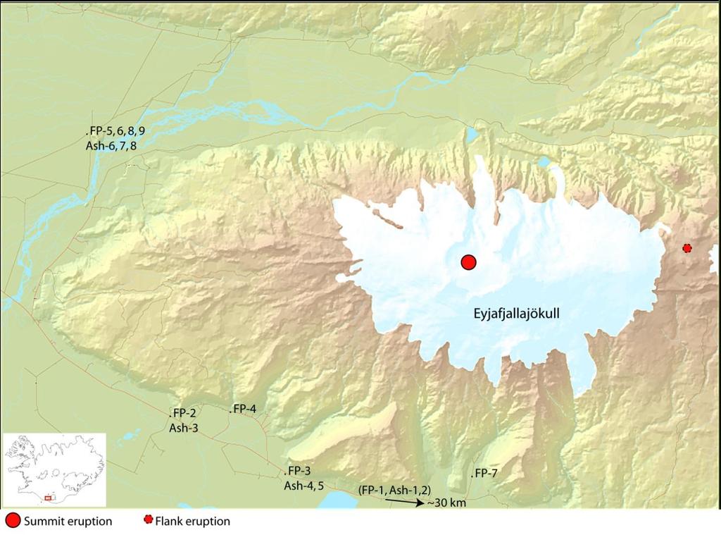
8 Eyjafjallajökull eruption in 2010: Two distinct eruption phases 1. Flank eruption on Fimmvörðuháls March 20 April 12: - Lava fountaning and lava flows - Tourist attraction - Negligible ash Phase I 2. Summit crater eruption April 14 May 23: - With highly explosive phases - Tephra and ash production - Disruptions to air traffic - Significant local ash fall Phase II Photos: E. Ilyinskaya
9 Fimmvörðuháls

10 Highly ash-rich activity I (April 14 17) Plume height 9.5 km on the first day, then 5-7 km Intraglacial eruption: contact of magma and glacial meltwater - explosivity intensified (?) Ash output kg s -1 Significant local ash fall Fine grain size Summit crater on April 15, 17:18 UTC (radar image)


11 April 16, 18:00 April 17, 18:00 Photos: E. Ilyinskaya


12 Mildly explosive activity (April 18 30) Dry eruption. Commencement of lava flow. Plume height 3-5 km Decrease in ash output kg s -1 Coarser ash grain size Change in wind direction - airports in Iceland close for the first time April 24 Mixed eruptive phase: ash generation + lava flows


13 Highly ash-rich activity II (May 1 18) Plume height 6-7 km. Lava flow halts Further European airspace closures


14 Explosive phase II: SO 2 increase preceeds ash May 4 14:09 UTC : Low SO 2 output May 5 13:13 UTC: High SO 2 output May 5 20:27 UTC : Low ash output May 6 11:50 UTC: High ash output

15 Photo: Joe Palca, NPR Ash characteristics
16 Ash grain size distributions Red: Highly explosive activity (April 15-17) Poorly sorted 30 % of fallout < 18 µm Up to 7% < 1µm Green: Mildly explosive activity (April 18-30) Better sorted 2.5 % of fallout < 18 µm < 0.1 % < 1µm XRD analysis (Ilyinskaya et al. 2011, Atmospheric Environment, in press)


17 Ash morphology Highly explosive activity: fine, poorly sorted grains commonly as aggregated clusters Mildly explosive activity: coarser, better sorted grains, more fluid and vesiculated (SEM images: E. Ilyinskaya, PhD thesis)
18 Near-source aerosol optical thickness and size distributions Flank eruption (black) Dominated by µm particles. Highly explosive activity (red) Significant short-interval fluctuations in the N ratio of coarse/fine particles Mildly explosive activity (green) Strongly bimodal size distribution (<0.4 and >1µm) Retrievals of Sun photometry measurements on April 1, 17 and 23 (Ilyinskaya et al. 2011, Atmos. Env., in press)
 Suspended aerosol: water droplets, other species b.d.l. Ash-adsorbed aerosol: F:Cl ratio 0.")
 Drastic change in ash-adsorbed aerosol: F:Cl ratio ~10. Up to 1000 mg/kg ash of F -.")
19 Composition of soluble aerosol and gas: difference between explosive phases April 14 17: Intraglacial, highly explosive Gaseous emissions of SO 2, HCl and HF not detected (direct sampling and remote sensing) Suspended aerosol: water droplets, other species b.d.l. Ash-adsorbed aerosol: F:Cl ratio 0.3 April 18 30: Dry, mildly explosive eruption Detection of gaseous SO 2, HCl and HF Suspended aerosol: dominated by Cl - (> 1 µm) and SO 4 2- (< 0.4 µm) Drastic change in ash-adsorbed aerosol: F:Cl ratio ~10. Up to 1000 mg/kg ash of F -. Ash-adsorbed aerosol April Ash-adsorbed aerosol April 18-25
 May 18 onwards: decreased activity May 23: No juvenile material, but")
20 Eruption cessation (May 23?) May 18 onwards: decreased activity May 23: No juvenile material, but still some seismic unrest August Photo: K. Weber

21 March Photo: J. Sigurdsson

22 The aftermath: Resuspended ash Photo: S. Karlsdóttir Reykjavík, June

23 Visibility: Very good Air quality: Good
24 Visibility: >16 km Air quality: Acceptable
25 Visibility: 4 km Air quality: Bad
26 Visibility: 1.6 km Air quality: Very bad
27 Visibility: 1 km Air quality: Very bad

28 Visibility: < 400 m Air quality: Very bad
![TPC [cm -3 ] Wind velocity [ms -1 ] Wind direction [ ] Resuspended ash in the](/docs-images/84/89362191/images/29-3.jpg "atmosphere MODIS image 30.10.")


29 TPC [cm -3 ] Wind velocity [ms -1 ] Wind direction [ ] Resuspended ash in the atmosphere MODIS image Resuspended ash and dust spreads over a large area Several hundred kilometres away from source, the dust cloud is still visible TPCs correspond to wind speed dependent on wind direction Tindfjöll - Drangshlíðardalur max ~ 900 cm -3 < 2.5 µm µm : : : :00 Date / Time (UTC)
 UV gas spectrometers (DOAS) in the field (Chalmers) Several instrument grant applications submitted Extensive report on Eyjafjallajökull eruption")
30 What now? New techniques deployed: Mobile radar (CPA, Italy) Lidar (NCAS) OPC instrument (UAS Dusseldorf) in the field ( µm) UV gas spectrometers (DOAS) in the field (Chalmers) Several instrument grant applications submitted Extensive report on Eyjafjallajökull eruption (ICAO) useful for future eruptions
31 Unanswered questions Quantification of produced ash Would the same amount of fine ash have been produced without magma-ice interaction? Unprecendented problem with resuspended ash: timescale? "Missing" gas emissions April Discrepancies between ground and satellite measurements in the later eruptive stages

32 Takk fyrir { Photo: Ó. Sigurjónsson
Eldgos í Eyjafjallajökli hlutverk Veðurstofu Íslands
 Photo: B. Pálmason Eldgos í Eyjafjallajökli hlutverk Veðurstofu Íslands Sigrún Karlsdóttir, Guðrún Nína Petersen, Halldór Björnsson, Halldór Pétursson, Hróbjartur Þorsteinsson, Kristín Vogfjörð og Þórður
A short meteorological overview of the Eyjafjallajökull eruption 14 April 23 May 2010
 A short meteorological overview of the Eyjafjallajökull eruption 14 April 23 May 2010 Guðrún Nína Petersen Icelandic Met Office, Reykjavík Introduction Eyjafjallajökull is an ice-capped stratovolcano with
The Eyjafjallajökull eruption
 The Eyjafjallajökull eruption and its aftermath The monitoring and guidance process Photo: B. Pálmason Contents The role of IMO The role of London VAAC Volcanic Monitoring network and other observations
A-Train observations of the 2010 eruption of Eyjafjallajökull volcano (Iceland)
") A-Train observations of the 2010 eruption of Eyjafjallajökull volcano (Iceland) S.A. Carn 1, N.A. Krotkov 2, K. Yang 2, A.J. Prata 3 1. Michigan Technological University, Houghton, MI, USA 2. GEST Center,
A-Train observations of the 2010 eruption of Eyjafjallajökull volcano (Iceland) S.A. Carn 1, N.A. Krotkov 2, K. Yang 2, A.J. Prata 3 1. Michigan Technological University, Houghton, MI, USA 2. GEST Center,
Near real-time monitoring of the April-May 2010 Eyjafjöll s ash cloud
 Near real-time monitoring of the April-May 2010 Eyjafjöll s ash cloud Labazuy P. and the HotVolc Team Observatoire de Physique du Globe de Clermont-Ferrand, CNRS, Université Blaise Pascal 13th International
The 2010 Eyjafjallajökull eruption: overview and OMI observations. Simon A. Carn Michigan Technological University, Houghton, MI, USA
 The 2010 Eyjafjallajökull eruption: overview and OMI observations Simon A. Carn Michigan Technological University, Houghton, MI, USA Global air routes and potentially active volcanoes Map courtesy of F.
Summary report of the EASA/EC Volcanic Ash Cloud workshop
 Draft Summary report of the EASA/EC Volcanic Ash Cloud workshop On 21 st of June an EASA/EC workshop was held in Cologne with the aim of bringing all the European expertise in the field of volcanic ash
Estimation of eruption site location using volcanic lightning. Þórður Arason Guðrún Nína Petersen Halldór Björnsson. Report VÍ
 Estimation of eruption site location using volcanic lightning Þórður Arason Guðrún Nína Petersen Halldór Björnsson Report VÍ 2013-006 Estimation of eruption site location using volcanic lightning Þórður
PHEOS - Weather, Climate, Air Quality
 Aerosol & cloud remote sensing over the Arctic : perspectives for the PHEMOS and meteorological imager payloads on the PCW mission Norm O Neill, Auromeet Saha, U. de Sherbrooke Chris E. Sioris, Jack McConnell,
The Eyjafjallajokull Volcanic Ash Cloud and its Effects on Scottish Air Quality. Update 06 May 2010
 The Eyjafjallajokull Volcanic Ash Cloud and its Effects on Scottish Air Quality. Update 06 May 2010 The volcanic ash cloud from the Eyjafjallakull volcano once again grounded flights from Scottish airports
MER from ground observations: practices and progresses at Osservatorio Etneo for measuring ash clouds-forming eruptions of the Etna volcano
 MER from ground observations: practices and progresses at Osservatorio Etneo for measuring ash clouds-forming eruptions of the Etna volcano Mauro Coltelli INGV Osservatorio Etneo, Catania, Italy MeMoVolc
Images from: Boston.com
 Images from: Boston.com Ireland in the shadow of a volcano: Understanding the 2010 eruption at Eyjafjallajökull, Iceland. Chris Bean, School of Geological Sciences, UCD. World Quakes and Volcanoes 1960-2010
The Eyjafjallajokull volcanic eruption
 Explain the formation of the volcano E15 and the causes of its eruptions. Describe the effects of the 2010 eruption. Make sure you can categorise these according to whether they are primary or secondary
Response of the London Volcanic Ash Advisory Centre to the Eyjafjallajökull Eruption
 Paper 1B.3 Response of the London Volcanic Ash Advisory Centre to the Eyjafjallajökull Eruption Ian Lisk, Volcanic Ash Programme Manager, Met Office, UK 1. INTRODUCTION The Met Office is home to the London
Photo credit: S Dumont
 Satellite Monitoring of the 2014 Dyke Intrusion and Eruption within the Bárðarbunga Volcanic System, facilitated by the CEOS Icelandic SUPERSITE M Parks, S Dumont, V Drouin, F Sigmundsson, K Spaans, A
Augustine Volcano, Calculating Ash Fallout
 Augustine Volcano, 1986 - Calculating Fallout -What controls the fallout of particles through the atmosphere? -Can we predict when and where an erupted ash cloud will fall out on the Earth? Summit: 1260
Explosive volcanic eruptions in the North Pacific: Interactions between the Alaska Volcano Observatory and Volcanic Ash Advisory Centers
 Explosive volcanic eruptions in the North Pacific: Interactions between the Alaska Volcano Observatory and Volcanic Ash Advisory Centers David Schneider U.S. Geological Survey Alaska Volcano Observatory
Volcanic eruptions: Introduction to remote sensing techniques for fine ash and SO2 detection
 Volcanic eruptions: Introduction to remote sensing techniques for fine ash and SO2 detection Bernie Connell Cooperative Institute for Research in the Atmosphere Colorado State University USA Ash clouds
Montserrat Eruption = Monster rat
 Montserrat Eruption 1997 = Monster rat Small island in the Caribbean sea Montserrat is a small... Soufriere Hills volcano Key facts: Date: 25 th June 1997 (small eruptions began in July 1995) Size: 4.5
Volcanic Plumes. JOHN WILEY & SONS Chichester New York Weinheim Brisbane Singapore Toronto
 Volcanic Plumes R. S. J. SPARKS University of Bristol, UK M. I. BURSIK State University of New York, USA S. N. CAREY University of Rhode Island, USA J. S. GILBERT Lancaster University, UK L. S. GLAZE NASA/Goddard
Acknowledgements. The careful recording of the weather of June 1982 by all whose records are referred
 possibly thundery, showers throughout the day though even then it is often the case that the thunder does not appear until the showers have left the area and headed across the south Midlands to East Anglia).
Volcanic, Weather and Climate Effects on Air Transport
 Volcanic, Weather and Climate Effects on Air Transport Ulrich Schumann German Aerospace Center Institute of Atmospheric Physics Oberpfaffenhofen, Germany Content: - Volcanic ash hazard avoidance by improved
Fate and Transport of Fine Volcanic Ash
 Fate and Transport of Fine Volcanic Ash William I Rose Michigan Tech University HOUGHTON, MI 49931 USA raman@mtu.edu www.geo.mtu.edu/~raman 26 May 2010 ESRIN Frascati MODIS Aqua 17 April 2010 fine ash
Volcanism (Chapter 5)
") GEOLOGY 306 Laboratory Instructor: TERRY J. BOROUGHS NAME: Volcanism (Chapter 5) For this assignment, you will require: a calculator, colored pencils, string, protractor, stereoscopes (provided). Objectives
GEOLOGY 306 Laboratory Instructor: TERRY J. BOROUGHS NAME: Volcanism (Chapter 5) For this assignment, you will require: a calculator, colored pencils, string, protractor, stereoscopes (provided). Objectives
Current capabilities and limitations of satellite monitoring and modeling forecasting of volcanic clouds: and example of Eyjafjallaj
 Current capabilities and limitations of satellite monitoring and modeling forecasting of volcanic clouds: and example of Eyjafjallaj fjallajökull eruption (pronounced EYE-a-fyat fyat-la-jo-kotl) N. Krotkov
Forecasting Resuspended Volcanic Ash Clouds
 Forecasting Resuspended Volcanic Ash Clouds F. M. Beckett ADAQ: C.S. Witham, S.J. Leadbetter, M.C. Hort University of Bristol: E.J. Liu and K.V. Cashman NILU: A. Kylling frances.beckett@metoffice.gov.uk
External water and ice effect of wind - empirical findings
 External water and ice effect of wind - empirical findings Magnús T. Gudmundsson, Based on work and contributions from Björn Oddsson, Tobias Dürig, Þórdís Högnadóttir, Thor Thordarson, Ármann Höskuldsson,
Earthquakes and volcanoes in Iceland
 Jenny Jenkins Daði Harðarson Explosive Earth Earthquakes and volcanoes in Iceland The eruption of Bárðarbunga volcano in Iceland, July 2014 Key words volcano earthquake seismology prediction Bárðarbunga
Efficient Forecasting of Volcanic Ash Clouds. Roger P Denlinger Hans F Schwaiger US Geological Survey
 Efficient Forecasting of Volcanic Ash Clouds Roger P Denlinger Hans F Schwaiger US Geological Survey Two basic questions addressed in this talk: 1. How does uncertainty affect forecasts of volcanic ash
Volcanic ash emergency in Northern Europe
 FORMAT-EO Leicester Volcanic ash emergency in Northern Europe The application of remote sensing techniques Group 3 Carlos Melo; Stefano Capobianco & Rejanne Le Bivic Tutor: Alfredo Falconieri 2013 Introduction
ST: A - Using the info on the
 QU: How can the Eyjafjallajökull eruption in Iceland 2010 be seen as a mega-disaster? AIM: To evaluate the social and economic impacts of a tectonic event in an HIC and the idea of a tectonic 'mega-disaster'.
Why was this eruption important?
 Mount St. Helens Mount St. Helens has a long geological history (>3,000 yrs) of explosive eruptions. The 1980 Events: Initial relatively mild steam and ash (Vulcanian) eruptions. Sustained plinian eruption
Recommendation proposed: CGMS-39 WGII to take note.
 Prepared by EUMETSAT Agenda Item: G.II/8 Discussed in WGII EUM REPORT ON CAPABILITIES AND PLANS TO SUPPORT VOLCANIC ASH MONITORING In response to CGMS action WGII 38.31: CGMS satellite operators are invited
Volcanoes drive climate variability by
 Volcanoes drive climate variability by 1. emitting ozone weeks before eruptions, 2. forming lower stratospheric aerosols that cool Earth, 3. causing sustained ozone depletion, surface warming, and lower
Remote sensing of volcanic ash plumes using groundbased. weather radars
 Remote sensing of volcanic ash plumes using groundbased microwave weather radars Frank S. Marzano 1, E. Picciotti, G. Vulpiani and M. Montopoli 1 ept. Information Eng., Sapienza University of Rome, Italy
Monitoring trace gas emissions and transport with Aura and the A-Train
 Monitoring trace gas emissions and transport with Aura and the A-Train Simon Carn Dept. of Geological and Mining Engineering, Michigan Technological University, Houghton, MI Aura (2004-) OMI - SO 2, NO
INTERNATIONAL VOLCANIC ASH TASK FORCE (IVATF)
") International Civil Aviation Organization 16/7/10 WORKING PAPER INTERNATIONAL VOLCANIC ASH TASK FORCE (IVATF) FIRST MEETING Montréal, 27 to 30 July 2010 Agenda Item 7: Improvement and harmonization of
International Civil Aviation Organization 16/7/10 WORKING PAPER INTERNATIONAL VOLCANIC ASH TASK FORCE (IVATF) FIRST MEETING Montréal, 27 to 30 July 2010 Agenda Item 7: Improvement and harmonization of
REFERENCE: The Blue Planet An Introduction to Earth System Science. Brian J. Skinner and Barbara W. Murck (2011) Third Edition. John Wiley and Sons
 Third Edition. John Wiley and Sons") REFERENCE: The Blue Planet An Introduction to Earth System Science. Brian J. Skinner and Barbara W. Murck (2011) Third Edition. John Wiley and Sons Inc. PLATE BOUNDARIES OCEAN FLOOR SEISMIC ACTIVITY WORLD'S
REFERENCE: The Blue Planet An Introduction to Earth System Science. Brian J. Skinner and Barbara W. Murck (2011) Third Edition. John Wiley and Sons Inc. PLATE BOUNDARIES OCEAN FLOOR SEISMIC ACTIVITY WORLD'S
Degassing processes and recent activity at Volcán de Colima. Universidad de Colima, Mexico Corresponding author
 Degassing processes and recent activity at Volcán de Colima Nick Varley * & Gabriel Reyes Dávila Universidad de Colima, Mexico Corresponding author email: nick@ucol.mx Volcán de Colima is currently in
INTERNATIONAL AIRWAYS VOLCANO WATCH OPERATIONS GROUP (IAVWOPSG)
") International Civil Aviation Organization IAVWOPSG/8-WP/39 13/1/14 WORKING PAPER INTERNATIONAL AIRWAYS VOLCANO WATCH OPERATIONS GROUP (IAVWOPSG) EIGHTH MEETING Melbourne, Australia, 17 to 20 February 2014
International Civil Aviation Organization IAVWOPSG/8-WP/39 13/1/14 WORKING PAPER INTERNATIONAL AIRWAYS VOLCANO WATCH OPERATIONS GROUP (IAVWOPSG) EIGHTH MEETING Melbourne, Australia, 17 to 20 February 2014
Validation and evaluation of SEVIRI volcanic ash heights
 Validation and evaluation of SEVIRI volcanic ash heights A.T.J. de Laat and R.J. van der A De Bilt, 2012 Technical report; TR-337 Validation and evaluation of SEVIRI volcanic ash heights. Version 1.0
Volcanic ash retrieval at Mt. Etna using Avhrr and Modis data
 Volcanic ash retrieval at Mt. Etna using Avhrr and Modis data Claudia Spinetti* a, Stefano Corradini a, Maria F. Buongiorno a a Istituto Nazionale di Geofisica e Vulcanologia, via di Vigna Murata, 605
A bowl shaped depression formed by the collapse of a volcano is called a. Magma that has left the vent of a volcano is known as. Lava.
 Magma that has left the vent of a volcano is known as Lava A bowl shaped depression formed by the collapse of a volcano is called a Caldera This can form in a caldera when magma starts to come back up
Chemistry of SO 2 in tropospheric volcanic plumes
 Chemistry of SO 2 in tropospheric volcanic plumes by Dr. Lizzette A. Rodríguez Iglesias Department of Geology University of Puerto Rico Mayagüez Campus Photo: L. Rodriguez http://volcano-pictures.info/glossary/volcanic_gas.html
University of Bristol - Explore Bristol Research
 Prata, F., Woodhouse, M. J., Huppert, H. E., Prata, A., Thordarson, TH., & Carn, S. A. (2017). Atmospheric processes affecting the separation of volcanic ash and SO2 in volcanic eruptions: Inferences from
WMO Aeronautical Meteorology Scientific Conference 2017
 Session 1 Science underpinning meteorological observations, forecasts, advisories and warnings 1.5 Atmospheric aerosols, volcanic ash research Modelling and data assimilation of hazardous volcanic ash
Detection from Space of Active Volcanism on Earth and, Potentially, on Venus and Rocky Exoplanets
 Detection from Space of Active Volcanism on Earth and, Potentially, on Venus and Rocky Exoplanets Pete Mouginis Mark Hawaii Institute Geophysics and Planetology University of Hawaii Overview Styles of
SCIENTIFIC RESEARCH AND EDUCATION IN THE AIR FORCE AFASES2017
 SCIENTIFIC RESEARCH AND EDUCATION IN THE AIR FORCE AFASES2017 PROBABILITY ASSESSMENT OF POSSIBLE VOLCANIC ASH CONTAMINATION FOR THE BULGARIAN AIRSPACE BY DEVELOPING OF EVENT TREE AND RISK MATRIX FOR HYPOTHETICAL
NSF-MARGINS Expedition to Anatahan Volcano March 2005
 1 NSF-MARGINS Expedition to Anatahan Volcano March 2005 According to the Emergency Management Office (EMO) report distributed in February 2005, the third historical eruption of Anatahan began on January
VAAC TOULOUSE REPORT. WMO VAAC Best Practice Workshop London 5-8 May 2015
 VAAC TOULOUSE REPORT WMO VAAC Best Practice Workshop London 5-8 May 2015 VOLCANIC ERUPTIONS VOLCANIC ERUPTIONS 2012/2015 (up to April 30th) : Issuance of 204 operational VAA/VAG (138 for Mt Etna, 50 for
NATURAL CLIMATIC FORCING Part II
 TOPIC #12 NATURAL CLIMATIC FORCING Part II (p 72 in Class Notes) Today we will focus on the third main driver of NATURAL CLIMATIC FORCING: 1) ATRONOMICAL FORCING 2) SOLAR FORCING 3) VOLCANIC FORCING VOLCANIC
Pyroclastic Deposits I: Pyroclastic Fall Deposits
 Pyroclastic Deposits I: Pyroclastic Fall Deposits EAS 458 Volcanology Introduction We have seen that physics is useful in understanding volcanic processes, but physical models must be constrained by and
JOURNAL OF GEOPHYSICAL RESEARCH, VOL. 116, D00U03, doi: /2011jd015608, 2011
 JOURNAL OF GEOPHYSICAL RESEARCH, VOL. 116,, doi:10.1029/2011jd015608, 2011 Evaluating the structure and magnitude of the ash plume during the initial phase of the 2010 Eyjafjallajökull eruption using lidar
Volcanic Ash Monitoring Claus Zehner, ESA
 Volcanic Ash Monitoring Claus Zehner, ESA Slide: 1 Support to Aviation Control Service A global Alert (and Analysis demonstration only) system for volcanic Ash and SO2 emissions using satellite measurements
FORCING ANTHROPOGENIC
 NATURAL CLIMATIC FORCING Earth-Sun orbital relationships, changing landsea distribution (due to plate tectonics), solar variability & VOLCANIC ERUPTIONS vs. ANTHROPOGENIC FORCING Human-Enhanced GH Effect,
Atmospheric. Atmospheric Chemistry and Physics
 Sciences ess doi:10.5194/acp-13-1277-2013 Author(s) 2013. CC Attribution 3.0 License. Atmospheric Chemistry and Physics Atmospheric Measurement Techniques Aircraft observations and model simulations of
Katla: Iceland s sleeping giant
 Katla: Iceland s sleeping giant (answers in red) Setting the scene The volcano Katla last erupted in 1918 and many people believe that its next eruption is overdue. Katla is one of a line of volcanoes
Tephra sedimentation during the 2010 Eyjafjallajökull eruption (Iceland) from deposit, radar, and satellite observations
 from deposit, radar, and satellite observations") JOURNAL OF GEOPHYSICAL RESEARCH, VOL. 116,, doi:10.1029/2011jb008462, 2011 Tephra sedimentation during the 2010 Eyjafjallajökull eruption (Iceland) from deposit, radar, and satellite observations C. Bonadonna,
JOURNAL OF GEOPHYSICAL RESEARCH, VOL. 116,, doi:10.1029/2011jb008462, 2011 Tephra sedimentation during the 2010 Eyjafjallajökull eruption (Iceland) from deposit, radar, and satellite observations C. Bonadonna,
Volcanic plume modelling and assimilation with the global MACC system (with emphasis on SO 2 )
") Volcanic plume modelling and assimilation with the global MACC system (with emphasis on SO 2 ) Johannes Flemming, Antje Inness, Angela Benedetti & Jean-Jacques Morcrette Introduction How can we use timely
Volcanic plume modelling and assimilation with the global MACC system (with emphasis on SO 2 ) Johannes Flemming, Antje Inness, Angela Benedetti & Jean-Jacques Morcrette Introduction How can we use timely
Module 1, Investigation 2: Log Sensing volcanic effects from space
 Module 1, Investigation 2: Log Sensing volcanic effects from space Background Volcanoes are extremely disruptive and destructive to the environment and to the people who live nearby. They may disrupt the
Pavlof. Alaska Peninsula N, W; summit elev. 2,519 m. All times are local (= UTC - 9 hours)
") Pavlof Alaska Peninsula 55.42 N, 161.887 W; summit elev. 2,519 m All times are local (= UTC - 9 hours) Eruption in May-June 2013 with lava flows and ash emissions to ~8.5 km a.s.l. Pavlof, the most active
Pavlof Alaska Peninsula 55.42 N, 161.887 W; summit elev. 2,519 m All times are local (= UTC - 9 hours) Eruption in May-June 2013 with lava flows and ash emissions to ~8.5 km a.s.l. Pavlof, the most active
The mantle under the crust (about 2,890 km deep) is composed mostly of silicate rocks rich in magnesium and iron. The elements of the crust have
 is composed mostly of silicate rocks rich in magnesium and iron. The elements of the crust have") The mantle under the crust (about 2,890 km deep) is composed mostly of silicate rocks rich in magnesium and iron. The elements of the crust have derived from the mantle by fractional melting that operates
The mantle under the crust (about 2,890 km deep) is composed mostly of silicate rocks rich in magnesium and iron. The elements of the crust have derived from the mantle by fractional melting that operates
Applying Mass Eruption Rates in an Operational Dispersion Model
 Applying Mass Eruption Rates in an Operational Dispersion Model Frances Beckett, ADAQ, Met Office frances.beckett@metoffice.gov.uk MeMoVolc Workshop, University of Iceland, May 2016 The London Volcanic
Recent activity. Current episode 12 years Transition between styles 4 periods of dome growth Since 2003, Vulcanian explosions (4 25 per day)
") Recent activity Current episode 12 years Transition between styles 4 periods of dome growth Since 2003, Vulcanian explosions (4 25 per day) 02 December 09 Explosions originating from dome e.g. 10 Jan 2010
Recent activity Current episode 12 years Transition between styles 4 periods of dome growth Since 2003, Vulcanian explosions (4 25 per day) 02 December 09 Explosions originating from dome e.g. 10 Jan 2010
What are Aerosols? Suspension of very small solid particles or liquid droplets Radii typically in the range of 10nm to
 What are Aerosols? Suspension of very small solid particles or liquid droplets Radii typically in the range of 10nm to 10µm Concentrations decrease exponentially with height N(z) = N(0)exp(-z/H) Long-lived
Projects in the Remote Sensing of Aerosols with focus on Air Quality
 Projects in the Remote Sensing of Aerosols with focus on Air Quality Faculty Leads Barry Gross (Satellite Remote Sensing), Fred Moshary (Lidar) Direct Supervision Post-Doc Yonghua Wu (Lidar) PhD Student
Estimates of the Dynamics of Volcano Eruption Column Using Real-time AVHRR Data
 Estimates of the Dynamics of Volcano Eruption Column Using Real-time AVHRR Data Ignacio Galindo Centro Universitario de Investigaciones en Ciencias del Ambiente (CUICA) UNIVERSIDAD DE COLIMA, Colima, México
Chapter 18. Volcanism
 Chapter 18 Volcanism Ring of fire contains 66% of world s active volcanoes Convergent : Divergent: Icelandic Eruption Mount Etna Different Kinds of eruptions: Volcanic activity is controlled by plate tectonics,
Environmental Effects On Volcanic Eruptions: From Deep Oceans To Deep Space
 Environmental Effects On Volcanic Eruptions: From Deep Oceans To Deep Space Environmental Impacts of Atmospheric Dust and - The air traffic disruption caused by the Iceland volcano eruption highlighted
( ) USGS (United States Geological Survey) Watch Green. Normal. alert level 1 Normal
 USGS (United States Geological Survey) Watch Green. Normal. alert level 1 Normal") (200610.1) USGS (United States Geological Survey) 1014 alert level 1 Normal Watch Green Normal USGS WARNING WATCH ADVISORY NORMAL SUMMARY OF VOLCANIC-ALERT LEVELS Highly hazardous eruption underway or
(200610.1) USGS (United States Geological Survey) 1014 alert level 1 Normal Watch Green Normal USGS WARNING WATCH ADVISORY NORMAL SUMMARY OF VOLCANIC-ALERT LEVELS Highly hazardous eruption underway or
What is the threat? Sue Loughlin and Julia Crummy British Geological Survey. NERC All rights reserved NERC All rights reserved
 What is the threat? Sue Loughlin and Julia Crummy British Geological Survey BATA Conference, London 15 th October 2013 What is a volcano? Where and how many? There are more than 1500 known potentially
Mike Fromm, Naval Research Laboratory Washington, DC
 a b c Mike Fromm, Naval Research Laboratory Washington, DC d Particlelarly Interesting Science: the Meaning, Marvels and Mysteries of Pyrocumulonimbus Grimsvötn (Iceland) volcano June 2011 Warm Fire (Arizona)
Nick Varley Universidad de Colima, Mexico
 Nick Varley Universidad de Colima, Mexico nick@ucol.mx Remote sensing often is the first signal of a new eruption for remote volcanoes Fumarole direct temperature measurements Spring water temperatures
Volcanic SO 2 by UV-TIR satellite retrievals: validation by using ground-based network at Mt. Etna
 ; doi: 10.4401/ag-6641 Volcanic SO 2 by UV-TIR satellite retrievals: validation by using ground-based network at Mt. Etna CLAUDIA SPINETTI 1 *, GIUSEPPE GIOVANNI SALERNO 1, TOMMASO CALTABIANO 1, ELISA
Satellite Data For Applications: Aviation/Volcanic Ash. Richard Eckman NASA 27 May 2013
 Satellite Data For Applications: Aviation/Volcanic Ash Richard Eckman NASA 27 May 2013 Background Following the unprecedented disruption to aviation by the recent eruptions of Eyjafjallajökull and Grímsvötn
Estimates of the dynamics of volcano eruption column using real-time AVHRR data
 Estimates of the dynamics of volcano eruption column using real-time AVHRR data Ignacio Galindo Centro Universitario de Investigaciones en Ciencias del Ambiente (CUICA) UNIVERSIDAD DE COLIMA, Colima, México
Module 1 Educator s Guide Investigation 2
 Module 1 Educator s Guide Investigation 2 Sensing volcanic effects from space Investigation Overview This investigation supplements traditional curriculum materials about volcanoes by focusing on how the
The BEYOND Center of Excellence for monitoring natural disasters from space
 The BEYOND Center of Excellence for monitoring natural disasters from space Ioannis Papoutsis National Observatory of Athens Institute for Astronomy, Astrophysics, Space Applications & Remote Sensing MOWE-IT
Magma. Objectives. Describe factors that affect the formation of magma. Compare and contrast the different types of magma. Vocabulary.
 Magma Objectives Describe factors that affect the formation of magma. Compare and contrast the different types of magma. Vocabulary viscosity Magma Magma The ash that spews from some volcanoes can form
Eyja volcanic ash retrievals by using MODIS data
 INGV Eyja volcanic ash retrievals by using MODIS data S. Corradini, L. Merucci, A. Piscini Remote Sensing Group INGV (Rome) ESRIN May 26-27, 2010 Outline Ash retrieval algorithms in the TIR spectral range
Welcome back. During last lecture, we were talking about eruption which took place along St Mount Helens so that during 1980.
 Earth Sciences for Civil Engineering Professor Javed N Malik Department of Earth Sciences Indian Institute of Technology Kanpur Module 2 Lecture No 8 Rock types and their Properties (Part-2) Welcome back.
Name: Page 1. 2) What do increases and decreases in RSAM data indicate about magma movement inside the volcano?
 What do increases and decreases in RSAM data indicate about magma movement inside the volcano?") Name: Page 1 Living on the Edge Unit 5: SEISMOLOGISTS A report on the seismic activity must be prepared in order to assess and forecast future activity. Complete the following components of the seismology
Name: Page 1 Living on the Edge Unit 5: SEISMOLOGISTS A report on the seismic activity must be prepared in order to assess and forecast future activity. Complete the following components of the seismology
Marie Boichu (1), Laurent Menut (1), Dmitry Khvorostyanov (1), Lieven Clarisse (2), Cathy Clerbaux (2,3), Solène Turquety (1)
, Laurent Menut (1), Dmitry Khvorostyanov (1), Lieven Clarisse (2), Cathy Clerbaux (2,3), Solène Turquety (1)") Inverting for high temporal resolution SO 2 flux using satellite imagery and chemistry-transport modelling: application to the 2010 Eyjafjallajökull eruption Marie Boichu (1), Laurent Menut (1), Dmitry
Inverting for high temporal resolution SO 2 flux using satellite imagery and chemistry-transport modelling: application to the 2010 Eyjafjallajökull eruption Marie Boichu (1), Laurent Menut (1), Dmitry
Hazard assessment: Auckland Volcanic Field
 Hazard assessment: Auckland Volcanic Field Jan Lindsay SGGES & Institute of Earth Science and Engineering Hazard assessment The use of all available tools to determine the location, intensity, frequency
Incorporating Volcanic Eruptions into Near Real time Aerosol Forecasts
 Incorporating Volcanic Eruptions into Near Real time Aerosol Forecasts Eric Hughes 1 Nick Krotkov 2 Arlindo Da Silva 2 Peter Colarco 2 (1) University of MD Department of Atmospheric and Oceanic Sciences
Living in the shadow of Italy's volcanoes
 Living in the shadow of Italy's volcanoes Where is Mount Etna? Mount Etna is located on the east coast of Sicily roughly midway between Messina and Catania (Figure 1). It is the largest and tallest volcano
Geology of the Hawaiian Islands
 Geology of the Hawaiian Islands Class 4 22 January 2004 Turn in Homework #1 Any Questions? IMPORTANT Big Island Field Trip We need a $162 payment for airfare BEFORE January 29 th Description of logistics,
Radiative forcing of fine ash and volcanic sulphate aerosol. sulphate aerosol after a very large Northern hemisphere mid-latitude eruption
 Radiative forcing of fine ash and volcanic sulphate aerosol after a very large Northern hemisphere mid-latitude eruption Ulrike Niemeier (1), Claudia Timmreck (1), Sebastian Rast (1), Marco Giorgetta (1),
Hazard assessment and risk mitigation for tourists at Hekla volcano, South Iceland. Jorge Montalvo Magnús Tumi Guðmundsson
 Hazard assessment and risk mitigation for tourists at Hekla volcano, South Iceland Jorge Montalvo Magnús Tumi Guðmundsson Volcandpark. Olot, Cataluña 25th of May 2012 1 Overview Introduction Classification
Aerosol formation in basaltic lava fountaining: Eyjafjallajökull volcano, Iceland
 JOURNAL OF GEOPHYSICAL RESEARCH, VOL. 117,, doi:10.1029/2011jd016811, 2012 Aerosol formation in basaltic lava fountaining: Eyjafjallajökull volcano, Iceland Evgenia Ilyinskaya, 1,2 Robert S. Martin, 1
Coordinated Monitoring of Ash Eruptions in the Russian Far East and Alaska
 Coordinated Monitoring of Ash Eruptions in the Russian Far East and Alaska Dr. John Eichelberger, Program Coordinator, Volcano Hazards Program, US Geological Survey, Reston, Virginia, USA Academician Evgeny
Improving the Accuracy of Particle Mass Concentration Prediction. Lessons learned from the Eyjafjallajokull crisis and other cases
 Improving the Accuracy of Particle Mass Concentration Prediction Lessons learned from the Eyjafjallajokull crisis and other cases J-L Brenguier Head Météo-France Experimental Research EUFAR Coordinator
IAA. 1.9: Aerosol-UA - Satellite remote sensing of aerosols in the Earth atmosphere
 IAA. 1.9: Aerosol-UA - Satellite remote sensing of aerosols in the Earth atmosphere Ya. Yatskiv (1), O. Degtyaryov (3), G. Milinevsky (1,2), I. Syniavskyi (1), A. Bovchaliuk (1), Yu. Ivanov (1), M. Sosonkin
Atmospheric Measurements from Space
 Atmospheric Measurements from Space MPI Mainz Germany Thomas Wagner Satellite Group MPI Mainz Part 1: Basics Break Part 2: Applications Part 1: Basics of satellite remote sensing Why atmospheric satellite
Satellite remote sensing of aerosols & clouds: An introduction
 Satellite remote sensing of aerosols & clouds: An introduction Jun Wang & Kelly Chance April 27, 2006 junwang@fas.harvard.edu Outline Principals in retrieval of aerosols Principals in retrieval of water
IVATF/4-WP/11 Revision 1 07/06/12. International WORKING PAPER IVATF TASK. (Presented SUMMARY 1.1. (5 pages)
") International Civil Aviation Organization WORKING PAPER Revision 1 07/06/12 INTERNATIONAL VOLCANIC ASH TASK FORCE (IVATF) FOURTH MEETING Montréal, 13 to 15 June 2012 Agenda Item 2: Report of the science
International Civil Aviation Organization WORKING PAPER Revision 1 07/06/12 INTERNATIONAL VOLCANIC ASH TASK FORCE (IVATF) FOURTH MEETING Montréal, 13 to 15 June 2012 Agenda Item 2: Report of the science
EUMETNET Statement for the EASA Workshop Volcanic Ash Cloud: Detection, Observation, Measurement, Modelling The Way Forward
 EUMETNET Statement for the EASA Workshop Volcanic Ash Cloud: Detection, Observation, Measurement, Modelling The Way Forward Cologne, 21 st June 2010 Background GIE EUMETNET (the network of European Meteorological
Volcanic Benefits & Forecasting
 Volcanic Benefits & Forecasting Review: https://www.youtube.com/watch?v=ydy28qtdyjy 1. Based on what we know about volcanoes, predict where you might you expect to see volcanoes in and around New Zealand?
Remote Detection and Monitoring of Volcanic Eruptions in the East African Rift
 Remote Detection and Monitoring of Volcanic Eruptions in the East African Rift Simon Carn 1, David Fee 2, Fred Prata 3 1 Department of Geological and Mining Engineering and Sciences, Michigan Technological
Comparison of methodologies for SO 2 and Ash identification using observations from IASI
 Comparison of methodologies for SO 2 and Ash identification using observations from IASI Maria Athanassiadou, Peter N Francis, Stephan Havemann, Elisa Carboni EGU, 15 Apr., 2015 This talk is about... IASI