Seismic microzonation of the Accumoli municipality (Rieti, Italy) after the August 24 th earthquake: preliminary considerations.
|
|
|
- Whitney Gaines
- 6 years ago
- Views:
Transcription
 after the August 24 th earthquake:")


1 Seismic microzonation of the Accumoli municipality (Rieti, Italy) after the August 24 th earthquake: preliminary considerations. C. Comina, M. Della Seta, C. Esposito, L. Falconi, S. Foti, L. M. Giannini, S. Hailemikael, L. Lenti, G. Martini, S. Martino, A. Paciello, F. Passeri, M. Proposito, C. Puglisi, S. Rivellino, Romeo R.W., L. Sambuelli, G. Scarascia Mugnozza, L. V. Socco, F. Troiani, C. Varone, V. Verrubbi
 - It is located in the Latium Region and in the Rieti administrative zone - According to ISTAT the area includes 16 administrative villages and 682 inhabitants (ISTAT, 2013) - It is extended from")
2 Study area: Macroarea2 Accumoli and villages - The study area is located less then 10 km far from to the epicenter of the 24 th August 2016 earthquake (M w 6.0) - It is located in the Latium Region and in the Rieti administrative zone - According to ISTAT the area includes 16 administrative villages and 682 inhabitants (ISTAT, 2013) - It is extended from the Mts of Laga to the Mts Sibillini, including part of the Tronto River valley at elevations varying from 700 up to 1750 m a.s.l.. Page 2

3 Geological setting: general view Cherty limestone group Marne a Fucoidi Scaglia Rossa Scaglia Cinerea Bisciaro MESO-CENOZOIC CARBONATIC DOMAIN Valle Tronto (lower zone) Grisciano 2 - Tino 3 - Illica 4 - Accumoli 5 - Fonte del Campo 6 - Poggio Casoli 7 - Villanova 8 - S.Giovanni 9 - Terracino Carbonatic ridge zone Valle Tronto (high zone) 3 Pre-evaporitic members: - arenaceous - arenaceous-pelitic - pelitic arenaceous CENOZOIC LAGA FLYSCH ZONE Marne con Cerrogna Marne a Pteropodi Flysch ridge zone Page 3

4 Geological setting: Tronto River valley (lower zone) - Alluvial fan deposits overlying or interlayered with coarse-size alluvial deposits - «V-shape» valley Page 4

5 Geomorphological features: Tronto River valley (lower zone) - Different generations of alluvial fan deposits overlying and interlayered each other - Heterogeneity of alluvial deposits due to fans overlying alluvia Page 5


6 Geophysical investigations: Tronto River valley (lower zone) Page 6
 SARA SL06")
7 Geophysical investigations: Tronto River valley (lower zone) SARA SL06 Page 7
")
8 Geophysical investigations: Tronto River valley (lower zone) Page 8

9 Geophysical investigations: Tronto River valley (lower zone) GRI1 GRI3 GRI3 GRI2 GRI1 GRI2 Page 9
 A Manual")

 GRI1 Possible")
10 Geophysical investigations: Tronto River valley (lower zone) A Manual picking and seismic tomography are obtained by the commercial software RAYFRACT. B A Distance (m) GRI1 Possible water table D D C C B GRI2 Page 10

11 Geophysical investigations: Tronto River valley (lower zone) The inversion performed by the first resonance mode does not fit completely the low frequency behavior higher modes are probably requested to obtain a better fitting Vs 30 evaluation is very well constrained and the distribution obtained for the 24 equivalent models shows a central value at 350 m/s. Page 11


12 Geophysical investigations: Tronto River valley (lower zone) A A Manual picking and seismic tomography are obtained by the commercial software RAYFRACT. B Strada di accesso GRI3 GRI3 B Vs 30 evaluation is very well constrained and the distribution obtained for the 136 equivalent models shows a central value at 520 m/s. Page 12

13 Geological setting: Tronto River valley (upper zone) - Alluvial fan deposits overlaying and interlayered with coarse-grained alluvial deposits - «V shape» valley - Alluvial deposits at river confluence - Ridges with normally oriented slopes Page 13

14 Geomorphological features: Tronto River valley (upper zone) - Different generations of alluvial fan deposits overlyed and interlayered each other - Heterogeneity of alluvial deposits due to fans overlying alluvial deposits Page 14
")
15 Geophysical investigations: Tronto River valley (upper zone) Page 15
")
16 Geophysical investigations: Tronto River valley (upper zone) Page 16
")
17 Geophysical investigations: Tronto River valley (upper zone) Page 17


18 Geophysical investigations: Tronto River valley (upper zone) FCAMP Page 18


19 Geophysical investigations: Tronto River valley (upper zone) falda Manual picking and seismic tomography are obtained by the commercial software RAYFRACT. bedrock FCAMP The dispersion curves were obtained by merging MASW, REMI and circular arrays. The circular array data were processed by the fkbeamforming approach. Also in this case the fitting will be improved by considering upper modes and not only the first one. Vs 30 evaluation is very well constrained and the distribution obtained for the 278 equivalent models shows a central value at 530 m/s. Page 19
 Preliminary results")


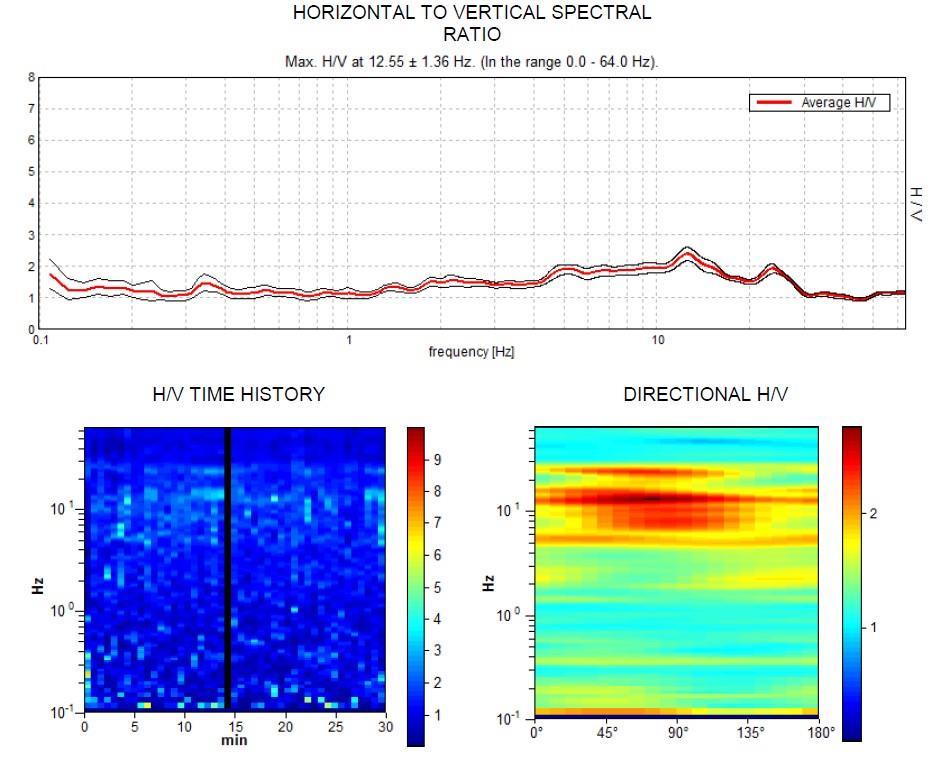
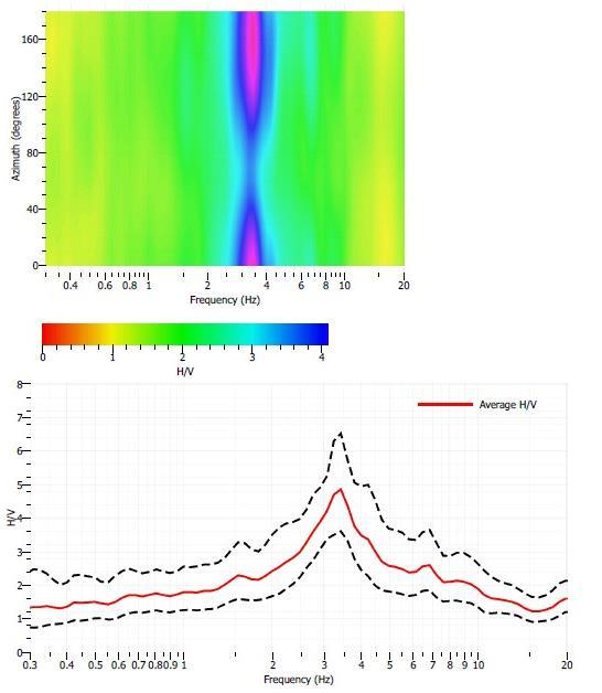
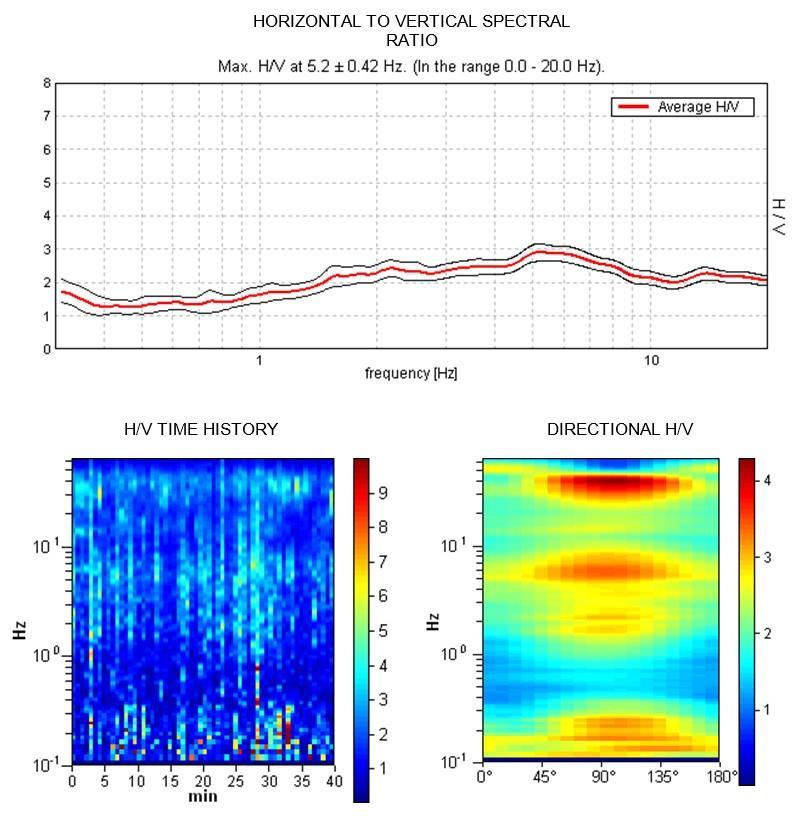
20 Geophysical investigations: Tronto River valley (upper zone) Preliminary results in terms of HVSR from the recorded weak motions show a significant amplification in the 5-7Hz frequency range, ascribable to the resonance of alluvial deposits Page 20
")
21 Geophysical investigations: Tronto River valley (upper zone) Page 21
")
22 Geophysical investigations: Tronto River valley (upper zone) Page 22

23 Geological setting: carbonatic ridge zone - Debris cover overlying a stiff bedrock - Cataclastic belt along the thrust zone - Different jointing conditions of the outcropping rock masses Page 23


24 Geomechanical characterization: carbonatic ridge zone Meso-cenozoic carbonatic domain Cenozoic emipelagic domain Villanova village Page 24
25 Geomechanical characterization: carbonatic ridge zone Page 25
26 Geophysical investigations: carbonatic ridge zone Villanova S.Giovanni Terracino Page 26

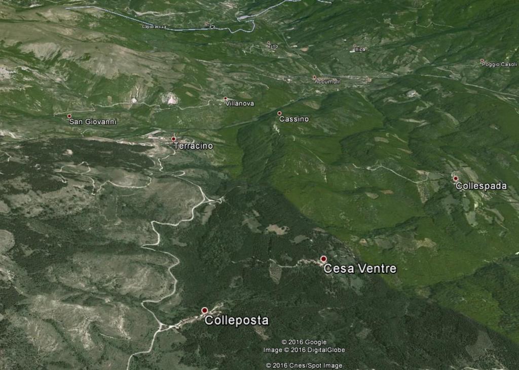
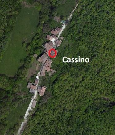
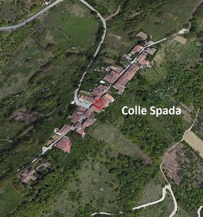
27 Geological setting: flysch ridge zone Cassino - Narrow ridges in the arenaceous and pelitic members of the Laga Flysch, elongated almost NE- SW and EW Collespada Colleposta Page 27

28 Geological setting: flysch ridge zone 24 August 2016 Page 28

29 Already existing MOPS (I SM level) map More detail is requested to describe the intense jointing of the cataclastic belt along the thrust zone More details is requested to describe the geometrical setting among different alluvial deposits More detailed mapping of debris and weathered covers is requested More details is requested to describe the geometrical setting among different alluvial deposits Topographic features responsible for possible topographic amplification effects should be mapped Page 29

30 Slope Instabilities: PARSIFAL approach to III level SM PARSIFAL (Probabilistic Approach for Rating Seismically Induced slope FAiLures), is a comprehensive approach aiming at quantifying the hazard related to earthquakeinduced landslide at municipality as well as at regional scale Ongoing activities ismica.it/it/attivita/terremotocentro-italia/49-applicazione-dellapproccio-parsifal-nell-areacolpita-dal-sisma-del-24-agosto Page 30

 - Use of buffers to allow")

31 - Detection of areas without wood cover - Detection of main connection lines (roads, tracks.) - Use of buffers to allow stability analysis of man-made trenches along roads Slope analysis: preliminary results Page 31


32 Geomechanical survey of jointed rock masses - Geomechanical survey of jointed rock masses, prelimirary to rock mass zonation and kinematic tests for evaluating the suitability of different failure mechanisms Page 32


33 Slope analysis: preliminary results - Half-basin morphometry analysis for carrying on slope stability for first time shallow landslides - Geomechanical survey to perform a lithotecnical zoning of debris and weathered covers Page 33
 and validation of the mapping criteria - Design of a geodatabase for already existing landslides Page")
34 Inventorying of already existing landslides - Use of the LIDAR DEM available from CNR for the Maroarea2 territory - Landslide inventorying from IFFI+PAI+MS1 (where existing) and validation of the mapping criteria - Design of a geodatabase for already existing landslides Page 34


35 Geomechanical survey of already existing landslides Page 35

36 Timeschedule and State of Art Page 36

37 Macroarea2 Accumoli and villages: preliminary conclusions - The Macroarea2 zone is characterized by local seismic amplification, mainly related to the alluvial deposits of the Tronto river valley - Minor amplification effects are measured somewhere in debris due to weathered rock masses, landslides or taluses - Topographic amplification effects can be supposed up to now even if numerical and instrumental data are still necessary to demonstrate and better constrain them - Both 1D and 2D conceptual models for local seismic response can be considered in the Macroarea2 zone; these models will represent the start-point for planning boreholes and DH tests as well as numerical modelling Page 37


38 Thanks for your attention GeoslopestabSPZ Geo-slopestability "Sapienza" Pagina 38
Project S4: ITALIAN STRONG MOTION DATA BASE. Deliverable # D3. Definition of the standard format to prepare descriptive monographs of ITACA stations
 Agreement INGV-DPC 2007-2009 Project S4: ITALIAN STRONG MOTION DATA BASE Responsibles: Francesca Pacor, INGV Milano Pavia and Roberto Paolucci, Politecnico Milano http://esse4.mi.ingv.it Deliverable #
Effects of Surface Geology on Seismic Motion
 4 th IASPEI / IAEE International Symposium: Effects of Surface Geology on Seismic Motion August 23 26, 2011 University of California Santa Barbara THE ROLE OF SUBSOIL HETEROGENEITY IN THE SEISMIC RESPONSE
LEVEL II SEISMIC MICROZONING IN THE SAN GIMIGNANO AREA (CENTRAL ITALY)
") European Congress on Regional Geoscientific Cartography and Information system Bologna 12-15 June 2012 LEVEL II SEISMIC MICROZONING IN THE SAN GIMIGNANO AREA (CENTRAL ITALY) D. Albarello, M. Coltorti,
European Congress on Regional Geoscientific Cartography and Information system Bologna 12-15 June 2012 LEVEL II SEISMIC MICROZONING IN THE SAN GIMIGNANO AREA (CENTRAL ITALY) D. Albarello, M. Coltorti,
ANNALS OF GEOPHYSICS, 59, Fast Track 5, 2016; DOI: / ag
 Local seismic response studies in the north-western portion of the August 24 th, 2016 Mw 6.0 earthquake affected area. The case of Visso village (Central Apennines) IOLANDA GAUDIOSI, GIANLUCA VIGNAROLI,
A PROCEDURE FOR THE EVALUATION OF SEISMIC LOCAL EFFECTS IN LOMBARDIA (ITALY) FOR URBAN PLANNING
 FOR URBAN PLANNING") A PROCEDURE FOR THE EVALUATION OF SEISMIC LOCAL EFFECTS IN LOMBARDIA (ITALY) FOR URBAN PLANNING F. Pergalani 1 and M. Compagnoni 1 1 Dipartimento di Ingegneria Strutturale - Politecnico di Milano, Piazzale
A PROCEDURE FOR THE EVALUATION OF SEISMIC LOCAL EFFECTS IN LOMBARDIA (ITALY) FOR URBAN PLANNING F. Pergalani 1 and M. Compagnoni 1 1 Dipartimento di Ingegneria Strutturale - Politecnico di Milano, Piazzale
Interpretive Map Series 24
 Oregon Department of Geology and Mineral Industries Interpretive Map Series 24 Geologic Hazards, and Hazard Maps, and Future Damage Estimates for Six Counties in the Mid/Southern Willamette Valley Including
ESTIMATION OF SEDIMENT THICKNESS BY USING MICROTREMOR OBSERVATIONS AT PALU CITY, INDONESIA. Pyi Soe Thein. 11 November 2013
 ESTIMATION OF SEDIMENT THICKNESS BY USING MICROTREMOR OBSERVATIONS AT PALU CITY, INDONESIA By Pyi Soe Thein 11 November 2013 Outlines Introduction Research objectives Research analyses Microtremor Single
Down-stream process transition (f (q s ) = 1)
 = 1)") Down-stream process transition (f (q s ) = 1) Detachment Limited S d >> S t Transport Limited Channel Gradient (m/m) 10-1 Stochastic Variation { Detachment Limited Equilibrium Slope S d = k sd A -θ d S
Down-stream process transition (f (q s ) = 1) Detachment Limited S d >> S t Transport Limited Channel Gradient (m/m) 10-1 Stochastic Variation { Detachment Limited Equilibrium Slope S d = k sd A -θ d S
SEISMIC SURVEY METHODS
 SEISMIC SURVEY METHODS Seismic methods Seismic surveys are used in geology and geotechnical engineering to: a) define the depth of the bedrock; b) investigate the landslide areas, c) check the structural
Refraction Microtremor for Shallow Shear Velocity in Urban Basins
 Refraction Microtremor for Shallow Shear Velocity in Urban Basins John Louie, Nevada Seismological Lab UNR students: J. B. Scott, T. Rasmussen, W. Thelen, M. Clark Collaborators: S. Pullammanappallil &
A METHODOLOGY FOR ASSESSING EARTHQUAKE-INDUCED LANDSLIDE RISK. Agency for the Environmental Protection, ITALY (
 A METHODOLOGY FOR ASSESSING EARTHQUAKE-INDUCED LANDSLIDE RISK Roberto W. Romeo 1, Randall W. Jibson 2 & Antonio Pugliese 3 1 University of Urbino, ITALY (e-mail: rwromeo@uniurb.it) 2 U.S. Geological Survey
August 31, 2006 Embankment Failure Debris Flow at the Cascades Development Haywood County, North Carolina. Introduction. Findings
 August 31, 2006 Embankment Failure Debris Flow at the Cascades Development Haywood County, North Carolina Introduction North Carolina Geological Survey (NCGS) staff members visited the site of the August
International Journal of Modern Trends in Engineering and Research e-issn No.: , Date: April, 2016
 International Journal of Modern Trends in Engineering and Research www.ijmter.com e-issn No.:2349-9745, Date: 28-30 April, 2016 Landslide Hazard Management Maps for Settlements in Yelwandi River Basin,
9. SLOPE AND EMBANKMENT FAILURES
 9. SLOPE AND EMBANKMENT FAILURES 9.1 Soil Slope Failures There were some soil slope failures on the banks of roadways and along Ceyhan river (Figures 9.1, 9.2 and 9.3). These are observed Mercimekköy,Yüreğir
Studio delle Proprietà Geotecniche e del Comportamento Dinamico dell Alta Valle del Crati nell Area Urbana di Cosenza
 Trieste, 17-19 Novembre 2015 Studio delle Proprietà Geotecniche e del Comportamento Dinamico dell Alta Valle del Crati nell Area Urbana di Cosenza Maurizio Piersanti 1, A. Caserta 2, G. Galli 1, G. Carlucci
Micro Seismic Hazard Analysis
 Micro Seismic Hazard Analysis Mark van der Meijde INTERNATIONAL INSTITUTE FOR GEO-INFORMATION SCIENCE AND EARTH OBSERVATION Overview Site effects Soft ground effect Topographic effect Liquefaction Methods
Local Seismic Response Analysis in the Large Büyükçekmece (Turkey) Landslide Area by Detailed Engineering-Geological and Numerical Modelling
 Landslide Area by Detailed Engineering-Geological and Numerical Modelling") 6 th International Conference on Earthquake Geotechnical Engineering 1-4 November 2015 Christchurch, New Zealand Local Seismic Response Analysis in the Large Büyükçekmece (Turkey) Landslide Area by Detailed
6 th International Conference on Earthquake Geotechnical Engineering 1-4 November 2015 Christchurch, New Zealand Local Seismic Response Analysis in the Large Büyükçekmece (Turkey) Landslide Area by Detailed
*Anne Carter Witt Matt Heller
 *Anne Carter Witt Matt Heller Division of Geology and Mineral Resources, Virginia Department of Mines, Minerals and Energy, 900 Natural Resources Drive, Suite 500, Charlottesville, VA 22903 anne.witt@dmme.virginia.gov
2D numerical modelling of seismically induced strain effects in a complex geological system hosting a recently urbanized
 2D numerical modelling of seismically induced strain effects in a complex geological system hosting a recently urbanized neighbour of Rome C. Varone 1, L. Lenti 2, S. Martino 1, G. Scarascia Mugnozza 1,
WORKSHOP ON PENETRATION TESTING AND OTHER GEOMECHANICAL ISSUES Pisa 14 June 2016 ROOM F8
 WORKSHOP ON PENETRATION TESTING AND OTHER GEOMECHANICAL ISSUES Pisa 14 June 2016 ROOM F8 LIQUEFACTION PHOENOMENA DURING THE EMILIA SEISMIC SEQUENCE OF 2012 AND THE LIQUEFACTION POTENTIAL FROM A LARGE DATABASE
Gemona valley (Italy)
") Gemona valley (Italy) Situation of the valley Gemona is a city located in the north-eastern part of Italy. It is mainly built on an alluvial fan. The area were Gemona is located is a seismologically active
Gemona valley (Italy) Situation of the valley Gemona is a city located in the north-eastern part of Italy. It is mainly built on an alluvial fan. The area were Gemona is located is a seismologically active
Haydar Hussin (1), Roxana Ciurean (2), Paola Reichenbach (1), Cees van Westen (3), Gianluca Marcato (4), Simone Frigerio (4), V. Juliette Cortes (4)
, Roxana Ciurean (2), Paola Reichenbach (1), Cees van Westen (3), Gianluca Marcato (4), Simone Frigerio (4), V. Juliette Cortes (4)") 7/10/2013 Changing Hydro-meteorological Risks - as Analyzed by a New Generation of European Scientists Probabilistic 2D numerical landslide modeling: a first step towards assessing changes in risk due
7/10/2013 Changing Hydro-meteorological Risks - as Analyzed by a New Generation of European Scientists Probabilistic 2D numerical landslide modeling: a first step towards assessing changes in risk due
3D Spectral Element Model for Numerical Simulation of the Seismic Ground Motion in the Aterno Valley (Italy)
") Chapter 30: 3D Spectral Element Model for Numerical Simulation of the Seismic Ground Motion in the Aterno Valley (Italy) Chapter 30 3D Spectral Element Model for Numerical Simulation of the Seismic Ground
Chapter 30: 3D Spectral Element Model for Numerical Simulation of the Seismic Ground Motion in the Aterno Valley (Italy) Chapter 30 3D Spectral Element Model for Numerical Simulation of the Seismic Ground
Evaluation of site effects: development of the semiquantitative abacuses in Lazio Region (Italy)
") Evaluation of site effects: development of the semiquantitative abacuses in Lazio Region (Italy) F. Pergalani & M. Compagnoni Politecnico di Milano-Dipartimento di Ingegneria strutturale, Milano, Italy
Evaluation of site effects: development of the semiquantitative abacuses in Lazio Region (Italy) F. Pergalani & M. Compagnoni Politecnico di Milano-Dipartimento di Ingegneria strutturale, Milano, Italy
NORTH OF TEHRAN SITE EFFECT MICROZONATION
 13 th World Conference on Earthquake Engineering Vancouver, B.C., Canada August 1-6, 2004 Paper No. 3423 NORTH OF TEHRAN SITE EFFECT MICROZONATION M.K. Jafari 1, M.Kamalian 2, A.Razmkhah 3, A.Sohrabi 4
SEISMIC RADAR AND ELECTRICAL TECHNIQUES FOR WASTE DISPOSAL ASSESSMENT. M. Pipan, G. Dal Moro, E. Forte & M. Sugan
 SEISMIC RADAR AND ELECTRICAL TECHNIQUES FOR WASTE DISPOSAL ASSESSMENT M. Pipan, G. Dal Moro, E. Forte & M. Sugan Department of Geological, Environmental and Marine Sciences, University of Trieste Via Weiss,
Two case history of EMS data application: earthquake in central italy and flooding in Piedmont region
 Two case history of EMS data application: earthquake in central italy and flooding in Piedmont region Luca Lanteri*, Rocco Pispico*, R. Cremonini** *Arpa Piemonte, Geological and Natural Risk Dipartiment
SEISMIC GROUND RESPONSE ANALYSIS AT THE SITE OF SAN FELICE CHURCH IN POGGIO PICENZE
 SEISMIC GROUND RESPONSE ANALYSIS AT THE SITE OF SAN FELICE CHURCH IN POGGIO PICENZE SabbaniVenkatesh,Rakesh K, GollapalliRakesh students University college of engineering,osmania University ABSTRACT When
Dipartimento di Ingegneria Civile, Edile-Architettura e Ambientale, Università degli Studi dell Aquila, Italy 2
 Comparison between shallow geology, resonance frequency and buildings damage due to the April 6, 2009 Mw 6.1 and the February 2, 1703 Mw 6.7 earthquakes at L Aquila historical downtown M. Tallini 1, F.
Geophysical Site Investigation (Seismic methods) Amit Prashant Indian Institute of Technology Gandhinagar
 Amit Prashant Indian Institute of Technology Gandhinagar") Geophysical Site Investigation (Seismic methods) Amit Prashant Indian Institute of Technology Gandhinagar Short Course on Geotechnical Aspects of Earthquake Engineering 04 08 March, 2013 Seismic Waves
Geophysical Site Investigation (Seismic methods) Amit Prashant Indian Institute of Technology Gandhinagar Short Course on Geotechnical Aspects of Earthquake Engineering 04 08 March, 2013 Seismic Waves
Seismic Response Analysis of selected sites in Wenxian urban area, China
 Seismic Response Analysis of selected sites in Wenxian urban area, China Y. Lu, K. Liu & Q. Li Earthquake Administration of Gansu Province (Key Laboratory of Loess Earthquake Engineering, CEA),China Y.
Response on Interactive comment by Anonymous Referee #1
 Response on Interactive comment by Anonymous Referee #1 Sajid Ali First, we would like to thank you for evaluation and highlighting the deficiencies in the manuscript. It is indeed valuable addition and
SPATIAL MODELS FOR THE DEFINITION OF LANDSLIDE SUSCEPTIBILITY AND LANDSLIDE HAZARD. J.L. Zêzere Centre of Geographical Studies University of Lisbon
 SPATIAL MODELS FOR THE DEFINITION OF LANDSLIDE SUSCEPTIBILITY AND LANDSLIDE HAZARD J.L. Zêzere Centre of Geographical Studies University of Lisbon CONCEPTUAL MODEL OF LANDSLIDE RISK Dangerous Phenomena
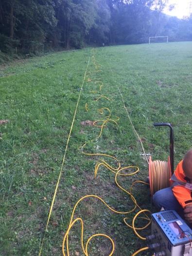
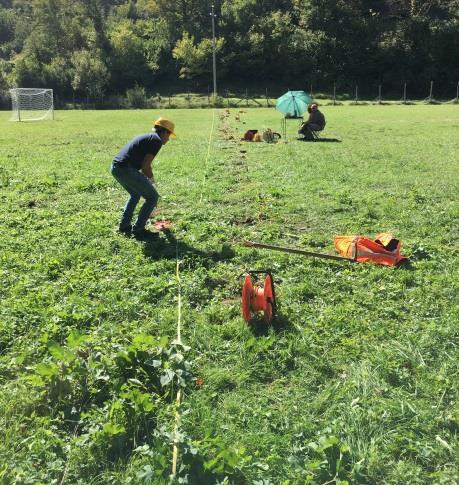
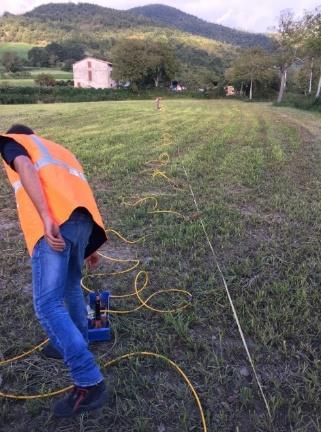
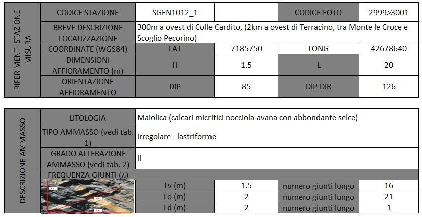
Station Description Sheet STE
 Station Description Sheet STE 1. General Information 2. Geographical Information / Geomorphology 3. Geological Information 4. Geotechnical Site Characterization. Geophysical Site Characterization 6. Site
UChile - LMMG Shear Wave Velocity (V S. ): Measurement, Uncertainty, and Utility in Seismic Hazard Analysis. Robb Eric S. Moss, Ph.D., P.E.
: Measurement, Uncertainty, and Utility in Seismic Hazard Analysis. Robb Eric S. Moss, Ph.D., P.E.") UChile - LMMG 2015 Shear Wave Velocity (V S ): Measurement, Uncertainty, and Utility in Seismic Hazard Analysis Robb Eric S. Moss, Ph.D., P.E. Assoc. Prof. of Earthquake, Geotechnical, and Risk Engineering
UChile - LMMG 2015 Shear Wave Velocity (V S ): Measurement, Uncertainty, and Utility in Seismic Hazard Analysis Robb Eric S. Moss, Ph.D., P.E. Assoc. Prof. of Earthquake, Geotechnical, and Risk Engineering
By Prof. Filippos Vallianatos, Technological Educational Institute of Crete
 Report of the Short Term Visit in CNR ITABC, Rome Italy By Prof. Filippos Vallianatos, Technological Educational Institute of Crete Period of Visit April 16, 2015 to April 29, 2015 As it is not possible
A. Refer to Appendix F in back of lab manual for list of commonly used geologic map symbols
 Structural Geology Lab 2: Outcrop Patterns and Structure Contours I. Geologic Map Symbols A. Refer to Appendix F in back of lab manual for list of commonly used geologic map symbols 1. Emphasis: a. strike
INTRODUCTION. Climate
 INTRODUCTION Climate Landslides are serious natural disasters in many parts of the world. Since the past 30 years, rainfall triggered landslides and debris flows had been one of the natural disasters of
Joint-inversion of Soil Profile with Receiver Function and Dispersion Curve using Arrays of Seismometers
 Joint-inversion of Soil Profile with Receiver Function and Dispersion Curve using Arrays of Seismometers D.Calderon 1, T.Sekiguchi 1, S.Nakai 1, Z.Aguilar 2, F.Lazares 2 1 Department of Urban Environment
Geospatial Approach for Delineation of Landslide Susceptible Areas in Karnaprayag, Chamoli district, Uttrakhand, India
 Geospatial Approach for Delineation of Landslide Susceptible Areas in Karnaprayag, Chamoli district, Uttrakhand, India Ajay Kumar Sharma & Anand Mohan Singh Overview Landslide - movement of a mass of rock,
The significance of site effect studies for seismic design and assessment of industrial facilities
 The significance of site effect studies for seismic design and assessment of industrial facilities Corinne Lacave, Martin G. Koller Pierino Lestuzzi, and Christelle Salameh Résonance Ingénieurs-Conseils
Effects of Surface Geology on Seismic Motion
 4 th IASPEI / IAEE International Symposium: Effects of Surface Geology on Seismic Motion August 23 26, 2011 University of California Santa Barbara EFFECTS OF EXISTING LANDSLIDES ON SEISMICALLY-INDUCED
Minor shallow gravitational component on the Mt. Vettore surface ruptures related to M W 6, 2016 Amatrice earthquake
 Minor shallow gravitational component on the Mt. Vettore surface ruptures related to M W 6, 2016 Amatrice earthquake MATTEO ALBANO 1, MICHELE SAROLI 2,1, MARCO MORO 1, EMANUELA FALCUCCI 1, STEFANO GORI
A scale/resolution problem
 Near Surface 2005 September 4-7, 2005, Palermo Italy WORKSHOP on Hydrogeophysics a tool for sustainable use of groundwater resources Integrated Seismic and GPR characterization of fractured rocks Pipan,
2014 Summer Training Courses on Slope Land Disaster Reduction Hydrotech Research Institute, National Taiwan University, Taiwan August 04-15, 2014
 Final Project Report 2014 Summer Training Courses on Slope Land Disaster Reduction Hydrotech Research Institute, National Taiwan University, Taiwan August 04-15, 2014 Landslides in Mt. Umyeon Susceptibility
Pinyol, Jordi González, Marta Oller, Pere Corominas, Jordi Martínez, Pere
 Rockfall hazard mapping methodology applied to the Geological Hazard Prevention Map in Catalonia 1:25000 Pinyol, Jordi González, Marta Oller, Pere Corominas, Jordi Martínez, Pere ROCKFALL HAZARD MAPPING
12 th International Symposium on Landslides June 2016, Napoli (Italy)
") 12 th International Symposium on s 12-19 June 2016, Napoli (Italy) use of thematic for landslide susceptibility assessment by means of statistical : case study of shallow landslides in fine grained soils
12 th International Symposium on s 12-19 June 2016, Napoli (Italy) use of thematic for landslide susceptibility assessment by means of statistical : case study of shallow landslides in fine grained soils
Geog 1000 Lecture 17: Chapter 10
 Geog 1000 Lecture 17: Chapter 10 Landslides and Mass Movements Link to lectures: http://scholar.ulethbridge.ca/chasmer/classes/ Today s Lecture 1. Assignment 2 Due Pick up Assignment 1 if you don t have
ANNEX I. 2 nd report on SEED project (Identification of landslide phenomena and landslides prone areas into the CKNP and in its buffer zone)
") ANNEX I 2 nd report on SEED project (Identification of landslide phenomena and landslides prone areas into the CKNP and in its buffer zone) Dr. Chiara Calligaris, Prof. Giorgio Poretti, Dr. Shahina Tariq
ANNEX I 2 nd report on SEED project (Identification of landslide phenomena and landslides prone areas into the CKNP and in its buffer zone) Dr. Chiara Calligaris, Prof. Giorgio Poretti, Dr. Shahina Tariq
Rock slope stability problems in Gold Coast area, Australia
 Rock slope stability problems in Gold Coast area, Australia Author Shokouhi, Ali, Gratchev, Ivan, Kim, Dong Hyun Published 2013 Journal Title International Journal of GEOMATE Copyright Statement 2013 GEOMATE
Slope dynamics acting on Villa del Casale (Piazza Armerina, Sicily)
") Slope dynamics acting on Villa del Casale (Piazza Armerina, Sicily) G. Delmonaco, C. Margottini, G. Martini, S. Paolini, C. Puglisi ENEA C.R. Casaccia, Rome, Italy L. Falconi & D. Spizzichino Consorzio
Slope dynamics acting on Villa del Casale (Piazza Armerina, Sicily) G. Delmonaco, C. Margottini, G. Martini, S. Paolini, C. Puglisi ENEA C.R. Casaccia, Rome, Italy L. Falconi & D. Spizzichino Consorzio
Earthquake-induced landslide distribution and hazard mapping. Megh Raj Dhital Central Department of Geology, Tribhuvan University
 Earthquake-induced landslide distribution and hazard mapping Megh Raj Dhital Central Department of Geology, Tribhuvan University Contents Geological setting of Gorkha earthquake Peak ground acceleration
General Geologic Setting and Seismicity of the FHWA Project Site in the New Madrid Seismic Zone
 General Geologic Setting and Seismicity of the FHWA Project Site in the New Madrid Seismic Zone David Hoffman University of Missouri Rolla Natural Hazards Mitigation Institute Civil, Architectural & Environmental
Report on the evaluation of geophysical data and seismic site effects in the Maltese archipelago in relation to the calculation of seismic risk
 Project Acronym: SIMIT Project Name: Sistema Integrato di Protezione CivileTransfrontalieroItalo-Maltese Project Code: B1-2.19/11 Start Date: March 2013 End Date: September 2015 Work Package 2: Identification
Landslides Classification
 ENVIRONMENTAL GEOTECHNICS Landslides Classification Prof. Ing. Marco Favaretti University of Padova Department of Civil, Environmental and Architectural Engineering, Via Ognissanti, 39 Padova (Italy) phone:
Seismic Reflection Imaging across the Johnson Ranch, Valley County, Idaho
 Seismic Reflection Imaging across the Johnson Ranch, Valley County, Idaho Report Prepared for the Skyline Corporation Lee M. Liberty Center for Geophysical Investigation of the Shallow Subsurface (CGISS)
Supplementary Material
 GSA Data Repository item 2018118 Brardinoni, F., Picotti, V., Maraio, S., Paolo Bruno, P., Cucato, M., Morelli, C., and Mair, V., 2018, Postglacial evolution of a formerly glaciated valley: Reconstructing
GROUND MOTION CHARACTERISTIC IN THE KAOHSIUNG & PINGTUNG AREA, TAIWAN
 GROUND MOTION CHARACTERISTIC IN THE KAOHSIUNG & PINGTUNG AREA, TAIWAN Hsien-Jen Chiang 1, Kuo-Liang Wen 1, Tao-Ming Chang 2 1.Institute of Geophysics, National Central University,ROC 2.Department of Information
MEMORANDUM. REVISED Options for Landslide Regulations: Setbacks and Slope Height
 Snohomish County Council Office MS #609 3000 Rockefeller Avenue Everett, WA 98201 (425) 388-3494 MEMORANDUM DATE: May 2, 2014 TO: FROM: RE: Councilmembers Will Hall, Council Staff REVISED Options for Landslide
DETAILED REPORT OF CONTRACTOR FOR THIRD PROGRESS MEETING. NEWCASTLE, NOVEMBER 2001.
 DETAILED REPORT OF CONTRACTOR FOR THIRD PROGRESS MEETING. NEWCASTLE, NOVEMBER 2001. PERIOD: MAY OCTOBER 2001 Assistant Contractor: Instituto Geológico y Minero de España (IGME) Responsible Scientist: Santiago
Geotechnical Site Classification and Croatian National Annex for EC 8
 Geotechnical Site Classification and Croatian National Annex for EC 8 by Predrag Kvasnika University of Zagreb Faculty of Mining-Geology and Petroleum engineering Outline General Motivation Site classification
Interfacing with the industry needs euro geotecnica, s.a.
 Interfacing with the industry needs Avda. Corts Catalanes 5-7 2ª planta 08173 Sant Cugat del Vallès. Barcelona. Telèfon: 93 583 04 80 / Fax: 93 583 69 60 Table of contents Introduction Natural hazards
Landslide Susceptibility, Hazard, and Risk Assessment. Twin Hosea W. K. Advisor: Prof. C.T. Lee
 Landslide Susceptibility, Hazard, and Risk Assessment Twin Hosea W. K. Advisor: Prof. C.T. Lee Date: 2018/05/24 1 OUTLINE INTRODUCTION LANDSLIDE HAZARD ASSESSTMENT LOGISTIC REGRESSION IN LSA STUDY CASE
Dan Miller + Kelly Burnett, Kelly Christiansen, Sharon Clarke, Lee Benda. GOAL Predict Channel Characteristics in Space and Time
 Broad-Scale Models Dan Miller + Kelly Burnett, Kelly Christiansen, Sharon Clarke, Lee Benda GOAL Predict Channel Characteristics in Space and Time Assess Potential for Fish Use and Productivity Assess
Study of seismic response of colluvium accumulation slope by particle flow code
 Granular Matter () 12:483 490 DOI.07/s035-0-0213-8 Study of seismic response of colluvium accumulation slope by particle flow code Jianming He Xiao Li Shouding Li Yueping Yin Haitao Qian Received: 15 December
Tu 22P1 04 Combination of Geophysical Technques to Characterize Sediments (Ebro Delta, Spain)
") Tu 22P1 04 Combination of Geophysical Technques to Characterize Sediments (Ebro Delta, Spain) B. Benjumea* (Institut Cartografic i Geologic de Catalunya (ICGC)), A. Gabàs (ICGC), A. Macau (ICGC), F. Bellmunt
Tu 22P1 04 Combination of Geophysical Technques to Characterize Sediments (Ebro Delta, Spain) B. Benjumea* (Institut Cartografic i Geologic de Catalunya (ICGC)), A. Gabàs (ICGC), A. Macau (ICGC), F. Bellmunt
Evaluation of the Liquefaction Potential by In-situ Tests and Laboratory Experiments In Complex Geological Conditions
 Evaluation of the Liquefaction Potential by In-situ Tests and Laboratory Experiments In Complex Geological Conditions V. Sesov, K. Edip & J. Cvetanovska University Ss. Cyril and Methodius, Institute of
Viale della Fiera 8 Bologna - Italy
 Assessment of landslides susceptibility and reactivation likelihood in the Emilia Romagna region (Italy) Mauro Generali e Marco Pizziolo Regione Emilia-Romagna Geological Survey Viale della Fiera 8 Bologna
Effects of Surface Geology on Seismic Motion
 4 th IASPEI / IAEE International Symposium: Effects of Surface Geology on Seismic Motion August 23 26, 2011! University of California Santa Barbara MICROZONATION OF MONTREAL, VARIABILITY IN SOIL CLASSIFICATION
Progress Report: Sentinel Asia Success Story in the Philippines
 Progress Report: Sentinel Asia Success Story in the Philippines 3 rd Joint Project Team Meeting on the Sentinel Asia STEP-2 July 6-8, 2010 Hyatt Hotel, Manila, Philippines Renato U. Solidum Jr. Director
Seismic Monitoring of the Gravity-Induced Deformation Involving the Peschiera Spring Slope (Italy) for the Management of a Main Infrastructure
 for the Management of a Main Infrastructure") 6 th International Conference on Earthquake Geotechnical Engineering 1-4 November 2015 Christchurch, New Zealand Seismic Monitoring of the Gravity-Induced Deformation Involving the Peschiera Spring Slope
6 th International Conference on Earthquake Geotechnical Engineering 1-4 November 2015 Christchurch, New Zealand Seismic Monitoring of the Gravity-Induced Deformation Involving the Peschiera Spring Slope
Prof. B V S Viswanadham, Department of Civil Engineering, IIT Bombay
 19 Module 5: Lecture -1 on Stability of Slopes Contents Stability analysis of a slope and finding critical slip surface; Sudden Draw down condition, effective stress and total stress analysis; Seismic
GLG101: What-To-Know List
 Exam 3, Page 1 GLG101: What-To-Know List (Derived from Before You Leave This Page Lists) This list is intended to guide your reading and to help you prepare for the online multiple-choice quizzes. Each
2) re-positioning of the SSS data, 3) individuation of geomorphological features and morphometrical parameters correlated to instability phenomena.
 re-positioning of the SSS data, 3) individuation of geomorphological features and morphometrical parameters correlated to instability phenomena.") HIGH-RESOLUTION SIDE SCAN SONAR AND MULTIBEAM DATA PROCESSING AND MERGING TO STUDY SUBMARINE INSTABILITY PHENOMENA ON VOLCANIC ISLANDS (PONTINE, CAMPANIAN AND AEOLIAN ARCHIPELAGOS) A. BOSMAN Extended abstract:
HIGH-RESOLUTION SIDE SCAN SONAR AND MULTIBEAM DATA PROCESSING AND MERGING TO STUDY SUBMARINE INSTABILITY PHENOMENA ON VOLCANIC ISLANDS (PONTINE, CAMPANIAN AND AEOLIAN ARCHIPELAGOS) A. BOSMAN Extended abstract:
Integration of Surface Seismic Data with Geo-electric Data
 Integration of Surface Seismic Data with Geo-electric Data ABDULRAHMAN AL-SHUHAIL Earth Sciences Department King Fahd Univesity of Petroleum & Minerals. SAUDI ARABIA s234817@kfupm.edu.sa Abstract: - The
Landslide Susceptibility in Tryon State Park, Oregon
 1 Landslide Susceptibility in Tryon State Park, Oregon Tracy E. Handrich 1 1 Geology Department, Portland State University, P.O. Box 751, Portland, Oregon, 97207 ABSTRACT LIDAR and topographic data were
Debris flow: categories, characteristics, hazard assessment, mitigation measures. Hariklia D. SKILODIMOU, George D. BATHRELLOS
 Debris flow: categories, characteristics, hazard assessment, mitigation measures Hariklia D. SKILODIMOU, George D. BATHRELLOS Natural hazards: physical phenomena, active in geological time capable of producing
PREDICTION OF AVERAGE SHEAR-WAVE VELOCITY FOR GROUND SHAKING MAPPING USING THE DIGITAL NATIONAL LAND INFORMATION OF JAPAN
 th World Conference on Earthquake Engineering Vancouver, B.C., Canada August -6, 00 Paper No. 07 PREDICTION OF AVERAGE SHEAR-WAVE VELOCITY FOR GROUND SHAKING MAPPING USING THE DIGITAL NATIONAL LAND INFORMATION
TWO DIMENSIONAL MODELING AND STABILITY ANALYSIS OF SLOPES OVERLAYING TO SHAHID RAGAEE POWER PLANT
 4 th International Conference on Earthquake Geotechnical Engineering June 25-28, 2007 Paper No. 1637 TWO DIMENSIONAL MODELING AND STABILITY ANALYSIS OF SLOPES OVERLAYING TO SHAHID RAGAEE POWER PLANT Mohammad
SLOPE STABILITY EVALUATION AND ACCEPTANCE STANDARDS
 INFORMATION BULLETIN / PUBLIC - BUILDING CODE REFERENCE NO.: LABC 7006.3, 7014.1 Effective: 01-01-2017 DOCUMENT NO.: P/BC 2017-049 Revised: 12-21-2016 Previously Issued As: P/BC 2014-049 SLOPE STABILITY
Impact : Changes to Existing Topography (Less than Significant)
") 4.2 Land Resources 4.2.1 Alternative A Proposed Action Impact 4.2.1-1: Changes to Existing Topography (Less than Significant) Development of the project site would involve grading and other earthwork as
4.2 Land Resources 4.2.1 Alternative A Proposed Action Impact 4.2.1-1: Changes to Existing Topography (Less than Significant) Development of the project site would involve grading and other earthwork as
SEISMIC MICROZONATION OF THE GIRONA URBAN AREA (CATALONIA, NE SPAIN) FROM STATISTICAL ANALYSIS OF GEOTECHNICAL DATA
 FROM STATISTICAL ANALYSIS OF GEOTECHNICAL DATA") Bologna, 12 th - 15 th June, 2012 Session 9 Seismic risk SEISMIC MICROZONATION OF THE GIRONA URBAN AREA (CATALONIA, NE SPAIN) David Soler (1), David Brusi (1), Manel Zamorano (1), Xavier Goula (2), Sara
Bologna, 12 th - 15 th June, 2012 Session 9 Seismic risk SEISMIC MICROZONATION OF THE GIRONA URBAN AREA (CATALONIA, NE SPAIN) David Soler (1), David Brusi (1), Manel Zamorano (1), Xavier Goula (2), Sara
volcanic tremor and Low frequency earthquakes at mt. vesuvius M. La Rocca 1, D. Galluzzo 2 1
 volcanic tremor and Low frequency earthquakes at mt. vesuvius M. La Rocca 1, D. Galluzzo 2 1 Università della Calabria, Cosenza, Italy 2 Istituto Nazionale di Geofisica e Vulcanologia Osservatorio Vesuviano,
University of Bristol - Explore Bristol Research. Peer reviewed version. Link to published version (if available): 10.
: 10.") Sextos, A., De Risi, R., Pagliaroli, A., Foti, S., Passeri, F., Ausilio, E.,... Zimmaro, P. (2018). Local site effects and incremental damage of buildings during the 2016 Central Italy earthquake sequence.
Sextos, A., De Risi, R., Pagliaroli, A., Foti, S., Passeri, F., Ausilio, E.,... Zimmaro, P. (2018). Local site effects and incremental damage of buildings during the 2016 Central Italy earthquake sequence.
EVALUATION OF SEISMIC SITE EFFECTS FOR BANGKOK DEEP BASIN
 EVALUATION OF SEISMIC SITE EFFECTS FOR BANGKOK DEEP BASIN Nakhorn POOVARODOM 1 and Amorntep JIRASAKJAMROONSRI 2 ABSTRACT In this study, seismic site effects of Bangkok focusing on deep basin structures
Background. Developing a FracMan DFN Model. Fractures, FracMan and Fragmentation Applications of DFN Models to Block & Panel Caving
 Background Golder Associates are one of the pioneering groups in the use of the Discrete Fracture Network (DFN) approach. DFN models seek to describe the heterogeneous nature of fractured rock masses by
An Hypothesis Concerning a Confined Groundwater Zone in Slopes of Weathered Igneous Rocks
 Symposium on Slope Hazards and Their Prevention: 8-10 May, 2000, Hong Kong, PRC An Hypothesis Concerning a Confined Groundwater Zone in Slopes of Weathered Igneous Rocks J. J. Jiao and A. W. Malone Department
Morphological and climatic aspects of the initiation of the San Mango sul Calore debris avalanche in southern Italy
 Morphological and climatic aspects of the initiation of the San Mango sul Calore debris avalanche in southern Italy Guerriero Luigi 1, Revellino Paola 1, Diodato Nazzareno 1-2, Grelle Gerardo 1, De Vito
Long term piezometric data analysis to validate landslide models
 Long term piezometric data analysis to validate landslide models M.G. Angeli C.N.R. Institute, Perugia, Italy P. Gasparetto IQT Consulting S.r.l., Rovigo, Italy F. Pontoni Geoequipe S.T.A., Tolentino,
Earthquake Lab! Seismic Waves 1. What do scientists believe the Earth is made of?
 Name: Earthquake Lab! Seismic Waves 1. What do scientists believe the Earth is made of? Period: 2. How do scientists make measurements of inside the Earth? 3. What are the two types of Earthquake waves?
SEISMIC HAZARD AND ALPINE VALLEY RESPONSE ANALYSIS : GENERIC VALLEY CONFIGURATIONS
 First European Conference on Earthquake Engineering and Seismology (a joint event of the 13 th ECEE & 30 th General Assembly of the ESC) Geneva, Switzerland, 3-8 September 2006 Paper Number: 1 SEISMIC
Landslide Hazard Assessment Methodologies in Romania
 A Scientific Network for Earthquake, Landslide and Flood Hazard Prevention SciNet NatHazPrev Landslide Hazard Assessment Methodologies in Romania In the literature the terms of susceptibility and landslide
Geothematic open data in Umbria region
 The open discussion version of this paper is available at: Motti A, Natali N. (2016) Geothematic open data in Umbria region. PeerJ Preprints 4:e2096v2 https://doi.org/10.7287/peerj.preprints.2096v2 Geothematic
Structural Analysis and Tectonic Investigation of Chamshir Dam Site, South West Zagros
 Open Journal of Geology, 2015, 5, 136-143 Published Online March 2015 in SciRes. http://www.scirp.org/journal/ojg http://dx.doi.org/10.4236/ojg.2015.53013 Structural Analysis and Tectonic Investigation
Landslide analysis to estimate probability occurrence of earthquakes by software ArcGIS in central of Iran
 Research Journal of Recent Sciences ISSN 2277-2502 Res.J.Recent Sci. Landslide analysis to estimate probability occurrence of earthquakes by software ArcGIS in central of Iran Abstract Hamid Reza Samadi
Inferring Seismic Response of Landslide-Prone Slopes from Microtremor Study
 Inferring Seismic Response of Landslide-Prone Slopes from Microtremor Study Vincenzo Del Gaudio, Janusz Wasowski, and Chyi-Tyi Lee Abstract The difficulty in identifying factors controlling the dynamic
Geological control in 3D stratigraphic modeling, Oak Ridges Moraine, southern Ontario. Logan, C., Russell, H. A. J., and Sharpe, D. R.
 Geological control in 3D stratigraphic modeling, Oak Ridges Moraine, southern Ontario Logan, C., Russell, H. A. J., and Sharpe, D. R. Rationale Increasing urbanization in the Greater Toronto Area is creating
Earthquake Seismology, Exploration Seismology, and Engineering Seismology: How Sweet It is --- Listening to the Earth
 Earthquake Seismology, Exploration Seismology, and Engineering Seismology: How Sweet It is --- Listening to the Earth Summary Oz Yilmaz Anatolian Geophysical, Istanbul, Turkey, and GeoTomo LLC, Houston,
MANAGEMENT OF LARGE MUDSLIDES
 36 MANAGEMENT OF LARGE MUDSLIDES Three large and active mudslides Poche, 1860?, Super-Sauze, 1960?, La Valette, March 1982, 1 M m 3 900,000 m 3 4-5 M m 3 37 Three large and active mudslides Type of development:
Guidelines for Site-Specific Seismic Hazard Reports for Essential and Hazardous Facilities and Major and Special-Occupancy Structures in Oregon
 Guidelines for Site-Specific Seismic Hazard Reports for Essential and Hazardous Facilities and Major and Special-Occupancy Structures in Oregon By the Oregon Board of Geologist Examiners and the Oregon