Ceramic compositional analysis projects Funded by the Begole Archaeological Research Grant Program
|
|
|
- Agnes Lee
- 5 years ago
- Views:
Transcription


1 Ceramic compositional analysis projects Funded by the Begole Archaeological Research Grant Program 2006 Compositional analysis of prehistoric ceramics from the Anza-Borrego desert: Seeking provenience and technology Patrick Quinn and Margie Burton 2007 Exploring prehistoric ceramic raw material resources in the Anza-Borrego desert through compositional analysis Patrick Quinn and Margie Burton 2008 Ceramic analysis and cultural interpretation of the Stacked Stone Site David Broughton and Patrick Quinn 2009 Ceramic production and distribution at a Late Prehistoric hunter-gatherer seasonal occupation site CA-SDI-813, Anza-Borrego Desert State Park Patrick Quinn and Margie Burton

: Tizon brown ware, Colorado buff ware More systematic")

2 Background Inspired by formal homogeneity of abundant ceramics in desert region of eastern San Diego County Different ware types have been identified in hand specimen (e.g. Rogers 1930s, Waters 1980s): Tizon brown ware, Colorado buff ware More systematic and detailed approach to ceramic compositional analysis may offer information about pottery production and distribution; hence a better understanding of pre-contact cultural development of the region since ca. 500 AD Brown ware Buff ware
 What they are made of and how they were made Two main approaches: Thin section petrography mineralogy;")
3 What is ceramic compositional analysis? Type of scientific archaeological approach Examines composition of ceramics ( recipes ) What they are made of and how they were made Two main approaches: Thin section petrography mineralogy; microstructure can be seen with magnification Analytical chemistry - elemental composition determined by irradiation, X-rays, lasers. INAA, XRF, XRD, ICP-MS etc. Different approaches have advantages and disadvantages Best to combine two or more techniques


4 Thin section petrographic analysis Sophie van Heymbeek University of Sheffield
5 Previous ceramic compositional studies in southern California Compositional analysis already applied to socal ceramics Important studies include Hildebrand et al. (2002), Griset (1996) CRM studies such as Wade (1999), Guerrero (2004) Applied petrography and chemistry to sites in mountains and coastal plain Important findings include general westwards movement of populations related to desiccation of Lake Cahuilla Total number of sherds analysed is still small c. 500 Problems with comparison of data due to different chemical approaches and presentation of petrographic data
 Cultural identity (as expressed through pottery-making traditions) Movement of people and pots Interaction between social")
6 Project Aims Assess the compositional diversity of ceramics found in the desert Explore archaeological issues, such as: Craft production (raw materials, technologies) Cultural identity (as expressed through pottery-making traditions) Movement of people and pots Interaction between social groups


7 Archaeological sites and ceramic samples Seven sites on western desert margin previously recorded by Wallace, Ezell, and Seidel. Collections curated at BARC. SDI-343 and SDI-2336 in Collins Valley in Cahuilla territory in north of park SDI and SDI in Bow Willow Canyon and SDI-955, SDI-956 and SDI-963 in Indian Valley in Kumeyaay territory in south of park All sites were temporary camps, except CA-SDI-343 which was part of village of Los Coyotes All sites have milling features, stone tools and abundant ceramic sherds Selected 70 diagnostic sherds, 4-27 per site

8 18 different fabric groups were identified on the basis of mineralogy, petrography, texture, and microstructure Selected petrographic classes

9 Fabric Group 7: Collins Valley and Indian Valley CA-SDI-343 CA-SDI-955 CA-SDI-956


10 Fabric Group 6: Indian Valley and Bow Willow Canyon CA-SDI-963 CA-SDI-10573
. IMP-2 considered by Hildebrand et al.")
11 Bulk chemical analysis performed by University of Missouri Research Reactor Center (MURR) Anza-Borrego sherds plotted with data from previous study by Hildebrand et al PCA plot of NAA data Findings: 1. Most Anza-Borrego sherds were classified as chemical groups IMP-2 and IMP-3 (new). IMP-2 considered by Hildebrand et al. (2002) to represent Rogers Salton Brown type 2. Some sherds classified as IMP-1A; equivalent to Water s Tumco Buff and Topoc Buff types 3. Only three mountain sherds - classified in group SDI-2, representing residual weathered igneous clays and equivalent to Tizon Brown ware


12 Raw material sites and samples Carried out program of raw material prospection Assessed availability of clays and tempers in the vicinity of the sites Collected geological materials near sites and elsewhere in the park Processed, fired and analysed clay samples with both chemistry and petrography Thin sectioned hard rock samples Compared raw material samples to ceramics Also compared Anza-Borrego ceramics to thin sections of ceramics from Stacked Stone Site (Broughton 2008) and Wikalokal (Hildebrand et al. 2002; Gallucci 2001, 2004) in Laguna Mountains George Jefferson State Parks Paleontologist/Geologist

13 Raw material prospecting revealed very few good clay sources close to study sites All sites are in granitic valleys and have sandy soils Ceramic production may not have taken place at most sites There were some compositional matches with local raw materials: Ceramics may have been made in Collins Valley from metamorphic material Some southern sites may have used broadly local quaternary sedimentary deposits

14 Results - Raw material choices Potters utilised a wide range of different raw materials to produce ceramics Residual weathered igneous clays from mountains Quaternary or Holocene alluvium at foot of mountains in western desert Residual(?) metamorphic clays Fine Cenozoic marine and nonmarine sediments of Salton Trough Raw materials determined to some extent by natural availability Potters may also have preferred specific raw material types

15 Results Clay preparation techniques Coarse clays may have been cleaned Evidence for crushing and rehydration of pulverised clays Several types of temper: Sand Crushed rock Crushed sherds or grog in many fabric classes Perhaps plant matter Repeated recycling of ceramics More than one type of temper found in some ceramics Tempering may not have always been purely functional


16 Fabric Group 17 - grog temper Fabric Group 13 - Non-functional grog temper Fabric Group 9 - Sand and grog temper


17 Results Forming and firing techniques Relic coils picked out by alignment of particles in thin section Alignment of particles to vessel walls by surface may indicate beating with paddle Degree of firing suggested by optical activity of clay matrix Ceramics were moderately well fired but varied Firing atmosphere seen in colour of clay Oxidation and reduction often within same sherd Firing technology appears poorly controlled, such as in bonfire or pit firing Techniques revealed in thin section largely match ethnographic accounts (e.g. Rogers 1936; Campbell 1999) provide evidence of antiquity and cultural continuity Oxidized Fabric Group 3 Reduced Campbell (1999)


18 Results - Movement of pots and people Much of the ceramics appear to have been transported to the sites The distribution of these ceramics and possible raw material sources provides an indication of general direction and scale of movement Comparison with ethnohistoric trails (e.g. Cline Tom Lucas) may indicate actual routes taken Can track movement over c. 40 miles Ceramics moved eastwest, west-east and perhaps north-south-- evidence of seasonal migration and crossing of ethnolinguistic boundaries Kumeyaay trails - Cline (1979)
19 Results - Cultural Patterning Few differences in craft practise detected between north (Cahuilla) and south (Kumeyaay) Range of techniques used to produce ceramics found at sites in both areas Some compositional differences may be explained by raw material availability Non-local origin of much of ceramics confuses picture Strong sampling bias due to small numbers of sherds analysed


20 Mine Wash CA-SDI-813 Late Prehistoric seasonal habitation site


21 Mine Wash site CA-SDI-813 Excavated by CA State Parks archaeologists Two phases of Late Prehistoric occupation, 1100 years ago and years ago. Sampled 115 sherds from several levels within Units A5, B1, and B3 in February 2010


22 Conducted raw material prospecting in the vicinity of the Mine Wash site, February 2010 Local raw materials consist of sandy soil unsuitable for pottery manufacture Mine Wash site Red dots=locations of geological samples


23 Sedimentary clays from the desert to the east dominate the tested sherd sample from the Mine Wash site, CA-SDI-813 Grog tempered fine sedimentary fabric Sand & grog tempered micaceous sedimentary fabric

.")

24 Residual weathered igneous fabrics occur in one excavation unit only. These fabrics are similar to those found at sites in the Laguna Mountains to the west of CA-SDI-813. Biotite-rich granitic fabric Coarse granitic residual igneous fabric Amphibole-rich residual igneous fabric Preliminary results suggest that all ceramics at the site are non-local in origin (i.e. pottery was not made at CA-SDI-813). Pottery appears to have been brought to the site mainly by people travelling westwards, but some pottery appears to have been brought by people travelling eastwards from the mountains. Are these the same or different people?


25 . CA-SDI-813 Summary Collins Valley Cahuilla territory Compositional analysis has revealed an unexpected level of diversity in plain desert ceramics This can be attributed to different recipes of raw materials and a craft technology characterised by microtraditions possibly representing individual potters or social groups Local production is not common in the western desert margin due to lack of raw materials A possible exception is the village of Los Coyotes in Collins Valley High ceramic diversity at individual sites may be explained by movement/regularly repeated occupation events Pottery moved in many directions for significant distances along seasonally travelled routes between environmental zones and crossed linguistic/ethnic boundaries


26 Thanks to:" Begole Archaeological Research Grant Program" Colorado Desert Archaeological Society" Anza-Borrego Foundation & Institute" Dr. Joan Schneider" Sue Wade" Bonnie Bruce" Dr. George Jefferson" Dr. John Hildebrand" Suzanne Moramarco" University of Missouri Research Reactor Archaeometry Lab (MURR) and the National Science Foundation"
Mineralogical and technological investigation of pottery and raw materials for ceramic production. Tel el Farcha, Nile Delta. Egypt.
 Maciej Pawlikowski* Mineralogical and technological investigation of pottery and raw materials for ceramic production. Tel el Farcha, Nile Delta. Egypt. */Cath. Mineralogy, Petrography and Geochemistry
LATE PREHISTORIC CERAMICS FROM AFTON CANYON (SBR-85) AND CRUCERO VALLEY (SBR-3572): INDIGENOUS OR INTRUSIVE?
 AND CRUCERO VALLEY (SBR-3572): INDIGENOUS OR INTRUSIVE?") LATE PREHSTORC CERAMCS FROM AFTON CANYON (SBR-85) AND CRUCERO VALLEY (SBR-3572): NDGENOUS OR NTRUSVE? Diann L McCloskey Taylor Department of Anthropology California State University Fullerton, CA 92634
LATE PREHSTORC CERAMCS FROM AFTON CANYON (SBR-85) AND CRUCERO VALLEY (SBR-3572): NDGENOUS OR NTRUSVE? Diann L McCloskey Taylor Department of Anthropology California State University Fullerton, CA 92634
Basin & Range / Mojave Desert
 Basin & Range / Mojave Desert Basin & Range vs. Great Basin 1 2/20/2016 An overview of the last horst Basin and Range / Mojave Desert Summary: Granitic, volcanic, marine sedimentary, non marine sedimentary,
ASSIGNING GEOGRAPHIC ORIGINS TO CERAMICS AT CA-RIV-1950
 ASSIGNING GEOGRAPHIC ORIGINS TO CERAMICS AT CA-RIV-1950 Gregory R. Seymour and Pamela Lawrence Department of Anthropology University Of Nevada, Las Vegas ABSTRACT Geographic origins of pottery types recovered
Coastal Brown Ware Ceramics from Camp Pendleton, San Diego County
 Coastal Brown Ware Ceramics from Camp Pendleton, San Diego County Jerry Schaefer Abstract This article addresses the chronology, technology, and regional distribution of brown ware ceramics in northern
Andrea Yankowski. Figure 1: The location of Bohol
 EARTHENWARE PRODUCTION AND TRADE: USING ETHNOGRAPHIC DATA AND PETROGRAPHIC ANALYSES TO COMPARE PREHISTORIC AND CONTEMPORARY POTTERY TRADITIONS FROM THE ISLAND OF BOHOL, PHILIPPINES. Andrea Yankowski PO
6 Clay Selection and Procurement
 6 Clay Selection and Procurement As previously noted in the Chapter 1, the archaeometric study of ceramic fabrics provides information on the type of raw materials used in the manufacture of the vessels.
Additional Testing for Padre Dam Eastern Service Area Secondary Connection- Alternative Site Location, San Diego County, California
 Mark Niemiec Padre Dam Municipal Water District P.O. Box 719003 9300 Fanita Parkway Santee, California 92072 Re: Additional Testing for Padre Dam Eastern Service Area Secondary Connection- Alternative
Prehistoric Clay Sources: A Forensic Exercise in Geoarchaeology
 Prehistoric Clay Sources: A Forensic Exercise in Geoarchaeology Lynn Ketterhagen Faculty Sponsor: Dean Wilder, Department of Geography and Earth Science ABSTRACT The prehistoric Oneota culture of the Upper
Woodland-Era Clay Procurement in the Carolinas: A Chemical and Mineralogical Study of Clays and Ceramics
 Woodland-Era Procurement in the Carolinas: A Chemical and Mineralogical Study of s and Ceramics Theresa E. McReynolds Research Laboratories of Archaeology University of North Carolina Chapel Hill, NC 27599
PHYSIOGRAPHIC REGIONS OF THE LOWER 48 UNITED STATES
 PHYSIOGRAPHIC REGIONS OF THE LOWER 48 UNITED STATES LAURENTIAN UPLAND 1. Superior Upland ATLANTIC PLAIN 2. Continental Shelf (not on map) 3. Coastal Plain a. Embayed section b. Sea Island section c. Floridian
Introduction. Chapter 1. Joseph M. Herbert and Theresa E. McReynolds
 Chapter 1 Introduction Joseph M. Herbert and Theresa E. McReynolds Archaeological surveys at Fort Bragg, a 65,000-ha Army installation in the North Carolina Sandhills, have identified thousands of prehistoric
WOODLAND POTTERY SOURCING IN THE CAROLINA SANDHILLS
 WOODLAND POTTERY SOURCING IN THE CAROLINA SANDHILLS edited by Joseph M. Herbert and Theresa E. McReynolds with contributions by Michael D. Glascock Joseph M. Herbert Theresa E. McReynolds Paul A. Schroeder
SCI-5 KES 5.7 Geology Post-test Exam not valid for Paper Pencil Test Sessions
 SCI-5 KES 5.7 Geology Post-test Exam not valid for Paper Pencil Test Sessions [Exam ID:1D5NLH 1 Earth's crust is made of plates that move slowly. This movement changes the appearance of the Earth's crust
INTRODUCTION. Climate
 INTRODUCTION Climate Landslides are serious natural disasters in many parts of the world. Since the past 30 years, rainfall triggered landslides and debris flows had been one of the natural disasters of
COMPOSITIONAL VARIABILITY IN PREHISTORIC NATIVE AMERICAN POTTERY FROM NORTH CAROLINA. A Report of Clay Sources and Performance Trials
 COMPOSITIONAL VARIABILITY IN PREHISTORIC NATIVE AMERICAN POTTERY FROM NORTH CAROLINA A Report of Clay Sources and Performance Trials Joseph M. Herbert and Theresa E. McReynolds Report of investigations
Soils and Soil Minerals. Remember, most things can be too little or too much.
 Soils and Soil Minerals Remember, most things can be too little or too much. 1 2 3 Source of essential elements CO 2, O 2 from atmosphere H 2 0, O 2, minerals from soil NH 4, SO 4 can volatilize and be
Prehistoric and Historic Brown Ware Pottery from the Pala Road Bridge Site
 Prehistoric and Historic Brown Ware Pottery from the Pala Road Bridge Site Philip de Barros Abstract CA-RIV-4707/H, the Pala Road Bridge site, produced abundant brown ware pottery. Ceramic evidence from
Clastic Sedimentary Rocks
 Clastic Sedimentary Rocks Alessandro Grippo, Ph.D. Alternating sandstones and mudstones in Miocene turbidites Camaggiore di Firenzuola, Firenze, Italy Alessandro Grippo review Mechanical weathering creates
Archaeological Survey and Evaluation at 8954 El Dorado Parkway, El Cajon, San Diego County, California
 April 16, 2013 Ms. Andrea Bitterling Helix Environmental Planning, Inc. 7578 El Cajon Blvd., Suite 200 El Cajon, California 91942 Re: Archaeological Survey and Evaluation at 8954 El Dorado Parkway, El
AN ARCHAEOLOGICAL SURVEY FOR THE EASTHAM STATE PRISON FARM UNIT PROJECT IN HOUSTON COUNTY TEXAS
 AN ARCHAEOLOGICAL SURVEY FOR THE EASTHAM STATE PRISON FARM UNIT PROJECT IN HOUSTON COUNTY TEXAS Antiquities Permit 5693 By William E. Moore and Edward P. Baxter Brazos Valley Research Associates Contract
ROCK ROOMS, STACKS and GRANARY BASES: THE STONE ARCHITECTURE OF WESTWOOD VALLEY!
 ROCK ROOMS, STACKS and GRANARY BASES: THE STONE ARCHITECTURE OF WESTWOOD VALLEY! Richard L. Carrico American Indian Studies Department San Diego State University ABSTRACT The rock complexes and other rock
4.11 CULTURAL RESOURCES
 4.11 CULTURAL RESOURCES 4.11 CULTURAL RESOURCES This section summarizes the cultural resources of. Information reviewed for the summary includes the General Plan, published reports on archaeological research
Claude N. Warren University of Nevada, Las Vegas. Joan S. Schneider University of California, Riverside ABSTRACT
 THE TRIPLE HOUSE SITE, A LATE PREHISTORIC HOUSEPIT SITE NEAR THE COCO MARICOPA TRAIL, JOSHUA TREE NATIONAL PARK: PRELIMINARY REPORT OF SYSTEMATIC SURFACE MAPPING AND COLLECTION Claude N. Warren University
Plate 51. Site 035. Collection of remains. Scale is in cm. Plate 50. Site 034. Collection of remains. Scale is in cm
 Plate 48. Site 033. View facing north west Plate 49. Site 034. View facing north Pottery Pottery Ostrich eggshell Plate 50. Site 034. Collection of remains. Scale is in cm Plate 51. Site 035. Collection
BINOCULAR AND PETROGRAPHIC ANALYSIS OF POTTERY FROM YUMA WASH
 BINOCULAR AND PETROGRAPHIC ANALYSIS OF POTTERY FROM YUMA WASH Mary F. Ownby, Desert Archaeology, Inc. Carlos P. Lavayen, Desert Archaeology, Inc. Elizabeth J. Miksa, Southwest Petrographic Specialists,
Answers. Rocks. Year 8 Science Chapter 8
 Answers Rocks Year 8 Science Chapter 8 p171 1 Rocks are made up of minerals such as quartz, feldspars, micas, and calcite. Different rocks are made up of different combinations of minerals. 2 Igneous,
Module 10: Resources and Virginia Geology Topic 4 Content: Virginia Geology Notes
 Virginia is composed of a very diverse landscape that extends from the beaches and barrier islands all of the way to the highly elevated Appalachian Plateau. Geologists have discovered ancient shallow
MAPS AND THEIR CLASSIFICATION
 MAPPING MAPS AND THEIR CLASSIFICATION WHAT IS A MAP? A map is representation of the Earth's surface, showing how things are related to each other by distance, direction, and size. Maps are a way of showing
DIRT ROADS, ANCIENT LANDSCAPES, AND EARLY SITES
 DIRT ROADS, ANCIENT LANDSCAPES, AND EARLY SITES JOAN E. BRANDOFF-KERR LOS PADRES NATIONAL FOREST (RETIRED) DAN REEVES ROCK ART DOCUMENTATION GROUP, SANTA BARBARA, CALIFORNIA Early populations in the Santa
Sedimentary Rocks. Rocks made of bits & pieces of other rocks.
 Sedimentary Rocks Rocks made of bits & pieces of other rocks. Sedimentary Rocks Igneous rocks are the most common rocks on Earth, but because most of them exist below the surface you might not have seen
Five Themes of Geography Project Ms. Kiesel, Per 5. The United States of America
 Five Themes of Geography Project Ms. Kiesel, Per 5 The United States of America Location Absolute Location : The USA is located in the continent of North America in the northern and western hemispheres.
The Archaeology of the A30 Bodmin to Indian Queens Road Scheme Specialist Report Archive
 The Archaeology of the A30 Bodmin to Indian Queens Road Scheme Specialist Report Archive The pottery By John Allan 5724: OXFORD ARCHAEOLOGY A30 POT REPORT The medieval and later ceramics comprise 417 sherds.
Sedimentary Rocks. Rocks made of bits & pieces of other rocks.
 Sedimentary Rocks Rocks made of bits & pieces of other rocks. Sedimentary Rocks Igneous rocks are the most common rocks on Earth, but because most of them exist below the surface you might not have seen
Selected Archeological Terms
 Page 1 of 6 Selected Archeological Terms Links General Reference Bibliographies Glossaries Terms A b C D E F G H i j k l M N O P q R S T U V w x y z ADAPTATION: The process of change to better conform
Lapita and Later Archaeology of the Malolo and Mamanuca Islands, Fiji
 Journal of Island & Coastal Archaeology, 2:245 250, 2007 Copyright 2007 Taylor & Francis Group, LLC ISSN: 1556-4894 print / 1556-1828 online DOI:10.1080/15564890701622896 Lapita and Later Archaeology of
Sourcing Volcanic Glass Temper in Potsherds from the Va oto Site. Christopher L. Bartek Petrology 2010
 Sourcing Volcanic Glass Temper in Potsherds from the Va oto Site Christopher L. Bartek Petrology 2010 Project Goals Iden;fy and source volcanic glass found in 6 potsherd samples from Va oto, Ofu Differen@ate
Rocks and the Rock Cycle notes from the textbook, integrated with original contributions
 Rocks and the Rock Cycle notes from the textbook, integrated with original contributions Alessandro Grippo, Ph.D. Gneiss (a metamorphic rock) from Catalina Island, California Alessandro Grippo review Rocks
ARTIFACT INVENTORIES AND RESEARCH QUESTIONS
 CHAPTER 5 ARTIFACT INVENTORIES AND RESEARCH QUESTIONS Jonathan B. Mabry and J. Homer Thiel Desert Archaeology, Inc. A large number of artifacts were discovered over the course of the Rio Nuevo archaeological
Rocks. Sedimentary Rocks. Before You Read. Read to Learn
 chapter 3 Rocks section 4 Sedimentary Rocks What You ll Learn how sedimentary rocks form how sedimentary rocks are classified Before You Read Imagine you are stacking slices of bread, one on top of the
In this lab, we will study and analyze geologic maps from a few regions, including the Grand Canyon, western Wyoming, and coastal California.
 Name: Lab Section: work in groups, but each person turns in his/her own GEOSCIENCE 001 LAB UNDERSTANDING GEOLOGIC MAPS Geologic maps are colorful and even beautiful, but they also contain an amazing amount
Ecoregions Glossary. 7.8B: Changes To Texas Land Earth and Space
 Ecoregions Glossary Ecoregions The term ecoregions was developed by combining the terms ecology and region. Ecology is the study of the interrelationship of organisms and their environments. The term,
Gennadii M. Kovnurko
 30448_panskoye_pc_.qxd 06-10-02 14:05 Side 317 APPENDIX III 317 III. PETROPHYSICAL STUDY OF THE HANDMADE POTTERY Gennadii M. Kovnurko In terms of tectonics, the north-western Crimea belongs to the platform
Wednesday October 22, VIII The Spread of Homo sapiens sapiens E. Colonization of the New World IX Broad Spectrum Hunting and Gathering
 Wednesday October 22, 2014 VIII The Spread of Homo sapiens sapiens E. Colonization of the New World IX Broad Spectrum Hunting and Gathering 1-2 paragraph Summary On the Human Prehistory Part of the Film
MINERALOGICAL AND CHEMICAL COMPOSITION CHARACTERIZATION OF PREHISTORIC (WOODLAND PERIOD) CERAMICS FROM FORT BRAGG, NORTH CAROLINA
 CERAMICS FROM FORT BRAGG, NORTH CAROLINA") MINERALOGICAL AND CHEMICAL COMPOSITION CHARACTERIZATION OF PREHISTORIC (WOODLAND PERIOD) CERAMICS FROM FORT BRAGG, NORTH CAROLINA Michael S. Smith Department of Earth Sciences University of North Carolina
MINERALOGICAL AND CHEMICAL COMPOSITION CHARACTERIZATION OF PREHISTORIC (WOODLAND PERIOD) CERAMICS FROM FORT BRAGG, NORTH CAROLINA Michael S. Smith Department of Earth Sciences University of North Carolina
SUPPLEMENTARY INVESTIGATION AND LABORATORY TESTING Aggregate Resource Evaluation Proposed Bernand Quarry San Diego County, California
 October 3, 2 Mr. Mark San Agustin Project No. 28-- Home Land Investments Document No. -92 2239 Curlew Street San Diego, CA 92 SUBJECT: SUPPLEMENTARY INVESTIGATION AND LABORATORY TESTING Aggregate Resource
APPENDIX B: REPORT ON GEOPHYSICAL SURVEY, JULY 1998
 APPENDIX B: REPORT ON GEOPHYSICAL SURVEY, JULY 1998 by Andy Payne Introduction A geophysical survey was carried out at Le Yaudet, Ploulec h, Brittany as part of the ongoing investigation into the archaeology
UNDERSTANDING GEOLOGIC M APS
 Name: Lab Section: work in groups, but each person turns in his/her own GEOSCIENCE 001 L AB UNDERSTANDING GEOLOGIC M APS Geologic maps are colorful and even beautiful, but they also contain an amazing
Bradbury Mountain, Pownal, Maine
 Maine Geologic Facts and Localities August, 2008 Bradbury Mountain, Pownal, Maine 43 o 53 56.56 N, 70 o 10 45.11 W Text by Henry N. Berry IV, Department of Agriculture, Conservation & Forestry 1 Introduction
A Geological Tour of Tumbledown Mountain, Maine
 Maine Geologic Facts and Localities April, 1998 A Geological Tour of Tumbledown Mountain, Maine 44 45 3.21 N, 70 32 50.24 W Text by Robert G. Marvinney, Department of Agriculture, Conservation & Forestry
Kara-Bom: new investigations of a Palaeolithic site in the Gorny Altai, Russia
 Kara-Bom: new investigations of a Palaeolithic site in the Gorny Altai, Russia Natalia E. Belousova 1,2,, Evgeny P. Rybin 1,2, Alexander Yu. Fedorchenko 1,2 &AntonA.Аnoykin 1,2 New archaeological investigations
Page 1. Name: 1) Which diagram best shows the grain size of some common sedimentary rocks?
 Which diagram best shows the grain size of some common sedimentary rocks?") Name: 1) Which diagram best shows the grain size of some common sedimentary rocks? 1663-1 - Page 1 5) The flowchart below illustrates the change from melted rock to basalt. 2) Which processes most likely
Name: 1) Which diagram best shows the grain size of some common sedimentary rocks? 1663-1 - Page 1 5) The flowchart below illustrates the change from melted rock to basalt. 2) Which processes most likely
SUMMARY OF 2015 RESEARCH OF THE SCOTTIE CREEK BORDERLANDS CULTURE HISTORY PROJECT
 SUMMARY OF 2015 RESEARCH OF THE SCOTTIE CREEK BORDERLANDS CULTURE HISTORY PROJECT Norman Alexander Easton Field research in 2015 began in early June and continued to late August. At the projects based
GEOL Lab 11 (Metamorphic Rocks in Hand Sample and Thin Section)
") GEOL 333 - Lab 11 (Metamorphic Rocks in Hand Sample and Thin Section) Introduction - Metamorphic rock forms from any pre-existing rock that undergoes changes due to intense heat and pressure without melting.
GEOL 333 - Lab 11 (Metamorphic Rocks in Hand Sample and Thin Section) Introduction - Metamorphic rock forms from any pre-existing rock that undergoes changes due to intense heat and pressure without melting.
Igneous Rocks. Sedimentary Rocks. Metamorphic Rocks
 Name: Date: Igneous Rocks Igneous rocks form from the solidification of magma either below (intrusive igneous rocks) or above (extrusive igneous rocks) the Earth s surface. For example, the igneous rock
Great Basin Ceramic Distribution Patterns in San Bernardino County
 Great Basin Ceramic Distribution Patterns in San Bernardino County Gregory R. Burns and Barry J. Olson, Jr. Abstract Ceramic evidence from San Bernardino County has often been neglected in both California
PALEOGEOGRAPHY of NYS. Definitions GEOLOGIC PROCESSES. Faulting. Folding 9/6/2012. TOPOGRAPHIC RELIEF MAP of NYS GRADATIONAL TECTONIC
 TOPOGRAPHIC RELIEF MAP of NYS PALEOGEOGRAPHY of NYS Prof. Anthony Grande AFG 2012 Definitions GEOLOGIC PROCESSES Geography: study of people living on the surface of the earth. Geology: the scientific study
Petrographic and chemical analyses of Pottery from Masafi.
 Petrographic and chemical analyses of Pottery from Masafi. Anne Benoist, Sophie Méry and Steven Karacic Excavations of the Iron Age sites of Bithnah and Masafi (Emirate of Fujairah) have uncovered several
Water, geology, climate & soils: Sierra Nevada, Merced River & Central Valley connections
 Water, geology, climate & soils: Sierra Nevada, Merced River & Central Valley connections Geography & geology Merced River basin Climate & hydrology Soils & soil formation Roger Bales UC Merced Water,
Your teacher will show you a sample or diagram of each, and show you a settling column. Draw these, and label your diagrams (8 pts) Ungraded:
 Ungraded:") From Sand to Stone: How do we recognize and interpret sedimentary rocks in the rock record? (Based closely on the University of Washington ESS 101 Lab 5: Sedimentary Rocks) Introduction: This lab consists
From Sand to Stone: How do we recognize and interpret sedimentary rocks in the rock record? (Based closely on the University of Washington ESS 101 Lab 5: Sedimentary Rocks) Introduction: This lab consists
Process and Interactions of the Earth s Surface Missouri Grade Level Expectations
 Process and Interactions of the Earth s Surface Missouri Grade Level Expectations Strand #4: Changes in Ecosystems and Interactions of Organisms with their Environments #1 Organisms are interdependent
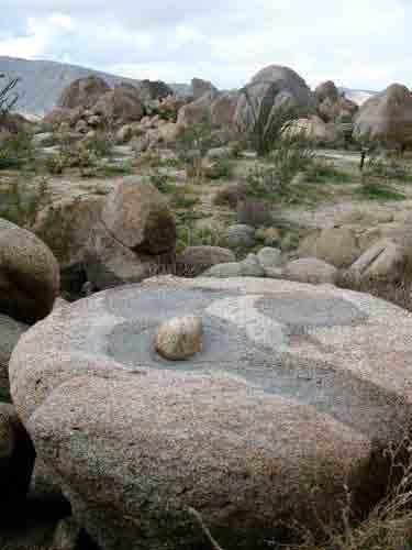
Examples of grinding tools in the San Diego. County. archaeological record, 7000 years ago to present
 Examples grinding tools in the San Diego County archaeological record, 7000 years ago to present Over 17,000 sites in San Diego County rinding acorns, Santa Ysabel, 1967. From Hedges and Beresford 1986.
Figure 1. Random orientation of crystal grains in an igneous rock, granite.
 ES088 The Earth s Crust: Rocks Earth system forensics might well start with a disciplined look at materials and how they are formed. When you are given a piece of rock, it is important to remember that
Bristol Dry Lake Calcium-Gypsum-Anhydrite-Halite Deposit, Bristol Mountains, San Bernardino County, California
 Bristol Dry Lake Calcium-Gypsum-Anhydrite-Halite Deposit, Bristol Mountains, San Bernardino County, California Gregg Wilkerson 2017 Acknowledgement and Disclaimer The information in this paper is taken
Pee Dee Explorer. Science Standards
 Science Standards About Pee Dee Explorer What does it mean when someone says they are from the "Pee Dee" of South Carolina? A place is bigger than its physical geography. A "sense of place" weaves together
LESSONS LEARNED FROM MINING-INFLUENCED WATERS STUDIES AT THE NEW MEXICO BUREAU OF GEOLOGY AND MINERAL RESOURCES
 LESSONS LEARNED FROM MINING-INFLUENCED WATERS STUDIES AT THE NEW MEXICO BUREAU OF GEOLOGY AND MINERAL RESOURCES Virginia T. McLemore New Mexico Bureau of Geology and Mineral Resources New Mexico Institute
CHAPTER 4. Blue Heron Site (47Je1001) 2003 Investigations. By Chrisie L. Hunter
 2003 Investigations. By Chrisie L. Hunter") CHAPTER 4 Blue Heron Site (47Je1001) 2003 Investigations By Chrisie L. Hunter Introduction The Blue Heron site (47Je1001) is on the property of the Crescent Bay Hunt Club, which is located in the NE 1/4
CHAPTER 4 Blue Heron Site (47Je1001) 2003 Investigations By Chrisie L. Hunter Introduction The Blue Heron site (47Je1001) is on the property of the Crescent Bay Hunt Club, which is located in the NE 1/4
Inferring Geological Environments from Cultural Artifacts Part 1: Cultural Halls at the American Museum of Natural History
 GEOL 640: Geology through Global Arts and Artifacts Inferring Geological Environments from Cultural Artifacts Part 1: Cultural Halls at the American Museum of Natural History People are reliant on their
THE STRUCTURE AND THICKNESS OF THE CLINTON AND BEREA FORMATIONS IN THE VICINITY OF WOOSTER, OHIO
 THE STRUCTURE AND THICKNESS OF THE CLINTON AND BEREA FORMATIONS IN THE VICINITY OF WOOSTER, OHIO KARL VER STEEG College of Wooster INTRODUCTION AND ACKNOWLEDGMENTS The data used in the construction of
Paa oatsa Hunuvi (Water Bottle Canyon) A Traditional Cultural Property
 A Traditional Cultural Property") Paa oatsa Hunuvi (Water Bottle Canyon) A Traditional Cultural Property Presented by Richard Stoffle University of Arizona At Great Basin Conference Las Vegas, Nevada October 19, 2006 1 Purpose of the talk
Paa oatsa Hunuvi (Water Bottle Canyon) A Traditional Cultural Property Presented by Richard Stoffle University of Arizona At Great Basin Conference Las Vegas, Nevada October 19, 2006 1 Purpose of the talk
Weathering and Soil Formation. Chapter 10
 Weathering and Soil Formation Chapter 10 Old and New Mountains The Appalachian Mountains appear very different from the Sierra Mountains. The Appalachians are smaller, rounded, gently sloping, and covered
CHEMICAL AND PETROGRAPHICAL CHARACTERISTICS OF POTTERY FRAGMENTS FROM THE NEOLITHIC AND CHALCOLITHIC SITE BULGARCHEVO, BLAGOEVGRAD REGION
 Geoarchaeology and Archaeomineralogy (Eds. R. I. Kostov, B. Gaydarska, M. Gurova). 2008. Proceedings of the International Conference, 29-30 October 2008 Sofia, Publishing House St. Ivan Rilski, Sofia,
The Production of Sediment. Contents. Weathering. Chapters 1, 3
 The Production of Sediment Chapters 1, 3 Contents Weathering Physical, chemical, biogeochemical processes Rates Products Carbon cycle and global change Erosion/Soils Sediment Texture Weathering General
Appendix A Pottery Sample Descriptions Joseph M. Herbert
 Appendix A Pottery Sample Descriptions Joseph M. Herbert Each pottery specimen analyzed was selected on the basis of its potential to reveal information about taxonomic relationships, in addition to providing
Michigan s Geology and Groundwater
 Michigan s Geology and Groundwater Ralph J. Haefner Deputy Director U.S. Geological Survey Michigan-Ohio Water Science Center Lansing, Michigan Outline About the USGS Geology 101 Michigan s geology Bedrock
discussion of North America s physical features, including its landforms and bodies of
 Chapter 7 Natural Environments of North America Chapter 7 focuses on the natural environments of North America. The chapter opens with a discussion of North America s physical features, including its landforms
Lecture 5 Sedimentary rocks Recap+ continued. and Metamorphic rocks!
 Lecture 5 Sedimentary rocks Recap+ continued and Metamorphic rocks! Metamorphism Process that leads to changes in: Mineralogy Texture Sometimes chemical composition Metamorphic rocks are produced from
APPLICATION OF ELECTRICAL RESISTIVITY TOMOGRAPHY FOR SAND UNDERWATER EXTRACTION
 International Scientific Conference GEOBALCANICA 2018 APPLICATION OF ELECTRICAL RESISTIVITY TOMOGRAPHY FOR SAND UNDERWATER EXTRACTION Maya Grigorova Ivaylo Koprev University of Mining and Geology St. Ivan
The Degree of Standardisation in the An Sơn Ceramic Assemblage
 7 The Degree of Standardisation in the An Sơn Ceramic Assemblage Introduction: Methodology for the study of standardisation The level of standardisation within an assemblage of pottery is used as an indirect
 Page 1 of 9 Name: Base your answer to the question on the diagram below. The arrows show the direction in which sediment is being transported along the shoreline. A barrier beach has formed, creating a
Archaeological Monitoring Report
 Archaeological Monitoring Report High Lodge, Santon Downham SMR Nos. STN 067, STN 068 A REPORT ON THE ARCHAEOLOGCAL MONTORNG, 2002 Andrew Tester Field Team Suffolk C.C. Archaeological Service November
S6E5: we will investigate the scientific view of how the earth s surface is formed. b. Investigate the contribution of minerals to rock composition
 S6E5: we will investigate the scientific view of how the earth s surface is formed. b. Investigate the contribution of minerals to rock composition c. Classify rocks by their process of formation d. Describe
Soil. Soil in Our Environment
 Soil Soil in Our Environment What is soil? Or is it Dirt? Gold s father is dirt, yet it regards itself as noble. Yiddish Proverb Is it alive? Is it fragile? Formations of Soils How much time does it take
Acrefield Cottage, Winkfield Street, Maidens Green, Winkfield, Windsor, Berkshire
 Acrefield Cottage, Winkfield Street, Maidens Green, Winkfield, Windsor, Berkshire An Archaeological Watching Brief For Mr and Mrs Elia by Pamela Jenkins Thames Valley Archaeological Services Ltd Site Code
Chapter 6, Part Colonizers arriving in North America found extremely landscapes. It looked different to region showing great.
 Social Studies 9 Unit 1 Worksheet Chapter 6, Part 1. 1. Colonizers arriving in North America found extremely landscapes. It looked different to region showing great. 2. The Earth is years old and is composed
Kansas Archaeology Month
 Activities for Discovering Prehistoric Trails TIME: 45 min. Kansas Archaeology Month Discovering Prehistoric Trails This lesson is divided into four sections: instructional goals, advanced preparation,
Thames Valley University, Kings Road, Reading, Berkshire
 Thames Valley University, Kings Road, Reading, Berkshire An Archaeological Evaluation for Thames Valley University by Danielle Milbank and Steve Ford Thames Valley Archaeological Services Ltd Site Code
I can classify objects by two of their properties. I can classify objects or events in sequential order.
 I can classify objects by two of their properties (attributes). S.C. Science 3-1.1 I can classify objects or events in sequential order. S.C. Science 3-1.2 I can generate questions such as what if? or
The Geology of Sebago Lake State Park
 Maine Geologic Facts and Localities September, 2002 43 55 17.46 N, 70 34 13.07 W Text by Robert Johnston, Department of Agriculture, Conservation & Forestry 1 Map by Robert Johnston Introduction Sebago
ROCK CLASSIFICATION AND IDENTIFICATION
 Name: Miramar College Grade: GEOL 101 - Physical Geology Laboratory SEDIMENTARY ROCK CLASSIFICATION AND IDENTIFICATION PRELAB SECTION To be completed before labs starts: I. Introduction & Purpose: The
ADVENTURES IN WATER DEVELOPED BY LOUISVILLE WATER COMPANY
 ADVENTURES IN WATER DEVELOPED BY LOUISVILLE WATER COMPANY Tunneling for Water explains the science behind a first-of-its-kind project in the world! Louisville Water Company is the first water utility
Lab Exercise 3: Geology, Soils and Archaeological Site Settings of Rift Valleys
 Name: Lab Exercise 3: Geology, Soils and Archaeological Site Settings of Rift Valleys Objectives: Grading The objectives of this lab are to: 1. To reinforce through exercises the sedimentary and stratigraphic
Barbuda Historical Ecology Project Assessment for Qualitative Field Analysis of Phosphates on Barbuda
 Barbuda Historical Ecology Project 2009 Assessment for Qualitative Field Analysis of Phosphates on Barbuda Cory Look Anthropology Department Brooklyn College and CUNY Graduate Center CLook@gc.cuny.edu
Anza-Borrego Desert State Park (SP), with
, with") RECENT ARCHAEOLOGICAL INVESTIGATIONS IN CALIFORNIA STATE PARKS: A SYMPOSIUM DEDICATED TO FRITZ RIDDELL, LEE MOTZ, AND NORM WILSON 163 ABORIGINAL SETTLEMENT IN MINE WASH AND ITS ROLE IN LOCAL PREHISTORY,
RECENT ARCHAEOLOGICAL INVESTIGATIONS IN CALIFORNIA STATE PARKS: A SYMPOSIUM DEDICATED TO FRITZ RIDDELL, LEE MOTZ, AND NORM WILSON 163 ABORIGINAL SETTLEMENT IN MINE WASH AND ITS ROLE IN LOCAL PREHISTORY,
THE TWO MOST SIGNIFICANT ARCHEOLOGICAL SITES IN KERR COUNTY, TEXAS ARE THE GATLIN SITE AND THE BEARING SINK HOLE SITE.
 WHAT ARE THE MOST IMPORTANT ARCHEOLOGY SITES IN KERR COUNTY? By Steve Stoutamire THE TWO MOST SIGNIFICANT ARCHEOLOGICAL SITES IN KERR COUNTY, TEXAS ARE THE GATLIN SITE AND THE BEARING SINK HOLE SITE. Map
The Protection of Ecosystem Services in the US- Mexico Border
 The Protection of Ecosystem Services in the US- Mexico Border Lina Ojeda-Revah El Colegio de la Frontera Norte Christopher Brown New Mexico State University ACES 2010 Annual Meeting Gila River Indian Community
ENGINEER S CERTIFICATION OF FAULT AREA DEMONSTRATION (40 CFR )
") PLATTE RIVER POWER AUTHORITY RAWHIDE ENERGY STATION BOTTOM ASH TRANSFER (BAT) IMPOUNDMENTS LARIMER COUNTY, CO ENGINEER S CERTIFICATION OF FAULT AREA DEMONSTRATION (40 CFR 257.62) FOR COAL COMBUSTION RESIDUALS
PLATTE RIVER POWER AUTHORITY RAWHIDE ENERGY STATION BOTTOM ASH TRANSFER (BAT) IMPOUNDMENTS LARIMER COUNTY, CO ENGINEER S CERTIFICATION OF FAULT AREA DEMONSTRATION (40 CFR 257.62) FOR COAL COMBUSTION RESIDUALS
Plan of Development Mountain Valley Pipeline Project. APPENDIX P Plan for Unanticipated Discovery of Paleontological Resources
 APPENDIX P Plan for Unanticipated Discovery of Paleontological Resources Appendix P Plan for Unanticipated Discovery of Paleontological Resources Prepared by: TABLE OF CONTENTS 1.0 INTRODUCTION... 1 1.1
The Upper Palaeolithic of North China Chaisi Locality 7701
 The Upper Palaeolithic of North China Chaisi Locality 7701 Tang Chung Centre for Chinese Archaeology and Art The Chinese University of Hong Kong 1 LOCATION The site of Chaisi is located at the bank of
Starting at Rock Bottom: A Peculiar Central Texas PreClovis Culture
 Starting at Rock Bottom: A Peculiar Central Texas PreClovis Culture Background Brushy Creek grades, overall, west-northwest (WNW) to east-southeast (ESE) through the easternmost portions of the central