Best practice in strategic noise mapping
|
|
|
- Dina Holt
- 5 years ago
- Views:
Transcription


1 Best practice in strategic noise mapping August 2013
2 REPORT BEST PRACTICE IN STRATEGIC NOISE MAPPING Final Report, 28 August 2013 This report was drawn up by the subgroup END noise mapping of the CEDR Project Group Road Noise 2: Jesús Rubio Alférez (ES) subgroup leader Ms Barbara Vanhooreweder (BE-FL) Fernando Segués (ES) Arto Kärkkäinen (FI) Ms Efterpi Giannopoulou (GR) Ms Patrizia Bellucci (IT) With contribution from the following members CEDR Project Group Road Noise 2: Klaus Gspan and Christof Rehling (AT) Ms Elena Sophocleous (CY) Wolfram Bartolomaeus (DE) Jakob Fryd (DK) Villu Lükk (EE) Marc Di Martino and Emmanuel Le Duc (FR) Vincent O'Malley (IE) Guntis Graveris (LV) Wiebe Alberts (NL) chairman Nico Faber (NL) secretariat Michiel Roebben (NL) secretariat Ms Ingunn Milford (NO) Jacek Wojtowicz (PL) Kjell Strömmer (SE) Edited and published by: CEDR s Secretariat General Disclosure: This document expresses solely the current view of CEDR. Readers should not regard these views as a statement of the official position of CEDR s Member States.
3 Project Group Road Noise 2 Page 3/36 Executive summary On the 25th June 2002, Directive 2002/49/EC of the European Parliament and Council (Environmental Noise Directive (END)), was adopted. This was a significant step forward in developing EU noise policy. The purpose of the END Directive is to define a common approach intended to avoid, prevent or reduce on a prioritised basis the harmful effects, including annoyance, due to the exposure to environmental noise. Environmental noise is a significant environmental problem across the EU. As stated in the report from the Commission to the European Parliament and the Council (COM ), traffic-related noise may account for over one million healthy years of life lost annually in EU Member States and other Western European countries. Noise pollution has, besides negative health effects, economic costs. The social costs of traffic, rail and road noise across the EU were recently estimated to amount to EUR 40 billion a year, of which 90 % is related to passenger cars and heavy goods vehicles. Member States have a number of obligations under the END. One of these is to undertake strategic noise mapping for major roads every five years. First round of strategic mapping was carried out in 2007, and the second round is to be completed by June The estimated costs for strategic noise mapping presented in this current report vary between EUR 0.33 to EUR 1.16 per inhabitant, and despite the improvements of comparability of strategic noise maps, the situation is far from ideal. Aware of the need to share experiences obtained from the first round of strategic noise mapping, CEDR Project Group Road Noise 2 created a subgroup with the aim of collecting information about mapping procedures, difficulties encountered and decisions taken during the first round, and to make recommendations based on best practices used by the different National Road Authorities (NRAs). This subgroup conducted a survey to ascertain directly exactly the work carried out by each road administration. Replies from 19 road administrations were received and based on the responses received the existence of many difficulties in making maps was evident. The time and cost invested in producing maps was quantified, confirming the existence of a large spread between different member states. An important requirement for strategic noise maps is that they have to be reliable, clear and comparable, and they should be of a consistent quality. In an effort to achieve this goal, this report provides recommendations on a range of issues such as the input data used, the modelling processes, and the presentation and dissemination of the mapping results. The recommendations are based on NRAs actual experiences in undertaking strategic noise mapping. Specific analysis and some examples have been described in order to develop and refine the recommendations. It is hoped that these recommendations will prove useful in preparing procedures for a common approach to strategic noise mapping, and to generate resource savings in the work of the NRAs without compromising the quality of the final output.
4 Project Group Road Noise 2 Page 4/36 TABLE OF CONTENTS Executive summary... 3 TABLE OF CONTENTS Noise mapping according to the EU Environmental Noise Directive (END) Objectives of the subgroup END Noise Mapping Literature review CEDR survey on END noise mapping General information Results Issues in first and second round of END noise mapping Conclusions Recommendations Introduction Recommendations: input data Recommendations: calculation process and noise maps results Internal and synergic actions to reduce cost in noise mapping. Coordination between Administrations Issues related to the second and third round of the END Annex 1: Relevant literature on noise mapping Annex 2: Interesting websites List of figures and tables Figure 1 Singular elements: big junctions, tunnels, viaducts Figure 2 Noise mapping calculation methods distribution among MS Figure 3 Noise mapping calculation software packages distribution among MS Figure 4 Mapping cost per kilometre Figure 5 Mapping calculation time Figure 6 Façade map...18 Figure 7 Proposed common colours example Figure 8 Different accuracy of the digital terrain models used in Finland Table 1 Questions and answers provided by MS for special elements... 9 Table 2 Questions and answers provided by MS for population data... 9 Table 3 Kilometres road network that has been noise mapped in the first round Table 4 Number of reflections Table 5 Grid size inside and outside urban areas Table 6 Calculation time...16 Table 7 Colour code proposal... 23
5 Project Group Road Noise 2 Page 5/36 1 Noise mapping according to the EU Environmental Noise Directive (END) In June 2002, the European Parliament adopted Directive 2002/49/EC relating to the assessment and management of environmental noise. The aim of this Directive was to define a common approach intended to avoid, prevent or reduce on a prioritised basis the harmful effects, including annoyance, due to exposure to environmental noise. To that end the following actions were implemented: - the determination of exposure to environmental noise, through noise mapping, by methods of assessment common to the Member States; - ensuring that information on environmental noise and its effects is made available to the public; - adoption of action plans by the Member States, based upon noise-mapping results, with a view to preventing and reducing environmental noise where necessary and particularly where exposure levels can induce harmful effects on human health and to preserving environmental noise quality where it is good. All Member States transposed the END into their national legislation before July As for the END noise mapping by the National Road Authorities (NRAs), no later than 30 June 2007, Member States had to make their first strategic noise maps for all major roads. Also Member States had to adopt the measures necessary to ensure that no later than 30 June 2012, and thereafter every five years, strategic noise maps will be made for all major roads within their territories. A strategic noise map is the presentation of data on one of the following aspects: - a noise situation in terms of the noise indicators L den and L night ; - the exceeding of a limit value; - the estimated number of dwellings that are exposed to specific values of a noise indicator; - the estimated number of people exposed to noise. Strategic noise mapping will be used as a source of information for citizens and as a basis for the END action plans. It will be used to provide the European Commission of data on the number of dwellings and people exposed to noise from traffic on major roads for instance.
6 Project Group Road Noise 2 Page 6/36 2 Objectives of the subgroup END Noise Mapping Road traffic noise is a sensitive issue when it comes to developing, upgrading, and maintaining national road networks in Europe. It is for this reason that the Conference of European Directors of Roads (CEDR) included the task 'to reduce road traffic noise' in their Strategic Plan. The main objective was to facilitate knowledge sharing on noise management and abatement issues among European National Road Authorities (NRAs). Following this objective, a report was published in 2010 containing the findings of a survey undertaken in The primary aim of this report was to promote knowledge sharing on noise abatement and practical management of noise-related issues between the NRAs, in order to adopt a more advanced approach to the treatment of noise and noise abatement measures in Europe. Stemming from that it was anticipated that people who live in close proximity to road networks and are impacted by noise, would benefit from such improved innovations. The second Strategic Plan (SP2) published by CEDR also included Road Noise as a primary task. The new CEDR Project Group Road Noise focussed on four relevant topics for NRAs: noise mapping, action planning, tyre/vehicle noise and the European noise model. As many subgroups were formed within the CEDR Project Group Road Noise 2 to analyse the aforementioned matters. The subgroup END noise mapping focused its activities on acquiring information to put the basis for a common noise mapping procedure to be developed according to the European Noise Directive. With this target in mind, the following objectives have been pursued: - collect information to identify mapping methods applied by NRAs; - document constraints and difficulties encountered in noise mapping the national road network; - provide recommendations to enhance noise mapping procedures. To achieve these objectives the subgroup END noise mapping analyzed the way the NRAs in Europe approached the first round of noise mapping in A review of relevant literature was undertaken in order to collect additional information (see chapter 3). A questionnaire among CEDR s NRAs was used to gather information relevant to strategic noise mapping (see chapter 4). The findings are summarized in terms of conclusions and recommendations (see chapter 5).
7 Project Group Road Noise 2 Page 7/36 3 Literature review In the past few years, many European working groups and experts have analyzed the different aspects relating to the implementation of the END. There are many publications addressing the approach and the criteria used to produce strategic noise maps. Primarily, they focus on difficulties in providing consistent results due to the lack of reliable input data and the development of a future European method to solve harmonization problems. Their work and publications have increased as the deadline for the second round of the END noise mapping approaches. Specific seminars have been held by DG Environment, WG-AEN, JRC, EEA, IHCP, Expert Panel on Noise (EPoN), etc., in addition to regular conferences in acoustics, on topics dealing with various aspects related to the achievement of accurate, clear and comparable maps. Methodological acoustic issues, difficulties with available basic data, timing, annoyance indicators, accuracy, public information, have been analysed. This external source of information is of great interest for CEDR MS, whose task is to carry out noise mapping. It provides all kind of proposals that can be applied in the second round of the END, in order to simplify the task of noise mapping for the NRAs. CEDR Project Group Road Noise 2 concentrated its efforts on optimizing mapping activities and simplifying data processing. A summary of the literature review dealing with strategic noise mapping is available in Annex 1. As a user of common European policies like the END, CEDR Project Group Road Noise has focused its interest on information that gives practical solutions and recommendations to ease future noise mapping activities. For this reason the summaries outlined in Annex 1 do not attempt to summarize the content of these documents, nor highlight the most absolute important items. Only those elements that were expected to be relevant to reach our goals are reported, such as practical suggestions or, problems encountered in finishing the first round of strategic noise mapping for major roads, so that recommendations useful to approach next noise mapping activities could be provided. All documents can be found online: Informacion.htm
8 Project Group Road Noise 2 Page 8/36 4 CEDR survey on END noise mapping 4.1 General information In recent years, several surveys on road noise and END noise mapping were undertaken. The results of the most recent survey are documented in the report from the European Commission to the European Parliament on the implementation of the Environmental Noise Directive (European Commission, 2011). Also the report Review of the implementation of Directive 2002/49/EC on Environmental Noise contains plenty of information about the key provisions of the END (Milieu, RPA & TNO, 2010). This report describes the main problems and difficulties experienced by member states and their competent authorities in implementing the key provisions of END. However, all these documents do not focus on the specific circumstances for major roads. Conscious of the need for more detailed information about the relevant aspects of the END noise mapping activities for major roads, the CEDR subgroup END noise mapping decided to undertake a new survey on this subject area and sent a questionnaire to the European National Roads Authorities in July The CEDR questionnaire contains administrative and technical questions dealing with crucial topics such as cost and processing time, quality and quantity of input data, modelling configuration and calculation procedures. The subgroup noise mapping received 19 responses from 18 (out of 24) CEDR member states (MS). In the following paragraphs the main results of this survey are discussed. 4.2 Results In this paragraph the results that emerged from the survey are outlined. The results were split in two parts, as a function of the context they belong to: input data and processing information Input Data * Digital terrain model The first question on input data dealt with type, resolution and accuracy of the cartography used to model the elements present in the environment to be noise mapped. Almost all MS have used a 3D digital terrain model with a scale varying from 1:4 000 to 1: The vertical accuracy of the digital terrain model was quite high: better than 2.5 m. As for the horizontal accuracy, 40 % of the respondents used very detailed data, with an accuracy better than 0.5 m, while the remaining 60 % settled for data with values better than 8 m. Digital terrain model data were collected in a corridor with a width of 200 m up to 6000 m. Many MS used a regional or national digital terrain model. * Traffic and speed data Traffic data were collected referring to a year included in a time span between 2003 and % of the respondents classified traffic data in different vehicle categories, ranging from two to five (one member state used 10 vehicle categories). Five MS had no different categories. Traffic data were assigned to road sections by road type in eight countries, by direction also in eight countries and with mixed methods in one country.
9 Project Group Road Noise 2 Page 9/36 Most of the countries used legal signposted speed data, instead of actual speeds. Actual speeds were collected only by three countries. * Pavement data The number of different pavements used to take rolling noise into account varies from one to eleven. However, about 40 % of the countries did not diversify pavement type in noise modelling and referred to standard pavement characteristics. * Building data As for buildings, different approaches were used depending on available data. In particular, 30 % of the respondents used 3D data and 15 % used 2D cartography with building heights; 40 % applied default building height, while the remaining countries acquired accurate data or estimated height from the number of storeys in a building. * Special elements (input as specific or independent items in the model) The survey also included questions on how MS mapped special elements such as viaducts, tunnels, junctions and noise barriers. The answers on this subject are reported in Table 1. Table 1 Questions and answers provided by MS for special elements Yes No n/a Are viaducts considered to be special elements? Are tunnels considered to be special elements? Are junctions considered to be special elements? Are noise barriers considered to be special elements? To define noise barriers, about 70 % of MS have completed the data extracted from digital terrain model with information coming from specific field inventories. * Population data Collecting and assigning population data to buildings is one of the most difficult tasks required by END. Many solutions were suggested by the Good practice Guide on noise mapping, depending on available data (population distribution on buildings floors, population by street number, population density, and so on). In Table 2 the answers given by the various member states on this matter are reported. Table 2 Questions and answers provided by MS for population data Yes No n/a Is population assigned to each building? Are all residents assigned to the most exposed façade? Are all residents evenly distributed on all façades? Did you assign residents to second residences, tourist buildings, empty houses and office buildings? In case of buildings that are exposed to noise from multiple roads, is the population occupying those buildings counted several times?
10 Project Group Road Noise 2 Page 10/36 About 75 % of the respondents tried to simplify the task assigning all residents to the most exposed façade, so providing an overestimate of people exposed to noise. The remaining 25 % of the respondents used a more detailed approach, evenly distributing people on all façades.

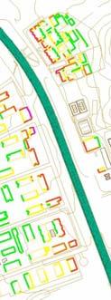
11 Project Group Road Noise 2 Page 11/36 Figure 1 Singular elements: big junctions, tunnels, viaducts
12 Project Group Road Noise 2 Page 12/36 * Meteorological data Meteorological data is another important issue that influences noise levels, especially in windy zones. Those data are usually locally difficult to retrieve, so as suggested by the Good Practice Guide it is advisable in many cases recurring to default values or national datasets. Responses from MS highlighted that only 10 % of the respondents used local meteorological data in noise mapping, 48 % made use of national meteorological datasets, 21 % used the default values reported in toolkit 17 of the Good Practice Guide, while the remaining 21 % used other methods. * Number of kilometres mapped MS were asked to undertake their first round END noise mapping for major roads which has more than six million vehicle passages a year. So the length of roads mapped differed significantly among MS, ranging from 11 km to km (see Table 3) Table 3 Kilometres road network that has been noise mapped in the first round Number of kilometres Number of MS < to to to to > n/a Calculation process * Calculation method A variety of calculation models were used during the first round of END. In total, nine different calculation methods were counted. The French NMPB-method was the most widely used calculation method with 8 out of 19 MS using it. NORD1996 and NORD2000 were used by Scandinavian countries (4 out 19), while Dutch RMW was applied by Belgium and the Netherlands. Ireland used the UK CRTN method while the other four MS had their own calculation method. Figure 2 shows the distribution of the different noise calculation models used by MS.

13 Project Group Road Noise 2 Page 13/36 Figure 2 Noise mapping calculation methods distribution among MS * Software packages for calculation methods The noise mapping calculation models chosen by MS were found to be implemented in different software packages. In total, seven different versions were used. SoundPLAN was the preferred software with six MS using it. Four MS undertook their calculations with CadnaA and two with IMMI and one with LIMA. Two MS used a combination of several software packages. The remaining three MS used their own software. Figure 3 shows the distribution of the different noise calculation software packages used by MS. Figure 3 Noise mapping calculation software packages distribution among MS
14 Project Group Road Noise 2 Page 14/36 * Outsourcing calculations Noise level calculations have been generally outsourced completely. Only 3 NRAs out of 19 mapped road noise levels in-house using either commercial software packages or their own software. * Costs Data on costs were distinguished in two classes: internal and external (outsourced work). 6 MS provided information on internal costs, and 11 on external. The highest internal cost was EUR , and the average cost was EUR Outsourced costs ranged from EUR 6500 for mapping 11 km to EUR for mapping km. If costs per kilometre are calculated, MS can be grouped in 3 categories: 20 % of the respondents have spent more than 1500 EUR/km, about 27 % between 500 and 800 EUR/km and the remaining 62 % less than 100 EUR/km. An approximate estimation of the average total costs per km mapped is EUR 604. Figure 4 Mapping cost per kilometre * Number of reflections The number of reflections used in calculations is a balance between accuracy and calculation time (and costs). Most MS undertook their calculations with one reflection. Table 4 Number of reflections Number of reflections Number of MS n/a 2 * Grid size In Table 5, the grid size inside and outside urban areas chosen by NRAs is shown. As can be seen, many MS used a grid size of 10 m inside urban areas. Outside urban areas grid size ranged mainly from 10 to 30 m. Only four NRAs used a different grid size inside and outside agglomerations, as suggested by The Good Practice Guide : a
15 Project Group Road Noise 2 Page 15/36 larger grid size for long road networks and extended inhabited areas and a smaller one for relatively short road stretches. Table 5 Grid size inside and outside urban areas Number of MS Grid size used Inside urban area Outside urban area < 10 m m to 30 m m 0 0 > 100 m 1 1 combination 2 2 n/a 2 2 * Receivers on façade Approximately 60 % of the MS who responded to this particular question used a narrow spatial frequency on building façades to assess noise levels at receivers. The common horizontal spacing among façade receivers applied by around 40 % of the respondents ranged between 3 and 5 m. Two MS used 10 m and one used 30 m. The remaining MS used a simplified approach with just one point per façade. * Reference height of 4 m All MS calculated noise levels at the reference height of 4 m. Four MS also calculated noise levels at different heights. Finland undertook calculations at 2.5 m heights in order to compare L Aeq day/night values to noise limits, to assess compliance with national regulations. Denmark calculated noise levels initially at a height of 1.5 m to take into account the noise exposure at single story residential buildings. For Austria calculations, heights of 2.4 m were also important. Switzerland started calculations at 1.5 m height and then at every 2.8 m. * Calculation time Calculation time depends on many factors: type of approach (more or less detailed), cartography resolution, building density, reflections number, width of the area to be mapped, calculation power of the system. So many different answers were expected for this question. The collected data showed that inside and outside agglomerations calculation time ranged from between 5 and 10 hours per 10 km of road, with a minimum of 0.34 h. As expected, the largest computation time was inside agglomerations (175 h), while outside agglomerations the maximum value was 50 h.
16 Project Group Road Noise 2 Page 16/36 Table 6 Calculation time Calculation time Number of MS (in hours per 10 km of major road) Inside urban area Outside urban area 1 h > 100 h 1 0 n/a 9 6 Figure 5 Mapping calculation time With respect to the total time taken for MS to map their respective road networks, including data preparation, computer modelling and calculation time, it took 34.4 weeks of work to map 35 kilometres of road as minimum and 900 weeks for a network containing 4799 kilometres as maximum (1 week of work equates to 1 person working for 1 week or 1 week of computer running). Nevertheless, it appears that there is no relationship between the time invested in undertaking the mapping and the number of kilometres mapped. Data on total time per kilometre show that two MS had spent more than a week of work per km, four MS between 0.2 and 0.5 weeks per kilometre and five MS less than 0.1 weeks/km. Based on reported data, it can be assumed that calculation time varies between weeks and 1.3 weeks per 10 kilometres. One respondent dedicated 1 week for calculating 3500 km and another required 20 weeks for only 750 km. Similar differences are found when comparing data collection and model preparation time. Differences can depend on building density, spread of urban areas, and surrounding terrain, but comparing the time spent in calculation, it can be concluded that technical criteria used for mapping related with accuracy and detail of input data and results were not the same.
17 Project Group Road Noise 2 Page 17/ Issues in first and second round of END noise mapping Based on the results provided by the respondents, it can be assumed that all CEDR MS experienced problems in collecting reliable input data. In particular, some MS reported that there was lack of and errors in data related to terrain, traffic and buildings with the result that some datasets were incomplete. Other MS cited problems with the collection of data related to geometrical and functional aspects of the propagation environment. Spain also referred to the use of meteorological conditions as a critical issue and added that managing the final data on noise levels and the number of people exposed was a serious problem. Switzerland and Ireland highlighted that determining building heights, walls and barriers, as particularly problematic. As for receiver noise exposure calculations, it was found that in most cases, it was impossible to associate population data to buildings with sufficient accuracy. Reliable data, in terms of quantity and distribution among buildings, were not available in many cases. Greece and Italy used the most recent census data, however, that referred to the year 2001 because the census in these respective countries is undertaken every 10 years. Also, the lack of experience in calculating noise maps on such a large scale was never tested, so errors in the results from the calculation process were expected, however, the nature of such errors was unknown. Italy, like other countries having their own legislation, cited the problem of double mapping with different noise indicators in order to make sound pressure levels comparable to their national noise limits and discriminate critical areas. That was found to be time consuming and quite costly. Belgium too used two methods to calculate the amount of people and dwellings exposed to noise. The first approach put all people and dwellings at the most exposed façade (overestimate), while the second one distributed people and dwellings on all façades, resulting in different outputs, as expected. Also Finland found it difficult to assign inhabitants to noise buildings. The timescale to produce noise maps was also highlighted as a problem by many respondents including the lack of public and political awareness, which was raised by the Dutch Road Administration. Some MS highlighted as a problem, the lack of guidelines or clear information on noise mapping methodologies, underlining that when guidelines were finally produced, there was not enough time to fulfil the mapping tasks. Unclear definitions of some elements included in the END, such as agglomerations, acoustical characteristics like absorption/reflection on buildings etc., were also highlighted. Finally, many MS cited the lack of national guidelines, with the exception of Spain, Finland, Austria, Switzerland, Italy, Denmark and Ireland. In conclusion, all CEDR MS encountered similar problems, albeit with different degrees of significance. The expectations for the second round of END noise mapping generally seem to be good. Some of the problems encountered in the first round of the END have already been or partially resolved. Most of the MS commenced the second round of mapping in The number of kilometres of roads to be noise mapped in the second END round varies from country to country. Due to the definition for major roads in the second round, roads which have more than three million vehicle passages a year, the total

18 Project Group Road Noise 2 Page 18/36 length will increase. More than 3000 km are expected to be mapped by many countries. As for roads having more than 6 million vehicles passages per year, that have been mapped in the first round, no specific methodologies to update maps are reported. It was noticed that 5 out of 19 of the respondents will change their computation method. 10 out of 19 MS have already set the time line for tendering the work to be outsourced. Different views were cited about the time needed to noise map the enlarged road network. Many respondents pointed out that the second round will take more time while Austria and the Netherlands feel that the second round will be less time consuming. However, it was generally asserted that the second round will be completed by June Conclusions The survey results have highlighted that different resources, both in terms of cost and time, have been required by MS for the provision of noise maps complying with the END. These differences are not only due to diverse road network lengths, but also to a different interpretation of the Directive. The adoption of common calculation methods and procedures would probably narrow the range of cost and time. Furthermore, a quality system for defining input and output data accuracy, as well as model configuration would be necessary to achieve homogeneous results with similar ratios of cost and time. Some shared decisions could be taken even before the final version of the new European common method CNOSSOS-EU will be published, such as the elimination of noise façade maps; the use of homogeneous meteorological conditions instead of favourable conditions and the restriction to only one reflection in calculations. Figure 6 Façade map
19 Project Group Road Noise 2 Page 19/36 5 Recommendations 5.1 Introduction This chapter aims to highlight those aspects of strategic noise mapping procedures that have presented major difficulties in the first round of the implementation of the END. It focuses on issues that are of great relevance for CEDR NRAs in order to fulfil their task in END noise mapping. During the first round, NRAs have taken all kind of decisions that had a dramatic impact on noise mapping costs, time to produce the maps and the accuracy of the final results. These decisions also affected the comparability of the output of END noise mapping at a European level. CEDR member states have in general approached the noise mapping process with a different perspective, depending on consistency and accuracy of input data. Their national methods have shown to differ in technical requirements. This had significant effect on the outcome of noise calculations and assessment procedures of population exposure. The availability of traffic, population and geographical data imposed conditions on the process of noise mapping. Some countries have used many default input data and a simple definition of roads, terrain, buildings and exposed population, while others have implemented more detailed procedures. In the near future, noise calculation procedures will be harmonised thanks to the introduction and the use of the new European model CNOSSOS-EU. The introduction of CNOSSOS-EU will also include a user s guide with recommendations on data quality and accuracy. However, it seems reasonable that institutions responsible for noise mapping still provide their own views and suggestions coming from their past experience, and taking into account not only technical problems, but also actual administrative and economic constraints. A balance should be found between the effort required in producing noise maps and the quality of the results in terms of their accuracy and comparability. Therefore, a series of recommendations are provided. These recommendations are based on NRAs experiences in undertaking the first round of noise mapping and they are also based on information received from external sources. It is anticipated that the use of these recommendations should simplify the noise mapping process in the next round of END noise mapping for the CEDR NRAs. 5.2 Recommendations: input data * digital terrain model (DTM) The digital terrain model to be used in noise mapping must be accurate and updated to the reference year. It must include all the major roads noise sources present in the area and the surfaces and objects influencing noise propagation from traffic on these roads (building, noise barriers, walls, bridges, etc.). However, it should be noted that too detailed information could increase calculation time, so a compromise between accuracy and calculation time should be found. A good compromise could be DTM based on 5 x 5 m grid, corresponding approximately to the specifications reported for digital terrain model in the Good Practice Guide, Group C. For such a group, an uncertainty ranging from 1 to 3 db is estimated and these results are considered to
20 Project Group Road Noise 2 Page 20/36 have a good quality for noise mapping. Recent evidence (second round of mapping) has shown that aerial LiDAR (Light Detection And Ranging) can be used to generate the digital terrain model for a reasonable cost, however, a compromise must again be struck between the detail of the contour data and the ability of the noise modelling software to handle such data. * traffic and speed data Traffic data should be related to the reference year. For practical reasons, noise mapping needs to be started well in advance with respect to the deadlines fixed by END so traffic data could be predicted or updated, if real data are available, using traffic models. Despite the fact that CNOSSOS-EU is going to recommend five vehicle categories (light, heavy 1, heavy 2, motorcycles and an open category), it could, in many cases, be very expensive to collate such detailed information. As for vehicle speeds, it is recommended to use legal speed limits related to light and heavy vehicles respectively, if they differ. * pavement data With regard to road pavements, a discussion about open categories in which each country would use their own pavement data is still ongoing. It is envisaged that common categories, in which each country could adapt their national categories with the possibility of adding new or special ones would be preferable. The dispersion of number of pavements used in the first round of the END suggests that national categories should be maintained for the second round. * building data Building definition should include height and number of floors. * special elements (input as specific or independent items in the model) It is recommended that large junctions (grade separated interchanges), as well as tunnels and viaducts, would be considered as special elements. Care should be taken when assessing their acoustical characteristics as input parameters. * noise barrier data Noise barriers must be included in the noise model with their correct intrinsic and extrinsic parameters, such as sound absorption and geometrical figures. When intrinsic characteristics are not known, average values, usually available in noise modelling software packages, can be used. * population data Each building should have the population assigned in GIS. Assignment of population inside the buildings depends mainly on the input data, and recommendations recently prepared by CNOSSOS-EU should be enough to guarantee accuracy and avoid overestimating population exposure. * meteorological data In many member states, local meteorological data are not available. The use of default values as suggested by the Good Practice Guide could lead to noise levels that are 3 or more db higher than average noise levels. In order to avoid overestimation of noise levels, average meteorological conditions should be applied instead of favourable conditions.
21 Project Group Road Noise 2 Page 21/ Recommendations: calculation process and noise maps results With regard to the calculation process, survey s results show clearly that two different approaches have been used by CEDR MS to noise map their respective road networks: a strategic approach, with more simplified parameters, and an advanced approach based on detailed data and a detailed calculation process. The difference was found mainly in the number of reflections, grid size and calculation of noise levels at receiver façades. These differences may explain the varying costs reported by the various member states. In the following paragraphs some recommendations on calculation configuration and parameters can be found. * calculation method As for the calculation method, it seems advisable to continue with the noise model used for the first round of the END until the common European assessment method CNOSSOS-EU is available. * software calculation method Any software package complying with END specifications can be used. * number of reflections Only one reflection is necessary to guarantee sufficient noise map accuracy for strategic noise mapping purposes. * calculation grid size The calculation grid size defines the detail level of noise maps. Narrowing the grid size improves the accuracy of the maps, but at higher costs, in terms of calculation time, hardware and human resources. The calculation time when using 5x5 m grids is estimated to more than double than when using a 10x10 m grid. In a Norwegian example, using the Nord2000 method, the time needed when using a 5x5 grid is 125 % greater, and the effect of the more accurate calculation grid is minimal. Based on responses given by respondents to the questionnaire, it seems reasonable to recommend a grid size of 10 m inside an urban area and 25 m outside agglomerations. * receivers on façade The number of people exposed to noise was calculated by CEDR MS in two ways: (1) indirectly from noise contours, assigning to buildings the noise levels corresponding to the noise band in which buildings resides, or (2) directly calculating sound pressure levels at receivers with a horizontal spacing ranging from 3 m to 10 m. As two thirds of the NRAs have calculated noise levels at receivers this is recommended as the correct way to estimate incident noise level at façade as stipulated by END Directive. * reference height of 4 m Almost all MS carried out their calculations at the reference height of 4 m, except Switzerland that fixed a height of 4.3 m. However, it is important not to overlook the fact that some buildings are one-storey houses, and if the building is lower than 4 m it will not have receivers assigned in its façades. To avoid this, it is recommended to use a minimum height of 4 m for one-storey houses.
22 Project Group Road Noise 2 Page 22/36 In accordance with END for strategic purposes, the total population is placed at a 4 m height level. However, for other purposes, as for definition of some noise control measures, different calculation heights will be necessary to correctly determine the noise impact affecting buildings that have more than one storey. * calculation time Calculation time depends on the resources available: hardware, software, data and human resources. To limit calculation time, it is suggested to comply with the recommendations reported in this chapter on grid size, number of reflections and cartographic resolution. To speed up calculations, tiling of the areas to be noise mapped and parallel calculation process is recommended. As an indication, a time ranging from 5 to 10 hours per 10 km of road is necessary on average. * last noise contour Based on CEDR MS responses, it has been seen that the distance from the road of the noise contour L den 55 db ranges from 500 m up to 1000 m. Seven countries have this noise contour at a distance of more than 1000 m and only one country has it at a distance of between 250 and 500 m. According to END, the mapping area is defined by the noise contour 55 db L den. This contour determines the extent of the input data required and the population potentially exposed to noise should be determined. Calculated noise levels at extended distances from the source have a very high degree of uncertainty and usually provide a miscalculation of the noise levels at receivers. It is therefore advisable to check the validation of the calculation, especially when the last contour is located more than 1000 m from the road axis. * exposed population When presenting data on noise exposed population for major roads, the European Commission requested figures for exposed people living outside agglomerations. However, most NRAs have used in public information the total number of exposed population both inside and outside agglomerations. This different approach has produced some confusion in the first round, so it is recommended to point out clearly which population has been considered when providing data of people exposed to noise coming from traffic on major roads, and explaining that these two sources may present different figures due to this reason. * colour proposal END does not fix a range of colours to be used in noise maps, so different approaches were applied by NRAs in the first round of the END. In order to make noise maps comparable and more readable, it seems advisable to fix a colour palette for the next round of END noise mapping. A common colour chart is proposed by CEDR Project Group Road Noise 2 in the Report Factsheets Colour proposal END noise mapping.
23 Project Group Road Noise 2 Page 23/36 Table 7 Colour code proposal Noise band [db] Colour RGB code HEX code Name less than 35 none and more R: 35 G: 132 B: 67 R: 120 G: 198 B: 121 R: 194 G: 230 B: 153 R: 255 G: 255 B: 178 R: 254 G: 204 B: 92 R: 252 G: 141 B: 60 R: 255 G: 9 B: 9 R: 179 G: 6 B: 34 R: 103 G: 3 B: 59 R: 28 G: 0 B: 84 # Moderate sea green #78C679 Greyish green #C2E699 Light greyish chartreuse green #FFFFB2 Pale yellow #FECC5C Light brilliant amber #FD8D3C Brilliant tangelo #FF0909 Light brilliant red #B30622 Moderate amaranth #67033B Dark rose #1C0054 Deep blue violet

24 Project Group Road Noise 2 Page 24/36 Figure 7 Proposed common colours example

25 Project Group Road Noise 2 Page 25/ Internal and synergic actions to reduce cost in noise mapping. Coordination between Administrations. Costs reduction of noise mapping is a significant challenge for NRAs. Coordinating efforts with other administrations may be helpful. Some Member States must also prepare noise maps for the major railways which have more than train passages per year. In order to reduce costs for the calculation of noise maps, a possible option is to work together with other administrations responsible for the preparation of noise maps for other sources such as railways, airports or other roads (e.g. railway agencies, agglomerations).the input data sets that are not specific for a particular source, e.g. digital terrain model, building data, population data or land use in some cases can be used for mapping different noise sources. So the costs for the collection of the data and preparation of the input model can be shared. Using higher quality terrain models within short distances from the road, may have a significant impact on the costs of noise mapping. In Finland laser scanned material has been used for second round mapping within 500 m on both sides of the road, outside this area 3D map data is used. Based on the Finnish experience, limiting the size of the digital terrain model saved costs in two ways: the terrain model is cheaper and the noise mapping time is shorter. Figure 8 Different accuracy of the digital terrain models used in Finland
26 Project Group Road Noise 2 Page 26/36 Substantial reductions in costs are expected in the third round, in which updating the data will be done starting from input data prepared in the second round. 5.5 Issues related to the second and third round of the END Maps should be adequate for the purpose to which they will be used. For this reason, there is a need for two different types of maps: strategic maps and more detailed local noise maps. Strategic noise maps are descriptive. They should be reliable and comparable with strategic maps from other administrations, all over Europe. A common procedure is required in sufficient detail to allow homogeneous formats and understandable data and figures. More detailed noise maps are, instead, intended to be used to specify, develop and discuss concrete actions to mitigate noise along major roads. It is anticipated that in the next round of END, the European Commission intends to propose the collection of data on people exposed to noise bands lower than those established in the END: L den db and L night db. Even if it is not mandatory, this will likely be perceived as strongly recommended. This decision has important consequences, not only increasing efforts, time and cost in the mapping process, but also in the process of providing information to the public. It also seems quite unreasonable to give the impression to European citizens that such a low noise level can be achieved in close proximity to major roads. This has the potential to divert attention away from issues that are attainable. To calculate such low levels, it would be necessary to map areas up to 2 km either side of a road. Calculations at such distances from the source have a very poor accuracy leading to inaccurate sound pressure levels and the number of people exposed to noise. Most calculation methods have a validation distance that is limited to less than 1000 metres. Also, the increase in computation time and costs of the mapping process would be very significant. Due to the expanded mapping, increased resources would be necessary in order to collate input data, cartography data, demographic information and building properties. It is common opinion among the members of CEDR Project Group Road Noise 2 that this would be too challenging, from both technical and costs perspective. Furthermore, a common quality control system is also needed in order to check the reliability of the output data before a CEDR NRA reports their figures to their national competent authority. In their factsheet Anomalous data of END noise mapping for major roads on the website of the European Environment Agency CEDR Project Group Road Noise 2 has formulated several recommendations. As for the quality control system, it is recommended that the NRA should assess the quality of their data by using variables like household size, residential density and distance of noise contours, before they report their END data to the competent authority. Only when the output of these calculations is within the range of what one would expect, the accuracy is assured. The Environmental Noise Directive requires preparing strategic noise maps every five years. The first round, finished in 2007 was predominantly experimental, both at national and European level. The second round, to be finished in 2012, is going to be undertaken by the NRAs with the same methodologies and it will cover more than km of European national roads. In the second round some administrations are going to simplify what has been done in the first one, benefiting from the previous experience.
27 Project Group Road Noise 2 Page 27/36 For noise mapping events after 2012, it is anticipated that the new harmonised noise mapping methodology known as CNOSSOS-EU will be used. It will start with a period in which both CNOSSOS-EU and national methods have to be compared. A number of different technical, methodological and legal issues will initially have to be resolved before the use of CNOSSOS-EU will be common practice. It is expected that noise levels resulting from the new calculation model could somewhat differ from those estimated with the previously adopted methods, so care should be taken in this phase, especially when noise levels have legal implications. After solving these problems, in 2017, a common mapping procedure could be established. CNOSSOS-EU is more than just a common European method for noise mapping. During the process of developing CNOSSOS-EU, a significant number of decisions were made to solve acoustic topics. The future Good Practice Guide on CNOSSOS-EU will be essential to explain the details of the new calculation model. The future simplified method for strategic noise mapping is considered now to be mandatory, assuming that local maps will take into account different national needs. The experience of the groups of European experts should come close to the experience of the NRAs responsible for the maps, and specifically take into consideration the difficulties found in the first round of the END in order to simplify data processing and optimize mapping activities, with the final objective of achieving reliable, understandable and useful strategic noise maps. As a consequence, not only the NRAs will benefit from this approach, but also people living in close proximity to major European roads. All NRAs should closely monitor or actively participate (trough relevant channels in their country) in the development of the proposed new calculation methodology (CNOSSOS-EU)
GIS-BASED VISUALISATION OF TRAFFIC NOISE
 Proceedings of the 9 th International Conference on Environmental Science and Technology Rhodes island, Greece, 1 3 September 2005 GIS-BASED VISUALISATION OF TRAFFIC NOISE A. KONSTANTINIDIS 1, K. EVANGELIDIS
Noise Maps, Report & Statistics, Dublin City Council Noise Mapping Project Roads and Traffic Department
 Noise Maps, Report & Statistics, Dublin City Council Noise Mapping Project Roads and Traffic Department Produced by Traffic Noise & Air Quality Unit November 2007 Contact: brian.mcmanus@dublincity.ie Ph;
INSPIRE in the context of EC Directive 2002/49/EC on Environmental Noise
 INSPIRE in the context of EC Directive 2002/49/EC on Environmental Noise Simon Shilton Acustica Ltd, United Kingdom Nigel Jones Extrium Ltd, United Kingdom About the Authors www.acustica.co.uk Acoustics
Directive on the Assessment and Management of Environmental Noise
 Directive on the Assessment and Management of Environmental Noise This Directive has been ratified by the European Parliament and is awaiting publication in the Official Journal.( around 23/5/02) The Directive
"Transport statistics" MEETING OF THE WORKING GROUP ON RAIL TRANSPORT STATISTICS. Luxembourg, 25 and 26 June Bech Building.
 Document: Original: Rail/2007/9/EN English "Transport statistics" MEETING OF THE WORKING GROUP ON RAIL TRANSPORT STATISTICS Luxembourg, 25 and 26 June 2007 Bech Building Room BECH Ampere Beginning 10:00
Comparing railway noise prediction results for passenger trains using various models
 Comparing railway noise prediction results for passenger trains using various models M. Reiter and B. Kostek Gdansk University of Technology, Multimedia Systems Department, 11/12 Gabriela Narutowicza Street,
PPDAC Worked Example Noise mapping
 PPDAC Worked Example Noise mapping This document provides a simplified worked example of the application of the PPDAC methodology discussed in Chapter 3 of Geospatial Analysis A comprehensive guide : P:
Implementation of Directive 2002/49/EC in EU Candidate State: Experience in Croatian noise mapping projects
 Implementation of Directive 2002/49/EC in EU Candidate State: Experience in Croatian noise mapping projects Alan Brodarski institute, HR-10 000 Zagreb, Ave. V. Holjevca 20, alan.stimac@zg.t-com.hr The
Status of implementation of the INSPIRE Directive 2016 Country Fiches. COUNTRY FICHE Netherlands
 Status of implementation of the INSPIRE Directive 2016 Country Fiches COUNTRY FICHE Netherlands Introduction... 1 1. State of Play... 2 1.1 Coordination... 2 1.2 Functioning and coordination of the infrastructure...
ON NOISE MAPPING AND ACTION PLANS IN PORTUGAL
 23 rd International Congress on Sound & Vibration Athens, Greece 0- July 206 ICSV23 ON NOISE MAPPING AND ACTION PLANS IN PORTUGAL José Luis Bento Coelho and Diogo Alarcão Group of Acoustics and Noise Control,
From Strategic Noise Maps to Action Plan: perspective of Spanish Main Roads
 María a Dolores Jiménez Jesús s Rubio Fernando Segués Pilar Fernández ndez General Directorate of Roads General Directorate of Roads CEDEX TECNALIA LABEIN 1 STRATEGIC NOISE MAPS 2 nd phase: year 2.012
Status of implementation of the INSPIRE Directive 2016 Country Fiches. COUNTRY FICHE France
 Status of implementation of the INSPIRE Directive 2016 Country Fiches COUNTRY FICHE France Introduction... 1 1. State of Play... 2 1.1 Coordination... 2 1.2 Functioning and coordination of the infrastructure...
Compact guides GISCO. Geographic information system of the Commission
 Compact guides GISCO Geographic information system of the Commission What is GISCO? GISCO, the Geographic Information System of the COmmission, is a permanent service of Eurostat that fulfils the requirements
Status of implementation of the INSPIRE Directive 2016 Country Fiches. COUNTRY FICHE Czech Republic
 Status of implementation of the INSPIRE Directive 2016 Country Fiches COUNTRY FICHE Czech Republic Introduction... 1 1. State of Play... 2 1.1 Coordination... 2 1.2 Functioning and coordination of the
Guidance Note for Strategic Noise Mapping. Environmental Noise Regulations 2006
 Guidance Note for Strategic Noise Mapping For the Environmental Noise Regulations 2006 July 2009 ENVIRONMENTAL PROTECTION AGENCY An Ghníomhaireacht um Chaomhnú Comhshaoil PO Box 3000, Johnstown Castle,
Progress of UN-GGIM: Europe Working Group A on Core Data
 INSPIRE KEN 13 December 2016 Progress of UN-GGIM: Europe Working Group A on Core Data François Chirié, Dominique Laurent, IGN France Plan Introduction Objectives of the working group with respect to INSPIRE
Progress of UN-GGIM: Europe Working Group A on Core Data
 PolicyKEN Budapest 29 November 2016 Progress of UN-GGIM: Europe Working Group A on Core Data François Chirié, Dominique Laurent, IGNF Core data context Background and purpose Aim of Work Group A to propose
Land Use and Land cover statistics (LUCAS)
") EUROPEAN COMMISSION EUROSTAT Directorate E: Sectoral and regional statistics Doc. ENV/DIMESA/7.1/2012 Original in EN Agenda point 7.1 Land Use and Land cover statistics (LUCAS) DIMESA Directors' Meeting
EUROPEAN COMMISSION EUROSTAT Directorate E: Sectoral and regional statistics Doc. ENV/DIMESA/7.1/2012 Original in EN Agenda point 7.1 Land Use and Land cover statistics (LUCAS) DIMESA Directors' Meeting
Use of the ISO Quality standards at the NMCAs Results from questionnaires taken in 2004 and 2011
 Use of the ISO 19100 Quality standards at the NMCAs Results from questionnaires taken in 2004 and 2011 Eurogeographics Quality Knowledge Exchange Network Reference: History Version Author Date Comments
Status of implementation of the INSPIRE Directive 2016 Country Fiches. COUNTRY FICHE Italy
 Status of implementation of the INSPIRE Directive 2016 Country Fiches COUNTRY FICHE Italy Introduction... 1 1. State of Play... 2 1.1 Coordination... 2 1.2 Functioning and coordination of the infrastructure...
Typical information required from the data collection can be grouped into four categories, enumerated as below.
 Chapter 6 Data Collection 6.1 Overview The four-stage modeling, an important tool for forecasting future demand and performance of a transportation system, was developed for evaluating large-scale infrastructure
The Milan agglomeration Strategic Noise Map
 Edinburgh, Scotland EURONOISE 2009 October 26-28 The Milan agglomeration Strategic Noise Map Giovanni Zambon a Simone Radaelli b Università degli Studi di Milano-Bicocca, Dipartimento di Scienze dell Ambiente
Land Cover and Land Use Diversity Indicators in LUCAS 2009 data
 Land Cover and Land Use Diversity Indicators in LUCAS 2009 data A. Palmieri, L. Martino, P. Dominici and M. Kasanko Abstract Landscape diversity and changes are connected to land cover and land use. The
Data Collection. Lecture Notes in Transportation Systems Engineering. Prof. Tom V. Mathew. 1 Overview 1
 Data Collection Lecture Notes in Transportation Systems Engineering Prof. Tom V. Mathew Contents 1 Overview 1 2 Survey design 2 2.1 Information needed................................. 2 2.2 Study area.....................................
19 th INTERNATIONAL CONGRESS ON ACOUSTICS MADRID, 2-7 SEPTEMBER 2007 LARGE SCALE NOISE MAPPING IN ALPINE VALLEYS WITH MITHRA-SIG
 19 th INTERNATIONAL CONGRESS ON ACOUSTICS MADRID, 2-7 SEPTEMBER 2007 LARGE SCALE NOISE MAPPING IN ALPINE VALLEYS WITH MITHRA-SIG PACS: 4.50.Rq Baulac, Marine 1 ; Defrance, Jérôme 1 ; Olny, Xavier 2 ; Miège,
Status of implementation of the INSPIRE Directive 2016 Country Fiches. COUNTRY FICHE Ireland
 Status of implementation of the INSPIRE Directive 2016 Country Fiches COUNTRY FICHE Ireland Introduction... 1 1. State of Play... 2 1.1 Coordination... 2 1.2 Functioning and coordination of the infrastructure...
Road Noise Management Tool: Mapping Action Areas classified by acoustical and non-acoustical priority criteria
 Edinburgh, Scotland EURONOISE 2009 October 26-28 Road Noise Management Tool: Mapping Action Areas classified by acoustical and non-acoustical priority criteria Pilar Fernández Alcalá a Jose Luis Eguiguren
Status of implementation of the INSPIRE Directive 2016 Country Fiches. COUNTRY FICHE Malta
 Status of implementation of the INSPIRE Directive 2016 Country Fiches COUNTRY FICHE Malta Introduction... 1 1. State of Play... 2 1.1 Coordination... 2 1.2 Functioning and coordination of the infrastructure...
Refinement of the OECD regional typology: Economic Performance of Remote Rural Regions
 [Preliminary draft April 2010] Refinement of the OECD regional typology: Economic Performance of Remote Rural Regions by Lewis Dijkstra* and Vicente Ruiz** Abstract To account for differences among rural
Natura 2000 and spatial planning. Executive summary
 Natura 2000 and spatial planning Executive summary DISCLAIMER The information and views set out in this study are those of the author(s) and do not necessarily reflect the official opinion of the Commission.
2.- Area of built-up land
 2.- Area of built-up land Key message Over recent decades, built-up areas have been steadily increasing all over Europe. In Western European countries, built-up areas have been increasing faster than the
Economic and Social Council
 United Nations Economic and Social Council Distr.: General 30 August 2012 Original: English Economic Commission for Europe Inland Transport Committee Working Party on Rail Transport Sixty-sixth session
Digitization in a Census
 Topics Connectivity of Geographic Data Sketch Maps Data Organization and Geodatabases Managing a Digitization Project Quality and Control Topology Metadata 1 Topics (continued) Interactive Selection Snapping
Economic and Social Council 2 July 2015
 ADVANCE UNEDITED VERSION UNITED NATIONS E/C.20/2015/11/Add.1 Economic and Social Council 2 July 2015 Committee of Experts on Global Geospatial Information Management Fifth session New York, 5-7 August
Status of implementation of the INSPIRE Directive 2016 Country Fiches. COUNTRY FICHE Croatia
 Status of implementation of the INSPIRE Directive 2016 Country Fiches COUNTRY FICHE Croatia Introduction... 1 1. State of Play... 2 1.1 Coordination... 2 1.2 Functioning and coordination of the infrastructure...
Status of implementation of the INSPIRE Directive 2016 Country Fiches. COUNTRY FICHE Finland
 Status of implementation of the INSPIRE Directive 2016 Country Fiches COUNTRY FICHE Finland Introduction... 1 1. State of Play... 2 1.1 Coordination... 2 1.2 Functioning and coordination of the infrastructure...
Derogation Criteria for the Requirements for Generators Network Code
 Derogation Criteria for the Requirements for Generators Network Code Decision Paper Reference: CER/17/084 Date Published: 13/04/2017 Closing Date: 0 Executive Summary Commission Regulation (EU) 2016/631
REGIONAL SDI DEVELOPMENT
 REGIONAL SDI DEVELOPMENT Abbas Rajabifard 1 and Ian P. Williamson 2 1 Deputy Director and Senior Research Fellow Email: abbas.r@unimelb.edu.au 2 Director, Professor of Surveying and Land Information, Email:
PART A Project summary
 PART A Project summary A.1 Project identification Project title Project acronym Name of the lead partner organisation in English Specific objective Demonstrattion AF DAF Partner 1.1. Improving innovation
1. Demand for property on the coast
 1. Demand for property on the coast Key message Irrespective of density and location, population in Europe in general tends to concentrate in coastal areas. Detailed spatial elaboration of processes shows
The Swedish National Geodata Strategy and the Geodata Project
 The Swedish National Geodata Strategy and the Geodata Project Ewa Rannestig, Head of NSDI Co-ordination Unit, Lantmäteriet, ewa.rannstig@lm.se Ulf Sandgren, Project Manager Geodata Project, Lantmäteriet,
Bathing water results 2011 Slovakia
 Bathing water results Slovakia 1. Reporting and assessment This report gives a general overview of water in Slovakia for the season. Slovakia has reported under the Directive 2006/7/EC since 2008. When
Figure 10. Travel time accessibility for heavy trucks
 Figure 10. Travel time accessibility for heavy trucks Heavy truck travel time from Rotterdam to each European cities respecting the prescribed speed in France on the different networks - Road, motorway
GIS FOR MAZOWSZE REGION - GENERAL OUTLINE
 GIS FOR MAZOWSZE REGION - GENERAL OUTLINE S. Bialousz 1), K Mączewski 2), E. Janczar 2), K. Osinska-Skotak 1) 1) Warsaw University of Technology, Warsaw, Poland 2) Office of the Surveyor of the Mazowieckie
Geological information for Europe : Towards a pan-european Geological Data Infrastructure
 Geological information for Europe : Towards a pan-european Geological Data Infrastructure Integrating geoscientific information for EU competitiveness Co-funded by the European Union European societal
The Combination of Geospatial Data with Statistical Data for SDG Indicators
 Session x: Sustainable Development Goals, SDG indicators The Combination of Geospatial Data with Statistical Data for SDG Indicators Pier-Giorgio Zaccheddu Fabio Volpe 5-8 December2018, Nairobi IAEG SDG
Economic and Social Council
 United Nations Economic and Social Council Distr.: General 2 July 2012 E/C.20/2012/10/Add.1 Original: English Committee of Experts on Global Geospatial Information Management Second session New York, 13-15
The Governance of Land Use
 The planning system The Governance of Land Use United Kingdom Levels of government and their responsibilities The United Kingdom is a unitary state with three devolved governments in Northern Ireland,
Economic and Social Council
 United Nations Economic and Social Council Distr.: General 18 July 2016 Original: English Committee of Experts on Global Geospatial Information Management Sixth session New York, 3-5 August 2016 Item 2
Possibilities of third parties in real estate management in the light of the INSPIRE Directive
 Possibilities of third parties in real estate management in the light of the INSPIRE Directive Faculty of Mining Surveying and Environmental Engineering Department of Geomatics Barcelona, Spain, 29 September
Nosie mapping in the service of developments
 Nosie mapping in the service of developments Szabolcs SILLO 1 and Pal Dr. BITE 2 1 Vibrocomp Ltd., Hungary 2 Vibrocomp Ltd., Hungary ABSTRACT Often noise mapping remains an untapped asset and the colorful
Bathing water results 2011 Latvia
 Bathing water results 2011 Latvia 1. Reporting and assessment This report gives a general overview of water in Latvia for the 2011 season. Latvia has reported under the Directive 2006/7/EC since 2008.
Economic and Social Council
 United Nation E/C.20/2012/4/Add.1 Economic and Social Council Distr.: General 2 July 2012 Original: English Committee of Experts on Global Geospatial Information Management Second session New York, 13-15
The Group of Representative Bodies (GRB) Position Paper on the EC Expert Group on the Technical Pillar of the 4th Railway Package Topics
 Position Paper on the EC Expert Group on the Technical Pillar of the 4th Railway Package Topics") The Group of Representative Bodies (GRB) Position Paper on the EC Expert Group on the Technical Pillar of the 4th Railway Package Topics Brussels, 15.03.2017 1 P a g e Scope of this GRB position paper
The Group of Representative Bodies (GRB) Position Paper on the EC Expert Group on the Technical Pillar of the 4th Railway Package Topics Brussels, 15.03.2017 1 P a g e Scope of this GRB position paper
44º CONGRESO ESPAÑOL DE ACÚSTICA ENCUENTRO IBÉRICO DE ACÚSTICA EAA EUROPEAN SYMPOSIUM ON ENVIRONMENTAL ACOUSTICS AND NOISE MAPPING
 NOISE MAPS FOR ENVIRONMENTAL SOUND MANAGEMENT AND PACS: 43.50.Rq PLANNING J. Luis Bento Coelho; Diogo Alarcão Instituto Superior Técnico, Universidade de Lisboa Av. Rovisco Pais 10049-001 Lisbon Portugal
Environmental Analysis, Chapter 4 Consequences, and Mitigation
 Environmental Analysis, Chapter 4 4.17 Environmental Justice This section summarizes the potential impacts described in Chapter 3, Transportation Impacts and Mitigation, and other sections of Chapter 4,
Airport Noise Action Planning Data Pack
 www.gov.uk/defra Airport Noise Action Planning Data Pack Norwich Airport (EGSH) July 2013 Crown copyright 2013 You may re-use this information (not including logos) free of charge in any format or medium,
ACCESSIBILITY TO SERVICES IN REGIONS AND CITIES: MEASURES AND POLICIES NOTE FOR THE WPTI WORKSHOP, 18 JUNE 2013
 ACCESSIBILITY TO SERVICES IN REGIONS AND CITIES: MEASURES AND POLICIES NOTE FOR THE WPTI WORKSHOP, 18 JUNE 2013 1. Significant differences in the access to basic and advanced services, such as transport,
THE SEVILLE STRATEGY ON BIOSPHERE RESERVES
 THE SEVILLE STRATEGY ON BIOSPHERE RESERVES 1 VISION FOR BIOSPHERE RESERVES IN THE 21 ST CENTURY The international Seville Conference on Biosphere Reserves, organised by UNESCO, adopted a two-pronged approach,
RETA 6422: Mainstreaming Environment for Poverty Reduction Category 2 Subproject
 RETA 6422: Mainstreaming Environment for Poverty Reduction Category 2 Subproject A. Basic Data 1. Subproject Title: Poverty-Environment Mapping to Support Decision Making 2. Country Director: Adrian Ruthenberg
The Infrastructure for Spatial Information in the European Community vs. regional SDI: the shortest way for reaching economic and social development
 The Infrastructure for Spatial Information in the European Community vs. regional SDI: the shortest way for reaching economic and social development Mauro Salvemini EUROGI PRESIDENT Professor at Sapienza
Establishment of Space Weather Information Service
 Establishment of Space Weather Information Service For International Air Navigation Raul Romero Technical Officer MET ICAO Headquarters, Montreal NAM/CAR/SAM Seminar on Space Weather and ICAO Weather Information
Marine/Maritime Spatial Planning Andrej Abramić
 Marine/Maritime Spatial Planning Andrej Abramić EcoAqua SUMMER SCHOOL: Ecosystem approach to aquaculture 26-29th of October 2015 Research and Technology to enhance excellence in Aquaculture development
NOISE PREDICTION, CALCULATION AND MAPPING USING SPECIALIZED SOFTWARE
 Journal of Engineering Studies and Research Volume 21 (2015) No. 3 59 NOISE PREDICTION, CALCULATION AND MAPPING USING SPECIALIZED SOFTWARE ALINA PETROVICI 1, CLAUDIA TOMOZEI 1, RICARDO GEY FLORES 2, FLORIN
On the declaration of the measurement uncertainty of airborne sound insulation of noise barriers
 On the declaration of the measurement uncertainty of airborne sound insulation of noise barriers Massimo Garai and Paolo Guidorzi 2,2 University of Bologna - DIN Viale Risorgimento 2, 036 Bologna, Italy
European Regional and Urban Statistics
 European Regional and Urban Statistics Dr. Berthold Feldmann berthold.feldmann@ec.europa.eu Eurostat Structure of the talk Regional statistics in the EU The tasks of Eurostat Regional statistics Urban
SDI Development in Georgia. Mari Khardziani Head of International Relations Unit National Agency of Public Registry
 SDI Development in Georgia Mari Khardziani Head of International Relations Unit National Agency of Public Registry Kehl, Germany September 5, 2017 2 National Agency of Public Registry Legal Entity of Public
[N492] Using GIS in Noise exposure analysis
![[N492] Using GIS in Noise exposure analysis](/thumbs/73/68973727.jpg "[N492] Using GIS in Noise exposure analysis") The 32nd International Congress and Exposition on Noise Control Engineering Jeju International Convention Center, Seogwipo, Korea, August 25-28, 2003 [N492] Using GIS in Noise exposure analysis Author:
The 32nd International Congress and Exposition on Noise Control Engineering Jeju International Convention Center, Seogwipo, Korea, August 25-28, 2003 [N492] Using GIS in Noise exposure analysis Author:
Common geographies for dissemination of SDG Indicators
 5 th High Level Forum on United Nations GGIM, Mexico 2017 Common geographies for dissemination of SDG Indicators Understanding statistical and geodetic division of territory Janusz Dygaszewicz Central
The Governance of Land Use
 The planning system Levels of government and their responsibilities The Governance of Land Use COUNTRY FACT SHEET NORWAY Norway is a unitary state with three levels of government; the national level, 19
The Governance of Land Use
 The Governance of Land Use Country fact sheet Austria The planning system Levels of government and their responsibilities Austria is a federal state with three levels of government; the national level,
SWEDISH SDI DEVELOPMENT & IMPLEMENTATION OF INSPIRE
 SWEDISH SDI DEVELOPMENT & IMPLEMENTATION OF INSPIRE Christina Wasström, Lantmäteriet, 801 82 Gävle, Sweden, christina.wasstrom@lm.se ABSTRACT The Swedish Government and Parliament has given Lantmäteriet
Status of implementation of the INSPIRE Directive 2016 Country Fiches. COUNTRY FICHE Estonia
 Status of implementation of the INSPIRE Directive 2016 Country Fiches COUNTRY FICHE Estonia Introduction... 1 1. State of Play... 2 1.1 Coordination... 2 1.2 Functioning and coordination of the infrastructure...
How proximity to a city influences the performance of rural regions by Lewis Dijkstra and Hugo Poelman
 n 01/2008 Regional Focus A series of short papers on regional research and indicators produced by the Directorate-General for Regional Policy Remote Rural Regions How proximity to a city influences the
SECTION D Monitoring plan as required in Annex VII of Directive 2001/18/EC
 SECTION D Monitoring plan as required in Annex VII of Directive 2001/18/EC Type of monitoring plan The monitoring plan described in the submission is based on general surveillance. We believe this is a
Infrastructure for Spatial Information in Europe (INSPIRE)
") Infrastructure for Spatial Information in Europe (INSPIRE) 2011 GISCO Working Party 8-9.3.2012 INSPIRE is about improving access to spatial information: the environment doesn t stop at borders EU Geoportal
Infrastructure for Spatial Information in Europe (INSPIRE) 2011 GISCO Working Party 8-9.3.2012 INSPIRE is about improving access to spatial information: the environment doesn t stop at borders EU Geoportal
INSPIRE Basics. Vlado Cetl European Commission Joint Research Centre. https://ec.europa.eu/jrc/
 INSPIRE Basics Vlado Cetl European Commission Joint Research Centre https://ec.europa.eu/jrc/ Serving society Stimulating innovation Supporting legislation Outline SDI? Why European SDI? INSPIRE Policy
ACCURACY AND PRECISION IN TRAFFIC NOISE PREDICTION
 ACCURACY AND PRECISION IN TRAFFIC NOISE PREDICTION Wolfgang Probst DataKustik GmbH, Greifenberg, Germany wolfgang.probst@datakustik.de Abstract Traffic is the main source responsible for unacceptable exposure
Assessing spatial distribution and variability of destinations in inner-city Sydney from travel diary and smartphone location data
 Assessing spatial distribution and variability of destinations in inner-city Sydney from travel diary and smartphone location data Richard B. Ellison 1, Adrian B. Ellison 1 and Stephen P. Greaves 1 1 Institute
The impact of the open geographical data follow up study Agency for Data Supply and Efficiency
 www.pwc.dk The impact of the open geographical data follow up study Agency for Data Supply and Efficiency March 17th 2017 Management summary In recent years, interest in releasing public-sector data has
8 th Arctic Regional Hydrographic Commission Meeting September 2018, Longyearbyen, Svalbard Norway
 8 th Arctic Regional Hydrographic Commission Meeting 11-13 September 2018, Longyearbyen, Svalbard Norway Status Report of the Arctic Regional Marine Spatial Data Infrastructures Working Group (ARMSDIWG)
Acoucité, Soundscape and Noise Observatory of Greater Lyon, FRANCE. Urban area of Nice Côte d Azur, FRANCE. Ecology department of Greater Lyon, FRANCE
 An Urban Noise Observatory: Scientific, Technical, Strategic and Political Challenges; A Systemic Complementary Approach to the New Requirements of the European Directives Bruno Vincent 1, Arnaud Cristini
APPLYING THE END FOR LOMBARDY S AIRPORTS
 APPLYING THE END FOR LOMBARDY S AIRPORTS Angela Alberici, Maurizio Bassanino, Paolo Deforza, Nadia Fibbiani, Paola Maggi, Mauro Mussin, Valeria Spirolazzi ARPA Lombardia Via Francesco Restelli 3\1, 20124,
IMPLEMENTATION OF THE EU NOISE DIRECTIVE IN PROCESS OF URBAN PLANNING IN POLAND
 IMPLEMENTATION OF THE EU NOISE DIRECTIVE IN PROCESS OF URBAN PLANNING IN POLAND J. Kwiecień a, *, K. Szopińska a a Dept. of Geomatics, Geodesy and Spatial Economy, University of Technology and Life Sciences,
EARTH OBSERVATION FOR ENVIRONMENTAL AND HEALTH IMPACT ASSESSMENT A METHODOLOGY WITH SYNERGIES FOR EUROPEAN POLICIES
 EARTH OBSERVATION FOR ENVIRONMENTAL AND HEALTH IMPACT ASSESSMENT A METHODOLOGY WITH SYNERGIES FOR EUROPEAN POLICIES Andreas N. Skouloudis (1), David G. Rickerby (2), Peter Pärt (3) (1) European Commission,
Variance estimation on SILC based indicators
 Variance estimation on SILC based indicators Emilio Di Meglio Eurostat emilio.di-meglio@ec.europa.eu Guillaume Osier STATEC guillaume.osier@statec.etat.lu 3rd EU-LFS/EU-SILC European User Conference 1
Proposal for a DIRECTIVE OF THE EUROPEAN PARLIAMENT AND OF THE COUNCIL. establishing an infrastructure for spatial information in the Community
 Proposal for a DIRECTIVE OF THE EUROPEAN PARLIAMENT AND OF THE COUNCIL establishing an infrastructure for spatial information in the Community INSPIRE http://inspire.jrc.it/ Alessandro Annoni 1 EU Commission
GIS ADMINISTRATOR / WEB DEVELOPER EVANSVILLE-VANDERBURGH COUNTY AREA PLAN COMMISSION
 GIS ADMINISTRATOR / WEB DEVELOPER EVANSVILLE-VANDERBURGH COUNTY AREA PLAN COMMISSION SALARY RANGE INITIATION $43,277 SIX MONTHS $45,367 POSITION GRADE PAT VI The Evansville-Vanderburgh County Area Plan
Navigable maritime and river waterways in the seaside - Danube Delta area and the connected rural development
 SUMMARY OF Ph-D Thesis, with title RESEARCH STUDIES ON MANAGEMENT IMPROVEMENT OF MARITIME AND RIVER TRANSPORT ACTIVITY IN THE COASTAL AND DANUBE DELTA AREA FROM AN ENVIROMENTAL, ECONOMIC AND SOCIAL PERSPECTIVE
Use of administrative registers for strengthening the geostatistical framework of the Census of Agriculture in Mexico
 Use of administrative registers for strengthening the geostatistical framework of the Census of Agriculture in Mexico Susana Pérez INEGI, Dirección de Censos y Encuestas Agropecuarias. Avenida José María
LUCAS 2009 (Land Use / Cover Area Frame Survey)
") EUROPEAN COMMISSION EUROSTAT Directorate E: Sectoral and regional statistics Unit E-1: Farms, agro-environment and rural development LUCAS 2009 (Land Use / Cover Area Frame Survey) M3 - Non sampling error
EUROPEAN COMMISSION EUROSTAT Directorate E: Sectoral and regional statistics Unit E-1: Farms, agro-environment and rural development LUCAS 2009 (Land Use / Cover Area Frame Survey) M3 - Non sampling error
PUBLIC WEATHER SERVICES
 WMO AGENDA ITEM 2.1(1) PUBLIC WEATHER SERVICES Gerald Fleming Chair, OPAG/PWS (Paraguay 8-12 September 2014) WMO - Public Weather Services, WDS WMO Summary CBS requested to make decisions on: Adopt Draft
The National Spatial Strategy
 Purpose of this Consultation Paper This paper seeks the views of a wide range of bodies, interests and members of the public on the issues which the National Spatial Strategy should address. These views
GIS Geographical Information Systems. GIS Management
 GIS Geographical Information Systems GIS Management Difficulties on establishing a GIS Funding GIS Determining Project Standards Data Gathering Map Development Recruiting GIS Professionals Educating Staff
The Role of Urban Planning and Local SDI Development in a Spatially Enabled Government. Faisal Qureishi
 The Role of Urban Planning and Local SDI Development in a Spatially Enabled Government Faisal Qureishi 1 Introduction A continuous increase in world population combined with limited resources has lead
Adding value to Copernicus services with member states reference data
 www.eurogeographics.org Adding value to Copernicus services with member states reference data Neil Sutherland neil.sutherland@os.uk GIS in the EU 10 November 2016 Copyright 2016 EuroGeographics 61 member
Restoration efforts required for achieving the objectives of the Birds and Habitats Directives
 In association with Restoration efforts required for achieving the objectives of the Birds and Habitats Directives Database notes and guidelines Prepared for the European Commission DG ENV Contents 1.
Global Geospatial Information Management Country Report Finland. Submitted by Director General Jarmo Ratia, National Land Survey
 Global Geospatial Information Management Country Report Finland Submitted by Director General Jarmo Ratia, National Land Survey Global Geospatial Information Management Country Report Finland Background
Economic and Social Council
 United Nations Economic and Social Council Distr.: General 23 May 2012 Original: English E/CONF.101/100 Tenth United Nations Conference on the Standardization of Geographical Names New York, 31 July 9
Analys av GIS-användning inom offentlig sektor i Norden
 Analys av GIS-användning inom offentlig sektor i Norden Henning Sten Hansen, Line Hvingel and Lise Schrøder Aalborg Universitet Jönköping, Sweden 30 March 2011 Overview The Danish and Swedish approaches