Agenda. 09:00 10:30 Sesiuni workshop partea I. 10:30 10:45 Coffee break. 10:45 12:00 Sesiuni workshop partea II
|
|
|
- Christopher Barrett
- 5 years ago
- Views:
Transcription


1 Workshop Educatie


")

2 Agenda 09:00 10:30 Sesiuni workshop partea I 10:30 10:45 Coffee break 10:45 12:00 Sesiuni workshop partea II 12:00 13:30 Pauza 12:20 13:20 Prezentare Partneri (sala Pache Protopopescu) 13:30 15:00 Masa rotunda INSPIRE Workshop Educatie Track Tehnic
 Server (Baze de date) Web GIS (Servicii Distribuite) GIS este parte dintr-o platforma")
3 GIS Evolueaza Web GIS este Noua Architectura Este vorba despre partajarea datelor si accesul mai usor la resurese Desktop (Fisiere) Server (Baze de date) Web GIS (Servicii Distribuite) GIS este parte dintr-o platforma interconectata
4 Platforma Esri COTS s-a imbunatatit Web GIS O Platforma pentru Viitor... Bine Construita si Documentata
5 ArcGIS An Integrated Web GIS Platform Desktop Web Device Identity Security Portal Providing Mapping, Analysis, Data Management, and Collaboration Server Online Content and Services Available on the Open Web and On-Premises

6 Portal Web GIS Desktop Portal Online Continut Server Apps ArcGIS PRODUSE Un Sistem Integrat


 Instrumnete LAS ArcGIS")

7 Desktop GIS Profesional Urmeaza Apps Mai Multe Analize & 3D Vector Tiles Mobile Map Packages ArcMap ArcGIS Pro Nou si Imbunatatit Geoprocesare Modelare Spatiu -Timp Procesare imagini Metadate imbunatatite Licentiere concurenta ArcGIS Pro Desktop Web GIS (Online/Portal) Instrumnete LAS ArcGIS Pro Analize Lidar Capabilitati de Cartare, Vizualizare, Editare, si Analiza 2D/3D Integrat Pro... Simplificare


8 Server Enterprise Web GIS in Propria Infrastructura Nou si Imbunatatit Apps Utilizatori Portal ArcGIS Online Cartografia Scene 3D Web Analize Spatiale Azzure Suport puternic LINUX Geocodare Urmeaza Analize pe Big Data Utility Network GeoJSON Google Cloud Portal Distribuit Server Ofera Management Centralizat, Analiza, si Cartografie... Sustine Implementari pe Platforme On-Premises si Cloud


9 Online Web GIS Hostat Nou si Imbunatatit Apps Utilizatori Cartografie Metadate Administrarea Capabilitati de Printare Geocodare Urmeaza Cautare imbunatatita Analize Avansate Suport OGC imbunatatit Suport Bing Maps Capabilitati Online pentru Cartografie, Apps, si Continut Solutie SaaS Completa


10 Open Data Flux de Lucru Integrat pentru Partajarea Datelor Geospatiale si Tabelare NOU Portal Pentru Toate Datele Deschise Portal Open Data OpenData.ArcGIS.com Pentru Mii de Site-uri Open Data Permitand Partajarea Datelor Deschise


11 Apps ANDROID ios/mac WINDOWS BROWSER


12 Apps ArcGIS pentru Toata Lumea, Oricand si Oriunde Navigator Teren Workforce ArcGIS for AutoCAD Office Maps for Office Public Open Data Story Maps Explorer ArcGIS Earth Survey123 Collector Mobil (Conectat & Deconectat) Solutii Configurabile care Lucreaza Impreuna Dashboard Foto Crowdsourcing Usor, Dedicat, si Gata de Utilizare
 HTML5/JavaScript Apps Native Ofera Instrumente Configurabile, Usor de Utilizat Creezi Odata, Ruleaza")
13 App Builders Permit Crearea App Web App Templates Web AppBuilder AppStudio Widgets (Apple, Android, Windows, Linux) HTML5/JavaScript Apps Native Ofera Instrumente Configurabile, Usor de Utilizat Creezi Odata, Ruleaza Oriunde...


14 Continut Pentru Intreaga Lume Harta de Baza Imagini Demografie Utilizarea Terenului Mii de Harti si Layere Pregatite pentru Utilizare Oficiale Milioane de Contributori Miliarde de vizualizari per Saptamana


15 Sabloane Solutii Asigura Succesul Implementarii 500,000+ Descarcari Administatie Locala si Nationala Siguranta Publica si Situatii de Urgenta Apps, Harti, multe altele Pregatite pentru utilizare Cele mai bune practici Configurabile Parks and Gardens Utilitati si Comunicatii Armata si Securitate... Open Source, Gratuite


16 Sabloane Solutii Aplicatii Focusate pe Industrii Batimetrie Business Analyst Community Analyst Roads and Highways (LRS) Airports Harta Topo Geoportal Harti maritime GeoPlanner ArcPad Harti Aeronautice
 Imagery OLEDB DXF Hadoop CityGML DBMS COLLADA AIXM DWG DGN OneGeology INSPIRE FileGDB Shapefiles Extensible Architecture Open Software Interoperability Open-Source Integration Embeddable")
17 Platforma Deschisa Asigurand Interoperabilitatea Datelor si Platformei Standarde GML WCS KML WMS SQL CSW WFS OPENDAP SOAP WMTS IFC SLD NetCDF GeoPackage WPS LAS REST Formate Industrii WaterML Web Scene (I3S) Imagery OLEDB DXF Hadoop CityGML DBMS COLLADA AIXM DWG DGN OneGeology INSPIRE FileGDB Shapefiles Extensible Architecture Open Software Interoperability Open-Source Integration Embeddable Open APIs Open-Source Libraries Open Data


18 Securitate & Complianta Securitate Imbunatatita Esri Cloud Services ArcGIS Online Communicate Status & Best Practices Roluri customizabile SAML DISA STIG PKI Moderate Compliance Low Authorized Trust.ArcGIS.com

19 Road Map 10.3 Lansari Incrementale 10.4 Pro Pro Pro 1.0 Big data GeoAnalytics 3D Vector tiles Crowdsourcing Retele Utilitati Navigare avansata Analize web raster Real-time Localizare Modelare Pro Mobil UAV/Drone 2015 Imbunatatiri Online... Focus pe Calitate, Nevoile Utilizatorilor, si Inovatie

20 Sabloane Solutii

21 Educatie Initiative Esri pentru colaborare European SchoolNet ConnectED Initiative GIS Day Top 400 Universitati Geomenor ArcPress MOOC for GIS STEM learngis.maps.arcgis.com Punte de legatura intre mediul academic si industrii

22 Educatie Esri Ro Status Program Educational Universitati edu.esriro.ro Platforma de colaborare internship evenimente Concursuri online portal Mediatizare Social Media Newsletter Story map: Colaborare NGO Ovidiu Ro Turneu Educational workshopuri in Universitati Platforma ArcGIS 3D 4 ore WebGIS Mobile GIS Web GIS 700 participanti Scoli si Licee Scoala Altfel edu.esriro.ro/scoalaaltfel Ateliere de GIS pentru copii Gandirea spatiala 130 participanti Colaborare vizibilitate
23 Turneu educational 2015 Concluzii, statistici, feedback Workshop de GIS pentru studenti si profesori 12 astfel workshopuri in 6 luni 700 participanti Nr. nelimitat de participanti (media studenti per workshop) Laboratoare Spatiale noi in Universitati (USAMV Cluj, Bacau) si donatii software Universitati Workshop-uri GIS Turneu educational Obiective: Promovarea tehnologiile geospatiale si tendintelor in materie de tehnologie - cresterea nivelului de pregatire al viitorilor profesionisti GIS, in conformitate cu cerintele pietei muncii; Facilitarea unei punti de legatura intre sectorul academic (ceea ce ofera profesorii in materie de GIS) cerintele pietei (asteptarile angajatorilor de la specialistii GIS); Se dezbat teme de actualitate din domeniul GIS-ului si oportunitatile pe care le oferim pentru studenti si profesori; Comunitate de Geomentori sau de pasionati GIS care propaga un mesaj corect. edu.esriro.ro/turneueducational
24 Grafic Prezenta per Universitati Total: ~700 participanti
25 Ati mai folosit tehnologia GIS pana in prezent? Total: ~700 participanti 2% 18% Da Nu N/A 80%
26 Ati mai folosit tehnologia GIS pana in prezent? Total: ~700 participanti N/A (fara raspuns) NU DA
27 Ce produse Esri ati folosit? Predomina ArcGIS for Desktop/ArcGIS Online 4% 6% 4% 7% ArcGIS for Desktop ArcGIS Online ArcGIS for Mobile/ArcPad ArcGIS for Server 20% 59% Geoportal Server Altele
28 cum apreciati utilizarea aplicatiilor software ArcGIS in educatie? Pe o scara de la 1-5, unde 1 semnifica "inutila", iar 5 semnifica "foarte utila 1% 2% 13% Nota 1 Nota 2 Nota 3 84% Nota 4 Nota 5
29 In care dintre urmatoarele domenii de specialitate utilizati mai des aplicatiile ArcGIS?

30 Scoala Altfel edu.esriro.ro/scoalaaltfel... Ateliere de GIS pentru K12


31 GI-N2K gin2k.bigknowledge.net/bokwiki Corelarea Educatiei GI S&T cu cerintele actuale din piata muncii Actualizarea GI S&T BoK e-platform - Instrumente de explorare a cartii, definire a curriculei, oportunitati de instruire si cursur, definire a profilelor de job-uri
32 Ce urmeaza Alte initiative si Programe educationale Scoala de IT (26 sept 2015) GIS Day (18 nov 2015) Carti GIS O serie de webinarii Esri Romania realizate pe parcursul 2016 Proiecte R&D sau care sa vizeze GIS in Curricula Colaborare NGOs si industrii Poate Centru de Excelenta etc Asteptam initiative de colaborare cu Universitati si parteneri, in aceste directii

33


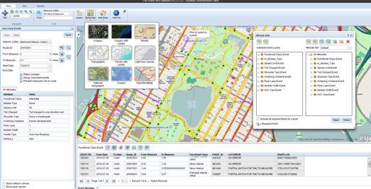
34 Demo 1 Web App Builder pentru crearea de aplicatii web ArcMap Model Builder Desktop Web AppBuilder Apps Collector 1 Pregatire resurse: harti, instrumente de geocodare, geoprocesare Widgets Web GIS (Online/Portal) 2 Partajarea resurselor in Portal. Configurarea Aplicatiei Web Survey123 3 Integrarea datelor din teren in aplicatia Web Crearea unei aplicatii Web ce va permite vizualizare, analiza si raportare la nivelul unui parc natural.

35 Demo 2 Story Maps cu scene Web 3D Desktop Web GIS (Online/Portal) Web App Templates, Story Maps, 3D ArcMap ArcGIS Pro 1 Pregatire resurse: harti, Scene 3D Busteni 2 Creare 3D Web Scene in ArcGIS Online 3 Creare Story Map Journal cu scene 3D Fiecare avem de impartasit idei si experiente. O harta face cat o mie de cuvinte...
36 Demo 3 Analiza Spatiala 2D si 3D cu ArcGIS Pro Desktop Web GIS City Engine ArcGIS Pro (Online/Portal) 1 Pregatire resurse: Analiza Spatiala 2D si 3D, editare 3D, gestionare 2 Partajarea hartii in ArcGIS Online Fiecare avem de impartasit idei si experiente. O harta face cat o mie de cuvinte...
37 Demo 4 App Studio for ArcGIS pentru crearea de aplicatii Mobile Crearea unui Map Tour Mobile App 1. Pregatirea unui Map Tour AppStudio 2. Configurare Mobile Story App - App Studio for ArcGIS (WEB) 3. Utilizarea aplicatie Mobile pe Smartphone Crearea unui Quick Report Mobile App 1. Pregatirea datelor pentru colectare 2. Configurare Mobile Quick Report App - App Studio for ArcGIS (Desktop) 3. Utilizarea aplicatie Mobile pe Smartphone Apps Native (Apple, Android, Windows, Linux) Scenariu: Crearea Mobile Story Map pentru turism si Mobile Quick Report App pentru inventarierea cladirilor cu risc seismic.
38 Q&A Colaborare
A Vision for ArcGIS Applying Geography Everywhere
 A Vision for ArcGIS Applying Geography Everywhere WELCOME PURPOSE A Network of GIS Professionals Are Awakening the World to the Power of Web GIS You Your WORK Making a Difference Your Work Open Maps and
The Platform Generation. Derek Law and Ebony Wicks
 The Platform Generation Derek Law and Ebony Wicks GIS Provides the Framework and Process For Applying Geography Analysis and Interpretation Design and Planning Creating Understanding Modeling and Predicting
Geo-Enabling Digital India. 15 th Esri India User Conference GIS and Smart Cities
 15 th Esri India User Conference 2014 GIS and Smart Cities 15 th Esri India User Conference 2014 GIS and Smart Cities Agendra Kumar President, Esri India Our World Is Facing Serious Challenges Our World
Managing and Analyzing Land Information
 ArcGIS Managing and Analyzing Land Information Tax Map Land Registration Predicting Vacancy Interagency Collaboration Cadastral Public Land Use Portal Russia Pennsylvania City of Philadelphia The Netherlands
ArcGIS is Advancing. Both Contributing and Integrating many new Innovations. IoT. Smart Mapping. Smart Devices Advanced Analytics
 ArcGIS is Advancing IoT Smart Devices Advanced Analytics Smart Mapping Real-Time Faster Computing Web Services Crowdsourcing Sensor Networks Both Contributing and Integrating many new Innovations ArcGIS
Connecting Communities. Jeff Peters - Esri
 Connecting Communities Jeff Peters - Esri Public Safety and Security Infrastructure Protection Officer Involved Shootings and Violent Crimes DHS Police Foundation Operation Centers Mail Theft Live Incident
Understanding. Purpose. Creating Relationships
 Understanding Purpose Creating Relationships You A Global Community of GIS Professionals Changing the World Together Your WORK Applying Geography Everywhere Environmental Monitoring and Assessment Ecologically
Welcome to Esri's Software Export Control Classification Number (ECCN) Matrix June 2018
 Matrix June 2018") Welcome to Esri's Software Export Control Classification Number (ECCN) Matrix June 2018 This portion of the Esri web site is to provide information regarding the export control classification of Esri products.
Welcome to Esri's Software Export Control Classification Number (ECCN) Matrix June 2018 This portion of the Esri web site is to provide information regarding the export control classification of Esri products.
OFWIM 2017 Annual Conference What Does Web GIS Really Mean for Fish and Wildlife Agencies?
 Content Open Mapping OFWIM 2017 Annual Conference What Does Web GIS Really Mean for Fish and Wildlife Agencies? Imagery Spatial Analysis Mike Bialousz, Esri 3D Data Exploration Real-Time Apps Visualization
Geospatial Standards Support - An Overview. Marten Hogeweg & Satish Sankaran
 Geospatial Standards Support - An Overview Marten Hogeweg & Satish Sankaran Agenda Interoperability and Standards ArcGIS Open, Interoperable and Standards Compliant Esri Open initiatives Understanding
ArcGIS for INSPIRE. Marten Hogeweg Satish Sankaran
 ArcGIS for INSPIRE Marten Hogeweg Satish Sankaran Outline What is ArcGIS ArcGIS for INSPIRE Web GIS Case Studies Roadmap Q&A What is INSPIRE? INSPIRE is the legal framework for a European Spatial Data
Leveraging Web GIS: An Introduction to the ArcGIS portal
 Leveraging Web GIS: An Introduction to the ArcGIS portal Derek Law Product Management DLaw@esri.com Agenda Web GIS pattern Product overview Installation and deployment Configuration options Security options
Introduction to Portal for ArcGIS
 Introduction to Portal for ArcGIS Derek Law Product Management March 10 th, 2015 Esri Developer Summit 2015 Agenda Web GIS pattern Product overview Installation and deployment Security and groups Configuration
Smart Land Administration. Brent A. Jones, PE, PLS
 Smart Land Administration Brent A. Jones, PE, PLS bjones@esri.com What is Smart? Required Important Modern Open Secure Authoritative Sustainable Cost Effective Reliable Scalable Contributory Usable Timely
Portal for ArcGIS: An Introduction. Catherine Hynes and Derek Law
 Portal for ArcGIS: An Introduction Catherine Hynes and Derek Law Agenda Web GIS pattern Product overview Installation and deployment Configuration options Security options and groups Portal for ArcGIS
Esri WebGIS Highlights of What s New, and the Road Ahead
 West Virginia GIS Conference WVU, Morgantown, WV Esri WebGIS Highlights of What s New, and the Road Ahead Mark Scott, Solutions Engineer, Esri Local Government Team May 5 th, 2016 West Virginia GIS Conference
Enabling Web GIS. Dal Hunter Jeff Shaner
 Enabling Web GIS Dal Hunter Jeff Shaner Enabling Web GIS In Your Infrastructure Agenda Quick Overview Web GIS Deployment Server GIS Deployment Security and Identity Management Web GIS Operations Web GIS
Web GIS: Architectural Patterns and Practices. Shannon Kalisky Philip Heede
 Web GIS: Architectural Patterns and Practices Shannon Kalisky Philip Heede Web GIS Transformation of the ArcGIS Platform Desktop Apps Server GIS Web Maps Web Scenes Layers Web GIS Transformation of the
Portal for ArcGIS: An Introduction
 Portal for ArcGIS: An Introduction Derek Law Esri Product Management Esri UC 2014 Technical Workshop Agenda Web GIS pattern Product overview Installation and deployment Security and groups Configuration
Esri User Conference 2018 Video Topics
 Esri User Conference 2018 Video Topics 3D GIS 3D Across ArcGIS 3D Analysis Tools in ArcGIS Pro 3D Cartographic Techniques: An Introduction 3D Data: Lidar Point Clouds and 3D Mesh 3D Feature and Sub-Surface
Changes in Esri GIS, practical ways to be ready for the future
 Changes in Esri GIS, practical ways to be ready for the future John Sharrard, Esri April 16, 2015 The only thing that is constant is change. Heraclitus, ca. 500 B.C. My story (of experiencing change) Changes
Strategies for Integrating CAD and BIM in ArcGIS. Don Kuehne Esri 3D Product Manager: CAD/BIM/AEC
 Strategies for Integrating CAD and BIM in ArcGIS Don Kuehne Esri 3D Product Manager: CAD/BIM/AEC CAD Digital Drawing CAD in ArcGIS Desktop CAD in Desktop CAD as Data CAD as a Map EXPORT TO CAD Create and
You are Building Your Organization s Geographic Knowledge
 You are Building Your Organization s Geographic Knowledge And Increasingly Making it Available Sharing Data Publishing Maps and Geo-Apps Developing Collaborative Approaches Citizens Knowledge Workers Analysts
Spatial Analysis with Web GIS. Rachel Weeden
 Spatial Analysis with Web GIS Rachel Weeden Agenda Subhead goes here Introducing ArcGIS Online Spatial Analysis Workflows Scenarios Other Options Resources ArcGIS is a Platform Making mapping and analytics
Introduction to Portal for ArcGIS. Hao LEE November 12, 2015
 Introduction to Portal for ArcGIS Hao LEE November 12, 2015 Agenda Web GIS pattern Product overview Installation and deployment Security and groups Configuration options Portal for ArcGIS + ArcGIS for
Web GIS & ArcGIS Pro. Zena Pelletier Nick Popovich
 Web GIS & ArcGIS Pro Zena Pelletier Nick Popovich Web GIS Transformation of the ArcGIS Platform Desktop Apps GIS Web Maps Web Scenes Layers Evolution of the modern GIS Desktop GIS (standalone GIS) GIS
esri.com/apps Copyright 2017 Esri. All rights reserved.
 ArcGIS Apps esri.com/apps Copyright 2017 Esri. All rights reserved. 159913 G79379 ArcGIS Apps Survey123 for ArcGIS Included with ArcGIS Survey123 for ArcGIS Create survey style forms to capture accurate
ArcGIS. for Server. Understanding our World
 ArcGIS for Server Understanding our World ArcGIS for Server Create, Distribute, and Manage GIS Services You can use ArcGIS for Server to create services from your mapping and geographic information system
Web GIS Deployment for Administrators. Vanessa Ramirez Solution Engineer, Natural Resources, Esri
 Web GIS Deployment for Administrators Vanessa Ramirez Solution Engineer, Natural Resources, Esri Agenda Web GIS Concepts Web GIS Deployment Patterns Components of an On-Premises Web GIS Federation of Server
What s New. August 2013
 What s New. August 2013 Tom Schwartzman Esri tschwartzman@esri.com Esri UC2013. Technical Workshop. What is new in ArcGIS 10.2 for Server ArcGIS 10.2 for Desktop Major Themes Why should I use ArcGIS 10.2
The Emerging Role of Enterprise GIS in State Forest Agencies
 The Emerging Role of Enterprise GIS in State Forest Agencies Geographic Information System (GIS) A geographic information system (GIS) is a computer software system designed to capture, store, manipulate,
Introduction to ArcGIS Maps for Office. Greg Ponto Scott Ball
 Introduction to ArcGIS Maps for Office Greg Ponto Scott Ball Agenda What is Maps for Office? Platform overview What are Apps for the Office? ArcGIS Maps for Office features - Visualization - Geoenrichment
ArcGIS 10.1 An Overview of the System
 ArcGIS 10.1 An Overview of the System ArcGIS 10.1 An Overview of the System Damian Spangrud Director of Solutions, Esri Redlands, CA USA ArcGIS 10.1 Web Cloud Online Mobile Enterprise Desktop ArcGIS 10.1
ArcGIS Earth for Enterprises DARRON PUSTAM ARCGIS EARTH CHRIS ANDREWS 3D
 ArcGIS Earth for Enterprises DARRON PUSTAM ARCGIS EARTH CHRIS ANDREWS 3D ArcGIS Earth is ArcGIS Earth is a lightweight globe desktop application that helps you explore any part of the world and investigate
ArcGIS Runtime: Migrating Your Apps from ArcGIS Engine. Eric Bader Lucas Danzinger Mike Branscomb
 ArcGIS Runtime: Migrating Your Apps from ArcGIS Engine Eric Bader Lucas Danzinger Mike Branscomb Migrating to ArcGIS Runtime ArcGIS Engine ArcGIS Runtime AppStudio for ArcGIS Apps: Collector, Workforce,
What Would John Snow Do (Today)? Part 1
? Part 1") What Would John Snow Do (Today)? Part 1 Tanya Bigos and Derek Law @Tanyabigos @GIS_Bandit Thurs Oct 19 th, 2017 Outline Overview of the ArcGIS Platform Whiteboard discussion Summary Questions A Whole New
What Would John Snow Do (Today)? Part 1 Tanya Bigos and Derek Law @Tanyabigos @GIS_Bandit Thurs Oct 19 th, 2017 Outline Overview of the ArcGIS Platform Whiteboard discussion Summary Questions A Whole New
Data Aggregation with InfraWorks and ArcGIS for Visualization, Analysis, and Planning
 Data Aggregation with InfraWorks and ArcGIS for Visualization, Analysis, and Planning Stephen Brockwell President, Brockwell IT Consulting, Inc. Join the conversation #AU2017 KEYWORD Class Summary Silos
ArcGIS Pro Q&A Session. NWGIS Conference, October 11, 2017 With John Sharrard, Esri GIS Solutions Engineer
 ArcGIS Pro Q&A Session NWGIS Conference, October 11, 2017 With John Sharrard, Esri GIS Solutions Engineer jsharrard@esri.com ArcGIS Desktop The applications ArcGIS Pro ArcMap ArcCatalog ArcScene ArcGlobe
Hosted by Esri Official Distributor
 Hosted by Esri Official Distributor Esri European User Conference October 15-17, 2012 Oslo, Norway Hosted by Esri Official Distributor Interoperability and Standards Support in ArcGIS 10.1 Roberto Lucchi
Demystifying ArcGIS Online. Karen Lizcano Esri
 Demystifying ArcGIS Online Karen Lizcano Esri An Integrated Web GIS Platform Desktop Web Device Powered by Services Managed via Portal Access from any Device Portal Server Online Content and Services ArcGIS
ArcGIS Deployment Pattern. Azlina Mahad
 ArcGIS Deployment Pattern Azlina Mahad Agenda Deployment Options Cloud Portal ArcGIS Server Data Publication Mobile System Management Desktop Web Device ArcGIS An Integrated Web GIS Platform Portal Providing
Web GIS Administration: Tips and Tricks
 EdUC 2017 July 8 th, 2017 Web GIS Administration: Tips and Tricks Geri Miller Agenda Concerns Acknowledged User Management Content Management Monitoring Licensing and logins Sophistication of IT support
New Methods for GeoDesign with ArcGIS and CityEngine. Dr. Özgür Ertac, Prof. Dr. Jörg Schaller, Cristina Mattos Tech. Uni. Munich, Esri Germany
 New Methods for GeoDesign with ArcGIS and CityEngine Dr. Özgür Ertac, Prof. Dr. Jörg Schaller, Cristina Mattos Tech. Uni. Munich, Esri Germany Agenda Evolution in 3D Introduction 3D Across the ArcGIS Platform
Introduction to ArcGIS Server - Creating and Using GIS Services. Mark Ho Instructor Washington, DC
 Introduction to ArcGIS Server - Creating and Using GIS Services Mark Ho Instructor Washington, DC Technical Workshop Road Map Product overview Building server applications GIS services Developer Help resources
June 19 Huntsville, Alabama 1
 June 19 Huntsville, Alabama 1 Real-Time Geospatial Data: The Fusion of PI and ArcGIS Enabling Smarter Facilities Management OSIsoft and Esri Mapping and Location Analytics Platform Supporting Your Use
These modules are covered with a brief information and practical in ArcGIS Software and open source software also like QGIS, ILWIS.
 Online GIS Training and training modules covered are: 1. ArcGIS, Analysis, Fundamentals and Implementation 2. ArcGIS Web Data Sharing 3. ArcGIS for Desktop 4. ArcGIS for Server These modules are covered
ArcGIS for INSPIRE. Marten Hogeweg
 ArcGIS for INSPIRE Marten Hogeweg Please Take Our Survey on the App Download the Esri Events app and find your event Select the session you attended Scroll down to find the feedback section Complete answers
ArcGIS Runtime: Migrating from ArcGIS Engine. Rex Hansen
 ArcGIS Runtime: Migrating from ArcGIS Engine Rex Hansen Thank You to Our Sponsors Migrating from ArcGIS Engine to ArcGIS Runtime ArcGIS Runtime API: new and evolved workflows on all platforms Windows Linux
NOMAD Workshop Linking Humanitarian Organizations with Mobile Data Collection Tool Providers, 15 th -17 th May, Paris!
 NOMAD Workshop Linking Humanitarian Organizations with Mobile Data Collection Tool Providers, 15 th -17 th May, Paris! Their Work is Contributing to build a Better World... IAEA UNODC Public Health Global
The Pace of Change Is Accelerating Creating Many Challenges
 VISION The Pace of Change Is Accelerating Creating Many Challenges Evidence Threatening Our Natural World and Our Future as Humans Social Conflict Mass Migration Ocean Acidification Food Population Urbanization
European Location Framework data in the ArcGIS platform
 European Location Framework data in the ArcGIS platform Presentation to: Author: Date: INSPIRE Conference 2016 Clemens Portele 26 September 2016 Why ELF? Global (e.g. UN GGIM) Regional Europe (INSPIRE
ArcGIS Enterprise: What s New. Philip Heede Shannon Kalisky Melanie Summers Sam Williamson
 ArcGIS Enterprise: What s New Philip Heede Shannon Kalisky Melanie Summers Sam Williamson ArcGIS Enterprise is the new name for ArcGIS for Server What is ArcGIS Enterprise ArcGIS Enterprise is powerful
Implementing INSPIRE Geoportal in Turkey
 Implementing INSPIRE Geoportal in Turkey Gencay SERTER City and Regional Planner 1 Presentation Plan Introduction INSPIRE and Turkey Importance of al Spatial Planning Portal Logical&Legal Hierarchy GeoPortal
Working with ArcGIS Online
 Esri International User Conference San Diego, CA Technical Workshops July 12, 2011 Working with ArcGIS Online Bern Szukalski, Deane Kensok Topics for this Session ArcGIS Online Overview ArcGIS Online Content
ELF products in the ArcGIS platform
 ELF products in the ArcGIS platform Presentation to: Author: Date: NMO Summit 2016, Dublin, Ireland Clemens Portele 18 May 2016 The Building Blocks 18 May, 2016 More ELF users through affiliated platforms
Incorporating ArcGIS Pro in your Curriculum
 AAG, Boston 2017 April 5, 2017 Incorporating ArcGIS Pro in your Curriculum Geri Miller Agenda Concerns Acknowledged Learning curve ArcGIS Pro does not have all the tools (perception) Licensing and offline
What is GIS and How Can It Help Me?
 esri European User Conference Madrid 2011 What is GIS and How Can It Help Me? Jaime Nieves Ignacio Vázquez esri spain «Knowing where things are, and why, is essential to rational decision making.» Jack
Discovery and Access of Geospatial Resources using the Geoportal Extension. Marten Hogeweg Geoportal Extension Product Manager
 Discovery and Access of Geospatial Resources using the Geoportal Extension Marten Hogeweg Geoportal Extension Product Manager DISCOVERY AND ACCESS USING THE GEOPORTAL EXTENSION Geospatial Data Is Very
Migrating to ArcGIS Runtime 100.0
 Migrating to ArcGIS Runtime 100.0 Eric Bader Mike Branscomb @ArcGISRuntime Migrating to ArcGIS Runtime 100.0 ArcGIS Runtime 10.2.x ArcGIS Engine ArcGIS Runtime SDK for Windows Mobile ArcGIS Explorer SDK
ArcGIS Runtime: Migrating from ArcGIS Engine
 ArcGIS Runtime: Migrating from ArcGIS Engine Rex Hansen Mike Branscomb https://community.esri.com/community/developers/native-app-developers ArcGIS Runtime session tracks at DevSummit 2018 ArcGIS Runtime
How does ArcGIS Server integrate into an Enterprise Environment? Willy Lynch Mining Industry Specialist ESRI, Denver, Colorado USA
 How does ArcGIS Server integrate into an Enterprise Environment? Willy Lynch Mining Industry Specialist ESRI, Denver, Colorado USA wlynch@esri.com ArcGIS Server Technology Transfer 1 Agenda Who is ESRI?
ArcGIS Data Reviewer: Assessing Positional Accuracy. Roslyn Dunn
 ArcGIS Data Reviewer: Assessing Positional Accuracy Roslyn Dunn What is ArcGIS Data Reviewer? Data Quality Management for ArcGIS Provides - Rule-based validation - Interactive tools - Track errors Validate
ArcGIS GeoAnalytics Server: An Introduction. Sarah Ambrose and Ravi Narayanan
 ArcGIS GeoAnalytics Server: An Introduction Sarah Ambrose and Ravi Narayanan Overview Introduction Demos Analysis Concepts using GeoAnalytics Server GeoAnalytics Data Sources GeoAnalytics Server Administration
Web GIS Patterns and Practices
 FedGIS Conference February 24 25, 2016 Washington, DC Web GIS Patterns and Practices Philip Heede Jay Theodore Witt Mathot Web GIS Transformation of the ArcGIS Platform Desktop Apps Web Maps Web Scenes
You Part of a Global Network of GIS Businesses. Your Work Making a Difference. Understanding Our World, with Web GIS, SDI and 3D
 Understanding Our World, with Web GIS, SDI and 3D Paul Hardy, Esri phardy@esri.com You Part of a Global Network of GIS Businesses XIV International User Conference of GeoInformation Systems & Remote Sensing,
Evaluating e-government : implementing GIS services in Municipality
 Evaluating e-government : implementing GIS services in Municipality Municipality of Thessaloniki - G.I.S. Unit Misirloglou Symeon Head of the GIS Unit ESRI UC - 2016 The GIS Section - subset of the department
Leveraging the OGC Capabilities of ArcGIS Server
 Leveraging the OGC Capabilities of ArcGIS Server Satish Sankaran Interoperability and Standards Team Yingqi Tang Server Team Jessica Parteno Geodatabase Team ArcGIS Server is Open & Interoperable Using
Why GIS & Why Internet GIS?
 Why GIS & Why Internet GIS? The Internet bandwagon Internet mapping (e.g., MapQuest) Location-based services Real-time navigation (e.g., traffic) Real-time service dispatch Business Intelligence Spatial
ArcGIS Earth Introduction and Deployment. Darron Pustam Product Manager Esri Jasmine Du Product Engineer Esri
 ArcGIS Earth Introduction and Deployment Darron Pustam Product Manager Esri Jasmine Du Product Engineer Esri Speaker Darron Pustam, Product Manager Esri Products ArcGIS Earth Desktop, (Android, ios) ArcGIS
ArcGIS Enterprise: What s New. Philip Heede Shannon Kalisky Melanie Summers Shreyas Shinde
 ArcGIS Enterprise: What s New Philip Heede Shannon Kalisky Melanie Summers Shreyas Shinde ArcGIS Enterprise is the new name for ArcGIS for Server ArcGIS Enterprise Software Components ArcGIS Server Portal
Esri Overview for Mentor Protégé Program:
 Agenda Passionate About Helping You Succeed Esri Overview for Mentor Protégé Program: Northrop Grumman CSSS Jeff Dawley 3 September 2010 Esri Overview ArcGIS as a System ArcGIS 10 - Map Production - Mobile
ArcGIS Pro 3D Workflows. Zena Pelletier
 ArcGIS Pro 3D Workflows Zena Pelletier 3D as a GIS capability Core part of the platform Desktop Web Device Combine 2D and 3D in the same web GIS architecture Reuse dynamic services across clients Securely
Overview. Everywhere. Over everything.
 Cadenza Desktop Cadenza Web Cadenza Mobile Cadenza Overview. Everywhere. Over everything. The ultimate GIS and reporting suite. Provide, analyze and report data efficiently. For desktop, web and mobile.
One platform for desktop, web and mobile
 One platform for desktop, web and mobile Search and filter Get access to all data thematically filter data in context factually and spatially as well as display it dynamically. Export a selection or send
ArcGIS Earth an Intro
 ArcGIS Earth an Intro Chris Andrews Product Manager, 3D and ArcGIS Earth Brian Sims 3D Content Lead 3D across the Esri product family ArcGIS Pro 3D Analyst CityEngine ArcGIS for Server ArcGIS Online ArcGIS
What s New in Collector for ArcGIS (Aurora)
") What s New in Collector for ArcGIS (Aurora) Derek Law (dlaw@esri.com) Esri Apps Product Management @GIS_Bandit Oct 10 th, 2018 Agenda Product overview Use cases Preparing data for Collector for ArcGIS
What s New in Collector for ArcGIS (Aurora) Derek Law (dlaw@esri.com) Esri Apps Product Management @GIS_Bandit Oct 10 th, 2018 Agenda Product overview Use cases Preparing data for Collector for ArcGIS
Esri and GIS Education
 Esri and GIS Education Organizations Esri Users 1,200 National Government Agencies 11,500 States & Regional Agencies 30,800 Cities & Local Governments 32,000 Businesses 8,500 Utilities 12,600 NGOs 11,000
Data Conversion to I3S for 3D Modeling from CityGML. Christian Dahmen (con terra GmbH) Satish Sankaran (Esri)
 Satish Sankaran (Esri)") Data Conversion to I3S for 3D Modeling from CityGML Christian Dahmen (con terra GmbH) Satish Sankaran (Esri) 3D Across the ArcGIS Platform Manage Multiscale 3D Models 3D Geodesign ArcGIS for 3D Cities
Data Conversion to I3S for 3D Modeling from CityGML Christian Dahmen (con terra GmbH) Satish Sankaran (Esri) 3D Across the ArcGIS Platform Manage Multiscale 3D Models 3D Geodesign ArcGIS for 3D Cities
Leveraging ArcGIS Online Elevation and Hydrology Services. Steve Kopp, Jian Lange
 Leveraging ArcGIS Online Elevation and Hydrology Services Steve Kopp, Jian Lange Topics An overview of ArcGIS Online Elevation Analysis Using Elevation Analysis Services in ArcGIS for Desktop Using Elevation
A Geographer s role in a Google Maps World. Jeremy Bartley ESRI
 A Geographer s role in a Google Maps World Jeremy Bartley ESRI 1 It is a good time to be a Geographer. 2 Microsoft, Google, Yahoo, and others are pushing geographic awareness to the general public Providing
OGC Standards Update 29 November 2018 Orlando
 OGC Standards Update 29 November 2018 Orlando Mark Reichardt mreichardt@opengeospatial.org +1 301 840-1361 OGC S INTEREST It s simple You have this or this and you need to make this... or this Courtesy
Make it Spatial. Josh Tanner. Theresa Burcsu. Tools, techniques, and tips for incorporating GIS into your research
 Make it Spatial Tools, techniques, and tips for incorporating GIS into your research Theresa Burcsu Josh Tanner Oregon GIS Framework Coordinator GIS Analyst & Web Administrator Geospatial Enterprise Office
ArcGIS Data Reviewer: Quality Assessment for Elevation Raster Datasets. Roslyn Dunn
 ArcGIS Data Reviewer: Quality Assessment for Elevation Raster Datasets Roslyn Dunn What is ArcGIS Data Reviewer? Data Quality Management for ArcGIS Provides - Rule-based validation - Interactive tools
GIS Workshop Data Collection Techniques
 GIS Workshop Data Collection Techniques NOFNEC Conference 2016 Presented by: Matawa First Nations Management Jennifer Duncan and Charlene Wagenaar, Geomatics Technicians, Four Rivers Department QA #: FRG
An introduction to ArcGIS Maps for Office. Scott Ball & Mike Flanagan
 An introduction to ArcGIS Maps for Office Scott Ball & Mike Flanagan Main takeaways for today Adding the where to your analysis You can learn a lot when you unlock the power of geography in your analytics
Exelis and Esri Technologies for Defense and National Security. Cherie Muleh
 Exelis and Esri Technologies for Defense and National Security Cherie Muleh Cherie.Muleh@exelisinc.com ENVI IMAGERY AND DATA BECOME KNOWLEDGE > Add information from imagery to your GIS > Automated workflows
Decision Support, Field Mobility, and Analysis in National Security and Public Safety
 Technical Demonstration Decision Support, Field Mobility, and Analysis in National Security and Public Safety Chris Delaney, Esri Safe Communities are Smart Communities Using Data and Technology to Prevent,
This Week is All About GIS, Geography and Sharing Our Knowledge
 Stockholm 2007 1 This Week is All About GIS, Geography and Sharing Our Knowledge Technology Methods Organization Data Processes Standards Projects Visualization And About You Applications Mapping Data
Technology Exposition Pradeep Thomas Partha Gosh Sreekumar MD Nilendu Purohit Ajit Babar Santanu Dutta
 Technology Exposition Pradeep Thomas Partha Gosh Sreekumar MD Nilendu Purohit Ajit Babar Santanu Dutta ArcGIS Product Components An Integrated System Pro Real-Time Mobile Enterprise Big Data Imagery Continuously
ArcGIS Urban: An Introduction. Lisa Staehli ArcGIS Urban Team Product Development Brooks Patrick ArcGIS Urban Team Business Development
 ArcGIS Urban: An Introduction Lisa Staehli ArcGIS Urban Team Product Development Brooks Patrick ArcGIS Urban Team Business Development Our Cities Are Facing Massive Challenges Our Cities Are Facing Massive
Network Analysis Services in ArcGIS Enterprise. Deelesh Mandloi
 Network Analysis Services in ArcGIS Enterprise Deelesh Mandloi Slides from this demo theater http://esriurl.com/uc17nas Agenda Network Analyst concepts ArcGIS Enterprise publishing workflow - Geoprocessing
Enabling ENVI. ArcGIS for Server
 Enabling ENVI throughh ArcGIS for Server 1 Imagery: A Unique and Valuable Source of Data Imagery is not just a base map, but a layer of rich information that can address problems faced by GIS users. >
GIS for Crime Analysis. Building Better Analysis Capabilities with the ArcGIS Platform
 GIS for Crime Analysis Building Better Analysis Capabilities with the ArcGIS Platform Crime Analysis The Current State One of the foundations of criminological theory is that three things are needed for
Introduction to ArcGIS Server Development
 Introduction to ArcGIS Server Development Kevin Deege,, Rob Burke, Kelly Hutchins, and Sathya Prasad ESRI Developer Summit 2008 1 Schedule Introduction to ArcGIS Server Rob and Kevin Questions Break 2:15
Using OGC standards to improve the common
 Using OGC standards to improve the common operational picture Abstract A "Common Operational Picture", or a, is a single identical display of relevant operational information shared by many users. The
Key Points Sharing fosters participation and collaboration Metadata has a big role in sharing Sharing is not always easy
 Sharing Resources Geoff Mortson esri, Inc. SDI Solutions Team Key Points Sharing fosters participation and collaboration Metadata has a big role in sharing Sharing is not always easy Data Sharing is Good
Google Maps and Beyond
 Google Maps and Beyond Aaron Paul First American Title apaul@firstam.com 2015 APRA Symposium Association of Professional Reserve Analysts May 2 nd, 2015 Google Maps and Beyond - Overview Business case
Innovation. The Push and Pull at ESRI. September Kevin Daugherty Cadastral/Land Records Industry Solutions Manager
 Innovation The Push and Pull at ESRI September 2004 Kevin Daugherty Cadastral/Land Records Industry Solutions Manager The Push and The Pull The Push is the information technology that drives research and
Web GIS in Agriculture Land Use, Crop Management and Planning. Kevin Knapp Bryan Baker, Phd.
 Web GIS in Agriculture Land Use, Crop Management and Planning Kevin Knapp Bryan Baker, Phd. Two Case Studies Two Custom Developed Web Applications Both Integrate different technologies Primary Requirement
October 2011 ArcGIS 10 for Server Functionality Matrix
 October 2011 ArcGIS 10 for Server Functionality Matrix Esri, 380 New York St., Redlands, CA 92373-8100 USA TEL 909-793-2853 FAX 909-793-5953 E-MAIL info@esri.com WEB www.esri.com Copyright 2011 Esri All