MyGeoOntology An Information- Focused Geospatial Ontology for SDI towards Knowledge Interoperability
|
|
|
- Alexandra Carroll
- 5 years ago
- Views:
Transcription
1 MyGeoOntology An Information- Focused Geospatial Ontology for SDI towards Knowledge Interoperability Mohd Sidek Abd Ghafar Alamisoft Sdn Bhd Fuziah Abu Hanifah Malaysian Centre for Geospatial Data Infrastructure Commission No. 3 Introduction Knowledge Ambiguity in geospatial data Geographic considerations such as spatial features, locations, place names, interrelationships, and attributes are often ambiguous and imprecise. 1
2 Semantic Technology.. Create a network of machine-processable resources. Existing in parallel with the current World Wide Web. Enables software to carry out tasks on users' behalf. Moving from a Web of "finding things" to a Web of "doing things... and Ontology Semantic technology provides contextual meaning in the exchange of geo-spatial information through the ability to organize information using ontologies(knowledgebase) and reasoning. 2

3 Spatial Data Infrastructure SDI such as MyGDI facilitates sharing of geospatial data through a catalogueof metadata and connected systems for data providers to register data and users to access the information. Enriching SDI Within SDI environment, Semantic application can use the catalogue to mediate the different meanings in the data and enrich the data with other information to achieve knowledge interoperability. 3
4 Geospatial Knowledge Status of biodiversity for an area: Information about species in the area (or by areas). Status of the species in terms of: Its biodiversity significance. Are the species are in protected areas. Any events that take place where the species in question are located that are of a biodiversity significance. Are there species and events that are of biodiversity significance that are not in the protected areas. Geospatial Knowledge (cont.) Area w/ BioD Significance Protected Areas Events with BioD Significance 4
5 Geospatial Knowledge (cont.) Geospatial Knowledge (cont.) w/ BioD Significance 5
6 Geospatial Knowledge (cont.) w/ BioD Significance Protected Areas Geospatial Knowledge (cont.) w/ BioD Significance Protected Areas Events with BioD Significance 6
7 Geospatial Knowledge (cont.) Area w/ BioD Significance Protected Areas Events with BioD Significance Knowledge Information about species. Biodiversity significance of species. Information about protected areas. Events with biodiversity significance. 7

8 Knowledge Information about species. Biodiversity significance of species. Information about protected areas. Events with biodiversity significance. Protected Areas 8


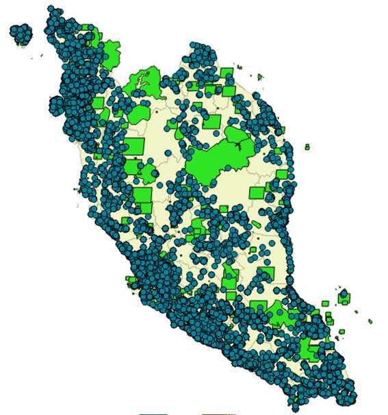
9 Reported Fauna-related Events Events in Protected Areas 9

10 Knowledge Information about species. Biodiversity significance of species. Information about protected areas. Events with biodiversity significance. Events Registered by Agency 10

11 Events Registered by Agency Building knowledge from operational data (that is updated in day-to-day operation) Day Month Year Locality GridX GridY Distict Parliament Area State Disturbance Type Action Knowledge at Operational Level Location GridY GridX Parliament Area State Bio-Diversity Considerations Time District Locality Disturbance Type Month Action Day Year 11
12 Knowledge at Operational Level State Locality ParliamentArea Location District GridY GridX Knowledge at Operational Level Disturbance Type Bio-Diversity Considerations Action 12
13 Domain Ontology Knowledge about biodiversity significance factors BioD Disturbance Poaching Illegal Trade Ivory Trade Forest Conversion Habitat Fragmentation Disease Habitat Disturbance Domain Ontology Knowledge about species and biod status Least Concern Threatened Wildlife Endangered Orang Utan Mammal Elephant Ivory Corals Asian Rhino Horns Vulnerable Critically Endangered Near Threatened 13
14 MyGeoOntology Kg. Batu Dua Belas Gombak Latitud dan Longitud 3 17' 38.2" N ' 49.9" E Nama Daerah Jenis Gombak Pekan Jalan Pantai Pulau Tasik Teluk Muara Bandar Tanjung Kampung Hutan Kg. Batu Dua Belas Gombak Federated Knowledge Knowledge at Operational Level MyGeo- Ontology Knowledge about biodiversity significance factors Knowledge about species and the biod status Information about protected areas Disturbance Type Same As BioD Disturbance Locality Jenis District Daerah Protected Area 14
15 MyGeoOntology in SDI Knowledge in field Knowledge in Domain Ontology agencies/operational Structured and Unstructured Data Sources Generated RDF RDF MyGeoOntology RDF Agency 1 RDF Web Browser Agency 2 Agency 3 RDF Semantic Application Geospatial knowledge API and Web Services RDF Knowledge Interoperability MyGeoOntologyaims to enable interoperability of geospatial knowledge at three levels. MyGeoOntologycan be used to realize the possibility of exchanging geospatial information unambiguously. Through MyGeoOntologythe geospatial data can be enriched to bring out further knowledge related to the data. MyGeoOntologycan further be used to enable integration of the knowledge with other information using geospatial context. 15
16 Thank you for your attention! Alamisoft Sdn Bhd and MaCGDI 16
INSPIRE Basics. Vlado Cetl European Commission Joint Research Centre. https://ec.europa.eu/jrc/
 INSPIRE Basics Vlado Cetl European Commission Joint Research Centre https://ec.europa.eu/jrc/ Serving society Stimulating innovation Supporting legislation Outline SDI? Why European SDI? INSPIRE Policy
Marine Spatial Planning, a Norwegian user case NSHC33
 Marine Spatial Planning, a Norwegian user case NSHC33 Marine Spatial Management Tool Support the marine spatial planning process with updated and reliable geospatial information Marine management is important
Key Points Sharing fosters participation and collaboration Metadata has a big role in sharing Sharing is not always easy
 Sharing Resources Geoff Mortson esri, Inc. SDI Solutions Team Key Points Sharing fosters participation and collaboration Metadata has a big role in sharing Sharing is not always easy Data Sharing is Good
Ministry of ICT of I.R.IRAN
 The ECO 8/6 mill km 2 10 Slamic countries ~330 mill people Oil, Gas, Industries,Tourism 2 Issue transformation in last decade Problem solving needs more integrated approach More interaction &complexity
INSPIRE - A Legal framework for environmental and land administration data in Europe
 INSPIRE - A Legal framework for environmental and land administration data in Europe Dr. Markus Seifert Bavarian Administration for Surveying and Cadastre Head of the SDI Office Bavaria Delegate of Germany
The Polar Data Landscape
 The Polar Data Landscape Polar Data Activities, Models and Issues from Local to Global Peter L. Pulsifer, NSIDC, GCRC Carleton University Cameron Wilson, Natural Resources Canada (NRCan) Martha Paiz, Natural
SDI Implementation at the Local
 SDI Implementation at the Local Administration Level of Germany Hartmut Müller and Stephan von St. Vith FIG Working Week 2009 Surveyors Key Role in Accelerated Development, Eilat, Israel, 3-8 May 2009
A Governance Framework for Geographic Data, Services, and Applications. Colin MacDonald Esri UC 2017
 A Governance Framework for Geographic Data, Services, and Applications Colin MacDonald Esri UC 2017 Some Context Nova Scotia, Canada Population ~1,000,000 Photos copyright Province of Nova Scotia Geomatics
Finding Common Ground Through GIS
 Finding Common Ground Through GIS Matthew Stone, MPH Special Unit for Technical Assistance Chronic Disease and Injury Control California Department of Public Health ESRI Health GIS Conference Scottsdale,
June 19 Huntsville, Alabama 1
 June 19 Huntsville, Alabama 1 Real-Time Geospatial Data: The Fusion of PI and ArcGIS Enabling Smarter Facilities Management OSIsoft and Esri Mapping and Location Analytics Platform Supporting Your Use
Spatial Data Infrastructure Concepts and Components. Douglas Nebert U.S. Federal Geographic Data Committee Secretariat
 Spatial Data Infrastructure Concepts and Components Douglas Nebert U.S. Federal Geographic Data Committee Secretariat August 2009 What is a Spatial Data Infrastructure (SDI)? The SDI provides a basis for
Spatial data interoperability and INSPIRE compliance the platform approach BAGIS
 Spatial data interoperability and INSPIRE compliance the platform approach BAGIS BAGIS Voluntary, independent, public, non-profit organization; Organization with main mission to promote the growth of the
Pal NIKOLLI Bashkim IDRIZI Ismail KABASHI Adelajda HALILI THE IMPLEMENTATION OF NATIONAL SPATIAL DATA INFRASTRUCTURE IN ALBANIA
 Pal NIKOLLI Bashkim IDRIZI Ismail KABASHI Adelajda HALILI THE IMPLEMENTATION OF NATIONAL SPATIAL DATA INFRASTRUCTURE IN ALBANIA Overview: Goals of paper Some definitions of SDI NSDI Development NSDI in
The Emerging Role of Enterprise GIS in State Forest Agencies
 The Emerging Role of Enterprise GIS in State Forest Agencies Geographic Information System (GIS) A geographic information system (GIS) is a computer software system designed to capture, store, manipulate,
Determination of Age and Geographical Origin of African Elephant Ivory
 Determination of Age and Geographical Origin of African Elephant Ivory Research project supported by the German Federal Agency for Nature Conservation and funded by the Federal Ministry for the Environment,
a national geological survey perspective François ROBIDA BRGM (French Geological Survey)
") a national geological survey perspective François ROBIDA BRGM (French Geological Survey) Pre-Conference Seminar on Socio-Economic Value of Geospatial for National and Regional Development 21 August 2017,
a national geological survey perspective François ROBIDA BRGM (French Geological Survey) Pre-Conference Seminar on Socio-Economic Value of Geospatial for National and Regional Development 21 August 2017,
Harmonizing spatial databases and services at local and regional level
 Harmonizing spatial databases and services at local and regional level A. Ionita 1, M. Caian 2, V. Vassilev 3, V. Craciunescu 2, I. Nedelcu 4 1 Research Institute for Artificial Intelligence, Bucuresti,
Discovery and Access of Geospatial Resources using the Geoportal Extension. Marten Hogeweg Geoportal Extension Product Manager
 Discovery and Access of Geospatial Resources using the Geoportal Extension Marten Hogeweg Geoportal Extension Product Manager DISCOVERY AND ACCESS USING THE GEOPORTAL EXTENSION Geospatial Data Is Very
Exploring GIS Potential for Northwestern Ontario Land Information Ontario
 Exploring GIS Potential for Northwestern Ontario Land Information Ontario May 13, 2015 The LIO Vision LIO Vision: That all geographic information about Ontario is fully integrated and accessible LIO Goal:
Report of Uruguay The National Spatial Data Infrastructure
 Report of Uruguay The National Spatial Data Infrastructure Prepared for High-Level Forum on Global Geospatial Information Management (GGIM) and Inaugural Session of the UN Committee of Experts on GGIM
The Global Statistical Geospatial Framework and the Global Fundamental Geospatial Themes
 The Global Statistical Geospatial Framework and the Global Fundamental Geospatial Themes Sub-regional workshop on integration of administrative data, big data and geospatial information for the compilation
Environmental Summit: Consolidated view from earth science to biodiversity
 Meeting Host Supporting Partner Meeting Sponsors Environmental Summit: Consolidated view from earth science to biodiversity 105th Technical Committee Palmerston North, New Zealand Josh Lieberman 6 December
INSPIREd solutions for Air Quality problems Alexander Kotsev
 INSPIREd solutions for Air Quality problems Alexander Kotsev www.jrc.ec.europa.eu Serving society Stimulating innovation Supporting legislation The European data puzzle The European data puzzle 24 official
IDEBarcelona: Cooperating for a Smart Region Infrastructure
 IDEBarcelona: Cooperating for a Smart Region Infrastructure Marta Codinachs Serra Diputació de Barcelona Territory and Sustainability Area Territorial Information Systems Department SMART CITY EXPO WORLD
Data Origin. Ron van Lammeren CGI-GIRS 0910
 Data Origin Ron van Lammeren CGI-GIRS 0910 How to obtain geodata? Geo data initiative Executive Order 12906, "Coordinating Geographic Data Acquisition and Access: The National Spatial Data Infrastructure,"
Issues and Challenges in NSDI Implementation
 Issues and Challenges in NSDI Implementation NOOR HABIBAH ARSHAD, FUZIAH ABU HANIFAH Faculty of Computer and Mathematical Sciences Universiti Teknologi MARA 40450 Shah Alam, Selangor MALAYSIA habibah@tmsk.uitm.edu.my
Global Challenges And Indian Initiatives *
 HIGH LEVEL FORUM ON GLOBAL GEOSPATIAL MANAGEMENT INFORMATION WORKING PAPER No. 15 First Forum Seoul, Republic of Korea, 24-26 October 2011 Global Challenges And Indian Initiatives * * Submitted by: Mr.
Data Origin. How to obtain geodata? Ron van Lammeren CGI-GIRS 0910
 Data Origin How to obtain geodata? Ron van Lammeren CGI-GIRS 0910 Spatial Data interest Improvement of policy making. ± 90% of all information used by government has spatial characteristics SPATIAL INFORMATION
AS/NZS ISO :2015
 Australian/New Zealand Standard Geographic information Reference model Part 1: Fundamentals Superseding AS/NZS ISO 19101:2003 AS/NZS ISO 19101.1:2015 (ISO 19101-1:2014, IDT) AS/NZS ISO 19101.1:2015 This
Implementing strategy for the Infrastructure for Spatial Information in Europe - INSPIRE Paul Smits
 Implementing strategy for the Infrastructure for Spatial Information in Europe - INSPIRE Paul Smits European Commission DG Joint Research Centre Institute for Environment and Sustainability Ispra, Italy
Arctic Spatial Data Infrastructure Enabling Access to Arctic Location-Based Information
 Arctic Spatial Data Infrastructure Enabling Access to Arctic Location-Based Information Arctic SDI Side Event Co-Chairs: Arvo Kokkonen Arctic SDI Board Chair & Director General, National Land Survey of
Status of implementation of the INSPIRE Directive 2016 Country Fiches. COUNTRY FICHE Ireland
 Status of implementation of the INSPIRE Directive 2016 Country Fiches COUNTRY FICHE Ireland Introduction... 1 1. State of Play... 2 1.1 Coordination... 2 1.2 Functioning and coordination of the infrastructure...
INSPIRE General Introduction & Service Architecture
 INSPIRATION Spatial Data Infrastructure in the Western Balkans INSPIRE General Introduction & Service Architecture 1st National INSPIRATION Workshop Croatia November 21-22, 2012 A multi-countryprojectfunded
Status of interoperability issues in the Chilean SDI. Álvaro Monett Pablo Morales Executive Secretariat NSDI-Chile
 Status of interoperability issues in the Chilean SDI Álvaro Monett Pablo Morales Executive Secretariat NSDI-Chile Outline Background - Chilean SDI working areas Background Interoperability, standards and
NOKIS an ISO Based Metadata System
 NOKIS an ISO 19115 Based Metadata System Carsten Heidmann BAW Hamburg (Tyskland) Overview Project NOKIS/NOKIS++ NOKIS Editor Metadata Infrastructure Germany NOKIS Tools: Survey Planning Tool Conclusions
INSPIRing effort. Peter Parslow Ordnance Survey December Various European approaches to managing an SDI
 INSPIRing effort Peter Parslow Ordnance Survey December 2015 Various European approaches to managing an SDI WHAT IS INSPIRE? A European Union Directive A community effort: http://inspire.ec.europa.eu/
Geospatial SDI Portal for effective Governance of Pune METROPOLIS region
 Geospatial SDI Portal for effective Governance of Pune METROPOLIS region Mr. Praveen Gautam Senior Manager 19 th January 2018 PMRDA Overview Provide a Spatial Framework for the entire region with various
IHO STAKEHOLDERS FORUM. Hydrographic data and its role in MSDI. Thursday 27 September Jens Peter Hartmann KMS
 IHO STAKEHOLDERS FORUM Hydrographic data and its role in MSDI Thursday 27 September Jens Peter Hartmann KMS Agenda Traditional approach to hydrographic data Expectations within the marine / maritime field
NOKIS - Information Infrastructure for the North and Baltic Sea
 NOKIS - Information Infrastructure for the North and Baltic Sea Carsten Heidmann 1 and Jörn Kohlus 2 Abstract 1. General The initial motivation for the project NOKIS (German title: Nord- und Ostsee-Küsteninformationssystem)
Realizing benefits of Spatial Data Infrastructure A user s perspective from Environment Agency - Abu Dhabi
 Realizing benefits of Spatial Data Infrastructure A user s perspective from Environment Agency - Abu Dhabi Anil Kumar Director, Environment Information Management 26 April 2012 Geospatial World Forum,
US National Spatial Data Infrastructure A Spatial Framework for Governance and Policy Development to Enable a Location-Based Digital Ecosystem
 GeoPlatform Workshop 7 Dec 2016, Department of the Interior Washington, D.C. US National Spatial Infrastructure A Spatial Framework for Governance and Policy Development to Enable a Location-Based Digital
The state-of-the-art of the Finnish SDI. Arctic SDI WG Meeting
 The state-of-the-art of the Finnish SDI Arctic SDI WG Meeting Moscow 8.9.2011 Esa Tiainen Development Centre 1 NATIONAL LAND SURVEY DOWN TO EARTH Contents Legal framework Coordination structure Network
Georef - Linked Data Deployment for Spatial Data; Finnish Initiative
 Georef - Linked Data Deployment for Spatial Data; Finnish Initiative Esa TIAINEN, Finland Key words: Linked Data, Semantics, Ontology, Web, RDF, Big Data SUMMARY 'Georef' is an initiative for a service
ARCTIC SPATIAL DATA INFRASTRUCTURE
 CAFF Strategy Series No. 1 January 2011 ARCTIC SPATIAL DATA INFRASTRUCTURE CONCEPT PAPER ARCTIC COUNCIL Acknowledgements The Conservation of Arctic Flora and Fauna (CAFF) is a Working Group of the Arctic
Arctic Spatial Data Infrastructure (Arctic SDI)
") Arctic Spatial Data Infrastructure (Arctic SDI) Arvo KOKKONEN, Jani KYLMÄAHO and Heli URSIN, Finland Key words: SDI, Arctic, Geoportal SUMMARY Understanding and responding to the impacts of climate change
Arctic Spatial Data Infrastructure (Arctic SDI) Arvo KOKKONEN, Jani KYLMÄAHO and Heli URSIN, Finland Key words: SDI, Arctic, Geoportal SUMMARY Understanding and responding to the impacts of climate change
Infrastructure for Spatial Information in Europe (INSPIRE)
") Infrastructure for Spatial Information in Europe (INSPIRE) 2011 GISCO Working Party 8-9.3.2012 INSPIRE is about improving access to spatial information: the environment doesn t stop at borders EU Geoportal
Infrastructure for Spatial Information in Europe (INSPIRE) 2011 GISCO Working Party 8-9.3.2012 INSPIRE is about improving access to spatial information: the environment doesn t stop at borders EU Geoportal
Integration for Informed Decision Making
 Geospatial and Statistics Policy Intervention: Integration for Informed Decision Making Greg Scott Global Geospatial Information Management United Nations Statistics Division Department of Economic and
Open spatial data infrastructure
 Open spatial data infrastructure a backbone for digital government Thorben Hansen Geomatikkdagene 2018 Stavanger 13.-15. mars Spatial Data Infrastructure definition the technology, policies, standards,
Semantics, ontologies and escience for the Geosciences
 Semantics, ontologies and escience for the Geosciences Femke Reitsma¹, John Laxton², Stuart Ballard³, Werner Kuhn, Alia Abdelmoty ¹femke.reitsma@ed.ac.uk: School of Geosciences, Edinburgh University ²
RESEARCG ON THE MDA-BASED GIS INTEROPERABILITY Qi,LI *, Lingling,GUO *, Yuqi,BAI **
 RESEARCG ON THE MDA-BASED GIS INTEROPERABILITY Qi,LI *, Lingling,GUO *, Yuqi,BAI ** * Digital Earth Studio, Peking University, Beijing, 100871 liqi@pku.edu.cn, guolingling@cybergis.org.cn ** Network Department,
Agenda. Status of GI activities. NGII Framework. SDI from the national policy perspective
 Towards a National Geographic Information Infrastructure: Overcoming Impediments to the Development of SDI in Nepal R.R. Chhatkuli Email: chhatkuli@ngiip.gov.np & D.M. Kayastha Email: chhatkuli@ngiip.gov.np
FINNISH LINKED DATA PILOTS
 FINNISH LINKED DATA PILOTS Kai Koistinen Data Linking by Indirect Reference Systems -workshop 5.9.2018 1 NLS FINLAND National Land Survey of Finland National mapping and cadastral agency Geodetic research
IRDAT Fvg, evolving a regional Spatial Data Infrastructure according to INSPIRE
 IRDAT Fvg, evolving a regional Spatial Data Infrastructure according to INSPIRE Tutti i diritti riservati. Proprietà INSIEL SpA. A. Benvenuti, A. Chiarandini Insiel (Italy) M. Lunardis - Friuli Venezia
Marine Spatial Management Tool
 Marine Spatial Management Tool Marine Spatial Management Tool Support the marine spatial planning process with updated and reliable geospatial information Marine management is important to Norway with
INSPIRE Directive. Status June 2007
 INSPIRE Directive INfrastructure for SPatial InfoRmation in Europe Status June 2007 European Commission Directorate-General Environment Research, Science and Innovation Unit Rue de la Loi, 200 1049 Brussels
Presentation of the gicases case studies Carlo Cipolloni ISPRA Giorgio Saio GISIG Dirk Frigne GEOSPARC Elena Krikigianni EPSGR
 Presentation of the gicases case studies Carlo Cipolloni ISPRA Giorgio Saio GISIG Dirk Frigne GEOSPARC Elena Krikigianni EPSGR 1 Which are the gicases Case study? CS1 - Use of indoor GIS in healthcare
Open Source Technologies and Remotely Sensed Data in Protecting Elephants. Rosemary Alles Dr. Justine Blanford Penn State World Campus July 2015
 Open Source Technologies and Remotely Sensed Data in Protecting Elephants Rosemary Alles Dr. Justine Blanford Penn State World Campus July 2015 Global Crisis: Poaching & Wildlife Trafficking 100,000 Elephants
An Introduction to Day Two. Linking Conservation and Transportation Planning Lakewood, Colorado August 15-16, 16, 2006
 An Introduction to Day Two Linking Conservation and Transportation Planning Lakewood, Colorado August 15-16, 16, 2006 1 Agenda Day One Transportation Planning Heritage Program State Wildlife Action Plan
The contribution of EUREF to Inspire
 EUREF2010 SYMPOSIUM The contribution of EUREF to Inspire J. Torres, V. Bitenc, A. Caporali, P. Cruddace, L. Engberg, B. Garayt and H. Habrich (members of TWG-RS) June 2-4, 2010 Gävle 1 EUREF2010 SYMPOSIUM
Saving the Leuser Ecosystem with Arc GIS
 Brian Mattern APEC 480 Saving the Leuser Ecosystem with Arc GIS Background: Right now, a significant and relatively unreported crisis is occurring on the island of Sumatra. The Leuser ecosystem is a topographically
SPATIALIST: Describing and Analysing the current SDI-status in Flanders (Belgium)
") SPATIALIST: Describing and Analysing the current SDI-status in Flanders (Belgium) J. Crompvoets, E. Dessers, K. Janssen, D. Vandenbroucke, G. Vancauwenberghe, T. Geudens - SPATIALIST - Zero measurement
SPATIALIST: Describing and Analysing the current SDI-status in Flanders (Belgium) J. Crompvoets, E. Dessers, K. Janssen, D. Vandenbroucke, G. Vancauwenberghe, T. Geudens - SPATIALIST - Zero measurement
Reducing Consumer Uncertainty
 Spatial Analytics Reducing Consumer Uncertainty Eliciting User and Producer Views on Geospatial Data Quality Introduction Cooperative Research Centre for Spatial Information (CRCSI) in Australia Communicate
Zagreb Spatial Data Infrastructure. Sanja Batić, APIS IT Split, 14. rujna 2011.
 Zagreb Spatial Data Infrastructure Sanja Batić, APIS IT Split, 14. rujna 2011. Agenda Zagreb Spatial Data Infrastructure - ZIPP Guidelines for further ZIPP Geoportal development Conclusion 1964 The Centre
Linked Open Data From OGC Compliant Web Services: The Case of Regione Emilia - Romagna Geoportal
 Linked Open Data From OGC Compliant Web Services: The Case of Regione Emilia - Romagna Geoportal Inspire Conference Florence 26/06/2013 Giovanni Ciardi (Regione Emilia-Romagna) Alfredo Abrescia (Planetek
6 February 2018, Subject: FME World Tour 2018 At Sunway Resort Hotel & Spa
 6 February 2018, Subject: FME World Tour 2018 At Sunway Resort Hotel & Spa FME technology has evolved from the ETL (Extract Transform Load) software to the multi tool for connecting, transforming and automating
Open Data meets Big Data
 Open Data meets Big Data Max Craglia, Sven Schade, Anders Friis European Commission Joint Research Centre www.jrc.ec.europa.eu Serving society Stimulating innovation Supporting legislation JRC is Technical
Welcome. C o n n e c t i n g
 Welcome C o n n e c t i n g YOU D i s c i p l i n e s Why is This Meeting......So Important Now? OUR WORLD Is Increasingly Challenged The Evidence Is Clear We Need Better Understanding and More Collaboration
Proposal for a DIRECTIVE OF THE EUROPEAN PARLIAMENT AND OF THE COUNCIL. establishing an infrastructure for spatial information in the Community
 Proposal for a DIRECTIVE OF THE EUROPEAN PARLIAMENT AND OF THE COUNCIL establishing an infrastructure for spatial information in the Community INSPIRE http://inspire.jrc.it/ Alessandro Annoni 1 EU Commission
8 th Arctic Regional Hydrographic Commission Meeting September 2018, Longyearbyen, Svalbard Norway
 8 th Arctic Regional Hydrographic Commission Meeting 11-13 September 2018, Longyearbyen, Svalbard Norway Status Report of the Arctic Regional Marine Spatial Data Infrastructures Working Group (ARMSDIWG)
Ready for INSPIRE.... connecting worlds. European SDI Service Center
 Ready for INSPIRE Consultancy SOFTWARE T r a i n i n g Solutions... connecting worlds European SDI Service Center Increasing Added Value with INSPIRE and SDI Components INSPIRE In 2007, the European Commission
EXPECTATIONS OF TURKISH ENVIRONMENTAL SECTOR FROM INSPIRE
 EXPECTATIONS OF TURKISH ENVIRONMENTAL SECTOR FROM INSPIRE June, 2010 Ahmet ÇİVİ Tuncay DEMİR INSPIRE in the Eyes of MoEF Handling of Geodata by MoEF Benefits Expected TEIEN First Steps for INSPIRE Final
State of the Art. in Spatial Planning Data Harmonisation & Spatial Data Infrastructure (SDI) Julia Neuschmid, CEIT ALANOVA
 Julia Neuschmid, CEIT ALANOVA") INSPIRE Conference, June 2010, Krakow State of the Art in Spatial Planning Data Harmonisation & Spatial Data Infrastructure (SDI) Julia Neuschmid, CEIT ALANOVA Co-funded by the Community programme econtentplus
INSPIRE Conference, June 2010, Krakow State of the Art in Spatial Planning Data Harmonisation & Spatial Data Infrastructure (SDI) Julia Neuschmid, CEIT ALANOVA Co-funded by the Community programme econtentplus
Using Information and Geospatial Technologies to Support Biodiversity Conservation Policy Options in Latin America
 Using Information and Geospatial Technologies to Support Biodiversity Conservation Policy Options in Latin America Cover map credit: Javier Alfonso Racero-Casarrubia Using Information and Geospatial Technologies
EuroGEOSS for Drought - Linking the European Drought Observatory to global and local scales
 EuroGEOSS for Drought - Linking the European Drought Observatory to global and local scales Barbara Hofer, Stefan Niemeyer, EC-JRC INSPIRE Conference 2010 Cracow June 24, 2010 Drought Relevance Droughts
Turkey s National SDI Implementation
 Onur PAŞAOĞULLARI Head of Department Turkey s National SDI Implementation Presentation Plan NSDI Background General Directorate of Geographic Information Systems NSDI Project INSPIRE Directive Urban Information
Geotechnology for Agriculture: A view from regulations and free software.
 Geotechnology for Agriculture: A view from regulations and free software. 11 de noviembre del 2015 C O N T E N T S Agriculture, two aspects: data and software Common problems with data and information
Nomination Form. Clearinghouse. New York State Office for Technology. Address: State Capitol-ESP, PO Box
 NASIRE 2001 RECOGNITION AWARDS Recognizing Outstanding Achievement in the Field of Innovative Use of Technology Nomination Form Title of Nomination: Manager/Job Title: Agency: NYS Geographic Information
Part 1: Fundamentals
 Provläsningsexemplar / Preview INTERNATIONAL STANDARD ISO 19101-1 First edition 2014-11-15 Geographic information Reference model Part 1: Fundamentals Information géographique Modèle de référence Partie
The Process of Spatial Data Harmonization in Italy. Geom. Paola Ronzino
 The Process of Spatial Data Harmonization in Italy Geom. Paola Ronzino ISSUES Geospatial Information in Europe: lack of data harmonization the lack of data duplication of data CHALLENGES Challenge of INSPIRE:
Application of INSPIRE rules to support environmental impact assessment in IPPC(Integrated Pollution Prevention and Control)
") Direzione Ambiente e Difesa del Suolo e della Costa Application of INSPIRE rules to support environmental impact assessment in IPPC(Integrated Pollution Prevention and Control) Inspire Conference Florence
Direzione Ambiente e Difesa del Suolo e della Costa Application of INSPIRE rules to support environmental impact assessment in IPPC(Integrated Pollution Prevention and Control) Inspire Conference Florence
A Case Study for Semantic Translation of the Water Framework Directive and a Topographic Database
 A Case Study for Semantic Translation of the Water Framework Directive and a Topographic Database Angela Schwering * + Glen Hart + + Ordnance Survey of Great Britain Southampton, U.K. * Institute for Geoinformatics,
Ethiopia. January About this Report and the World Database on Protected Areas (WDPA)
") WDPA Data Status Report About this Report and the World Database on Protected Areas (WDPA) Map showing protected areas in the WDPA Ethiopia January 2015 The WDPA is the most comprehensive global dataset
WDPA Data Status Report About this Report and the World Database on Protected Areas (WDPA) Map showing protected areas in the WDPA Ethiopia January 2015 The WDPA is the most comprehensive global dataset
Suriname. January About this Report and the World Database on Protected Areas (WDPA)
") WDPA Data Status Report About this Report and the World Database on Protected Areas (WDPA) Map showing protected areas in the WDPA Suriname January 2015 The WDPA is the most comprehensive global dataset
WDPA Data Status Report About this Report and the World Database on Protected Areas (WDPA) Map showing protected areas in the WDPA Suriname January 2015 The WDPA is the most comprehensive global dataset
A Model of GIS Interoperability Based on JavaRMI
 A Model of GIS Interoperability Based on Java Gao Gang-yi 1 Chen Hai-bo 2 1 Zhejiang University of Finance & Economics, Hangzhou 310018, China 2 College of Computer Science and Technology, Zhejiang UniversityHangzhou
Spatially enabling e-government through geo-services
 Spatially enabling e-government through geo-services Mauro Salvemini EUROGI PRESIDENT Professor at Sapienza Università di Roma (IT) 1 About the presentation Few information about Eurogi ; Some essential
Enabling ENVI. ArcGIS for Server
 Enabling ENVI throughh ArcGIS for Server 1 Imagery: A Unique and Valuable Source of Data Imagery is not just a base map, but a layer of rich information that can address problems faced by GIS users. >
Spatializing Research Hypotheses a long- term research vision for
 Spatializing Research Hypotheses a long- term research vision for spatial@ucsb Werner Kuhn Center for Spatial Studies a vision for spatial Spatial computing shall reach the same level of general utility
ESTABLISHMENT OF KARNATAKA GEOPORTAL AND ITS ROLE IN PLANNING
 ESTABLISHMENT OF KARNATAKA GEOPORTAL AND ITS ROLE IN PLANNING By H. Hemanth Kumar Karnataka State Council for Science & Technology (KSCST), Indian Institute of Science, Bangalore, India Abstract Natural
SITMUN: Cooperating to Build Local SDIs in the Barcelona Region
 SITMUN: Cooperating to Build Local SDIs in the Barcelona Region Diputació de Barcelona Territory and Sustainability Area Territorial Information Systems Department INSPIRE CONFERENCE Barcelona, September
On the front line with Esri Malaysia s dynamic user community: User story - MaCGDI
 On the front line with Esri Malaysia s dynamic user community: User story - MaCGDI Puan Hajah Norizam binti Che Noh, Director MaCGDI MyGDI Current Challenges : Formulating National Geospatial Blueprint
Exploring Visualization of Geospatial Ontologies Using Cesium
 Exploring Visualization of Geospatial Ontologies Using Cesium Abhishek V. Potnis, Surya S. Durbha Centre of Studies in Resources Engineering, Indian Institue of Technology Bombay, India abhishekvpotnis@iitb.ac.in,
SWEDISH SDI DEVELOPMENT & IMPLEMENTATION OF INSPIRE
 SWEDISH SDI DEVELOPMENT & IMPLEMENTATION OF INSPIRE Christina Wasström, Lantmäteriet, 801 82 Gävle, Sweden, christina.wasstrom@lm.se ABSTRACT The Swedish Government and Parliament has given Lantmäteriet
Increasing GI awareness in local authorities in Poland experiences from the INSPIRE Academy training programme
 Increasing GI awareness in local authorities in Poland experiences from the INSPIRE Academy training programme http://www.akademiainspire.pl Maria Andrzejewska, Monika Rusztecka UNEP/GRID-Warsaw Centre,
How local communities could profit from Habitats infrastructure
 Social Validation of INSPIRE Annex III Data Structures in EU Habitats How local communities could profit from Habitats infrastructure Andrea Scianna ( Icar CNR Italy ) consultant for Madonie Park Authority
Gistat: moving towards a location information management system
 Gistat: moving towards a location information management system (merging geographical, statistical and historical information) Pina Grazia Ticca Marco Ballin Istat - Italy Aguascalientes, Mexico 2-4 December
Building a National Data Repository
 Building a National Data Repository Mladen Stojic, Vice President - Geospatial 1/30/2013 2012 Intergraph Corporation 1 Information has meaning and gives power only when shared and distributed. Information,
Visualizing Uncertainty In Environmental Work-flows And Sensor Streams
 Visualizing Uncertainty In Environmental Work-flows And Sensor Streams Karthikeyan Bollu Ganesh and Patrick Maué Institute for Geoinformatics (IFGI), University of Muenster, D-48151 Muenster, Germany {karthikeyan,pajoma}@uni-muenster.de
Building a national spatial data infrastructure. Thorben Hansen, Head of Division Danish Agency for Data Supply and Efficiency
 Building a national spatial data infrastructure Thorben Hansen, Head of Division Danish Agency for Data Supply and Efficiency About Spatial Data Infrastructure Spatial data come from many sources and is
Bentley Map Advancing GIS for the World s Infrastructure
 Bentley Map Advancing GIS for the World s Infrastructure Presentation Overview Why would you need Bentley Map? What is Bentley Map? Where is Bentley Map Used? Why would you need Bentley Map? Because your
Foundation Geospatial Information to serve National and Global Priorities
 Foundation Geospatial Information to serve National and Global Priorities Greg Scott Inter-Regional Advisor Global Geospatial Information Management United Nations Statistics Division UN-GGIM: A global