Dr. Jonathan Muñoz Barreto
|
|
|
- Barrie McGee
- 6 years ago
- Views:
Transcription


1 Centro de Transferencia de Tecnología en Transportación Departamento de Ingeniería Civil y Agrimensura UPR- Recinto Universitario de Mayagüez Call Box 9000 * Mayagüez, PR Tel * Fax: * 29 Años de Excelencia en el Adiestramiento de Oficiales de Transportación a Nivel Municipal, Estatal, y Federal en Puerto Rico e Islas Vírgenes Instructor Dr. Jonathan Muñoz Barreto Departamento de Ingeniería Civil y Agrimensura UPR Recinto Universitario de Mayagüez 17 de noviembre de 2015
2 Open Source GIS: Geospatial Solutions in Transportation Engineering Tuesday, November 17, 2015 INSTRUCTOR s: Dr. Jonathan Muñoz-Barreto Assistant Professor, Department of Civil Engineering and Surveying University of Puerto Rico-Mayaguez Sr. Roy Ruiz-Vélez Puerto Rico Seismic Network University of Puerto Rico-Mayaguez

3 Liberal Arts Education No puede impedirse el viento. Pero pueden construirse molinos. Proverbio holandés


4 Liberal Arts Education (Information at Glance) Earth s Population by Latitude and Longitude
 Global Internet Usage Based on Time")
5 Liberal Arts Education (Information at Glance) Global Internet Usage Based on Time of Day
 World Map of Vegetation on")
6 Liberal Arts Education (Information at Glance) World Map of Vegetation on Earth

 Overall")
7 Liberal Arts Education (Information at Glance) Overall Water Risk Around the World

8 Open Source Geographic Information Systems (Quantum GIS, Map Window, ArcGIS Online) Objectives Procedures for the management of geospatial data (transportation applications)
9 Working Items Basic Concepts of GIS with focus on Open Source Solutions Acquisition of geospatial data (vector and raster) Government databases Applications in transportation Delineation and identification of road infrastructure. Online Geo Data as an option to share information between agencies. Delineation of watersheds and networks for flood mitigation
10 Agenda Morning Session: Review and Fundamental Concepts Afternoon Session: Practice and Computational Time


11 Required Software: QGIS ( Housekeeping Mapwindow (
12 What is GIS? Help to Understand the World around You GIS software is designed to capture, manage, analyze, and display all forms of geographically referenced information. GIS allows us to view, understand, question, interpret, and visualize our world in ways that reveal relationships, patterns, and trends in the form of maps, globes, reports, and charts. GIS software helps you answer questions and solve problems by looking at your data in a way that is quickly understood and easily shared on a map!
 is computer software with its source code made available with a license in which the copyright holder provides the rights to study, change, and distribute the")
13 What is Open Source Software? Open-source software (OSS) is computer software with its source code made available with a license in which the copyright holder provides the rights to study, change, and distribute the software to anyone and for any purpose. The term "open source" refers to something that can be modified and shared because its design is publicly accessible.


14 This outbreak is best known for the physician John Snow's study of the outbreak and his discovery that contaminated water, not air, spread cholera. History: 1854 Broad Street cholera outbreak Snow later used a spot map to illustrate how cases of cholera were centered on the pump. He also made a solid use of statistics to illustrate the connection between the quality of the source of water and cholera cases. Snow's efforts to connect the incidence of cholera with potential geographic sources.

15 History: 1854 Broad Street cholera outbreak
16 Fundamentals of Geographic Information Systems

17 Data vs. Information Data Raw facts and observations (just numbers) i.e. Raifall, Temperature, road locations, building footprints Information Data with context or making sense of the data so it is actionable of useful. i.e. Weather Reports & Traffic Reports

18 Map Projections The earth is an oblique sphere. Map projections are attempts to portray the surface of the earth or a portion of the earth on a flat surface. Projections are mathematical transformations. Some distortions of conformity, distance, direction, scale, and area always result from this process. Some projections minimize distortions in some of these properties at the expense of maximizing errors in others. Some projection are attempts to only moderately distort all of these properties.
19 Types of Maps Projections Conformity When the scale of a map at any point on the map is the same in any direction, the projection is conformal. Meridians (lines of longitude) and parallels (lines of latitude) intersect at right angles. Shape is preserved locally on conformal maps. Distance A map is equidistant when it portrays distances from the center of the projection to any other place on the map. Direction A map preserves direction when azimuths(azimuthal - angles from a point on a line to another point) are portrayed correctly in all directions. Area When a map portrays areas over the entire map so that all mapped areas have the same proportional relationship to the areas on the Earth that they represent, the map is an equal-area map.

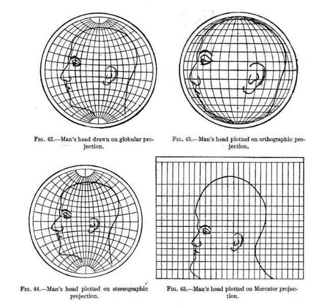
20 Types of Maps Projections


21 Map Projections on perspective
22 Wiki In geometry, a coordinate system is a system which uses one or more numbers, or coordinates, to uniquely determine the position of a point or other geometric element on the space, These systems can represent points in two-dimensional or threedimensional space. Coordinate Systems
23 Coordinate Systems When Mapping the earth s terrain and natural and cultural features, it is important that all mapped objects be accurately located with respect to an accepted geographic frame of reference. This is particularly important when spatial data from multiple sources are being integrated. (Examples??) If any of the spatial data sets are not accurately defined in an accepted frame of reference, then gaps overlaps and mismatches will occur.
24 NSRS Coordinate Systems: Coordinate Systems Latitude & Longitude State Plane Coordinates UTM Coordinates Earth-Centered Earth-Fixed NAD 83 NAD 27 NGVD 29 NAVD 88 PRVD 02 ITRF15


25 Mixing Coordinate Systems
26 Geographic Information Systems
27 GIS: Tool Box Information System Approach to Science GIS is a powerful tool for storing and retrieving at will, transforming and displaying spatial data from the real world for a particular set of purposes. GIS is a system capturing, storing, checking, manipulating, analyzing and displaying data which are spatially referenced to Earth. Analogy: GISciences is to GIS as Statistics is to Statistical software packages.
28 A System a group of connected entities and activities GIS An information System a set of procedures, executed on raw data, to produce information for decision making A Geographic Information System- an information system using geographically reference data.

29 GIS Components Data Hardware Software Brainware: People/Procedures/Plan Infrastructure: GIS operation Environment

30 GIScience: Contributing Disiplines Geography Cartography Remote Sensing Geomatics Engineering Geodesy Statistics Operation Research Computer Science Mathematics Management
31 Non-Spatial Data Attributes or information that describes the spatial entity Basic Elements of GIS: Data Spatial Data: Geographically referenced data Latitude and Longitude X and Y Coordinates Street Address Range and township Location shown on a map
32 GIS Data: Spatial is Special Geographic Location is a key feature of all government data. ( Experts estimate that as much of the 80% of the cost associated with a GIS system is related to the development and maintenance of its spatial data. Federal Agencies alone are spending $ billion annually on collection and management of geospatial data (National academy of public administration)
 Demographic Data Physical Features Hydrography Geology Etc Research Field")
33 Examples of Data integration Ortho-rectified Aerial photos Satellite Images Image Products Digital Elevation Models (DEMs) Demographic Data Physical Features Hydrography Geology Etc Research Field Data
34 Spatial Assessment Spatial analysis or spatial statistics includes any of the formal techniques which study entities using their topological, geometric, or geographic properties
35 Spatial Assessment Spatial analysis is how we understand our world mapping where things are, how they relate, what it all means, and what actions to take. Understanding Where Where are my (X or Y thing) located? Understanding where is about putting the world in context. This includes geocoding your data, putting it on a map, and symbolizing it in ways that can help you visualize and understand your data.
36 Spatial Assessment Spatial analysis is how we understand our world mapping where things are, how they relate, what it all means, and what actions to take. Measuring Size, Shape, and Distribution How long is the road/river? How tall is the building? How large are the sugar cane fields? Measuring size and shape shows how large an object is or describes a feature in terms of its area, perimeter, length, height, and volume. It also helps to understand the distribution of multiple features.
37 Spatial Assessment Spatial analysis is how we understand our world mapping where things are, how they relate, what it all means, and what actions to take. Determining How Places Are Related Which rivers or roads are within 10 miles of a pipeline? Have other crimes occurred at this location? Answering spatial questions often requires an understanding of spatial relationships such as proximity, coincidence, intersection, overlap, visibility, and accessibility.
38 Spatial Assessment Spatial analysis is how we understand our world mapping where things are, how they relate, what it all means, and what actions to take. Finding the Best Locations and Paths Whether you're looking for the best route to travel, the best corridor to build a pipeline, or the best location to site a new store, spatial analysis helps you make more informed decisions about the best locations and paths
39 Spatial Assessment Spatial analysis is how we understand our world mapping where things are, how they relate, what it all means, and what actions to take. Detecting and Quantifying Patterns Where are clusters of high expenditures on electronic goods? Where are the hot spots of cancer deaths? Detecting and quantifying patterns in data can be used to find hot spots and outliers, find natural data clusters, and analyze changes in patterns over time.

40 Spatial Modeling

41 Visualization The term visualization encompasses a broad range of analytic tools and techniques that includes GIS, 3D modeling, and data and statistical visualizations. The common thread is the underlying desire to organize date into a coherent visual display that can be readily interpreted and understood.
42 Visualization Data visualization is the subset of visualization that involves the graphic display of data too complex for manual processing, and the resultant imagery is typically the end result of an algorthmic process or generated from a large-scale dataset. Prime examples of this type of visualization done through the IDRE-HPC team include 100K DLA simulation, laser simulation, fluid simulation, and network analysis. Statistical visualization originates from the statistical analysis of datasets and is supported by the combined forces of IDRE s Stats Group and GIS, Visualization and Modeling team.

43 GIS Data: Raster In its simplest form, a raster consists of a matrix of cells (or pixels) organized into rows and columns (or a grid) where each cell contains a value representing information, such as temperature. Rasters are digital aerial photographs, imagery from satellites, digital pictures, or even scanned maps.
44 GIS Data Raster Data stored in a raster format represents real-world phenomena: Thematic data (also known as discrete) represents features such as land-use or soils data. Continuous data represents phenomena such as temperature, elevation, or spectral data such as satellite images and aerial photographs. Pictures include scanned maps or drawings and building photographs.
 data and floating-point values to represent")
45 GIS Data Raster Cell values can be either positive or negative, integer, or floating point. Integer values are best used to represent categorical (discrete) data and floating-point values to represent continuous surfaces.
46 GIS Data Raster

47 GIS Data Raster

48 GIS Data Raster

49 GIS Data Vector Vector is a coordinate-based data model that represents geographic features as points, lines, and polygons. Each point feature is represented as a single coordinate pair, while line and polygon features are represented as ordered lists of vertices. Attributes are associated with each vector feature, as opposed to a raster data model, which associates attributes with grid cells.
50 GIS Data Vector vs. Raster

51 GIS Data Vector vs. Raster
52 Open Source GIS Solutions
53 Open Source Geospatial Foundation (OSGeo) Non-profit non-governmental organization whose mission is to support and promote the collaborative development of open geospatial technologies and data. The foundation was formed in February 2006 to provide financial, organizational and legal support to the broader Free and open source geospatial community. It also serves as an independent legal entity to which community members can contribute code, funding and other resources, secure in the knowledge that their contributions will be maintained for public benefit.
54 OSGeo Projects Web Mapping deegree geomajas GeoMOOSE GeoServer Mapbender MapBuilder MapFish MapGuide Open Source MapServer OpenLayers Desktop Applications GRASS GIS Marble QGIS Geospatial Libraries FDO GDAL/OGR GEOS GeoTools OSSIM PostGIS Metadata Catalogs GeoNetwork pycsw Outreach Projects Public Geospatial Data Education and Curriculum OSGeo Live

55 QGIS QGIS (previously also known as Quantum GIS) is a free (GNU GPL v2) and open source GIS application It enable the user to visualize, manage, edit, analyse data, and compose printable maps. It runs on Linux, Unix, Mac OSX, Windows and Android and can be downloaded free of charge from qgis.org
56 QGIS Features The major features of QGIS include: Direct viewing and exploration of spatial data Advanced symbology (edit rendering styles) QGIS Browser as a simple and fast data viewer Support for numerous vector, raster, and database formats ESRI shapefiles, GeoJSON, KML/KMZ, and GPX PostGIS, SpatiaLite, MSSQL spatial, WMS (Create, edit and export spatial data Work with nodes, lines and polygons Convert between different coordinate systems (re-projection) Down/upload directly to a GPS unit Perform spatial analysis Find polygon centroids and basic statistics Distance matrix and line intersections Publish your map on the internet An extensible plug-in architecture Remote control JOSM
57 QGIS Coordinate Systems Earth is a three-dimensional body, roughly spherical in shape, yet the vast majority of maps are flat (2-dimesional). QGIS has support for approximately 2,700 known CRS. Some, such as WGS-84 are global projections, whereas others represent only specific regions. QGIS can be used to convert between CRS. Open the input layer making sure to select the correct CRS as described above. Use Layer->Save As... to export the layer with a different CRS (you may choice between the "Project" CRS or select a CRS from QGIS's extensive list).
58 MAPWindow Features MapWindow GIS is an open source GIS (mapping) application and set of programmable mapping components. It has been adopted by the United States Environmental Protection Agency as the primary GIS platform for its BASINS (Better Assessment Science Integrating Point and Nonpoint Sources) watershed analysis and modeling software. MapWindow includes standard GIS data visualization features as: DBF attribute table editing shapefile editing Data converters Dozens of standard GIS formats are supported, including: Shapefiles, GeoTIFF, ESRI ArcInfo ASCII and binary grids
59 Other Software's (Open Source) GRASS GIS Originally developed by the U.S. Army Corps of Engineers: a complete GIS. gvsig Written in Java. Runs on Linux, Unix, Mac OS X and Windows. ILWIS (Integrated Land and Water Information System) Integrates image, vector and thematic data. JUMP GIS / OpenJUMP ((Open) Java Unified Mapping Platform) The desktop GISs OpenJUMP, SkyJUMP, deejump and Kosmo all emerged from JUMP.[3] MapWindow GIS Free desktop application and programming component. QGIS (previously known as Quantum GIS) Runs on Linux, Unix, Mac OS X and Windows. SAGA GIS (System for Automated Geoscientific Analysis) - A hybrid GIS software. Has a unique Application Programming Interface (API) and a fast-growing set of geoscientific methods, bundled in exchangeable Module Libraries. udig API and source code (Java) available.


60 Other Software's (Open Source) QGIS
 GRASS")
61 Other Software's (Open Source) GRASS GIS
")
62 Other Software's (Open Source) SagaGIS
")
63 Other Software's (Open Source) MapWindow
64 Computational Time QGIS, Mapwindow & ArcGIS Online
65 Exercise # 1 Ejercicio 1: Descargar y abrir datos en QGIS, editar y digitalizar una nueva carretera Fuente de datos: Si tienes acceso a internet puedes hacer este ejercicio desde cero sin tener datos ninguno, descargando todo por Internet.
66 Exercise # 2 Ejercicio 2: Convertir de texto a puntos elementos de infraestructura vial Este ejercicio consiste en plotear unos puntos tomados en el campo a partir de un archivo de texto. Estos corresponden a un sistema de alcantarillado pluvial. Luego editaremos la base de datos y digitalizaremos una tubería conectando así los sistemas. Finalmente haremos un mapa.
67 Exercise # 3 Ejercicio 3: Delineación automática de cuencas hidrográficas El ejercicio consiste en delinear las cuencas hidrográficas de una zona con el fin de calcular variables hidrológicas para estudios H&H para mitigación de inundaciones en carreteras o para estructuras hidráulicas en carreteras (puentes, tajeas, tubos, otros).
68 Exercise # 4 Ejercicio 4: Publicar y compartir mis datos (demo) Este ejercicio consiste en una demostración de cómo podemos compartir nuestros datos con clientes o personas que no tengan la herramienta de GIS. Usaremos GoogleEarth y el App ArcExplorer de ArcGIS.
69 Exercise #5 Ejercicio 5: Estimación de pérdidas de carreteras dentro de una zona de peligro Este ejercicio busca calcular los pies lineales de carreteras que se encuentran dentro de la zona de riesgo y que pudieran verse afectadas en caso de un tsunami en Mayagüez.
Overview of Geospatial Open Source Software which is Robust, Feature Rich and Standards Compliant
 Overview of Geospatial Open Source Software which is Robust, Feature Rich and Standards Compliant Cameron SHORTER, Australia Key words: Open Source Geospatial Foundation, OSGeo, Open Standards, Open Geospatial
GIS = Geographic Information Systems;
 What is GIS GIS = Geographic Information Systems; What Information are we talking about? Information about anything that has a place (e.g. locations of features, address of people) on Earth s surface,
These modules are covered with a brief information and practical in ArcGIS Software and open source software also like QGIS, ILWIS.
 Online GIS Training and training modules covered are: 1. ArcGIS, Analysis, Fundamentals and Implementation 2. ArcGIS Web Data Sharing 3. ArcGIS for Desktop 4. ArcGIS for Server These modules are covered
Display data in a map-like format so that geographic patterns and interrelationships are visible
 Vilmaliz Rodríguez Guzmán M.S. Student, Department of Geology University of Puerto Rico at Mayagüez Remote Sensing and Geographic Information Systems (GIS) Reference: James B. Campbell. Introduction to
GIS for ChEs Introduction to Geographic Information Systems
 GIS for ChEs Introduction to Geographic Information Systems AIChE Webinar John Cirucci 1 GIS for ChEs Introduction to Geographic Information Systems What is GIS? Tools and Methods Applications Examples
Data Aggregation with InfraWorks and ArcGIS for Visualization, Analysis, and Planning
 Data Aggregation with InfraWorks and ArcGIS for Visualization, Analysis, and Planning Stephen Brockwell President, Brockwell IT Consulting, Inc. Join the conversation #AU2017 KEYWORD Class Summary Silos
Existing Open Source Tools and Possibilities for Cadastre Systems
 Existing Open Source Tools and Possibilities for Cadastre Systems Gertrude Pieper Espada FIG Congress Sydney, 11-16 April 2010 What is FLOSS? What is open source? What open source software tools are available?
An Introduction to Geographic Information System
 An Introduction to Geographic Information System PROF. Dr. Yuji MURAYAMA Khun Kyaw Aung Hein 1 July 21,2010 GIS: A Formal Definition A system for capturing, storing, checking, Integrating, manipulating,
Among various open-source GIS programs, QGIS can be the best suitable option which can be used across partners for reasons outlined below.
 Comparison of Geographic Information Systems (GIS) software As of January 2018, WHO has reached an agreement with ESRI (an international supplier of GIS software) for an unlimited use of ArcGIS Desktop
Karsten Vennemann, Seattle. QGIS Workshop CUGOS Spring Fling 2015
 Karsten Vennemann, Seattle 2015 a very capable and flexible Desktop GIS QGIS QGIS Karsten Workshop Vennemann, Seattle slide 2 of 13 QGIS - Desktop GIS originally a GIS viewing environment QGIS for the
Techniques for Science Teachers: Using GIS in Science Classrooms.
 Techniques for Science Teachers: Using GIS in Science Classrooms. After ESRI, 2008 GIS A Geographic Information System A collection of computer hardware, software, and geographic data used together for
Imagery and the Location-enabled Platform in State and Local Government
 Imagery and the Location-enabled Platform in State and Local Government Fred Limp, Director, CAST Jim Farley, Vice President, Leica Geosystems Oracle Spatial Users Group Denver, March 10, 2005 TM TM Discussion
OPEN SOURCE TECHNOLOGIES IN GEOGRAPHIC INFORMATION SYSTEMS
 GEOGRAPHIC INFORMATION SYSTEMS OPEN SOURCE TECHNOLOGIES IN GEOGRAPHIC INFORMATION SYSTEMS Marijana Petković 1, Vladmir Bulatović 1, Ivan Aleksić 2 1 University of Novi Sad, Faculty of Technical Sciences,
GIS Workshop Data Collection Techniques
 GIS Workshop Data Collection Techniques NOFNEC Conference 2016 Presented by: Matawa First Nations Management Jennifer Duncan and Charlene Wagenaar, Geomatics Technicians, Four Rivers Department QA #: FRG
Dr. ABOLGHASEM AKBARI Faculty of Civil Engineering & Earth Resources, University Malaysia Pahang (UMP)
") Workshop on : Dr. ABOLGHASEM AKBARI Faculty of Civil Engineering & Earth Resources, University Malaysia Pahang (UMP) 14-15 April 2016 Venue: Tehran, Iran GIS definitions GIS: A simplified view of the real
Workshop on : Dr. ABOLGHASEM AKBARI Faculty of Civil Engineering & Earth Resources, University Malaysia Pahang (UMP) 14-15 April 2016 Venue: Tehran, Iran GIS definitions GIS: A simplified view of the real
Hydrology and Floodplain Analysis, Chapter 10
 Hydrology and Floodplain Analysis, Chapter 10 Hydrology and Floodplain Analysis, Chapter 10.1 Introduction to GIS GIS Geographical Information System Spatial Data Data linked with geographical location
INTRODUCTION TO GEOGRAPHIC INFORMATION SYSTEM By Reshma H. Patil
 INTRODUCTION TO GEOGRAPHIC INFORMATION SYSTEM By Reshma H. Patil ABSTRACT:- The geographical information system (GIS) is Computer system for capturing, storing, querying analyzing, and displaying geospatial
Geospatial data and analysis fundamentals applied to renewable energies potential assessment
 Geospatial data and analysis fundamentals applied to renewable energies potential assessment Network analysis: Do we go to Perugia by car? Guideline Introduction renewable energy and Geospatial Technologies
NR402 GIS Applications in Natural Resources
 NR402 GIS Applications in Natural Resources Lesson 1 Introduction to GIS Eva Strand, University of Idaho Map of the Pacific Northwest from http://www.or.blm.gov/gis/ Welcome to NR402 GIS Applications in
Lecture 1 Introduction to GIS. Dr. Zhang Spring, 2017
 Lecture 1 Introduction to GIS Dr. Zhang Spring, 2017 Topics of the course Using and making maps Navigating GIS Map design Working with spatial data Geoprocessing Spatial data infrastructure Digitizing
Free and Open Source Software for Cadastre and Land Registration : A Hidden Treasure? Gertrude Pieper Espada. Overview
 Free and Open Source Software for Cadastre and Land Registration : A Hidden Treasure? Gertrude Pieper Espada Overview FLOSS concepts Digital Land Administration systems FLOSS Database alternatives FLOSS
Innovation. The Push and Pull at ESRI. September Kevin Daugherty Cadastral/Land Records Industry Solutions Manager
 Innovation The Push and Pull at ESRI September 2004 Kevin Daugherty Cadastral/Land Records Industry Solutions Manager The Push and The Pull The Push is the information technology that drives research and
Methodological Chain for Hydrological Management with Web-GIS Applications
 Advances in Geosciences Konstantinos Perakis & Athanasios Moysiadis, Editors EARSeL, 2012 Methodological Chain for Hydrological Management with Web-GIS Applications Alexandros Konstantinidis 1, Eleni Tzanou
GIS Lecture 5: Spatial Data
 GIS Lecture 5: Spatial Data GIS 1 Outline Vector Data Formats Raster Data Formats Map Projections Coordinate Systems US Census geographic files US Census data files GIS Data Sources GIS 2 Vector Data Formats
Overview key concepts and terms (based on the textbook Chang 2006 and the practical manual)
") Introduction Geo-information Science (GRS-10306) Overview key concepts and terms (based on the textbook 2006 and the practical manual) Introduction Chapter 1 Geographic information system (GIS) Geographically
Introduction Geo-information Science (GRS-10306) Overview key concepts and terms (based on the textbook 2006 and the practical manual) Introduction Chapter 1 Geographic information system (GIS) Geographically
FUNDAMENTALS OF GEOINFORMATICS PART-II (CLASS: FYBSc SEM- II)
") FUNDAMENTALS OF GEOINFORMATICS PART-II (CLASS: FYBSc SEM- II) UNIT:-I: INTRODUCTION TO GIS 1.1.Definition, Potential of GIS, Concept of Space and Time 1.2.Components of GIS, Evolution/Origin and Objectives
FUNDAMENTALS OF GEOINFORMATICS PART-II (CLASS: FYBSc SEM- II) UNIT:-I: INTRODUCTION TO GIS 1.1.Definition, Potential of GIS, Concept of Space and Time 1.2.Components of GIS, Evolution/Origin and Objectives
Development of Univ. of San Agustin Geographic Information System (USAGIS)
") , pp.170-176 http://dx.doi.org/10.14257/astl.2014.48.27 Development of Univ. of San Agustin Geographic Information System (USAGIS) Rosslin John H. Robles Chair, Computer Science Department, University
, pp.170-176 http://dx.doi.org/10.14257/astl.2014.48.27 Development of Univ. of San Agustin Geographic Information System (USAGIS) Rosslin John H. Robles Chair, Computer Science Department, University
Geography 38/42:376 GIS II. Topic 1: Spatial Data Representation and an Introduction to Geodatabases. The Nature of Geographic Data
 Geography 38/42:376 GIS II Topic 1: Spatial Data Representation and an Introduction to Geodatabases Chapters 3 & 4: Chang (Chapter 4: DeMers) The Nature of Geographic Data Features or phenomena occur as
DATA SOURCES AND INPUT IN GIS. By Prof. A. Balasubramanian Centre for Advanced Studies in Earth Science, University of Mysore, Mysore
 DATA SOURCES AND INPUT IN GIS By Prof. A. Balasubramanian Centre for Advanced Studies in Earth Science, University of Mysore, Mysore 1 1. GIS stands for 'Geographic Information System'. It is a computer-based
The. Michael P. Gerlek, OSGeo & LizardTech. GeoWeb 2006 Vancouver, BC 26 July 2006
 The Open Source Geospatial Foundation Michael P. Gerlek, OSGeo & LizardTech Vancouver, BC 26 July 2006 1 Who Speaks for Open Source in the GIS Community? Some motivations: promote the use of open source
Introduction-Overview. Why use a GIS? What can a GIS do? Spatial (coordinate) data model Relational (tabular) data model
 data model Relational (tabular) data model") Introduction-Overview Why use a GIS? What can a GIS do? How does a GIS work? GIS definitions Spatial (coordinate) data model Relational (tabular) data model intro_gis.ppt 1 Why use a GIS? An extension
Introduction-Overview Why use a GIS? What can a GIS do? How does a GIS work? GIS definitions Spatial (coordinate) data model Relational (tabular) data model intro_gis.ppt 1 Why use a GIS? An extension
Introduction to GIS I
 Introduction to GIS Introduction How to answer geographical questions such as follows: What is the population of a particular city? What are the characteristics of the soils in a particular land parcel?
4. GIS Implementation of the TxDOT Hydrology Extensions
 4. GIS Implementation of the TxDOT Hydrology Extensions A Geographic Information System (GIS) is a computer-assisted system for the capture, storage, retrieval, analysis and display of spatial data. It
INDOT Office of Traffic Safety
 Intro to GIS Spatial Analysis INDOT Office of Traffic Safety Intro to GIS Spatial Analysis INDOT Office of Traffic Safety Kevin Knoke Section 130 Program Manager Highway Engineer II Registered Professional
Applications: Introduction Task 1: Introduction to ArcCatalog Task 2: Introduction to ArcMap Challenge Question References
 CHAPTER 1 INTRODUCTION 1.1 GIS? 1.1.1 Components of a GIS 1.1.2 A Brief History of GIS 1.1.3 GIS Software Products Box 1.1 A List of GIS Software Producers and Their Main Products 1.2 GIS Applications
Geographic Information Data, Analysis & Representation
 Geographic Information Data, Analysis & Representation Michaela Kinberger University of Vienna Department of Geography and Regional Research 31 48 44 N 78 39 33 E Geographic Phenomena Types of Geographic
Welcome to NR502 GIS Applications in Natural Resources. You can take this course for 1 or 2 credits. There is also an option for 3 credits.
 Welcome to NR502 GIS Applications in Natural Resources. You can take this course for 1 or 2 credits. There is also an option for 3 credits. The 1st credit consists of a series of readings, demonstration,
Introduction to GIS. Geol 4048 Geological Applications of Remote Sensing
 Introduction to GIS Geol 4048 Geological Applications of Remote Sensing GIS History: Before Computers GIS History Using maps for a long time Dr. Roger F. Tomlinson Father of GIS He was an English geographer
ENV208/ENV508 Applied GIS. Week 1: What is GIS?
 ENV208/ENV508 Applied GIS Week 1: What is GIS? 1 WHAT IS GIS? A GIS integrates hardware, software, and data for capturing, managing, analyzing, and displaying all forms of geographically referenced information.
Louisiana Transportation Engineering Conference. Monday, February 12, 2007
 Louisiana Transportation Engineering Conference Monday, February 12, 2007 Agenda Project Background Goal of EIS Why Use GIS? What is GIS? How used on this Project Other site selection tools I-69 Corridor
Leveraging Your Geo-spatial Data Investments with Quantum GIS: an Open Source Geographic Information System
 Leveraging Your Geo-spatial Data Investments with Quantum GIS: an Open Source Geographic Information System Donald L. Schrupp Colorado Division of Wildlife (Retired) Danny Lewis Texas Parks and Wildlife
Applied Cartography and Introduction to GIS GEOG 2017 EL. Lecture-2 Chapters 3 and 4
 Applied Cartography and Introduction to GIS GEOG 2017 EL Lecture-2 Chapters 3 and 4 Vector Data Modeling To prepare spatial data for computer processing: Use x,y coordinates to represent spatial features
Projections & GIS Data Collection: An Overview
 Projections & GIS Data Collection: An Overview Projections Primary data capture Secondary data capture Data transfer Capturing attribute data Managing a data capture project Geodesy Basics for Geospatial
GIS CONCEPTS ARCGIS METHODS AND. 3 rd Edition, July David M. Theobald, Ph.D. Warner College of Natural Resources Colorado State University
 GIS CONCEPTS AND ARCGIS METHODS 3 rd Edition, July 2007 David M. Theobald, Ph.D. Warner College of Natural Resources Colorado State University Copyright Copyright 2007 by David M. Theobald. All rights
YYT-C3002 Application Programming in Engineering GIS I. Anas Altartouri Otaniemi
 YYT-C3002 Application Programming in Engineering GIS I Otaniemi Overview: GIS lectures & exercise We will deal with GIS application development in two lectures. Because of the versatility of GIS data models
Introduction to Geographic Information Systems
 Introduction to Geographic Information Systems Lynn_Carlson@brown.edu 401-863-9917 The Environmental And Remote TecHnologies Lab MacMillan Hall, Room 105 http://www.brown.edu/research/earthlab/ Outline
Technical Drafting, Geographic Information Systems and Computer- Based Cartography
 Technical Drafting, Geographic Information Systems and Computer- Based Cartography Project-Specific and Regional Resource Mapping Services Geographic Information Systems - Spatial Analysis Terrestrial
Data Origin. Ron van Lammeren CGI-GIRS 0910
 Data Origin Ron van Lammeren CGI-GIRS 0910 How to obtain geodata? Geo data initiative Executive Order 12906, "Coordinating Geographic Data Acquisition and Access: The National Spatial Data Infrastructure,"
Newcastle City Council - Migration to QGIS and Open Source GIS
 Newcastle City Council - Migration to QGIS and Open Source GIS Brian Williams & Saber Razmjooei 13 April 2016 Outline I Why Open Source? Rational What we did How we did it Benefits Discussion Points QGIS
When Map Quality Matters
 When Map Quality Matters 50% 25% Powerful geospatial mapping tools for Adobe Creative Cloud and offline map solutions for mobile devices 20% When Map Quality Matters 10% We re focused on creating powerful
Popular Mechanics, 1954
 Introduction to GIS Popular Mechanics, 1954 1986 $2,599 1 MB of RAM 2017, $750, 128 GB memory, 2 GB of RAM Computing power has increased exponentially over the past 30 years, Allowing the existence of
Geographical Information System GIS
 Geographical Information System GIS LOOM.02.331 anto.aasa@ut.ee Scale GIS and spatial planning National Regional Local Strategic (National Dev. Plan) National Goals and development policy Tactical (Regional
Algorithms for GIS csci3225
 Algorithms for GIS csci3225 Laura Toma Bowdoin College Spatial analysis: the beginnings Finding: nb. cholera deaths aer spatially clustered around the Broad St pump 1848, London, John Snow Claim: Cholera
Introduction to Spatial Data Resources and Analysis for research in Urban Design and Planning
 Introduction to Spatial Data Resources and Analysis for research in Urban Design and Planning 2-day workshop notes 27-28 September 2004 Introductions please put on a name tag to help me know who you are
ArcGIS for Desktop. ArcGIS for Desktop is the primary authoring tool for the ArcGIS platform.
 ArcGIS for Desktop ArcGIS for Desktop ArcGIS for Desktop is the primary authoring tool for the ArcGIS platform. Beyond showing your data as points on a map, ArcGIS for Desktop gives you the power to manage
2. GETTING STARTED WITH GIS
 2. GETTING STARTED WITH GIS What are geographic information systems and what are they used for? ArcGIS: ArcMap, ArcCatalog and ArcToolbox Vector data vs. raster data vs. attribute tables Polygons, polylines,
Introduction to GIS. Phil Guertin School of Natural Resources and the Environment GeoSpatial Technologies
 Introduction to GIS Phil Guertin School of Natural Resources and the Environment dguertin@cals.arizona.edu Mapping GeoSpatial Technologies Traditional Survey Global Positioning Systems (GPS) Remote Sensing
Data Origin. How to obtain geodata? Ron van Lammeren CGI-GIRS 0910
 Data Origin How to obtain geodata? Ron van Lammeren CGI-GIRS 0910 Spatial Data interest Improvement of policy making. ± 90% of all information used by government has spatial characteristics SPATIAL INFORMATION
OSGIS Platform. Storing and distributing PostGIS, Deegree, UMN Map Server Desktop visualization JUMP, QGIS, Thuban, udig, gvsig
 GIS groups of tasks Geodata collecting, updating Geodata storing and distributing Geodata analysis Geodata visualization: Desktop, Internet, Printing Geodata describing: metadata management Geodata converting:
UNIT 4: USING ArcGIS. Instructor: Emmanuel K. Appiah-Adjei (PhD) Department of Geological Engineering KNUST, Kumasi
 Department of Geological Engineering KNUST, Kumasi") UNIT 4: USING ArcGIS Instructor: Emmanuel K. Appiah-Adjei (PhD) Department of Geological Engineering KNUST, Kumasi Getting to Know ArcGIS ArcGIS is an integrated collection of GIS software products ArcGIS
UNIT 4: USING ArcGIS Instructor: Emmanuel K. Appiah-Adjei (PhD) Department of Geological Engineering KNUST, Kumasi Getting to Know ArcGIS ArcGIS is an integrated collection of GIS software products ArcGIS
a system for input, storage, manipulation, and output of geographic information. GIS combines software with hardware,
 Introduction to GIS Dr. Pranjit Kr. Sarma Assistant Professor Department of Geography Mangaldi College Mobile: +91 94357 04398 What is a GIS a system for input, storage, manipulation, and output of geographic
GIS Boot Camp for Education June th, 2011 Day 1. Instructor: Sabah Jabbouri Phone: (253) x 4854 Office: TC 136
 x 4854 Office: TC 136") GIS Boot Camp for Education June 27-30 th, 2011 Day 1 Instructor: Sabah Jabbouri Phone: (253) 833-9111 x 4854 Office: TC 136 Email: sjabbouri@greenriver.edu http://www.instruction.greenriver.edu/gis/ Summer
GIS Boot Camp for Education June 27-30 th, 2011 Day 1 Instructor: Sabah Jabbouri Phone: (253) 833-9111 x 4854 Office: TC 136 Email: sjabbouri@greenriver.edu http://www.instruction.greenriver.edu/gis/ Summer
Steve Pietersen Office Telephone No
 Steve Pietersen Steve.Pieterson@durban.gov.za Office Telephone No. 031 311 8655 Overview Why geography matters The power of GIS EWS GIS water stats EWS GIS sanitation stats How to build a GIS system EWS
Geodatabase An Overview
 Federal GIS Conference February 9 10, 2015 Washington, DC Geodatabase An Overview Ralph Denkenberger - esri Session Path The Geodatabase - What is it? - Why use it? - What types are there? Inside the Geodatabase
You are Building Your Organization s Geographic Knowledge
 You are Building Your Organization s Geographic Knowledge And Increasingly Making it Available Sharing Data Publishing Maps and Geo-Apps Developing Collaborative Approaches Citizens Knowledge Workers Analysts
GIS-T 2010 Building a Successful Geospatial Data Sharing Framework: A Ohio DOT Success Story
 GIS-T 2010 Building a Successful Geospatial Data Sharing Framework: A Ohio DOT Success Story ODOT District 2 GIS John Puente District 1 GIS Coordinator\ Planning Administrator 2 Interoperability 3 District
Geographic Information Systems. Introduction to Data and Data Sources
 Geographic Information Systems Introduction to Data and Data Sources Presented by John Showler, NJDA-SSCC NJ SCD GIS Training Session December 10, 209 The Objectives of this session are 3-fold: 1. Introduce
GIS Resources for Local Governments
 ISSUE PAPER SERIES GIS Resources for Local Governments February 2018 NEW YORK STATE TUG HILL COMMISSION DULLES STATE OFFICE BUILDING 317 WASHINGTON STREET WATERTOWN, NY 13601 (315) 785-2380 WWW.TUGHILL.ORG
Lecture 6 - Raster Data Model & GIS File Organization
 Lecture 6 - Raster Data Model & GIS File Organization I. Overview of Raster Data Model Raster data models define objects in a fixed manner see Figure 1. Each grid cell has fixed size (resolution). The
Geodatabase An Introduction
 2013 Esri International User Conference July 8 12, 2013 San Diego, California Technical Workshop Geodatabase An Introduction David Crawford and Jonathan Murphy Session Path The Geodatabase What is it?
Introduction INTRODUCTION TO GIS GIS - GIS GIS 1/12/2015. New York Association of Professional Land Surveyors January 22, 2015
 New York Association of Professional Land Surveyors January 22, 2015 INTRODUCTION TO GIS Introduction GIS - GIS GIS 1 2 What is a GIS Geographic of or relating to geography the study of the physical features
Introduction to Geographic Information Science. Updates/News. Last Lecture 1/23/2017. Geography 4103 / Spatial Data Representations
 Geography 4103 / 5103 Introduction to Geographic Information Science Spatial Data Representations Updates/News Waitlisted students First graded lab this week: skills learning Instructional labs vs. independence
Chapter 02 Maps. Multiple Choice Questions
 Chapter 02 Maps Multiple Choice Questions 1. Every projection has some degree of distortion because A. a curved surface cannot be represented on a flat surface without distortion. B. parallels and meridians
Why GIS & Why Internet GIS?
 Why GIS & Why Internet GIS? The Internet bandwagon Internet mapping (e.g., MapQuest) Location-based services Real-time navigation (e.g., traffic) Real-time service dispatch Business Intelligence Spatial
EnvSci 360 Computer and Analytical Cartography
 EnvSci 360 Computer and Analytical Cartography Lecture 7 Mapping Images, Surfaces, and 3-D Data Brief Overview of Imagery What is Imagery? A spatial data model that defines space as an array of equally
GED 554 IT & GIS INTRODUCTION TO THE COURSE CHAPTER 1
 GED 554 IT & GIS INTRODUCTION TO THE COURSE CHAPTER 1 March 1, 2013 Lines before starting class 1. Initial Introductions 2. Usage of the building 3. Assistance 4. Timetable 5. Curriculum 6. Introduction
Experiences and Directions in National Portals"
 FIG Seminar on e-land Administration Innsbruck/Austria 2-4 June 2004 "ESRI's Experiences and Directions in National Portals" Kevin Daugherty Cadastral/Land Records Manager ESRI Topic Points Technology
GED 554 IT & GIS. Lecture 6 Exercise 5. May 10, 2013
 GED 554 IT & GIS Lecture 6 Exercise 5 May 10, 2013 Free GIS data sources ******************* Mapping numerical data & Symbolization ******************* Exercise: Making maps for presentation GIS DATA SOFTWARE
INTRODUCTION TO GIS. Dr. Ori Gudes
 INTRODUCTION TO GIS Dr. Ori Gudes Outline of the Presentation What is GIS? What s the rational for using GIS, and how GIS can be used to solve problems? Explore a GIS map and get information about map
Introduction to Geographic Information Systems Dr. Arun K Saraf Department of Earth Sciences Indian Institute of Technology, Roorkee
 Introduction to Geographic Information Systems Dr. Arun K Saraf Department of Earth Sciences Indian Institute of Technology, Roorkee Lecture 01 What is Geographic Information Systems? I welcome to this
Write a report (6-7 pages, double space) on some examples of Internet Applications. You can choose only ONE of the following application areas:
 on some examples of Internet Applications. You can choose only ONE of the following application areas:") UPR 6905 Internet GIS Homework 1 Yong Hong Guo September 9, 2008 Write a report (6-7 pages, double space) on some examples of Internet Applications. You can choose only ONE of the following application
UPR 6905 Internet GIS Homework 1 Yong Hong Guo September 9, 2008 Write a report (6-7 pages, double space) on some examples of Internet Applications. You can choose only ONE of the following application
Delineation of Watersheds
 Delineation of Watersheds Adirondack Park, New York by Introduction Problem Watershed boundaries are increasingly being used in land and water management, separating the direction of water flow such that
10/13/2011. Introduction. Introduction to GPS and GIS Workshop. Schedule. What We Will Cover
 Introduction Introduction to GPS and GIS Workshop Institute for Social and Environmental Research Nepal October 13 October 15, 2011 Alex Zvoleff azvoleff@mail.sdsu.edu http://rohan.sdsu.edu/~zvoleff Instructor:
GIS for NRM. N.D.K. Dayawansa
 GIS for NRM N.D.K. Dayawansa GIS--What is it? Geographic/Geospatial Information information about places on the earth s surface knowledge about what is where when Geographic/geospatial: synonymous GIS--what
Development and operation of GIS exercise materials for undergraduate students
 Development and operation of GIS exercise materials for undergraduate students Since around 2000, GIS researchers in Japan have collaborated to provide materials for GIS lecture classes for university
Practical teaching of GIS at University of Liège
 Practical teaching of GIS at University of Liège Jean-Paul Kasprzyk, assistant Lessons Pr. Jean-Paul Donnay: For non-geographers (geologists, urban planners, engineers ) GIS users Master: Introduction
Advanced Algorithms for Geographic Information Systems CPSC 695
 Advanced Algorithms for Geographic Information Systems CPSC 695 Think about Geography What is Geography The 3 W s of Geography What is where Why is it there Why do I care Data - Data - Data We all got
gvsig a real tool for GIS technicians
 gvsig a real tool for GIS technicians Jorge Gaspar Sanz Salinas jsanz@prodevelop.es International Geodetic Students Meeting 05/05/08 Valencia Agenda of the project OK, but what can gvsig do for me now?
ArcGIS Data Reviewer: Assessing Positional Accuracy. Roslyn Dunn
 ArcGIS Data Reviewer: Assessing Positional Accuracy Roslyn Dunn What is ArcGIS Data Reviewer? Data Quality Management for ArcGIS Provides - Rule-based validation - Interactive tools - Track errors Validate
STEREO ANALYST FOR ERDAS IMAGINE Stereo Feature Collection for the GIS Professional
 STEREO ANALYST FOR ERDAS IMAGINE Stereo Feature Collection for the GIS Professional STEREO ANALYST FOR ERDAS IMAGINE Has Your GIS Gone Flat? Hexagon Geospatial takes three-dimensional geographic imaging
ArcGIS Platform For NSOs
 ArcGIS Platform For NSOs Applying GIS and Spatial Thinking to Official Statistics Esri UC 2014 Demo Theater Applying GIS at the NSO Generic Statistical Business Process Model (GSBPM) 1 Specify Needs 2
SRJC Applied Technology 54A Introduction to GIS
 SRJC Applied Technology 54A Introduction to GIS Overview Lecture of Geographic Information Systems Fall 2004 Santa Rosa Junior College Presented By: Tim Pudoff, GIS Coordinator, County of Sonoma, Information
Aileen Buckley, Ph.D. and Charlie Frye
 An Information Model for Maps: Towards Production from GIS Databases Aileen Buckley, Ph.D. and Charlie Frye Researchers, ESRI GIS vs. cart GIS Outline of the presentation Introduction Differences between
Web-GIS based Framework for Solid Waste Complaint Management for Sustainable and Smart City
 Cloud Publications International Journal of Advanced Remote Sensing and GIS 2016, Volume 5, Issue 10, pp. 1930-1936 ISSN 2320-0243, DOI: 10.23953/cloud.ijarsg.71 Research Article Open Access Web-GIS based
Discovery and Access of Geospatial Resources using the Geoportal Extension. Marten Hogeweg Geoportal Extension Product Manager
 Discovery and Access of Geospatial Resources using the Geoportal Extension Marten Hogeweg Geoportal Extension Product Manager DISCOVERY AND ACCESS USING THE GEOPORTAL EXTENSION Geospatial Data Is Very
Are You Maximizing The Value Of All Your Data?
 Are You Maximizing The Value Of All Your Data? Using The SAS Bridge for ESRI With ArcGIS Business Analyst In A Retail Market Analysis SAS and ESRI: Bringing GIS Mapping and SAS Data Together Presented
University of Lusaka
 University of Lusaka BSPH 315 Health Mapping & GIS Topic: Background of GIS Content: 1. Aim of the course 2. What do you know about GIS? 3. Difference between geographic data and geographic information
Learning ArcGIS: Introduction to ArcCatalog 10.1
 Learning ArcGIS: Introduction to ArcCatalog 10.1 Estimated Time: 1 Hour Information systems help us to manage what we know by making it easier to organize, access, manipulate, and apply knowledge to the
Basic GIS Concepts Basic Geographic Information System/Science (GIS) Training
 Training") Basic GIS Concepts Development and Implementation of a GIS based Road Maintenance Management System for Saint Lucia Basic Geographic Information System/Science (GIS) Training Javaid Iqbal GIS Expert (PhD
Basic GIS Concepts Development and Implementation of a GIS based Road Maintenance Management System for Saint Lucia Basic Geographic Information System/Science (GIS) Training Javaid Iqbal GIS Expert (PhD
What is GIS? Introduction to data. Introduction to data modeling
 What is GIS? Introduction to data Introduction to data modeling 2 A GIS is similar, layering mapped information in a computer to help us view our world as a system A Geographic Information System is a