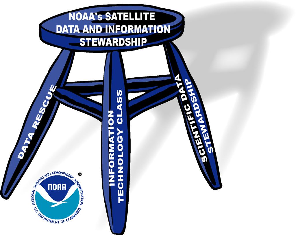
An Overview of NOAA s Satellite, Data, and Information Stewardship Program
|
|
|
- Diana Green
- 5 years ago
- Views:
Transcription
1 An Overview of NOAA s Satellite, Data, and Information Stewardship Program John J. Bates and Mitch Goldberg National Oceanic and Atmospheric Administration National Environmental Satellite Data and Information Service
2
3 Scientific Data Stewardship The goal is to ensure that satellite observations and products are processed and used in a manner that is scientifically defensible, not only for real-time assessments and predictions of climate, but for retrospective analyses, re-analyses, and reprocessing efforts. Primary functions are: Careful monitoring of observing system performance for long-term applications Generation of climate data records CDRs provide information to: monitor change (climate variability and trends) of the Earth s climate. predict change especially SI forecasts input to model re-analyses (note: reanalysis is also a CDR) validate climate prediction models and model reanalyses understand processes ( water vapor-cloud-radiation feedback) In preparation of this new program, NESDIS is developing a plan for generating CDRs from NOAA operational satellites, which will be reviewed by the National Academies.
4 What is a CDR? A climate data record is a collection of data that can be used to construct a high quality time series with quantified error characteristics. The time series should be free of instrument artifacts and changes in algorithms.
5 Motivation for Developing A Plan for Operational Climate Data Record Production Increasing demand for credible climate information to monitor and predict climate change and variability. NOAA s operational satellites are a major source of sustained long term observations of the Earth s climate NOAA is not fully exploiting these satellites to meet the needs of climate change investigators Observations from EOS, METOP, NPP and NPOESS FY05 Initiative to begin Scientific Data Stewardship
6 NOAA Operational Satellite Products Atmosphere Temperature soundings Moisture soundings Winds Clouds Aerosols Earth Radiation Budget Precipitation Ozone Ocean Surface temperature Ice cover Surface winds Color Land Sea level Vegetation condition Snow cover Other land characteristics (e,g., albedo, skin temperature, insolation) Fire locations/smoke Plumes


7 Ozone: A True NESDIS CDR Ozone is adjusted to NOAA-9 Validated against Dobson Stations Reprocessed when new algorithms are developed Compared with models
8 Academy Study Provide NOAA with advice in developing the Plan The NRC involvement will consist of two phases: Phase 1 -- (August 2003) Information gathering workshop, including review of NOAA white paper on generation of CDRs and an interim report to NOAA Phase 2 Review of NOAA draft plan (March 2004)
9 NOAA White Paper on Climate Data Records Provide background information, issues, and initial NOAA thoughts on CDR creation: Motivation to establish end-to-end system for creating climate data records (CDRs) from operational satellites Review of current programs to create CDRs (NOAA and external) Summary of lessons learned in the use of satellite observations for climate monitoring Conceptual framework for moving ahead Additional issues for Committee to consider Serves as a draft background section of the NOAA Plan for Creating CDRs from Operational Satellites
10 Lessons Learned Impediments to Generation of Climate Quality Data Sets at NOAA Limitations of satellite instruments mainly designed for weather observations Constraints of a real-time operational processing system developed for weather satellite data No standard methodologies for creating CDRs Lack of infrastructure at NESDIS for climate data generation systems for near-real time and retrospective processing/reprocessing
11 Where are We Going? Creating Quality Climate Data Records Requires: Lowest level of data (level 1) be preserved with complete documentation and metadata, includes data that records the satellite and instrument performance Observing performance monitoring to minimize spatial and temporal biases Tools to detect and account for changes in the observing system Science team guidance and participation Near Real-Time CDR Generation Tight connection between algorithm developer and CDR generator (may be same group) Strong calibration/validation program Research with the data set as part of the program Collaboration with user communities (e.g., diagnosticians, modelers) to obtain feedback
12 Where are We Going? Creating Quality Climate Data Records Requires (cont): Re-processing An improved algorithm is developed New information on an instrument An error is discovered in the processing system Research and Application Development of climate quality algorithms Analysis of time series to detect emerging trends Joint studies with climate modeling community Production of periodic assessments for decision makers, other climate researchers and the public Data Requirements End-to-end data management Near real-time access to data (including raw radiances) Development of community consensus algorithms and data standards Complete archiving: data, meta data, source code, ancillary data, etc. Free and open sharing and exchange of climate data» Nationally and internationally
13 Where Are We Going? Functional Areas An end-to-end process for creating CDRs could consist of 5 functional areas Real-time instrument monitoring Detect problems early Production of near real-time CDRs Monitor current state of climate system and short -term variations Reprocessing of CDRs for long-term records Consistent, seamless, high quality time series with minimized bias Climate research, applications, and monitoring Joint activities with external community Includes observing system performance monitoring Archive and distribution Includes output of above activities, metadata, and timely distribution
14 Where Are We Going? Conceptual Framework Leveraging Resources/ Collaboration NASA International Space Agencies International Data Programs CCSP Observations Management Structure Climate Data Science Teams Experts in Instrument Characterization, Algorithms, Validation, Data Management, Applications, and Observing System Performance Monitoring Instrument Monitoring Production of Near Real-Time CDRs Processing of CDRs for Long Term Records Archive and Distribution Interactions with Users Climate Research/ Applications/ Monitoring Modeling Monitoring Prediction Research Improved CDR Products Design for Future Systems
15 Vision A climate science community empowered with the high quality satellite-based climate data records needed to define global climate variations and change
16 Backup slides
17 Scientific Data Stewardship Generic Guiding Principles 1. Careful monitoring of observing system performance for longterm applications 2. Generation of authoritative long-term records through validation of the calibration process, reprocessing, product generation and the blending of in situ and satellite measurements 3. Provide state of the environment information for decision makers and place the current state in its historical context 4. Archive and access to fundamental measurements, products and metadata (supported by CLASS) 5. Data archaeology and improved use (supported by CDMP)
18 Introduction NOAA Mission and Strategic Goals Mission Understand and predict changes in the earth s environment and conserve and manage coastal and marine resources to meet our nation s economic, social, and environmental needs Strategic Goals Protect, restore, and manage the use of coastal and ocean resources through ecosystem-based management Understand climate variability and change to enhance society s ability to plan and respond Serve society s needs for weather and water information Support the nation s commerce with information for safe, efficient, and environmentally sound transportation
19 Introduction NOAA Strategic Goal to Understand Climate Variability and Change Measurable Outcomes Strategies Increased use and effectiveness of climate observations to improve long-range climate, weather, and water predictions. Increased use and effectiveness of climate information for decision makers and managers. Increased use of the knowledge of how climate variability and change affect commerce. Monitor and Observe: Invest in highquality, long-term climate observations and encourage other national and international investments to provide a comprehensive observing system in support of climate assessments and forecasts. UUnderstand and Describe: Increase understanding of the dynamics and impacts of coupled atmosphere/ocean/land systems by working with national and international partners to conduct research on climate variability and change. Assess and Predict: Provide decision makers with reliable, objective information, by improving the skill and accuracy of intraseasonal and interannual climate forecasts and regional, national, and international assessments and projections. EEngage, Advise, & Inform: Help customers effectively use climate information to enhance public health and safety; support environmental, economic, and community planning; maximize potential benefits; and minimize the impacts of climate variability.
20 White Paper Contents Section 1 Introduction Provides background on mandates, initiatives and NRC recommendations Section 2 Where Are We Now? Examples of climate records derived from operational satellites NESDIS Satellite data and data management resources (POES, NPP, NPOESS, CLASS) Section 3 Lessons Learned Issues and recommendations resulting through use of operational satellite data to produce climate records Section 4 Where Are We Going? Some thoughts on components of end-to-end system for creating CDRs
21 Introduction Background At request of White House, National Research Council (NRC) recommends several research priorities for climate research (2001) President Bush announces Climate Change Science Program (CCSP) to integrate Federal climate research (2002) CCSP finalizes its Strategic Plan (2003) NOAA initiates development of a Plan to Create CDRs from Operational Satellites (2003)
22 Why Now? Increasing importance of climate information NRC s Climate Change Science report: ensure the existence of a long-term monitoring system that provides a more definitive observational foundation to evaluate decadal- to century-scale changes Economic value of improved seasonal-interannual climate forecasts Observations and Monitoring are a key component of recently released Strategic Plan for U.S. Climate Change Science Program Earth Observations Summit has initiated 10-year program to develop an international, comprehensive, coordinated and sustained Earth observation system
23 Where are We Now? Climate Products Produced from Operational Satellites in Different Ways Operational products gridded to climate scale by NOAA or external investigators (Several DMSP SSM/I products; ERB, SST, vegetation and aerosols from AVHRR) NOAA/NASA collaborations (Ozone from SBUV and ATOVS/HIRS) Produced by external investigators (Atmospheric temperatures from MSU, snow cover from AVHRR) One-time projects such as NOAA/NASA Pathfinder International climate projects (ISCCP: clouds and GPCP: precipitation)


24 Where are We Now? CDRs Produced by NESDIS by Gridding Operational Products to Climate Scale OLR 7-03 Rainfall 7-03 Vegetation Health and


25 Where are We Now? Examples of CDRs Produced by External Groups U. Alabama Tropospheric Temp Snow Cover Anomalies ISCCP Global Cloud Amount GPCP Global Precipitation
26 Where are We Now? The NOAA/NASA Pathfinder Project: A One-Time Reprocessing Project Initiated in the early 1990s to generate climate quality data sets from the archived observations of the U.S. operational environmental satellites AVHRR (since 1981), TOVS (since 1979), SSM/I (since 1987), GOES (since 1978) Guided by scientific working groups Transcribed the data from hundreds of thousands of magnetic tapes to more accessible media for processing; Developed improved instrument calibration histories Selected community consensus algorithms for generating geophysical products Processed, validated, and provided access to the data sets Produced CDRs: temperature and moisture profiles, cloudiness, precipitation, earth radiation budget, and aerosols
27 Where are We Now? Examples of Climate Data Records Based on Operational Satellite Observations Climate Product Satellite Instrument Produced by Since Earth Radiation Budget (ERB) Outgoing long-wave radiation (OLR) Absorbed solar radiation (ASR) POES/AVHRR NESDIS 1978 Ozone POES/SBUV/2 & POES/ATOVS/HIRS NESDIS/NASA 1985 Blended Sea Surface Temperature (SST) POES/AVHRR NESDIS/NWS 1981 DMSP SSM/I Climate Products (rainfall, rain frequency, snow cover, sea ice cover, clouds, water vapor, and oceanic wind speed) DMSP SSM/I NESDIS 1987 Vegetation (NDVI and drought index) POES/AVHRR NESDIS 1982 Atmospheric Temperature POES/MSU Univ. of Alabama 1979 Snow Cover POES/AVHRR, GOES, Meteosat, GMS Visible imagery, DMSP/SSM/I Rutgers Univ. Climate Laboratory 1966 Clouds POES/AVHRR, GOES, Meteosat, and GMS Visible/IR imagery WCRP/International Satellite Cloud Climatology Project 1983 Precipitation POES/AVHRR, GOES; Meteosat and GMS Visible IR imagery, DMSP SSM/I WCRP/Global Precipitation Climatology Project 1986


28 Where are We Now? The NOAA/NASA Pathfinder Project: A One-Time Reprocessing Project (cont) Mean Global Maps Based on 20 Years of AVHRR Observations Cloud Amount Reflected Solar Radiation OLR Aerosol Amount
29 Lessons Learned Important Questions Spawned via Production of Climate Records Using Operational Data What are the priority climate products that an operational center should produce and how? What methods and good practices should be used to facilitate access to a variety of products, metadata, and raw data? What in situ baseline observations are required to use for longterm calibration and validation of space-based observations? What critical performance measures should be monitored in realtime to avoid single-point failures in long-term records of critical climate variables? How do we reconcile different observations and analysis techniques to achieve the best and/or consensus climate data records?
30 Lessons Learned Minimize Bias 9 Application of the forward and inverse radiative transfer equation to climate studies emphasizes the need to minimize systematic bias in the raw data and retrieval method
31 Lessons Learned Importance of Satellite Intercalibration

32 Lessons Learned Importance of Multiple Independent Observations and Analyses

33 Lessons Learned Expect the Unexpected Volcanic eruptions contaminate infrared-only SSTs. Lesson is that we must have robust observing methods for critical climate variables
34
35
36 International TOVS Study Conference, 13 th, TOVS-13, Sainte Adele, Quebec, Canada, 29 October-4 November Madison, WI, University of Wisconsin-Madison, Space Science and Engineering Center, Cooperative Institute for Meteorological Satellite Studies, 2003.
NOAA Climate Data Record (CDR) Program and Products: Briefing to the NOAA Climate Reanalysis Task Force (seeking opportunity and collaboration)
 Program and Products: Briefing to the NOAA Climate Reanalysis Task Force (seeking opportunity and collaboration)") NOAA Climate Data Record (CDR) Program and Products: Briefing to the NOAA Climate Reanalysis Task Force (seeking opportunity and collaboration) E. J. Kearns, W. J. Glance, and X. (Tom) Zhao 28 January
NOAA Climate Data Record (CDR) Program and Products: Briefing to the NOAA Climate Reanalysis Task Force (seeking opportunity and collaboration) E. J. Kearns, W. J. Glance, and X. (Tom) Zhao 28 January
International Cooperation in Operational Environmental Satellites: The U.S. Experience
 Committee on the Peaceful Uses of Outer Space Science and Technology Sub committee Forty seventh session February 17, 2010 Vienna, Austria International Cooperation in Operational Environmental Satellites:
EUMETSAT Activities Related to Climate
 EUMETSAT Activities Related to Climate Jörg Schulz joerg.schulz@eumetsat.int Slide: 1 What we do USER REQUIREMENTS European National Meteorological Services Operating Agency! European Space Industry Private
NOAA Report. Hal Bloom Mitch Goldberg NOAA/NESDIS
 NOAA Report Hal Bloom Mitch Goldberg NOAA/NESDIS Summary of Major Events at NESDIS (of interest to ITSC) NOAA/NASA addressing NPOESS Climate Sensors Letter of agreement signed with JAXA on GCOM interagency
Joint Polar Satellite System. 3 rd Post-EPS User Consultation Workshop Mike Haas
 3 rd Post-EPS User Consultation Workshop Mike Haas Overview Introduction - Policy Drivers - Management System Description - Space Segment - Ground Segment Partnerships Status Benefits 2 Introduction (Policy
Research applications with Click to edit Master title style NOAA s Climate Data Record Program
 Research applications with Click to edit Master title style NOAA s Climate Data Record Program Click to edit Master subtitle style Jessica Matthews November 29, 2016 1 NOAA s CDR Program Mission: To develop
The CEOS Atmospheric Composition Constellation (ACC) An Example of an Integrated Earth Observing System for GEOSS
 An Example of an Integrated Earth Observing System for GEOSS") The CEOS Atmospheric Composition Constellation (ACC) An Example of an Integrated Earth Observing System for GEOSS Presentation Authors: E. Hilsenrath NASA, C. Zehner ESA, J. Langen ESA, J. Fishman NASA
The CEOS Atmospheric Composition Constellation (ACC) An Example of an Integrated Earth Observing System for GEOSS Presentation Authors: E. Hilsenrath NASA, C. Zehner ESA, J. Langen ESA, J. Fishman NASA
EUMETSAT SAF NETWORK. Lothar Schüller, EUMETSAT SAF Network Manager
 1 EUMETSAT SAF NETWORK Lothar Schüller, EUMETSAT SAF Network Manager EUMETSAT ground segment overview METEOSAT JASON-2 INITIAL JOINT POLAR SYSTEM METOP NOAA SATELLITES CONTROL AND DATA ACQUISITION FLIGHT
The National Integrated Drought Information System (NIDIS) Moving the Nation from Reactive to Proactive Drought Risk Management
 Moving the Nation from Reactive to Proactive Drought Risk Management") The National Integrated Drought Information System (NIDIS) Moving the Nation from Reactive to Proactive Drought Risk Management CSG-West Annual Meeting Agriculture & Water Committee Snowbird, UT September
The National Integrated Drought Information System (NIDIS) Moving the Nation from Reactive to Proactive Drought Risk Management CSG-West Annual Meeting Agriculture & Water Committee Snowbird, UT September
Experiences of using ECV datasets in ECMWF reanalyses including CCI applications. David Tan and colleagues ECMWF, Reading, UK
 Experiences of using ECV datasets in ECMWF reanalyses including CCI applications David Tan and colleagues ECMWF, Reading, UK Slide 1 Main points Experience shows benefit of integrated & iterative approach
Climate Change Service
 Service Metadata for the Data Store Dick Dee, ECMWF C3S: data + expertise + operational Open and free access to climate data (observations, reanalyses, model predictions) Tools and best scientific practices
APPLICATIONS WITH METEOROLOGICAL SATELLITES. W. Paul Menzel. Office of Research and Applications NOAA/NESDIS University of Wisconsin Madison, WI
 APPLICATIONS WITH METEOROLOGICAL SATELLITES by W. Paul Menzel Office of Research and Applications NOAA/NESDIS University of Wisconsin Madison, WI July 2004 Unpublished Work Copyright Pending TABLE OF CONTENTS
Lecture 4b: Meteorological Satellites and Instruments. Acknowledgement: Dr. S. Kidder at Colorado State Univ.
 Lecture 4b: Meteorological Satellites and Instruments Acknowledgement: Dr. S. Kidder at Colorado State Univ. US Geostationary satellites - GOES (Geostationary Operational Environmental Satellites) US
REVISION OF THE STATEMENT OF GUIDANCE FOR GLOBAL NUMERICAL WEATHER PREDICTION. (Submitted by Dr. J. Eyre)
") WORLD METEOROLOGICAL ORGANIZATION Distr.: RESTRICTED CBS/OPAG-IOS (ODRRGOS-5)/Doc.5, Add.5 (11.VI.2002) COMMISSION FOR BASIC SYSTEMS OPEN PROGRAMME AREA GROUP ON INTEGRATED OBSERVING SYSTEMS ITEM: 4 EXPERT
WORLD METEOROLOGICAL ORGANIZATION Distr.: RESTRICTED CBS/OPAG-IOS (ODRRGOS-5)/Doc.5, Add.5 (11.VI.2002) COMMISSION FOR BASIC SYSTEMS OPEN PROGRAMME AREA GROUP ON INTEGRATED OBSERVING SYSTEMS ITEM: 4 EXPERT
Atmospheric Soundings of Temperature, Moisture and Ozone from AIRS
 Atmospheric Soundings of Temperature, Moisture and Ozone from AIRS M.D. Goldberg, W. Wolf, L. Zhou, M. Divakarla,, C.D. Barnet, L. McMillin, NOAA/NESDIS/ORA Oct 31, 2003 Presented at ITSC-13 Risk Reduction
An Arctic Perspective NCEI's Prototype Arctic Data Viewer
 An Arctic Perspective NCEI's Prototype Arctic Data Viewer NCEI Arctic Action Team Kate Rose NOAA National Environmental Satellite, Data, and Information Service National Centers for Environmental Information
A New Microwave Snow Emissivity Model
 A New Microwave Snow Emissivity Model Fuzhong Weng 1,2 1. Joint Center for Satellite Data Assimilation 2. NOAA/NESDIS/Office of Research and Applications Banghua Yan DSTI. Inc The 13 th International TOVS
The Delaware Environmental Monitoring & Analysis Center
 The Delaware Environmental Monitoring & Analysis Center Tina Callahan Delaware Estuary Science & Environmental Summit 2013 January 27-30, 2013 What is DEMAC? Delaware Environmental Monitoring & Analysis
Earth Science Flight Mission Overview
 Earth Science Flight Mission Overview Nand Topiwala Science Mission Directorate NASA Headquarters April 25, 2007 Earth Science Missions Afternoon Constellation, or A-Train, Multi-Satellite Observatory
NOAA Report. Mitch Goldberg. NOAA/NESDIS Center for Satellite Applications and Research
 NOAA Report Mitch Goldberg NOAA/NESDIS Center for Satellite Applications and Research NOAA JOINT POLAR SATELLITE PROGRAM Mission Support to NOAA Programs Ecosystems NOAA CoastWatch Program Real-time distribution
EUMETSAT SAF NETWORK. Lothar Schüller, EUMETSAT SAF Network Manager
 1 EUMETSAT SAF NETWORK Lothar Schüller, EUMETSAT SAF Network Manager EUMETSAT ground segment overview METEOSAT JASON-2 INITIAL JOINT POLAR SYSTEM METOP NOAA SATELLITES CONTROL AND DATA ACQUISITION FLIGHT
Building a 4-D Weather Data Cube for the NextGen Initial Operating Capability (IOC)
") Building a 4-D Weather Data Cube for the NextGen Initial Operating Capability (IOC) Friends/Partners in Aviation Weather Vision Forum July 15, 2008 Bruce Lambert - DoD Tom Ryan FAA Jason Tuell NWS 1 Overview
Building a 4-D Weather Data Cube for the NextGen Initial Operating Capability (IOC) Friends/Partners in Aviation Weather Vision Forum July 15, 2008 Bruce Lambert - DoD Tom Ryan FAA Jason Tuell NWS 1 Overview
NOAA Surface Weather Program
 NOAA Surface Weather Program Maintenance Decision Support System Stakeholder Meeting #9 Jim O Sullivan NOAA Surface Weather Program Manager NWS Office of Climate, Water, and Weather Services September
NOAA s Strategy for Monitoring Earth s Climate System. John J Bates NOAA s National Climatic Data Center
 NOAA s Strategy for Monitoring Earth s Climate System John J Bates NOAA s National Climatic Data Center May 21, 2010 Understanding the various complex processes that make up Earth s system is a major scientific
An Overview of Atmospheric Analyses and Reanalyses for Climate
 An Overview of Atmospheric Analyses and Reanalyses for Climate Kevin E. Trenberth NCAR Boulder CO Analysis Data Assimilation merges observations & model predictions to provide a superior state estimate.
CEOS and Climate monitoring
 CEOS and Climate monitoring Committee on Earth Observation Satellites www.ceos.org Climate challenges and the need for observations Observations play a crucial role in the detection of climate change and
ERA-CLIM: Developing reanalyses of the coupled climate system
 ERA-CLIM: Developing reanalyses of the coupled climate system Dick Dee Acknowledgements: Reanalysis team and many others at ECMWF, ERA-CLIM project partners at Met Office, Météo France, EUMETSAT, Un. Bern,
Operational Climate Monitoring
 Operational Climate Monitoring Concept of Climate data records & operational climate monitoring Introduction CM SAF Examples of downstream services in Europe (e.g. WMO RCC RA VI) in US (e.g. drought monitoring)
Ministry of Health and Long-Term Care Geographic Information System (GIS) Strategy An Overview of the Strategy Implementation Plan November 2009
 Strategy An Overview of the Strategy Implementation Plan November 2009") Ministry of Health and Long-Term Care Geographic Information System (GIS) Strategy An Overview of the Strategy Implementation Plan November 2009 John Hill, Health Analytics Branch Health System Information
Ministry of Health and Long-Term Care Geographic Information System (GIS) Strategy An Overview of the Strategy Implementation Plan November 2009 John Hill, Health Analytics Branch Health System Information
National Climatic Data Center Data Management Issues Tom Karl Director, NOAA s National Climatic Data Center
 National Climatic Data Center Data Management Issues Tom Karl Director, NOAA s National Climatic Data Center Opening Meeting NOAA Science Advisory Board s Data Archiving and Access Requirements Working
ERA5 and the use of ERA data
 ERA5 and the use of ERA data Hans Hersbach, and many colleagues European Centre for Medium-Range Weather Forecasts Overview Overview of Reanalysis products at ECMWF ERA5, the follow up of ERA-Interim,
NOAA S2S Planning. Dave DeWitt Fred Toepfer
 NOAA S2S Planning Dave DeWitt Fred Toepfer 1 Agenda 1. Brief synopsis of The Weather Research and Forecasting Act of 2017 2. Report to Congress a. Timeline b. Process c. Document Outline 3. Some Preliminary
Overview: Scope and Goals
 Overview: Scope and Goals Current operational NOAA instruments: AVHRR, HIRS, SBUV, GOES Imagers/Sounders; Non-NOAA satellites/sensors; Future: MetOP and NPP/NPOESS; GOES-R Assure Functionality of Current/Near-Future
The National Weather Service of the Future: Building a Weather-Ready Nation
 The of the Future: Building a Weather-Ready Nation Dr. Louis W. Uccellini Director, NOAA Assistant Administrator for Weather Services NCEP Production Suite Review December 2, 2014 Outline Building a Weather-Ready
Egypt-NOAA Cooperation: Advancing our Environmental Science, Technology, and Education
 Egypt-NOAA Cooperation: Advancing our Environmental Science, Technology, and Education T. G. Onsager NOAA Space Weather Prediction Center and NWS International Activities Office (one-year detail) Terry.Onsager@noaa.gov
ESA Climate Change Initiative (CCI)
") ESA Climate Change Initiative (CCI) New ESA Programme with the aim to contribute to worldwide efforts to generate Essential Climate Variables (ECVs) C. Zehner Barcelona, 07/09/2009 Two climate action paths
ESA Climate Change Initiative (CCI) New ESA Programme with the aim to contribute to worldwide efforts to generate Essential Climate Variables (ECVs) C. Zehner Barcelona, 07/09/2009 Two climate action paths
NOAA Hurricane Forecast Improvement Project
 NOAA Hurricane Forecast Improvement Project Fred Toepfer Hurricane Forecast Improvement Project Manager November 9 th, 2009 Outline NOAA Hurricane Forecast Improvement Project Driving Issue Purpose NOAA
McIDAS support of Suomi-NPP /JPSS and GOES-R L2
 McIDAS support of Suomi-NPP /JPSS and GOES-R L2 William Straka III 1 Tommy Jasmin 1, Bob Carp 1 1 Cooperative Institute for Meteorological Satellite Studies, Space Science and Engineering Center, University
IMPORTANCE OF SATELLITE DATA (FOR REANALYSIS AND BEYOND) Jörg Schulz EUMETSAT
 Jörg Schulz EUMETSAT") IMPORTANCE OF SATELLITE DATA (FOR REANALYSIS AND BEYOND) Jörg Schulz EUMETSAT Why satellite data for climate monitoring? Global coverage Global consistency, sometimes also temporal consistency High spatial
IMPORTANCE OF SATELLITE DATA (FOR REANALYSIS AND BEYOND) Jörg Schulz EUMETSAT Why satellite data for climate monitoring? Global coverage Global consistency, sometimes also temporal consistency High spatial
NOAA Arctic Priorities and Potential Contributions to PPP/YOPP. Randall Dole NOAA Earth System Research Laboratory Physical Sciences Division
 NOAA Arctic Priorities and Potential Contributions to PPP/YOPP Randall Dole NOAA Earth System Research Laboratory Physical Sciences Division 1 NOAA s Arctic Goals Forecast Sea Ice Strengthen Foundational
Which Climate Model is Best?
 Which Climate Model is Best? Ben Santer Program for Climate Model Diagnosis and Intercomparison Lawrence Livermore National Laboratory, Livermore, CA 94550 Adapting for an Uncertain Climate: Preparing
NESDIS Polar (Region) Products and Plans. Jeff Key NOAA/NESDIS Madison, Wisconsin USA
 Products and Plans. Jeff Key NOAA/NESDIS Madison, Wisconsin USA") NESDIS Polar (Region) Products and Plans Jeff Key NOAA/NESDIS Madison, Wisconsin USA WMO Polar Space Task Group, 2 nd meeting, Geneva, 12 14 June 2012 Relevant Missions and Products GOES R ABI Fractional
NESDIS Polar (Region) Products and Plans Jeff Key NOAA/NESDIS Madison, Wisconsin USA WMO Polar Space Task Group, 2 nd meeting, Geneva, 12 14 June 2012 Relevant Missions and Products GOES R ABI Fractional
Climate Data Record Program Overview
 Climate Data Record Program Overview Hilawe Semunegus CDR Program Scientist NOAA s National Climatic Data Center Asheville, NC Western States Water Council: Hydroclimate Monitoring Systems & Measurement
What Measures Can Be Taken To Improve The Understanding Of Observed Changes?
 What Measures Can Be Taken To Improve The Understanding Of Observed Changes? Convening Lead Author: Roger Pielke Sr. (Colorado State University) Lead Author: David Parker (U.K. Met Office) Lead Author:
Rainfall-River Forecasting: Overview of NOAA s Role, Responsibilities, and Services
 Dr. Thomas Graziano Chief Hydrologic Services Division NWS Headquarters Steve Buan Service Coordination Hydrologist NWS North Central River Forecast Center Rainfall-River Forecasting: Overview of NOAA
The Copernicus Climate Change (C3) service: State of play
 service: State of play") Enterprise and Industry The Copernicus Climate Change (C3) service: State of play B. Pinty (a) & J-N. Thépaut (b) (a) Copernicus G.2 unit (b) ECMWF CCI October2014 Legal frame & MS consultations Publica6on
Enterprise and Industry The Copernicus Climate Change (C3) service: State of play B. Pinty (a) & J-N. Thépaut (b) (a) Copernicus G.2 unit (b) ECMWF CCI October2014 Legal frame & MS consultations Publica6on
Climate Models and Snow: Projections and Predictions, Decades to Days
 Climate Models and Snow: Projections and Predictions, Decades to Days Outline Three Snow Lectures: 1. Why you should care about snow 2. How we measure snow 3. Snow and climate modeling The observational
Contemporary Challenges in Short-Term Climate Forecasting. David DeWitt Director, Climate Prediction Center
 Contemporary Challenges in Short-Term Climate Forecasting David DeWitt Director, Climate Prediction Center 1 Outline Commercial: NOAA Administrator s Award for Decisions Support Services Associated with
A two-season impact study of the Navy s WindSat surface wind retrievals in the NCEP global data assimilation system
 A two-season impact study of the Navy s WindSat surface wind retrievals in the NCEP global data assimilation system Li Bi James Jung John Le Marshall 16 April 2008 Outline WindSat overview and working
Use of satellite data in reanalysis
 Use of satellite data in reanalysis Dick Dee Acknowledgements: Paul Poli, Adrian Simmons, Hans Hersbach, Carole Peubey, David Tan, Rossana Dragani, the rest of the reanalysis team and many others at ECMWF.
Gaps in Space Weather Forecasting
 Gaps in Space Weather Forecasting Awareness Gap: Where is there uncertainty about how the scientific community can contribute to space weather operations? Areas With Good Awareness - All agencies recognize
MSG system over view
 MSG system over view 1 Introduction METEOSAT SECOND GENERATION Overview 2 MSG Missions and Services 3 The SEVIRI Instrument 4 The MSG Ground Segment 5 SAF Network 6 Conclusions METEOSAT SECOND GENERATION
METEOSAT THIRD GENERATION
 METEOSAT THIRD GENERATION FACTS AND FIGURES MONITORING WEATHER AND CLIMATE FROM SPACE A HIGHLY INNOVATIVE GEOSTATIONARY SATELLITE SYSTEM FOR EUROPE AND AFRICA The Meteosat Third Generation (MTG) system
Update from the European Centre for Medium-Range Weather Forecasts
 JSC-34 Brasilia, May 2013 Update from the European Centre for Medium-Range Weather Forecasts Adrian Simmons Consultant, ECMWF First main message ECMWF has a continuing focus on a more seamless approach
Some NOAA Products that Address PSTG Satellite Observing Requirements. Jeff Key NOAA/NESDIS Madison, Wisconsin USA
 Some NOAA Products that Address PSTG Satellite Observing Requirements Jeff Key NOAA/NESDIS Madison, Wisconsin USA WMO Polar Space Task Group, 4 th meeting, Greenbelt, 30 September 2014 Relevant Missions
P1.34 MULTISEASONALVALIDATION OF GOES-BASED INSOLATION ESTIMATES. Jason A. Otkin*, Martha C. Anderson*, and John R. Mecikalski #
 P1.34 MULTISEASONALVALIDATION OF GOES-BASED INSOLATION ESTIMATES Jason A. Otkin*, Martha C. Anderson*, and John R. Mecikalski # *Cooperative Institute for Meteorological Satellite Studies, University of
Global Precipitation Data Sets
 Global Precipitation Data Sets Rick Lawford (with thanks to Phil Arkin, Scott Curtis, Kit Szeto, Ron Stewart, etc) April 30, 2009 Toronto Roles of global precipitation products in drought studies: 1.Understanding
NWSEO CALLS FOR NATIONAL CLIMATE SERVICE TO BE MADE PART OF THE NATIONAL WEATHER SERVICE
 APRIL 2009 NWSEO CALLS FOR NATIONAL CLIMATE SERVICE TO BE MADE PART OF THE NATIONAL WEATHER SERVICE At its recent winter meeting, the NWSEO National Council decided to urge the Administration and Congress
The known requirements for Arctic climate services
 The known requirements for Arctic climate services based on findings described in STT White paper 8/2015 Johanna Ekman / EC PHORS STT Regional drivers The Arctic region is home to almost four million people
EUMETSAT Beitrag zu CAMS und C3S. Jörg Schulz. Credits to many EUMETSAT Staff
 ETSAT Beitrag zu CAMS und C3S Jörg Schulz Credits to many ETSAT Staff The Copernicus Programme at ETSAT ETSAT is entrusted by the European Commission; ETSAT s Delegation Agreement is organised in 3 major
Opportunities and Priorities in a New Era for Weather and Climate Services
 Opportunities and Priorities in a New Era for Weather and Climate Services John A. Dutton The Pennsylvania State University 1. Progress in Weather and Climate Services Rapid changes are sweeping through
The Kentucky Mesonet: Entering a New Phase
 The Kentucky Mesonet: Entering a New Phase Stuart A. Foster State Climatologist Kentucky Climate Center Western Kentucky University KCJEA Winter Conference Lexington, Kentucky February 9, 2017 Kentucky
Challenges to Improving the Skill of Weekly to Seasonal Climate Predictions. David DeWitt with contributions from CPC staff
 Challenges to Improving the Skill of Weekly to Seasonal Climate Predictions David DeWitt with contributions from CPC staff 1 Outline CPC Background Prediction, monitoring, diagnostics, and climate services
Space Studies Board Meeting Mary E. Kicza
 Space Studies Board Meeting Mary E. Kicza Assistant Administrator for Satellites and Information Services May 14, 2009 1 Summary Budget Update FY 2009 Stimulus (ARRA) FY 2009 Omnibus FY 2010 President
Maryland Space. Business Roundtable. Satellite and Information Service. Stephen Volz, Ph.D., Assistant Administrator. January 2018
 Maryland Space Satellite and Information Service Business Roundtable Stephen Volz, Ph.D., Assistant Administrator January 2018 Delivering on the Commitment JPSS-1 Launch Nov 18, 2017 GOES-R Launch Nov
Behind the Climate Prediction Center s Extended and Long Range Outlooks Mike Halpert, Deputy Director Climate Prediction Center / NCEP
 Behind the Climate Prediction Center s Extended and Long Range Outlooks Mike Halpert, Deputy Director Climate Prediction Center / NCEP September 2012 Outline Mission Extended Range Outlooks (6-10/8-14)
VWG.01 EUMETSAT Corporate Slide Collection (EUM/CIS/VWG/14/743878) Version 1, January 2014 MONITORING WEATHER AND CLIMATE FROM SPACE
 Version 1, January 2014 MONITORING WEATHER AND CLIMATE FROM SPACE") 1 VWG.01 EUMETSAT Corporate Slide Collection (EUM/CIS/VWG/14/743878) Version 1, January 2014 MONITORING WEATHER AND CLIMATE FROM SPACE Royal charter: 25/26 October 1859 From observation to decision making:
1 VWG.01 EUMETSAT Corporate Slide Collection (EUM/CIS/VWG/14/743878) Version 1, January 2014 MONITORING WEATHER AND CLIMATE FROM SPACE Royal charter: 25/26 October 1859 From observation to decision making:
Improving Sub-Seasonal to Seasonal Prediction at NOAA
 Improving Sub-Seasonal to Seasonal Prediction at NOAA Dr. Louis W. Uccellini Director, National Weather Service NOAA Assistant Administrator for Weather Services July 13, 2016 Congressional Briefing Value
GCOM-W1 now on the A-Train
 GCOM-W1 now on the A-Train GCOM-W1 Global Change Observation Mission-Water Taikan Oki, K. Imaoka, and M. Kachi JAXA/EORC (& IIS/The University of Tokyo) Mini-Workshop on A-Train Science, March 8 th, 2013
WMO Integrated Global Observing Systems (WIGOS) and the QA4EO
 and the QA4EO") WMO OMM World Meteorological Organization Working together in weather, climate and water WMO Integrated Global Observing Systems (WIGOS) and the QA4EO J. Lafeuille WMO Space Programme WMO www.wmo.int Outline
WMO OMM World Meteorological Organization Working together in weather, climate and water WMO Integrated Global Observing Systems (WIGOS) and the QA4EO J. Lafeuille WMO Space Programme WMO www.wmo.int Outline
NSF Expeditions in Computing. Understanding Climate Change: A Data Driven Approach. Vipin Kumar University of Minnesota
 NSF Expeditions in Computing Understanding Climate Change: A Data Driven Approach Vipin Kumar University of Minnesota kumar@cs.umn.edu www.cs.umn.edu/~kumar Vipin Kumar UCC Aug 15, 2011 Climate Change:
Observation (EO) & Geomatics in Canada
 & Geomatics in Canada") Innovating to Increase the Impact of Earth Observation (EO) & Geomatics in Canada Natural Resources Canada February 25, 2014 Prashant Shukle, Director General Canada Centre for Mapping and Earth Observation
Innovating to Increase the Impact of Earth Observation (EO) & Geomatics in Canada Natural Resources Canada February 25, 2014 Prashant Shukle, Director General Canada Centre for Mapping and Earth Observation
Country Report - Singapore
 Country Report - Singapore The 5th Meeting of the Coordinating Group Vladivostok city, Russky Island, Russia Far Eastern Federal University of the RA II WIGOS Satellite Project 21 October 2017 Outline
OSE/OSSEs at NOAA. Eric Bayler NOAA/NESDIS/STAR
 OSE/OSSEs at NOAA Eric Bayler NOAA/NESDIS/STAR OSE/OSSEs at NOAA NOAA Leadership view: Relatively inexpensive way to: Assess the impact of potential new observations Refine and redirect current observing
CLAVR-x is the Clouds from AVHRR Extended Processing System. Responsible for AVHRR cloud products and other products at various times.
 CLAVR-x in CSPP Andrew Heidinger, NOAA/NESDIS/STAR, Madison WI Nick Bearson, SSEC, Madison, WI Denis Botambekov, CIMSS, Madison, WI Andi Walther, CIMSS, Madison, WI William Straka III, CIMSS, Madison,
Creating a WeatherSMART nation: SAWS drought related research, services and products
 Creating a WeatherSMART nation: SAWS drought related research, services and products Drought Dialogue 23-24 June 2016 Western Cape Government Hannes Rautenbach South African Weather Service SAWS mandate
FINDINGS OF THE ARCTIC METEOROLOGY SUMMIT
 FINDINGS OF THE ARCTIC METEOROLOGY SUMMIT 2018 WWW.FMI.FI CHAIR S SUMMARY: 1 2 3 We need to be curious to explore the known unknowns. Meteorology is an elemental part of international collaboration in
Climate Prediction Center Research Interests/Needs
 Climate Prediction Center Research Interests/Needs 1 Outline Operational Prediction Branch research needs Operational Monitoring Branch research needs New experimental products at CPC Background on CPC
Space research. Horizon Work Programme. "Countdown to Horizon 2020 Space" Earth Observation topics. Brussels, 12 December 2013
 Space research Horizon 2020 - Work Programme "Countdown to Horizon 2020 Space" Earth Observation topics Brussels, 12 December 2013 richard.gilmore@ec.europa.eu Table of contents FP/Copernicus - general
The Use of Hyperspectral Infrared Radiances In Numerical Weather Prediction
 The Use of Hyperspectral Infrared Radiances In Numerical Weather Prediction J. Le Marshall 1, J. Jung 1, J. Derber 1, T. Zapotocny 2, W. L. Smith 3, D. Zhou 4, R. Treadon 1, S. Lord 1, M. Goldberg 1 and
CGMS Baseline In response to CGMS action/recommendation A45.01 HLPP reference: 1.1.8
 Prepared by WGIII Agenda Item: 7.1 Discussed in WGIII CGMS Baseline In response to CGMS action/recommendation A45.01 HLPP reference: 1.1.8 In CGMS-45, Working Group III agreed to hold a review of the CGMS
United States Multi-Hazard Early Warning System
 United States Multi-Hazard Early Warning System Saving Lives Through Partnership Lynn Maximuk National Weather Service Director, Central Region Kansas City, Missouri America s s Weather Enterprise: Protecting
EUMETSAT Data and Services for Climate Services and Research. Jörg Schulz
 EUMETSAT Data and Services for Climate Services and Research Jörg Schulz 1 WMO Workshop on Operational Space-based Weather and Climate Extremes Monitoring, WMO HQ, Geneva, Switzerland, 15-17 February 2017
Sustained, Co-Ordinated Processing of Environmental Satellite Data for Climate Monitoring (SCOPE-CM)
") Sustained Coordinated Processing of Environmental Satellite Data for Climate Monitoring Sustained, Co-Ordinated Processing of Environmental Satellite Data for Climate Monitoring (SCOPE-CM) Joerg Schulz,
Sustained Coordinated Processing of Environmental Satellite Data for Climate Monitoring Sustained, Co-Ordinated Processing of Environmental Satellite Data for Climate Monitoring (SCOPE-CM) Joerg Schulz,
Land Data Assimilation at NCEP NLDAS Project Overview, ECMWF HEPEX 2004
 Dag.Lohmann@noaa.gov, Land Data Assimilation at NCEP NLDAS Project Overview, ECMWF HEPEX 2004 Land Data Assimilation at NCEP: Strategic Lessons Learned from the North American Land Data Assimilation System
CGMS-45-WMO-WP-05 Monitoring Extreme Weather and Climate from Space. World Meteorological Organization (WMO) Space Programme
 Space Programme") CGMS-45-WMO-WP-05 Monitoring Extreme Weather and Climate from Space World Meteorological Organization (WMO) Space Programme Introduction UNOSAT Report Satellite Detected Waters over Xieng Ngneun District,
CGMS-45-WMO-WP-05 Monitoring Extreme Weather and Climate from Space World Meteorological Organization (WMO) Space Programme Introduction UNOSAT Report Satellite Detected Waters over Xieng Ngneun District,
Follow-up to WMO 2012 Survey on the Use of Satellite Data: Feedback by RA I Members
 WMO Follow-up to WMO 2012 Survey on the Use of Satellite Data: Feedback by RA I Members Gillie Cheelo-Intern WMO Space Programme World Meteorological Organization (WMO) WMO; Observation and Information
Interpretation of Polar-orbiting Satellite Observations. Atmospheric Instrumentation
 Interpretation of Polar-orbiting Satellite Observations Outline Polar-Orbiting Observations: Review of Polar-Orbiting Satellite Systems Overview of Currently Active Satellites / Sensors Overview of Sensor
Enhancing Weather Information with Probability Forecasts. An Information Statement of the American Meteorological Society
 Enhancing Weather Information with Probability Forecasts An Information Statement of the American Meteorological Society (Adopted by AMS Council on 12 May 2008) Bull. Amer. Meteor. Soc., 89 Summary This
Atmospheric Profiles Over Land and Ocean from AMSU
 P1.18 Atmospheric Profiles Over Land and Ocean from AMSU John M. Forsythe, Kevin M. Donofrio, Ron W. Kessler, Andrew S. Jones, Cynthia L. Combs, Phil Shott and Thomas H. Vonder Haar DoD Center for Geosciences
Global Satellite Products & Services for Agricultural and Vegetation Health
 Global Satellite Products & Services for Agricultural and Vegetation Health Presented at the WMO Expert Meeting on National Early Warning System for Agricultural Weather Management George Mason University
NOAA/NESDIS Contributions to the International Polar Year (IPY)
") NOAA/NESDIS Contributions to the International Polar Year (IPY) WMO Space Task Group for IPY 5-66 May 2008 Frascati, Italy Jeff Key and Pablo Clemente-Col Colón Overview NESDIS is responsible for operational
NOAA/NESDIS Contributions to the International Polar Year (IPY) WMO Space Task Group for IPY 5-66 May 2008 Frascati, Italy Jeff Key and Pablo Clemente-Col Colón Overview NESDIS is responsible for operational
Proper Data Management Responsibilities to Meet the Global Ocean Observing System (GOOS) Requirements
 Requirements") Data Buoy Cooperation Panel XXVI Oban, Scotland, UK 27 September 2010 Proper Data Management Responsibilities to Meet the Global Ocean Observing System (GOOS) Requirements William Burnett Data Management
Data Buoy Cooperation Panel XXVI Oban, Scotland, UK 27 September 2010 Proper Data Management Responsibilities to Meet the Global Ocean Observing System (GOOS) Requirements William Burnett Data Management
The Climatology of Clouds using surface observations. S.G. Warren and C.J. Hahn Encyclopedia of Atmospheric Sciences.
 The Climatology of Clouds using surface observations S.G. Warren and C.J. Hahn Encyclopedia of Atmospheric Sciences Gill-Ran Jeong Cloud Climatology The time-averaged geographical distribution of cloud
Evaluation of Satellite and Reanalysis Products of Downward Surface Solar Radiation over East Asia
 International Workshop on Land Use/Cover Changes and Air Pollution in Asia August 4-7th, 2015, Bogor, Indonesia Evaluation of Satellite and Reanalysis Products of Downward Surface Solar Radiation over
Global reanalysis: Some lessons learned and future plans
 Global reanalysis: Some lessons learned and future plans Adrian Simmons and Sakari Uppala European Centre for Medium-Range Weather Forecasts With thanks to Per Kållberg and many other colleagues from ECMWF
Greening of Arctic: Knowledge and Uncertainties
 Greening of Arctic: Knowledge and Uncertainties Jiong Jia, Hesong Wang Chinese Academy of Science jiong@tea.ac.cn Howie Epstein Skip Walker Moscow, January 28, 2008 Global Warming and Its Impact IMPACTS
Operational Uses of Bands on the GOES-R Advanced Baseline Imager (ABI) Presented by: Kaba Bah
 Presented by: Kaba Bah") Operational Uses of Bands on the GOES-R Advanced Baseline Imager (ABI) Presented by: Kaba Bah Topics: Introduction to GOES-R & ABI ABI individual bands Use of band differences ABI derived products Conclusions
Operational Uses of Bands on the GOES-R Advanced Baseline Imager (ABI) Presented by: Kaba Bah Topics: Introduction to GOES-R & ABI ABI individual bands Use of band differences ABI derived products Conclusions
Applications of Data Assimilation in Earth System Science. Alan O Neill University of Reading, UK
 Applications of Data Assimilation in Earth System Science Alan O Neill University of Reading, UK NCEO Early Career Science Conference 16th 18th April 2012 Introduction to data assimilation Page 2 of 20
Progress on GCOS-China CMA IOS Development Plan ( ) PEI, Chong Department of Integrated Observation of CMA 09/25/2017 Hangzhou, China
 PEI, Chong Department of Integrated Observation of CMA 09/25/2017 Hangzhou, China") Progress on GCOS-China CMA IOS Development Plan (2016-2020) PEI, Chong Department of Integrated Observation of CMA 09/25/2017 Hangzhou, China 1. Progress on GCOS-China 1 Organized GCOS-China GCOS-China
Progress on GCOS-China CMA IOS Development Plan (2016-2020) PEI, Chong Department of Integrated Observation of CMA 09/25/2017 Hangzhou, China 1. Progress on GCOS-China 1 Organized GCOS-China GCOS-China