This presentation is intended to provide some basic information about 3 subjects: First, Why might a flood protection system be needed for the
|
|
|
- Marvin Reed
- 5 years ago
- Views:
Transcription
1 This presentation is intended to provide some basic information about 3 subjects: First, Why might a flood protection system be needed for the urbanized, eastern part of Galveston Island? Second, What might a flood protection system be? Third, Why not just tag along with other big projects and just let someone from somewhere else tell Galveston Island what Galveston needs to do and what they are going to allow Galveston to do?

2 The Galveston Ring Levee A Critical Investment in Galveston s Future Goals of the Galveston Ring Levee Provide bay-side flood protection for the City of Galveston. Essential to protect Galveston from flooding, even if Ike Dike is built. Enhance Galveston s relationship to Galveston Bay. Encourage investment in Galveston by decreasing the risk of flooding

3 Major storms impact Galveston on a regular basis This is the aftermath of the 1900 Storm Column 1 Column 2 Column Row 1 Row 2 Row 3 Row 4

4 The response of the citizens of Galveston to protect the city from battering storm waves was the first of multiple phases of the Seawall. This was Hurricane Ike Column 1 Column 2 Column Row 1 Row 2 Row 3 Row 4

5 Flood waters occur on a regular basis from the north side, bay side of the island. This picture is from Hurricane Carla in 1961 which went inland on Matagorda Island by Port O'Connor, some hundred miles away.

6 Hurricane Ike Flood waters in 2008.

7

8 Computer simulation in 2005 about different flood levels by Johnson Space Center Office of Emergency Management

9 Hurricane Carly is a made up name
10
11 Just slightly less than Hurricane Ike flood level of approximately 13.5 feet on the east end of the island. Note how dry Texas City is.
12 Just 2 feet more surge than Hurricane Ike. Note Galveston is almost completely underwater. Note that Texas City is dry.
13

14 Texas City Levee Orange line is the Flood protection system
. They have put roads on top of some.")
15 The Texas City Flood Protection System includes earthen embankments (levees). They have put roads on top of some.

16 There are Gates where the levees cross roads and train tracks, that are closed during major storm events.

17 Moses Lake is used as a retention lake. Note the closed gray gate which can be opened.
18 This diagram is from the Washington Post, done after Hurricane Rita. Noting the differences between Galveston and New Orleans, Galveston is normally above sea level, while New Orleans is below sea level. New Orleans is always in a bathtub. Galveston is not in a bathtub since water will normally flow down hill, north to the bay along streets and storm sewers.

19 In Galveston, gates (red) would be closed only during major flooding events to keep out flood water from the bay. Water from rain or overtopping the Seawall would be ejected from the city into the bay by big pumps.

20 An overview of Galveston Bay to show how big the bay is with 600 sq. miles
21 Following is the US Army Corp of Engineers published a Texas Coast Hurricane Study feasibility report in 1979 which listed a Galveston Ring Levee as one of the best cost/benefit ratios and most feasible engineering tasks with fewer negatives.

22
23 Shows a Ring Levee location
24 Following is the city of Galveston Long Term Community Recovery Plan of 2009 devoted 3 pages to a Galveston Ring Levee.


25
26 Galveston Levee Recovery Value: Moderate Project Champion (when identified sponsor is a local public body 30% cost must be borne by sponsor) Background The City of Galveston is a barrier island community subject to hurricanes from the Gulf of Mexico. The most widespread and costly damage inflicted by these storms is flood damage generally caused by the wind-driven storm surge and the wave action associated with storms. While Galveston has a seaward-facing seawall that has proven its value in protecting the city from storm waves, it is unprotected from hurricane flood damage from Galveston Bay, as evidenced by Hurricane Ike (Sep 2008). Storm surge during this storm was driven into Galveston Bay causing it to inundate the island from its bay side. Statistically, Galveston is affected by hurricanes approximately once every 2.5 years. The island is hit directly approximately once every 10 years. Extremely severe storms hit Galveston roughly once every 25 to 50 years. Historical recorded storm surges associated with hurricanes have reached 14.2 ft in the storm of 1900 (killing an at least 6,000 people, making it the deadliest natural disaster in U.S. history), 12 feet in the storm of 1915, and 15 feet for Hurricane Carla in In Hurricane Ike, the storm surge elevations were approximately 10 feet on the western end of the island and approximately 13 feet on the eastern end. Construction of the 17-foot Seawall on the southern facing shore of the City began soon after the 1900 hurricane hit Galveston. During Hurricane Ike, the Seawall functioned as designed and protected the southern part of the City from the wind driven waves as it did during previous storms since Unfortunately, Ike caused a huge mass of water to come from the bay and flood the island from the north, where there is no flood protection system in place. This flooding caused much of the island to be inundated, causing the majority of the damage to the island. The estimated cost of the damages caused by Hurricane Ike are in
27 excess of $22 billion, making it the third most costly hurricane in U.S. history. Included in this estimate are the costs of the devastating damage to essential infrastructure such as the wastewater treatment plants and the potable water distribution system caused by Ike. The threat of disease and disruption of service resulted in the island residents not being allowed back to their homes for over 12 days, which caused additional damages from extensive mold growth and spoiled food. A substantial proportion of the island s residences are undergoing or awaiting repair at the time of preparing this plan, six months following the storm. Goals To protect the health, welfare and property of the residents and businesses of the densely populated area of Galveston Island from storm related floodwaters. To encourage investment (commercial, residential, medical, educational, infrastructure, governmental, and utilities) in Galveston by decreasing the risk of flooding with a structural flood control system. Additional Benefits: Enhancing land values (and subsequently increasing the tax base) Reducing losses of income by residents and businesses Reducing emergency response and recovery costs during and following storm events Complementing other recovery and development projects for Galveston Project Description This project calls for the construction of a levee around the more densely populated eastern portion of the island. It is an effort to minimize the exposure to flood damages during large-scale storm events and protect the lives and property of the residents of Galveston. The proposed levee system would protect the City on its bay side and connect with the eastern and western ends of the existing seawall. The project proposes to enhance the existing storm protection provided by the seawall by constructing a levee/floodwall system encircling the City (Figure 1). Depending on its final
28 engineering and alignment after thorough study, the system might include both earthen levees and concrete floodwalls, pump stations, gates, interior storm water outlets and other features to control floodwater intrusion and removal from the city. Galveston Long-Term Community Recovery Plan 112 Figure 1. Proposed Galveston Levee system and existing Texas City levee shown with 15.8foot storm surge and the resulting flood protection. Potential additional benefits of the plan to other developments for Galveston Island are also indicated. The exact course and components of the system would be determined by a detailed feasibility and engineering study. The community recommends that this study be initiated immediately. The issue of storm related flood protection is not a new one and is one that the community and federal agencies have considered in the past. In 1979, the USACE released a report entitled Feasibility Study Texas Coast Hurricane Study. This report preliminarily studied the effects of hurricanes on five Gulf coastal areas in Texas including the Houston-Galveston Area. The report contains a Galveston levee plan that closely resembles the measures conceived in the project described here (Figure 2). The 1979 plan contains a brief economic analysis of the project including the potential benefits associated with it. All of the analysis provided is based on 1970s data and would need to be updated to current figures for any new levee plan. The updated plan should include the knowledge learned over time including the success of the Texas City levee system during Hurricane Ike. The 1979 plan proposed a levee/seawall based protection system that encompasses the eastern end of the island and includes approximately 7.8 miles of earthen levee and approximately 4.7 miles of concrete floodwall (predominately through the port area). In addition, the report recognized that the system would need to accommodate the roads, railroads and other infrastructure that would be impacted. This plan was identified at the time to be the most feasible when
29 compared to several other plans for protecting larger areas of the island and Galveston Bay (up to 127 miles of coastline) because it provided the highest benefit-cost ratio (2.4 compared to 1.1) and had the fewest environmental, engineering and management challenges. Further study and discussion should take place with the USACE to determine current feasibility. Figure 2. Recommended Galveston Levee plan resulting from the 1979 USACE study. In addition to the primary function of protecting the majority of the City s residents and businesses from flood damage during storm events, the proposed levee project could benefit a number of other projects to help Galveston s recovery and development (Figure 1). For example, the levee could be incorporated into a plan to raise Harborside Drive and/or provide an easement for the Galveston end of a commuter rail line to Houston. It could provide an elevated highway connecting FM 3005 and West End traffic directly to the I-45 causeway via a bridge and floodgate at the entrance to Offatts Bayou. If the plan is designed and constructed in an appropriate and aesthetic manner, the levee and its adjacent areas could be an eco-tourist draw, providing a hiking/bike path with wetland, city and bay
30 observation points. The plan would also incorporate an improved storm water drainage system for the city. Similar ideas have been implemented in other areas including the nearby community of Texas City. The levee system protecting Texas City is 17 miles long and 23 feet in elevation at its highest point. The Texas City levee was built in response to Hurricane Carla and has functioned well in all subsequent hurricanes protecting that city from flood damage during hurricanes, tropical storms and torrential rains (see Figure 1). In addition to creating a barrier to storm surge, the Texas City levee system was designed to handle 9 inches of rainwater runoff in a 24-hour period and a 14-inch rainfall during non-hurricane tide conditions. There are considerable hurdles to cross in conjunction with this project including (but not limited to): funding, environmental impacts, state and federal regulations, land acquisition, timing, construction management and inspection, and public sentiment. However, though the obstacles and costs may be high the community believes the considerable benefits of this project outweigh those costs and that further study to update the previous USACE study is warranted. The community recommends that the city and county move rapidly to revisit and update the previous studies for protecting Galveston, and seek funding to implement a modern levee protection system for the city. Otherwise, it is only a matter of time before Galveston will once again experience devastating flooding from a hurricane. Sustainable Opportunities: The construction of a Galveston levee system would help the City rebound from this disaster by helping to ensure the future growth and vitality of Galveston. It would protect the City from damages from future storms and may help in the implementation of other reconstruction projects (such as storm sewer system upgrades and evacuation route and transportation enhancements). Financial Considerations
31 determined with engineering study Funding Funding Gap: $ 400 to 800 million Potential Funding Sources Federal Grants (see Emergency Management Performance Grant (CDFA Number ) Flood Mitigation Assistance Program (CDFA Number ) Repetitive Flood Claims Programs (CDFA Number ) Community Disaster Loan Program (CDFA Number 97.03) Hazard Mitigation Grant Program (CDFA Number ) Pre-Disaster Mitigation Program (CDFA Number ) Superfund Amendments and Reauthorization Act USACE State of Texas Grants (see State of Texas Governor s Division of Emergency Management (GDEM) ORCA Funds Local Businesses Local Residents Tax Revenue
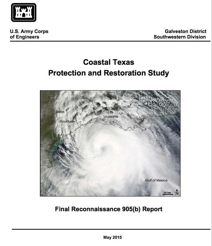
32 Following is the US Army Corp of Engineers' Coastal Texas Protection and Restoration Study Report from May 2015 which included a Galveston Ring Levee.
33

34

35
36 The Gulf Coast Community Protection and Recovery District's (GCCPRD) Storm Surge Suppression Study Phase 3 Report of June 2016 included a Galveston Ring Levee.

37
 - Texas City Levee Modifications and Extensions North (SH-146) and West--Galveston Ring Levee A map from the report showing a Galveston Ring Levee Figure 2: Central Region")
38 Storm Surge Suppression Study Central Region Alternatives Galveston, Chambers, and Harris Counties Central Region Alternative #1 (CR#1) - High Island to San Luis Pass Coastal Spine Central Region Alternative #2 (CR#2) - Texas City Levee Modifications and Extensions North (SH-146) and West--Galveston Ring Levee A map from the report showing a Galveston Ring Levee Figure 2: Central Region Alternatives Selected for Development
39 GCCPRD Phase 3 Report Recommendations A High Island to San Luis Pass Coastal Spine A navigation gate at Clear Lake and a Galveston ring levee Provides a region-wide reduction in storm surge that enhances protection for communities located along the shoreline of Galveston Bay and industry located along the Houston Ship Channel. While the Coastal Spine alone provides a dramatic reduction in overall surge, there are still heavily populated areas within the region that can expect to experience four to 12 feet of surge-related flooding. The addition of the Galveston ring levee and a navigation gate at Clear Lake will enhance protection for the City of Galveston, Seabrook, Taylor Lake Village, El Lago, Clear Lake Shores and Kemah. With the coastal spine in place, the structure design elevation for the modified Galveston ring levee is expected to be in the 12 to 15 feet range.

40 Some possible alignment options in yellow lines. White is existing storm barriers.

41 An actual levee in New Orleans

42 An actual levee in New Orleans

43 An actual levee in New Orleans


44 New Orleans Flood wall and Gate Alley north of Galveston Strand

45 2 to 3 meter storm surge on north side of Galveston Island 10pm Friday night Hurricane Ike Water Levels 9/13/09 04:00 UTC
46 2 to 3 meter storm surge at 6am. The eye passed over at 2.10am Saturday. Hurricane Ike Water Levels 9/13/09 12;00 UTC
47 Following is a map from Wikipedia that shows the Seiche flooding on Lake Okeechobee caused by the 1928 Hurricane. The lake does not connect to the Atlantic, so what happened was caused by moving around the water already in the lake. The lake is 12 to 20 feet deep and is roughly the size of Galveston Bay. There was a surge to 20 feet and 2,500 people died.

48

49 How storm surge is created by storm winds acting on an enclosed water body Seiche, or sloshing, is a well studied phenomena with courses on the subject at universities around the Great Lakes and other places.

50 Published LSU research study showing sloshing effect in Galveston Bay caused by Hurricane Ike

51 Modeling study by UT showing how flooding can still occur in Houston Ship Channel and Galveston behind a closed Ike Dike The storm track is the dotted line on the left. The flooding is around 16 feet

52 Modeling study by UT showing how flooding can still occur in Galveston behind a closed Ike Dike The storm track is to the right and the flooding is still in the range of 10 feet

53 Flooding of Galveston with only a 6 ft rise of water in Galveston Bay. This could be the general area protected by a Ring Levee

54 Post Hurricane Ike at Market and 25th
55 Summarizing the 3 subjects of the presentation: Why might a flood protection system be needed for the eastern part of Galveston Island? Historically and scientifically, it is well demonstrated that substantial flooding can occur from storm winds pushing water around the bay. What might a flood protection system be? It would likely be a combination of earthen embankments (levees), walls and gates. Different examples are Texas City, Freeport, Jefferson/Orange, New Orleans, the Netherlands. Books such as the Atlas of Sustainable Strategies for Galveston Island, Section III, Design Proposals is full of possibilities. Why not just tag along with other big projects and just let someone from somewhere else tell Galveston Island what Galveston needs to do and what they are going to allow Galveston to do? A Ring Levee is much smaller and therefore more feasible and can be done in a much shorter time. Big projects are more complex and are delayed by a myriad of issues. Tying a Ring Levee to a big project will conceivably stall the Ring Levee for years, decades or never happen. A Ring Levee is listed as a desirable project in all of the studies. The GCCPRD Study Recommendations list it as a desirable project. The GCCPRD Study Recommendations are most likely what is going to happen because the GCCPRD was authorized by the Texas legislature. The US Army Corp of Engineers have listed it in 2 different studies. Moving ahead with one aspect of a series of recommendations does not cancel the other recommendations. Texas City moved ahead with their levee system 50 years ago and they saved billions of dollars by staying dry during Hurricane Ike flooding. Freeport is in the process of getting a levee system. Jefferson/Orange are moving ahead with an enhanced levee system after experiencing the disastrous flooding from Hurricanes Rita and Ike. Why on earth would Galveston wait around to be told what to do when? Galveston led with the Seawall construction and with the grade raising of the city. Galveston has led with many things so shouldn t it continue to do so?
56
57

58
59 2.5 mile flood wall with gates 4.5 mile levee 0.4 mile Floodgate 2.1 mile levee

60 Delft Univ research program that has not been presented, but Dr. Merrell was an advisor The effects of the Ike Dike barriers on Galveston Bay A 2D numerical modeling study on hydrodynamics and the implications for the water quality and morphology of Galveston Bay Delft, June 2011 M.Sc. Thesis of M. Ruijs Committee: prof. dr. ir. M.J.F. Stive dr. ir. Z.B. Wang dr. ir. G.J. de Boer dr. ir. M. van Ledden ir. A.J. Lansen dr. W.J. Merrell

61 Blue colors show decrease in flow through channel due to structures that allow 40% and 20% of original flow
62 Conclusions of the Study of Ike Dike Effects on Galveston Bay The placement of barriers in Bolivar Roads results in a decrease of the tidal prism (the volume of water in the bay at any time during the tidal cycle) and a decrease in the current velocities, that would change the morphology of tidal channels Due to the placement of the barriers it is likely that the sediment exchange from the Gulf of Mexico into Galveston Bay through Bolivar Roads is blocked. The extra sediment that is needed to maintain tidal channels would then only come from inside the bay. This could lead to shoreline erosion, erosion of tidal flats and erosion of the marshes. The health of the tidal flats and marshes is also strongly influenced by the amount of time that the flat or marsh is under or above water. The reduced tidal range together with sea level rise, subsidence and sediment deficit, the shorelines, flats and marshes might retreat. Decreased flow through Bolivar Roads will increase water residence time within the bay and substantially decrease salinity within the bay.
63 Galveston Bay is essential to the ecological life-cycle of shrimp and other marine life. No structure would be allowed to be built without these significant environmental and ecological impacts being addressed. Diagram by Texas Parks and Wildlife

64

65
Hurricane Protection and Environmental Restoration
 November 16, 2010 Hurricane Protection and Environmental Restoration Presented by: Colonel (Ret.) Leonard Waterworth AGENDA How do we protect People/Environment/Economy 1900 Year Storm Hurricane Carla
CHAPTER FIVE: THE LOWER MISSISSIPPI REGION AND PLAQUEMINES PARISH
 CHAPTER FIVE: THE LOWER MISSISSIPPI REGION AND PLAQUEMINES PARISH 5.1 Overview Plaquemines Parish is the area where the last portion of the Mississippi River flows out into the Gulf of Mexico (see Figures
THC-T-2013 Conference & Exhibition
 Modeling of Shutter Coastal Protection against Storm Surge for Galveston Bay C. Vipulanandan, Ph.D., P.E., Y. Jeannot Ahossin Guezo and and B. Basirat Texas Hurricane Center for Innovative Technology (THC-IT)
Comparative Analysis of Hurricane Vulnerability in New Orleans and Baton Rouge. Dr. Marc Levitan LSU Hurricane Center. April 2003
 Comparative Analysis of Hurricane Vulnerability in New Orleans and Baton Rouge Dr. Marc Levitan LSU Hurricane Center April 2003 In order to compare hurricane vulnerability of facilities located in different
Improvements to Southeast Louisiana s floodwalls and pump stations since Katrina: the Hurricane and Storm Damage Risk Reduction System (HSDRRS)
") Improvements to Southeast Louisiana s floodwalls and pump stations since Katrina: the Hurricane and Storm Damage Risk Reduction System (HSDRRS) Pat Fitzpatrick Mississippi State University Review of levee
Improvements to Southeast Louisiana s floodwalls and pump stations since Katrina: the Hurricane and Storm Damage Risk Reduction System (HSDRRS) Pat Fitzpatrick Mississippi State University Review of levee
Hurricane Harvey: SE Texas Impacts. 10 PM CDT UPDATE Friday, August 25, 2017 Prepared by: Lance Wood
 Hurricane Harvey: SE Texas Impacts 10 PM CDT UPDATE Friday, August 25, 2017 Prepared by: Lance Wood Latest Observations Hurricane Harvey making landfall this evening near Rockport as a category 4 hurricane.
THE NEW STORM SURGE MODULE IN AIR S U.S. HURRICANE MODEL
 THE NEW STORM SURGE MODULE IN AIR S U.S. HURRICANE MODEL Hurricane Ike storm surge devastation of Bolivar Peninsula near Galveston, Texas. (Source: Chuck Davis, flickr) When a hurricane comes onshore,
Application #: TEXT
 TOWN OF FORT MYERS BEACH 2008 PROPOSED COMPREHENSIVE PLAN AMENDMENTS Application #: 2008-13-TEXT Description: Modify the Coastal Management and Future Land Use Elements to reflect the state s new definition
Greater New Orleans Hurricane and Storm Damage Risk Reduction System 101
 Greater New Orleans Hurricane and Storm Damage Risk Reduction System 101 René Poché New Orleans District U.S. Army Corps of Engineers US Army Corps of Engineers BUILDING STRONG 1878 Gentilly Ridge Metairie
Earth Wind & Fire. Game Changing Restoration Options in the Texas Chenier Plain
 Earth Wind & Fire Game Changing Restoration Options in the Texas Chenier Plain EARTH: The Chenier Plain is a 5 million acre coastal region in Southwest Louisiana and Southeast Texas providing landscape
Tropical Storm Harvey: SE Texas Impacts
 Tropical Storm Harvey: SE Texas Impacts 10 AM CDT UPDATE Thursday, August 24, 2017 Prepared by: Dan Reilly, Brian Kyle PLEASE MUTE YOUR LINES AND DON T PUT ON HOLD! Situation Overview Tropical Storm Harvey
Material Workshop. Galveston District 2012 Beneficial Use of Dredged. Material Workshop. Custodians of the Coast
 Galveston District 2012 Beneficial Use of Dredged Material Workshop Galveston District 2012 Beneficial Use of Dredged Material Workshop US Army Corps of Engineers BUILDING STRONG Welcome Opening Remarks
US Army Corps of Engineers BUILDING STRONG
 Greater New Orleans Hurricane and Storm Damage Risk Reduction System Robert Rowlette Senior Senior Program Manager Task Force Hope U.S. Army Corps of Engineers April 19, 2012 US Army Corps of Engineers
Background and Purpose of Meeting. River Towers Meeting. Flood Risk Management Study Alternatives Overview
 1 and Purpose of Meeting River Towers Meeting Flood Risk Management Study Alternatives Overview September 23, 2014 There is no "proposed" flood risk management solution for this area at this time Fairfax
Hurricane Harvey: SE Texas Impacts. 10 AM CDT UPDATE Saturday, August 26, 2017 Prepared by: Dan Reilly, Brian Kyle
 Hurricane Harvey: SE Texas Impacts 10 AM CDT UPDATE Saturday, August 26, 2017 Prepared by: Dan Reilly, Brian Kyle Latest Observations and Radar Hurricane Harvey centered near Victoria and weakening Wind
COLORING PAGES. Follow Raindy the Raindrop as he travels from your house out to sea.
 COLORING PAGES www.hcfcd.org Follow Raindy the Raindrop as he travels from your house out to sea. Raindy the Raindrop falls from the sky and lands on your house or in your neighborhood. Once he s on the
Hurricane Matthew Threats and Impacts Briefing for Eastern NC
 Hurricane Matthew Threats and Impacts Briefing for Eastern NC October 6 th, 2016 Date/Time Created: 10/6/2016, Noon EDT National Weather Service Newport/Morehead City, NC Hurricane Matthew Key Points Changes
Name Earth Science Pd. Hurricanes. Directions: Read the information, view diagrams and answer the questions in the worksheet.
 Hurricanes Directions: Read the information, view diagrams and answer the questions in the worksheet. Hurricane Basics The ingredients for a hurricane include a pre-existing weather disturbance, warm tropical
Hurricane Katrina. Learning Objective: -Analyse the causes, effects and responses of a tropical storm
 Hurricane Katrina Learning Objective: -Analyse the causes, effects and responses of a tropical storm Learning Outcomes: -Classify the impacts of Hurricane Katrina -Apply understanding to an exam question
MODELLING CATASTROPHIC COASTAL FLOOD RISKS AROUND THE WORLD
 MODELLING CATASTROPHIC COASTAL FLOOD RISKS AROUND THE WORLD Nicola Howe Christopher Thomas Copyright 2016 Risk Management Solutions, Inc. All Rights Reserved. June 27, 2016 1 OUTLINE MOTIVATION What we
Major Hurricane Matthew Briefing Situation Overview
 Major Hurricane Matthew Briefing Situation Overview THIS IS NOW A WORST CASE STORM SURGE SCENARIO Catastrophic Damage is Anticipated for Coastal Areas. Major Hurricane Matthew is still expected to move
CHAPTER SEVEN: THE NEW ORLEANS EAST PROTECTED AREA
 7.1 Introduction CHAPTER SEVEN: THE NEW ORLEANS EAST PROTECTED AREA The New Orleans East (NEO) protected area includes some of the lowest ground in the metropolitan region. Therefore, it is not surprising
Hurricane Katrina and Oil Spills: Impact on Coastal and Ocean Environments
 Archived version from NCDOCKS Institutional Repository http://libres.uncg.edu/ir/asu/ Pine, J. C. (June 2006). Hurricane Katrina and oil spills: Impact on coastal and ocean environments. Oceanography,
TROPICAL STORM NATE BRIEFING
 TROPICAL STORM NATE BRIEFING 10:30 AM CDT Friday, October 06, 2017 Prepared by: NWS NWSNewOrleans www.weather.gov/neworleans Situation Overview Track forecast has shifted slightly eastward. Hurricane Watch
Regional Sediment Management
 Regional Sediment Management Linda S. Lillycrop Program Manager Coastal Engineer US Army Engineer Research and Development Center Coastal and Hydraulics Laboratory Q AVG Coastal Resilience: The Environmental,
Draft for Discussion 11/11/2016
 Coastal Risk Consulting (CRC) Climate Vulnerability Assessment for Village of Key Biscayne Deliverable 1.1 in Statement of Work. Preliminary Vulnerability Assessment Identifying Flood Hotspots Introduction...
Developed in Consultation with Florida Educators
 Developed in Consultation with Florida Educators Table of Contents Next Generation Sunshine State Standards Correlation Chart... 7 Benchmarks Chapter 1 The Practice of Science...................... 11
Construction complete on all HSDRRS projects across storm evacuation routes
 Task Force Hope Status Report August 29, 2013 Construction complete on all HSDRRS projects across storm evacuation routes Eastern Tie-In Swing Gates positioned across Hwy. 23 By Susan Spaht If a tropical
TROPICAL STORM NATE BRIEFING
 TROPICAL STORM NATE BRIEFING 2:00 PM CDT Friday, October 06, 2017 Prepared by: NWS NWSNewOrleans www.weather.gov/neworleans Situation Overview Track forecast has not changed since the 10 am advisory. Hurricane
Wetland attenuation of Hurricane Rita s storm surge
 Wetland attenuation of Hurricane Rita s storm surge Pat Fitzpatrick, Yee Lau, Yongzuo Li, Nam Tran, Chris Hill, and Suzanne Shean Geosystems Research Institute, Mississippi State University Sponsors: NOAA
Table-Top Exercise for Emergency Preparedness Evaluation: Little Anse, Isle Madame
 Table-Top Exercise for Emergency Preparedness Evaluation: Little Anse, Isle Madame Alexander Chung, M.Sc. Candidate C-Change Student Research Associate May 2013 The Community of Little Anse Coastal community
The Use of Geographic Information Systems (GIS) by Local Governments. Giving municipal decision-makers the power to make better decisions
 by Local Governments. Giving municipal decision-makers the power to make better decisions") The Use of Geographic Information Systems (GIS) by Local Governments Giving municipal decision-makers the power to make better decisions Case Study: Examples of GIS Usage by Local Governments in North
The Use of Geographic Information Systems (GIS) by Local Governments Giving municipal decision-makers the power to make better decisions Case Study: Examples of GIS Usage by Local Governments in North
Hurricane KATRINA Lessons Learned for Managing Risk
 Hurricane KATRINA Lessons Learned for Managing Risk Steven L. Stockton, P.E. Deputy Director of Civil Works U.S. Army Corps of Engineers What Happened? Storm Path from August 23 to 31, 2005 Mon. August
SLOSH New Orleans Basin 2012 Update
 SLOSH New Orleans Basin 2012 Update Michael Koziara Science and Operations Officer National Weather Service Slidell, LA The Basics What is storm surge? What is SLOSH? Details Assumptions Inundation = Storm
Solutions to Flooding on Pescadero Creek Road
 Hydrology Hydraulics Geomorphology Design Field Services Photo courtesy Half Moon Bay Review Solutions to Flooding on Pescadero Creek Road Prepared for: San Mateo County Resource Conservation District
TROPICAL DEPRESSION HARVEY BRIEFING
 TROPICAL DEPRESSION HARVEY BRIEFING 10:15 PM CDT Wednesday, August 23, 2017 Prepared by: Lara Beal NWSCorpus www.weather.gov/corpuschristi Situation Overview No changes to Watches. Hurricane Watch remains
2006 & 2007 Pre-Hurricane Scenario Analyses
 2006 & 2007 Pre-Hurricane Scenario Analyses Executive Summary May 2007 Page 1 OF X FOR OFFICIAL USE ONLY 4 Public Availability to be Determined Under 5 U.S.C. 552 NOTE: Limited Distribution. Release of
Red River Levee Panel
 Red River Levee Panel Mississippi River Commission Monday, August 9, 2017 Red River Levees in LA & AR NONE along TX & OK Boarder Red River Levee Issues Caddo Levee Cherokee Park Authorization Bossier Levee
Natural Disasters. in Florida. Severe Thunderstorms
 Natural Disasters in Florida SC.6.E.7.7 Investigate how natural disasters have affected human life in Florida. Severe Thunderstorms While the typical afternoon thunderstorm in Florida may not appear to
OSCILLATIONS OF SEMI-ENCLOSED WATER BODY INDUCED BY HURRICANES. Yuan-Hung Paul Tan 1 and Jiin-Jen Lee 1
 OSCILLATIONS OF SEMI-ENCLOSED WATER BODY INDUCED BY HURRICANES Yuan-Hung Paul Tan 1 and Jiin-Jen Lee 1 The primary focus of this research is to study the oscillations of semi-enclosed water body induced
Report on the Damage Survey Caused by Hurricane Katrina (Tentative Report)
") Report on the Damage Survey Caused by Hurricane Katrina (Tentative Report) November 1, 2005 Coastal Disaster Prevention Technology Survey Team 1. Introduction Hurricane Katrina struck the United States
Report on the Damage Survey Caused by Hurricane Katrina (Tentative Report) November 1, 2005 Coastal Disaster Prevention Technology Survey Team 1. Introduction Hurricane Katrina struck the United States
Hydrologic Briefing Tropical Storm Harvey
 Hydrologic Briefing Tropical Storm Harvey 10:30 AM CDT Sunday, August 27, 2017 Prepared by: John Metz NWSCorpus www.weather.gov/corpuschristi Situation Overview Tropical Storm Harvey Harvey to remain a
ΛTKINS. Applications of Regional Sediment Management Concepts in Texas Estuarine Restoration Projects. Riparian Workshop Fort Worth, October 17, 2012
 Juan C Moya, PhD., PG Coastal Planning and Restoration Applications of Regional Sediment Management Concepts in Texas Estuarine Restoration Projects Riparian Workshop Fort Worth, October 17, 2012 West
THE NEED FOR AN ADDITIONAL SPILLWAY AT THE SANFORD DAM BOILING SPRING LAKES, NC. Presentation for The Brunswick County Commissioners April 20, 2015
 THE NEED FOR AN ADDITIONAL SPILLWAY AT THE SANFORD DAM BOILING SPRING LAKES, NC Presentation for The Brunswick County Commissioners April 20, 2015 The Sanford Dam Earth Dam constructed in 1961 Drainage
Like other coastal cities, Honolulu s
 Worst-Case Scenarios: Flooding and Evacuation Plans in Honolulu Karl Kim, Pradip Pant, Eric Yamashita Like other coastal cities, Honolulu s long-term viability depends on how well it can adapt to climate
Ice Mass & Sea Level Change Unit 5: New York City vignettes
 Ice Mass & Sea Level Change Unit 5: New York City vignettes Becca Walker and Leigh Stearns Part 1: Background With a population of nearly 20 million people and 2400 km of coastline, the NYC region is susceptible
 Red River Flooding June 2015 Caddo and Bossier Parishes Presented by: Flood Technical Committee Where the Rain Falls Matters I-30 versus I-20 I-20 Backwater and Tributary Floods (Localized) 2016 Flood
Hurricanes. Cause: a low pressure storm system over warm ocean water. Effect: potential massive widespread destruction and flooding.
 Hurricanes Hurricanes Cause: a low pressure storm system over warm ocean water. Effect: potential massive widespread destruction and flooding. Hurricanes also known as: cyclone (Indian Ocean) or typhoon
HURRICANES AND TORNADOES
 HURRICANES AND TORNADOES The most severe weather systems are hurricanes and tornadoes. They occur in extremely low pressure systems, or cyclones, when the air spirals rapidly into the center of a low.
LECTURE #18: Hurricane Damage, Monitoring & Case Study
 GEOL 0820 Ramsey Natural Disasters Spring, 2018 LECTURE #18: Hurricane Damage, Monitoring & Case Study Date: 27 March 2018 I. Exam II grades now posted online o high: 98, low: 46, average: 80 (~3 points
TXWARN Tabletop Exercise: Hurricane Helen
 TXWARN Tabletop Exercise: Hurricane Helen July 31, 2015 Administrative Details In-studio participants and remote participants Situation manual Evaluations Training hours 1 In Studio: Welcome and Introductions
Phases of Disaster Response. John Yeaw, Gavin Vanstone, Haochen Wu, Jordan Tyler
 Phases of Disaster Response John Yeaw, Gavin Vanstone, Haochen Wu, Jordan Tyler BP Oil Spill One of the worst man made disasters in human history The BP oil spill occurred in April of 2010 when the Deepwater
MEMORANDUM FOR SWG
 MEMORANDUM FOR SWG-2007-1623 Subject: Jurisdictional Determination (JD) for SWG-2007-1623 on Interdunal Wetlands Adjacent to Traditional Navigable Waters (TNWs) Summary The U.S. Environmental Protection
A HURRICANE IS COMING. Presented by Atiba Upchurch Broward Emergency Management Division
 A HURRICANE IS COMING Presented by Atiba Upchurch Broward Emergency Management Division Mission Statement To safeguard the lives and property of the people of Broward County from major hazards and emergencies
Miami-Dade County Overview
 Miami-Dade County Overview 2,000 square miles World s busiest cruise port 2.6 million residents Second busiest US airport for international travelers Gateway to the Caribbean and Latin America Natural
Risk Assessment and Mitigation. Hurricane Checklist
 Risk Assessment and Mitigation Hurricane Checklist Hurricane Checklist Hurricanes are severe tropical storms with sustained winds of at least 74 miles per hour. Hurricane winds can reach 160 miles per
Changes in Ecosystems - Natural Events
 Changes in Ecosystems - Natural Events 8A predict and describe how different types of catastrophic events impact ecosystems such as floods, hurricanes, or tornadoes Textbook pages: 396-406 How can ecosystems
Pre-Disaster Natural Hazard Mitigation Plan Guilford, Connecticut History of Hazard Mitigation Planning Authority Disaster Mitigation Act of 2000 (ame
 Pre-Disaster Natural Hazard Mitigation Plan Guilford, Connecticut History of Hazard Mitigation Planning Authority Disaster Mitigation Act of 2000 (amendments to Stafford Act of 1988) Presented by: David
Tropical Update. 12 PM EDT Friday, October 7, 2016 Hurricane Matthew & Tropical Storm Nicole
 Tropical Update 12 PM EDT Friday, October 7, 2016 Hurricane Matthew & Tropical Storm Nicole This update is intended for government and emergency response officials, and is provided for informational and
SHORELINE PROTECTION & RESTORATION PROGRAM
 City of Mandeville, LA SHORELINE PROTECTION & RESTORATION PROGRAM June 8, 2017 Pre-Budget Background Presentation Prepared by: Overview Background Context: RSLR, Rigolets Closure City Program & Project
Semi-enclosed seas. Estuaries are only a particular type of semi-enclosed seas which are influenced by tides and rivers
 Semi-enclosed seas Estuaries are only a particular type of semi-enclosed seas which are influenced by tides and rivers Other semi-enclosed seas vary from each other, mostly by topography: Separated from
Appendix C Fluvial Flood Hazards
 Appendix C Fluvial Flood Hazards Sea Level Rise Vulnerability Assessment and Adaptation Project March 2019 Contents Contents... i Figures... i Tables... i Definitions, Acronyms, & Abbreviations... ii
Pacific Catastrophe Risk Assessment And Financing Initiative
 Pacific Catastrophe Risk Assessment And Financing Initiative TIMOR-LESTE September Timor-Leste is expected to incur, on average, 5.9 million USD per year in losses due to earthquakes and tropical cyclones.
Pacific Catastrophe Risk Assessment And Financing Initiative
 Pacific Catastrophe Risk Assessment And Financing Initiative TUVALU is expected to incur, on average,. million USD per year in losses due to earthquakes and tropical cyclones. In the next 5 years, has
How Will Melting Ice Sheets Affect Us?
 PASSAGE 4 How Will Melting Ice Sheets Affect Us? Variation is normal. During the last ice age, for example, ice sheets also covered much of North America and Scandinavia. Why is what s happening now different
3Chapter Three: Rescue and Response
 17 16 Report Science Title and the Storms: the USGS Response to the Hurricanes of 2005 3Chapter Three: Rescue and Response This chapter documents the U.S. Geological Survey s (USGS) humanitarian rescue
TROPICAL STORM NATE BRIEFING
 TROPICAL STORM NATE BRIEFING 5:00 AM CDT Friday, October 6, 2017 Prepared by: NWS NWSNewOrleans www.weather.gov/neworleans Situation Overview No significant changes to the track forecast this morning.
Hurricanes and Storm Surge : Before coming to lab, visit the following web site:
 Geol 108 Lab #7 Week of October 15-19, 2012 Coastal Studies Hurricanes and Storm Surge : Before coming to lab, visit the following web site: http://www.usatoday.com/graphics/weather/gra/gsurge/flash.htm
Initiative. Country Risk Profile: papua new guinea. Better Risk Information for Smarter Investments PAPUA NEW GUINEA.
 Pacific Catastrophe Risk Assessment And Financing Initiative PAPUA NEW GUINEA September 211 Country Risk Profile: papua new is expected to incur, on average, 85 million USD per year in losses due to earthquakes
Delta Flood Protection Strategy Update. May 16, 2016
 Delta Flood Protection Strategy Update May 16, 2016 Presentation Overview 1. Background 2. Understanding the Dike Reaches/Issues 3. Future Dike Improvements 4. Next Steps Boundary Bay Village March 10,
THE TRINITY RIVER VISION/ GATEWAY PARK / PANTHER ISLAND
 Quarterly Project Status Report May 2018 THE TRINITY RIVER VISION/ GATEWAY PARK / PANTHER ISLAND Flood Control Project Update Construction of North Main Street Bridge by TxDOT s bridge contractor, Texas
Advisory #35 Briefing 630 PM EDT Thursday October 06, 2016
 Advisory #35 Briefing 630 PM EDT Thursday October 06, 2016 Disclaimer: The information contained within this briefing is time-sensitive, do not use beyond 6 hours after the issuance Next Webinar Update:
THE TRINITY RIVER VISION/ GATEWAY PARK / PANTHER ISLAND Flood Control Project Update
 Quarterly Project Status Report September 2018 THE TRINITY RIVER VISION/ GATEWAY PARK / PANTHER ISLAND Flood Control Project Update TxDot s contractor has nearly completed the superstructure false work
Florida Flood Risks. Heavy Rainfall. Groundwater. Tidal Flooding. Storm Surge. King Tides. Runoff/Riverine
 Florida Flood Risks Heavy Rainfall Storm Surge Groundwater Tidal Flooding Runoff/Riverine King Tides Sawgrass Mills Mall Sunrise, Florida 15 of rain in 3 days, with most in 24 hours. Mall closed for 3
Salem Coastal Vulnerability. By: Ariabel Adames, Abby Jackson, Mariluz Ayala, Mikara Crowley, Karley Skutul
 Salem Coastal Vulnerability By: Ariabel Adames, Abby Jackson, Mariluz Ayala, Mikara Crowley, Karley Skutul Total Population: 42,544 Sea level Rise: 10,700 Worst Case Storm Surge: 22,560 Minority Income
Rising Sea Levels: Time for Proactive Action in Florida and the Caribbean?
 Rising Sea Levels: Time for Proactive Action in Florida and the Caribbean? Dr. Alan Fyall and Dr. Thomas Wahl National Center for Integrated Coastal Research, University of Central Florida Dr. Roberta
Climate Adaptation Challenges for Boston s Water and Sewer Systems
 National Association of Flood & Stormwater Management Agencies Climate Adaptation Challenges for Boston s Water and Sewer Systems John P Sullivan P.E. October 15,2014 Boston 1630 Boston 1630-2012 Boston
3301 Rickenbacker Causeway, Miami, FL 33149
 Virginia Key and Miami Beach 2016 King Tide Report and Projections (to 2045) using: 3301 Rickenbacker Causeway, Miami, FL 33149 *THIS REPORT IS PROVIDED SUBJECT TO THE COASTAL RISK CONSULTING, LLC, PRINTED
Pacific Catastrophe Risk Assessment And Financing Initiative
 Pacific Catastrophe Risk Assessment And Financing Initiative VANUATU September 211 Country Risk Profile: VANUATU is expected to incur, on average, 48 million USD per year in losses due to earthquakes and
Post-Hurricane Recovery: How Long Does it Take?
 Post-Hurricane Recovery: How Long Does it Take? Implications for disaster recovery after hurricanes Harvey and Irma In the following report, BuildFax analyzed the geographic areas impacted by three of
Ecological Context - Urban settlements are part of their surrounding ecosystem. Austin
 Ecological Context - Urban settlements are part of their surrounding ecosystem Austin Ecotone Division between West and East Flyway Uplift River Balcones Escarpment Central Texas Climate The principal
Ice Sheets and Sea Level -- Concerns at the Coast (Teachers Guide)
") Ice Sheets and Sea Level -- Concerns at the Coast (Teachers Guide) Roughly 153 million Americans (~53% of the US population) live in coastal counties. World wide some 3 billion people live within 200 km
Ice Sheets and Sea Level -- Concerns at the Coast (Teachers Guide) Roughly 153 million Americans (~53% of the US population) live in coastal counties. World wide some 3 billion people live within 200 km
Hurricane Harvey and What is to come. Eric Berger, Space City Weather
 Hurricane Harvey and What is to come Eric Berger, Space City Weather Today s talk A word about Space City Weather Social media-rology A look back at Hurricane Harvey Why does Houston get these storms Rainfall
MISSISSIPPI COASTAL IMPROVEMENTS
 MISSISSIPPI COASTAL IMPROVEMENTS PROGRAM (MsCIP) Comprehensive Barrier 237 27 200 237 27 200 Island 237 Restoration 27 200 Plan 80 9 27 252 74.59 255 255 255 0 0 0 63 63 63 3 32 22 239 65 53 0 35 20 2
Benchmarking of Hydrodynamic Models for Development of a Coupled Storm Surge Hazard-Infrastructure Modeling Method to improve Inundation Forecasting
 Benchmarking of Hydrodynamic Models for Development of a Coupled Storm Surge Hazard-Infrastructure Modeling Method to improve Inundation Forecasting Abstract Fragility-based models currently used in coastal
Weather Middle School Teacher Instructions and Activity
 Weather Middle School Teacher Instructions and Activity Based on the guidelines of the Saffir-Simpson Scale for hurricane severity and the Fujita Scale for tornado damage, students will write a brief synopsis
Promoting Resilience to Changing Weather
 Promoting Resilience to Changing Weather Harpswell Neck Harpswell Sound Orr s Island Basin Cove Pott s Point Harpswell Conservation Commission March 30, 2017 What Does This Mean for Harpswell? Topography
THE WEATHER CASE STUDIES
 THE WEATHER CASE STUDIES Hedi Maurer, NEA (Panteia) Athens, 23.04.2012 Case studies, regions and modes 1. Flood of 2002 in Eastern Germany 2. Summer heat 2007 in Southern Europe 3. Flooding of the rail
HAZUS-MH: A Predictable Hurricane Risk Assessment Tool for the City of Houston and Harris County
 HAZUS-MH: A Predictable Hurricane Risk Assessment Tool for the City of Houston and Harris County Presented by Melvin G. Spinks, P.E., President Annie Ding, PhD, GISP October 29, 2008 Rice University Contents
GC Briefing. Weather Sentinel Tropical Storm Michael. Status at 8 AM EDT (12 UTC) Today (NHC) Discussion. October 11, 2018
 Today (NHC) Discussion. October 11, 2018") GC Briefing Weather Sentinel Tropical Storm Michael October 11, 2018 After making landfall as a high-end category-4 hurricane on the Florida Panhandle, Michael weakened to tropical storm status early this
GC Briefing Weather Sentinel Tropical Storm Michael October 11, 2018 After making landfall as a high-end category-4 hurricane on the Florida Panhandle, Michael weakened to tropical storm status early this
Appendix A STORM SURGE AND WAVE HEIGHT ANALYSIS
 Appendix A STORM SURGE AND WAVE HEIGHT ANALYSIS Memo To: Jeff Robinson, P.E., GEC, Inc. From: Silong Lu, Ph.D., P.E., D.WRE, Dynamic Solutions, LLC. Date: 1/9/2014 CC: Re: Chris Wallen, Vice President,
Hurricane Tracks. Isaac versus previous storms Impacts and solutions. ( Continue by clicking on the slide bar to the right)
") Hurricane Tracks Isaac versus previous storms Impacts and solutions ( Continue by clicking on the slide bar to the right) 1 Hurricane Tracks 2 Sample Hurricanes The sample hurricanes selected were chosen
Hurricane Tracks Isaac versus previous storms Impacts and solutions ( Continue by clicking on the slide bar to the right) 1 Hurricane Tracks 2 Sample Hurricanes The sample hurricanes selected were chosen
Hurricane Matthew. Life Threatening Flash Flooding Likely. National Weather Service Wilmington NC. Josh Weiss, Meteorologist
 Hurricane Matthew Life Threatening Flash Flooding Likely Threat Assessment for northeast South Carolina & southeast North Carolina National Weather Service Wilmington NC 630 PM EDT Friday October 7, 2016
Geospatial natural disaster management
 Geospatial natural disaster management disasters happen. are you ready? Natural disasters can strike almost anywhere at any time, with no regard to a municipality s financial resources. These extraordinarily
Module 10 Summative Assessment
 Module 10 Summative Assessment Activity In this activity you will use the three dimensions of vulnerability that you learned about in this module exposure, sensitivity, and adaptive capacity to assess
THE 3D SIMULATION INFORMATION SYSTEM FOR ASSESSING THE FLOODING LOST IN KEELUNG RIVER BASIN
 THE 3D SIMULATION INFORMATION SYSTEM FOR ASSESSING THE FLOODING LOST IN KEELUNG RIVER BASIN Kuo-Chung Wen *, Tsung-Hsing Huang ** * Associate Professor, Chinese Culture University, Taipei **Master, Chinese
Warm Up Vocabulary Check
 Warm Up Vocabulary Check Surface current Coriolis Effect global winds upwelling Gulf Stream deep current climate El Nino convection current continental deflection 1.The apparent curving of the path of
SEVERE WEATHER 101. Flood Basics
 SEVERE WEATHER 101 Flood Basics What is flooding? Flooding is an overflowing of water onto land that is normally dry. Floods can happen during heavy rains, when ocean waves come on shore, when snow melts
Keywords: storm surge barrier, hurricanes, probabilistic analysis, flood risk, coastal protection, flood defences
 RECONNAISSANCE LEVEL STUDIES ON A STORM SURGE S BARRIER FOR FLOOD OD RISK REDUCTION IN THE HOUSTON-GALVESTON BAY Sebastiaan N. Jonkman 1, Leslie Mooyaart 1,2, Mathijs van Ledden 1,2 Kasper Stoeten 1, Peter
COMMUNITY EMERGENCY RESPONSE TEAM FLOODS INTRODUCTION
 INTRODUCTION Floods are one of the most common hazards in the United States. A flood occurs any time a body of water rises to cover what is usually dry land. Flood effects can be local, impacting a neighborhood