Performance of TANC (Taiwan Auto- Nowcaster) for 2014 Warm-Season Afternoon Thunderstorm
|
|
|
- Irene Blair
- 6 years ago
- Views:
Transcription
 for 2014 Warm-Season")


1 Performance of TANC (Taiwan Auto- Nowcaster) for 2014 Warm-Season Afternoon Thunderstorm Wei-Peng Huang, Hui-Ling Chang, Yu-Shuang Tang, Chia-Jung Wu, Chia-Rong Chen Meteorological Satellite Center, Central Weather Bureau, CHINESE TAIPEI
2 Overview Nowcast technique Nowcasting Forecast Country of origin Technique system period (min) MAPLE Canada United States radar echo extrapolation 60 CARDS Canada radar echo extrapolation 60 STEPS Australia United Kingdom radar echo extrapolation 60 TIFS Australia Ensemble human 60 BJANC China Fuzzy logic 60 Wilson et al. 2010


3 CWB nowcast technique Radar echo extrapolation Good skill for the cases with high persistence
4 Radar echo extrapolation Limitation The extrapolation method can t capture the storm initiation, growth, and dissipation.


5 Challenge for nowcast in Taiwan Warm-season afternoon thunderstorm
.")
6 New nowcast technique TANC (Taiwan AutoNowCaster) CWB introduced the AutoNowCaster developed by NCAR in TANC is localized for Taiwan to predict the initiation of the summer thunderstorm (reflectivity > 35 dbz). Based on the fuzzy logic concept and considering the factors from the radar, surface observation, and numerical model prediction to make the nowcast for 0-1 hour. TANC product
7 TANC (Taiwan AutoNowCaster) Fuzzy logic concept Fuzzy logic is a form of many-valued logic that deals with approximate, rather than fixed and exact reasoning. Compared to traditional binary logic (where variables may take on true or false values), fuzzy logic variables may have a truth value that ranges in degree between 0 and 1. Fuzzy logic has been extended to handle the concept of partial truth, where the truth value may range between completely true and completely false. From Wikipedia

8 TANC system methodology Flow chart Define predictors Data analysis Create the corresponding membership functions and weights Produce the 1 hour likelihood prediction Wind convergence Vertical velocity Instability index RH


9 TANC system methodology How to generate the nowcast product? 1. Convert the predictors to likelihood fields using the membership functions membership fn. 2. Weight the importance of each field 3. Sum * W Nowcast likelihood product * W1 + *W2 +
10 TANC Predictors for afternoon thunderstorm in operational TANC Radar climofreq Climatology Wt=0.6 Wt=0.7 Radar climotrend Wt=0.3 From Climate statistics using Radar data Large scale Wt=0.5 Stability Wt=0.1 CAPE Wt=0.4 CIN Wt=0.6 From WRF Entrainment Rhavg Storm initiation 60 min nowcast Mesoscale Wt=0.05 Wt=0.3 convergence Wt=1 Wt=1 SurfDiv Wt=1 From surface obs. CI proximity storminint Storm scale Wt=0.45 Wt=0.3 Cumulus Wt=0.7 Wt=1 RadarCu Wt=1 From real-time radar data
11 TANC Membership functions corresponding to the preditors 1. Large scale :
12 TANC Membership functions for afternoon thunderstorm 2. Mesoscale : 3. Storm scale :

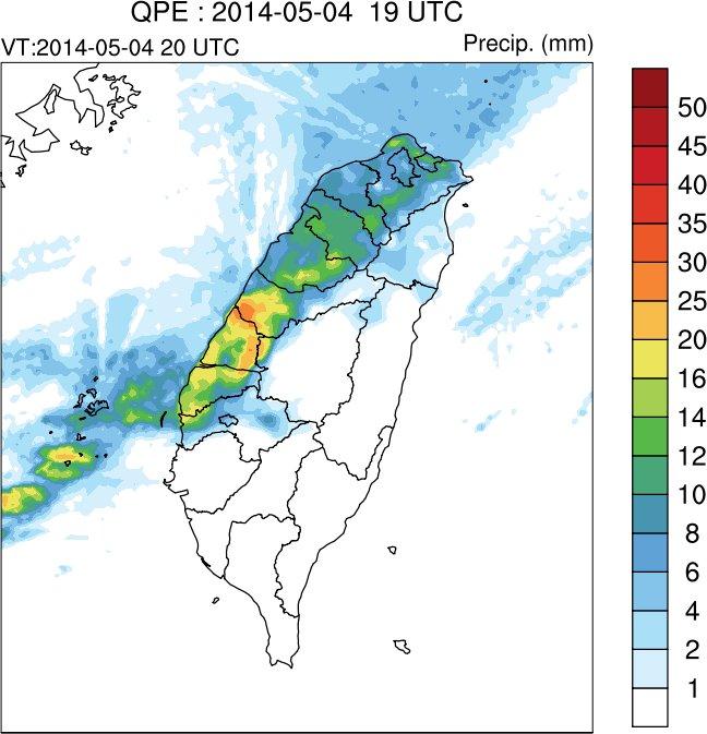
13 TANC Afternoon thunderstorm case: Aug. 27, 2014 The ridge of subtropical high covers Taiwan with weak synoptic forcing. The convection initiation is captured well spatially and temporally, but a little bit over-forecast for southern Taiwan. Likelihood of storm initiation (colored area) from TANC (Dark blue line: Observed convection for verification)

14 TANC Afternoon thunderstorm case: Aug. 29, 2014 The ridge of subtropical high covers Taiwan with weak synoptic forcing. The convections occurs both in southern and northern Taiwan are captured well. Likelihood of storm initiation (colored area) from TANC (Dark blue line: Observed convection for verification)
15 Total: h nowcasts TANC performance statistics 2014 afternoon thunderstorm cases Case date: No. of validation times Start-end 30 Jun (34) UTC 01 Jul (24) UTC 27 Aug (33) UTC 29 Aug (30) UTC UTC 09 Sep (20) UTC
16 TANC performance statistics TS, Bias, POD, FAR and and SR TS=CSI=h/(h+f+m) varies from 0 1(best) Bias=(h+f)/(h+m) 1~best POD=h/(h+m) varies from 0 1(best) FAR=f/(h+f) varies from 0(best) 1 Success ratio (SR)=1-FAR varies from 0 1(best)
17 TANC performance for 2014 Sensitivity of scores to likelihood thresholds - Score median with 95% confidence interval The range of confidence interval is not large, so the verification results are robust.
18 TANC performance statistics TANC vs. STMAS-WRF(GFS) TANC STMAS-WRF STMASWRF: CV threshold = 35 dbz TANC: Prob. threshold = 0.6
19 Summary The performance of the daily real-time prediction in 2014 warm season shows the TANC has the basic ability to capture when and where the afternoon thunderstorm will initiate. According to the statistics of the 2014 cases, TANC has the better forecast skill compared to the hot-start model STMAS-WRF. The statistics show that the area covered by likelihood 0.6 is suggested to depict where the storm will occur. Proper interpretation of such nowcasts both spatially and temporally is needed to use TANC output as the guidance for nowcast operation.
20 Future work The dynamic forecast predictors(such as vertical velocity, wind convergence, moisture convergence) from high-resolution analysis will be investigated to improve the 0-1 hour nowcast. The TANC forecast predictors for the other weather regimes with strong synoptic forcing will be developed since 2016.
Auto-Nowcast System Tom Saxen (July) Huaqing Cai (Aug) National Center for Atmospheric Research
 Huaqing Cai (Aug) National Center for Atmospheric Research") Auto-Nowcast System Tom Saxen (July) Huaqing Cai (Aug) National Center for Atmospheric Research Summer 2006 ATEC Forecaster Conference Photo courtesy of Greg Thompson Overview: Introductory comments on
Auto-Nowcast System Tom Saxen (July) Huaqing Cai (Aug) National Center for Atmospheric Research Summer 2006 ATEC Forecaster Conference Photo courtesy of Greg Thompson Overview: Introductory comments on
P5.11 TACKLING THE CHALLENGE OF NOWCASTING ELEVATED CONVECTION
 P5.11 TACKLING THE CHALLENGE OF NOWCASTING ELEVATED CONVECTION Huaqing Cai*, Rita Roberts, Dan Megenhardt, Eric Nelson and Matthias Steiner National Center for Atmospheric Research, Boulder, CO, 80307,
Update on CoSPA Storm Forecasts
 Update on CoSPA Storm Forecasts Haig August 2, 2011 This work was sponsored by the Federal Aviation Administration under Air Force Contract No. FA8721-05-C-0002. Opinions, interpretations, conclusions,
Improvement and Ensemble Strategy of Heavy-Rainfall Quantitative Precipitation Forecasts using a Cloud-Resolving Model in Taiwan
 Improvement and Ensemble Strategy of Heavy-Rainfall Quantitative Precipitation Forecasts using a Cloud-Resolving Model in Taiwan Chung-Chieh Wang Department of Earth Sciences, National Taiwan Normal University,
7.26 THE NWS/NCAR MAN-IN-THE-LOOP (MITL) NOWCASTING DEMONSTRATION: FORECASTER INPUT INTO A THUNDERSTORM NOWCASTING SYSTEM
 NOWCASTING DEMONSTRATION: FORECASTER INPUT INTO A THUNDERSTORM NOWCASTING SYSTEM") 7.26 THE NWS/NCAR MAN-IN-THE-LOOP (MITL) NOWCASTING DEMONSTRATION: FORECASTER INPUT INTO A THUNDERSTORM NOWCASTING SYSTEM Rita Roberts 1, Steven Fano 2, William Bunting 2, Thomas Saxen 1, Eric Nelson 1,
7.26 THE NWS/NCAR MAN-IN-THE-LOOP (MITL) NOWCASTING DEMONSTRATION: FORECASTER INPUT INTO A THUNDERSTORM NOWCASTING SYSTEM Rita Roberts 1, Steven Fano 2, William Bunting 2, Thomas Saxen 1, Eric Nelson 1,
Developing Applications for Nowcasting Heavy Rainfall over Complex Terrain
 Developing Applications for Nowcasting Heavy Rainfall over Complex Terrain Rita Roberts 1, Juanzhen Sun 1, Eric Nelson 1, James Wilson 1, Fu Tien Tsai 2 1 National Center for Atmospheric Research, 3450
 Identification of Predictors for Nowcasting Heavy Rainfall In Taiwan --------------------- Part II: Storm Characteristics and Nowcasting Applications Challenges in Developing Nowcasting Applications for
Severe storm forecast guidance based on explicit identification of convective phenomena in WRF-model forecasts
 Severe storm forecast guidance based on explicit identification of convective phenomena in WRF-model forecasts Ryan Sobash 10 March 2010 M.S. Thesis Defense 1 Motivation When the SPC first started issuing
COSMIC GPS Radio Occultation and
 An Impact Study of FORMOSAT-3/ COSMIC GPS Radio Occultation and Dropsonde Data on WRF Simulations 27 Mei-yu season Fang-Ching g Chien Department of Earth Sciences Chien National and Taiwan Kuo (29), Normal
Extracting probabilistic severe weather guidance from convection-allowing model forecasts. Ryan Sobash 4 December 2009 Convection/NWP Seminar Series
 Extracting probabilistic severe weather guidance from convection-allowing model forecasts Ryan Sobash 4 December 2009 Convection/NWP Seminar Series Identification of severe convection in high-resolution
A WRF-based rapid updating cycling forecast system of. BMB and its performance during the summer and Olympic. Games 2008
 A WRF-based rapid updating cycling forecast system of BMB and its performance during the summer and Olympic Games 2008 Min Chen 1, Shui-yong Fan 1, Jiqin Zhong 1, Xiang-yu Huang 2, Yong-Run Guo 2, Wei
Weather Products for Decision Support Tools Joe Sherry April 10, 2001
 Weather Products for Decision Support Tools Joe Sherry National Convective Weather Forecast (NCWF) Computer generated graphical forecast extending 0-1 hours, updated every 5 minutes Conservative forecast
Predictability of precipitation determined by convection-permitting ensemble modeling
 Predictability of precipitation determined by convection-permitting ensemble modeling Christian Keil and George C.Craig Meteorologisches Institut, Ludwig-Maximilians-Universität, München Motivation 1.Predictability,
Research on Lightning Nowcasting and Warning System and Its Application
 Research on Lightning Nowcasting and Warning System and Its Application Wen Yao Chinese Academy of Meteorological Sciences Beijing, China yaowen@camscma.cn 2016.07 1 CONTENTS 1 2 3 4 Lightning Hazards
Forecasting Extreme Events
 Forecasting Extreme Events Ivan Tsonevsky, ivan.tsonevsky@ecmwf.int Slide 1 Outline Introduction How can we define what is extreme? - Model climate (M-climate); The Extreme Forecast Index (EFI) Use and
Seasonal Climate Watch July to November 2018
 Seasonal Climate Watch July to November 2018 Date issued: Jun 25, 2018 1. Overview The El Niño-Southern Oscillation (ENSO) is now in a neutral phase and is expected to rise towards an El Niño phase through
Weather report 28 November 2017 Campinas/SP
 Weather report 28 November 2017 Campinas/SP Summary: 1) Synoptic analysis and pre-convective environment 2) Verification 1) Synoptic analysis and pre-convective environment: At 1200 UTC 28 November 2017
MSG FOR NOWCASTING - EXPERIENCES OVER SOUTHERN AFRICA
 MSG FOR NOWCASTING - EXPERIENCES OVER SOUTHERN AFRICA Estelle de Coning and Marianne König South African Weather Service, Private Bag X097, Pretoria 0001, South Africa EUMETSAT, Am Kavalleriesand 31, D-64295
J8.4 NOWCASTING OCEANIC CONVECTION FOR AVIATION USING RANDOM FOREST CLASSIFICATION
 J8.4 NOWCASTING OCEANIC CONVECTION FOR AVIATION USING RANDOM FOREST CLASSIFICATION Huaqing Cai*, Cathy Kessinger, David Ahijevych, John Williams, Nancy Rehak, Daniel Megenhardt and Matthias Steiner National
P 5.16 Documentation of Convective Activity in the North-eastern Italian Region of Veneto
 P 5.16 Documentation of Convective Activity in the North-eastern Italian Region of Veneto Andrea M. Rossa 1, Alberto. Dalla Fontana 1, Michela Calza 1 J.William Conway 2, R. Millini 1, and Gabriele Formentini
Verification and performance measures of Meteorological Services to Air Traffic Management (MSTA)
") Verification and performance measures of Meteorological Services to Air Traffic Management (MSTA) Background Information on the accuracy, reliability and relevance of products is provided in terms of verification
Verification and performance measures of Meteorological Services to Air Traffic Management (MSTA) Background Information on the accuracy, reliability and relevance of products is provided in terms of verification
Synoptic and mesoscale analysis of waterspouts in the Adriatic ( preliminary climatology)
") Synoptic and mesoscale analysis of waterspouts in the Adriatic (2001-2011 preliminary climatology) Josipa Kuzmić 1, Tanja Renko 1, Nataša Strelec Mahović 1 1 Meteorological and Hydrological Service of
Synoptic and mesoscale analysis of waterspouts in the Adriatic (2001-2011 preliminary climatology) Josipa Kuzmić 1, Tanja Renko 1, Nataša Strelec Mahović 1 1 Meteorological and Hydrological Service of
Localized Aviation Model Output Statistics Program (LAMP): Improvements to convective forecasts in response to user feedback
: Improvements to convective forecasts in response to user feedback") Localized Aviation Model Output Statistics Program (LAMP): Improvements to convective forecasts in response to user feedback Judy E. Ghirardelli National Weather Service Meteorological Development Laboratory
Localized Aviation Model Output Statistics Program (LAMP): Improvements to convective forecasts in response to user feedback Judy E. Ghirardelli National Weather Service Meteorological Development Laboratory
TIFS DEVELOPMENTS INSPIRED BY THE B08 FDP. John Bally, A. J. Bannister, and D. Scurrah Bureau of Meteorology, Melbourne, Victoria, Australia
 P13B.11 TIFS DEVELOPMENTS INSPIRED BY THE B08 FDP John Bally, A. J. Bannister, and D. Scurrah Bureau of Meteorology, Melbourne, Victoria, Australia 1. INTRODUCTION This paper describes the developments
ABSTRACT 3 RADIAL VELOCITY ASSIMILATION IN BJRUC 3.1 ASSIMILATION STRATEGY OF RADIAL
 REAL-TIME RADAR RADIAL VELOCITY ASSIMILATION EXPERIMENTS IN A PRE-OPERATIONAL FRAMEWORK IN NORTH CHINA Min Chen 1 Ming-xuan Chen 1 Shui-yong Fan 1 Hong-li Wang 2 Jenny Sun 2 1 Institute of Urban Meteorology,
Using Convection-Allowing Models to Produce Forecast Guidance For Severe Thunderstorm Hazards via a Surrogate-Severe Approach!
 Using Convection-Allowing Models to Produce Forecast Guidance For Severe Thunderstorm Hazards via a Surrogate-Severe Approach! Ryan Sobash! University of Oklahoma, School of Meteorology, Norman, OK! J.
Cb-LIKE: thunderstorm forecasts up to 6 hrs with fuzzy logic
 Cb-LIKE: thunderstorm forecasts up to 6 hrs with fuzzy logic Martin Köhler DLR Oberpfaffenhofen 15th EMS/12th ECAM 07 11 September, Sofia, Bulgaria Long-term forecasts of thunderstorms why? -> Thunderstorms
Seasonal Climate Watch June to October 2018
 Seasonal Climate Watch June to October 2018 Date issued: May 28, 2018 1. Overview The El Niño-Southern Oscillation (ENSO) has now moved into the neutral phase and is expected to rise towards an El Niño
icast: A Severe Thunderstorm Forecasting, Nowcasting and Alerting Prototype Focused on Optimization of the Human-Machine Mix
 icast: A Severe Thunderstorm Forecasting, Nowcasting and Alerting Prototype Focused on Optimization of the Human-Machine Mix 1Cloud Physics and Severe Weather Research Section, Toronto, ON 2Meteorological
Application and verification of ECMWF products 2008
 Application and verification of ECMWF products 2008 RHMS of Serbia 1. Summary of major highlights ECMWF products are operationally used in Hydrometeorological Service of Serbia from the beginning of 2003.
Seasonal Climate Watch April to August 2018
 Seasonal Climate Watch April to August 2018 Date issued: Mar 23, 2018 1. Overview The El Niño-Southern Oscillation (ENSO) is expected to weaken from a moderate La Niña phase to a neutral phase through
AVIATION APPLICATIONS OF A NEW GENERATION OF MESOSCALE NUMERICAL WEATHER PREDICTION SYSTEM OF THE HONG KONG OBSERVATORY
 P452 AVIATION APPLICATIONS OF A NEW GENERATION OF MESOSCALE NUMERICAL WEATHER PREDICTION SYSTEM OF THE HONG KONG OBSERVATORY Wai-Kin WONG *1, P.W. Chan 1 and Ivan C.K. Ng 2 1 Hong Kong Observatory, Hong
REGIONAL VARIABILITY OF CAPE AND DEEP SHEAR FROM THE NCEP/NCAR REANALYSIS ABSTRACT
 REGIONAL VARIABILITY OF CAPE AND DEEP SHEAR FROM THE NCEP/NCAR REANALYSIS VITTORIO A. GENSINI National Weather Center REU Program, Norman, Oklahoma Northern Illinois University, DeKalb, Illinois ABSTRACT
4.4 THE PERFORMANCE ANALYSIS OF TOTAL LIGHTNING IN NCAR S AUTO-NOWCASTER
 4.4 THE PERFORMANCE ANALYSIS OF TOTAL LIGHTNING IN NCAR S AUTO-NOWCASTER Nicholas L. Wilson* University of Oklahoma, Norman, Oklahoma Daniel W. Breed, Cindy K. Mueller, Thomas R. Saxen NCAR, Boulder, Colorado
Satellite-based Convection Nowcasting and Aviation Turbulence Applications
 Satellite-based Convection Nowcasting and Aviation Turbulence Applications Kristopher Bedka Cooperative Institute for Meteorological Satellite Studies (CIMSS), University of Wisconsin-Madison In collaboration
Application and verification of ECMWF products 2014
 Application and verification of ECMWF products 2014 Israel Meteorological Service (IMS), 1. Summary of major highlights ECMWF deterministic runs are used to issue most of the operational forecasts at IMS.
Verifying Ensemble Forecasts Using A Neighborhood Approach
 Verifying Ensemble Forecasts Using A Neighborhood Approach Craig Schwartz NCAR/MMM schwartz@ucar.edu Thanks to: Jack Kain, Ming Xue, Steve Weiss Theory, Motivation, and Review Traditional Deterministic
Convection Nowcasting Products Available at the Army Test and Evaluation Command (ATEC) Ranges
 Ranges") Convection Nowcasting Products Available at the Army Test and Evaluation Command (ATEC) Ranges Cathy Kessinger National Center for Atmospheric Research (NCAR), Boulder, CO with contributions from: Wiebke
Convection Nowcasting Products Available at the Army Test and Evaluation Command (ATEC) Ranges Cathy Kessinger National Center for Atmospheric Research (NCAR), Boulder, CO with contributions from: Wiebke
Strategic Radar Enhancement Project (SREP) Forecast Demonstration Project (FDP) The future is here and now
 Forecast Demonstration Project (FDP) The future is here and now") Strategic Radar Enhancement Project (SREP) Forecast Demonstration Project (FDP) The future is here and now Michael Berechree National Manager Aviation Weather Services Australian Bureau of Meteorology
Strategic Radar Enhancement Project (SREP) Forecast Demonstration Project (FDP) The future is here and now Michael Berechree National Manager Aviation Weather Services Australian Bureau of Meteorology
Hail nowcast exploiting radar and satellite observations
 Federal Department of Home Affairs FDHA Federal Office of Meteorology and Climatology MeteoSwiss Hail nowcast exploiting radar and satellite observations Ulrich Hamann, Elena Leonarduzzi, Kristopher Bedka,
Description of the case study
 Description of the case study During the night and early morning of the 14 th of July 011 the significant cloud layer expanding in the West of the country and slowly moving East produced precipitation
Seoul National University. Ji-Hyun Ha, Gyu-Ho Lim and Dong-Kyou Lee
 Numerical simulation with radar data assimilation over the Korean Peninsula Seoul National University Ji-Hyun Ha, Gyu-Ho Lim and Dong-Kyou Lee Introduction The forecast skill associated with warm season
Hazard assessment based on radar-based rainfall nowcasts at European scale The HAREN project
 Hazard assessment based on radar-based rainfall nowcasts at European scale The HAREN project Marc Berenguer, Daniel Sempere-Torres 3 OPERA radar mosaic OPERA radar mosaic: 213919 133 Precipitation observations
Evaluation of Ensemble Icing Probability Forecasts in NCEP s SREF, VSREF and NARRE-TL Systems
 Evaluation of Ensemble Icing Probability Forecasts in NCEP s, V and Systems Binbin Zhou 1,2, Jun Du 2, Geoff DeMigo 2 and Robert Sallee 3 1. I.M. System Group 2. Environmental Modeling Center of NCEP 3.
Aviation Hazards: Thunderstorms and Deep Convection
 Aviation Hazards: Thunderstorms and Deep Convection TREND Empirical thunderstorm forecasting techniques Contents Necessary conditions for convection: Instability Low-level moisture Trigger mechanism Forecasting
Severe Weather with a strong cold front: 2-3 April 2006 By Richard H. Grumm National Weather Service Office State College, PA 16803
 Severe Weather with a strong cold front: 2-3 April 2006 By Richard H. Grumm National Weather Service Office State College, PA 16803 1. INTRODUCTION A strong cold front brought severe weather to much of
Automatic Thunderstorm Detection via Boosting Using LM Output (Master Thesis Preliminary results)
") Automatic Thunderstorm Detection via Boosting Using LM Output (Master Thesis Preliminary results), Oliver Marchand MeteoSchweiz, Bereich Wetter, Prozess Modelle ETH Zürich, Departement Informatik, Institute
Automatic Thunderstorm Detection via Boosting Using LM Output (Master Thesis Preliminary results), Oliver Marchand MeteoSchweiz, Bereich Wetter, Prozess Modelle ETH Zürich, Departement Informatik, Institute
Performance of a Probabilistic Cloud-to-Ground Lightning Prediction Algorithm
 Performance of a Probabilistic Cloud-to-Ground Lightning Prediction Algorithm John Cintineo 1,2,3 * Valliappa Lakshmanan 1,2, Travis Smith 1,2 Abstract A probabilistic cloud- to- ground lightning algorithm
VERIFICATION OF HIGH RESOLUTION WRF-RTFDDA SURFACE FORECASTS OVER MOUNTAINS AND PLAINS
 VERIFICATION OF HIGH RESOLUTION WRF-RTFDDA SURFACE FORECASTS OVER MOUNTAINS AND PLAINS Gregory Roux, Yubao Liu, Luca Delle Monache, Rong-Shyang Sheu and Thomas T. Warner NCAR/Research Application Laboratory,
Xinhua Liu National Meteorological Center (NMC) of China Meteorological Administration (CMA)
 of China Meteorological Administration (CMA)") The short-time forecasting and nowcasting technology of severe convective weather for aviation meteorological services in China Xinhua Liu National Meteorological Center (NMC) of China Meteorological Administration
The short-time forecasting and nowcasting technology of severe convective weather for aviation meteorological services in China Xinhua Liu National Meteorological Center (NMC) of China Meteorological Administration
Seasonal Climate Watch September 2018 to January 2019
 Seasonal Climate Watch September 2018 to January 2019 Date issued: Aug 31, 2018 1. Overview The El Niño-Southern Oscillation (ENSO) is still in a neutral phase and is still expected to rise towards an
Verification of ensemble and probability forecasts
 Verification of ensemble and probability forecasts Barbara Brown NCAR, USA bgb@ucar.edu Collaborators: Tara Jensen (NCAR), Eric Gilleland (NCAR), Ed Tollerud (NOAA/ESRL), Beth Ebert (CAWCR), Laurence Wilson
The Scope and Future of Nowcasting
 The Scope and Future of Walter Dabberdt, Ph.D. Director, Strategic Research Vaisala Boulder Colorado, USA What is nowcasting and how does it relate to other weather and climate forecasting methods and
STATISTICAL ANALYSIS ON SEVERE CONVECTIVE WEATHER COMBINING SATELLITE, CONVENTIONAL OBSERVATION AND NCEP DATA
 12.12 STATISTICAL ANALYSIS ON SEVERE CONVECTIVE WEATHER COMBINING SATELLITE, CONVENTIONAL OBSERVATION AND NCEP DATA Zhu Yaping, Cheng Zhoujie, Liu Jianwen, Li Yaodong Institute of Aviation Meteorology
Nowcasting techniques in use for severe weather operation in NMC/CMA
 WWRP NMRWG Buenos Aires Aug 2017 Nowcasting techniques in use for severe weather operation in NMC/CMA Jianjie WANG National Meteorological Center, CMA Cascading Weather Forecasting Process --- different
Assimilation of Satellite Infrared Brightness Temperatures and Doppler Radar Observations in a High-Resolution OSSE
 Assimilation of Satellite Infrared Brightness Temperatures and Doppler Radar Observations in a High-Resolution OSSE Jason Otkin and Becky Cintineo University of Wisconsin-Madison, Cooperative Institute
Early detection of thunderstorms using satellite, radar and
 Federal Department of Home of Home Affairs Affairs FDHA FDHA Federal Office of of Meteorology and and Climatology MeteoSwiss Early detection of thunderstorms using satellite, radar and Observing convection
Appalachian Lee Troughs and their Association with Severe Thunderstorms
 Appalachian Lee Troughs and their Association with Severe Thunderstorms Daniel B. Thompson, Lance F. Bosart and Daniel Keyser Department of Atmospheric and Environmental Sciences University at Albany/SUNY,
ANSWER KEY. Part I: Synoptic Scale Composite Map. Lab 12 Answer Key. Explorations in Meteorology 54
 ANSWER KEY Part I: Synoptic Scale Composite Map 1. Using Figure 2, locate and highlight, with a black dashed line, the 500-mb trough axis. Also, locate and highlight, with a black zigzag line, the 500-mb
Rapidly Developing Cumulus Area RDCA detection using Himawari-8 data
 AOMSUC-7@Incheon Rapidly Developing Cumulus Area RDCA detection using Himawari-8 data Hiroshi SUZUE and Yasuhiko SUMIDA Meteorological Satellite Center Japan Meteorological Agency Contents Ø Outline of
An Algorithm to Nowcast Lightning Initiation and Cessation in Real-time
 An Algorithm to Nowcast Initiation and Cessation in Real-time An Data Mining Model Valliappa 1,2 Travis Smith 1,2 1 Cooperative Institute of Mesoscale Meteorological Studies University of Oklahoma 2 Radar
Techniques of Severe Convective Weather Comprehensive Monitoring
 Techniques of Severe Convective Weather Comprehensive Monitoring Yongguang Zheng, Lin Yinjing, Zhu Wenjian, Lan Yu, Tang Wenyuan, Zhang Xiaoling, Mao Dongyan, Zhou Qingliang, Zhang Zhigang Severe Weather
The Nowcasting Demonstration Project for London 2012
 The Nowcasting Demonstration Project for London 2012 Susan Ballard, Zhihong Li, David Simonin, Jean-Francois Caron, Brian Golding, Met Office, UK Introduction The success of convective-scale NWP is largely
P3.1 Development of MOS Thunderstorm and Severe Thunderstorm Forecast Equations with Multiple Data Sources
 P3.1 Development of MOS Thunderstorm and Severe Thunderstorm Forecast Equations with Multiple Data Sources Kathryn K. Hughes * Meteorological Development Laboratory Office of Science and Technology National
Large hail in Estonia on 12th August 2015
 Large hail in Estonia on 12th August 2015 Taimi Paljak, Velle Toll, Tanel Voormansik, Estonian Weather Service Introduction Hail is not as common in Northern Europe as in the rest of Europe due to the
ALASKA REGION CLIMATE OUTLOOK BRIEFING. June 22, 2018 Rick Thoman National Weather Service Alaska Region
 ALASKA REGION CLIMATE OUTLOOK BRIEFING June 22, 2018 Rick Thoman National Weather Service Alaska Region Today s Outline Feature of the month: Ocean Warmth Headed into Summer Climate Forecast Basics Climate
6.2 DEVELOPMENT, OPERATIONAL USE, AND EVALUATION OF THE PERFECT PROG NATIONAL LIGHTNING PREDICTION SYSTEM AT THE STORM PREDICTION CENTER
 6.2 DEVELOPMENT, OPERATIONAL USE, AND EVALUATION OF THE PERFECT PROG NATIONAL LIGHTNING PREDICTION SYSTEM AT THE STORM PREDICTION CENTER Phillip D. Bothwell* NOAA/NWS/NCEP/SPC, Norman, Oklahoma 772 1.
The Impact of FORMOSAT-3/ COSMIC Data on Regional Weather Predictions
 The Impact of FORMOSAT-3/ COSMIC Data on Regional Weather Predictions Shu-Ya Chen 1, Yong-Run Guo 2, Chin-Tzu Fong 1, Ying-Hwa Kuo 2,3, Chun-Tzu Terng 4, Pan Chi 1 Meteorological Information Center, Central
The South Eastern Australian Climate Initiative
 The South Eastern Australian Climate Initiative Phase 2 of the South Eastern Australian Climate Initiative (SEACI) is a three-year (2009 2012), $9 million research program investigating the causes and
Using Satellite Data to Analyze the Initiation and Evolution of Deep Convective Clouds
 Atmospheric and Oceanic Science Letters ISSN: 674-2834 (Print) 2376-623 (Online) Journal homepage: https://www.tandfonline.com/loi/taos20 Using Satellite Data to Analyze the Initiation and Evolution of
Basic Verification Concepts
 Basic Verification Concepts Barbara Brown National Center for Atmospheric Research Boulder Colorado USA bgb@ucar.edu Basic concepts - outline What is verification? Why verify? Identifying verification
THE MESOSCALE CONVECTIVE SYSTEM FROM
 RISCURI I CATASTROFE, NR.X, VOL.9, NR. 1/2011 THE MESOSCALE CONVECTIVE SYSTEM FROM 24.07.2010 ELZA HAUER, 1 C. NICHITA 1 ABSTRACT. The Mesoscale Convective System from 24.07.2010. A severe weather event
Preliminary results. Leonardo Calvetti, Rafael Toshio, Flávio Deppe and Cesar Beneti. Technological Institute SIMEPAR, Curitiba, Paraná, Brazil
 HIGH RESOLUTION WRF SIMULATIONS FOR WIND GUST EVENTS Preliminary results Leonardo Calvetti, Rafael Toshio, Flávio Deppe and Cesar Beneti Technological Institute SIMEPAR, Curitiba, Paraná, Brazil 3 rd WMO/WWRP
Kenneth L. Pryor* and Gary P. Ellrod Center for Satellite Applications and Research (NOAA/NESDIS) Camp Springs, MD
 Camp Springs, MD") P1.57 GOES WMSI PROGRESS AND DEVELOPMENTS Kenneth L. Pryor* and Gary P. Ellrod Center for Satellite Applications and Research (NOAA/NESDIS) Camp Springs, MD 1. INTRODUCTION A multi-parameter index has
P1.57 GOES WMSI PROGRESS AND DEVELOPMENTS Kenneth L. Pryor* and Gary P. Ellrod Center for Satellite Applications and Research (NOAA/NESDIS) Camp Springs, MD 1. INTRODUCTION A multi-parameter index has
Utilising Radar and Satellite Based Nowcasting Tools for Aviation Purposes in South Africa. Erik Becker
 Utilising Radar and Satellite Based Nowcasting Tools for Aviation Purposes in South Africa Erik Becker Morné Gijben, Mary-Jane Bopape, Stephanie Landman South African Weather Service: Nowcasting and Very
Application and verification of ECMWF products 2010
 Application and verification of ECMWF products Hydrological and meteorological service of Croatia (DHMZ) Lovro Kalin. Summary of major highlights At DHMZ, ECMWF products are regarded as the major source
Multi-day severe event of May 2013
 Abstract: Multi-day severe event of 18-22 May 2013 By Richard H. Grumm and Charles Ross National Weather Service State College, PA A relatively slow moving Trough over the western United States and a ridge
Impact of GPS RO Data on the Prediction of Tropical Cyclones
 Impact of GPS RO Data on the Prediction of Tropical Cyclones Ying-Hwa Kuo, Hui Liu, UCAR Ching-Yuang Huang, Shu-Ya Chen, NCU Ling-Feng Hsiao, Ming-En Shieh, Yu-Chun Chen, TTFRI Outline Tropical cyclone
The Ensemble Prediction Systems at NMC/CMA
 The Ensemble Prediction Systems at NMC/CMA Xiaoli Li, Jing Chen, Guo Deng, Hua Tian Numerical Prediction Center/ National Meteorological Center, CMA May 11 2011 Maryland, U.S.A Overview Operational EPSs
Convective-scale NWP for Singapore
 Convective-scale NWP for Singapore Hans Huang and the weather modelling and prediction section MSS, Singapore Dale Barker and the SINGV team Met Office, Exeter, UK ECMWF Symposium on Dynamical Meteorology
National Weather Service-Pennsylvania State University Weather Events
 National Weather Service-Pennsylvania State University Weather Events Eastern United States Winter Storm and Severe Event of 28-29 February 2012 by Richard H. Grumm National Weather Service State College
The World Weather Research Program. David Parsons and Gilbert Brunet WWRP
 The World Weather Research Program David Parsons and Gilbert Brunet Assessments Prediction Observations Service Delivery Capacity Building Membership of JSC Dr Gilbert BRUNET, Chairman of -JSC, Environment
NCAR Auto-Nowcast System
 VOLUME 8 WEATHER AND FORECASTING AUGUST 2003 NCAR Auto-Nowcast System C. MUELLER, T.SAXEN, R.ROBERTS, J.WILSON, T.BETANCOURT, S.DETTLING, N.OIEN, AND J. YEE National Center for Atmospheric Research,* Boulder,
WxChallenge Model Output Page Tutorial
 WxChallenge Model Output Page Tutorial Brian Tang University at Albany - SUNY 9/25/12 http://www.atmos.albany.edu/facstaff/tang/forecast/ Clicking on square brings up graphic for the specified variable
NOWCASTING PRODUCTS BASED ON MTSAT-1R RAPID SCAN OBSERVATION. In response to CGMS Action 38.33
 CGMS-39, JMA-WP-08 Prepared by JMA Agenda Item: G.II/8 Discussed in WG II NOWCASTING PRODUCTS BASED ON MTSAT-1R RAPID SCAN OBSERVATION In response to CGMS Action 38.33 This document reports on JMA s MTSAT-1R
P3.17 THE DEVELOPMENT OF MULTIPLE LOW-LEVEL MESOCYCLONES WITHIN A SUPERCELL. Joshua M. Boustead *1 NOAA/NWS Weather Forecast Office, Topeka, KS
 P3.17 THE DEVELOPMENT OF MULTIPLE LOW-LEVEL MESOCYCLONES WITHIN A SUPERCELL Joshua M. Boustead *1 NOAA/NWS Weather Forecast Office, Topeka, KS Philip N. Schumacher NOAA/NWS Weather Forecaster Office, Sioux
Precipitation verification. Thanks to CMC, CPTEC, DWD, ECMWF, JMA, MF, NCEP, NRL, RHMC, UKMO
 Precipitation verification Thanks to CMC, CPTEC, DWD, ECMWF, JMA, MF, NCEP, NRL, RHMC, UKMO Outline 1) Status of WGNE QPF intercomparisons 2) Overview of the use of recommended methods for the verification
3.6 NCEP s Global Icing Ensemble Prediction and Evaluation
 1 3.6 NCEP s Global Icing Ensemble Prediction and Evaluation Binbin Zhou 1,2, Yali Mao 1,2, Hui-ya Chuang 2 and Yuejian Zhu 2 1. I.M. System Group, Inc. 2. EMC/NCEP AMS 18th Conference on Aviation, Range,
Impacts of the April 2013 Mean trough over central North America
 Impacts of the April 2013 Mean trough over central North America By Richard H. Grumm National Weather Service State College, PA Abstract: The mean 500 hpa flow over North America featured a trough over
The Impact of Horizontal Resolution and Ensemble Size on Probabilistic Forecasts of Precipitation by the ECMWF EPS
 The Impact of Horizontal Resolution and Ensemble Size on Probabilistic Forecasts of Precipitation by the ECMWF EPS S. L. Mullen Univ. of Arizona R. Buizza ECMWF University of Wisconsin Predictability Workshop,
Verification Methods for High Resolution Model Forecasts
 Verification Methods for High Resolution Model Forecasts Barbara Brown (bgb@ucar.edu) NCAR, Boulder, Colorado Collaborators: Randy Bullock, John Halley Gotway, Chris Davis, David Ahijevych, Eric Gilleland,
Thunderstorm Downburst Prediction: An Integrated Remote Sensing Approach. Ken Pryor Center for Satellite Applications and Research (NOAA/NESDIS)
") Thunderstorm Downburst Prediction: An Integrated Remote Sensing Approach Ken Pryor Center for Satellite Applications and Research (NOAA/NESDIS) Topics of Discussion Thunderstorm Life Cycle Thunderstorm
Thunderstorm Downburst Prediction: An Integrated Remote Sensing Approach Ken Pryor Center for Satellite Applications and Research (NOAA/NESDIS) Topics of Discussion Thunderstorm Life Cycle Thunderstorm
National Weather Service-Pennsylvania State University Weather Events
 National Weather Service-Pennsylvania State University Weather Events Historic Ohio Valley January Severe weather and Tornado Event by Richard H. Grumm National Weather Service State College PA 16803 and
Feature-specific verification of ensemble forecasts
 Feature-specific verification of ensemble forecasts www.cawcr.gov.au Beth Ebert CAWCR Weather & Environmental Prediction Group Uncertainty information in forecasting For high impact events, forecasters
Typhoon Relocation in CWB WRF
 Typhoon Relocation in CWB WRF L.-F. Hsiao 1, C.-S. Liou 2, Y.-R. Guo 3, D.-S. Chen 1, T.-C. Yeh 1, K.-N. Huang 1, and C. -T. Terng 1 1 Central Weather Bureau, Taiwan 2 Naval Research Laboratory, Monterey,
REQUIREMENTS FOR WEATHER RADAR DATA. Review of the current and likely future hydrological requirements for Weather Radar data
 WORLD METEOROLOGICAL ORGANIZATION COMMISSION FOR BASIC SYSTEMS OPEN PROGRAMME AREA GROUP ON INTEGRATED OBSERVING SYSTEMS WORKSHOP ON RADAR DATA EXCHANGE EXETER, UK, 24-26 APRIL 2013 CBS/OPAG-IOS/WxR_EXCHANGE/2.3
Heavy Rainfall Event of June 2013
 Heavy Rainfall Event of 10-11 June 2013 By Richard H. Grumm National Weather Service State College, PA 1. Overview A 500 hpa short-wave moved over the eastern United States (Fig. 1) brought a surge of
Probabilistic Quantitative Precipitation Forecasts for Tropical Cyclone Rainfall
 Probabilistic Quantitative Precipitation Forecasts for Tropical Cyclone Rainfall WOO WANG CHUN HONG KONG OBSERVATORY IWTCLP-III, JEJU 10, DEC 2014 Scales of Atmospheric Systems Advection-Based Nowcasting
Convection-Resolving NWP with WRF. Section coordinator Ming Xue University of Oklahoma
 Convection-Resolving NWP with WRF Section coordinator Ming Xue University of Oklahoma Convection-resolving NWP Is NWP that explicitly treats moist convective systems ranging from organized MCSs to individual
Research on Experiment of Lightning Nowcasting and Warning System in Electric Power Department of HeNan
 Research on Experiment of Lightning Nowcasting and Warning System in Electric Power Department of HeNan Ning Zhou 1) 周宁 Zhe LI 1) 李哲 Wen YAO 2) 姚雯 Qing MENG 2) 孟青 1) State Grid Henan Electric Power Research