Satellite-derived environmental drivers for top predator hotspots
|
|
|
- Brandon Patterson
- 6 years ago
- Views:
Transcription


1 Satellite-derived environmental drivers for top predator hotspots Peter South West Marine Ecosystems Apr. 2017, Plymouth University

2 Satellite environmental drivers for hotspots
3 Satellite environmental drivers for hotspots Introduction to satellite products for ecology Environmental drivers for 2016 Predictions of top predator hotspots

4 An obvious ocean front


 Composite front maps")

5 Detecting oceanic fronts 26 Jun :37 SST 27 Jun :58 SST F comp Mean gradient F mean Persistence P front Miller, P.I., (2009) Composite front maps for improved visibility of dynamic oceanic fronts on cloudy data, Journal of Marine Systems. SST
6 Ocean fronts: from spaghetti to synoptic chart Weak Strong May 2008 Key Warm Cold May 2008 Miller, P.I., (in preparation), A line clustering algorithm with application to simplifying ocean front maps derived from satellite data, Remote Sensing of Environment.


7 Ocean front metrics Weak Strong Front strength Front distance May 2008 Key Warm Cold May 2008 Low High Low High


 Frequent locations of ocean fronts as an indicator of pelagic")
8 Frequently observed ocean fronts Huge unique archive: >30,000 AVHRR passes Developed and tested methodology to analyse persistent fronts in time series Percentage of months in which strong front observed = Frequent fronts Nov Dec.1998 Summer Jul Miller, P.I. & Christodoulou, S. (2014) Frequent locations of ocean fronts as an indicator of pelagic diversity: application to marine protected areas. Marine Policy. %
 Frequent locations of ocean fronts as an")

9 Areas of Pelagic Ecological Importance Miller, P.I. & Christodoulou, S. (2014) Frequent locations of ocean fronts as an indicator of pelagic diversity: application to marine protected areas. Marine Policy.
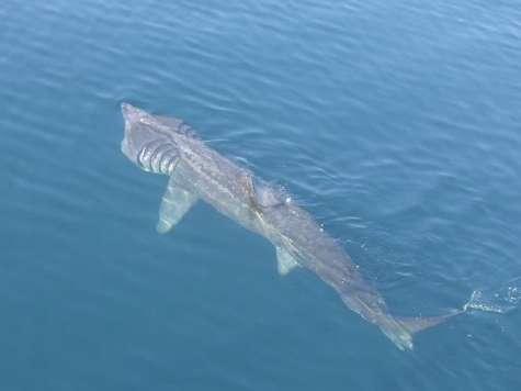
 Basking sharks and oceanographic fronts: quantifying associations in the north-east Atlantic.")
10 Many pelagic animals use fronts for foraging Weak Strong Basking shark tracked with GLS tag 24 Aug. 15 Oct Key Warm Cold Miller, P.I., Scales, et al. (2015) Basking sharks and oceanographic fronts: quantifying associations in the north-east Atlantic. Functional Ecology
11 Satellite environmental drivers for hotspots Introduction to satellite products for ecology Environmental drivers for 2016 Predictions of top predator hotspots

12 Thermal fronts 2016 Onset of stratification Coastal upwelling Breakdown in stratification Monthly thermal front maps, from AVHRR 1km resolution daily SST data (PML)

13 Ocean front frequency % Winter Spring Summer Autumn
14 Anomaly in thermal front frequency -50% % Winter Spring Weak stratification? Summer Autumn Weak upwelling?


15 Thermal and chlorophyll front fusion Weak Weak Strong Strong Sep Thermal fronts Dilated Chl-a fronts Dilated Front fusion map Separated Warm Cold Colocated High Low Front fusion mask High chl Low chl


16 Front fusion maps - bio-active? Weekly fusion of simplified thermal and chl-a front maps, from AVHRR and Aqua-MODIS 1km data (PML)

17 Surface chlorophyll 2016 mg Chl m -3 Aqua-MODIS 1km resolution OC3 chlorophyll algorithm, NEODAAS-Plymouth

18 Anomaly in surface chlorophyll Early growth? Restricted spring bloom Weak dinoflagellate blooms Autumn bloom ESA Climate Change Initiative 4km resolution monthly anomaly based on monthly climatology (v2.0, )

19 Sea-surface temperature 2016 Low High AVHRR 1km resolution monthly SST composites, variable colour scale, NEODAAS-Plymouth
20 Satellite environmental drivers for hotspots Introduction to satellite products for ecology Environmental drivers for 2016 Predictions of top predator hotspots
21 Predicting basking sharks habitat


22 Predicting dolphin habitat Broad-scale foraging: Seasonal; Seabed slope; Shelf-sea front density. Fine-scale foraging: Seasonal; Tidal mixing.


23 Predicting seabird habitat Latitude Longitude Year Season Effort Bathymetry Bathymetry spatial gradient Distance to coastline Mean chlorophyll a concentration Temporal change in chlorophyll a during season Spatial chlorophyll a concentration gradient Mean sea surface temperature Temporal change in SST during season Spatial sea surface temperature gradient Mean sea surface temperature anomaly Density of fronts Distance to front Mean sea surface height
24 Predicting cetacean habitat
 Autumn bloom (Aug. Sep.) Biophysical frontal zones (Mar. Sep.) Reduced summer blooms, limiting food chain (Jul. Aug.")
25 Satellite prediction of 2016 predator hotspots Ocean front frequency Summer 2016 Weak spring bloom (Mar. May) Autumn bloom (Aug. Sep.) Biophysical frontal zones (Mar. Sep.) Reduced summer blooms, limiting food chain (Jul. Aug.)
26 Satellite environmental drivers for hotspots Introduction to satellite products for ecology Environmental drivers for 2016 Predictions of top predator hotspots Any questions? Peter Miller - PML ocean fronts: tinyurl.com/pmlfronts Satellite data: neodaas.ac.uk
Ocean front maps for integrating dynamic thermal, colour and salinity features Peter Miller and Weidong Xu
 Ocean front maps for integrating dynamic thermal, colour and salinity features Peter Miller and Weidong Xu 44 th International Liège Colloquium on Ocean Dynamics: Remote sensing of colour, temperature
Ocean fronts as an indicator of marine animals: expediting site selection and survey for offshore renewables
 Ocean fronts as an indicator of marine animals: expediting site selection and survey for offshore renewables Peter Miller and David Sims 1 1 MBA Oceanic fronts for pelagic diversity Detecting ocean fronts
Frequent locations of oceanic fronts as an indicator of pelagic diversity: application to marine protected areas and renewables
 Extended MPA abstract for MCS website, based on WCMB 2011, Aberdeen. Frequent locations of oceanic fronts as an indicator of pelagic diversity: application to marine protected areas and renewables Peter
The pattern determination of sea surface temperature distribution and chlorophyll a in the Southern Caspian Sea using SOM Model
 Iranian Journal of Fisheries Sciences 2()05-4 203 The pattern determination of sea surface temperature distribution and chlorophyll a in the Southern Caspian Sea using SOM Model Downloaded from jifro.ir
Eddy and Chlorophyll-a Structure in the Kuroshio Extension Detected from Altimeter and SeaWiFS
 14th Symposium on Integrated Observing and Assimilation Systems for the Atmosphere, Oceans, and Land Surface (IOAS-AOLS), AMS Atlanta, January 17-21, 21 Eddy and Chlorophyll-a Structure in the Kuroshio
Investigating the contribution of allochthonous subsidies to kelp forests in central California
 Investigating the contribution of allochthonous subsidies to kelp forests in central California melissa m foley UCSC Institute of Marine Science and Center for Ocean Solutions system connectivity rivers
Changes in spatial distribution of chub mackerel under climate change: the case study using Japanese purse seine fisheries data in the East China Sea
 Changes in spatial distribution of chub mackerel under climate change: the case study using Japanese purse seine fisheries data in the East China Sea Tohya Yasuda, Ryuji Yukami, Seiji Ohshimo Seikai National
Seasonal cycle of phytoplankton community composition off Newport, Oregon, in 2009
 Seasonal cycle of phytoplankton community composition off Newport, Oregon, in 29 Xiuning Du 1, William Peterson 2 1 College of Environmental science and Engineering, Ocean University of China, Qingdao,
Seasonal Climate Watch July to November 2018
 Seasonal Climate Watch July to November 2018 Date issued: Jun 25, 2018 1. Overview The El Niño-Southern Oscillation (ENSO) is now in a neutral phase and is expected to rise towards an El Niño phase through
Yellow Sea Thermohaline and Acoustic Variability
 Yellow Sea Thermohaline and Acoustic Variability Peter C Chu, Carlos J. Cintron Naval Postgraduate School, USA Steve Haeger Naval Oceanographic Office, USA Yellow Sea Bottom Sediment Chart Four Bottom
Regional Forecasting of California HABs
 Regional Forecasting of California HABs Chlorophyll Domoic Acid Clarissa Anderson UC Santa Cruz West Coast Regional HAB Summit February 12, 2009 Trainer et al 2000, Hickey and Banas 2003, in Kudela 2005
Life Cycle of Convective Systems over Western Colombia
 Life Cycle of Convective Systems over Western Colombia Meiry Sakamoto Uiversidade de São Paulo, São Paulo, Brazil Colombia Life Cycle of Convective Systems over Western Colombia Convective System (CS)
Habitat Suitability for Forage Fishes in Chesapeake Bay
 Habitat Suitability for Forage Fishes in Chesapeake Bay Aug 2017 Jul 2019 Mary C Fabrizio Troy D Tuckey Aaron J Bever Michael L MacWilliams 21 June 2018 Photo: Chesapeake Bay Program Motivation Production
Long-term Change of Ocean Productivity: A case study in the Bay of Bengal
 Long-term Change of Ocean Productivity: A case study in the Bay of Bengal The 3 rd Asian /12 th Korean-Japan Workshop on Ocean Color Dr.Md.Latifur Rahman Sarker, UTM, Malaysia & RU, Bangladesh & Noor Saadah
ENSO Outlook by JMA. Hiroyuki Sugimoto. El Niño Monitoring and Prediction Group Climate Prediction Division Japan Meteorological Agency
 ENSO Outlook by JMA Hiroyuki Sugimoto El Niño Monitoring and Prediction Group Climate Prediction Division Outline 1. ENSO impacts on the climate 2. Current Conditions 3. Prediction by JMA/MRI-CGCM 4. Summary
Atmospheric circulation analysis for seasonal forecasting
 Training Seminar on Application of Seasonal Forecast GPV Data to Seasonal Forecast Products 18 21 January 2011 Tokyo, Japan Atmospheric circulation analysis for seasonal forecasting Shotaro Tanaka Climate
GAMINGRE 8/1/ of 7
 FYE 09/30/92 JULY 92 0.00 254,550.00 0.00 0 0 0 0 0 0 0 0 0 254,550.00 0.00 0.00 0.00 0.00 254,550.00 AUG 10,616,710.31 5,299.95 845,656.83 84,565.68 61,084.86 23,480.82 339,734.73 135,893.89 67,946.95
Synoptic and mesoscale analysis of waterspouts in the Adriatic ( preliminary climatology)
") Synoptic and mesoscale analysis of waterspouts in the Adriatic (2001-2011 preliminary climatology) Josipa Kuzmić 1, Tanja Renko 1, Nataša Strelec Mahović 1 1 Meteorological and Hydrological Service of
Synoptic and mesoscale analysis of waterspouts in the Adriatic (2001-2011 preliminary climatology) Josipa Kuzmić 1, Tanja Renko 1, Nataša Strelec Mahović 1 1 Meteorological and Hydrological Service of
Seasonal shelf-sea front mapping using satellite ocean colour and temperature to support development of a marine protected area network
 Seasonal shelf-sea front mapping using satellite ocean colour and temperature to support development of a marine protected area network Peter I. Miller, Weidong Xu and Morven Carruthers 1 Remote Sensing
Multivariate time-series forecasting of the NE Arabian Sea Oil Sardine fishery using satellite covariates
 Multivariate time-series forecasting of the NE Arabian Sea Oil Sardine fishery using satellite covariates Eli Holmes 1, Nimit Kumar 2, Sourav Maity 2, B.R Smitha 3, Sherine Cubelio 3, Cara Wilson 4, Narayanane
Investigate the influence of the Amazon rainfall on westerly wind anomalies and the 2002 Atlantic Nino using QuikScat, Altimeter and TRMM data
 Investigate the influence of the Amazon rainfall on westerly wind anomalies and the 2002 Atlantic Nino using QuikScat, Altimeter and TRMM data Rong Fu 1, Mike Young 1, Hui Wang 2, Weiqing Han 3 1 School
Coastal Ocean Circulation Experiment off Senegal (COCES)
") DISTRIBUTION STATEMENT A. Approved for public release; distribution is unlimited. Coastal Ocean Circulation Experiment off Senegal (COCES) Pierre-Marie Poulain Istituto Nazionale di Oceanografia e di Geofisica
DISTRIBUTION STATEMENT A. Approved for public release; distribution is unlimited. Coastal Ocean Circulation Experiment off Senegal (COCES) Pierre-Marie Poulain Istituto Nazionale di Oceanografia e di Geofisica
Distributional changes of west coast species and impacts of climate change on species and species groups
 Distributional changes of west coast species and impacts of climate change on species and species groups Elliott Hazen 1 Ole Shelton 2 Eric Ward 2 1 NOAA Southwest Fisheries Science Center 2 NOAA Northwest
Variability and trends in daily minimum and maximum temperatures and in diurnal temperature range in Lithuania, Latvia and Estonia
 Variability and trends in daily minimum and maximum temperatures and in diurnal temperature range in Lithuania, Latvia and Estonia Jaak Jaagus Dept. of Geography, University of Tartu Agrita Briede Dept.
What is the difference between Weather and Climate?
 What is the difference between Weather and Climate? Objective Many people are confused about the difference between weather and climate. This makes understanding the difference between weather forecasts
On the presence of tropical vortices over the Southeast Asian Sea- Maritime Continent region
 Technical Conference of 50 th Annual Session of Typhoon Committee 2018 On the presence of tropical vortices over the Southeast Asian Sea- Maritime Continent region Nguyen Dang-Quang 1, James Renwick 2,
Surface Anomalies Prior to Earthquakes
 Surface Anomalies Prior to Earthquakes Habibeh Valizadeh, Shattri B. Mansor Husaini Omar and Farid Azad Department of Civil Engineering Universiti Putra Malaysia Serdang, Selangor Malaysia shattri@eng.upm.edu.my
SSS retrieval from space Comparison study using Aquarius and SMOS data
 44 th International Liège Colloquium on Ocean Dynamics 7-11 May 2012 SSS retrieval from space Comparison study using Aquarius and SMOS data Physical Oceanography Department Institute of Marine Sciences
Southern Florida to Cape Hatteras Spring Season Preview 2018 UPDATE ON U.S. EAST COAST GULF STREAM CONDITIONS
 Southern Florida to Cape Hatteras Spring Season Preview 2018 UPDATE ON U.S. EAST COAST GULF STREAM CONDITIONS By ROFFS Gregory J. Gawlikowski ROFFS continues its spring preview series by providing an overall
Spatial ecology of Carcharias taurus in the northwestern Mid- Atlantic coastal ocean. Supplement 1. Supplemental Figures and Tables
 Spatial ecology of Carcharias taurus in the northwestern Mid- Atlantic coastal ocean D. E. Haulsee*, M. W. Breece, L.M. Brown, B. M. Wetherbee, D. A. Fox, M. J. Oliver * Corresponding author: dhaulsee@udel.edu
CLIMATE OVERVIEW. Thunder Bay Climate Overview Page 1 of 5
 CLIMATE OVERVIEW The climate in the Thunder Bay area is typical of a mid-latitude inland location with a Great Lake Moderating influence. The moderating effect of Lake Superior results in cooler summer
LESSON THREE Time, Temperature, Chlorophyll a Does sea surface temperature affect chlorophyll a concentrations?
 STUDENT PAGES LESSON THREE A partnership between California Current Ecosystem Long Term Ecological Research (CCE LTER) and Ocean Institute (OI) Beth Simmons, Education and Outreach Coordinator, CCE LTER,
Interannual variation of MODIS NDVI in Lake Taihu and its relation to climate in submerged macrophyte region
 Yale-NUIST Center on Atmospheric Environment Interannual variation of MODIS NDVI in Lake Taihu and its relation to climate in submerged macrophyte region ZhangZhen 2015.07.10 1 Outline Introduction Data
Dust storm variability over EGYPT By Fathy M ELashmawy Egyptian Meteorological Authority
 WMO WORKSHOP ON CLIMATE MONITORING INCLUDING THE IMPLEMENTATION OF CLIMATE WATCH SYSTEMS FOR ARAB COUNTRIES IN WEST ASIA, AMMAN, JORDAN, 27-29 MAY 2013 Dust storm variability over EGYPT By Fathy M ELashmawy
Global Ocean Monitoring: Recent Evolution, Current Status, and Predictions
 Global Ocean Monitoring: Recent Evolution, Current Status, and Predictions Prepared by Climate Prediction Center, NCEP November 6, 2009 http://www.cpc.ncep.noaa.gov/products/godas/ This project to deliver
Detection and Visualisation of Oceanic Fronts from Satellite Data, with Applications for Fisheries, Marine Megafauna and Marine Protected Areas
 Case Study 16 Detection and Visualisation of Oceanic Fronts from Satellite Data, with Applications for Fisheries, Marine Megafauna and Marine Protected Areas Peter I. Miller 1 16.1 Background Information
OVERVIEW OF IMPROVED USE OF RS INDICATORS AT INAM. Domingos Mosquito Patricio
 OVERVIEW OF IMPROVED USE OF RS INDICATORS AT INAM Domingos Mosquito Patricio domingos.mosquito@gmail.com Introduction to Mozambique /INAM Introduction to AGRICAB/SPIRITS Objectives Material & Methods Results
Long term change in the abundances of northern Gulf of Mexico scyphomedusae Chrysaora sp. and Aurelia spp. with links to climate variability
 Long term change in the abundances of northern Gulf of Mexico scyphomedusae Chrysaora sp. and Aurelia spp. with links to climate variability Kelly L. Robinson William M. Graham U. Southern Mississippi
Interannual Variability of Wind Induced Onshore Transport over the Northern West Florida Shelf
 Interannual Variability of Wind Induced Onshore Transport over the Northern West Florida Shelf Steve Morey Austin Todd Mark Bourassa COAPS/FSU Motivation Understand the physical controls on regional Gag
2. What is a phytoplankton bloom and when does it generally occur in the North Atlantic?
 Name: Date: Guiding Question: Seasonal Cycles: the North Atlantic Phytoplankton Bloom What are the factors that control the patterns/cycles of phytoplankton growth in the North Atlantic Ocean? Introduction
APPENDIX B PHYSICAL BASELINE STUDY: NORTHEAST BAFFIN BAY 1
 APPENDIX B PHYSICAL BASELINE STUDY: NORTHEAST BAFFIN BAY 1 1 By David B. Fissel, Mar Martínez de Saavedra Álvarez, and Randy C. Kerr, ASL Environmental Sciences Inc. (Feb. 2012) West Greenland Seismic
Characterizing the Physical Oceanography of Coastal Waters Off Rhode Island
 Characterizing the Physical Oceanography of Coastal Waters Off Rhode Island Dan Codiga and Dave Ullman Graduate School of Oceanography University of Rhode Island RI OSAMP Stakeholder Meeting January 5,
Turbulence and the Spring Phytoplankton Bloom
 Turbulence and the Spring Phytoplankton Bloom Raffaele Ferrari Earth, Atmospheric and Planetary Sciences, MIT Collaborators: Sophia Merrifield and John Taylor Toronto, February 2, 2012 Phytoplankton Bloom
Results of oceanographic analyses conducted under JARPA and possible evidence of environmental changes.
 SC/D06/J30 Results of oceanographic analyses conducted under JARPA and possible evidence of environmental changes. Tomowo Watanabe*, Takashi Yabuki**, Toshio Suga**, Kimio Hanawa**, Koji Matsuoka*** and
TEACHER VERSION: Suggested student responses are included. Seasonal Cycles: the North Atlantic Phytoplankton Bloom
 Name: Date: Guiding Question: TEACHER VERSION: Suggested student responses are included. Seasonal Cycles: the North Atlantic Phytoplankton Bloom What are the factors that control the patterns/cycles of
8.1 Attachment 1: Ambient Weather Conditions at Jervoise Bay, Cockburn Sound
 8.1 Attachment 1: Ambient Weather Conditions at Jervoise Bay, Cockburn Sound Cockburn Sound is 20km south of the Perth-Fremantle area and has two features that are unique along Perth s metropolitan coast
MERSEA Marine Environment and Security for the European Area
 MERSEA Marine Environment and Security for the European Area Development of a European system for operational monitoring and forecasting of the ocean physics, biogeochemistry, and ecosystems, on global
particular regional weather extremes
 SUPPLEMENTARY INFORMATION DOI: 1.138/NCLIMATE2271 Amplified mid-latitude planetary waves favour particular regional weather extremes particular regional weather extremes James A Screen and Ian Simmonds
over the Northern West Florida Shelf from SeaWinds and ASCAT
 Interannual Variability of Synoptic Scale Winds over the Northern West Florida Shelf from SeaWinds and ASCAT Steve Morey Mark Bourassa Austin Todd COAPS/FSU This work is sponsored by the NASA Ocean Vector
Harmful Algal Blooms (HABs) 5 Applications
 5 Applications") Harmful Algal Blooms (HABs) 5 Applications Richard P. Stumpf NOAA, National Ocean Service HAB occurrences worldwide Image from whoi.edu/redtide HAB applications: short term Management: Monitoring and Response
Harmful Algal Blooms (HABs) 5 Applications Richard P. Stumpf NOAA, National Ocean Service HAB occurrences worldwide Image from whoi.edu/redtide HAB applications: short term Management: Monitoring and Response
ALASKA REGION CLIMATE OUTLOOK BRIEFING. June 22, 2018 Rick Thoman National Weather Service Alaska Region
 ALASKA REGION CLIMATE OUTLOOK BRIEFING June 22, 2018 Rick Thoman National Weather Service Alaska Region Today s Outline Feature of the month: Ocean Warmth Headed into Summer Climate Forecast Basics Climate
ECMWF: Weather and Climate Dynamical Forecasts
 ECMWF: Weather and Climate Dynamical Forecasts Medium-Range (0-day) Partial coupling Extended + Monthly Fully coupled Seasonal Forecasts Fully coupled Atmospheric model Atmospheric model Wave model Wave
Increased phytoplankton blooms detected by ocean color
 Increased phytoplankton blooms detected by ocean color Mati Kahru & B. Greg Mitchell Scripps Institution of Oceanography/ University of California San Diego La Jolla, CA 92093-0218 ASLO Aquatic Sciences
Physical factors driving the oceanographic regime around the Florida Keys. Villy Kourafalou. University of Miami/RSMAS
 Physical factors driving the oceanographic regime around the Florida Keys Villy Kourafalou University of Miami/RSMAS Oceanographic connectivity around the Florida Keys LC FC http://oceancurrents.rsmas.miami.edu/atlantic/loop-current_2.html
Mapping and Valuing Pelagic Ecosystem Services in the Lesser Sunda Ecoregion Preliminary Results on the Manta Rays Pelagic Fisheries for Tourism
 Mapping and Valuing Pelagic Ecosystem Services in the Lesser Sunda Ecoregion Preliminary Results on the Manta Rays Pelagic Fisheries for Tourism Luky Adrianto. Yudi Wahyudin, Alan F Koropitan and Benny
Seasonal Climate Watch April to August 2018
 Seasonal Climate Watch April to August 2018 Date issued: Mar 23, 2018 1. Overview The El Niño-Southern Oscillation (ENSO) is expected to weaken from a moderate La Niña phase to a neutral phase through
Seasonal Climate Watch June to October 2018
 Seasonal Climate Watch June to October 2018 Date issued: May 28, 2018 1. Overview The El Niño-Southern Oscillation (ENSO) has now moved into the neutral phase and is expected to rise towards an El Niño
Name Period Part I: INVESTIGATING OCEAN CURRENTS: PLOTTING BUOY DATA
 Name Period Part I: INVESTIGATING OCEAN CURRENTS: PLOTTING BUOY DATA INTRODUCTION: Ocean currents are like huge rivers in the sea. They carry drifting organisms, vital dissolved chemical nutrients and
Climate also has a large influence on how local ecosystems have evolved and how we interact with them.
 The Mississippi River in a Changing Climate By Paul Lehman, P.Eng., General Manager Mississippi Valley Conservation (This article originally appeared in the Mississippi Lakes Association s 212 Mississippi
Appendix B. A proposition for updating the environmental standards using real Earth Albedo and Earth IR Flux for Spacecraft Thermal Analysis
 19 Appendix B A proposition for updating the environmental standards using real Earth Albedo and Earth IR Romain Peyrou-Lauga (ESA/ESTEC, The Netherlands) 31 st European Space Thermal Analysis Workshop
ALASKA REGION CLIMATE OUTLOOK BRIEFING. December 22, 2017 Rick Thoman National Weather Service Alaska Region
 ALASKA REGION CLIMATE OUTLOOK BRIEFING December 22, 2017 Rick Thoman National Weather Service Alaska Region Today s Outline Feature of the month: Autumn sea ice near Alaska Climate Forecast Basics Climate
PROJECT REPORT (ASL 720) CLOUD CLASSIFICATION
 CLOUD CLASSIFICATION") PROJECT REPORT (ASL 720) CLOUD CLASSIFICATION SUBMITTED BY- PRIYANKA GUPTA 2011CH70177 RINI KAPOOR 2011CH70179 INDIVIDUAL CONTRIBUTION- Priyanka Gupta- analysed data of region considered in India (West:80,
PROJECT REPORT (ASL 720) CLOUD CLASSIFICATION SUBMITTED BY- PRIYANKA GUPTA 2011CH70177 RINI KAPOOR 2011CH70179 INDIVIDUAL CONTRIBUTION- Priyanka Gupta- analysed data of region considered in India (West:80,
Sea-ice change around Alaska & Impacts on Human Activities
 Sea-ice change around Alaska & Impacts on Human Activities Hajo Eicken Geophysical Institute University of Alaska Fairbanks, hajo.eicken@gi.alaska.edu Introduction The Arctic sea-ice cover: Observations
United States Climate
 25-1 Alabama Annual Average Temperature Data Source: http://www.wrcc.dri.edu/cgi-bin/divplot1_form.pl?0106 25-2 How does climate vary as we traverse the U.S. along 40 N? 25-3 Average Temperature Along
THE ROLE OF OCEAN OBSERVATORIES IN CLIMATE CHANGE MONITORING, MULTI-HAZARD EARLY WARNING AND DISASTER RISK REDUCTION
 THE ROLE OF OCEAN OBSERVATORIES IN CLIMATE CHANGE MONITORING, MULTI-HAZARD EARLY WARNING AND DISASTER RISK REDUCTION Tania L. Insua, Moran, K., De Leo, F., Sastri, A., Heesemann, M., Dewey, R. UNOOSA Conference
RESEARCH REPORT SERIES
 GREAT AUSTRALIAN BIGHT RESEARCH PROGRAM RESEARCH REPORT SERIES Regional Availability of MODIS Imagery in the Great Australian Bight Ana Redondo Rodriguez1 Edward King2 and Mark Doubell1 SARDI Aquatic Sciences
Eyes in the sky: linking satellite oceanography and biotelemetry to explore habitat selection by basking sharks
 Eyes in the sky: linking satellite oceanography and biotelemetry to explore habitat selection by basking sharks Curtis et al. Curtis et al. Animal Biotelemetry 2014, 2:12 Curtis et al. Animal Biotelemetry
El Niño, South American Monsoon, and Atlantic Niño links as detected by a. TOPEX/Jason Observations
 El Niño, South American Monsoon, and Atlantic Niño links as detected by a decade of QuikSCAT, TRMM and TOPEX/Jason Observations Rong Fu 1, Lei Huang 1, Hui Wang 2, Paola Arias 1 1 Jackson School of Geosciences,
ENSO UPDATE By Joseph D Aleo, CCM
 ENSO UPDATE By Joseph D Aleo, CCM El Nino is still hanging on but likely not for very long. Warmer than normal water can still be seen along the equator in the tropical Pacific. It is even warmer in the
POPULATION DYNAMICS AND PREDATION IMPACT OF THE INTRODUCED CTENOPHORE MNEMIOPSIS LEIDYI IN THE GULLMARS FJORD, WEST COAST OF SWEDEN
 POPULATION DYNAMICS AND PREDATION IMPACT OF THE INTRODUCED CTENOPHORE MNEMIOPSIS LEIDYI IN THE GULLMARS FJORD, WEST COAST OF SWEDEN Lene Friis Møller & Peter Tiselius Dep. Of Marine Ecology Kristineberg
Wavelet analysis on upwelling index along the Moroccan Atlantic coast
 Wavelet analysis on upwelling index along the Moroccan Atlantic coast Bessa Ismail, M.S Laboratory of engineering and Materials, Hassan II University of Casablanca, Faculty of Sciences Ben M Sik, P.B 7955,
Aggregation Hotspots
 Photo: Mike Brittain Aggregation Hotspots George L. Hunt, Jr. School of Aquatic and Fishery Sciences University of Washington Aggregation Hotspots Predictable in Time and Space Places with high rates of
Cambridge International Examinations Cambridge International Advanced Subsidiary and Advanced Level
 Cambridge International Examinations Cambridge International Advanced Subsidiary and Advanced Level *2554656732* MARINE SCIENCE 9693/01 Paper 1 AS Structured Questions October/November 2017 1 hour 30 minutes
Location. Datum. Survey. information. Etrometa. Step Gauge. Description. relative to Herne Bay is -2.72m. The site new level.
 Tide Gauge Location OS: 616895E 169377N WGS84: Latitude: 51 o 22.919196 N Longitude: 01 o 6.9335907 E Instrument Type Etrometa Step Gauge Benchmarks Benchmark TGBM = 5.524m above Ordnance Datum Newlyn
Relationship between atmospheric circulation indices and climate variability in Estonia
 BOREAL ENVIRONMENT RESEARCH 7: 463 469 ISSN 1239-695 Helsinki 23 December 22 22 Relationship between atmospheric circulation indices and climate variability in Estonia Oliver Tomingas Department of Geography,
2004 State of the Ocean: Physical Oceanographic Conditions in the Newfoundland and Labrador Region
 Canadian Science Advisory Secretariat Science Advisory Report 25/18 Research vessel CCGS Teleost 24 State of the Ocean: Physical Oceanographic Conditions in the Newfoundland and Labrador Region Background
Seasonal Hydrometeorological Ensemble Prediction System: Forecast of Irrigation Potentials in Denmark
 Seasonal Hydrometeorological Ensemble Prediction System: Forecast of Irrigation Potentials in Denmark Diana Lucatero 1*, Henrik Madsen 2, Karsten H. Jensen 1, Jens C. Refsgaard 3, Jacob Kidmose 3 1 University
Predicting summer pelagic habitat hotspots of neon flying squid (Ommastrephes bartramii) in the western North Pacific
 in the western North Pacific") Predicting summer pelagic habitat hotspots of neon flying squid (Ommastrephes bartramii) in the western North Pacific Irene D. Alabia 1, Sei-Ichi Saitoh 1, Hiromichi Igarashi 2, Yoichi Ishikawa 2, Norihisa
Predicting summer pelagic habitat hotspots of neon flying squid (Ommastrephes bartramii) in the western North Pacific Irene D. Alabia 1, Sei-Ichi Saitoh 1, Hiromichi Igarashi 2, Yoichi Ishikawa 2, Norihisa
Constructing a typical meteorological year -TMY for Voinesti fruit trees region and the effects of global warming on the orchard ecosystem
 Constructing a typical meteorological year -TMY for Voinesti fruit trees region and the effects of global warming on the orchard ecosystem ARMEANU ILEANA*, STĂNICĂ FLORIN**, PETREHUS VIOREL*** *University
Location. Datum. Survey. information. Etrometa. Step Gauge. Description. relative to Herne Bay is -2.72m. The site new level.
 Tide Gauge Location OS: 616895E 169377N WGS84: Latitude: 51 o 22.919196 N Longitude: 01 o 6.9335907 E Instrument Type Etrometa Step Gauge Benchmarks Benchmark TGBM = 5.524m above Ordnance Datum Newlyn
Variability and trend of the heat balance in the southeast Indian Ocean
 Variability and trend of the heat balance in the southeast Indian Ocean Ming Feng, CSIRO Marine & Atmospheric Research Arne Biastoch, Claus Böning, Leibniz-Institut für Meeresforschung Nick Caputi, Department
5 - Seasons. Figure 1 shows two pictures of the Sun taken six months apart with the same camera, at the same time of the day, from the same location.
 ASTR 110L 5 - Seasons Purpose: To plot the distance of the Earth from the Sun over one year and to use the celestial sphere to understand the cause of the seasons. What do you think? Write answers to questions
The PML data assimilation system For the North East Atlantic and ocean colour. Stefano Ciavatta, Ricardo Torres, Stephane Saux-Picart, Icarus Allen
 The PML data assimilation system For the North East Atlantic and ocean colour Stefano Ciavatta, Ricardo Torres, Stephane Saux-Picart, Icarus Allen OPEC, Dartington, 11-12 December 2012 Outline Main features
Analysis of Historical Pattern of Rainfall in the Western Region of Bangladesh
 24 25 April 214, Asian University for Women, Bangladesh Analysis of Historical Pattern of Rainfall in the Western Region of Bangladesh Md. Tanvir Alam 1*, Tanni Sarker 2 1,2 Department of Civil Engineering,
Spatio-temporal dynamics of Marbled Murrelet hotspots during nesting in nearshore waters along the Washington to California coast
 Western Washington University Western CEDAR Salish Sea Ecosystem Conference 2014 Salish Sea Ecosystem Conference (Seattle, Wash.) May 1st, 10:30 AM - 12:00 PM Spatio-temporal dynamics of Marbled Murrelet
Upper Ocean Circulation
 Upper Ocean Circulation C. Chen General Physical Oceanography MAR 555 School for Marine Sciences and Technology Umass-Dartmouth 1 MAR555 Lecture 4: The Upper Oceanic Circulation The Oceanic Circulation
The Climate of Oregon Climate Zone 5 High Plateau
 105 E55 Unbound issue i". 9 13oes not circulate CZe Special Report 917 May 1993 The Climate of Oregon Climate Zone 5 Property of OREGON STATE UNIVERSITY Library Serials Corvallis, OR 97331-4503 Agricultural
Potential of profiling floats to enhance NASA s mission
 Potential of profiling floats to enhance NASA s mission Emmanuel Boss University of Maine Outline: What are profiling floats? Studies to date involving optics and profiling floats. Apex float 5. Collaborators:
Satellite-based Red-Tide Detection/Monitoring
 Satellite-based Detection/Monitoring Contents 1. Introduction - and Its Monitoring System 2. Detection Using Ocean Color Remote Sensing 3. Satellite-Based Monitoring in the Asian Coastal Seas Hiroshi KAWAMURA
Spatiotemporal variations of alpine climate, snow cover and phenology
 Spatiotemporal variations of alpine climate, snow cover and phenology S. Asam, M. Callegari, M. Matiu, G. Fiore, L. De Gregorio, A. Jacob, A. Menzel, C. Notarnicola, M. Zebisch Asam et al., Spatiotemporal
The Arctic Energy Budget
 The Arctic Energy Budget The global heat engine [courtesy Kevin Trenberth, NCAR]. Differential solar heating between low and high latitudes gives rise to a circulation of the atmosphere and ocean that
The Blob, El Niño, and the Drought in Puget Sound
 The Blob, El Niño, and the Drought in Puget Sound Christopher Krembs, Marine Monitoring Unit, EAP, Ecology The Drought The Blob El Niño Warmest first four months since 1981, (Source: NASA's Goddard Institute
The Climate of Payne County
 The Climate of Payne County Payne County is part of the Central Great Plains in the west, encompassing some of the best agricultural land in Oklahoma. Payne County is also part of the Crosstimbers in the
Seasonal forecasting as a stepping stone to climate adaptation in marine fisheries and aquaculture
 Seasonal forecasting as a stepping stone to climate adaptation in marine fisheries and aquaculture Alistair Hobday Paige Eveson Jason Hartog Claire Spillman Projected changes (e.g. distribution) 11 species
Climatography of the United States No
 Climate Division: AK 5 NWS Call Sign: ANC Month (1) Min (2) Month(1) Extremes Lowest (2) Temperature ( F) Lowest Month(1) Degree s (1) Base Temp 65 Heating Cooling 90 Number of s (3) Jan 22.2 9.3 15.8
ALASKA REGION CLIMATE OUTLOOK BRIEFING. July 20, 2018 Rick Thoman National Weather Service Alaska Region
 ALASKA REGION CLIMATE OUTLOOK BRIEFING July 20, 2018 Rick Thoman National Weather Service Alaska Region Today s Outline Feature of the month: 2018 Wildfire Season Update Climate Forecast Basics Climate
Climate Variability. Eric Salathé. Climate Impacts Group & Department of Atmospheric Sciences University of Washington. Thanks to Nathan Mantua
 Climate Variability Eric Salathé Climate Impacts Group & Department of Atmospheric Sciences University of Washington Thanks to Nathan Mantua Northwest Climate: the mean Factors that influence local/regional
Climate Variability in South Asia
 Climate Variability in South Asia V. Niranjan, M. Dinesh Kumar, and Nitin Bassi Institute for Resource Analysis and Policy Contents Introduction Rainfall variability in South Asia Temporal variability
Champaign-Urbana 2000 Annual Weather Summary
 Champaign-Urbana 2000 Annual Weather Summary ILLINOIS STATE WATER SURVEY 2204 Griffith Dr. Champaign, IL 61820 wxobsrvr@sws.uiuc.edu Maria Peters, Weather Observer January: January started on a mild note,
From El Nino to Atlantic Nino: pathways as seen in the QuikScat winds
 From El Nino to Atlantic Nino: pathways as seen in the QuikScat winds Rong Fu 1, Lei Huang 1, Hui Wang 2 Presented by Nicole Smith-Downey 1 1 Jackson School of Geosciences, The University of Texas at Austin