New RadCalNet Instrumented Site at Gobabeb, Namibia: Field Campaign Conclusions and First Absolute Calibration Results
|
|
|
- Bertha Price
- 6 years ago
- Views:
Transcription


1 New RadCalNet Instrumented Site at Gobabeb, Namibia: Field Campaign Conclusions and First Absolute Calibration Results Sebastien Marcq 1, Sophie Lacherade 1, Aime Meygret 1, Agnieszka Bialek 2, Claire Greenwell 2, Maxim Lamare 2, Nigel Fox 2, Marc Bouvet 3, Beatrice Berthelot 4 1: CNES, France; 2: NPL, United Kingdom; 3: ESA, Netherlands; 4: Magellium, France
2 Outline Context - RadCalNet Global search for site Precise location at Gobabeb Results from characterization campaign Conclusion and outlook 2


 La Crau")
 Gobabeb (ESA/CNES, Namibia) 3 Already operational To be")
3 RadCalNet (Radiometric Calibration Network) CEOS/WGCV IVOS Calibration field campaigns: Atmosphere and surface optical properties are characterized simultaneously to the satellite overpass -> Limitations: cost + availability Baotou Railroad Valley La Crau Gobabeb Automatic field instrumentation Data will be accessible to the public Baotou (AOE, China) La Crau (CNES, France) Railroad Valley (NASA/University of Arizona, USA) Gobabeb (ESA/CNES, Namibia) 3 Already operational To be installed Autumn 2016
 as part of RadCalNet (Radiometric")

 - Stability (no vegetation) - Atmospheric")
 Area of")
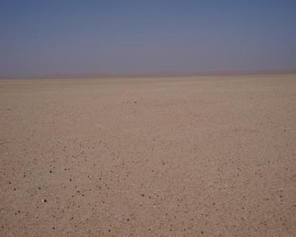
4 Global search for a new site look for a new site (ESA+CNES) as part of RadCalNet (Radiometric Calibration Network) Criteria of global analysis: - Low Cloud coverage - High Spatial homogeneity at several scales (10s of meters to 100s of meters) - Stability (no vegetation) - Atmospheric changes (atmospheric particles, water wapor ) - Pratical reasons (access, transmission) Area of Gobabeb, Namibia 4
 Homogeneity Representativeness Different scales, LxL: - 100x100 m² - 200x200 m² - 500x500 m² - 1000x1000 m² - 2000x2000 m² Different")
5 Precise location at Gobabeb from Satellite data 1000 m² Site characterized by the instrumentation needs to be homogeneous and representative of the surrounding area, acquired by the satellite sensor ( m²) Homogeneity Representativeness Different scales, LxL: - 100x100 m² - 200x200 m² - 500x500 m² x1000 m² x2000 m² Different resolutions: 5


6 Precise location at Gobabeb from Satellite data Spatial homoneneity better than 3% LxL = 1 km² Homogeneity LxL = 200x200 m² Spatial Representativeness LxL = 200x200 m² 6 potential sites 6


7 Precise location at Gobabeb: visual assessment of Potential sites 1 2 1bis Titre présentation

8 Characterization GRASS directional reflectance HDRF results from the Gonio RAdiometric Spectrometer System (GRASS NPL)


9 Characterization ASD Surface reflectance ρρ tt = LL tt LL rrrrrr ρρ rrrrrr ASD measurements Characterized by NPL in the lab Z1 but the wind is getting it dirty Z4 -> needs to be monitored Z3 9
 given by 6S for each")
 -> dimming factor ff tt Day-to-day monitoring using a super reference Spectralon BRDF measured in the")
10 Spectralon panel reflectance monitoring Spectralon reflectance is modeled as ρρ dddddddddddd θθ ss EE dddddd tt + ρρ heeeeeeeeeeeeeeeeeee EE dddddd tt ρρ ssssssss θθ ss, tt = ff tt EE dddddd tt + EE dddddd tt - Direct and diffuse irradiances (EE dddddd, EE ddddff ) given by 6S for each measurement - Directionnal and hemispheric reflectance (ρρ dddddddddddd, ρρ dddddddddddddd ) measured in the lab (NPL) - Day-to-day variations (comparison to «super reference» + cleaning ) -> dimming factor ff tt Day-to-day monitoring using a super reference Spectralon BRDF measured in the lab (NPL) NPL 10

 - 100m (potential")
11 Surface reflectance protocol 10 m 100m ~1.5km Characterize surface reflectance at different resolutions: - < 1m (ASD + CIMEL footprint) - 10m (CIMEL characterized surface) - 100m (potential sensors to calibrate) 11
12 Surface reflectance results Variability at different scales Note that kilometric variability is not representative (BRDF + poor correction of Spectralon Variation) Absolute Reflectance value Gobabeb site is much more homogeneous than La Crau 12
13 Surface reflectance results: other potential sites Z1 Z4 Z3 13 Slighly less homogeneous than Z3 Confirmation of satellite data analysis
14 Surface reflectance results: Comparison with other sites Reflectance Wavelength (µm) La Crau, Gobabeb reflectance acquired by CNES (in-situ) Algeria spectra acquired by ONERA based on samples La Crau GOBABEB_Z3 Algeria_2 Algeria_3 Algeria_4 14

15 NPL Measurement Positions Circles represent GRASS measurement locations, and point markers represent ASD measurement locations.
16 NPL ASD measurements The surface points measured by the NPL team formed four 10 m x 10 m squares. The graph below shows the BRF at 1640 nm for every measurement. -> So significant variations due to solar elevation change


17 GRASS measurements Gonio Radiometric Spectrometer System The results show homogeneity in the forward scattering direction, with enhanced radiance in a hotspot located centred on the solar principal plane in the backscatter direction
 -> Relatively low AOT most of the time")
18 Characterization CIMEL Aerosols Use of the Gobabeb AERONET station (7km away) AOT -> Consistency between station and place of measurements confirmed by Calitoo (handheld sunphotometer) -> Relatively low AOT most of the time 18

 Quartz 51.")
19 Material Analysis From Royal Holloway, University of London During the campaign, samples of the surface materials were collected at all the GRASS measurement sites. Particle characterisation was performed with an SEM. Mineral analysis was undertaken using X-Ray Diffraction. Mineral Weight (%) Quartz 51.4 Calcite 1.6 Feldspar 35.8 Silicate 9.0 Mica 2.2


20 Impact of the characterization campaign Monitoring using PLEIADES 70cm resolution imagery Before Right After Sept 9th 2015 Dec. 18th 2015 Now July 26th 2016 Footprints Impact: ~6% No visible Footprints Impact 20

21 Conclusion Location of the site: Determination of the precise location of the future RadCalNet site S, E Confirmation on the ground of what satellite data had shown : very good spatial homogeneity from very high to coarse resolution Installation campaign: currently early October: Mast + photometer Weather station All sky camera Drone measurements Calibration results next year? 21
RadCalNet Quick Start Guide. RadCalNet Quick Start Guide
 RadCalNet Quick Start Guide RadCalNet Quick Start Guide 1. Scope of the document... 2 2. How to access the RadCalNet data?... 2 3. RadCalNet: which data for which purpose?... 2 4. How to use the data?...
RADIOMETRIC INTERCALIBRATION OF MOMS AND SPOT BY VICARIOUS METHOD
 RADIOMETRIC INTERCALIBRATION OF MOMS AND SPOT BY VICARIOUS METHOD M. Schroeder, R. Müller, P. Reinartz German Aerospace Center, DLR Remote Sensing Technology Institute, Image Science P.O. Box 11 16 82234
TOTAL COLUMN OZONE AND SOLAR UV-B ERYTHEMAL IRRADIANCE OVER KISHINEV, MOLDOVA
 Global NEST Journal, Vol 8, No 3, pp 204-209, 2006 Copyright 2006 Global NEST Printed in Greece. All rights reserved TOTAL COLUMN OZONE AND SOLAR UV-B ERYTHEMAL IRRADIANCE OVER KISHINEV, MOLDOVA A.A. ACULININ
Progress in Field Spectroscopy
 Progress in Field Spectroscopy Ted Milton School of Geography University of Southampton NASA JPL Reflectomobile 1976... 1976... Progress in Instrument Design Challenges in Instrument Design SNR in SWIR
CNES Activity Report. Patrice Henry - CNES WGCV Plenary # 41 Tokyo Sept. 5-7, Working Group on Calibration and Validation
 Activity Report Patrice Henry - Tokyo Sept. 5-7, 2016 Working Group on Calibration and Validation SUMMARY Calibration Monitoring of in-flight Missions Preparation of future Missions Involvement in CEOS/WGCV
Sentinel-2 and Sentinel-3 absolute calibration monitoring. C. Desjardins & V. Lonjou CNES
 Sentinel-2 and Sentinel-3 absolute calibration monitoring C. Desjardins & V. Lonjou CNES Radiometric S2A Calibration RRQI, 28 January Workshop, 2016, 30-31/08/2017 CNES SUMMARY CALCON Aug 22-25 2017 VICARIOUS
The Boundary layer Air Quality-analysis Using Network of Instruments (BAQUNIN) Super-Site for atmospheric science and satellite data validation
 Super-Site for atmospheric science and satellite data validation") The Boundary layer Air Quality-analysis Using Network of Instruments (BAQUNIN) Super-Site for atmospheric science and satellite data validation A.M. Iannarelli 1, M. Cacciani 2, A. Scoccione 2, A. Burini
The Boundary layer Air Quality-analysis Using Network of Instruments (BAQUNIN) Super-Site for atmospheric science and satellite data validation A.M. Iannarelli 1, M. Cacciani 2, A. Scoccione 2, A. Burini
Land Surface Temperature Field Intercomparison Experiment at Gobabeb, Namibia
 Land Surface Temperature Field Intercomparison Experiment at Gobabeb, Namibia Frank-M. Göttsche, LST FICE 2017 team, CEOS Land Product Validation sub-group INSTITUTE OF METEOROLOGY AND CLIMATE RESEARCH
In-flight Evaluation of the SPOT-6 Radiometric Calibration based on Acquisitions over Natural Targets and Automated in-situ Measurements
 In-flight Evaluation of the SPOT-6 Radiometric Calibration based on Acquisitions over Natural Targets and Automated in-situ Measurements Philippe GAMET, Bertrand FOUGNIE, Sophie LACHERADE (CNES), Mathieu
CNES WGCV-36 Report Cal/Val Activities
 CEOS WGCV Meeting 13-17th May 2013, Shangai, China CNES WGCV-36 Report Cal/Val Activities Bertrand Fougnie, Sophie Lachérade, Denis Jouglet, Eric Péquignot, Aimé Meygret, Patrice Henry CNES 1 Summary Pleiades
Making Accurate Field Spectral Reflectance Measurements By Dr. Alexander F. H. Goetz, Co-founder ASD Inc., Boulder, Colorado, 80301, USA October 2012
 Making Accurate Field Spectral Reflectance Measurements By Dr. Alexander F. H. Goetz, Co-founder ASD Inc., Boulder, Colorado, 80301, USA October 2012 Introduction Accurate field spectral reflectance measurements
SATELLITE RETRIEVAL OF AEROSOL PROPERTIES OVER BRIGHT REFLECTING DESERT REGIONS
 SATELLITE RETRIEVAL OF AEROSOL PROPERTIES OVER BRIGHT REFLECTING DESERT REGIONS Tilman Dinter 1, W. von Hoyningen-Huene 1, A. Kokhanovsky 1, J.P. Burrows 1, and Mohammed Diouri 2 1 Institute of Environmental
FUNDAMENTALS OF REMOTE SENSING FOR RISKS ASSESSMENT. 1. Introduction
 FUNDAMENTALS OF REMOTE SENSING FOR RISKS ASSESSMENT FRANÇOIS BECKER International Space University and University Louis Pasteur, Strasbourg, France; E-mail: becker@isu.isunet.edu Abstract. Remote sensing
Uncertainties assessment in orbital or airborne sensors absolute calibration
 Uncertainties assessment in orbital or airborne sensors absolute calibration 1 Cibele Teixeira Pinto 1,, Flávio Jorge Ponzoni 1, Giovanni Araújo Boggione 1, Leila Maria Garcia Fonseca 1, Ruy Morgado de
CALIBRATION over the Moon An introduction to «POLO»
 CALIBRATION over the Moon An introduction to «POLO» Sophie Lachérade Bertrand Fougnie Aimé Meygret CEOS - IVOS 25, Frascati, 19-21 march 2013 Introduction It has been demonstrated that the Moon is a very
Chapter 4 Nadir looking UV measurement. Part-I: Theory and algorithm
 Chapter 4 Nadir looking UV measurement. Part-I: Theory and algorithm -Aerosol and tropospheric ozone retrieval method using continuous UV spectra- Atmospheric composition measurements from satellites are
CALIBRATION AND VALIDATION OF ENVISAT MERIS PART 1: VICARIOUS CALIBRATION AT RAIL ROAD VALLEY PLAYA (NV)
") CALIBRATION AND VALIDATION OF ENVISAT MERIS PART 1: VICARIOUS CALIBRATION AT RAIL ROAD VALLEY PLAYA (NV) Mathias Kneubühler (1), Michael Schaepman (1), Kurt Thome (2), Fréderic Baret (3), Andreas Müller
CALIBRATION AND VALIDATION OF ENVISAT MERIS PART 1: VICARIOUS CALIBRATION AT RAIL ROAD VALLEY PLAYA (NV) Mathias Kneubühler (1), Michael Schaepman (1), Kurt Thome (2), Fréderic Baret (3), Andreas Müller
GMES: calibration of remote sensing datasets
 GMES: calibration of remote sensing datasets Jeremy Morley Dept. Geomatic Engineering jmorley@ge.ucl.ac.uk December 2006 Outline Role of calibration & validation in remote sensing Types of calibration
Fri. Apr. 14, Hewson paper: Geological Map using ASTER data Sabins Ch. 10 Oil Exploration Overview. Reading:
 Fri. Apr. 14, 2018 Hewson paper: Geological Map using ASTER data Sabins Ch. 10 Oil Exploration Overview Reading: Skim Sabins Chapter 10. Oil Exploration 1 Hewson et al. Objectives 1. 2. 3. 4. 5. 6. 7.
A Method Suitable for In-flight Calibration of a UAV Hyperspectral Remote Sensor
 A Method Suitable for In-flight Calibration of a UAV Hyperspectral Remote Sensor Haiwei Li, Hao Zhang, Zhengchao Chen Institute of Remote Sensing and Digital Earth (RADI), Chinese Academy of Sciences (CAS)
MERIS, A-MODIS, SeaWiFS, AATSR and PARASOL over the Salar de Uyuni March 2006 MAVT 2006 Marc Bouvet, ESA/ESTEC
 MERIS, A-MODIS, SeaWiFS, AATSR and PARASOL over the Salar de Uyuni Plan of the presentation 1. Introduction : from absolute vicarious calibration to radiometric intercomparison 2. Intercomparison at TOA
ACTRIS TNA Activity Report
 ACTRIS TNA Activity Report Characterization of Aerosol mixtures of Dust And MArine origin by synergy of lidar, sunphotometer and surface/airborne in situ, ADAMA Natalia Kouremeti Introduction and motivation
Status of VIIRS Reflective Solar Bands On-orbit Calibration and Performance
 EOS Status of VIIRS Reflective Solar Bands On-orbit Calibration and Performance X. Xiong 1, J. Fulbright 2, N. Lei 2, J. Sun 2, Z. Wang 2, and J. McIntire 2 1. NASA/GSFC, Greenbelt, MD 20771, USA 2. Sigma
Application of a Land Surface Temperature Validation Protocol to AATSR data. Dar ren Ghent1, Fr ank Göttsche2, Folke Olesen2 & John Remedios1
 Application of a Land Surface Temperature Validation Protocol to AATSR data Dar ren Ghent1, Fr ank Göttsche, Folke Olesen & John Remedios1 1 E a r t h O b s e r v a t i o n S c i e n c e, D e p a r t m
Desert dust remote sensing with the new zenith looking narrow band radiometer
 Desert dust remote sensing with the new zenith looking narrow band radiometer based system (ZEN) A. F. Almansa 1,2,5, E. Cuevas 1, B. Torres 3, A. Barreto 1,2, R. D. García 1,4, V. E. Cachorro 5, C. Guirado
Field spectrometer measurement errors in presence of partially polarized light; evaluation of ground truth measurement accuracy
 DRDC-RDDC-2016-P121 Field spectrometer measurement errors in presence of partially polarized light; evaluation of ground truth measurement accuracy MARTIN P. LÉVESQUE * AND MARIA DISSANSKA Defence Research
Status of CNES Cal/Val Activities
 GSICS Executive Panel Meeting 16-17th May 2014, Guangzhou, China Status of CNES Cal/Val Activities Patrice Henry CNES 1 Summary Overview of CNES Cal/Val Activities Summary Re-Calibration Activities POLDER(s)/PARASOL
Radiometry, apparent optical properties, measurements & uncertainties
 Radiometry, apparent optical properties, measurements & uncertainties Lecture 1: Introduction to traceable radiometric measurements Agnieszka Bialek IOCCG 2016 SLS, 26 th July, Villefranche-sur-Mer Queen's
ABSTRACT 1. INTRODUCTION 2. MATERIALS AND METHODS
 Deriving Aerosol Parameters from in situ Spectrometer Measurements for Validation of Remote Sensing Products Sebastian Riedel *a,b, Joanna Janas b, Peter Gege a, Natascha Oppelt a a Kiel University Department
Improved Confidence on the PLEIADES In-flight Absolute Calibration Through the Merging of Different Vicarious Calibration Methods
 Improved Confidence on the PLEIADES In-flight Absolute Calibration Through the Merging of Different Vicarious Calibration Methods 22 nd CALCON TechnicalConference August 2013, Logan, UT Sophie Lachérade
The VENμS mission: Earth Observation with High Spatial and Temporal Resolution Capabilities
 Ben Gurion University The VENμS mission: Earth Observation with High Spatial and Temporal Resolution Capabilities G. Dedieu 1, O. Hagolle 2, A. Karnieli 3, S. Cherchali 2 P. Ferrier 2 and Y. Yaniv 4 1
GOSAT mission schedule
 GOSAT mission schedule 29 21 12 1 2 3 4 6 7 8 9 1 11 12 1 2 214 1 2 3 ~ Jan. 23 Launch Initial Checkout Initial function check Initial Cal. and Val. Mission life Normal observation operation Extra Operati
CALIBRATION INFRASTRUCTURE AND TYPICAL APPLICATIONS OF CHINA LAND OBSERVATION SATELLITES. Li Liu. Executive summary (corresponding to ca ½ a page)
") Prepared by CNSA Agenda Item: WG.3 CALIBRATION INFRASTRUCTURE AND TYPICAL APPLICATIONS OF CHINA LAND OBSERVATION SATELLITES Li Liu Executive summary (corresponding to ca ½ a page) This report introduces
Prepared by CNSA Agenda Item: WG.3 CALIBRATION INFRASTRUCTURE AND TYPICAL APPLICATIONS OF CHINA LAND OBSERVATION SATELLITES Li Liu Executive summary (corresponding to ca ½ a page) This report introduces
GSICS UV Sub-Group Activities
 GSICS UV Sub-Group Activities Rosemary Munro with contributions from NOAA, NASA and GRWG UV Subgroup Participants, in particular L. Flynn 1 CEOS Atmospheric Composition Virtual Constellation Meeting (AC-VC)
THE LAND-SAF SURFACE ALBEDO AND DOWNWELLING SHORTWAVE RADIATION FLUX PRODUCTS
 THE LAND-SAF SURFACE ALBEDO AND DOWNWELLING SHORTWAVE RADIATION FLUX PRODUCTS Bernhard Geiger, Dulce Lajas, Laurent Franchistéguy, Dominique Carrer, Jean-Louis Roujean, Siham Lanjeri, and Catherine Meurey
Soil emissivity spectra for ground and remote sensing thermal calibration. J. A. Sobrino, C. Mattar,, S. Hook,, J. C. Jiménez
 Soil emissivity spectra for ground and remote sensing thermal calibration J. A. Sobrino, C. Mattar,, S. Hook,, J. C. Jiménez Global Change Unit, University of Valencia, Spain. Experimental Setup FTIR spectra
A Method for MERIS Aerosol Correction : Principles and validation. David Béal, Frédéric Baret, Cédric Bacour, Kathy Pavageau
 A Method for MERIS Aerosol Correction : Principles and validation David Béal, Frédéric Baret, Cédric Bacour, Kathy Pavageau Outlook Objectives Principles Training neural networks Validation Comparison
THE USE OF MERIS SPECTROMETER DATA IN SEASONAL SNOW MAPPING
 THE USE OF MERIS SPECTROMETER DATA IN SEASONAL SNOW MAPPING Miia Eskelinen, Sari Metsämäki The Finnish Environment Institute Geoinformatics and Land use division P.O.Box 140, FI 00251 Helsinki, Finland
Recent activity. Current episode 12 years Transition between styles 4 periods of dome growth Since 2003, Vulcanian explosions (4 25 per day)
") Recent activity Current episode 12 years Transition between styles 4 periods of dome growth Since 2003, Vulcanian explosions (4 25 per day) 02 December 09 Explosions originating from dome e.g. 10 Jan 2010
Recent activity Current episode 12 years Transition between styles 4 periods of dome growth Since 2003, Vulcanian explosions (4 25 per day) 02 December 09 Explosions originating from dome e.g. 10 Jan 2010
An experimental study of angular variations of brightness surface temperature for some natural surfaces
 An experimental study of angular variations of brightness surface temperature for some natural surfaces Juan Cuenca, José A. Sobrino, and Guillem Soria University of Valencia, c./ Dr. Moliner 5, 46 Burjassot,
Calibration of MERIS on ENVISAT Status at End of 2002
 Calibration of MERIS on ENVISAT Status at End of 2002 Bourg L. a, Delwart S. b, Huot J-P. b a ACRI-ST, 260 route du Pin Montard, BP 234, 06904 Sophia-Antipolis Cedex, France b ESA/ESTEC, P.O. Box 299,
AATSR atmospheric correction
 AATSR atmospheric correction Objective: Retrieval of aerosol opacity and bidirectional reflectance over land surface Talk structure Science background and objectives Dual-angle method Validation and satellite
Mapping water constituents in Lake Constance using CHRIS/Proba
 S. Miksa, T. Heege, V. Kisselev and P. Gege Mapping water constituents in Lake Constance using CHRIS/Proba 3rd ESA CHRIS/Proba Workshop Frascati,, 21-23 23 March 2005 Overview - Test site and in-situ data
Determination of aerosol optical depth using a Micro Total Ozone Spectrometer II. (MICROTOPS II) sun-photometer
 sun-photometer") Determination of aerosol optical depth using a Micro Total Ozone Spectrometer II (MICROTOPS II) sun-photometer Agossa Segla, Antonio Aguirre, and VivianaVladutescu Office of Educational Program (FAST Program)
Determination of aerosol optical depth using a Micro Total Ozone Spectrometer II (MICROTOPS II) sun-photometer Agossa Segla, Antonio Aguirre, and VivianaVladutescu Office of Educational Program (FAST Program)
Temperature and Emissivity from AHS data in the framework of the AGRISAR and EAGLE campaigns
 AGRISAR and EAGLE Campaigns Final Workshop 15-16 October 2007 (ESA/ESTEC, Noordwijk, The Netherlands) Temperature and Emissivity from AHS data in the framework of the AGRISAR and EAGLE campaigns J. A.
Current Application of Vicarious Calibration for Geostationary Ocean Color Imager (GOCI) DATA
 DATA") Current Application of Vicarious Calibration for Geostationary Ocean Color Imager (GOCI) DATA On behalf of Jae-Hyun Ahn & Young-je Park, Seongick CHO(Secondment at Astrium SAS, France) Korea Ocean Satellite
Current Application of Vicarious Calibration for Geostationary Ocean Color Imager (GOCI) DATA On behalf of Jae-Hyun Ahn & Young-je Park, Seongick CHO(Secondment at Astrium SAS, France) Korea Ocean Satellite
FLUXNET and Remote Sensing Workshop: Towards Upscaling Flux Information from Towers to the Globe
 FLUXNET and Remote Sensing Workshop: Towards Upscaling Flux Information from Towers to the Globe Space-Based Measurements of CO 2 from the Japanese Greenhouse Gases Observing Satellite (GOSAT) and the
Thermal And Near infrared Sensor for carbon Observation (TANSO) On board the Greenhouse gases Observing SATellite (GOSAT) Research Announcement
 On board the Greenhouse gases Observing SATellite (GOSAT) Research Announcement") Thermal And Near infrared Sensor for carbon Observation (TANSO) On board the Greenhouse gases Observing SATellite (GOSAT) Research Announcement Appendix A Outlines of GOSAT and TANSO Sensor GOSAT (Greenhouse
Thermal And Near infrared Sensor for carbon Observation (TANSO) On board the Greenhouse gases Observing SATellite (GOSAT) Research Announcement Appendix A Outlines of GOSAT and TANSO Sensor GOSAT (Greenhouse
Experience learned and recommendations from AATSR Land Surface Temperature (and Emissivity)
") Experience learned and recommendations from AATSR Land Surface Temperature (and Emissivity) Gary Corlett 1, Darren Ghent 1, John Remedios 1, Philipp Schneider 2, Simon Hook 3 1 University of Leicester,
Experience learned and recommendations from AATSR Land Surface Temperature (and Emissivity) Gary Corlett 1, Darren Ghent 1, John Remedios 1, Philipp Schneider 2, Simon Hook 3 1 University of Leicester,
Atmospheric Lidar The Atmospheric Lidar (ATLID) is a high-spectral resolution lidar and will be the first of its type to be flown in space.
 is a high-spectral resolution lidar and will be the first of its type to be flown in space.") www.esa.int EarthCARE mission instruments ESA s EarthCARE satellite payload comprises four instruments: the Atmospheric Lidar, the Cloud Profiling Radar, the Multi-Spectral Imager and the Broad-Band Radiometer.
www.esa.int EarthCARE mission instruments ESA s EarthCARE satellite payload comprises four instruments: the Atmospheric Lidar, the Cloud Profiling Radar, the Multi-Spectral Imager and the Broad-Band Radiometer.
MERIS SURFACE PRESSURE AND CLOUD FLAG: PRESENT STATUS AND IMPROVEMENTS
 ABSTRACT MERIS SURFACE PRESSURE AND CLOUD FLAG: PRESENT STATUS AND IMPROVEMENTS D. Ramon (1), R. Santer (2), P. Dubuisson (2) (1) HYGEOS, 191 rue N. Appert, 59650 Villeneuve d Ascq, FRANCE, dr@hygeos.com
Hot Spot Signature Dynamics in Vegetation Canopies with varying LAI. F. Camacho-de Coca, M. A. Gilabert and J. Meliá
 Hot Spot Signature Dynamics in Vegetation Canopies with varying LAI F. Camacho-de Coca, M. A. Gilabert and J. Meliá Departamento de Termodinàmica. Facultat de Física. Universitat de València Dr. Moliner,
Authors response to the reviewers comments
 Manuscript No.: amtd-3-c1225-2010 Authors response to the reviewers comments Title: Satellite remote sensing of Asian aerosols: A case study of clean, polluted, and Asian dust storm days General comments:
Using Copernicus Atmosphere Monitoring Service Products to Constrain the Aerosol Type in the Atmospheric Correction Processor MAJA
 remote sensing Article Using Copernicus Atmosphere Monitoring Service Products to Constrain the Aerosol Type in the Atmospheric Correction Processor MAJA Bastien Rouquié 1, *, Olivier Hagolle 1, *, François-Marie
Above water-protocols, Past and present. Kenneth Voss. 5/17/17, Advances in protocols for water-leaving radiance and related parameters
 Above water-protocols, Past and present Kenneth Voss 5/17/17, Advances in protocols for water-leaving radiance and related parameters Current NASA protocol The parameter I will focus on is the Remote sensing
Measurement of the photometric and spectral BRDF of small Canadian satellite in a controlled environment
 Measurement of the photometric and spectral BRDF of small Canadian satellite in a controlled environment 15 September 2011 AMOS Conference Major Donald Bédard Royal Military College of Canada, Department
In-flight Calibration Techniques Using Natural Targets. CNES Activities on Calibration of Space Sensors
 In-flight Calibration Techniques Using Natural Targets CNES Activities on Calibration of Space Sensors Bertrand Fougnie, Patrice Henry (DCT/SI, CNES, Toulouse, France) In-flight Calibration using Natural
Atmospheric Correction Using Hyperion
 Atmospheric Correction Using Hyperion Progress and Issues Investigation: Correlative Analysis of EO-1, Landsat, and Terra Data of the DOE ARM CART Sites: An Investigation of Instrument Performance and
What are Aerosols? Suspension of very small solid particles or liquid droplets Radii typically in the range of 10nm to
 What are Aerosols? Suspension of very small solid particles or liquid droplets Radii typically in the range of 10nm to 10µm Concentrations decrease exponentially with height N(z) = N(0)exp(-z/H) Long-lived
Atmospheric correction of HJ1-A/B images and the effects on remote sensing monitoring of cyanobacteria bloom
 Remote Sensing and GIS for Hydrology and Water Resources (IAHS Publ. 368, 2015) (Proceedings RSHS14 and ICGRHWE14, Guangzhou, China, August 2014). 69 Atmospheric correction of HJ1-A/B images and the effects
MSI aerosol retrieval algorithm for the Multi- Spectral Imager (MSI) on EarthCare
 on EarthCare") MSI aerosol retrieval algorithm for the Multi- Spectral Imager (MSI) on EarthCare Wolfgang von Hoyningen-Huene Huene,, Alexander Kokhanovsky, Vladimir Rozanov,, John P. Burrows,, Gerard Hesselmans 2),
MSI aerosol retrieval algorithm for the Multi- Spectral Imager (MSI) on EarthCare Wolfgang von Hoyningen-Huene Huene,, Alexander Kokhanovsky, Vladimir Rozanov,, John P. Burrows,, Gerard Hesselmans 2),
EXTRACTION OF THE DISTRIBUTION OF YELLOW SAND DUST AND ITS OPTICAL PROPERTIES FROM ADEOS/POLDER DATA
 EXTRACTION OF THE DISTRIBUTION OF YELLOW SAND DUST AND ITS OPTICAL PROPERTIES FROM ADEOS/POLDER DATA Takashi KUSAKA, Michihiro KODAMA and Hideki SHIBATA Kanazawa Institute of Technology Nonoichi-machi
Traceability to the GIRO and ROLO
 EOS Traceability to the GIRO and ROLO Jack Xiong (NASA) In collaboration with Tom Stone (USGS) Sébastien Wagner, Tim Hewison (EUMETSAT) Sophie Lachérade, Bertrand Fougnie (CNES) GSICS Lunar Calibration
Hyperspectral Atmospheric Correction
 Hyperspectral Atmospheric Correction Bo-Cai Gao June 2015 Remote Sensing Division Naval Research Laboratory, Washington, DC USA BACKGROUND The concept of imaging spectroscopy, or hyperspectral imaging,
The Spectral Radiative Effects of Inhomogeneous Clouds and Aerosols
 The Spectral Radiative Effects of Inhomogeneous Clouds and Aerosols S. Schmidt, B. Kindel, & P. Pilewskie Laboratory for Atmospheric and Space Physics University of Colorado SORCE Science Meeting, 13-16
The steps to an uncertainty budget
 The steps to an uncertainty budget Emma Woolliams 4 April 2017 Prepared by Paul Miller http://www.emceoc.org Uncertainty Where to start? What to do? How to be consistent? Make it easy. At the end of this
HICO Science Mission Overview
 HICO Science Mission Overview Michael R. Corson* and Curtiss O. Davis** * Naval Research Laboratory Washington, DC corson@nrl.navy.mil ** College of Oceanic and Atmospheric Sciences Oregon State University
RADIOMETER-BASED ESTIMATION OF THE ATMOSPHERIC OPTICAL THICKNESS
 RADIOMETER-BASED ESTIMATION OF THE ATMOSPHERIC OPTICAL THICKNESS Vassilia Karathanassi (), Demetrius Rokos (),Vassilios Andronis (), Alex Papayannis () () Laboratory of Remote Sensing, School of Rural
Atmospheric Measurements from Space
 Atmospheric Measurements from Space MPI Mainz Germany Thomas Wagner Satellite Group MPI Mainz Part 1: Basics Break Part 2: Applications Part 1: Basics of satellite remote sensing Why atmospheric satellite
AEROSOL RETRIEVAL AND ATMOSPHERIC CORRECTION FOR MERIS DATA OVER LAKES
 AEROSOL RETRIEVAL AND ATMOSPHERIC CORRECTION FOR MERIS DATA OVER LAKES Dana Floricioiu, Helmut Rott Institute of Meteorology and Geophysics, University of Innsbruck, Innrain, A-6 Innsbruck, Austria. Email:
Challenges in calibration of in-situ Ocean Colour Radiometers
 Challenges in calibration of in-situ Ocean Colour Radiometers Viktor Vabson, Andrew Banks, Rüdiger Heuermann, Ilmar Ansko, Joel Kuusk, Riho Vendt, Anu Reinart, Agnieszka Bialek, Claire Greenwell, Barry
(A)ATSR and SLSTR VIS/SWIR Channels Calibration
ATSR and SLSTR VIS/SWIR Channels Calibration") (A)ATSR and SLSTR VIS/SWIR Channels Calibration Dave Smith & Mireya Etxaluze 2017 RAL Space 1 ATSR Series 1991-2000 ATSR-1 1995-2008 ATSR-2 2002-2012- AATSR 2 SLSTR Series 2016 Sentinel 3A 2018 Sentinel
(A)ATSR and SLSTR VIS/SWIR Channels Calibration Dave Smith & Mireya Etxaluze 2017 RAL Space 1 ATSR Series 1991-2000 ATSR-1 1995-2008 ATSR-2 2002-2012- AATSR 2 SLSTR Series 2016 Sentinel 3A 2018 Sentinel
Tracking On-orbit Radiometric Accuracy and Stability of Suomi NPP VIIRS using Extended Low Latitude SNOs
 Tracking On-orbit Radiometric Accuracy and Stability of Suomi NPP VIIRS using Extended Low Latitude SNOs Sirish Uprety a Changyong Cao b Slawomir Blonski c Xi Shao c Frank Padula d a CIRA, Colorado State
YMC FOR CLIMATE CHANGE AND AIR QUALITY (CCAQ) CENTER of BMKG
 CENTER of BMKG") Contribution of CENTER for CLIMATE CHANGE and AIR QUALITY (CCAQ) OF BMKG in the Prepared by Dr. Dodo Gunawan Director FIRST INTERNATIONAL SCIENCE AND PLANNING WORKSHOP ON YMC, SINGAPORE 27-30 JANUARY 2015
Contribution of CENTER for CLIMATE CHANGE and AIR QUALITY (CCAQ) OF BMKG in the Prepared by Dr. Dodo Gunawan Director FIRST INTERNATIONAL SCIENCE AND PLANNING WORKSHOP ON YMC, SINGAPORE 27-30 JANUARY 2015
Simulation of UV-VIS observations
 Simulation of UV-VIS observations Hitoshi Irie (JAMSTEC) Here we perform radiative transfer calculations for the UV-VIS region. In addition to radiance spectra at a geostationary (GEO) orbit, air mass
Status of ESA EO Programmes
 Status of ESA EO Programmes 54 th ESSC Plenary Meeting 24 November 2017 Maurice Borgeaud, ESA Head of the ESA Earth Observation Science, Applications and Climate Department Issue/Revision: 0.0 Reference:
Evaluation of MODIS, VIIRS and Landsat albedos at BSRN sites: Development of CEOS/WGCV/LPV albedo ECV protocols
 Evaluation of MODIS, VIIRS and Landsat albedos at BSRN sites: Development of CEOS/WGCV/LPV albedo ECV protocols Crystal Schaaf, Zhuosen Wang, Yan Liu, Angela Erb, Jihyun Kim, Xiaoyuan Yang, Qingsong Sun,
Aerosol forecasting and assimilation at ECMWF: overview and data requirements
 Aerosol forecasting and assimilation at ECMWF: overview and data requirements Angela Benedetti Luke Jones ECMWF Acknowledgements: Jean-Jacques Morcrette, Carole Peubey, Olaf Stiller, and Richard Engelen
Sentinel-3 Sea and Land Surface Temperature Radiometer (SLSTR) Mireya Etxaluze (STFC RAL Space)
 Mireya Etxaluze (STFC RAL Space)") Sentinel-3 Sea and Land Surface Temperature Radiometer (SLSTR) Mireya Etxaluze (STFC RAL Space) RAL Space Radiometry Group Dave Smith Mireya Etxaluze, Ed Polehampton, Caroline Cox, Tim Nightingale, Dan
Sentinel-3 Sea and Land Surface Temperature Radiometer (SLSTR) Mireya Etxaluze (STFC RAL Space) RAL Space Radiometry Group Dave Smith Mireya Etxaluze, Ed Polehampton, Caroline Cox, Tim Nightingale, Dan
Non-meteorological Applications for Next Generation Geostationary Satellites: A 2016 CEOS Chair Initiative
 Committee on Earth Observation Satellites Non-meteorological Applications for Next Generation Geostationary Satellites: A 2016 CEOS Chair Initiative Ian Grant, Australian Bureau of Meteorology (Adapted
Estimating extinction coefficient and aerosol concentration profiles in the atmospheric surface boundary layer with commercial lidar ceilometers
 Estimating extinction coefficient and aerosol concentration profiles in the atmospheric surface boundary layer with commercial lidar ceilometers Christoph Münkel Senior Scientist Vaisala GmbH, Hamburg,
Windcube TM Pulsed lidar wind profiler Overview of more than 2 years of field experience J.P.Cariou, R. Parmentier, M. Boquet, L.
 Windcube TM Pulsed lidar wind profiler Overview of more than 2 years of field experience J.P.Cariou, R. Parmentier, M. Boquet, L.Sauvage 15 th Coherent Laser Radar Conference Toulouse, France 25/06/2009
Solar Cycle 24 Variability Observed by Aura OMI Matthew DeLand and Sergey Marchenko Science Systems and Applications, Inc. (SSAI)
") Solar Cycle 24 Variability Observed by Aura OMI Matthew DeLand and Sergey Marchenko Science Systems and Applications, Inc. (SSAI) 2014 SORCE Science Meeting Cocoa Beach, FL 28-31 January 2014 Solar Measurements
Solar Cycle 24 Variability Observed by Aura OMI Matthew DeLand and Sergey Marchenko Science Systems and Applications, Inc. (SSAI) 2014 SORCE Science Meeting Cocoa Beach, FL 28-31 January 2014 Solar Measurements
FIRST VALIDATION OF MERIS AEROSOL PRODUCT OVER LAND
 ABSTRACT FIRST VALIDATION OF MERIS AEROSOL PRODUCT OVER LAND Didier Ramon (1), Richard Santer (2), Jerôme Vidot (2) 1. HYGEOS, 191 rue N. Appert, 59650 Villeneuve d Ascq, France, dr@hygeos.com 2. Université
Retrieval Algorithm Using Super channels
 Retrieval Algorithm Using Super channels Xu Liu NASA Langley Research Center, Hampton VA 23662 D. K. Zhou, A. M. Larar (NASA LaRC) W. L. Smith (HU and UW) P. Schluessel (EUMETSAT) Hank Revercomb (UW) Jonathan
9/12/2011. Training Course Remote Sensing - Basic Theory & Image Processing Methods September 2011
 Training Course Remote Sensing - Basic Theory & Image Processing Methods 19 23 September 2011 Introduction to Remote Sensing Michiel Damen (September 2011) damen@itc.nl 1 Overview Electro Magnetic (EM)
Astronomical Characterization at the Canarian Observatories. SUCOSIP 2011 Instituto de Astrofísica de Canarias
 SUMMARY OF ACTIONS AND ACTIVITIES SKY QUALITY GROUP November 2011 Items: water vapour, seeing, EELT site characterization results, use of satellites for site characterization, airborne dust counter, site
Aerosol Retrieved from MODIS: Algorithm, Products, Validation and the Future
 Aerosol Retrieved from MODIS: Algorithm, Products, Validation and the Future Presented by: Rob Levy Re-presenting NASA-GSFC s MODIS aerosol team: Y. Kaufman, L. Remer, A. Chu,, C. Ichoku,, R. Kleidman,,
Radiation Fluxes During ZCAREX-99: Measurements and Calculations
 Radiation Fluxes During ZCAREX-99: Measurements and Calculations G. S. Golitsyn, P. P. Anikin, E. M. Feigelson, I. A. Gorchakova, I. I. Mokhov, E. V. Romashova, M. A. Sviridenkov, and T. A. Tarasova Oboukhov
THERMAL MEASUREMENTS IN THE FRAMEWORK OF SPARC
 THERMAL MEASUREMENTS IN THE FRAMEWORK OF SPARC J.A. Sobrino (1), M. Romaguera (1), G. Sòria (1), M. M. Zaragoza (1), M. Gómez (1), J. Cuenca (1), Y. Julien (1), J.C. Jiménez-Muñoz (1), Z. Su (2), L. Jia
Conference Presentation
 Conference Presentation Satellite Derived Irradiance: Clear Sky and All-Weather Models Validation on Skukuza Data INEICHEN, Pierre Abstract Downward short wave incoming irradiances play a key role in the
Comparison of Results Between the Miniature FASat-Bravo Ozone Mapping Detector (OMAD) and NASA s Total Ozone Mapping Spectrometer (TOMS)
 and NASA s Total Ozone Mapping Spectrometer (TOMS)") Comparison of Results Between the Miniature FASat-Bravo Ozone Mapping Detector (OMAD) and NASA s Total Ozone Mapping Spectrometer (TOMS) Juan A. Fernandez-Saldivar, Craig I. Underwood Surrey Space Centre,
Comparison of Results Between the Miniature FASat-Bravo Ozone Mapping Detector (OMAD) and NASA s Total Ozone Mapping Spectrometer (TOMS) Juan A. Fernandez-Saldivar, Craig I. Underwood Surrey Space Centre,
Detailed studies of atmospheric calibration in Imaging Cherenkov astronomy. Sam Nolan, Cameron Rulten
 Detailed studies of atmospheric calibration in Imaging Cherenkov astronomy Sam Nolan, Cameron Rulten http://arxiv.org/abs/1009.0517 (Early Attempts at) Atmospheric Correction With H.E.S.S. (Phase 1) Sam
Sources and Properties of Atmospheric Aerosol in Texas: DISCOVER-AQ Measurements and Validation
 Sources and Properties of Atmospheric Aerosol in Texas: DISCOVER-AQ Measurements and Validation Thanks to: Rebecca Sheesley and Sascha Usenko, Baylor Barry Lefer, U. Houston, AQRP Sarah D. Brooks T. Ren,
Updates on CMA FENGYUN Meteorological Satellite Programs
 Updates on CMA FENGYUN Meteorological Satellite Programs Peng ZHANG National Satellite Meteorological Center, China Meteorological Administration (NSMC/CMA) 29 Nov. - 5 Dec. 2017, Darmstadt, Germany 1.
Calibration of Ocean Colour Sensors
 Dr. A. Neumann German Aerospace Centre DLR Remote Sensing Technology Institute Marine Remote Sensing What is Calibration, why do we need it? Sensor Components Definition of Terms Calibration Standards
In-flight Spectral Calibration of MERIS/OLCI. Jürgen Fischer, Rene Preusker, Rasmus Lindstrot Institute for Space Science Free University Berlin
 In-flight Spectral Calibration of MERIS/OLCI Jürgen Fischer, Rene Preusker, Rasmus Lindstrot Institute for Space Science Free University Berlin 1 MERIS Instrument 2 MERIS Instrument Concept 3 MERIS Operation
In-situ emissivity measurement for land surface temperature determination
 TWENTIETH SYMPOSIUM ON THERMOPHYSICAL PROPERTIES Boulder, CO, USA June 24 29, 2018 In-situ emissivity measurement for land surface temperature determination J.P. MONCHAU 1*, M. MARCHETTI 2, L. IBOS 3,
A unified, global aerosol dataset from MERIS, (A)ATSR and SEVIRI
ATSR and SEVIRI") A unified, global aerosol dataset from MERIS, and SEVIRI Gareth Thomas gthomas@atm.ox.ac.uk Introduction GlobAEROSOL is part of the ESA Data User Element programme. It aims to provide a global aerosol
A unified, global aerosol dataset from MERIS, and SEVIRI Gareth Thomas gthomas@atm.ox.ac.uk Introduction GlobAEROSOL is part of the ESA Data User Element programme. It aims to provide a global aerosol
Ocean Colour: Calibration Approach. CEOS WGCV-39, May The International Ocean Colour Coordinating Group
 Ocean Colour: Calibration Approach CEOS WGCV-39, May 2015 The International Ocean Colour Coordinating Group Ocean Colour requires special calibration considerations Percentage of ocean signal in the total