OHIO S NEW CLASS II REGULATIONS AND ITS PROACTIVE APPROACH TO SEISMIC MONITORING AND INDUCED SEISMICITY
|
|
|
- Alison Sherman
- 5 years ago
- Views:
Transcription

1 OHIO S NEW CLASS II REGULATIONS AND ITS PROACTIVE APPROACH TO SEISMIC MONITORING AND INDUCED SEISMICITY Tom Tomastik, ODNR, Division of Oil and Gas Resources Management

2 THE YOUNGSTOWN EVENT On December 31,2011 a 4.0 magnitude seismic event occurred near the Class II Northstar #1 injection well in Youngstown, Ohio Caused immediate changes to the Class II saltwater injection well program Shutdown three other Class II wells and one Class II permit in a seven mile radius around the Northstar #1 Put a hold on the issuance of any new permits A preliminary report on the Youngstown seismic events was released in March of 2012


3 THE AFTERMATH Due to these seismic events, the Director of Ohio DNR and the Governor initiated drafting of new regulations to help prevent larger magnitude induced seismicity associated with Class II injection Regulations to be based upon sound scientific methods Development of regulations that are evaluated and implemented on a well-by-well basis

4 DRAFT REGULATIONS The drafting of new Class II SWD regulations started in late spring of 2012 On July 10, 2012, the Governor issued Executive Order K as an emergency amendment of UIC Rules 1501: and 1501: of the Ohio Administrative Code This Executive Order allowed for the implementation of new draft UIC rules into the legislative process.

5 NEW CLASS II REGULATIONS The new UIC Class II saltwater injection well rules proceeded through the legislative process, were passed and went into effect on October 1, 2012 The Division of Oil and Gas Resources Management started again to issue new Class II saltwater injection well permits in November of 2012 These new permits had the new regulations added as conditions to those permits The new regulations are added to a permit on a well-bywell evaluation basis The chief may require the following tests or evaluations of a proposed brine injection well, in any combination that the chief deems necessary.


6 POTENTIAL TESTS OR EVALUATIONS Pressure fall-off testing Geological investigation of potential faulting within the immediate vicinity of the proposed injection may require seismic surveys or other methods Submittal of a seismic monitoring plan Testing and recording of original bottomhole injection interval pressure Minimum geophysical logging suite gamma ray, compensated density-neutron, and resistivity logs Radioactive tracer or spinner survey Prohibits drilling into the Precambrian basement Any such other tests the chief deems necessary

7 ADDITIONAL AUTHORITY If tests or evaluations are required, applicant shall refrain from injection until evaluation of results are performed Chief has the right to withhold injection authority or to require well plugged after results are evaluated Chief may implement a graduated maximum allowable injection pressure based upon the data from the tests or evaluations


8 OTHER REGULATORY Increased one-day public notice requirement to a fiveday public notice requirement All new Class II injection wells must continuously monitor the injection and annulus pressures to maintain mechanical integrity Must have a shut-off device installed on the injection pump set to the maximum allowable injection pressure CHANGES
9 SEISMIC MONITORING During the development of the new UIC regulations, it became apparent to the Ohio Division of Oil and Gas Resources Management there was a need for a better understanding of seismicity issues in Ohio Two new geologists were hired in early summer of 2012 to work in the Division s UIC program and one had a PhD in seismology which will further strengthen the Division s ability to evaluate seismic events and to design seismic monitoring plans if needed Additionally, the decision was made by the chief for the Division to proactively start our own seismic monitoring for microseismic events around a few of the new Class II injection well sites
10 CURRENT SEISMIC MONITORING IN OHIO The Ohio Seismic Network (OhioSeis) consists of 29 cooperative, volunteeroperated seismic stations at colleges, universities, and other institutions across Ohio Network is managed by the Ohio Division of Geological Survey The first stations of OhioSeis went on-line in January of 1999 Prior to 1999, there was only one seismic station in Ohio

11 ISSUES WITH OHIOSEIS Regional seismic networks such as OhioSeis rely upon a single-component system Most of the stations in the OhioSeis network are one-component (vertical) stations and are only capable of recording the up and down motion of a seismic event This dramatically reduces the accuracy in calculation of surface location and depth of a seismic event The Ohio Division of Geological Survey has a very limited budget to run the OhioSeis network

12 EXAMPLE OF OHIOSEIS NETWORK STATION

13 PROACTIVE SEISMIC The Division s proactive approach to seismic is to purchase threecomponent portable seismic stations and install these stations around newly permitted Class II injection wells to initiate seismic monitoring in advance of start-up of injection operations MONITORING
 and two sensors detect horizontal motion in")

14 THREE COMPONENT STATIONS Capable of recording data on the X, Y, and Z axes One sensor detects vertical motion (up/down) and two sensors detect horizontal motion in the north-south and eastwest directions This type of station also measures the body and surface waves, thus providing information on the depth and strength of a seismic event


15 PORTABLE SEISMIC STATIONS To date, the Division has purchased nine RefTek three-channel digitizers and nine Sercel, Inc. three-directional L-22 sensors L-22 sensors have a range of 0.1 to 1000 hertz with a natural frequency of 2 hertz Three of each have been deployed into the field Awaiting the arrival of the six remaining units Potential to purchase 11 more units

16 EXAMPLE OF A SEISMIC EVENT

17 EXAMPLE OF NOISE

18 REFTEK DIGITIZER


19 SERCEL INC. L-22 SENSOR


20 SOUTHEASTERN OHIO STATION Deployment of one station in conjunction with existing Ohio Division of Geological Survey portable stations around Marietta, Ohio Monitoring of existing Class II operations and two newly permitted Class II wells not in operation yet DEPLOYMENT

21 NORTHEASTERN OHIO STATION Two stations deployed around a newly drilled Class II injection well 12 miles south of Youngstown, Ohio near North Lima New unit will be deployed to the third station when received DEPLOYMENT

22 NORTH LIMA PORTABLE Installation of the two portable units at North Lima were installed approximately three feet below the ground Sensor installed on poured concrete pad with digitizer and battery for solar panel STATIONS

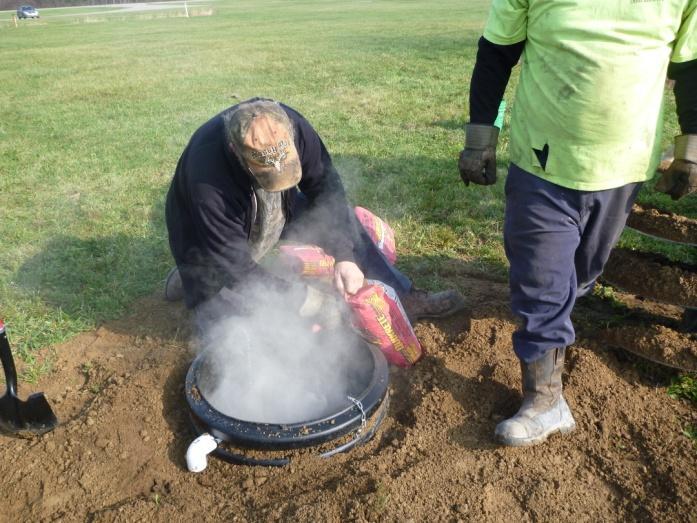


23 STATION INSTALLATION


24 FINISHING INSTALLATION
25 CURRENT STATUS OF PORTABLE SEISMIC NETWORK Once the new units are received, portable stations will be installed in ground also Currently all stations are running on electric power, but solar panels have been purchased for use Currently, five wireless modems have been installed three in southeastern Ohio and two in North Lima Real time monitoring of all five stations has started Goal is to get three portable stations around each Class II injection facility

26 REAL TIME MONITORING


27 DIVISION S PROACTIVE APPROACH TO SEISMIC MONITORING The Division is placing portable seismic stations around Class II injection wells and start monitoring prior to commencement of injection operations Continue to monitor for microseismic events up to approximately six months after initiation of injection operations If no evidence of larger seismic events, move portable seismic stations to another Class II location
28 RECOMMENDATIONS As scientists, we need to stop making the statement that this area has not had any previous seismic activity Clarify what are microseismic events and what can cause them Be cautious in using the term earthquake when in reality it is a microseismic event
29 CONCLUSIONS The Division will continue to proactively address seismic monitoring in relation to Class II injection The chief now has the authority to require seismic surveys, seismic monitoring, and other tests to address potential geologic conditions that may induce seismicity The results of any scientific data analysis are only as good as the quality and integrity of the recorded data set It is critical that we do good, sound scientific research before drawing conclusions that may not be based on reliable scientific methods

30 QUESTIONS?
DEP Office of Oil and Gas Management
 DEP Office of Oil and Gas Management Bureau of Oil and Gas Planning and Program Management Well Plugging and Subsurface Activities Division Production Waste Trends and Management May 19, 2017 2017 Shale
Colorado s Underground Injection Control Program: Prevention and Mitigation of Induced Seismicity
 Colorado s Underground Injection Control Program: Prevention and Mitigation of Induced Seismicity Energy & Environment Symposium April 2015 Robert P. Koehler, PhD. UIC Lead OVERVIEW What is a UIC well?
Marcellus Shale Gas Play Tetra Tech Capabilities
 Potential for Induced Seismicity From Injection Well Operations and Managing Related Risks The Shale Exchange GTI Dale E. Skoff, PG Tetra Tech, Inc. October 20-22, 2015 Pittsburgh, Pennsylvania Marcellus
Seismicity and the SWD-C4A well: An ongoing UIC case study in the Denver Basin, Colorado
 Seismicity and the SWD-C4A well: An ongoing UIC case study in the Denver Basin, Colorado Ground Water Protection Council Annual Forum October 6, 2014 Chris Eisinger Stuart Ellsworth Bob Koehler I. Colorado
SCEK Report on Phase I ( ) Induced Seismicity Monitoring Project (ISMP) Carlos Salas, VP Oil & Gas, Geoscience BC
 Induced Seismicity Monitoring Project (ISMP) Carlos Salas, VP Oil & Gas, Geoscience BC") SCEK Report on Phase I (2012 2013) Induced Seismicity Monitoring Project (ISMP) Carlos Salas, VP Oil & Gas, Geoscience BC Contents Background... 2 Summary of Activities... 5 Additional Work... 8 References...
SCEK Report on Phase I (2012 2013) Induced Seismicity Monitoring Project (ISMP) Carlos Salas, VP Oil & Gas, Geoscience BC Contents Background... 2 Summary of Activities... 5 Additional Work... 8 References...
Review of April 2016 Lawrence County Seismic Events
 Review of April 2016 Lawrence County Seismic Events February 17, 2017 Dial-in number for Audio: 1-650-479-3208 Event Number: 640 637 941 WebEx Technical Support: 866-229-3239 Note: You will not hear any
Regulatory Considerations for Evaluating the Potential for Induced Seismicity of a Class I Non-Hazardous Disposal Well
 Regulatory Considerations for Evaluating the Potential for Induced Seismicity of a Class I Non-Hazardous Disposal Well Chad Milligan, P.G.-SCS Engineers Craig Pangburn, P.G.-T&C Consulting Many Options
State of Shimane Nuclear Power Station
 Investors Meeting for FY2014-2Q Financial Results State of Shimane Nuclear Power Station November 11, 2013 The Chugoku Electric Power Co., Inc. 1. Basic approach of the new regulatory standards 1 Under
COGCC Underground Injection Program & Induced Seismicity
 COGCC Underground Injection Program & Induced Seismicity February 2017 Stuart Ellsworth, Engineering Manager Bob Koehler, UIC Lead, Geologic Advisor Agenda: Colorado UIC Permit Process UIC Well Construction
TexNet and CISR: An Update on Monitoring and Understanding Seismicity in Texas
 TexNet and CISR: An Update on Monitoring and Understanding Seismicity in Texas Michael H. Young a, Alexandros Savvaidis a, Peter Hennings a, Ellen Rathje b a Bureau of Economic Geology, Jackson School
Seismic Recording Station AZ_PFO Summary Report
 Seismic Recording Station AZ_PFO Summary Report Thank you for hosting station AZ_PFO on your property. We hope that you find the enclosed report interesting. Your station is one of the 2000 USArray seismic
Potential Injection-Induced Seismicity Associated With Oil & Gas Development
 Potential Injection-Induced Seismicity Associated With Oil & Gas Development A primer on technical & regulatory considerations informing risk management & mitigation Second Edition September, 2017 www.statesfirstinitiative.org
IBDP Pre-Injection Microseismicity
 VW1 CCS1 Z feet (msl) IBDP Pre-Injection Microseismicity Valerie Smith, Senior Reservoir Geophysicist October 8, 2013 Processing by: Paul Jaques, Systems Engineer, Schlumberger Cambridge Research www.slb.com/carbonservices
Risk Treatment. Todd Shipman PhD, Alberta Geological Survey/Alberta Energy Regulator November 17 th,2017 Induced Seismicity Workshop, Yellowknife NWT
 Risk Treatment Todd Shipman PhD, Alberta Geological Survey/Alberta Energy Regulator November 17 th,2017 Induced Seismicity Workshop, Yellowknife NWT Risk Management Approach to Induced Seismicity Establishing
Minimizing and Managing Potential Impacts of Injection-Induced Seismicity from Class II Disposal Wells: Practical Approaches
 Minimizing and Managing Potential Impacts of Injection-Induced Seismicity from Class II Disposal Wells: Practical Approaches Philip Dellinger, Chief Ground Water/UIC Section EPA Region 6 Acknowledgments
Table One: Induced seismicity since 2011 in five previously aseismic Ohio counties. Locality County Year Induced Recorded Reference
 Merry Christmas Brookfield Here s Five Salt Water Injection Wells Dr. Raymond Beiersdorfer, Distinguished Professor of Geology Department of Geological and Environmental Sciences Youngstown State University,
Regional methane emissions estimates in northern Pennsylvania gas fields using a mesoscale atmospheric inversion system
 Regional methane emissions estimates in northern Pennsylvania gas fields using a mesoscale atmospheric inversion system Thomas Lauvaux1, A. Deng1, B. Gaudet1, S. J. Richardson1, N. L. Miles1, J. N. Ciccarelli1,2,
On 31 October 2008 and the following day, numerous
 Dallas-Fort Worth earthquakes coincident with activity associated with natural gas production Cliff Frohlich and Eric Potter, University of Texas at Austin Chris Hayward and Brian Stump, Southern Methodist
Kansas Underground Injection Control Program & Induced Seismicity. By: Benjamin Busboom Stinson Leonard Street
 Kansas Underground Injection Control Program & Induced Seismicity By: Benjamin Busboom Stinson Leonard Street What is underground injection? Unground injection is used to place fluid underground into porous
The EarthScope Geophysical Observatories. Slides courtesy Bob Woodward, Incorporated Research Institutions for Seismology (IRIS)
") The EarthScope Geophysical Observatories Slides courtesy Bob Woodward, Incorporated Research Institutions for Seismology (IRIS) 1 EarthScope Project Study the four dimensional structure and evolution of
The EarthScope Geophysical Observatories Slides courtesy Bob Woodward, Incorporated Research Institutions for Seismology (IRIS) 1 EarthScope Project Study the four dimensional structure and evolution of
Regulations concerning protection of Bjørnøya Nature Reserve in Svalbard
 Regulations concerning protection of Bjørnøya Nature Reserve in Svalbard Laid down by the Royal Decree of 16 August 2002 pursuant to sections 12 and 17 of the Act of 15 June 2001 No. 79 relating to the
TexNet and CISR Integrated Seismicity Monitoring and Research in Texas
 Alliance Regulatory and Legislative Forum August, 2015 TexNet and CISR Integrated Seismicity Monitoring and Research in Texas Scott W. Tinker Bureau of Economic Geology University of Texas at Austin Energy
HARMONIZATION OF SEISMIC HAZARD MAPS FOR THE WESTERN BALKAN COUNTRIES : Overview of main BSHAP results
 Zagreb, Croatia Hotel Sheraton 12-13 May 2011 NATO SfP Project no. 983054 HARMONIZATION OF SEISMIC HAZARD MAPS FOR THE WESTERN BALKAN COUNTRIES : Overview of main BSHAP results Prof. Branislav Glavatović,
POLICY ISSUE (INFORMATION)
") POLICY ISSUE (INFORMATION) August 12, 2011 SECY-11-0112 FOR: FROM: SUBJECT: The Commissioners Michael R. Johnson, Director /RA/ Office of New Reactors STAFF ASSESSMENT OF SELECTED SMALL MODULAR REACTOR
POLICY ISSUE (INFORMATION) August 12, 2011 SECY-11-0112 FOR: FROM: SUBJECT: The Commissioners Michael R. Johnson, Director /RA/ Office of New Reactors STAFF ASSESSMENT OF SELECTED SMALL MODULAR REACTOR
Seismicity Associated with Geothermal Systems
 Seismicity Associated with Geothermal Systems Randi Walters: McNair Scholar Dr. Kasper van Wijk: Mentor Geosciences Abstract Studying natural and induced seismicity associated with geothermal systems can
MESOZOIC BASINS. North Carolina Geological Survey
 MESOZOIC BASINS North Carolina Geological Survey The 1823 organic act which created the North Carolina Geological Survey (NCGS) tasked us to examine, describe and map the geology, geologic hazards, and
Time-lapse well logging to monitor injected CO 2 in an aquifer at Nagaoka
 Nagaoka Project Time-lapse well logging to monitor injected CO 2 in an aquifer at Nagaoka Daiji Tanase 1), Jiro Watanabe 2), Ziqiu Xue 3), Hiroyuki Azuma 4) 1: Engineering Advancement Association of Japan
Fracking and Earthquakes What s the Risk? Alastair Muir, President Muir&Associates Consulting
 Fracking and Earthquakes What s the Risk? Alastair Muir, President Muir&Associates Consulting Who am I? Big data since 1979 Hydraulic Fracturing Induced Earthquakes Earthquake Prediction Since my first
An Assessment of Geological Carbon Sequestration in the Illinois Basin: The Illinois Basin-Decatur Site
 An Assessment of Geological Carbon Sequestration in the Illinois Basin: The Illinois Basin-Decatur Site presented by Robert J. Finley and the MGSC Project Team April 15, 2009 Illinois Sustainable Technology
Hijiori HDR Reservoir Evaluation by Micro-Earthquake Observation
 GRC Transactions, Vol. 38, 2014 Hijiori HDR Reservoir Evaluation by Micro-Earthquake Observation Hideshi Kaieda Central Research Institute of Electric Power Industry, Abiko, Chiba, Japan Keywords HDR,
GEOLOGY, SOILS, AND SEISMICITY
 4.9 GEOLOGY, SOILS, AND SEISMICITY 4.9.1 Introduction Information about the geological conditions and seismic hazards in the study area was summarized in the FEIR, and was based on the Geotechnical Exploration
Julie Shemeta, MEQ Geo Inc., WCEE Webinar 1/13/2016 1/14/2016
 1/14/16 1 Julie Shemeta, MEQ Geo Inc., WCEE Webinar 1/13/2016 1/14/2016 WSJ, Nov 16, 2015 Women s Council on Energy and the Environment (WCEE) January 13, 2016 http://www.cpr.org 1/7/2016 http://stateimpact.npr.org/texas/tag/earthquake/
Seismic Recording Station TA_109C Summary Report
 Seismic Recording Station TA_109C Summary Report Thank you for hosting station TA_109C on your property. We hope that you find the enclosed report interesting. Your station is one of the 2000 USArray seismic
The Advanced Technology Solar Telescope and NSO. Jim Ulvestad Craig Foltz March 7, 2013
 The Advanced Technology Solar Telescope and NSO Jim Ulvestad Craig Foltz March 7, 2013 The ATST Science Case ATST s relevance re-affirmed by recent NRC Solar and Space Physics and Astronomy & Astrophysics
From an earthquake perspective, 2011 was. Managing the Seismic Risk Posed by Wastewater Disposal. 38 EARTH April
 Liquid carbon dioxide has been injected into the Sleipner gas- and oilfield in the North Sea for 15 years without triggering any seismicity. It serves as a good example of how fluid injection can be done
Converse Consultants Geotechnical Engineering, Environmental & Groundwater Science, Inspection & Testing Services
 Converse Consultants Geotechnical Engineering, Environmental & Groundwater Science, Inspection & Testing Services Ms. Rebecca Mitchell Mt. San Antonio College Facilities Planning & Management 1100 North
Microseismic data illuminate fractures in the Montney
 Spectraseis White Paper August 16, 2012 2013 Spectraseis Microseismic data illuminate fractures in the Montney Brad Birkelo and Konrad Cieslik, Spectraseis High-quality data reveal fracture orientation
Vermont Soil Climate Analysis Network (SCAN) sites at Lye Brook and Mount Mansfield
 sites at Lye Brook and Mount Mansfield") Vermont Soil Climate Analysis Network (SCAN) sites at Lye Brook and Mount Mansfield 13 Years of Soil Temperature and Soil Moisture Data Collection September 2000 September 2013 Soil Climate Analysis Network
Vermont Soil Climate Analysis Network (SCAN) sites at Lye Brook and Mount Mansfield 13 Years of Soil Temperature and Soil Moisture Data Collection September 2000 September 2013 Soil Climate Analysis Network
An Open Air Museum. Success breeds Success. Depth Imaging; Microseismics; Dip analysis. The King of Giant Fields WESTERN NEWFOUNDLAND:
 VOL. 7, NO. 4 2010 GEOSCIENCE & TECHNOLOGY EXPLAINED GEO EXPRO VOL. 7, NO. 4 2010 Success breeds Success geoexpro.com Country Profile: Senegal Ocean Bottom Node Seismic WESTERN NEWFOUNDLAND: An Open Air
COMMUNITY DEVELOPMENT DEPARTMENT POLICY & PROCEDURE
 COMMUNITY DEVELOPMENT DEPARTMENT POLICY & PROCEDURE Policy No: DSP-OO3 Release Date: January 1, 2014 Effective Date: January 1, 2014 Revision Date: March 1, 2018 TITLE: The City Policy for Site Specific
Identified a possible new offset location where the customer is currently exploring drill options.
 GroundMetrics was hired to conduct a Full-Field Resistivity Survey for an oil and gas producer that needed to make crucial decisions to drive profitability at the location. The results saved them hundreds
Contractor Name and Address: Oxy USA, Inc. (Oxy), Midland, Texas OBJECTIVES
, Midland, Texas OBJECTIVES") 1 F TITLE: APPLICATION OF RESERVOIR CHARACTERIZATION AND ADVANCED TECHNOLOGY TO IMPROVE RECOVERY AND ECONOMICS IN A LOWER QUALITY SHALLOW SHELF CARBONATE RESERVOIR Cooperative Agreement No.: DE - FC22-948C14990
1 F TITLE: APPLICATION OF RESERVOIR CHARACTERIZATION AND ADVANCED TECHNOLOGY TO IMPROVE RECOVERY AND ECONOMICS IN A LOWER QUALITY SHALLOW SHELF CARBONATE RESERVOIR Cooperative Agreement No.: DE - FC22-948C14990
Seismicity in Pennsylvania and the Pennsylvania State Seismic Network (PASEIS)
") Seismicity in Pennsylvania and the Pennsylvania State Seismic Network (PASEIS) Andy Nyblade Department of Geosciences, Penn State University May 19, 2017 Shale Network Workshop Introduction Review of historic
Seismicity in Pennsylvania and the Pennsylvania State Seismic Network (PASEIS) Andy Nyblade Department of Geosciences, Penn State University May 19, 2017 Shale Network Workshop Introduction Review of historic
Regulations on Administration of Earthquake Predictions
 Regulations on Administration of Earthquake Predictions (Promulgated by Decree No.255 of the State Council of the People s Republic of China on December 17, 1998, and effective as of the date of promulgation)
region includes nine states and four provinces, covering over 1.4 million square miles. The PCOR Partnership
 Overview of Phase II PCOR Partnership MVA Activities IEAGHG Monitoring Network Meeting Natchez, MS May 6-8, 2010 Steven A. Smith, Energy & Environmental Research Center The Plains CO 2 Reduction (PCOR)
Calpine Corporation. NW Geysers Enhanced Geothermal System Demonstration Project. Community Update Calpine Geysers Visitor Center Middletown, CA
 Calpine Corporation NW Geysers Enhanced Geothermal System Demonstration Project November 2, 2012 Community Update Calpine Geysers Visitor Center Middletown, CA Calpine Northwest Geysers Enhanced Geothermal
PRELIMINARY AFTERSHOCK ANALYSIS OF THE BALA - ANKARA EARTHQUAKES (DECEMBER 20, Ml=5.6, DECEMBER 27, 2007-Ml=5.5) IN CENTRAL TURKEY
 IN CENTRAL TURKEY") PRELIMINARY AFTERSHOCK ANALYSIS OF THE BALA - ANKARA EARTHQUAKES (DECEMBER 20, 2007 - Ml=5.6, DECEMBER 27, 2007-Ml=5.5) IN CENTRAL TURKEY S. ZÜNBÜL (sami@deprem.gov.tr ), C. ERKMEN, R.F. KARTAL, A.YATMAN,
PRELIMINARY AFTERSHOCK ANALYSIS OF THE BALA - ANKARA EARTHQUAKES (DECEMBER 20, 2007 - Ml=5.6, DECEMBER 27, 2007-Ml=5.5) IN CENTRAL TURKEY S. ZÜNBÜL (sami@deprem.gov.tr ), C. ERKMEN, R.F. KARTAL, A.YATMAN,
Review of Vermont Yankee Thermal Discharge Permit Requirements and Analysis of Connecticut River Water Temperature and Flow
 Review of Vermont Yankee Thermal Discharge Permit Requirements and Analysis of Connecticut River Water Temperature and Flow August 17, 2012 Prepared by: Ken Hickey Peter Shanahan, Ph.D., P.E. 481 Great
Measurement, Monitoring and Verification (MMV)
") Measurement, Monitoring and Verification (MMV) Larry Myer USCSC CCS Capacity Building Workshop Charleston, West Virginia October 25, 2011 Outline Why monitor? Information needs Monitoring methods Baselines
Measurement, Monitoring and Verification (MMV) Larry Myer USCSC CCS Capacity Building Workshop Charleston, West Virginia October 25, 2011 Outline Why monitor? Information needs Monitoring methods Baselines
February 10, Mr. Jeff Smith, Chairman Imperial Valley Water Authority E County Road 1000 N Easton, IL Dear Chairman Smith:
 February 1, 1 Mr. Jeff Smith, Chairman Imperial Valley Water Authority 8 E County Road 1 N Easton, IL Dear Chairman Smith: The Illinois State Water Survey (ISWS), under contract to the Imperial Valley
GEOPHYSICAL SURVEYS: What are Seismic Surveys and How are They Done?
 GEOPHYSICAL SURVEYS: What are Seismic Surveys and How are They Done? Marine Geophysical Exploration Purpose Image the subsurface Evaluate the acreage Identify potential hydrocarbon accumulations Reducing
Preliminary Geotechnical and Environmental Report
 ` Preliminary Geotechnical and Environmental Report (Volume 2) December 2011 THIS PAGE INTENTIONALLY LEFT BLANK VOLUME 2 Summary As part of PE phase, the following investigations were performed: Geotechnical
for Presentatic~ to the: 1978 Annual Meeting John l~. Shupe Spec; a1,4ss; s t&nt for Eneigy! echrology U. S. DE:partnient of Ener;)'
'") :-lgp -fl. John l~. Shupe Spec; a1,4ss; s t&nt for Eneigy! echrology U. S. DE:partnient of Ener;)' Chi'anology and Tabies Used as Gackgnunri for Presentatic~ to the: Geotherma 1 ResoL!rces COiJnc 11 1978
:-lgp -fl. John l~. Shupe Spec; a1,4ss; s t&nt for Eneigy! echrology U. S. DE:partnient of Ener;)' Chi'anology and Tabies Used as Gackgnunri for Presentatic~ to the: Geotherma 1 ResoL!rces COiJnc 11 1978
Understanding Water Level Transducers. Texas Groundwater Summit San Antonio, TX 2018
 Understanding Water Level Transducers Texas Groundwater Summit San Antonio, TX 2018 Presented by Raymond L Straub Jr., P.G. Raymond L Straub Jr., P.G. Licensed Professional Geoscientist President of Straub
Wireless Networks in Geophysical Monitoring
 Workshop on New Frontiers in Internet of Things 7-18 March 2016 Trieste, Italy Wireless Networks in Geophysical Monitoring Hairo Villalobos Vulcanological and Seismological Observatory of Costa Rica, National
DATA MINING THE KNOWN UNKNOWNS OF OKLAHOMA S CLASS II UIC DATA TO IMPROVE INJECTION INDUCED SEISMICITY STUDIES
 Groundwater Protection Council (GWPC) Underground Injection Control Conference Tulsa, OK Feb 13, 2018 DATA MINING THE KNOWN UNKNOWNS OF OKLAHOMA S CLASS II UIC DATA TO IMPROVE INJECTION INDUCED SEISMICITY
Addressing the risks of induced seismicity in sub-surface energy operations
 Addressing the risks of induced seismicity in sub-surface energy operations Richard Porter a, Alberto Striolo a, Haroun Mahgerefteh a, Joanna Faure Walker b a Department of Chemical Engineering, University
Texas researchers dig into quake data Nathanial Gronewold, E&E News reporter Published: Thursday, January 18, 2018
 OIL Texas researchers dig into quake data Nathanial Gronewold, E&E News reporter Published: Thursday, January 18, 2018 Data published on the Bureau of Economic Geology's public TexNet portal show one year's
An Overview of the Tapia Canyon Field Static Geocellular Model and Simulation Study
 An Overview of the Tapia Canyon Field Static Geocellular Model and Simulation Study Prepared for Sefton Resources Inc. Jennifer Dunn, Chief Geologist Petrel Robertson Consulting Ltd. Outline Background
revised October 30, 2001 Carlos Mendoza
 Earthquake Sources in the circum-caribbean Region Puerto Rico Tsunami Mitigation and Warning Program Federal Emergency Management Agency Preliminary Report: Task 3 revised October 30, 2001 Carlos Mendoza
Modeling pressure response into a fractured zone of Precambrian basement to understand deep induced-earthquake hypocenters from shallow injection
 Modeling pressure response into a fractured zone of Precambrian basement to understand deep induced-earthquake hypocenters from shallow injection S. Raziperchikolaee 1 and J. F. Miller 1 Abstract Analysis
Microseismicity applications in hydraulic fracturing monitoring
 Available online atwww.scholarsresearchlibrary.com Archives of Applied Science Research, 2016, 8 (4):13-19 (http://scholarsresearchlibrary.com/archive.html) ISSN 0975-508X CODEN (USA) AASRC9 Microseismicity
Risk Evaluation. Todd Shipman PhD, Alberta Geological Survey/Alberta Energy Regulator November 17 th,2017 Induced Seismicity Workshop, Yellowknife NWT
 Risk Evaluation Todd Shipman PhD, Alberta Geological Survey/Alberta Energy Regulator November 17 th,2017 Induced Seismicity Workshop, Yellowknife NWT Risk Management Approach to Induced Seismicity Establishing
The UK GeoEnergy Test Bed Ceri J Vincent British Geological Survey
 The UK GeoEnergy Test Bed Ceri J Vincent British Geological Survey Thanks to Matthew Hall (GTB Theme Lead for G ERA), Phil Meldrum, Russell Swift, Oliver Kuras, Richard Luckett, Andrew Butcher, Jonathan
IV. ENVIRONMENTAL IMPACT ANALYSIS E. GEOLOGY/SOILS
 IV. ENVIRONMENTAL IMPACT ANALYSIS E. GEOLOGY/SOILS The following discussion is based upon information contained in the Hollywood Redevelopment Plan Amendment EIR and a letter prepared by Geotechnologies,
Licensing of Geologists in Florida: A Result of the Population/Development Explosion and Political Environmental Awareness
 State of Florida Department of Natural Resources Tom Gardner, Executive Director Division of Resource Management Jeremy Craft, Director Florida Geological Survey Walt Schmidt, State Geologist and Chief
Induced Seismic Monitoring: Insights from a Duvernay Case Study
 Induced Seismic Monitoring: Insights from a Duvernay Case Study Dario Baturan*, Emrah Yenier, Ray Morin, David Damico Presented at CSUR Induced Seismicity Workshop December 2016 1 Introduction Significant
One of the coldest places in the country - Peter Sinks yet again sets this year s coldest temperature record for the contiguous United States.
 One of the coldest places in the country - Peter Sinks yet again sets this year s coldest temperature record for the contiguous United States. In the early morning of February 22, 2010 the temperature
West Coast Research. WESTCARB Technical Director California Energy Commission
 Field Experience from West Coast Research Larry Myer WESTCARB Technical Director California Energy Commission lrmyer@lbl.gov Carbon Capture & Sequestration Public Workshop Bakersfield, CA September 25,
Challenges and Strategies for Monitoring Induced Seismic Activity
 Challenges and Strategies for Monitoring Induced Seismic Activity Designing and operating induced seismic monitoring networks to meet regulations Dario Baturan Geophysical Society of Tulsa 2015 Introduction
Harvey Thorleifson, Director, Minnesota Geological Survey. Status of geological mapping needed for groundwater protection in Minnesota
 Harvey Thorleifson, Director, Minnesota Geological Survey Status of geological mapping needed for groundwater protection in Minnesota Minnesota is located between the Dakotas and Wisconsin, north of Iowa,
Oklahoma Earthquakes: Trends and Underlying Causes. Jeremy Boak, Oklahoma Geological Survey October 21, 2016
 Oklahoma Earthquakes: Trends and Underlying Causes Jeremy Boak, Oklahoma Geological Survey jboak@ou.edu October 21, 2016 1 The Oklahoma Geological Survey is a state agency for research and public service
Upper crust structure under CTBTO station «Petropavlovsk-Kamchatsky» by endogenic microseismic activity
 Upper crust structure under CTBTO station «Petropavlovsk-Kamchatsky» by endogenic microseismic activity Chebrov V.N., Kugaenko Yu.A., Saltykov V.A. Geophysical Survey of Russia, Kamchatkan Branch, Petropavlovsk-Kamchatsky
Finding Large Capacity Groundwater Supplies for Irrigation
 Finding Large Capacity Groundwater Supplies for Irrigation December 14, 2012 Presented by: Michael L. Chapman, Jr., PG Irrigation Well Site Evaluation Background Investigation Identify Hydrogeologic Conditions
Monthly Magnetic Bulletin
 BRITISH GEOLOGICAL SURVEY Ascension Island Observatory Monthly Magnetic Bulletin December 2008 08/12/AS Crown copyright; Ordnance Survey ASCENSION ISLAND OBSERVATORY MAGNETIC DATA 1. Introduction Ascension
PART I Hot Dry Rock Geothermal Energy: History and Potential of the Newest and Largest Renewable Energy Resource
 Contents PART I Hot Dry Rock Geothermal Energy: History and Potential of the Newest and Largest Renewable Energy Resource Chapter 1 Serendipity A Brief History of Events Leading to the Hot Dry Rock Geothermal
Approved by: A. Cherrie Epps, Ph.D., President and Chief Executive Officer
 Page 1 of 5 Retired: Revised: Approved by: A. Cherrie Epps, Ph.D., President and Chief Executive Officer Subject: Office of General Counsel/Compliance - Inclement Weather and Emergency Closing Policy PURPOSE:
Final Report for DOEI Project: Bottom Interaction in Long Range Acoustic Propagation
 Final Report for DOEI Project: Bottom Interaction in Long Range Acoustic Propagation Ralph A. Stephen Woods Hole Oceanographic Institution 360 Woods Hole Road (MS#24) Woods Hole, MA 02543 phone: (508)
Internal Audit Report
 Internal Audit Report Right of Way Mapping TxDOT Internal Audit Division Objective To determine the efficiency and effectiveness of district mapping procedures. Opinion Based on the audit scope areas reviewed,
Monitoring and Verification of CO 2 Storage in Geological Formations Sally M. Benson Lawrence Berkeley National Laboratory Berkeley, CA 94720
 Monitoring and Verification of CO 2 Storage in Geological Formations Sally M. Benson Lawrence Berkeley National Laboratory Berkeley, CA 94720 Global Climate & Energy Project (GCEP) International Workshop
June 4, 2014 News Release Valley of the Kings Exploration Program Underway; Project Update
 June 4, 2014 News Release 14-13 Valley of the Kings Exploration Program Underway; Project Update Vancouver, British Columbia June 4, 2014; Pretium Resources Inc. (TSX/NYSE:PVG) ( Pretivm ) is pleased to
SEPTEMBER 1991 MONTHLY REPORT. Scientific Observation Hole (SOH) Geothermal Resource Permit: GRP TMK: :01; :02; and :32
 Geothermal Resource Permit: GRP TMK: :01; :02; and :32") SEPTEMBER 1991 MONTHLY REPORT Scientific Observation Hole (SOH) Program Geothermal Resource Permit: GRP 89-1 Lilewa, Kapoho, and Halekamahina, Hawaii TMK: 1-2-10:01; 1-4-01:02; and 1-4-02:32 Hawaii Natural
SEPTEMBER 1991 MONTHLY REPORT Scientific Observation Hole (SOH) Program Geothermal Resource Permit: GRP 89-1 Lilewa, Kapoho, and Halekamahina, Hawaii TMK: 1-2-10:01; 1-4-01:02; and 1-4-02:32 Hawaii Natural
Oklahoma Corporation Commission
 Oklahoma Corporation Commission Oil and Gas Conservation Division Jim Marlatt, Oil and Gas Specialist Induced Seismicity Master of Science in Geology Spatial Information Systems Certification OCC and Seismicity
Haiti: Earthquake on January 12, 2010
 Geophysical Hazards and Plate Boundary Processes In Central America, Mexico and the Caribbean Haiti: Earthquake on January 12, 2010 Situation, achievements and perspective. Hotel La Condesa, Costa Rica
S e i s m i c W a v e s
 Project Report S e i s m i c W a v e s PORTLAND STATE UNIVERSITY PHYSICS 213 SPRING TERM 2005 Instructor: Dr. Andres La Rosa Student Name: Prisciliano Peralta-Ramirez Table Of Contents 1. Cover Sheet 2.
Dallas-Fort Worth and Cleburne, TX
 The 2008-20092009 Earthquakes Near Dallas-Fort Worth and Cleburne, TX See also paper in Leading Edge March 2010 Cliff Frohlich Institute for Geophysics University of Texas Eric Potter Bureau of Economic
Welcome to the NRC. Nuclear Energy Tribal Working Group 10/13/2016
 Welcome to the NRC Nuclear Energy Tribal Working Group 10/13/2016 NRC Tribal Policy Statement Final draft delivered to the Commission August 23 rd, 2016 Commenter panel invited to present before the Commission:
For personal use only
 Date: 18 February 2019 ASX Code: WEL Directors John Kopcheff Non-Executive Chairman Neville Henry Managing Director Peter Allchurch Non-Executive Director James Hodges Non-Executive Director Larry Liu
January 22, Coronado National Forest 300 West Congress Street Tucson, AZ Jim Upchurch, Forest Supervisor. Dear Mr.
 January 22, 2015 Coronado National Forest 300 West Congress Street Tucson, AZ 85701 Attn: Jim Upchurch, Forest Supervisor Dear Mr. Upchurch: In your letter dated January 16, 2015, you requested that Hudbay
What can I do with a major in Earth Information Science?
 Lewis-Clark State College offers a Bachelor of Arts or Science Degree in Earth Information Science through the Natural Sciences and Mathematics Division. You can learn more about the Natural Sciences and
27th Seismic Research Review: Ground-Based Nuclear Explosion Monitoring Technologies
 EVALUATION OF CROSS-CORRELATION METHODS ON A MASSIVE SCALE FOR ACCURATE RELOCATION OF SEISMIC EVENTS Won-Young Kim, Paul G. Richards, David P. Schaff, Felix Waldhauser, and Jian Zhang Lamont-Doherty Earth
Roy Pyle March 24, 2017 Chief Facilities Planner Contra Costa Community College District 500 North Court Street Martinez, CA 94533
 State of California Natural Resources Agency Edmund G. Brown Jr., Governor Department of Conservation John G. Parrish, Ph.D., State Geologist California Geological Survey 801 K Street MS 12-31 Sacramento,
Analysis of Microseismic Events from a Stimulation at Basel, Switzerland
 GRC Transactions, Vol. 31, 2007 Analysis of Microseismic Events from a Stimulation at Basel, Switzerland Hiroshi Asanuma 1, Yusuke Kumano 1, Akito Hotta 1, Ulrich Schanz 2, Hiroaki Niitsuma 1, and Markus
COMMENT CARD RESPONSES (SEISMIC)
") COMMENT CARD 1 1. Please explain once and for all why the original route isn t an option while it s safer and cheaper, instead of going under the high school? Response: Please refer to the November Community
COMMENT CARD 1 1. Please explain once and for all why the original route isn t an option while it s safer and cheaper, instead of going under the high school? Response: Please refer to the November Community
SONIC THERMOMETRY TODAY. W.R. Dagle and H.A. Zimmerman. Applied Technologies, Inc., Longmont, CO 80501
 SONI THERMOMETRY TODAY W.R. Dagle and H.A. Zimmerman Applied Technologies, Inc., Longmont, O 80501 Sonic anemometer-thermometers began appearing in field studies over 50 years ago. They have since been
MEMORANDUM OF UNDERSTANDING. between the ASSOCIATION OF AMERICAN STATE GEOLOGISTS. and the U.S. DEPARTMENT OF THE INTERIOR OFFICE OF SURFACE MINING
 MEMORANDUM OF UNDERSTANDING between the ASSOCIATION OF AMERICAN STATE GEOLOGISTS and the U.S. DEPARTMENT OF THE INTERIOR OFFICE OF SURFACE MINING MEMORANDUM OF UNDERSTANDING between the ASSOCIATION OF
Geologic and Reservoir Characterization and Modeling
 Geologic and Reservoir Characterization and Modeling Scott M. Frailey and James Damico Illinois State Geological Survey Midwest Geologic Sequestration Science Conference November 8 th, 2011 Acknowledgements
Professional Development Grant Final Report. Attend and Present at the Annual Meeting of the Geological Society of America
 Professional Development Grant Final Report Attend and Present at the Annual Meeting of the Geological Society of America Michael G. Davis, Ph.D. Department of Physical Sciences College of Natural and
Use of Non-Invasive Near-Surface Geophysics for Managing Brine Releases
 Use of Non-Invasive Near-Surface Geophysics for Managing Brine Releases Presented by: Brent W. Barker, Staff Geophysicist Remediation Technologies Symposium 2012 Imagine the result Co-Authors Boyce L.