Track design and management
|
|
|
- Charles Morton
- 5 years ago
- Views:
Transcription
1 1 Track design and management Peter Fogarty, Certified Professional Soil Scientist NSW Soil Knowledge Network Cooma, June 18, 2018 Acknowledgements Antia Brademann, Cooma Waterwatch, Organiser Jo Powells, Cooma LLS, Organiser Ashley Bolton, Cooma Soil Conservation Service
2 2 Today we will cover Why it s worth putting thought into track design and construction Understanding soils and hydrology Planning track location Management practices; keeping soil erosion and runoff to acceptable levels Your situation New track or fixing and existing track Lots of space or tight site with few options
3 3 Why Protect your investment, cost of construction typically $2,500 to $20,000 Costs more to repair than to construct properly, get it right the first time Inconvenience, discomfort Emergency services access such as fire, household emergencies Off site impacts particularly water quality and stream condition

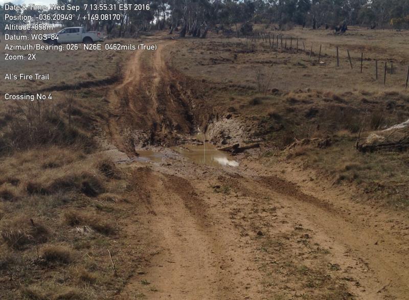
4 4 Help you avoid situations such as this Photos: Ashley Bolton, NSW Soil Conservation Service


5 5 Photos: Ashley Bolton, NSW Soil Conservation Service

6 6 And have something like this Photo: Ashley Bolton, NSW Soil Conservation Service


7 7 Resources Experience Soil Conservation Service and other agencies Publications and guides Research CRC for Catchment Hydrology major project
8 8 Published Information sources Key documents NSW RFS (2017) Fire Trail Design, Construction and Maintenance Manual NSW Dept of Environment and Climate Change (2008) Soils and Construction Volume 2C: Unsealed roads Useful background NSW Soil Conservation Service (1990) Earthmovers Training Course, Unit 17, Access Tracks Forests NSW (1999) Forest Practices Code, Part Four, Forest Roads And Fire Trails CRC for Catchment Hydrology (1999) Managing Sediment Sources and Movement in Forests

9 9 Understanding the processes Role of topsoil Runoff generation Soil erosion Transport of sediment and its delivery to drainage system Photo: Ashley Bolton, NSW Soil Conservation Service

10 10 Role of topsoil
 without topsoil (a)")
11 11 Hillslope runoff process (a) with and (b) without topsoil (a) (b)
12 12 Soil erosion Erosion occurs when resistance to soil and plant cover is exceeded by energy in rainfall and runoff Conceptualised in Universal Soil Loss Equation Model (USLE) (Rainfall erosivity * Slope grade * Slope length) * (Soil erodibility * Vegetation cover) (Rfactor*LSfactor)*(Kfactor*Cfactor) Models allow scenarios (pre- and post-track) to be quantified and compared
13 Granite soil 13 USLE predicted soil erosion rate granite soil, gentle slope Site condition R L S K C Erosion rate (t/ha/yr) Natural % Bare surface % Bare 15cm % Bare 15cm % shale soil, gentle slope Site condition R L S K C Erosion rate (t/ha/yr) Natural % Bare surface % Bare 15cm % Bare 15cm %
14 14 Calculating track erosion (length * width * erosion rate) Pre track 1km X 4m X 0.02t/ha/yr = 0.008t/yr Track 1km X 4m X 24t/ha/yr = 9.6t/yr Hence, rough working guide is 10t/km/yr of track erosion
15 15 Soil erodibility classes Class A soils are stable, well aggregated with low potential to erode Class B soils are coarse grain / sandy, have weaker structure throughout, are erodible but, because they are coarse grained, sediment doesn t travel far Class C soils have medium to fine grain B horizon, are relatively stable but, because they have a high silt and/or clay content, their sediment will travel much further than Class B soil sediment. Class D soils are highly erosive and dispersive and because they also have a high silt and clay content pose the greatest hazard.

16 16 Soil erodibility classes cont d from RFS (2017)


17 17 Stable soil, coherent when wet Unstable soil, low coherence when wet Photos: Ashley Bolton, NSW Soil Conservation Service

18 18 Sediment export from tracks shale soil granite soil f forest track forest track From: CRC CH, 1999
19 19 Effect on streams Concept of connectivity; aim to minimise connectivity between tracks and streams Concentrated flow paths do not permit deposition and infiltration Dispersed flow paths allow infiltration and sediment deposition Track runoff tends to disperse and infiltrate within 20m on flat or divergent hillslope Track crossings most susceptible to sediment delivery to streams From: CRC CH, 1999


20 20 Track vocabulary and jargon From: RFS (2017)
21 21 What is it about tracks (summary to this point) Generate runoff even after few mm of rain Cut batters bring infiltrated rainfall to surface Bare surface so potential for high erosion rate Traffic breaks up surface into easily eroded particles Sediment enriched runoff connects directly to the drainage networks
22 22 Planning Purpose of track eg main access or fire egress; volume of traffic Site assessment Soil erosion hazards Drainage line crossings: depressions versus channelised; catchment size Landform issues; very rocky ground, poorly drained areas Steep slopes; affects amount of cut and fill Potential land slip areas Vegetation types Route identification
23 23 Site assessment tools 1:25000 scale topo maps: show contours for grade, drainage features Google imagery: good for vegetation Six Viewer ( imagery with overlay of lot boundary Soil landscape maps; 1:100,000 (see
24 24 Route identification getting to know your site Ridgelines rather than valleys; divergent rather than convergent contours; ie spreads rather than concentrates runoff Running up and down rather than across slope minimizes cut and fill Slope grade less than 10degrees or 18%; short sections may be steeper Maximum distance from a stream to allow sediment filtering Avoid highly erodible soils Avoid steep stream banks
25 25 Management practices Track surface drainage crowning Infall Outfall Table drains Relief drainage Cross (diversion) banks Mitre drains Culverts Drainage line crossings Track surfacing Natural Imported Batter stabilisation Cut Fill Topsoil management


26 26 Surface drainage: crowning From: RFS (2017)


27 27 Surface drainage: infall From: RFS (2017)

28 28 Surface drainage: outfall From: RFS (2017)

29 29 Surface drainage: table drains Run beside track surface Collect runoff from track and direct to safe disposal point From: RFS (2017)
 likely to need protection (rock, jute")
30 30 Table drains: cont d Prone to washing out if: soil is erodible Inadequate relief ie water runs in drain too far Erodible soils (class 3 and 4) likely to need protection (rock, jute mesh)

31 31 Relief drainage: cross banks Simple and effective Pick up track runoff and direct onto undisturbed ground Easy to drive over if well constructed Maximum suitable grade 20% From: RFS (2017)


32 32 Cross banks cont d From: RFS (2017)

33 33 Cross banks: spacing From: RFS (2017)

34 34 Relief drainage: mitre drains From: RFS (2017)
 From: DECC (2008)")
35 35 Relief drainage: mitre drains cont d Sometimes called push outs Aim to take water from table drain out onto hillslope where it disperses Should slow water down before exit Should direct water onto undisturbed ground From: RFS (2017) From: DECC (2008)

36 36 Relief drainage: culverts Culverts convey water under the track Relieve flows in a table drain on the inside of the road surface; also for small drainage features Comprise pipes and headwalls, often with box inlet Without a headwall, fill around pipe will be prone to washing out Pipe size is crucial, too small and they will block up with debris Photo: Antia Brademann, Cooma Waterwatch From: RFS (2017)
37 37 Drainage line crossings Warning: approvals required for any disturbance to bed and banks of a stream Aim to cause as little disturbance as possible to bed and banks Do not obstruct or divert flow Likely to need engineering design on all but smallest drainage features Options include bed level crossing, culvert and bridge

38 38 Minor drainage features Depressions rather than streams, no banks so need to ensure flow remains diffuse Bed level crossing or ford Bed of watercourse reinforced From: RFS (2017)


39 39 Major drainage features Discrete channel and banks, carry large flows during and after rain events Banks may be vertical or sloping May be perennial or non-perennial Best option is for bed level crossing Bed floor reinforced with rock if not natural Gullies and steep banks may require culvert or bridge From: RFS (2017)


40 40 Photos: Ashley Bolton, NSW Soil Conservation Service
41 41 Track surface Most suitable surface depends on Usage: heavy traffic will break up natural surface Soil type: erodible soils will need protection Slope grade: steep grades will be slippery when wet Natural surface Good for flatter (<10%) sites, low erodibility soils Well drained sites Steeper very gravely sites (self graveling) Imported material Gravel to protect surface Compactable fill for shaping surface Warning, know source of material (weeds, asbestos, other waste)


42 42 Batter management Track construction across the slope creates a fill and a cut batter Risk of both erosion and slumping Likely to need geotechnical design on slope grades >30% as cut batter will exceed 1.5m height plus substantial volume of fill Best practice to conserve topsoil from track construction then respread on batter Batter grades need to be less than 2.5:1, steeper grades will not hold topsoil Drain outlets should be onto natural ground Photo: Ashley Bolton, NSW Soil Conservation Service From: RFS (2017)

43 43 Rock protection of fill batter at drain outlet From: RFS (2017)
44 44 Topsoil management Topsoil crucial for rehabilitation of track edges after construction Ensure it is retained separately in stockpiles Max depth 15cm Respread on batters, ensure even cover
45 45 Track maintenance Absolutely will be required, no track is maintenance free Assess after storms, at least every two years Preferable to import road base than keep cutting down surface Clean out culverts and mitre drains Cross banks fill with sediment and overtop Check during rain when runoff is occurring From: RFS (2017)
46 46 To recap How will track be used Rough out route on topo map or plan Identify hazards slopes >30%, poorly drained land erodible soil rocky ground vegetation to protect Identify drainage crossings Plan specific measures Surface drainage Relief drainage Road surface Batters Topsoil stockpiles Finalise route Approval
47 47 Specific examples Powerline maintenance track on red clay shale derived soils (class A) Soils not highly erodible, problem due to lack of surface drainage Also, track below adjacent land surface so water stays on track Repair entailed Drainage banks at 40m spacing, draining to left side so do not run back towards track Reform track surface Photo: Ashley Bolton, NSW Soil Conservation Service

48 48 Fire trail on yellow brown clay loam, shale derived soils (class A) Recent substandard contractor repairs to trail Lack of relief drainage due to windrow along right side of trail, lack of surface drainage Repair entailed Removal of windrow Install cross banks at 60m spacing Photo: Ashley Bolton, NSW Soil Conservation Service

49 49 Fire trail on yellow brown sandy clay, granite derived soils (class C) Recent substandard contractor repairs to trail Lack of capacity in cross bank Repair entailed increase height and volume of cross bank to 0.5m freeboard on high side Photo: Ashley Bolton, NSW Soil Conservation Service

50 50 Fire trail on grey silty loam alluvial soils (class C) Recent substandard contractor repairs to trail Excessive disturbance along edge of trail Repair entailed reinstating topsoil cover on track verging to encourage natural regeneration Photo: Ashley Bolton, NSW Soil Conservation Service


51 51
Rock & Aggregate Drop Inlet Protection
 Rock & Aggregate Drop Inlet Protection SEDIMENT CONTROL TECHNIQUE Type 1 System Sheet Flow Sandy Soils Type 2 System [1] Concentrated Flow Clayey Soils Type 3 System Supplementary Trap Dispersive Soils
Construction Exits Rock pads
 Construction Exits Rock pads SEDIMENT CONTROL TECHNIQUE Type 1 System Sheet Flow Sandy Soils Type 2 System Concentrated Flow [1] Clayey Soils Type 3 System Supplementary Trap Dispersive Soils [1] Minor
Gully Erosion Part 1 GULLY EROSION AND ITS CAUSES. Introduction. The mechanics of gully erosion
 Gully Erosion Part 1 GULLY EROSION AND ITS CAUSES Gully erosion A complex of processes whereby the removal of soil is characterised by incised channels in the landscape. NSW Soil Conservation Service,
Construction Exits Vibration grids
 Construction Exits Vibration grids SEDIMENT CONTROL TECHNIQUE Type 1 System Sheet Flow Sandy Soils Type 2 System Concentrated Flow Clayey Soils [1] Type 3 System Supplementary Trap Dispersive Soils [1]
[1] Performance of the sediment trap depends on the type of outlet structure and the settling pond surface area.
![[1] Performance of the sediment trap depends on the type of outlet structure and the settling pond surface area.](/thumbs/76/74245181.jpg "[1] Performance of the sediment trap depends on the type of outlet structure and the settling pond surface area.") Sediment Trench SEDIMENT CONTROL TECHNIQUE Type 1 System Sheet Flow Sandy Soils Type 2 System [1] Concentrated Flow Clayey Soils Type 3 System [1] Supplementary Trap Dispersive Soils [1] Performance of
Sediment Trench SEDIMENT CONTROL TECHNIQUE Type 1 System Sheet Flow Sandy Soils Type 2 System [1] Concentrated Flow Clayey Soils Type 3 System [1] Supplementary Trap Dispersive Soils [1] Performance of
Erosion and Sediment Control Measures 2.7 Silt Fences
 Erosion and Sediment Control Measures Silt fences are designed to intercept sheet flow sediment laden stormwater run-off and filter out both the larger and smaller particles of sediment. Silt fences and
Selected Site BMPs: Why s the Water Muddy? John C. Hayes, Ph.D., P. E. Biosystems Engineering Clemson University
 Selected Site BMPs: Why s the Water Muddy? John C. Hayes, Ph.D., P. E. Biosystems Engineering Clemson University The BMP worked fine until last week when it rained! Turbidity Best Management Practices
Chutes Part 5: Rock linings
 Chutes Part 5: Rock linings DRAINAGE CONTROL TECHNIQUE Low Gradient Velocity Control Short-Term Steep Gradient Channel Lining Medium-Long Term Outlet Control [1] Soil Treatment Permanent [2] [1] Chutes
Materials. Use materials meeting the following.
 208.01 Section 208. SOIL EROSION AND SEDIMENTATION CONTROL 208.01 Description. Install and maintain erosion and sedimentation controls to minimize soil erosion and to control sedimentation from affecting
U-Shaped Sediment Traps
 U-Shaped Sediment Traps SEDIMENT CONTROL TECHNIQUE Type 1 System Sheet Flow Sandy Soils Type 2 System Concentrated Flow Clayey Soils [1] Type 3 System Supplementary Trap Dispersive Soils [1] Generally
Instream Erosion Control General
 Instream Erosion Control General EROSION CONTROL TECHNIQUES Revegetation Temperate Climates Short-Term Non Vegetation Wet Tropics Long-Term Weed Control [1] Semi-Arid Zones Permanent [1] Weed control attributes
Template for Sediment and Erosion Control Plan General Instructions. Section Instructions
 Template for Sediment and Erosion Control Plan General Instructions Introduction: Soil erosion and sediment deposition from farmlands can contribute to degraded surface water quality. Sediment delivery
Coarse Sediment Traps
 Coarse Sediment Traps SEDIMENT CONTROL TECHNIQUE Type 1 System Sheet Flow Sandy Soils Type 2 System [1] Concentrated Flow Clayey Soils [2] Type 3 System Supplementary Trap Dispersive Soils [1] Though primarily
Continuing Education Associated with Maintaining CPESC and CESSWI Certification
 Continuing Education Associated with Maintaining CPESC and CESSWI Certification Module 2: Stormwater Management Principles for Earth Disturbing Activities Sponsors: ODOTs Local Technical Assistance Program
Chapter 7 Mudflow Analysis
 Chapter 7 Mudflow Analysis 7.0 Introduction This chapter provides information on the potential and magnitude of mud floods and mudflows that may develop in Aspen due to rainfall events, snowmelt, or rain
Chapter 7 Mudflow Analysis
 Chapter 7 Mudflow Analysis 7.0 Introduction This chapter provides information on the potential and magnitude of mud floods and mudflows that may develop in Aspen due to rainfall events, snowmelt, or rain
Low Gradient Velocity Control Short Term Steep Gradient Channel Lining Medium-Long Term Outlet Control Soil Treatment Permanent [1]
![Low Gradient Velocity Control Short Term Steep Gradient Channel Lining Medium-Long Term Outlet Control Soil Treatment Permanent [1]](/thumbs/87/96478185.jpg "Low Gradient Velocity Control Short Term Steep Gradient Channel Lining Medium-Long Term Outlet Control Soil Treatment Permanent [1]") Rock Linings DRAINAGE CONTROL TECHNIQUE Low Gradient Velocity Control Short Term Steep Gradient Channel Lining Medium-Long Term Outlet Control Soil Treatment Permanent [1] [1] The design of permanent installations
Rock Linings DRAINAGE CONTROL TECHNIQUE Low Gradient Velocity Control Short Term Steep Gradient Channel Lining Medium-Long Term Outlet Control Soil Treatment Permanent [1] [1] The design of permanent installations
Essential Questions. What is erosion? What is mass wasting?
 Erosion Essential Questions What is erosion? What is mass wasting? What is Erosion? Erosion The transportation of sediment from one area to another Caused mainly by running water but also caused by glaciers,
Rock Sizing for Batter Chutes
 Rock Sizing for Batter Chutes STORMWATER MANAGEMENT PRACTICES Photo 1 Rock-lined batter chute Photo 2 Rock-lined batter chute 1. Introduction In the stormwater industry a chute is a steep drainage channel,
Stone Outlet Sediment Trap
 3.12 Sediment Control Description: A stone outlet sediment trap is a small detention area formed by placing a stone embankment with an integral stone filter outlet across a drainage swale for the purpose
Erosion Surface Water. moving, transporting, and depositing sediment.
 + Erosion Surface Water moving, transporting, and depositing sediment. + Surface Water 2 Water from rainfall can hit Earth s surface and do a number of things: Slowly soak into the ground: Infiltration
B805 TEMPORARY EROSION AND SEDIMENT CONTROL MEASURES - OPSS 805
 B805 MEASURES - OPSS 805 805.1 GENERAL Construction activities frequently remove protective cover and expose soil to accelerated rates of erosion. Sediments generated thereby can be conveyed via runoff
FOR PROJECTS INITIATED AFTER NOVEMBER 1, 2008 ITEM 716 EMBANKMENT EARTH OUTLET SEDIMENT TRAP
 AFTER NOVEMBER 1, 2008 ITEM 716 EMBANKMENT EARTH OUTLET SEDIMENT TRAP 716.1 Description. This work shall consist of furnishing, installing, maintaining, and removing temporary erosion protection and sediment
Instream Sediment Control Systems
 Instream Sediment Control Systems INSTREAM PRACTICES Photo 1 Photo 2 Modular sediment The information contained within this series of fact sheets deals only with the design of temporary instream sediment
STREUVER FIDELCO CAPPELLI, LLC YONKERS DOWNTOWN DEVELOPMENT PHASE 1. DRAFT ENVIRONMENTAL IMPACT STATEMENT For: PALISADES POINT
 STREUVER FIDELCO CAPPELLI, LLC YONKERS DOWNTOWN DEVELOPMENT PHASE 1 DRAFT ENVIRONMENTAL IMPACT STATEMENT For: PALISADES POINT Prepared by: PAULUS, SOKOLOWSKI & SARTOR STORMWATER MANAGEMENT 1. Methodology
Weathering, Erosion and Deposition
 Weathering, Erosion and Deposition Shaping the Earth s Surface Weathering the process of breaking down rocks into smaller fragments Erosion the transport of rock fragments from one location to another
Stormwater Inlet Sediment Traps
 Stormwater Inlet Sediment Traps SEDIMENT CONTROL TECHNIQUES Photo 1 Kerb inlet Photo 2 Field (drop) inlet Table 1 provides the recommended default classification of various sediment control systems suitable
Bachelor of Biosystems Technology Faculty of Technology South Eastern University of Sri Lanka
 Bachelor of Biosystems Technology Faculty of Technology South Eastern University of Sri Lanka BSE 11042 Principles of Irrigation Furrow Irrigation Running water in small channels (furrows) Water infiltration
EARTH S CHANGING SURFACE
 EARTH S CHANGING SURFACE Weathering Together, weathering and erosion work continuously to wear down the material on Earth s surface. weathering process that breaks down rock and other substances of Earth
3.12 Geology and Topography Affected Environment
 3 Affected Environment and Environmental Consequences 3.12 Geology and Topography 3.12.1 Affected Environment 3.12.1.1 Earthquakes Sterling Highway MP 45 60 Project Draft SEIS The Kenai Peninsula is predisposed
What Is Water Erosion? Aren t they the same thing? What Is Sediment? What Is Sedimentation? How can Sediment Yields be Minimized?
 Jerald S. Fifield, Ph.D. CISEC HydroDynamics Incorporated Parker, CO 303-841-0377 Aren t they the same thing? What Is Sediment? Soil particles deposited or suspended in water or air The process of depositing
STUDY GUIDE FOR CONTENT MASTERY. Surface Water Movement
 Surface Water SECTION 9.1 Surface Water Movement In your textbook, read about surface water and the way in which it moves sediment. Complete each statement. 1. An excessive amount of water flowing downslope
Template for Sediment and Erosion Control Plan General Instructions
 Template for Sediment and Erosion Control Plan General Instructions Introduction: Soil erosion and sediment deposition from farmlands can contribute to degraded surface water quality. Sediment delivery
ENGINEERING HYDROLOGY
 ENGINEERING HYDROLOGY Prof. Rajesh Bhagat Asst. Professor Civil Engineering Department Yeshwantrao Chavan College Of Engineering Nagpur B. E. (Civil Engg.) M. Tech. (Enviro. Engg.) GCOE, Amravati VNIT,
Sediment Trap. A temporary runoff containment area, which promotes sedimentation prior to discharge of the runoff through a stabilized spillway.
 Sediment Trap SC-15 Source: Caltrans Construction Site Best Management Practices Manual, 2003. Description A temporary runoff containment area, which promotes sedimentation prior to discharge of the runoff
Orica Australia Pty Ltd Ammonium Nitrate Facility Upgrade
 Orica Australia Pty Ltd Ammonium Nitrate Facility Upgrade January 2010 Revision 0 Contents 1. Introduction 1 1.1 Purpose 1 1.2 Objectives 1 1.3 Relevant Environmental Legislation, Guidelines and Policies
Landscape Function Analysis
 Landscape Function Analysis Ephemeral Drainage-line Assessments (EDA): Indicators of Stability Ephemeral drainage-lines are present in almost all landscapes such as those observed on a hillslope in a watershed
Rock Sizing for Small Dam Spillways
 Rock Sizing for Small Dam Spillways STORMWATER MANAGEMENT PRACTICES Photo 1 Rock-lined spillway on a construction site sediment basin Photo 2 Rock-lined spillway on a small farm dam 1. Introduction A chute
In-channel coarse sediment trap Best Management Practice
 In-channel coarse sediment trap Best Management Practice By Henry R. Hudson July 2002 Environmental Management Associates Ltd., Christchurch Complexity Environmental Value Cost Low Moderate High Low Moderate
Type 1 System Sheet Flow Sandy Soils Type 2 System Concentrated Flow Clayey Soils Type 3 System [1] Supplementary Trap Dispersive Soils
![Type 1 System Sheet Flow Sandy Soils Type 2 System Concentrated Flow Clayey Soils Type 3 System [1] Supplementary Trap Dispersive Soils](/thumbs/77/76519623.jpg "Type 1 System Sheet Flow Sandy Soils Type 2 System Concentrated Flow Clayey Soils Type 3 System [1] Supplementary Trap Dispersive Soils") Sediment Weirs SEDIMENT CONTROL TECHNIQUE Type 1 System Sheet Flow Sandy Soils Type 2 System Concentrated Flow Clayey Soils Type 3 System [1] Supplementary Trap Dispersive Soils [1] Type 3 classification
Sediment Weirs SEDIMENT CONTROL TECHNIQUE Type 1 System Sheet Flow Sandy Soils Type 2 System Concentrated Flow Clayey Soils Type 3 System [1] Supplementary Trap Dispersive Soils [1] Type 3 classification
Sediment Trap. At multiple locations within the project site where sediment control is needed.
 Sediment Trap SE-3 Objectives EC Erosion Control SE Sediment Control TR Tracking Control WE Wind Erosion Control Non-Stormwater NS Management Control Waste Management and WM Materials Pollution Control
Natural hazards in Glenorchy Summary Report May 2010
 Natural hazards in Glenorchy Summary Report May 2010 Contents Glenorchy s hazardscape Environment setting Flood hazard Earthquakes and seismic hazards Hazards Mass movement Summary Glossary Introduction
Ch. 8: Mass Movements, Wind and Glaciers
 Ch. 8: Mass Movements, Wind and Glaciers Every day the landscape around us undergoes changes. Changes that are powered by gravity alone are called mass movement or mass wasting. Mass movement includes
Mass Wasting. Revisit: Erosion, Transportation, and Deposition
 Mass Wasting Revisit: Erosion, Transportation, and Deposition While landslides are a normal part of erosion and surface processes, they can be very destructive to life and property! - Mass wasting: downslope
GY 111 Lecture Note Series Sedimentary Environments 2: Rivers and Deltas
 GY 111 Lecture Notes D. Haywick (2008-09) 1 GY 111 Lecture Note Series Sedimentary Environments 2: Rivers and Deltas Lecture Goals A) Rivers and Deltas (types) B) Water Flow and sedimentation in river/deltas
APPENDIX B DESIGN CRITERIA FOR TEMPORARY WATER QUALITY BMPS USED DURING CONSTRUCTION
 APPENDIX B DESIGN CRITERIA FOR TEMPORARY WATER QUALITY BMPS USED DURING CONSTRUCTION This Appendix presents design criteria and example calculations for the following temporary water quality BMPs for use
Rock Sizing for Waterway & Gully Chutes
 Rock Sizing for Waterway & Gully Chutes WATERWAY MANAGEMENT PRACTICES Photo 1 Rock-lined waterway chute Photo 2 Rock-lined gully chute 1. Introduction A waterway chute is a stabilised section of channel
Mass Wasting. Requirements for Mass Wasting. Slope Stability. Geol 104: mass wasting
 Mass Wasting Movement of earth materials downslope, driven by Gravitational Forces. Landslides - general term for rock or soil movement. In U.S., on average, mass wasting causes 1 to 2 billion dollars
 DRAFT DRAFT DRAFT DRAFT DRAFT SEDIMENT CONTROLS Method Application Description BMP Sediment fencing Flat Ground Y Anywhere low flow runoff is Sloping Ground Y Geotextile fabric, buried at the bottom
Why Geomorphology for Fish Passage
 Channel Morphology - Stream Crossing Interactions An Overview Michael Love Michael Love & Associates mlove@h2odesigns.com (707) 476-8938 Why Geomorphology for Fish Passage 1. Understand the Scale of the
Biosphere. All living things, plants, animals, (even you!) are part of the zone of the earth called the biosphere.
 are part of the zone of the earth called the biosphere.") Unit 1 Study Guide Earth s Spheres Biosphere All living things, plants, animals, (even you!) are part of the zone of the earth called the biosphere. Hydrosphere Water covers ¾ of the earth, made up mostly
Unit 1 Study Guide Earth s Spheres Biosphere All living things, plants, animals, (even you!) are part of the zone of the earth called the biosphere. Hydrosphere Water covers ¾ of the earth, made up mostly
Sediment Weirs (Instream)
") Sediment Weirs (Instream) INSTREAM PRACTICES Flow Control No Channel Flow Dry Channels Erosion Control Low Channel Flows Shallow Water Sediment Control High Channel Flows [1] Deep Water [1] Sediment weirs
Sediment Weirs (Instream) INSTREAM PRACTICES Flow Control No Channel Flow Dry Channels Erosion Control Low Channel Flows Shallow Water Sediment Control High Channel Flows [1] Deep Water [1] Sediment weirs
APPENDIX G APPENDIX G SEDIMENT CONTAINMENT SYSTEM DESIGN RATIONALE
 APPENDIX G SEDIMENT CONTAINMENT SYSTEM DESIGN RATIONALE March 18, 2003 This page left blank intentionally. March 18, 2003 G-2 FIGURES Page # Figure G.1 Estimated Runoff from Precipitation Over Different
What do you need for a Marathon?
 What do you need for a Marathon? Water and a snack? What about just a normal day? 1 flush = 3.5 gallons 1 flush = 3.5 gallons 10 minute shower = 20 gal 1 flush = 3.5 gallons 10 minute shower = 20 gal Jeans
MIDDLESEX COUNTY Department of Planning and Community Development P.O. Box 427, Saluda, VA Phone: Fax:
 MIDDLESEX COUNTY Department of Planning and Community Development P.O. Box 427, Saluda, VA 23149 Phone: 804-758-3382 Fax: 804-758-0061 LAND DISTURBANCE PERMIT SUBMISSION REQUIREMENTS In order to expedite
Soil Map Boulder County Area, Colorado (Planet Blue Grass) Web Soil Survey National Cooperative Soil Survey
 Web Soil Survey National Cooperative Soil Survey") 475910 476000 476090 476180 476270 476360 105 16' 21'' W 476450 476540 476630 476720 476810 4453350 4453440 4453260 4453350 4453170 4453260 4453080 4453170 4453080 475820 475910 4452990 476000 476090 476180
475910 476000 476090 476180 476270 476360 105 16' 21'' W 476450 476540 476630 476720 476810 4453350 4453440 4453260 4453350 4453170 4453260 4453080 4453170 4453080 475820 475910 4452990 476000 476090 476180
9/13/2011 CHAPTER 9 AND SUBSIDENCE. Case History: La Conchita Landslide. Introduction
 CHAPTER 9 SLOPE PROCESSES, LANDSLIDES, AND SUBSIDENCE Case History: La Conchita Landslide La Conchita: small coastal community 80 km (50 mi) northwest of Los Angeles Landslide occurred on January 10, 2005
Specifications Whitcomb Elementary School Demolition January 15, 2016
 SECTION 31 2500 - EROSION CONTROL PART 1 - GENERAL 1.1 RELATED DOCUMENTS: A. The provisions of the Contract Documents apply to the work of this Section. B. The Virginia Erosion and Sediment Control Handbook,
Case Study 2: Twenty-mile Creek Rock Fords
 Case Study : Twenty-mile Creek Rock Fords Location Crossing Description Washington. Okanagan National Forest. Methow Valley Ranger District. Chewuch river basin, East Chewuch Road. The Twenty-mile Creek
Erosion and Sedimentation Basics
 Erosion and Sedimentation Basics Coastal San Luis Resource Conservation District G.W. Bates, PE, CPESC Outline: 1. Terms & Concepts 2. Causes of Erosion 3. The Erosion/Sedimentation Process 4. Erosion
6.11 Naas River Management Unit
 6.11 Naas River Management Unit 6.11.1 Site 41 Issue: Bed and bank erosion Location: E 0685848 N 6058358 Waterway: Naas River Management Unit: Naas River Facing downstream from Bobeyan Rd bridge Facing
Suitable Applications Sediment traps should be considered for use:
 Categories EC Erosion Control SE Sediment Control TC Tracking Control WE Wind Erosion Control Non-Stormwater NS Management Control Waste Management and WM Materials Pollution Control Legend: Primary Objective
CONSTRUCTION EXIT SEDIMENT BARRIER
 241428_itizen ield Guide_v3 2/22/06 11:09 M Page 1 (1,1) ONSTRUTION EXIT stone pad located where traffic leaves a construction site to eliminate the transport of soil to public streets. SEDIMENT BRRIER
APPENDIX B WORKSHEETS & EXHIBITS
 APPENDIX B WORKSHEETS & EXHIBITS A worksheet provides the designer a representation of a measure that allows for input of specific design criteria. The plan designer will be required to assess field conditions
Re: Steep Slope Assessment for 2465 Waverly Drive, Blind Bay, BC; Legal Address: Lot 39, Section 18, Township 22, Range 10, Plan 25579, W6M, KDYD.
 OEL File 1563-1 May 30, 2017 Doug Wall PO Box 774 Salmon Arm, BC V1E 4N7 Re: Steep Slope Assessment for 2465 Waverly Drive, Blind Bay, BC; Legal Address: Lot 39, Section 18, Township 22, Range 10, Plan
Black Gore Creek 2013 Sediment Source Monitoring and TMDL Sediment Budget
 Black Gore Creek 2013 Sediment Source Monitoring and TMDL Sediment Budget Prepared for: Prepared By: - I. Introduction The Black Gore Creek Total Maximum Daily Load (TMDL) was developed in collaboration
CHAPTER FIVE 5.0 STABILITY OF CUT SLOPES IN THE STUDY AREA. them limited by a thick canopy of vegetation and steep slope angles.
 CHAPTER FIVE 5.0 STABILITY OF CUT SLOPES IN THE STUDY AREA 5.1. Introduction Ukay Perdana area is a developing community with continuous building activities and road construction. There are thus only left
Using Weather and Climate Information for Landslide Prevention and Mitigation
 Using Weather and Climate Information for Landslide Prevention and Mitigation Professor Roy C. Sidle Disaster Prevention Research Institute Kyoto University, Japan International Workshop on Climate and
Subject Name: SOIL AND WATER CONSERVATION ENGINEERING 3(2+1) COURSE OUTLINE
 COURSE OUTLINE") Subject Name: SOIL AND WATER CONSERVATION ENGINEERING 3(2+1) COURSE OUTLINE (Name of Course Developer: Prof. Ashok Mishra, AgFE Department, IIT Kharagpur, Kharagpur 721 302) Module 1: Introduction and
Subject Name: SOIL AND WATER CONSERVATION ENGINEERING 3(2+1) COURSE OUTLINE (Name of Course Developer: Prof. Ashok Mishra, AgFE Department, IIT Kharagpur, Kharagpur 721 302) Module 1: Introduction and
Degradation Concerns related to Bridge Structures in Alberta
 Degradation Concerns related to Bridge Structures in Alberta Introduction There has been recent discussion regarding the identification and assessment of stream degradation in terms of how it relates to
Overview of fluvial and geotechnical processes for TMDL assessment
 Overview of fluvial and geotechnical processes for TMDL assessment Christian F Lenhart, Assistant Prof, MSU Research Assoc., U of M Biosystems Engineering Fluvial processes in a glaciated landscape Martin
Woodford County Erosion Prevention Plan and Permit. Application #
 Woodford County Erosion Prevention Plan and Permit Application # Date Instructions: Applicant will complete Parts A and B, and attach a proposed site diagram. This diagram must be completed in accordance
Sediment Control Practices. John Mathews Ohio Dept. of Natural Resources, Division of Soil and Water Resources
 Sediment Control Practices John Mathews Ohio Dept. of Natural Resources, Division of Soil and Water Resources Practices Treat the Largest Soil Particles Sand Sand Silt Clay Treated Untreated Settleable
Weathering, Soil, and Mass Movements
 Tarbuck Lutgens Weathering, Soil, and Mass Movements 5.1 Weathering Mechanical Weathering Mechanical weathering occurs when physical forces break rock into smaller and smaller pieces without changing the
Stream Simulation: A Simple Example
 Stream Simulation: A Simple Example North Thompson Creek, CO Paul T. Anderson U.S.D.A. Forest Service Here s How We Started May 2011 2-1 USDA-Forest Service Here s How We Finished Forest Service Aquatic
Erosion and Deposition
 CHAPTER 3 LESSON 2 Erosion and Deposition Landforms Shaped by Water and Wind Key Concepts What are the stages of stream development? How do water erosion and deposition change Earth s surface? How do wind
Rocks and Weathering
 Rocks and Weathering The Effects of Weathering The process of mountain building thrusts rock up to Earth s surface. Weathering is the process that breaks down rock and other substances at Earth s surface.
1/6/ th Grade Earth s Surface. Chapter 3: Erosion and Deposition. Lesson 1 (Mass Movement)
") Lesson 1 (Mass Movement) 7 th Grade Earth s Surface Chapter 3: Erosion and Deposition Weathering the chemical and physical processes that break down rock at Earth s surface Mechanical weathering when rock
Lesson 1 (Mass Movement) 7 th Grade Earth s Surface Chapter 3: Erosion and Deposition Weathering the chemical and physical processes that break down rock at Earth s surface Mechanical weathering when rock
GEOL 1121 Earth Processes and Environments
 GEOL 1121 Earth Processes and Environments Wondwosen Seyoum Department of Geology University of Georgia e-mail: seyoum@uga.edu G/G Bldg., Rm. No. 122 Seyoum, 2015 Chapter 6 Streams and Flooding Seyoum,
SPOTLIGHT ON BLUFF STABILITY
 SPOTLIGHT ON BLUFF STABILITY Glacial Origins Much of Puget Sound's uplands are comprised of and underlain by glacial and interglacial deposits of sand, gravel, silt, and clay. Repeated glaciations have
Topic 6: Weathering, Erosion and Erosional-Deposition Systems (workbook p ) Workbook Chapter 4, 5 WEATHERING
 Workbook Chapter 4, 5 WEATHERING") Topic 6: Weathering, Erosion and Erosional-Deposition Systems (workbook p. 95-125) Workbook Chapter 4, 5 THE BIG PICTURE: Weathering, erosion and deposition are processes that cause changes to rock material
Topic 6: Weathering, Erosion and Erosional-Deposition Systems (workbook p. 95-125) Workbook Chapter 4, 5 THE BIG PICTURE: Weathering, erosion and deposition are processes that cause changes to rock material
ISSUED FOR CONSTRUCTION
 PAGE No. DESCRIPTION 1 Cover Page 2 Overview Map 3 Western Road Plan View 4 Eastern Road Plan View West Road Profiles & Cross Sections 6-7 East Road Profiles 8- East Road Cross Sections 11-14 Campsite
Landslide Mitigation (BYUI)
") Landslide Mitigation (BYUI) The general principle behind landslide mitigation is stabilization. Slopes that are too steep are shallowed or strengthened. Loose rocks can be bolted or cemented into place.
Landslide Mitigation (BYUI) The general principle behind landslide mitigation is stabilization. Slopes that are too steep are shallowed or strengthened. Loose rocks can be bolted or cemented into place.
Custom Soil Resource Report for Forrest County, Mississippi
 United States Department of Agriculture Natural Resources Conservation Service A product of the National Cooperative Soil Survey, a joint effort of the United States Department of Agriculture and other
Agenda. INDOT Office of Environmental Services. Describe Results of FHWA QAR. Landscape and Waterway Permitting Unit. Interviews Site Inspections
 Nathan Saxe Administrator, Ecology and Waterway Permitting Section Back to Basics: Erosion and Sediment Control FHWA INDOT Quality Assurance Review (QAR) Results 1 Agenda INDOT Office of Environmental
MINISTRY OF FORESTS, LANDS AND NATURAL RESOURCE OPERATIONS, POST-WILDFIRE RISK ANALYSIS PRELIMINARY REPORT
 MINISTRY OF FORESTS, ANDS AND NATURA RESOURCE OPERATIONS, POST-WIDFIRE RISK ANAYSIS PREIMINARY REPORT NOTE: The results given on this form are preliminary in nature and are intended to be a warning of
December 11, 2006 File:
 December 11, 2006 File: 15-85-38 Alberta Infrastructure and Transportation Room 301, Provincial Building 9621-96 Avenue Peace River, Alberta T8S 1T4 Attention: Mr. Ed Szmata PEACE REGION (SWAN HILLS AREA)
Bell Ringer. Are soil and dirt the same material? In your explanation be sure to talk about plants.
 Bell Ringer Are soil and dirt the same material? In your explanation be sure to talk about plants. 5.3 Mass Movements Triggers of Mass Movements The transfer of rock and soil downslope due to gravity is
APPENDIX E. GEOMORPHOLOGICAL MONTORING REPORT Prepared by Steve Vrooman, Keystone Restoration Ecology September 2013
 APPENDIX E GEOMORPHOLOGICAL MONTORING REPORT Prepared by Steve Vrooman, Keystone Restoration Ecology September 2 Introduction Keystone Restoration Ecology (KRE) conducted geomorphological monitoring in
Weathering of Rocks. Weathering - Breakdown of rocks into pieces (sediment) 2 main types of weathering to rocks
 2 main types of weathering to rocks") Weathering of Rocks Weathering - Breakdown of rocks into pieces (sediment) 2 main types of weathering to rocks Mechanical weathering requires physical forces to break rocks into smaller pieces. Chemical
Weathering of Rocks Weathering - Breakdown of rocks into pieces (sediment) 2 main types of weathering to rocks Mechanical weathering requires physical forces to break rocks into smaller pieces. Chemical
C) D) 3. Which graph best represents the relationship between soil particle size and the rate at which water infiltrates permeable soil?
 D) 3. Which graph best represents the relationship between soil particle size and the rate at which water infiltrates permeable soil?") 1. Which earth material covering the surface of a landfill would permit the least amount of rainwater to infiltrate the surface? A) silt B) clay C) sand D) pebbles 2. Which graph best represents the relationship
1. Which earth material covering the surface of a landfill would permit the least amount of rainwater to infiltrate the surface? A) silt B) clay C) sand D) pebbles 2. Which graph best represents the relationship
3/8/17. #20 - Landslides: Mitigation and Case Histories. Questions for Thought. Questions for Thought
 #20 - Landslides: Mitigation and Case Histories Web Exercise #3 (Volcanoes) Due Wednesday There is a 2-point penalty for every day the assignment is late. Exam 1 Scores Scores and exam key are posted Vaiont
Gully erosion and associated risks in the Tutova basin Moldavian Plateau
 Landform Analysis, Vol. 17: 193 197 (2011) Gully erosion and associated risks in the Tutova basin Moldavian Plateau University Alexandru Ioan Cuza of Iasi, Department of Geography, Romania, e-mail: catiul@yahoo.com
TABLE OF CONTENTS LIST OF TABLES. Page
 TABLE OF CONTENTS Page 11.0 EFFECTS OF THE ENVIRONMENT ON THE PROJECT... 11-1 11.1 Weather Conditions... 11-1 11.2 Flooding... 11-2 11.3 Forest Fires... 11-2 11.4 Permafrost and Subsidence Risk... 11-3
Laboratory Exercise #3 The Hydrologic Cycle and Running Water Processes
 Laboratory Exercise #3 The Hydrologic Cycle and Running Water Processes page - 1 Section A - The Hydrologic Cycle Figure 1 illustrates the hydrologic cycle which quantifies how water is cycled throughout
Need of Proper Development in Hilly Urban Areas to Avoid
 Need of Proper Development in Hilly Urban Areas to Avoid Landslide Hazard Dr. Arvind Phukan, P.E. Cosultant/Former Professor of Civil Engineering University of Alaska, Anchorage, USA RI District Governor
Clyde River Landslide
 Clyde River Landslide Department of Geology, Perkins Hall, University of Vermont, Burlington, VT 05405 Abstract: This paper investigates a landslide on the Clyde River in Newport, Vermont. The landslide
Soil and Water Conservation Engineering Prof. Rajendra Singh Department of Agricultural and Food Engineering Indian Institute of Technology, Kharagpur
 Soil and Water Conservation Engineering Prof. Rajendra Singh Department of Agricultural and Food Engineering Indian Institute of Technology, Kharagpur Lecture 04 Soil Erosion - Mechanics Hello friends
SECTION G SEDIMENT BUDGET
 SECTION G SEDIMENT BUDGET INTRODUCTION A sediment budget has been constructed for the for the time period 1952-2000. The purpose of the sediment budget is to determine the relative importance of different
Provide sediment tubes for ditch check and Type A inlet structure filter applications that meet the minimum performance requirements of Table 1.
 Supplemental Technical Specification for SEDIMENT TUBES SCDOT Designation: SC-M-815-1 (03/08) 1.0 Sediment Tubes This Supplemental Specification replaces sections 815.1.1.2, 815.2.3, 815.4.5, 815.5, and