Identification of temporary evacuation sites and relocation of dangerous settlements in the Dolakha District: An approach by hazard mapping
|
|
|
- Rosemary Palmer
- 5 years ago
- Views:
Transcription


1 J-RAPID Workshop, June 2016 Identification of temporary evacuation sites and relocation of dangerous settlements in the Dolakha District: An approach by hazard mapping PI Nepal side: Lalu Paudel 1 PI Japan side: Teiji Watanabe 2 1. Central Department of Geology, Tribhuvan University 2. Environmental Earth Science, Hokkaido University
2 Members HU Team TU Team Teiji Watanabe Faculty of Environmental Earth Science Lalu Paudel Central Department of Geology Yusuke Kobayashi Graduate School of Environmental Science Narendra Raj Khanal Central Department of Geography Bhabana Thapa Graduate School of Environmental Science Motilal Ghimire Central Department of Geography Dhananjay Regmi The Himalayan Research Expedition


3 Study area Death toll by the earthquake Dolakha District source: Government of Nepal Dolakha District = eastern part of the damaged area of the country Tama Koshi = hydropower dam Trekking destination of Rolwaling
4 Objectives 1. To identify potentially dangerous sties in the Dolakha region through landslide susceptibility mapping. 2. To identify potentially dangerous sites in the case of future earthquakes and other hazards. 3. To map GLOF inundation along the main river. 4. To propose temporal evacuation sites in the case of future hazards.
5 EARTHQUAKE FACT SHEET Dolakha was the epicentre of the 12 May earthquake, while the 25 April earthquake caused widespread damage to the area. KEY FIGURES 280,874 total population 87% houses fully or partially damaged 50,284 houses fully damaged 305 houses partially damaged 134 dead 304 injured 2,037 people in nine sites (Temporary settlements) ( Source: Tamakoshi Hydropower 2014, 2 District Development Committee 03/07/2015, 3 IOM/CCCM 20/07/2015)

6 Many People are still living in temporary houses in temporary settlement sites

7 Flow of research Remote sensing & GIS Base maps (Land use and land cover map, etc.) Damage, dearth toll, etc. Field survey Distribution of landslides/rockfalls /other hazards Baseline survey UAV survey Photography for 3D mapping at seriously damaged sites Modeling HEC-RAS analysis for GLOF hazard Field survey Distribution of damages; social survey Landslide hazard map Training seminars for students Recommendation to local communities/gove rnment Labo. analysis Base-mapping for hazard map Landslide & GLOF hazard map Labo. analysis 3D-mapping (Structure from Motion) Labo. analysis Identifying evacuation sites Identifying evacuation sites
8 Topographc Maps Satellite Image Methodology Data Sources Input layer Analysis Contour line DEM Drainage line Slope Aspect Relative relief Curvature Drainage distance Reclassification Reclassification Landuse Land use IR & R NDVI Reclassification band Road map Road distance Reclassification Field survey: Geology Geological unit Feature class Google earth Image Field Survey Landslide Inventory Landslide Weighted value Cross tabulation Bivariate analysis Predictive rate evaluation Landslide Susceptibility
9 Procedure Landslide (both pre and post Earthquake) were inventoried from Google Earth Image and Field Survey Causative parameters were developed in Arc GIS Environment Inventoried pre earth quake landslide and the parameters were cross tabulated Landslide index was calculated by using formula (Van Westen, 1979) ln Wi = ln ( DDDDDDDDDDDD A (SS)/A (NN) ) = ln ( DDDDDDDDDD A(SS)/ A(NN) A (Si) = Number of evidence in a certain parameter class. A (Ni) = Total area, in a certain parameter class.
10 Landslide susceptibility was determined by summation of each factor s ratings using equation: Where, n LHI = i WW... Wi = Weight assigned to each i parameters N= Total number of parameters

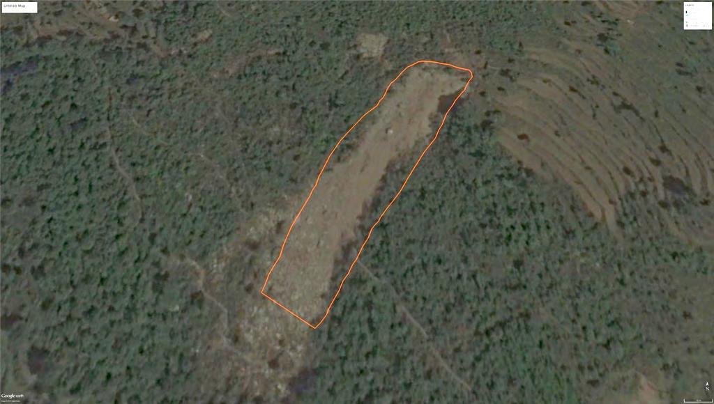
11 Geology Field Survey was carried out for Geological mapping of the area
12 Geological map of the area Area (Sq Km) Landslide (Sq Km) Geology Wi Higher Himalaya (Gneiss) Graphitic Schist Garnet Schist Chlorite-Biotite Schist Gneiss (Orthogneiss) MCT


13 Gneiss Schist Quartzite

14 Landslide Inventory Landslide inventory was prepared using Google Image, topomap and field survey

15 Identification of earthquake induced landslides 3/3/2015
16 Earthquake-Induced 15/5/2015


17 Rockfall at Wosimpa village Debris flow at Buma Village Debris flow at Charnawoti area Jointed rocks at Olitar


18 Identification of unstable slopes Unstable jointed slope at Sigati bazar Cracks near Kalinchwok temple

19 Landslide Inventory Map
20 Slope Class Area (Sq Km) Landslide (Sq Km) Wi Slope Map < >
21 Relative Area Landslide Relief (Sq Km) (Sq Km) Wi Relative Relief
22 Drainage distance Area (Sq Km) Landsli de (Sq Km) Wi < > Drainage Distance
23 Landuse/ Landcover Landuse Area Landslide (Sq Km) (Sq Km) Wi Barren Land Cultivated Land Exposed Rock Forest Grassland Lake Landslide/Erosi on Riverbed Settlement Shrub/Bushes Snow Sparse Forest

24 Aspect Area (Sq Km) Landslid e (Sq Km) Wi Aspect North East South West
25 Curvature Area (Sq Km) Landslid e (Sq Km) Wi Concave Curvature Straight Convex
26 Road Distance Area (Sq Km) Landsli de (Sq Km) Wi < > Distance to road
27 Normalized Vegetation Index (NDVI) NDVI Area Landslide (Sq Km) (Sq Km) Wi
 Low 426.2 46.5 Moderate 331.8 36.2 High 158.")
28 Landslide Susceptibility Map Susceptibility Area (sq Km) Percentage (%) Low Moderate High

 Labo.")
29 Flow of research Remote sensing & GIS Base maps (Land use and land cover map, etc.) Damage, dearth toll, etc. Field survey Distribution of landslides/rockfalls /other hazards Baseline survey UAV survey Photography for 3D mapping at seriously damaged sites Modeling HEC-RAS analysis for GLOF hazard Field survey Distribution of damages; social survey Landslide hazard map Training seminars for students Recommendation to local communities/gove rnment Labo. analysis Base-mapping for hazard map Landslide & GLOF hazard map Labo. analysis 3D-mapping (Structure from Motion) Labo. analysis Identifying evacuation sites Identifying evacuation sites
")


30 UAV survey (Singati and Gongar only) Permission issued on: 26 Feb UAV:DJI Phantom 2 Camera:RICOH GR Attached to UAV GPS logs & flight sites Gave dimensions SfM: DSM, Ortho-map
31 Social survey: 13 settlements The number of interviewed households in Nov. 2015: Tamakosi Kattike Charikot Dolakha Singati Olital Bohle Suri Doban Jamune Purano Jagat Jagat Manthali Gongar Face-to-face questionnaire survey 25 questions: Income Length of residence Damage Knowledge about evacuation site and hazard map
. Tsho Rolpa (ICIMOD, 2011): Length=3.7 km Area=1.54 km 2 Vol=86 million m 3 Max depth=135.5 m http://www.trekking-in-nepal.net/")
32 Focuses of hazard map (1) Landslide hazard map (2) GLOF hazard map One of the dangerous glacial lakes, Tsho Rolpa: potential source of future GLOF Local residents, hydropower-related workers, and international trekkers to Rolwaling Himal (>3,000 per year). Tsho Rolpa (ICIMOD, 2011): Length=3.7 km Area=1.54 km 2 Vol=86 million m 3 Max depth=135.5 m
33 HEC-RAS model for mapping inundation area along the river Where, Q = discharge (m 3 /s) A = cross-section area (m 2 ) R = hydraulic radius (m) S = friction slope and n = Manning s roughness coefficient Manning s n for different land use (Chow et al., 2010) Land use Manning s n type Barren 0.03 Bush 0.05 Cultivation area Cutting 0.04 area Forest 0.1 Grassland Orchard River 0.04 Sand 0.03


34 Gongar Singati GLOF hazard and landslide hazard map

35 GLOF hazard and landslide hazard map: Dolakha, Charikot, Kattike, Tamakoshi

36 GLOF hazard and landslide hazard map: Purano Jagat, Jagat, Manthali

37 GLOF hazard and landslide hazard map: Jamune, Suri Dobhan, Bhorle, Olitar
:")
38 GLOF hazard and landslide hazard map (Detailed): Singati

39 GLOF hazard and landslide hazard in Gongar


40 UAV and questionnaire surveys in Singati Nov. 2015: Interviewed household number: 66 Feb. 2016: Drone coverage: 16 households June 2016: More interviewed & drone covered all settlement area Drone coverage in Feb Singati: Population=1,618 Households=338
41 Earthquake damage survey in Singati 116 houses: 33 collapsed 5 partly damaged 4 emigrated to KTM (no use)
 120 100")

42 Damaged houses by the earthquake (by questionnaire survey) Completely Distroyed Condition of House Partly damaged No. of houses
: quite OK III (lower): more collapsed")
43 Earthquake damage survey in Singati River terrace I (higher): quite OK II (middle): quite OK III (lower): more collapsed houses
44 GLOF hazard in Singati estimate by HEC-RAS Nov. 2015: 33 houses were used on the lower river terrace. The lower river terrace (III) should be avoided to reside: relocation suggested. Legend To be inundated Collapsed Partly damaged Currently used Rebuilt No use Storage Temple As of Nov. 2015, 4 houses have been rebuilt at the same site at lower river terrace. In June, 2016, there were more rebuilt houses.

45 Temple 1 st river terrace 2 nd river terrace 3 rd river terrace To be inundated 2 nd river terrace 3 rd river terrace To be inundated A-A section B-B section Safe site: 1 st river terrace Good for evacuation
46 Residents knowledge on hazard map in Singati Interviewed 66 households: Yes=1, No=65 Only 1.5% of residents know a hazard map *) The entire area: Yes=3, No=280 Legend To be inundated Do not know
47 Residents knowledge on the safe site for evacuation in Singati Interviewed 66 households: Yes=2, No=64 Legend To be inundated Do not know Know


48 Residents knowledge on the evacuation site and safe site Interviewed 66 households: Yes=2, No=64 No. of houses Yes No Evacuate to safe site Yes=7/283 Legend No. of houses To be 80 inundated 40 Do not know Know Yes Safe site near by place Yes=134/283

49 Evacuation routes in Singati *) Will work on the lower Singati area


")

50 Evacuation routes in Singati Stone steps: cm wide (max: 1.8 m) Existing evacuation routes are not enough

51 Preparedness for future hazards 100 No. of households Yes No 0 Governmental & UNDP s awareness projects after the earthquake

52 UAV and questionnaire surveys in Gongar Drone coverage in Feb Nov. 2015: Interviewed household number: 10 Feb. 2016: Drone coverage: 10 households Hydropower facilities Drone coverage in Feb. 2016

53 GLOF hazard in Gongar estimate by HEC-RAS Hydropower facilities To be inundated Collapsed Partly damaged Currently used Rebuilt No use Storage


54 To be inundated To be inundated To be inundated A-A section B-B section C-C section Relocation suggested Gongar: some risk of GLOF
55 Conclusions and policy recommendation Landslide inventory of pre- and post-earthquake event of April 2015 prepared. Landslide incidences were found to be higher on steep and rectilinear, and south facing slopes, high relative relief, barren, poorly vegetated slopes, closed to roads and small rivers. High relative relief areas are in high risk of earthquake induced landslides such as rockfall and rock slides. The susceptibility areas shown in the maps should be considered for relocating the settlements in future.
56 Conclusions and policy recommendation HEC-RAS modeling suggests that future GLOF from Tso Rolpa could affect some settlements such as Gongar (16 houses), Kattike (4 houses), Signati (13houses), and Tamakoshi (6 houses; 100%). Location of the reconstruction of buildings should avoid lower river terraces. Evacuation routes in Singati and Gongar were examined to point out the need of their improvement. Organizing local workshops is suggested to increase awareness of hazard map and to realize evacuation drills.
: training seminar will be conducted on 23 and 24 June 2016 and")
57 Additional outcome/effects 56 Transferring the methodology of the hazard mapping to Nepal (students of TU): training seminar will be conducted on 23 and 24 June 2016 and beyond.
58 Presentations 57 1) Kobayashi Y, Thapa B, Watanabe T, Paudel L, Khanal NR, Ghimire M & Regmi D: Survey on damage in settlements along the Tamakoshi river in Dolakha, Nepal, caused by earthquakes in April/May 2015, Annual Meeting of Japanese Geographers Association, Waseda Univ., Tokyo, March 21, ) Watanabe T, Paudel L, Kobayashi Y, Thapa B, Khanal NR, Ghimire M, & Regmi D: Floods Occurred by a Collapse of an Earthquake-Induced Dam, Gongar, Dolakha, Nepal in April International Geographical Congress, Beijing, August 22-23, ) Kobayashi Y, Thapa B, Watanabe T, Paudel L, Khanal N, Ghimire M, & Regmi D: Inhabitants Awareness of Prevention and Preparation towards Hazards in the Settlements along the Tamakoshi River, Dolakha, Nepal. International Geographical Congress, Beijing, August 22-23, ) Thapa B, Watanabe T & Kobayashi, Y: Risk assessment of flood Hazard in the Nepal Himalaya: Case studies of Seti River, Pokhara and Tamakoshi River, Dolakha. International Geographical Congress, Beijing, August 22-23, 2016.
 58 1) Watanabe T,")


59 Publication (to be submitted) 58 1) Watanabe T, Thapa B, Kobayashi Y, Paudel L, Khanal NR, Ghimire M, & Regmi D: Floods occurred by a collapse of an earthquake-induced dam, Gongar, Dolakha, Nepal. To be submitted. 26 th April 2015
60 Acknowledgements We are grateful to the following organizations and persons for their generous helps and support besides the funding support of the J-RAPID project: Hokkaido University and Himalayan Research Expedition provided additional funds, and Tribhuvan University provided necessary facilities, Mr. Niroj Timilsina, Mr. Kran Dahal, Mr. Shreekrishna Karki, Ms. Alina Karki helped in the field and data analysis.
DISASTER HAZARDS IN BHUTAN By Tshewang Rinzin January Reducing Disaster Risks for a Safe and Happy Bhutan
 DISASTER HAZARDS IN BHUTAN By Tshewang Rinzin 26-27 January 2009 Reducing Disaster Risks for a Safe and Happy Bhutan Disaster Hazards in Bhutan Earthquakes Glacial Lake Outburst Flood (GLOF) Floods in
Country Report Nepal Geospatial Data Sharing Initiatives of Survey Department Supporting Disaster Management
 Third JPTM Step 2 for Sentinel Asia 6-8 July, 2010 Manila, The Philippines Country Report Nepal Geospatial Data Sharing Initiatives of Survey Department Supporting Disaster Management Durgendra M Kayastha
Recent extreme weather events in the Nepal Himalayas
 The Extremes ofthe Extremes: Extraordinary Floods (Proceedings of n symposium held al Reykjavik. Iceland. July 2000). lalispubl.no. 271. 2002. 141 Recent extreme weather events in the Nepal Himalayas SURESH
Landslide dam outburst flood risk management
 Case Studies on Flash Flood Risk Management in the Himalayas Madi River, Nepal Landslide dam outburst flood risk management Narendra Raj Khanal, Tribhuvan University; Achyuta Koirala, Fulbright Consultant;
Disaster RISK Management : Bhutanese Scenario
 Disaster RISK Management : Bhutanese Scenario Expert Group Meeting (EGM) on Geo-referenced Information Systems for Disaster Risk Management (Geo-DRM) and sustaining the Community of Practice (COP), Bangkok,
Disaster Management and Spatial Data An Experience of Sri Lanka for Joint project team meeting 2012
 Disaster Management and Spatial Data An Experience of Sri Lanka for Joint project team meeting 2012 1 by Padma Kumara Withana Provincial Surveyor General Uva Province 2 Out line ü Introduction ü Natural
Earthquake-induced landslide distribution and hazard mapping. Megh Raj Dhital Central Department of Geology, Tribhuvan University
 Earthquake-induced landslide distribution and hazard mapping Megh Raj Dhital Central Department of Geology, Tribhuvan University Contents Geological setting of Gorkha earthquake Peak ground acceleration
Natural Terrain Risk Management in Hong Kong
 Natural Terrain Risk Management in Hong Kong Nick Koor Senior Lecturer in Engineering Geology School of Earth and Environmental Sciences Slope failures in Hong Kong Man-made Slope Failure - 300 landslides
International Journal of Modern Trends in Engineering and Research e-issn No.: , Date: April, 2016
 International Journal of Modern Trends in Engineering and Research www.ijmter.com e-issn No.:2349-9745, Date: 28-30 April, 2016 Landslide Hazard Management Maps for Settlements in Yelwandi River Basin,
Grant 0299-NEP: Water Resources Project Preparatory Facility
 Document Produced under Grant Project Number: 45206 May 2016 Grant 0299-NEP: Water Resources Project Preparatory Facility Final Report Volume 3 East Rapti (1 of 9) Prepared by Pvt. Ltd. For Ministry of
Use of Geospatial data for disaster managements
 Use of Geospatial data for disaster managements Source: http://alertsystemsgroup.com Instructor : Professor Dr. Yuji Murayama Teaching Assistant : Manjula Ranagalage What is GIS? A powerful set of tools
Georeferencing and Satellite Image Support: Lessons learned, Challenges and Opportunities
 Georeferencing and Satellite Image Support: Lessons learned, Challenges and Opportunities Shirish Ravan shirish.ravan@unoosa.org UN-SPIDER United Nations Office for Outer Space Affairs (UNOOSA) UN-SPIDER
4 th Joint Project Team Meeting for Sentinel Asia 2011
 A Revisit on the Structural Flood Mitigation Measure with the Application of Remote Sensing and GIS in Gin River Basin, Sri Lanka 4 th Joint Project Team Meeting for Sentinel Asia 2011 Geoinformatics Center
Preparing Landslide Inventory Maps using Virtual Globes
 Introduction: A landslide is the movement of a mass of rock, debris, or earth down a slope, under the influence of gravity. Landslides can be caused by different phenomena, including intense or prolonged
Hazard Zonation for Glacial Lake Outburst Flood (GLOF) in Bhutan Himalaya
 in Bhutan Himalaya") Hazard Zonation for Glacial Lake Outburst Flood (GLOF) in Bhutan Himalaya A mode of Adaptation to the impacts of climate change DGM-NCAP Project Karma Department of Geology & Mines Ministry of Economic
Hazard Zonation for Glacial Lake Outburst Flood (GLOF) in Bhutan Himalaya A mode of Adaptation to the impacts of climate change DGM-NCAP Project Karma Department of Geology & Mines Ministry of Economic
Geo-information and Disaster Risk Reduction in the Hindu Kush-Himalayan region
 Geo-information and Disaster Risk Reduction in the Hindu Kush-Himalayan region Basanta Shrestha, Division Head MENRIS, International Centre for Integrated Mountain Development Kathmandu, Nepal The International
Geospatial Approach for Delineation of Landslide Susceptible Areas in Karnaprayag, Chamoli district, Uttrakhand, India
 Geospatial Approach for Delineation of Landslide Susceptible Areas in Karnaprayag, Chamoli district, Uttrakhand, India Ajay Kumar Sharma & Anand Mohan Singh Overview Landslide - movement of a mass of rock,
GG101 Lecture 22: Mass Wasting. Soil, debris, sediment, and broken rock is called regolith.
 GG101 Lecture 22: Mass Wasting Mass Wasting is the movement of rock and soil down a slope due to the force of gravity. Soil, debris, sediment, and broken rock is called regolith. Mass wasting creates broad
Bhutan Country Report for JPTM 2010 (July, 2010) Department of Disaster Management Ministry of Home & Cultural Affairs Royal Government of Bhutan
 Department of Disaster Management Ministry of Home & Cultural Affairs Royal Government of Bhutan") Bhutan Country Report for JPTM 2010 (July, 2010) Department of Disaster Management Ministry of Home & Cultural Affairs Royal Government of Bhutan 1 Contents of Presentation 1. Disaster Hazards and Underlying
Bhutan Country Report for JPTM 2010 (July, 2010) Department of Disaster Management Ministry of Home & Cultural Affairs Royal Government of Bhutan 1 Contents of Presentation 1. Disaster Hazards and Underlying
Disaster Management in Bhutan
 ROYAL GOVERNMENT OF BHUTAN Disaster Management in Bhutan Tshering Wangchuk ROYAL GOVERNMENT OF BHUTAN EARTH FIRE WATER AIR ROYAL GOVERNMENT OF BHUTAN Presentation Outline Various Hazards in Bhutan Major
Adopted projects related to the April 2015 Nepal earthquake
 Attachment Adopted projects related to the April 2015 Nepal earthquake Title of the Project Japan based Principal Investigator Nepal based Principal Investigator Title Affiliation Outline 1 Investigation
LANLDSIDE HAZARD, SOCIAL-ECONOMIC VULNERABILITY AND PHYSICAL (BUILDINGS) RISK ASSESMENT SAGAREJO MUNICIPALITY CASE STUDY (PROJECT)
 RISK ASSESMENT SAGAREJO MUNICIPALITY CASE STUDY (PROJECT)") LANLDSIDE HAZARD, SOCIAL-ECONOMIC VULNERABILITY AND PHYSICAL (BUILDINGS) RISK ASSESMENT SAGAREJO MUNICIPALITY CASE STUDY (PROJECT) - 1 - 1. INTRODUCTION 3 2. USED DATA 4 3. METHODOLOGY 5 3.1 Work flow
LANLDSIDE HAZARD, SOCIAL-ECONOMIC VULNERABILITY AND PHYSICAL (BUILDINGS) RISK ASSESMENT SAGAREJO MUNICIPALITY CASE STUDY (PROJECT) - 1 - 1. INTRODUCTION 3 2. USED DATA 4 3. METHODOLOGY 5 3.1 Work flow
Earthquake hazards. Aims 1. To know how hazards are classified 2. To be able to explain how the hazards occur 3. To be able to rank order hazards
 Earthquake hazards Aims 1. To know how hazards are classified 2. To be able to explain how the hazards occur 3. To be able to rank order hazards Types of hazard Primary A direct result of the earthquake
Geotechnical damage in rural areas caused by the 2015 Gorkha Nepal Earthquake
 Tokyo, 1 June 2015 Geotechnical damage in rural areas caused by the 2015 Gorkha Nepal Earthquake Chiaro Gabriele JSPS RESEARCH FELLOW, University of Tokyo Lecturer, University of Canterbury, New Zealand
GENERAL. CHAPTER 1 BACKGROUND AND PURPOSE OF THE GUIDELINES Background of the Guidelines Purpose of the Guidelines...
 GENERAL CHAPTER 1 BACKGROUND AND PURPOSE OF THE GUIDELINES... 1 1.1 Background of the Guidelines... 1 1.2 Purpose of the Guidelines... 3 CHAPTER 2 APPLICATION OF THE GUIDELINES... 3 2.1 Potential Users
9/13/2011 CHAPTER 9 AND SUBSIDENCE. Case History: La Conchita Landslide. Introduction
 CHAPTER 9 SLOPE PROCESSES, LANDSLIDES, AND SUBSIDENCE Case History: La Conchita Landslide La Conchita: small coastal community 80 km (50 mi) northwest of Los Angeles Landslide occurred on January 10, 2005
APPLICATION OF REMOTE SENSING & GIS ON LANDSLIDE HAZARD ZONE IDENTIFICATION & MANAGEMENT
 APPLICATION OF REMOTE SENSING & GIS ON LANDSLIDE HAZARD ZONE IDENTIFICATION & MANAGEMENT PRESENTED BY SUPRITI PRAMANIK M.TECH IN ENVIRONMENTAL SCIENCE AND TECHNOLOGY NIT,DURGAPUR 25-04-2015 1 INTRODUCTION
How to manage risk through integrated geohazard assessment. Prof. John M. Reynolds Reynolds International Ltd, Mold, UK
 How to manage risk through integrated geohazard assessment Prof. John M. Reynolds Reynolds International Ltd, Mold, UK Talk outline Introduction Types of disasters within the Himalayas Integrated Geohazard
MultiHazard Process Chains: Nepal and other hotspots
 MultiHazard Process Chains: Nepal and other hotspots Jeffrey S. Kargel (Thanks to NASA Disasters program and David Green for support) 6 Sep 2016 Glaciers Glacial Lakes Seismicity Meteorological floods
Debris flow: categories, characteristics, hazard assessment, mitigation measures. Hariklia D. SKILODIMOU, George D. BATHRELLOS
 Debris flow: categories, characteristics, hazard assessment, mitigation measures Hariklia D. SKILODIMOU, George D. BATHRELLOS Natural hazards: physical phenomena, active in geological time capable of producing
STRATEGY ON THE LANDSLIDE TYPE ANALYSIS BASED ON THE EXPERT KNOWLEDGE AND THE QUANTITATIVE PREDICTION MODEL
 STRATEGY ON THE LANDSLIDE TYPE ANALYSIS BASED ON THE EXPERT KNOWLEDGE AND THE QUANTITATIVE PREDICTION MODEL Hirohito KOJIMA*, Chang-Jo F. CHUNG**, Cees J.van WESTEN*** * Science University of Tokyo, Remote
Skeletal remains of what was a debris-covered glacier near Mt. Everest
 Annual satellite imaging of the world s glaciers Assessment of glacier extent and change GLIMS Development and population of a digital glacier data inventory HIGH ICE Skeletal remains of what was a debris-covered
ANALYSIS OF EVACUATION BEHAVIORS IN DIFFERENT AREAS BEFORE AND AFTER THE GREAT EAST JAPAN EARTHQUAKE
 Fifth International Conference on Geotechnique, Construction Materials and Environment, Osaka, Japan, Nov. 16-18, 2015, ISBN: 978-4-9905958-4-5 C3051 ANALYSIS OF EVACUATION BEHAVIORS IN DIFFERENT AREAS
Landslide hazard assessment in the Khelvachauri area, Georgia
 Report on the project of AES Geohazards Stream Landslide hazard assessment in the Khelvachauri area, Georgia May 2010 George Jianping Panisara Gaprindashvili Guo Daorueang Institute of Geo-Information
SIMPLE GUIDELINES TO MINIMISE EXPOSURE TO EARTHQUAKE-TRIGGERED LANDSLIDES
 SIMPLE GUIDELINES TO MINIMISE EXPOSURE TO EARTHQUAKE-TRIGGERED LANDSLIDES David Milledge, Nick Rosser, Katie Oven, Amod Mani Dixit, Ranjan Dhungel, Gopi Krishna Basyal, Sujan Raj Adhikari and Alexander
INTERNATIONAL JOURNAL OF GEOMATICS AND GEOSCIENCES Volume 1, No 1, 2010
 An Integrated Approach with GIS and Remote Sensing Technique for Landslide Hazard Zonation S.Evany Nithya 1 P. Rajesh Prasanna 2 1. Lecturer, 2. Assistant Professor Department of Civil Engineering, Anna
Chapter 4 Hydrodynamic Modelling of Glacial Lake Outburst Floods
 Chapter 4 Hydrodynamic Modelling of Glacial Lake Outburst Floods To better understand the impacts that a GLOF can have on the downstream valleys, an attempt was made to simulate one GLOF event each in
UIB Network - TWG 5 Hazards and risks:
 UIB Network - TWG 5 Hazards and risks: Philippus Wester & Muhammad Asif Khan ICIMOD & Karakoram International university TWG-5 members: Arun Shrestha, Liu Shiyin, Nusrat Nasab, Deedar Karim, Muhammad Zafar
Report on Disaster statistics of Nepal
 Report on Disaster statistics of Nepal Submitted by Altaf Rehman Submitted to Dr. Naveed Ahmed University of engineering and technology Peshawar Assignment 1 Section A Registration id 14PWCIV456 Page 1
GIS Application in Landslide Hazard Analysis An Example from the Shihmen Reservoir Catchment Area in Northern Taiwan
 GIS Application in Landslide Hazard Analysis An Example from the Shihmen Reservoir Catchment Area in Northern Taiwan Chyi-Tyi Lee Institute of Applied Geology, National Central University, No.300, Jungda
Virtual Reality Modeling of Landslide for Alerting in Chiang Rai Area Banphot Nobaew 1 and Worasak Reangsirarak 2
 Virtual Reality Modeling of Landslide for Alerting in Chiang Rai Area Banphot Nobaew 1 and Worasak Reangsirarak 2 1 Banphot Nobaew MFU, Chiang Rai, Thailand 2 Worasak Reangsirarak MFU, Chiang Rai, Thailand
9/23/2013. Introduction CHAPTER 7 SLOPE PROCESSES, LANDSLIDES, AND SUBSIDENCE. Case History: La Conchita Landslide
 Introduction CHAPTER 7 SLOPE PROCESSES, LANDSLIDES, AND SUBSIDENCE Landslide and other ground failures posting substantial damage and loss of life In U.S., average 25 50 deaths; damage more than $3.5 billion
2014 Summer Training Courses on Slope Land Disaster Reduction Hydrotech Research Institute, National Taiwan University, Taiwan August 04-15, 2014
 Final Project Report 2014 Summer Training Courses on Slope Land Disaster Reduction Hydrotech Research Institute, National Taiwan University, Taiwan August 04-15, 2014 Landslides in Mt. Umyeon Susceptibility
Applying Hazard Maps to Urban Planning
 Applying Hazard Maps to Urban Planning September 10th, 2014 SAKAI Yuko Disaster Management Expert JICA Study Team for the Metro Cebu Roadmap Study on the Sustainable Urban Development 1 Contents 1. Outline
Role of Hydro-Met Services in Disaster Risk Management
 Role of Hydro-Met Services in Disaster Risk Management Tshewang Rigzin (Mr) National Centre for Hydrology and Meteorology, Bhutan 30 th November 2017 Outline Vision and Mission Functions related to Disaster
Progress Report. Flood Hazard Mapping in Thailand
 Progress Report Flood Hazard Mapping in Thailand Prepared By: Mr. PAITOON NAKTAE Chief of Safety Standard sub-beuro Disaster Prevention beuro Department of Disaster Prevention and Mitigation THAILAND E-mail:
1. INTRODUCTION. EXAMPLE OF SECHILIENNE ROCKFALL (France)
") FORM OSE POST-GRADUATE COURSE Landslide vulnerability and risk 1 FORM OSE POST-GRADUATE COURSE Landslide vulnerability and risk 2 FORM OSE POST-GRADUATE COURSE Landslide vulnerability and risk 3 Christophe
FORM OSE POST-GRADUATE COURSE Landslide vulnerability and risk 1 FORM OSE POST-GRADUATE COURSE Landslide vulnerability and risk 2 FORM OSE POST-GRADUATE COURSE Landslide vulnerability and risk 3 Christophe
Vulnerability of Flood Hazard in Selected Ayeyarwady Delta Region, Myanmar
 Vulnerability of Flood Hazard in Selected Ayeyarwady Delta Region, Myanmar Khin Thandar Win Department of Civil Engineering Nilar Aye Department of Civil Engineering Kyaw Zaya Htun Department of Remote
FLOOD HAZARD MAPPING OF DHAKA-NARAYANGANJ-DEMRA (DND) PROJECT USING GEO-INFORMATICS TOOLS
 PROJECT USING GEO-INFORMATICS TOOLS") FLOOD HAZARD MAPPING OF DHAKA-NARAYANGANJ-DEMRA (DND) PROJECT USING GEO-INFORMATICS TOOLS Md. Aminul Islam MEE07178 Supervisor: Prof. Kuniyoshi TAKEUCHI ABSTRACT Dhaka-Narayanganj-Demra (DND) Project is
FLOOD HAZARD MAPPING OF DHAKA-NARAYANGANJ-DEMRA (DND) PROJECT USING GEO-INFORMATICS TOOLS Md. Aminul Islam MEE07178 Supervisor: Prof. Kuniyoshi TAKEUCHI ABSTRACT Dhaka-Narayanganj-Demra (DND) Project is
Landslide Susceptibility Mapping Using Logistic Regression in Garut District, West Java, Indonesia
 Landslide Susceptibility Mapping Using Logistic Regression in Garut District, West Java, Indonesia N. Lakmal Deshapriya 1, Udhi Catur Nugroho 2, Sesa Wiguna 3, Manzul Hazarika 1, Lal Samarakoon 1 1 Geoinformatics
SLOPE PROCESSES, LANDSLIDES, AND SUBSIDENCE
 CHAPTER 9 SLOPE PROCESSES, LANDSLIDES, AND SUBSIDENCE La Conchita slide January 10, 2005 Triggered by heavy rainfall, reactivation along an older landslide surface (35,000 years ago, 6000 years ago, and
In Issue of International Sabo News Letter
 In Issue of International Sabo News Letter I had an opportunity to make a keynote speech on March 18 2003 at the session on Sedimentrelated Issues at the 3rd World Water Forum held in (Kyoto) Japan. Chairing
Landslide Hazard Assessment Methodologies in Romania
 A Scientific Network for Earthquake, Landslide and Flood Hazard Prevention SciNet NatHazPrev Landslide Hazard Assessment Methodologies in Romania In the literature the terms of susceptibility and landslide
USING GIS FOR AVALANCHE SUSCEPTIBILITY MAPPING IN RODNEI MOUNTAINS
 USING GIS FOR AVALANCHE SUSCEPTIBILITY MAPPING IN RODNEI MOUNTAINS IOANA SIMEA 1 ABSTRACT. Using GIS for avalanche susceptibility mapping in Rodnei Mountains. This case study combines GIS methods with
International Symposium on Natural Disaster Mitigation. Local vulnerability assessment of landslides and debris flows
 International Symposium on Natural Disaster Mitigation of landslides and debris flows Lessons learnt from Cam Pha town and Van Don district, Quang Ninh province, Vietnam Nguyen Quoc Phi Faculty of Environment
Sino-Nepal Joint Research Centre for Geography
 Sino-Nepal Joint Research Centre for Geography Central Department of Geography, Tribhuvan University, Kathmandu, Nepal Institute of Mountain Hazards and Environment, Chinese Academy of Sciences, Chengdu,
MULTI-HAZARD RISK ASSESSMENT AND DECISION MAKING
 MULTI-HAZARD RISK ASSESSMENT AND DECISION MAKING JULINDA KEÇI Epoka University Logo of the institution CONTENT: Introduction Multi Hazard Risks Multi-Hazard Risk Assessment Quantitative Assessment Event
Development of Global Map for GEOSS SBAs US-09-03a
 Development of Global Map for GEOSS SBAs US-09-03a UIC User Engagement Session 2 November, 2010 Yoshikazu FUKUSHIMA Secretariat General of International Steering Committee for Global Mapping Geospatial
Natural hazards in Glenorchy Summary Report May 2010
 Natural hazards in Glenorchy Summary Report May 2010 Contents Glenorchy s hazardscape Environment setting Flood hazard Earthquakes and seismic hazards Hazards Mass movement Summary Glossary Introduction
SOCIO-ECONOMIC IMPACTS OF FLOODING IN DIRE DAWA, ETHIOPIA
 SOCIO-ECONOMIC IMPACTS OF FLOODING IN DIRE DAWA, ETHIOPIA Alemu Yonas Tadesse * Supervisor: Prof. A.W. Jayawardena ** MEE08182 ABSTRACT Dire Dawa, the second largest city of Ethiopia, has been suffering
EFFECT OF WATERSHED DEVELOPMENT PROGRAMME IN GUDHA GOKALPURA VILLAGE, BUNDI DISTRICT, RAJASTHAN - A REMOTE SENSING STUDY
 EFFECT OF WATERSHED DEVELOPMENT PROGRAMME IN GUDHA GOKALPURA VILLAGE, BUNDI DISTRICT, RAJASTHAN - A REMOTE SENSING STUDY G. Sajeevan, C. P. Johnson, D. J. Pal and B. K. Kakade* C-DAC, Pune University Campus,
GOAL 7 AREAS SUBJECT TO NATURAL DISASTERS AND HAZARDS. To protect life and property from natural disasters and hazards.
 GOAL 7 AREAS SUBJECT TO NATURAL DISASTERS AND HAZARDS A. GOALS: To protect life and property from natural disasters and hazards. B. POLICIES: 1. Floodplains shall be maintained as natural drainage-ways.
Report. Developing a course component on disaster management
 Report Developing a course component on disaster management By Chira Prangkio Tawee Chaipimonplin Department of Geography, Faculty of Social Sciences, Chiang Mai University Thailand Presented at Indian
GIS AND REMOTE SENSING FOR GEOHAZARD ASSESSMENT AND ENVIRONMENTAL IMPACT EVALUATION OF MINING ACTIVITIES AT QUY HOP, NGHE AN, VIETNAM
 GIS AND REMOTE SENSING FOR GEOHAZARD ASSESSMENT AND ENVIRONMENTAL IMPACT EVALUATION OF MINING ACTIVITIES AT QUY HOP, NGHE AN, VIETNAM QuocPhi Nguyen 1, Phuong Nguyen 1, ThiHoa Nguyen 2 and TienPhu Nguyen
Level 1/Level 2 Certificate Specimen Paper
 Centre Number Surname Other Names Candidate Number For Examiner s Use Examiner s Initials Candidate Signature Geography 8031/1 Dynamic Physical World For this paper you must have: the colour insert (enclosed).
Landslide Hazard Mapping of Nagadhunga-Naubise Section of the Tribhuvan Highway in Nepal with GIS Application
 Journal of Geographic Information System, 2014, 6, 723-732 Published Online December 2014 in SciRes. http://www.scirp.org/journal/jgis http://dx.doi.org/10.4236/jgis.2014.66059 Landslide Hazard Mapping
Vulnerability mapping for sustainable hazard mitigation in the city of Bukavu, South Kivu DRCongo
 IAG/AIG REGIONAL CONFERENCE, 18th to 22nd Feb. 2011 Vulnerability mapping for sustainable hazard mitigation in the city of Bukavu, South Kivu DRCongo Sadiki Ndyanabo 1, Ine Vandecasteele 2, Jan Moeyersons
FLOOD HAZARD AND RISK ASSESSMENT IN MID- EASTERN PART OF DHAKA, BANGLADESH
 FLOOD HAZARD AND RISK ASSESSMENT IN MID- EASTERN PART OF DHAKA, BANGLADESH Muhammad MASOOD MEE07180 Supervisor: Prof. Kuniyoshi TAKEUCHI ABSTRACT An inundation simulation has been done for the mid-eastern
Using Weather and Climate Information for Landslide Prevention and Mitigation
 Using Weather and Climate Information for Landslide Prevention and Mitigation Professor Roy C. Sidle Disaster Prevention Research Institute Kyoto University, Japan International Workshop on Climate and
Need of Proper Development in Hilly Urban Areas to Avoid
 Need of Proper Development in Hilly Urban Areas to Avoid Landslide Hazard Dr. Arvind Phukan, P.E. Cosultant/Former Professor of Civil Engineering University of Alaska, Anchorage, USA RI District Governor
Crowdsourcing approach for large scale mapping of built-up land
 Crowdsourcing approach for large scale mapping of built-up land Kavinda Gunasekara Kavinda@ait.asia Geoinformatics Center Asian Institute of Technology, Thailand. Regional expert workshop on land accounting
Hydrological parameters Controls Vulnerable Zones in Calicut Nilambur Gudalur Ghat section, Gudalur, The Nilgiris, Tamil Nadu.
 International Journal of ChemTech Research CODEN (USA): IJCRGG ISSN: 0974-4290 Vol.9, No.03 pp 248-253, 2016 Hydrological parameters Controls Vulnerable Zones in Calicut Nilambur Gudalur Ghat section,
Tsukuba, Japan International Institute of Seismology and Earthquake Engineering Building Research Institute STUDY TRIP TO ITAKO CITY
 Tsukuba, Japan International Institute of Seismology and Earthquake Engineering Building Research Institute STUDY TRIP TO ITAKO CITY A Technical Report By MARTINEZ BRAVO Delvin Abdiel (MEE10515) Disaster
5/3/2018 Susceptibility analysis of landslide due to earthquake due in Gorkha (25th April 2015) Animesh Bahadur Pradhan GIS IN WATER RESOURCES CE 547
 Animesh Bahadur Pradhan GIS IN WATER RESOURCES CE 547") Susceptibility 5/3/2018 analysis of landslide due to earthquake due in Gorkha (25th April 2015) Animesh Bahadur Pradhan GIS IN WATER RESOURCES CE 547 Contents 1. Acknowledgement:... 2 2. Motivation and
Susceptibility 5/3/2018 analysis of landslide due to earthquake due in Gorkha (25th April 2015) Animesh Bahadur Pradhan GIS IN WATER RESOURCES CE 547 Contents 1. Acknowledgement:... 2 2. Motivation and
Risk-based land use and spatial planning
 Risk-based land use and spatial planning Miho OHARA International Centre for Water Hazards and Risk Management (ICHARM) Public Works Research Institute PWRI), Japan Under the auspices of UNESCO Introduction
Alaska, USA. Sam Robbins
 Using ArcGIS to determine erosion susceptibility within Denali National Park, Alaska, USA Sam Robbins Introduction Denali National Park is six million acres of wild land with only one road and one road
Final Presentation on Disaster Risk Management in Japan. Through ADRC V. R Programme. Main Findings and Action Plan:
 Final Presentation on Disaster Risk Management in Japan Through ADRC V. R Programme Main Findings and Action Plan: Problem/Hazard and Disaster in Japan Good Practiced on Disaster Risk Management in Japan
INTERNATIONAL JOURNAL OF GEOMATICS AND GEOSCIENCES Volume 2, No 2, 2011
 INTERNATIONAL JOURNAL OF GEOMATICS AND GEOSCIENCES Volume 2, No 2, 2011 Copyright 2010 All rights reserved Integrated Publishing services Research article ISSN 0976 4380 Geomorphological study of Atagad
UNITED NATIONS E/CONF.96/CRP. 5
 UNITED NATIONS E/CONF.96/CRP. 5 ECONOMIC AND SOCIAL COUNCIL Eighth United Nations Regional Cartographic Conference for the Americas New York, 27 June -1 July 2005 Item 5 of the provisional agenda* COUNTRY
Assessment of the Incidence of Landslides Using Numerical Information
 PAPER Assessment of the Incidence of Landslides Using Numerical Information Atsushi HASEGAWA Takehiro OHTA, Dr. Sci. Assistant Senior Researcher, Senior Researcher, Laboratory Head, Geology Laboratory,
SEISMIC RISK ASSESSMENT IN ARMENIA
 SEISMIC RISK ASSESSMENT IN ARMENIA Hovhannes Khangeldyan Head of National Crisis Management Center Rescue Service Ministry of Emergency Situations of the Republic of Armenia Tokyo, 2016 ARMENIA: GEOGRAPHICAL
Topographical Change Monitoring for Susceptible Landslide Area Determination by Using Multi-Date Digital Terrain Models and LiDAR
 Topographical Change Monitoring for Susceptible Landslide Area Determination by Using Multi-Date Digital Terrain Models and Chanist PRASERTBURANAKUL 1, Parkorn SUWANICH 2, Kanchana NAKHAPAKORN 3, and Sukit
Multi-Jurisdictional Hazard Mitigation Plan. Table C.10 The Richter Scale. Descriptor Richter Magnitude Earthquake Effects
 Geologic Hazards Earthquake Earthquakes are very rare in Pennsylvania and have caused little damage, with no reported injuries or causalities. Earthquakes that do occur in Pennsylvania happen deep within
LANDSLIDE HAZARDS. presented during the. TRAINING-WORKSHOP ON DISASTER RISK MANAGEMENT Rakdell Inn Virac, Catanduanes 03 July 2008
 LANDSLIDE HAZARDS presented during the TRAINING-WORKSHOP ON DISASTER RISK MANAGEMENT Rakdell Inn Virac, Catanduanes 03 July 2008 GEOLOGIC HAZARDS the probability of occurrence, within a specific period
INTRODUCTION. Climate
 INTRODUCTION Climate Landslides are serious natural disasters in many parts of the world. Since the past 30 years, rainfall triggered landslides and debris flows had been one of the natural disasters of
Geography Education Challenges Regarding Disaster Mitigation in Japan
 Geography Education Challenges Regarding Disaster Mitigation in Japan Koji OHNISHI 1 University of Toyama, Toyama, JAPAN Hiroshi MITSUHASHI 2 Ministry of Education, Culture, Sports, Science & Technology,
Disaster Management in Republic of Korea
 The Third UN-GGIM-AP Plenary Meeting Disaster Management in Republic of Korea ~Coordination among NGIA & Other Related Organizations and Recommendations~ Bali Indonesia 10 November 2014 Sanghoon Lee, Ph.D.
Community: An Asset to reduce landslide risk. Prepared by: Azra Jawaid Jafreen Alamgir
 Community: An Asset to reduce landslide risk Prepared by: Azra Jawaid Jafreen Alamgir Map of Bangladesh Map of Bangladesh. Google Images. Web. 25 Sep. 2014 Chittagong at a view Situated at the bank of
Interpretive Map Series 24
 Oregon Department of Geology and Mineral Industries Interpretive Map Series 24 Geologic Hazards, and Hazard Maps, and Future Damage Estimates for Six Counties in the Mid/Southern Willamette Valley Including
RiskCity Training package on the Application of GIS for multi- hazard risk assessment in an urban environment.
 RiskCity Training package on the Application of GIS for multi- hazard risk assessment in an urban environment. Cees van Westen (Westen@itc.nl) & Nanette C. Kingma (Kingma@itc.nl) ITC: Training & Research
ESTIMATING LAND VALUE AND DISASTER RISK IN URBAN AREA IN YANGON, MYANMAR USING STEREO HIGH-RESOLUTION IMAGES AND MULTI-TEMPORAL LANDSAT IMAGES
 ESTIMATING LAND VALUE AND DISASTER RISK IN URBAN AREA IN YANGON, MYANMAR USING STEREO HIGH-RESOLUTION IMAGES AND MULTI-TEMPORAL LANDSAT IMAGES Tanakorn Sritarapipat 1 and Wataru Takeuchi 1 1 Institute
A National Scale Landslide Susceptibility Assessment for St. Lucia, Caribbean Sea
 A National Scale Landslide Susceptibility Assessment for St. Lucia, Caribbean Sea Submitted by James Varghese As a part of M.Sc. Module On Empirical Modeling of Hazard Processes TABLE OF CONTENTS INTRODUCTION...
Geohazards in the Himalaya GEOL 3000 (3 Credits / 45 class hours)
") Geohazards in the Himalaya GEOL 3000 (3 Credits / 45 class hours) SIT Study Abroad Program: Nepal: Geoscience in the Himalaya PLEASE NOTE: This syllabus represents a recent term. Because courses develop
Geohazards in the Himalaya GEOL 3000 (3 Credits / 45 class hours) SIT Study Abroad Program: Nepal: Geoscience in the Himalaya PLEASE NOTE: This syllabus represents a recent term. Because courses develop
GIS Techniques for Floodplain Delineation. Dean Djokic
 GIS Techniques for Floodplain Delineation Dean Djokic (ddjokic@esri.com) Content What is a floodplain? How to get a floodplain? What can GIS do for floodplain modeling? Simple GIS techniques for floodplain
Report for Area Drainage Studies for 1320 MW (2x660 MW) THERMAL POWER PROJECT AT MIRZAPUR, U.P.
 THERMAL POWER PROJECT AT MIRZAPUR, U.P.") Report for Area Drainage Studies for 1320 MW (2x660 MW) THERMAL POWER PROJECT AT MIRZAPUR, U.P. 1. Introduction M/s Welspun Energy Uttar Pradesh Ltd. (WEUPL) is putting up 1320 MW (2 x 660 MW) coal fired
Report for Area Drainage Studies for 1320 MW (2x660 MW) THERMAL POWER PROJECT AT MIRZAPUR, U.P. 1. Introduction M/s Welspun Energy Uttar Pradesh Ltd. (WEUPL) is putting up 1320 MW (2 x 660 MW) coal fired
Geohazards in the Himalaya GEOL 3000 (3 Credits / 45 class hours)
") Geohazards in the Himalaya GEOL 3000 (3 Credits / 45 class hours) SIT Study Abroad Program: Nepal: Geoscience in the Himalaya PLEASE NOTE: This syllabus represents a recent term. Because courses develop
Geohazards in the Himalaya GEOL 3000 (3 Credits / 45 class hours) SIT Study Abroad Program: Nepal: Geoscience in the Himalaya PLEASE NOTE: This syllabus represents a recent term. Because courses develop
Flood Inundation Mapping under different climate change scenarios in the upper Indus River Basin, Pakistan
 Flood Inundation Mapping under different climate change scenarios in the upper Indus River Basin, Pakistan Sohaib Baig (doctoral student) 16 November 2017 Disaster Prevention Research Institute 1 Kyoto
Section 3. Slopes and Landscapes. What Do You See? Think About It. Investigate. Learning Outcomes
 Chapter 4 Surface Processes Section 3 Slopes and Landscapes What Do You See? Learning Outcomes In this section, you will Calculate the angle of repose for different kinds of soils and other granular materials.
Pipeline Routing Using Geospatial Information System Analysis
 Pipeline Routing Using Geospatial Information System Analysis Mahmoud Reza 1 Delavar and Fereydoon 2 Naghibi 1-Assistance Professor, Dept. of Surveying and Geomatic Eng., Eng. Faculty, University of Tehran,