The Importance of Cultural Contexts in Climate Education
|
|
|
- Irma Stokes
- 5 years ago
- Views:
Transcription


1 The Importance of Cultural Contexts in Climate Education Kathryn Berry Bertram, Ph.D., University of Alaska Fairbanks Geophysical Institute Education Director

2 Climate education for indigenous students in Alaska

3 Studying Earth s Systems Earth systems research is naturally synchronous with indigenous ideology. Indigenous ideology is grounded in examining the interconnectedness of all things, a worldview that involves studying each part of our environment in relationship to Earth s system as a whole.


4 The Statistics The Alaska Native and American Indian population is the least represented of all minorities in science, technology, engineering and math careers. Earth System Science and geophysics suffer from the lowest minority representation of all science, technology, engineering and math disciplines. Less than.001% of the nationwide Alaska Native or American Indian population is pursuing graduate degrees in geoscience.


5 GI Climate Education Programs ( ) National Science Foundation Arctic Climate Modeling Program, with education extension focused on climate impacts on permafrost ( ) National Science Foundation Preparing Responsive Educators using Place-based Authentic Research in Earth Systems (PREPARES) ( ) National Aeronautics & Space Administration The Cryospheric Connection to Understanding Climate Change (Cryospheric Connection) ( ) U.S. Department of Education Uniting Native Indigenous Traditional Education and University Science (UNITE US)


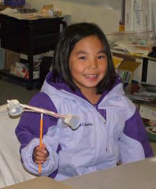
6 The Arctic Climate Modeling Program ACMP was created for teachers in the Bering Strait School District, an 80,000 sq. mile area supporting 15 schools in rural Alaska. ACMP emphasized instruction in a suite of STEM skills that mirror those practiced by Arctic climate researchers.


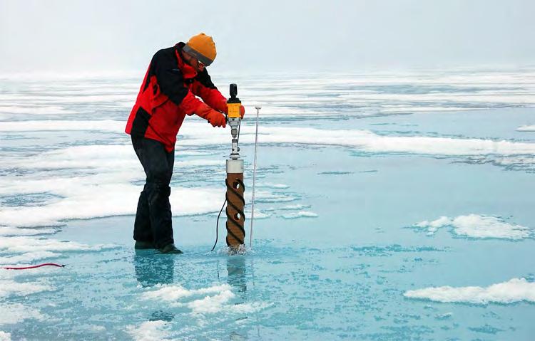
7 Arctic Climate Modeling Program scientists installed weather stations at schools in Bering Strait villages so students could collect data useful to university research. In many of these remote areas of Alaska, scientists had never before been able to collect weather data.

8 S.N.O.W. Teachers and students entered local weather and frost depth data into S.N.O.W., an online portal accessible from the ACMP Website. Online graphs and charts compare data from 15 Bering Strait villages.

9 One unanticipated outcome was the value village residents placed on locally collected student data. Local residents retrieved data from school weather stations and made it available for the entire community. They also downloaded near-real time satellite imagery from the ACMP website to help others in the community determine when local weather and sea ice conditions were favorable for subsistence hunting.


10 Including Native language terms for weather and climate in classroom lessons increased student understanding of Earth system science. Indigenous languages often contain action words that reveal cause-and-effect relationships and offer insight into Earth s geophysical processes.


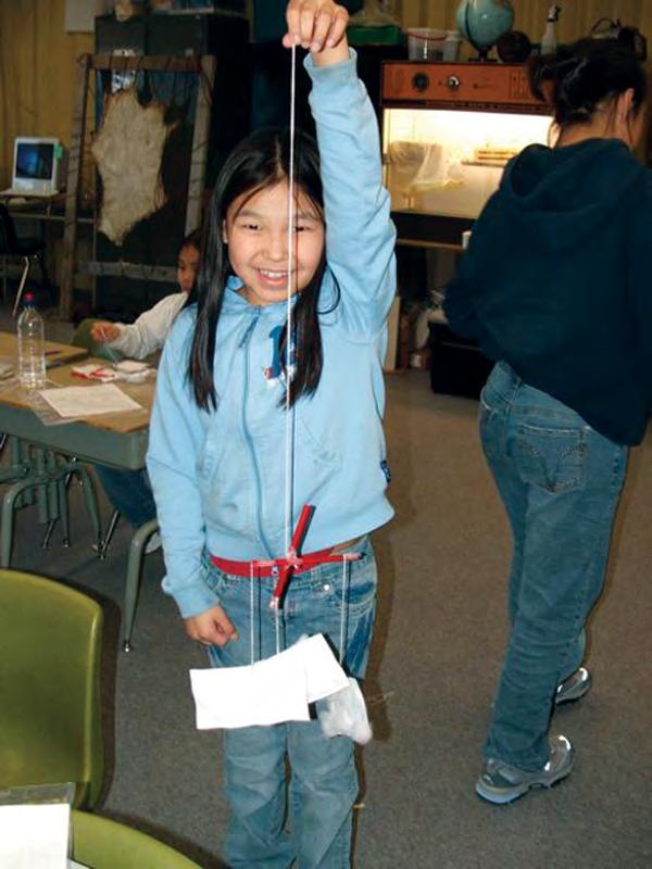
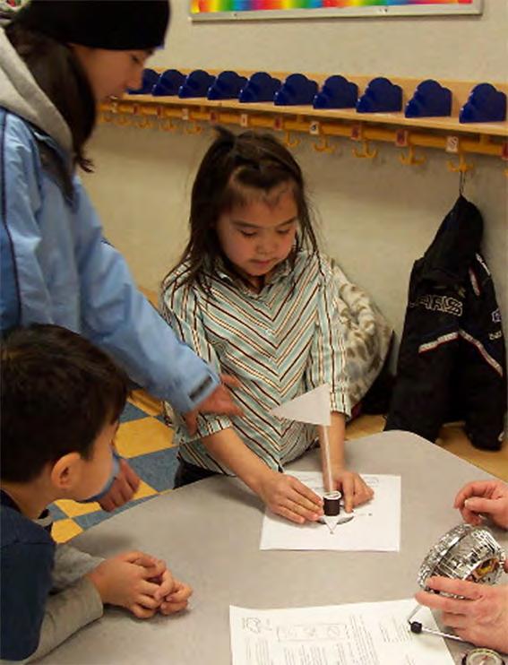
11 Place-based standard-aligned lessons focus on hands-on activities, supplemented by interactive multimedia to help students visualize complex scientific concepts.

12 Online Professional Development for Teachers Online Professional Development A NASA Global Climate Change Education Program University of Alaska Fairbanks Geophysical Institute A NASA Global Climate Change Education Program

 are")
13 Scientists believe the cryosphere is a key indicator of climate change. The cryosphere collectively describes the portions of Earth that are frozen. Online Professional Development for Teachers A NASA Global Climate Change Education Program University of Alaska Fairbanks Geophysical Institute Parts of the cryosphere (permafrost, sea ice, and snow cover) are undergoing dramatic change as a result of recent climate changes.

14 Teachers incorporate NASA data on permafrost collected from space, sky and underground to paint a picture of how climate changes affect the cryosphere. Online Professional Development for Teachers A NASA Global Climate Change Education Program University of Alaska Fairbanks Geophysical Institute The Indigenous Knowledge Database of Native observations of climate-induced change helps triangulate the dramatic changes occurring in the Arctic.

15

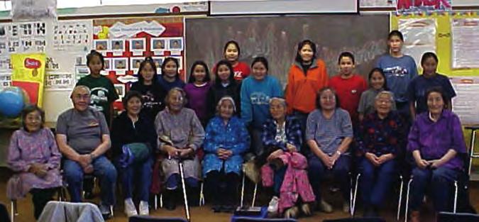
16 Scientists and Elders Working Together


17 Native Alaskans have made observations of the Arctic, and interpreted and adapted to changes in climate for thousands of years.


18 After working with standard-aligned, culturally relevant, place-based instruction on weather and climate, K-12 students look for solutions to local problems resulting from climate changes in the Arctic.


19

 are undergoing dramatic change as a result")
20 Scientists believe the cryosphere is a key indicator of global climate change. PREPARES Preparing Responsive Educators using Place-based Authentic Research in Earth Systems An NSF-ITEST Nationwide Scale-up of the Arctic Climate Modeling Program Parts of the cryosphere (sea ice, snow cover, and permafrost) are undergoing dramatic change as a result of recent climate trends.


21 In PREPARES, Yupik Alaska Native students will work with Native Hawaiian students to analyze and share climate data unique to their locations, model future climate scenarios, and devise plans for adapting to forecasted changes.


22 Alaska Hawaii 30 matched classrooms 30 matched classrooms Control STEM content only Treatment STEM + Indigenous


23 PREPARES Core Curriculum is being created with scientists and industry experts in both Alaska and Hawaii.


24 Yupik Elders dancing with the Northern Lights. In the Treatment Group, students will learn Alaskan Yupik and Native Hawaiian language terms for a variety of climate processes and then share them with each other. Students also will compare and contrast their cultural beliefs, and come to understand how the community of their heritage conducts climate research. Namakaokaha i


25 Encourages knowledge exchange among scientists, Elders, and students Blends western and indigenous practices and language terminology Incorporates skills used in STEM careers Involves students in research that is relevant to their local communities Focuses on learning and sharing placebased climate data and information Rests on evidence-based methods for engaging indigenous students, such as tactile lessons and visual activities Infuses cultural methods of instruction, such as story telling, dance, and art with data collection, graphing and inquiry Fosters local-to-global stewardship

26 Contact Kathryn Berry Bertram, Ph.D. Education Director UAF Geophysical Institute C.T. Elvey Building All photos courtesy of the UAF Geophysical Institute, unless otherwise noted.
Developing Cross-cultural Education Programs
 Developing Cross-cultural Education Programs Kathy Bertram Director, Education Outreach Office Geophysical Institute University of Alaska Fairbanks Communicating Science in Native Cultures Alaska Native
OBSERVE AND REPORT. Overview: Objectives: Targeted Alaska Grade Level Expectations: Vocabulary: Materials: Whole Picture:
 Overview: In this lesson, students are introduced to various methods of learning about weather and climate through an interactive multimedia file. Students awareness of weather is further heightened by
Weather Observation Journal
 Weather Observation Journal Levels Overview: Elders and scientists alike use Weather Observation Journals to note patterns in the weather and to have a written record of stories and information shared
Activity 2 Changes Close to Home
 Activity 2 Changes Close to Home Forces of Change >> Arctic >> Activity 2 >> Page 1 ACTIVITY 2 CHANGES CLOSE TO HOME ORAL CLIMATE HISTORY PROJECT Documenting Cultural Knowledge, Savoonga, Alaska Smithsonian
Activity 1 Eyewitnesses to Change
 Activity 1 Eyewitnesses to Change Forces of Change >> Arctic >> Activity 1 >> Page 1 EYEWITNESSES TO CHANGE NATIVE PEOPLES OBSERVE CLIMATE CHANGES IN THE ARCTIC Living With Change Sachs Harbour, Canada
Global Climate Change
 Global Climate Change Overview: Students will learn about global climate change, what causes global warming, and scientific projections about climate change in the near future. Levels V-VI Grades 9-12
In this activity, students will make a classroom weather report chart and record data for four weeks.
 Weather Report Chart s Overview: In this activity, students will make a classroom weather report chart and record data for four weeks. Objectives: The student will: measure temperature, precipitation,
Tell students that Earth is the only planet in our solar system known to have life. Ask:
 This website would like to remind you: Your browser (Safari 7) is out of date. Update your browser for more security, comfort and the best experience on this site. Activityengage The Vastness of Space
Sea Ice Board Game. Overview: Objectives: GLEs Addressed: Whole Picture: Materials: Levels III-IV. Grades 5-8
 Sea Ice Board Game Overview: Students review the types of sea ice and are introduced to the four stages of the sea ice cycle. Students enhance and demonstrate their knowledge by playing a sea ice board
Changing Landscapes. Coastal Erosion. Middle School Guide. REACH Up Raising Educational Achievement. through Cultural Heritage Up
 Changing Landscapes Coastal Erosion Middle School Guide REACH Up Raising Educational Achievement through Cultural Heritage Up Changing Landscapes How does climate change impact the landscape? The climate
MIDDLE TENNESSEE STATE UNIVERSITY Earth Science (Endorsement in Earth Science 7-12) Page 1 of 9
 Page 1 of 9") (Endorsement in 7-12) Page 1 of 9 Undergraduate Catalog The goals of science education are to enable the student to demonstrate an understanding of science as an inquiry process; develop scientific knowledge
(Endorsement in 7-12) Page 1 of 9 Undergraduate Catalog The goals of science education are to enable the student to demonstrate an understanding of science as an inquiry process; develop scientific knowledge
Trends Forecasting. Overview: Objectives: GLEs Addressed: Materials: Activity Procedure:
 Trends Forecasting Overview: How do meteorologists forecast weather? Students learn one of 5 main methods for forecasting weather, use it to create a forecast, and analyze results. Objectives: The student
Techniques for Science Teachers: Using GIS in Science Classrooms.
 Techniques for Science Teachers: Using GIS in Science Classrooms. After ESRI, 2008 GIS A Geographic Information System A collection of computer hardware, software, and geographic data used together for
Your web browser (Safari 7) is out of date. For more security, comfort and. the best experience on this site: Update your browser Ignore
 is out of date. For more security, comfort and. the best experience on this site: Update your browser Ignore") Your web browser (Safari 7) is out of date. For more security, comfort and Activitydevelop the best experience on this site: Update your browser Ignore Extracting Gas from Shale How is natural gas extracted
Your web browser (Safari 7) is out of date. For more security, comfort and Activitydevelop the best experience on this site: Update your browser Ignore Extracting Gas from Shale How is natural gas extracted
Mapping Climate Change in a Yupik Eskimo Village
 Mapping Climate Change in a Yupik Eskimo Village Stephen C. Brown, Ph.D. University of Alaska Fairbanks Cooperative Extension Service scbrown4@alaska.edu Terence Reeve University of Alaska Fairbanks Marine
Weather Observation Journal
 Weather Observation Journal Overview: Elders and scientists alike use Weather Observation Journals to note patterns in the weather and to have a written record of stories and information to share with
TIME SERIESLong Term Research
 TIME SERIESLong Term Research opens our eyes to the degree of an invisible present - a time-lapse of events that occur within one s lifetime. (Mangnuson,1990) Uncovering the hidden processes in science.
Subject: Geography Unit 1: The Earth
 Subject: Geography Unit 1: The Earth Learning outcomes Activities Resources Thinking Skills Language of Learning The earth s relief and its different forms such as mountains, valleys, plains. The parts
Activity 7: Be an Aurora Forecaster
 ACTIVITY 7 NASA/STEREO Be an Aurora Forecaster Iñupiaq value: Respect for Nature We can predict when the northern lights are likely to occur by monitoring solar activity. When a solar storm such as a coronal
What Is It Like Outside?
 What Is It Like Outside? Focus: Students will describe daily changes in temperature and weather. Specific Curriculum Outcomes Students will be expected to: 1.0 pose questions that lead to exploration and
Hunting for Planets. Overview. Directions. Content Created by. Activitydevelop. How can you use star brightness to find planets?
 This website would like to remind you: Your browser (Safari 7) is out of date. Update your browser for more security, comfort and the best experience on this site. Activitydevelop Hunting for Planets How
1. Engage students in a discussion about conditions that are necessary for life.
 This website would like to remind you: Your browser (Safari 7) is out of date. Update your browser for more security, comfort and the best experience on this site. Activitydevelop Habitable Conditions
MIDDLE TENNESSEE STATE UNIVERSITY Global Studies / Cultural Geography Major Matrix Page 1 of 7
 Page 1 of 7 I. Social Studies Core GS 4990 (3) Senior Seminar in Global Studies SSC 1. Demonstrate critical thinking in the social sciences by GEOG 2000 (1/3) Introduction to Regional Geography posing
Drinkable Snow. Overview: Objectives: Materials: Activity Preparation: Activity Procedure: Levels I-II. Grades K-4
 Overview: In this lesson, students explore the uses of ice and snow through interviews with local Elders and classroom readings. Objectives: The student will: listen to a story; identify types of snow
The Arctic Ocean. Grade Level: This lesson is appropriate for students in Grades K-5. Time Required: Two class periods for this lesson
 The Arctic Ocean Lesson Overview: This lesson will introduce students to the Eastern Arctic Region and the benefits of the Arctic Ocean to the people who live in the Far North. This lesson can be modified
Glaciology Exchange (Glacio-Ex) Norwegian/Canadian/US Partnership Program
 Norwegian/Canadian/US Partnership Program") Glaciology Exchange (Glacio-Ex) Norwegian/Canadian/US Partnership Program Luke Copland University of Ottawa, Canada Jon Ove Hagen University of Oslo, Norway Kronebreeen, Svalbard. Photo: Monica Sund The
Glaciology Exchange (Glacio-Ex) Norwegian/Canadian/US Partnership Program Luke Copland University of Ottawa, Canada Jon Ove Hagen University of Oslo, Norway Kronebreeen, Svalbard. Photo: Monica Sund The
C1: From Weather to Climate Looking at Air Temperature Data
 C1: From Weather to Climate Looking at Air Temperature Data Purpose Students will work with short- and longterm air temperature data in order to better understand the differences between weather and climate.
Alaska ACE Education Programs
 Alaska ACE Education Programs Elena Bautista Sparrow, Tania Clucas, Holly McQueen, Sarai, Timothy, Chip McMuellen, Gary Kofinas, Sanjay Pyare, Andy Kliskey, Tom Moran, Alan Boraas, John Monahan, Denise
EXECUTIVE SUMMARY OF EVALUATION FINDINGS
 B R A I N P R O F E S S I O N A L D E V E L O P M E N T EXECUTIVE SUMMARY OF EVALUATION FINDINGS R E P O R T B Y : J E A N I N E A N C E L E T N O V E M B E R 1 5, 2 0 1 7 Jeanine E. Ancelet - Audience
Effects of Global Warming on Coastal Cities: A Katrina Case Study
 Effects of Global Warming on Coastal Cities: A Katrina Case Study Introduction This lesson was created to discuss the possible effects of temperatures increasing worldwide, with a focus on the events that
Arctic Science & Engineering. Martin Jeffries. Ron Liston Seminar, 17 October PhD. MSc. Calgary ( ) UK ( )
 UK ( )") Arctic Science & Calgary (1981-1985) Engineering PhD Martin Jeffries MSc Ron Liston Seminar, 17 October 2018. UK (1979-1981) Outline Career Background Research Background The State of the Arctic Arctic
Arctic Science & Calgary (1981-1985) Engineering PhD Martin Jeffries MSc Ron Liston Seminar, 17 October 2018. UK (1979-1981) Outline Career Background Research Background The State of the Arctic Arctic
The maps in this resource can be freely modified and reproduced in the classroom only.
 Teacher's Notes In this activity, students work collaboratively to explore sections of old and new maps. By closely examining these documents, students learn to see maps as more than just tools for locating
Elem Reading I Methods. Elem Writing Methods. Elem SS Methods. Elem Reading II Methods
 Crosswalk: CO TQ + INTASC + CAEP Standards with TE Courses: July 2015 DRAFT 1 Learning & Dev Foundations 4322/ CO TQ 1a Teachers provide instruction that is aligned with the Colorado Academic Standards
Module 2 Educator s Guide Overview
 Module 2 Educator s Guide Overview Water, water almost everywhere? Module Overview The presence of water in solid, liquid, and gaseous forms is one of the primary factors that distinguishes Earth from
Village Weather, Snow, Ice, Breakup, Flooding, Fire sites
 Village Weather, Snow, Ice, Breakup, Flooding, Fire sites What is the weather like now in Villages?... 1 BREAKUP:... 2 Flooding... 3 Fires... 5 Weather Predictability, Weather and Ice Advisories and How
Day and Night. Fast Facts. Stage 1 Desired Results. Established Goals. Understandings. Essential Questions
 Day and Night Fast Facts Curriculum Area: Science Grade Level: Grade 1 Suggested Duration: 120 minutes Stage 1 Desired Results Established Goals Science Content Standard 4: Students, through the inquiry
Course Outline School Name: KEEWAYTINOOK INTERNET HIGH SCHOOL Department Name: Science
 Course Outline School Name: KEEWAYTINOOK INTERNET HIGH SCHOOL Department Name: Science Ministry of Education Course Title: Chemistry Grade Level:11 Ministry Course Code: SCH3U Teacher's Name: Raj Budhram
STUDY GUIDE. Exploring Geography. Chapter 1, Section 1. Terms to Know DRAWING FROM EXPERIENCE ORGANIZING YOUR THOUGHTS
 For use with textbook pages 19 22. Exploring Geography Terms to Know location A specific place on the earth (page 20) absolute location The exact spot at which a place is found on the globe (page 20) hemisphere
Sea Ice and Satellites
 Sea Ice and Satellites Overview: Students explore satellites: what they are, how they work, how they are used, and how to interpret satellite images of sea ice using Google Earth. (NOTE: This lesson may
[5] SA1.2 The student demonstrates an understanding of the processes of science by using
![[5] SA1.2 The student demonstrates an understanding of the processes of science by using](/thumbs/85/92104322.jpg "[5] SA1.2 The student demonstrates an understanding of the processes of science by using") Overview: Students learn the composition and layers of the atmosphere through discussion, creation of a scale model, and a written exercise. (NOTE: This lesson may require more than one class period. Students
Overview: Students learn the composition and layers of the atmosphere through discussion, creation of a scale model, and a written exercise. (NOTE: This lesson may require more than one class period. Students
Beginning Orienteering Post visit
 Beginning Orienteering Post visit Classroom Activities Brief Synopsis The post activities are designed to reinforce what the students learned at Eagle Bluff and practice the skill of map reading. Students
Hudson River Estuary Climate Change Lesson Project. Grades 5-8 Teacher s Packet. Lesson 3. Climate Change in My City
 Grades 5-8 Teacher s Packet Lesson 3 Climate Change in My City Teacher s Packet 2 Climate Change in My City NYS Intermediate Level Science Standard 1: Analysis, Inquiry and Design/Scientific Inquiry S1.3
Hudson River Estuary Climate Change Lesson Project. Grades 5-8 Teacher s Packet. Lesson 2. Observing Changes at Mohonk Preserve
 Grades 5-8 Teacher s Packet Lesson 2 Observing Changes at Mohonk Preserve 2 Observing Changes at Mohonk Preserve NYS Intermediate Level Science Standard 1: Analysis, Inquiry and Design/Scientific Inquiry
GIS Visualization: A Library s Pursuit Towards Creative and Innovative Research
 GIS Visualization: A Library s Pursuit Towards Creative and Innovative Research Justin B. Sorensen J. Willard Marriott Library University of Utah justin.sorensen@utah.edu Abstract As emerging technologies
Factors that Shape Places (Blacktown) Stage 3 Geography
 Stage 3 Geography") Factors that Shape Places (Blacktown) Stage 3 Geography Summary This unit is written for Stage 3 "Factors that shape places". It is a Geographical Inquiry, enabling students to work through the 3 stages
Factors that Shape Places (Blacktown) Stage 3 Geography Summary This unit is written for Stage 3 "Factors that shape places". It is a Geographical Inquiry, enabling students to work through the 3 stages
Changing the World of Geosciences
 Changing the World of Geosciences This is a great time to pursue graduate studies at the Jackson School of Geosciences. Since receiving one of the largest bequests in the history of higher education, we
Solving Systems of Linear Equations with the Help. of Free Technology
 Solving Systems of Linear Equations with the Help of Free Technology Calin Galeriu, Ph.D. 1. Introduction The use of computer technology when teaching new math concepts, or when solving difficult math
Teacher s Guide For. Measuring the Earth s Temperature
 Teacher s Guide For Measuring the Earth s Temperature For grade 7 - College Program produced by Centre Communications, Inc. for Ambrose Video Publishing, Inc. Executive Producer William V. Ambrose Teacher's
Course Outline. School Name: Keewaytinook Internet High School. Department Name: Canadian and World Studies. Ministry of Education Course Title:
 School Name: Keewaytinook Internet High School Department Name: Canadian and World Studies Course Outline Ministry of Education Course Title: Travel and Tourism: A Geographic Perspective Grade Level: 11
What's Going to Happen at Any Given Barometer Reading?
 What's Going to Happen at Any Given Reading? Summary Students will learn to recognize simple weather patterns. Main Core Tie Science 4th Grade Standard 2 Objective 2 Additional Core Ties Science 4th Grade
Climate Change: How it impacts Canadians and what we can do to slow it down.
 Climate Change: How it impacts Canadians and what we can do to slow it down. Lesson Overview This lesson takes stock of how climate change has already affected Canadians in geographic, economic, and cultural
Prentice Hall Science Explorer - Georgia Earth Science 2009
 Prentice Hall 2009 Grade 6 C O R R E L A T E D T O Georgia Performance s for Science Grade 6 FORMAT FOR CORRELATION TO THE GEORGIA PERFORMANCE STANDARDS Subject Area: Science State-Funded Course: Science/Grade
Unit 2: Astronomy. Content Area: Science Course(s): Generic Course Time Period: Marking Period 1 Length: approximately 15days Status: Published
: Generic Course Time Period: Marking Period 1 Length: approximately 15days Status: Published") Unit 2: Astronomy Content Area: Science Course(s): Generic Course Time Period: Marking Period 1 Length: approximately 15days Status: Published Unit Summary (Content) This unit is broken down into three
Unit 2: Astronomy Content Area: Science Course(s): Generic Course Time Period: Marking Period 1 Length: approximately 15days Status: Published Unit Summary (Content) This unit is broken down into three
An Arctic Perspective NCEI's Prototype Arctic Data Viewer
 An Arctic Perspective NCEI's Prototype Arctic Data Viewer NCEI Arctic Action Team Kate Rose NOAA National Environmental Satellite, Data, and Information Service National Centers for Environmental Information
V Q \ = 7]Z 4IVL 126 Unit 5
![V Q \ = 7]Z 4IVL 126 Unit 5](/thumbs/77/75709676.jpg "V Q \ = 7]Z 4IVL 126 Unit 5") 126 Unit 5 Is it cold and windy? Or is it a sunny day? Is it raining cats and dogs? Or can we go out to play? I will learn to talk about seasons and weather plant life environments caring for the earth
126 Unit 5 Is it cold and windy? Or is it a sunny day? Is it raining cats and dogs? Or can we go out to play? I will learn to talk about seasons and weather plant life environments caring for the earth
Subject: Science Course Title: Earth & Grade Level(s): 8th
: 8th") Teacher: Mike Valenti School: Mt. Tabor Middle School Subject: Science Course Title: Earth & Grade Level(s): 8th Space Is high school credit an option for this course? Yes X No Prerequisites: None Course
Teacher: Mike Valenti School: Mt. Tabor Middle School Subject: Science Course Title: Earth & Grade Level(s): 8th Space Is high school credit an option for this course? Yes X No Prerequisites: None Course
GPS Mapping. Teacher Instructions. Overview: Objectives: Materials: Answers to Student Worksheets:
 Overview: Scientists use Global Positioning System (GPS) receivers to map lava flows. GPS data are compiled by computer Geographic Information System (GIS) software into a digital map. Digital maps can
3. Recognize that when a science investigation is replicated, very similar results are expected.
 STANDARD 5.1 SCIENTIFIC PROCESSES ALL STUDENTS WILL DEVELOP PROBLEM-SOLVING, DECISION-MAKING AND INQUIRY SKILLS, REFLECTED BY FORMULATING USABLE QUESTIONS AND HYPOTHESES, PLANNING EXPERIMENTS, CONDUCTING
United States of America Geography
 United States of America Geography Part I by Sonja E. Schild LearnSmart Publishing Co. Vancouver, BC, Canada Phone: (604) 433-1347 ISBN 0-9694445-3-9 Notice! All rights reserved. Permission to reproduce
Activity 4 It s a Cool Color
 Activity 4 It s a Cool Color Forces of Change >> Arctic >> Activity 4 >> Page 1 ACTIVITY 4 IT S A COOL COLOR THE ALBEDO EFFECT AND CLIMATE OVERVIEW SUGGESTED GRADE LEVEL ALIGNMENT WITH NATIONAL STANDARDS
Unit: Climate and Weather General Task Effects of Earth s Tilt on Climate
 The following instructional plan is part of a GaDOE collection of Unit Frameworks, Performance Tasks, examples of Student Work, and Teacher Commentary. Many more GaDOE approved instructional plans are
INSTRUCTIONAL FOCUS DOCUMENT HS/Integrated Physics and Chemistry (IPC)
") Exemplar Lesson 01: Conservation of Mass Exemplar Lesson 02: Exothermic and Endothermic Reactions Exemplar Lesson 03: Nuclear Reactions State Resources: RATIONALE: This unit bundles student expectations
Exemplar Lesson 01: Conservation of Mass Exemplar Lesson 02: Exothermic and Endothermic Reactions Exemplar Lesson 03: Nuclear Reactions State Resources: RATIONALE: This unit bundles student expectations
Amarillo ISD Science Curriculum
 Amarillo Independent School District follows the Texas Essential Knowledge and Skills (TEKS). All of AISD curriculum and documents and resources are aligned to the TEKS. The State of Texas State Board
Unlocking the Power of Geographic Inquiry. Thomas Herman, PhD Director, California Geographic Alliance Department of Geography, San Diego State Univ.
 Unlocking the Power of Geographic Inquiry Thomas Herman, PhD Director, California Geographic Alliance Department of Geography, San Diego State Univ. Why I am here, and how I got here A few words about
Looking for Signs of Life. Overview. Directions. Content Created by. Activitydevelop. How do scientists determine whether a planet has life?
 This website would like to remind you: Your browser (Safari 7) is out of date. Update your browser for more security, comfort and the best experience on this site. Activitydevelop Looking for Signs of
BS degrees awarded by race/ethnicity 2014
 BS degrees awarded by race/ethnicity 2014 Race or Ethnicity % of population Ocean Science BS (%) Earth Science BS (%) White 62.1 80 80 Hispanic 17.4 6.8 7.7 Black 12.4 3.2 2.1 Asian 5.3 6.8 3.3 Am. Indian/
Early Experience in Semantics: The Semantic Sea Ice Interoperability Initiative Ruth Duerr
 Early Experience in Semantics: The Semantic Sea Ice Interoperability Initiative Ruth Duerr Partners: Mark A. Parsons, Siri Jodha Singh Khalsa, Peter Pulsifer National Snow t Ice Data Center, Univ. Colorado
Module 4 Educator s Guide Overview
 Module 4 Educator s Guide Overview Paths Module Overview This module looks at many different kinds of paths and considers why paths are where they are and how they look from space. Paths are usually not
Teaching GIS Technology at UW-Superior. Volume 9, Number 8: May 23, 2003
 Teaching GIS Technology at UW-Superior Volume 9, Number 8: May 23, 2003 William Bajjali University of Wisconsin, department of Biology and Earth Science, Superior, WI 54880 Abstract As educators, it is
Factors that Shape Places Stage 3 Geography
 Factors that Shape Places Stage 3 Geography Summary This unit is written for Stage 3 "Factors that shape places". It is a Geographical Inquiry, enabling students to work through the 3 stages of inquiry;
Geography: Place & Liveability
 Geography: Place & Liveability Learning Area(s) Geography Year(s) 6, 7 Description AC Geography : Year 6 A diverse and connected world takes a global view of geography and focuses particularly on the concepts
Tracking Ash Plumes. Teacher Instructions. Overview: Objectives: Materials: Answers to Student Worksheet:
 Teacher Instructions Tracking Ash Plumes Overview: Composite volcanoes usually erupt with large clouds of ash, called ash plumes. Volcanologists track ash plumes and relay the information to air traffic
Clouds & Mission for NASA
 Clouds & Mission for NASA Name: Danielle Leavitt Estimated Time: 1 hr. 10 min. + Daily NASA Observations Content Area(s): Science Grade Level(s): 4th Number of Students: 30 Stage 1- Desired Results Established
Inuit Circumpolar Council
 TRADITIONAL KNOWLEDGE OF THE LAST ICE AREA WWF Last Ice Area Workshop Iqaluit June 4 & 5, 2013 Pitsey Moss-Davies, Research Coordinator ICC Canada Circumpolar Inuit 160,000 Inuit live in the Arctic spread
WHAT IS THE ROCK CYCLE?
 Overview In this lesson, students will conduct an investigation to learn how rock changes from one type to another in the rock cycle. Objectives On successful completion of this lesson, students will be
Citizen Science and Arctic Observing: Using the Internet and Simple Technologies to Improve Understanding of Arctic Ecosystem Change
 Citizen Science and Arctic Observing: Using the Internet and Simple Technologies to Improve Understanding of Arctic Ecosystem Change Maribeth S. Murray 1, Phillip A. Loring 2, Howard Ferren 3 and Rebekka
Lab-Aids Correlations for ARIZONA SCIENCE STANDARDS HIGH SCHOOL LEVEL, EARTH SCIENCE 1. January 2019
 Lab-Aids Correlations for ARIZONA SCIENCE STANDARDS HIGH SCHOOL LEVEL, EARTH SCIENCE 1 January 2019 Mark Koker, Ph D, Director of Curriculum &Professional Development, Lab-Aids Lisa Kelp, Curriculum Specialist,
Careful, Cyclones Can Blow You Away!
 Title: Careful, Cyclones Can Blow You Away! (Meteorology) Grade(s): 6-8 Introduction: Most people associate twisters with tornadoes, but in fact tropical twisters come from hurricanes. Hurricanes are what
Grade 11 Student Electives Guidelines for 2015/16
 Grade 11 Student Guidelines for 2015/16 Overview As part of Abu Dhabi Education Council s continuous improvements efforts towards raising the standard of education in the Emirate of Abu Dhabi, the Cycle
EXPLORE PLATE TECTONICS & MORE THROUGH GPS DATA. Shelley Olds, UNAVCO April 12, 2018 NGSS Webinar
 EXPLORE PLATE TECTONICS & MORE THROUGH GPS DATA Shelley Olds, UNAVCO April 12, 2018 NGSS Webinar Today s Outline Central question: How do we know the tectonic plates are still moving? -- What evidence
A Correlation of. Pearson myworld Social Studies We Are Connected to the
 A Correlation of Pearson myworld Social Studies We Are Connected 2013 Standard 2-1: The student will demonstrate an understanding of the local community as well as the fact that geography influences not
Activity 6 Ride the Arctic Climate Rollercoaster
 Activity 6 Ride the Arctic Climate Rollercoaster Forces of Change >> Arctic >> Activity 6 >> Page 1 ACTIVITY 6 RIDE THE ARCTIC CLIMATE ROLLERCOASTER CLIMATE CHANGE IN THE ARCTIC SINCE THE ICE AGE Graphic
Graphing the Weather. Main Core Tie
 Graphing the Weather Summary Students take weather readings using simple weather instruments and predict the weather in this lesson. They take readings for a month during a season and chart it. With the
The Bottom of the Ocean
 The Bottom of the Ocean Overview: In this lesson, students study bathymetric features of the ocean, predict how bathymetric features influence propagation and runup, then analyze an animation of a tsunami
Dear Teacher, Overview Page 1
 Dear Teacher, You are about to involve your students in one of the most exciting frontiers of science the search for other worlds and life in solar systems beyond our own! Using the MicroObservatory telescopes,
how fast is the wind? Levels III-IV Overview: Grades 5-8 Objectives: Targeted Alaska Grade Level Expectations: Vocabulary: Whole Picture:
 how fast is the wind? Levels Overview: Traditional knowledge of wind is important to indigenous people for many reasons, including success in hunting and safety in travel. Knowledge of wind speed and direction
Winter Solstice. PreK- 6th A FREE RESOURCE PACK FROM EDUCATIONCITY. Topical Teaching Resources. Grade Range
 A FREE RESOURCE PACK FROM EDUCATIONCITY Winter Solstice PreK- 6th Topical Teaching Resources Grade Range Free school resources by EducationCity. This may be reproduced for class use. Winter Solstice Topical
NES: Heat, Temperature and Energy: MESSENGER Cooling With Sunshades
 LIVE INTERACTIVE LEARNING @ YOUR DESKTOP NES: Heat, Temperature and Energy: MESSENGER Cooling With Sunshades Presented by: Jordan Snyder November 10, 2011 6:30 p.m. - 8:00 p.m. Eastern time Mercury Surface
Welcome to PolarConnect. With Kelly McCarthy and NASA s Operation IceBridge
 Welcome to PolarConnect With Kelly McCarthy and NASA s Operation IceBridge 5 May 2016 If you are joining by phone, please mute your phone. Press *6 to mute and *6 to unmute. Participant Introductions In
Overview: Key Concepts: Time: 2, minute class periods. Materials:
 Text and Activities Adapted from: Teachers Domain, Texas A&M University: Ocean Drilling Distance Learning Program, The New York Times, Center for Remote Sensing of Ice Sheets (CReSIS), the Natural Resources
The Mystery of the Destroyed Weather Station
 Details Learning Resources Completion Time: Less than a week Permission: Download and Share The Mystery of the Destroyed Weather Station Overview: Students use data and pictures of a destroyed wind sensor,
Rebecca Nayler Medium term planning. Curriculum area GEOGRAPHY - AUTUMN 2016
 Medium term planning Curriculum area GEOGRAPHY - AUTUMN 2016 As geographers we are getting better at: LO s EYFS Early Learning Goal Children know about similarities and differences in relation to places,
2018 ESRI Education Summit. San Diego. California. Sunday July 8 th 2018 Harper College, Palatine, Illinois, USA Dr. Tong Cheng (Biology), Dr.
, Dr.") 2018 ESRI Education Summit. San Diego. California. Sunday July 8 th 2018 Harper College, Palatine, Illinois, USA Dr. Tong Cheng (Biology), Dr. James Gramlich (Sociology), Mukila Maitha (Geography), Dr.
2018 ESRI Education Summit. San Diego. California. Sunday July 8 th 2018 Harper College, Palatine, Illinois, USA Dr. Tong Cheng (Biology), Dr. James Gramlich (Sociology), Mukila Maitha (Geography), Dr.
Your web browser (Safari 7) is out of date. For more security, comfort and. the best experience on this site: Update your browser Ignore
 is out of date. For more security, comfort and. the best experience on this site: Update your browser Ignore") Your web browser (Safari 7) is out of date. For more security, comfort and Activityengage the best experience on this site: Update your browser Ignore The Arctic Region Where is the Arctic region and why
Your web browser (Safari 7) is out of date. For more security, comfort and Activityengage the best experience on this site: Update your browser Ignore The Arctic Region Where is the Arctic region and why
Welcome Survey getting to know you Collect & log Supplies received Classroom Rules Curriculum overview. 1 : Aug 810. (3 days) 2nd: Aug (5 days)
 2nd: Aug (5 days)") 1st Quarter (41Days) st 1 : Aug 810 (3 days) 2nd: Aug 13-17 Reporting Categories (TEKS SEs) Skill Create and write a postcard about your favorite community activity Review 2nd Grade Vocabulary Chapter
1st Quarter (41Days) st 1 : Aug 810 (3 days) 2nd: Aug 13-17 Reporting Categories (TEKS SEs) Skill Create and write a postcard about your favorite community activity Review 2nd Grade Vocabulary Chapter
Pacing: Block = 45 minutes
 Name Class Date _ Learning Unit: Inquiry (Mathematics); Interactions (Science) Lesson Plan: Counting Sunspots Content Strand: Data Analysis and Probability (Mathematics); Content Strand: Energy Transformation
K- 5 Academic Standards in. Social Studies. June 2013
 - 5 Academic s in Social Studies June 2013 Word Tables of s ONLY This Word version of the 2.17.12 social studies standards (DRAFT for Rulemaking 2.17.12) document contains the standards ONLY; no explanatory
Pan-Arctic Digital Elevation Map (Pan-Arctic DEM)
") Memorandum to CAFF Board 07/28/2017 BACKGROUND: Pan-Arctic Digital Elevation Map (Pan-Arctic DEM) ArcticDEM is a National Geospatial-Intelligence Agency (NGA)-National Science Foundation (NSF) publicprivate
Memorandum to CAFF Board 07/28/2017 BACKGROUND: Pan-Arctic Digital Elevation Map (Pan-Arctic DEM) ArcticDEM is a National Geospatial-Intelligence Agency (NGA)-National Science Foundation (NSF) publicprivate
STAMP Spa)al Tools for Arc)c Mapping & Planning. Creating an interactive data tool to improve access and usability of Arctic data
al Tools for Arc)c Mapping & Planning. Creating an interactive data tool to improve access and usability of Arctic data") STAMP Spa)al Tools for Arc)c Mapping & Planning Creating an interactive data tool to improve access and usability of Arctic data Mission Provide easy access to physical, chemical, and biological data Network
STAMP Spa)al Tools for Arc)c Mapping & Planning Creating an interactive data tool to improve access and usability of Arctic data Mission Provide easy access to physical, chemical, and biological data Network
Science Grade 01 Unit 07 Exemplar Lesson 02: Investigating the Moon, the Stars, and the Sky
 Grade 1 Unit: 07 Lesson: 02 Suggested Duration: 5 days Grade 01 Unit 07 Exemplar Lesson 02: Investigating the Moon, the Stars, and the Sky This lesson is one approach to teaching the State Standards associated