Impact of the Human Activities on the Local Climate and Environment of the Suez City in Egypt
|
|
|
- Rachel Hardy
- 5 years ago
- Views:
Transcription

1 International Journal of Geosciences, 2014, 5, Published Online June 2014 in SciRes. Impact of the Human Activities on the Local Climate and Environment of the Suez City in Egypt Mona Fouad Kaiser Geology Department, Faculty of Science, Suez Canal University, Ismailia, Egypt Received 9 April 2014; revised 6 May 2014; accepted 2 June 2014 Copyright 2014 by author and Scientific Research Publishing Inc. This work is licensed under the Creative Commons Attribution International License (CC BY). Abstract Surface temperature and vegetation are the major land cover changes that significantly affect on the thermal environment. In the present study, remote sensing techniques were applied to identify the relationship between anthropogenic activities and the thermal environment in the North Gulf of Suez area. Results have indicated that the urbanization and agricultural expansion have been increased during the last 25 years. Although urban areas increased from 49 km 2 in 1987 to 57 km 2 in 2012, the urban heat island-range declined from very high and high, to moderate and low. An expansion in cultivated areas from 3 km 2 in 1987 to 26 km 2 in 2012 was responsible for the decline. The results of this study provided valuable information for understanding the local thermal changes that associate rapid urbanization and expansion of cultivated areas. Consequently, this work recommends that proper planning and management regimes for land use and cover changes associated with rapid urbanization will result in positive impacts on the local climate and environment. Keywords Urban Heat Island, Urbanization, Vegetation Expansion, North Gulf of Suez, Image Classification 1. Introduction Human activities during different civilizations have long been known to be categorized in either urbanization or cultivation. Urbanization has been and remains a major form of land use and land cover changes in human history [1]. The replacement of vegetation-cover by an urban highly impervious landscape, such as asphalts, concrete, and building rooftops prevents precipitation to penetrate soils. Urbanized areas usually exhibit high ther- How to cite this paper: Kaiser, M.F. (2014) Impact of the Human Activities on the Local Climate and Environment of the Suez City in Egypt. International Journal of Geosciences, 5,
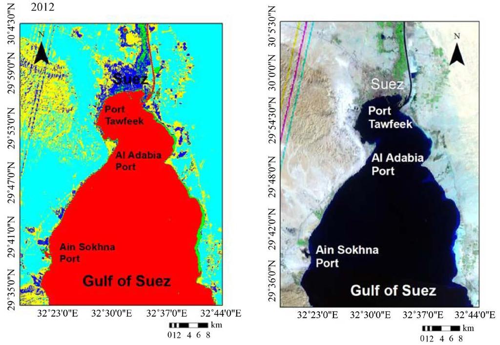
2 mal conductivity and radiation heat budgets, characterized by increased atmospheric and surface temperatures when compared to the surrounding rural areas [2]. Urban materials, including construction materials, roofs, asphalt, concrete, metals, and roads absorb more heat from the sun. The subsequent energy release causes urban areas to be warmer than the surrounding non-urban areas, giving rise to the urban heat effect [3]. Therefore, the temperature difference between urban and rural areas contributes to the development of the Urban Heat Island (UHI). UHI quantitatively describes the increased temperature of either the urban surface, or the urban atmosphere compared to rural surroundings due to increased anthropogenic activities or the consequences of human activities. [4] emphasized a number of factors associated with UHI intensity, including building density [5], industrial areas [6], impervious surface fraction [7], population concentration [8], and road density [9]. Remote sensing and geographic information system (GIS) techniques are powerful and effective tools widely applied in detecting the spatio-temporal dynamics of land use cover changes. [10] integrated remote sensing and GIS to study the urban thermal environment in Guangzhou. Normalized Difference Build-up Index (NDBI), and Normalized Difference Vegetation Index (NDVI) were used to qualitatively evaluate the relationship between LST and land use/land cover (LULC). The results indicated that most urban developed regions were located in high LST areas. LST is commonly increased with the density of urban development and bare land, but decreased with vegetation cover [10]. Remote sensing data provide a continuous and synchronized portrayal of urban surface temperature spatial patterns [11]. [12] applied remote sensing technology and spatial/multivariate statistics methods to examine the impacts of rapid urbanization on the urban thermal environment of Guangzhou, South China. The results indicated that urbanization in Guangzhou had a substantial effect on the regional thermal environment, with notable UHIs during Mean temperatures were higher in urban areas than in the surrounding suburban/rural areas over the entire period. High temperature anomalies were closely associated with developed land, and heavily industrialized districts. Satellite-derived land surface temperatures (LSTs), obtained from satellite thermal infrared (TIR) imagery [13], were employed to characterize UHI phenomenon [11]. The approach is positively related with (NDBI), and negatively with (NDVI). The objectives of this study were to understand and analyze the local changes in thermal environment that occurred during a period of twenty-five years ( ) in the northern parts of the Gulf of Suez. The region has been experiencing a rapid expansion in urban development, and vegetation cover over the last 25 years. 2. Data 2.1. Study Area The Gulf of Suez basin is a northwest-elongated depression separating Sinai massif from the Eastern Desert Red Sea hills. It is a topographic sink within the stable shelf of Egypt which is characterized by intensive block faulting and massive accumulation of sediments [14]. The sedimentary succession of the Gulf of Suez is generally thick one, ranges in age from Carboniferous to Recent and non-conformably overlying the basement rocks. The geologic and tectonic setting of the study area is inherited due to the regional tectonic framework of the Gulf of Suez and Red Sea rift. The Suez Governorate is one of the fame Suez Canal Region s urban governorates. It is located at the northern tip of the Gulf of Suez, where the Suez Canal leads forward into the north (Figure 1). The Suez Governorate occupies a total surface area of ~9000 km 2. The area is bounded by Gabal Ataqa to the west and Suez Canal to the east. The Suez Governorate infrastructure is supported by investments in wide network of internal and transportation roads, energy-generation stations, companies of drinking and sewage water, mature industrial zones, economic free-zone, international harbours, etc. Furthermore, the Suez Governorate supports many investment industries, including petroleum, foods, basic chemicals and chemical products, basic metallic, and engineering and electronic industries. The Suez Governorate is divided into four administrative districts; The Suez City, Ataqa, Al-Ganayen, and Al-Arbaeen Districts. Ataqa District is a heavily industrial zone. Al-Ganayen District is a primarily zone of dense fruit cultivated lands. The Suez City is a growing industrial and commercial zone due to the presence of natural resources, including mineral and rock raw materials, ready-cultivated lands, growing fisheries, and scenery-touristic sites. Moreover, the Suez City centralizes most governmental commercial and economic bureaus and agencies. Al-Arbaeen District is a heavily populated urban area with many variable civilian activities. 701
3 2.2. Satellite Data Figure 1. Area of study. The satellite remote sensing provides a straightforward and consistent approach to determine the Urban Heat Island (UHI), expressing the thermal difference between urban and rural areas. In this study, the remote sensing images were used to recognize the relationship between the urban heat islands (UHI), and the land use changes during the time span extending from 1987 to Three sets of the remotely-sensed data were acquired; Landsat5 Thematic Mapper (TM) in 1987, and Enhanced Landsat Thematic Mapper Images Plus (ETM+) in 2000 and 2012 (Table 1). Using 3 remote sensing datasets are adequate during to monitor significant LULC changes in the study site. 3. Methods and Image Processing Two measuring methods are used to compute LST. These include 1) direct ground recorded LST, and 2) satellite-retrieved LST. The satellite-retrieved LST data have better advantages when compared to the ground measurements due to their high spatial resolution, extensive coverage area, and less time-consuming data retrieval. 702
4 Table 1. Landsat TM and ETM+ satellite images data. Data Landsat5 TM Landsat7 ETM+ Landsat7 ETM+ Resolution (m) Date 20 August September August 2012 Generally, the remotely-sensed thermal imagery provides the potential to improve our understanding of urban surface energy budgets, and observe UHI effects. Thermal imagery generates a time-synchronized dense temperature data grid, and distinctive temperatures for individual buildings [10]. Thermal infrared information from satellites can be converted to brightness temperature using Planck s law to measure surface temperatures [15]. In the present study, the remote sensing image processing techniques were applied to classify land cover, and extract the UHIs in the North Gulf of Suez area during the period extending from 1987 to Classification of Land Use and Land Cover Image classification is used to automatically categorize all pixels in an image into land cover classes or themes. Unsupervised classification was performed separately on the three sets of remotely-sensed images (Table 1) using a histogram peak cluster technique to identify dense or frequently occurring pixelated areas [16]-[20]. In the unsupervised approach, spectrally separable classes are determined to form a supervised classification scheme. ENVI 4.8 was used to process satellite image classifications. [21] applied supervised maximum likelihood classification (MLC) to detect land cover classes. Once a sufficient number of the spectral subclasses were obtained for all information classes, a maximum likelihood classification was performed with the full set of refined spectral classes [19]. MLC is a statistically complex approach to classify images for change detection; however several studies reported that the methodology is most effective for supervised classification [22] [23]. Supervised classification was verified for each year using field investigation information collected from more than 25 ground checkpoints Calculation of Urban Heat Islands (UHIs) Urban areas represent a complex mix of different land cover types and materials, including developed and vegetated areas, soil surfaces, and water bodies. Satellite sensors record earth s surface image from the radiance value, which depends on land cover spectral characteristics. UHIs were retrieved from the study area using ENVI 4.8 and ERDAS Imagine 9.3 as follows Digital Number (DN) Values to Spectral Radiance Conversion Landsat calibration equation [24] was used to convert the Landsat TM/ETM+ thermal infrared (TIR) band, low gain, ( μm) digital number (DN) to spectral radiance in units (W m 2 µm 1 sr 1 ). All specific calibration coefficients, and related parameters, including sun elevation, gain and offset were extracted from a level 1 product header or ancillary data record Spectral Radiance to Effective At-Sensor Brightness Temperature Conversion Spectral radiance was converted to the at-satellite brightness temperature (i.e. blackbody temperature) using Equation (1), [24] [25]. The K 1 and K 2 constant values for Landsat5 TM and Landsat7 ETM+ are shown in Table 2: T i = K2 K + 1 ln 1 L λ where: T i : effective at-satellite brightness temperature in Kelvin; K 1 : calibration constant 1 in W/(m 2 sr µm); (1) 703
5 Table 2. TM thermal band calibration constant. Units W/(m 2 sr µm) Kelvin Constant K 1 K 2 Landsat7 ETM Landsat5 TM K 2 : calibration constant 2 in Kelvin; L λ : spectral radiance at the sensor s aperture Effective At-Sensor Brightness Temperature to LST Conversion LST can be extracted using Equation (2), [12] and [4]: Ti Ts = Ti 1+ λ ln ε ρ where: T s : LST; T i : the effective at-satellite brightness temperature in Kelvin; λ: wavelength of the emitted radiance (λ = 11.5 µm for Landsat band 6 data); hc ρ = = mk, where h is the Plank s constant ( Js), c is the velocity of light (2.998 σ 10 8 m/s), and is the Boltzmann constant ( Wm 2 k 4 = J/k); ɛ: is the land surface spectral emissivity Normalizing LST Top-of-atmosphere (TOA) radiances, which are measured by satellite thermal infrared sensors, are the combination of three energy types. TOA includes the emitted radiance from Earth s surface, the upwelling radiance from the atmosphere, and the down welling radiance from the sky [26]. The differences between the TOA radiances, and land surface temperatures are influenced by atmospheric conditions. In the present study, despite the fact that the satellite images were selected during the same season, a normalization method was applied to avoid annual variation in atmospheric conditions [12]. This correction was performed by calculation of land surface spectral emissivity (ɛ), which varied significantly due to differences in soil and vegetation cover characteristics [27]. Land surface spectral emissivity values were estimated from NDVI values [28], (Table 3). NDVI was used to transform multispectral data into a single image band representing vegetation distribution [29]. NDVI values indicate the amount of green vegetation in a pixel. The standard algorithm was computed using ENVI 4.8 software, from the equation published in [30]. NDVI values range from 1 to +1; with higher values indicating more green vegetation. In highly vegetated areas, NDVI typically ranges from 0.1 to 0.6, whereas urban surface and water values are negative. The normalization method used equation (3) to extract UHIs from LSTs (Table 4). T T s min Ui = T max T min where: U i : UHI; T s : LST; T min and T max : minimum and maximum LST retrieved from all data, excluding extremes. 4. Results and Discussion Unsupervised/supervised image classification procedures for Landsat Thematic Mapper data obtained during were employed to generate detailed land use categories. Unsupervised classification classes were (2) (3) 704
6 Table 3. NDVI values and its corresponding values of land surface spectral emissivity. NDVI Land surface spectral emissivity ɛ NDVI < NDVI < NDVI ln(ndvi) NDVI > Table 4. Urban Heat Island (UHI) range and its classification. U i range Class name and temperature range (0.0 U i < 0.2) Class 1: very law temperature (0.2 U i < 0.4) Class 2: law temperature (0.4 U i < 0.6) Class 3: moderate temperature (0.6 U i < 0.8) Class 4: high temperature (0.8 U i 1.0) Class 5: very high temperature very similar to those produced in the supervised classification scheme. Maximum likelihood supervised classification was applied to Landsat images acquired in 1987, 2000, and 2012 to assess land cover classes. Six land use categories were identified (Figure 2), including: 1) Surface water; 2) Quaternary playa deposits; 3) Fluviatile and lacustrine deposits; 4) Nile deposits and cultivated area; 5) Urbanized land; and 6) Miocene (gypsum and carbonate deposits). Each class was checked and verified in the field using a Garmin 38 GPS unit, where more than 25 ground data sites were visited and examined. Results have shown that the urbanized areas have been increased from 49 km 2 in 1987 to 57 km 2 in 2012, whereas the areas of vegetation-cover have been expanded from 3.0 km 2 in 1987 to 26 km 2 in [31] stated that with population growth, a consequent rise in urbanization takes place. This implies that the increasing building-rate in cities resulted in a noticeable reduction in green areas coupled with marked increase in impervious surfaces. [32] demonstrated that the excessive heat energy absorbed by an urban construction is large enough to raise the average temperature of urban areas by several degrees relative to surrounding nonurban areas. In the present study, it was found that remote sensing technology was of adequate usage to monitor the impacts of urban growth and vegetation expansion on thermal environment in the North Gulf of Suez over the last 25 years. The thermal bands were processed to obtain radiant surface temperatures to investigate spatial and temporal effects of UHI associated with increasing urbanization and vegetation cover. Results have shown that the urban temperatures decreased from 1987 to 2012 (Figure 3). This can be explained in terms of the increasing role of the agricultural activities done over the last 25 years. During this period, many cultivated areas have replaced barren poor land. The UHI mitigation strategies, such as urban vegetation, play a remarkable role in cooling the urban environment. [33] have evidenced the significant role of vegetation cover in cooling effect, where the plants absorb much of the incoming solar radiation, and dissipate energy via transpiration rather than energy conversion to heat. Efforts conducted to increase cultivated lands in urban environments help in reduction of surface temperature and cooling of the surrounding air. Based upon the above findings, it is herein confirmed that the urban development and vegetation expansion are the major land cover changes that significantly impacted the thermal environment in the northern part of the Gulf of Suez during the last 25 years. 705


7 Figure 2. Landuse/landcover changes during in the North Gulf of Suez. 706


8 Figure 3. Urban heat island during in the North Gulf of Suez. 707
9 5. Conclusions 1) Three sets of Landsat Thematic Mapper images were used to classify land cover, and calculate UHIs in the northern part of the Gulf of Suez during ) Six land use classes were identified, including: surface water, quaternary playa deposits, fluviatile and lacustrine deposits, Nile deposits and cultivated area, urbanized land, and Miocene (gypsum and carbonate deposits). 3) Urbanized areas have been increased from 49 km 2 in 1987 to 57 km 2 in 2012, whereas the areas of vegetation-cover have been expanded from 3 km 2 in 1987 to 26 km 2 in Many barren lands are largely replaced by cultivated and vegetated ones. 4) Accordingly, the urban temperatures were directly decreased from 1987 (wide areas with very high and high temperatures) to 2012 (limited areas with moderate and low temperatures). Generally, moderate and low temperatures were progressively increased from 1987 to ) The results of this study confirmed that urban development and vegetation expansion were the major land cover changes that significantly impacted the northern part of the Gulf of Suez thermal environment. The study has proved that despite the increased urban and industrial activities at the northern part of the Gulf of Suez, the thermal environment has experienced a decrease in values due to the expansion of cultivated/agricultural activities. References [1] Weng, Q. (2001) A Remote Sensing-GIS Evaluation of Urban Expansion and Its Impact on Surface Temperature in the Zhujiang Delta, China. International Journal of Remote Sensing, 22, [2] Voogt, J.A. and Oke, T.R. (1998) Effects of Urban Surface Geometry on Remotely-Sensed Surface Temperature. International Journal of Remote Sensing, 19, [3] Voogt, J.A. and Oke, T.R. (2003) Thermal Remote Sensing of Urban Climates. Remote Sensing of Environment, 86, [4] Yue, W.Z., Liu, Y., Fan, P.L., Ye, X.Y. and Wu, C.F. (2012) Assessing Spatial Pattern of Urban Thermal Environment in Shanghai, China. Stochastic Environmental Research and Risk Assessment, 26, [5] Yue, W.Z. and Xu, J.H. (2008) Impact of Human Activities on Urban Thermal Environment in Shanghai. Acta Meteorologica Sinica, 63, [6] Kato, S. and Yamaguchi, Y. (2005) Analysis of Urban Heat-Island Effect Using ASTER and ETM Data: Separation of Anthropogenic Heat Discharge and Natural Heat Radiation from Sensible Heat Flux. Remote Sensing of Environment, 99, [7] Imhoff, M.L., Zhang, P., Wolfe, R.E. and Bounoua, L. (2010) Remote Sensing of the Urban Heat Island Effect across Biomes in the Continental USA. Remote Sensing of Environment, 114, [8] Huang, H., Ooka, R. and Kato, S. (2005) Urban Thermal Environment Measurements and Numerical Simulation for an Actual Complex Urban Area Covering a Large District Heating and Cooling System in Summer. Atmospheric Environment, 34, [9] Hart, M. and Sailor, D. (2009) Quantifying the Influence of Land-Use and Surface Characteristics on Spatial Variability in the Urban Heat Island. Theoretical and Applied Climatology, 95, [10] Sun, Q., Wu, Z. and Tan, J. (2012) The Relationship between Land Surface Temperature and Land Use/Land Cover in Guangzhou, China. Environmental Earth Sciences, 65, [11] Weng, Q. (2012) Remote Sensing of Impervious Surfaces in the Urban Areas: Requirements, Methods and Trends. Remote Sensing of Environment, 117, [12] Xiong, Y., Huang, S., Chen, F., Ye, H., Wang, C. and Zhu, C. (2012) The Impacts of Rapid Urbanization on the Thermal Environment: A Remote Sensing Study of Guangzhou, South China. Remote Sensing, 4, [13] Li, J., Song, C., Cao, L., Zhu, F., Meng, X. and Wu, J. (2011) Impacts of Landscape Structure on Surface Urban Heat Islands: A Case Study of Shanghai, China. Remote Sensing of Environment, 115, [14] Said, R. (1962) The Geology of Egypt. Elsevier, Amsterdam. 708
10 [15] Carlson, T.N., Gillies, R.R. and Schmugge, T.J. (1995) An Interpretation of Methodologies for Indirect Measurement of Soil Content Water. Agricultural and Forest Meteorology, 77, [16] Eastman, J.R. (1997) Supervised Classification in IDRISI for Windows Version 2, Tutorial Exercises. Clark University, Worcester, [17] Lillesand, T.M. and Kiefer, R.W. (2000) Remote Sensing and Image Interpretation. John Wiley & Sons, Inc., Hoboken, 650 p. [18] Lillesand, T.M. and Kiefer, R.W. (1994) Remote Sensing and Image Interpretation. John Wiley & Sons, Inc., Hoboken, 750 p. [19] Lillesand, T.M., Kiefer, R.W. and Chipman, J.W. (2004) Remote Sensing and Image Interpretation. John Wiley & Sons, Inc., Hoboken, 763 p. [20] Mather, P.M. (1999) Computer Processing of Remotely-Sensing Images, an Introduction. 2nd Edition, John Wiley & Sons, Inc., Chichester, [21] Salem, B.B., El-Cibahy, A. and El-Raey, M. (1995) Detection of Land Cover Classes in Agro-Ecosystems of Northern Egypt by Remote Sensing. International Journal of Remote Sensing, 16, [22] Csillage, F. (1986) Comparison of Some Classification Methods on a Set Site (Kiskore, Hungary): Separability as a Measure of Accuracy. International Journal of Remote Sensing, 7, [23] Hixon, M.M., Davis, B.J. and Bauer, M.E. (1981) Sampling Landsat Classification for Crop Area Estimation. Photogrammetric Engineering and Remote Sensing, 47, [24] Chander, G. and Markham, B. (2003) Revised Landsat-5 TM Radiometric Calibration Procedures and Post Calibration Dynamic Ranges. IEEE Transaction on Geosciences and Remote Sensing, 41, [25] Wu, C., Wang, Q., Yang, Z. and Wang, W. (2007) Monitoring Heated Water Pollution of the DaYaWan Nuclear Power Plant Using TM Images. International Journal of Remote Sensing, 28, [26] Van, T.T. and Bao, H.D.X. (2010) Study of the Impact of Urban Development on Surface Temperature Using Remote Sensing in Ho Chi Minh City, North Vietnam. Geographical Research, 48, [27] Van De Griend, A.A. and Owe, M. (1993) On the Relationship between Thermal Emissivity and the Normalized Difference Vegetation Index for Natural Surfaces. International Journal of Remote Sensing, 14, [28] Liu, L. and Zhang, Y. (2011) Urban Heat Island Analysis Using the Landsat TM Data and ASTER Data: A Case Study in Hong Kong. Remote Sensing, 3, [29] Rouse, J.W., Haas, R.H., Schell, J.A. and Deering, D.W. (1974) Monitoring Vegetation Systems in the Great Plains with ERTS. Proceedings of 3rd Earth Resources Technology Satellite-1 Symposium, Greenbelt, NASA SP-351, [30] Jensen, J.R. (1986) Introductory Digital Image Processing. Prentice-Hall, New Jersey, 379. [31] Ma, Y., Kuang, Y.Q. and Huang, N.S. (2010) Coupling Urbanization Analyses for Studying Urban Thermal Environment and Its Interplay with Biophysical Parameters Based on TM/ETM+ Imagery. International Journal of Applied Earth Observation and Geoinformation, 12, [32] Oke, T. (1987) Boundary Layer Climates. Routledge, New York. [33] Owen, T.W., Carlson, T.N. and Gilles, R.R. (1998) An Assessment of Satellite Remotely Sensed Land Cover Parameters in Quantitatively Describing the Climatic Effect of Urbanization. International Journal of Remote Sensing, 19,
Research Article A Quantitative Assessment of Surface Urban Heat Islands Using Satellite Multitemporal Data over Abeokuta, Nigeria
 International Atmospheric Sciences Volume 2016, Article ID 3170789, 6 pages http://dx.doi.org/10.1155/2016/3170789 Research Article A Quantitative Assessment of Surface Urban Heat Islands Using Satellite
Applications of GIS and Remote Sensing for Analysis of Urban Heat Island
 Chuanxin Zhu Professor Peter V. August Professor Yeqiao Wang NRS 509 December 15, 2016 Applications of GIS and Remote Sensing for Analysis of Urban Heat Island Since the last century, the global mean surface
Comparison between Land Surface Temperature Retrieval Using Classification Based Emissivity and NDVI Based Emissivity
 Comparison between Land Surface Temperature Retrieval Using Classification Based Emissivity and NDVI Based Emissivity Isabel C. Perez Hoyos NOAA Crest, City College of New York, CUNY, 160 Convent Avenue,
Geo-Environmental Assessment of the Suez Canal Area, using Remote sensing and GIS Techniques
 Journal of Earth Sciences and Geotechnical Engineering, vol. 4, no. 2, 2014, 69-78 ISSN: 1792-9040 (print), 1792-9660 (online) Scienpress Ltd, 2014 Geo-Environmental Assessment of the Suez Canal Area,
1. Introduction. Chaithanya, V.V. 1, Binoy, B.V. 2, Vinod, T.R. 2. Publication Date: 8 April DOI: https://doi.org/ /cloud.ijarsg.
 Cloud Publications International Journal of Advanced Remote Sensing and GIS 2017, Volume 6, Issue 1, pp. 2088-2096 ISSN 2320 0243, Crossref: 10.23953/cloud.ijarsg.112 Research Article Open Access Estimation
AssessmentofUrbanHeatIslandUHIusingRemoteSensingandGIS
 Global Journal of HUMANSOCIAL SCIENCE: B Geography, GeoSciences, Environmental Science & Disaster Management Volume 16 Issue 2 Version 1.0 Type: Double Blind Peer Reviewed International Research Journal
MONITORING THE SURFACE HEAT ISLAND (SHI) EFFECTS OF INDUSTRIAL ENTERPRISES
 EFFECTS OF INDUSTRIAL ENTERPRISES") MONITORING THE SURFACE HEAT ISLAND (SHI) EFFECTS OF INDUSTRIAL ENTERPRISES A. Şekertekin a, *, Ş. H. Kutoglu a, S. Kaya b, A. M. Marangoz a a BEU, Engineering Faculty, Geomatics Engineering Department
MONITORING THE SURFACE HEAT ISLAND (SHI) EFFECTS OF INDUSTRIAL ENTERPRISES A. Şekertekin a, *, Ş. H. Kutoglu a, S. Kaya b, A. M. Marangoz a a BEU, Engineering Faculty, Geomatics Engineering Department
Remote sensing Based Assessment of Urban Heat Island Phenomenon in Nagpur Metropolitan Area
 International Journal of Information & Computation Technology. ISSN 0974-2239 Volume 4, Number 11 (2014), pp. 1069-1074 International Research Publications House http://www. irphouse.com Remote sensing
Monitoring Vegetation Growth of Spectrally Landsat Satellite Imagery ETM+ 7 & TM 5 for Western Region of Iraq by Using Remote Sensing Techniques.
 Monitoring Vegetation Growth of Spectrally Landsat Satellite Imagery ETM+ 7 & TM 5 for Western Region of Iraq by Using Remote Sensing Techniques. Fouad K. Mashee, Ahmed A. Zaeen & Gheidaa S. Hadi Remote
DEPENDENCE OF URBAN TEMPERATURE ELEVATION ON LAND COVER TYPES. Ping CHEN, Soo Chin LIEW and Leong Keong KWOH
 DEPENDENCE OF URBAN TEMPERATURE ELEVATION ON LAND COVER TYPES Ping CHEN, Soo Chin LIEW and Leong Keong KWOH Centre for Remote Imaging, Sensing and Processing, National University of Singapore, Lower Kent
Landuse and Landcover change analysis in Selaiyur village, Tambaram taluk, Chennai
 Landuse and Landcover change analysis in Selaiyur village, Tambaram taluk, Chennai K. Ilayaraja Department of Civil Engineering BIST, Bharath University Selaiyur, Chennai 73 ABSTRACT The synoptic picture
Application of Remote Sensing Techniques for Change Detection in Land Use/ Land Cover of Ratnagiri District, Maharashtra
 IOSR Journal of Applied Geology and Geophysics (IOSR-JAGG) e-issn: 2321 0990, p-issn: 2321 0982.Volume 3, Issue 6 Ver. II (Nov. - Dec. 2015), PP 55-60 www.iosrjournals.org Application of Remote Sensing
COMPARASION OF NDBI AND NDVI AS INDICATORS OF SURFACE URBAN HEAT ISLAND EFFECT IN LANDSAT 8 IMAGERY: A CASE STUDY OF IASI
 DOI 10.1515/pesd-2017-0032 PESD, VOL. 11, no. 2, 2017 COMPARASION OF NDBI AND NDVI AS INDICATORS OF SURFACE URBAN HEAT ISLAND EFFECT IN LANDSAT 8 IMAGERY: A CASE STUDY OF IASI Paul Macarof 1, Florian Statescu
Land Surface Temperature Analysis in an Urbanising Landscape through Multi- Resolution Data
 Land Surface Temperature Analysis in an Urbanising Landscape through Multi- Resolution Data Ramachandra T. V. 1,2,3 *, Bharath H. Aithal 1,2, Durgappa Sanna D. 2 1 Energy & Wetlands Research Group, Centre
LAND USE LAND COVER, CHANGE DETECTION OF FOREST IN KARWAR TALUK USING GEO-SPATIAL TECHNIQUES
 LAND USE LAND COVER, CHANGE DETECTION OF FOREST IN KARWAR TALUK USING GEO-SPATIAL TECHNIQUES Dr. A.G Koppad 1, Malini P.J 2 Professor and University Head (NRM) COF SIRSI, UAS DHARWAD Research Associate,
Digital Change Detection Using Remotely Sensed Data for Monitoring Green Space Destruction in Tabriz
 Int. J. Environ. Res. 1 (1): 35-41, Winter 2007 ISSN:1735-6865 Graduate Faculty of Environment University of Tehran Digital Change Detection Using Remotely Sensed Data for Monitoring Green Space Destruction
Spatial Geotechnologies and GIS tools for urban planners applied to the analysis of urban heat island. Case Caracas city, Venezuela Contribution 115.
 planners applied to the analysis of urban heat island. Case Caracas city, Venezuela Contribution 115. Fig.1 The city of Caracas, as many others Latin-American cities, has experimented a fast growth in
Monitoring and Change Detection along the Eastern Side of Qena Bend, Nile Valley, Egypt Using GIS and Remote Sensing
 Advances in Remote Sensing, 2013, 2, 276-281 http://dx.doi.org/10.4236/ars.2013.23030 Published Online September 2013 (http://www.scirp.org/journal/ars) Monitoring and Change Detection along the Eastern
Vegetation Change Detection of Central part of Nepal using Landsat TM
 Vegetation Change Detection of Central part of Nepal using Landsat TM Kalpana G. Bastakoti Department of Geography, University of Calgary, kalpanagb@gmail.com Abstract This paper presents a study of detecting
Estimation of Land Surface Temperature of Kumta Taluk Using Remote Sensing and GIS Techniques
 Estimation of Land Surface Temperature of Kumta Taluk Using Remote Sensing and GIS Techniques Dr. A.G Koppad 1 and Malini P.J 2 Research Associate, NISAR Project (NRM) COF SIRSI, UAS Dharwad Professor
Evaluation of Land Surface Temperature and Vegetation Relation Based on Landsat TM5 Data
 SCIREA Journal of Geosciences http://www.scirea.org/journal/geosciences October 15, 2016 Volume 1, Issue1, October 2016 Evaluation of Land Surface Temperature and Vegetation Relation Based on Landsat TM5
Accuracy Assessment of Land Cover Classification in Jodhpur City Using Remote Sensing and GIS
 Accuracy Assessment of Land Cover Classification in Jodhpur City Using Remote Sensing and GIS S.L. Borana 1, S.K.Yadav 1 Scientist, RSG, DL, Jodhpur, Rajasthan, India 1 Abstract: A This study examines
COMPARISON OF NOAA/AVHRR AND LANDSAT/TM DATA IN TERMS OF RESEARCH APPLICATIONS ON THERMAL CONDITIONS IN URBAN AREAS
 COMPARISON OF NOAA/AVHRR AND LANDSAT/TM DATA IN TERMS OF RESEARCH APPLICATIONS ON THERMAL CONDITIONS IN URBAN AREAS Monika J. Hajto 1 *, Jakub P. Walawender 2,3 and Piotr Struzik 2 1 Department of Air
Change Detection Methods Using Band Ratio and Raster to Vector Transform
 Change Detection Methods Using Band Ratio and Raster to Vector Transform Gheidaa Sabeeh Al-Hassany Remote sensing Unit, College of Science, University of Baghdad, Baghdad, Iraq Gheida2009@yahoo.com Abstract
IMPACT OF URBAN EVOLUTION ON LAND-USE CHANGE OF SARGODHA CITY, PAKISTAN
 Impact of Urban Evolution on Land-Use Change of Sargodha City in Pakistan J. Sc. & Tech. Univ. Peshawar, 2015, 39 (2), 29-36. IMPACT OF URBAN EVOLUTION ON LAND-USE CHANGE OF SARGODHA CITY, PAKISTAN SAJJAD
Comparison of MLC and FCM Techniques with Satellite Imagery in A Part of Narmada River Basin of Madhya Pradesh, India
 Cloud Publications International Journal of Advanced Remote Sensing and GIS 013, Volume, Issue 1, pp. 130-137, Article ID Tech-96 ISS 30-043 Research Article Open Access Comparison of MLC and FCM Techniques
Impact of Landuse Change on Surface Temperature in Ibadan, Nigeria Abegunde Linda, Adedeji Oluwatola
 Impact of Landuse Change on Surface Temperature in Ibadan, Nigeria Abegunde Linda, Adedeji Oluwatola Abstract It has become an increasing evident that large development influences the climate. There are
Use of Corona, Landsat TM, Spot 5 images to assess 40 years of land use/cover changes in Cavusbasi
 New Strategies for European Remote Sensing, Olui (ed.) 2005 Millpress, Rotterdam, ISBN 90 5966 003 X Use of Corona, Landsat TM, Spot 5 images to assess 40 years of land use/cover changes in Cavusbasi N.
Dynamical Monitoring and Evaluation Methods to Urban Heat Island Effects Based on RS&GIS
 Available online at www.sciencedirect.com Procedia Environmental Sciences 10 (2011 ) 1228 1237 Procedia 2011 Environmental 3rd International Sciences 00 Conference (2011) 000 000 on Environmental Science
CHANGES IN VIJAYAWADA CITY BY REMOTE SENSING AND GIS
 International Journal of Civil Engineering and Technology (IJCIET) Volume 8, Issue 5, May 2017, pp.217 223, Article ID: IJCIET_08_05_025 Available online at http://www.ia aeme.com/ijciet/issues.asp?jtype=ijciet&vtyp
GIS GIS ETM+
 GIS 1388 Vol.1, No.1, Spring 2009 39-56 GIS Iranian Remote Sensing & GIS ETM+ *4 3 2 1 GIS -1-2 -3 GIS -4 88/8/9 : 88/4/30 :.. ). (.... ( ). ETM+. (LSU)...V_I_S : Email: soodabeh_namdari@yahoo.com 22431788
Remote Sensing and GIS Application in Change Detection Study Using Multi Temporal Satellite
 Cloud Publications International Journal of Advanced Remote Sensing and GIS 2013, Volume 2, Issue 1, pp. 374-378, Article ID Tech-181 ISSN 2320-0243 Case Study Open Access Remote Sensing and GIS Application
Land-use/land-cover change and its influence on surface temperature: a case study in Beijing City
 International Journal of Remote Sensing ISSN: 0143-1161 (Print) 1366-5901 (Online) Journal homepage: http://www.tandfonline.com/loi/tres20 Land-use/land-cover change and its influence on surface temperature:
Critical review of the Climate Change Impact on urban areas by assessment of Heat Island effect
 Critical review of the Climate Change Impact on urban areas by assessment of Heat Island effect Case of Pune, India Town Planning, Civil Department Prof. Omkar Parishwad, ogp.civil@coep.ac.in Climate Change
The Study of Impact of Urbanization on Urban Heat Island with Temperature Variation Analysis of MODIS Data Using Remote Sensing and GIS Technology
 Cloud Publications International Journal of Advanced Remote Sensing and GIS 2015, Volume 4, Issue 1, pp. 944-952, Article ID Tech-269 ISSN 2320-0243 Research Article Open Access The Study of Impact of
METRIC tm. Mapping Evapotranspiration at high Resolution with Internalized Calibration. Shifa Dinesh
 METRIC tm Mapping Evapotranspiration at high Resolution with Internalized Calibration Shifa Dinesh Outline Introduction Background of METRIC tm Surface Energy Balance Image Processing Estimation of Energy
Characterizing fractional vegetation cover and land surface temperature based on sub- pixel fractional impervious surfaces from Landsat TM/ETM+
 1 2 Characterizing fractional vegetation cover and land surface temperature based on sub- pixel fractional impervious surfaces from Landsat TM/ETM+ 3 4 Youshui Zhang a, b, *, Angela Harris a, Heiko Balzter
Yanbo Huang and Guy Fipps, P.E. 2. August 25, 2006
 Landsat Satellite Multi-Spectral Image Classification of Land Cover Change for GIS-Based Urbanization Analysis in Irrigation Districts: Evaluation in Low Rio Grande Valley 1 by Yanbo Huang and Guy Fipps,
MAPPING LAND USE/ LAND COVER OF WEST GODAVARI DISTRICT USING NDVI TECHNIQUES AND GIS Anusha. B 1, Sridhar. P 2
 MAPPING LAND USE/ LAND COVER OF WEST GODAVARI DISTRICT USING NDVI TECHNIQUES AND GIS Anusha. B 1, Sridhar. P 2 1 M. Tech. Student, Department of Geoinformatics, SVECW, Bhimavaram, A.P, India 2 Assistant
Remote Sensing and GIS Techniques for Monitoring Industrial Wastes for Baghdad City
 The 1 st Regional Conference of Eng. Sci. NUCEJ Spatial ISSUE vol.11,no.3, 2008 pp 357-365 Remote Sensing and GIS Techniques for Monitoring Industrial Wastes for Baghdad City Mohammad Ali Al-Hashimi University
Analysis of Urban Surface Biophysical Descriptors and Land Surface Temperature Variations in Jimeta City, Nigeria
 Global Journal of Human Social Science Vol. 10 Issue 1 (Ver 1.0), April 2010 Page 19 Analysis of Urban Surface Biophysical Descriptors and Land Surface Temperature Variations in Jimeta City, Nigeria Ambrose
Thermal Infrared (TIR) Remote Sensing: Challenges in Hot Spot Detection
 Remote Sensing: Challenges in Hot Spot Detection") Thermal Infrared (TIR) Remote Sensing: Challenges in Hot Spot Detection ASF Seminar Series Anupma Prakash Day : Tuesday Date : March 9, 2004 Time : 2.00 pm to 2.30 pm Place : GI Auditorium Geophysical
Thermal Infrared (TIR) Remote Sensing: Challenges in Hot Spot Detection ASF Seminar Series Anupma Prakash Day : Tuesday Date : March 9, 2004 Time : 2.00 pm to 2.30 pm Place : GI Auditorium Geophysical
Estimation of Wavelet Based Spatially Enhanced Evapotranspiration Using Energy Balance Approach
 Estimation of Wavelet Based Spatially Enhanced Evapotranspiration Using Energy Balance Approach Dr.Gowri 1 Dr.Thirumalaivasan 2 1 Associate Professor, Jerusalem College of Engineering, Department of Civil
GIS.
 GIS 389 Vol., No.3, Autumn 00 89-0 GIS Iranian Remote Sensing & GIS ( : ) ETM+ *.. 390/3/7 : 389/5/3 : (LST).. 00 3 ETM+.. MNF NDVI. SEBAL. FVC NDVI... (FVC) SEBAL (LULC) (LST) :. 887708 : : * Email: taleai@kntu.ac.ir
Mapping Land Surface Temperature and Land Cover to Detect Urban Heat Island Effect: A Case Study of Tarkwa, South West Ghana
 Research Journal of Environmental and Earth Sciences 4(1): 68-75, 2012 ISSN: 2041-0492 Maxwell Scientific Organization, 2012 Submitted: August 15, 2011 Accepted: October 07, 2011 Published: January 01,
CORRELATION BETWEEN URBAN HEAT ISLAND EFFECT AND THE THERMAL INERTIA USING ASTER DATA IN BEIJING, CHINA
 CORRELATION BETWEEN URBAN HEAT ISLAND EFFECT AND THE THERMAL INERTIA USING ASTER DATA IN BEIJING, CHINA Yurong CHEN a, *, Mingyi DU a, Rentao DONG b a School of Geomatics and Urban Information, Beijing
VISUALIZATION URBAN SPATIAL GROWTH OF DESERT CITIES FROM SATELLITE IMAGERY: A PRELIMINARY STUDY
 CO-439 VISUALIZATION URBAN SPATIAL GROWTH OF DESERT CITIES FROM SATELLITE IMAGERY: A PRELIMINARY STUDY YANG X. Florida State University, TALLAHASSEE, FLORIDA, UNITED STATES ABSTRACT Desert cities, particularly
IMAGE CLASSIFICATION TOOL FOR LAND USE / LAND COVER ANALYSIS: A COMPARATIVE STUDY OF MAXIMUM LIKELIHOOD AND MINIMUM DISTANCE METHOD
 IMAGE CLASSIFICATION TOOL FOR LAND USE / LAND COVER ANALYSIS: A COMPARATIVE STUDY OF MAXIMUM LIKELIHOOD AND MINIMUM DISTANCE METHOD Manisha B. Patil 1, Chitra G. Desai 2 and * Bhavana N. Umrikar 3 1 Department
Abstract: Introduction: 10 th ESRI India User Conference 2009 Geography in Action
 Mitigation of Thermal Pollution to enhance urban air quality through Remote Sensing and GIS Anshu Gupta, Lecturer, Centre of Remote Sensing and GIS, MANIT, Bhopal, E- mail: anshugupta20002001@gmail.com
M.C.PALIWAL. Department of Civil Engineering NATIONAL INSTITUTE OF TECHNICAL TEACHERS TRAINING & RESEARCH, BHOPAL (M.P.), INDIA
, INDIA") INVESTIGATIONS ON THE ACCURACY ASPECTS IN THE LAND USE/LAND COVER MAPPING USING REMOTE SENSING SATELLITE IMAGERY By M.C.PALIWAL Department of Civil Engineering NATIONAL INSTITUTE OF TECHNICAL TEACHERS
INVESTIGATIONS ON THE ACCURACY ASPECTS IN THE LAND USE/LAND COVER MAPPING USING REMOTE SENSING SATELLITE IMAGERY By M.C.PALIWAL Department of Civil Engineering NATIONAL INSTITUTE OF TECHNICAL TEACHERS
Proceedings Combining Water Indices for Water and Background Threshold in Landsat Image
 Proceedings Combining Water Indices for Water and Background Threshold in Landsat Image Tri Dev Acharya 1, Anoj Subedi 2, In Tae Yang 1 and Dong Ha Lee 1, * 1 Department of Civil Engineering, Kangwon National
Land cover/land use mapping and cha Mongolian plateau using remote sens. Title. Author(s) Bagan, Hasi; Yamagata, Yoshiki. Citation Japan.
 Bagan, Hasi; Yamagata, Yoshiki. Citation Japan.") Title Land cover/land use mapping and cha Mongolian plateau using remote sens Author(s) Bagan, Hasi; Yamagata, Yoshiki International Symposium on "The Imp Citation Region Specific Systems". 6 Nove Japan.
Title Land cover/land use mapping and cha Mongolian plateau using remote sens Author(s) Bagan, Hasi; Yamagata, Yoshiki International Symposium on "The Imp Citation Region Specific Systems". 6 Nove Japan.
Preparation of LULC map from GE images for GIS based Urban Hydrological Modeling
 International Conference on Modeling Tools for Sustainable Water Resources Management Department of Civil Engineering, Indian Institute of Technology Hyderabad: 28-29 December 2014 Abstract Preparation
Influence of Micro-Climate Parameters on Natural Vegetation A Study on Orkhon and Selenge Basins, Mongolia, Using Landsat-TM and NOAA-AVHRR Data
 Cloud Publications International Journal of Advanced Remote Sensing and GIS 2013, Volume 2, Issue 1, pp. 160-172, Article ID Tech-102 ISSN 2320-0243 Research Article Open Access Influence of Micro-Climate
SUPPORTING INFORMATION. Ecological restoration and its effects on the
 SUPPORTING INFORMATION Ecological restoration and its effects on the regional climate: the case in the source region of the Yellow River, China Zhouyuan Li, Xuehua Liu,* Tianlin Niu, De Kejia, Qingping
AGRY 545/ASM 591R. Remote Sensing of Land Resources. Fall Semester Course Syllabus
 AGRY 545/ASM 591R Remote Sensing of Land Resources Fall Semester 2005 Course Syllabus Agronomy 545/ASM 591R is a graduate level course designed to teach students how to analyze and interpret remotely sensed
International Journal of Scientific & Engineering Research, Volume 6, Issue 7, July ISSN
 International Journal of Scientific & Engineering Research, Volume 6, Issue 7, July-2015 1428 Accuracy Assessment of Land Cover /Land Use Mapping Using Medium Resolution Satellite Imagery Paliwal M.C &.
KNOWLEDGE-BASED CLASSIFICATION OF LAND COVER FOR THE QUALITY ASSESSEMENT OF GIS DATABASE. Israel -
 KNOWLEDGE-BASED CLASSIFICATION OF LAND COVER FOR THE QUALITY ASSESSEMENT OF GIS DATABASE Ammatzia Peled a,*, Michael Gilichinsky b a University of Haifa, Department of Geography and Environmental Studies,
MODULE 5 LECTURE NOTES 5 PRINCIPAL COMPONENT ANALYSIS
 MODULE 5 LECTURE NOTES 5 PRINCIPAL COMPONENT ANALYSIS. (PCA) Principal component analysis (PCA), also known as Karhunen-Loeve analysis, transforms the information inherent in multispectral remotely sensed
International Journal of Intellectual Advancements and Research in Engineering Computations
 ISSN:2348-2079 Volume-5 Issue-2 International Journal of Intellectual Advancements and Research in Engineering Computations Agricultural land investigation and change detection in Coimbatore district by
EVALUATION OF URBANIZATION INFLUENCES ON URBAN CLIMATE WITH REMOTE SENSING AND CLIMATE OBSERVATIONS. George Xian 1 and Mike Crane 2.
 EVALUATION OF URBANIZATION INFLUENCES ON URBAN CLIMATE WITH REMOTE SENSING AND CLIMATE OBSERVATIONS George Xian 1 and Mike Crane 2 1 SAIC/ 2 USGS National Center for Earth Resources Observation and Science,
INTERNATIONAL JOURNAL OF GEOMATICS AND GEOSCIENCES Volume 2, No 1, 2011
 INTERNATIONAL JOURNAL OF GEOMATICS AND GEOSCIENCES Volume 2, No 1, 2011 Copyright 2010 All rights reserved Integrated Publishing services Research article ISSN 0976 4380 Spatio-Temporal changes of Land
Quick Response Report #126 Hurricane Floyd Flood Mapping Integrating Landsat 7 TM Satellite Imagery and DEM Data
 Quick Response Report #126 Hurricane Floyd Flood Mapping Integrating Landsat 7 TM Satellite Imagery and DEM Data Jeffrey D. Colby Yong Wang Karen Mulcahy Department of Geography East Carolina University
Monitoring influence of urbanization on urban thermal environment using multi-temporal LANDSAT imagery: application to Da Nang city
 Vietnam Journal of Earth Sciences 37 (2015) 318-327 (VAST) Vietnam Academy of Science and Technology Vietnam Journal of Earth Sciences Website: http://www.vjs.ac.vn/index.php/jse Monitoring influence of
Effect of land use/land cover changes on runoff in a river basin: a case study
 Water Resources Management VI 139 Effect of land use/land cover changes on runoff in a river basin: a case study J. Letha, B. Thulasidharan Nair & B. Amruth Chand College of Engineering, Trivandrum, Kerala,
STUDY OF NORMALIZED DIFFERENCE BUILT-UP (NDBI) INDEX IN AUTOMATICALLY MAPPING URBAN AREAS FROM LANDSAT TM IMAGERY
 INDEX IN AUTOMATICALLY MAPPING URBAN AREAS FROM LANDSAT TM IMAGERY") STUDY OF NORMALIZED DIFFERENCE BUILT-UP (NDBI) INDEX IN AUTOMATICALLY MAPPING URBAN AREAS FROM LANDSAT TM IMAGERY Dr. Hari Krishna Karanam Professor, Civil Engineering, Dadi Institute of Engineering &
STUDY OF NORMALIZED DIFFERENCE BUILT-UP (NDBI) INDEX IN AUTOMATICALLY MAPPING URBAN AREAS FROM LANDSAT TM IMAGERY Dr. Hari Krishna Karanam Professor, Civil Engineering, Dadi Institute of Engineering &
Geographical Information System Tool Monitoring the Environmental Impact of Tangier Industrial Zones
 VOLUME 5 NO 4, 2017 Geographical Information System Tool Monitoring the Environmental Impact of Tangier Industrial Zones Boutaina Sebbah, Miriam Wahbi, Mustapha Maâtouk Department of Geology, Faculty of
ASSESSING THE IMPACT OF URBANIZATION ON URBAN CLIMATE BY REMOTE SENSING PERSPECTIVE: A CASE STUDY IN DANANG CITY, VIETNAM
 ASSESSING THE IMPACT OF URBANIZATION ON URBAN CLIMATE BY REMOTE SENSING PERSPECTIVE: A CASE STUDY IN DANANG CITY, VIETNAM Nguyen Hoang Khanh Linh a,*, Huynh Van Chuong a a Faculty of Land Resources and
APPLICATION OF LAND CHANGE MODELER FOR PREDICTION OF FUTURE LAND USE LAND COVER A CASE STUDY OF VIJAYAWADA CITY
 APPLICATION OF LAND CHANGE MODELER FOR PREDICTION OF FUTURE LAND USE LAND COVER A CASE STUDY OF VIJAYAWADA CITY K. Sundara Kumar 1, Dr. P. Udaya Bhaskar 2, Dr. K. Padmakumari 3 1 Research Scholar, 2,3
Defining microclimates on Long Island using interannual surface temperature records from satellite imagery
 Defining microclimates on Long Island using interannual surface temperature records from satellite imagery Deanne Rogers*, Katherine Schwarting, and Gilbert Hanson Dept. of Geosciences, Stony Brook University,
The relationship between land cover changes and spatial-temporal dynamics of land surface temperature
 76 The relationship between land cover changes and spatial-temporal dynamics of land surface temperature Samereh Falahatkar 1, Seyed Mohsen Hosseini 2 and Ali Reza Soffianian 3 1 Academic center for education,
May 3, :41 AOGS - AS 9in x 6in b951-v16-ch13 LAND SURFACE ENERGY BUDGET OVER THE TIBETAN PLATEAU BASED ON SATELLITE REMOTE SENSING DATA
 Advances in Geosciences Vol. 16: Atmospheric Science (2008) Eds. Jai Ho Oh et al. c World Scientific Publishing Company LAND SURFACE ENERGY BUDGET OVER THE TIBETAN PLATEAU BASED ON SATELLITE REMOTE SENSING
ESTIMATION OF LANDFORM CLASSIFICATION BASED ON LAND USE AND ITS CHANGE - Use of Object-based Classification and Altitude Data -
 ESTIMATION OF LANDFORM CLASSIFICATION BASED ON LAND USE AND ITS CHANGE - Use of Object-based Classification and Altitude Data - Shoichi NAKAI 1 and Jaegyu BAE 2 1 Professor, Chiba University, Chiba, Japan.
THE UTILITY OF HYPERSPECTRAL DATA ON EXPLORATION OF SANDSTONE-HOSTED URANIUM DEPOSITS *
 THE UTILITY OF HYPERSPECTRAL DATA ON EXPLORATION OF SANDSTONE-HOSTED URANIUM DEPOSITS * Jie-lin Zhang Beijing Research Institute of Uranium Geology Key Laboratory of Remote Sensing Beijing 100029, China,
International Journal of Scientific & Engineering Research, Volume 4, Issue 12, December-2013 ISSN
 International Journal of Scientific & Engineering Research, Volume 4, Issue 12, December-2013 144 Assessment of Seasonal Variation of Land Surface Temperature (LST) in an Urban Area Arun Mondal1, Deepak
Quantifying Land Use/Cover Dynamics of Nainital Town (India) Using Remote Sensing and GIS Techniques
 Using Remote Sensing and GIS Techniques") Quantifying Land Use/Cover Dynamics of Nainital Town (India) Using Remote Sensing and GIS Techniques Jiwan Rawat 1*, Vivekananda Biswas 1 and Manish Kumar 1 1 Centre of Excellence for NRDMS in Uttarakhand,
Quantifying Land Use/Cover Dynamics of Nainital Town (India) Using Remote Sensing and GIS Techniques Jiwan Rawat 1*, Vivekananda Biswas 1 and Manish Kumar 1 1 Centre of Excellence for NRDMS in Uttarakhand,
GLOBAL/CONTINENTAL LAND COVER MAPPING AND MONITORING
 GLOBAL/CONTINENTAL LAND COVER MAPPING AND MONITORING Ryutaro Tateishi, Cheng Gang Wen, and Jong-Geol Park Center for Environmental Remote Sensing (CEReS), Chiba University 1-33 Yayoi-cho Inage-ku Chiba
ANALYSIS AND VALIDATION OF A METHODOLOGY TO EVALUATE LAND COVER CHANGE IN THE MEDITERRANEAN BASIN USING MULTITEMPORAL MODIS DATA
 PRESENT ENVIRONMENT AND SUSTAINABLE DEVELOPMENT, NR. 4, 2010 ANALYSIS AND VALIDATION OF A METHODOLOGY TO EVALUATE LAND COVER CHANGE IN THE MEDITERRANEAN BASIN USING MULTITEMPORAL MODIS DATA Mara Pilloni
Urban Growth Analysis: Calculating Metrics to Quantify Urban Sprawl
 Urban Growth Analysis: Calculating Metrics to Quantify Urban Sprawl Jason Parent jason.parent@uconn.edu Academic Assistant GIS Analyst Daniel Civco Professor of Geomatics Center for Land Use Education
Geospatial Information for Urban Sprawl Planning and Policies Implementation in Developing Country s NCR Region: A Study of NOIDA City, India
 Geospatial Information for Urban Sprawl Planning and Policies Implementation in Developing Country s NCR Region: A Study of NOIDA City, India Dr. Madan Mohan Assistant Professor & Principal Investigator,
ESTIMATING TEMPORAL LAND SURFACE TEMPERATURE USING REMOTE SENSING: A STUDY OF VADODARA URBAN AREA, GUJARAT
 ESTIMATING TEMPORAL LAND SURFACE TEMPERATURE USING REMOTE SENSING: A STUDY OF VADODARA URBAN AREA, GUJARAT Janak P. Joshi and *Bindu Bhatt Department of Geography, Faculty of Science, the Maharaja Sayajirao
CHAPTER 2 REMOTE SENSING IN URBAN SPRAWL ANALYSIS
 9 CHAPTER 2 REMOTE SENSING IN URBAN SPRAWL ANALYSIS 2.1. REMOTE SENSING Remote sensing is the science of acquiring information about the Earth's surface without actually being in contact with it. This
Shalaby, A. & Gad, A.
 Urban Sprawl Impact Assessment on the Fertile Agricultural Land of Egypt Using Remote Sensing and Digital Soil Database, Case study: Qalubiya Governorate Shalaby, A. & Gad, A. National Authority for Remote
PREDICTION OF FUTURE LAND USE LAND COVER CHANGES OF VIJAYAWADA CITY USING REMOTE SENSING AND GIS
 PREDICTION OF FUTURE LAND USE LAND COVER CHANGES OF VIJAYAWADA CITY USING REMOTE SENSING AND GIS K. Sundara Kumar 1 *, N V A Sai Sankar Valasala 2, J V Subrahmanyam V 3, Mounika Mallampati 4 Kowsharajaha
Abstract. TECHNOFAME- A Journal of Multidisciplinary Advance Research. Vol.2 No. 2, (2013) Received: Feb.2013; Accepted Oct.
 Received: Feb.2013; Accepted Oct.") Vol.2 No. 2, 83-87 (2013) Received: Feb.2013; Accepted Oct. 2013 Landuse Pattern Analysis Using Remote Sensing: A Case Study of Morar Block, of Gwalior District, M.P. Subhash Thakur 1 Akhilesh Singh 2
Vol.2 No. 2, 83-87 (2013) Received: Feb.2013; Accepted Oct. 2013 Landuse Pattern Analysis Using Remote Sensing: A Case Study of Morar Block, of Gwalior District, M.P. Subhash Thakur 1 Akhilesh Singh 2
INTERNATIONAL JOURNAL OF GEOMATICS AND GEOSCIENCES Volume 4, No 1, 2013
 INTERNATIONAL JOURNAL OF GEOMATICS AND GEOSCIENCES Volume 4, No 1, 2013 Copyright 2010 All rights reserved Integrated Publishing services Research article ISSN 0976 4380 Spatio-temporal analysis of land
Using Geographic Information Systems and Remote Sensing Technology to Analyze Land Use Change in Harbin, China from 2005 to 2015
 Using Geographic Information Systems and Remote Sensing Technology to Analyze Land Use Change in Harbin, China from 2005 to 2015 Yi Zhu Department of Resource Analysis, Saint Mary s University of Minnesota,
A Logistic Regression Method for Urban growth modeling Case Study: Sanandaj City in IRAN
 A Logistic Regression Method for Urban growth modeling Case Study: Sanandaj City in IRAN Sassan Mohammady GIS MSc student, Dept. of Surveying and Geomatics Eng., College of Eng. University of Tehran, Tehran,
DEM-based Ecological Rainfall-Runoff Modelling in. Mountainous Area of Hong Kong
 DEM-based Ecological Rainfall-Runoff Modelling in Mountainous Area of Hong Kong Qiming Zhou 1,2, Junyi Huang 1* 1 Department of Geography and Centre for Geo-computation Studies, Hong Kong Baptist University,
Satellite image-based quantitative assessment of surface urban heat island supporting environmental management at the city level
 Journal of Biodiversity and Environmental Sciences (JBES) ISSN: 2220-6663 (Print) 2222-3045 (Online) Vol. 10, No. 3, p. 224-234, 2017 http://www.innspub.net RESEARCH PAPER OPEN ACCESS Satellite image-based
Study of Urban Heat Island Trends to Aid in Urban Planning in Nakuru County-Kenya
 Journal of Geographic Information System, 2017, 9, 309-325 http://www.scirp.org/journal/jgis ISSN Online: 2151-1969 ISSN Print: 2151-1950 Study of Urban Heat Island Trends to Aid in Urban Planning in Nakuru
MONITORING SALT-AFFECTED SOILS IN A REGION IN SAUDI ARABIA USING REMOTE SENSING TECHNIQUES
 MONITORING SALT-AFFECTED SOILS IN A REGION IN SAUDI ARABIA USING REMOTE SENSING TECHNIQUES Saleh A. Al-Hassoun Civil Engineering Department King Saud University Riyadh, Saudi Arabia ABSTRACT A Multitemporal
ENERGY IN THE URBAN ENVIRONMENT: USE OF TERRA/ASTER IMAGERY AS A TOOL IN URBAN PLANNING N. CHRYSOULAKIS*
 ENERGY IN THE URBAN ENVIRONMENT: USE OF TERRA/ASTER IMAGERY AS A TOOL IN URBAN PLANNING N. CHRYSOULAKIS* Foundation for Research and Technology Hellas, Institute of Applied and Computational Mathematics,
7.1 INTRODUCTION 7.2 OBJECTIVE
 7 LAND USE AND LAND COVER 7.1 INTRODUCTION The knowledge of land use and land cover is important for many planning and management activities as it is considered as an essential element for modeling and
Urban Area Delineation Using Pattern Recognition Technique
 Cloud Publications International Journal of Advanced Remote Sensing and GIS 2018, Volume 7, Issue 1, pp. 2466-2470 ISSN 2320 0243, Crossref: 10.23953/cloud.ijarsg.333 Methodology Article Urban Area Delineation
Spatial Drought Assessment Using Remote Sensing and GIS techniques in Northwest region of Liaoning, China
 Spatial Drought Assessment Using Remote Sensing and GIS techniques in Northwest region of Liaoning, China FUJUN SUN, MENG-LUNG LIN, CHENG-HWANG PERNG, QIUBING WANG, YI-CHIANG SHIU & CHIUNG-HSU LIU Department
Mario Flores, Graduate Student Department of Applied Mathematics, UTSA. EES 5053: Remote Sensing
 Mario Flores, Graduate Student Department of Applied Mathematics, UTSA Miguel Balderas, E.I.T., Graduate Student Department of Civil/Environmental Engineering, UTSA EES 5053: Remote Sensing REMOTE SENSING
Coastal Water Quality Monitoring in Cyprus using Satellite Remote Sensing
 Coastal Water Quality Monitoring in Cyprus using Satellite Remote Sensing D. G. Hadjimitsis 1*, M.G. Hadjimitsis 1, 2, A. Agapiou 1, G. Papadavid 1 and K. Themistocleous 1 1 Department of Civil Engineering
This is trial version
 Journal of Rangeland Science, 2012, Vol. 2, No. 2 J. Barkhordari and T. Vardanian/ 459 Contents available at ISC and SID Journal homepage: www.rangeland.ir Full Paper Article: Using Post-Classification
1. Introduction. Jai Kumar, Paras Talwar and Krishna A.P. Department of Remote Sensing, Birla Institute of Technology, Ranchi, Jharkhand, India
 Cloud Publications International Journal of Advanced Remote Sensing and GIS 2015, Volume 4, Issue 1, pp. 1026-1032, Article ID Tech-393 ISSN 2320-0243 Research Article Open Access Forest Canopy Density