Maritime Spatial Planning Conference Addressing Land-Sea Interactions
|
|
|
- Duane Cannon
- 5 years ago
- Views:
Transcription
1 DIRECTORATE-GENERAL FOR MARITIME AFFAIRS AND FISHERIES Maritime Spatial Planning Conference Addressing Land-Sea Interactions St.Julian s, Malta June 2017 #MSPLandSea Conference Report


2 Maritime Spatial Planning Conference: Addressing Land-Sea Interactions St. Julian s Malta, June 2017 Conference Report, Version of 26 September 2017 This document was developed by the European MSP Platform for the European Commission Directorate-General for Maritime Affairs and Fisheries (DG MARE). It was developed as the result of the conference Maritime Spatial Planning Conference: Addressing Land-Sea Interactions, June 2017, which was organized by the European MSP Platform on behalf of DG MARE. The information contained in this document does not represent the official view of the European Commission. Authors: Hannah Jones, Sue Kidd University of Liverpool Editing: Lisa Simone de Grunt, Clare Waldmann, Angela Schultz-Zehden s.pro European MSP Platform Contractors: with Thetis, University of Liverpool, NIMRD and Seascape Consultants 2 Conference Report Maritime Spatial Planning Conference: Addressing Land-Sea Interactions Version:
3 Contents Foreword Introduction Background on Land-Sea Interactions LSI in the MSP Directive ICM and MSP A General Framework for understanding Land-Sea Interactions Key Land-Sea Interaction issues Key Issues related to Dynamics of Land-sea Interactions Key Institutional and Legislative issues identified Different approaches and scales to address LSI Spatial Scales for Addressing LSI Sub-national approaches to LSI Additional approaches to LSI Addressing LSI in European Sea Basins Ways Forward Annex 1 Conference Programme Annex 2 Presentation summaries Annex 3 List of participants Annex 4 Conference Briefing Paper Conference Report Maritime Spatial Planning Conference: Addressing Land-Sea Interactions Version:
 in St Julian s, Malta on 15 th 16 th June, 2017.")
4 Foreword The European Commission s Directorate-General for Maritime Affairs and Fisheries (DG MARE) was pleased to host the Maritime Spatial Planning Conference: Addressing Land-Sea Interactions (LSI) in St Julian s, Malta on 15 th 16 th June, The conference, organized by the EU MSP Assistance Mechanism (EU MSP Platform) on behalf of DG MARE, was an interactive and engaging event which included knowledge exchange, debate and networking between participants. The conference aimed to inform delegates about LSI in general and the legislative and regulatory mechanisms demonstrated across Europe, as well as provide an opportunity for discussion and knowledge exchange between participants. As the spatial pillar of the Integrated Maritime Policy of the European Union, the Maritime Spatial Planning Directive (2014/89/EU) establishes a framework for Maritime Spatial Planning (MSP), including the consideration of Land-Sea Interactions. The European Commission offers various support services to Members States for the implementation of the MSP Directive, including the European MSP Platform, which facilitates the exchange of MSP knowledge and experiences in diverse, implementation-oriented formats, including this conference. The conference demonstrated there is a great deal of activity taking place with regard to LSI, particularly at local level. While it is important to consider the municipal scale, it is also vital to look at regional, national and sea-basin scales, to ensure that planning across larger regions is sustainable, and that the integrity of coastal areas and larger marine ecosystems is maintained. Seabasin scale planning initiatives, including beyond the EU borders, provide Member States with examples of effective cooperation mechanisms. Apart from this report, the various practices and tools presented during the conference are available on the website of the European MSP Platform for further reference. I would like to thank all speakers for their informative and thought provoking presentations and delegates for the high level of engagement during the conference. We look forward to seeing you again at future conferences and workshops. I would like to encourage those working in the MSP field to engage with the European MSP Platform to identify further areas for discussion, which could assist the implementation of the MSP Directive in all Member States over the coming years. With best wishes for your future work, Felix Leinemann Head of Unit DG MARE Unit A2: Blue Economy Sectors, Aquaculture and Maritime Spatial Planning Conference Report Maritime Spatial Planning Conference: Addressing Land-Sea Interactions Version:
5 1. Introduction Many maritime uses have an onshore component or implication, such as the shipping sector s need for ports or the grid connections required for offshore wind arrays. Similarly, many terrestrial activities and developments, especially in coastal areas, also impact the sea, such as wastewater discharge from urban areas. Natural processes also involve interaction between land and sea, such as coastal accretion and erosion caused by currents and weather events. Human activities and natural processes therefore interact with each other in complex ways along the land-sea interface. When carrying out maritime spatial planning (MSP), it is important to consider the dynamics that occur between land and sea, and to ensure that spatial planning is conducted in an integrated manner across maritime and terrestrial areas. This is in the interest of both environmental protection of coastal areas and the effective development of maritime and coastal economies. It is also a minimum requirement of the MSP Directive (2014/89/EU) 1 to take land-sea interactions (LSI) into account when preparing maritime spatial plans. There are a number of possible ways to address LSI in MSP, such as building on the experience of integrated coastal management (ICM), harmonising terrestrial and maritime spatial plans, and carrying out spatial planning at a scale that crosses the land-sea border. Where practice has already developed within Member States, different approaches are being taken, reflecting those nations geographies and institutional and planning frameworks. Other Member States are now considering how best to deal with LSI in their MSP processes. All Member States could benefit from understanding the options that are available and considering how to develop their practice further. The MSP Conference Addressing Land-Sea Interactions brought together over 70 national experts and MSP practitioners from across Europe to exchange experiences and knowledge through a programme of presentations and interactive sessions focusing on key LSI issues and different institutional and legislative approaches to addressing these. Over the course of the conference, 15 presentations were delivered during four sessions covering an introduction to LSI; sub-national approaches; national and sea-basin approaches; as well as sectoral approaches to LSI and specific tools. This report considers the relationship between LSI and the MSP Directive, ICM and MSP, and builds on the general framework for understanding land- sea interactions that was developed prior to the conference. The discussions held during the interactive sessions that focused on key LSI issues, sub-national approaches to LSI and addressing LSI in European sea basins, as well as the discussions that took place during the panel sessions are integrated throughout the report. The conference programme, general framework, summaries of speaker presentations and a list of conference participants can be found in the appendices and online on the EU MSP Platform website 2. 1 Directive 2014/89/EU of the European Parliament and of the Council of 23 July 2014 establishing a framework for maritime spatial planning Conference Report Maritime Spatial Planning Conference: Addressing Land-Sea Interactions Version:
6 2. Background on Land-Sea Interactions 2.1 LSI in the MSP Directive Interest in LSI has increased due to the need for its consideration in MSP, as stated in the EU MSP Directive 2014/89/EU (Article 6), through formal or informal processes such as ICM (Integrated Coastal Management, Article 7). LSI in the MSP Directive Art 6 para 2(a) sets out as one of the minimum requirements of MSP that LSI should be taken into account (also Art 4 paras 2 and 5). Art 7 para 1 states that Member States may achieve this through the MSP process itself or by other formal or informal processes, such as ICM (in which case, the outcome must be reflected in the maritime spatial plans). In this context, para 2 states that MSP should aim to promote coherence with other relevant processes. LSI is also referred to in the recital: Maritime spatial planning should take into account land-sea interactions and promote cooperation among Member States (recital 9). Marine and coastal activities are often closely interrelated. In order to promote the sustainable use of maritime space, maritime spatial planning should take into account land-sea interactions. For this reason, maritime spatial planning can play a very useful role in determining orientations related to sustainable and integrated management of human activities at sea, preservation of the living environment, the fragility of coastal ecosystems, erosion and social and economic factors. Maritime spatial planning should aim to integrate the maritime dimension of some coastal uses or activities and their impacts and ultimately allow an integrated and strategic vision (recital 16). 2.2 ICM and MSP ICM (also referred to as integrated coastal zone management, or ICZM) is a longer-standing practice than MSP that is also concerned with spatial management, but there are differences of emphasis between ICM and MSP. ICM generally focuses on collaboration between, for example, the voluntary, business and government sectors, and may result in strategies and management plans, but does not usually lead to the allocation of space to particular activities in the way that MSP may. ICM has a greater overlap with the land, often drawing in terrestrially-focused areas and bodies, whereas MSP tends not to extend its remit further inland than the high-water mark. Also, ICM is in most contexts a voluntary practice, rather than a statutory requirement, in contrast to MSP in the EU. Conference Report Maritime Spatial Planning Conference: Addressing Land-Sea Interactions Version:
7 The uptake of ICM by Member States is encouraged through a Communication 3 and a Recommendation 4, where it is defined as a dynamic, multi-disciplinary and iterative process to promote the sustainable management of coastal zones. The need for informed participation and co-operation of all stakeholders is stressed. However, practice varies considerably according to local conditions. Importantly, for the Mediterranean, a common binding framework for ICM has been agreed upon within the framework of the Mediterranean Action Plan 5. More generally, it is recognised that MSP and ICM should be linked where possible, as they both seek to address the problems of fragmented governance in coastal and marine settings, and have overlapping principles, such as the importance of stakeholder participation. They may therefore work together in addressing issues such as nature conservation, coastal flooding and defense and local economic development. Currently, an LSI toolbox (see Annex 2) is being developed as a mechanism to integrate land-sea interactions into MSP and other strategic environmental assessments according to the principles of ICM. The toolbox aims to provide practical support for LSI practitioners, which can be easily applied within any administrative or governance arrangement A General Framework for understanding Land-Sea Interactions Prior to the LSI conference, a General Framework for LSI was developed (Annex 4), which describes LSI as a complex phenomenon that involves both natural processes across the land-sea interface, as well as the impact of socio-economic human activities that take place in the coastal zone (see Figure 1). The framework demonstrated the dynamics of land-sea interactions and the options for institutional arrangement available to deal with such dynamics, as well as the different spatial scales. The general framework informed the design of the conference programme of presentations and interactive sessions. The full programme is shown in Annex 1 and summaries of the presentations are available in Annex 2, whereas results from the discussions at the inter-active sessions have been integrated into the original briefing paper. The three interactive sessions evolved around the following topics: Key LSI Issues Reflection on sub-national approaches to LSI Addressing LSI in European Sea Basins The discussions have substantially enriched the original conference briefing paper with some interesting insights into current views on the key land-sea interaction issues facing European member states and upon the strengths and challenges of different institutional and legislative arrangements for addressing these issues Conference Report Maritime Spatial Planning Conference: Addressing Land-Sea Interactions Version:

8 Figure 1. A General Framework for Addressing Land- Sea Interactions 8 Conference Report Maritime Spatial Planning Conference: Addressing Land-Sea Interactions Version:
9 3. Key Land-Sea Interaction issues Identification of the key LSI issues for Europe was the focus of the first interactive session. A number of general points could be distilled from the discussions on key LSI issues for Europe: Context matters Although many LSI issues are common to all European seas, the detailed experience of LSI issues varies in significant ways between countries and sea basins. This reflects the differences in physical / human geography and legal / administrative arrangements, as well as wider cultural norms and perspectives. The extent of variation associated with physical / human geography factors is relevant in particular and highlights that there is no one-size-fits-all approach and thus that the particular context must always be taken into account when addressing LSI. For example, the LSI experience of small islands is considered to be very different from that of large countries with small areas of coastline. This suggests that while there is much scope for developing common understanding and collaborative approaches to LSI, localized variations highlight the value in fostering diversity in LSI related practices. Integrated perspectives are important Interactions between land and sea and between environmental, socio-economic and governance elements are highly complex. While disaggregation of different LSI elements can aid understanding and help direct action, integrated system perspectives are required to address LSI in an effective way. The need to develop a broad based understanding of LSI issues among both terrestrial and marine stakeholders and the need foster integrated approaches to planning and management across land and sea must be taken into account when addressing LSI. 3.1 Key Issues related to Dynamics of Land-sea Interactions Within the framework developed, interactions between land and sea are grouped as occurring between natural bio-geo-chemical processes, or interactions between socio-economic activities. These dynamic interactions highlight the complexity in which LSI needs to be addressed, especially when they occur in parallel. The conference pointed to numerous issues associated to these two dynamic interactions. Interactions between natural bio-geo-chemical processes The framework spelled out that interactions between natural processes can include for example agricultural run-off resulting in eutrophication of coastal waters, or land based pollution associated with industrial / agricultural activities affecting coastal waters. The coastlines subject to the highest environmental pressures are those surrounded by the Atlantic Ocean, the North Sea and the Baltic Sea, while other hotspots are evident along the northern shores of the Mediterranean and along the coasts of the Black Sea. The nature of these interactions has been investigated in a number of Conference Report Maritime Spatial Planning Conference: Addressing Land-Sea Interactions Version:
10 EU-funded projects; for example, the Celtic Seas Partnership project 6 and the INTERREG-MED funded CO-EVOLVE project 7. Key LSI issues relating to natural processes identified during the conference included coastal erosion (including coastal defence and coastal change) and pollution from landward activities, e.g. the impact on the good environmental status of the marine environment and associated human activities (such as land based sources of water pollution and marine litter and the subsequent impacts on marine species / habitats, shellfisheries / aquaculture, bathing waters). In addition, climate change is also a key LSI issue that relates to natural processes, such as the acidification of oceans, sea level rise / increased impacts of storms on coastal infrastructure, periods of coastal flooding and drought and connections to saltwater intrusion of freshwater systems. Interactions between socio-economic activities As shown in the original briefing paper, maritime uses often require support installations on land; for example, tourism, ports and recreational activities, which exist predominantly on land or inshore waters. The English Channel and southern North Sea are typical examples of regions with high levels of maritime activity. This is due to the concentration of population and economic activity on the London, Paris, Amsterdam axis, the presence of mega ports such as Rotterdam and channels such as the Nord-Ostsee-Kanal, one of the main trade routes between Europe and the rest of the world. EU funded projects such as the ESPON 2013 programme and the ESaTDOR project 8 sought to understand both the development opportunities and risks associated for Europe s maritime regions by understanding land sea interactions as an integrated whole. Key issues for LSI identified during the conference relating to interactions between socio-economic activities include connectivity between offshore and onshore infrastructure and activities. This can refer to ports and inland economy and transport / traffic. It can also refer to offshore oil / gas / renewable energy developments and onshore cables / pipelines / supply chains / seascape views. In addition, coastal tourism and the access for coastal communities to the sea are key issues for LSI. This includes connections to regional economies and community well-being, as well as coastal construction and defence, with particular reference to their impact on marine activities and marine environment. 3.2 Key Institutional and Legislative issues identified The complex pattern of responsibilities between land and sea was identified as another key issue of concern when it comes to LSI interactions. There seems to be a concern for a general lack of integration regarding the application of European legislation such as the MSP Directive, the Marine Conference Report Maritime Spatial Planning Conference: Addressing Land-Sea Interactions Version:
11 Strategy Framework Directive 9 and the Water Framework Directive 10 as well as other pieces of European legislation and strategies. There is also uncertainty about who is responsible for what and whether the scale of governance related to LSI issues is fit for purpose. There is often a mismatch between administrative boundaries and the scale of natural and socio-economic LSI processes. Discussions showed that synergies need to be created between MSP and regional development strategies. Regions can contribute to this, where they have powers in areas related to ICM and MSP, and they can play an important role in facilitating discussions with stakeholders. An integrated vision on MSP, ICM and LSI is needed, as natural processes and human activities on sea and on land influence each other. A transect planning approach (TPA), traditionally used in environmental planning, can assist planners with integrating LSI into MSP. This approach focuses on particular hotspots such as when there are overlapping uses in maritime areas. TPAs can help identify particular spatial interactions and clarify the potential to position different planning functions, which could be associated with either marine or terrestrial planning. Member States must find a way to work within existing planning frameworks as long as there are no appropriate formal legislative frameworks in place to integrate LSI into MSP or terrestrial planning. Please see Francesco Musco s presentation for more information about TPAs (summary of his presentation on page 4 of Annex II). Ø The Marine Strategy Framework Directive aims to achieve Good Environmental Status (GES) of the European waters by the year 2020 and aims to protect the resource base on which marine-related economic and social activities depend. It is a legislative instrument that protects marine biodiversity. The Directive includes reference to the ecosystem approach to the management of human activities that have an impact on the marine environment, as well as integrating environmental protection and sustainable use. Ø The Water Framework Directive (WFD) provides a legislative framework for both land and sea. The Directive takes into account the input from rivers into the sea and can strengthen the environmental aspect of LSI. However, the WFD is often seen as an administrative burden for municipalities that sometimes hinders progress. It has faced difficulties in meeting its improvement targets and in communication between agencies. Ø The Nitrate Directive 11 aims to protect water quality across Europe by preventing nitrates from agricultural sources polluting ground and surface waters and by promoting the use of good farming practices. A number of politics influence agricultural production, such as the Common Agricultural Policy, which has been adapted to new challenges faced by European agriculture between Currently the next reform is under discussion and provides the chance to strongly include land-sea interactions. Furthermore, the 9 Directive 2008/56/EC of the European Parliament and of the Council of 17 June 2008 establishing a framework for community action in the field of marine environmental policy 10 Directive 2000/60/EC of the European Parliament and of the Council of 23 October 2000 establishing a framework for Community action in the field of water policy 11 Council Directive 91/676/EEC of 12 December 1991 concerning the protection of waters against pollution caused by nitrates from agricultural sources 11 Conference Report Maritime Spatial Planning Conference: Addressing Land-Sea Interactions Version:

12 implementation of the EU Nitrate Directive is central for the protection of freshwater and saltwater ecosystems to reduce nitrogen and phosphate inputs. Considering the different legislative frameworks that concern LSI, there is little integrated governance and there are sometimes contradicting aspects. The challenge therefore is to achieve interaction between these agreements. There is also a general lack of knowledge about LSI impacts, highlighting the need for monitoring but also the need for education and interpretation of expert material, including improved communication between different levels and stakeholders to inform LSI administrations. In addition, discussions showed that there is uncertainty about how to promote sustainability at the land-sea interface and how to ensure a balanced approach to Blue Growth. These uncertainties can refer to developing an approach to sector needs, how to manage system interactions such as shipping and aquaculture and uncertainties concerning the interactions with terrestrial activities. 12 The EU Blue Growth Strategy focuses on maritime sector development in areas like aquaculture and coastal tourism. Developing those sectors requires effective management of land-based impacts from both coastal and rural regions, indicating the need for integrated coastal-rural governance. Figure 2. Participants engaged in lively and dynamic exchanges during the conference. 12 COMMUNICATION FROM THE COMMISSION TO THE EUROPEAN PARLIAMENT, THE COUNCIL, THE EUROPEAN ECONOMIC AND SOCIAL COMMITTEE AND THE COMMITTEE OF THE REGIONS Blue Growth opportunities for marine and maritime sustainable growth 12 Conference Report Maritime Spatial Planning Conference: Addressing Land-Sea Interactions Version:
13 4. Different approaches and scales to address LSI 4.1. Spatial Scales for Addressing LSI LSI can be addressed at a variety of spatial scales, including: Local areas, such as ICM partnerships and economically-driven initiatives, involving municipalities and other local interests Sub-national planning territories, such as maritime plan areas, involving MSP authorities working in collaboration with coastal and maritime stakeholders National territories, where a national strategy or plan, covering the whole of the nation s waters, and possibly its land area as well, may guide LSI efforts Sea-basins / transnational regions, where transnational cooperation may produce a strategy or protocol for guiding national LSI efforts and ensuring ongoing cross-border cooperation These scales are not mutually exclusive. For example, higher-level strategies may be implemented or supplemented at a sub-national or local level by other instruments for addressing LSI. It should also be recognized that spatial scales vary between Member States. In some contexts, the subnational (regional) scale of governance is of great importance, whereas for other Member States only the local and national scales of governance exist. It is for each Member State / MSP authority to decide on the most suitable level(s) of governance for taking LSI into account in MSP processes, giving consideration to existing institutional arrangements for spatial planning and management Sub-national approaches to LSI The briefing paper showed many different institutional and legislative approaches to addressing key issues for LSI. Sub-national approaches can include ICM initiatives, coordination of separate terrestrial and maritime spatial plans, and extending a terrestrial planning area into a marine area. Following a series of presentations on relevant examples, the conference provided for more indepth reflections on these different sub-national approaches, which are shown in the following tables. In general discussions evidenced that each approach has its strengths and challenges. ICM processes are well placed to facilitate holistic planning for and management of coastal areas that are the focus of many LSI issues, but so far ICM activities are uneven in their coverage and often voluntary. The coordination of separate terrestrial and maritime plans may benefit from the special character of the marine environment being reflected in new planning approaches, however such approaches may fragment efforts in relation to LSI without clear guidance and collaborative effort. Extending terrestrial planning into the marine area can facilitate a more coherent approach to LSI, as overall control of planning is then the responsibility of a single authoritative body, but terrestrial authorities may not have sufficient data, experience or understanding to adequately take into account aspects of the marine area. In addition, sub-national approaches to LSI reflect different local contexts. Key factors relating to legal and institutional factors are important for determining the development of different 13 Conference Report Maritime Spatial Planning Conference: Addressing Land-Sea Interactions Version:
14 approaches to addressing LSI across Europe. In this sense, the different options for sub-national LSI governance are not necessarily appropriate for all Member States. In some countries, the management for LSI does not fall distinctly into one category or another. Mixed approaches to LSI are not uncommon and could bring benefits by combining the strengths of different approaches. 4.3 Additional approaches to LSI In addition to the sub-national institutional and legislative approaches to LSI, there are also several other options to approach LSI. One approach includes the management of LSI through the creation of a national strategy covering both the terrestrial and the marine environment. Countries such as the Netherlands and Malta have taken this approach, with the latter having adopted a Strategic Plan for Environment and Development, which is the overarching document for planning issues on land and at sea, also constituting the national Maritime Spatial Plan. The management of LSI can also be undertaken on a larger, sea-basin scale, where it can benefit from guidance from sea basin strategies. For example in the Baltic Sea Region, VASAB was established as an intergovernmental multilateral co-operation to develop long-term strategies and visions for the region, including spatial planning and development. In the Mediterranean, UNEP- MAP is taking LSI on board, in particular through the PAP/RAC that is specifically focused on the implementation of the ICZM protocol. This protocol expressly includes territorial waters within its geographic scope, creating a direct link to MSP. LSI can also be managed within sectors themselves, such as the oil and gas sectors or tourism sectors sometimes operating at a sea basin scale. For example, the INTERREG MED-funded project CO-EVOLVE started at the beginning of 2017, and it is currently analyzing and promoting the coevolution of human activities and natural systems in touristic coastal areas in the Mediterranean, allowing for the sustainable development of touristic activities, based on the principles of ICM and MSP. It is also technically possible that LSI could be addressed by extending the remit of MSP inland, landwards of the high-water mark (in contrast to extending a terrestrial planning area seawards (4.2.3). However, this would impinge on existing terrestrial planning systems. This is not an approach that appears to have been adopted so far. Conference Report Maritime Spatial Planning Conference: Addressing Land-Sea Interactions Version:
15 Management of LSI through ICM initiatives LSI may be managed through ICM initiatives that are already established. The ICZM Protocol of the Barcelona Convention is directly concerned with LSI and provides for exchange of experience, but there are different speeds of application in its Member States. However, the institutional and operational structure can offer a good practice example for EU Member States. In addition to the ICZM protocol, Croatia is developing a Joint Management Strategy for Marine Environmental and Coastal Zone Areas and the related Action Programme. The strategy links the ICZM Protocol obligations with the obligations of the MSFD. The development of ICM activities to manage LSI should be promoted through a structured approach to funding opportunities. Strengths Challenges Good Practice Proposals Can provide carefully founded ICM principles on how to tackle LSI Many sources of local expertise on LSI Great diversity of applied ICM approaches Many ICM projects have delivered practical results Many well-established institutions with experience in engaging networks of stakeholders in LSI issues, some with connections to Regional Seas Conventions (Mediterranean) Wide scope addressing both planning and management of LSI issues Can work well for smaller areas It is a process which can support MSP and terrestrial planning in well-defined coastal areas where LSI issues tend to be most intense Detailed, problem-oriented and more flexible than statutory approaches ICM can address LSI issues through visioning ICM is so far only voluntary wit the exception of Mediterranean countries and is not on the political agenda ICM does not necessarily inform licensing regimes; it needs to be driven forward by a national strategy in order to be effective ICM is not understood in the same way in various regions / countries unlike MSP it can be mean different things Most ICM initiatives rely on project funding, which is not always secure ICM tends to be focused on coastal areas and might not be strategic enough for complex LSI issues ICM initiatives may place more emphasis on environmental protection (e.g. in the ICZM Protocol in the Mediterranean) Latvia developed permanent councils of coastal municipalities that approach common problems and share solutions The formalized ICM protocol of the Barcelona Convention that applies to Mediterranean Member States could provide examples for other Member States 15 Conference Report Maritime Spatial Planning Conference: Addressing Land-Sea Interactions Version:
16 Management of LSI through coordination of separate terrestrial and maritime spatial plans Some Member States have chosen to maintain separate terrestrial and marine planning systems whilst still ensuring that land-sea interactions are taken into consideration. An example of this can be seen in Finland where land-sea interactions are strongly reflected because the Land Use and Building Act is implemented in territorial waters as well, and plans cover usually both land and sea. Still, there are also some regional plans covering only sea areas. In other cases, marine areas are planned for in the frame of regional plans that cover both terrestrial and marine areas, such as the Finnish regional plans for Uusimaa, Varsinais-Suomi, Satakunta or Keski-Pohjanmaa. Strengths Challenges Good Practices Terrestrial plans are different from marine plans (4 maritime dimensions): a coordination recognizes those differences and allows plans to be more specialized Allows for a combination of different points of view May result in better stakeholder engagement in clearly separate plans In some countries coordination / cooperation among different institutions is well-established: approach builds upon established practices Both maritime spatial plans and terrestrial plans are legally enforceable and could provide a clear legislative framework to guide LSI Not holistic, may present difficulties in applying different land and sea-based procedures to shared LSI issues (e.g. connection of wind turbines with cables extending on land) Risks of complex legislative fragmentation Potential challenge dividing roles and responsibilities among responsible institutions Governance structure is different and there might be communication / coordination / implementation issues particularly where different levels of government are involved A great coordination effort is needed to properly address LSI issues, balance marine and terrestrial perspectives, and to ensure that LSI issues are addressed clearly and explicitly in both terrestrial and marine plans Proper coordination between maritime and terrestrial plans only works when cross-border: neighboring countries that don t follow the same approach could slow down planning processes Separate processes may not be optimal in terms of stakeholder engagement and developing holistic approaches to addressing LSI issues Belgium s State Secretary for the North Sea is responsible for both MSP and terrestrial planning Malta has installed technical committees with expert decisionmakers that support planning processes In the UK a coastal concordat brings together all licensing bodies Sweden has experience with coordinating terrestrial plans and MSPs Transboundary pilot plans for Romania / Bulgaria are being developed through the MARSPLAN project 16 Conference Report Maritime Spatial Planning Conference: Addressing Land-Sea Interactions Version:
17 Management of LSI by extending a terrestrial planning area into a marine area Local and regional scale territorial plans can also extend to the marine environment with a view to include land-sea interactions within these areas. Extending terrestrial planning to the sea could lead to terrestrial measures not being fit for purpose i.e. may not be appropriate for the marine environment. However, there exist several examples across Europe where LSI is managed by extending terrestrial plans to marine areas. For example, the Spatial Planning Act of Mecklenburg-Vorpommern (Germany) covers both land and sea areas (12nm-zone), and the Spatial Development Programme Mecklenburg-Vorpommern contributes to integrated land-sea spatial development. The original idea was to extend ICM to more offshore areas thus it was called Integrated Maritime Spatial Planning it was not meant to only cover planning but also the implementation / management aspects. Strengths Challenges Good Practice Proposals More holistic - no fraction between land and sea More coherent as overall control of planning under the authority of one body means conflicts are reduced and implementation is likely to be easier Most LSI issues are covered in one plan / licensing process, as most LSI issues occur in coastal waters Competent authority has full knowledge of all planning aspects streamlines processes Encourages coordination at the local level Forces terrestrial planners to cooperate and integrates marine and terrestrial aspects in a supportive way without one overrunning the other Territorial development aspects are easier to translate to stakeholders how does it affect them e.g. more jobs, improved economy, etc.) potentially resulting in better stakeholder feedback and engagement with LSI issues There may the be danger of terrestrial dominance (as there is more expertise in terrestrial planning) Possibly overlooks the scientific, societal and geographical differences between the two areas and the runs the risk of copying mistakes / approaches from the land and not developing new tools appropriate to the marine context Applying terrestrial zoning practices to sea might be too rigid as it does not take in consideration some contradistinguishing aspects of MSP 4 dimensions, temporal differences (i.e. seasonality), regulation of different uses enabling synergies Municipalities / authorities may not have sufficient data / experience/ understanding to take aspects of the marine area reasonably into account during the planning process Offshore implications of LSI issues may not be addressed appropriately Germany (Mecklenburg- Vorpommern) Finland Connecting to ICM activities (such as the joint strategy on ICZM and MSFD applied in Croatia) was seen to be beneficial from an LSI perspective. 17 Conference Report Maritime Spatial Planning Conference: Addressing Land-Sea Interactions Version:
18 5. Addressing LSI in European Sea Basins In the final interactive session of the conference, delegates were divided into groups according to sea basin and were asked to consider the significant LSI issues in the areas Atlantic Ocean, Baltic Sea, Black Sea, Mediterranean Sea, and North Sea and also to reflect on the role that different established transnational institutional and legislative arrangements might play in addressing LSI. The result of discussions per sea-basin are summarised in the following tables. Generally discussions showed that there are different perspectives on what constitutes a significant LSI issue across different European Sea Basins. For example, coastal erosion/coastal protection was identified as particularly significant in the Atlantic, Baltic, and Mediterranean seas, mass coastal tourism and coastal urbanisation and impacts on the wider marine environment were prominent in discussions in the Black Sea and Mediterranean, while transnational management of supply chains linking shipping, port &inland transport infrastructure and import/export industries was regarded as particularly important in the North Sea. Contrasts also emerged in relation to issues related to LSI governance, with the enforceability of transnational plans highlighted in the Baltic, while a lack of legislation and strategies to deal with LSI is evident in the Black Sea. In the Atlantic Ocean, it was stressed that strong governance structures exist in relation to monitoring programmes and that there seems to be adequate communication between the different institutions. Where institutions are connected to international conventions, there is a greater focus on environmental LSI issues, as well as a natural science orientation and a procedural approach. Opportunity for cooperative sea-basin approaches to LSI. In all sea basins, transnational institutional and legislative arrangements are established that can help Member States with managing LSI. These range from institutions associated with international conventions to regional development programmes and projects, as well as mechanisms associated with the delivery of European Directives including the MSFD, WFD and MSP Directive. There also exist various other transnational fora, ranging from the formal to the informal. However it was noted that many of these organisations were only partial in the coverage of LSI issues and/or land/sea responsibilities and that the scope for improved synergy and joined up action to better address LSI at a regional sea scale was great. Further suggestions for improvement included a better integration of the existing mechanisms, for example by combining or coordinating monitoring programmes. There is also an opportunity for voluntary fora to be better connected to formal systems and to play a greater role in addressing LSI issues. Moreover, as suggested by participants from the North Sea, mechanisms could be developed to manage LSI related to specific food webs. In the Baltic, many projects are of high relevance for LSI as they provide holistic and sectoral perspectives and are planning oriented. The challenge remains, however, how to catch the attention of national sectors and those who are traditionally not interested in planning (such as sectors including shipping). Moreover the uptake of specific tools identified by projects, such as sediment tools, for further work on LSI should be improved. Conference Report Maritime Spatial Planning Conference: Addressing Land-Sea Interactions Version:
19 Atlantic Ocean Significant LSI issues Coastal erosion Climate change Air quality associated with ports and related activities Landscape and visual impacts of windfarms Institutional and legislative arrangements OSPAR OSPAR - Protecting and Conserving the North-East Atlantic and its resources, is the mechanism for governments to cooperate on the implementation of the Convention for the Protection of the Marine Environment of the North East Atlantic. OSPAR works on a number of fields including biodiversity and ecosystems, hazardous and radioactive substances, human activities and offshore industries. OSPAR had installed a dedicated working group on MSP that is inactive at this time. Atlantic Strategy The Atlantic Strategy 13 provides directions for investment and funding relevant to LSI issues. As it is high level, its influence is rather intangible and bottom-up interaction is limited at present. Atlantic Arc Commission The Atlantic Arc Commission is one of the Conference of the Peripheral Maritime Region s (CPMR) six geographical Commissions. In the general work of the CPMR, LSI is being looked at in terms of implementation of the MSP Directive with reference to Articles 4, 6 & 7, but also Article 9, which includes a requirement for consulting with other relevant parties and stakeholders. Voluntary & Sectoral fora For example Fisheries Advisory Councils provide mechanisms for discussion and knowledge- and experience sharing concerning a range of LSI issues. There are different levels of involvement in different Member States across the Atlantic Ocean. 13 COMMUNICATION FROM THE COMMISSION TO THE EUROPEAN PARLIAMENT, THE COUNCIL, THE EUROPEAN ECONOMIC AND SOCIAL COMMITTEE AND THE COMMITTEE OF THE REGIONS Developing a Maritime Strategy for the Atlantic Ocean Area 19 Conference Report Maritime Spatial Planning Conference: Addressing Land-Sea Interactions Version:
20 Baltic Sea Significant LSI issues Strategic alliances between mechanisms and projects feeding into practices include LSI aspects Pilot plans have fostered MSP processes and support strong collaboration between stakeholders Institutional and legislative arrangements VASAB VASAB is an intergovernmental multilateral co-operation of 11 countries of the Baltic Sea Region (BSR) on spatial planning and development. Its current work is guided by the 2009 VASAB Long-Term Perspective for the Territorial Development of the Baltic Sea Region strategic document, which considers MSP as a key instrument for the alleviation of potential sea use conflicts. HELCOM HELCOM is the governing body of the Convention on the Protection of the Marine Environment of the Baltic Sea Area (Helsinki Convention). In 2007, HELCOM developed the new Baltic Sea Action Plan (BSAP), which introduced MSP as a process aiming at more coherent management of human activities in the Baltic Sea. HELCOM is an excellent coordinator for LSI activities. HELCOM VASAB MSP working group The joint Baltic Sea MSP Working Group, established by HELCOM and VASAB, is a forum for intergovernmental discussions on MSP. The Working Group hosts dialogues on recent and future developments in the field of MSP in the Baltic Sea Region. EUSBSR The objectives of the European Strategy for the Baltic Sea Region are to save the sea, increase prosperity and connect the region. Spatial planning is here seen as one of four major tools to achieve these objectives. The strengths of the strategy are transnational cooperation and tools developed to implement the strategy on vertical and horizontal level. However, there is still a lack of continuous implementation and huge potential to be used by Member States. Numerous other organisations working across the Baltic Sea Region also consider land-sea interaction issues, such as KIMO (Marine Litter), the Council of the Baltic Sea States (CBSS) as well as: The SUBMARINER Network as a unique platform that brings actors and initiatives from the Baltic Sea Region together to actively promote innovative and sustainable uses of marine resources. It integrates perspectives from local to international scale, different science disciplines as well as policy and economic 20 Conference Report Maritime Spatial Planning Conference: Addressing Land-Sea Interactions Version:
21 stakeholders. Current work on MSP related land-sea interaction concerns marine aquaculture, maritime cultural heritage as well as development of new tools to consider land-sea interaction. The CPMR Baltic Sea Commission is one of six Geographical Commissions, which comprise the Conference of Peripheral Maritime Regions of Europe (CPMR). The Baltic Sea Commission contributes to CPMR reflections and policy positions, and acts as a lobby and think tank for the regions around the Baltic Sea. The thematic working group, Maritime Working Group, monitors developments on MSP. BSSSC. The Baltic Sea States Sub-regional Co-operation (BSSSC) is a political network consisting of regional authorities from the 10 littoral states of the Baltic Sea. The network stresses the importance of coordinating different EU and national policies across the Baltic Sea Region and has installed a working group on Maritime Policy. Black Sea Significant LSI issues Mass coastal tourism and related environmental impacts Lack of accurate and up to date data Geopolitical barriers to addressing LSI Lack of legislation and strategies to deal with LSI Institutional and legislative arrangements Black Sea Basin Programme The programme provides opportunities to extend existing European experience to the Black Sea and is particularly useful concerning the development of transboundary cooperation and improving LSI practices through networking. Black Sea Commission The Commission on the Protection of the Black Sea against Pollution provides an inventory of data, partnership and governance of relevance to the environmental dimensions of LSI, as well as challenges related to political issues. It could take a lead in data standardization and monitoring of environmental aspects. 21 Conference Report Maritime Spatial Planning Conference: Addressing Land-Sea Interactions Version:
22 North Sea Significant LSI issues Transnational management of supply chains linking shipping, port & inland transport infrastructure, import / export industries Offshore renewable energy developments and impacts on shipping / port accessibility Difficulties in transnational management of LSI as many issues are country specific Institutional and legislative arrangements OSPAR OSPAR is an international co-operation organization with the potential to take responsibility for transnational LSI issues, however it is questioned whether or not there is a mandate for this and if the correct management systems are in place. North Sea Commission The North Sea Commission is a political cooperation platform for regions across the North Sea. The aim is to promote common interests, especially concerning EU institutions, national governments and other organizations that deal with issues relevant to the North Sea, including LSI. One of the focus areas of the North Sea Region 2020 Strategy is MSP. One of the thematic working groups, Marine Resources, includes exchange of best practice on ICZM and MSP across the North Sea. Mediterranean Sea Significant LSI issues Coastal erosion Climate change Intense transport/traffic Urbanization and impacts on wider marine environment Institutional fragmentation Institutional and legislative arrangements Barcelona Convention ICZM Protocol The Protocol is directly concerned with LSI and provides for exchange of experience, but there are different stages of application between countries. EUSAIR The macro-regional strategy provides a common political agreement for the Adriatic, which is of key relevance to LSI issues, but there is a need to improve the operationability. There is also a need to develop good practices regarding the integration of ecological and economic parts. UNEP MAP/ Regional Activity Centers (RACs) In the Mediterranean there RAC SPA, which relates to, the RAC SPC, which relates to marine litter, and the INFO RAC, which disseminates information, provides informal institutional settings (although there is a desire for more formalized settings) and facilitates networking through events and conferences BLUE MED initiative strengthens cooperation on Mediterranean issues of relevance to LSI, but the long term sustainability of the initiative may be a challenge. Conference Report Maritime Spatial Planning Conference: Addressing Land-Sea Interactions Version:

23 6. Ways Forward Figure 3. Concluding remarks during the conference Ø The value of diversity in approaching LSI The LSI framework outlined in the conference briefing paper provides an interesting way to structure the discussions on LSI issues and the different approaches that are being developed across Europe to address these. The conference discussions revealed the great diversity of experiences, both within and between European Seas and made clear that a one-size-fits-all approach to tackling LSI is not appropriate. Variations in context means that what might be relevant and work well in one area or sea basin, might not be appropriate in another. However, there are many useful lessons learned from different experiences which can be shared. Ø Learning from ICM Integrated Coastal Management is a voluntary tool designed to address many LSI issues that is implemented in different ways across Europe. It provides much valuable experience and in some instances, such as the Barcelona Convention, established mechanisms can be built upon to find new ways to integrate maritime and terrestrial planning and to address LSI issues appropriate to contemporary issues. Ø Connecting strategic and local level action All European Sea Basins have experience with strategic level agencies and projects of various sorts that can provide frameworks for addressing LSI issues. Although in many cases these are partial in their scope and remit, they can offer useful guidance to lower levels of governance, which are often 23 Conference Report Maritime Spatial Planning Conference: Addressing Land-Sea Interactions Version:
24 important for implementation. However, there is often a gap in understanding between the various levels that can hamper effective responses to LSI. More generally, there is a need to increase knowledge of LSI among all stakeholders and this requires improved LSI related data collection. Ø The importance of sea-basin scale approaches The MSP Directive presents new opportunities to address issues that have been investigated for many years, but it is important to recognize that it is only one of many mechanisms which can be used to address LSI. DG MARE has recognised the importance of stepping back to look at maritime issues at sea basin or sub-sea basin scale. European funding has been made available to support action at this scale and there are many examples of successful projects that have addressed LSI. Whilst further EU funding for projects can provide an avenue for continuing this work, a long-term sustainable mechanism has yet to be identified. For example, HELCOM-VASAB cooperation is an example of how Member States can work together without direct input from the Commission and could be a model for addressing LSI at a transnational scale that other sea basins could follow. Ø Knowledge Exchange Throughout the conference, practices and strategies were presented to participants, some of which are already available on the MSP Platform and others will be added as a result of the dynamic and interactive discussion and engaging presentations. Whilst it was noted that there is no one-size-fitsall solution to LSI issues, the search function available on the MSP Platform Practices database allows users to search by issue, sector, sea basin and other fields allowing Member States to exchange knowledge and experiences effectively. A number of interesting questions were also raised during plenary sessions which will be added to the FAQ section of the EU MSP Platform website. Conference Report Maritime Spatial Planning Conference: Addressing Land-Sea Interactions Version:
25 Annex I Conference programme Please find on the next pages, the conference programme for the Maritime Spatial Planning Conference: Addressing Land-Sea Interactions, that took place in St. Julian s, Malta on 15 and 16 June 2017.
26
27
28
29
30


31


32


33


34


35


36


37

38
39
40

41
42 Annex II Presentations summary Contents INTRODUCTION... 2 Plenary Session 1: Introduction to LSI Chaired by Angela Schultz-Zehden... 3 Sue Kidd A general Land-Sea Interaction Framework... 3 Damien Périssé Land-Sea Interactions... 4 Francesco Musco Land & Sea Interaction in Spatial Planning... 5 Plenary Session 2: Sub-national approaches to LSI Chaired by Felix Leinemann... 6 Frank Hering Regional land use plan for the Sea, Kymenlaakso Region, Finland. Fehler! Textmarke nicht definiert. Holger Janßen Land-Sea Interaction in Mecklenburg-Vorpommern s recent State Development Programme... 7 Kathy Belpaeme LSI within the Belgian MSP-ICM process... 8 Plenary Session 3: National and Sea-basin approaches to LSI Chaired by Emiliano Ramieri... 9 Fátima Lopes Alves Portuguese experience with ICM... 9 Lenča Humerca Šolar & Slavko Mezek LSI approach in Slovenia Marina Markovic LSI in ICZM Projects Ingūna Urtāne Outcomes of the BALTICSCOPE project with considerations of the Land-Sea Interactions Plenary Session 4: Sectoral approaches to LSI and specific tools Chaired by Juan Ronco Zapatero Lodewijk Abspoel Ports: a gateway for understanding Land-Sea Interactions Margarita Stancheva Burgas Case Study: Land-Sea Interactions Corine Lochet Coastal Data for Integrated Maritime Policies Natasha Bradshaw - Participatory engagement in MSP: lessons from Integrated Coastal Management Heidi Roberts LSI Toolbox Closing Remarks... 18

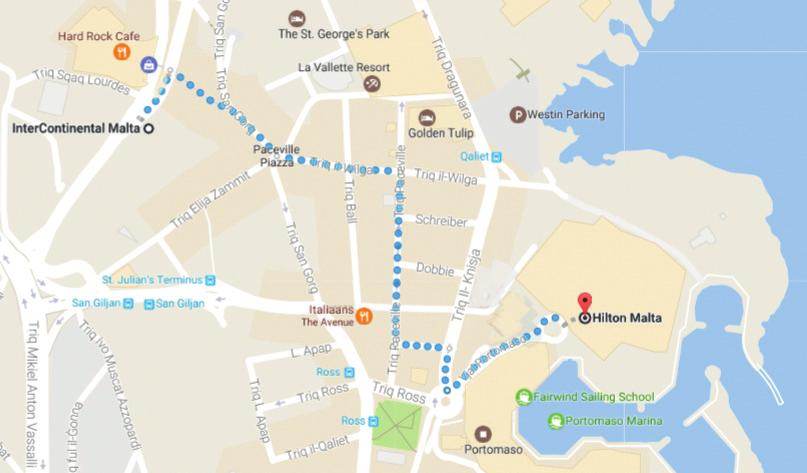
43 Introduction The conference Maritime Spatial Planning Addressing Land-Sea Interactions took place over the course of two days at the Intercontinental Hotel in St. Julian s, Malta on 15 and 16 June This document outlines key points raised in the opening and closing sessions, together with summaries of the 15 presentations delivered during the four sessions. The conference was opened by Angela SchultzZehden, Contract Lead Manager of the EU Commission funded European MSP Platform and Managing Director of s. Pro - sustainable projects GmbH. Delegates were welcomed to the conference and the island of Malta by Michelle Borg on behalf of the Executive Chairman for Malta Planning Authority Johann Buttigieg. Ms. Borg explained how the islands of Malta provide good examples of both spatial and temporal land-sea interactions and stated that she hoped the conference would provide participants with ample opportunity to exchange experiences. Figure 1. Opening Session, 15/06/2017 Felix Leinemann, Head of Unit for Blue Economy Sectors, Aquaculture and Maritime Spatial Planning at the Directorate General for Maritime Affairs and Fisheries (DG MARE), welcomed the delegates as host of the conference. Mr. Leinemann reminded the participants that MSP is the spatial pillar for the EU Integrated Maritime Policy, and that Member States are required to submit 1 their maritime spatial plans by March 2021, in line with the MSP Directive (2014/89/EU). He noted that the Directive is gradually being implemented across the EU and that Member States are all at different stages of the implementation process. Mr. Leinemann pointed out that many different tools are available to Member States to assist them in achieving a proper inclusion of LSI in their maritime spatial plans, as this is one of the requirements set out in the MSP Directive. Such tools include the Member States expert group (MSEG) on MSP, transnational projects funded by the European Commission, as well as the European MSP Platform. All presentations given during the conference have been published on and can be downloaded via this link. 1 Directive 2014/89/EU of the European Parliament and of the Council of 23 July 2014 establishing a framework for maritime spatial planning
.")
44 Plenary Session 1: Introduction to LSI Chaired by Angela Schultz-Zehden Sue Kidd A general Land-Sea Interaction Framework Sue Kidd, maritime spatial planner at the Department of Geography and Planning at the University of Liverpool and member of the European MSP Platform consortium, presented a conceptual framework to guide the discussions (see Figure 2). The framework demonstrates the dynamics of land-sea interactions and the options for institutional arrangement available to deal with such dynamics. A briefing paper explaining this framework was circulated to all participants and has been published on 2. A map of river basin catchments, produced as part of the ESaTDOR 3 project, was used to clearly highlight how every area on land is connected to the sea, and that LSI should thus be considered beyond coastal zones. Recently, interest in LSI has increased due to the need for its consideration in MSP, as stated in the EU MSP Directive 2014/89/EU (Article 6), through formal or informal processes such as ICM (Integrated Coastal Management, Article 7). Discussions on LSI are longstanding through primarily voluntary ICM initiatives, which are in place across European sea basins. There are differences between the new statutory planning policy and marine focused MSP approach, and the often landward-oriented, stakeholder-focused ICM initiatives providing new perspectives. Figure 2. Conceptual Framework for LSI. Source: University of Liverpool,

45 Damien Périssé Land-Sea Interactions Damien Périsseé, Director of Maritime Affairs, introduced the Conference of Peripheral Maritime Regions 4, an association that includes more than 150 regional governments from all sea basins within Europe. Maritime issues are very important to the CPMR. LSI is being looked at in terms of implementation of the MSP Directive with reference to Articles 4, 6 & 7, but also Article 9, which includes a requirement for consulting with other relevant parties and stakeholders. The CPMR is developing a number of initiatives led by the Noord-Holland region of the Netherlands, including a study on regions and different directives (MSP, Marine Strategy Framework Directive, Water Framework Directive, Birds and Habitats Directives) that have an impact on the use of coastal and maritime space. The CPMR is also involved in projects including NorthSEE 5, SIMNORAT 6, SIMWESTMED 7, PANACeA 8 and CO-EVOLVE 9, as well as processes such as the Bologna Charter 10, described as a powerful cooperation process in the Mediterranean Sea. Figure 3. Presentation by Damien Périssé, 15/06/2017 A key issue for the CPMR with regards to LSI in MSP is how to build synergies between MSP and regional development strategies. Regions can contribute to this, where they have powers in areas related to ICM and MSP, and can play an important role in facilitating discussions with stakeholders. Regions can also address LSI using the approach applied in Brittany, France, where regional authorities have been leading discussions with local fishermen. Additionally, an integrated vision on MSP, ICM and LSI is needed. Natural processes and human activities on sea and on land influence each other

46 Francesco Musco Land & Sea Interaction in Spatial Planning Francesco Musco, Professor of Urban and Environmental Planning at the University of Venice, Italy, provided a short introduction into LSI in MSP. Three topics were covered: elements for LSI within territorial and spatial planning; planning cultures and scales in LSI and different planning tools; and suggestions and indications from a planners perspective. Northern and Southern Europe have different traditions when it comes to planning implementation and interactions between different levels of government. This can affect the capacity of MSP to be effective at local levels in different countries. Therefore, a solution that proved successful in Northern Europe cannot necessarily be translated to the Mediterranean, and vice versa. Furthermore, the scale of activities at different levels of planning needs to be taken into consideration. Using a transect planning approach (TPA), traditionally used in environmental planning, can help with consideration for LSI. This approach focuses on particular hotspots; for example, where there are overlapping or increased intensity of uses. TPA can help identify particular spatial interactions and understand the potential to position different planning functions, which could be associated with either marine or terrestrial planning. Figure 4. Diagram indicating the transect planning (TPA) approach for environmental planning. Source: Presentation by Francesco Musco, 15/06/2017 A good example is the Adriatic region, which is representative of many European regions in terms of a mixture of local legislative frameworks between countries. A path forward needs to be found to overcome the differences in legal systems between countries. Best practice examples in overcoming administrative borders to provide LSI in local planning can be seen in Norway and Puglia 11, Italy. Professor Musco explained that in order to properly consider LSI in MSP, an understanding of the often heterogeneous planning frameworks is required. A transect approach could provide a potential solution. In order to address these issues, waiting for a formal legislative framework which is applicable across the board is not an option; a way must be found to work within existing planning frameworks. 11

47 Plenary Session 2: Sub-national approaches to LSI Chaired by Felix Leinemann Frank Hering, Planning Director of the Regional Council of Kymenlaakso, discussed the regional plan for the Kymenlaakso region of Finland 12. In Finland, regional plans cover both land and sea areas, and therefore a strong planning tradition exists in territorial marine areas, which takes into consideration land-sea interactions. The regional plan for the Kymenlaakso region was approved by the Finnish Ministry for the Environment in 2014, prior to the adoption of the EU MSP directive 2014/89/EU. Therefore, predicting what the MSP directive would mean for the region was important when putting together the regional plan. In the future there will be regional plans covering the sea and land areas in addition to maritime spatial plans according to the MSP directive, which will both be managed by the same institutions, i.e. the regional councils. Figure 5. Regional planning of territorial waters in Finland. Source: Presentation by Frank Hering, 15/06/2017 When starting the process of developing the pilot plan, newly available environmental data on the submarine geological and biological diversity was studied, in order to determine the blue-green infrastructure network. This allowed for the creation of maps of core areas for geological and biological diversity and also identified patterns and corridors. This is among other things, beneficial to ensure that for example salmon migratory paths are considered, which are of high importance for the protection of nature tourism more inland. Transport and logistic planning issues are one of the most crucial topics. One of Finland s largest harbours is located within the region, along with a major railroad terminal located within the hinterland. These are part of the trans-european network; thus, it is important that transport issues are looked at in a holistic way, particularly when thinking about how to include inland stakeholders in MSP. 12

48 Holger Janßen Land-Sea Interaction in Mecklenburg-Vorpommern s recent State Development Programme Holger Janßen is the Senior Policy Advisor for the Ministry of Energy, Infrastructure and Digitalisation for the Mecklenburg-Vorpommern region of Germany. Mecklenburg-Vorpommern has around 1,200 km of coastline and is located in the northeastern part of Germany. The region has a marine spatial plan, which forms part of a holistic plan for land and sea. Work started on the first marine spatial plan for the area in 2002 when the concept was very new. The Mecklenburg13 Vorpommern plan came into force in 2005 and has subsequently been revised. By looking at maps showing areas of activity intensity in marine areas and transport maps on land, one can see a focus towards port areas linking land and sea. When developing the marine spatial plan, the approach was taken to extend the terrestrial plan into the sea in order to create one holistic plan with a common legal framework. A process of screening land-sea interactions was undertaken in order to establish what kind of interactions were taking place, what data was available and who was responsible for managing them. As a result of this approach, most of the stipulations in the updated State Development Programme are regulations that deal with Land-Sea-Interactions (see Figure 6). Figure 6. Elements of Land-Sea-Interaction in the State Development Programme of MecklenburgVorpommern. Source: Presentation by Holger Janßen, 15/06/2017 Having a combined approach is something that is reflected in the participation process. In the Mecklenburg-Vorpommern example, a two-stage process combined formal and informal instruments. These resulted in the production of around 2,600 statements with over 1,000 issues raised relating to MSP. Upon examination, only around 630 could be solely classified as marinerelated, highlighting the importance of having a wider perspective. 13

49 Kathy Belpaeme LSI within the Belgian MSP-ICM process Kathy Belpaeme, working for the coastal department for West Flanders in Belgium, presented LSI within the Belgian MSP - ICM process, with a particular focus on the North Sea 2050 Vision process. During this visioning process, three working groups were established, with a focus on the ecosystem based approach; innovation; and multi-functional uses. Across these three working groups, six cross cutting themes were identified, including LSI, which was led by Ms. Belpaeme. By working closely with stakeholders several key observations could be made: Figure 7. Presentation by Kathy Belpaeme, 15/06/2017 Integration in the minds: There was a tendency for people to focus only on the sea when talking about MSP, even with those experienced in the subject. The terrestrial side is often overlooked, but should be considered in MSP as well. Integration in the maps: When discussing MSP in Belgium, quite often the map that is used does not show the terrestrial side, including harbours, built-up areas, etc. Maps showing both the landward and seaward side of an area help to identify LSI. The same goes for data - if one is gathering data in the marine environment, they should do the same on land. There can be difficulties getting all parties to agree on what should be taken into account when considering LSI. Having someone guarding when it comes to defining the focus of LSI can help. Make sure all sectors are on board: the Belgian process involved stakeholders with an open invitation. Involve scientists: In order to get a solid basis for any plan, make sure scientists are involved from the outset and get them in the same room with other stakeholders, including policy makers.

50 Plenary Session 3: National and Sea-basin approaches to LSI Chaired by Emiliano Ramieri Fátima Lopes Alves Portuguese experience with ICM Fátima Lopes Alves is a professor at the Department of Environment and Planning at the University of Aviero, Portugal. Prof. Lopes Alves provided insight on ICM in Portugal. Legislation relating to land-sea interactions in Portugal has been in place since 1993 with legally binding, Coastal Zone Master Plans, which pre-dated the EU recommendation on ICZM. In 2003, the National Strategy for Coastal Zone Management was assumed. New legislation was put into place in 2006, which focused on the sea and blue growth, with the adoption of the National Sea Strategy 14. Figure 8. Timeline of major legislation affecting LSI in Portugal. Source: Presentation by Fátima Lopes Alves, 16/06/2017 In Portugal, concepts used within these planning processes such as transitional water, coastal zone, and coastal border, are assumed within legal frameworks, therefore removing any ambiguity. Definitions of limits are in place for both the Coastal Zone Master Plan and Maritime Spatial Planning, in terms of maritime and terrestrial protection zones, which are again assumed within a legal framework. In addition, different scales of work are included in the Coastal Management Plan in order to take into account the differences between challenges and opportunities in different areas. The operational scales of work include the Coastal Zone National Strategy (containing five strategic plans covering the whole mainland); Coastal Management Plans on a regional scale; and coastal zone management beach plans on a scale for bathing areas. The scope of Integrated Coastal Management in Portugal includes the following areas: i) Transitional waters; ii) Coastal Waters; iii) Bathing Areas; iv) Tourism development; v) Climate Change; and vi) Natural capital. 14

51 Lenča Humerca Šolar & Slavko Mezek LSI approach in Slovenia Lenča Humerca Šolar of the Ministry of Environment and Spatial Planning, Directorate for Spatial Planning in Slovenia and Slavko Mezek, Senior Programme Manager with the Regional Development Centre of Koper, presented the approach to LSI in Slovenia. Every coastal Member State in the EU is responsible for applying the MSP Directive; therefore, an integrated structure for the management of the sea and coast has to be prepared along with a national maritime spatial plan and a procedure for its implementation. The process of implementation has already begun in Slovenia and existing legislation is being revised with the amendment of existing laws to provide greater support for MSP. The Spatial Development Strategy of Slovenia is currently under revision and will place a greater emphasis on maritime issues for the long term (up to 2050) and action points (up to 2030) of the strategy. The shaping of the MSP process is underway, with approval sought from scientific bodies. Slovenia s Spatial Development Strategy already contains some maritime elements, which will be expanded upon in the revised strategy, which is expected to be released before the end of MSP in Slovenia is influenced by the country s short coastline, and the numerous activities that take place in the small area. There is no tradition of MSP and jurisdiction is divided between the national level and local municipalities. MSP will provide an inter-sectoral and cross-border reconciled sea use plan with a criteria framework for future projects, that also tackles land spatial development. Slovenia has been involved in a number of transboundary MSP projects, including PLANCOAST 15 and SHAPE 16. Scoping and SWOT analyses identified a number of issues on sea and land for several case studies, which were used to produce an integrated map. Proposals were adopted in municipal plans. Figure 9. Proposed Maritime and Coastal Plan Slovenia. Source: Presentation by Lenča Humerca Šolar & Slavko Mezek, 16/06/

52 Marina Markovic LSI in ICZM Projects Marina Markovic is the Programme Officer for the UNEP Mediterranean Action Plan Priority Actions Programme / Regional Activities Centre 17 based in Split, Croatia. The legal framework of work undertaken by the PAP / RAC is the Barcelona Convention and its protocols, with the ICZM protocol being the most relevant. Within the ICZM Protocol, the coastal zone includes both land and marine areas, so for the past 40 years countries in the Mediterranean have in fact been working on LSI. When considering LSI in ICZM, it is important to consider a broad picture examining the drivers, pressures and impacts all the way from source to the sea and vice versa. A number of different projects are currently undertaken across the Mediterranean. In Croatia, preparations began in 2012 for a marine strategy based on MSFD requirements. The boundaries for the proposed Maritime Plan for Croatia started from the coastline and extended beyond the limits of the territorial sea, including ecological and fisheries zones. An ICZM Strategy was also required, which would cover the terrestrial zone to the limit of the territorial sea. It was decided to create one single integrated strategy covering both maritime and coastal areas, meaning that all areas included in both the maritime and ICZM plans were covered. Figure 10. Integrated Strategy for Croatia. Source: Presentation by Marina Markovic, 16/06/2017 One of the most recent projects in Italy has a specific focus to identify LSI in different regions by creating matrices to assist in this identification process. The techniques used in this project will be further developed as part of the SUPREME 18 and SIMWESTMED 19 projects. Two policy documents are currently being prepared to define the future steps for the Barcelona Convention communities towards MSP and LSI, which are key components for achieving GES and sustainable development of coastal zones

53 Ingūna Urtāne Outcomes of the BALTICSCOPE project with considerations of the Land-Sea Interactions Ingūna Urtāne, Director of the Spatial Planning Department at the Ministry for Environmental Protection and Regional Development of Latvia and project leader for the national maritime spatial plan, summarised the outcomes of the Baltic SCOPE project 20. The Baltic Sea Region has much experience with transboundary cooperation within the frame of spatial development planning and the Baltic Marine Environment Protection Commission (HELCOM). This has resulted in a Baltic Sea Action Plan for environmental protection and the VASAB Long-term Vision for the Baltic Sea Region, along with several guidance documents for transboundary cooperation. The guidelines produced by the HELCOM-VASAB MSP working group 21 on transboundary consultations, public participation and cooperation helped define the framework for the Baltic SCOPE project, which uses a stakeholder approach as the basis for cooperation. The BalticSCOPE project focused on the energy, fisheries and shipping sectors, as well as the environment. All countries had already initiated their MSP processes, which served as the background for transboundary cooperation. Stakeholder mapping was undertaken to identify key actors. The project produced a number of recommendations; such as identifying the need for joint planning criteria for certain sectors; the importance of a transboundary perspective in planning; the sharing of harmonised data; and the need for a permanent platform such as the HELCOM-VASAB working group to assist the implementation of future projects. Figure 11. Recommendations from BalticSCOPE. Source: Presentation by Ingūna Urtāne, 16/06/2017 Baltic Sea countries often have very different legislation: in some cases, the responsibility for the implementation of MSP is carried out on a local level, whereas in other countries this is done on the national level. Some Baltic countries have separate marine and terrestrial planning, whilst others have more integrated plans. The project also found that often items that were identified as being of greatest concern to national or regional level stakeholders were very different to those operating at a local or municipal level. This can create barriers when trying to implement MSP. The second major conclusion of the project was that green networks need to be dealt with in a holistic way

54 Plenary Session 4: Sectoral approaches to LSI and specific tools Chaired by Juan Ronco Zapatero Lodewijk Abspoel Ports: a gateway for understanding Land-Sea Interactions Lodewijk Abspoel is a senior policy advisor for the Ministry of Infrastructure and Environment of the Netherlands and deals directly with MSP. Mr. Abspoel gave a presentation using ports as a key example for explaining the importance of land-sea interactions. He posed the question: should land-sea interactions not rather be considered land-sea investigations? Ports can be classified in a number of ways, such as marinas or harbours, but they have similarities and also differences. The importance of ports impacts not only coastal areas, but also major manufacturing hubs, such as the engineering industry in the South of Germany. In addition, changes in the shipping sector imply the necessity of adaptations made in inland waterways of Europe, such as to bridges. A number of examples from the Netherlands were presented, including the port of Amsterdam, which demonstrates the economic importance of shipping and that freight is the cheapest way of transport, following the principles of just-in-time management. Land-sea interactions stretch across the globe and ports are connected across continents, from a socio-economic as well as from an environmental perspective. Mr. Abspoel also mentioned that much of the energy from offshore renewables is used by industry rather than households, and how it reaches these factories has to do with land-sea interactions as well, raising questions such as whether industries should be relocated closer to shore. Part of the presentation also included information on the issues posed by super yachts, which are designed for the maritime environment, but built and transported from further inland, as well as on rural areas that could get an economic impulse from the creation of new ports or harbours. Mr. Abspoel engaged the participants with a captivating presentation and several key discussion points, including a question on the definition of Short Sea Shipping and the meaning of Motorways of the Seas. Figure 12. Discussion points on ports and LSI. Source: Presentation by Lodewijk Abspoel, 16/06/2017
.")

55 Margarita Stancheva Burgas Case Study: Land-Sea Interactions Margarita Stancheva is a coastal / marine scientist at the Bulgarian Academy of Sciences Institute of Oceanology (IO-BAS). She has worked on a number of projects including the DG MARE funded MARSPLAN project 22 which addresses cross-border maritime spatial planning in the Black Sea region (Bulgaria and Romania). A diverse range of partners are involved in the project including ministries of regional development, maritime administrations, ports and research institutes. As one of the five pilot case study areas in the project, the city of Burgas is the fourth largest in Bulgaria and one of the largest ports on the coast of the Black Sea. It is a leading industrial centre and experiencing rapid development, and is surrounded by many ecologically important areas including Natura 2000 sites and wetlands. The current challenge in the area is the need to sustain economic development whilst protecting biodiversity and effective use of natural resources. The approach set in the MSP Directive was applied to follow the LSI and to identify the impact of land infrastructure on wetlands and maritime space. It was challenging to find out about the conflicts between different sectors and uses (both terrestrial and marine) and to identify key stakeholders. A number of analytical techniques were used to create a matrix of land-sea synergies and conflicts. The complex nature of land-sea interactions is currently managed by existing legislation, but dedicated maritime spatial plans are required. A draft for amending the law for managing maritime space, inland waters and coastal areas has been prepared at the expert level covering the legislative transposition of the MSP Directive which is awaiting political decision. Both human resources and data for MSP at municipal and national level are still insufficient. These are vital for any MSP and identifying land-sea interactions. GIS, mapping and visual interpretations have proven to be the best way to obtain decision support of the MSP approach. Research for LSI in both marine and terrestrial environments is costly in nature and should be provided by the competent authority for MSP. Figure 13. Matrix of land-sea synergies and conflicts in the Burgas Region. Source: Presentation by Margarita Stancheva, 16/06/

56 Corine Lochet Coastal Data for Integrated Maritime Policies Corine Lochet is a Chief Engineer at the French Hydrographic Office (SHOM) with experience in the organization and synergy of marine data to implement coastal and maritime policy. Whilst data is readily available in the terrestrial environment, this is often harder to come by in the marine part of the coastal zone. In maritime spatial planning, a variety of different data is required, such as data to manage flood risks, marine archaeology, safe maritime navigation and cables. Ecosystems can often overlap jurisdictional borders and a transnational approach to data collection is important to effectively manage these areas. Figure 14. Presentation by Corine Lochet, 16/06/2017 SIMCelt 23 is a transnational project funded by DG MARE to assist in the delivery of the MSP Directive. One of the project deliverables is to assess and identify gaps in data within the Celtic Seas. The examination of data can often be complex due to the difficulty in gathering the data or the quantity of data involved for a simulation and the range of expertise required to analyse it. In other instances, a simple image (WMS-WFS feeds) can be enough to highlight the same issue to different stakeholders. Part of the Data was obtained from the EMODnet 24 data portal, funded by DG MARE, which collates data from around Europe and promotes the homogeny of the data output from Member States. This consistency in data collection and formatting is assisting MSP. Information that cannot be provided by EMODNet, such as data concerning energy and cultural heritage, must sometimes be derived from other national or local sources, but this is not always easy to find and not always freely available. Three axes have been proposed by the Coastal Mapping Partnership to fill the gaps with a European Strategy to obtaining high-resolution coastal bathymetric data and a land-sea interaction data for coastal management 1) Set up coordinated programmes for data acquisition at maritime basin scale; 2) Increase the opportunities for bathymetric data acquisition in the framework of the EU operational programmes and funds; and 3) Promote the production of bathymetric data from multiple sources, usable by different categories of coastal users for maritime policies

57 Natasha Bradshaw - Participatory engagement in MSP: lessons from Integrated Coastal Management Natasha Bradshaw is an Advisory Board Member for the Coastal and Marine Union (EUCC). Ms. Bradshaw s presentation focused on the coastal zone as the main interface between land and sea, and she encouraged participants to think about the communities who reside there. Coastal regions are the most densely populated and therefore present the biggest challenge to sustainability. Coastal regions also contain some of the world s most fragile ecosystems. The MSP Directive, which includes land-sea interactions, shows that progress is being made to encourage sustainability in coastal regions. Collectively, there exists 20 or 30 years of experience in planning at the coast. There has been some evidence seen over the past few days which demonstrates that integrated plans that extend outward from the land into marine areas, may be more effective at managing land-sea interactions than separate maritime and terrestrial spatial plans. One of the main strengths of Integrated Coastal (Zone) Management (ICM) is the ability to engage people; however, it is important to make the distinction between stakeholder engagement and public participation. It is important to consider the extent to which you are really engaging people as highlighted by Figure 15. Figure 15. Armstein s Ladder. Source: Armstein, Sherry R. "A Ladder of Citizen Participation, JAIP, Vol. 35, No. 4, July 1969, pp (above) Figure 16. Principles of participatory engagement in MSP. Source: Presentation by Natasha Bradshaw, 16/06/2017 (left) Examples of where these principles have been put into practice can be seen in a number of local ICM projects and partnerships and also in larger projects within Europe s regional seas, such as the Celtic Seas Partnership

. Figure 17: Planning stages of development of the LSI toolbox.")
58 Heidi Roberts LSI Toolbox Heidi Roberts, Head of Coastal and Marine Processes at ABPMer, presented the LSI toolbox concept which is currently being developed as a mechanism to integrate land-sea interactions into MSP and other strategic environmental assessments. The project aims to provide a practical toolbox for LSI practitioners, which can be easily applied within any administrative or governance arrangement and will be underpinned by the principles of integrated coastal management (ICM). Figure 17: Planning stages of development of the LSI toolbox. Source: Presentation by Heidi Roberts, 16/06/2017 The toolbox will provide a library of real and conceptual case studies and will allow users to search through different topics and land-sea interactions. The toolbox will be presented via a website which will provide a knowledge sharing platform, whilst the case study matrices allow for the application to be tailored to individual requirements. Once both the website and toolbox matrices have been developed, the toolbox will be presented to stakeholders, a period of testing will begin and feedback will be obtained. The functionality of the toolbox will be optimised following confirmation of its performance. The toolbox will be developed as part of a contract to provide administrative and technical support to the European Commission in its work on ICM and MSP in the Member States, as well as consider how an integrated approach might support the implementation of the MSFD and other relevant environmental policies.
59 Closing Remarks The conference was closed by a panel discussion, which included Angela Schultz-Zehden, Felix Leinemann, Francesco Musco and Sue Kidd. Ms. Schultz-Zehden summarized how throughout the course of the conference, different LSI issues had been identified, along with mechanisms to manage them and even tools to assist in this. She noted that whilst it was important to identify good practices going forward, it is equally important to identify where gaps in knowledge still exist. Ms. Kidd reflected on how the LSI framework outlined in the briefing paper provided an interesting guide for the discussions that took place over the two days. One key message that has become evident is the diverse range of issues and approaches that are evolving. There is also a variety of experience, reflecting that there can be no one-size-fits all approach to tackle LSI in MSP. Francesco Musco noted a number of key points that should be considered when addressing LSI in MSP. Firstly, with regards to strategic level planning (including sea basin level strategies); these provide the basic level frameworks under which all other levels operate. In most cases, these are implemented at a regional or municipal scale, which do not necessarily operate on a day-to-day basis on a strategic level, and this can create a gap in terms of their capacity to implement MSP. Secondly, Integrated Coastal Management is a voluntary tool that is implemented in different ways across Europe. In addition, with regards to the knowledge available to support planning at all scales, there is a need to increase the amount of for instance geographical and environmental data available to assist MSP. Lastly, in reference to best practice techniques, it is important to note that whilst these may have been effective, they are not necessarily geographically transferrable. Felix Leinemann closed the conference with some concluding remarks. Although maritime spatial planning is often carried out at the local level, there is also a need to sometimes look at things on a larger scale, as was the purpose with the MSP Directive. Over the past two days, several examples were highlighted where planning on a larger scale was possible and even successful. While European funding for projects can provide a possibility for this work to continue, this is not a sustainable mechanism in the long term. HELCOM-VASAB is an example of how Member States can work together without the need for direct input from the European Commission, and it can be seen as an example for other sea basins. Mr. Leinemann concluded that in addition to identifying some of the more general issues associated with LSI, he expressed the hope that more specific issues had also been identified during the interactive sessions, which could be the focus of future workshops and the continued work facilitated by the European MSP Platform.
60 Annex III List of participants NAME LAST NAME AFFILIATION Dania Abdul Malak University of Malaga (Spain) Andrej Abramic EcoAqua/Las Palmas University (Spain) Lodewijk Abspoel Ministry of Infrastructure and Environment (Netherlands) Maher Al-Quhali University of IUAV (Italy) Laura Alexandrov NIMRD (Romania) Susanne Altvater s.pro (Germany) Fatima Alves Aveiro University (Portugal) Julie-Ann Auerbach Environment and Resources Authority (Malta) Niccolò Bassan University of IUAV (Italy) Kathy Belpaeme Flanders Province (Belgium) Joseph Bianco Ports and Yachting Directorate, Transport Malta Michelle Borg Malta Planning Authority Greta Borg EASME Natasha Bradshaw EUCC Matteo Braida Sogesid (Italy) Pierpaolo Campostrini CORILA (Italy) Brian Christie Environment and Resources Authority (Malta) Suzanne Dael Danish Maritime Authority Lisa Simone de Grunt s.pro (Germany) Anja Detant EASME Ann Dom Seas at Risk Karin Dubsky Coastwatch Europe Özhan Erdal Mediterranean Coastal Foundation (MEDCOAST) Rhona Fairgrieve Scottish Coastal Forum Michelle Formosa Malta Marittima Agency Elena García Autonomous University Barcelona Maria Georgieva Ministry of Regional Development and Public Works (Bulgaria) Barbara Giuponi CORILA (Italy) María Gómez- Ballesteros Spanish Institute of Oceanography Sonsoles Gonzalez-Gil Spanish Institute of Oceanography Dirk Gotzmann CIVILSCAPE (Germany) Henriette Grimmel University of Sevilla (Spain) Frank Hering Kymenlaakso Region (Finland) Lenca Humerca Solar Ministry of the Environment and Spatial Planning (Slovenia) Julia Hunt Welsh Government
61 Alberto Innocenti University IUAV of Venice (Italy) Stephane Isoard European Environment Agency Holger Janßen Ministerium für Energie, Infrastruktur und Digitalisierung Mecklenburg-Vorpommern (Germany) Hannah Jones University of Liverpool Katerina Kanellopoulou Hellenic Ministry of Environment & Energy Katerina Karditsa National & Kapodistrian University of Athens (Greece) Xander Keijser Rijkswaterstaat (Netherlands) Sue Kidd University of Liverpool (UK) Marija Lazic Maritime Institute in Gdansk (Poland) Felix Leinemann DG MARE Camino Liquete DG ENV Corine Lochet SHOM (France) Ivana Lukic s.pro (Germany) Denis Maragno University of IUAV, Venice (Italy) Marina Markovic UNEP MAP PAP RAC Vesna Marohnić Kuzmanović Croatian Institute for Spatial Development Márcia Marques CESAM & University of Aveiro (Portugal) Razvan Mateescu NIMRD (Romania) Slavko Mezek Regional development centre Koper (Slovenia) Francesco Musco University of IUAV, Venice (Italy) Caitriona Nic Aonghusa Marine Institute (Ireland) Daniel Nigohosyan Ecorys Alda Nikodemusa VASAB Secretariat Maria Pafi Queen's University Belfast Theodora Paramana National & Kapodistrian University of Athens (Greece) Damien Périssé CPMR Stelios Petrakis National & Kapodistrian University of Athens Giulietta Rak ISPRA - Italian National Institute for Environmental Protection and Research Maria Rampavila Hellenic Ministry of Environment and Energy Yves-Henri Renhas Secrétariat général de la mer (France) Heidi Roberts ABP MER Juan Ronco Zapatero DG MARE Eva Rosenhall Swedish Agency for Marine and Water Management Md Nazmus Sakib University IUAV of Venice (Italy) Joseph Scalpello Malta Planning Authority Laura Scarpelli Rete Autostrade Mediterranee Spa (Italy) Jan Schmidtbauer Crona Swedish Agency for Marine and Water Management Angela Schultz-Zehden s.pro (Germany)
62 Hristo Stanchev Institute of Oceanology - Bulgarian Academy of Sciences Margarita Stancheva IOBAS (Bulgaria) Wim Stooker Province of Noord-Holland (Netherlands) Asdis Hlokk Theodorsdottir National Planning Agency (Iceland) Tiina Tihlman Ministry of the Environment (Finland) Kai Truempler Federal Maritime and Hydrographic Agency (Germany) Inguna Urtane Ministry of Environmental protection and regional development (Latvia) Steven Vandenborre Belgian (federal) DG Environment Diletta Zonta Ecorys
63 Annex IV Conference briefing paper Please find on the next pages, the briefing paper that was developed for the Maritime Spatial Planning Conference: Addressing Land-Sea Interactions, that took place in St. Julian s, Malta on 15 and 16 June 2017.
64 EUROPEAN COMMISSION DIRECTORATE-GENERAL FOR MARITIME AFFAIRS AND FISHERIES Maritime Spatial Planning: Addressing Land-Sea Interaction A briefing paper This document was developed by the European MSP Platform for the European Commission Directorate General for Maritime Affairs and Fisheries.
65 EUROPEAN COMMISSION DIRECTORATE-GENERAL FOR MARITIME AFFAIRS AND FISHERIES Contents 1. INTRODUCTION LSI IN THE MSP DIRECTIVE ICM AND MSP A GENERAL FRAMEWORK FOR LAND-SEA INTERACTION Dynamics of land-sea interaction Interactions due to natural processes Interactions between socio-economic activities Options for institutional and legislative arrangements to address LSI ICM initiatives Coordination of separate terrestrial and maritime spatial plans Extending a terrestrial planning area into a marine area National strategy covering terrestrial and marine areas Guidance from a sea basin strategy Sector-by-sector approach Extending a maritime planning area landwards? Spatial scales for addressing LSI... 8 This document was developed by the European MSP Platform for the European Commission Directorate General for Maritime Affairs and Fisheries.
66 EUROPEAN COMMISSION DIRECTORATE-GENERAL FOR MARITIME AFFAIRS AND FISHERIES 1. Introduction Many maritime uses have an onshore component or implication, such as the ports need for shipping, or grid connections needed for offshore wind arrays. Similarly, many terrestrial activities and development, especially in coastal areas, also impact on the sea, such as waste water discharge from urban areas. Natural processes also involve interaction between land and sea, such as coastal accretion and erosion being caused by currents and weather events. Human activities and natural processes can therefore interact with each other in complex ways along the land-sea interface. When carrying out maritime spatial planning (MSP), it is important to consider the dynamics between land and sea, and to ensure that spatial planning is conducted in an integrated manner across maritime and terrestrial areas. This is in the interests of both environmental protection of coastal areas and the effective development of maritime and coastal economies. It is a requirement of the MSP Directive to take land-sea interactions into account when preparing maritime spatial plans There are a number of possible ways of addressing land-sea interaction (LSI) in MSP. These include building on the experience of integrated coastal management (ICM), harmonising terrestrial and maritime spatial plans, and carrying out spatial planning at a scale that crosses the land-sea border. Where practice has already developed within Member States, different approaches are being taken, reflecting those nations geographies and institutional and planning frameworks. Other Member States are now considering how best to deal with LSI in their MSP processes. All Member States could benefit from understanding the options that are available and considering how to develop their practice further. 2. LSI in the MSP Directive Art 6 para 2(a) sets out as one of the minimum requirements of MSP that LSI should be taken into account (also Art 4 paras 2 and 5). Art 7 para 1 states that Member States may achieve this through the MSP process itself or by other formal or informal processes, such as ICM (in which case, the outcome must be reflected in the maritime spatial plans). In this context, para 2 states that MSP should aim to promote coherence with other relevant processes. LSI is also referred to elsewhere: Maritime spatial planning should take into account land-sea interactions and promote cooperation among Member States (recital 9). Marine and coastal activities are often closely interrelated. In order to promote the sustainable use of maritime space, maritime spatial planning should take into account land-sea interactions. For this reason, maritime spatial planning can play a very useful role in determining orientations related to sustainable and integrated management of human activities at sea, preservation of the living environment, the fragility of coastal ecosystems, erosion and social and economic factors. Maritime This document was developed by the European MSP Platform for the European Commission Directorate General for Maritime Affairs and Fisheries.
67 EUROPEAN COMMISSION DIRECTORATE-GENERAL FOR MARITIME AFFAIRS AND FISHERIES spatial planning should aim to integrate the maritime dimension of some coastal uses or activities and their impacts and ultimately allow an integrated and strategic vision (recital 16). 3. ICM and MSP ICM (also referred to as integrated coastal zone management) is a longer-standing practice than MSP. It is also concerned with spatial management, but there are differences of emphasis between it and MSP. ICM generally focuses on collaboration between, for example, civil society, businesses and government, and may result in strategies and management plans, but does not usually lead to the allocation of space to particular activities in the way that MSP may. ICM tends to include land based activities, areas and bodies, whereas MSP does not extend its remit further inland than the highwater mark. Also, ICM is, in most contexts, a voluntary practice, rather than a statutory requirement, in contrast to MSP in the EU. In the EU, the uptake of ICM by Member States is encouraged through a Communication 1 and Recommendation 2, where it is defined as a dynamic, multi-disciplinary and iterative process to promote the sustainable management of coastal zones. The need for informed participation and co-operation of all stakeholders is stressed. However, practice varies considerably according to local conditions. Importantly, for the Mediterranean, a common binding framework for ICM has been agreed within the Mediterranean Action Plan 3. The geographic scope of this protocol extends seaward to the limit of territorial seas, thus overlapping with the MSP area of responsibility of the Member States that are signatories. More generally, it is recognised that MSP and ICM should be linked where possible, as they both seek to address the problems of fragmented governance in coastal and marine settings, and include similar principles, such as the importance of stakeholder participation. They may therefore work together in addressing issues such as nature conservation, coastal flooding and defence and local economic development This document was developed by the European MSP Platform for the European Commission Directorate General for Maritime Affairs and Fisheries.


68 EUROPEAN COMMISSION! DIRECTORATE-GENERAL FOR MARITIME AFFAIRS AND FISHERIES 4. A general Framework for Land-Sea interaction LSI is a complex phenomenon, involving both natural processes across the land-sea interface and the impact of human activities in this zone. When undertaking MSP, authorities should, firstly, seek to understand the dynamics involved, and, secondly, find institutional mechanisms that are most suited to addressing LSI within their governance context. There may be a range of options available, involving different spatial scales of intervention. The figure below sets out a general framework to address LSI within MSP. 4.1 Dynamics of land-sea interaction Interactions due to bio-geo-chemical processes Interactions between the land and sea can be driven by a number of bio-geo-chemical processes, such as agricultural run-off resulting in eutrophication of coastal waters. Another example is the land-based pollution associated with agricultural and industrial activity. The coastlines subject to This document was developed by the European MSP Platform for the European Commission Directorate General for Maritime Affairs and Fisheries.
MODELS AND TOOLS FOR GOVERNANCE OF
 Working Papers Collection No. 1/2015 MODELS AND TOOLS FOR GOVERNANCE OF THE ADRIATIC AND IONIAN SEAS www.unimc.it/maremap NATIONAL POLITICS AND EU POLITICS: THE MARITIME SPATIAL PLANNING AND INTEGRATED
Towards coherent maritime spatial planning in the Baltic Sea Region, transnational and project perspective Talis Linkaits Head of VASAB Secretariat
 3 June 2013 Riga PartiSEApate Workshop MSP as Tool for Underwater Cultural Heritage Management in the Baltic Sea Towards coherent maritime spatial planning in the Baltic Sea Region, transnational and project
Maritime Spatial Planning in the Baltic Sea Region
 Maritime Spatial Planning in the Baltic Sea Region Talis Linkaits Head of VASAB Secretariat 20 May 2015 Helsinki A cooperation of ministers of the 11 Baltic Sea Region countries responsible for spatial
1. Baltic SCOPE Towards coherence and cross-border solutions in Baltic Maritime Spatial Plans
 NSHC 32th Conference Explanatory Note Dublin, Ireland Item E.2 MSP 21-23 June 2016 Germany Cross border MSP for the EEZ, a case study from the Baltic Sea The Federal Maritime and Hydrographic Agency of
MR. George ALEXAKIS, parallel session 3. "Mediterranean Sea Region. laying the conditions. for sustainable growth and jobs"
 parallel session 3 "Mediterranean Sea Region laying the conditions for sustainable growth and jobs" MR. George ALEXAKIS, elected Regional Councillor of Crete, Greece and representative of Crete in CRPM.
HELSINKI COMMISSION Baltic Marine Environment Protection Commission
 HELSINKI COMMISSION Baltic Marine Environment Protection Commission HELCOM RECOMMENDATION 24/10 Adopted 25 June 2003, having regard to Article 20, Paragraph 1 b) of the 1992 Helsinki Convention IMPLEMENTATION
Marine/Maritime Spatial Planning Andrej Abramić
 Marine/Maritime Spatial Planning Andrej Abramić EcoAqua SUMMER SCHOOL: Ecosystem approach to aquaculture 26-29th of October 2015 Research and Technology to enhance excellence in Aquaculture development
Natura 2000 and spatial planning. Executive summary
 Natura 2000 and spatial planning Executive summary DISCLAIMER The information and views set out in this study are those of the author(s) and do not necessarily reflect the official opinion of the Commission.
Maritime Spatial Planning: Transboundary Cooperation in the Celtic Seas Looking Ahead
 Maritime Spatial Planning: Transboundary Cooperation in the Celtic Seas Looking Ahead Looking ahead MSP in the context of the European Maritime and Fisheries Fund (EMFF) and beyond SIMCelt Final Conference
Tackling MSP integration challenges in the BSR
 Towards sustainable governance of Baltic marine space 2015 2018 BALTSPACE Towards sustainable governance of Baltic marine space Tackling MSP integration challenges in the BSR Michael Gilek, Södertörn University,
EUSAIR on sea topics from Slovenian perspective
 MINISTRY OF FOREIGN AFFAIRS REPUBLIC OF SLOVENIA EUSAIR on sea topics from Slovenian perspective Mag. Andreja Jerina National Coordinator 4 EU MRS: 270 millions of population 19 MS 12 non MS Sea basin
Marine Spatial Planning in the Baltic Sea Region
 Marine Spatial Planning in the Baltic Sea Region Towards coherence and cross-border solutions in Baltic Maritime Spatial Plans Coordinator & Project manager Dr Ingela Isaksson Swedish Agency for Marine
COUNCIL OF THE EUROPEAN UNION. Brussels, 2 May /14 CULT 68
 COUNCIL OF THE EUROPEAN UNION Brussels, 2 May 2014 9129/14 CULT 68 NOTE from: General Secretariat of the Council to: Permanent Representatives Committee (Part 1) / Council No. prev. doc.: 8892/14 CULT
Identification of maritime spatial planning best practices in the Baltic Sea Region and other EU maritime regions
 Identification of maritime spatial planning best practices in the Baltic Sea Region and other EU maritime regions PLAN BOTHNIA Baltic Sea Region Stakeholder Meeting Jacek Zaucha, Magdalena Matczak Two
Country Fiche Lithuania
 Country Fiche Lithuania Updated June 2018 1. General information The Lithuanian maritime space is delimited by the Decree of the Government of the Republic of Lithuania of 6 December, 2004, No. 1597 and
Natura 2000 in the marine environment: state of implementation and next steps
 Life on the blue planet: biodiversity research and the new European marine policies EPBRS European Platform on Biodiversity Research Strategy Porto, Portugal 7-9 November 2007 Natura 2000 in the marine
Implementation of the Political Declaration on energy cooperation between the North Seas Countries. Support Group 1 on Maritime Spatial Planning
 Implementation of the Political Declaration on energy cooperation between the North Seas Countries Support Group 1 on Maritime Spatial Planning Work Programme 1. Work area as outlined in Annex I to the
CONFERENCE STATEMENT
 Final draft CONFERENCE STATEMENT We, the elected representatives of Canada, Denmark/Greenland, the European Parliament, Finland, Iceland, Norway, Russia, Sweden and the United States of America; In collaboration
Mediterranean Sea and Territorial Development, Opportunities and Risks
 EESC Hearing Towards an EU Macro-Regional Strategy for the Mediterranean Mediterranean Sea and Territorial Development, Opportunities and Risks Michaela Gensheimer Structure of Intervention Part I: What
Mediteranean sea issues in the view of ESPON ESaTDOR project and Marine Spatial Planning in Slovenia
 DIREKTORAT ZA PROSTOR, GRADITEV IN STANOVANJA Mediteranean sea issues in the view of ESPON ESaTDOR project and Marine Spatial Planning in Slovenia BlueMed meeting of stakeholders on a micro-regional level
Baltic Sea Region cooperation in Maritime Spatial Planning - HELCOM/VASAB
 Baltic Sea Region cooperation in Maritime Spatial Planning - HELCOM/VASAB Sten Jerdenius Swedish Ministry of the Environment HELCOM/VASAB MSP Group Baltic Sea Region subregional workshop Espoo 31 March
Shetland Islands Council
 Shetland Islands Council Response to EU Green Paper on Territorial Cohesion Shetland Islands Council is strongly in favour of a territorial dimension to cohesion policy and welcomes the Commission s consultation
CONFERENCE STATEMENT
 CONFERENCE STATEMENT We, the elected representatives from Canada, Denmark/Greenland, Finland, Iceland, Norway, Russia, Sweden and the United States of America; In collaboration with the indigenous peoples
16540/14 EE/cm 1 DG E 1A
 Council of the European Union Brussels, 5 December 2014 (OR. en) 16540/14 ENV 965 CULT 139 NOTE From: To: Subject: General Secretariat of the Council Delegations Charter of Rome on Natural and Cultural
Outline National legislative & policy context Regional history with ESSIM ESSIM Evaluation Phase Government Integration via RCCOM Regional ICOM Framew
 What MSP Implementation could change in the Maritimes Region Tim Hall, Regional Manager Oceans and Coastal Management Division Ecosystem Management Branch Fisheries and Oceans Canada Maritimes Region BIO
Evaluation of Spatial Planning as a Tool for Integrated Marine Management Status, Obstacles and Research Gaps
 Evaluation of Spatial Planning as a Tool for Integrated Marine Management Status, Obstacles and Research Gaps Baltic MSP Forum Riga 17.-18. June 2014 A. Morf & A. Grimvall: Swedish Institute for the Marine
THE SEVILLE STRATEGY ON BIOSPHERE RESERVES
 THE SEVILLE STRATEGY ON BIOSPHERE RESERVES 1 VISION FOR BIOSPHERE RESERVES IN THE 21 ST CENTURY The international Seville Conference on Biosphere Reserves, organised by UNESCO, adopted a two-pronged approach,
Maritime Spatial Planning in the Baltic Sea Region
 Maritime Spatial Planning in the Baltic Sea Region Past, present, perspective Talis Linkaits VASAB Secretariat XIX International Environmental Forum 22 March 2018, Saint Petersburg A cooperation of ministers
Marine Spatial Planning as an important tool for implementing the MSFD
 Marine Spatial Planning as an important tool for implementing the MSFD Risto Kalliola Tallinn, Nov. 16 th 2012 DEPARTMENT OF GEOGRAPHY AND GEOLOGY University of Turku, Finland Ten principles to provide
Policy framework The Netherlands and the Polar Regions, Summary and priorities
 Policy framework The Netherlands and the Polar Regions, 2011-2015 Summary and priorities The policy outlined in this Policy Framework for the Polar Regions (2011-2015) is part of the government s orientation
Marine Spatial Planning (MSP): A practical approach to ecosystembased
: A practical approach to ecosystembased") Marine Spatial Planning (MSP): A practical approach to ecosystembased management Erik Olsen, Institute of Marine Research, Norway Fanny Douvere, International Oceanographic Commission Overview Why we need
Marine Spatial Planning (MSP): A practical approach to ecosystembased management Erik Olsen, Institute of Marine Research, Norway Fanny Douvere, International Oceanographic Commission Overview Why we need
Economic and Social Council
 United Nation E/C.20/2012/4/Add.1 Economic and Social Council Distr.: General 2 July 2012 Original: English Committee of Experts on Global Geospatial Information Management Second session New York, 13-15
The ESPON Programme. Goals Main Results Future
 The ESPON Programme Goals Main Results Future Structure 1. Goals Objectives and expectations Participation, organisation and networking Themes addressed in the applied research undertaken in ESPON projects
SPLAN-Natura Towards an integrated spatial planning approach for Natura th January, 2017 Brussels. Commissioned by DG Environment
 SPLAN-Natura 2000 Towards an integrated spatial planning approach for Natura 2000 Commissioned by DG Environment 17 th January, 2017 Brussels V. Simeonova (Ph.D.) Drivers towards integrating Biodiversity
ADRIPLAN: an EU funded pilot project on MSP in the Adriatic Ionian Region Pierpaolo Campostrini CORILA and CNR-ISMAR
 ADRIPLAN: an EU funded pilot project on MSP in the Adriatic Ionian Region Pierpaolo Campostrini CORILA and CNR-ISMAR ADRiatic Ionian maritime spatial PLANning ADRIPLAN PROJECT ADRIPLAN has the objective
Alps Results from the ESPON Project. Common spatial perspectives for the Alpine area. Towards a common vision
 Results from the ESPON Project Alps 2050 Common spatial perspectives for the Alpine area. Towards a common vision Tobias Chilla, University of Erlangen Cooperation Alps 2020+ 1 & 2 October 2018 Salzburg
KUNMING FORUM ON UNITED NATIONS GLOBAL GEOSPATIAL INFORMATION MANAGEMENT CITIES OF THE FUTURE: SMART, RESILIENT
 KUNMING FORUM ON UNITED NATIONS GLOBAL GEOSPATIAL INFORMATION MANAGEMENT CITIES OF THE FUTURE: SMART, RESILIENT and SUSTAINABLE Yunnan Zhenzhuang Guest House, Kunming, China 10 12 May 2017 BACKGROUND CONCEPT
DELIVERING ECOSYSTEM- BASED MARINE SPATIAL PLANNING IN PRACTICE
 DELIVERING ECOSYSTEM- BASED MARINE SPATIAL PLANNING IN PRACTICE A first assessment for the UK and Ireland January 08 GLOBAL WARMING IMAGES / WWF ABOUT WWF WWF is the world s leading independent conservation
National Perspectives - Portugal. Margarida Almodovar
 National Perspectives - Portugal Margarida Almodovar margarida.almodovar@mam.gov.pt from base line to the external limit of the continental shelf behind 200 miles and according to UNCLOS definitions Economic
Margarita Stancheva Hristo Stanchev & Robert Young 2. MEDCOAST JUBILEE WORKSHOP May 2015, Iberotel Sarigerme Park, Dalaman, Turkey
 Margarita Stancheva Hristo Stanchev & Robert Young 2 INTRODUCTION: Bulgarian Black Sea coast INTRODUCTION: Increasing pressure on Bulgarian coastal zone In 2011, of the 7 364 570 people that lived in Bulgaria,
Aquaculture Spatial Planning: The case of Greece
 Aquaculture Spatial Planning: The case of Greece Nikos Anagnopoulos Panhellenic Association for Small-Medium sized Aquaculture Enterprises Panhellenic Association for Small-Medium sized Aquaculture Enterprises
Stepping into the sea - New evidence on territorial development and the opportunities and risks for European seas and maritime regions
 ESPON 2013 Programme Workshop Stepping into the sea - New evidence on territorial development and the opportunities and risks for European seas and maritime regions 15 May 2013 9h00 16h30 Venue The Norwegian
BURGAS CASE STUDY: LAND-SEA INTERACTIONS. Dr. Margarita Stancheva
 BURGAS CASE STUDY: LAND-SEA INTERACTIONS Dr. Margarita Stancheva Name of presentation NEED FOR COHERENCE BETWEEN LAND AND SEA ACTIVITIES Name presenter Burgas is the fourth largest city in Bulgaria and
Country Fiche Sweden Updated May 2018
 Country Fiche Sweden Updated May 2018 1. General information 2 the territorial sea (12-nm zone) 70,000 km2 the Exclusive Economic Zone 60,000 km2 the EEZ is limited to the central line between adjacent
THE ROLE OF SPATIAL PLANNING IN INTEGRATED COASTAL ZONE MANAGEMENT RECOMMENDATIONS FROM THE INTERREG III B BALTCOAST PROJECT
 THE ROLE OF SPATIAL PLANNING IN INTEGRATED COASTAL ZONE MANAGEMENT RECOMMENDATIONS FROM THE INTERREG III B BALTCOAST PROJECT DISCUSSION PAPER FOR THE TRANSNATIONAL WORKING GROUP DECEMBER 2004 CONTENT 1.
The Baltic Sea Region Maritime Spatial Planning Data Expert Sub-group. First Report 2015/2016/
 The Baltic Sea Region Maritime Spatial Planning Data Expert Sub-group First Report 2015/2016/2017 21.04.2017. Contents 1. Glossary 2 2. Introduction. 3 3. MSP Data. 5 3.1. Input Data. 5 3.2 Output Data.
Economic and Social Council
 United Nations Economic and Social Council Distr.: General 2 July 2012 E/C.20/2012/10/Add.1 Original: English Committee of Experts on Global Geospatial Information Management Second session New York, 13-15
Council conclusions on Arctic issues. 2985th FOREIGN AFFAIRS Council meeting Brussels, 8 December 2009
 COU CIL OF THE EUROPEA U IO EN Council conclusions on Arctic issues 2985th FOREIGN AFFAIRS Council meeting Brussels, 8 December 2009 The Council adopted the following conclusions: The Council recalls its
The National Spatial Strategy
 Purpose of this Consultation Paper This paper seeks the views of a wide range of bodies, interests and members of the public on the issues which the National Spatial Strategy should address. These views
Briefing. H.E. Mr. Gyan Chandra Acharya
 Briefing by H.E. Mr. Gyan Chandra Acharya Under-Secretary-General and High Representative for the Least Developed Countries, Landlocked Developing Countries and Small Island Developing States Briefing
Country Fiche Latvia Updated October 2016
 Country Fiche Latvia Updated October 2016 1. General information Marine area under Latvian jurisdiction includes inland sea waters, Territorial sea (12 nautical miles from the baseline) and exclusive economic
Emerging tensions between blue growth and good environmental status
 Emerging tensions between blue growth and good environmental status Dr Peter Jones, Reader in Environmental Governance, Dept of Geography, University College London www.bnycharters.com Slides @PJSJones
Management Planning & Implementation of Communication Measures for Terrestrial Natura 2000 Sites in the Maltese Islands Epsilon-Adi Consortium
 Management Planning & Implementation of Communication Measures for Terrestrial Natura 2000 Sites in the Maltese Islands Epsilon-Adi Consortium Briefing Meetings, February 2013 CT3101/2011, MEPA, Malta
Evaluation Model for the Sustainable Development of European Coastal Zones
 Evaluation Model for the Sustainable Development of European Coastal Zones SUMMARY Interreg IIIC - South 2 INDEX 1.- INTRODUCTION... 3 2.- CONTEXT OF DEDUCE... 4 3.- CURRENT SITUATION AND CHALLENGES...
Maritime Spatial Planning Framework Directive Supported by INSPIRE
 Maritime Spatial Planning Framework Directive Supported by INSPIRE Andrej Abramić, Vanda Nunes de Lima, Paul Smits, Emanuele Bigagli, Chris Schubert European Commission Joint Research Centre Institute
Country Fiche Estonia
 Country Fiche Estonia Updated October 2017 1. General information Size of internal waters (to the baseline) and territorial sea (12-nm zone from the baseline) approximately 25 200 km 2. Exclusive economic
Country Fiche Estonia
 Country Fiche Estonia Deleted: October Updated May 2018 Deleted: 7 1. General information Size of internal waters (to the baseline) and territorial sea (12-nm zone from the baseline) approximately 25 200
Multinational Spatial Planning Experience
 POLAND Multinational Spatial Planning Experience of the Baltic Sea Region Competitiveness and territorial cohesion in Eastern and South-Eastern Europe Magdalena Zagrzejewska-Fiedorowicz VASAB 2010 Visions
BURGAS CASE STUDY: LAND-SEA INTERACTIONS
 BURGAS CASE STUDY: LAND-SEA INTERACTIONS Dr. Margarita Stancheva IO-BAS, Bulgaria Name of presentation CROSS BORDER MARITIME SPATIAL PLANNING IN THE BLACK SEA ROMANIA AND BULGARIA (MARSPLAN BS) Project
CLLD Cooperation OFFER
 Title of the proposed project (English) CLLD Cooperation OFFER PARKS PROTECTION III - Management, Protection and Economic Development in Protected Areas Type of project (select as many as you want) Cooperation
MSP Process drawings and descriptions
 MSP Process drawings and descriptions 12 December 2016 2 Table of Contents 1. Belgium... 3 2. The Netherlands... 5 3. Germany... 7 4. Denmark... 9 5. Scotland... 11 6. Sweden... 13 7. Norway... 15 1. Belgium
PartiSEApate: Multi-Level-Governance in Maritime Spatial Planning
 PartiSEApate: Multi-Level-Governance in Maritime Spatial Planning Establish a dialogue amongst MSP actors at ALL LEVELS and develop a proposal for a pan- Bal>c MSP governance structure Angela Schultz Zehden,
TOWARDS CLIMATE-RESILIENT COASTAL MANAGEMENT: OPPORTUNITIES FOR IMPROVED ICZM IN BELIZE
 TOWARDS CLIMATE-RESILIENT COASTAL MANAGEMENT: OPPORTUNITIES FOR IMPROVED ICZM IN BELIZE CHANTALLE SAMUELS Coastal Zone Management Authority and Institute The Caribbean Community Climate Change Centre VULNERABILITY
r i l:!n::5 ] F i n a l Repo rt Coas ta l Zon e Managemen t ( I CZM )
![r i l:!n::5 ] F i n a l Repo rt Coas ta l Zon e Managemen t ( I CZM )](/thumbs/94/122218329.jpg "r i l:!n::5 ] F i n a l Repo rt Coas ta l Zon e Managemen t ( I CZM )") C l i e n t : Eu ropean Com m iss ion - DG Env i ron men t S u bj e ct : An a lys is of Mem be r Sta tes p rog ress repo rts on I n teg rated Coas ta l Zon e Managemen t ( I CZM ) D o c. t i t l e : F
C l i e n t : Eu ropean Com m iss ion - DG Env i ron men t S u bj e ct : An a lys is of Mem be r Sta tes p rog ress repo rts on I n teg rated Coas ta l Zon e Managemen t ( I CZM ) D o c. t i t l e : F
MARINE SPATIAL PLANNING & MARINE CADASTRE: CHALLENGES AND ISSUES
 MARINE SPATIAL PLANNING & MARINE CADASTRE: CHALLENGES AND ISSUES Roger Longhorn Secretary General, GSDI Association rlonghorn@gsdi.org Member, IHO Marine SDI Working Group ral@alum.mit.edu Member, UNESCO
CONCEPTUAL FRAMEWORK FOR MARINE SPATIAL PLANNING IN THE MEDITERRANEAN
 CONCEPTUAL FRAMEWORK FOR MARINE SPATIAL PLANNING IN THE MEDITERRANEAN CONCEPTUAL FRAMEWORK FOR SPATIAL PLANNING IN THE MEDITERRANEAN LEGAL NOTICE The designations employed and the presentation of the material
Key Indicators for Territorial Cohesion & Spatial Planning Stakeholder Workshop - Project Update. 13 th December 2012 San Sebastián, Basque Country
 Key Indicators for Territorial Cohesion & Spatial Planning Stakeholder Workshop - Project Update 13 th December 2012 San Sebastián, Basque Country Key Aims Explore the use of territorial data in developing
Declaration Population and culture
 Declaration Population and culture The ministers of the parties to the Alpine Convention regard the socio-economic and socio-cultural aspects mentioned in Article 2, Paragraph 2, Item a., as being central
SPIMA Spatial dynamics and strategic planning in metropolitan areas
 Targeted Analysis SPIMA Spatial dynamics and strategic planning in metropolitan areas Executive Summary Conference version 1 February 2018 0 1. Background To address the challenges of metropolitan development
HELCOM-VASAB Maritime Spatial Planning Working Group Twelfth Meeting Gdansk, Poland, February 2016
 HELCOM-VASAB Maritime Spatial Planning Working Group Twelfth Meeting Gdansk, Poland, 24-25 February 2016 Document title MSP exhibition stands at the European Maritime Day 2016 Code 7-3-Add.1 Category INF
FINDINGS OF THE ARCTIC METEOROLOGY SUMMIT
 FINDINGS OF THE ARCTIC METEOROLOGY SUMMIT 2018 WWW.FMI.FI CHAIR S SUMMARY: 1 2 3 We need to be curious to explore the known unknowns. Meteorology is an elemental part of international collaboration in
Proposal for a DIRECTIVE OF THE EUROPEAN PARLIAMENT AND OF THE COUNCIL. establishing an infrastructure for spatial information in the Community
 Proposal for a DIRECTIVE OF THE EUROPEAN PARLIAMENT AND OF THE COUNCIL establishing an infrastructure for spatial information in the Community INSPIRE http://inspire.jrc.it/ Alessandro Annoni 1 EU Commission
ICZM and MSP in the Black Sea Region
 ICZM and MSP in the Black Sea Region Drd. Claudia Coman, Environmental engineer AG ICZM Focal Point, Romania Black Sea Commission Black Sea Commission on the Protection of the Black Sea against Pollution
UN-GGIM: Strengthening Geospatial Capability
 Fifth Plenary Meeting of UN-GGIM: Europe Brussels, 6-7 June 2018 UN-GGIM: Strengthening Geospatial Capability Walking the talk to leave no one behind Greg Scott, UN-GGIM Secretariat Environmental Statistics
IMA s ROLE IN COASTAL AND OCEAN GOVERNANCE IN TRINIDAD AND TOBAGO
 IMA s ROLE IN COASTAL AND OCEAN GOVERNANCE IN TRINIDAD AND TOBAGO Presented by Rahanna Juman, Deputy Director (Ag.) About the Institute of Marine Affairs Institute of Marine Affairs (IMA) was established,
Implementing the Sustainable Development Goals: The Role of Geospatial Technology and Innovation
 Fifth High Level Forum on UN Global Geospatial Information Management Implementing the Sustainable Development Goals: The Role of Geospatial Technology and Innovation 28-30 November 2017 Sheraton Maria
ESPON support for Targeted Analyses Ilona Raugze Director
 ESPON support for Targeted Analyses Ilona Raugze Director ESPON EGTC 14 November 2017 ESPON EGTC workshop Targeted Analysis in support of better policy making in cities and regions Inspire policy making
POLISH LAW ON MSP. Andrzej Cieślak Maritime Office in Gdynia
 POLISH LAW ON MSP Andrzej Cieślak Maritime Office in Gdynia Preconditions Ownership/management of allsea areas (internal sea waters, territorial sea, EEZ): the State, and in its name the Minister responsible
Offshore Energy and Maritime Spatial Planning in the German EEZ
 Offshore Energy and Maritime Spatial Planning in the German EEZ Bettina Käppeler, BSH Federal Maritime and Hydrographic Agency On Duty for Shipping and Seas German Exclusive Economic Zone EEZ not part
ACRONYMS AREAS COUNTRIES MARINE TERMS
 Natura 2000 ACRONYMS AREAS COUNTRIES MARINE TERMS DEFINITION A European network of protected sites under the European Habitats and Birds Directives, aiming to protect the most valuable and threatened European
PLAN BOTHNIA MSP 1/2011 PLAN BOTHNIA. PLAN BOTHNIA short description (document 3/1) PLAN BOTHNIA MSP 1 Pori, Finland, March
 PLAN BOTHNIA MSP 1 Pori, Finland, March") PLAN BOTHNIA Co-Financed Under European Integrated maritime Policy PLAN BOTHNIA short description (document 3/1) PLAN BOTHNIA MSP 1 Pori, Finland, March 7-8 2011 PLAN BOTHNIA MSP 1/2011 Agenda Item 3 Introduction
PLAN BOTHNIA Co-Financed Under European Integrated maritime Policy PLAN BOTHNIA short description (document 3/1) PLAN BOTHNIA MSP 1 Pori, Finland, March 7-8 2011 PLAN BOTHNIA MSP 1/2011 Agenda Item 3 Introduction
MyCoast Elaboration of a vision and a strategy for Integrated Coastal Zone Management in Bulgaria
 1. NAME MyCoast Elaboration of a vision and a strategy for Integrated Coastal Zone Management in Bulgaria 2. DESCRIPTION 2.1 The case Bulgaria s coastal territory is distributed among three administrative
Croatian physical planning system and strategic approach to MSP
 W 1/7 Past two years all over the Europe: case studies 2 Croatian physical planning system and strategic approach to MSP Vesna Marohnić Kuzmanović Head of Department Croatian Institute for Spatial Development
INTERNATIONAL CULTURAL TOURISM CHARTER Managing Tourism at Places of Heritage Significance (1999)
") INTERNATIONAL CULTURAL TOURISM CHARTER Managing Tourism at Places of Heritage Significance (1999) Adopted by ICOMOS at the 12th General Assembly in Mexico, October 1999. INTRODUCTION The Charter Ethos
INTERNATIONAL CULTURAL TOURISM CHARTER Managing Tourism at Places of Heritage Significance (1999) Adopted by ICOMOS at the 12th General Assembly in Mexico, October 1999. INTRODUCTION The Charter Ethos
The HELCOM Baltic Sea Action Plan and Marine Spatial Planning
 The HELCOM Baltic Sea Action Plan and Marine Spatial Planning Anne Christine Brusendorff Executive Secretary HELCOM The Baltic Sea Our common responsibility. Workshop on Integrated Sea Use management Stockholm
Marine Spatial Planning Leslie-Ann McGee Battelle Memorial Institute
 Marine Spatial Planning Leslie-Ann McGee Battelle Memorial Institute Rev061708 1 Marine Spatial Planning What is it? Why is it different? Where is it currently being employed? What is happening in the
Interest for HOs to cooperate with EU Commission:
 Plenary session of the European IHO Network Working Group (IENWG) Interest for HOs to cooperate with EU Commission: Why HOs and the EU Commission need a closer cooperation Rear Admiral (N) Luigi SINAPI
ESPON 2020 Cooperation Programme. Anneloes van Noordt MC-member Belgium
 ESPON 2020 Cooperation Programme Anneloes van Noordt MC-member Belgium Anneloes.vannoordt@vlaanderen.be Outline ESPON 2020 Cooperation Programme Applied Research Targeted Analysis Database & Tools Outreach
Maritime Spatial Planning in a CCB s context Mikhail Durkin MSP Seminar, 22 November 2016 Riga, Latvia
 Maritime Spatial Planning in a CCB s context Mikhail Durkin MSP Seminar, 22 November 2016 Riga, Latvia co-funded by EU LIFE Programme Maritime Spatial Planning "a public process of analyzing and allocating
Land Use in the context of sustainable, smart and inclusive growth
 Land Use in the context of sustainable, smart and inclusive growth François Salgé Ministry of sustainable development France facilitator EUROGI vice president AFIGéO board member 1 Introduction e-content+
Regional Plan 4: Integrating Ecosystem Services Mapping into Regional Land Use Planning
 Rural-Urban Outlooks: Unlocking Synergies (ROBUST) ROBUST receives funding from the European Union s Horizon 2020 research and innovation programme under grant agreement No 727988.* October 2018 Natural
Country reports. Israel did not establish an Exclusive Economic Zone. Consequently, its jurisdiction is restricted to the Israeli territorial waters.
 Country reports I. ISRAEL Disclaimer This document has not been adopted by the European Commission and should therefore not be relied upon as a statement of the European Commission. The purpose of this
ACTION PLAN FOR WORLD HERITAGE IN LATIN AMERICA AND THE CARIBBEAN ( )
") Annex ACTION PLAN FOR WORLD HERITAGE IN LATIN AMERICA AND THE CARIBBEAN (2014-2024) The current Regional Action Plan for Latin America and the Caribbean for 2014-2024 has been elaborated by the State Parties
Annex ACTION PLAN FOR WORLD HERITAGE IN LATIN AMERICA AND THE CARIBBEAN (2014-2024) The current Regional Action Plan for Latin America and the Caribbean for 2014-2024 has been elaborated by the State Parties
Tourism. April State Planning Policy state interest guideline. Department of Infrastructure, Local Government and Planning
 Department of Infrastructure, Local Government and Planning State Planning Policy state interest guideline Tourism April 2016 Great state. Great opportunity. Preface Using this state interest guideline
MESMA: An integrated tool box to support an ecosystem based spatial management of marine areas
 MESMA: An integrated tool box to support an ecosystem based spatial management of marine areas Stelzenmüller, V., Stamford, T., Vassilopoulou, V., Kastanevakis, S., Vincx, M, Vanaverbeke, J., Rabaut, M.,
Contents: LEVANTE DE ALMERÍA A INFORMATION SYSTEM OBJECTIVES AND ACTIONS GEOGRAPHIC INFORMATION SYSTEM RESULTS
 Contents: LEGAL FRAMEWORK: BARCELONA CONVENTION AND ICZM PROTOCOL; COASTAL AREAS MANAGEMENT PROGRAMME; CAMP LEVANTE DE ALMERIA; OVERALL AIM AND KEY IDEAS AREA PHASES PROJECT STRUCTURE ACTIVITIES INSTITUTIONAL
Implementation of the ESPON 2020 cooperation program. 16 January 2017 Anneloes van Noordt
 Implementation of the ESPON 2020 cooperation program 16 January 2017 Anneloes van Noordt Outline! ESPON Cooperation Program! Specific Objectives! Applied Research! Targeted Analysis! Database & Tools!
Economic and Social Council
 United Nations Economic and Social Council Distr.: General 18 July 2016 Original: English Committee of Experts on Global Geospatial Information Management Sixth session New York, 3-5 August 2016 Item 2
The European territory: Strategic developmentd
 The European territory: Strategic developmentd Peter Mehlbye Workshop Strategic Development Catalonia 11 June 2002 THE LECTURE Structure I. Territorial trends II. Strategy for European spatial development
Carpathians Unite mechanism of consultation and cooperation for implementation of the Carpathian Convention
 Carpathians Unite mechanism of consultation and cooperation for implementation of the Carpathian Convention Zbigniew Niewiadomski, UNEP/GRID-Warsaw Centre First Joint Meeting of the Carpathian Convention