Presented at the FIG Congress 2018, May 6-11, 2018 in Istanbul, Turkey
|
|
|
- Hubert Riley
- 5 years ago
- Views:
Transcription

1 Presented at the FIG Congress 2018, May 6-11, 2018 in Istanbul, Turkey
2 A Geoid model of northern Chile from airborne and surface gravity


3 Geographic Description of Chile. Total Surface: 2,006,096 Km 2. Estimated population 2012 (INE): 17,402,630 inhabitants. International boundaries: Peru: 180 kms. Bolivia: 850 kms. Argentina: 5,600 kms.
 which describes the theoretical height of the ocean and the zero level surface on land.")
4 Definitions Geoid: The equipotential surface of the Earth's gravity field which best fits, in a least squares sense, global mean sea level. The geoid model is a surface (N) which describes the theoretical height of the ocean and the zero level surface on land. The geoid is required to obtain orthometric height H ( height above sea level ) from GPS by H = h GPS N Source: where h GPS is the GPS ellipsoidal height, and H the levelled (orthometric) height.


5 Definitions Earth Gravitational Model 2008 (EGM2008) EGM2008 is a spherical harmonic model of the Earth s gravitational potential, developed by a least squares combination of the ITG-GRACE03S gravitational model The GRACE satellite mission determined a global gravity field model by circling the Earth and tracking the orbital perturbations of the satellite pair.
 ALAGaC/MonMap/NGA")
.")

6 Major DTU-Space international aerogravity surveys Malaysia (AN38 aircraft) cooperation partners JUPEM/GlobalTrak Mongolia (Twin-Otter and Cessna Caravan) ALAGaC/MonMap/NGA Ethiopia (Cessna Caravan) Ethiopian Mapping Agency/NGA/U Edinb. Indonesia (Cessna Caravan)... Bakosurtanal/NGA Major objectives: Geoid in support of national GPS nets + EGM08 (NGA) Layang-Layang Airways Antonov-38 in Kota Kinabalu, Malasya Sept Air Greenland DHC-6 Twin Otter in Ulaanbaatar, Mongolia, October 2004 Abyssian Flight Service Cessna Caravan, Addis Abeba, Etiophia, September 2006


7 Northern Chile Geoid Model from airborne and surface gravity project The aircraft used was a Beech King Air 350i aircraft from the Chilean company Aviasur Bases at Santiago + Copiapo + Antofagasta
. The main reason of this, is due to the destruction of the network due to recent earthquakes that have affected the area.")
8 Chilean leveling data The Chilean geoid was computed in a global vertical reference system, without fits to the Chile GPS-levelling data (due to insufficient and no updated GPS-levelling data available). The main reason of this, is due to the destruction of the network due to recent earthquakes that have affected the area.
9 Data for the geoid computation 1. DTU airborne gravity data, augmented with additional IMU data from TU Darmstadt (processed by D. Becker), using a draping technique. 2. Land gravity from IGM compilations. 3. DTU10 global gravity anomalies from multi-mission satellite altimetry. (Only in the open ocean area). 4. SRTM 30 DEM data for the region. 5. EGM08 and GOCE RL4 satellite data.

10 Data for the geoid computation IGM land gravity data used for the geoid determination. Colors show the free-air anomalies.

11 Data for the geoid computation Airborne gravity data. Left: LCR data with gaps at turns, April 2014 version. Right: new merged LCR/IMU data for final airborne survey results.
12 Gravimetric geoid computation The Chile geoid computations was done in connection with a workshop on airborne and strapdown inertial gravity held at the Astronomical Observatory in the city of Porto in Portugal on May 12-15, 2014, with support of prof. Luisa Bastos and with the participation of one Military Geographic Institute team member. The Chile gravimetric geoid was computed by the use of GRAVSOFT system, which is a set of FORTRAN routines developed through many years of research and project work at DTU-Space and Niels Bohr Institute of the University of Copenhagen
13 Steps of the final gravimetric geoid solution 1. Subtraction of EGM08GOCE spatial reference field. 2. Residual Terrain Model (RTM) for terrain reduction of surface gravimetry, after editing for outliers. 3. Residual Terrain Model (RTM) for terrain reduction of airborne gravimetry. 4. Reduction of DTU-10 satellite altimetry in ocean areas away from airborne data. 5. Downward continuation to the terrain level and gridding of all data by least-squares collocation using a 1 x 1 moving-block scheme with 0.6 overlap borders. 6. Spherical Fourier Transformation from gravity to geoid. 7. Restore of RTM and EGM08GOCE effects on the geoid.
.")
14 The available data from the airborne and surface sources were quality controlled through plotting of the EGM08GOCE and terrain reduction residuals, showing a few (~ 1%) surface gravity outliers, which were deleted in the final geoid processing. Quality control of the data Estimated errors of the airborne gravity data (Crossover analysis mgal). Statistics of the final Geoid

15 Use of the final GRID With the data grid provided by the project, and after preparing the data properly, through the use of the software Surfer 8, Global Mapper and Matlab, the author of this technical paper generated different outputs to be use as an input to other products in IGM. The purpose of the generation of this output is allow to non-specialist figured the form of a geoid in a visual form. Matlab output


16 Output in different Software Matlab with function surf Global Mapper

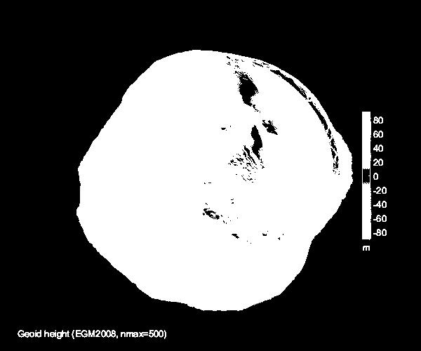
17 Comparison of new Chilean geoid to EGM2008 EGM2008 Geoid of Northern Chile


18 Closer to the Chilean land borders it is seen large differences to EGM2008, large effects are seen along the border of Argentina, where lack of data will make the geoid uncertain. Large differences are seen especially in the mountains. Difference between Chile Geoid and EGM2008.


19 Outliers around 30 S Absolute value of the difference between Chile Geoid and EGM2008. Peaks in the difference between Chile Geoid and EGM2008 and the Flight tracks.


20 Interpolation function in Matlab for any Latitude and Longitude. The final geoid geoid2.gri can be interpolated with a user-friendly interpolation matlab function. The function shows in 3D a 1 x 1 plot of the Geoid Undulation for the input Latitude and Longitude.
21 CONCLUSIONS 1. Airborne gravity measurements has become essential to determine features of the gravity field, and thus a precise geoid. 2. Airborne gravimetry is an important technique to quickly collect gravity data over large regions, where terrestrial gravity data are sparse and/or of poor quality for use in geoid determination. 3. Airborne measurement of gravity has been a goal for geodesy and geophysics for many years. 4. Airborne measurement provide efficient and economic mapping of gravity anomalies for geophysical exploration. 5. Airborne gravity provide an obvious means of gravity field data over large, inaccessible regions, such as polar and mountainous areas. 6. Satellite gravity missions, such as CHAMP, GRACE and GOCE, and airborne gravity campaigns in areas without ground gravity will enhance the present knowledge of the Earth s gravity field. 7. Many countries have been involved in projects related to the determination of local geoid by combining EGM08 and airborne gravity.
22 CONCLUSIONS 8. Due to political restrictions the flight tracks did not consider pass the border with Peru, Bolivia and Argentina and is very difficult develop international joint projects. 9. Unfortunately the IGM GPS-levelling data appears to have relatively large errors (due to insufficient and no updated GPS-levelling data available), and it is therefore difficult to use these data. 10. The northern Chile geoid was computed on a grid of 0.02 x resolution (corresponding to roughly 2 x 2 km grid). 11. It is seen that large differences to EGM2008 exist in the mountains, in addition, large effects are seen along the border with Argentina, due to the lack of data. 12. The apparent outliers around 30 S appears to be due to errors in EGM2008 and not related to data error of the airborne gravity data used in the Chile Geoid, but can be analyzed in depth in a future study. 13. The cooperation of National Geospatial and Intelligence Agency (NGA), Denmark's National Space Institute (DTU-Space) and University of Bergen has generated the opportunity to give Chile a new geoid model.

23 Thank You
24 A Geoid model of northern Chile from airborne and surface gravity
PGM2016: A new geoid model for the. Philippines
 PGM2016: A new geoid model for the Philippines United Nations/Nepal Workshop on the Applications of Global Navigation Satellite Systems Kathmandu, Nepal December 12-16, 2016 Ronaldo Gatchalian, Chief Geodesy
A Geoid Model Of Northern Chile From Airborne And Surface Gravity
 A Geoid Model Of Northern Chile From Airborne And Surface Gravity Julio NEIRA and Cristian Carrasco, Chile Key words: Geoid, Airborne Gravity, Geodesy, Gravimetry SUMMARY In recent decades many countries
D DAVID PUBLISHING. Towards a New Geoid Model of Tanzania Using Precise Gravity Data. 1. Introduction. Selassie David Mayunga
 Journal of Environmental Science and Engineering A 5 (2016) 267-276 doi:10.17265/2162-5298/2016.05.005 D DAVID PUBLISHING Towards a New Geoid Model of Tanzania Using Precise Gravity Data Selassie David
HIMALAYAN AIRBORNE GRAVITY AND GEOID OF NEPAL
 Mt. Everest HIMALAYAN AIRBORNE GRAVITY AND GEOID OF NEPAL -Niraj Manandhar Head, Geodetic Survey Branch Survey Department, Geodetic Survey Branch Project Background Air Borne Gravity Survey Project was
Evaluation of the Earth Gravity Model EGM2008 in Algeria
 Evaluation of the Earth Gravity Model EGM2008 in Algeria BENAHMED DAHO S. A. National Centre of Space Techniques, Geodetic Laboratory - BP 13 Arzew - 31200 - Algeria. E-mail: d_benahmed@hotmaii.com /Fax:
The first high-precision gravimetric geoid of Hungary: HGG2013
 Server on Geodesy, Seismology and Environmental Sciences Published Online 2013 (http://airy.ual.es/) The first high-precision gravimetric geoid of Hungary: HGG2013 Abstract V. Corchete Higher Polytechnic
Coastal geoid improvement using airborne gravimetric data in the United Arab Emirates
 International Journal of Physical Sciences Vol. 7(45), pp. 6012-6023, 30 November, 2012 Available online at http://www.academicjournals.org/ijps DOI: 10.5897/IJPS12.413 ISSN 1992-1950 2012 Academic Journals
GEOID UNDULATIONS OF SUDAN USING ORTHOMETRIC HEIGHTS COMPARED WITH THE EGM96 ANG EGM2008
 GEOID UNDULATIONS OF SUDAN USING ORTHOMETRIC HEIGHTS COMPARED Dr. Abdelrahim Elgizouli Mohamed Ahmed* WITH THE EGM96 ANG EGM2008 Abstract: Positioning by satellite system determine the normal height above
Activities in South America: Gravity and Geoid Projects
 Activities in South America: Gravity and Geoid Projects Segundo Taller de Grupo de Trabajo I SIRGAS Montevideo - Uruguay May 26 a 30, 2008 Maria Cristina Pacino Universidade de Rosário CGED - IBGE Denizar
Arctic Ocean Mean Sea Surface, Geoid and Gravity from Surface Data, Icesat and GRACE a reference for Cryosat sea-ice mapping
 Arctic Ocean Mean Sea Surface, Geoid and Gravity from Surface Data, Icesat and GRACE a reference for Cryosat sea-ice mapping R. Forsberg and H. Skourup, Geodynamics Dept., DNSC rf@spacecenter.dk Arctic
POLAR GRAVITY FIELDS FROM GOCE AND AIRBORNE GRAVITY
 POLAR GRAVITY FIELDS FROM GOCE AND AIRBORNE GRAVITY Rene Forsberg (1), Arne V Olesen (1), Hasan Yildiz (2), C C Tscherning (3) (1) DTU-Space, Juliane Maries Vej 30, 2100 Copenhagen Ø, Denmark, email rf@space.dtu.dk
(1) , 6WHYH.HQ\RQ (2) *HRG\QDPLFV 'HSW 1DWLRQDO 6XUYH\ DQG &DGDVWUH 5HQWHPHVWHUYHM '. &RSHQKDJHQ 19 'HQPDUN UI#NPV GN
 , 6WHYH.HQ\RQ (2) *HRG\QDPLFV 'HSW 1DWLRQDO 6XUYH\ DQG &DGDVWUH 5HQWHPHVWHUYHM '. &RSHQKDJHQ 19 'HQPDUN UI#NPV GN") *5$9,7
*5$9,7
REFINED GEOID MODEL FOR THE UNITED ARAB EMIRATES
 REFINED GEOID MODEL FOR THE UNITED ARAB EMIRATES Sahrum Ses 1, Adel Khaleefa and Rene Forsberg 3 1 UTM GNSS and Geodynamics Research Group, Universiti Teknologi Malaysia Military Survey Departments, GHQ
International Gravity Field Service (IGFS)
") IAG-Services: International Gravity Field Service (IGFS) 477 International Gravity Field Service (IGFS) http://www.gravityfield.org Chairman: Renè Forsberg (Denmark, 2011-2013) - Riccardo Barzaghi (Italy,
IAG-Services: International Gravity Field Service (IGFS) 477 International Gravity Field Service (IGFS) http://www.gravityfield.org Chairman: Renè Forsberg (Denmark, 2011-2013) - Riccardo Barzaghi (Italy,
A global high resolution mean sea surface from multi mission satellite altimetry
 BOLLETTINO DI GEOFISICA TEORICA ED APPLICATA VOL. 40, N. 3-4, pp. 439-443; SEP.-DEC. 1999 A global high resolution mean sea surface from multi mission satellite altimetry P. KNUDSEN and O. ANDERSEN Kort
Status of the European Gravimetric Quasigeoid
 Status of the European Gravimetric Quasigeoid C. Voigt, H. Denker {voigt,denker}@ife.uni-hannover.de 1 Introduction 2 The European Gravity and Geoid Project (EGGP) 3 Data Sets 4 Quasigeoid Computation
HOW CAN YOU ESTIMATE THE GEOID UNDULATION BY LEAST SQUARE COLLOCATION TECHNIQUE AND GPS DATA?
 УДК M. Kaloop, H. EL-Shmbaky, Ashraf A. Beshr Mansoura University, EGYPT HOW CAN YOU ESTIMATE THE GEOID UNDULATION BY LEAST SQUARE COLLOCATION TECHNIQUE AND GPS DATA? Abstract Levels have been normally
Final composite report
 Conduct aerial gravity survey countrywide for height component of the geodetic network Final composite report Part 1: Final gravity acquisition and processing report Part 2: Geoid model for Tanzania from
GRAVIMETRIC MAP OF CHILE. Services Mining and Engineering Geophysics Instituto Geográfico Militar
 GRAVIMETRIC MAP OF CHILE Araneda M., Rivas L., Avendaño M, Sottolichio G., Rubio W. Services Mining and Engineering Geophysics segmi@netexpress.cl) Instituto Geográfico Militar (lrivas@igm.cl) Abstract
GOCE based Gravity Field Models Signal and Error Assessment
 GOCE based Gravity Field Models Signal and Error Assessment Th. Gruber, M. Willberg Institute of Astronomical & Physical Geodesy (IAPG) Technical University Munich GOCE Reprocessing Status Expected Results
The GOCE Geoid in Support to Sea Level Analysis
 The GOCE Geoid in Support to Sea Level Analysis The geoid is a very useful quantity for oceanographers Thomas Gruber Astronomical & Physical Geodesy (IAPG) Technische Universität München 1. Characteristics
USING LIDAR MEASUREMENTS FOR IMPROVING OR UP-DATING A DEM
 JAES_1(14)_3_2011 VAIS M. et. all, pp.123-128 SECTION Geodesic Engineering USING LIDAR MEASUREMENTS FOR IMPROVING OR UP-DATING A DEM VAIS Manuel*, IOSIF Gheorghe, Bucharest University, *e-mail: manuel.vais@sipg.ro
Geoid Determination Based on a Combination of Terrestrial and Airborne Gravity Data in South Korea
 Geoid Determination Based on a Combination of Terrestrial and Airborne Gravity Data in South Korea by Hyo Jin Yang Report No. 507 Geodetic Science The Ohio State University Columbus, Ohio 43210 December
GRACE impact in geodesy and geophysics. R. Biancale (GRGS-CNES Toulouse), M. Diament (IPG Paris)
, M. Diament (IPG Paris)") GRACE impact in geodesy and geophysics R. Biancale (GRGS-CNES Toulouse), M. Diament (IPG Paris) Improvement of gravity models Since 2002 the GRACE mission has changed some goals in geodesy. It has become
GRACE impact in geodesy and geophysics R. Biancale (GRGS-CNES Toulouse), M. Diament (IPG Paris) Improvement of gravity models Since 2002 the GRACE mission has changed some goals in geodesy. It has become
Proceedings of the First International Conference on Civil Engineering, Assiut University, Volume 2, pp , October 7-8.
 Proceedings of the First International Conference on Civil Engineering, Assiut University, Volume 2, pp. 246-253, October 7-8. PRODUCTIVE GPS TOPOGRAPHIC MAPPING FOR NATIONAL DEVELOPMENT PROJECTS IN EGYPT
EXPLOITATION OF GOCE DATA FOR A LOCAL ESTIMATE OF GRAVITY FIELD AND GEOID IN THE PIEMONTE AREA (NORTHERN ITALY)
") EXPLOITATION OF GOCE DATA FOR A LOCAL ESTIMATE OF GRAVITY FIELD AND GEOID IN THE PIEMONTE AREA (NORTHERN ITALY) R. Barzaghi (2), R. Conte (1), G. Falletti (3), A. Maggi (2), M. Martino (3), F. Migliaccio
EXPLOITATION OF GOCE DATA FOR A LOCAL ESTIMATE OF GRAVITY FIELD AND GEOID IN THE PIEMONTE AREA (NORTHERN ITALY) R. Barzaghi (2), R. Conte (1), G. Falletti (3), A. Maggi (2), M. Martino (3), F. Migliaccio
A new geoid model for Bhutan. Machiel Bos Rui Fernandes
 A new geoid model for Bhutan Machiel Bos (machiel@segal.ubi.pt) Rui Fernandes (rui@segal.ubi.pt) June 2015 1 Definition of heights June 2015 2 Purpose of a geoid model Orthometric heights are the official
A Combined DGPS/INS and Synthetic Aperture Radar System for Geoid Referenced Elevation Models and Ortho-Rectified Image Maps
 A Combined DGPS/INS and Synthetic Aperture Radar System for Geoid Referenced Elevation Models and Ortho-Rectified Image Maps C. L. Glennie, K. P. Schwarz and A.M. Bruton, Department of Geomatics Engineering,
Final VRF grids Date: Aug 25, 2011 Author: R. Forsberg, G. Strykowski, O. Andersen
 Final VRF grids Date: Aug 25, 2011 Author: R. Forsberg, G. Strykowski, O. Andersen www.blast-project.eu 1 Authors Name Organisation Rene Forsberg National Space Institute, DTU G. Strykowski National Space
Some Mathematical Problems of the Geoid Determination in the Coastal Areas of the Gulf of Mexico
 Some Mathematical Problems of the Geoid Determination in the Coastal Areas of the Gulf of Mexico Alexey L. Sadovski, Gary Jeffress, Hong-Zhi Song, Natalya Warner, Department of Mathematics and Statistics
A Preliminary Gravitational Model to Degree 2160
 A Preliminary Gravitational Model to Degree 2160 N.K. Pavlis, S.A. Holmes Raytheon ITSS Corporation, 1616 McCormick Drive, Upper Marlboro, Maryland 20774, USA Nikolaos_Pavlis@raytheon.com Fax: +301-883-4140
Height systems. Rüdiger Gens
 Rüdiger Gens 2 Outline! Why bother about height systems?! Relevant terms! Coordinate systems! Reference surfaces! Geopotential number! Why bother about height systems?! give a meaning to a value defined
Strategy for the Realization of the International Height Reference System (IHRS)
") Deutsches Geodätisches Forschungsinstitut (DGFI-TUM) Technische Universität München Strategy for the Realization of the International Height Reference System (IHRS) Laura Sánchez 1, Johannes Ihde 2, Roland
Deutsches Geodätisches Forschungsinstitut (DGFI-TUM) Technische Universität München Strategy for the Realization of the International Height Reference System (IHRS) Laura Sánchez 1, Johannes Ihde 2, Roland
IMPROVING GEOID DETERMINATION OVER MOROCCO AREA USING GOCE LEVEL 2 DATA
 IMPROVING GEOID DETERMINATION OVER MOROCCO AREA USING GOCE LEVEL 2 DATA EL Hassan EL BRIRCHI (1), Driss EL AZZAB (2) (1) Hassania School of Public Works, km 7, Route d El Jadida B.P 8108 Oasis Casablanca
Geoiddetermination -a brief review. Zainal Abidin Md Som Department of Geoinformation FGHT
 Geoiddetermination -a brief review Zainal Abidin Md Som Department of Geoinformation FGHT The geoid Definition of Geoid The one gravityequipotentialsurface of particular interest is that which best approximates
GEOID UNDULATION DIFFERENCES BETWEEN GEOPOTENTIAL. RICHARD H. RAPP and YAN MING WANG
 GEOID UNDULATION DIFFERENCES BETWEEN GEOPOTENTIAL MODELS RICHARD H. RAPP and YAN MING WANG Department of Geodetic Science and Surveying, The Ohio State University, Columbus, Ohio, U.S.A. (Received 15 September,
Comparison between EGM96 and FCUL96B tailored geopotential model for the north-east Atlantic
 BOLLETTINO DI GEOFISICA TEORICA ED APPLICATA VOL. 40, N. 3-4, pp. 255-259; SEP.-DEC. 1999 Comparison between EGM96 and FCUL96B tailored geopotential model for the north-east Atlantic J. C. CATALAO (1)
Evaluation of GPS in Orthometric Heights Determination in Khartoum State (Sudan)
") Evaluation of GPS in Orthometric Heights Determination in Khartoum State (Sudan) Dr. Nagi Zomrawi Mohammed 1, Dr. Abd Elrahim Elgizouli Mohammed 2 and Engineer Osman Bakry 3 1 Sudan University of Science
Evaluation of GPS in Orthometric Heights Determination in Khartoum State (Sudan) Dr. Nagi Zomrawi Mohammed 1, Dr. Abd Elrahim Elgizouli Mohammed 2 and Engineer Osman Bakry 3 1 Sudan University of Science
New gravimetric quasigeoid of Slovakia
 BOLLETTINO DI GEOFISICA TEORICA ED APPLICATA VOL. 40, N. 3-4, pp. 211-217; SEP.-DEC. 1999 New gravimetric quasigeoid of Slovakia M. MOJZEŠ and J. JANÁK Departament of Theoretical Geodesy, Slovak University
Dependences in the pillar Earth s gravity field of
 Reports on Geodesy, vol. 92, no. 1, 2012 Dependences in the pillar Earth s gravity field of GGOS - description using UML notation Małgorzata Paśnicka 1, Karolina Szafranek 2, Agnieszka Zwirowicz Rutkowska
Height systems. Rudi Gens Alaska Satellite Facility
 Rudi Gens Alaska Satellite Facility Outline Why bother about height systems? Relevant terms Coordinate systems Reference surfaces Geopotential number 2 Why bother about height systems? give a meaning to
Geoid and MDT of the Arctic Ocean
 Geoid and MDT of the Arctic Ocean Rene Forsberg, Henriette Skourup Geodynamics Dept National Space Institute Techical University of Denmark rf@space.dtu.dk Outline: Determination of MDT from remote sensing
Determination of Marine Gravity Anomalies in the Truong Sa Archipelago s Sea Territory Using Satellite Altimeter Data
 This is a Peer Reviewed Paper Determination of Marine Gravity Anomalies in the Truong Sa Archipelago s Sea Territory Using Satellite Altimeter Data NGUYEN Van Sang, VU Van Tri, PHAM Van Tuyen, Vietnam
National Report of Sweden
 National Report of Sweden NKG geoid WG meeting Jonas Ågren jonas.agren@lm.se Jonas Ågren, 2010-03-09, Masala Summary of Swedish geoid activities Updated GNSS/levelling observations. New gravimetric quasigeoid
Detailed Geoid Model for Africa Final Report
 Detailed Geoid Model for Africa Final Report Hussein A. Abd-Elmotaal Minia University, Faculty of Engineering Civil Engineering Department Egypt abdelmotaal@lycos.com 1. Over View This report summaries
Shuvuu farm Oortsog uul Buyant Dood niseh Shand tolgoi Aeroport Tseverleh Tolgoit Niseh Nairamdal Depo Nuht Chingelt am Arshaant Autobaz Shivred Damba
 GEODETIC NETWORK AND GEOID MODEL OF MONGOLIA D.Munkhtsetseg Senior specialist in Geodesy, Geodesy and Cartography division, Administration of Land affairs, construction, geodesy and cartography Ulaanbaatar-211238,
THE SITUATION IN EASTERN EUROPE ABOUT GEOID / QUASIGEOID MODELS DETERMINATION
 THE SITUATION IN EASTERN EUROPE ABOUT GEOID / QUASIGEOID MODELS DETERMINATION Petre Iuliu DRAGOMIR, Professor, PhD Technical University of Civil Engineering Bucharest, Faculty of Geodesy, pdragomir@rdslink.ro
Gis-Based Accuracy Assessment of Global Geopotential Models: A Case Study of Egypt
 American Journal of Geographic Information System 2018, 7(4): 118-124 DOI: 10.5923/j.ajgis.20180704.03 Gis-Based Accuracy Assessment of Global Geopotential Models: A Case Study of Egypt Ahmed El Shouny
A gravimetric quasi-geoid evaluation in the Northern region of Algeria using EGM96 and GPS/Levelling
 A gravimetric quasi-geoid evaluation in the Northern region of Algeria using EGM96 and GPS/Levelling Mohamed Aissa MESLEM Laboratory of geodesy Department of Research and Development National Institute
Progress Towards a Centimeter Geoid for Dubai Emirate
 Progress Towards a Centimeter Geoid for Dubai Emirate Y. AL MARZOOQI, H. FASHIR and Syed Iliyas AHMED, Dubai, United Arab Emirates and R. FORSBERG and G. STRYKOWSKI, Denmark Key words: GPS, Gravity, Geoid,
The development and evaluation of the Earth Gravitational Model 2008 (EGM2008)
") JOURNAL OF GEOPHYSICAL RESEARCH, VOL. 117,, doi:10.1029/2011jb008916, 2012 The development and evaluation of the Earth Gravitational Model 2008 (EGM2008) Nikolaos K. Pavlis, 1 Simon A. Holmes, 2 Steve
JOURNAL OF GEOPHYSICAL RESEARCH, VOL. 117,, doi:10.1029/2011jb008916, 2012 The development and evaluation of the Earth Gravitational Model 2008 (EGM2008) Nikolaos K. Pavlis, 1 Simon A. Holmes, 2 Steve
EPUSP. ( Escola Politécnica da Universidade de São Paulo
 EPUSP Escola Politécnica da Universidade de São Paulo Present and Future of the gravity surveys and geoid model in South America Denizar Blitzkow Ana Cristina Oliveira Cancoro de Matos Gabriel do Nascimento
GRACE Gravity Model GGM02
 GRACE Gravity Model GGM02 The GGM02S gravity model was estimated with 363 days (spanning April 2002 through December 2003) of GRACE K-band range-rate, attitude, and accelerometer data. No Kaula constraint,
PROJECT FOR THE PRODUCTION OF 1/1000 SCALE BASE MAPS FROM COLOUR IMAGES USING DIGITAL CAMERAS IN BURSA METROPOLITAN AREA (BMA) IN TURKEY
 IN TURKEY") PROJECT FOR THE PRODUCTION OF 1/1000 SCALE BASE MAPS FROM COLOUR IMAGES USING DIGITAL CAMERAS IN BURSA METROPOLITAN AREA (BMA) IN TURKEY Şenol KUŞCU, M.Sait AYIK, Eray CAN, Hasan Yasar ARKAYIN, Turkey
PROJECT FOR THE PRODUCTION OF 1/1000 SCALE BASE MAPS FROM COLOUR IMAGES USING DIGITAL CAMERAS IN BURSA METROPOLITAN AREA (BMA) IN TURKEY Şenol KUŞCU, M.Sait AYIK, Eray CAN, Hasan Yasar ARKAYIN, Turkey
Gravimetry data validation in Algeria
 BOLLETTINO DI GEOFISICA TEORICA ED APPLICATA VOL. 40, N. 3-4, pp. 205-210; SEP.-DEC. 1999 Gravimetry data validation in Algeria S.A. BENAHMED DAHO and S. KAHLOUCHE National Centre of Spatial Techniques,
Numerical Investigation on Spherical Harmonic Synthesis and Analysis
 Numerical Investigation on Spherical Harmonic Synthesis and Analysis Johnny Bärlund Master of Science Thesis in Geodesy No. 3137 TRITA-GIT EX 15-006 School of Architecture and the Built Environment Royal
Keywords: ASTER, SRTM, Digital Elevation Model, GPS-Levelling data, Validation.
 www.sgem.org ACCURACY ASSESSMENT OF ASTER AND SRTM DIGITAL ELEVATION MODELS: A CASE STUDY IN TURKEY H. Tugba Arli IL 1 Dr. R. Alpay ABBAK 2 1 Ministry of Health - Turkey 2 Selcuk University - Turkey ABSTRACT
Precision geoid determination by spherical FFT in and around the Korean peninsula
 Earth Planets Space, 51, 13 18, 1999 Precision geoid determination by spherical FFT in and around the Korean peninsula Hong-Sic Yun Department of Civil Engineering, Sungkyunkwan University, Korea (Received
Latest Geoid Determinations for the Republic of Croatia
 Latest Geoid Determinations for the Republic of Croatia T. Bašić *, Ž. Hećimović ** * Faculty of Geodesy, University of Zagreb, HR-10000 Zagreb, Kačićeva 26, Croatia ** Av. M. Držića 76, 10000 Zagreb,
Improved Official Geoid Model for Israel, 2008
 Hezi SARID, Hsein NASR-ALDIN and Dan SHARNI, Israel Key words: geoid, undulation, EGM2008, WGS84, gravity anomaly SUMMARY The Survey of Israel (SOI) has 849 anchor-points, where orthometric and ellipsoidal
Report for 15th PCGIAP Meeting at 18th UNRCC-AP Working Group 1 Regional Geodesy
 Report for 15th PCGIAP Meeting at 18th UNRCC-AP Working Group 1 Regional Geodesy Chairman Shigeru Matsuzaka, Japan - shigeru@gsi.go.jp Vice Chairman Prof. Pengfei Cheng, China - chengpf@casm.ac.cn John
HEIGHT SYSTEM MODERNIZATION AND GEOID MODELLING STUDIES IN TURKEY
 Presented at the FIG Congress 2018, May 6-11, 2018 in Istanbul, Turkey HEIGHT SYSTEM MODERNIZATION AND GEOID MODELLING STUDIES IN TURKEY İrem YAKAR Istanbul Technical University,Turkey TALK OUTLINE Turkey
Geographic Information Systems class # 1 February 19, Coordinate reference systems in GIS: geodetic coordinates
 Geographic Information Systems class # 1 February 19, 2013 Coordinate reference systems in GIS: geodetic coordinates Manuel Campagnolo ISA Manuel Campagnolo (ISA) GIS/SIG 2012 2013 February 19, 2013 1
ON THE ACCURACY OF CURRENT MEAN SEA SURFACE MODELS FOR THE USE WITH GOCE DATA
 ON THE ACCURACY OF CURRENT MEAN SEA SURFACE MODELS FOR THE USE WITH GOCE DATA Ole B. Andersen 1, M-.H., Rio 2 (1) DTU Space, Juliane Maries Vej 30, Copenhagen, Denmark (2) CLS, Ramon St Agne, France ABSTRACT
The GOCE User Toolbox
 The GOCE User Toolbox Jérôme Benveniste - ESA Earth Observation Science and Applications Department Per Knudsen - Danish National Space Center and the GUT TEAM 37th COSPAR Scientific Assembly 2008, Montreal
Satellite Geodesy and Navigation Present and Future
 Satellite Geodesy and Navigation Present and Future Drazen Svehla Institute of Astronomical and Physical Geodesy Technical University of Munich, Germany Content Clocks for navigation Relativistic geodesy
Numerical solution of the fixed gravimetric BVP on the Earth s surface its possible contribution to the realization of IHRS.
 Numerical solution of the fixed gravimetric BVP on the Earth s surface its possible contribution to the realization of IHRS. Róbert Čunderlík cunderli@svf.stuba.sk Dept. of Mathematics and Descriptive
CHILEAN PART OF SIRGAS REFERENCE FRAME, REALIZATION, ADOPTION, MAINTENANCE AND ACTUAL STATUS. Geodesy for Planet Earth IAG 2009, Buenos Aires
 CHILEAN PART OF SIRGAS REFERENCE FRAME, REALIZATION, ADOPTION, MAINTENANCE AND ACTUAL STATUS Geodesy for Planet Earth IAG 2009, Buenos Aires Ing. Héctor Parra hparra@igm.cl, IGM Chile Dr. Juan Báez jbaez@udec.cl,
GOCE. Gravity and steady-state Ocean Circulation Explorer
 GOCE Gravity and steady-state Ocean Circulation Explorer Reiner Rummel Astronomical and Physical Geodesy Technische Universität München rummel@bv.tum.de ESA Earth Observation Summerschool ESRIN/Frascati
Circular Letter SC7: Satellite Gravity Field Missions SSG 2.193: Gravity Field Missions: Calibration and Validation
 Circular Letter SC7: Satellite Gravity Field Missions SSG 2.193: Gravity Field Missions: Calibration and Validation Many groups around the world are working hard to develop software for analyzing satellite
A Preliminary Attempt of a Quasi-Geoid for Saudi Arabia
 A Preliminary Attempt of a Quasi-Geoid for Saudi Arabia Saad MOGREN, Saudi Arabia Key words: Geoid, Saudi Arabia, SUMMARY This proposal describes the need to undertake a national geoid (quasi-geoid) model
GRAVITY ANOMALY ASSESSMENT USING GGMS AND AIRBORNE GRAVITY DATA TOWARDS BATHYMETRY ESTIMATION
 GRAVITY ANOMALY ASSESSMENT USING GGMS AND AIRBORNE GRAVITY DATA TOWARDS BATHYMETRY ESTIMATION A Tugi a, A H M Din a,b *, K M Omar a, A S Mardi a, Z A M Som a, A H Omar a, N A Z Yahaya a, N Yazid a a Geomatic
GOCE DATA PRODUCT VERIFICATION IN THE MEDITERRANEAN SEA
 GOCE DATA PRODUCT VERIFICATION IN THE MEDITERRANEAN SEA Juan Jose Martinez Benjamin 1, Yuchan Yi 2, Chungyen Kuo 2, Alexander Braun 3, 2, Yiqun Chen 2, Shin-Chan Han 2, C.K. Shum 2, 3 1 Universitat Politecnica
Scott A. True Project Scientist Geodesy & Geophysics Division Basic and Applied Research Office InnoVision Directorate
 EGM96 Variable Resolution Geoid Implementation Error in GEOTRANS 2.3 Scott A. True Project Scientist Geodesy & Geophysics Division Basic and Applied Research Office InnoVision Directorate Introduction
m and km baseline with a standard deviation of relative to EGM08 and levelling, respectively ( 10 is approximately equivalent to 1mm of
 An Absolute Geopotential Height System for Ethiopia Tulu Besha Bedada A thesis submitted in fulfilment of the requirements for the degree of Doctor of Philosophy to the University of Edinburgh Abstract
Presented at the FIG Congress 2018, May 6-11, 2018 in Istanbul, Turkey
 Presented at the FIG Congress 2018, May 6-11, 2018 in Istanbul, Turkey Paper ID: 9253 (Peer Review) By: Amalina Izzati Abdul Hamid, Ami Hassan Md Din & Kamaludin Mohd Omar Geomatic Innovation Research
Precise Hong Kong Geoid HKGEOID-2000
 Yong-Qi Chen 1, Zhicai Luo 1 and Simon Kwok 2 1.Department of Land Surveying and Geo-Informatics, The Hong Kong olytechnic University 2 Geodetic Survey Section, Lands Department, HKSAR Abstract: This paper
A Mission to Planet Mars Gravity Field Determination
 A Mission to Planet Mars Gravity Field Determination Department for Theoretical Geodesy Graz University of Technology and Space Research Institute Austrian Academy of Sciences Gravity field CHAMP GRACE
Outline. Shape of the Earth. Geographic Coordinates (φ, λ, z) Ellipsoid or Spheroid Rotate an ellipse around an axis. Ellipse.
 Ellipsoid or Spheroid Rotate an ellipse around an axis. Ellipse.") Map Projections Outline Geodesy and map projections Prof. D. Nagesh Kumar Department of Civil Engineering Indian Institute of Science Bangalore 560 012, India http://www.civil.iisc.ernet.in/~nagesh Shape
Map Projections Outline Geodesy and map projections Prof. D. Nagesh Kumar Department of Civil Engineering Indian Institute of Science Bangalore 560 012, India http://www.civil.iisc.ernet.in/~nagesh Shape
Pan-Arctic Digital Elevation Map (Pan-Arctic DEM)
") Memorandum to CAFF Board 07/28/2017 BACKGROUND: Pan-Arctic Digital Elevation Map (Pan-Arctic DEM) ArcticDEM is a National Geospatial-Intelligence Agency (NGA)-National Science Foundation (NSF) publicprivate
Memorandum to CAFF Board 07/28/2017 BACKGROUND: Pan-Arctic Digital Elevation Map (Pan-Arctic DEM) ArcticDEM is a National Geospatial-Intelligence Agency (NGA)-National Science Foundation (NSF) publicprivate
The National Spatial Reference System of the Future
 The National Spatial Reference System of the Future William Stone Southwest Region (AZ, NM, NV, UT) Geodetic Advisor william.stone@noaa.gov NOAA s National Geodetic Survey geodesy.noaa.gov Salt Lake City
Global Journal of Engineering Science and Research Management
 QUALITY ANALYSIS OF GPS DATA PROCESSED BY EARTH GRAVITATIONAL MODEL (EGM2008) OF HILLA AREA, IRAQ Prof. Dr. Hussein H. Karim*, Asst. Prof. Dr. Imzahim A. Alwan, Basheer S. Jasim * Professor, Building and
UCGE Reports Number 20344
 UCGE Reports Number 20344 Department of Geomatics Engineering Geoid Investigations for the New Vertical Datum in Canada (URL: http://www.geomatics.ucalgary.ca/graduatetheses) by Elmas Sinem Ince December
IGFS Structure Director : Rene Forsberg
 IGFS Structure Director : Rene Forsberg International Gravimetric Bureau (BGI) Director S. Bonvalot International Geoid Service (IGeS) Director R. Barzaghi International Center for Global Earth Models
Military Geographic Institute
 New Chilean Reference Frame, 3 years after Maule Earthquake 90 YEARS SUPORTING THE NATIONAL DEVELOPMENT Major Julio Neira Gutierrez (MSc) Head of Geodetic Department & GDB Military Geographic Institute
GGOS INFORMATION MODELS: ANALYSIS OF INTERRELATIONS BETWEEN OBSERVATION TECHNIQUES AND THE EARTH GRAVITY FIELD
 GGOS INFORMATION MODELS: ANALYSIS OF INTERRELATIONS BETWEEN OBSERVATION TECHNIQUES AND THE EARTH GRAVITY FIELD Wojciech Pachelski 1) Małgorzata Paśnicka-Pawłowska 2) Karolina Szafranek 3) Agnieszka Zwirowicz
National Geodetic Survey
 Geodesy, Geoids, and Vertical Datums: A Perspective from te U.S. ational Geodetic Survey Daniel R. ROMA, Yan Ming WAG, Jarir SALEH, and Xiaopeng LI Paper 3768 ational Geodetic Survey An Office wit te ational
Modernization of National Geodetic Datum in China *
 UNITED NATIONS E/CONF.102/IP.16 ECONOMIC AND SOCIAL COUNCIL Nineteenth United Nations Regional Cartographic Conference for Asia and the Pacific Bangkok, 29 October 1 November 2012 Item 6(b) of the provisional
ESTIMATION OF ORTHOMETRIC HEIGHT USING EGM2008 AND GPS OVER NAIROBI COUNTY AND ITS ENVIRONS
 Estimation of orthometric height JAGST Vol. 17(2) 2016 ESTIMATION OF ORTHOMETRIC HEIGHT USING EGM2008 AND GPS OVER NAIROBI COUNTY AND ITS ENVIRONS K. E. Kemboi and P. A. Odera Department of Geomatic Engineering
On Determination of a Regional Vertical Datum by Combination of EGM, Local Gravity and GPS/leveling Data
 On Determination of a Regional Vertical Datum by Combination of EGM, Local Gravity and GPS/leveling Data Pavel NOVÁK, Czech Republic Key words: geodetic heights, orthometric heights, normal heights, geoid,
International Centre for Global Earth Models (ICGEM)
") International Centre for Global Earth Models (ICGEM) 1 International Centre for Global Earth Models (ICGEM) http://icgem.gfz-potsdam.de/ Franz Barthelmes, Elmas Sinem Ince, Sven Reißland Overview The ICGEM
International Centre for Global Earth Models (ICGEM) 1 International Centre for Global Earth Models (ICGEM) http://icgem.gfz-potsdam.de/ Franz Barthelmes, Elmas Sinem Ince, Sven Reißland Overview The ICGEM
Globally covering a-priori regional gravity covariance models
 Globally covering a-priori regional gravity covariance models D. Arabelos, C. C. Tscherning To cite this version: D. Arabelos, C. C. Tscherning. Globally covering a-priori regional gravity covariance models.
Accuracy Assessment of the Gravitational Geoid Model of Hilla Area, Iraq
 International Journal of Current Engineering and Technology E-ISSN 2277 4106, P-ISSN 2347 5161 2016 INPRESSCO, All Rights Reserved Available at http://inpressco.com/category/ijcet Research Article Accuracy
A Study on Precise Local Gravity Field Modelling
 A Study on Precise Local Gravity Field Modelling R. Čunderlík 1, J. Papčo 2, P. Záhorec 3 cunderli@svf.stuba.sk, juraj.papco@stuba.sk, zahorec@savbb.sk 1 Dept. of Mathematics and Descriptive Geometry,
TECH NOTE. New Mean Sea Surface for the CryoSat-2 L2 SAR Chain. Andy Ridout, CPOM, University College London
 TECH NOTE Subject : From : To : New Mean Sea Surface for the CryoSat-2 L2 SAR Chain Andy Ridout, CPOM, University College London Tommaso Parrinello, CryoSat Mission Manager, ESRIN Date : 30 th June 2014
An initial investigation of the GOCE error variance-covariance matrices in the context of the GOCE user toolbox project
 Downloaded from orbit.dtu.dk on: Nov, 1 An initial investigation of the GOCE error variance-covariance matrices in the context of the GOCE user toolbox project Bingham, Rory J.; Tscherning, Christian;
1 The satellite altimeter measurement
 1 The satellite altimeter measurement In the ideal case, a satellite altimeter measurement is equal to the instantaneous distance between the satellite s geocenter and the ocean surface. However, an altimeter
International Union of Geodesy and Geophysics. Resolutions
 International Union of Geodesy and Geophysics Resolutions ADOPTED BY THE COUNCIL AT THE XXVI GENERAL ASSEMBLY PRAGUE, CZECH REPUBLIC (22 JUNE 2 JULY 2015) 0 Page Resolution 1: Role of Ocean in Climate
Wavelet Modeling of the Gravity Field over Japan
 29 the colored noise by the applied wavelet method with weights homogeneous in space and dependent on scale at one hand, and to keep in mind the difficulty in determining proper relative weights to respective
Gravity 3. Gravity 3. Gravitational Potential and the Geoid. Chuck Connor, Laura Connor. Potential Fields Geophysics: Week 2.
 Gravitational Potential and the Geoid Chuck Connor, Laura Connor Potential Fields Geophysics: Week 2 Objectives for Week 1 Gravity as a vector Gravitational Potential The Geoid Gravity as a vector We can