A Strategy for Coupled Vegetation and Soil Sampling to Develop Ecological Site Descriptions
|
|
|
- Regina Randall
- 5 years ago
- Views:
Transcription
1 A Strategy for Coupled Vegetation and Soil Sampling to Develop Ecological Site Descriptions Brandon Bestelmeyer Arlene Tugel George Peacock Homer Sanchez Pat Shaver USDA-ARS Jornada Experimental Range and USDA-NRCS
2 The overall strategy Point-based sampling: connect hard data to hard data 1) Point data to test map unit concepts and design map units 2) Or revision of map unit descriptions 3) Data driven ecological site distinctions 4) Data-driven state-and-transition model descriptions Map unit component sampling: transects of points 5) Representative measurements for diagnostic properties of states within tolerances of site and state concepts


3 The problem is that soils are patchy and map units are guesses and guides, but not real things One soil Another one Transition classes Persistent bare Vegetated to bare Bare to vegetated Persistent vegetated 100 m
4 Map unit design and ESD and S&T concepts require climate, vegetation, and soils data related by location Problems: 1) Vegetation data (e.g., NRCS 417 data) nonexistent 2) Vegetation data exists, but not related to soil samples 3) Too few samples to represent LRU -scale variation 4) Neither data type is geolocated 5) Vegetation/cover attributes measured are insufficient 6) No surface soil data, therefore weak connection to rangeland health and state-and-transition models
5 The solution: coupled vegetation and soil sampling Elements of a successful approach 1) One or more range cons working with soil scientists 2) Range cons that understand soils 3) A vegetation/soil surface sampling protocol that matches the pace of soil sampling 4) A coding system that relates vegetation measurements, soil measurements, and coordinates at points 5) Many points with varying levels of detail at a regional scale, rather than a few points with unnecessarily high precision 6) A database to house these data and their relationships
6 A three-level sampling procedure Based on Presidio County, TX and White Sands, NM Soil Surveys Low intensity) Traverse --low intensity sampling, many points (100s) -arbitrary points, often along roads -soil to taxon or series or even prelim ecological site -vegetation community classes, state class id Purpose: Initial concept building for map unit design and ESDs, locations for medium intensity samples
7 A three-level sampling procedure Low intensity) Traverse --low intensity sampling, many points (100s) Medium intensity) Transect medium intensity sampling, fewer points -intervals within replicate map unit representatives -can be used to examine causes of vegetation differences within and between map units -rapid soil profile information (mini-pit, auger holes) -vegetation cover estimates by species, soil surface indicators Purpose: Data used to create and test vegetation-soil relationships, soil-site correlation, and to develop S&T models and model text
8 A three-level sampling procedure Low intensity) Traverse --low intensity sampling, many points (100s) Medium intensity) Transect medium intensity sampling, fewer points High intensity) Characterization high intensity sampling, few points -replicate, representative pedons and states -full soil characterization (232) in trench or pits -line-point intercept, production, soil stability test augmented by "tier 2" above Purpose: Create precise data ranges for reference and alternative states of benchmark soils in ESDs
9 A general strategy for sampling 1. Rapid reconnaissance of potential map units across LRU (Low) 2. How do map units differ, how many community types? 3. Use spatial digital data/remote sensing to stratify landscape/preliminary map units 4. Rapid review of map unit delineations (Low) 5. Transect a subset of proposed map unit delineations with different communities (at least 3 replicates/community/map unit), id map unit component (Medium) 6. Evaluate data: important plant community differences are coupled with: a) no consistent soil differences=different states b) distinct soil or climate properties=different LRU and/or ecological sites 7. Select representatives of states within a map unit component for intensive measurement (High)

 0 0 5 10 15 20 25 30 % cover L.")
10 An example: medium/high intensity data used to define states % cover of grass < 12% shrub, high or low grasses (restorable when low) 12% shrub, few grasses (probably not restorable) % cover L. tridentata
11 An example: medium/high intensity data used to reconsider an ecological site designation! % cover L. tridentata Gravelly = Gravelly + Calcareous gravelly? % CaCO 3 in argillic horizon You probably would not be able to do this with transect data, because transects sum across soil variation in map units and produce too few data

12 Low: Traverse (ESD Quick data form) Date: Observers: Area : Point State/community MU Landform Soil family/characteristics Series Easting Northing Elevation Tobosa-honey mesquite community Very rapid identification of plant community from catalog of types generated at S&T workshops or in databases (geolocation also important!)
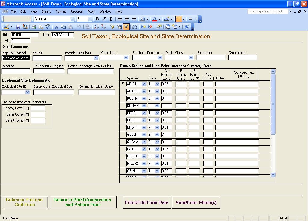
13 Medium: Transect (Plant Composition and Pattern form) Modified Domin-Krajina cover estimate in 20x20 m plot +--few 1--<0.1% 2--<1% % % % % % % 9--> 75% +--<0.2m2 Woody m m m m m m Forb Class Grass Class Class Other Class Litter Percent Cryptogram Scale 20 m pit 20 m = 1/10 th acre plot Cover estimated ocularly using cover scale within a 20x20 m area around pit, can be performed rapidly during soil survey transecting (15 minutes)
14 Medium : Transect (Plant Composition and Pattern form) Resource retention class in 20 x 20 m Interconnected grass cover or dense bunchgrasses; and surrounding ellipsoid bare patches < 30 cm Grass cover interconnected and surrounding ellipsoid bare ground patches from 30- cm Grass cover fragmented by elongate bare ground areas to cm wide but bounded in plot Grass cover fragmented by elongate bare ground areas to cm wide that across entire width of plot Bare ground interconnected in several directions and isolated grass patches up to cm Bare ground interconnected with scattered or no grass plants cm cm cm cm A simple measure of patch structure that relates to the potential for erosion Relates to Rangeland Health Indicators, but does not compare to a standard (because it is not defined yet) Used in S&T model text to describe states from Reitkerk et al., 2004, Science 305: 1926

15 Medium : Transect (Plant Composition and Pattern form) Resource retention class in 20 x 20 m Interconnected grass cover or dense bunchgrasses; and surrounding ellipsoid bare patches < 30 cm Grass cover interconnected and surrounding ellipsoid bare ground patches from 30- cm Grass cover fragmented by elongate bare ground areas to cm wide but bounded in plot Grass cover fragmented by elongate bare ground areas to cm wide that across entire width of plot Bare ground interconnected in several directions and isolated grass patches up to cm Bare ground interconnected with scattered or no grass plants cm cm cm cm from Reitkerk et al., 2004, Science 305: 1926

16 Medium : Transect (Plant Composition and Pattern form) Resource retention class in 20 x 20 m Interconnected grass cover or dense bunchgrasses; and surrounding ellipsoid bare patches < 30 cm Grass cover interconnected and surrounding ellipsoid bare ground patches from 30- cm Grass cover fragmented by elongate bare ground areas to cm wide but bounded in plot Grass cover fragmented by elongate bare ground areas to cm wide that across entire width of plot Bare ground interconnected in several directions and isolated grass patches up to cm Bare ground interconnected with scattered or no grass plants cm cm cm cm from Reitkerk et al., 2004, Science 305: 1926
 bare patches, gullies, flow patterns, but low soil loss Erosion across large areas with minor deflation, coppicing, flow patterns, pedestals Erosion across large areas")
17 Medium : Transect (Plant Composition and Pattern form) Erosion pattern class in 20 x 20 m No evidence of erosion or deposition Erosion limited to small (< 50 cm) blowouts or rills, few pedestals Erosion across large (> 50 cm) bare patches, gullies, flow patterns, but low soil loss Erosion across large areas with minor deflation, coppicing, flow patterns, pedestals Erosion across large areas with deflation, coppicing, and truncation of horizons Deposition across large areas, may have rills, flow patterns. Check one A simple measure of erosion pattern that describes the consequences of erosion processes for soils Relates to Rangeland Health Indicators, but does not compare to a standard (because it is not defined yet) Used in S&T model text to describe states
 blowouts or rills, few pedestals Erosion across large (> 50 cm) bare patches, gullies, flow patterns, but low soil loss Erosion")

18 Medium : Transect (Plant Composition and Pattern form) Erosion pattern class in 20 x 20 m No evidence of erosion or deposition Erosion limited to small (< 50 cm) blowouts or rills, few pedestals Erosion across large (> 50 cm) bare patches, gullies, flow patterns, but low soil loss Erosion across large areas with minor deflation, coppicing, flow patterns, pedestals Erosion across large areas with deflation, coppicing, and truncation of horizons Deposition across large areas, may have rills, flow patterns. Check one Another simple measure related to rangeland health indicators and used in text
19 Medium : Transect (Soil form) Surface soil properties S = No crust; may be plant base or soil without any other surface feature WP = Weak physical or bilogical crust, may have few cyanobacterial sheaths dangling from ped, no darkening from cyanobacteria. SP = Strong physical crust PDB = Poorly developed biological crust assemblage, few to many cyanobacterial sheaths, may be slightly dark, can include some other morphological group (algal crust, lichen, moss SDB = Strongly developed biological crust assemblage, obvious dark cyanobacteria, rubbery algal moss or lichen crust. CB = Cracking or curling, rubbery algal crusts, with or without lichen RA = Uniform rock armor CEM = Cemented D = Duff EL = Embedded litter These classes are estimated visually in Tier 2 plots or can be used with more intensive techniques
20 High: Intensive characterization: line point intercept vegetation, quantitative soil surface properties, production 20m x 20m plot, one stratum, four soil subsamples Baseline, 20 m long Transect, 20m long Herbaceous production subplot, 1m-sq Woody production subplot, 100m-sq 20 m Soil subsample Soil subsample, full pedon description Soil stability sample 0m 5m 10m 15m 20m Transect LPI design yields 200 points for basal and canopy cover but maintains observations within m of the soil pit

21 Characterization of soil map unit components Variable length line-point intercept 500 m, 2 m spacing 200 m, 1 m spacing 100 m,.5 m spacing =200 points Double sampling 10 1m 2 plots spread along transect Soil surface classes Diagnostic pits Spread along transect Objective is to adequately capture variation within and between map unit components

22 Landscape pattern: DOQQs and satellite imagery can add to descriptions of states Within a site, we describe the pattern of highly vegetated and bare areas to help define states expressed at larger scales than a 400m 2 plot
23
24 Conclusions The protocol has successfully matched the pace of soil survey in the White Sands Missile Range survey Without additional range cons to participate in soil survey teams, valuable data are not being gathered Numerous samples of coupled plant, soil surface, and subsoil data at MLRA scales are essential to develop and improve ESDs and S&T models ESDs need to be data driven, there is increased scrutiny
Vegetation and Soil Sampling for STM and ESD Development
 Vegetation and Soil Sampling for STM and ESD Development Brandon Bestelmeyer David Trujillo Dan Robinett USDA-ARS Jornada Experimental Range USDA-NRCS Tucson, AZ Sampling for ESDs Part 1: How can sampling
Measurements, Calculations, and Database Storage and Retrieval
 Measurements, Calculations, and Database Storage and Retrieval Laura Burkett Brandon Bestelmeyer USDA-ARS Jornada Experimental Range Data that link plant communities to soil and climate properties are
Assembling information to develop ecological site and state and transition concepts. Brandon Bestelmeyer, Jornada Experimental Range, Las Cruces, NM
 Assembling information to develop ecological site and state and transition concepts Brandon Bestelmeyer, Jornada Experimental Range, Las Cruces, NM Concepts: Ecological site: division of the landscape
Welcome to the Pedoderm and Pattern Class workshop
 Welcome to the Pedoderm and Pattern Class workshop 1. Provide participants with a clear understanding of Pedoderm and Pattern Classes (PPCs), how to record, and how to interpret them. 2. Train participants
ESDs HELPING US BE MORE EFFICIENT. Leticia Lister Supervisory Rangeland Management Specialist BLM, Las Cruces District Office
 ESDs HELPING US BE MORE EFFICIENT Leticia Lister Supervisory Rangeland Management Specialist BLM, Las Cruces District Office 11/2010 Otero Mesa, L. Phillips, 9/2010 BLM, Las Cruces District Office SIERRA
STM Development: A Systematic Approach Focused on Quality Control
 STM Development: A Systematic Approach Focused on Quality Control A Lofty Aspiration Tamzen K. Stringham University of Nevada, Reno Multiple Approaches Dig lots of holes - I will figure this out! Hang
ESD Workshop Poster Session
 ESD Workshop Poster Session A Brief Introduction January 28, 2012 Mobile Soil Survey for Interpreting and Developing ESDs Synergy Resource Solutions, Inc Mark Hendrix Calli Oiestad Melissa Kelson Jack
Soil Map Polk County, Florida
 Soil Map Polk County, Florida 28 9' 21'' 28 8' 23'' 3113000 3113200 3113400 3113600 3113800 3114000 3114200 3114400 3114600 81 51' 19'' 81 51' 19'' 416000 416000 ± 416200 416200 68 416400 68 416400 7 13
Soil Map Boulder County Area, Colorado (Planet Blue Grass) Web Soil Survey National Cooperative Soil Survey
 Web Soil Survey National Cooperative Soil Survey") 475910 476000 476090 476180 476270 476360 105 16' 21'' W 476450 476540 476630 476720 476810 4453350 4453440 4453260 4453350 4453170 4453260 4453080 4453170 4453080 475820 475910 4452990 476000 476090 476180
475910 476000 476090 476180 476270 476360 105 16' 21'' W 476450 476540 476630 476720 476810 4453350 4453440 4453260 4453350 4453170 4453260 4453080 4453170 4453080 475820 475910 4452990 476000 476090 476180
RANCHO de DOS PALMAS DAVIS, California, AC +/-
 RANCHO de DOS PALMAS DAVIS, California, 507.28 AC +/- Boundary Transmission Line Pond / Tank Well SCOTT STONE P: (530) 662-4094 sastone57@gmail.com 37874 County Road 28, Woodland, Ca. 95695 The information
Line Point Intercept Transect for Foliar Cover Composition
 Chapter 9 Line Point Intercept Transect for Foliar Cover Composition 9.1 Overview This chapter covers data elements relating to: foliar canopy and basal cover 9.2 What s New The following changes were
Ecological Site Descriptions ESDs : NRCS Site-based Approach to Land Classification and Evaluation. Nels Barrett, NRCS Ecologist SSSSNE 20
 Ecological Site Descriptions ESDs : NRCS Site-based Approach to Land Classification and Evaluation Nels Barrett, NRCS Ecologist SSSSNE 20 Overview Definition of Ecological Sites, ES Content of Ecological
Reporting from DIMA Preparing for Data Analysis
 Reporting from DIMA Preparing for Data Analysis After data collection and quality control, the next step in monitoring is extracting data for analysis. This document will guide you through extracting the
EBIPM Curriculum. Unit Pre/Post test. Module 1 Test. Rangeland ecosystems
 Module 1 Test. Rangeland ecosystems EBIPM Curriculum Unit Pre/Post test Species Identification - Label the species pictured with the correct name. (2 points each) 1 2 1 Mark W. Skinner. USDA, NRCS. 2011.
Natural resource assessment and monitoring protocols,
 Society for Range Management Learning Natural Resource Assessment Protocols: Elements for Success and Lessons From an International Workshop in Inner Mongolia, China By Guodong Han, Jeffrey E. Herrick,
Ecological site-based assessments of wind and water erosion: informing accelerated soil erosion management in rangelands
 Ecological Applications, 24(6), 2014, pp. 1405 1420 Ó 2014 by the Ecological Society of America Ecological site-based assessments of wind and water erosion: informing accelerated soil erosion management
An integrated framework for science-based arid land management
 Journal of Arid Environments Journal of Arid Environments 65 (2006) 319 335 www.elsevier.com/locate/jnlabr/yjare An integrated framework for science-based arid land management J.E. Herrick a,, B.T. Bestelmeyer
Sampling. Where we re heading: Last time. What is the sample? Next week: Lecture Monday. **Lab Tuesday leaving at 11:00 instead of 1:00** Tomorrow:
 Sampling Questions Define: Sampling, statistical inference, statistical vs. biological population, accuracy, precision, bias, random sampling Why do people use sampling techniques in monitoring? How do
Ecological Site Description Overview
 Ecological Site Description Overview 2018 Coastal Zone Soil Survey (CZSS) Work Planning Conference Savannah, GA January 9th, 2018 Greg Taylor Senior Regional Soil Scientist USDA-NRCS Raleigh, NC j.greg.taylor@nc.usda.gov
Custom Soil Resource Report for Victoria County, Texas
 United States Department of Agriculture Natural Resources Conservation Service A product of the National Cooperative Soil Survey, a joint effort of the United States Department of Agriculture and other
The Future of Soil Mapping using LiDAR Technology
 The Future of Soil Mapping using LiDAR Technology Jessica Philippe Soil Scientist/GIS Specialist March 24, 2016 Natural Resources Conservation Service Helping People Help the Land Area 12-STJ covers parts
Elevation (ft) Slope ( ) County CONDITION CATEGORY. Parameter Natural Condition Slightly impacted Moderately Impacted Heavily Impacted
 Slope ( ) County CONDITION CATEGORY. Parameter Natural Condition Slightly impacted Moderately Impacted Heavily Impacted") Version: 8/25/14 Meadow Name Date : / / MM DD YYYY GPS Location:. N. W GPS Datum (e.g., WGS 84, NAD 27) Elevation (ft) Slope ( ) County Watershed (HUC8) Landowner USGS Quad Name Observers: 7.5 or 15 (circle
Version: 8/25/14 Meadow Name Date : / / MM DD YYYY GPS Location:. N. W GPS Datum (e.g., WGS 84, NAD 27) Elevation (ft) Slope ( ) County Watershed (HUC8) Landowner USGS Quad Name Observers: 7.5 or 15 (circle
Maggie Payne Jim Turenne
 Maggie Payne Jim Turenne USDA-NRCS 60 Quaker Lane, Suite 46 Warwick, RI. 02886 401-822-8832 maggie.payne@ri.usda.gov U.S. Department of Agriculture 1935: Soil Conservation Service (SCS) Natural Resources
REMOTE SENSING ACTIVITIES. Caiti Steele
 REMOTE SENSING ACTIVITIES Caiti Steele REMOTE SENSING ACTIVITIES Remote sensing of biomass: Field Validation of Biomass Retrieved from Landsat for Rangeland Assessment and Monitoring (Browning et al.,
CRUM RANCH AREA MAP YOLO COUNTY, California, AC +/-
 CRUM RANCH AREA MAP YOLO COUNTY, California, 235.59 AC +/- Map data 2016 Google Imagery 2016, CAPCOG, DigitalGlobe, Texas Orthoimagery Program, U.S. Geological Survey, USDA Farm Service Agency Boundary
Just as ecological systems are dynamic, so too are the
 Society for Range Management Information Technologies and Ecological Site Descriptions By Curtis J. Talbot, Steven B. Campbell, Michael Hansen, and Alan B. Price Just as ecological systems are dynamic,
Custom Soil Resource Report Soil Map
 121 3' 56'' W Custom Soil Resource Report Soil Map 121 2' 49'' W 45 16' 39'' N 5013800 5014000 5014200 5014400 5014600 5014800 5015000 5015200 5015400 5015600 651800 652000 652200 652400 652600 652800
SOIL: DEFINITION, FORMATION! & LAYERS"
 SOIL: DEFINITION, FORMATION & LAYERS" What Is Soil? soil - upper-most (relatively thin) layer of Earth s crust, which supports terrestrial plants, animals, & microorganisms basic natural resource that
Custom Soil Resource Report for Forrest County, Mississippi
 United States Department of Agriculture Natural Resources Conservation Service A product of the National Cooperative Soil Survey, a joint effort of the United States Department of Agriculture and other
Custom Soil Resource Report. Soil Map. Map projection: Web Mercator Corner coordinates: WGS84 Edge tics: UTM Zone 14N WGS84. Feet.
 Custom Soil Resource Report Soil Map 3188500 3188700 3188900 3189100 3189300 3189500 3189700 96 43' 30'' W 3188500 3188700 3188900 3189100 3189300 3189500 3189700 96 42' 11'' W 28 48' 59'' N 28 48' 59''
Using the Web Soil Survey Resilience and Resistance Score Sheet Soils Report
 Using the Resilience and Resistance Score Sheet Soils Report 1. Go to http://websoilsurvey.nrcs.usda.gov/app/ and click on the Start WSS button. 2. Create an Area of Interest (AOI) using any of the available
Earth systems the big idea guiding questions Chapter 1 & 2 Earth and Earth Systems review notes are in purple
 Earth systems the big idea guiding questions Chapter 1 & 2 Earth and Earth Systems review notes are in purple How can you describe Earth? What are the composition and the structure of the atmosphere? How
CALIFORNIA AGRICULTURAL PR OPERTIES, IN C. GALE RANCH
 CALIFORNIA AGRICULTURAL PR OPERTIES, IN C. GALE RANCH LOCATION: The Ranch is located 6 Yi miles west of the City of Davis on the northwest corner of County Roads 29A and 92E in Yolo County. SIZE: 368.64
Guidelines for Using the NTCHS Indicators of Hydric Soils. 1.NTCHS Indicators of Hydric Soils (p1)
") Guidelines for Using the NTCHS Indicators of Hydric Soils Outline: 1. Glossary of Terms and Guides Used with Soil Descriptions 2. Soil Plug Extraction Procedure 3. Caveats for Using the Indicators Ref:
Guidelines for Using the NTCHS Indicators of Hydric Soils Outline: 1. Glossary of Terms and Guides Used with Soil Descriptions 2. Soil Plug Extraction Procedure 3. Caveats for Using the Indicators Ref:
Figure DR3. Constraints on the depth of the hiatus surface based on 10 Be concentration of middle core sample.
 GSA Data Repository Item 2018099 Del Vecchio, J., DiBiase, R.A., Denn, A.R., Bierman, P.R., Caffee, M.W., and Zimmerman, S.R., 2018, Record of coupled hillslope and channel response to Pleistocene erosion
Improving the Effectiveness of Ecological Site Descriptions: General State-and-Transition Models and the Ecosystem Dynamics Interpretive Tool (EDIT)
") Improving the Effectiveness of Ecological Site Descriptions: General State-and-Transition Models and the Ecosystem Dynamics Interpretive Tool (EDIT) By Brandon T. Bestelmeyer, Jeb C. Williamson, Curtis
Improving the Effectiveness of Ecological Site Descriptions: General State-and-Transition Models and the Ecosystem Dynamics Interpretive Tool (EDIT) By Brandon T. Bestelmeyer, Jeb C. Williamson, Curtis
Utilization. Utilization Lecture. Residue Measuring Methods. Residual Measurements. 24 October Read: Utilization Studies and Residual Measurements
 Utilization Utilization Lecture 24 October Read: Utilization Studies and Residual Measurements Utilization is the proportion or degree of current year s forage production that is consumed or destroyed
Web Soil Survey National Cooperative Soil Survey
 122 14' 27'' W () 122 13' 37'' W 40 8' 40'' N 564700 564800 564900 565000 565100 565200 565300 565400 565500 565600 565700 565800 40 8' 40'' N 4443400 4443500 4443600 4443700 4443800 4443900 4444000 4443400
Plant responses to climate change in the Negev
 Ben-Gurion University of the Negev Plant responses to climate change in the Negev 300 200 150? Dr. Bertrand Boeken Dry Rangeland Ecology and Management Lab The Wyler Dept. of Dryland Agriculture Jacob
Application of an Enhanced, Fine-Scale SWAT Model to Target Land Management Practices for Maximizing Pollutant Reduction and Conservation Benefits
 Application of an Enhanced, Fine-Scale SWAT Model to Target Land Management Practices for Maximizing Pollutant Reduction and Conservation Benefits Amanda Flynn, Todd Redder, Joe DePinto, Derek Schlea Brian
The Effect of Weather, Erosion, and Deposition in Texas Ecoregions
 The Effect of Weather, Erosion, and Deposition in Texas Ecoregions 7.8B: I can analyze the effects of weathering, erosion, and deposition on the environment in ecoregions of Texas Weathering The breakdown
12- TOL MLRA Soil Survey Area Approximately 15,000,000 Acres
 !@ 12- TOL MLRA Soil Survey Area Approximately 15,000,000 Acres Office Location: Tolland, Connecticut Staff: Donald Parizek Acting Soil Survey Office Party Leader Jacob Isleib Soil Scientist Marissa Theve
Wyoming Big Sagebrush Sites Fire/Land Treatment Study Overview
 Wyoming Big Sagebrush Sites Fire/Land Treatment Study Overview J. Swanson, S. Swanson, P. Murphy K. McAdoo, B. Schultz University of Nevada; UNR Cooperative Extension Ranches Elko BLM Elko BLM Implications
It is relatively simple to comprehend the characteristics and effects of an individual id fire. However, it is much more difficult to do the same for
 Interactive Effects of Plant Invasions and Fire in the Hot Deserts of North America Matt Brooks U.S. Geological Survey Western Ecological Research Center Yosemite Field Station, El Portal CA Presentation
Soil Morphology and Stratigraphy on an Erosional Footslope: Dickinson Experiment Station in Western North Dakota
 Soil Morphology and Stratigraphy on an Erosional Footslope: Dickinson Experiment Station in Western North Dakota By D. Claypool, D. G. Hopkins, and J. L. Richardson ABSTRACT A first order soil survey of
Document Control. Revision No. Date issued Authors Reviewed by Date Reviewed Revision type. 1 25/07/2012 T. Brown A. Sinel 25/07/2012 Draft
 Kanmantoo Mine LFA Monitoring Autumn 2012 1 20 July 2012 Version 1 Prepared by EBS Ecology for Hillgrove Resources Document Control Revision No. Date issued Authors Reviewed by Date Reviewed Revision type
3 Communities, Biomes, and Ecosystems BIGIDEA Write the Big Idea for this chapter.
 3 Communities, Biomes, and Ecosystems BIGIDEA Write the Big Idea for this chapter. Use the What I Know column to list the things you know about the Big Idea. Then list the questions you have about the
Soil Surveys. What are the most important properties to consider in a taxonomic system used for making a soil survey?
 Soil Surveys What are the most important properties to consider in a taxonomic system used for making a soil survey? What is a Soil Survey? Inventory of soil resources Delineation of spatial distribution
Custom Soil Resource Report for Washoe County, Nevada, South Part
 United States Department of Agriculture Natural Resources Conservation Service A product of the National Cooperative Soil Survey, a joint effort of the United States Department of Agriculture and other
Directorate E: Sectoral and regional statistics Unit E-4: Regional statistics and geographical information LUCAS 2018.
 EUROPEAN COMMISSION EUROSTAT Directorate E: Sectoral and regional statistics Unit E-4: Regional statistics and geographical information Doc. WG/LCU 52 LUCAS 2018 Eurostat Unit E4 Working Group for Land
Jim Turenne. Soils on Social Media
 Jim Turenne USDA-NRCS 60 Quaker Lane, Suite 46 Warwick, RI. 02886 401-822-8832 Jim.turenne@ri.usda.gov Soils on Social Media www.twitter.com/soilsne www.fb.com/soilsne www.nesoil.com U.S. Department of
Weathering & Erosion
 Name Test Date Hour Earth Processes#1 - Notebook Weathering & Erosion LEARNING TARGETS I can explain the process of weathering. I can explain why weathering is important. I can describe the difference
APPENDIX B. NMFWRI Field Inventory Summary for Three L Canyon, pre-treatment (2008 and 2009) and post-treatment (2013)
 and post-treatment (2013)") SACRAMENTO MOUNTAINS WATERSHED STUDY APPENDIX B NMFWRI Field Inventory Summary for Three L Canyon, pre-treatment (2008 and 2009) and post-treatment (2013) These documents describe efforts and results from
SACRAMENTO MOUNTAINS WATERSHED STUDY APPENDIX B NMFWRI Field Inventory Summary for Three L Canyon, pre-treatment (2008 and 2009) and post-treatment (2013) These documents describe efforts and results from
NEW CONCEPTS - SOIL SURVEY OF THE FUTURE
 NEW CONCEPTS - SOIL SURVEY OF THE FUTURE The new process of doing soil surveys by Major Land Resource Areas (MLRA) highlights this section. Special emphasis is given to an overview of the National Soil
Vegetation Structure Assessment (VSA):
:") Vegetation Structure Assessment (VSA): LFA Procedures for Measuring Vegetation Structure and its Functional Role Vegetation plays an important functional role in providing goods and services for both itself
Vegetation Structure Assessment (VSA): LFA Procedures for Measuring Vegetation Structure and its Functional Role Vegetation plays an important functional role in providing goods and services for both itself
3.3 CLIMATE, GEOLOGY, TOPOGRAPHY, AND SOILS CLIMATE GEOLOGY TOPOGRAPHY
 3.3 CLIMATE, GEOLOGY, TOPOGRAPHY, AND SOILS This section describes the climate, geology, topography, and soil resource characteristics of the Yolo Bypass Wildlife Area (Wildlife Area). Agricultural soil
Lecture 24 Plant Ecology
 Lecture 24 Plant Ecology Understanding the spatial pattern of plant diversity Ecology: interaction of organisms with their physical environment and with one another 1 Such interactions occur on multiple
Partnering with LANDFIRE, NatureServe, and Heritage Programs. Utilizing Legacy Data for Ecological Site Concept Development and Descriptions
 Partnering with LANDFIRE, NatureServe, and Heritage Programs Utilizing Legacy Data for Ecological Site Concept Development and Descriptions Content LANDFIRE: BpS vs. EVT LANDFIRE: Disturbance Models NatureServe:
Southwest LRT Habitat Analysis. May 2016 Southwest LRT Project Technical Report
 Southwest LRT Habitat Analysis Southwest LRT Project Technical Report This page intentionally blank. Executive Summary This technical report describes the habitat analysis that was performed to support
This is trial version
 Journal of Rangeland Science, 2012, Vol. 2, No. 2 J. Barkhordari and T. Vardanian/ 459 Contents available at ISC and SID Journal homepage: www.rangeland.ir Full Paper Article: Using Post-Classification
Carlos Rymer. Cornell University
 The Ecological Ecological Role Role of of Biological Biological Soil Soil The Crusts in in the the Rome Rome Sand Sand Plains Plains Crusts Carlos Rymer Rymer Carlos Advisor: Rebecca Rebecca Schneider
FINAL REPORT Rangeland Rehabilitation through Water Conservation/Concentration
 FINAL REPORT Rangeland Rehabilitation through Water Conservation/Concentration Alyson McDonald, Extension Assistant - Hydrology and Charles Hart, Extension Range Specialist Photo Courtesy: Bill Thompson
Describing Greater sage-grouse (Centrocercus urophasianus) Nesting Habitat at Multiple Spatial Scales in Southeastern Oregon
 Nesting Habitat at Multiple Spatial Scales in Southeastern Oregon") Describing Greater sage-grouse (Centrocercus urophasianus) Nesting Habitat at Multiple Spatial Scales in Southeastern Oregon Steven Petersen, Richard Miller, Andrew Yost, and Michael Gregg SUMMARY Plant
Describing Greater sage-grouse (Centrocercus urophasianus) Nesting Habitat at Multiple Spatial Scales in Southeastern Oregon Steven Petersen, Richard Miller, Andrew Yost, and Michael Gregg SUMMARY Plant
REVEGETATION TRENDS AND LESSONS MONTANA COAL
 REVEGETATION TRENDS AND LESSONS MONTANA COAL The secret of managing is to keep the guys who hate you away from the guys who are undecided. Casey Stengel Can't anybody here play this game? Casey Stengel
The Land Degradation Surveillance Framework LDSF. Guide to Field Sampling and Measurement Procedures. Markus G. Walsh and Tor-G.
 The Land Degradation Surveillance Framework LDSF Guide to Field Sampling and Measurement Procedures Markus G. Walsh and Tor-G. Vågen! October 2006!! The Land Degradation Surveillance Framework Table of
Wetland Delineation. Proposed CVS Pharmacy 9th Street and US Highway 98 (Avenue E) Apalachicola, Franklin County, Florida
 Apalachicola, Franklin County, Florida") Wetland Delineation Proposed CVS Pharmacy 9th Street and US Highway 98 (Avenue E) Apalachicola, Franklin County, Florida August 11, 2016 Terracon Project No. 49167572 Prepared for: Halstead Montgomery,
Wetland Delineation Proposed CVS Pharmacy 9th Street and US Highway 98 (Avenue E) Apalachicola, Franklin County, Florida August 11, 2016 Terracon Project No. 49167572 Prepared for: Halstead Montgomery,
soil assessment and management planning for CSG projects
 Use of historical soils information for soil assessment and management planning for CSG projects Cameron Traill 1, Greg Holz 2, Alex Kochnieff 3, Sarah de Man 4, Adam Christison 5 1 WorleyParsons Services,
Biological soil crust distribution on the Boardman Conservation Area: Results from 2009 monitoring
 Biological soil crust distribution on the Boardman Conservation Area: Results from 2009 monitoring Introduction Adrien Elseroad, Joseph St. Peter, and Maile Uchida The Nature Conservancy March 2010 Biological
Web (Java, ArcGIS Server [WebADF, flex, silverlight]) Mobile (ArcGIS Mobile, ArcPad, Windows Mobile) Deskt
![Web (Java, ArcGIS Server [WebADF, flex, silverlight]) Mobile (ArcGIS Mobile, ArcPad, Windows Mobile) Deskt](/thumbs/96/129284052.jpg "Web (Java, ArcGIS Server [WebADF, flex, silverlight]) Mobile (ArcGIS Mobile, ArcPad, Windows Mobile) Deskt") GIS Services company in Lincoln, NE Custom GIS database design and build (for local, county, state and private corporations) Custom (ESRI and non-esri) application design and build in Java, C++, C#,.Net
GIS Services company in Lincoln, NE Custom GIS database design and build (for local, county, state and private corporations) Custom (ESRI and non-esri) application design and build in Java, C++, C#,.Net
1.1 What is Site Fingerprinting?
 Site Fingerprinting Utilizing GIS/GPS Technology 1.1 What is Site Fingerprinting? Site fingerprinting is a planning tool used to design communities where protection of natural resources is the primary
Measuring & monitoring soil carbon. Ermias Aynekulu Betemariam, Keith Shepherd, Richard Coe, Markus Walsh, Tor-G Vagen & Leigh Winowiecki
 Measuring & monitoring soil carbon Ermias Aynekulu Betemariam, Keith Shepherd, Richard Coe, Markus Walsh, Tor-G Vagen & Leigh Winowiecki September 13 2012 Issues There is a lack of coherent and rigorous
GIS Assessment and Modeling to Support Soil Landscape Correlation. Southern Regional Cooperative Soil Survey Conference July 17, 2008
 GIS Assessment and Modeling to Support Soil Landscape Correlation Southern Regional Cooperative Soil Survey Conference July 17, 2008 Sharon W. Waltman Soil Scientist-Spatial Data Analyst Amanda Moore Soil
4-2 What Shapes an Ecosystem? Slide 1 of 39
 4-2 What Shapes an Ecosystem? 1 of 39 Biotic and Abiotic Factors Biotic and Abiotic Factors Ecosystems are influenced by a combination of biological and physical factors. The biological influences on organisms
O\.OLSSON \ ASSOC I ATES
 O\.OLSSON \ ASSOC I ATES NRCS Soils Report Larry D. Knox Juniper Hills Private Landing Strip ) OAProject No. 012-1776 760 Horizon Drive, Suite 1021 Grand Junction, CO 815061 TEL 970.263.7800 I FAX 970.263.7456
Projecting a Gully on Wilson Ranch Meadow, Eldorado National Forest By David Russell and Angelina Lasko Humboldt State University
 Projecting a Gully on Wilson Ranch Meadow, Eldorado National Forest By David Russell and Angelina Lasko Humboldt State University Introduction The purpose of this project is to create a digital elevation
Steve Pye LA /22/16 Final Report: Determining regional locations of reference sites based on slope and soil type. Client: Sonoma Land Trust
 Steve Pye LA 221 04/22/16 Final Report: Determining regional locations of reference sites based on slope and soil type. Client: Sonoma Land Trust Deliverables: Results and working model that determine
4-2 What Shapes an Ecosystem?
 Biology 1 of 39 4-2 What Shapes an Ecosystem? 2 of 39 Biotic and Abiotic Factors Biotic and Abiotic Factors Ecosystems are influenced by a combination of biological and physical factors. 3 of 39 1 Biotic
Developing Monitoring Protocols for Vegetation Response to Watershed Restoration
 Developing Monitoring Protocols for Vegetation Response to Watershed Restoration Natalie R. Wilson* 1, Laura M. Norman 1, Miguel Villarreal 1, Steve Buckley 2, Joel Sankey 3, David Dean 3, Steve Delong
Reinterpreting Historical Data for Evidence-Based Shrubland Management
 Natural Resources and Environmental Issues Volume 17 Issue 1 Threats to Shrubland Ecosystem Integrity Article 18 January 2011 Reinterpreting Historical Data for Evidence-Based Shrubland Management Jeb
Unit 3 Study Guide -- Greenberg science, 6C
 Unit 3 Study Guide -- Greenberg science, 6C Name Pd. Date / / 2018 + +5 extra credit points on the test if submitted complete and correct ON THE TEST DATE. + A copy can be found on my website mgreenberg.weebly.com
Biology. Slide 1 of 39. End Show. Copyright Pearson Prentice Hall
 Biology 1 of 39 4-2 What Shapes an Ecosystem? 2 of 39 Biotic and Abiotic Factors Biotic and Abiotic Factors Ecosystems are influenced by a combination of biological and physical factors. Biotic biological
Project Leader: Project Partners:
 UTILIZING LIDAR TO MAP HIGH PRIORITY WOODLAND HABITAT IN ARKANSAS DEVELOPING METHODOLOGY AND CONDUCTING A PILOT PROJECT IN THE OZARK HIGHLANDS TO MAP CURRENT EXTENT, SIZE AND CONDITION Project Summary
TSEGI WASH 50% DESIGN REPORT
 TSEGI WASH 50% DESIGN REPORT 2/28/2014 Daniel Larson, Leticia Delgado, Jessica Carnes I Table of Contents Acknowledgements... IV 1.0 Project Description... 1 1.1 Purpose... 1 Figure 1. Erosion of a Headcut...
Custom Soil Resource Report for Fresno County, California, Western Part
 United States Department of Agriculture Natural Resources Conservation Service A product of the National Cooperative Soil Survey, a joint effort of the United States Department of Agriculture and other
Cover/Frequency (CF) Sampling Method
 Sampling Method") Cover/Frequency (CF) Sampling Method EXECUTIVE SUMMARY The FIREMON Cover/Frequency (CF) method is used to assess changes in plant species cover and frequency for a macroplot. This method uses multiple
Cover/Frequency (CF) Sampling Method EXECUTIVE SUMMARY The FIREMON Cover/Frequency (CF) method is used to assess changes in plant species cover and frequency for a macroplot. This method uses multiple
Joint Federal Agency Submerged Aquatic Vegetation Survey Guidance for the New England Region Updated August 11, 2016
 Joint Federal Agency Submerged Aquatic Vegetation Survey Guidance for the New England Region Updated August 11, 2016 FOREWORD This guidance is the result of on-going interagency collaboration between the
Custom Soil Resource Report for Santa Fe Area, New Mexico, Santa Fe County and Part of Rio Arriba County; and Santa Fe County Area, New Mexico
 United States Department of Agriculture Natural Resources Conservation Service A product of the National Cooperative Soil Survey, a joint effort of the United States Department of Agriculture and other
Custom Soil Resource Report for Clark County, Washington
 United States Department of Agriculture Natural Resources Conservation Service A product of the National Cooperative Soil Survey, a joint effort of the United States Department of Agriculture and other
Custom Soil Resource Report for Clackamas County Area, Oregon
 United States Department of Agriculture Natural Resources Conservation Service A product of the National Cooperative Soil Survey, a joint effort of the United States Department of Agriculture and other
Opportunities to Develop an Interagency Spatial Hierarchy for ESD Applications
 Opportunities to Develop an Interagency Spatial Hierarchy for ESD Applications Presentation Outline Brief history of ecological classification and mapping What is a spatial hierarchy concepts and examples
On-Site Soils Investigation. Buttermilk Way Storm water Treatment Project Buzzards Bay. MA. February 28 th, 2012
 1 On-Site Soils Investigation Buttermilk Way Storm water Treatment Project Buzzards Bay. MA February 28 th, 2012 Glenn Stanisewski, Resource Soil Scientist, USDA-NRCS, West Wareham, MA Introduction: The
VCS MODULE VMD0018 METHODS TO DETERMINE STRATIFICATION
 VMD0018: Version 1.0 VCS MODULE VMD0018 METHODS TO DETERMINE STRATIFICATION Version 1.0 16 November 2012 Document Prepared by: The Earth Partners LLC. Table of Contents 1 SOURCES... 2 2 SUMMARY DESCRIPTION
Biosphere. All living things, plants, animals, (even you!) are part of the zone of the earth called the biosphere.
 are part of the zone of the earth called the biosphere.") Unit 1 Study Guide Earth s Spheres Biosphere All living things, plants, animals, (even you!) are part of the zone of the earth called the biosphere. Hydrosphere Water covers ¾ of the earth, made up mostly
Unit 1 Study Guide Earth s Spheres Biosphere All living things, plants, animals, (even you!) are part of the zone of the earth called the biosphere. Hydrosphere Water covers ¾ of the earth, made up mostly
E1212 Vol. 3 I~~~~~~~~~~~~~~~~~~~~~~~~~~~~~~~~~~~~~~~~~~~~~~~~~~~~~~~~~~~~~~~~~~~~~~~~~~~~~~~~~~~~~~~~~~~~~~~~~~~~~~~~~~~~~~
 Public Disclosure Authorized Public Disclosure Authorized Public Disclosure Authorized Public Disclosure Authorized EU Tacis: Joint Environment Programme 11 FOREST PROTECTION AND REFORESTATION PROJECT,
Custom Soil Resource Report for Multnomah County Area, Oregon
 United States Department of Agriculture Natural Resources Conservation Service A product of the National Cooperative Soil Survey, a joint effort of the United States Department of Agriculture and other
Airborne laser altimeter applications to water management
 Remote Sensing and Geographic Information Systems for Design and Operation of Water Resources 721 Systems (Proceedings of Rabal Symposium S3, April 1997). IAHS Publ. no. 242, 1997 Airborne laser altimeter
Four Soil Orders on a Vermont mountaintop One-third of the world s soil orders in a 2500 square meter research plot
 Four Soil Orders on a Vermont mountaintop One-third of the world s soil orders in a 2500 square meter research plot Thomas R. Villars, Scott W. Bailey, Donald S. Ross 38% of world s soils are in these
Karr J.R. and D.R. Dudley Ecological perspective on water quality goals. Environmental Manager 5:55-68.
 Ecological Integrity Assessment: An Approach for Assessing Ecosystem Condition to Guide Conservation and Management Ecological Integrity " the ability of an ecosystem to support and maintain i a balanced
Custom Soil Resource Report for Valley County, Montana
 United States Department of Agriculture Natural Resources Conservation Service A product of the National Cooperative Soil Survey, a joint effort of the United States Department of Agriculture and other
Global Biogeography. Natural Vegetation. Structure and Life-Forms of Plants. Terrestrial Ecosystems-The Biomes
 Global Biogeography Natural Vegetation Structure and Life-Forms of Plants Terrestrial Ecosystems-The Biomes Natural Vegetation natural vegetation is the plant cover that develops with little or no human