Demonstration Test Catchments building our capacity for catchment management
|
|
|
- Kevin Osborne
- 5 years ago
- Views:
Transcription


1 Demonstration Test Catchments building our capacity for catchment management Bob Harris A joint project of Defra, WAG and the Environment Agency


2 The BIG Challenges

3 providing ecosystem services which are out of balance River catchments are complex systems

4 Demonstration Test Catchments Overall Initial Objective and Hypothesis DTC Programme will: assess the effectiveness of on farm mitigation measures for reducing diffuse pollution from agriculture to water produce evidence to test the hypothesis that it is possible through the implementation of multiple onfarm measures to: cost effectively reduce the impact of agricultural diffuse pollution to water on ecological function, while maintaining food security
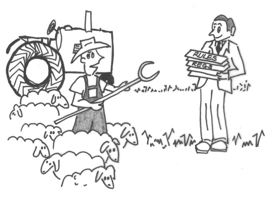
5 The Challenges Water and river ecosystems have little identifiable value in our society; We have lost the connectivity of people to their (environmental) surroundings Tendency to work a top down system and find it difficult to capture local learning ; Some river basins do not lend themselves to large scale joined up planning geographically and institutionally; Science/research has not been closely involved in the (WFD) process 5
6 The Challenges WFD allows adaptive approaches and encourages synergies, but the RBPs so far have been developed with little built in. Focus has been on the process of preparing them we need to address diffuse pressures but all our processes and culture for past 40 years have been honed to address point sources We collect data from the wrong places Our approach is not holistic we tend to deal with one issue at a time, in isolation whatever s in the public eye
7 To balance and maximise ecosystem services we need to understand the complexities as well as we can/need to, work holistically, and integrate Integrated understanding Integration between scales Integrated approaches. Integrated working


8 Today?

9 Tomorrow?

10

11 Integrated Catchment Management Community & stakeholders Science & knowledge Policy & regulation

12 Learning from Europe Be well informed Have a sound understanding of the functioning of the soil water system and its interaction with the socio economic system Manage Adaptively Learn to manage by managing to learn as a way of addressing uncertainties in the system Take a participatory approach Learn and manage together to develop win wins
13 DTC Three Objectives To test the hypothesis it is possible to cost effectively reduce the impact of agricultural diffuse water pollution on ecological function while maintaining food security through the implementation of multiple on farm measures. To develop a research platform to host collaborative research and thus test: More efficient and effective ways of undertaking research How interdisciplinary working can inform integrated policy. To explore a new model for catchment management centred around local knowledge and understanding.
14 Delivery of objectives by: Developing communities of practice with wider stakeholder groups Obtaining and using existing data, information and knowledge more effectively, better definition of the weight of evidence on agricultural diffuse pollution for policy and regulation Linking currently disparate research on interrelated impacts of agriculture on the environment
15 Overall project broken down into five work streams (components) 1. Design and implementation of monitoring approach for each catchment catchment conceptual model 2. On farm measures to mitigate diffuse pollution by monitoring outcomes at a range of scales 3. Knowledge exchange and knowledge transfer, 4. Development of infrastructure for data management and dissemination 5. Predictive Modelling and DSS 3 and 4 undertaken in close co operation with the NERC VO


16 Focusing effort on 3 catchments but linking closely to other catchment work and an additional Welsh catchment to be added in 2010/11
17 DTC some figures 3 (4) Catchments 9 sub catchments each 10 square Km in area 5 year programme 6 million budget >40 Institutions
18 Demonstration Test Catchments Testing measures to protect water Using new monitoring approaches Making data available Sharing knowledge Linking monitoring to modelling Building research platforms Building Communities of Practice Being adaptive, participatory, collaborative


19 Catchment Management Objective of DTC project working with family of other activities EA & NE activities Catchment Sensitive Farming etc Local schemes/other projects LA and Rivers Trusts etc Water company schemes and investigations NERC & RCUK Programmes VO Shared vision of Integrated Catchment Management DTC Defra Programmes Scottish and Irish Catchment projects


20 DTC as a Research Platform Researchers working collaboratively with themselves stakeholders and policy makers/regulators; Multi disciplinary approaches lead to interdisciplinary working; Local stakeholders bring local knowledge, policymakers bring challenges; State of the art monitoring producing data which will be made available to others; Data linked closely to models; an iterative process develops our knowledge and understanding Communities of practice develop and Knowledge exchange just happens!
21 Integrated Approaches Win wins Rely on knowledge, understanding and education Incentives Rely on a funding source If consumers and taxpayers pay they have to understand why the value of ecosystems and how people relate to them Regulation Minimal, but always some who won t conform; and it needs to be joined up e.g. water and land use
22
23 A mix of approaches Win wins where you can Regulation where they won t Incentives where you can t
24 What DTC project can offer links to existing research consortia working with local stakeholder communities on real problems; close links with policy and regulatory communities at local and national levels; opportunities to explore new techniques and technologies with the ability to rapidly verify resultant data; early take up of successful techniques in support of scientific research that is policy relevant.
25 DTC Project Contacts General enquiries: Defra Project Manager: Dan McGonigle, EA Project Manager: Sean Burke DTC Secretariat: Bob Harris, : robert.harris@defra.gsi.gov.uk Avon Consortium: Prof Adrian Collins, ADAS Eden Consortium: Prof Phil Haygarth, Lancaster Uinversity Wensum Consortium:Dr. Kevin Hiscock, UEA GHG Platform: Luke.Spadavecchia, luke.spadavecchia@defra.gsi.gov.uk
Framework on reducing diffuse pollution from agriculture perspectives from catchment managers
 Framework on reducing diffuse pollution from agriculture perspectives from catchment managers Photo: River Eden catchment, Sim Reaney, Durham University Introduction This framework has arisen from a series
16540/14 EE/cm 1 DG E 1A
 Council of the European Union Brussels, 5 December 2014 (OR. en) 16540/14 ENV 965 CULT 139 NOTE From: To: Subject: General Secretariat of the Council Delegations Charter of Rome on Natural and Cultural
Advancing Geoscientific Capability. Geological Survey of Finland
 Advancing Geoscientific Capability Geological Survey of Finland GTK in brief The Geological Survey of Finland (GTK) is one of the largest European centres of excellence in assessment, research and the
CONFERENCE STATEMENT
 Final draft CONFERENCE STATEMENT We, the elected representatives of Canada, Denmark/Greenland, the European Parliament, Finland, Iceland, Norway, Russia, Sweden and the United States of America; In collaboration
Natura 2000 and spatial planning. Executive summary
 Natura 2000 and spatial planning Executive summary DISCLAIMER The information and views set out in this study are those of the author(s) and do not necessarily reflect the official opinion of the Commission.
LAND USE PLANNING (LUP) TOOLS A bottom-up tool
 TOOLS A bottom-up tool") LAND USE PLANNING (LUP) TOOLS A bottom-up tool PARTICIPATORY 3D MAPPING IN THE UPPER SURINAME RIVER BASIN A tool for an inclusive land use planning and decision making in Suriname. Sara O.I. Ramirez Gomez
LAND USE PLANNING (LUP) TOOLS A bottom-up tool PARTICIPATORY 3D MAPPING IN THE UPPER SURINAME RIVER BASIN A tool for an inclusive land use planning and decision making in Suriname. Sara O.I. Ramirez Gomez
SPLAN-Natura Towards an integrated spatial planning approach for Natura th January, 2017 Brussels. Commissioned by DG Environment
 SPLAN-Natura 2000 Towards an integrated spatial planning approach for Natura 2000 Commissioned by DG Environment 17 th January, 2017 Brussels V. Simeonova (Ph.D.) Drivers towards integrating Biodiversity
Geological information for Europe : Towards a pan-european Geological Data Infrastructure
 Geological information for Europe : Towards a pan-european Geological Data Infrastructure Integrating geoscientific information for EU competitiveness Co-funded by the European Union European societal
BACKGROUND INFORMATION DOCUMENT
 Strategic Environmental Assessment of the SKA Phase 1 in South Africa BACKGROUND INFORMATION DOCUMENT www.skaphase1.csir.co.za SKAPhase1@csir.co.za Introduction The MeerKAT and SKA projects are part of
Economic and Social Council
 United Nations Economic and Social Council Distr.: General 2 July 2012 E/C.20/2012/10/Add.1 Original: English Committee of Experts on Global Geospatial Information Management Second session New York, 13-15
Catchment Guide Appendix 2: Case Studies
 Catchment Guide Appendix 2: Case Studies List of Case Studies 1. Ribble Catchment Online Information 2. Upper Thames Catchment Integrated Local Delivery The Ribble Catchment Question 8: What information
COUNCIL OF THE EUROPEAN UNION. Brussels, 2 May /14 CULT 68
 COUNCIL OF THE EUROPEAN UNION Brussels, 2 May 2014 9129/14 CULT 68 NOTE from: General Secretariat of the Council to: Permanent Representatives Committee (Part 1) / Council No. prev. doc.: 8892/14 CULT
Weather Climate Science to Service Partnership South Africa
 PROJECTS UNDERWAY Title of the Weather Climate Science to Service Partnership South Africa Together, building on an existing strong partnership, South African Weather Service and the Met Office will build
Sustainable tourism in for Sustaibale Danang
 Sustainable tourism in for Sustaibale Danang A case study of Balearic Ecotax in Spain toward Sustainable tourism Miki Yoshizumi Associate Professor College of Gastronomy Management Ritsumeikan University
GENERAL RECOMMENDATIONS. Session 7. Breakout discussion. discuss on regional and interregional. proposals 1. COLLABORATION BETWEEN PROGRAMMES
 Session 7 24 July 2016, 9.00-11.00 Breakout discussion on regional and interregional joint project proposals Mr Shahbaz Khan summarized the two days of presentations and exchanges and requested the participants
DEPARTMENT OF GEOLOGY AND MINERAL INDUSTRIES WAYS & MEANS SUBCOMMITTEE ON NATURAL RESOURCES MARCH 2, 2017
 DEPARTMENT OF GEOLOGY AND MINERAL INDUSTRIES WAYS & MEANS SUBCOMMITTEE ON NATURAL RESOURCES MARCH 2, 2017 1 ABOUT DOGAMI AGENCY MISSION, VISION & GOALS 2 Lidar image of a stream network along the Umpqua
Outline. Tourism A Viable Option for Abandoned Mines?
 Tourism A Viable Option for Abandoned Mines? Pete Whitbread-Abrutat Post-Mining Alliance, Eden Project Outline Post-Mining Alliance Mining and tourism Aspects of mining and tourism Case studies Success
Climate Services in Practice UK Perspective
 Climate Services in Practice UK Perspective Chris Hewitt ICCS, Columbia University, October 2011 Overview Perspectives on: Why have a climate service? What is a climate service? UK activities Examples
Alluvium Consulting Australia Senior integrated water management specialist Position Description March 2018
 Alluvium Consulting Australia Senior integrated water management specialist Position Description March 2018 Overview of Alluvium We are an employee-owned consulting firm founded in 2006 to provide advice
Plenary Session 2, part 2 A European shared information system
 3 rd GMES Forum 5 6 June 2003 Athens Plenary Session 2, part 2 A European shared information system Gordon McInnes Deputy Director European Environment Agency 1 I keep six honest serving men. They taught
What is Spatial Planning?
 Spatial Planning in the context of the Responsible Governance of Tenure What is Spatial Planning? Text-only version This course is funded by the European Union through the EU-FAO Improved Global Governance
Urban Climate Resilience
 Urban Climate Resilience in Southeast Asia Partnership Project Introduction Planning for climate change is a daunting challenge for governments in the Mekong Region. Limited capacity at the municipal level,
Foundation Geospatial Information to serve National and Global Priorities
 Foundation Geospatial Information to serve National and Global Priorities Greg Scott Inter-Regional Advisor Global Geospatial Information Management United Nations Statistics Division UN-GGIM: A global
Natural Resource Management Strategy. Southern Tasmania. Summary. Natural Resource Management Strategy for Southern Tasmania Summary
 Natural Resource Management Strategy Summary Southern Tasmania 2015 2020 Natural Resource Management Strategy for Southern Tasmania 2015 2020 - Summary i Disclaimer In developing this Strategy, every effort
Lombardy Region Territorial Context and Planning Structures
 Lombardy Region Territorial Context and Planning Structures Carlo Palazzoli RUMORE project manager carlo_palazzoli@regione.lombardia.it 15th May 2018 / RUMORE Third Partner Meeting Lombardy Region in Europe
Ministry of Health and Long-Term Care Geographic Information System (GIS) Strategy An Overview of the Strategy Implementation Plan November 2009
 Strategy An Overview of the Strategy Implementation Plan November 2009") Ministry of Health and Long-Term Care Geographic Information System (GIS) Strategy An Overview of the Strategy Implementation Plan November 2009 John Hill, Health Analytics Branch Health System Information
Ministry of Health and Long-Term Care Geographic Information System (GIS) Strategy An Overview of the Strategy Implementation Plan November 2009 John Hill, Health Analytics Branch Health System Information
West-Estonian Archipelago Biosphere Reserve and Lima Action Plan
 West-Estonian Archipelago Biosphere Reserve and Lima Action Plan Lia Rosenberg, BR co ordinaator Toomas Kokovkin, MAB Focal Point ESTONIA 15.03.2016 LIMA Location on the globe and Europe The West-Estonian
TEEB: The Economics of Ecosystems and Biodiversity Overview of Process, Content and Approach
 TEEB: The Economics of Ecosystems and Biodiversity Overview of Process, Content and Approach Heidi Wittmer TEEBAgriFood writers workshop Paris, 9-10 May 2016 TEEB s genesis Potsdam Initiative Biological
USER PARTICIPATION IN HOUSING REGENERATION PROJECTS
 USER PARTICIPATION IN HOUSING REGENERATION PROJECTS Dr. Hatice Sadıkoğlu Bahçeşehir University, Faculty of Architecture and Design Prof. Dr. Ahsen Özsoy Istanbul Technical University, Faculty of Architecture
Restoring Rivers in Cumbria Online Story Map of a case study on the River Lyvennet
 Restoring Rivers in Cumbria Online Story Map of a case study on the River Lyvennet Summary This Story Map presents a river restoration case study for the River Eden Catchment, Cumbria. Students can learn
Land Use in the context of sustainable, smart and inclusive growth
 Land Use in the context of sustainable, smart and inclusive growth François Salgé Ministry of sustainable development France facilitator EUROGI vice president AFIGéO board member 1 Introduction e-content+
Shetland Islands Council
 Shetland Islands Council Response to EU Green Paper on Territorial Cohesion Shetland Islands Council is strongly in favour of a territorial dimension to cohesion policy and welcomes the Commission s consultation
Economic and Social Council
 United Nations Economic and Social Council Distr.: General 18 July 2016 Original: English Committee of Experts on Global Geospatial Information Management Sixth session New York, 3-5 August 2016 Item 2
CATCHMENT SCIENCE 2011
 CATCHMENT SCIENCE 2011 SCHEDULE AND PROGRAMME OF SPEAKERS DAY 1 (14th September 2011) Registration at the Mansion House from 09:00 12:45 Gather 13:00 Introductory addresses 13:45 Keynote 1 Andrew Sharpley
Alps Results from the ESPON Project. Common spatial perspectives for the Alpine area. Towards a common vision
 Results from the ESPON Project Alps 2050 Common spatial perspectives for the Alpine area. Towards a common vision Tobias Chilla, University of Erlangen Cooperation Alps 2020+ 1 & 2 October 2018 Salzburg
A BRIEF INTRODUCTION TO COPERNICUS AND CAMS
 A BRIEF INTRODUCTION TO COPERNICUS AND CAMS Juan Garcés de Marcilla Director of Copernicus Services European Centre for Medium-Range Weather Forecasts Copernicus EU Copernicus EU Copernicus EU www.copernicus.eu
sentinel-2 COLOUR VISION FOR COPERNICUS
 sentinel-2 COLOUR VISION FOR COPERNICUS SATELLITES TO SERVE By providing a set of key information services for a wide range of practical applications, Europe s Copernicus programme is providing a step
Together towards a Sustainable Urban Agenda
 Together towards a Sustainable Urban Agenda The City We (Youth) Want Preliminary findings from youth consultations Areas Issue Papers Policy Units 1.Social Cohesion and Equity - Livable Cities 2.Urban
1. Baltic SCOPE Towards coherence and cross-border solutions in Baltic Maritime Spatial Plans
 NSHC 32th Conference Explanatory Note Dublin, Ireland Item E.2 MSP 21-23 June 2016 Germany Cross border MSP for the EEZ, a case study from the Baltic Sea The Federal Maritime and Hydrographic Agency of
COMMON CONCEPTUAL AND OPERATIONAL FRAMEWORKS FOR RESEARCH AND SUSTAINABLE MANAGEMENT OF NESTED SOCIO-ECOLOGICAL SYSTEMS ACROSS LARGE WATERSHEDS
 COMMON CONCEPTUAL AND OPERATIONAL FRAMEWORKS FOR RESEARCH AND SUSTAINABLE MANAGEMENT OF NESTED SOCIO-ECOLOGICAL SYSTEMS ACROSS LARGE WATERSHEDS Angheluta VADINEANU 1 & Nusret KARAKAYA 2 1 Department of
Mapping and Assessment of Ecosystems and their Services
 Mapping and Assessment of Ecosystems and their Services ALTER-Net Conference 2013: Science underpinning the EU 2020 Biodiversity Strategy. April 2013 Gent Joachim MAES 1 This presentation is based on the
Towards international cooperation in the development of Marine Spatial Plans for the North Pacific: economic, social, and environmental dimensions
 Towards international cooperation in the development of Marine Spatial Plans for the North Pacific: economic, social, and environmental dimensions A.V. Sereda, V.B. Lobanov V.I. Il ichev Pacific Oceanological
EUSAIR on sea topics from Slovenian perspective
 MINISTRY OF FOREIGN AFFAIRS REPUBLIC OF SLOVENIA EUSAIR on sea topics from Slovenian perspective Mag. Andreja Jerina National Coordinator 4 EU MRS: 270 millions of population 19 MS 12 non MS Sea basin
INSPIREd solutions for Air Quality problems Alexander Kotsev
 INSPIREd solutions for Air Quality problems Alexander Kotsev www.jrc.ec.europa.eu Serving society Stimulating innovation Supporting legislation The European data puzzle The European data puzzle 24 official
The National Spatial Strategy
 Purpose of this Consultation Paper This paper seeks the views of a wide range of bodies, interests and members of the public on the issues which the National Spatial Strategy should address. These views
Adding value to Copernicus services with member states reference data
 www.eurogeographics.org Adding value to Copernicus services with member states reference data Neil Sutherland neil.sutherland@os.uk GIS in the EU 10 November 2016 Copyright 2016 EuroGeographics 61 member
EcoServ-GIS. EcoServ GIS Stage I. Why EcoServ GIS? 17/12/2012
 EcoServ-GIS Ecosystem Services Mapping: A Wildlife Trust GIS Toolkit to map ecosystem services at a county scale Dr Jonathan Winn Living Landscape Coordinator Durham Wildlife Trust Dr Chloe Bellamy Ecosystem
HUMAN DEVELOPMENT IN ECOLOGICAL CONTEXT
 HUMAN DEVELOPMENT IN ECOLOGICAL CONTEXT ECOLOGICAL BACKGROUND We do not live in isolation we interact Environment: everything outside the system that we (the organism) live in Human beings = biological
Application for Horizon Research and Innovation Framework Programme. ANTHUSIA Anthropology of Human Security in Africa (48 months)
") Application for Horizon 2020 - Research and Innovation Framework Programme ANTHUSIA Anthropology of Human Security in Africa (48 months) 2 Presentation of IARA (Institute for Anthropological Research in
Application for Horizon 2020 - Research and Innovation Framework Programme ANTHUSIA Anthropology of Human Security in Africa (48 months) 2 Presentation of IARA (Institute for Anthropological Research in
ERA-NET CRUE Funding Initiative. Risk Assessment and Risk Management in Small Urban Catchments
 ERA-NET CRUE Funding Initiative Integrate, Consolidate and Disseminate European Flood Risk Management Research Kick-off Meeting of Research Projects Risk Assessment and Risk Management in Small Urban Catchments
Council Workshop on Neighbourhoods Thursday, October 4 th, :00 to 4:00 p.m. Burlington Performing Arts Centre
 Council Workshop on Neighbourhoods Thursday, October 4 th, 2012 1:00 to 4:00 p.m. Burlington Performing Arts Centre Agenda Introductions Warm-Up Exercise Presentation Exercise Neighbourhood Planning Break
Economic Development and Transport in New Zealand. Thomas Simonson 4/7/2016
 Economic Development and Transport in New Zealand Thomas Simonson 4/7/2016 Definitions > Economics is about people and communities, and the skills, equipment and resources they acquire to pursue their
Belfairs Academy GEOGRAPHY Fundamentals Map
 YEAR 12 Fundamentals Unit 1 Contemporary Urban Places Urbanisation Urbanisation and its importance in human affairs. Global patterns of urbanisation since 1945. Urbanisation, suburbanisation, counter-urbanisation,
Towards a National Ecosystem Services Strategy for Australia
 Towards a National Ecosystem Services Strategy for Australia Peter Ampt, Simone Maynard, Geoff Gorrie, Philippa Rowland, Allan Dale, Jeremy Thompson, Steve Cork, Bob Douglas, Lynne Reeder Australia 21
Spatial Planning & Climate Change
 Spatial Planning & Climate Change A GRIP Approach Joseph Scott, Glasgow & Clyde Valley Strategic Development Plan Authority, Scotland Today s presentation Context Spatial Planning & Climate Change Exploring
GLP Workshop on. The design of integrative models of natural and social systems in land change science
 The Global land Project Nodal Office on Integration and Modelling, Aberdeen, UK GLP Workshop on The design of integrative models of natural and social systems in land change science Introduction Post Workshop
Governance and Urban Nexus: Closing the gaps
 Governance and Urban Nexus: Closing the gaps Donovan Storey Chief, Sustainable Urban Development, Environment & Development Division National Dialogue on Urban Nexus in Thailand Bangkok, UNCC, 19 March
IN THE ZONE? Nature and culture in a Swedish Biosphere Reserve. Katarina Saltzman Department of Conservation University of Gothenburg
 IN THE ZONE? Nature and culture in a Swedish Biosphere Reserve Katarina Saltzman Department of Conservation University of Gothenburg In this presentation I will present a study conducted within the research
New Frameworks for Urban Sustainability Assessments: Linking Complexity, Information and Policy
 New Frameworks for Urban Sustainability Assessments: Linking Complexity, Information and Policy Moira L. Zellner 1, Thomas L. Theis 2 1 University of Illinois at Chicago, Urban Planning and Policy Program
TOWARDS STRATEGIC SPATIAL PLANNING IN JAMAICA: THE NATIONAL SPATIAL PLAN
 TOWARDS STRATEGIC SPATIAL PLANNING IN JAMAICA: THE NATIONAL SPATIAL PLAN JIEP 5th Biennial Conference on the Environment: Balancing National Development and Environmental Protection June 6, 2011 Jamaica
REGIONAL SDI DEVELOPMENT
 REGIONAL SDI DEVELOPMENT Abbas Rajabifard 1 and Ian P. Williamson 2 1 Deputy Director and Senior Research Fellow Email: abbas.r@unimelb.edu.au 2 Director, Professor of Surveying and Land Information, Email:
Applying Health Outcome Data to Improve Health Equity
 Applying Health Outcome Data to Improve Health Equity Devon Williford, MPH, Health GIS Specialist Lorraine Dixon-Jones, Policy Analyst CDPHE Health Equity and Environmental Justice Collaborative Mile High
The future of SDIs. Ian Masser
 The future of SDIs Ian Masser Presentation Considers two questions relating to the future development of SDIs throughout the world Where have we got to now? Where should we go from here? Identifies four
Outline National legislative & policy context Regional history with ESSIM ESSIM Evaluation Phase Government Integration via RCCOM Regional ICOM Framew
 What MSP Implementation could change in the Maritimes Region Tim Hall, Regional Manager Oceans and Coastal Management Division Ecosystem Management Branch Fisheries and Oceans Canada Maritimes Region BIO
CHAPTER 4 HIGH LEVEL SPATIAL DEVELOPMENT FRAMEWORK (SDF) Page 95
 Page 95") CHAPTER 4 HIGH LEVEL SPATIAL DEVELOPMENT FRAMEWORK (SDF) Page 95 CHAPTER 4 HIGH LEVEL SPATIAL DEVELOPMENT FRAMEWORK 4.1 INTRODUCTION This chapter provides a high level overview of George Municipality s
CHAPTER 4 HIGH LEVEL SPATIAL DEVELOPMENT FRAMEWORK (SDF) Page 95 CHAPTER 4 HIGH LEVEL SPATIAL DEVELOPMENT FRAMEWORK 4.1 INTRODUCTION This chapter provides a high level overview of George Municipality s
ACTION PLAN FOR WORLD HERITAGE IN LATIN AMERICA AND THE CARIBBEAN ( )
") Annex ACTION PLAN FOR WORLD HERITAGE IN LATIN AMERICA AND THE CARIBBEAN (2014-2024) The current Regional Action Plan for Latin America and the Caribbean for 2014-2024 has been elaborated by the State Parties
Annex ACTION PLAN FOR WORLD HERITAGE IN LATIN AMERICA AND THE CARIBBEAN (2014-2024) The current Regional Action Plan for Latin America and the Caribbean for 2014-2024 has been elaborated by the State Parties
Territorial Intelligence and Innovation for the Socio-Ecological Transition
 Territorial Intelligence and Innovation for the Socio-Ecological Transition Jean-Jacques Girardot, Evelyne Brunau To cite this version: Jean-Jacques Girardot, Evelyne Brunau. Territorial Intelligence and
a national geological survey perspective François ROBIDA BRGM (French Geological Survey)
") a national geological survey perspective François ROBIDA BRGM (French Geological Survey) Pre-Conference Seminar on Socio-Economic Value of Geospatial for National and Regional Development 21 August 2017,
a national geological survey perspective François ROBIDA BRGM (French Geological Survey) Pre-Conference Seminar on Socio-Economic Value of Geospatial for National and Regional Development 21 August 2017,
Building the Sustainable Network of Settlements on the Caspian Sea Region of Kazakhstan
 Building the Sustainable Network of Settlements on the Caspian Sea Region of Kazakhstan Introduction The Ecological Zoning and Identification of Ecological Capacity of Natural and Socio- Economic Potential
DELIVERING ECOSYSTEM- BASED MARINE SPATIAL PLANNING IN PRACTICE
 DELIVERING ECOSYSTEM- BASED MARINE SPATIAL PLANNING IN PRACTICE A first assessment for the UK and Ireland January 08 GLOBAL WARMING IMAGES / WWF ABOUT WWF WWF is the world s leading independent conservation
Challenges and Successes in Sharing Geospatial Data in Africa
 Challenges and Successes in Sharing Geospatial Data in Africa 2018 GeoNode Summit Torino, Italy March 26-28, 2018 Bernard Justus Muhwezi Manager, Geo-Information Services Uganda Bureau of Statistics, Kampala,
Smart City Governance for effective urban governance. David Ludlow Assoc. Professor European Smart Cities University of the West of England, Bristol
 Smart City Governance for effective urban governance David Ludlow Assoc. Professor European Smart Cities University of the West of England, Bristol Complexities of urban territorial governance Complexities
INSPIRE Basics. Vlado Cetl European Commission Joint Research Centre. https://ec.europa.eu/jrc/
 INSPIRE Basics Vlado Cetl European Commission Joint Research Centre https://ec.europa.eu/jrc/ Serving society Stimulating innovation Supporting legislation Outline SDI? Why European SDI? INSPIRE Policy
Reflections on Problems of Fit, Interplay and Scale. Timothy Moss
 Reflections on Problems of Fit, Interplay and Scale Timothy Moss WINS Inception Workshop, Berlin, 14-16 July 2014 Structure 1. Introducing the analytical framework 2. The illusion of perfect spatial fit
New Prospects for Peripheral Rural Regions Helmut Hiess Glasgow, 19th of May 2010
 New Prospects for Peripheral Rural Regions Helmut Hiess Glasgow, 19th of May 2010 ÖROK: Organisation & Tasks Austrian Conference on Spatial Planning (ÖROK, since 1971): Joint organisation by Federal level,
Strengthening the cooperation in the region: Carpathian, Tisa,, Danube and Black Sea areas
 Strengthening the cooperation in the region: Carpathian, Tisa,, Danube and Black Sea areas 14th October 2009 SEE Annual Conference Advancing development through transnational cooperation in South East
Atlas of Living Scotland New data infrastructure for research and citizen science
 Atlas of Living Scotland New data infrastructure for research and citizen science John Sawyer and Rachel Stroud CEO NBN Trust, j.sawyer@nbn.org.uk Who is the National Biodiversty Network? The National
Social Studies 3 Vocabulary Cards. century. History 1. period of 100 years
 century History 1 period of 100 years chronological History 1 in order of time decade History 1 period of 10 years timeline History 1 list of important events in the order in which they happened year History
ikapa GDS White Paper Governance and Integration Department of the Premier Department of the Premier 2 December 2008
 ikapa GDS White Paper Governance and Integration Outline of presentation Western Cape Situation Strategic Framework Implementation Framework Alignment and implementation example Diversified economy Small
Economic and Social Council
 United Nation E/C.20/2012/4/Add.1 Economic and Social Council Distr.: General 2 July 2012 Original: English Committee of Experts on Global Geospatial Information Management Second session New York, 13-15
EcoServ-GIS. Ecosystem Services Mapping: A Wildlife Trust GIS Toolkit to map ecosystem services at a county scale
 EcoServ-GIS Ecosystem Services Mapping: A Wildlife Trust GIS Toolkit to map ecosystem services at a county scale Dr Jonathan Winn Living Landscape Coordinator Durham Wildlife Trust Dr Chloe Bellamy Ecosystem
Concept note. High-Level Seminar: Accelerating Sustainable Energy for All in Landlocked Developing Countries through Innovative Partnerships
 Concept note High-Level Seminar: Accelerating Sustainable Energy for All in Landlocked Developing Countries through Innovative Partnerships Date: 24 and 25 October 2016 Venue: Conference Room C3, Vienna
Kakahu Catchment Group. Sub-Catchment Plan Recommendations to Zone Committee
 Kakahu Catchment Group Sub-Catchment Plan Recommendations to Zone Committee About our catchment Part of the Temuka nutrient allocation zone (red) State of the Environment testing showed the Lower Kakahu
Entrepreneurship on islands and other peripheral regions. Specific Contract No 6511 implementing Framework contract No CDR/DE/16/2015/
 Entrepreneurship on islands and other peripheral regions Specific Contract No 6511 implementing Framework contract No CDR/DE/16/2015/ Aims of this study: To analyse the particular challenges and obstacles
Vulnerability and Adaptation to Climate Change
 Vulnerability and Adaptation to Climate Change Prof. Dr. Christoph Görg Department of Social Sciences, University of Kasssel Head of Department Environmental Politics, UFZ Leipzig 1 Introduction: Climate
SPIMA Spatial dynamics and strategic planning in metropolitan areas
 Targeted Analysis SPIMA Spatial dynamics and strategic planning in metropolitan areas Executive Summary Conference version 1 February 2018 0 1. Background To address the challenges of metropolitan development
Coastal Mapping Follow on? Bruno Frachon Corine Lochet Gaël Morvan
 Coastal Mapping Follow on? Bruno Frachon Corine Lochet Gaël Morvan Shared objectives; IHO DG MARE CPMR Development of a Joint European Coastal Mapping Programme (JECMaP) within the IHO EU network with
Sediment management: a european perspective. Piet den Besten Centre for Water Management Rijkswaterstaat, Netherlands
 Sediment management: a european perspective Piet den Besten Centre for Water Management Rijkswaterstaat, Netherlands Content Background of Dutch-German exchange (DGE plus) What is needed for adequate sediment
Linking the value of ocean space and marine ecosystem to coastal reclamation planning: A case study of Xiamen
 Linking the value of ocean space and marine ecosystem to coastal reclamation planning: A case study of Xiamen Benrong Peng, PhD Coastal and Ocean Management Institute, Xiamen University (COMI) Nov. 20,
GMES and AFRICA Support Programme 1st technical committee meeting
 GMES and AFRICA Support Programme 1st technical committee meeting Developing an Earth Observation Operational Application for Coastal Ecosystems Mapping, Monitoring and Assessment of the Northern African
Fig 1. Steps in the EcoValue Project
 Assessing the Social and Economic Value of Ecosystem Services in the Northern Forest Region: A Geographic Information System (GIS) Approach to Landscape Valuation Principal Investigator(s): Dr. Matthew
THE SEVILLE STRATEGY ON BIOSPHERE RESERVES
 THE SEVILLE STRATEGY ON BIOSPHERE RESERVES 1 VISION FOR BIOSPHERE RESERVES IN THE 21 ST CENTURY The international Seville Conference on Biosphere Reserves, organised by UNESCO, adopted a two-pronged approach,
Scenario development for reaching urban and environmental planning integration in the context of climate change*.
 Scenario development for reaching urban and environmental planning integration in the context of climate change*. PhD (cand) Verónica Zagare (TUDelft, ) Dr. Diego Sepúlveda Carmona (TUDelft) September
Land Use Planning and Agriculture: Austrian Experiences and Challenges I
 Land Use Planning and Agriculture: Austrian Experiences and Challenges I SULANET Summer School 2016 Walter Seher BOKU Vienna 1 Land Use Planning and Agriculture 2 Land Use Planning and Agriculture Agriculture
Assessment and valuation of Ecosystem Services for decision-makers
 Assessment and valuation of Ecosystem Services for decision-makers An introduction to the ARIES approach Ferdinando Villa *, Ken Bagstad Gary Johnson, Marta Ceroni *Basque Center for Climate Change, Bilbao,
WORLD DAY TO COMBAT DESERTIFICATION 2018 IN MONGOLIA
 WORLD DAY TO COMBAT DESERTIFICATION 2018 IN MONGOLIA This year the WDCD slogan was Land has true value. Invest in it to address the importance of sustainable land use, land degradation prevention and its
Open Data meets Big Data
 Open Data meets Big Data Max Craglia, Sven Schade, Anders Friis European Commission Joint Research Centre www.jrc.ec.europa.eu Serving society Stimulating innovation Supporting legislation JRC is Technical
Advancing Urban Models in the 21 st Century. Jeff Tayman Lecturer, Dept. of Economics University of California, San Diego
 Advancing Urban Models in the 21 st Century Jeff Tayman Lecturer, Dept. of Economics University of California, San Diego 1 Regional Decision System Better tools Better data Better access Better Decisions
Land Accounts - The Canadian Experience
 Land Accounts - The Canadian Experience Development of a Geospatial database to measure the effect of human activity on the environment Who is doing Land Accounts Statistics Canada (national) Component
UPTAKE AND PATHWAYS OF COASTAL ADAPTATION PROCESSES IN AUSTRALIA
 2015 Effect of Climate Change on the World's Oceans - Santos, Brazil UPTAKE AND PATHWAYS OF COASTAL ADAPTATION PROCESSES IN AUSTRALIA COASTAL COLLABORATION CLUSTER: MEETING COASTAL CHALLENGES Débora M.