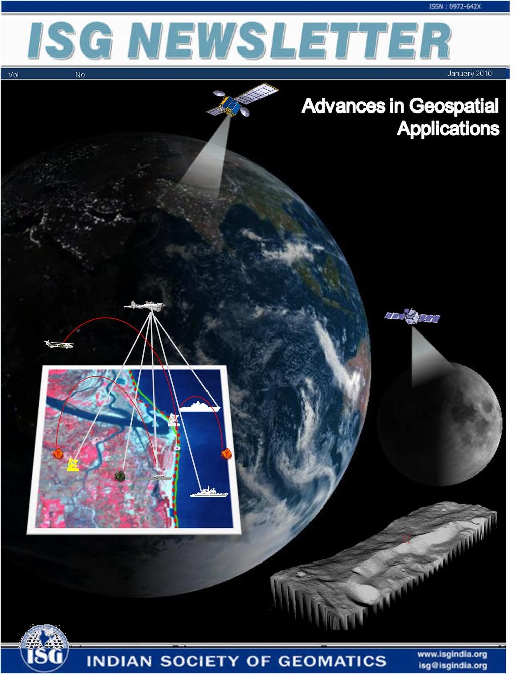
ISG NEWSLETTER. Volume 15, No. 1 4 Advances in Geospatial Applications December, In this Issue. Editorial 3
|
|
|
- Cuthbert Bishop
- 5 years ago
- Views:
Transcription
1
2 ISG NEWSLETTER Volume 15, No. 1 4 Advances in Geospatial Applications December, 2009 In this Issue Editorial 3 Articles च य न-1 भ रत क थम च मशन 4 ए.एस. करणक म र, प न त व प एव स ब ध प. क छ ल Moon & The Chandryaan -1 TMC Application 14 A.S Arya, R P Rajsekhar & Dr. Ajai Planetary Geomatics 18 B Gopala Krishna & Amitabh Technological Trends in Geo-informatics 24 Ajai & P M Udani Data Constraints in Precisely Quantifying the Indicators and Impacts of Climate Change (With special reference to snow, glaciers, hydrometeorology and wetlands) 30 Shakil A Romshoo Driving Force in Climate Change Dynamics 46 V K Verma Status of Tamil Nadu Coast in the Context of Global Warming and Related Sea Level Rise 51 C. J. Kumanan, S. M. Ramasamy, J. Saravanavel, & A.S. Rajawat Society Matters 59 From ISG Secretariat Memberships 1
3 ISG Executive Council President Dr. R.R. Navalgund, Director, Space Applications Centre, Ahmedabad Vice-Presidents Dr. Ajai, Space Applications Centre, Ahmedabad Shri K.R. Sridhara Murthy, Antrix Corporation, Bangalore Secretary Dr. S.K. Pathan, Space Applications Centre, Ahmedabad Joint Secretary Dr. Y.V.S. Murthy, National Remote Sensing Centre, Hyderabad Treasurer Shri N.S. Mehta, Space Applications Centre, Ahmedabad Members Shri Vinod M. Bothale, RRSSC, Jodhpur Shri T. Gangadhar Rao, RSI Soft Tech Pvt. Ltd., Hyderabad Shri M.H. Kalubarme, Space Applications Centre, Ahmedabad Prof. Arun K. Saraf, IIT, Roorkee Shri Ramakrishna Suryawanshi, Pune Ex-officio Shri Rajesh Mathur, ESRI India, New Delhi Permanent Invitees Dr Ajai, Chief Editor, Journal of Geomatics Shri R P Dubey, Associate Editor, JoG & Editor, ISG Newsletter rajesh.mathur@niit tech.com drajai1953@gmail.com rpdubey@sac.isro.gov,.in Editorial Board ISG Newsletter Editor R P Dubey Members Dr. Beena Kumari Dr. Nandakumar Pushpalata Shah Shashikant A Sharma C P Singh Dr. Punit Swaroop (co-opted) rpdubey@sac.isro.gov.in beena@sac.isro.gov.in nandakumar@sac.isro.gov.in pushpa@sac.isro.gov.in sasharma@sac.isro.gov.in cpsingh@sac.isro.gov.in punitswarup@sac.isro.gov.in Send your contributions/comments to the Editor at the above . 2
4 Editorial During the year 2000, ISG Newsletter underwent a change - from a mere newsletter, it was transformed into a specialized 'magazine', publishing special issues on themes which were considered to be most relevant to the time of publication, apart from important news of interest to Geomatics community. During the same year, with December 2000 Issue i.e. volume 6, number 4, the Society started publishing ISG Newsletter in a printed form. The tradition of bringing out special thematic issues has been continued. The current special issue on Advances in Geospatial Applications is a pertinent topic for today. The issue overall should fit in the backdrop of National Conference Geomatics 2010 being organized by ISG in Space Applications Centre, Ahmedabad due to its thematic relevance. In this issue, you will find very informative articles on planetary geomatics in form of the applications and the mission of India s first lunar mission Chandrayaan-1 geomatics and some authorative articles related to geological aspects of climate change and sea level rise due to global warming. The painstaking efforts of Dr Ajai in collection of articles and of Shri C P Singh in compilation of the issue and design of cover needs special mention. The authors have been very supportive of the newsletter by their liberalcontirbutions of articles cast in popular accent. With this issue, the hardcopy circulation of this newsletter will cease to exist as per the guidelines provided by ISG Executive Council. However, the softcopy version will be continued and circulated through the society s website ( Members of ISG and other professionals are requested to keep reading the newsletter and sending their articles for upcoming volumes of future issues. R P Dubey 3

5 च क सतह स म यतय स ख, ध ल और प थर स य और च ट न व ल ह भ म क ओर अ भम ख भ ग पर पथर ल सतह लगभग 60 क.म.म ट ह और द सर भ ग पर लगभग 107 क.म.ह च ट न म क शयम, ए य म नयम एव टट नयम क म ऽ अ धक ह च र म ऽ म स लक न और ह लयम भ ह ल ख बरस स स र म डल क ह लयम क च सतह क स थ ट कर क क रण वह क ख नज म फ सकर च र म ऽ म ह लयम-3 एव ह लयम-4 उपल ध ह च म क उ व च म क उ प अभ तक प करण क द र म ह और इसक उ व क ब र म अन म न लग ए गए ह क य क स बन ह ग रस य नक ख नज य सम थ नक और क ल न बम आ कड़ क उपय ग करत ह ए, कए गए अ ययन स च क उ व क ब र म प च म ख स त क अ भध रण बन वख डन स त- बह त समय पहल कभ च म प व स प थक ह गय श यद तब प व इतन ग ल नह थ जतन आज ह और उस अस त लन क क रण यह द ह स म ब ट गई महण स त- स र म डल म कह च म क उ व ह आ, अत ब द म यह प व क ग व कष ण ऽ क प र ध म आय सब-अ भवध क स त- प व और च म क सह अ भवध न र स र न य ल स एक ह समय म उ व ह आ टकर न क मह ण स त- स र ण ल क इ तह स म बह त पहल प व क प रबमण और स य क प रबमण करन व ल मह ण ओ ( मह ज स च ट न क ब हत भ ड र) क अ य य बय क मलव स उ व ह आ वश लक य (ब हत ) स घ ट स त- च न क ल म म गल क आक र क मह ण क प व क स थ स घ ट ह आ, जसस वक सत ह त प व स बड़ म ऽ म पद थ क न क सन ह आ और इनक मलन स च म क उ व ह आ प भ म च म पर व नक मशन भ जन क स ब ध म वच र क श आत भ रत य खग लय नक स स इट र क गई मह य एव अ त र भ तक, प व व न, भ - व न, भ तक, खग लक तथ डक क व भ न स ब द ऽ क लगभग 100 त त व नक क एक दल न अ ल 2003 म इस क य दल क अ ययन रप ट क सम क व त त वच र वमश क ब द तभ गय न एकमत स भ रत क च मशन श करन क सफ रश क त प त, भ रत सरक र न इसर क च य न-1 न मक थम भ रत य च मशन क त व क म ज र द द 5
6 च मशन क क र म य प स प च क र क च मशन ह त ह पहल क र म य न च क प स स ग जरत ह जस ल य व च कहत ह द सर क र म य न व नक उपकरण ल कर च क नध रत क म प र मण करत ह जस ओरब टर कहत ह त सर क र म च क सतह पर अम नव य न क उत रकर व नक पर ण कए ज त ह जस ल डर-र वर कहत ह च थ क र म य ऽ म नव च क सतह स नम न ल त ह जस स पल- रटन कहत ह और प चव क र म च क सतह पर म नव पद प ण ह त ह जस म न- मशन कहत ह भ रत क च य न-1 ओरब टर क र क मशन ह जस म अ त र य न क च क सतह स 100 क.म. क ऊ च ई पर ग ल क र व य क म प रब मत कय गय ह लआय इस मशन क थ मक उ य, - च म क उ व और वक स क ब र म व नक न क बढ़ न, भ रत क गक य मत ओ क उ नयन करन, मह क अ ययन ज स नय और उ जक ऽ म अन स ध न करन क लए भ रत क य व व नक क च न त प ण अवसर द न करन, च क म न चऽ त य र करन ज इसक सतह पर वत रत व भ न त व और ख नज क दश य तथ च क सतह क ऐस फ ट म फ ल न क च क सतह ल ण क ल ब ई, च ड़ ई और ऊ च ई क प रश द प स पहच न ज सक आ द ह च य न-1 मशन क म यम स क श भ व न, ख नज व न य और रस य नक म न चऽण स व भ न भ - व न य य नट क नध रण करन स भव ह ग, ज क च म क र भक वक स मक इ तह स क ज च कर ग रस य नक म न चऽण च म क भ -पप ट क वज त य क त और गहर ई स त रत व न क नध रण कर ग तथ इसक र म गम मह स गर क प रक पन क क छ पहल ओ क ज च कर ग एव स घटक क स य जन क नध रण कय ज सकत ह, ज क प व क नम ण स भ स ब द ह यह मशन म लभ त अन स ध न क अन सरण क लए य व ओ ह त एक मह वप ण रक ह ग गक य और व नक ल भ क अल व च य न-1 द श म म लभ त व न और इ ज नय र ग अन स ध न क व कर ग श क जगत, वश ष प स व व लय क व नक, च य न-1 स अ य त ल भ वत ह ग च य न 1 क व नक उपकरण च य न- 1 र इ त म ल कय गय पहल प च भ रत य व नक उपकरण इस क र ह (i) च स घ ट ब (एम.आई.प.) Ð च य न-1 क नध रत क म थ पत करन क ब द एम.आई.प. क य न स अलग करक च क सतह स ट कर लग न ह त इस उपकरण क नम ण कय गय इस उपकरण क त न म य भ ग थ जसम (i) व डय क मर -ज च सतह पर उत र क द र न 6

 एमआईएस क मर च ज़ रड र आ ट म")


7 नजद क स चऽ ल सक, (ii) रड र त गत म प -ज एम.आई.प. क च सतह स ऊ च ई म प सक और (iii) पद थ प ड प श म प -ज च क पय वरण म रह घटक क ब र म ज नक र द सक इसर क म न इ प ट ब (एमआईप ) एमआईएस क मर च ज़ रड र आ ट म टर एमआईप इ क ट ब द - म उ ट म ल पट वबम स र भ ई अ त र क र एम.आई.प. क नम ण कय गय (ii) च ल सर र ज ग उपकरण (एल.एल.आर.आई.) - यह उपकरण अवर ल सर क श क प द क च म क सतह क ओर भ जत ह और पर व त त क श क स व दत करत ह ऐस करत ह ए यह उपकरण च सतह क ऊ च ई क ब र म यथ थ स चन उपल ध कर त ह ब गल र म इसर क व त- क शक ण ल य गश ल ( लय स) र एल.एल.आर.आई. क नम ण ह आ एल.एल.आर.आई. क व त त व नद शन न क र ह : प द व दर 10 Hz द रब न 20 स.म. य स, पर वत नश ल ल ज़र तर ग ॐ त 1064 न न म टर स म म पनश त <5 म टर (iii) भ भ ग म न चऽण क मर (ट.एम.स.) - यह एक इल श नक क मर ह ज च क सतह क त- य म चऽ ल त ह इसक नम ण इस तरह कय गय ह क च क व त क ऊ च ई क, चऽ क ज च करन स ह पत लग य ज सकत ह ट.एम.स. च सतह क ऽ प रम ण य (3 D) चऽ ल त ह ऐस चऽ च क सतह पर ऐस ऽ, ज व नक च क ह और अ धक व त त अवल कन क य य ह, क पहच नन म सह यत कर ग इसक नम ण अहमद ब द थत स क र कय गय ह ट एमस क व त त व नद शन न न क र ह - भ वभ दन म ज प शम ब ड क स य अवल कन र ख ग णत 5 म टर (100 कम क ऊ च ई स ) 20 कल म टर 1-प नब म ट क ब ड ( न न म टर) फ र, न द र और आ ट न म क त न क मर स 7
 - यह उपकरण, ए स करण जसम श ह, क उ सज न क स व दत करत ह अप ल -15 ल ड ग स इट 13 जनवर 09 क द ख गए ब")

 अ त प शम त ब बऽ (एच.व ई.एस.आई.")

 म ज 20 कल म टर प शम र ज 400-950 न न म टर प शम")


8 (iv) उ च ऊज व ल ए स करण प शमम प (एच.ई.ए स) - यह उपकरण, ए स करण जसम श ह, क उ सज न क स व दत करत ह अप ल -15 ल ड ग स इट 13 जनवर 09 क द ख गए ब टर क ल ब-स ब टर क 2.5 ड प र य जस व नक र 'उ च' म न ज त ह ऐस ए स करण क अ भल खन व व षण क र य र नयम तथ थ रयम ज स भ र घटक क उप थ त क पत अ य प स लग य ज सकत ह इस उपकरण क प.आर.एल., अहमद ब द व ब गल र क इसर उपमह क र स य प स बन य गय (v) अ त प शम त ब बऽ (एच.व ई.एस.आई.) - यह क मर, च स य व त त श य और अवर क श क रक ड करत ह ए च क सतह क र ग न चऽ ल त ह यह च क सतह स क श क 64 अ य त पतल ब ड म वभ जत करत ह जसस क छ न द व त य प रघटन कट ह त ह ह स (एच.व ई.एस.आई.) स लय गय चऽ च सतह पर वत रत ख नज क तर क ज नन म सह यत करत ह ह स स क, अहमद ब द र न म त ह HySI क व त त व नद शन न न क र ह : भ - वभ दन 80 म टर (100 कम क ऊ च ई स ) म ज 20 कल म टर प शम र ज न न म टर प शम ब ड क स य प शम वभ दन 64 अ वरल <15 न न म टर एच.व ई.एस.आई. 3- व भ न प शम ब ड म त ब ब भ रत क प च भ रत य व नक य ऽ क अल व च य न-1 अ य द श र बन य गय छ :उपकरण क भ ल गय इसर न ट न, जम न, व डन, ब ग रय तथ स य र य अमर क क क ल छ : व नक उपकरण क चयन कय व इस क र ह (i) चत र नकट अवर प शमम प (एस.आई.आर.-2) यह उपकरण ऐस करण क पत लग सकत ह और रक ड कर सकत ह तथ यह पत लग न म भ सह यत करत ह क च सतह पर ख नज कह और कतन म ऽ म उप थत ह इसक अल व इस उपकरण स च सतह पर उप थत पद थ वह क अ य धक गरम व ठ ड क थ त क अन स र क छ क ल व ध क ब द, क स बदलत ह इसक भ पत लग सकत ह इस य ऽ क नम ण जम न क म स ल क स थ न र कय गय एसआईआर-2 (जम न स )- उ श मक म नरल म प ग प शल स म 0.9 स 2.7µम. 8
 - यह उपकरण स य स उ स ज त ए स करण क च सतह पर क छ स म मय स टकर न क त बय व प उनस उ स ज त अ य क र क ए स- करण क म पत ह")
 मन स ष रक र ड र ( मन -एस.ए.आर.")

 - यह च म क वगत च बक य ऽ क ब र म ज नन क लए स र ग उपल ध कर सकत ह स थ ह स थ अ त र म थत पद थ क छ क ल व ध क")
 क नम ण कय गय (v) च ख नज व न य म न चऽक (एम ) - ज स क न म स ह पत चलत ह एम-3 च म पर उप थत ख नज क क र तथ")

9 (ii) ए स- करण प शमम प - (स.आई.ए स.एस.) - यह उपकरण स य स उ स ज त ए स करण क च सतह पर क छ स म मय स टकर न क त बय व प उनस उ स ज त अ य क र क ए स- करण क म पत ह यह य ऽ म न शयम, क शयम, ए य म नयम, ट ट नयम, स लक न तथ ल ह ज स घटक क ब टव र क समझन म सह यक ह त ह ट न क दरफ ड एप लट न य गश ल तथ इसर उपमह क, ब गल र क र स य प स इस उपकरण क नम ण कय गय (iii) मन स ष रक र ड र ( मन -एस.ए.आर.) - च म क व य ऽ म य द क ई जल बफ उप थत ह त उसक पत लग न क लए मन एस.ए.आर.क नम ण कय गय इस य ऽ क र म द म क छ म टर तक क गहर ई तक जल बफ क उप थ त क पत लग सकत ह इस उपकरण क वक स स य प स ज न-ह क स व व लय क य गक भ तक य गश ल और स य र य अमर क क न व य य क र कय गय और न स र म यत द गई (iv) उप कल व ट परम ण पर वत न व षऽ (एस.ए.आर.ए.) - यह च म क वगत च बक य ऽ क ब र म ज नन क लए स र ग उपल ध कर सकत ह स थ ह स थ अ त र म थत पद थ क छ क ल व ध क ब द क स ध र -ध र बदलत ह, उस पर भ क श ड लत ह व डन क अ त र भ तक स थ न क र एस.ए.आर.ए.(स र ) क नम ण कय गय (v) च ख नज व न य म न चऽक (एम ) - ज स क न म स ह पत चलत ह एम-3 च म पर उप थत ख नज क क र तथ स थ ह स थ उसक थ न क पत लग न म सह यत करत ह एम3 क वक स स य प स उन व व लय तथ न स क ज ट न दन य गश ल र कय गय (vi) व करण म ऽ म न टर (आर.ए.ड.ओ.एम.) - ब ग रयन व न अक दम र न म त यह य ऽ च म क च र ओर आ छ दत उ च श व ल उपपरम ण कण क ब र म समझन म सह यक ह यह अ य त मह वप ण ह य क ऐस कण म नव क लए खतरन क ह आर.ए.ड.ओ.एम. च म क च र ओर व करण क ब टव र और उसक म ऽ क ब र म ज नक र उपल ध कर त ह भ - स वध ए च य न-1 क भ स वध ओ क त न भ ग ह - 9

- यह क ब गल र क उपनगर प य म थ पत ह एस.स.स. अ त र य न क म चन क ब द च य न-1 मशन क म य क बन च य न-1 क व भ न क य क न प दन करन ह त अन द श द त ह ए र डय आद श एस.स.स. स ह भ ज ज त थ च य न-1 स आन व ल श य और एक स ओ क ध र क म नव र समझन य य क प म अथ नव चन करन म स म स टव यर स य अ य ध नक क य टर भ एस.")


10 भ रत य गहन अ त र न टवक (आई.ड.एस.एन.)- यह वह स वध ह ज द र थ च य न-1 क अ त र र र डय तर ग क ज रए भ ज गई व वध क र क स चन क अ भमहण करत ह यह ब गल र स 35 क.म. द र ब यल ल म थत ह आई.ड.एस.एन. म द वश ल ऐ ट न ह - 18 म. य स क एक ऐ ट न और 32 म. य स क द सर ऐ टन 32 म. क डश ऐ ट न क इसर द र म त, अन वत न तथ आद श न टवक, ब गल र क न त व म कई भ रत य स थ न और क प नय क र इसक डज़ इन, वक स एव नम ण क ज च क गई थ यह ऐ ट न 20,000 व ट क प वर पर अ त र य न क लए अन द श क स आमतर ग क व करण भ कर सकत ह अ त र नय ऽण क (एस.स.स.)- यह क ब गल र क उपनगर प य म थ पत ह एस.स.स. अ त र य न क म चन क ब द च य न-1 मशन क म य क बन च य न-1 क व भ न क य क न प दन करन ह त अन द श द त ह ए र डय आद श एस.स.स. स ह भ ज ज त थ च य न-1 स आन व ल श य और एक स ओ क ध र क म नव र समझन य य क प म अथ नव चन करन म स म स टव यर स य अ य ध नक क य टर भ एस.स.स. क भ ग ह भ रत य अ त र व न आ कड़ क (आई.एस.एस.ड.स.)- यह भ ब यल ल म ह थत ह अत अ त र य न स भ ज गई और आई.ड.एस.एन. ऐ ट न ओ क अल व द श स ब हर क ऐ ट न ओ स स म हत म यव न व नक स चन ओ क व क र करत ह, इसक स स धन करत ह और एक बमब तर क स स मह करत ह इस आ कड़ क ल कर इसक लए अन र ध कए गए ल ग क भ जन क स वध भ इस क म ह अ य ध नक आ कड़ भ ड रण और क य टर य य इस क क भ ग ह म चक र क ट तथ अ त र य न भ रत य अ त र अन स ध न स गठन (इसर ) क व य उपमह म चक र क ट (प.एस.एल.व.), जस पहल भ स त ब र सफलत प व क म चत कय ज च क ह और जसन व य क म भ रत य स द र स व दन उपमह क तथ भ -त यक ल अ तरण क म म सम व न य उपमह, क पन -1 क भ थ पत कय ह, उसक च य न-1 मशन क लए उपय ग म ल य गय 29 अ बर 2008 क ट एमस र लय गय प व क त ब ब च य न-1 क प.एस.एल.व. 11 र म चत कय गय ज, पहल अन क उपमह क म चत करन व ल म नक प.एस.एल.व. क त लन म अ धक श श ल थ प.एस.एल.व. क नम ण एक क ऊपर एक च र वत ऽ र क ट चरण क रखकर बन य गय प.एस.एल.व. क थम तथ त सर चरण म तथ ट प-ऑन म ठ स-न दन क उपय ग कय गय 10

11 च य न-1 भ रत क थम च मशन ए.एस. करणक म र, ड. प न त व प एव स ब ध प. क छ ल स क, अहमद ब द भ रत न 14 नव बर, 2008 क च म क सतह पर पहल ब र अपन र य वज थ पत कर एक नय इ तह स रच ह च य न-1 प व स पर अ व षण करन क भ रत क ख ज क र भक कदम ह अब च म क सतह पर क ई व नक य ऽ-उपकरण आ द उत रन व ल भ रत त सर द श और च थ अ त र श बन गय ह इसस प व अम रक, भ तप व स वयत स घ और य र पय अ त र एज स यह क य कर च क ह च म क ब र म अब पड़ स च द हम र लए अनज न नह रह गय ह च द, प व स औसतन 3,84,400 कल म टर द र ह ल कन प व क च र ओर उसक प रबम पथ ब क ल ग ल क र नह ह इस लए वह कभ 4,06,000 कल म टर द र ह त ह त कभ क वल 3,56,000 कल म टर वह हम र प व क क तक उपमह ह कई व नक क अन म न ह क स र स मम स हम र प व और च द क ज म एक स थ ह ह आ ल कन क छ अ य व नक क वच र ह क वह प व स ट ट कर बन च म र ऽ म आक श म सबस अ धक चमकद र प ड ह और स य क ब द यह द सर सबस क शम न प ड ह प व और च क भ तक च लन क त लन न न क र ह :- चल प व च ग ल क र म चपट पन (Oblateness) ऽ य (Radius) 6378 क.म क.म. घन व (Density) 5.52 (म म/स म 3 ) 3.344(म म/स म 3 ) यम न (Mass) 5.95 x (म.) (म ) ग व कष ण (Gravity) 9.8 (म /स. 2 ) 1.7 (म /स. 2 ) नक स ग त (Escape velocity) ( कम /स ) 2.3 ( कम /स ) औसतन त पम न (Average Temp) 17 ० स -170 ० स / +130 ० स च द क व य म डल नह ह, उसक ग व कष ण इतन कम ह क ग स उसक पकड़ म नह रह सकत इस लए वह स य दय और स य त क वह नज र नह दख ई द त ज हम प व पर दख ई द त ह एक र चक त य यह ह क च म प व क प रबम लगभग एक म ह म करत ह एक अम व य स द सर अम व य तक क समय लगभग 29 दन ह 4
12 जब क इसक द सर और च थ चरण म व न दक क उपय ग कय गय प.एस.एल.व.क ठ स न दक (चरण तथ ट प-ऑन) ए य म नयम प उडर धन क प म य ग कय गय, अम नयम पर ल र ट क एक ऑ स क रक क प म और एक रबड़ क क ब नक म ण क एक धन क ब धक क प म उपय ग कय गय प.एस.एल.व. म एक व त इल श नक म त क ह ज बन कस ब हर सह यत क अपन उड़ न क नय ऽण म रखत ह इस म त क क नम ण छ स आम क य टर क उपय ग करत ह ए कय गय ह प.एस.एल.व. क डज इन, वबम स र भ ई अ त र क (व.एस.एस.स.) र कय गय च य न-1 मशन म, अ त र य न क च म क सतह क ऊपर लगभग 100 कम क ऊ च ई पर व य क म थ पत कय गय इसक आक र एक धन भ क तरह थ इसक स र प नल, इसक एक प स प ख क तरह दख ई द त ह अ त र य न क ऊपर भ ग म तथ इसक बगल म व नक य ऽ ज ड़ थ म चन क समय अ त र य न क वजन 1380 कम थ इसम आध स य द न दन ( धन व ऑ स क रक) क वजन थ च म क च र ओर क एक क म अ त र य न क थ पत करन क लए तथ उ चत प स इस बन य रखन ह त भ उनक आव यकत थ अ त र य न क 240 कम क उपभ और कल म टर क अपभ क, ज क उस भ -त यक ल अ तरण क (ज.ट.ओ.) जसम क पन -1 उपमह क थ पत कय गय थ, क द घ व य प क ग क (ई.प.ओ.) म प.एस.एल.व. र म चत कय गय प.एस.एल.व. क भ -क म पह चन क ब द च य न-1 अ त र य न न च म तक पह चन क लए अपन ह र क ट इ जन क उपय ग कय तथ उसक ब द उस आक श य प ड क एक क ऽम उपमह बन गय उस र क ट इ जन क व अपभ म टर (एल.ए.एम.) कहत ह य क यह व न दन क उपय ग करत ह अ त र य न क अपन च क म पह चन क लए लगभग स ढ़ प च दन क समय लग व नक आ कड़ भ जन क लए इसम ग बलड स च लन य उ चल ध ए ट न ण ल थ स र श अ त र य न क ब गल र क इसर उपमह क (आईज़ क) म अ तम प दय गय इसक अल व त वन तप रम क वबम स र भ ई अ त र क (व.एस.एस.स.), व न दन ण ल क (एल.प.एस.स.), इसर जड़ व य ण ल य नट (आई.आई.एस.य.), अहमद ब द क अ त र उपय ग क (स क) व भ तक अन स ध न य गश ल (प.आर.एल) तथ ब गल र क व त क शक ण ल य गश ल ( लय स) न च य न-1 अ त र य न क लए मह वप ण य गद न दय अ य धक नव न ह न क ब वज द अत र तकन क न हम र ज वन म मह न प रवत न ल दए ह म नव स यत न क वल एक म नव क च म पर उत रकर अपन सपन ह प र नह कय, ब क हम सभ ल ग अ त र तकन क क ग ण उपय ग स अ य धक ल भ वत ह ए ह अ त र अ व षण मशन न म नव क मह, पय वरण, स र त ऽ और ब ड क वषय म अभ तप व क ज नक र द न क ह, ज श यद हम न म ल म ह प त, य द अ त र क य बम न ह त इस स चन न हम प व क इ तह स क त 11


13 सम चत प स अवगत कर दय ह तथ हम इस मत क भ एहस स कर दय ह क हम ज वन क आव यक नण य कस क र ल अ त र क य बम क उपय ग न हम र ज वन क एक अ त एहस स और अन भव स भर दय ह भ रत क अ त र व नक म गल और मह पर भ र ब टक अ त र य न भ जन क स भ वन ओ क अ ययन कर रह ह हम गव ह क इसर द श क वक स क लए, अ त र गक क उपय ग करक, अपन म ल उ य पर बन क ई तक ल भ व ड ल हम र स र ण ल क ब र म व त त ज नक र द न क लए म यव न य गद न द रह ह, च य न-1 त क वल श आत ह... 12
14 व नक उ य व नक न तभ र न तभ र क वजन म चऽ मशन न त च क च लन मक क ल व ध अ त र य न अ त र य न क यम न स च र ण ल गहन अ त र न टवक (ड.एन.एस) क मशन नय ऽण क र य व न आ कड क (एन.एस.ड.स ) च य न 1 स र प र च म क उ च आक श य वभ दन स हत श य, नकट अवर न न तथ उ च ऊज ए स करण म एक स थ रस य नक ख नज व न य और फ ट भ व नक म न चऽण भ -भ ग म न चऽण क मर ट एमस उ च प शम त ब बन- एचव ईएसआई च ल ज़र र ज ग उपकरण- एलएलआरआई स र ऊज ए स करण/व य करण प श म प -एचईए स 55 क.म. (इसर तथ व क त वद श न तभ र) व य उपमह म चन र क ट प एसएलव -11 द घ व य प क ग क श स च अ त पण- च क म व श 100 x 100 क.म. ग ल क र व य 2 वष आयतन आक र, 1.5 म. प, ऽअ य थर क त श क भ र440 क.म. र भक च क क न दन स हत यम न 524 क.म. द र द श क लए एस-ब ड अप ल क द र म त क लए एस-ब ड ड उन ल क न तभ र आ कड अ भमहण क लए ए स-ब ड थ न- बयल ल प र घ मन व ल य भरण 32 म. य स क ए ट न थ न ब गल र- सभ अ त र य न च लन क लए ज म द र, भ - अवस रचन क स च लन च य न -1 पर थत न तभ र स व नक आ कड क भ ड र क प म क य करत ह 13
 For a long time, the fundamental question regarding the history of the Moon was about its origin. Early hypotheses included fission from the Earth, capture, and co-accretion.")
15 Moon & the Chandryaan -1 TMC Application A.S Arya, R P Rajsekhar & Dr. Ajai Space Applications Centre, ISRO, Ahmedabad ( arya_as@sac.dos.gov.in) For a long time, the fundamental question regarding the history of the Moon was about its origin. Early hypotheses included fission from the Earth, capture, and co-accretion. Today, the giant impact hypothesis, postulated by Reginald Aldworth Daly in 1940 s, and which became popular in 1984, is widely accepted by the scientific community. Accordingly the origin of the Moon involves a collision of two protoplanetary bodies during the early accretional period of Solar System evolution. Moon came into existance about 4.5 billion years ago and after solidification of its crust a significant percentage of the lunar impact basins formed within a very short period of time between about 4 and 3.85 Ga ago (lunar cataclysm hypothesis). Many big and huge craters came into existance, which formed enormous basins. The heavy and continuous impacting resulted in volcanism on Moon which filled these basins with dark colored basaltic lava. This is why when we see the Moon from earth with naked eyes, we see two distinct colors on the Moon, the dark patches are called MARE (younger rockes) and MARE the bright areas are HIGHLANDS MARE (older rockes.). It is interesting to note that only one side of the Moon is visible from Earth all the time and thus HIGHLANDS HIGHLANDS it is called the NEAR-SIDE and the opposite one is the FAR-SIDE. NEAR SIDE VIEW FAR SIDE VIEW The Moon has no atmosphere, so no typical forms of erosion/ degradation, known on earth viz. water-erosion, wind-erosion, frost-shattering etc. is applicable on the Moon. However, the Moon experiences space weathering due to high energy particles, solar wind implantation, and micrometeorite impacts. The lunar landscape is characterized by impact craters, their ejecta, hills, lava flows and depressions filled by magma etc. A lot of these features vary in size from several kms. to few cms, or even less. Thus the Lunar surface furnishes an excellent opportunity to study and map all these features to re-construct the hostory of the Moon, and satellite remote sensing is the best and fastest way to do this. The TMC camera images the Lunar surface in the panchromatic spectral region of 0.5 to 0.85 µm with a spatial/ ground resolution of 5m, 10 bit quantization and swath coverage of 20 Km. The camera has been configured for imaging in the push broom mode with three linear 4K element detectors in the image plane for fore, nadir and aft views in the along track direction of satellite movement. The strength of this camera lies in its high resolution and 3D imaging capabilities providing unique opportunity to study the Lunar terrain in unprecedented way. The primary aim of TMC is to map topography 14

 on Chandrayaan-1 will also improve the Moon gravity model.")

16 in both near and far side of the Moon and prepare a 3-dimensional atlas with high spatial and altitude resolution. However, for geological purpose the TMC data is used primarily to map the morphology, structural features and crater studies, in order to answer the science questions related to the origin & evolution of the Moon as well as the Earth-Moon system. The digital elevation model available from TMC along with the Lunar Laser Ranging Instrument (LLRI) on Chandrayaan-1 will also improve the Moon gravity model. Parts of the near and far side of the Moon has been covered in strip (swath of 20kms) mode and some of these strips have been processed and interpreted for identification of various features on the Moon, especially the morphological features, faults, grabens, lava-flows, crater types etc. Some of the Lunar features viz. types of craters, rilles etc, as viewed by the TMC camera, are given below: NADIR Simple/Conical Crater :Nearside ( ) Ray Crater : Far-side ( ) Complex Crater with a A typical `Sinuous Rille indicating a Central dome (see arrow) collapsed lava tube, tapering away : Far-side (13 Jan 2009) from the crater. The following image shows a major break in the Lunar surface showing part of a faulted rim of Moretus crater near the south pole. 15

17 3D view of part of step faulted-rim of Moretus Crater (see arrow) : Near-side, 15 Nov 2008, TMC Image) The multi-viewing capability of TMC (Fore- Aft- Nadir-) enables to estimate the depth and height of craters as shown in following profile cross-section of a crater. classifying them accordingly. 29 km 14 km 3 km Consequentially the 3D view of TMC is used to generate DEM (Digital Elevation Model) of desired area or feature and a perspective view of the same is possible to generate as follows, which is useful in understanding the chronological ordering of the features and 16

18 Ti Fe Fe Ejecta Fe Ti Ejecta 1km 3km 12km 5.5km The TMC DEM is also very useful as the` riderdata for other CHANDRYAAN-1 sensors, e.g. HySI data can be draped on the TMC DEM and thus a perspective view can be generated to understand the three dimensional sptial distribution of the mineral assemblages, and their relative proportions, in and around a crater, as shown below Thus a wealth of data set from TMC is available which could be mosaiced for entire Moon surface to map composition and structure of the Moon inorder to address the scientific issues associated with the origin and evolution of the Moon and Earth-Moon system. 17
19 Planetary Geomatics B Gopala Krishna and Amitabh Space Applications Centre, ISRO, Ahmedabad ( bgk@sac.isro.gov.in) Introduction The term Geomatics is an acronym formed by Geo that means the Earth, while the term matics refers to the information. There are various definitions cited in the literature, viz., Geomatics is the science and technology of gathering, analyzing, interpreting, distributing and using geographic information. Source: Natural Resources Canada. Geomatics is a field of activities which, using a systemic approach, integrates all the means used to acquire and manage spatial data required as part of scientific, administrative, legal and technical operations involved in the process of the production and management of spatial information." -- quote from the Canadian Institute of Geomatics Hence the field of Geomatics encompasses the acquisition, storage, analysis, dissemination, and management of geographically referenced information for improved decision-making. It embraces the subjects of geodetic reference systems, Global Positioning System (GPS), astronomy, Geographical Information System (GIS), Photogrammetry, Remote Sensing (RS) and Cartography, as well as traditional surveying. It uses tools of Data Base Management Systems (DBMS), Computer Graphics and Artificial Intelligence. Originally used in Canada, because it is similar in French and English, the term geomatics has been adopted by the International Organization for Standardization, the Royal Institution of Chartered Surveyors, and many other international authorities, although some (especially in the United States) have shown a preference for the term geospatial technology. A number of university departments which were once titled surveying, survey engineering or topographic science have re-titled themselves as geomatics or geomatic engineering. The rapid progress, and increased visibility, of geomatics since 1990s has been made possible by advances in computer technology, computer science, and software engineering, as well as airborne and space observation remote sensing technologies. Geomatics applications areas include the environment, land management and reform, urban planning, subdivision planning, infrastructure management, natural resource monitoring and development, coastal zone management and mapping, archaeological 18
20 excavation and survey for GIS applications, disaster informatics for disaster risk reduction and response, Air Navigation Services. There are other related fields defined in geomatics. The new field Hydrogeomatics covers the geomatics area associated with surveying work carried out on, above or below the surface of the sea or other areas of water. The older term of hydrographics was too specific to the preparation of marine charts and failed to include the broader concept of positioning or measurements in all marine environments. The field Planetary Geomatics concerns the spatial information, usually scientific, of terrestrial worlds such as Earth, Moon, Mars and other bodies in the solar system with a solid surface such as asteroids and comets. The allied fields are planetary GIS, Planetary remote sensing, planetary cartography and planetary mapping. GIS procedures offer the planetary scientists a way for data organisation, fast retrieval, storage and analysis of the heterogeneous data from the planetary bodies. Planetary researchers have only begun to apply rudimentary GIS techniques. Because of its (1) flexibility in data management, (2) time and cost efficient production of large databases (including planetary maps), (3) ability to create multilayered databases for comparison studies, and (4) capacity to readily update and add information obtained from future missions and studies. GIS is becoming an increasingly valuable tool in planetary studies, which continues to grow rapidly in functionality for planetary research. The ability to overlay datasets is becoming increasingly vital, as more diverse databases are created. The influence of online GIS websites will also continue to rapidly grow as the technology matures and the Internet becomes faster. For the more scientific approach of data viewing, querying and basic analyses, the USGS Astrogeology Branch has been playing a major role in the planetary community by providing not only pre-processed data for download but also by employing a webbased GIS (the USGS Planetary GIS Web Server PIGWAD) to which one can connect either directly via web browser or via WCS/WMS services (T M Hare, et al, 1999; PIGWAD website; T M Hare et.al, 2002). Planetary Interactive GIS-on-the- Web Analyzable Database (PIGWAD) has been an experimental method for planetary analysis, for data distribution over the Internet, and for educating the planetary community in Geographic Information Systems (GIS). The contents of PIGWAD include Polar Image Mosaics, Equatorial Image tiles, 3D topography and Unified Lunar Control Points (ULCN 2005). PIGWAD is built on technologies created by Environmental Systems Research Institute s (ESRI) ArcView Internet Map Server and Arc Internet Map Server (ArcIMS).This system is continuously updated with the upcoming technologies. By supporting OpenGIS standards and makes the datasets available to the widest possible audience. Terrestrial GIS technology is predominantly used for data organization, data revision, data modelling and data analysis in all sorts of scientific and public branches and it 19
21 forms a well-established platform for planning purposes. Consequently, such possibilities can easily be transferred to other planning requirements, such as planetary landing site selection, planning of orbital imaging, or for data organization by means of large-scaled database systems. The fundament for such goals is the consistent and coherent storage of data within a proper geospatial context. Use of GIS procedures for study of terrestrial planets and their satellites is provided in detail with good examples of Mars data (A. Frigeri, et al, 2007). Very few references could be found on the use of GIS on lunar observation. The Lunar mapping and Modeling Project (LMMP) (Cohen, et al, 2008) is a NASA led initiative with the aim to create a single, consistent, uniform, intuitive, and easy to use NASA portal that accesses lunar mapping and modeling products, tools and media. A lunar Information System is being developed (J. Schulz, et al. 2009) within the commercial ArcGIS framework by ESRI for (a) building a consistent database of lunar mission data and file management infrastructure by means of geo databases and by incorporating additional tools and routines for performing sophisticated analyses making use of different data types and a variety of scales, i.e. global scales for orbiting spacecraft to local scales for manned missions and experiments during the Apollo program. A geotechnical GIS is proposed (L Croukamp, et al, 2009) to contribute substantially to building the base of relevant data required to enhance and support the future missions, target generation for mining of materials for the purpose of propellants, oxygen, construction material and planning of excursions as well as the construction of permanent moon base. Envisaged data layers to be collected include but not limited to Geology, Slope angle, Topography, Slope aspect, surface roughness, excavatibility, bearing capacity, soil density etc., Good results are available in this reference. Apart from GIS, Planetary cartography (Wikis.gis.com) & planetary mapping ( which are used to produce Albedo maps, Atlas, Geochemical, Geologic, Geomorphologic, Geomorphic, Geophysical, Hypsometric, landing site, tectonic, thematic, synoptic, outline, physical properties, terrain maps and Planetary mapping play an important role in Planetary Geomatics. Indian Scenario Planetary Geomatics is a new field and just coming up in India with the launch of Chandrayaan-1; the first mission to moon. Considerable amount of data was collected from the onboard instruments, especially from Terrain Mapping Camera (TMC), Hyper Spectral Imager (HySI) and M3 which are mainly used for terrain and mineralogy mapping of the moon. The organisation of the data is carried out in the global standards called Planetary Data System (PDS) and the data is planned to be distributed through a web portal after querying and ordering the user requested area from Indian Space Science Data Centre (ISSDC). This system (data dissemination for 20
22 TMC and HySI) also caters to the visualisation of the available data including its meta data (label) information. Lunar Mapping and the Atlas generation are the prime objectives of the above data for which the concepts are defined and the software is being developed at Space Applications Centre (ISRO). Towards this, Digital Elevation Model (DEMs) and orthoimages for the acquired data (B Gopala Krishna, et al, 2009) are the prime layers, which are being generated with the help of third party packages along with the indigenous software development. The overall (mapping) system caters to visualisation and data base management aspects of generated maps along with the corresponding layers of information like elevation contours, annotation, images etc. With the upcoming ISRO planetary missions in future, this field is likely to grow in a multi-fold. Tools Some of the tools available in literature for Planetary Geomatics are : 1. ArcMap 8.x ( 8_x and Planetary Projection Tutorial.htm) is one of the tools used in the planetary geomatics for data analysis and manipulation of the geospatial data now updated to the new version 9.x with solar systems definitions package giving provision for many projection parameters.. 2. ArcGIS, GRASS (Saiger Peter et. Al, 2005, while the regular standard GIS Systems are developed for terrestrial reference systems, additional efforts are required for the integration of planetary datasets into a GIS, to related them to a common reference system before analyzing them. ESRI`s commercial ArcGIS 9 and the open source project GRASS 5.3 (Geographic Resources Analysis Support System) address these issues. 3. Geodesic Tools (Jeff Jenness, 2008), this is a package of the tools for calculating surface measures (coordinates, distances, areas) on a variety of spheres or spheroids, with specialized functions optimized to assist planetary researchers with planetocentric / planetographic conversions. All tools are available at the ArcView license level. This also includes a tool to wrap existing geographic datasets around longitude ranges of -180 to 180 or 0 to 360. Several tools produce point, multipoint, polyline or polygon shape files. Some geometry tools produce new shape files while others add new fields to attribute tables. This package requires ArcGIS 9.1 or better This tool has only been tested on Windows 2000 and XP. Some of the issues and solutions (T M Hare, et al 2005) a. Planetary mapprojections: Practical understanding of map projections is required, in order to successfully use planetary imagery in a cartographic package. This usually means that the data must be translated to the same map projection using a matching coordinate reference system (CRS). While planetary CRSs are well defined, when mixing different map projections, datasets, and software 21
23 packages, there are many potential pitfalls. Accurate documentation of the dataset s CRS and map projection is even more vital with the advent of on-line or streamed databases. Fortunately for planetary mappers, many of the datasets are eventually map-projected and released in PDS. However, many parameters needed to accurately define the map projection may be missing from the dataset label, like the particularsof the projection s equation or the latitude type. b. Ographic and Ocentric Martian Issues: In dealing with Martian datasets ther is a confusion of existance of two competing coordinate systems for Mars viz, International Astronomical Union (IAU), where one combines longitude measured positive east with latititude measured from the equatorial plane to a point through the center of the planet, so-called planetocentric (areocentric for Mars, geocentric for Earth) latitude. This is simply a right-handed spherical-polar coordinate system. The other system uses longitude measured in such a direction that the sub-earth longitude increases with time; for Mars, this means positive west. The maximum difference between the two types of latitude on Mars is about 0.3 degree or 20 km, at 45 degrees In fact IAU has approved these two systems for all bodies, but Mars has been more difficult because there has been extensive use of both systems and the fact that Mars is defined on an ellipse.north and south. As with the projection, researchers must recognize the details of the coordinate system and whether or not their software system can handle the defined system c. Cartographic package: With respect to the above issues, major consideration is the compatibility of software with the projection type and, for Mars, the two types of coordinate systems. The two main planetary cartographic packages, ISIS and VICAR have already incorporated modifications with respect to the elliptical references; however most of the other GIS and photogrammetry systems (i.e. ESRI s ArcGIS, Generic Mapping Tools, BAE s SOCET SET) use a mixed east/planetographic system not approved for Mars by the IAU/IAG. Thus, one must convert data for use with these packages in either case. Some solutions are suggested (T M Hare, et al. 2005) to the above issues by making CRS standard as part of PDS as well as usage of OGC (Open Geospatial Consortium) standards and encoding the CRS information in Geography Mark Language (GML) (T Hare, et al, 2006), which is quickly becoming a standard for Geospatial data to not only hold the CRS and the transformation, but also the data itself. Technology The development of online mapping makes web mapping or cartography one of the most important growth areas for cartography, geomatics and 3D visualisation. Prototype is being implemented (E. Dobinson, et al, 2006) at JPL using open gepspatial standards viz.,web Mapping Services (WMS) and Web Coverage Services (WCS) to present high level products derived from NASA s Mars and Lunar datasets to produce scientific composites of the knowledge of the planet. These techniques of data distribution will be a significant addition to the method currently used by the Planetary Data System (PDS) (T M Hare et al, 2007, T M Hare et al, 2008). 22
24 In Indian context, these are upcoming technologies to be used in the field of Planetary Geomatics, starting with the Chandrayaan-1 data, towards user access and data dissemination. References 1. Planetary Geographic Information Systems (GIS) on the web. T. M. Hare and K. L. Lunar and Planetary Science XXX, 1999, 1456.pdf 2. PIGWAD OPENGIS and Image Technologies for Planetary Data Analysis. T. M. Hare, Lunar and Planetary Science XXXIII (2002), 1365.pdf 3. PIGWAD, 4. Working with Planetary Coordinate Reference Systems T. M. Hare, R. L. Kirk, B. Archinal, K.L. Tanaka, Lunar and Planetary Science XXXVI (2005), 2213.pdf 5. ArcGIS and GRASS GIS for Planetary Data (2005), Saiger Peter, Wahlish Marita, Scholten Frank, Gwinner Klaus, Jaumann Ralf, Neukum Gerhard, 6. Adaptation & Use of Open GEOSPATIAL web technologies for MultidiciplinaryAccess to Planetary Data, E. Dobinson, D. Curkendall, L. Plesea and T.M. Hare, Lunar and Planetary Science XXXVII (2006), 1463.pdf 7. Standards Proposal to Support Planetary coordinate Reference Systems in Open Geospatial web Services and Geospatial Applications, T. Hare, B. Archinal, L. Plesea, E. Dobinson and D. Curkendall, Lunar and Planetary Science XXXVII (2006), 1931.pdf 8. Advanced Uses of Open GEOSPATIAL web Technologies for Planetary Data. T.M. Hare, L. Plesea, E. Dobinson, and D. Curkendall, Lunar and Planetary Science XXXVIII (2007), 2213.pdf 9. Procedures for using Geographic Information Systems for the handling and processing of scientific data from the planetary surfaces, A. Frigeri, C. Federico, C. Pauselli, and G. Minelli, Mem. S.A.It. Suppl. Vol. 11, 103, Planetary GIS Updates for T. M. Hare and L. Plesea, Lunar and Planetary Science XXXIX (2008), 2536.pdf 11. The Lunar Mapping and Modeling Project (LMMP), B A Cohen et al, Lunar and Planetary Science XXXIX (2008) 12. Geodesic Tools, Jeff Jenness, website: December Digital Elevation Models of The Lunar Surface from Chandrayaan-1 Terrain Mapping Camera (TMC) Imagery Initial Results, B. Gopala Krishna, Amitabh, Sanjay Singh, P. K. Srivastava and A. S. Kiran Kumar, Lunar and Planetary Science XXXX (2009), 1694.pdf 14. Proposal for a Lunar Technical GIS, L Croukamp, 11 SAGA Biennial Technical Meeting and Exhibition, Swaziland, 16-18, September 2009, pages Concept and Implementation of a Lunar Information System, J. Schulz, S. van Gasselt and G. Neukum, EPSC Abstracts, Vol. 4, EPSC , Website: Website: 8_x and Planetary Projection Tutorial.htm 23
25 Technological Trends in Geo-informatics Ajai and P M Udani Space Applications Centre, ISRO, Ahmedabad ( ajai@sac.isro.gov.in) Information has always been the corner stone of effective decisions, be it on managing the resources, planning the infrastructure or managing/mitigating the disasters. In the context of disaster management, efficient decision, accurate planning and organized response are the key functions which highly depend upon the readily available easily interpretable and highly reliable information, both spatial and non-spatial. Spatial information is particularly complex as it requires two descriptors where is what. For thousands of years the link between the two descriptors has been traditional, the manually drafted maps. More recently, analysis of mapped data has become an important part of understanding and managing geographic space thus the decision making. This new perspective marks a turning point in the use of maps from just emphasizing physical description of geographic space, to interpreting mapped data, combining map layers and finally, to spatially characterising and communicating complex spatial relationships. The movement from Where is what (descriptive) to So what and why has set the stage for entirely new concepts and tools i.e. today s geoinformatics or geomatics. Geo-informatics is a broad term and encompasses a gamet of technologies such as remote sensing, GIS, GPS, Photogrammetry, image processing, cartography, networking technologies etc. Geo-informatics has evolved over a period of time but made rapid progress during the past three and a half decades. There have been many issues and challenges in each of the technologies which have converged to define geoinformatics. Needless to say that the spatial data and the above mentioned technologies have proven to be crucial in management of natural resources, monitoring environment and disaster mitigation. Recent advances in the space based data capturing techniques (imaging), during the past three decades, have revolutionized the field of cartography and mapping. High resolution images acquired by satellites, high precision measurements from global positioning systems (GPS) as well as the sophisticated image processing and GIS techniques, developed during the last three decades, have further augmented the pace 24
26 of mapping and its updation manyfolds. The use of satellite images for mapping started way back in 1972 with the launch of ERTS satellite (later known as LANDSAT), the first one in the series of earth resources satellites. The period of past three decades has witnessed a dramatic improvement in spatial resolution from 80m to less than a meter, monoscopic data capturing to stereoscopic imaging, broad band to hyper spectral bands and moderate to high radiometry in the earth observation systems. All these improvements in satellite imaging has led to availability of better quality images for mapping applications. There have been rapid strides in the imaging/data capturing capability from space platform in our country as well. The improvement in indigenous space imaging quality, in terms of spatial resolutions from 1 km in 1979 (from Bhaskara) to as high as 1m in 2001 (TES), as well as the stereoscopic capabilities from IRS 1C and 1D have given tremendous boost to the field of mapping the country. The Cartosat- 1 having 2.5 spatial resolution with along track stereo helps to generate high resolution DEM required for many applications. Cartosat-2 with 0.8m spatial resolution offers the potential of large scale mapping required for urban and rural planning. These recent developments in the imaging capability will go a long way in empowering and strengthening the discipline of mapping and surveying in the country by offering mapping potential to a scale of 10,000 scale for topographic and to 4,000 scale for thematic mapping. The recent developments in satellite remote sensing, ranging from high resolution DEM/topography (using digital Photogrammetry, SAR interferometry & LIDAR) to hyperspectral (available from MODIS, ASTER, IMS, Hyperion) and active microwave imaging have transformed the discipline of earth observation and earth system sciences. Coming to GIS considerable changes in both expectations and capabilities have taken place since the introduction of GIS in late sixties/early seventies. Increased demands for mapped data focussed attention on data availability, accuracy and standards as well as data structure issues. Regional, national and international organizations began addressing the necessary standards for digital maps to insure compatibility among systems. As GIS continued its evolution, the emphasis turned from descriptive query to prescriptive analysis of maps and thus the spatial analysis involving many layers operation such as effective distance, optimal path routing, visual exposure density and landscape diversity became possible. These new tools and modelling approach to spatial information combine models into effective decision support systems. 25
27 In the early years, GIS was considered the domain of relatively few cloistered technogeeks. Today, it is on everyone s desk, PDA and even cell phones. In just three decades it has evolved from an emerging science to a fabric of society that depends on its products from getting driving directions to sharing interactive maps of the family vacation. Societal acceptance of this technology is due to the new map forms and processing environments available in recent times. Flagship GIS systems, once heralded as tool boxes are giving way to web services and tailored application solutions. There is growing number of websites with extensive sets of map layers that enables users to mix and match their own custom views. Data exchange and interoperability standards are taking hold to extend this flexibility to multiple nodes. On the web, with some data from here, analytical tools from there and the available display capabilities results in to high level applications that speak in a user idiom and hide the complexity of data manipulation and obscure command sequences. Another characteristic of new processing environment is the full integration of GPS and remote sensing with GIS and the digital map bring geographic positioning to the palm of your hand. In addition to the changes in the processing environment, contemporary maps have radical new forms of display beyond the historical 2D paper maps i.e. draping spatial information on a 3D view of the terrain. 4D GIS (X, Y, Z and time) is the next major frontier. Currently, time is handled as a series of stored maps layers that can be animated to view changes on the landscape. As mentioned earlier, the data exchange and interoperability are the key words today. There have been paradigm shift from proprietary data models to open source data models. Open Geospatial Consortium (OGC) which is a group of 333 partners all over the world has brought out the open standards for geospatial services which are being accepted by more and more geomatics professionals and many companies have initiated development of OGC compliant GIS software. In OGC model types of objects/features and storage structure is well defined and user end modification or enhancement is not possible as been practised in case of GIS data model. This allows easier data exchange and do not pause any interoperability problems. At, Space 26
28 Applications Centre (ISRO), Dept. of Space, OGC compliant IGIS software has been developed with combined functionalities of GIS and image processing. GIS Database storage is also moving from file based system to RDBMS system and network accessed based storage architecture. Open source PostGRE relational data management system combined with open source PostGIS software is increasingly used for OGC compliant GIS database organisation, access, processing and providing web services for distribution of maps and data. This approach not only helps in data storage but also allows to associate rule and relationship with data so that business data and business logic can be seamlessly applied for applications like customer relation management, emergency response for utilities services, market and sales forecasting. Thus GIS is getting integrated to main stream IT. In context of GIS software development, many industries prefer customisable.net or JAVA components library development compared to out of the box solutions. Growing trend is observed in utilisation of GIS in utilities services, enterprise asset management and this would lead to development of industry specific GIS data models and software modules. The development of client side third party plug-ins is another area of development where researchers are defining solutions for appropriate partitioning of client-server GIS processing for the purpose of network load balancing and quality of web GIS services. In web GIS architecture multiple clients are provided services from the single web interface/gateway. For distributed resources such implementation is not suitable and many enterprise GIS implementation have been following distributed GIS architecture where client and server role are interchangeable and solutions are built using distributed servers where GIS data, software and applications are residing at different locations. The recent technology development and unification pertaining to GPS, GIS, mobile computing and wireless communication has lead to development of mobile GIS system for extending GIS data collection and maintenance services from office environment to in-situ field access. Mobile GIS system with GPS interface provides tools for real time GPS data collection and integration with the existing GIS databases. Most of the mobile GIS systems have been used for mapping purpose and required limited GIS capabilities. The proliferation of wireless internet GIS, Pocket PC devices and cell phones has created greater demand for GIS data dispatch and collection services and requires to embed few more GIS functions like simple and complex attributes query, direct theme table access, object/feature level symbolisation, simple attributes based 27
29 classification. The GPS functions for configuration settings, filtering and NMEA data access and decoding have become essential. Versatile GPS-GIS interface software for mobile GIS services is required for enabling access of RS-GPS-GIS technologies for emergency support services like disaster damage assessment. Space Applications Centre (ISRO) has developed a low cost reconfigurable mobile GIS system comprising of indigenous QPad GPS-GIS software, CF GPS and Windows CE Pocket PC for showcasing technology integration and applications for in-situ GIS database creation and manipulation. Cell phone based similar systems are increasingly used for consumer centric allocations like on route navigation and location based services. Satellite navigation systems are among the top 10 emerging technologies. The notable satellite navigation systems in the world are GPS of USA, GLONASS of Russia, GALILEO of European Union. Two upcoming navigation systems are Indian Regional Navigation Satellite System (IRNSS) of India and COMPASS of China. Indian IRNSS would comprise of 4 GSO satellites and 3 GEO satellites for providing navigation and timing information over Indian Territory and for 1500 kms around India. The GPS of USA is getting augmented and more civilian signals are incorporated for enhance and more accurate standard positioning services. Almost all GPS programs are designed to provided inter operable services at RF front level based on common frequency slot of L- band with choice of different code structure and messages formats. This has lead to increasing demand and development of GPS receivers with interoperable unified RF front-end platforms. The unified RF front end with subsequent signal processing based on software approach would be the one of the major area of design and development in context of next generation satellite navigation receivers. This facilitates designing of reconfigurable receiver with choice of appropriate acquisition and tracking mechanism and offers multiple choice of selection of IF, correlation time interval, messages structure etc. Such software defined GPS receiver uses same positioning techniques after decoding of ephemeris and almanac data. The miniaturization of GPS receivers and development of new SiRF chipsets has made possible to embed GPS in more and more consumer electronics devices such as cell phone, digital camera, wrist watch, PDA etc. This has lead to development of consumer centric applications such as car navigation, fleet monitoring, search and rescue etc. The growing geospatial technologies have made significant contributions in the growth of two peripheral technologies namely, scanning and plotting technology. 28
30 In today s era of web GIS, distributed GIS and wireless mobile GIS, the inter operability is of big concern and most of the time heterogeneity problems are solved limited to GIS data only. The GIS interoperability encompasses from lower most network protocol level to highest level of applications. In most of the GIS implementation, attention is paid to interoperability at data level which needs to address three issues i.e. syntax, structure and semantic. The syntactic heterogeneity is related to data format and it can be overcome by adopting common data format like GML. The structure interoperability, relevant to attributes schema, enforces common data model like NNRMS. The critical among the above three issue is semantic interoperability and is still considered to be the area of research. It requires development of semantic translator (SOI DGN to NNRMS conversion) and adherence to common domain specific vocabulary. The GIS interoperability also needs to address the issues related to remote procedure calls, search and access of databases and file system (OS). In the context of geospatial information system, which normally comprises of a data bases, query/analysis tools and a spatial data interface (SDI)/search engine. The key issues are the standardizations of data bases, open source data model, the cost effective or freely available software tools as well as the easy accessibility of data bases. Towards, this department of space & NNRMS have made good beginning. These are: i) NNRMS Standards for geospatial thematic data has been evolved. ii) OGC compliant indigenous software IGIS has been developed. This integrated GIS and image processing software (IGIS) is the only available high end software having both GIS and image processing functions in one package. IGIS is based on a fully OGC compliant data model. As the preparation of development plan, infrastructure development and disaster management requires both image processing tools as well as the analysis of multi layer spatial data for decision support, IGIS will be ideally suited for the purpose. iii) Development of a indigenous Mobile GIS Q Pad. This mobile GIS system, comprising of a pocket PC, GIS software and GPS, is ideally suited as mobile mapping system for data collection attribute based querying, direct access to thematic tables, classification, analysis and display. This mobile mapping system is highly useful in data collection and damage assessment during the disaster. 29
31 Data Constraints in Precisely Quantifying the Indicators and Impacts of Climate Change (With special reference to snow, glaciers, hydrometeorology and wetlands) Shakil A Romshoo Professor, Department of Geology and Geophysics, University of Kashmir, Srinagar Kashmir ( shakilrom@yahoo.com) Introduction: With climate change, as with ozone depletion, the human footprint on earth is apparent. The earth's climate is now clearly out of balance and is warming. Evidence from most oceans and all continents except Antarctica shows warming attributable to human activities (Alley et al., 2003, IPCC, 2001a, IPCC, 2007). Many components of the climate system--including the temperatures of the atmosphere, land and ocean, the extent of sea ice and mountain glaciers, the sea level, the distribution of precipitation, and the length of seasons--are now changing at rates and in patterns that are not natural and are best explained by the increased atmospheric abundances of greenhouse gases and aerosols generated by human activity during the 20th century (AGU, 2008). Therefore, the argument that Climate Change is natural and has nothing to do with the humans is simply not tenable in light of the plethora of research that has been conducted in every nock and corner of the globe over the last few decades. So, whilst we cannot exclude natural variability as the cause of global warming over the past few decades, and it has definitely played some role, but it is very unlikely that this will have been the sole reason. The changes in the average global temperature during the last century are larger than can be explained by the natural changes alone, As of 2006, eleven of the previous twelve years were warmer than any others since Global average surface temperatures increased on average by about 0.6 C over the period (AGU, 2008). Looking at the ice cores, the levels of Co2 have been 35% greater than they have been for at least last 0.65 Million years. From the chemical composition of these gases, we know that this is mainly due to the burning of fossil fuels, production of cement and the widespread burning of forests in the tropics (Barnett et al., 1999, Claussen, 2001, Stevens, 1999). These results enabled International Panel on Climate Change (IPCC) to pronounce that... most of the observed warming over the past 50 years is likely to have been due to the increase in greenhouse gas concentrations. IPCC thus concluded that most recent warming, observed globally, is due to man s activities (IPCC, 1996, IPCC, 2001a, IPCC, 2007). The potential consequences of the Climate Change have been established beyond any doubt at the global level (Rosenzweig and Solecki, 2001) Though, there is absolutely no uncertainty about the causes of climate change, however, there are various kinds of uncertainties involved in the climate change science (Forest et al., 2000, Forest et al., 2002, Reilly et al., 2001). The experts disagree about how climate might change in future but they generally agree that climate change shall have impacts, not only on environment, but on every sphere of the human activity (NAS, 2001, Prinn et al., 1999, Reilly, 2002). However, we have to move from the use of qualitative language (likely or unlikely) while describing the likelihood of climate change scenarios. We need to talk of 30

 In this article, I shall be, in the first part, briefly discussing the uncertainties associated with the")
 Uncertainties with the Climate Change predictions: The earth system is so complex and our time series of good observations so short relative to the time scale on which the system operates that our")
32 uncertainties in quantitative terms by describing exactly what we mean by the specific uncertainty. At least, describing the likelihood more precisely could reduce the uncertainty about the occurrence of various climate change scenarios. Therefore, there is an urgent need to accurately characterize, understand and predict various climatological processes so that the uncertainty could be narrowed down to the minimum possible level in order to predict the impacts of climate change on various sectors (Allen, 2000, Webster, 2003) In this article, I shall be, in the first part, briefly discussing the uncertainties associated with the climate change predictions and in the second part, I shall be discussing the data constraints encountered while quantifying the various indicators and impacts of climate change. I) Uncertainties with the Climate Change predictions: The earth system is so complex and our time series of good observations so short relative to the time scale on which the system operates that our ability to know the behaviour of this system may be quite limited. This means that possible responses are not captured in a distribution created with a model that includes only what we now know about the earth system s behaviour. We have the modelling techniques available that help us to calculate how much a given emissions-reduction policy will likely reduce the odds of serious impacts from global climate change (Berliner et al., 2000, McGuffie and Henderson, 1997, Wigley and Raper, 2001). These analytical models take uncertain inputs that affect economic activities, GHG emissions, and the climate system s response and calculate the probability of specific outcomes (Fig. 1). Thus, these Fig.1 Showing different simulated Co2 emission scenarios (Source: IPCC report) probabilities. Though, there is no uncertainty about the impact of greenhouse gases on global warming but there is uncertainty about how fast and by how much shall the emissions be reduced to achieve a specific stable concentration of GHG. One of the pressing challenges is to understand the processes that have led to the previous relatively abrupt change of several degrees Celsius within a decade or so found models forecast possible temperature increases in future and the probability that each will occur. Subsequent runs using lower emissions show how emissions-control policies could change the (a) (b) Fig.2: Showing the inaccuracies in the baseline data where the glacier seen on the image(a) is not shown on the map(b) 31
33 in the paleo record of earth (Kaplan et al., 1998, Webster et al., 2002). Current models do not provide an explanation for such changes (Jones et al., 1998, Jones et al., 1999). The IPCC in its first report in 1990 predicted that temperatures would warm by 0.5 degree Fahrenheit (0.3 degree Celsius) per decade if no efforts were made to restrain greenhouse gas emissions. But the panel of scientists and other experts was wrong: By 2001, the group estimated that average temperatures would increase by 2.7 to 8.1 degrees F (1.5 to 4.5 degrees C) in the 21st century, and they raised the lower end to 3.6 degrees F (2 degrees C) this year in their most recent report. In essence, neither this international team of experts nor any other can say with any certainty just how bad global warming may get. Scientists have projected that simply doubling carbon dioxide in the atmosphere from pre-industrial Revolution levels would increase global mean temperature by about 2.2 degrees Fahrenheit. However, that projection does not take into account climate feedbacks -- physical processes in the climate system that amplify or subdue the response. Those feedbacks would raise temperature even more, as much as another 5 degrees F according to the most likely projection. One example of a feedback is that a warmer atmosphere holds more water vapour, which in itself is a greenhouse gas. The increased water vapour then amplifies the effect on temperature caused by the original increase in carbon dioxide. Some of these feedback processes are poorly understood like how climate change affects clouds and many are difficult to model, therefore the climate's propensity to amplify any small change makes predicting how much and how fast the climate will change inherently difficult. Uncertainty and sensitivity are inextricably linked and some warming is a virtual certainty, but the amount of that warming is much less certain (UW, 2007) A vigorous scientific research program will undoubtedly improve our understanding of the climate system and may reduce the uncertainties (Allen, 2000, Stainforth et al., 2005, Webster, 2003,). But some of the uncertainty we face in projecting decades into the future is irreducible (Risbey and Kandikar, 2002), no matter what kind of improvements are made in understanding physical processes or the timescale of observations. Even as the necessary research and measurements proceed, we need to decide how much we should begin deflecting the world s economy from a path that would likely more than double the concentration of greenhouse gases (GHGs) by the end of this century. As new data become available, we will need to revise our estimate of uncertainty, and that, in turn, may involve a midcourse correction of policies designed to address climate change. II. Difficulties in assessing the Climate Change indicators and Impacts: a) Snow and Glaciers: Information about the snow and glaciers is important for understanding and modelling several hydrologic, climatologic and vegetation processes. The glaciers have been recognized as important and sensitive indicators of the climate change and often help us to understand the climate dynamics (Haeberli and Hoelzle, 1995, Paul, 2002, Schoner et al, 2000, Solomon et al., 2007). There has been continuous recession of glaciers all over the world and the Himalayan region is no exception. The Himalayan region, because of presence of largest glacierized areas outside the polar region, need to be monitored for glacier dynamics and other 32
34 glacial processes to better understand and characterize the climate change science. Further, the snow and glacier resources in the Himalayan region have tremendous social, economic and ecological importance. Besides being a main source of drinking water and irrigation, the snow and glaciers form the backbone of several industrial sectors in the Trans-Himalayan region like hydropower generation, horticulture, tourism and inland fisheries. Though a number of glacier studies have been conducted in the Himalayas in general (Bahuguna et al., 2004, Kulkarni et al., 2002, Saraf et al., 1999, Singh and Kumar, 1996, Wagnon et al., 2007) but only a few studies have been conducted in the Kashmir Himalayas (Romshoo et al., 2007) and Korakaram regions (Ahmad and Hashimi, 1974, Nijampurkar et al, 1982). It is therefore imperative that the glaciers changes and other associated processes are studied, using geological, climatological, and remote sensing techniques, to understand their role in regional and global land surface processes. The role of remote sensing, both optical and microwave, has been well recognized for mapping and monitoring the glacier dynamics and glacial processes in different regions of the world (Bayr et al., 1994, Hall et al., 2003, Mastuoka et al., 2007, Paul, 2002, Williams et al., 1991). However, there are various methodological challenges encountered while using these methods for assessing the changes in the snow and glacier resources. These are briefly discussed here under: i) Availability of credible Baseline data: In order to assess the changes in the glacier extent over a period of time, it is important to have credible baseline data available so that the changes could be precisely quantified using the time series of satellite and field observations. However, it is often possible that the baseline data has been generated using coarse resolution or sometimes, the glacier boundaries and extents may not have been properly surveyed or measured. In the worst case, sometimes it has been found that the glaciers in a region have been completely left out of the inventory (Fig. 2). With faulty baseline data, it is not possible to precisely determine the changes in glacier geometry and dynamics using imperfect base data. Under such circumstances, it would be more appropriate to determine the changes in the glacier geometry and dynamics using multi-temporal satellite data. However, we have the satellite data mostly available from 1972 and in few cases from 1960 s as well. The use of satellite data for determining the changes in the glacier geometry, extent and dynamics shall overcome the drawbacks inherent in the baseline data generated through human resources and instrumentation. ii) Satellite data selection: Assuming that one has the access to the repository of cloud free satellite data over the desired region, the selection of the appropriate images for glacier mapping is one of the major challenges for glacier mapping. Proper scene selection is always a time consuming process. Most of the satellite data lacks continuity and even LANDSAT series of satellites that are in the orbit since the year 1972, vary in spatial and spectral resolutions. Therefore, for change detection analysis of glaciers over longer time periods, there is often no choice but to use data from two different satellite systems with varied spatial and spectral resolutions and that adds certain errors in the mapping accuracy that may sometimes be difficult to resolve (Paul and Anderson, 2009). Fig. 3 33
 1972 MSS data b) 2005 LISS III Some a region or even a glacier is not covered by a single scene and it is necessary to")
 (b) Fig.5: Showing the seasonal snowcover at the end of the ablation period a) Sept., 1992 b) Sept.")

35 shows the glacier snapped from two images with different spatial and spectral resolutions. (a) (b) Fig.4: Showing the glacier on 2 scenes taken a few weeks apart Fig.3: Showing the impact of spatial and spectral resolution on glacier sensing a) 1972 MSS data b) 2005 LISS III Some a region or even a glacier is not covered by a single scene and it is necessary to stitch a mosaic from two or more scenes taken at different points in time. This makes making and analysis difficult because of the variation in the scene radiometry. Fig. 4 shows the glacier extent spread over two scenes taken at different point in time. (a) (b) Fig.5: Showing the seasonal snowcover at the end of the ablation period a) Sept., 1992 b) Sept., 2001 The seasonal snow cover in the images also poses a difficult challenge in glacier inventory. Effectively, one is left with a very little choice on the best possible snow conditions that may be appropriate for glacier mapping. Normally, the images acquired in the ablation session are appropriate for the glacier mapping but from the Fig. 5, it is evident that the sometimes the images acquired by the end of ablation period may have appreciable snow cover that may hinder the mapping of glaciers. The debris cover on the glaciers poses challenges for the accurate snout mapping and determining the rates of glacier recession. Fig. 6 shows the debris and non-debris covered glaciers as seen from the satellite images. 34
 and debris covered (b) glacier snouts b) Hydrometeorological indicators Long term instrumental records show a systematic increase in global mean temperature with global")
.")
36 (a) (b) Fig.6: Showing the debris free (a) and debris covered (b) glacier snouts b) Hydrometeorological indicators Long term instrumental records show a systematic increase in global mean temperature with global mean at a rate of 0.07 o C decade -1 over the last century. However, the warming has not been globally uniform with high northern latitudes particularly adversely affected (Mann et al., 1999, Mann and Jones, 2003). Due to scanty network and short records of observation stations, particularly in mountainous regions, it is difficult to get statistically significant trends of the hydro-meteorological indicators of the climate change. For example, in the entire valley of Kashmir, we have only five meteorological stations manned by the Indian Meteorological Department. Similar, is the scenario for most of the mountainous regions in the country where the existing network of weather stations falls short by more than an order of magnitude of the minimum requirement recommended by the World Meteorological Organization (WMO, 1970). Mountainous regions are said to require a much greater density of climate stations than the neighbouring flatlands to achieve the same reliability for the estimation of climate change indicators. Strong contrasts are found between the winter and summer temperatures over the Himalayan regions and between maximum and minimum temperatures. Winter mean and maximum temperature shows significant increase but mean and minimum summer temperatures show consistent decline (Fowler and archer, 2006). This divergence is not unique to the Kashmir Himalayan region but has been observed in Karakoram range and over much of the Indian subcontinent (Kumar and Pant, 1994, Yadav et al., 2004). However, the analysis is based on the inadequate observed data. Fig. 7 shows the contrasting trends in winter temperatures in the two stations, one hilly and other on flatland. 35
 at Srinagar station")
 at Pahagam")
 at Pahagam station Average Yearly")

 For assessing the impacts")


37 Average yearly Max. Temperature ( ) at Srinagar station Average Yearly Minimum Temperature ( ) at Srinagar station Average Yearly Temperature ( ) at Srinagar station Average Yearly Maximum Temperature ( ) at Pahagam station Average Yearly Minimum Temperature ( ) at Pahagam station Average Yearly Temperature ( ) at Pahalgam station Fig.7: Showing the divergent trends of the average minimum temperature at hillstation (Pahalgam and the flatland (Srinagar) For assessing the impacts of climate change on glacier mass balance and hydrological regime, we require the credible data about both the precipitation and the temperature. How far the temperature and precipitation measurements at weather stations in the valleys and flatlands are suitable indicators of these parameters at higher altitude where most of our glaciers are located, is a debatable question. Fig. 8 shows the mismatch between the observed and simulated hydrograph from a glacierized basin in Kashmir valley (Romshoo and Dar, 2009). Most of the disagreement is due to the empirical lapse rate used in absence of the actual observed temperature and precipitation data in mountainous parts of the watershed. 36
38 Fig.8: Showing the disagreement between the observed and simulation hydrograph due to the inaccurate temperature lapse rate Another very important hydrometeorological parameter that is used as a credible indicator of climate change is the changes in the stream discharge. Again, we have neither adequate network of stream discharge observation stations nor a long time series of the data, particularly, in the upstream mountains basins in the country that could provide us a precise and robust estimate of the climate change impacts. More sophisticated modelling techniques such as physically based hydrological models or artificial neural network models could be used for estimating the temporal change in the discharge in unguaged streams. In view of the impending water shortage in the region due to climate change, the forecasting of seasonal flows may become a fundamental requirement for the successful management of the depleting water resources in the region. The rugged terrain in the Himalayas is a serious obstacle for ground based observations of snow cover, snow depth, snow water equivalence and other snow physical parameters at higher elevations. Satellite observations of the snow physical parameters suffers from the perpetual cloud cover during most part of the winter over the Himalayan region (Fig. 9) Microwave remote sensing data, having cloud penetrating capability, could be used for estimating most of the snow physical parameters. However, compared to the optical data, microwave data is still not so popular and freely available in the country. 37


39 Fig.9: Showing the difficulties in glacier mapping due to cloud cover C. Wetlands Climate Change predictions, with increase or decrease in precipitation, will have important implications for all ecosystems, particularly, wetlands, whose ecological character is very much dependent on its hydrological regime (Anderson et al., 2008, Winter, 2000). The potential impacts of climate change on wetland hydrology are of interest to a wide-range of stakeholders from wetland managers to international policy makers. With the snow and glaciers resources receding at a fast pace due to increasing temperatures, together with decrease in the precipitation, many rivers, fed by snow and glacier melt, are showing, on an average, decreasing trends in discharge and therefore will have an impact wetland hydrology and aquatic life (Finlayson, 1996, Gregory and Oerlemans, 1998, IPCC, 2001b, Johnson et al., 2005). Despite the benefits of increased precipitation for some freshwater wetlands, the climate change projected by the IPCC are likely to have pronounced harmful impacts on many wetland ecosystem (MEA, 2005) The loss of wetlands can result in wetlands becoming a net source of carbon dioxide serving as positive feedback to global warming (Burkett and Kusler, 2000, Clement and Aidoud, 2007). Wetland responses to climate change are still not fully understood In order to quantify the impacts of climate change on the wetlands (Clair, 1997). However, we usually assess the relationship between the wetlands and the climate change through the changes in the ecological parameters like vegetation, wetland hydrology and hydric soils over a period of time. Remotely sensed data is regarded as a primary source data for determining the changes in these parameters as a result of climate change. Climate change is projected to severely effect regions where precipitation is mainly in the form of winter snowfall and spring and summer snow- and ice-melt. In these areas, a temperature increase is likely to induce an increased winter runoff and a reduced spring and summer flow (Kwadijk and middlekoop, 1994, Sealthun et al., 1998). The decline in the precipitation and river discharge will adversely affect the water spread of the wetlands and lakes. Several wetlands are showing depletion in the water spread over a period of time attributed to the climate change. Remotely sensed data is used detect the changes in the water spread of the wetlands. However the use of multi- 38


40 temporal satellite data introduced some complexities in the data analysis as can be seen from the Fig. 10. The use of high resolution IKonos data in 2009 shows higher water spread compared to So in order to resolve this conflict, the impact of spatial resolution on wetland mapping has to be worked out. Further, the changes in the wetland extent could be a result of both the climate Fig.10: Showing the impact of resolution on mapping the water spread; 2008 water spread is mapped from the high resolution IKONOS data change and anthropogenic factors. Urbanization, deforestation and the conversion of wetlands to agriculture also leads to major changes in the hydrology, vegetation and soil characteristics and sediment and nutrient loads. Sometimes, these changes may dwarf some of the expected changes associated with the climate change. Wetland flora responds to small and permanent changes in the water levels and water temperature. A number of new species and extinction of some other species has been reported in various wetlands during the last few decades and is attributed to the climate change (Kaul and Zutshi, 1967, Khan, 2002, Pandit and Kumar, 2006). However, the use of remotely sensed data for determining the changes in the aquatic flora over a longer period of time suffers from the inadequacy of appropriate satellite data. Though the use of hyperspectral remote sensing data for discrimination between vascular and 39

 Sept., 1972; b) Sept., 2005.")
41 non-vascular plants, trees and shrubs and mosses is possible because of the variation in their structural, biochemical and function attributes but the high cost and the difficulty in procuring the hyperspectral data makes this source of data limited for determining the changes in the composition and distribution of aquatic vegetation for most of the wetlands. Fig. 11 shows the distribution of vegetation at two different points in time and no distinction can be made about the vegetation composition and patterns from these two images. (a) (b) Fig.11: Showing the multispectral data over wetland a) Sept., 1972; b) Sept., The data is not suitable for mapping the changes in the species composition observed in the lake Wetlands and rice fields are two of the largest sources of methane to the atmosphere, making up about 40% of the methane input to the atmosphere, due to the anoxic conditions occurring in their flooded soils and their high primary production (Bartlett and Harriss, 1993, Mathews, 1993). Important factors controlling methane production from wetlands include water level (Roulet et al., 1992) and soil properties (Sas et al., 1994), Optical remote sensing data has limited applicability for mapping the inundation and soil moisture patterns in the wetlands because they reflect off the top of the aquatic vegetation. Because of their ability to penetrate beneath the canopy, active microwave data has a potential for inundation mapping and for determining the hydric status of the soils (Romshoo, 2003). Fig. 12 shows the inundation patterns mapped at various points in time using the L-band SAR in Kalimanthan peatlands. Satellite radar altimetry can be used to measure the surface water height changes in wetlands. This information is very important to estimate the emissions of carbon dioxide and methane from the wetlands. 40
 The most effective approach for observing various wetland parameters and processes should combine optical multispectral remote sensing data Synthetic Aperture Radar (SAR)and microwave")
42 p, 5 June, May, 1997 Fig. 12: Showing the capability of L-band SAR to map the inundation patterns in the tropical peat lands (Source: Romshoo et al., 2001) The most effective approach for observing various wetland parameters and processes should combine optical multispectral remote sensing data Synthetic Aperture Radar (SAR)and microwave altimetry data. Conclusion: Uncertainty in climate change predictions and data constraints for quantifying the indicators and climate change impacts is no argument for doing nothing. The belief that uncertainty and constraints must mean that things can only be less bad than predicted is purely wishful thinking, not science. There is utterly no case to be made for inaction and a strong case to be made for developing and improving robust and holistic scientific mechanisms to characterize, understand and predict the climate change processes and impacts. As we reduce the uncertainty of the science and data constraints, we will find catastrophic warming becoming more likely. References: 1) Ahmad, N. and Hashimi, N. H., (1974). Glacial history of Kolahoi glacier, Kashmir India. Journal of Glaciology, 13(68): ) Allen, M., Stott, P. A., Mitchell, J. F. B., Schnur, R. and Delworth, T. L. (2000). Quantifying the uncertainty in forecasts of anthropogenic climate change. Nature 407: ) Alley, R.B., Marotzke, J., Nordhaus,W.D., Overpeck, J.T., Petect, d.m., Pielke, R.A., Jr. Pierrehumbert, R.T., Rhines, P.B., Stocker, T.F., Talley, L.D., Wallance, J.M., (2003). Abrupt Climate Change. Science, 299: ) American Geophysical Union (2008, January 28). American Geophysical Union Revises Position On Climate Change. ScienceDaily. Retrieved January 19, 2010, from /releases/2008/01/ htm 5) Anderson, J., Arblaster, K. and Bartley, J. (2008). Climate change induced water stress and its impact on natural and managed ecosystems. In: Economic and Scientific Policy (Eds. J. Anderson, K. Arblaster, and J. Bartley) pp E.P. Publishers, Brussels. 6) Bahuguna, I. M., Kulkarni, A. V. and Nayak, S. (2004) DEM from IRS-1C PAN stereo coverages over Himalayan glaciated region-accuracy and its utility. International Journal of Remote Sensing 25:
43 7) Bahuguna, I. M. and Kulkarni, A. V. (2005). Application of digital elevation model and orthoimages derived from IRS-1C pan stereo data in monitoring variations in glacial dimensions. International Journal of Indian Society of Remote Sensing 33(1): ) Bayr, K. J., Hall, D. K. and Kovalick, W. M. (1994). Observation on glaciers in the eastern Austrian Alps using satellite data. International Journal of Remote Sensing, 15: ) Bartlett, K. and Harriss, R. (1993). Review and assessment of methane emissions from wetlands. Chemosphere, 26: ) Barnett, T. P., Hasselmann, K., Chelliah, M., Delworth, T., Hegerl, G., Jones, P., Rasmussen, E., Roeckner, E., Ropelewski, C., Santer, B. and Tett, S. (1999). Detection and attribution of recent climate change: A status report. Bull. Amer. Meteorol. Soc. 80: ) Berliner, L. M., Levine, R. A. and Shea, D. J. (2000). Bayesian climate change assessment. J. Climate ) Burkett, V. and Kusler, J. (2000). Climate change: potential impacts and interactions in wetlands of the United States. Journal of the American Water Resources Association 36: ) Clair, T. A., Warner, B. G., Robarts, R., Murkin, H., Lilley, J., Mortsch, L. And Rubec, C. (1997). Impacts of climate change on inland wetlands: a Canadian perspective, Wetland International Special Publication No. 1, pp ) Claussen, E., Cochran, V. A. and Davis, D. P., eds. (2001). Climate Change: Science, Strategies and Solutions. Brill, Boston. 15) Clement, B. and Aidoud, A. (2007). Hypothesis of changes in palustrian plant communities under climate change. Ecohydrology 2: ) Finlayson, C.M. (1996). Framework for designing a monitoring program. In: Monitoring Mediterranean Wetlands: A Methodological Guide (Ed. P. Thomas) pp Wetlands International Slimbridge, U.K. Lisbon. 17) Forest, C.; Allen, M.; et al. (2000). Constraining uncertainties in climate models using climate change detection techniques. Geophys. Res. Lett. 27 (4): ) Forest, C.; Stone, P.; et al. (2002) Quantifying uncertainties in climate system properties with the use of recent climate observations. Science, 295, ) Fowler, H. J. and Archer, D. R. (2006). Conflicting signals of climate change over the upper Indus basin. Journal of Climate, 19: ) Gregory, J.M. and Oerlemans, J. (1998). Simulated future sea level rise due to glacier melt based on regionally and seasonally resolved temperature changes. Nature, 391: ) Haeberli, W., and Hoelzle, M (1995). Application of inventory data for estimating characteristics and regional climate change effects on mountain glaciers: A pilot study with European Alps. Annals of Glaciology, 21, ) Hall, D. K., Bayr, K. J., Schoner, W., Bindschadler and Chien Y. L.. J (2003). Consideration of the errors inherent in mapping historical glacier positions in Australia from the ground and space ( ). Remote Sensing of Environment, 86: ) Intergovernmental Panel on Climate Change (IPCC) (1996). Climate Change 1995: The IPCC Second Scientific Assessment. Cambridge Univ. Press. 24) IPCC, (2001a).Climate Change 2001: The Scientific Basis-Contribution of Working Group I- the First Assessment. Report of Intergovernmental Panel on Climate Change. Cambridge University Press. Cambridge UK and New York USA. 42
44 25) IPCC (2001b). Climate change: Impacts Adaptation and Vulnerability, Summary for Policymakers and Technical Survey of Working Group II. Report, Intergovernmental Panel on Climate Change, Cambridge University Press, Cambridge, U.K. 26) IPCC, (2007).Climate Change 2007: The Physical Science Basis. Contribution of Working Group I to the 4 th Assessment. Report of Intergovernmental Panel on Climate Change (ISBN ). 27) Johnson, W.C., Millett, B.V., Gilmanov, T., Voldseth, R.A., Guntenspergen, G.R. and Naugle, D.E. (2005). Vulnerability of Northern Prairie wetlands to climate change. Bioscience 55: ) Jones, P. D., Briffa, K. R., Barnett, T. P. and Tett, S. F. B. (1998). High-resolution paleoclimatic records for the last millennium: Interpretation, integration and comparison with general circulation model control-run temperatures. The Holocene ) Jones, P. D., New, M., Parker, D. E., Martin, S. and Rigor, I. G. (1999). Surface air temperature and its changes over the past 150 years. Rev. Geophys ) Kaplan, A., Cane, M. A., Kushnir, Y. A. and Clement, A. C. (1998). Analyses of global sea surface temperatures, J. Geophys. Res.-Oceans , , ) Kaul,V.and Zutshi,D.P.(1967). A study of aquatic and marshland vegetation of Srinagar lakes.proc. Nat.Inst. Sci.India, 33B:111:128 32) Khan,M.A. (2000). Wetland biodiversity in the Kasmir Himalaya:Assessment and Conservation strategies.. p in: Environmental Biodiversity and Conservation. M.A.Khan, (ed).aph. Publishing House, New Dehli,India. 33) Kulkarni, A. V., Mathur, P., Rathore, B. P., Suja Alex, Thakur, N. and Kumar, M. (2002). Effects of global warming on snow ablation patterns in the Himalaya. Current Science, 83(2): ) Kumar, K. R. and Pant, G. B. (1994). Diurnal asymmetry of surface temperature trends over India. Geophys. Res. Lett., 21: ) Kwadijk, J and Middlekoop, H. (1994). Estimation of impact of climate change on the peak discharge probability of the river Rhine. Climate Change, 27: ) Mann, M. E., Bradley, R. S. and Hughes, M. K. (1999). Northern Hemisphere temperatures during the past millennium: Inferences, uncertainties, and limitations. Geophys. Res. Lett., 26: ) Mann, M. E. and Jones, P. D. (2003). Global surface temperatures over the past two millennia. Geophysical Res. Lett., 30: ) Mathews, E. (1993). Wetlands, in Atmospheric Methane: Sources, Sinks and Role in Global Change, edited by M. A. K. Khalil, pp , NATO ASI Series, Berlin Germany. 39) Matsuoka, K., Thorsteinsson, T., Bjornsson, H. and Waddington, E. D. (2007). Anisotropic radio-wave scattering from englacial water regimes, Myrdalsjokull, Iceland. Journal of Glaciology, 53(182), ) McGuffie, K. and Henderson-Sellers, A. (1997). A Climate Modelling Primer, 2nd ed. Wiley, New York 41) Millennium Ecosystem Assessment (2005). Ecosystem and human well-being: Wetlands and water synthesis. World Resources Institute, Washington, DC., USA 42) National Academy of Sciences. (2001). Climate Change Science: An Analysis of Some Key Questions. National Academy Press, Washington. 43) Nijampurkar, V. N., Bhandari, N., Vohra, C. P. And Krishnan, V. (1982). Radiometric chronology of Neh-nar glacier, Kashmir. Journal of Glaciology, 28(98),
45 44) Pandit, A. K and Kumar, R. (2006). Comparative studies on ecology of Hokersar wetland, Kashmir: Present and Past. Journal of Himalayan Ecology and sustainable Development, 1: ) Paul, F. (2002). Changes in glacier area in Tyrol, Austria, between 1969 and 1992 derived from Landsat-5 Thematic Mapper and Austrian Glacier inventory. International Journal of Remote Sensing, 23: ) Paul, F. and Andressen, L. M. (2009). A new glacier inventory of the Svartisen region, Norway, from LANDAT ETM+ data: Challenges and change assessment. Journal of Glaciology, 55 (192): ) Prinn, R.; Jacoby, H. A.; et al. Integrated global system model for climate policy assessment: Feedbacks and sensitivity studies. Climatic Change 1999, 41, ) Reilly, J. M., Stone, P. H., Forest, C. E., Webster, M. D., Jacoby, H. D. and Prinn, R. G. (2001). Uncertainty and climate change assessments. Science 293: ) Reilly, J. M., ed. (2002). Agriculture: The Potential Consequences of Climate Variability and Change for the United States. Report of the National Agriculture Assessment Group for the U.S. Global Change Research Program. Cambridge Univ. Press. 50) Risbey, J. S. and Kandlikar, M. (2002). Expert assessment of uncertainties in detection and attribution of climate change. Bull. Amer. Meteorol. Soc. 83: ) Romshoo, S. A (2003). Radar Remote Sensing for Monitoring of Dynamic Processes Related to Biogeochemical Exchanges in the Tropical Peatlands. Visual Geosciences, 8: ) Romshoo, S.A., Hassan, N., Bahuguna and Ajai. (2008). Satellite Remote Sensing for Mapping and Monitoring of Glacier Geometry and Dynamics in Suru Basin, Zanaskar. Abstr. Proceedings of National Symposium on Water Resources in India: Concerns, Conservation and Mangement.1-3 Nov ) Romshoo, S.A., and Dar, R. (2009). Climate Change and snowmelt runoff in a mountainous Kashmir Himalayan basin. Abstr. Proceedings of the National Symposium of Indian Society of Geomatics on the impacts of Climate Change in Mountainous Ecosystems, DehraDun, India 4-6 Feb., ) Rosenzweig, C. and Solecki, W. D., eds. (2001). Climate Change and a Global City: The Potential Consequences of Climate Variability and Climate Change---Metro East Coast. Report for the U.S. Global Change Research Program, National Assessment of the Potential Consequences of Climate Variability and Change for the United States. Columbia Earth Institute, New York. 55) Roulet, N., Ash, R., and Moore, T. (1992). Low boreal wetlands as a source of atmospheric methane. J. Geophys. Res., 97: ) Saraf, A. K., Foster, J. L., Singh, P. and Tarafdar, S. (1999). Passive microwave data for snow depth and snow extent estimation in the Himalayan mountains. International Journal of Remote Sensing, 20(1): ) Sas, R., Fisher, F., Lewis, S., Turner, F. and Jund, M. (1994). Methane emission from rice fields: effects of soil properties. Global Biogeochemical cycles, 8: ) Schoner, W. Auer, I., and Bohm, R. (2000). Climate variability and glacier reaction in the Austrian eastern Alps. Annals of Glaciology, 31: ) Sealthun, N. R., Aittoniemi, P., and Bergsstorm, S. (1998). Climate change impacts on runoff and hydropower in the Nordic countries. TemaNord report No. 52. Nordic Council of Ministers, 170 pp. 60) Singh, P., and Kumar, N., (1996). Determination of snowmelt factor in the Himalayan region. Hydrological Science Journal, 41: ) Solomon, S, Qin, D., Manning, M., Chen, Z., Marquis, M., Averyt, K. B., Tignor, M and Miller, H. L. (eds) IPCC 2007: Climate Change 2007: The physical science basis. Contribution of working group I to the Fourth Assessment Report of the 44
46 Intergovernmental Panel on climate Change. Cambridge University Press, New York, USA, 996 pp. 62) Stainforth, D. A., Aina, T., Christensen, C., Collins, M., Faull, N., Frame, D. J., Kettleborough, J. A., Knight, S., Martin, A., Murthy, J. M., Piani, C., Sexton, D., Smith, L. A., Spicer, R. A., Thrope, A. J., and Allen, M. R. (2005). Uncertainty in predictions of the climate response to rising levels of greenhouse gases. Nature, 433: ) Stevens, W. K. (1999). The Change in the Weather: People, Weather, and the Science of Climate. Delacorte Press, New York. 64) University of Washington (2007, October 27). Like It Or Not, Uncertainty And Climate Change Go Hand-in-hand. ScienceDaily. Retrieved January 19, 2010, from /releases/2007/10/ htm 65) Wagnon, P., Linda, A., Arnaud, Y., Kumar, R. Sharma, P, Vincent, C., Pottakka, J. G., Berthier, E., Ramanathan, A., Hasnain, S.I., Chevallier, P. (2007). Four years of mass balance on Chhota Shigri Glacier, Himachal Pradesh, India, a new benchmark glacier in the western Himalaya. Journal of Glaciology, 53(183): ) Webster, M.; Babiker, M.; et al. (2002) Uncertainty in emissions projections for climate models. Atmospheric Environment, 36 (22): ) Webster, M.; Forest, C.; et al. (2003) Uncertainty analysis of climate change and policy response. Climatic Change, 61 (3): ) Wigley, T. M. L. and Raper, S. C. B. (2001). Interpretation of high projections for globalmean warming. Science 293: ) Williams, R. S., Hall, D.K. and Benson, C. S. (1991). Analysis of glacier facies using satellite techniques. Journal of Glaciology, 37: ) Winter, T.C. (2000). The vulnerability of wetlands to climate change: A hydrological landscape perspective. Journal of the American Water Resources Association 36: ) World Meteorological Organization. (1970). Guide to hydrometeorological practices. 2 nd Edition, WMO No. 168, Technical paper ) Yadav, R. R., Park, W. K., Singh, J. and Dubey, B. (2004). Do the western Himalayas defy global warming? Geophys. Res. Lett., 31: L
47 Driving Force in Climate Change Dynamics V K Verma Professor (Rtd) of Geology, University of Delhi B-3/1 Janak Puri New Delhi ( profvk_verma@yahoo.com) The climate of the Earth has varied through past many geologic times. Climate change is, essentially, a significant meteorological deviation in the mean or in its variability through space and time,- often used for anthropogenically driven temperature led radiation imbalance or global warming a process that triggers climatic change, a product may (or may not) be always related to global warming. Indicators of Climate Change: Following are some of the indicators of climate change, as observed in different regions of the world: I) Arctic region Polar sea-ice melting and shrinking from approximately 7.0 to 5.0 million square km between 1978 to 2005; Snow-pack visco-elastic avalanches and huge ice block(s) structural dismembering to form ice island (as on August 13, 2005) Giant crack development in the major and massive Northern Greenland (Petermann glacier) haemorrhaging 29 sq. km chunk off between July 10 and 24, 2008 (Box, Jason 2008); II) Antarctic region Higher CO 2 and methane concentrations in frozen cylindrical ice cores of EPICA and Japanese projects and Emergence of large grass growths earlier under frozen ice-cloak, hundreds of kilometer away from the Abbott Ice Shelf III) Europe : advancing wild cherry blossoming comparatively earlier IV) South America : Peruvian Broggi glacier disappearance V) Asia region : Retreat in Himalayan glaciers. Himalaya glaciers retreated in the past three decades, Its ice cover during the Quaternary Ice Age 15,000 to 17,000 years is believed to have been at least three times what it is today. In Gangotri group of glaciers; 46
48 the trunk is receding at a slower rate than the tributaries. 30 km long, the impressive Gangotri glacier never extended beyond km odd from the present snout is said to be erratically receding in different time windows at varying rates now believed to be natural and need no corrective measure. Recent studies (Kumar et. al. 2008) on estimation of retreat of Gangotri glacier is 6 meters/yr indicate a general rapidly declining recessional trend; the slow down attributed to high and frequent snow-fall during 2004 winter. Kolahal glacier encompassing a little over 11 km 2 has shrunk down to 2.63 km 2 on the last three decades at an alarming rate of 0.08 km 2 /year attributed due to temperature rise of C in the past 100 years. On the other hand; Siachen and some other glaciers are reported to be advancing. Impact of Climate Change: Some of the obvious consequences of global warming are Glacier melting and consequent land shrinkage due to sea level rise saltwater ingress in coastal areas and land salinity increase change in rainfall pattern, frequent drought and floods adverse effect on (i) drinking water supply (like saline enriched ground water in Haryana, Fluorine + Arsenic rich waters contamination in UP and Bengal) (ii) agricultural productivity [land becoming infertile and lack of fresh sediment (soil) supply compounding problems of droughts] and (iii) hydro-power generation climate and landuse pattern changes as the drought ravaged the Great Sahara Desert at least in 2400 stretch around Sahel, Chad and Western-Sudan on a satellite imagery study shows huge vegetation increase signaling the return of 1200 years ago Savaana lush revitalized by glacier melt rains (TOI, 2009 d) propagation in vector-borne diseases like malaria and dengue change in floral and faunal patterns bio-diversity and migration, loss of life as Invasive Allien Species (IAS) may wipe off the local species leading to bio-extinction Global warming may have more impact in the tropics. Cook (2009) critically examined 70 peer-reviewed papers related to long term satellite measurements, balloon data, climatic models and sea temperature studies to conclude that the traditional Tropic of Cancer and the Tropic of Capricorn widened apart upto 50 kms in the past 25 years pushing the subtropical arid zone bordering the heavily populated temperature areassouthern Australia, Africa, Europe (Mediterranean), Middle East, Southern Western United States, Northern Mexico, southern South America predicted to encounter devastating severely drying out water resources crunch already visible in wind and, consequently, rain pattern changes. Is Climate Change Anthropogenic or Natural The period much before the incept of Phenerozoic era (5 million years ago), when the complex life arose amid volcanic eruptions, has CO 2 concentrations 18 times of the present levels substantiating that the gas level fluctuations are fall out of step of the 47
49 planet s hot and cold cycles (Ghosh 1976). The above time period show three major glacial periods viz. 700 m.y, 300 m.y and 200 m.y. The earliest glaciations are recorded through the Pre-Cambrian Vindhyan Supergroup. The Gondwana Ice-age and subsequent at least 16 large and small Pleistocene glaciation cycles each lasting for about 1.25 lakh years, of which the glacial phase varying from about 5 decades upto 1.00 lakh year duration may have prevailed with brief intervals of 1 to years when the temperature rose, are rather well documented in geo-records. The Earth seesawed a series of varying duration glacial- interglacial cycles. It s temperature is estimated ~22 0 C about 65 million years ago, much before the alleged CO 2 problem was in the picture in contrast to present 12 0 C. The Earth has passed through several periods of warming and cooling during the past years (Holocene) prior to large scale industrial growth or even much before human appearance. Pollen studies indicate ongoing climate change during the past 10,000 years in temperate regions. It also witnessed in general climate change during historic times. It is further observed that there was warming since 1850s on temperature rise by ~0.5 C between 1900 and 1945, when industrial CO 2 input in the atmosphere was rather low and precedes the anthropogenic contribution beginning of sharp atmospheric CO 2 rise. Cooling on temperature lowering between 1945 to 1977 when severe winters were considered as on-setting of Big Ice Age, and again a steep rise attributable to atmospheric CO 2 increase the most recent decade 1999 to 2008 was indeed the warmest in the last 2000 years of least in the Arctic (TOI, 2009i). Earlier it was cooling for nearly two million because of changes in Earth s orbit causing direct sunlight reduction availability. The warming trend over India is estimated at 0.57 o C/ 100 years (Rupkumar et al. 1994). The prolonged Late Quaternary dry period including Last Glacial Maximum (20,000 16,000 years BP) continued until about years BP where after progressively wetter and warmer climate dawned (Valdiya, 1999) with SW monsoon intensification prompted by strong unveiling of the oceanic currents commencing about 10,500 10,000 years BP. In fact, the Earth has been traveling a well-defined roller-coaster temperature path cycle of 900,000 years an solar intensity variations There appears to be ongoing years global warming/cooling cycle matching well with that of similar solar irradiance (Easterbrock 2009) cycles. Alternate postulates A great condition is observed between solar intensity and Earth s temperature. Weakened solar activity by fluctuations in sun s magnetic field causes global cooling. It (sunspot activity) was at its peak in 1990 s. Based on 150 years of climate data, Danish Space Research Center DSRC (2008) opined that Greenhouse Gas Emission may be one of the many factors in global warming and evinced exceptionally high varying solar activity in the 20 th century compared to 400 to 800 years ago when the flux of the galactic atmosphere cosmic rays ionizing in atmosphere with condensable gases such 48
50 as sulphuric acid and water vapours that control aerosols production cloud droplet formation precursors, is reduced due to increased solar magnetic shielding influencing climate through low lying clouds causing more warmth near the Earth surface. The sun is the biggest contributor in global warming. Milankovich identified 3 cyclical movements to display the complex space-time scale climate spectra seeking significant available valuable data decoding due to changes in (i) eccentricity from circular to elliptical of which the periodicity is ~ 1 lakh years (ii) obliquity or tilt of the Earth s axis with ~ 22.1 degrees to 24.5 degrees and back again on a 41,000-year cycle periodicity and on Hercynian like Earth movements and (iii) orbital precision on gravitational attraction inducing equinoxes that lead to changes in the Earth receipt of solar redirections. Slight change in earth s obliquity or eccentricity can play in (a) mega scale mass displacement and/or (b) change in it s magnetic field. Recent researcher s view that the Earth s spin-axis is tilted some implying shift in dates of equinoxes, solstices and monsoon along with temperature change. The planetspin axis would deviate on mass distribution displacement as eventually indicated by 3 microseconds centre ward~ 1 shift on recent 2004 December tsunami, developing earth s and rock s magnetic fields anomalous alignments impinging on the global environment. Subtle effect is being expected over the century to cause the spin-axis northern pole to shift by ~1.5cm /year westwards (TOI, 2009g). A study indicates dearth of terrestrial volcanoes during the Archaean but later in Palaeoproterozoic associated with profound global change scenario including the break up into two super count after tectonic episode terrestrial volcanoes dramatically surfaced and dominated whence oxygen levels increased in the atmosphere in control to submarine volcanic eruptions at lower temperature more efficient at reducing oxygen. Volcanic eruptions as also meteoric impacts throw dust into the atmosphere causing cooling by reflection. The Holocene temperature/climatic vicissitudes coupled with the ongoing neotectonic Himalaya uplift on India crashing down underside of Asia initiated by lithospheric plate dynamism perhaps about 40 to 50 million years ago causing 1 to 4 Richter scale around 250 seismic shocks a year and also changing the climate controller land and sea distribution to slide northward at a geologically quick pace of 2 (5 to 6cm) a year displaces low pressure areas and consequently monsoon spells too, impacting on climate. Volcanism worldwide is on decline, both in terms of (i) frequency and (ii) intensity. P/T and K/T boundaries mass extinction on oxygen deficiency on gigantic scale volcanic CO 2 release (Singh 2007) is no match and incompatible to fossil fuels human use CO 2 release. 49
51 These natural disequilibria may be surmised as plausible response showing a definite climate change and dispels off the British economist Sir Nicolas Stern s concept on impact of climate change and is altogether insensitive to CO 2 concentration enhancement supremacy on fossil fuel use global warming postulate. Impressive years climate change data generated on various meteorological variables mostly computed through instrumental climatology with more reliability limited to only years are inadequate to infer the passage through which the planet Earth and the Indian subcontinent in particular traveled through its long journey of several billion years though the weather pattern fluctuations over a few decades are rather visible and calls for earlier or even palaeoclimatic record documentation in natural archives for sensitive proxies particularly for the tropics. They could as well reverse the change in terms of temperature and rainfall are not free from uncertainties (De, 2001) as also possibilities of surprises in correctness are not ruled out. Admittedly it is rather hard to strike unique signature(s) to unravel the changing nonlinear multifactorial interactive climate complex, but it attracts to strive compatible convergence of various exogenic and endogenic processes related climate data with geo-match records to relate and reconcile the meteorological deviations scientific quest. Perhaps it may be worthwhile to generate, accumulate and integrate more data obtainable from climate change related driving force viz. (a) Plate dynamics and consequential unrest, isostism and volcanism and (b) Sunspot activity and then interwoven with the bio-related driven data component to arrive at reasonably reconciled inferences to work out more meaningful mitigation/management measures. REFERENCES Box, Jason (2008) cited in Times of India (Delhi Edu), Aug 23 rd pg 17. Cook James (2009) cited in Climate Change increasing width of Tropics, Times of India (Delhi Edu) July 7, p. 17. De, U.S. (2001) Climate Change Impact; Regional Scenario, Mousam, Vol. 52(1), pp Easterbrook, D.J., 2005, Causes and effects of abrupt, global, climate changes and global warming: Geological Society of America, Abstracts with Program, v. Ghosh, RN (1976) Photogeological studies on Water Regimes of Rajasthan Rivers, Proc Workshop on Palaeoclimate and Arecheology of Rajasthan and Gujarat, Ahmedabad cited in Sinha, Subrato (1977) Quaternary geology, aridity and desertification in Rajasthan, Annals of Arid Zone, Vol. 16(3), pp Rupkumar, K, Krishna Kumar, K and Pant, G.B. (1994) Diurnal asymmetry of surface temperature trends over India, Geophys Res. Lett. Vol. 21, pp Times of India (2009a) Italy Quake shifted Earth by 15cm, April 13, p. 11. Times of India (2009g) Gas that saves ozone layer making world warmer, June 22, p. 17 Valdiya, K.S. (1999) Crucial Holocene Development in the Indian Subcontinent in context of societal concerns 4 th Foundation Lect. Indian Geol. Cong. pp
52 Status of Tamil Nadu Coast in the Context of Global Warming and Related Sea Level Rise C.J. Kumanan 1, SM.Ramasamy 2, J.Saravanavel 1, and A.S. Rajawat 3 1 Centre of Excellence in Remote Sensing, Bharathidasan University Tiruchirappalli , Tamil Nadu, India 2 Gandhigram Rural University, Gandhigram, Dindigul , Tamil Nadu, India 3 Marine and Earth Sciences Group (MESG), Remote Sensing Applications Area (RESA) Space Applications Centre (SAC), Ahmedabad , India ( cersbard@yahoo.co.in) 1.0 INTRODUCTION The coastal zones generally remain dynamically active due to multivariate tectonic and geomorphic processes viz: tectonic, fluvial, fluvio-marine, marine and aeolian processes, which act in varying degrees and duration independently and conjunctively and thus construct and destroy various landforms / geosystems. Further, the coastal zones always remain vulnerably exposed to various natural disasters viz: tsunamis, storm surges, cyclones, floods, tectonic movements and related seismicities, etc. In addition to such hierarchy of natural disasters, global warming and the much apprehended Sea Level Rise (SLR) has driven the scientists from all over the world to look into this phenomenon critically, as coastal zones are thickly populated along with infrastructural developments and the considerable percent of these are likely to get submerged and also expected to face many related environmental problems. Hence realizing these, a lot of international studies for assessing vulnerability of a coast to climate change have developed from the IPCC Common Methodology for vulnerability assessment developed in For example, the coastal vulnerability index (CVI) developed by the United States Geological Survey (Gornitz and Kanciruk 1989, Gornitz 1991, Thieler and Hammer-Klose 2000) is based on the geomorphology, coastal slope, relative sea-level rise, shoreline erosion/accretion, mean tidal range and mean wave height. A social vulnerability index (SoVI) developed by Boruff et al. (2005) 51
53 for USA is based on the socio-economic variables. The Sensitivity index (SI) for Canada developed by Shaw et al. (1998) used various physical parameters like relief, rock type, landform, sea-level change, shoreline displacement, tidal range and maximum wave height. A risk matrix model for assessing vulnerability of the South African coast lines by Hughes and Brundrit (1992) used location, infrastructure (economic value) and hazard as variables. Yamada et al (1995) developed a sustainable capacity index (SCI) for South Pacific coast by analyzing vulnerability and resilience of natural, cultural, institutional, infrastructural, economic and human factors. Recently, Nageswara Rao et al (2008) have brought out the coastal vulnerability mapping for Andra Pradesh coast lines using various physical variables like geomorphology, slopes, shoreline changes, mean spring tide range and wave height. With the above studies and literatures review in the background and the credentials of Geomatics technology (comprising satellite borne multi spectral and altimeter data, GIS, GPS and digital cartography) in visualizing and mapping the various coastal vulnerability parameters, the present research study was taken up to evaluate the status of the Tamil Nadu coastal regions in the context of global warming and related sea level rise. 2.0 APPROACH For this present study of evaluating the status of Tamil Nadu coast with special reference to global warming and related sea level rise, the following methodology was adopted Preparation of geomorphology map using high resolution IRS P6 LISS IV satellite data for entire Tamil Nadu coastal segments Preparation of coastal slopes using digitally processed SRTM data By analyzing the multi-dated satellite data and brought out the shoreline changes (i.e.) erosion and accretion coasts of Tamil Nadu Mean spring tidal range of the Tamil Nadu coastal segments were from National hydrographic chart Finally the ranks and weightages were assigned to each geosystem parameters according to its vulnerability to sea level rise and related impacts 52
54 Integrating the ranked and weighted various physical coastal variables and brought out the coastal vulnerability index for Tamil Nadu coast 3.0 COASTAL VULNERABILITY OF TAMIL NADU COAST 3.1 Geomorphology The geomorphology map for entire Tamil Nadu coastal region was prepared by interpreting raw and digitally processed IRS P6 LISS 3 and AWIFS and LANDSAT satellite data. While interpreting the geomorphology, wherever necessary, the satellite data was subjected to various image processing techniques using ENVI image processing software. At places, satellite data was wrapped over the SRTM based DEM and geomorphic features were interpreted in 3D visualization. The geomorphology of the Tamil Nadu coastal sectors is represented by a package of landforms of tectonic origin, viz: dissected and undissected uplands and pediments; fluvial origin viz. flood plains, palaeo channels, river beds, sand bars etc and fluvio marine and marine origin like deltaic plains, beach ridges and swales, tidal flats, mangroves, creeks, beaches, etc. Further, the Geomorphology map was critically analyzed and on the basis of its vulnerability to sea level rise and possible inundation, the coast line was divided into five classes (ranks) such as 1 - Very low (Rocky coasts, Cliffed coasts) 2 - Low (uplands, pediments, Medium cliffs, Indented coasts) 3 - Moderate (Low cliffs, alluvial plains, beach ridges) 4 - High (Estuary, lagoon, creeks, backwater) 5 - Very high (Barrier beaches, sand beaches, saltmarsh, mud flats, deltas, mangrove) 3.2 Slope The slopes % of the Tamil Nadu coastal region was prepared using the digitally processed SRTM data using ENVI image processing software. As per the slope is concerned, 80% Tamil Nadu coastal segments fall in with in 1% slopes. On the basis of slope, according to the coastal vulnerability, the coastline was classified into five 53
55 classes (ranks) such as 1 - Very low (Slope > 0.81 %), 2 - Low (Slope % ), 3 - Moderate (Slope %), 4 - High (Slope %) and 5 - Very high (Slope < 0.2 %). 3.3 Shoreline changes (erosion and accretion coasts) By analyzing the multi-dated satellite data of same season (LANDSAT TM 1990, LANDSAT ETM 2000 and IRS P6 LISS 3 satellite data), the shoreline changes (i.e.) erosion and accretion pattern of Tamil Nadu were brought out. According to the erosion and accretion pattern, the coastline was divided into five classes (ranks) such as 1 - Very low ( > +2 m/yr), 2 - Low (1 to 2 m/yr), 3 - Moderate ( - 1 to +1 m /yr), 4 - High ( to m/yr) and 5 - Very high (> -2 m /yr). The Figure 1 shows the erosion and accretion status of Tamil Nadu coast. 3.4 Mean spring tidal range Mean tidal range elevation data collected from National Hydrographic Chart at 13 locations and extrapolated into entire coastal region of Tamil Nadu. The same shows that the 0.6m to 1.2 m mean tidal range elevation variations was observed along Tamil Nadu coastal sectors. On the basis of mean spring tidal range, according to the vulnerability, the coastal sectors were divided into five classes (ranks). 54
 along Tamil Nadu")
56 Fig.1 Shoreline changes (erosion and accretion coasts) along Tamil Nadu coast 55
57 3.5 Coastal Vulnerability Index After ranking the each geosystem parameters in to 1-5 according to their coastal vulnerability, coastal vulnerability index was worked out using the above variables and assigning the relative weightages according to their significance in coastal vulnerability with special reference to global warming and related sea level rise using the following formula. CVI = 4 G + 3 SL+ 2 SC+ 1 TH CVI Index G SL SC TH - Coastal Vulnerability - Geomorphology - Slope - Shoreline change - Mean Tidal Height Ramasamy et al (2006) have inferred that the run-up and inundation limit of Tsunami 2004 was greatly controlled by coastal geomorphic units and accordingly they have classified the geomorphic units into facilitators Fig.2 Coastal Vulnerability Index for Tamil Nadu (River mouths, creek mouths, coast Bay mouth bars and spits, mudflats and saltpans), carriers (Creeks and rivers/streams), accommodators (Estuary, backwaters, mangrove swamp, palaeo mudflat and swale), absorbers (Beaches) and barriers (Beach ridges). Further, many studies have come out on the role of geomorphology in controlling tsunami inundation (Nair et al 2005, Ram Mohan 2005, Chadha et al 2005, Banerjee 2005). The Ramanamurthy et al (2005) have attributed 56
58 that the gentle slope nature of Nagapattinam coast only lead to tsunami inundation and related hazards. Using the above formula, CVI (Coastal Vulnerability Index) were worked out entire Tamil Nadu coast. The same shows that the CVI ranging from and these CVI were classified Low (CVI = 11 to 20), Moderate (CVI = 21 to 30), High (CVI = 31 to 40) and Very High (CVI = 41 to 50) vulnerable coasts. The GIS map showing the various vulnerability index has been generated (Fig.2). 4.0 DISCUSSION AND CONCLUSION The coastal vulnerability map so prepared for Tamil Nadu coast by the above model is coinciding with the tsunami inundation, storm surges and coastal erosion scenario of Tamil Nadu coast. Further, during tsunami 2004, Pondicherry, Cuddalore, Colleroon coast and Nagapattinam coastal region faced ferocious tsunami waves and related disasters in greater extent. Now those regions were fall in the high and very high coastal vulnerability index. At the same time, Manamelkudi and Tuticorin region have fallen in higher vulnerability, but they have lesser tsunami impact compare to other coastal pockets because of Srilanka obstructed the tsunami waves. The southern tip of Tamil Nadu coastal region falls in the low vulnerability grade as these region having higher slope and rocky coast. Further, the present study indicates that the 300 km coastal length fall in very high vulnerability, 350 km coastal length fall in the high vulnerability grade. The present research study shows that the Tamil Nadu coast is highly vulnerable to global warming and related sea level rise. Acknowledgement: The authors of this paper are very great full to the Space Application Centre, Department of Space, Ahamedabad for granting the Project SLR- TA (Predicted Sea Level Rise and its Impact along Tamil Nadu coast), through which only the present study was carried out. 57
59 References Banerjee, A. (2005) Tsunami deaths. Current Science, vol. 88, p1358 Boruff, B. J., Emrich, C., and Cutter, S. L. (2005), Erosion hazard vulnerability of US coastal counties. Journal of Coastal Research, vol 21, no. 5, pp Chadha, RK., Latha, G., Yeh Harry, Peterson-Curt and Katada Toshitama (2005). The tsunami of the gtreat Sumatra earthquake of M9.0 on 26 December impact on the east coast of India. Current Science, vol. 88, pp Gornitz, V. (1991), Global coastal hazards from future sea level rise. Palaeogeography, Palaeoclimatology, Palaeoecology, vol 89, pp Gornitz, V. and Kanciruk, P. (1989), Assessment of global coastal hazards from sea-level rise. Proceedings of the 6 th Symposium on Coastal and Ocean management, ASCE, July 11-14, 1989, Charleston, SC. Hughes, P. and Brundrit, G.B. (1992), An index to assess South Africa's vulnerability to sea level rise. South African Journal of Science, vol 88, pp Nageswara Rao, K., Rajawat, A.S. and Ajai. (2008). Climate change and sea level rise: Implications to coastal zones. ISG Newsletter, vol.14, No1-4, pp25-30 Nair, M.M., Nagarajan, k., Srinivasan, R and Kanishkan, B. (2005). Indian ocean tsunami of 2004 An Indian perspective. Tsunami: The Indian context, SM.Ramasamy and C.J.Kumanan (Eds), Allied Publishers, Chennai, pp Ramanamurthy, M.V., Sundaramoorthy, S., Pari, Y., Ranga Rao, V., Mishra, P., Bhat, M., Usha, T., Venkatesan, R. and Subramanian, B.R. (2005). Inundation of sea water in Andaman and Nicobar Islands and parts of Tamil Nadu coast during 2004 Sumatra tsunami. Current Science, vol. 88, No. 11, Ramasamy, SM., Kumanan C.J., Saravanavel J. and Selvakumar R. (2006). Geosystem Responses to December 26 (2004) Tsunami and Mitigation Strategies for Cuddalore Nagapattinam Coast, Tamil Nadu, India. Journal of Geological Society of India, Vol. 68(6), pp Ram Mohan (2005). December 26, 2004 Tsunami: A field assessment in Tamil Nadu. Tsunami: The Indian context, SM.Ramasamy and C.J.Kumanan (Eds), Allied Publishers, Chennai, pp Shaw, J., Taylor, R.B., Forbes, D.L., Ruz, M.-H. and Solomon, S. (1998), Sensitivity of the coasts of Canada to sea-level rise. Bulletin of the Geological Survey of Canada, vol 505, pp Thieler, E.R. and Hammer-Klose, E.S. (2000), National Assessment of Coastal Vulnerability to Sea-Level Rise: Preliminary Results for the US Pacific Coast. Woods Hole, MA: United States Geological Survey (USGS), Open File Report , 1p. Yamada, K., Nunn, P.D., Mimura, N., Machida, S. and Yamamoto, M. (1995), Methodology for the assessment of vulnerability of South Pacific island countries to sea-level rise and climate change. Journal of Global Environmental Engineering, vol 1, pp
60 Change of Address of Members FROM ISG SECRETARIAT Members are kindly requested to inform us your changed mailing address as well as current address to update our database. Active Chapter of Year Award ( ) Each chapter Chairman/Secretary is requested to send the applications for this award in the prescribed format to the President/Secretary, ISG. The prescribed format for this award is available on ISG website. Chapter Reports and Audit Statements The chapter Chairman/Secretary are requested to send the report on the activities of the chapter during FY for publication in the ISG newsletter. All the ISG Chapters are requested to get their accounts audited at the earliest and send them to ISG HQ to include in the audited report of the Society. GEOMATICS 2010 National Conference on Climate Change: Coastal Eco Systems with a Special Session on Planetary Geomatics and Annual Convention of Indian Society of Geomatics 4-6 February, 2010 at Ahmedabad Hosted by Space Applications Centre (ISRO), Ahmedabad And Indian Society of Geomatics Ahmedabad Chapter Pre-Conference Tutorials on Coastal Eco-systems, Planetary Geomatics and Municipal GIS during February 2-3, 2010 at SAC and CEPT University, Ahmedabad Address for Correspondence: Arun Kumar Sharma 4136, ESHD, MESG, Space Applications Centre (ISRO), Ahmedabad T.No , Fax No geomatics2010@isgindia.org 59
61 ISG FELLOWS 1) ISG-F-1: Shri Pramod P. Kale, Pune 2) ISG-F-2: Dr. George Joseph, Ahmedabad 3) ISG-F-3: Dr. A.K.S. Gopalan, Secunderabad 4) ISG-F-4: Shri A.R. Dasgupta, Gandhinagar 5) ISG-F-5: Dr. Baldev Sahai, Ahmedabad 6) ISG-F-6: Dr. Prithvish Nag, Kolkata ISG PATRON MEMBERS P-1 Director, SAC, Space Applications Centre (ISRO), Room No. 3344, Jodhpur Tekra, Satellite Road, Ahmedabad P-2 Settlement Commissioner, O/o The Settlement Commissioner & Director of Land Records-Gujarat, Block No. 13, Floor - 2, Old Sachivalay, Sector-10, Gandhinagar P-3 Commissioner, Mumbai Metro. Region Development Authority (MMRDA), Bandra- Kurla Complex, Bandra East, Mumbai P-4 Commissioner, Land Records & Settlements Office, MP, Gwalior P-5 Director General, Centre for Development of Adv.Comp. (C-DAC), Pune Univercity Campus, Ganesh Khind, Pune P-6 Chairman, Indian Space Research Organization (ISRO), ISRO HQ., Dept. of Space, Antariksh Bhavan,, New BEL Road, Bangalore P-7 Director General, Forest Survey of India, Kaulagarh Road, P.O. IPE, Dehradun P-8 Commissioner, Vadodara Municipal Corporation, Vadodara P-9 Director, Centre for Envir. Planning & Tech. (CEPT), Navarangpura,, Ahmedabad P-10 Managing Director, ESRI India Ltd, NIIT GIS Ltd., 8 Balagi Estate, Sudershan Munjal Marg,Kalkaji, New Delhi P-11 Director, Gujarat Water Supply & Sewarage Board (GWSSB), Jalseva bhavan, 2nd floor, Opp. Air Force Station, Sector - 10 A,, Gandhinagar P-12 Director, National Atlas & Thematic Mapping Organization, NATMO, Salt Lake, Kolkata P-13 Director of Operations & GIS Servises, Genesys International Corporation Ltd., 73- A, SDF III, SEEPZ, Andheri(E), Mumbai P-14 Managing Director, Speck Systems Ltd., B-49 Elecronic Complex, Kushaiguda, ECIL Post, Hyderabad P-15 Director, Institute of Remote Sensing (IRS), Anna University, Sardar Patel Road, Chennai P-16 Managing Director, Tri-Geo Image Systems Ltd., 813 Nagarjuna Hills, PunjaGutta,, Hyderabad P-17 Managing Director, Scanpoint Graphics Ltd., B/h Town Hall, Ashram Road, Ahmedabad P-18 Secretary General, Inst. for Sustainable Development Res. Studies (ISDRS), 7 Manav Ashram Colony, Gopalpura Mod,, Tonk Road, Jaipur P-19 Commandant, Defence Inst. for GeoSpatial Info. & Training (DIGIT), Near Army HQs Camp, Rao Tula Ram Marg, Delhi Cantt, New Delhi P-20 Vice President, Rolta (India) Ltd., Rolta Bhavan, 22nd Street, MIDC - Marol, Andheri (E), Mumbai
62 P-21 Director, National Remote Sensing Centre (NRSC), Govt. of India, Dept. of Space, Balanagar, Hyderabad P-22 Managing Director, ERDAS INDIA Pvt. Ltd., Plot No. 7, Type - I,, I E Kukatpally,, Hyderabad P-23 Senior Manager, Library & Documentation Centre, Larsen & Toubro Ltd., ECC Constr. Gp., PB No. 979, Mt. Poonamalee Rd,, Chennai P-24 Director, North Eastern-Space Appli. Centre (NE-SAC), Dept. of Space, Govt. of India, Umiam, Shillong P-25 Programme Coordinator, Centre for Development of Adv.Comp. (C-DAC), Pune University Campus,, Pune P-26 Chief Executive, Jishnu Ocean Technologies, PL-6A, Bldg. No. 6/15, Sector-1, Khanda Colony, New Panvel (W), Navi Mumbai P-27 Director General, APSRAC, 2 nd Floor, DES Campus, Khairatabad, Hyderabad P-28 Director, Advanced Data Processing Research Institute (ADRIN), No. 203, Akbar Road Manovikasnagar PO, Secunderabad ISG New Members (Life) - April-December, Shri D. Ram Rajak - SAC/ISRO, Ahmedabad 2. Shri Sampad Kumar Panda - SRM University, Champeswar 3. Shri H.J. Chauhan - BVM Engineering College 4. Shri L.B. Zala - BVM Engineering College 5. Dr. B.K. Singh - Govt. Eng. College 6. Mr. Jagadish B.L. - WS ATKINS (India) Pvt. Ltd 7. Ms. Pratibha Thakuria Das - NESAC 8. Mr. R. Amutha - Rajagopal Polytechnic College 9. Dr. G.P. Ganapathy - VIT University 10. Prof. P. Porchelvan - VIT University 11. Shri C. Lakshmi Narasimhan - VIT University 12. Ms. N. Vaani - VIT University 13. Mr. Biju Phukan - Rolta India Limited 14. Mr. H. Mohanta - Rolta India Limited 15. Mr. K. Dalal Shabbir - Student, CEPT 16. Prof. H.S. Pandalai - Professor 17. Prof. J. Adinarayana - Professor 18. Shri Prasanth Sri Ram Yadati - Asst. Manager, RMSI 19. Dr. M. Krishnaveni - Assistant Professor, Anna Univ. 20. Mr. V. Abhinaya - Student 21. Ms. S. Durga Ms. N. Thilagavathi Ms. Kalamani K Mr. G. Saravana Kumar Mr. M. Jagadish Kumar Mr. A.S. Mohammad Abdul A Dr. Mohammed Qasim Kohli - Asst. Registrar, Rajouri, J&K. 28. Dr. K.E.A. Palaniappan - Professor & HOD, SVE&T 29. Ms. S. Gayathri - Asst. Professor, SVE&T 30. Mr. P. Murali Krishna - Asst. Professor, SVE&T 61
63 31. Mr. S. Saravanan - Lecturer, SVE&T 32. Mr. Balamurugan, V. - Asst. Professor, SVE&T 33. Mr. D. Sentil Velan - Lecturer, SVE&T 34. Ms. M. Annapurani - Lecturer, SVE&T 35. Ms. E. Banu Priya - Lecturer, SVE&T 36. Students 37 (Rs.60 /stu) - Students, SVE&T 72. Dr. N. Chandrasekhar - Professor and Head 73. Dr. Kinnari J. Dubal - Lecturer, St. Xaviers college 74. M.Navamuniyammal - Scientist, IRS, Chennai 75. Mr. Shwetank Arya - Asst. Professor, VCE, Meerut 76. Ms. Pratima bose - Researcher, Jiwaji Univ, Gwalior 77. Ms. Suchit Purohit - Lecturer, CEPT, Ahmedabad 78. Dr. Anup Kumar - Scientist, HARSAC, Hissar 79. Shri L. Gnanappazham - IIST, Tiruvanantapuram 80.Ms. Veena Devi - Asst.Prof., SJEC, Mangalore 81.Mr. Ranjan Kumar Mallick - GIS Specialist, OFS, B neswar 83. Ms. Sreeja S. Nair - Asst. Prof., NIDM, New Delhi S. Name Address No. 1. Shalabh Prakash Bharadwaj M-76, Madhusudan Nagar, shalabh.bharadwaj@gmail.com Bhubaneswar Orissa 2. Dr. G. Somaiah Associate Professor Fl. No. B2, H.No Balaji Nivas Street No.2, Tarnaka drgsomg@gmail.com Hyderabad Dr. Puneet Swarup Scientist PPMD-PPG SAC Ahmedabad Shri Kannan V. Iyer SPDCG/SIPA 47-A, Room No.10 SAC Ahmedabad Jagat Singh Heet Bisht Q.No. A2/12 Vikramnagar DOS Quarters, Bopal road Ahmedabad Dhadi Rajendra Babu Q.No. A2/09 Vikramnagar DOS Quarters, Bopal road Ahmedabad Satyendra Kumar Singh Q.No. 14, B-VI/TB1 Vikramnagar DOS Quarters, Bopal road Ahmedabad Durgesh Nandan Piyush Q.No. B1/16 Vikramnagar 62 punitswarup@sac.isro.gov.in sackannan@yahoo.com singh_heet@yahoo.com snowfall_drb@yahoo.co.in, drb@sac.isro.gov.in satyendra.0086@gmail.com -
64 DOS Quarters, Bopal road Ahmedabad Ms. Vanya Bajpai Q.No. A2/8 Vikramnagar DOS Quarters, Bopal road Ahmedabad Ms. Varunika Jain Q.No. A3/07 Vikramnagar DOS Quarters, Bopal road Ahmedabad Ms. Mini Maurya Q.No. A2/10 Vikramnagar DOS Quarters, Bopal road Ahmedabad Ms. Inderpreet Kaur Q.No. A2/05 Vikramnagar DOS Quarters, Bopal road Ahmedabad C. Prabhakaran Q.No. A1/05 Vikramnagar DOS Quarters, Bopal road Ahmedabad Sashikant Patel Q.No. A2/16 Vikramnagar DOS Quarters, Bopal road Ahmedabad Ravaji S. More Q.No. A2/13 Vikramnagar DOS Quarters, Bopal road 16. Suvarna Meghasyam Punalekar Ahmedabad Q.No. A2/09 Vikramnagar DOS Quarters, Bopal road Ahmedabad Ms. Arunima Dasgupta Q.No. A2/06 Vikramnagar DOS Quarters, Bopal road Ahmedabad Ms. Prabhjot Kaur Q.No. A5/02 Vikramnagar DOS Quarters, Bopal road Ahmedabad Manik Mahapatra Q.No. A2/14 Vikramnagar
65 DOS Quarters, Bopal road Ahmedabad Swapnil Sunil Vyas Q.No. B1/15 Vikramnagar DOS Quarters, Bopal road Ahmedabad Mohit Kumar MESG/SAC Ahmedabad Rahul Rajan MCED/MESG/RESA SAC Ahmedabad Roshan Tamang Q.No. A2/13 Vikramnagar DOS Quarters, Bopal road Ahmedabad Dr. Laxmikant Sharma Dept. of Remote Sensing Birla Inst. of Technology MESRA Prem Chandra Pandey Dept. of Remote Sensing Birla Inst. of Technology MESRA Satish B. Sharma 1, Kamaldeep Apartment Old Aradhana School charrasta, Near Daxini society, Maninagar Ahmedabad Ananth Damle 2382, Space Applications Centre (ISRO), Ahmedabad Dhruvesh P Patel Plot No. 647/1, Sector-6 (B) Gandhinagar Dr. M. Muthukumar 7A, Mullaithinnai Street Senjai, Karaikudi Sivagangai Dist. Tamilnadu 30. SK Mahammad Sartaj D.No.8/1243-A, Agadi Street, Basha Cuddapah Onkar Dikshit Professor, Dept. of Civil Engg., IIT, Kanpur Kanpur Manjulata Kumari Dept. of RS and Geoinformatics MDS University Ajmer 33 Nagesh Kumar Sharma S/o Ashok Kumar Sharma, Garden behind the math, Lakhri Ajay Kumar Sharma Dept. of RS and Geoinformatics MDS University Ajmer 35 Randheer Meerwal Dept. of RS and Geoinformatics 64 swapneil.vyas@gmail.com - rahul99rajan@gmail.com - laxmikant1000@yahoo.com prem26bit@gmail.com ssharma@sac.isro.gov.in anant_damle@sac.isro.gov.in Dhruvesh1301@yahoo.com Mmuthukumar1980@yahoo.co.i n sartajbasha@yahoo.co.in onkar@iitk.ac.in - nageshdubey25@gmail.com kumarajaysharma87@gmail.com meerwalrandheer43@gmail.com
66 MDS University Ajmer 36 Laxmi Sharma Dept. of RS and Geoinformatics MDS University Ajmer 37 Sunita Kothari Dept. of RS and Geoinformatics MDS University Ajmer 38 Parul Bhalla Guru Kripa, Near Sanskar Public School, Shakti nagar, Aam ka talab, Ajmer Nidhi giri Dept. of RS and Geoinformatics MDS University Ajmer 40 Raju Lal Verma H.No. 11G12, Bombay Yojna, R.K. Puram Kota Gaurav Sharma Dept. of RS and Geoinformatics MDS University Ajmer 42 Ganesh Yadav Dept. of RS and Geoinformatics MDS University Ajmer 43 Vimal Kumar Meena Dept. of RS and Geoinformatics MDS University Ajmer 44. Ashutosh Dutt C-3/5, Vikramnagar Bopal Road Ahmedabad Dr. Maya G. Unde Dept. of Geography Reader Remote Sensing Ahmednagar sharma.laxmi@gmail.com vanita.suneetam@gmail.com parualbhall86@gmail.com cheer2mannidhi@gmail.com rajutogaria@gmail.com coolraj4404@gmail.com ganesh.yadav986@gmail.com - duttashutosh@sac.isro.gov.in Maya4unde@gmail.com Library Membership S. No. Name Address Subscription year Amount in Rs. 1. M.P. Council of Science and Technology Library cum Documentation Centre, Vigyan Bhavan Nehrunagar Bhopal Atmiya Institute of Technology and Science Yogitham Gurukul, Kalawad road, Rajkot
67 New Life Members Name Shri Yogesh Singh Shri Pinak Ranade Dr. Manish P. Kale Shri Bishwarup Banerjee Shri Nirav Rajeshbhai Gohil Ms. Shruti Rashmikant Sheth Shri M. Arul Raj Shri Dipen Atulkumar Shah Shri Kamireddy Mruthyunjaya Reddy Dr. S.V.B. Krishnabhagavan Shri D.V.J. Sastry Dr. A.V. Subba Rao Dr. V. Raghu Shri S.V. Raghava Reddy Dr. T. Narendra Babu Shri Moida Venkata Ramana Murty Shri Akella Nageswara Rao Shri G. Prasada Rao Shri V.V.R.M. Narayana Rao Shri D.V. Ramana Murthy Shri G. Mehar Baba Membership Address No. GSDG, 6th Floor, Above Tata Croma NSG IT park, Sarjaa Hotel Lane, Aundh Pune Maharashtra ISG L 1068 A 20, Fifth Floor, Yash Classic Nr. Lenyadri Society, SUS Road, Pashan Pune Maharashtra ISG L 1069 GSDG, 6th Floor, Above Tata Croma NSG IT park, Sarjaa Hotel Lane, Aundh Pune Maharashtra ISG L 1070 GSDG, 6th Floor, Above Tata Croma NSG IT park, Sarjaa Hotel Lane, Aundh Pune Maharashtra ISG L , Jay Bhavani Society Nr. Malav Talav, Jivraj Park road, Jivarajpark Ahmedabad Gujarat ISG L , Neela Appts., Near Bhagyodaya Society, Jivrajpark Ahmedabad Gujarat ISG L 1073 Geoinformatics Div., USGIG, RS&GIS Balanagar Hyderabad Andhra Pradesh ISG L , Sona Sweet Home New C.G. Road, Chandkheda Ahmedabad Gujarat ISG L 1075 DES Campus, 2nd Floor Khairatabad Hyderabad Andhrapradesh DES Campus, 2nd Floor Khairatabad Hyderabad Andhra Pradesh H.No. : 7 87, Scientists Colony Habsiguda Hyderabad Andhra Pradesh DES Campus, 2nd Floor Khairatabad Hyderabad Andhra Pradesh DES Campus, 2nd Floor Khairatabad Hyderabad Andhra Pradesh DES Campus, 2nd Floor Khairatabad Hyderabad Andhra Pradesh DES Campus, 2nd Floor Khairatabad Hyderabad Andhra Pradesh DES Campus, 2nd Floor Khairatabad Hyderabad Andhra Pradesh Flat No. 106, BNR Apts., B Block Upperpalli, Rajendranagar, Hydergnda Post Hyderabad Andhra Pradesh F 201, Siri's Sairam Estate, H.No / 1 / B / 9 / 1 B/h. Gokul Theatre, Erragadda Hyderabad Andhra Pradesh DES Campus, 2nd Floor Khairatabad Hyderabad Andhra Pradesh DES Campus, 2nd Floor Khairatabad Hyderabad Andhra Pradesh DES Campus, 2nd Floor Khairatabad Hyderabad Andhra Pradesh 66 ISG L 1076 ISG L 1077 ISG L 1078 ISG L 1079 ISG L 1080 ISG L 1081 ISG L 1082 ISG L 1083 ISG L 1084 ISG L 1085 ISG L 1086 ISG L 1087 ISG L 1088
68 Shri K.V.V. Ramesh Dr. Yenduru Ramesh Shri C.V.S. Sandilya Shri A. Satya Harish Shri P. Sreenivasa Satya Murty Shri S. Balakrishna H.No /14, Flat No. T2, Sai Venketeswara Enclave, New Gaddiannavaram, Patel Nagar Hyderabad Andhra Pradesh DES Campus, 2nd Floor Khairatabad Hyderabad Andhra Pradesh / 22 / 1 Erramanzil, Samajiguda Hyderabad Andhra Pradesh DES Campus, 2nd Floor Khairatabad Hyderabad Andhra Pradesh DES Campus, 2nd Floor Opp. GHMC Circle IV, Khairatabad Hyderabad Andhra Pradesh DES Campus, 2nd Floor Opp. GHMC Circle IV, Khairatabad Hyderabad Andhra Pradesh 67 ISG L 1089 ISG L 1090 ISG L 1091 ISG L 1092 ISG L 1093 ISG L 1094 Shri Adrijit Basu 20 A, Ram Ratan Bose Lane Shyambazar Kolkata West Bengal ISG L 1095 Shri Anil Kumar Sariar V 7, Vidayapuri Kankar Bag Patna Bihar ISG L 1096 Dr. Atul Aditya Pandey Department of Geology Patna Bihar ISG L 1097 Mr. Prashant Kumar Amode Niketan Khabra Road Muzaffarpur Bihar ISG L 1098 Mr. P. Srinibas Rao F.No. 303, Shivanil Appt. Kasturaba Path, Boring Road Patna Bihar ISG L 1099 Mr. Rahul Kumar Lalgi Tola Post G.P.O. Patna Bihar ISG L 1100 Mr. Chandra Shekhar Kumar Village Buddhuchak P.O. Fatuha Patna Bihar ISG L 1101 Mr. Md. Surabuddin Mondal Nazrulnagar (Unsani Dakshin Para) H.M.C. Ward No. 46, P.O. Unsani Howrah West Bengal ISG L 1102 Mr. Kaushik Jayantilal Gajjar "SWAYAM", 43, Trivenipark, 'AUDA' Staff Society Nr. Surdhara Circle, Thaltej Ahmedabad Gujarat ISG L 1103 Mr. Vivek Dey Room 532, P.G. Hostel Nr. S.S.K.M. Hospital, 242 A.J.C. Bose Rd. Kolkata West Bengal ISG L 1104 Mr. Rakesh Kaur B 601, Plot No. 21, Divya Cooperative Group Housing Society Sector 10, Dwarka New Delhi Delhi ISG L 1105 Mr. S.K. Parihar B/h. Radio Station Paota C II Road Jodhpur Rajasthan ISG L 1106 Mr. Neeraj Saini B 80, Malviya Nagar Alwar Rajasthan ISG L 1107 Mr. Amit Kumar Sharma Plot No. 52/58, Sector 5 Pratap Nagar, Sanganer Jaipur 30 Rajasthan ISG L 1108 Mr. Deepak Joshi Kamdaron Ka Mohalla, Joshi Street, Kuchaman city Nagour Rajasthan ISG L 1109 Ms. Deepika Acharya Plot No. 16, Bhooth Nath Bhawan Alakh Nanda Colony, B/h. M.P.S. Ajmer Rajasthan ISG L 1110 Mr. Madan Lal Kamdaron Ka Mohalla, Joshi Street, Kuchaman City Nagour Rajasthan ISG L 1111 Mr. Nitesh Kilania H.No. 524, HaribhauUpdhaya Nagar Extension Pushkar Road Ajmer Rajasthan ISG L 1112 Mr. Rajeev 128, New Anaj Mandi Sirsa Haryana ISG L 1113 Ms. Vinita Bana H.No. 97/33, Shiv Nagar Topdhara Ajmer Rajasthan ISG L 1114 Ms. Vineeta Sharma 490/K/5/D 22, New Kesri Colony Balupura Road, Adarshnagar Ajmer ISG L 1115
69 Rajasthan Mr. Yunus Saleem S/o. Hasan Ali Nr. Idgah, Vill.+Post Soorwal Sawai Madhopur Rajashtan ISG L 1116 Mr. Ghanshyam New Colony Nimaj Teh. Jaitaran Pali Rajashtan ISG L 1117 Ms. Richa Kaushal 1 A 34, New Housing Board Nr. S.T.C. (Panchwati) Bharatpur Rajasthan ISG L 1118 Mr. Mahadev V.P.O. 54, L.N.P. Padampur Rajasthan ISG L 1119 Ms. Babita D 121 III A Khelri Nagar, Copper Complex Jhunjhunu Rajasthan ISG L 1120 Mr. Ajay Singh 4/29, Saket Nagar Housing Board Beawar Rajasthan ISG L 1121 Mr. Balveer Singh Rathore Village Nokha Chandawata, Via Gotan Nagour Rajasthan ISG L 1122 Mr. Richpal Singh Ajmer Rajasthan ISG L 1123 Ms. Shikha Jhanwar 82, Rastogi House Street No. 2, Nagina Bagh Ajmer Rajasthan ISG L 1124 Mr. Saurabh Sharma Ayodhya Kunj Colony Saipau Road Dholpur Rajasthan ISG L 1125 Ms. Khushboo Chouhan H.No. : 969/29, Chouhano Ka Kua Dhola Bhata Ajmer Rajasthan ISG L 1126 Ms. Khushbu Rawat H. No. : 427, Adarsh Nagar Railway Station Vigyan Nagar, Street No. 5 Ajmer Rajasthan ISG L 1127 Mr. Suresh Chandra H. No. : 827A/24, Opp. Vaishnav Hostal Subhash Nagar, Khanpura Road Ajmer Rajasthan ISG L 1128 Mr. Shyo Ratan Pareek V.P.O. Manderpura Teh. Nohar Hanumangarh Rajasthan ISG L 1129 Mr. Aakash Saini Opp. Param Hans Aashram Hospital Road Sawai Madhopur Rajasthan ISG L 1130 Mr. Ram Kishor Kumawat J.P. Builders & Suppl. Bass Ka Teeba, Post Niwana, Via Etawa Bhopji, Teh. Chom Jaipur Rajasthan ISG L 1131 Mr. Amit Yadav Kaliya Para Bari Dholpur Rajasthan ISG L 1132 Mr. Sunil Hotchandani Plot No. 576, Haribhau Upadhayay Nagar (Extension) Pushkar Road Ajmer Rajasthan ISG L 1133 Mr. Kripal Singh Q.No. F 48 I.D. Khetri Nagar Jhunjhunu Rajasthan ISG L 1134 Mr. Rajesh Kumar Dhinwa Village Sautholi (Dhinwa ki Dhani) Post Titanwer Jhunjhunu Rajasthan ISG L 1135 Ms. Megha Sharma 24, Gyan Vihar B.K. kaul Nagar, Pushkar Road Ajmer Rajasthan ISG L 1136 Mr. Manoj Kumar Pachar C/o. Hemkirana and General Store Nr. Subalpura Power House, Fathepur Rd. Sikar Rajasthan ISG L 1137 Mr. Dinesh Chand Saini VIP. Rashidpur (Rawat Mohalla) Teh. Mahwa Dausa Rajasthan ISG L 1138 Ms. Sulochana Pareek V.P.O. Hastera, VIA Govindgarh Teh. Chomu Jaipur Rajasthan ISG L 1139 Ms. Sunita D 121 III A, Khetri Copper Complex Khetri Nagar Jhunjhunu Rajasthan ISG L 1140 Ms. Kirti Yadav H.No. : 221/A, Nr. Raja Koti Gulab Bari Ajmer Rajasthan ISG L 1141 Dr. Varun Joshi Sikkim Unit P.B. No. 24 Gangtok Sikkim ISG L
 Abha Chhabra AMD/AFEG/RESA (Room No. 4007) Ahmedabad 380015 Gujarat ISG L 1145 Dr. K. Nageswara Rao D.No. 4 51 6 Lawsons's Bay Colony Visakhapatnam 530017 Andhra Pradesh ISG L 1146 Mr.")

70 Mr. Anand N. Khobragade 66, Empress Mill Qtrs. Bezon Baug Nagpur Maharashtra ISG L 1143 Dr. Markand P. Oza CMD/AFEG/RESA (Room No. 4331) Ahmedabad Gujarat ISG L 1144 Dr.(Ms.) Abha Chhabra AMD/AFEG/RESA (Room No. 4007) Ahmedabad Gujarat ISG L 1145 Dr. K. Nageswara Rao D.No Lawsons's Bay Colony Visakhapatnam Andhra Pradesh ISG L 1146 Mr. Vijay Singh 25/1A, Institutional Area D Block, Pankha Road, Janakpuri New Delhi Delhi ISG L 1147 Chapter s Activities Activities of the Kashmir Chapter The election for the selection Executive Council and other office bearers of the Chapter was held through open vote. Dr. Shakil A Romshoo was elected as the President of the Kashmir Chapter of the ISG. The Kashmir Chapter of the ISG was formally inaugurated by the Vice-Chancellor of the Kashmir University, Prof. Reyaz Punjabi on 7 May, 2008 at Gandhi Bhavan, University of Kashmir Srinagar. The Registrar of the University of Kashmir, Dr. K. L. N. Sastry, Scientist SAC, ISRO, and Prof. Shakil Ahmad Romshoo, Chairman of the Kashmir Chapter of the Indian Society of Geomatics also addressed the inaugural. On this occasion, one day symposium on the theme Geoinformatics for Sustainable Development and a Geomatics Exhibition was also held. The inaugural function, Symposium and the Geomatics Exhibition was attended by the around 350 participants from different University Departments, academia, State Government agencies and the print and electronic media. The Vice-chancellor of the Kashmir University, Prof. Riyaz Punjabi hoped that, with the launching of the Chapter, the research in the field of Geomatics in the state of Jammu and Kashmir shall get further boast in near future. He emphasized the need for translating the benefits of the advancement in the field of Science and Technology for the common man. He suggested organizing more such workshops in the University so that the scientific achievements could be better utilized for the societal benefits. Prof. S. Fayaz, Registrar of the University implored the participants for optimizing the benefit of the advancements in the field of Geomatics for different sectors in the state. Dr. Sastry 69


71 deliberated on the utility and importance of the Geomatics for environmental and socio-economic development. He also gave a detailed account of the milestones of the Indian Society of Geomatics. Prof. Shakil Ahmad Romshoo, Chairman Kashmir Chapter of the Indian Society of Geomatics talked about the rationale and urgency for starting the Kashmir Chapter of the ISG. He said that the Chapter has enrolled around 40 life members and 30 student members after its launch in January. He said that the launching of the Chapter shall boost the inter- and intradepartmental collaboration in the field of Geomatics research and education in the state. In the symposium, the experts delivered keynote speeches on the theme Geoinformatics for Sustainable Development with special reference to the state of Jammu and Kashmir. The Geomatics Exhibition hosting more than 30 posters, prepared by the members of the Chapter, on a variety of scientific themes related to different aspects of physical, geological and biological sciences was inaugurated by the Vice- Chancellor. The participants had interactive discussions with the authors of these posters and the research findings were appreciated by one and all. The Newsletter of the Chapter was also released on the same day. Newsletter highlighted the importance and applications of Geomatics for sustainable eco-friendly economic development. 500 copies of the Newsletter have been distributed to various Departments and agencies in the state. The Chapter plans to hold the next 1-day symposium in the month of July, 2009 and theme shall be Geomatics for the Earth Resource Management. Further the Chapter proposes to hold a few functions/lectures in the Schools and Colleges to popularize the understanding of the Geomatics at the school/college level. The Chapter contemplates to launch a special drive to increase the life membership from the Chapter above 50 members. 70

72 Activities of Ahmedabad Chapter GIS - Day Celebrations GIS day was celebrated at CEPT University on 22 November 2008, with lectures on "Data Products from Indian Moon Mission" by Dr. B Gopala Krishna and "Indigenous GIS" by Dr. S.K. Pathan, followed by screening of a documentary - Indian Moon Mission. Students participated through Quiz Challenge, GPS based Treasure Hunt, and Face Painting. ISG AC CSI Workshop: Kadi One Day Workshop on Applications of Geoinformatics was held on Sept 12, 2009 at S V Institute of Computer Studies, Kadi, Mehsana for students of MCA stream of the isntitute. ISG AC CSI Workshop: Ahmedabad The Indian Society of Geomatics Ahmedabad Chapter organsied a two day workshop during October 30-31, 2009 (Friday / Saturday) at Ahmedabad for college students and faculty. The workshop was jointly organized with Ahmedabad Chapter of Computer Society of India (CSI) and Scanpoint Education and Research Institute (SERI), Ahmedabad. 71
 Campus Jodhpur Tekra, Ambawadi PO, AHMEDABAD 380 015 Sir, I want to become a Life Member/ Sustaining Member/ Patron Member/Annual Member of the Indian Society of")
73 INDIAN SOCIETY OF GEOMATICS (ISG) ( MEMBERSHIP APPLICATION FORM To: The Secretary Indian Society of Geomatics Building No. 40, Room No. 34, Space Applications Centre (SAC) Campus Jodhpur Tekra, Ambawadi PO, AHMEDABAD Sir, I want to become a Life Member/ Sustaining Member/ Patron Member/Annual Member of the Indian Society of Geomatics, Ahmedabad from Month of year. Membership fee of Rs./US$ /- is being sent to you by Cash/ DD/ Cheque (In case of DD/ Cheque: No., drawn on Bank payable at Ahmedabad. For outstation cheques add clearing charges Rs 65.00/US$ 10.00). I agree to abide by the constitution of the Society. Date: Place: Signature 1. Name: (Dr / Mr / Mrs/ Ms) 2. Address: PIN: Phone: Fax: 3. Date of Birth: 4. Sex (Male/Female): 5. Qualification: 6. Specialisation: 7. Designation: 8. Membership in other Societies: 9. Mailing Address: Proposed by: (Member s Name and No) PIN: Signature of Proposer ISG Membership No: ISG- - Receipt No.: For Office Use 72 Date:
74 MEMBERSHIP SUBSCRIPTION Sr. No. Membership Category Admission Fee Rs. (Indian) US $ (Foreign) 1. Annual Member Life Member ) Admitted before 45 years of age b) Admitted after 45 years of age Annual Subscription Rs. (Indian) 3. Sustaining Member Patron Member Student Member MEMBERSHIP GUIDELINES 1. Subscription for Life Membership is also accepted in two equal instalments payable within duration of three months, if so desired by the applicant. In such a case, please specify that payment will be in instalments and also the probable date for the second instalment (within three months of the first instalment). 2. A Member of the Society should countersign application of membership. 3. Subscription in DD or Cheques should be made out in the name of INDIAN SOCIETY OF GEOMATICS and payable at Ahmedabad. 4. Outstation cheques must include bank-clearing charges of Rs /US$ For further details, contact Secretary, Indian Society of Geomatics at the address given above. 6. Financil year of the society is from April 1 to March ISG has chapters already established at the following places: Ahmedabad, Ajmer, Chennai, Hyderabad, Indore, Mangalore, Mumbai, New Delhi, Pune, Tiruchirappalli and Vadodara. Applicants for membership have the option to contact Secretary/Chairman of the local chapter for enrolment. Details can be found at the website of the society: 8. Journal of the society will be sent only to Patron Members, Sustaining Members and Life Members. 73
 for circulation to its members.")
75 Journal of Geomatics Indian Society of Geomatics (ISG), established in 1993, is a premier society of professionals and institutions involved in promoting and popularising Geomatics in India. It has about 1150 life members as on date. ISG regularly brings out a quarterly newsletter (ISSN: X) for circulation to its members. We have recently published many special issues on various themes such as Agriculture, Urban Planning, Coastal and Marine Environment, Spacebased Cartography, GIS: Education and Training in India, Water Resources, Location-based Services, Geomatics in India: Retrospect and Prospects, Impact of Climate Change etc. The journal will cover all aspects of Geomatics starting from geodata acquisition, pre-processing, processing, analysis and publishing. It implies inclusion of areas like GIS, GPS, Photogrammetry, Cartography, Remote Sensing, Surveying, Spatial data Infrastructure and Technology including hardware, software, algorithms and modelling. It will endeavour to provide an international forum for rapid publication of developments in the field both in technology and applications. Each paper will be reviewed by three peers. The interested scientists are requested to submit their contributed papers on the following address: ajai@sac.isro.gov.in, ajai_dr@yahoo.com. Instructions for authors to submit the paper are available on ISG website 74
76 Reviewers of Journal of Geomatics Volume 3 Editorial Board places on record its sincere gratitude to the following peers for sparing their valuable time to review the papers and provide critical comments for Journal of Geomatics Volume 3. Dr. Rajkumar Dr. Ashok Kaushal Dr. Anirudha Roy Dr. B. Kartikeyan Prof. R. Krishnan Prof. A.K. Singh Prof. S.K. Katiyar Prof. P.K. Garg Prof. K. Nageshwar Rao Dr. A.S. Rajawat Dr. R. Ghosh Prof. S.S. Ramakrishnan Dr. Tara Sharma Mr. R.K. Mahey Mr. R.P. Dubey Prof. Suman Mitra Dr. J. Saibaba Dr. S.K. Pathan Dr. K. Venugopal Rao Dr. S. Mohan Prof. Shakil Ahmed Romshoo Dr. S.K. Patra Prof. Arun Kumar Dr. Varun Joshi Mr. R. Phani Rajasekhar Dr. K. Vinod Kumar Dr. R.P. Singh Mr. A.S. ARya Dr. G. Raghavaswamy Dr. K. Ganeshraj Dr. V. Hari Prasad Dr. A.V. Kulkarni Dr. Rajashree Bothale Ms. Shweta Sharma 75


 Following")


77 GEOMATICS-2010 Conference Themes: Integrated development for coastal environment Eco-sensitive marine habitats Natural resources management Water resources Urban and Regional planning Infrastructure development Terrain Characteristics & evaluation Vegetation monitoring Renewable energy Technological trends and Geomatics Planetary Geomatics Geoinformation for industries and business processes Archaeology Pre-Conference Tutorials (February 02 03, 2010) Following three tutorials are planned : Coastal Ecosystem : Venue - SAC, Ahmedabad Planetary Geomatics : Venue - SAC, Ahmedabad Municipal GIS & e-governance : Venue - CEPT, Ahmedabad Participation Please send us indicating your interest towards attending the conference and / or preconference tutorial. The number of seats are limited for tutorials. Important Dates Last Date for Submission of Abstracts : November 1, 2009 Intimation of Acceptance of Abstracts : November 30, 2009 Submission of Full papers : December 31, geomatics2010@isgindia.org Web site:
Solutions for IBPS Clerk Pre: Expected Paper 1
 Solutions for IBPS Clerk Pre: Expected Paper 1 1-D Rest options apart from option (4) can easily be inferred from the passage. In the passage, it is nowhere mentioned that SWIFT allows a receiver to get
Join the Best Online Mock Tests For SSC, Railways And BANK Exams, Visit
 Click to Print logout Challenges REGISTRATION NUMBER : WWW.QMATHS.IN EXAM DATE : 19-February-2018 EXAM NAME : SSC Examination TOTAL MARKS : 200 CANDIDATE NAME : WWW.QMATHS.IN EXAM START TIME : 10:30:00
CGL-17 TIER-II MATHS ( )
") Click to Print logout CGL-17 TIER-II MATHS (09.03.2018) Challenges REGISTRATION NUMBER : EXAM DATE : 9-March-2018 EXAM NAME : SSC Examination TOTAL MARKS : 200 CANDIDATE NAME : EXAM START TIME : 10:30:00
Click to Print logout CGL-17 TIER-II MATHS (09.03.2018) Challenges REGISTRATION NUMBER : EXAM DATE : 9-March-2018 EXAM NAME : SSC Examination TOTAL MARKS : 200 CANDIDATE NAME : EXAM START TIME : 10:30:00
Join the Best Online Mock Tests For SSC, Railways And BANK Exams, Visit
 Click to Print logout Challenges REGISTRATION NUMBER : WWW.QMATHS.IN EXAM DATE : 19-February-2018 EXAM NAME : SSC Examination TOTAL MARKS : 200 CANDIDATE NAME : WWW.QMATHS.IN EXAM START TIME : 10:30:00
CGL-17 TIER-II MATHS ( )
") Click to Print logout CGL-17 TIER-II MATHS (20.02.18) Challenges REGISTRATION NUMBER : EXAM DATE : 20-February-2018 EXAM NAME : SSC Examination TOTAL MARKS : 200 CANDIDATE NAME : EXAM START TIME : 10:30:00
Click to Print logout CGL-17 TIER-II MATHS (20.02.18) Challenges REGISTRATION NUMBER : EXAM DATE : 20-February-2018 EXAM NAME : SSC Examination TOTAL MARKS : 200 CANDIDATE NAME : EXAM START TIME : 10:30:00
4/13/2018 Staff Selection Commision Join the Best Online Mock Tests For SSC, Railways And BANK Exams, Visit
 Click to Print logout Challenges REGISTRATION NUMBER : WWW.QMATHS.IN EXAM DATE : 22-February-2018 EXAM NAME : SSC Examination TOTAL MARKS : 200 CANDIDATE NAME : WWW.QMATHS.IN EXAM START TIME : 10:30:00
Railway Exam Guide Visit
 Click to Print logout Challenges REGISTRATION NUMBER : KnowledgePhilic.com EXAM DATE : 9-March-2018 EXAM NAME : SSC Examination TOTAL MARKS : 200 CANDIDATE NAME : KnowledgePhilic.com EXAM START TIME :
Downloaded from
 Click to Print logout Challenges REGISTRATION NUMBER : WWW.QMATHS.IN EXAM DATE : 21-February-2018 EXAM NAME : SSC Examination TOTAL MARKS : 200 CANDIDATE NAME : WWW.QMATHS.IN EXAM START TIME : 10:30:00
Downloaded from
 Click to Print logout Challenges REGISTRATION NUMBER : www.kvclasses.com EXAM DATE : 18-February-2018 EXAM NAME : SSC Examination TOTAL MARKS : 200 CANDIDATE NAME : ww.kvclasses.com EXAM START TIME : 10:30:00
Join the Best Online Mock Tests For SSC, Railways And BANK Exams, Visit
 Click to Print logout Challenges REGISTRATION NUMBER : WWW.QMATHS.IN EXAM DATE : 17-February-2018 EXAM NAME : SSC Examination TOTAL MARKS : 200 CANDIDATE NAME : WWW.QMATHS.IN EXAM START TIME : 10:30:00
Subject Code : 104. Subject Code. Q Id. Answer Key. Exam Date. Questions
 Subject Code : 104 Subject Code Exam Date Q Id Questions Answer Key In Indian Constitution, which of the following article guarantee Right to Education? भ रत य स वध न म, न ल खत म स क न स अन द श क अ धक
State Eligibility Test Mathematical Sciences. (Model Answer Key) Part-A
 Part-A") State Eligibility Test 2017 Mathematical Sciences (Model nswer Key) Part- Q1 mong the following, choose the odd one न न ल खत म स ज स म लत नह ह, क च नय The axiom of choice एग जयम ऑफ च इस Well - ordering
State Eligibility Test 2017 Mathematical Sciences (Model nswer Key) Part- Q1 mong the following, choose the odd one न न ल खत म स ज स म लत नह ह, क च नय The axiom of choice एग जयम ऑफ च इस Well - ordering
Downloaded from
 Click to Print logout Challenges REGISTRATION NUMBER : www.kvclasses.com EXAM DATE : 17-February-2018 EXAM NAME : SSC Examination TOTAL MARKS : 200 www.kvclasses.com R EXAM START TIME : 10 : 30 : 00 EXAM
1/24/2017 Staff Selection Commision
 Click to Print logout Challenges REGISTRATION NUMBER : www.qmaths.in EXAM DATE : 30-November-2016 EXAM NAME : SSC Examination 2016 TOTAL MARKS : 200 CANDIDATE NAME : www.qmaths.in EXAM START TIME : 10:00:00
CGL-17 TIER-II MATHS ( ) Click to Print logout Challenges
 Click to Print logout Challenges") 1 of 27 13-04-2018, 21:55 CGL-17 TIER-II MATHS (18.02.2018) Click to Print logout Challenges REGISTRATION NUMBER : EXAM DATE : 18-February-2018 EXAM NAME : SSC Examination TOTAL MARKS : 200 CANDIDATE NAME
1 of 27 13-04-2018, 21:55 CGL-17 TIER-II MATHS (18.02.2018) Click to Print logout Challenges REGISTRATION NUMBER : EXAM DATE : 18-February-2018 EXAM NAME : SSC Examination TOTAL MARKS : 200 CANDIDATE NAME
A sum of money becomes ` 2016 in 2 years and ` 2124 in 3 years, at simple interest. What is the sum of money? Q2_OA ` 1700
 COAL INDIA LIMITED RECRUITMENT OF MANAGEMENT TRAINEES 2016-17 MODEL QUESTIONS FOR PAPER-I :COMMON FOR ALL DISCIPLINES ENGLISH: Q1 What is the least number which when divided by 24, 96 and 84 leaves remainder
Subject Code : 102. Subject Code. Q Id. Answer Key. Exam Date. Questions
 Subject Code : 102 Subject Code Exam Date Q Id Questions Answer Key In Indian Constitution, which of the following article guarantee Right to Education? भ रत य स वध न म, न ल खत म स क न स अन द श क अ धक
Subject Code : 204. Subject Code. Q Id. Answer Key. Exam Date. Questions
 Subject Code : 204 Subject Code Exam Date Q Id Questions Answer Key In Indian Constitution, which of the following article guarantee Right to Education? भ रत य स वध न म, न ल खत म स क न स अन द श क अ धक
A sum of money becomes ` 2016 in 2 years and ` 2124 in 3 years, at simple interest. What is the sum of money? Q2_OA ` 1700
 COAL INDIA LIMITED RECRUITMENT OF MANAGEMENT TRAINEES 2016-17 MODEL QUESTIONS FOR PAPER-I :COMMON FOR ALL DISCIPLINES ENGLISH: Q1 What is the least number which when divided by 24, 96 and 84 leaves remainder
म हल ओ और प ष क गत वर यत ओ और य त ओ क आध र पर व भ भ मक ओ और क य क आब टन क ओर स क त करत ह
 DU MEd Topic:- DU_J18_MED_Topic01 1) Which of the following statements stands true for gendered division of labor? म क जडर वभ जन क स ब ध म न ल खत म स क न-स कथन सह ह? 1. It refers to allocation of different
MASTER QUESTION PAPER WITH KEY 3. य द NOCIE, और SCENT,!#%$^ क प म क ड कय ज त ह, त COIN क क ड म क स लख ज एग? A. B. D.
 1. क न स श द न च दए गए स ब ध क सबस अ छ तरह स प र कर ग? फ ल : गमल :: खल ड़ :?. ट म. क न. ख ल. ख त 2. क न स श द न च दए गए स ब ध क सबस अ छ तरह स प र कर ग? म च : चमड़ :: दज :?. पर. फ त. ध ग. कपड़ 3. य द NOIE,
ABSTRACT/ स र श ४, ३०५ ह ट यर. 4,305 ha to E Longitude प व द श तर व त त म द सव. February 2018 to March 2018
 ABSTRACT/ स र श 1. सव त Survey 2. क ल म न च त तथ रप ट कय गय फल Total Mapped and Reported 3. उपय ग कय आध र न श Base map used : स द र स व दन और भ ग लक स चन ण ल क उपय ग करत ए एनट प स, सपट, बल सप र, छ सगढ़
 UNIVERSITY OF CAMBRIDGE INTERNATIONAL EXAMINATIONS International General Certificate of Secondary Education MARK SCHEME for the May/June 2011 question paper for the guidance of teachers 0549 HINDI AS A
1/24/2017 Staff Selection Commision
 Click to Print logout Challenges REGISTRATION NUMBER : WWW.QMATHS.IN EXAM DATE : 12-January-2017 EXAM NAME : SSC Examination 2016 TOTAL MARKS : 200 CANDIDATE NAME : WWW.QMATHS.IN EXAM START TIME : 10:00:00
Subject Code : 202. Subject Code. Q Id. Answer Key. Exam Date. Questions
 Subject Code : 202 Subject Code Exam Date Q Id Questions Answer Key In Indian Constitution, which of the following article guarantee Right to Education? भ रत य स वध न म, न ल खत म स क न स अन द श क अ धक
SSCEXAMFORUM.COM CGL-16 TIER-II STATISTICS PAPER DATED
 25/01/2017 CGL-16 TIER-II STATISTICS PAPER DATED 02.12.2016 REGISTRATION NUMBER : EXAM DATE : 2-December-2016 EXAM NAME : SSC Examination 2016 TOTAL MARKS : 200 QID : 02401 - For determination of mode
KENDRIYA VIDYALAYA NO.1, BOLANGIR
 KENDRIYA VIDYALAYA NO., BOLANGIR HOMEWORK 05-6 WINTER-BREAK CLASS-XI: ENGLISH HOLIDAY. READING : A) The Ailing Planet: The Green Movement s Role B) The Canterville Ghost Chapter 5, 6, 7 C) The Tale of
Q1 What is the least number which when divided by 24, 96 and 84 leaves remainder 8 in each case? Q1_OA 344 Q1_OB 664 Q1_OC 672 Q1_OD 680 Q2
 COAL INDIA LIMITED RECRUITMENT OF MANAGEMENT TRAINEES 2016-17 MODEL QUESTIONS FOR PAPER-I :COMMON FOR ALL DISCIPLINES ENGLISH: Q1 What is the least number which when divided by 24, 96 and 84 leaves remainder
Amar Sir One stop solution for all competitive exams Static General Knowledge: General Science (Both in English and Hindi)
") Amar Sir One stop solution for all competitive exams Static General Knowledge General Science ( Mass, Weight And Density ) By Pradeep Pradhan If You Keep Chasing Your Dreams,One day you ll Catch them यद
Amar Sir One stop solution for all competitive exams Static General Knowledge General Science ( Mass, Weight And Density ) By Pradeep Pradhan If You Keep Chasing Your Dreams,One day you ll Catch them यद
CLASS XI HALF-YEARLY EXAMINATION SUB: GEOGRAPHY CLASS - XI
 TIME: 3 HOURS M.M: 70 General Instructions:- 1. There are 22 questions in all. 2. All questions are compulsory 3. Question Number 01 to 07 are Very Short Answer Questions carrying 1 mark each. Answer to
Part-A. State Eligibility Test Physical Sciences. (Model Answer Key) Q1 : A 1 B -1/ D 1/ Q2 :
 Q1 : A 1 B -1/ D 1/ Q2 :") State Eligibility Test 2017 Physical Sciences (Model nswer Key) Part- Q1 If f=tan -1 (y/x) then div(grad f ) is equal to य द f=tan -1 (y/x) ह त div(grad f ) क म न ह ग 1 1-1/ -1/ 0 0 1/ 1/ nswer Key Q2
State Eligibility Test 2017 Physical Sciences (Model nswer Key) Part- Q1 If f=tan -1 (y/x) then div(grad f ) is equal to य द f=tan -1 (y/x) ह त div(grad f ) क म न ह ग 1 1-1/ -1/ 0 0 1/ 1/ nswer Key Q2
ARMY PUBLIC SCHOOL UDHAMPUR HOLIDAY HOMEWORK WORKSHEET
 ARMY PUBLIC SCHOOL UDHAMPUR HOLIDAY HOMEWORK WORKSHEET 2017-18 NAME CLASS-VIII Please complete the Holiday Home Work given below. Question Bank and extra activities of various subjects are uploaded on
STREAM SB/SX. Page1of90
 STREAM SB/SX Page1of90 Section 1 - PartA-Mathematics 1) Let be a fixed line segment in the plane. The locus of a point such that the triangle is isosceles, is (with finitely many possible exceptional points)
2) Out of the given four sentences, choose the one which is grammatically
 Out of the given four sentences, choose the one which is grammatically") PROFESSIONAL EXAMINATION BOARD Jail Vibhag, Karyalay Pradhan Mukhya Van Sanrakhsak & Rajya Van Vikas Nigam Ltd. Bhopal Combined Recruitment Test 2017 27 th July 2017 09:00AM Topic:- General English 1)
PROFESSIONAL EXAMINATION BOARD Jail Vibhag, Karyalay Pradhan Mukhya Van Sanrakhsak & Rajya Van Vikas Nigam Ltd. Bhopal Combined Recruitment Test 2017 27 th July 2017 09:00AM Topic:- General English 1)
A New Plus Course by Amar Sir in the Bank Exam Category is now Live!
 For 100 most important Data Interpretation Sets for SBI PO 2019, watch: https://unacademy.com/course/hindi- 100-data-interpretation-sets-for-sbipoclerk-2019/R2EJY9BM @unacademy (Hindi) 100+ Important Miscellaneous
Current Affairs Live 6:00 PM Daily
 Question of the Day आ ध र प रद श क र ज य व क य ह? (a) न म (b) प पल (c) स ल (d) आम What is the State Tree of Andhra Pradesh? (a) Neem (b) Peepal (c) Sal (d) Mango 1. कन ह असम क क कल कह ज त थ, जनक ह ल ह
9/22/16 Staff Selection Commision
 Click to Print logout Challenges REGISTRATION NUMBER : 2405018087 EXAM DATE : 31-August-2016 EXAM NAME : SSC Examination 2016 TOTAL MARKS : 200 CANDIDATE NAME : GOPAL GUPTA EXAM START TIME : 16:15:00 EXAM
Time & Tense समय और य क प. Mishra English Study Centre BY M. K. Mishra
 Time & Tense समय और य क प Mishra English Study Centre BY M. K. Mishra The use of appropriate verb according to appropriate time is called Time & Tense. There are three kinds of Time in uses 1. Present
9/22/2016 Staff Selection Commision Downloaded from
 Click to Print logout Challenges REGISTRATION NUMBER : Qmaths DATE : 1-September-2016 SSC Examination 2016 TOTAL MARKS : 200 CANDIDATE NAME : www.qmaths.in START TIME : 13:15:00 EXAM DURATION : 01:15 Hrs
SSCEXAMFORUM.COM CGL-16 TIER-II MATHS PAPER DATED
 25/01/2017 t CGL-16 TIER-II MATHS PAPER DATED 01.12.2016 REGISTRATION NUMBER : EXAM DATE : 1-December-2016 EXAM NAME : SSC Examination 2016 TOTAL MARKS : 200 QID : 01101 - Let 0 < x < 1. Then the correct
A sum of money becomes ` 2016 in 2 years and ` 2124 in 3 years, at simple interest. What is the sum of money? Q2_OA ` 1700
 COAL INDIA LIMITED RECRUITMENT OF MANAGEMENT TRAINEES 2016-17 MODEL QUESTIONS FOR PAPER-I :COMMON FOR ALL DISCIPLINES ENGLISH: Q1 What is the least number which when divided by 24, 96 and 84 leaves remainder
VISIT FOR LATEST EXAM UPDATES & MATERIALS. RAILWAY GROUP D EXAMS 26th SEPTEMBER, 2018 ALL SHIFTS ASKED QUESTIONS PDF
 VISIT WWW.EXAMSTOCKS.COM FOR LATEST EXAM UPDATES & MATERIALS RAILWAY GROUP D EXAMS 26th SEPTEMBER, 2018 ALL SHIFTS ASKED QUESTIONS PDF Which of the following is homosexual? If a body falling on earth Tissue
(Provisional Model Answer Key) Statistics (Test Date: 20-Feb-2016)
 Statistics (Test Date: 20-Feb-2016)") State Forest Service Examination - 2014 (Provisional Model nswer Key) Q1 The xiomatic definition of probability was given by Statistics (Test ate 20-Feb-2016) यकत क एक य म टक प रभ ष कसक व र क गई Kolmogorov
State Forest Service Examination - 2014 (Provisional Model nswer Key) Q1 The xiomatic definition of probability was given by Statistics (Test ate 20-Feb-2016) यकत क एक य म टक प रभ ष कसक व र क गई Kolmogorov
R.B.I.S.B. (R.O. DSIM) P.Y प II - वणर न त मक स व प - स ख यक
 P.Y प II - वणर न त मक स व प - स ख यक") आर.ब.आई.एस.ब. (अन स ध न अ धक र स.स.. व.) P.Y. - 3 R.B.I.S.B. (R.O. DSIM) P.Y. 3 --------------------------------- प II - वणर न त मक स व प - स ख यक PAPER II DESCRIPTIVE TYPE ON STATISTICS (अ धकतम अ क )
आर.ब.आई.एस.ब. (अन स ध न अ धक र स.स.. व.) P.Y. - 3 R.B.I.S.B. (R.O. DSIM) P.Y. 3 --------------------------------- प II - वणर न त मक स व प - स ख यक PAPER II DESCRIPTIVE TYPE ON STATISTICS (अ धकतम अ क )
EXAM DATE : 1-September-2016 EXAM NAME : SSC Examination 2016 TOTAL MARKS : 200
 Click to Print logout Challenges EXAM DATE : 1-September-2016 EXAM NAME : SSC Examination 2016 TOTAL MARKS : 200 Question 1.Select the related word/letters/number from the given alternatives. EXAM START
STREAM SB/SX. Page1of89
 STREAM SB/SX Page1of89 Section 1 - PartA-Mathematics 1) Consider a rigid square as in the figure with and on the and axis respectively. When and slide along their respective axes, the locus of forms a
CANDIDATE NAME : EXAM DATE : 5 June 2016
 Click to Print logout challenges REGISTRATION NUMBER : CANDIDATE NAME : EXAM DATE : 5 June 2016 EXAM START TIME : 14:00:00 EXAM NAME : SUB INSPECTORS IN DELHI POLICE, CAPFs and ASSISTANT SUB INSPECTORS
वषय: 31/12/18 स 06/01/19 तक क स ह क लए आरआरएएस ल ख क ववरण. Sub: RRAS Settlement Account Statement for the week of 31/12/18 to 06/01/19
 भ रत सरक र क य व त धकरण द ण य व त स म त, र स क स स र ड ब गल र :-0 00 Government of India Central Electricity Authority Southern Regional Committee, Race Course Cross Road BENGALURU - 0 00 Phone : 00 -
21/09/2016 Staff Selection Commision
 Click to Print logout Challenges REGISTRATION NUMBER : 7204704173 EXAM DATE : 27 August 2016 EXAM NAME : SSC Examination 2016 TOTAL MARKS : 200 CANDIDATE NAME : KENY TRUPTI VISHWANATH EXAM START TIME :
Question of the Day On how many occasions, Nobel Peace Prize has not been awarded? (a) 19 (b) 20 (c) 21 (d) 22
 19 (b) 20 (c) 21 (d) 22") Topics of the Day Nobel Peace Prize 2018 First Moon outside Solar System discovered IL&FS Crisis explained IORA countries adopt Delhi Declaration First India-Vietnam Joint Coast Guard Exercise Question
Topics of the Day Nobel Peace Prize 2018 First Moon outside Solar System discovered IL&FS Crisis explained IORA countries adopt Delhi Declaration First India-Vietnam Joint Coast Guard Exercise Question
CLASS NURSERY. 1 st Term. (April Sept.) Oral and Written. A to Z, To fill in the gaps with missing letters. Page No. 3-13
 Oral and Written. A to Z, To fill in the gaps with missing letters. Page No. 3-13") CLASS NURSERY 3 rd Unit 4 th Unit (July Sept.) (April Sept.) (Jan. Feb.) English Alphabet Written Capital Letter A to G Written Capital Letter A to Z Written Capital Letter A to Z, To fill in the gaps
CLASS NURSERY 3 rd Unit 4 th Unit (July Sept.) (April Sept.) (Jan. Feb.) English Alphabet Written Capital Letter A to G Written Capital Letter A to Z Written Capital Letter A to Z, To fill in the gaps
REGISTRATION NUMBER : EXAM DATE : 7-September-2016 EXAM NAME : SSC Examination 2016 TOTAL MARKS : 200
 Click to Print logout Challenges REGISTRATION NUMBER : 3001032854 EXAM DATE : 7-September-2016 EXAM NAME : SSC Examination 2016 TOTAL MARKS : 200 CANDIDATE NAME : MUKUL BHOOSHAN EXAM START TIME : 10:00:00
Syllabus for Class V. Schedule for SA1
 Syllabus for Class V SCHEDULE OF CYCLE TEST 1 DATE SUBJECT SYLLABUS 24-04-17 HINDI प ठ यप तत(नवरस):प ठ 1 य करण(नवतर ग): प ठ 1,6 ( ल ग) अ न छ द : म र य म 28-04-17 ENGLISH READER:- L 1,2, POEM On wings of
PROFESSIONAL EXAMINATION BOARD
 PROFESSIONAL EXAMINATION BOARD Police Constable Recruitment Test 2016 5th August 2016, 03:00 PM Topic: General and Logical Knowledge 1) In the following question, some group of letters is given, all of
वषय- ह द न-1 कम ह ज वन ह -क मच र कह न क आध र पर इस कथन पर अपन वच र य त कर. न- 2 ब च क क म क बदल प स द न उ चत ह य अन चत तक प ण उ तर द.
 ENGLISH 1. How far do you think it is important to stay balanced in life? 2. What do you think should one choose ---right religion or right living 3. What is more important : leaning to left or to the
PROFESSIONAL EXAMINATION BOARD
 PROFESSIONAL EXAMINATION BOARD Police Constable Recruitment Test 2016 1st August 2016, 12:00 PM Topic: General and Logical Knowledge 1) Playing It My Way is the autobiography of./ इ ग جح' इट म य व ' क
CLASS XIC ENGLISH PHYSICS
 CLASS XIC ENGLISH (1) Make Notes of 3 rd and 4 th chapter from The Canterville Ghost. (2) Write theme of the poem- A Photograph and Voice of the rain with poetic beauty. (3) Write daily one page for your
CANDIDATE NAME : EXAM START TIME : 16:15:00 EXAM DURATION : 01:15 Hrs TOTAL NO OF QUESTIONS : 100
 Click to Print logout Challenges REGISTRATION NUMBER : EXAM DATE : 27-August-2016 EXAM NAME : SSC Examination 2016 TOTAL MARKS : 200 CANDIDATE NAME : EXAM START TIME : 16:15:00 EXAM DURATION : 01:15 Hrs
EXAM DATE : EXAM NAME : BSNL Online Examination 2016 TOTAL MARKS : 200
 EXAM DATE : 26 09 2016 EXAM NAME : BSNL Online Examination 2016 TOTAL MARKS : 200 EXAM START TIME : 15:00:00 EXAM DURAITON : 03:00:00 TOTAL NO OF QUESTIONS : 200 Question 1.Pick the Synonym for the word
Verification of quality of GPS based radiosonde data
 MAUSAM, 66, 3 (July 2015), 367-374 551.509.5 : 551.501.7 Verification of quality of GPS based radiosonde data M. I. ANSARI, RANJU MADAN and S. BHATIA India Meteorological Department, Lodi Road, New Delhi
PROFESSIONAL EXAMINATION BOARD
 PROFESSIONAL EXAMINATION BOARD Police Constable Recruitment Test 2016 1st August 2016, 03:00 PM Topic: General and Logical Knowledge 1) Which of these museums was built by Raja Mansingh Tomar? / इनम स
Challenges. Click to Print logout. CANDIDATE NAME : EXAM START TIME : 10:00:00 EXAM DURATION : 01:15 Hrs TOTAL NO OF QUESTIONS : 100
 Click to Print logout Challenges REGISTRATION NUMBER : EXAM DATE : 31 August 2016 EXAM NAME : SSC Examination 2016 TOTAL MARKS : 200 CANDIDATE NAME : EXAM START TIME : 10:00:00 EXAM DURATION : 01:15 Hrs
EXAM DATE : 31-August-2016 EXAM NAME : SSC Examination 2016 TOTAL MARKS : 200
 EXAM DATE : 31-August-2016 EXAM NAME : SSC Examination 2016 TOTAL MARKS : 200 EXAM START TIME : 13:15:00 EXAM DURATION : 01:15 Hrs TOTAL NO OF QUESTIONS : 100 Question 1.Select the related word/letters/numbers
REGISTRATION NUMBER : EXAM DATE : 31-August-2016 EXAM NAME : SSC Examination 2016 TOTAL MARKS : 200
 Click to Print logout Challenges REGISTRATION NUMBER : 8201069266 EXAM DATE : 31-August-2016 EXAM NAME : SSC Examination 2016 TOTAL MARKS : 200 CANDIDATE NAME : LOGESHWARAN R EXAM START TIME : 13:15:00
SEPARATION OF URANIUM AND COMMON IMPURITIES FROM SOLID ANALYTICAL WASTE CONTAINING PLUTONIUM
 BARC/2014/E/005 BARC/2014/E/005 SEPARATION OF URANIUM AND COMMON IMPURITIES FROM SOLID ANALYTICAL WASTE CONTAINING PLUTONIUM by Nimai Pathak, Mithlesh Kumar, S.K.Thulasidas, N.S. Hon, M.J. Kulkarni, Amol
1 of 32 9/22/2016 6:33 PM
 TOTAL MARKS : 200 TOTAL NO OF QUESTIONS : 100 1 of 32 9/22/2016 6:33 PM Question 1.Select the related word/letters/numbers from the alternatives: दय गय वक प म स स ब धत श द/अ र /स य क च नए Pig : Sty : :
SHIKSHA BHARATI GLOBAL SCHOOL HOLIDAY HOMEWORK SESSION CLASS - VII
 SHIKSHA BHARATI GLOBAL SCHOOL HOLIDAY HOMEWORK SESSION 208-9 CLASS - VII ENGLISH I. Question bank (Topics Covered:. The Brahamani and the Mongoose 2. When papa scolded me) a. Who was Dev Sharma? b. Who
NICNET:HP Page 1 of 7 (District Collector,Kangra)
") 1 ब ड ठणग हर Sq. Metre National Highway 0 0 0 0 0 0 0 0 0 0 2 भ ल ग Sq. Metre National Highway 0 0 0 0 0 0 0 0 0 0 Other Road 83 69 66 55 50 41 41 34 33 28 3 बड ध र Sq. Metre National Highway 0 0 0 0 0
1 ब ड ठणग हर Sq. Metre National Highway 0 0 0 0 0 0 0 0 0 0 2 भ ल ग Sq. Metre National Highway 0 0 0 0 0 0 0 0 0 0 Other Road 83 69 66 55 50 41 41 34 33 28 3 बड ध र Sq. Metre National Highway 0 0 0 0 0
PROFESSIONAL EXAMINATION BOARD
 PROFESSIONAL EXAMINATION BOARD Police Constable Recruitment Test 2016 4th August 2016, 12:00 PM Topic: General and Logical Knowledge 1) Following are the three positions of a cube. / न घन क त न थ तय ह
Free weekly MocKs at Test.KnowledgePhilic.in
 REGISTRATION NUMBER : EXAM DATE : 29-January-2018 EXAM NAME : SSC Examination TOTAL MARKS : 200 CANDIDATE NAME : KnowledgePhilic.com EXAM START TIME : 10:30:00 EXAM DURATION : 02:00 Hrs TOTAL NO OF QUESTIONS
CANDIDATE NAME : ANUPAM PATEL EXAM START TIME : 10:00:00 EXAM DURATION : 01:15 Hrs TOTAL NO OF QUESTIONS : 100
 Click to Print logout Challenges REGISTRATION NUMBER : 3005003180 EXAM DATE : 6 September 2016 EXAM NAME : SSC Examination 2016 TOTAL MARKS : 200 CANDIDATE NAME : ANUPAM PATEL EXAM START TIME : 10:00:00
SUMMATIVE ASSESSMENT II, 2012 II, 2012 MATHEMATICS / Class X / Time allowed : 3 hours Maximum Marks : 80
 SUMMATIVE ASSESSMENT II, 0 II, 0 65007 MATHEMATICS / Class X / X Time allowed : 3 hours Maimum Marks : 80 3 80 General Instructions : (i) All questions are compulsory. (ii) The question paper consists
 1 of 31 9/22/2016 1:04 AM Click to Print logout Challenges REGISTRATION NUMBER : 6005029881 EXAM DATE : 2-September-2016 EXAM NAME : SSC Examination 2016 TOTAL MARKS : 200 CANDIDATE NAME : RAHUL SHRIVASTAVA
AOEC, India's No. 1 Institute for JE/AE,
 Click to Print logout Challenges REGISTRATION NUMBER : 2201103861 EXAM DATE : 29-January-2018 EXAM NAME : SSC Examination TOTAL MARKS : 200 QID : 601 - In the following question, select the related word
New Era Public School Mayapuri New Delhi Syllabus - Class I
 New Era Public School Mayapuri New Delhi Syllabus - Class I 2016-2017 Month English Hindi Mathematics EVS April and May Block 1 Reading on our own Block 2- People, places and things Block 3 Reading for
R.H.M.PUBLIC SCHOOL WINTER VACATION HOLIDAYS HOMEWORK CLASS-3 RD
 R.H.M.PUBLIC SCHOOL WINTER VACATION HOLIDAYS HOMEWORK CLASS-3 RD ENGLISH 1. Read the passage given below and answer the questions that follow: Scientists know many things about the Sun. They know how old
CIVIL ENGINEERING. 29 January 2018 (Evening) (Preliminary Examination) Solution Key
 (Preliminary Examination) Solution Key") SSC-JEn - 2017 (Staff Selection Commission - Junior Engineer Examination - 2017) CIVIL ENGINEERING 29 January 2018 (Evening) (Preliminary Examination) Solution Key Gopalpura Centre : S-52-53, Mahaveer
SSC-JEn - 2017 (Staff Selection Commission - Junior Engineer Examination - 2017) CIVIL ENGINEERING 29 January 2018 (Evening) (Preliminary Examination) Solution Key Gopalpura Centre : S-52-53, Mahaveer
examscomp.com 9/23/2016 Staff Selection Commision
 Click to Print logout Challenges REGISTRATION NUMBER : EXAM DATE : 2-September-2016 EXAM NAME : SSC Examination 2016 200 TOTAL MARKS : CANDIDATE NAME : EXAM START TIME : 13:15:00 EX AM DURATION : 01:15
Downloaded from 12/6/2017 Staff Selection Commision
 Click to Print logout Challenges REGISTRATION NUMBER :WWW.kvclasses.com EXAM DATE : 22-November-2017 E XAM NAME : SSC Examination TOTAL MARKS : 200 CANDIDATE NAME : WWW.kvclasses.com EXAM START TIME :
KENDRIYA VIDYALAYA NO-1, SRINAGAR
 Class: Ist NOTE :- School will remain close from 5 December 2018 to 23 January 2019 and reopen from 24 English *Read one page from your book. *Draw a picture of your book and colour it. *Draw a picture
Gurudwara Road Model Town, Hisar SSC CGL Tier 1
 Gurudwara Road Model Town, Hisar 9729327755 SSC CGL Tier 1 Math Paper code: 813 ------------------------------------------------------------------------------------------------------------------- No. of
Click to Print logout Challenges
 Click to Print logout Challenges REGISTRATION NUMBER: EXAM DATE: 24-Nov-2017 EXAM NAME: SSC Examination TOTAL MARKS: 200 CANDIDATE NAME: EXAM START TIME: 14:45:00 EXAM DURATION: 02:00 Hrs TOTAL NO OF QUESTIONS:
Social Attitudes Research, India (SARI) Rajasthan ( )
 Rajasthan ( )") Social Attitudes Research, India (SARI) Rajasthan (2016-17) In the dataset: a * after the variable label indicates that there was a sample restriction on that variable and a + indicates that the variable
Social Attitudes Research, India (SARI) Rajasthan (2016-17) In the dataset: a * after the variable label indicates that there was a sample restriction on that variable and a + indicates that the variable
Downloaded from
 Click to Print logout Challenges REGISTRATION NUMBER : 3013011956 EXAM DATE : 11-September-2016 EXAM NAME : SSC Examination 2016 TOTAL MARKS : 200 CANDIDATE NAME : qmaths.in EXAM START TIME : 10:00:00
भ त क अन स ध न प रय गश ऱ PHYSICAL RESEARCH LABORATORY
 प रश नऩत र ब कऱ ट स र ज: Question Booklet Series: B भ त क अन स ध न प रय गश ऱ PHYSICAL RESEARCH LABORATORY व तनक सह यक (Physics) ऩद क लऱए लऱख ऩर / Written Test for the post of Scientific Assistant (Physics)
Auhippo.com. Auhippo.com. REGISTRATION NUMBER : EXAM DATE : 23-January-2018 EXAM NAME : SSC Examination TOTAL MARKS : 200
 Click to Print logout Challenges REGISTRATION NUMBER : 2201122087 EXAM DATE : 23-January-2018 EXAM NAME : SSC Examination TOTAL MARKS : 200 CANDIDATE NAME : AMIT KUMAR EXAM START TIME : 15:15:00 EXAM DURATION
Spare Change : Evaluating revised forecasts
 MAUSAM, 66, 3 (July 2015), 635-644 551.509.5 Spare Change : Evaluating revised forecasts TRESSA L. FOWLER, BARBARA G. BROWN, JOHN HALLEY GOTWAY and PAUL KUCERA National Center for Atmospheric Research/Research
(10% of TERM-I) S.NO. BOOKS TOPICS/CHAPTERS. 2 A Pact With The Sun(Supplementary Reader) The Shepherd s Treasure
 S.NO. BOOKS TOPICS/CHAPTERS. 2 A Pact With The Sun(Supplementary Reader) The Shepherd s Treasure") KENDRIYA VIDYALAYA SANGATHAN REGIONAL OFFICE GOVT.HOSPITAL ROAD GANDHI NAGAR,JAMMU SELECTED TOPICS FROM TERM-I TO BE INCLUDED IN TERM-II SESSION 2018-19 (10% of TERM-I) Class VIth Subject :- English S.NO.
KENDRIYA VIDYALAYA SANGATHAN REGIONAL OFFICE GOVT.HOSPITAL ROAD GANDHI NAGAR,JAMMU SELECTED TOPICS FROM TERM-I TO BE INCLUDED IN TERM-II SESSION 2018-19 (10% of TERM-I) Class VIth Subject :- English S.NO.
GYAN VIGYAN SARITA: श
 GYAN VIGYAN SARITA: श A non-remunerative, non-commercial and non-political initiative to Democratize Education as a Personal Social Responsibility (PSR) nd Monthlye-Bulletin dt st December 8, Fou rth Y
Syllabus Class 1 st ( )
") English: - for FA-1 My English Reader L-1 to 6 English Practice Book:- pg. no-1 to 17 Days of week Syllabus Class 1 st (2013-14) From MER: - 1.) Difficult words 2.) Q/A 3.) True/False 4.) Fill ups 5.)
English: - for FA-1 My English Reader L-1 to 6 English Practice Book:- pg. no-1 to 17 Days of week Syllabus Class 1 st (2013-14) From MER: - 1.) Difficult words 2.) Q/A 3.) True/False 4.) Fill ups 5.)
PROFESSIONAL EXAMINATION BOARD
 PROFESSIONAL EXAMINATION BOARD Police Constable Recruitment Test 2016 5th August 2016, 09:00 AM Topic: General and Logical Knowledge 1) Select the option, which is the logical equivalent of the statement
Auhippo.com. Auhippo.com. REGISTRATION NUMBER : EXAM DATE : 29-January-2018 EXAM NAME : SSC Examination TOTAL MARKS : 200
 Click to Print logout Challenges REGISTRATION NUMBER : 2201118307 EXAM DATE : 29-January-2018 EXAM NAME : SSC Examination TOTAL MARKS : 200 CANDIDATE NAME : ANIL KUMAR EXAM START TIME : 15:15:00 EXAM DURATION
Material Handling Systems and Equipment Sectional Committee, MED 07
 DRAFTS IN WIDE CIRCULATION DOCUMENT DESPATCH ADVICE Ref. Date MED 7 /T- 169 02 01 2019 Material Handling Systems and Equipment Sectional Committee, MED 07 1) All Members of Mechanical Engineering Division
UNIT TEST 4 CLASS V. Recitation of poem - The Vagabond and A Winter Night. Exercise of skill book of the above chapters will be discussed.
 UNIT TEST 4 CLASS V 1. English Active Teach- Frames Ch- 11 The Vagabond (Poem) Ch-12 Seven Wonders of the Ancient World Ch-13 A Winter Night (Poem) Ch-14 The Refund Finger reading of Chapter 11 and 13,
EG Classes अख़ब र स र 04 जनवर Our Ventures. IndIa s FIrst InstItute with PortabIlIty FacIlIty
 Think Ethical!! Think EG!! अख़ब र स र 04 जनवर 2019 For any query WhatsApp Our Ventures us :( 8586816870, 9711970358) Or Join Telegram @EGclasses(Click the icon to get daily update) IndIa s FIrst InstItute
Part-A. State Eligibility Test Chemical Science. (Model Answer Key) Q1 : A Pb. B Po. C Bi. D At Q2 : A sp3 d 2. B sp2 d 3. C d2 sp 3.
 Q1 : A Pb. B Po. C Bi. D At Q2 : A sp3 d 2. B sp2 d 3. C d2 sp 3.") State Eligibility Test 2017 hemical Science (Model nswer Key) Part- Q1 Which is the next element in Periodic Table in S, Se, Te, आवत स रण म S,Se,Te स अगल त व क न स ह Pb Pb Po Po i i t t nswer Key Q2 Name
State Eligibility Test 2017 hemical Science (Model nswer Key) Part- Q1 Which is the next element in Periodic Table in S, Se, Te, आवत स रण म S,Se,Te स अगल त व क न स ह Pb Pb Po Po i i t t nswer Key Q2 Name
Social Attitudes Research, India (SARI) Mumbai ( )
 Mumbai ( )") Social Attitudes Research, India (SARI) Mumbai (2016-17) In the dataset: a * after the variable label indicates that there was a sample restriction on that variable and a + indicates that the variable
Social Attitudes Research, India (SARI) Mumbai (2016-17) In the dataset: a * after the variable label indicates that there was a sample restriction on that variable and a + indicates that the variable