Indiana University Maps
|
|
|
- Tabitha Garrison
- 5 years ago
- Views:
Transcription
1 Indiana University Maps
2 Maps Mission Action Cause related cartography at National Geographic Networks and Complex Systems This talk series is open to all Indiana University faculty and students interested in network analysis, modeling, visualization, and complex systems research. A major intent is to cross fertilize between research done in the social and behavioral sciences, research in natural sciences such as biology or physics, but also research on Internet technologies.
3 Networks and Complex Systems This talk series is open to all Indiana University faculty and students interested in network analysis, modeling, visualization, and complex systems research. A major intent is to cross fertilize between research done in the social and behavioral sciences, research in natural sciences such as biology or physics, but also research on Internet technologies. Networks and Complex Systems This talk series is open to all Indiana University faculty and students interested in network analysis, modeling, visualization, and complex systems research. A major intent is to cross fertilize between research done in the social and behavioral sciences, research in natural sciences such as biology or physics, but also research on Internet technologies.
4 Networks and Complex Systems This talk series is open to all Indiana University faculty and students interested in network analysis, modeling, visualization, and complex systems research. A major intent is to cross fertilize between research done in the social and behavioral sciences, research in natural sciences such as biology or physics, but also research on Internet technologies Visualization Organizing information Communication Storytelling Action MAPS, MISSION 20th Century history of mapping at National Geographic ACTION 21st Century tradition + technology


5 National Geographic founded in 1888 Cartographic division established in 1915 in the waning days of the Age of Exploration Arctic Regions, November 1925


6 in the waning days of the Age of Exploration Albert Bumstead, first Chief Cartographer 1918 Western Theater of War


7 1930s Charles Riddiford, second Chief Cartographer 1939 Riddiford s artistry


8 1939 World War II


9 World War II 1963 First Edition, National Geographic Atlas of the World


10 1964 Wellman Chamberlin, chief cartographer


11 th Edition Atlas, launch of the MapMachine 2008 Seamless GIS databases at multiple scales
12 21st Century Accelerating change Technology: Remote sensing, GIS, GPS, networked computing Visualization Platforms: Google Earth, Virtual Earth (Bing) The GeoWeb: Volunteered geographic information, Mashups, Open Street Map, Wikimapia, location enabled smart phones Geography: From observational to analytical; from qualitative to quantitative; from noun to active verb The World: Globalization, climate change, endangered species, ecosystems and cultures 21st Century Change at National Geographic Mission, articulated in 1888: to increase and diffuse geographic knowledge 21st century: National Geographic s global reach: 32 local language magazines, worldwide distribution via television inspiring people to care about the planet
13 What role does cartography play? MAPS MISSION ACTION accuracy authority curated (structured) content map based storytelling inspiration education sustainability learn share participate Four new platforms LandScope FieldScope Geotourism MapGuides Global Action Atlas
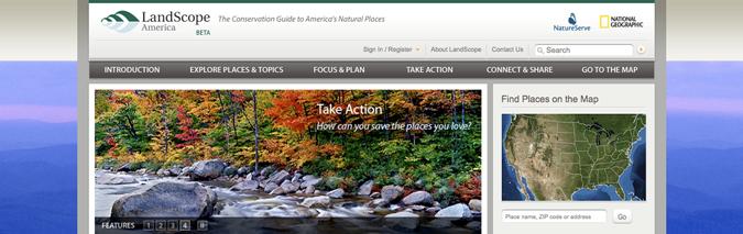
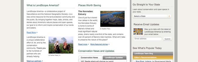
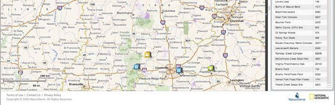
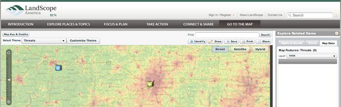
14 MAP The conservation guide to America s natural places MISSION Inspire and inform place based conservation action ACTION Increase the pace and effectiveness of land protection


15
16 LandScope America


17 MAP Prototype mapping and analysis tool for K 12 MISSION Get schoolkids excited about geography through technology ACTION Get schoolkids into the field, collecting real data Enable them to do real spatial analysis in a user friendly web environment
18 Fieldscope


19 MAP Tourist destinations: Greater Yellowstone, etc. MISSION Promote tourism that sustains or enhances the geographical character of a place its environment, culture, aesthetics, heritage, and the well being of its residents. ACTION Travel sustainably Partner: Appalachian Regional Commission


20 Geotourism Vermont s Northeast Kingdom Baja California Crown of the Continent Arizona Sonora Peru s Vilcanota Valley Greater Yellowstone
21 Geotourism (cue drum roll)


22 inspiring people to care about the planet inspiration action

23 You connecting people and planet
24 What is the Global Action Atlas? An online resource that will expose thousands of local, cause related projects around the world to a large audience of concerned citizens giving individuals opportunities to take action by donating, volunteering, advocating, and sharing information. What is our mission? Engage people to discover and support a planet spanning array of local efforts to solve the major challenges facing society and nature.
25 What is our vision? Tap the worldwide reach and convening power of the National Geographic brand to mobilize a vast corps of concerned world citizens to support thousands of local projects that will collectively change the world Where are we now? Alpha site up and running About 200 projects exposed across all theme areas Rapidly growing list of partnership and funding opportunities November 2009: beta; February 2010: launch

26 Who is participating? Action Against Hunger African Medical and Research Foundation Agua Para La Vida American Bird Conservancy American Prairie Foundation AMREF Basecamp Explorer CARE Catholic Relief Services Cheetah Conservation Fund Conservation International EarthWatch Institute El Porvenir Freedom to Roam Global Viral Forecasting Initiative Great Plains Conservation HandsOn New Orleans Helen Keller International Lifewater International Lindblad Expeditions Mercy Corps National Audubon Society New Forests NG Enduring Voices initiative NG Geotourism initiatives NG Mission Programs/research grantees New Forests Project Planet Action RARE Save the Children The Nature Conservancy Volunteers for International Partnership Water Advocates WaterAid Water for People WaterPartners International WILD Foundation Wildlife Conservation Society World Vision World Wildlife Fund 51 Demo


27 actionatlas.org Some key ideas organizing information aggregation ı distribution macrocosm ı microcosm inspiration ı action people ı planet
28 organizing information L A T C H location alphabet time category hierarchy Richard Saul Wurman, Information Anxiety 2 organizing information L A T C H location! alphabet time category hierarchy our place: authoritative, curated content

29 gather and organize information aggregation serve it out to lots of people distribution solve these problems macrocosm microcosm at this level X 100,000,000
30 get people excited inspiration urge them to participate action people planet
31 connecting people and planet
How a Media Organization Tackles the. Challenge Opportunity. Digital Gazetteer Workshop December 8, 2006
 A Case-Study-In-Process: How a Media Organization Tackles the Georeferencing Challenge Opportunity Digital Gazetteer Workshop December 8, 2006 to increase and diffuse geographic knowledge 1888 to 2006:
National Geographic Society Proposal for a Geotourism Website and Stewardship Council Program for the Heart of the Continent Partnership
 National Geographic Society Proposal for a Geotourism Website and Stewardship Council Program for the Heart of the Continent Partnership Submitted To: Heart of the Continent Partnership Submitted By: National
Esri and GIS Education
 Esri and GIS Education Organizations Esri Users 1,200 National Government Agencies 11,500 States & Regional Agencies 30,800 Cities & Local Governments 32,000 Businesses 8,500 Utilities 12,600 NGOs 11,000
Dublin City Schools Social Studies Graded Course of Study Grade 5 K-12 Social Studies Vision
 K-12 Social Studies Vision The Dublin City Schools K-12 Social Studies Education will provide many learning opportunities that will help students to: develop thinking as educated citizens who seek to understand
National Geographic World English 2 Workbook Answers
 We have made it easy for you to find a PDF Ebooks without any digging. And by having access to our ebooks online or by storing it on your computer, you have convenient answers with national geographic
Heritage and Cultural Tourism Management
 Unit 34: Heritage and Cultural Tourism Management Unit code: L/601/1757 QCF level: 4 Credit value: 15 Aim The aim of this unit is to enable learners to gain understanding of the heritage and cultural,
Spatial Data Availability Energizes Florida s Citizens
 NASCIO 2016 Recognition Awards Nomination Spatial Data Availability Energizes Florida s Citizens State of Florida Agency for State Technology & Department of Environmental Protection Category: ICT Innovations
Citizen Science and Arctic Observing: Using the Internet and Simple Technologies to Improve Understanding of Arctic Ecosystem Change
 Citizen Science and Arctic Observing: Using the Internet and Simple Technologies to Improve Understanding of Arctic Ecosystem Change Maribeth S. Murray 1, Phillip A. Loring 2, Howard Ferren 3 and Rebekka
Center for Sustainable Destinations
 CSD Mission: To protect and enhance the world s distinctive places through wisely managed tourism and enlightened destination stewardship. Core concept for achieving the mission: geotourism From eco- to
You are Building Your Organization s Geographic Knowledge
 You are Building Your Organization s Geographic Knowledge And Increasingly Making it Available Sharing Data Publishing Maps and Geo-Apps Developing Collaborative Approaches Citizens Knowledge Workers Analysts
Cartography and Children Commission: Proposals for the next 4 years
 International Cartographic Association Cartography and Children Commission: Proposals for the next 4 years José Jesús Reyes Nuñez Eötvös Loránd University Dept. of Cartography and Geoinformatics Budapest,
Think Global, Map Local! Introducing the. Open Green Map
 Think Global, Map Local! Introducing the Open Green Map Green Map System: Promoting inclusive participation in sustainable community development since 1995 Engaging over 550 communities in 54 countries,
Your web browser (Safari 7) is out of date. For more security, comfort and the best experience on this site: Update your browser Ignore
 is out of date. For more security, comfort and the best experience on this site: Update your browser Ignore") Your web browser (Safari 7) is out of date. For more security, comfort and the best experience on this site: Update your browser Ignore U NLO CKING THE EDUCATIO NAL PO TENTIAL O F CITIZEN SCIENCE Essays
Your web browser (Safari 7) is out of date. For more security, comfort and the best experience on this site: Update your browser Ignore U NLO CKING THE EDUCATIO NAL PO TENTIAL O F CITIZEN SCIENCE Essays
GED 554 IT & GIS. Lecture 6 Exercise 5. May 10, 2013
 GED 554 IT & GIS Lecture 6 Exercise 5 May 10, 2013 Free GIS data sources ******************* Mapping numerical data & Symbolization ******************* Exercise: Making maps for presentation GIS DATA SOFTWARE
LOUISIANA STUDENT STANDARDS FOR SOCIAL STUDIES THAT CORRELATE WITH A FIELD TRIP TO DESTREHAN PLANTATION KINDERGARTEN
 LOUISIANA STUDENT STANDARDS FOR SOCIAL STUDIES THAT CORRELATE WITH A FIELD TRIP TO DESTREHAN PLANTATION KINDERGARTEN Standard 2 Historical Thinking Skills Students distinguish between events, people, and
Use maps, atlases, globes and computer mapping to locate countries and describe features studied
 Roseberry Primary School Curriculum planning Lead Question: What s so amazing about America? National Curriculum driver: Geography Rationale statement: In this study about the amazing Americas, children
Geography for the 2020 Round of Census
 Boundaries Key Census Data EA Id Population Male Female EA Id Area EA Id Num HH Avg HH size Geography for the 2020 Round of Census Linda Peters, Esri lpeters@esri.com Integration of Statistical and Geospatial
Geo Business Gis In The Digital Organization
 We have made it easy for you to find a PDF Ebooks without any digging. And by having access to our ebooks online or by storing it on your computer, you have convenient answers with geo business gis in
Unit 1 Continents And Geo Skills Lesson 1 Getting To
 We have made it easy for you to find a PDF Ebooks without any digging. And by having access to our ebooks online or by storing it on your computer, you have convenient answers with unit 1 continents and
Application for Geotourism Charter
 Application for Geotourism Charter Thank you for the interest in geotourism as a long-term strategy to foster wisely managed tourism and enlightened destination stewardship. National Geographic s Center
Cartographic and Geospatial Futures
 Cartographic and Geospatial Futures 1. Web Cartography, WebGIS, & Virtual Globes--New Roles for Maps, GIS, and GIS professionals 2. Map Mashups, the Neo Neo-geography Movement, & Crowd-sourcing Geospatial
Working with ArcGIS Online
 Esri International User Conference San Diego, CA Technical Workshops July 12, 2011 Working with ArcGIS Online Bern Szukalski, Deane Kensok Topics for this Session ArcGIS Online Overview ArcGIS Online Content
Fifth Grade Social Studies. Curriculum Map (Update, June, 2015)
") Fifth Grade Social Studies Curriculum Map (Update, June, 2015) Unit 1 Geography September 4. Globes and other geographic tools can be used to gather, process and report information about people, places
Fifth Grade Social Studies Curriculum Map (Update, June, 2015) Unit 1 Geography September 4. Globes and other geographic tools can be used to gather, process and report information about people, places
World Geography and Cultures Michigan Social Studies Grade Six Content Expectations - Geography
 World Geography and Cultures 2008 Correlated to Michigan Social Studies Grade Six Content Expectations - Geography 5910 Rice Creek Pkwy, Suite 1000 Shoreview, MN 55126 Copyright 2007 Pearson Education,
Getting Started with Community Maps
 Esri International User Conference San Diego, California Technical Workshops July 24, 2012 Getting Started with Community Maps Shane Matthews and Tamara Yoder Topics for this Session ArcGIS is a complete
The Relevance of Cartography. Dubai 2015, Georg Gartner
 The Relevance of Cartography Dubai 2015, Georg Gartner Where are we? Data! Data? We are not short of data Technologies! Technologies? We are not short of technologies Data-driven and technology-driven
Haida Gwaii Queen Charlotte Islands
 Haida Gwaii Queen Charlotte Islands H E R I T A G E T O U R I S M STRATE GY January 2003 Haida Gwaii/Queen Charlotte Islands Heritage Tourism Strategy Working Group The Haida Gwaii/Queen Charlotte Islands
ASIA GEOSPATIAL FORUM 2011 Eco-Friendly Walk Score Calculator Choosing a Place to Live with GIS
 ASIA GEOSPATIAL FORUM 2011 Eco-Friendly Walk Score Calculator Choosing a Place to Live with GIS Ko Ko Lwin and Yuji Murayama Division of Spatial Information Science Graduate School of Life and Environmental
Key Issue #1 - Why is Geography a Science?
 Key Issue #1 - Why is Geography a Science? Geography - means - coined by Greek philosopher Geographers Historians The Vocabulary of Human Geography (State, Explain, Apply) in regards to Luxembourg Place
Friends of Saguaro National Park. Strategic Plan
 Friends of Saguaro National Park Strategic Plan January, 2016 For the past 100 years, America s national park system has preserved and protected what Theodore Roosevelt described as the most glorious heritage
A Correlation of. Ohio s Learning Standards in Social Studies. Grade 5
 A Correlation of 2019 To in Social Studies Grade 5 Introduction The all new myworld Interactive Social Studies encourages students to explore their world, expand their thinking, and engage their college,
GIS Visualization: A Library s Pursuit Towards Creative and Innovative Research
 GIS Visualization: A Library s Pursuit Towards Creative and Innovative Research Justin B. Sorensen J. Willard Marriott Library University of Utah justin.sorensen@utah.edu Abstract As emerging technologies
Welcome Survey getting to know you Collect & log Supplies received Classroom Rules Curriculum overview. 1 : Aug 810. (3 days) 2nd: Aug (5 days)
 2nd: Aug (5 days)") 1st Quarter (41Days) st 1 : Aug 810 (3 days) 2nd: Aug 13-17 Reporting Categories (TEKS SEs) Skill Create and write a postcard about your favorite community activity Review 2nd Grade Vocabulary Chapter
1st Quarter (41Days) st 1 : Aug 810 (3 days) 2nd: Aug 13-17 Reporting Categories (TEKS SEs) Skill Create and write a postcard about your favorite community activity Review 2nd Grade Vocabulary Chapter
WORLD DAY TO COMBAT DESERTIFICATION 2018 IN MONGOLIA
 WORLD DAY TO COMBAT DESERTIFICATION 2018 IN MONGOLIA This year the WDCD slogan was Land has true value. Invest in it to address the importance of sustainable land use, land degradation prevention and its
Chemical Safety as a Core ACS Value: Report on the 2018 Safety Summit
 Chemical Safety as a Core ACS Value: Report on the 2018 Safety Summit Introduction In December 2016, the ACS Board of Directors adopted safety as one of the Society s core values, thus affirming that the
Canadian Explorers. Learning object La Vérendyre map
 Canadian Explorers Learning object La Vérendyre map Lesson overview Students will be inspired by La Vérendyre to become explorers themselves. Students will embark on a research expedition to discover the
A Correlation of. Eastern Hemisphere. Ohio s Learning Standards Social Studies: K-12 Grade 6
 A Correlation of Eastern Hemisphere To Grade 6 to,, Grade 6 Introduction This document demonstrates how, Eastern Hemisphere, Ohio Edition, meets : K-12 Social Studies for Grade 6. Correlation page references
Application of WebGIS and VGI for Community Based Resources Inventory. Jihn-Fa Jan Department of Land Economics National Chengchi University
 Application of WebGIS and VGI for Community Based Resources Inventory Jihn-Fa Jan Department of Land Economics National Chengchi University OUTLINE Introduction Methodology Results Conclusions 2 MOTIVATION
file://q:\report1\greenatlasfinalreportindex.html
 Page 1 of 8 Quick Links WATER MANAGEMENT INTERNSHIP USDA HIS GRANT FUNDED FINAL PROJECT REPORT SUBMITTED BY MELISSA QUINTANA 11/07/07-03/24/08 Summary Provided is an assessment of my accomplishments for
Mission Geography and Missouri Show-Me Standards Connecting Mission Geography to State Standards
 Module 1: Volcanoes local hazard, global issue Mission Geography and Missouri Show-Me Standards Connecting Mission Geography to State Standards Grades 5-8 Inv Geography for Life State Standard(s) Connection
STATE GEOGRAPHIC INFORMATION DATABASE
 STATE GEOGRAPHIC INFORMATION DATABASE Data Information and Knowledge Management STATE GEOGRAPHIC INFORMATION DATABASE EXECUTIVE SUMMARY Utah has developed one of the most comprehensive statewide GIS resources
FUNDAMENTALS OF GEOINFORMATICS PART-II (CLASS: FYBSc SEM- II)
") FUNDAMENTALS OF GEOINFORMATICS PART-II (CLASS: FYBSc SEM- II) UNIT:-I: INTRODUCTION TO GIS 1.1.Definition, Potential of GIS, Concept of Space and Time 1.2.Components of GIS, Evolution/Origin and Objectives
FUNDAMENTALS OF GEOINFORMATICS PART-II (CLASS: FYBSc SEM- II) UNIT:-I: INTRODUCTION TO GIS 1.1.Definition, Potential of GIS, Concept of Space and Time 1.2.Components of GIS, Evolution/Origin and Objectives
GRADE 5 SOCIAL STUDIES SOCIAL STUDIES APPLICATION. SOCIAL STUDIES STANDARDS for Grade 5
 GRADE 5 SOCIAL STUDIES The Archdiocese of Cincinnati has established the following Social Studies standards based on the most current teachings which are aligned to Ohio New Learning Social Studies Standards.
The Research Agenda of the Wisconsin Coastal Atlas
 The Research Agenda of the Wisconsin Coastal Atlas David Hart GIS Specialist University of Wisconsin Sea Grant Institute International Coastal Atlas Network Workshop 4 Trieste, Italy Tuesday, November
Many Ways to Name a Place
 Your web browser (Safari 7) is out of date. For more security, comfort and Activityapply the best experience on this site: Update your browser Ignore Many Ways to Name a Place What are the names for the
HOLY CROSS CATHOLIC PRIMARY SCHOOL
 HOLY CROSS CATHOLIC PRIMARY SCHOOL Geography Policy Date Implemented Jan 17 Review Date Jan 22 Mission Statement Holy Cross Primary School is a Catholic School. We seek to provide a broad, balanced Christian
A Correlation of. Pearson myworld Social Studies We Are Connected to the
 A Correlation of Pearson myworld Social Studies We Are Connected 2013 Standard 2-1: The student will demonstrate an understanding of the local community as well as the fact that geography influences not
TEMPLATE FOR CMaP PROJECT
 TEMPLATE FOR CMaP PROJECT Project Title: Native Utah Plants Created by: Anna Davis Class: Box Elder 2008 Project Description Community Issue or Problem Selected -How project evolved? Community Partner(s)
St John s Catholic Primary School. Geography Policy. Mission Statement
 St John s Catholic Primary School Geography Policy Mission Statement We at St John s strive for excellence in education by providing a safe, secure and caring family environment where individuals are valued
3D MAPS SCALE, ACCURACY, LEVEL OF DETAIL
 26 th International Cartographic Conference August 25 30, 2013 Dresden, Germany 3D MAPS SCALE, ACCURACY, LEVEL OF DETAIL Prof. Dr. Temenoujka BANDROVA Eng. Stefan BONCHEV University of Architecture, Civil
GCSE GEOGRAPHY. Your guide to GCSE St. Richard s Catholic College
 GCSE GEOGRAPHY Your guide to GCSE Geography @ St. Richard s Catholic College A Geographer s way of thinking Caring for the environment Understand cultural differences Understand and explore worldwide disasters
Barlows Primary School Geography Curriculum Content Key Stage 1 and
 Geography Curriculum Content Key Stage 1 and 2 2017-2018 Curriculum Content Year 1 The content for Year 1 is detailed below: WHAT ARE SEASONS? WHAT SIT LIKE WHERE WE LIVE? WHERE DO DIFFERENT ANIMALS LIVE?
5 th Grade Social Studies Goals for the First Trimester Miss Gaull
 5 th Grade Social Studies Goals for the First Trimester Overview: American People, American Land The American People Government by the People Free Enterprise Lands and Regions Resources and the Environment
Geography By A B Savadi Vutay
 We have made it easy for you to find a PDF Ebooks without any digging. And by having access to our ebooks online or by storing it on your computer, you have convenient answers with geography by a b savadi
National Geographic New York City: Destination Map (National Geographic Destination Map) By National Geographic Society;Laminating Services
 By National Geographic Society;Laminating Services") National Geographic New York City: Destination Map (National Geographic Destination Map) By National Geographic Society;Laminating Services director of the Hayden Planetarium and host of National Geographic's
National Geographic New York City: Destination Map (National Geographic Destination Map) By National Geographic Society;Laminating Services director of the Hayden Planetarium and host of National Geographic's
Community Engagement in Cultural Routes SiTI Higher Institute on Territorial Systems for Innovation Sara Levi Sacerdotti
 Transnational Workshop Wroclaw, 7th-8th December 2016 Community Engagement in Cultural Routes SiTI Higher Institute on Territorial Systems for Innovation Sara Levi Sacerdotti levi@siti.polito.it TAKING
GEOGRAPHY POLICY STATEMENT. The study of geography helps our pupils to make sense of the world around them.
 GEOGRAPHY POLICY STATEMENT We believe that the study of geography is concerned with people, place, space and the environment and explores the relationships between the earth and its peoples. The study
Open Source Software Education in Texas
 Open Source Software Education in Texas PHILLIP DAVIS / RICHARD SMITH GEOACADEMY The Challenge for Open Source Adoption OPEN SOURCE Less the 5% of US colleges and universities offer training in Free and
SKILLS (MA State Standards/Learning Outcomes)
") BRISCOE MIDDLE SCHOOL, BEVERLY, MA SOCIAL STUDIES CURRICULUM MAP & PACING GUIDE REVISED: JUNE 2012 GRADE 7 AUTHORS & GRADE-7 TEACHERS: Mr. Brian Bayer-Larson/Ms. Joy Benosky/Mr. Adam Olbash SEPTEMBER OCTOBER
BRISCOE MIDDLE SCHOOL, BEVERLY, MA SOCIAL STUDIES CURRICULUM MAP & PACING GUIDE REVISED: JUNE 2012 GRADE 7 AUTHORS & GRADE-7 TEACHERS: Mr. Brian Bayer-Larson/Ms. Joy Benosky/Mr. Adam Olbash SEPTEMBER OCTOBER
Programs Aligned With: Kindergarten Social Studies
 Programs Aligned With: Kindergarten Social Studies Progressive Waste Solutions K.2.1 Compare and contrast children and families today with those in the past using various sources K.3.2 Identify maps and
Research Group Cartography
 Research Group Cartography Research Group Cartography Towards supporting wayfinding LBS components 1. Mobile devices 2. Communication Network 3. Positioning Component 4. Service and Application Provider
Reimaging GIS: Geographic Information Society. Clint Brown Linda Beale Mark Harrower Esri
 Reimaging GIS: Geographic Information Society Clint Brown Linda Beale Mark Harrower Esri 8 billion = Number of basemap requests per month on AGOL 14,000 = Unique requests per second 12,000 = New Items
3 rd Grade Social Studies
 3 rd Grade Social Studies UNITED STATES HISTORY Year 1: American Indian Cultures through Colonization In third grade, students begin a three-year study of United States history in which all four strands
Ministry of Health and Long-Term Care Geographic Information System (GIS) Strategy An Overview of the Strategy Implementation Plan November 2009
 Strategy An Overview of the Strategy Implementation Plan November 2009") Ministry of Health and Long-Term Care Geographic Information System (GIS) Strategy An Overview of the Strategy Implementation Plan November 2009 John Hill, Health Analytics Branch Health System Information
Ministry of Health and Long-Term Care Geographic Information System (GIS) Strategy An Overview of the Strategy Implementation Plan November 2009 John Hill, Health Analytics Branch Health System Information
FUTURE COURSES AND CAREERS
 FUTURE COURSES AND CAREERS IN GEOGRAPHY CGC1D Ms. Hyndman PHYSICAL GEOGRAPHY: PATTERNS, PROCESSES AND INTERACTIONS CGF3M Grade 11 course This course examines the major patterns of physical geography and
Archaeology & Digital Humanities
 WAYNE STATE UNIVERSITY Archaeology & Digital Humanities The D.I.R.T. on Big Data STRENGTHENING THE BIG DATA & ANALYTICS ECOSYSTEM WAYNE STATE UNIVERSITY Krysta Ryzewski Associate Professor of Anthropology
Oman NSDI Supporting Economic Development. Saud Al-Nofli Director of Spatial Data Directorate General of NSDI, NCSI
 Oman NSDI Supporting Economic Development 2017 Saud Al-Nofli Director of Spatial Data Directorate General of NSDI, NCSI "It s critical to make correct decisions the first time to optimize the Investments
Smart use of Geographic Information System (GIS) platform for delivering weather information and nowcasting services
 platform for delivering weather information and nowcasting services") Smart use of Geographic Information System (GIS) platform for delivering weather information and nowcasting services C. K. Pan Hong Kong Observatory Hong Kong, China It is a world of beauty Source: Image
Smart use of Geographic Information System (GIS) platform for delivering weather information and nowcasting services C. K. Pan Hong Kong Observatory Hong Kong, China It is a world of beauty Source: Image
Chapter 1: Introduction to Safety and Ethics
 Core Curriculum Standards Met by Each Chapter On the Right Trail meets Utah s Social Studies Core Curriculum Standards for grades 3-7. Each chapter has specific standard objectives, which are met by the
Introduction and Project Overview
 Greater New Orleans Regional Land Use Modeling GIS Techniques in a P olitical C ontext Louisiana Remote Sensing and GIS Workshop Wednesday, April 24, 2013 Working Towards a Shared Regional Vision Introduction
Strategic Framework Executive Summary JANUARY 2018
 Strategic Framework Executive Summary JANUARY 2018 LETTER FROM OUR BOARD For the people of Los Angeles and the world beyond, the Natural History Family of Museums explores connections between nature, culture,
Smart Citizens. Maria Antonia Brovelli Politecnico di Milano, Italy
 Smart Citizens Maria Antonia Brovelli Politecnico di Milano, Italy UN-GGIM Academic Network Forum Secure Land Rights and Smart Cities: Making It Work for Sustainable Development New York, 31 July 2017
This table connects the content provided by Education Perfect to the NSW Syllabus.
 Education Perfect Geography provides teachers with a wide range of quality, engaging and innovative content to drive positive student learning outcomes. Designed by teachers and written by our in-house
16540/14 EE/cm 1 DG E 1A
 Council of the European Union Brussels, 5 December 2014 (OR. en) 16540/14 ENV 965 CULT 139 NOTE From: To: Subject: General Secretariat of the Council Delegations Charter of Rome on Natural and Cultural
Web 2.0, map production & publishing and geospatial information dissemenation
 Web 2.0, map production & publishing and geospatial information dissemenation Professor William Cartwright President, International Cartographic Association William Cartwright 18th UNRCC for Asia and the
Course Outline. School Name: Keewaytinook Internet High School. Department Name: Canadian and World Studies. Ministry of Education Course Title:
 School Name: Keewaytinook Internet High School Department Name: Canadian and World Studies Course Outline Ministry of Education Course Title: Travel and Tourism: A Geographic Perspective Grade Level: 11
NATIONAL GEOGRAPHIC VISUAL ATLAS OF THE WORLD PDF
 NATIONAL GEOGRAPHIC VISUAL ATLAS OF THE WORLD PDF ==> Download: NATIONAL GEOGRAPHIC VISUAL ATLAS OF THE WORLD PDF NATIONAL GEOGRAPHIC VISUAL ATLAS OF THE WORLD PDF - Are you searching for National Geographic
2015 Copyright Board of Studies, Teaching and Educational Standards NSW for and on behalf of the Crown in right of the State of New South Wales.
 2015 Copyright Board of Studies, Teaching and Educational Standards NSW for and on behalf of the Crown in right of the State of New South Wales. This document contains Material prepared by the Board of
Canadian Historical GIS Partnership Development: Taking Steps for Historical Mapping in Canada
 Canadian Historical GIS Partnership Development: Taking Steps for Historical Mapping in Canada Byron Moldofsky Manager, GIS and Cartography Office Department of Geography and Planning University of Toronto
Google Maps and Beyond
 Google Maps and Beyond Aaron Paul First American Title apaul@firstam.com 2015 APRA Symposium Association of Professional Reserve Analysts May 2 nd, 2015 Google Maps and Beyond - Overview Business case
Geotourism: Focusing on the Power of Place
 Uniting Culture, Nature, Preservation, and Economics Geotourism: Focusing on the Power of Place World Heritage Conference 8 June 2009 - Bergen, Norway CSD Mission: To protect and enhance the world s distinctive
The Atlas of Living Australia
 The Atlas of Living Australia The ALA is a national collaborative research infrastructure supported by the Australian Government. It is led by CSIRO in partnership with the Australian biological community.
An introduction to thee Urban Oases Site Selection Tool:
 An introduction to thee Urban Oases Site Selection Tool: Created by Audubon Connecticut with assistance from a GIS Consultant/Research Assistant at the Harvard Forest Essential input provided by the New
Greater Portland Pulse: an Evolution
 Greater Portland Pulse: an Evolution Measuring and Monitoring Community Outcomes portlandpulse.org Meg Merrick, Ph. D. Institute of Portland Metropolitan Studies Portland State University merrickmpdx.edu
Topic: Fundamentals of Topographic Map (Cartographic Technique) Honors
 Honors") SN Kansagra School Master lesson Plan : Geography Subject Teacher :- Sanjay Nath Topic: Fundamentals of Topographic Map (Cartographic Technique) Honors Materials (Teaching Aids): White board, Audio visual
SN Kansagra School Master lesson Plan : Geography Subject Teacher :- Sanjay Nath Topic: Fundamentals of Topographic Map (Cartographic Technique) Honors Materials (Teaching Aids): White board, Audio visual
Aboriginal communities strengthen governance with location-based tools in the 21st century
 Aboriginal communities strengthen governance with location-based tools in the 21st century Today, Aboriginal communities are taking advantage of the geomatics technologies that underpin popular online
Spatial Web Technology for Urban Green Society (A Case of Tsukuba City)
") The 5th Japan-Korea-China Joint Conference on Geography (Green Society in East Asia: A Geographical Contribution) Spatial Web Technology for Urban Green Society (A Case of Tsukuba City) Ko Ko Lwin and
The 5th Japan-Korea-China Joint Conference on Geography (Green Society in East Asia: A Geographical Contribution) Spatial Web Technology for Urban Green Society (A Case of Tsukuba City) Ko Ko Lwin and
Grade 5: Social Studies Practices
 Grade 5: Social Studies Practices A. Gathering and Using Evidence 1. Develop questions to help identify evidence about topics related to the historical events occurring in the Western Hemisphere that can
PaikkaOppi - a Virtual Learning Environment on Geographic Information for Upper Secondary School
 PaikkaOppi - a Virtual Learning Environment on Geographic Information for Upper Secondary School Jaakko Kähkönen*, Lassi Lehto*, Juha Riihelä** * Finnish Geodetic Institute, PO Box 15, FI-02431 Masala,
Empowered lives. Resilient nations. Data for People and Planet. powered by
 Empowered lives. Resilient nations. Data for People and Planet powered by Overview As we enter the fourth industrial revolution, technology is revolutionizing our ability to map nature. Satellite data
GIS at UCAR. The evolution of NCAR s GIS Initiative. Olga Wilhelmi ESIG-NCAR Unidata Workshop 24 June, 2003
 GIS at UCAR The evolution of NCAR s GIS Initiative Olga Wilhelmi ESIG-NCAR Unidata Workshop 24 June, 2003 Why GIS? z z z z More questions about various climatological, meteorological, hydrological and
SEA LIFE Sydney Aquarium. Penguin Expedition Self-Guided Resource Kit. Secondary 7-10
 SEA LIFE Sydney Aquarium Penguin Expedition Self-Guided Resource Kit Secondary 7-10 Introduction The following material has been developed by the SEA LIFE Sydney Aquarium Education Team to support our
Your web browser (Safari 7) is out of date. For more security, comfort and. the best experience on this site: Update your browser Ignore
 is out of date. For more security, comfort and. the best experience on this site: Update your browser Ignore") Your web browser (Safari 7) is out of date. For more security, comfort and Activityengage the best experience on this site: Update your browser Ignore The Arctic Region Where is the Arctic region and why
Your web browser (Safari 7) is out of date. For more security, comfort and Activityengage the best experience on this site: Update your browser Ignore The Arctic Region Where is the Arctic region and why
ESSENTIAL CONCEPTS AND SKILL SETS OF THE IOWA CORE CURRICULUM
 ESSENTIAL CONCEPTS AND SKILL SETS OF THE IOWA CORE CURRICULUM SOCIAL STUDIES PROVIDED BY THE IOWA DEPARTMENT OF EDUCATION INTRODUCTION Social studies is the integrated study of the social sciences and
The importance of international university and project cooperation in science
 The importance of international university and project cooperation in science The Role of Science in Arctic Social and Business Development Arctic Frontiers Science January 25, 2017 Dr. Marina Kalinina
Geo-Enabling Mountain Bike Trail Maintenance:
 Title Slide Geo-Enabling Mountain Bike Trail Maintenance: Enhanced Stewardship of the Fountainhead Mountain Bike Trail through GIS Technology Ruthann Ligon Follow the Trail Fountainhead Mountain Bike
Chapter 27. Bhutan, Maldives, Nepal, & Sri Lanka
 Chapter 27 Bhutan, Maldives, Nepal, & Sri Lanka Physical Geography of Bhutan, Maldives, Nepal & Sri Lanka Landforms Their locations on the fringe of South Asia means their physical and human geography
geographic patterns and processes are captured and represented using computer technologies
 Proposed Certificate in Geographic Information Science Department of Geographical and Sustainability Sciences Submitted: November 9, 2016 Geographic information systems (GIS) capture the complex spatial
The Future of Geography in an. Society. Michael F. Goodchild University of California Santa Barbara
 The Future of Geography in an Emerging Information-Technology Society Michael F. Goodchild University of California Santa Barbara Geographic technologies Positioning i on the Earth s surface GPS, RFID
CLLD Cooperation OFFER
 Title of the proposed project (English) CLLD Cooperation OFFER PARKS PROTECTION III - Management, Protection and Economic Development in Protected Areas Type of project (select as many as you want) Cooperation