Think Global, Map Local! Introducing the. Open Green Map
|
|
|
- Mervin Bruce
- 5 years ago
- Views:
Transcription

1 Think Global, Map Local! Introducing the Open Green Map


2 Green Map System: Promoting inclusive participation in sustainable community development since 1995 Engaging over 550 communities in 54 countries, more than 365 locally published Green Maps are already being used by millions of people


3 We partner with students, community groups, NGOs, tourism and city agencies, eco-entrepreneurs and others


4 Thousands of local green living, nature, social justice and cultural sites have been charted in cities, towns and villages Barcelona s Sun Factory Local Farmers & Artisans Market Robeson US s kayak tours Yogyakarta ID s Geologic Feature Breda NL s Eco Center Hybrid Mass Transit


5 We offer adaptable tools that help Mapmakers create compelling local maps of all scales and formats Icons Use as a font with any computer application or on stickers Mapmaking Guides Adaptable for print or web maps, community involvement, etc. Multimedia Resources Multi-lingual books, guides, workshops, exhibits, websites Archives Green Maps, stories, videos, presentations and exchanges

6 However, the process remains daunting for many, preventing important local findings from being shared Development Research Design Production Without losing the valuable community organizing, research and dissemination processes, can Green Map System help lower technological and financial barriers? And, dramatically increase participation, exchange and impacts!


7 Our solution: Develop the Open Green Map platform to increase participation and address diverse (g)local needs Merge open source and Google Map technology, our global icons and local knowledge to create a constantly evolving cross-cultural guide to local sustainability strategies and best practices


8 Instantly accessible, Open Green Map is now in Preview. Celebrate its global launch with us on June ! World View starts with with 2 sites from each map, zoom for more. Public can add sites later.

9 Explore the map by clicking each site. You can filter your view by toggling the Legend s icons. Although the website s design is in progress, it s easy to explore the first 40 maps today


10 To locate the Mapmaker s overview, open the info window. Click tabs for public comments and interaction Several icons describe each site. Info Tab links to Profiles and locally designed map PDFs

11 At the Multimedia tab, everyone is invited to display their own images and videos of the site via Flickr, YouTube, etc. Later, a wider range of images, PDFs, podcasts or other multimedia will be available here
12 The Connections tab now helps users quickly compare sites worldwide that use the same icons Later, this tab will also include volunteering, getting there and other kinds of connections. At Maryland Zoo

13 The Impacts tab indexes important data that describes how each site benefits individuals and communities Now, map-wide outcomes can also be viewed. Later, find more advanced survey tools, calculators.


14 Any language can be used in the info windows. We are translating key interfaces to invite broader participation Spanish, Portuguese, Indonesian & Swedish are underway. Static pages have a translate tool

15 Behind the scenes, map making and team management tools rely on simple design and conventions for ease of use These forms will become easier to use with cloning, icon charts, offline spreadsheet for batchs

16 Mapmakers or users can now choose Google Map s street, satellite or terrain view with more options to come Later, choose Google Earth, Open Street Map, historic or handmade base maps


17 Explore the Open Green Map by iphone now, with other wireless devices and onsite markers to come Adding or enhancing sites by phone, What s Nearby list for low-tech mobile use, GPS, etc

18 Basic widgets let Mapmakers embed Open Green Maps in websites and blogs now, Facebook App is to come Coming soon: Lines & areas, create widgets, share a tour, static views and other sharing

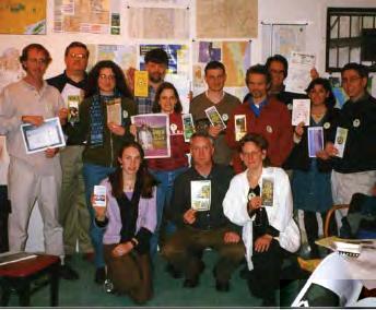
19 Excitement is building, and the Open Green Map is gaining recognition, even before it is officially launched! This online map program is fabulous and I'm inspired. What a cool way to get connected and see what's green around the country. Planet Pink n' Green "...since it is interactive, the locals who really know their home can give the inside scoop it ll be like being with the green in-crowd wherever you are even my own town will suddenly have a whole slew of new secrets revealed. EcoGeek.org It s one of the more intriguing Google Maps interface efforts that I ve seen, and certainly in line with their exquisite map design efforts to date I look forward to contributing what I know about my locale. Spatial Sustain The Stockholm Green Map is now fully digital you are encouraged to list information or provide comments, thanks to an innovative Open Green Map.org platform used by Green Mapmakers worldwide. Delta Airlines magazine Open Green Map team, summer 2008 Featured: NetSquared 3rd: Tele Atlas Maps in Apps Finalist: We Media Pitch It Top 10: America s Giving Challenge


20 Join with us to help people everywhere take part in creating and promoting sustainable communities Skill-building and Leadership through Green Mapmaking: Tech, Communications & Ecological Literacy Analytic and Visual Expression Cross-culture Collaboration & Exchange Voice Assessment of Current Issues Orientation to Community Assets & Challenges Create a Lasting Record of Change Experiential & Service Learning Planning & Visioning If the best greening resource in the world is around the corner but no one knows about it, what good can it do? Yelitza Espinosa, Pereira Colombia Green Mapmaker


21 Think Global, Map Local! Explore GreenMap.org and get involved! Contact Green Map System:
Global Green Map. Directions to a Sustainable Future
 Global Green Map Directions to a Sustainable Future What Global is the Green Global Map Green Map? As detailed in this sideshow, the Global Green Map is an interactive open multilingual world map that
Your web browser (Safari 7) is out of date. For more security, comfort and. the best experience on this site: Update your browser Ignore
 is out of date. For more security, comfort and. the best experience on this site: Update your browser Ignore") Your web browser (Safari 7) is out of date. For more security, comfort and Activityengage the best experience on this site: Update your browser Ignore Introduction to GIS What is a geographic information
Your web browser (Safari 7) is out of date. For more security, comfort and Activityengage the best experience on this site: Update your browser Ignore Introduction to GIS What is a geographic information
Trends, Helpouts and Hidden Gems: Additional Google Tools to Strengthen Your Brand
 Trends, Helpouts and Hidden Gems: Additional Google Tools to Strengthen Your Brand a bit about me Father, husband of Kathy, Milan and Savannah Head of Social Strategy at WCG, a W2O Company Adjunct Professor,
Many Ways to Name a Place
 Your web browser (Safari 7) is out of date. For more security, comfort and Activityapply the best experience on this site: Update your browser Ignore Many Ways to Name a Place What are the names for the
Reimaging GIS: Geographic Information Society. Clint Brown Linda Beale Mark Harrower Esri
 Reimaging GIS: Geographic Information Society Clint Brown Linda Beale Mark Harrower Esri 8 billion = Number of basemap requests per month on AGOL 14,000 = Unique requests per second 12,000 = New Items
GIS Visualization: A Library s Pursuit Towards Creative and Innovative Research
 GIS Visualization: A Library s Pursuit Towards Creative and Innovative Research Justin B. Sorensen J. Willard Marriott Library University of Utah justin.sorensen@utah.edu Abstract As emerging technologies
Basic Training Battlemind to Home Symposium. Sept
 Basic Training Battlemind to Home Symposium Sept 2017 1 What is Measuring Communities? A social indicators project which allows users to obtain military-specific information about communities strengths
United States Forest Service Makes Use of Avenza PDF Maps App to Reduce Critical Time Delays and Increase Response Time During Natural Disasters
 CASE STUDY For more information, please contact: Christine Simmons LFPR Public Relations www.lfpr.com (for Avenza) 949.502-7750 ext. 270 Christines@lf-pr.com United States Forest Service Makes Use of Avenza
Introduction to ArcGIS Maps for Office. Greg Ponto Scott Ball
 Introduction to ArcGIS Maps for Office Greg Ponto Scott Ball Agenda What is Maps for Office? Platform overview What are Apps for the Office? ArcGIS Maps for Office features - Visualization - Geoenrichment
Strategic Framework Executive Summary JANUARY 2018
 Strategic Framework Executive Summary JANUARY 2018 LETTER FROM OUR BOARD For the people of Los Angeles and the world beyond, the Natural History Family of Museums explores connections between nature, culture,
ASSESSING THE ARTS COMMUNITY: Mapping with GIS and Social Media Tools
 ASSESSING THE ARTS COMMUNITY: Mapping with GIS and Social Media Tools Gary Coutu Associate Professor Department of Geography and Planning West Chester University July 15, 2014 Mapping with GIS and Social
Agency Credentials S P R I N G
 Agency Credentials S P R I N G 2 0 1 8 A B O U T U S About us Since 2013, we have been building digital experiences, transforming brands, and expertly kicking ass. Our passionate team of designers, developers
The Stars By H. A. Rey READ ONLINE
 The Stars By H. A. Rey READ ONLINE If looking for a book The Stars by H. A. Rey in pdf format, then you've come to correct site. We present utter variation of this ebook in txt, doc, epub, PDF, DjVu formats.
Geography. Programme of study for key stage 3 and attainment target (This is an extract from The National Curriculum 2007)
") Geography Programme of study for key stage 3 and attainment target (This is an extract from The National Curriculum 2007) Crown copyright 2007 Qualifications and Curriculum Authority 2007 Curriculum aims
Geography Programme of study for key stage 3 and attainment target (This is an extract from The National Curriculum 2007) Crown copyright 2007 Qualifications and Curriculum Authority 2007 Curriculum aims
Student Technology Standards Scope and Sequence
 ntroduce- Skill is demonstrated, discussed, and practiced evelop-skill is practiced, reinforced, and enhanced 1. General Computer Knowledge 1.1 emonstrates basic operation (example: start up, log on, log
Cartographic and Geospatial Futures
 Cartographic and Geospatial Futures 1. Web Cartography, WebGIS, & Virtual Globes--New Roles for Maps, GIS, and GIS professionals 2. Map Mashups, the Neo Neo-geography Movement, & Crowd-sourcing Geospatial
Framework on reducing diffuse pollution from agriculture perspectives from catchment managers
 Framework on reducing diffuse pollution from agriculture perspectives from catchment managers Photo: River Eden catchment, Sim Reaney, Durham University Introduction This framework has arisen from a series
Working with ArcGIS Online
 Esri International User Conference San Diego, CA Technical Workshops July 12, 2011 Working with ArcGIS Online Bern Szukalski, Deane Kensok Topics for this Session ArcGIS Online Overview ArcGIS Online Content
The 7th Annual SARGIS Workshop and Meeting. Welcome to SARGIS7!
 The 7th Annual SARGIS Workshop and Meeting Welcome to SARGIS7! The National Alliance for Public Safety GIS Foundation is a 501 (C) (3) not-forprofit organization» OUR VISION A Nation of emergency responders
Build relationships not link. Scott Wyden Kivowitz
 Digital Agency Build relationships not link. Scott Wyden Kivowitz Company book yoursocialnoise.digital #progettinoise Digital Agency Hi! #progettinoise We are yoursocialnoise! A young Digital Agency that
Introduction to Google Mapping Tools
 Introduction to Google Mapping Tools Google s Mapping Tools Explore geographic data. Organize your own geographic data. Visualize complex data. Share your data with the world. Tell your story and educate
SUMMER SOLSTICE CELEBRATION. I n t e r n a t i o n a l A r t, M u s i c & C u l t u r e F e s t i v a l
 SUMMER SOLSTICE CELEBRATION I n t e r n a t i o n a l A r t, M u s i c & C u l t u r e F e s t i v a l Parade: June 23 Solstice Festival June 22-24, 2018 Open to the Public MAY 3-8 Wed-Fri Sat-Sun 12-6
DEVELOPMENT FOR THE PEOPLE OF THE NORTH. Results achieved during
 DEVELOPMENT FOR THE PEOPLE OF THE NORTH Results achieved during Learn more about the work and the activities of the Arctic Council by visiting the Council s website and connecting on social media: www.arctic-council.org
THE SKY IN YOUR HANDS: TAKING ASTRONOMY TO VISUALLY IMPAIRED STUDENTS
 THE SKY IN YOUR HANDS: TAKING ASTRONOMY TO VISUALLY IMPAIRED STUDENTS The sky in your hands is a project created in 2009, during the International Year of Astronomy, with the goal to create an image of
Social Exclusion and Digital Disengagement
 Social Exclusion and Digital Disengagement Issues of Policy, Theory and Measurement OxIS Discussion Seminar 2007 (OII) Ellen J. Helsper Bill Dutton Agenda Introduction Bill Dutton Director OII & Principal
BASIC TECHNOLOGY Pre K starts and shuts down computer, monitor, and printer E E D D P P P P P P P P P P
 BASIC TECHNOLOGY Pre K 1 2 3 4 5 6 7 8 9 10 11 12 starts and shuts down computer, monitor, and printer P P P P P P practices responsible use and care of technology devices P P P P P P opens and quits an
Spatial Data Availability Energizes Florida s Citizens
 NASCIO 2016 Recognition Awards Nomination Spatial Data Availability Energizes Florida s Citizens State of Florida Agency for State Technology & Department of Environmental Protection Category: ICT Innovations
Geography for the 2020 Round of Census
 Boundaries Key Census Data EA Id Population Male Female EA Id Area EA Id Num HH Avg HH size Geography for the 2020 Round of Census Linda Peters, Esri lpeters@esri.com Integration of Statistical and Geospatial
Mystery Images from Space Educator s Guide
 Mystery Images from Space Educator s Guide Summary: Students learn and reinforce core concepts in Earth science and achieve learning goals in other fields as well by exploring photographs taken by astronauts.
Economic and Social Council 2 July 2015
 ADVANCE UNEDITED VERSION UNITED NATIONS E/C.20/2015/11/Add.1 Economic and Social Council 2 July 2015 Committee of Experts on Global Geospatial Information Management Fifth session New York, 5-7 August
Implementing the Sustainable Development Goals: The Role of Geospatial Technology and Innovation
 Fifth High Level Forum on UN Global Geospatial Information Management Implementing the Sustainable Development Goals: The Role of Geospatial Technology and Innovation 28-30 November 2017 Sheraton Maria
Water Atlas Overview. Myakka River Management Coordinating Council June 22, 2012 Englewood, Florida
 Water Atlas Overview Myakka River Management Coordinating Council June 22, 2012 Englewood, Florida What is the Water Atlas? A data warehouse A set of interactive maps A collection of tools for viewing/analyzing
Mapping Diversity in Old and New Netherland
 Your web browser (Safari 7) is out of date. For more security, comfort and Activityengage the best experience on this site: Update your browser Ignore Mapping Diversity in Old and New Netherland How did
Indiana University Maps
 Indiana University 9.28.09 Maps Maps Mission Action Cause related cartography at National Geographic Networks and Complex Systems This talk series is open to all Indiana University faculty and students
Planner's Postcode Area Map (Route Planning Map)
") Planner's Postcode Area Map (Route Planning Map) If you are looking for a book Planner's Postcode Area Map (Route Planning Map) in pdf form, then you have come on to correct website. We presented utter
Planner's Postcode Area Map (Route Planning Map) If you are looking for a book Planner's Postcode Area Map (Route Planning Map) in pdf form, then you have come on to correct website. We presented utter
Global Geoparks focus on developing their regions as Sustainable Tourism Destinations.
 The Burren & Cliffs of Moher region has achieved UNESCOsupported Global Geopark Status in recognition of the region s significant geological, ecological and cultural value, as well as its sustainable tourism
The Pace of Change Is Accelerating Creating Many Challenges
 VISION The Pace of Change Is Accelerating Creating Many Challenges Evidence Threatening Our Natural World and Our Future as Humans Social Conflict Mass Migration Ocean Acidification Food Population Urbanization
Journal of e-media Studies Volume 3, Issue 1, 2013 Dartmouth College
 Journal of e-media Studies Volume 3, Issue 1, 2013 Dartmouth College Review of Old Maps Online Alyssa McLeod Labeled Google for old maps by its creators, the Jisc-funded Old Maps Online is an interface
Climate Risk Visualization for Adaptation Planning and Emergency Response
 Climate Risk Visualization for Adaptation Planning and Emergency Response NCR Flood Fact Finding Workshop Ricardo Saavedra ricardo@vizonomy.com Social Media, Mobile, and Big Data St. Peter s Basilica,
Esri s Living Atlas of the World Community Maps
 Esri s Living Atlas of the World Community Maps Seth Sarakaitis Wednesday May 7, 2014 ArcGIS Living Atlas Concept Living Atlas Content Tour Contributing to the Living Atlas (Community Maps) Seth Sarakaitis
COUNCIL OF THE EUROPEAN UNION. Brussels, 2 May /14 CULT 68
 COUNCIL OF THE EUROPEAN UNION Brussels, 2 May 2014 9129/14 CULT 68 NOTE from: General Secretariat of the Council to: Permanent Representatives Committee (Part 1) / Council No. prev. doc.: 8892/14 CULT
Community Engagement in Cultural Routes SiTI Higher Institute on Territorial Systems for Innovation Sara Levi Sacerdotti
 Transnational Workshop Wroclaw, 7th-8th December 2016 Community Engagement in Cultural Routes SiTI Higher Institute on Territorial Systems for Innovation Sara Levi Sacerdotti levi@siti.polito.it TAKING
SCENT: A Smart Toolbox for Engaging Citizens into a People Centric Observation Web. INSPIRE 2016 Conference Barcelona, 28 September 2016
 SCENT: A Smart Toolbox for Engaging Citizens into a People Centric Observation Web INSPIRE 2016 Conference Barcelona, 28 September 2016 Summary SCENT Facts & figures Motivation SCENT @ a glance SCENT objectives
Arizona Recreation Map By Benchmark Maps READ ONLINE
 Arizona Recreation Map By Benchmark Maps READ ONLINE Families can come and see what the Sierra Montana Recreation Center has to offer. The center has a game room with Xbox 360s on high definition TV's,
My Map Activity MINNESOTA SOCIAL STUDIES STANDARDS & BENCHMARKS
 My Map Activity OVERVIEW & OBJECTIVES Students will learn the basics of Google Maps while using geospatial data to create their neighborhood map with the places they spend time. They will also collect
Online to Offline : Translating Media Usage To Real Life Public
 +Avivah Yamani +Indonesia langitselatan Online to Offline : Translating Media Usage To Real Life Public +Map of Indonesia Google map Indonesia is a tropical country with 17,508 island With a population
National Geographic Australia: Continent Maps (NG Continent Maps) By National Geographic Society READ ONLINE
 By National Geographic Society READ ONLINE") National Geographic Australia: Continent Maps (NG Continent Maps) By National Geographic Society READ ONLINE If you are searching for a ebook by National Geographic Society National Geographic Australia:
National Geographic Australia: Continent Maps (NG Continent Maps) By National Geographic Society READ ONLINE If you are searching for a ebook by National Geographic Society National Geographic Australia:
Brian D. George. GIMS Specialist Ohio Coastal Atlas Project Coordinator and Cartographer. Impacts and Outcomes of Mature Coastal Web Atlases
 Ohio Coastal Atlas Project Brian D. George GIMS Specialist Ohio Coastal Atlas Project Coordinator and Cartographer Ohio Department of Natural Resources Office of Coastal Management Sandusky, OH Impacts
Mapping Secondary Cities for Resiliency and Emergency Preparedness
 Mapping Secondary Cities for Resiliency and Emergency Preparedness Secondary Cities Geospatial Training Workshop Pilot Project: Cusco, Peru June 29 July 3 2015 WHO ARE WE? Office of the Geographer (GGI)
Human Geography: People, Place, And Culture By Erin H. Fouberg;Alexander B. Murphy;Harm J. De Blij
 Human Geography: People, Place, And Culture By Erin H. Fouberg;Alexander B. Murphy;Harm J. De Blij If you are looking for the book by Erin H. Fouberg;Alexander B. Murphy;Harm J. de Blij Human Geography:
GIS for Crime Analysis. Building Better Analysis Capabilities with the ArcGIS Platform
 GIS for Crime Analysis Building Better Analysis Capabilities with the ArcGIS Platform Crime Analysis The Current State One of the foundations of criminological theory is that three things are needed for
The Ultimate Guide To Chatbots For Businesses ONLIM 2018
 The Ultimate Guide To Chatbots For Businesses O N L I M 2 0 1 8 Where We're At Today Y o u ve probably heard a lot a b o u t c h a t b o t s d u r i n g 2 0 1 7. The l a s t y e a r h a s s h o w n u s
Maps and sustainability
 Maps and sustainability The International Map Year [ mapyear.org ] Menno-Jan Kraak Maps Cartography and maps A map is a visual representation of an environment maps tell stories maps invite maps show patterns
Towards a City Model for Heritage-Led Regeneration and Tourism Development
 Towards a City Model for Heritage-Led Regeneration and Tourism Development Brian Smith, Secretary General European Association of Historic Towns and Regions Summary of Presentation Objective Background
THE COMPLETE IDIOT'S GUIDE TO ASTROLOGY (2ND EDITION) BY MADELINE GERWICK-BRODEUR, LISA LENARD
 BY MADELINE GERWICK-BRODEUR, LISA LENARD") Read Online and Download Ebook THE COMPLETE IDIOT'S GUIDE TO ASTROLOGY (2ND EDITION) BY MADELINE GERWICK-BRODEUR, LISA LENARD DOWNLOAD EBOOK : THE COMPLETE IDIOT'S GUIDE TO ASTROLOGY (2ND Click link bellow
Read Online and Download Ebook THE COMPLETE IDIOT'S GUIDE TO ASTROLOGY (2ND EDITION) BY MADELINE GERWICK-BRODEUR, LISA LENARD DOWNLOAD EBOOK : THE COMPLETE IDIOT'S GUIDE TO ASTROLOGY (2ND Click link bellow
How a Media Organization Tackles the. Challenge Opportunity. Digital Gazetteer Workshop December 8, 2006
 A Case-Study-In-Process: How a Media Organization Tackles the Georeferencing Challenge Opportunity Digital Gazetteer Workshop December 8, 2006 to increase and diffuse geographic knowledge 1888 to 2006:
Your web browser (Safari 7) is out of date. For more security, comfort and. the best experience on this site: Update your browser Ignore
 is out of date. For more security, comfort and. the best experience on this site: Update your browser Ignore") Your web browser (Safari 7) is out of date. For more security, comfort and Activityengage the best experience on this site: Update your browser Ignore Comparing Historical Maps How can historical maps
Your web browser (Safari 7) is out of date. For more security, comfort and Activityengage the best experience on this site: Update your browser Ignore Comparing Historical Maps How can historical maps
From Your Home to NEPAL
 From Your Home to NEPAL Grade Levels: K-12 Overview Geography has a great impact on education and sustainability. This activity invites students to explore Nepal in comparison to their home country so
Briefing. H.E. Mr. Gyan Chandra Acharya
 Briefing by H.E. Mr. Gyan Chandra Acharya Under-Secretary-General and High Representative for the Least Developed Countries, Landlocked Developing Countries and Small Island Developing States Briefing
Archaeology & Digital Humanities
 WAYNE STATE UNIVERSITY Archaeology & Digital Humanities The D.I.R.T. on Big Data STRENGTHENING THE BIG DATA & ANALYTICS ECOSYSTEM WAYNE STATE UNIVERSITY Krysta Ryzewski Associate Professor of Anthropology
Grade Four Content Overview
 Grade Four Content Overview Physical features Regions Contributions of the states Our Country: Geography and Regions Coastal and inland communities Famous landmarks Physical and human characteristics Local,
STAGE 2 GEOGRAPHY: Natural environments
 STAGE 2 GEOGRAPHY: Natural environments Focus area: The Earth s environment Different environments Significance of environments Key inquiry questions How does the environment support the lives of people
Urban Climate Resilience
 Urban Climate Resilience in Southeast Asia Partnership Project Introduction Planning for climate change is a daunting challenge for governments in the Mekong Region. Limited capacity at the municipal level,
TRAITS to put you on the map
 TRAITS to put you on the map Know what s where See the big picture Connect the dots Get it right Use where to say WOW Look around Spread the word Make it yours Finding your way Location is associated with
WMO. Key Elements of PWS and Effective EWS. Haleh Haleh Kootval Chief, PWS Programme
 WMO Key Elements of PWS and Effective EWS Haleh Haleh Kootval Chief, PWS Programme Workshop Objectives This workshop is all about Service Delivery and becoming excellent at it through: Sharing experiences
Creating a Staff Development Plan with Esri
 Creating a Staff Development Plan with Esri Michael Green David Schneider Guest Presenter: Shane Feirer, University of California Esri UC 2014 Technical Workshop Agenda What is a Staff Development Plan?
Planets Clues. Webaddress for this activity is:
 Planets Clues Webaddress for this activity is: COLLABORATIVE LEARNING PROJECT Project Director: Stuart Scott We support a network of teaching professionals throughout the European Union to promote inclusive
REGIONAL SDI DEVELOPMENT
 REGIONAL SDI DEVELOPMENT Abbas Rajabifard 1 and Ian P. Williamson 2 1 Deputy Director and Senior Research Fellow Email: abbas.r@unimelb.edu.au 2 Director, Professor of Surveying and Land Information, Email:
Strategies for Control of Giant Salvinia and Other Invasive Species
 Strategies for Control of Giant Salvinia and Other Invasive Species Projects under consideration for a Caddo Lake Institute grant proposal to the National Fish & Wildlife Foundation Initial Focus is on
ARGUS.net IS THREE SOLUTIONS IN ONE
 OVERVIEW H i g h l y c o n f i g u r a b l e s o f t w a r e a c c o m m o d a t e s a w i d e r a n g e o f c o l l e c t i o n s T h r e e s o l u t i o n s c o v e r P o r t a l s, C o l l e c t i o
GLOBAL GEOPARKS NETWORK
 GLOBAL GEOPARKS NETWORK International Association on Geoparks CELEBRATING EARTH HERITAGE SUSTAINING LOCAL COMMUNITIES REQUEST FOR PROPOSALS Communication & Marketing Strategy FOR UNESCO Global Geoparks
Empowered lives. Resilient nations. Data for People and Planet. powered by
 Empowered lives. Resilient nations. Data for People and Planet powered by Overview As we enter the fourth industrial revolution, technology is revolutionizing our ability to map nature. Satellite data
Esri and GIS Education
 Esri and GIS Education Organizations Esri Users 1,200 National Government Agencies 11,500 States & Regional Agencies 30,800 Cities & Local Governments 32,000 Businesses 8,500 Utilities 12,600 NGOs 11,000
GIS Applications on Environmental Education in Taiwan
 GIS Applications on Environmental Education in Taiwan Track: Education Authors: Yu-Chen Lai, Mei-Ling Yeh, Tien-Yin Chou Abstract GIS is a perfect vehicle to deliver environmental knowledge and spatial
Rebecca Nayler Medium term planning. Curriculum area GEOGRAPHY - AUTUMN 2016
 Medium term planning Curriculum area GEOGRAPHY - AUTUMN 2016 As geographers we are getting better at: LO s EYFS Early Learning Goal Children know about similarities and differences in relation to places,
St. Helens: Out of the Ash Learning Resource Guide
 St. Helens: Out of the Ash Learning Resource Guide Overview: In May of 1980 Mount St. Helens grabbed the world s attention by putting on a volcanic display never before witnessed in modern times. Today,
The maps in this resource can be freely modified and reproduced in the classroom only.
 Teacher's Notes In this activity, students work collaboratively to explore sections of old and new maps. By closely examining these documents, students learn to see maps as more than just tools for locating
How Every Library Can Use Web GIS
 How Every Library Can Use Web GIS Eva Dodsworth Geospatial Data Services Librarian University of Waterloo Library Courtney Lundrigan Librarian Intern/MLIS Candidate Ryerson University Library/University
Welcome. C o n n e c t i n g
 Welcome C o n n e c t i n g YOU D i s c i p l i n e s Why is This Meeting......So Important Now? OUR WORLD Is Increasingly Challenged The Evidence Is Clear We Need Better Understanding and More Collaboration
Sharing GIS to Empower the End User David Wray, Roanoke County, Virginia
 Sharing GIS to Empower the End User David Wray, Roanoke County, Virginia Sharing GIS to Empower the End User Roanoke County, Virginia Roanoke County, Virginia Population: 92,901 Area: 251 Square Miles
The World Bank and the Open Geospatial Web. Chris Holmes
 The World Bank and the Open Geospatial Web Chris Holmes Geospatial is Everywhere QuickTime and a TIFF (Uncompressed) decompressor are needed to see this picture. Spatial Data Infrastructure (SDI) the sources,
Using the FCMQ`s snowmobile trail interactive map
 Using the FCMQ`s snowmobile trail interactive map Recommended browsers: Google Chrome, Mozilla Firefox or Internet Explorer 10 or newer. The interactive map is compatible with any type of mobile device
The Church Demographic Specialists
 The Church Demographic Specialists Easy-to-Use Features Map-driven, Web-based Software An Integrated Suite of Information and Query Tools Providing An Insightful Window into the Communities You Serve Key
Canadian Historical GIS Partnership Development: Taking Steps for Historical Mapping in Canada
 Canadian Historical GIS Partnership Development: Taking Steps for Historical Mapping in Canada Byron Moldofsky Manager, GIS and Cartography Office Department of Geography and Planning University of Toronto
Designing smart & Resilient cities:
 Designing smart & Resilient cities: How can Egyptian cities learn from an emerging global practice On the Cuspof Change Professor Samer Bagaeen FRICS MRTPI FRSA AoU 1. GLOBAL CHALLENGES POPULATION GROWTH,
ESSENTIAL CONCEPTS AND SKILL SETS OF THE IOWA CORE CURRICULUM
 ESSENTIAL CONCEPTS AND SKILL SETS OF THE IOWA CORE CURRICULUM SOCIAL STUDIES PROVIDED BY THE IOWA DEPARTMENT OF EDUCATION INTRODUCTION Social studies is the integrated study of the social sciences and
GOVERNMENT MAPPING WORKSHOP RECOVER Edmonton s Urban Wellness Plan Mapping Workshop December 4, 2017
 GOVERNMENT MAPPING WORKSHOP 12.4.17 RECOVER Edmonton s Urban Wellness Plan Mapping Workshop December 4, 2017 In July of 2017, City Council directed administration to develop RECOVER, Edmonton s Urban Wellness
The purpose of this report is to recommend a Geographic Information System (GIS) Strategy for the Town of Richmond Hill.
 Strategy for the Town of Richmond Hill.") Staff Report for Committee of the Whole Meeting Department: Division: Subject: Office of the Chief Administrative Officer Strategic Initiatives SRCAO.18.12 GIS Strategy Purpose: The purpose of this report
Staff Report for Committee of the Whole Meeting Department: Division: Subject: Office of the Chief Administrative Officer Strategic Initiatives SRCAO.18.12 GIS Strategy Purpose: The purpose of this report
SCORE. INSPIRE-ing VOLUNTEERED GEOGRAPHIC INFORMATION: CASES FROM SOUTH EAST EUROPE. mashing up community and spatial technology
 mashing up community and spatial technology INSPIRE-ing VOLUNTEERED GEOGRAPHIC INFORMATION: CASES FROM SOUTH EAST EUROPE Spatial Consulting and Research Group integrating geospatial and organizational
Wisconsin Academic Standards Science Grade: 8 - Adopted: 1998
 Main Criteria: Wisconsin Academic Standards Secondary Criteria: Subjects: Science, Social Studies Grade: 8 Correlation Options: Show Correlated Wisconsin Academic Standards Science Grade: 8 - Adopted:
Nepal (Countries & Cities Of The World) [Import] [Map]
![Nepal (Countries & Cities Of The World) [Import] [Map]](/thumbs/89/98730252.jpg "Nepal (Countries & Cities Of The World) [Import] [Map]") Nepal (Countries & Cities Of The World) [Import] [Map] If you are searched for a book Nepal (Countries & Cities of the World) [Import] [Map] in pdf format, then you've come to faithful site. We furnish
Nepal (Countries & Cities Of The World) [Import] [Map] If you are searched for a book Nepal (Countries & Cities of the World) [Import] [Map] in pdf format, then you've come to faithful site. We furnish
A Correlation of. Ohio s Learning Standards in Social Studies. Grade 5
 A Correlation of 2019 To in Social Studies Grade 5 Introduction The all new myworld Interactive Social Studies encourages students to explore their world, expand their thinking, and engage their college,
Evaluating e-government : implementing GIS services in Municipality
 Evaluating e-government : implementing GIS services in Municipality Municipality of Thessaloniki - G.I.S. Unit Misirloglou Symeon Head of the GIS Unit ESRI UC - 2016 The GIS Section - subset of the department
Summer Programs 2017
 Summer Programs 2017 A t S t a r t u p S k o o l, w e r e f o c u s e d o n e d u c a t i n g y o u r c h i l d f o r t h e f u t u r e. Y o u t h w i l l l e a r n a b o u t e n t r e p r e n e u r s
Graphene Experience Zone
 Graphene Experience Zone Mobile World Congress 2017 Organised by Curated by Supported by Mobile World Congress 2017 Barcelona, 27 February 2 March 2017 The largest global mobile technology exhibition,
Changing Communities: Regions of the United States. Social Studies Fairfield Public Schools
 4 Changing Communities: Regions of the United States Social Studies Fairfield Public Schools 4 Grade 4-Communities Across The United States (9/08/2015) DRAFT Description: In Grade 4, students engage in
A Correlation of. Pearson myworld Social Studies We Are Connected to the
 A Correlation of Pearson myworld Social Studies We Are Connected 2013 Standard 2-1: The student will demonstrate an understanding of the local community as well as the fact that geography influences not
TreesCount! NYC Innovation & Emerging Technologies Workgroup. Culture of Innovation in NYC Government Series. Session will begin at 1:00 pm
 NYC Innovation & Emerging Technologies Workgroup NYC Innovation & Emerging Technologies Workgroup Presents: Culture of Innovation in NYC Government Series TreesCount! Session will begin at 1:00 pm 1 NYC
HYDRO LO GY O F THE NEW O RL EANS REGIO N
 Your web browser (Safari 7) is out of date. For more security, comfort and the best experience on this site: Update your browser Ignore Activityengage HYDRO LO GY O F THE NEW O RL EANS REGIO N How does
Google Maps and Beyond
 Google Maps and Beyond Aaron Paul First American Title apaul@firstam.com 2015 APRA Symposium Association of Professional Reserve Analysts May 2 nd, 2015 Google Maps and Beyond - Overview Business case