Sea Level Rise Providing Nature A-Right-of Way
|
|
|
- Charlene Farmer
- 5 years ago
- Views:
Transcription

1 Sea Level Rise Providing Nature A-Right-of Way
2

3 Study Area


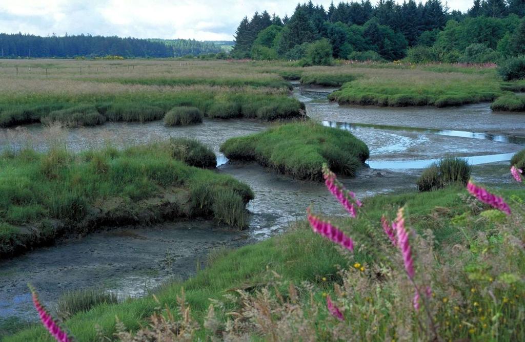
4 Site 2: Skagit Bay Initial Condition 11.2 Inches by 2050 No Dikes 27.3 Inches by 2100 No Dikes
5 The Problem Loss of coastal wetlands due to submergence Wetlands cannot migrate upslope because of human infrastructure or geomorphology
6 Providing Nature A-Right-of-Way Conservation Programs Sea Level-Rise Initiative No Net Loss Of Coastal Wetlands Science Policy
7 Partners Pacific Coast Joint Venture Ducks Unlimited Oregon Department of Fish and Wildlife Northern Pacific LCC
8 Improvements to NWF Report Used LIDAR data Better dike layer definition Separate analysis of major estuary systems Simpler wetland classification Examining uncertainty in SLAMM
9
10 Status of Oregon Work Assembling / processing LIDAR data Assembling dike layer Recoding wetlands OR geodatabase Analyses complete summer 2012
11 Status of Oregon Work Nehalem Tillamook Sand Lake Nestucca -- USFWS Salmon Siletz -- USFWS Yaquina Alsea Bay Siuslaw Umpqua Coos Bay Coquille -- USFWS Rogue
12 Nearshore Zones Habitat Type in NWF Report Estuarine Beach Tidal Flat Cowardin et al. (1979) Classification Estuarine intertidal unconsolidated shore (sand) Estuarine intertidal unconsolidated shore (mud) Nearshore Zone Low Tidal Saltmarsh Estuarine intertidal emergent Saltmarsh Transitional Marsh Brackish Marsh Tidal Swamp Transitional Fresh Marsh Riverine Tidal Estuarine intertidal scrub shrub Estuarine intertidal emergent Palustrine forested or scrub shrub (tidal modifier) Palustrine emergent (tidal modifier) Riverine aquatic bed (tidal modifier) Transitional Freshwater Tidal

13 Freshwater Tidal Saltmarsh Transitional Low Tidal
14 Low Tidal

15 Saltmarsh
16 Transitional
17 Freshwater Tidal
18 Site 2: Skagit Bay Initial Condition 11.2 Inches by 2050 No Dikes 27.3 Inches by 2100 No Dikes
19
20
21
22
23 Addressing this issue is urgent only because there are inexpensive opportunities to solve the problem now opportunities that will be prohibitively costly if we wait until housing developments replace our shorefront farms and forests" James Titus 1998 James Titus, 1998


24 Purchase development rights Farm indefinitely Place on conservation buyers market based on economic considerations Buyer assumes restoration costs
25 North Puget Sound Habitat Type Current Conditions 0.69 SLR Dikes in Place 0.69 SLR Dikes Removed Low Tidal 10,623 8,723 19,629 Saltmarsh 5,701 5,836 36,391 Transitional 637 2,133 9,748 Freshwater Tidal 1,
26 Acres Puget Sound 12,000 10,000 Low Tidal 8,000 6,000 4,000 Saltmarsh 2,000 Freshwater Tidal Transitional
27 Skagit Bay, Initial Condition

28 Skagit Bay, 2100 A1B Max With Dikes
29 Skagit Bay, 2100 A1B Max No Dikes
30 Gray s Harbor Habitat Type Current Conditions 0.69 SLR Dikes in Place 0.69 SLR Dikes Removed Low Tidal 37,646 12,271 12,271 Saltmarsh 2,758 3,716 3,716 Transitional 1,135 6,373 7,826 Freshwater Tidal 6,993 5,317 5,317
31 Acres Grays Harbor 40,000 35,000 30,000 Low Tidal 25,000 20,000 15,000 10,000 5,000 0 Freshwater Tidal Transitional Saltmarsh
32 Site 2, 2100 A1B Max No Dike Gray s Harbor, Initial Condition
33 Gray s Harbor, 2100 A1B Max with Dikes Site 2, 2100 A1B Max No Dike


34 Gray s Harbor, 2100 A1B Max without Dikes Site 2, 2100 A1B Max No Dike
35 Willapa Bay Habitat Type Current Conditions 0.69 SLR Dikes in Place 0.69 SLR Dikes Removed Low Tidal 50,268 16,889 17,609 Saltmarsh 7,806 7,307 9,251 Transitional 1,972 6,046 6,721 Freshwater Tidal 1,
36 Acres Willapa Bay 60,000 50,000 40,000 30,000 20,000 Low Tidal 10,000 Salt Marsh T. Marsh F. Tidal

37 Willapa Bay, Initial Condition
38 Willapa Bay, 2100 A1B Max with Dikes

39 Willapa Bay, 2100 A1B Max without Dikes
40 Lower Columbia Habitat Type Current Conditions 0.69 SLR Dikes in Place 0.69 SLR Dikes Removed Low Tidal 5,545 5,433 9,703 Saltmarsh 5,975 4,848 13,990 Transitional 810 2,103 4,218 Freshwater Tidal 6,370 5,654 5,587
41 Acres Lower Columbia 8,000 7,000 6,000 5,000 4,000 3,000 2,000 1,000 0 Low Tidal Freshwater Tidal Saltmarsh Transitional Marsh
42 Willapa Bay, 2100 A1B Max without D Lower Columbia, Initial Condition

43 Lower Columbia, 2100 A1B Max with Dikes

44 Lower Columbia, 2100 A1B Max without Dikes
45 New SLAMM Uncertainty Component Ducks Unlimited has funded creation of a new SLAMM uncertainty component that allows for site-specific information about model uncertainty. Coding is underway Product expected to be available in early 2011
46 Uncertainty Simulation Model Inputs Represented as Distributions Model Outputs
47 Acres Long-Term Regional Changes Low Tidal Saltmarsh Transitional Marsh

48 Skagit Bay Initial Conditions

49 Skagit Bay 2100 No Dikes

50 Acres Web-Based Planning Tool 600 LT LT Low Tidal LT SM SM SM TM SM TM TM LT = Low Tidal SM = Saltmarsh TM = Transitional Marsh Saltmarsh Transitional Marsh
51 Uncertainty Viewer Work in progress Most significant technical challenges complete Capability to interface with shape-files such as PLAT Maps User can draw polygon of choice and analyze uncertainty data based on that shape Pie-chart, map output, and interface refinements are pending
52 Easement Uncertainty (Dominance Class) Low Tidal Saltmarsh Transitional Marsh Freshwater Tidal
53 Policy Funding a Shoreline Easement Program
54 Opportunities to Adapt
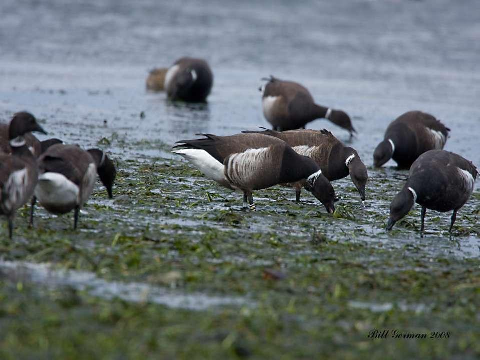
55 Opportunities to Adapt
56 Adapting to Sea Level Rise Present & Future Our Solutions Shouldn t be One-Dimensional
57 Acres Long-Term Regional Changes Low Tidal Saltmarsh Transitional Marsh
58 The Ideal Project Adds Low Tidal Habitat in the long-term (2100) Saltmarsh gains in the short-term (2050) Providing Transitional Marsh habitat not a priority
59 Acres Long-Term Project Changes Saltmarsh Low Tidal Transitional Marsh
60 Adapting to SLR Understanding long-term regional changes Shorefront easement programs centered on agricultural lands Predicting long-term changes at the project scale (will the project s evolution help offset habitat loss at the larger scale) Providing upslope migration opportunities at the project scale
61
62 Brant Initiative Develop brant specific carrying capacity model Sea level rise impacts on eelgrass distribution and abundance Alaska to Mexico PCJV, SJV, AGJV
Mapping tidal wetlands and their losses on the U.S. West Coast: new methods, new insights
 Mapping tidal wetlands and their losses on the U.S. West Coast: new methods, new insights Assoc. of State Wetland Managers Members Webinar January 31, 2018 Presented by: Laura Brophy Director, Estuary
Appendix E: Cowardin Classification Coding System
 Appendix E: Cowardin Classification Coding System The following summarizes the Cowardin classification coding system and the letters and numbers used to define the USFWS NWI wetland types and subtypes:
Modeling Sea-Level Rise in Coastal Wetlands: Understanding Potential Impacts and Their Implications for Management on Cape Cod
 Modeling Sea-Level Rise in Coastal Wetlands: Understanding Potential Impacts and Their Implications for Management on Cape Cod C a p e C o a s t a l C o n f e r e n c e H y a n n i s R e s o r t a n d
Planning for the Future of Humboldt Bay: Sea Level Rise, Sediment Management, Sand Spits and Salt Marshes. Joel Gerwein
 Planning for the Future of Humboldt Bay: Sea Level Rise, Sediment Management, Sand Spits and Salt Marshes Joel Gerwein Introduction to Humboldt Bay Setting Economy, community, and environment Sediment
Baseline Estuarine-Upland Transition Zone
 Baseline Estuarine-Upland Transition Zone in SF, San Pablo and Suisun Bays 10/5/18 Prepared for San Francisco Bay Joint Venture (SFBJV) Prepared by Brian Fulfrost, Principal bfaconsult@gmail.com with additional
Types of Wetlands. Tidal Systems
 Types of Wetlands Tidal Systems 1 COASTAL WETLAND ECOSYSTEMS Tidal Salt Marshes Tidal Freshwater Marshes Mangrove Wetlands 2 Tidal Estuarine Wetland 3 Definition and Formation of Estuaries Estuary: : partially
Subtidal permanently flooded with tidal water. Irregularly exposed surface exposed by tides less often than daily
 Types of Wetlands Tidal Systems COASTAL WETLAND ECOSYSTEMS Tidal Salt Marshes Tidal Freshwater Marshes Mangrove Wetlands Tidal Estuarine Wetland 1 Definition and Formation of Estuaries u Estuary : partially
Modeling habitat suitability for the European green crab using the ShoreZone mapping system
 Modeling habitat suitability for the European green crab using the ShoreZone mapping system Jodi N. Harney, Ph.D. and John R. Harper, Ph.D. Coastal and Ocean Resources Inc. Mary Morris, R.P. Bio. Archipelago
ICAN Great Lakes Workshop
 Washington Coastal latlas ICAN Great Lakes Workshop September 13 15, 15 2010 Current Washington Coastal Atlas http://www.ecy.wa.gov/programs/sea/sma/atlas_home.html 1 st version of WA Coastal Atlas was
We are interconnected, we are resilient As air temperatures warm forests change, fires increase glaciers retreat, snowpack diminishes sediment
 We are interconnected, we are resilient As air temperatures warm forests change, fires increase glaciers retreat, snowpack diminishes sediment increases rivers change, salmon respond base sea level rises
CORE CMECS GIS PROCESSING METHODS OREGON ESTUARY PROJECT OF SPECIAL MERIT
 CORE CMECS GIS PROCESSING METHODS OREGON ESTUARY PROJECT OF SPECIAL MERIT Andy Lanier, Tanya Haddad, Laura Mattison, Laura Brophy Oregon Coastal Management Program Oregon Dept. of Land Conservation and
V. IMPLICATIONS FOR COASTAL NEARSHORE HABITATS & ECOSYSTEMS
 V. IMPLICATIONS FOR COASTAL NEARSHORE HABITATS & ECOSYSTEMS Waves, currents, and sediment supply are the primary controls on coastal evolution; any changes in global climate which alter the timing and
Coastal and Marine Ecological Classification Standard (CMECS)
") Coastal and Marine Ecological Classification Standard (CMECS) Kathy Goodin, NatureServe EMECS, August 2011 Baltimore, MD 1 Outline Objectives & Process Classification Content Questions 2 Objectives Develop
Coastal and Marine Ecological Classification Standard (CMECS) Kathy Goodin, NatureServe EMECS, August 2011 Baltimore, MD 1 Outline Objectives & Process Classification Content Questions 2 Objectives Develop
PROBABILITY-BASED ESTIMATION OF NEARSHORE HABITAT CHARACTERISTICS
 In: Proceedings of Puget Research '98 Conference, Seattle, WA. PROBABILITY-BASED ESTIMATION OF NEARSHORE HABITAT CHARACTERISTICS Allison Bailey, Helen Berry, Betty Bookheim Washington State Department
Presentation Outline. Project Overview. Sea Level Rise Assessment & Decision Tools. Community Engagement. Tina Whitman, Friends of the San Juans
 Healthy Beaches for People & Fish Sea Level Rise Adaptation Tools for San Juan County, WA Tina Whitman & Andrea MacLennan December 10, 2015 Presentation Outline Project Overview Tina Whitman, Friends of
Sea Level Rise in Miami-Dade County Florida Implications for Management of Coastal Wetlands and the Everglades
 Sea Level Rise in Miami-Dade County Florida Implications for Management of Coastal Wetlands and the Everglades Peter W. Harlem Dr. John F. Meeder Florida International University Southeast Environmental
Sediment Management in the Coastal Bays
 Sediment Management in the Coastal Bays Introduction Need for ecosystem view of sediment management in Coastal Bays Island loss and restoration Navigation needs Habitat Trade offs Living Shoreline Requirements
Chapter 3 - White Oak River Subbasin Includes Bogue Sound and the Newport River
 Chapter 3 - White Oak River Subbasin 03-05-03 Includes Bogue Sound and the Newport River 3.1 Water Quality Overview Subbasin 03-05-03 at a Glance Land and Water Area (sq. mi.) Total area: 228 Land area:
Puget Sound Shorelines. Announcements
 Announcements Puget Sound Shorelines Wednesday discussion of Bates paper Bham Bay project: Updates, finals week schedules Last portion of the class: Environmental issues in Puget Sound Puget Sound shorelines:
Coastal and Marine Ecological Classification Standard (CMECS)
") Coastal and Marine Ecological Classification Standard (CMECS) Mark Finkbeiner NOAA Coastal Services Center Presented at the International Workshop on Seabed Mapping Methods and Technology 18 October 2012
Coastal and Marine Ecological Classification Standard (CMECS) Mark Finkbeiner NOAA Coastal Services Center Presented at the International Workshop on Seabed Mapping Methods and Technology 18 October 2012
Integrating new coastline information and geographically coordinated coastal geomorphology data
 Integrating new coastline information and geographically coordinated coastal geomorphology data NOAA Contemporary Shoreline DOE Coastal Geomorphology Cynthia Miller Corbett Jeff Simley 1 National Hydrography
Application of the Sea-Level Affecting Marshes Model (SLAMM 6) to Texas Point NWR
 to Texas Point NWR") Application of the Sea-Level Affecting Marshes Model (SLAMM 6) to Texas Point NWR U. S. Fish and Wildlife Service National Wildlife Refuge System Division of Natural Resources and Conservation Planning
Application of the Sea-Level Affecting Marshes Model (SLAMM 6) to Texas Point NWR U. S. Fish and Wildlife Service National Wildlife Refuge System Division of Natural Resources and Conservation Planning
Wetland and Riparian Mapping: An Overview of the Montana Program
 Wetland and Riparian Mapping: An Overview of the Montana Program Meghan Burns, Catherine McIntyre, Karen Newlon Ecology Program Montana Natural Heritage Program Helena, MT Montana Natural Heritage Program
ICAN Great Lakes 2010 Workshop
 ICAN Great Lakes 2010 Workshop Chris Cortina Maryland s Chesapeake & Coastal Program MD Department of Natural Resources Maryland s Coastal Atlas: What is it? The Coastal Atlas is an online mapping and
MEMORANDUM FOR SWG
 MEMORANDUM FOR SWG-2007-1623 Subject: Jurisdictional Determination (JD) for SWG-2007-1623 on Interdunal Wetlands Adjacent to Traditional Navigable Waters (TNWs) Summary The U.S. Environmental Protection
Ms. A. Mormando's Class *
 8 th Grade Science Essential Standard: 8.E.1.1 Explain the structure of the hydrosphere including: Water distribution on Earth; Local river basin and water availability Stream - A stream is a body of water
Modeling the Effects of Sea Level Rise on Massachusetts Coastal Wetlands Improving Protection, Management, and Climate Change Adaptation Planning
 Modeling the Effects of Sea Level Rise on Massachusetts Coastal Wetlands Improving Protection, Management, and Climate Change Adaptation Planning Photo credit: Mike McHugh, MassDEP Marc Carullo Massachusetts
Sea Level Rise and the Scarborough Marsh Scarborough Land Trust Annual Meeting April 24, 2018
 Sea Level Rise and the Scarborough Marsh Scarborough Land Trust Annual Meeting April 24, 2018 Peter A. Slovinsky, Marine Geologist Maine Geological Survey Funded by: 50% 40% Figure modified from Griggs,
The Use of Geographic Information Systems to Assess Change in Salt Marsh Ecosystems Under Rising Sea Level Scenarios.
 The Use of Geographic Information Systems to Assess Change in Salt Marsh Ecosystems Under Rising Sea Level Scenarios Robert Hancock The ecological challenges presented by global climate change are vast,
Application of the Sea-Level Affecting Marshes Model (SLAMM 5.0) to Green Cay National Wildlife Refuge
 to Green Cay National Wildlife Refuge") Application of the Sea-Level Affecting Marshes Model (SLAMM 5.0) to Green Cay National Wildlife Refuge Prepared For: Dr. Brian Czech, Conservation Biologist U. S. Fish and Wildlife Service National Wildlife
Application of the Sea-Level Affecting Marshes Model (SLAMM 5.0) to Green Cay National Wildlife Refuge Prepared For: Dr. Brian Czech, Conservation Biologist U. S. Fish and Wildlife Service National Wildlife
Current and Future Technology Applications for Coastal Zone Management. Bruce K. Carlisle, Acting Director Office of Coastal Zone Management
 Current and Future Technology Applications for Coastal Zone Management Bruce K. Carlisle, Acting Director Office of Coastal Zone Management The Massachusetts Coastal Zone Management Program Approved in
Modeling the Fate of New Jersey s Salt Marshes Under Future Sea Level Rise
 Modeling the Fate of New Jersey s Salt Marshes Under Future Sea Level Rise Richard Lathrop and John Bognar Contact: lathrop@crssa.rutgers.edu Center for Remote Sensing & Spatial Analysis, Rutgers University
SAGE. Systems Approach to Geomorphic Engineering. Barnegat Bay Pilot. Heather Jensen Philadelphia District. US Army Corps of Engineers BUILDING STRONG
 SAGE Systems Approach to Geomorphic Engineering Barnegat Bay Pilot Heather Jensen Philadelphia District US Army Corps of Engineers SAGE Nationwide program with a Regional Approach Innovative approach to
South Carolina Coastal Habitats
 South Carolina Coastal Habitats By C. Livingston, 2009 Earth Where is South Carolina? North America United States of America SC Here we are! South Carolina borders the Atlantic Ocean. Did you know? South
Application of the Sea-Level Affecting Marshes Model (SLAMM 6) to Pearl Harbor NWR
 to Pearl Harbor NWR") Application of the Sea-Level Affecting Marshes Model (SLAMM 6) to Pearl Harbor NWR Prepared For: Dr. Brian Czech, Conservation Biologist U. S. Fish and Wildlife Service National Wildlife Refuge System
Application of the Sea-Level Affecting Marshes Model (SLAMM 6) to Pearl Harbor NWR Prepared For: Dr. Brian Czech, Conservation Biologist U. S. Fish and Wildlife Service National Wildlife Refuge System
Application of the Sea-Level Affecting Marshes Model (SLAMM 6) to Kilauea Point NWR
 to Kilauea Point NWR") Application of the Sea-Level Affecting Marshes Model (SLAMM 6) to Kilauea Point NWR Prepared For U. S. Fish and Wildlife Service National Wildlife Refuge System Division of Natural Resources and Conservation
Application of the Sea-Level Affecting Marshes Model (SLAMM 6) to Kilauea Point NWR Prepared For U. S. Fish and Wildlife Service National Wildlife Refuge System Division of Natural Resources and Conservation
Application of the Sea-Level Affecting Marshes Model (SLAMM 6) to John Heinz NWR
 to John Heinz NWR") Application of the Sea-Level Affecting Marshes Model (SLAMM 6) to John Heinz NWR Prepared for: U. S. Fish and Wildlife Service National Wildlife Refuge System Division of Natural Resources and Conservation
Application of the Sea-Level Affecting Marshes Model (SLAMM 6) to John Heinz NWR Prepared for: U. S. Fish and Wildlife Service National Wildlife Refuge System Division of Natural Resources and Conservation
Application of the Sea-Level Affecting Marshes Model (SLAMM 5.0) to Bon Secour National Wildlife Refuge
 to Bon Secour National Wildlife Refuge") Application of the Sea-Level Affecting Marshes Model (SLAMM 5.0) to Bon Secour National Wildlife Refuge Prepared For: Dr. Brian Czech, Conservation Biologist U. S. Fish and Wildlife Service National Wildlife
Application of the Sea-Level Affecting Marshes Model (SLAMM 5.0) to Bon Secour National Wildlife Refuge Prepared For: Dr. Brian Czech, Conservation Biologist U. S. Fish and Wildlife Service National Wildlife
Application of the Sea-Level Affecting Marshes Model (SLAMM 6) to Potomac River NWR Complex
 to Potomac River NWR Complex") Application of the Sea-Level Affecting Marshes Model (SLAMM 6) to Potomac River NWR Complex U. S. Fish and Wildlife Service National Wildlife Refuge System Division of Natural Resources and Conservation
Application of the Sea-Level Affecting Marshes Model (SLAMM 6) to Potomac River NWR Complex U. S. Fish and Wildlife Service National Wildlife Refuge System Division of Natural Resources and Conservation
Appendix B. SLAMM Analysis of Kenai Peninsula and Anchorage, AK. Final Report
 Appendix B SLAMM Analysis of Kenai Peninsula and Anchorage, AK Final Report For: Jim Adams Director, Pacific Region National Wildlife Federation Anchorage, AK And: David Wigglesworth Coastal Program Manager
Virginia Shoreline Mapping Tools
 Virginia Shoreline Mapping Tools December 15, 2017 Karen Duhring Center for Coastal Resources Management Virginia Institute of Marine Science College of William & Mary Virginia Shoreline Mapping Tools
Application of the Sea-Level Affecting Marshes Model (SLAMM 6) to Huleia NWR
 to Huleia NWR") Application of the Sea-Level Affecting Marshes Model (SLAMM 6) to Huleia NWR Prepared For U. S. Fish and Wildlife Service National Wildlife Refuge System Division of Natural Resources and Conservation
Application of the Sea-Level Affecting Marshes Model (SLAMM 6) to Huleia NWR Prepared For U. S. Fish and Wildlife Service National Wildlife Refuge System Division of Natural Resources and Conservation
Introduction: The Gulf of Mexico Alliance. The Gulf GAME project MERMAid and PHINS Results & Conclusions What s next? Examples
 AAG Las Vegas March 25, 2009 Introduction: Ocean governance and Ecosystem-Based Management The Gulf of Mexico Alliance Habitat Identification and Characterization The Gulf GAME project MERMAid and PHINS
Carbon Sequestration Potential from Coastal Wetlands Restoration Sites
 Carbon Sequestration Potential from Coastal Wetlands Restoration Sites Insert then choose Picture select your picture. Right click your picture and Send to back. Paul Krause, Alyssa Beach Emily Cooper,
2016 MBNEP Uplands/Wetlands Habitat Mapping Project Trend Analysis Report
 2016 MBNEP Uplands/Wetlands Habitat Mapping Project Trend Analysis Report Introduction To support the MBNEP mission and objectives, an analysis of the trends in changes to landcover types has been conducted.
Application of the Sea-Level Affecting Marshes Model (SLAMM 6) to Crocodile Lake NWR
 to Crocodile Lake NWR") Application of the Sea-Level Affecting Marshes Model (SLAMM 6) to Crocodile Lake NWR U. S. Fish and Wildlife Service National Wildlife Refuge System Division of Natural Resources and Conservation Planning
Application of the Sea-Level Affecting Marshes Model (SLAMM 6) to Crocodile Lake NWR U. S. Fish and Wildlife Service National Wildlife Refuge System Division of Natural Resources and Conservation Planning
Application of the Sea-Level Affecting Marshes Model (SLAMM 6) to Bandon Marsh NWR
 to Bandon Marsh NWR") Application of the Sea-Level Affecting Marshes Model (SLAMM 6) to Bandon Marsh NWR Prepared For: Dr. Brian Czech, Conservation Biologist U. S. Fish and Wildlife Service National Wildlife Refuge System
Application of the Sea-Level Affecting Marshes Model (SLAMM 6) to Bandon Marsh NWR Prepared For: Dr. Brian Czech, Conservation Biologist U. S. Fish and Wildlife Service National Wildlife Refuge System
Landscape Planning Framework
 Landscape Planning Framework Fish Habitat Catena Geodatabase Methodology Mary Ramirez 1 Charles Simenstad 1 Phil Trask 2 Allan Whiting 2 Alex McManus 2 Funding provided by the Bonneville Power Administration
The Refugia Concept: Using Watershed Analysis to Prioritize Salmonid Habitat for Conservation and Restoration
 The Refugia Concept: Using Watershed Analysis to Prioritize Salmonid Habitat for Conservation and Restoration Christopher May Battelle & UW Cumulative Impacts of Urbanization Landscape Alterations Loss
Application of the Sea-Level Affecting Marshes Model (SLAMM 5.0) to Cabo Rojo and Laguna Cartagena National Wildlife Refuge
 to Cabo Rojo and Laguna Cartagena National Wildlife Refuge") Application of the Sea-Level Affecting Marshes Model (SLAMM 5.0) to Cabo Rojo and Laguna Cartagena National Wildlife Refuge Prepared For: Dr. Brian Czech, Conservation Biologist U. S. Fish and Wildlife
Application of the Sea-Level Affecting Marshes Model (SLAMM 5.0) to Cabo Rojo and Laguna Cartagena National Wildlife Refuge Prepared For: Dr. Brian Czech, Conservation Biologist U. S. Fish and Wildlife
Application of the Sea-Level Affecting Marshes Model (SLAMM 5.1) to Seatuck NWR
 to Seatuck NWR") Application of the Sea-Level Affecting Marshes Model (SLAMM 5.1) to Seatuck NWR Prepared For: Dr. Brian Czech, Conservation Biologist U. S. Fish and Wildlife Service National Wildlife Refuge System Division
Application of the Sea-Level Affecting Marshes Model (SLAMM 5.1) to Seatuck NWR Prepared For: Dr. Brian Czech, Conservation Biologist U. S. Fish and Wildlife Service National Wildlife Refuge System Division
Long-Distance Pumping and Opportunities for Engineering with Nature
 Long-Distance Pumping and Opportunities for Engineering with Nature Tim Welp and Derek Wilson Tim Welp Research Hydraulic Engineer Coastal and Hydraulics Laboratory 23 October 2012 Engineering with Nature
Solutions to Flooding on Pescadero Creek Road
 Hydrology Hydraulics Geomorphology Design Field Services Photo courtesy Half Moon Bay Review Solutions to Flooding on Pescadero Creek Road Prepared for: San Mateo County Resource Conservation District
Adaptation to Sea Level Rise A Regional Approach
 Adaptation to Sea Level Rise A Regional Approach Project Partners: in Saco Bay, ME Peter Slovinsky, Marine Geologist Maine Geological Survey, Department of Conservation Project Funding from: Saco Bay Hazards
Application of the Sea-Level Affecting Marshes Model (SLAMM 6) to Back Bay NWR
 to Back Bay NWR") Application of the Sea-Level Affecting Marshes Model (SLAMM 6) to Back Bay NWR U. S. Fish and Wildlife Service National Wildlife Refuge System Division of Natural Resources and Conservation Planning Conservation
Application of the Sea-Level Affecting Marshes Model (SLAMM 6) to Back Bay NWR U. S. Fish and Wildlife Service National Wildlife Refuge System Division of Natural Resources and Conservation Planning Conservation
Preliminary Results from Coordinated Sea-Level Rise Modeling Using SLAMM, the Sea Level Affecting Marshes Model, Across the US Gulf of Mexico Coast
 Preliminary Results from Coordinated Sea-Level Rise Modeling Using SLAMM, the Sea Level Affecting Marshes Model, Across the US Gulf of Mexico Coast James W. Pahl, Ph.D., and Kristin DeMarco, State of Louisiana
Wetlands and Riparian Mapping Framework Technical Meeting
 Wetlands and Riparian Mapping Framework Technical Meeting Meghan Burns Landscape Ecologist Linda Vance Senior Ecologist Why wetland and riparian mapping? Preliminary site assessment for the presence of
Regional Sediment Management
 Regional Sediment Management Linda S. Lillycrop Program Manager Coastal Engineer US Army Engineer Research and Development Center Coastal and Hydraulics Laboratory Q AVG Coastal Resilience: The Environmental,
CHAPTER 6 & 7 VOCABULARY
 CHAPTER 6 & 7 VOCABULARY 1. Biome 2. Climate 3. Latitude 4. Altitude 5. Emergent layer 6. Epiphyte 7. Understory 8. Permafrost 9. Wetland 10.Plankton 11.Nekton 12.Benthos 13.Littoral zone 14.Benthic zone
A Geographic Information System Based Model John L Marshall Geography 562 GIS Coastal Resources - Final Project: Fall 2017 University of Washington
 EFFECTS OF OYSTER CULTURE ON NATIVE EELGRASS AND RELATED NATURAL RESOURCES IN THE PUGET SOUND A Geographic Information System Based Model John L Marshall Geography 562 GIS Coastal Resources - Final Project:
Assessing the Vulnerability of Alaska s Coastal Habitats to Accelerating Sea-level Rise Using the SLAMM Model: A Case Study for Cook Inlet
 Assessing the Vulnerability of Alaska s Coastal Habitats to Accelerating Sea-level Rise Using the SLAMM Model: A Case Study for Cook Inlet Photo by: David Wigglesworth, USFWS Region 7 Coastal Program Prepared
Australian Coastal Councils Conference
 Australian Coastal Councils Conference 11 March 2015 Estimating Future Coastal Inundation and Erosion Hazards Dr Andrew McCowan Dr Christine Lauchlan-Arrowsmith Warwick Bishop Background Victorian Future
Aundrea McBride, Karen Wolf, and Eric Beamer June 2006
 SKAGIT BAY NEARSHORE HABITAT MAPPING Aundrea McBride, Karen Wolf, and Eric Beamer June 2006 INTRODUCTION Juvenile Chinook salmon travel through and utilize nearshore habitats as part of their life cycle.
Home About Us Articles Press Releases Image Gallery Contact Us Media Kit Free Subscription 10/5/2006 5:56:35 PM
 Home About Us Articles Press Releases Image Gallery Contact Us Media Kit Free Subscription 10/5/2006 5:56:35 PM Industry Resources Industry Directory NASA Links Missions/Launches Calendar Human development
Application of the Sea-Level Affecting Marshes Model (SLAMM 5.0) to Guadalupe-Nipomo Dunes NWR
 to Guadalupe-Nipomo Dunes NWR") Application of the Sea-Level Affecting Marshes Model (SLAMM 5.0) to Guadalupe-Nipomo Dunes NWR Prepared For: Dr. Brian Czech, Conservation Biologist U. S. Fish and Wildlife Service National Wildlife Refuge
Application of the Sea-Level Affecting Marshes Model (SLAMM 5.0) to Guadalupe-Nipomo Dunes NWR Prepared For: Dr. Brian Czech, Conservation Biologist U. S. Fish and Wildlife Service National Wildlife Refuge
Application of the Sea-Level Affecting Marshes Model (SLAMM 6) to Pelican Island NWR
 to Pelican Island NWR") Application of the Sea-Level Affecting Marshes Model (SLAMM 6) to Pelican Island NWR U. S. Fish and Wildlife Service National Wildlife Refuge System Division of Natural Resources and Conservation Planning
Application of the Sea-Level Affecting Marshes Model (SLAMM 6) to Pelican Island NWR U. S. Fish and Wildlife Service National Wildlife Refuge System Division of Natural Resources and Conservation Planning
1 Shoreline Landforms 2. 2 Emergent v. Submergent 2. 3 Wavecutting 3. 4 Planview 4. 5 Marine Terraces 5. 6 California 7. 7 Tombolos, Sea Stacks 8
 Shorelines November 9, 2008 Contents 1 Shoreline Landforms 2 2 Emergent v. Submergent 2 3 Wavecutting 3 4 Planview 4 5 Marine Terraces 5 6 California 7 7 Tombolos, Sea Stacks 8 8 Active Processes 9 9 Emergence
Great Lakes Coastal Wetlands Classification First Revision (July 2003)
") Great Lakes Coastal Wetlands Classification First Revision (July 2003) D. A. Albert, J. Ingram, T. Thompson, D. Wilcox, on behalf of the Great Lakes Coastal Wetland Consortium (GLCWC) Great Lakes coastal
Great Lakes Coastal Wetlands Classification First Revision (July 2003) D. A. Albert, J. Ingram, T. Thompson, D. Wilcox, on behalf of the Great Lakes Coastal Wetland Consortium (GLCWC) Great Lakes coastal
Nearshore Habitats Why What You do Matters. Landscapes on the Edge November 2016
 Nearshore Habitats Why What You do Matters Landscapes on the Edge November 2016 Primary Topics Focus on marine shorelines ESA species rely on this area Many other fish and wildlife rely on this area The
Application of the Sea-Level Affecting Marshes Model (SLAMM 6) to Guam NWR
 to Guam NWR") Application of the Sea-Level Affecting Marshes Model (SLAMM 6) to Guam NWR Prepared For U. S. Fish and Wildlife Service National Wildlife Refuge System Division of Natural Resources and Conservation Planning
Application of the Sea-Level Affecting Marshes Model (SLAMM 6) to Guam NWR Prepared For U. S. Fish and Wildlife Service National Wildlife Refuge System Division of Natural Resources and Conservation Planning
Miami-Dade County Technical Update Meeting South Florida Coastal Study. May 11, 2016
 Miami-Dade County Technical Update Meeting South Florida Coastal Study May 11, 2016 Welcome and Introductions FEMA Region IV Christina Lindemer Technical Lead Production and Technical Services (PTS) Contractor
Columbia Estuary Province
 Rolling Provincial Review: Implementation 2001-2004 Province 73 Columbia Basin Fish & Wildlife Authority Province FY 2001-2004 Spending Summaries NPCC Recommendations and BPA Spending by Project Category,
Ecosystems Chapter 4. What is an Ecosystem? Section 4-1
 Ecosystems Chapter 4 What is an Ecosystem? Section 4-1 Ecosystems Key Idea: An ecosystem includes a community of organisms and their physical environment. A community is a group of various species that
Application of the Sea-Level Affecting Marshes Model (SLAMM 5.0) to Salinas River NWR
 to Salinas River NWR") Application of the Sea-Level Affecting Marshes Model (SLAMM 5.0) to Salinas River NWR Prepared For: Dr. Brian Czech, Conservation Biologist U. S. Fish and Wildlife Service National Wildlife Refuge System
Application of the Sea-Level Affecting Marshes Model (SLAMM 5.0) to Salinas River NWR Prepared For: Dr. Brian Czech, Conservation Biologist U. S. Fish and Wildlife Service National Wildlife Refuge System
SIF_7.1_v2. Indicator. Measurement. What should the measurement tell us?
 Indicator 7 Area of natural and semi-natural habitat Measurement 7.1 Area of natural and semi-natural habitat What should the measurement tell us? Natural habitats are considered the land and water areas
SLAMM 6.3 Technical Documentation. Sea Level Affecting Marshes Model, Version 6.3 beta
 SLAMM 6.3 Technical Documentation Sea Level Affecting Marshes Model, Version 6.3 beta DRAFT December 11, 2012 SLAMM 6.3 Technical Documentation Sea Level Affecting Marshes Model, Version 6.3 beta Acknowledgements...
Create your own map for tidepooling, beach field trips, boating, camping, kayaking, fishing, and exploring the beaches in Southcentral Alaska.
 Create your own map for tidepooling, beach field trips, boating, camping, kayaking, fishing, and exploring the beaches in Southcentral Alaska. Here s an opportunity to download and customize your own free
OREGON DEPARTMENT OF FISH AND WILDLIFE 2015 Sport Fishing Catch - Fall Chinook Expanded numbers by month 'Final' Version
 OREGON DEPARTMENT OF FISH AND WILDLIFE 2015 Sport Fishing Catch - Fall Chinook Expanded numbers by month 'Final' Version Based upon Run Year Code Location Name Jan Feb Mar Apr May Jun Jul Aug Sep Oct Nov
OREGON DEPARTMENT OF FISH AND WILDLIFE 2015 Sport Fishing Catch - Spring Chinook Expanded numbers by month 'Final' Version
 OREGON DEPARTMENT OF FISH AND WILDLIFE 2015 Sport Fishing Catch - Spring Chinook Expanded numbers by month 'Final' Version Based upon Run Year Code Location Name Jan Feb Mar Apr May Jun Jul Aug Sep Oct
Application of the Sea-Level Affecting Marshes Model (SLAMM 5.1) to San Diego Bay NWR
 to San Diego Bay NWR") Application of the Sea-Level Affecting Marshes Model (SLAMM 5.1) to San Diego Bay NWR Prepared For: Dr. Brian Czech, Conservation Biologist U. S. Fish and Wildlife Service National Wildlife Refuge System
Application of the Sea-Level Affecting Marshes Model (SLAMM 5.1) to San Diego Bay NWR Prepared For: Dr. Brian Czech, Conservation Biologist U. S. Fish and Wildlife Service National Wildlife Refuge System
6. Geomorphology. Abstract
 6. Geomorphology Abstract The Skagit River delta has evolved over time due to both human and natural processes. Human activities such as construction of dikes and levees have influenced the spatial location,
EXISTING CONDITIONS : EAST SEGMENT
 EXISTING CONDITIONS : Area of Natural and Interest (ANSI) Environmentally Waterfront Trail Wetlands Hazard Setback Dunes Private Shoreline road ends Unsafe shoreline access Waterfront Trail on route FISH
NOAA s OCM: Services, tools and collaboration opportunities & Puerto Rico s NE Marine Corridor as a case study
 NOAA s OCM: Services, tools and collaboration opportunities & Puerto Rico s NE Marine Corridor as a case study Dr. Antares Ramos Álvarez NOAA s Office of Coastal Management September 15 th, 2016 Conservation
Overview. Gulf of Mexico Alliance Ocean and Coastal Mapping Regional Ecosystem Data Management (REDM) Q2O (QARTOD to OGC) Things to Consider
 Q2O (QARTOD to OGC) Things to Consider") 1 Overview Gulf of Mexico Alliance Ocean and Coastal Mapping Regional Ecosystem Data Management (REDM) Q2O (QARTOD to OGC) Things to Consider 2 Gulf Of Mexico Alliance Partnership of the states of Alabama,
1 Overview Gulf of Mexico Alliance Ocean and Coastal Mapping Regional Ecosystem Data Management (REDM) Q2O (QARTOD to OGC) Things to Consider 2 Gulf Of Mexico Alliance Partnership of the states of Alabama,
Sea-level Rise on Cape Cod: How Vulnerable Are We? Rob Thieler U.S. Geological Survey Woods Hole, MA
 Sea-level Rise on Cape Cod: How Vulnerable Are We? Rob Thieler U.S. Geological Survey Woods Hole, MA Outline Sea-level and coastal processes Past sea-level change Predictions for the future Coastal responses
The Problem. Which ecosystems are the most sensitive? Where will ecosystems be migrating? Where will investments be overwhelmed?
 BC Parks BC Parks is responsible for the designation, management and conservation of a system of ecological reserves, provincial parks and recreation areas located throughout the province. British Columbia
Scenarios for the NI coast in the 21 st Century
 Scenarios for the NI coast in the 21 st Century Prof Julian Orford Geography, Archaeology & Palaeoecology Queen s University, Belfast Challenging perspective Living by the coast is good for your health!
Application of the Sea-Level Affecting Marshes Model (SLAMM 6) to Currituck NWR
 to Currituck NWR") Application of the Sea-Level Affecting Marshes Model (SLAMM 6) to Currituck NWR U. S. Fish and Wildlife Service National Wildlife Refuge System Division of Natural Resources and Conservation Planning Conservation
Application of the Sea-Level Affecting Marshes Model (SLAMM 6) to Currituck NWR U. S. Fish and Wildlife Service National Wildlife Refuge System Division of Natural Resources and Conservation Planning Conservation
Subaqueous Soils A A New Frontier in Soil Survey. By Jim Turenne
 Subaqueous Soils A A New Frontier in Soil Survey By Jim Turenne http://nesoil.com.sas Subaqueous History Traditional soil survey conducted on land. Not a lot of work in wetlands and tidal marshes until
Human Impacts to Rivers
 Human Impacts to Rivers Sediment Water Wood Confinement Valley slope Channel morphology Bank material Flow obstructions Riparian vegetation Human Impacts on Rivers dams channelization loss of woody debris/riparian
USGS efforts to model sea-level rise impact to tidal marshes along the California coast.
 USGS efforts to model sea-level rise impact to tidal marshes along the California coast. Karen Thorne 1 J.Y Takekawa 1, K. Buffington 1, K. Swanson 2, J. Drexler 2, D.Schoellhamer 2, M. Casazza 3, and
Wetland Mapping. Wetland Mapping in the United States. State Wetland Losses 53% in Lower US. Matthew J. Gray University of Tennessee
 Wetland Mapping Caribbean Matthew J. Gray University of Tennessee Wetland Mapping in the United States Shaw and Fredine (1956) National Wetlands Inventory U.S. Fish and Wildlife Service is the principle
Mapping of Future Coastal Hazards. for Southern California. January 7th, David Revell, Ph.D. E.
 Mapping of Future Coastal Hazards for Southern California January 7th, 2014 David Revell, Ph.D. drevell@esassoc.com E. Vandebroek, 2012 Outline Coastal erosion hazard zones Flood hazard zones: Coastal
Oyster Reef for Shoreline Stabilization and Restoration. Jason Kirkpatrick Conservation Program Manager MacDill AFB Tampa, Florida
 Oyster Reef for Shoreline Stabilization and Restoration Jason Kirkpatrick Conservation Program Manager MacDill AFB Tampa, Florida Interbay Penninsula Port of Tampa X The few remaining mangroves are being
THE USE OF GEOSPATIAL DATA TO SUPPORT VULNERABILITY MAPPING OF THE OREGON COAST. Kelvin Raiford MS Candidate Geography Department of Geosciences
 THE USE OF GEOSPATIAL DATA TO SUPPORT VULNERABILITY MAPPING OF THE OREGON COAST Kelvin Raiford MS Candidate Geography Department of Geosciences INTRODUCTION This study is an outcome of the project Geospatial
Aim and objectives Components of vulnerability National Coastal Vulnerability Assessment 2
 ASSESSING THE UTILITY OF GEOMORPHIC SENSITIVITY MAPPING ON THE ILLAWARRA COAST Pamela Abuodha, Christina Baker, Chris Sharples, Darren Skene and Colin Woodroffe Geoquest Research Centre, University of
Overview of Methods. Terrestrial areas that are most important for conservation Conservation
 Overview of Methods The goal of the Western Lake Erie Coastal Conservation Vision project (WLECCV) is to define where we should be working locally to optimally achieve regional conservation impact. The
Earth Wind & Fire. Game Changing Restoration Options in the Texas Chenier Plain
 Earth Wind & Fire Game Changing Restoration Options in the Texas Chenier Plain EARTH: The Chenier Plain is a 5 million acre coastal region in Southwest Louisiana and Southeast Texas providing landscape
Sunset Harbour / Huntington Harbour Maintenance Dredging and Waterline Installation Project. CMANC 21 January 2016
 Sunset Harbour / Huntington Harbour Maintenance Dredging and Waterline Installation Project CMANC 21 January 2016 County of Orange Footprint Huntington Harbour Operational and Dredging Cost Sharing Agreements
ONR Tidal Flats DRI: Planning Joint Modeling and Field Exercises
 ONR Tidal Flats DRI: Planning Joint Modeling and Field Exercises Lyle Hibler Battelle/Marine Research Operations 1529 West Sequim Bay Road Sequim, WA 98382 Phone: (360) 681-3616 Fax: (360) 681-3681 Email: