Esri Image & Mapping Forum 9 July 2017 Geiger-Mode for Conservation Planning & Design by USDA NRCS NGCE
|
|
|
- Jerome Stewart
- 5 years ago
- Views:
Transcription


1 Esri Image & Mapping Forum 9 July 2017 Geiger-Mode for Conservation Planning & Design by USDA NRCS NGCE

 as a permanent agency in the USDA.")
2 For over 75 years, the Natural Resources Conservation Service has been a pioneer in conservation, working with landowners, local and state governments, and other federal agencies to maintain healthy and productive working landscapes. On April 27, 1935 Congress establish the Soil Conservation Service (SCS) as a permanent agency in the USDA. In 1994, Congress changed SCS s name to the Natural Resources Conservation Service (NRCS) to better reflect the broadened scope

3 The creation of the Soil Conservation Service represented the culmination of the efforts of Hugh Hammond Bennett, father of Soil Conservation and the first Chief of SCS, to awaken public concern for the problem of soil erosion. Soil has long been confused with land. It is but one part of land. For conservation purposes, land must be regarded in terms of all its component parts: soil, slope, climate, susceptibility to depreciation by erosion, over-cropping or other processes of deterioration.


4 Many Resource Issues Soil Quality Water Quality Irrigation Water Management Rangeland Management Wildlife Habitat Soil Erosion Forest Management Nutrient Management

5 Identifying Resource Concerns


6 Surveys Networks Addresses Vectors Annotation 3D Objects Attribute Topology Terrain Dimensions Cadastral Geodatabase Cartography Images CAD 6

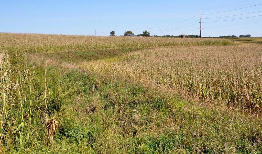
7 Conservation Terraces Before After


8 Conservation Terraces NAIP Topo Hillshade from LiDAR

9 VISION: Create an INTEGRATED Topologically correct National Agricultural Geodatabase Common Land Units Easements Planning Land Units Parcel Boundaries Public Land Survey Watershed Boundaries Streams & Ponds NAIP leaf on 1 meter Natural Color 1 ft / 6 Elevation (LiDAR/IFSAR/NED)
10 Imagery Programs and Products Used in USDA-NRCS Type Years Imagery Type NHAP Aerial B&W, CIR Approximately 300,000 images Approximately 300 TB for the scans AHAP Aerial for Alaska NAPP/NDOP* Aerial B&W, CIR* NAIP Natural Color, CIR, All 4 Band since 2012 Satellite (High Res) or 8 Bands Aerial Misc For select areas (AK/HI/PR/USVI) ASCS (FSA) 35mm Slides Varies by State Natural Color Approximately over 30 million slides Natural Resources Inventory Stewardship Lands Initiative Commercial Satellite NRI Imagery 276 TB Adding 20 TB per year SLI Imagery 53 TB Adding 15 TB per year 40 TB Pacific Basin, Alaska, Hawaii, Puerto Rico, VI

11 Sample SLI Imagery TX NRCS SLI 2014 Digital 15 cm GSD NRCS Service GF

12 Sample SLI Imagery TX NRCS SLI 2016 Film 1ft GSD NRCS Service GF

13 Sample SLI Imagery TX NAIP 10/13/14 Digital - 1 m GSD - NRCS Service GF


14 Browser Links:
15 Objectives of the NRCS National Enterprise Elevation Program (NEEP): Create and Maintain a National High Resolution Elevation Datamart that meets NRCS business requirements Deploy value added elevation products and services via the web & for desktop apps Integrate high resolution elevation data into business workflows and applications that are plug and play like Conservation Toolkit & Engineering Field Tools & Terrain Mapping
16 Rasters - DTM, DSM, Hillshade, Slope, Aspect Vectors 2 foot Contours indexed with labels LiDAR Products & Services NRCS conducted a study in 2010 led by Dr David F Maune, Dewberry to document elevation requirements, publish a white paper and funding and implementation plan. The National Enterprise Elevation Program (NEEP) is being built to achieve the outcomes and goals of the program. The products from NEEP are. Web Based that are fast and reliable Point Clouds - LAS shown as points, TIN, Contours
17 NRCS Applications using Elevation Products & Services Field Office Conservation Planning Engineering Field Tools Terrain Mapping Hydrologic Modeling Dam Breech simulation studies


18 Conservation Technical Assistance The CTA Program provides land users with proven conservation technology and the delivery system needed to achieve the benefits of a healthy and productive landscape.
19 NRCS Quality Level Cross Walk


20 Manual Digital

21 NRCS Legacy Map Products USGS Topographic Maps for base maps

22 NAPP Imagery to create legacy conservation plan maps 1: =660 8 to the mile Features mapped: Tract & Field boundaries, Wetland Areas, Highly Erodible Lands

23 Classic Conservation Plan Map Photocopy of the 24x24 CIBA photo map Usually 1 square mile Usually in Black and White 1:7920 scale 1 = 660 Feet 1985 Farm Bill Era Shows highly erodible land determinations Shows Conservation Reserve Program fields Shows tracts, field numbers and field boundaries with acres

24 NAIP 1 meter LiDAR 1 m QL2

25 Wetland Reserve Program Easement on NAIP & Hillshade from LiDAR 25
26 Wetland Reserve Program Easement on High Resolution 1 foot Imagery & Hillshade from LiDAR 26

27 NRCS Mapping Tool aka POD uses NGCE web services to create Watershed and Conservation Maps using standard templates 27

28 28

29 29

30 30

31 31

32 Shawnee County, KS LiDAR Collection in

33 33

34 34

35 35

36

37


38 2005 Steve Nechero, Geospatial Data Management Branch Chief or Office Paul Fukuhara, Geospatial IT Innovations Leader or Office Collin McCormick,National Elevation Leader or NGCE Home Page Darren Hickman, Director Darren.Hickman@ftw.usda.gov West Felix Street Fort Worth Federal Center, Building 23 Fort Worth, Texas 76126
Geospatial Data, Services, and Products. National Surveying, mapping and geospatial conference
 Geospatial Data, Services, and Products Federal Programs -- USDA NRCS National Surveying, mapping and geospatial conference March 15, 2016 NRCS Applications using Geosaptial Products & Services Field
GIS APPLICATIONS IN SOIL SURVEY UPDATES
 GIS APPLICATIONS IN SOIL SURVEY UPDATES ABSTRACT Recent computer hardware and GIS software developments provide new methods that can be used to update existing digital soil surveys. Multi-perspective visualization
Chesapeake Bay Remote Sensing Pilot Executive Briefing
 Chesapeake Bay Remote Sensing Pilot Executive Briefing Introduction In his Executive Order 13506 in May 2009, President Obama stated The Chesapeake Bay is a national treasure constituting the largest estuary
A Comprehensive Inventory of the Number of Modified Stream Channels in the State of Minnesota. Data, Information and Knowledge Management.
 A Comprehensive Inventory of the Number of Modified Stream Channels in the State of Minnesota Data, Information and Knowledge Management Glenn Skuta Environmental Analysis and Outcomes Division Minnesota
The 3D Elevation Program: Overview. Jason Stoker USGS National Geospatial Program ESRI 2015 UC
 + The 3D Elevation Program: Overview Jason Stoker USGS National Geospatial Program ESRI 2015 UC + 2 A little history USGS has a long, proud tradition of mapmaking (2009) + 3 The changing times Mapping
Web (Java, ArcGIS Server [WebADF, flex, silverlight]) Mobile (ArcGIS Mobile, ArcPad, Windows Mobile) Deskt
![Web (Java, ArcGIS Server [WebADF, flex, silverlight]) Mobile (ArcGIS Mobile, ArcPad, Windows Mobile) Deskt](/thumbs/96/129284052.jpg "Web (Java, ArcGIS Server [WebADF, flex, silverlight]) Mobile (ArcGIS Mobile, ArcPad, Windows Mobile) Deskt") GIS Services company in Lincoln, NE Custom GIS database design and build (for local, county, state and private corporations) Custom (ESRI and non-esri) application design and build in Java, C++, C#,.Net
GIS Services company in Lincoln, NE Custom GIS database design and build (for local, county, state and private corporations) Custom (ESRI and non-esri) application design and build in Java, C++, C#,.Net
Management and Use of LiDAR-derived Information. Elizabeth Cook, GIS Specialist
 Management and Use of LiDAR-derived Information Elizabeth Cook, GIS Specialist Advanced LiDAR Workshop March 15, 2012 50-100 gb/county Now What? Project Deliverables LAS mass point files, classification
LIDAR: Statutory Compliance Benefits for Nebraska Natural Resources
 LIDAR: Statutory Compliance Benefits for Nebraska Natural Resources 2011 Nebraska GIS Symposium La Vista, NE April 21, 2011 Doug Hallum, P.G. Integrated Water Management Coordinator Nebraska Department
What s New in Topographic Information - USGS National Map
 + What s New in Topographic Information - USGS National Map SARGIS Workshop November 14, 2016 Rob Dollison, 703-648-5724 rdollison@usgs.gov + USGS 2 National Geospatial Program The National Geospatial
IMPERIAL COUNTY PLANNING AND DEVELOPMENT
 IMPERIAL COUNTY PLANNING AND DEVELOPMENT GEODATABASE USER MANUAL FOR COUNTY BUSINESS DEVELOPMENT GIS June 2010 Prepared for: Prepared by: County of Imperial Planning and Development 801 Main Street El
USGS Hydrography Overview. May 9, 2018
 + 1 USGS Hydrography Overview May 9, 2018 + 2 The National Geospatial Program Provides the geospatial baseline of the Nation s topography, natural landscape and built environment through The National Map,
Introduction. Elevation Data Strategy. Status and Next Steps
 1 2 Introduction Elevation Data Strategy Status and Next Steps 3 Canada is the 2nd largest country in the world - 9.9 million sq km Surrounded by 3 oceans with 202 000 km of coastline Population over 35
MISSOURI LiDAR Stakeholders Meeting
 MISSOURI LiDAR Stakeholders Meeting East-West Gateway June 18, 2010 Tim Haithcoat Missouri GIO Enhanced Elevation Data What s different about it? Business requirements are changing.fast New data collection
Wetland Mapping. Wetland Mapping in the United States. State Wetland Losses 53% in Lower US. Matthew J. Gray University of Tennessee
 Wetland Mapping Caribbean Matthew J. Gray University of Tennessee Wetland Mapping in the United States Shaw and Fredine (1956) National Wetlands Inventory U.S. Fish and Wildlife Service is the principle
GIS Changing the World GIS Day November 15, 2017
 + GIS Changing the World GIS Day November 15, 2017 + Growing Up On The Farm 3 Geographic Information in DNR A 75 year history of mapping and GIS. Forest type map from 1944. State of Washington - Division
Geospatial SDI Portal for effective Governance of Pune METROPOLIS region
 Geospatial SDI Portal for effective Governance of Pune METROPOLIS region Mr. Praveen Gautam Senior Manager 19 th January 2018 PMRDA Overview Provide a Spatial Framework for the entire region with various
Technical Drafting, Geographic Information Systems and Computer- Based Cartography
 Technical Drafting, Geographic Information Systems and Computer- Based Cartography Project-Specific and Regional Resource Mapping Services Geographic Information Systems - Spatial Analysis Terrestrial
Summary Description Municipality of Anchorage. Anchorage Coastal Resource Atlas Project
 Summary Description Municipality of Anchorage Anchorage Coastal Resource Atlas Project By: Thede Tobish, MOA Planner; and Charlie Barnwell, MOA GIS Manager Introduction Local governments often struggle
Geospatial Data Sources. SLO GIS User Group June 8, 2010
 Geospatial Data Sources SLO GIS User Group June 8, 2010 Presenters Drew Decker USGS Southern California Geospatial Liaison Kelly Bobbitt Mike Bobbitt & Associates Joe Larson Cal Fire Peter Meertens Regional
Steve Pye LA /22/16 Final Report: Determining regional locations of reference sites based on slope and soil type. Client: Sonoma Land Trust
 Steve Pye LA 221 04/22/16 Final Report: Determining regional locations of reference sites based on slope and soil type. Client: Sonoma Land Trust Deliverables: Results and working model that determine
Pierce Cedar Creek Institute GIS Development Final Report. Grand Valley State University
 Pierce Cedar Creek Institute GIS Development Final Report Grand Valley State University Major Goals of Project The two primary goals of the project were to provide Matt VanPortfliet, GVSU student, the
Manitoba s Elevation (LiDAR) & Imagery Datasets. Acquisition Plans & Opportunities for Collaboration
 & Imagery Datasets. Acquisition Plans & Opportunities for Collaboration") Manitoba s Elevation (LiDAR) & Imagery Datasets Acquisition Plans & Opportunities for Collaboration Manitoba Planning Conference May 2017 Presentation Outline Manitoba s Elevation (LiDAR) and Imagery Datasets
Manitoba s Elevation (LiDAR) & Imagery Datasets Acquisition Plans & Opportunities for Collaboration Manitoba Planning Conference May 2017 Presentation Outline Manitoba s Elevation (LiDAR) and Imagery Datasets
² 2015 Program Year. Farm Tract McLeod County, Minnesota 1:4, NHEL NHEL
 United States Department of Agriculture McLeod County, Minnesota Farm 5125 #* 2 3.65 NHEL Tract 2762 1 33.19 NHEL ² 2015 Program Year Map Created November 06, 2014 Common Land Unit Cropland Non-cropland
Presented by: Bryan Bloch GIS Specialist DNREC Division of Watershed Stewardship
 Presented by: Bryan Bloch GIS Specialist DNREC Division of Watershed Stewardship Bryan Hall, AICP Sussex County Circuit Rider Planner, Office of State Planning Coordination, OMB November 19, 2012 UD Sustainable
Cripps Ranch 76+/- Acres Orchard Development Opportunity Dixon, CA. Presented By:
 Cripps Ranch 76+/- Acres Orchard Development Opportunity Dixon, CA Presented By: Cripps Ranch 76+/- Acres Orchard Development Opportunity Dixon, CA Location: This property is located at 5663 Dally Road
State of Israel Ministry of Housing and Construction Survey of Israel. The Hydrological project case
 State of Israel Ministry of Housing and Construction Survey of Israel The Hydrological project case Survey of Israel Content Introduction To the Survey of Israel The operation assumptions The main responsibilities
Workshops funded by the Minnesota Environment and Natural Resources Trust Fund
 Workshops funded by the Minnesota Environment and Natural Resources Trust Fund Conservation Applications of LiDAR Data Workshops funded by: Minnesota Environment and Natural Resources Trust Fund Presented
ELEVATION IS FOUNDATIONAL. A DEM that is inaccurate or of poor resolution will pass those characteristics onto other data layers
 ELEVATION IS FOUNDATIONAL A DEM that is inaccurate or of poor resolution will pass those characteristics onto other data layers THE DEM IS FOUNDATIONAL TO ALL GIS (Geospatial Information System) LAYERS
Soil Business Area Analysis Group (SBAAG)
") Soil Business Area Analysis Group (SBAAG) Southern Regional Cooperative Soil Survey Conference July 15, 2008 Sharon W. Waltman, USDA-NRCS (Acting SBAAG Chair) National Geospatial Development Center Morgantown,
Soil Business Area Analysis Group (SBAAG) Southern Regional Cooperative Soil Survey Conference July 15, 2008 Sharon W. Waltman, USDA-NRCS (Acting SBAAG Chair) National Geospatial Development Center Morgantown,
3D Elevation Program, Lidar in Missouri. West Central Regional Advanced LiDAR Workshop Ray Fox
 3D Elevation Program, Lidar in Missouri West Central Regional Advanced LiDAR Workshop Ray Fox National Enhanced Elevation Assessment (Dewberry, 2011) Sponsored by the National Digital Elevation Program
USGS National Geospatial Program Understanding User Needs. Dick Vraga National Map Liaison for Federal Agencies July 2015
 + USGS National Geospatial Program Understanding User Needs Dick Vraga National Map Liaison for Federal Agencies July 2015 + Topics 2 Background Communities of Use User Surveys National Map Liaisons Partnerships
Forest Service. Geospatial Management. Presented by: Carl Zulick, USFS Geospatial Information Officer. April 1, 2014
 Forest Service Geospatial Management Presented by: Carl Zulick, USFS Geospatial Information Officer April 1, 2014 USFS Mission "Caring for the Land and Serving People" The mission of the USDA Forest Service
Mapping Your Land and Introduction to Web Soil Survey. Elizabeth Cook GIS Specialist USDA-NRCS (retired)
") Mapping Your Land and Introduction to Web Soil Survey Elizabeth Cook GIS Specialist USDA-NRCS (retired) Using Geographic Information Systems (GIS), Global Positioning System (GPS), digital aerial photography
Mapping Your Land and Introduction to Web Soil Survey Elizabeth Cook GIS Specialist USDA-NRCS (retired) Using Geographic Information Systems (GIS), Global Positioning System (GPS), digital aerial photography
NR402 GIS Applications in Natural Resources
 NR402 GIS Applications in Natural Resources Lesson 1 Introduction to GIS Eva Strand, University of Idaho Map of the Pacific Northwest from http://www.or.blm.gov/gis/ Welcome to NR402 GIS Applications in
NOAA s OCM: Services, tools and collaboration opportunities & Puerto Rico s NE Marine Corridor as a case study
 NOAA s OCM: Services, tools and collaboration opportunities & Puerto Rico s NE Marine Corridor as a case study Dr. Antares Ramos Álvarez NOAA s Office of Coastal Management September 15 th, 2016 Conservation
The Future of Soil Mapping using LiDAR Technology
 The Future of Soil Mapping using LiDAR Technology Jessica Philippe Soil Scientist/GIS Specialist March 24, 2016 Natural Resources Conservation Service Helping People Help the Land Area 12-STJ covers parts
Lecture 9: Reference Maps & Aerial Photography
 Lecture 9: Reference Maps & Aerial Photography I. Overview of Reference and Topographic Maps There are two basic types of maps? Reference Maps - General purpose maps & Thematic Maps - maps made for a specific
U.S. Geological Survey Agency Briefing for MAPPS Mark L. DeMulder Director, National Geospatial Program. March 12, 2013
 + U.S. Geological Survey Agency Briefing for MAPPS Mark L. DeMulder Director, National Geospatial Program March 12, 2013 + 3D Elevation Program (3DEP) National Leadership The National Enhanced Elevation
GEOMATICS. Shaping our world. A company of
 GEOMATICS Shaping our world A company of OUR EXPERTISE Geomatics Geomatics plays a mayor role in hydropower, land and water resources, urban development, transport & mobility, renewable energy, and infrastructure
The National Hydrography Dataset in the Pacific Region. U.S. Department of the Interior U.S. Geological Survey
 The National Hydrography Dataset in the Pacific Region U.S. Department of the Interior U.S. Geological Survey The National Map The National Map is built on partnerships and standards The National Map consists
Esri s Living Atlas of the World Community Maps
 Esri s Living Atlas of the World Community Maps Seth Sarakaitis Wednesday May 7, 2014 ArcGIS Living Atlas Concept Living Atlas Content Tour Contributing to the Living Atlas (Community Maps) Seth Sarakaitis
Web Soil Survey National Cooperative Soil Survey
 121 52' 18'' W Irrigated Capability Class Sutter County, California () 121 51' 49'' W 597600 597700 597800 597900 598000 598100 598200 39 6' 27'' N 39 6' 27'' N 39 5' 57'' N 4328400 4328500 4328600 4328700
GIS Data and Technology to Support Transportation & MPO Decision-Making & Planning. using an Eco-Logical* Approach within the Kansas City Region
 GIS Data and Technology to Support Transportation & MPO Decision-Making & Planning using an Eco-Logical* Approach within the Kansas City Region Authors (in alphabetical order): Tom Gerend, Tom Jacobs,
LiDAR User Data Needs Survey Results
 LiDAR User Data Needs Survey Results June 2012 Introduction The Minnesota Geospatial Information Office (MnGeo) is working with the Minnesota Department of Natural Resources (DNR) to develop a data distribution
Fugro Geospatial: Turning Spatial Data into Knowledge
 Fugro Geospatial: Turning Spatial Data into Knowledge 2016 Fugro Geospatial, GIS and Consultants Locations Variety of Collection Platforms Traditional Mapping Traditional Mapping Imagery Photogrammetric
What is the Living Atlas for ArcGIS and How Can you be Involved?
 Federal GIS Conference February 9 10, 2015 Washington, DC What is the Living Atlas for ArcGIS and How Can you be Involved? Clint Brown Deane Kensok Agenda Introduction to Living Atlas - Transformation
IMAGE AND DATA CREDITS
 Image credits All images created by Keranen and Image (figure 03_basics_a.tif) from ArcGIS Help 10.2 http://resources.arcgis.com/en/help /main/10.2/index.html#/015w0000006n000000, courtesy of Esri. Image
Developing a Campus-wide Base Map for Planning, Design and Construction. June 21, 2007
 Developing a Campus-wide Base Map for Planning, Design and Construction June 21, 2007 Presenters Berent Pippert UCR Project Manager Capital and Physical Planning Academic Planning and Budget 951-827-2431
APPROVED JURISDICTIONAL DETERMINATION FORM U.S. Army Corps of Engineers
 APPROVED JURISDICTIONAL DETERMINATION FORM U.S. Army Corps of Engineers This form should be completed by following the instructions provided in Section IV of the JD Form Instructional Guidebook. SECTION
AN ASSESSMENT OF THE IMPACT OF RETENTION PONDS
 AN ASSESSMENT OF THE IMPACT OF RETENTION PONDS FOR SEDIMENT TRAPPING IN THE ADA CREEK AND LONGWOOD COVE USING REMOTELY SENSED DATA AND GIS ANALYSIS Sudhanshu Sekhar Panda Associate Professor, GIS/Env.
NAVAJO NATION PROFILE
 NAVAJO NATION PROFILE Largest land based area and federally recognized tribe in the United States Over 27,000 square miles (or 17.2 million acres with a population of over 300,000 people. Covers Arizona,
Development of Webbased. Tool for Tennessee
 Development of Webbased Farm Mapping Tool for Tennessee Southern Region Water Quality Conference, Oct. 24 2005 Forbes Walker and Alan Jolly Biosystems Engineering and SOIL SCIENCE Nutrient Management Planning
FUNDAMENTALS OF GEOINFORMATICS PART-II (CLASS: FYBSc SEM- II)
") FUNDAMENTALS OF GEOINFORMATICS PART-II (CLASS: FYBSc SEM- II) UNIT:-I: INTRODUCTION TO GIS 1.1.Definition, Potential of GIS, Concept of Space and Time 1.2.Components of GIS, Evolution/Origin and Objectives
FUNDAMENTALS OF GEOINFORMATICS PART-II (CLASS: FYBSc SEM- II) UNIT:-I: INTRODUCTION TO GIS 1.1.Definition, Potential of GIS, Concept of Space and Time 1.2.Components of GIS, Evolution/Origin and Objectives
USGS Data Initiatives for Elevation, Streams and Topo Maps
 USGS Data Initiatives for Elevation, Streams and Topo Maps Gary Merrill, USGS Geospatial Liaison for Carolinas Silvia Terziotti, USGS Assoc. Geospatial Liaison for North Carolina, Water Communities of
MAPPING ALASKA S WATERS
 MAPPING ALASKA S WATERS NHD Advisory Team Call December, 16 2014 K a c y K r i e ge r kacy.krieger@uaa.alaska.edu Alaska Hydrography Coordinator ALASKA S WATER > 3,000,000 Mapped Lakes and Ponds > 847,000
Imagery and the Location-enabled Platform in State and Local Government
 Imagery and the Location-enabled Platform in State and Local Government Fred Limp, Director, CAST Jim Farley, Vice President, Leica Geosystems Oracle Spatial Users Group Denver, March 10, 2005 TM TM Discussion
Appendix C. Questionnaire Summary of Responses Geographic Information Systems
 Appendix C Questionnaire Summary of Responses Geographic Information Systems 1. Is your agency using or planning use of GIS for: a. general mapping (e.g. highway routes, political boundaries, etc.) b.
Designing GIS Databases to Support Mapping and Map Production Charlie Frye, ESRI Redlands Aileen Buckley, ESRI Redlands
 Designing GIS Databases to Support Mapping and Map Production Charlie Frye, ESRI Redlands Aileen Buckley, ESRI Redlands 1 Designing GIS Databases to Support Mapping and Map Production Charlie Frye, ESRI
Improvement of the National Hydrography Dataset for Parts of the Lower Colorado Region and Additional Areas of Importance to the DLCC
 Improvement of the National Hydrography Dataset for Parts of the Lower Colorado Region and Additional Areas of Importance to the DLCC Carlos Reyes-Andrade California State University, Northridge September
STATE-WIDE HIGH-DENSITY LIDAR IS NOW AVAILABLE GEIGER-MODE LIDAR AND THE MULTI-USE BENEFITS
 Place image here (13.33 x 3.5 ) STATE-WIDE HIGH-DENSITY LIDAR IS NOW AVAILABLE GEIGER-MODE LIDAR AND THE MULTI-USE BENEFITS SCOTT BENNETT Director of Strategic Growth - Geospatial Solutions scott.a.bennett@harris.com
USGS POD implementation in USGS Cloud to Support US Topo Production
 USGS POD implementation in USGS Cloud to Support US Topo Production 2017 Esri User Conference 16 June 2017 Bob Davis lrdavis@usgs.gov 573-308-3554 William J. Marken, GSP wmarken@usgs.gov 573-308-3532 U.S.
GIS and Web Technologies to Improve Irrigation Districts
 GIS and Web Technologies to Improve Irrigation Districts Presented To: Montana Association of Dam and Canal Systems Workshop Presented By: Brian Fischer, CFM GIS Manager October 07, 2010 What you won t
Unmanned Aircraft Systems (UAS) Activities in Earth Sciences
 Activities in Earth Sciences") Unmanned Aircraft Systems (UAS) Activities in Earth Sciences Bruce K. Quirk quirk@usgs.gov Department of the Interior U.S. Geological Survey June 22, 2015 Department of the Interior Bureau of Land Management
Unmanned Aircraft Systems (UAS) Activities in Earth Sciences Bruce K. Quirk quirk@usgs.gov Department of the Interior U.S. Geological Survey June 22, 2015 Department of the Interior Bureau of Land Management
Web Soil Survey National Cooperative Soil Survey
 122 14' 27'' W () 122 13' 37'' W 40 8' 40'' N 564700 564800 564900 565000 565100 565200 565300 565400 565500 565600 565700 565800 40 8' 40'' N 4443400 4443500 4443600 4443700 4443800 4443900 4444000 4443400
Wetland and Riparian Mapping: An Overview of the Montana Program
 Wetland and Riparian Mapping: An Overview of the Montana Program Meghan Burns, Catherine McIntyre, Karen Newlon Ecology Program Montana Natural Heritage Program Helena, MT Montana Natural Heritage Program
APPROVED JURISDICTIONAL DETERMINATION FORM U.S. Army Corps of Engineers
 APPROVED JURISDICTIONAL DETERMINATION FORM U.S. Army Corps of Engineers This form should be completed by following the instructions provided in Section IV of the JD Form Instructional Guidebook. SECTION
SCAUG Community Maps Building a Living Atlas of the World
 SCAUG Community Maps Building a Living Atlas of the World Mark Stewart Topics: SCAUG ArcGIS Online Overview Community Maps Overview Community Maps Workflow Update Process Utilizing Your Contribution Community
Introduction to Geographic Information Systems (GIS): Environmental Science Focus
: Environmental Science Focus") Introduction to Geographic Information Systems (GIS): Environmental Science Focus September 9, 2013 We will begin at 9:10 AM. Login info: Username:!cnrguest Password: gocal_bears Instructor: Domain: CAMPUS
Introduction to Geographic Information Systems (GIS): Environmental Science Focus September 9, 2013 We will begin at 9:10 AM. Login info: Username:!cnrguest Password: gocal_bears Instructor: Domain: CAMPUS
Sustainable and Harmonised Development for Smart Cities The Role of Geospatial Reference Data. Peter Creuzer
 Sustainable and Harmonised Development for Smart Cities The Role of Geospatial Reference Data Peter Creuzer 1. Introduction - Smart Cities and Geodata 2. Geodata in Germany 3. Examples 4. Data and Service
Geographic Information Systems. Introduction to Data and Data Sources
 Geographic Information Systems Introduction to Data and Data Sources Presented by John Showler, NJDA-SSCC NJ SCD GIS Training Session December 10, 209 The Objectives of this session are 3-fold: 1. Introduce
GERSVIEW: A New Database for Web Mapping
 GERSVIEW: A New Database for Web Mapping William J. Hernández, M.S. Graduate Student Department of Marine Sciences-UPRM Fernando Gilbes, Ph.D. Associate Professor Department of Geology-UPRM Overview Introduction
Creating Watersheds and Stream Networks. Steve Kopp
 Creating Watersheds and Stream Networks Steve Kopp Workshop Overview Demo Data Understanding the tools Elevation Data Types DEM : Digital Elevation Model bare Earth DSM : Digital Surface Model Data Structure
APPROVED JURISDICTIONAL DETERMINATION FORM U.S. Army Corps of Engineers
 APPROVED JURISDICTIONAL DETERMINATION FORM U.S. Army Corps of Engineers This form should be completed by following the instructions provided in Section IV of the JD Form Instructional Guidebook. SECTION
Denis White NSI Technical Services Corporation 200 SW 35th St. Corvallis, Oregon 97333
 POLYGON OVERLAY TO SUPPORT POINT SAMPLE MAPPING: THE NATIONAL RESOURCES INVENTORY Denis White NSI Technical Services Corporation 200 SW 35th St. Corvallis, Oregon 97333 Margaret Maizel ' American Farmland
3D Elevation Program- Status and Updates. Oklahoma GI Council Meeting November 2, 2018 Claire DeVaughan US Geological Survey
 + 1 3D Elevation Program- Status and Updates Oklahoma GI Council Meeting November 2, 2018 Claire DeVaughan US Geological Survey + 2 3D Elevation Program (3DEP) Goals Complete acquisition in 8 years Address
Producing Chandler Walnut Orchard
 AG-LAND Investment Brokers 275 Sale Lane Red Bluff, CA 96080 530-529-4400 Fax 530-527-5042 Producing Chandler Walnut Orchard West Sacramento Avenue - Chico, CA AG-LAND INVESTMENT BROKERS 275 Sale Lane
APPROVED JURISDICTIONAL DETERMINATION FORM U.S. Army Corps of Engineers
 APPROVED JURISDICTIONAL DETERMINATION FORM U.S. Army Corps of Engineers This form should be completed by following the instructions provided in Section IV of the JD Form Instructional Guidebook. SECTION
Welcome to NR502 GIS Applications in Natural Resources. You can take this course for 1 or 2 credits. There is also an option for 3 credits.
 Welcome to NR502 GIS Applications in Natural Resources. You can take this course for 1 or 2 credits. There is also an option for 3 credits. The 1st credit consists of a series of readings, demonstration,
CALIFORNIA AGRICULTURAL PR OPERTIES, IN C. GALE RANCH
 CALIFORNIA AGRICULTURAL PR OPERTIES, IN C. GALE RANCH LOCATION: The Ranch is located 6 Yi miles west of the City of Davis on the northwest corner of County Roads 29A and 92E in Yolo County. SIZE: 368.64
To achieve these Global Sustainable Development Goals, geospatial data are crucial.
 To achieve these Global Sustainable Development Goals, geospatial data are crucial. 2 http://www.globalgoals.org/ HIGH INCOME NATION SUSTAINABLE GROWTH SOCIALLY INCLUSIVE 3 http://etp.pemandu.gov.my/ 12
USGS Community Engagement and its Role in Improving The National Map
 USGS Community Engagement and its Role in Improving The National Map ESRI User Conference, 2014 Bob Davis Carol Ostergren Drew Decker USGS Strategic Direction Provides a sharpened focus on our topographic
APPROVED JURISDICTIONAL DETERMINATION FORM U.S. Army Corps of Engineers
 APPROVED JURISDICTIONAL DETERMINATION FORM U.S. Army Corps of Engineers This form should be completed by following the instructions provided in Section IV of the JD Form Instructional Guidebook. SECTION
Base Maps: Creating, Using & Participating
 Base Maps: Creating, Using & Participating Michael Fashoway & Erin Geraghty Montana Base Map Service Center 2010 MAGIP Technical Session October 28, 2010 What is a Base Map? Using a Base Map Creating a
Chittenden Road Prune Orchard Corning, California
 AG-LAND INVESTMENT BROKERS 275 Sale Lane / P. O. Box 896 Red Bluff, CA 96080 530.529.4400 office / 530.527.5042 fax Chittenden Road Prune Orchard Corning, California Property: 40.00 acres planted to producing
CRP HEL CRP Ortho Imagery. Tract Cropland Total: acres
 United States Department of Agriculture Madison County, Iowa 17 4.09 23 1.26 6 10.74 14 2.89 12 1.7 1 18.02 230TH LN T 347 3 34 4.65 13 2.81 2 11.4 ELMWOOD AVE 16 3 6.49 18 6.5 1.59 21 2.35 8.76 24 11
Huron Creek Watershed 2005 Land Use Map
 Huron Creek Watershed 2005 Land Use Map Created By: Linda Kersten, 12/20/06 Created For: MTU Introduction to GIS Class (FW 5550) The Huron Creek Watershed Advisory Committee Michigan Technological University,
Project Leader: Project Partners:
 UTILIZING LIDAR TO MAP HIGH PRIORITY WOODLAND HABITAT IN ARKANSAS DEVELOPING METHODOLOGY AND CONDUCTING A PILOT PROJECT IN THE OZARK HIGHLANDS TO MAP CURRENT EXTENT, SIZE AND CONDITION Project Summary
Template for Sediment and Erosion Control Plan General Instructions. Section Instructions
 Template for Sediment and Erosion Control Plan General Instructions Introduction: Soil erosion and sediment deposition from farmlands can contribute to degraded surface water quality. Sediment delivery
The Emerging Role of Enterprise GIS in State Forest Agencies
 The Emerging Role of Enterprise GIS in State Forest Agencies Geographic Information System (GIS) A geographic information system (GIS) is a computer software system designed to capture, store, manipulate,
IMAGE ANALYSIS MEASURING LANDSCAPE VEGETATION IN 1.3 MILLION PARCELS FOR OUTDOOR WATER BUDGETS
 IMAGE ANALYSIS MEASURING LANDSCAPE VEGETATION IN 1.3 MILLION PARCELS FOR OUTDOOR WATER BUDGETS Pete Vitt Santa Ana Watershed Project Authority (SAWPA) Doug Mende Statistical Research Inc. July 13, 2017
SOLUTIONS ADVANCED GIS. TekMindz are developing innovative solutions that integrate geographic information with niche business applications.
 ADVANCED GIS SOLUTIONS TekMindz are developing innovative solutions that integrate geographic information with niche business applications. TEK INDZ TM GIS Services Overview At the leading edge of geospatial
Waterborne Environmental, Inc., Leesburg, VA, USA 2. Syngenta Crop Protection, LLC, North America 3. Syngenta Crop Protection, Int.
 Application of High Resolution Elevation Data (LiDAR) to Assess Natural and Anthropogenic Agricultural Features Affecting the Transport of Pesticides at Multiple Spatial Scales Josh Amos 1, Chris Holmes
Emergency Planning. for the. Democratic National. Convention. imaging notes // Spring 2009 //
 Emergency Planning for the Democratic National Convention The DRAPP Demonstrates Partnership among Local, Regional, State, Utility and Federal Governments 14 imaging notes // Spring 2009 // www.imagingnotes.com
Geospatial Data Model for Archaeology Site Data
 Authors: David T. Hansen, Barbara D. Simpson, Anastasia Leigh, Patrick Welch, and Lorri Peltz-Lewis Geospatial Data Model for Archaeology Site Data Presented by David T. Hansen and Barbara D. Simpson at
Bringing it all together. David R. Maidment Texas Water Forum 13 February 2012
 Bringing it all together David R. Maidment Texas Water Forum 13 February 2012 What have I learned today? Texas drought is very complex On a physical level as to causes in the atmosphere and their translation
Analyzing the Operational Environment
 Esri International User Conference July 23 27 San Diego Convention Center Analyzing the Operational Environment Matthew Funk (Esri) David Mitchell (Esri) Tim Burley (Helyx SIS) Geospatial Enterprise for
Locational business intelligence in the U.S. Forest Service: Geospatial Accomplishment Reporting ESRI USER CONFERENCE 2015 JULY 21, 2015
 Locational business intelligence in the U.S. Forest Service: Geospatial Accomplishment Reporting ESRI USER CONFERENCE 2015 JULY 21, 2015 Agenda Introduction to the US Forest Service Why geo-enable Performance
RANGE SUSTAINABILITY GIS APPLICATIONS AND ENTERPRISE IMPLEMENTATIONS
 RANGE SUSTAINABILITY GIS APPLICATIONS AND ENTERPRISE IMPLEMENTATIONS May 4, 2009 Gabe Lovasz, Geospatial Analyst, ManTech SRS Molly Rodriguez, Geospatial Analyst, ManTech SRS -In Support of- The Office
USDA NRCS Soil Survey
 USDA NRCS Soil Survey Thomas Reinsch National Leader World Soil Resources Slide 1 Slide 2 National Cooperative Soil Survey Congress Has Directed The Secretary Of Agriculture To: 1899-2011 Inventory Soils
Object Based Imagery Exploration with. Outline
 Object Based Imagery Exploration with Dan Craver Portland State University June 11, 2007 Outline Overview Getting Started Processing and Derivatives Object-oriented classification Literature review Demo