Evaluation of multi-year drought capabilities of the CESM Large-Ensemble using MODE
|
|
|
- Dominic Myron Cummings
- 5 years ago
- Views:
Transcription
1


2 Evaluation of multi-year drought capabilities of the CESM Large-Ensemble using MODE by: Abayomi A. Abatan Iowa State University CESM Societal Dimensions Working Group Meeting NCAR Boulder, CO 28 February 1 March, 2017
3 Research Team William J. Gutowski Jr. Iowa State University Ames, IA Barbara G. Brown Research Applications Laboratory NCAR, Boulder, CO Tressa Fowler Research Applications Laboratory NCAR, Boulder, CO Lawrence Buja Research Applications Laboratory NCAR, Boulder, CO Caspar M. Ammann Research Applications Laboratory NCAR, Boulder, CO Eric Gilleland Research Applications Laboratory NCAR, Boulder, CO Laurna Kaatz Denver Water Denver, CO John Halley Gotway Research Applications Laboratory NCAR, Boulder, CO Randy Bullock Research Applications Laboratory NCAR, Boulder, CO
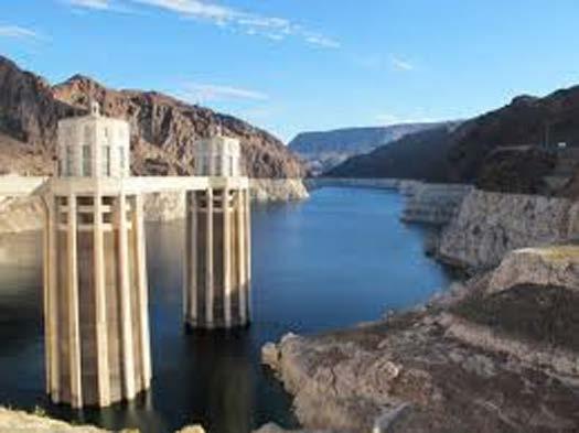
4 Background The southwestern U.S., including the upper Colorado River basin (UCRB), is highly vulnerable to regional climatic extremes, such as droughts and pluvials. Devastating droughts had occurred in the 1930s, 1950s, and more recently. Multiyear droughts and pluvials have severe consequences for the agricultural sector and water resources management, such as for Denver Water, a major water utility in the region. To this day, the drought remains the reference drought for Denver Water to illustrate water management challenges. The work presented in this study is part of an effort by the research community and the Denver Water management to characterize long-term droughts and pluvials over the basin, and to assess the quality of climate models in reproducing real-world conditions.
5 Objectives Determine the appropriate drought index to characterized hydrological drought over UCRB (SPEI and SPI). Evaluate the ability of CESM-LE to reproduce observed drought object attributes using the Method for Object-based Diagnostic Evaluation (MODE).
6 Data and Analysis Procedures We use monthly precipitation and maximum and minimum temperatures datasets from PRISM for the period We use SPEI and SPI to characterized droughts and pluvials. Keeping in mind the example of the 1950s drought, Denver Water managers are especially interested in 36-month and longer droughts for planning water management, both for maintaining supply and for adequate operating revenue. We use monthly streamflow data aggregated over three gauging stations as representative streamflow data for the UCRB. The stations are Blue River below Dillon, Fraser River near Winter Park, and Williams Fork near Leal (see Fig. 1). Parameter-Elevation Regressions on Independent Slopes Model (PRISM; Daly et al. 1994, 2008) Streamflow data from the U.S. Geological Survey National Water Information System website (

7 Fig. 1: Map of the UCRB with the locations of three streamflow gauge stations in the black box. The outline of the map of the contiguous U.S. showing the location of UCRB is shown in the inset.
8 Evolution of hydrological variables over UCRB The normalized TX36 anomalies show clusters of hot and cool periods (Fig. 2a). Of the clusters, the most obvious are the positive anomalies spanning and , and negative anomalies spanning , , and The pattern displayed by the normalized TX36 anomalies time series indicate trend towards warming, consistent with Gleason et al. (2008). There appears to be similarity between PET36 anomalies (Fig. 2b) and TX36 anomalies (Fig. 2a). For P36, SPI36, and SPEI36 anomalies, dry spell occurred mostly during , , , and Similarity between SPI36, and SPEI36 anomalies. Fig. 2: Evolution of climate variables and drought indices over UCRB during Out-of-phase relationship of SPEI36 anomalies with TX36 and PET36 indicates the role of warming coupled with higher evaporative demand on variations of SPEI36 events over UCRB. Drying during the recent decade is consistent with results from others studies in the literature.

9 Evolution of hydrological variables over the three gage stations Close resemblance between hydroclimate variables and drought indices in Fig. 2 and Fig. 3. Periods of anomalous positive and negative SF36 are in good agreement with the wet and dry periods indicated by both SPI36 and SPEI36 anomalies. The correlation between SF36 and SPEI36 is 0.78, while it is 0.79 for SF36 and SPI36. This suggests that both indices are good indicators to characterized streamflow and drought events over the Denver Water s reservoirs. Fig. 3: Evolution of climate variables and drought indices averaged over the sub-region in Fig. 1 during
10 Percent area of the UCRB in drought and pluvial: Although the two indices have similar patterns, there are slight differences in percent area and period. 58% of the UCRB experienced moderate drought in 2004 (SPEI36 ), while in 2002 about 54% of the region had moderate drought according to the SPI36 (Fig. 4a). Overall, the percentage of area in drought in the 2000s stands out as a prominent feature of the temporal pattern over the region, with a peak in The results indicate that SPEI36 and SPI36 show similar temporal patterns, but that the inclusion of temperatures in SPEI36 leads to more extreme magnitudes in SPEI36 than in SPI36. For severe-to-extreme drought (Fig. 4b), there are about 83% (76%) and about 62% (37%) of the region in this classification of drought in 2003 (2002) as indicated by SPEI36 (SPI36), respectively. For pluvial, both indices peaked at the same period. SPEI36 (SPI36) indicated that about 46% (33%) of the area experienced severe-to-extreme wet conditions in 1984 (1985). Fig. 4: Areas (%) of the UCRB in (a) moderate and (b) severe-to-extreme drought and (c) moderate and (d) severe-to-extreme pluvial conditions at the 36-month time scale ending in December from 1950 to The solid line is for SPEI, while the dashed line is for SPI.
11 Verification of CESM LE drought objects using the Method for Object-based Diagnostic Evaluation (MODE)
12 Verification of simulated drought objects using MODE MODE is an object-based technique that represents a class of spatial verification methods. The objective is to identify localized features of interest in scalar fields and compare features in two fields to identify which features best correspond to each other (Davis et al. 2009). The MODE process involves object identification based on specified thresholds, object attributes measurement, objects merging, objects matching, and comparison. MODE uses two basic steps to identify objects in meteorological fields: - Convolution of raw data (basically a smoothing using a convolution radius) - Masking of the convolved field using a threshold (T) on the intensity of the fields Various object parameters can be calculated, including - Intersection area, Area ration, Centroid distance separation, Orientation angle difference, Curvature, etc. MODE uses these object attributes to calculate a quantity called total interest (I). MODE uses a total interest threshold for guiding the precise identification of a match between objects in the two fields.
13 Verification of simulated drought objects using MODE To examine the capability of CESM Large Ensemble datasets to simulate drought events over UCRB, we use MODE to examine their drought object parameters. The drought object parameters examined in this work include: - Intensity (expressed in terms of percentiles) - Area (object s size) - Centroid location (center of mass for the object; characterized by latitude-longitude coordinate) Once objects are identified, we compute statistics, such as minimum, 25th, 50th, 75th, and maximum, and then compare attributes of drought objects defined using the SPEI. Then we examine and compare the attributes of objects between ensemble members and observations. The results are presented using box-plot for easy interpretation.

14 Sample output of MODE objects Table 1. Statistics of attributes of the matched cluster objects between SPEI36 and SPI36 for December CLUS PAIR CEN DIST ANG DIFF SPEI36 AREA SPI36 AREA INTER AREA UNION AREA SPEI36 INT 50 SPI36 INT 50 TOT INTR Figure 5. The spatial distributions of the values of (a) SPEI36, (b) SPI36, and clusters of drought objects identified for (c) SPEI36 and (d) SPI36 for December The colored numbers in (c) and (d) indicate the objects that were matched between the two fields.
15 Percentile intensity attribute: There exists an uncertainty among the observational datasets. Only 2 of the CESM-LE ensemble members are within the spread of the median of observation datasets. This indicates that the CESM-LE ensemble members overestimate the 50th percentile intensity of drought. The ensemble members are characterized by different statistics: -- The median value of the 50th-PI of drought object ranges from 1.23 to Some ensemble members have narrow spread in agreement with observations. -- The IQR ranges from 0.13 to 0.44; slightly wider than observations ( 0.14 to 0.23). Fig. 6: Box plots of 50th percentile intensity attribute of observed and simulated drought object over UCRB. On average, the magnitude of simulated drought objects is considerably higher.
16 Percentile intensity attribute: CRU has higher drought intensity ( 1.58) than PRISM ( 1.40); observational uncertainty. 9 of the CESM-LE ensemble members are within the spread of the median of observation datasets. The CESM-LE ensemble members overestimate the 90th percentile intensity of drought. The ensemble members are characterized by different statistics: -- The median value of the 90th-PI of drought object ranges from 1.44 to Consistent with observations, some ensemble members have narrow spread in agreement with observations. -- The IQR ranges from 0.22 to 0.75 wider than observations ( 0.25 to 0.29). Fig. 7: Box plots of 90th percentile intensity attribute of observed and simulated drought object over UCRB. On average, drought severity in CESM-LE is higher than in observations.
17 Area attribute of drought object: Area of observed drought objects are similar; slight difference in the median values. The observed spread and IQR are also similar. For CESM-LE, 83% of the ensemble members have smaller drought object area as indicated by the median values. The CESM-LE ensemble members overestimate the 90th percentile intensity of drought. The statistics of the ensemble members are as follows: -- The median value ranges from 6.5 to Ensemble members have narrow spread. Fig. 8: Box plots of Area of observed and simulated drought object over UCRB. On average, the ensemble mean indicates that some members have considerably larger object areas.

18 Centroid location attribute: Observed centroids ranges from 39.8 N to 40, N; W to W. There exist larger spread in centroids of CESM- LE ensemble members. The centroid locations of the simulated objects are further north than observed. However, the ensemble mean centroid location is slight north of CRU drought object. Fig. 9: Spatial distribution of centroid locations of observed and simulated drought object over UCRB.
19 Summary The results indicate that SPEI36 and SPI36 show similar temporal pattern, but that the inclusion of temperatures in SPEI36 leads to more extreme magnitudes in SPEI36 than SPI36. Although the percentile intensity of drought objects are higher, MODE results show that simulated area of drought objects are smaller in CESM-LE ensemble members than in observations. The results show the advantage of using MODE as a tool to monitor and characterize extreme drought events over UCRB.
20 Thank you
Sensitivity of Water Supply in the Colorado River Basin to Warming
 Sensitivity of Water Supply in the Colorado River Basin to Warming Greg McCabe U.S. Geological Survey, Denver, Colorado Dave Wolock U.S. Geological Survey, Lawrence, Kansas The Colorado River Basin Streamgage
Drought Monitoring in Mainland Portugal
 Drought Monitoring in Mainland Portugal 1. Accumulated precipitation since 1st October 2014 (Hydrological Year) The accumulated precipitation amount since 1 October 2014 until the end of April 2015 (Figure
NIDIS Intermountain West Regional Drought Early Warning System February 7, 2017
 NIDIS Drought and Water Assessment NIDIS Intermountain West Regional Drought Early Warning System February 7, 2017 Precipitation The images above use daily precipitation statistics from NWS COOP, CoCoRaHS,
NIDIS Intermountain West Drought Early Warning System October 17, 2017
 NIDIS Drought and Water Assessment NIDIS Intermountain West Drought Early Warning System October 17, 2017 Precipitation The images above use daily precipitation statistics from NWS COOP, CoCoRaHS, and
NIDIS Intermountain West Drought Early Warning System November 14, 2017
 NIDIS Intermountain West Drought Early Warning System November 14, 2017 Precipitation The images above use daily precipitation statistics from NWS COOP, CoCoRaHS, and CoAgMet stations. From top to bottom,
How Will the Colorado Run? The Colorado River in a Warmer World
 How Will the Colorado Run? The Colorado River in a Warmer World The Future of the Colorado River October 13, 2018 Brad Udall Senior Scientist/Scholar Colorado State University Bradley.Udall@colostate.edu
NIDIS Intermountain West Drought Early Warning System September 4, 2018
 NIDIS Drought and Water Assessment NIDIS Intermountain West Drought Early Warning System September 4, 2018 Precipitation The images above use daily precipitation statistics from NWS COOP, CoCoRaHS, and
Prediction of Snow Water Equivalent in the Snake River Basin
 Hobbs et al. Seasonal Forecasting 1 Jon Hobbs Steve Guimond Nate Snook Meteorology 455 Seasonal Forecasting Prediction of Snow Water Equivalent in the Snake River Basin Abstract Mountainous regions of
UPPLEMENT A COMPARISON OF THE EARLY TWENTY-FIRST CENTURY DROUGHT IN THE UNITED STATES TO THE 1930S AND 1950S DROUGHT EPISODES
 UPPLEMENT A COMPARISON OF THE EARLY TWENTY-FIRST CENTURY DROUGHT IN THE UNITED STATES TO THE 1930S AND 1950S DROUGHT EPISODES Richard R. Heim Jr. This document is a supplement to A Comparison of the Early
Precipitation. Standardized Precipitation Index. NIDIS Intermountain West Drought Early Warning System September 5, 2017
 9/6/2017 NIDIS Drought and Water Assessment NIDIS Intermountain West Drought Early Warning System September 5, 2017 Precipitation The images above use daily precipitation statistics from NWS COOP, CoCoRaHS,
Precipitation. Standardized Precipitation Index. NIDIS Intermountain West Regional Drought Early Warning System January 3, 2017
 1/3/2017 NIDIS Drought and Water Assessment NIDIS Intermountain West Regional Drought Early Warning System January 3, 2017 Precipitation The images above use daily precipitation statistics from NWS COOP,
Precipitation. Standardized Precipitation Index. NIDIS Intermountain West Regional Drought Early Warning System December 6, 2016
 12/9/2016 NIDIS Drought and Water Assessment NIDIS Intermountain West Regional Drought Early Warning System December 6, 2016 Precipitation The images above use daily precipitation statistics from NWS COOP,
NIDIS Intermountain West Drought Early Warning System December 18, 2018
 NIDIS Intermountain West Drought Early Warning System December 18, 2018 Precipitation The images above use daily precipitation statistics from NWS COOP, CoCoRaHS, and CoAgMet stations. From top to bottom,
PRECIPITATION. Last Week Precipitation:
 12/3/2014 NIDIS Drought and Water Assessment PRECIPITATION The images above use daily precipitation statistics from NWS COOP, CoCoRaHS, and CoAgMet stations. From top to bottom, and left to right: most
SWIM and Horizon 2020 Support Mechanism
 SWIM and Horizon 2020 Support Mechanism Working for a Sustainable Mediterranean, Caring for our Future REG-7: Training Session #1: Drought Hazard Monitoring Example from real data from the Republic of
NIDIS Intermountain West Drought Early Warning System July 18, 2017
 NIDIS Drought and Water Assessment NIDIS Intermountain West Drought Early Warning System July 18, 2017 Precipitation The images above use daily precipitation statistics from NWS COOP, CoCoRaHS, and CoAgMet
Comparative assessment of different drought indices across the Mediterranean
 European Geosciences Union General Assembly 2016 Vienna, Austria, 17-22 April 2016 Session HS7.4: Change in climate, hydrology and society, Vol. 18, EGU2016-18537, 2016. Comparative assessment of different
NIDIS Intermountain West Drought Early Warning System April 18, 2017
 1 of 11 4/18/2017 3:42 PM Precipitation NIDIS Intermountain West Drought Early Warning System April 18, 2017 The images above use daily precipitation statistics from NWS COOP, CoCoRaHS, and CoAgMet stations.
NIDIS Drought and Water Assessment
 NIDIS Drought and Water Assessment PRECIPITATION The images above use daily precipitation statistics from NWS COOP, CoCoRaHS, and CoAgMet stations. From top to bottom, and left to right: most recent 7-days
NIDIS Intermountain West Drought Early Warning System December 11, 2018
 NIDIS Drought and Water Assessment NIDIS Intermountain West Drought Early Warning System December 11, 2018 Precipitation The images above use daily precipitation statistics from NWS COOP, CoCoRaHS, and
NIDIS Intermountain West Drought Early Warning System March 26, 2019
 NIDIS Intermountain West Drought Early Warning System March 26, 2019 The images above use daily precipitation statistics from NWS COOP, CoCoRaHS, and CoAgMet stations. From top to bottom, and left to right:
NIDIS Drought and Water Assessment
 7/23/13 1:57 PM PRECIPITATION The images above use daily precipitation statistics from NWS COOP, CoCoRaHS, and CoAgMet stations. From top to bottom, and left to right: most recent 7-days of accumulated
NIDIS Intermountain West Drought Early Warning System April 16, 2019
 NIDIS Intermountain West Drought Early Warning System April 16, 2019 Precipitation The images above use daily precipitation statistics from NWS COOP, CoCoRaHS, and CoAgMet stations. From top to bottom,
NIDIS Weekly Climate, Water and Drought Assessment Summary. Upper Colorado River Basin
 NIDIS Weekly Climate, Water and Drought Assessment Summary Upper Colorado River Basin August 3, 2010 Precipitation and Snowpack Fig. 1: July precipitation in inches Fig. 2: July precip as percent of average
NIDIS Intermountain West Drought Early Warning System December 30, 2018
 1/2/2019 NIDIS Drought and Water Assessment NIDIS Intermountain West Drought Early Warning System December 30, 2018 Precipitation The images above use daily precipitation statistics from NWS COOP, CoCoRaHS,
NIDIS Intermountain West Drought Early Warning System February 12, 2019
 NIDIS Intermountain West Drought Early Warning System February 12, 2019 Precipitation The images above use daily precipitation statistics from NWS COOP, CoCoRaHS, and CoAgMet stations. From top to bottom,
Chiang Rai Province CC Threat overview AAS1109 Mekong ARCC
 Chiang Rai Province CC Threat overview AAS1109 Mekong ARCC This threat overview relies on projections of future climate change in the Mekong Basin for the period 2045-2069 compared to a baseline of 1980-2005.
NIDIS Intermountain West Drought Early Warning System August 8, 2017
 NIDIS Drought and Water Assessment 8/8/17, 4:43 PM NIDIS Intermountain West Drought Early Warning System August 8, 2017 Precipitation The images above use daily precipitation statistics from NWS COOP,
NIDIS Intermountain West Drought Early Warning System January 16, 2018
 NIDIS Drought and Water Assessment NIDIS Intermountain West Drought Early Warning System January 16, 2018 Precipitation The images above use daily precipitation statistics from NWS COOP, CoCoRaHS, and
2012 drought being two of the most recent extreme events affecting our state. Unfortunately, the
 Problem and Research Objectives Iowa is plagued by catastrophic natural hazards on a yearly basis, with the 2008 flood and the 2012 drought being two of the most recent extreme events affecting our state.
NIDIS Intermountain West Drought Early Warning System May 23, 2017
 NIDIS Drought and Water Assessment NIDIS Intermountain West Drought Early Warning System May 23, 2017 Precipitation The images above use daily precipitation statistics from NWS COOP, CoCoRaHS, and CoAgMet
Indices and Indicators for Drought Early Warning
 Indices and Indicators for Drought Early Warning ADRIAN TROTMAN CHIEF, APPLIED METEOROLOGY AND CLIMATOLOGY CARIBBEAN INSTITUTE FOR METEOROLOGY AND HYDROLOGY IN COLLABORATION WITH THE NATIONAL DROUGHT MITIGATION
NIDIS Intermountain West Drought Early Warning System January 15, 2019
 NIDIS Drought and Water Assessment NIDIS Intermountain West Drought Early Warning System January 15, 2019 Precipitation The images above use daily precipitation statistics from NWS COOP, CoCoRaHS, and
NIDIS Intermountain West Drought Early Warning System December 4, 2018
 12/4/2018 NIDIS Drought and Water Assessment NIDIS Intermountain West Drought Early Warning System December 4, 2018 Precipitation The images above use daily precipitation statistics from NWS COOP, CoCoRaHS,
Webinar and Weekly Summary February 15th, 2011
 Webinar and Weekly Summary February 15th, 2011 -Assessment of current water conditions - Precipitation Forecast - Recommendations for Drought Monitor Upper Colorado Normal Precipitation Upper Colorado
Extremes Events in Climate Change Projections Jana Sillmann
 Extremes Events in Climate Change Projections Jana Sillmann Max Planck Institute for Meteorology International Max Planck Research School on Earth System Modeling Temperature distribution IPCC (2001) Outline
NIDIS Intermountain West Drought Early Warning System November 21, 2017
 NIDIS Drought and Water Assessment NIDIS Intermountain West Drought Early Warning System November 21, 2017 Precipitation The images above use daily precipitation statistics from NWS COOP, CoCoRaHS, and
-Assessment of current water conditions. - Precipitation Forecast. - Recommendations for Drought Monitor
 2 May 1 st, 2012 -Assessment of current water conditions - Precipitation Forecast - Recommendations for Drought Monitor AHPS Water Year Precipitation as Percentage of Normal 7-day average
NIDIS Intermountain West Drought Early Warning System October 30, 2018
 10/30/2018 NIDIS Drought and Water Assessment NIDIS Intermountain West Drought Early Warning System October 30, 2018 Precipitation The images above use daily precipitation statistics from NWS COOP, CoCoRaHS,
NIDIS Intermountain West Drought Early Warning System November 13, 2018
 NIDIS Intermountain West Drought Early Warning System November 13, 2018 Precipitation The images above use daily precipitation statistics from NWS COOP, CoCoRaHS, and CoAgMet stations. From top to bottom,
Current Water Conditions in Massachusetts January 11, 2008
 Current Water Conditions in Massachusetts January 11, 2008 December precipitation was above normal December streamflows were below normal and normal December ground-water levels were below normal and normal
Verification Methods for High Resolution Model Forecasts
 Verification Methods for High Resolution Model Forecasts Barbara Brown (bgb@ucar.edu) NCAR, Boulder, Colorado Collaborators: Randy Bullock, John Halley Gotway, Chris Davis, David Ahijevych, Eric Gilleland,
HIGHLIGHTS. Selected stations in eight parishes received below-normal rainfall in November.
 AGROMET BULLETIN Volume 6. No. 11 November 2018 Weather Summary November 2018 HIGHLIGHTS Selected stations in eight parishes received below-normal rainfall in November. Drier conditions were noticeable
PRECIPITATION. Last Week Precipitation:
 2/24/2015 NIDIS Drought and Water Assessment PRECIPITATION The images above use daily precipitation statistics from NWS COOP, CoCoRaHS, and CoAgMet stations. From top to bottom, and left to right: most
Upper Missouri River Basin December 2017 Calendar Year Runoff Forecast December 5, 2017
 Upper Missouri River Basin December 2017 Calendar Year Runoff Forecast December 5, 2017 Calendar Year Runoff Forecast Explanation and Purpose of Forecast U.S. Army Corps of Engineers, Northwestern Division
Climate Impacts to Southwest Water Sector. Dr. Dave DuBois New Mexico State Climatologist
 Climate Impacts to Southwest Water Sector Dr. Dave DuBois New Mexico State Climatologist Presented at EPA Extreme Events and Climate Adaptation Planning Workshop June 3, 2015 Water Year Precip. % of Average
THE MODEL EVALUATION TOOLS (MET): COMMUNITY TOOLS FOR FORECAST EVALUATION
: COMMUNITY TOOLS FOR FORECAST EVALUATION") THE MODEL EVALUATION TOOLS (MET): COMMUNITY TOOLS FOR FORECAST EVALUATION Tressa L. Fowler John Halley Gotway, Barbara Brown, Randy Bullock, Paul Oldenburg, Anne Holmes, Eric Gilleland, and Tara Jensen
THE MODEL EVALUATION TOOLS (MET): COMMUNITY TOOLS FOR FORECAST EVALUATION Tressa L. Fowler John Halley Gotway, Barbara Brown, Randy Bullock, Paul Oldenburg, Anne Holmes, Eric Gilleland, and Tara Jensen
-Assessment of current water conditions. - Precipitation Forecast. - Recommendations for Drought Monitor
 June 1, 2010 -Assessment of current water conditions - Precipitation Forecast - Recommendations for Drought Monitor Snotel WYTD Precipitation as Percentage of Average Upper Colorado Headwaters 88% of
Analysis Links Pacific Decadal Variability to Drought and Streamflow in United States
 Page 1 of 8 Vol. 80, No. 51, December 21, 1999 Analysis Links Pacific Decadal Variability to Drought and Streamflow in United States Sumant Nigam, Mathew Barlow, and Ernesto H. Berbery For more information,
-Assessment of current water conditions. - Precipitation Forecast. - Recommendations for Drought Monitor
 2 June 26 th, 2012 -Assessment of current water conditions - Precipitation Forecast - Recommendations for Drought Monitor CMPDSI Value Percentile Rank Characteristic -1.0 - -1.9 21-30 Abnormally
High Resolution Indicators for Local Drought Monitoring
 High Resolution Indicators for Local Drought Monitoring REBECCA CUMBIE, STATE CLIMATE OFFICE OF NC, NCSU Monitoring Drought Multiple indicators, multiple sources Local detail important 1 Point-Based Climate-Division
NIDIS Intermountain West Drought Early Warning System February 6, 2018
 NIDIS Intermountain West Drought Early Warning System February 6, 2018 Precipitation The images above use daily precipitation statistics from NWS COOP, CoCoRaHS, and CoAgMet stations. From top to bottom,
March Figure 1: Precipitation Pattern from for Jamaica.
 March 2018 Introduction This rainfall summary is prepared by the Climate Branch of the Meteorological Service, Jamaica. The Meteorological Service maintains a network of approximately one hundred and seventy
Drought and Climate Extremes Indices for the North American Drought Monitor and North America Climate Extremes Monitoring System. Richard R. Heim Jr.
 Drought and Climate Extremes Indices for the North American Drought Monitor and North America Climate Extremes Monitoring System Richard R. Heim Jr. NOAA/NESDIS/National Climatic Data Center Asheville,
August Figure 1: Precipitation Pattern from for Jamaica.
 August 2018 Introduction This rainfall summary is prepared by the Climate Branch of the Meteorological Service, Jamaica (MSJ). The MSJ maintains a network of rainfall stations located in every parish across
NIDIS Intermountain West Drought Early Warning System February 19, 2019
 NIDIS Intermountain West Drought Early Warning System February 19, 2019 Precipitation The images above use daily precipitation statistics from NWS COOP, CoCoRaHS, and CoAgMet stations. From top to bottom,
Wind River Indian Reservation and Surrounding Area Climate and Drought Summary
 Northern Arapaho Tribe Wind River Indian Reservation and Surrounding Area Climate and Drought Summary Spring Events & Summer Outlook 2015 Spring Was Warm And Very Wet Across The Region The spring season
THE STUDY OF NUMBERS AND INTENSITY OF TROPICAL CYCLONE MOVING TOWARD THE UPPER PART OF THAILAND
 THE STUDY OF NUMBERS AND INTENSITY OF TROPICAL CYCLONE MOVING TOWARD THE UPPER PART OF THAILAND Aphantree Yuttaphan 1, Sombat Chuenchooklin 2 and Somchai Baimoung 3 ABSTRACT The upper part of Thailand
NIDIS Weekly Climate, Water and Drought Assessment Summary. Upper Colorado River Basin July 31, 2012
 NIDIS Weekly Climate, Water and Drought Assessment Summary Upper Colorado River Basin July 31, 2012 Fig. 1: July month-to-date precipitation in inches. Fig. 2: SNOTEL WYTD precipitation percentiles (50%
Key information and data that is available, and transparent protocols required, to support mainstreaming of climate change into planning processes
 Key information and data that is available, and transparent protocols required, to support mainstreaming of climate change into planning processes Caspar Ammann National Center for Atmospheric Research
NIDIS Intermountain West Drought Early Warning System January 22, 2019
 NIDIS Drought and Water Assessment NIDIS Intermountain West Drought Early Warning System January 22, 2019 Precipitation The images above use daily precipitation statistics from NWS COOP, CoCoRaHS, and
Climate Change Impact on Drought Risk and Uncertainty in the Willamette River Basin
 Portland State University PDXScholar Geography Faculty Publications and Presentations Geography 5-24-2011 Climate Change Impact on Drought Risk and Uncertainty in the Willamette River Basin Heejun Chang
Northern Rockies Adaptation Partnership: Climate Projections
 Northern Rockies Adaptation Partnership: Climate Projections Contents Observed and Projected Climate for the NRAP Region... 2 Observed and Projected Climate for the NRAP Central Subregion... 8 Observed
Spatial and Temporal Analysis of Droughts in Iraq Using the Standardized Precipitation Index
 IOSR Journal of Applied Physics (IOSR-JAP) e-issn: 2278-4861.Volume 8, Issue 6 Ver. V (Nov. - Dec. 216), PP 19-25 www.iosrjournals.org Spatial and Temporal Analysis of Droughts in Iraq Using the Standardized
Chapter 5 Identifying hydrological persistence
 103 Chapter 5 Identifying hydrological persistence The previous chapter demonstrated that hydrologic data from across Australia is modulated by fluctuations in global climate modes. Various climate indices
April Figure 1: Precipitation Pattern from for Jamaica.
 April 2018 Introduction This rainfall summary is prepared by the Climate Branch of the Meteorological Service, Jamaica. The Meteorological Service maintains a network of approximately one hundred and seventy
Mozambique. General Climate. UNDP Climate Change Country Profiles. C. McSweeney 1, M. New 1,2 and G. Lizcano 1
 UNDP Climate Change Country Profiles Mozambique C. McSweeney 1, M. New 1,2 and G. Lizcano 1 1. School of Geography and Environment, University of Oxford. 2.Tyndall Centre for Climate Change Research http://country-profiles.geog.ox.ac.uk
USING STANDARDIZED PRECIPITATION EVAPOTRANSPIRATION INDEX TO ASSESS LOW FLOWS IN SOUTHERN BUH RIVER
 Sept. 14. Vol.. No. ISSN 11-4 1-14 IJREES & K.A.J. All rights reserved USING STANDARDIZED PRECIPITATION EVAPOTRANSPIRATION INDEX TO ASSESS LOW FLOWS IN SOUTHERN BUH RIVER NATALIIA YERMOLENKO, VALERIY KHOKHLOV
PH YSIC A L PROPERT IE S TERC.UCDAVIS.EDU
 PH YSIC A L PROPERT IE S 8 Lake surface level Daily since 1900 Lake surface level varies throughout the year. Lake level rises due to high stream inflow, groundwater inflow and precipitation directly onto
Mason Modelling Days 2014 Climate Dynamics Project: A Drought Prediction System
 Mason Modelling Days 2014 Climate Dynamics Project: A Drought Prediction System Muhammad Baqui, Lorianne Donato, Adam Moskey, Nick Oderio, Changkai Sun, Marilyn Vasquez June 14, 2014 Abstract. Abstract
10A.1 The Model Evaluation Tool
 10A.1 The Model Evaluation Tool Lacey Holland, John Halley Gotway, Barbara Brown, Randy Bullock, Eric Gilleland, and David Ahijevych National Center for Atmospheric Research Boulder, CO 80307 1. INTRODUCTION
Journal of Pharmacognosy and Phytochemistry 2017; 6(4): Sujitha E and Shanmugasundaram K
: Sujitha E and Shanmugasundaram K") 2017; 6(4): 452-457 E-ISSN: 2278-4136 P-ISSN: 2349-8234 JPP 2017; 6(4): 452-457 Received: 01-05-2017 Accepted: 02-06-2017 Sujitha E Research Scholar, Department of Soil and Water Conservation Engineering,
2017; 6(4): 452-457 E-ISSN: 2278-4136 P-ISSN: 2349-8234 JPP 2017; 6(4): 452-457 Received: 01-05-2017 Accepted: 02-06-2017 Sujitha E Research Scholar, Department of Soil and Water Conservation Engineering,
A COMPARISON OF VERY SHORT-TERM QPF S FOR SUMMER CONVECTION OVER COMPLEX TERRAIN AREAS, WITH THE NCAR/ATEC WRF AND MM5-BASED RTFDDA SYSTEMS
 A COMPARISON OF VERY SHORT-TERM QPF S FOR SUMMER CONVECTION OVER COMPLEX TERRAIN AREAS, WITH THE NCAR/ATEC WRF AND MM5-BASED RTFDDA SYSTEMS Wei Yu, Yubao Liu, Tom Warner, Randy Bullock, Barbara Brown and
PHYSICAL PROPERTIES TAHOE.UCDAVIS.EDU 8
 PHYSICAL PROPERTIES 8 Lake surface level Daily since 1900 Lake surface level varies throughout the year. Lake level rises due to high stream inflow, groundwater inflow, and precipitation directly onto
The Recent Long Island Drought
 The Recent Long Island Drought David J. Tonjes Department of Technology and Society Stony Brook University david.tonjes@stonybrook.edu Abstract Drought is a qualitatively defined and determined phenomenon.
NIDIS Intermountain West Drought Early Warning System May 1, 2018
 NIDIS Intermountain West Drought Early Warning System May 1, 2018 Precipitation The images above use daily precipitation statistics from NWS COOP, CoCoRaHS, and CoAgMet stations. From top to bottom, and
Malawi. General Climate. UNDP Climate Change Country Profiles. C. McSweeney 1, M. New 1,2 and G. Lizcano 1
 UNDP Climate Change Country Profiles Malawi C. McSweeney 1, M. New 1,2 and G. Lizcano 1 1. School of Geography and Environment, University of Oxford. 2. Tyndall Centre for Climate Change Research http://country-profiles.geog.ox.ac.uk
Fifth ICTP Workshop on the Theory and Use of Regional Climate Models. 31 May - 11 June, 2010
 2148-9 Fifth ICTP Workshop on the Theory and Use of Regional Climate Models 31 May - 11 June, 2010 Extreme precipitation by RegCM3 and other RCMs in NARCCAP William J. Gutowski Iowa State University Ames,
Upper Missouri River Basin February 2018 Calendar Year Runoff Forecast February 6, 2018
 Upper Missouri River Basin February 2018 Calendar Year Runoff Forecast February 6, 2018 Calendar Year Runoff Forecast Explanation and Purpose of Forecast U.S. Army Corps of Engineers, Northwestern Division
Monthly probabilistic drought forecasting using the ECMWF Ensemble system
 Monthly probabilistic drought forecasting using the ECMWF Ensemble system Christophe Lavaysse(1) J. Vogt(1), F. Pappenberger(2) and P. Barbosa(1) (1) European Commission (JRC-IES), Ispra Italy (2) ECMWF,
2003 Moisture Outlook
 2003 Moisture Outlook Nolan Doesken and Roger Pielke, Sr. Colorado Climate Center Prepared by Tara Green and Odie Bliss http://climate.atmos.colostate.edu Through 1999 Through 1999 Fort Collins Total Water
DROUGHT IN MAINLAND PORTUGAL
 DROUGHT IN MAINLAND Ministério da Ciência, Tecnologia e Ensino Superior Instituto de Meteorologia, I. P. Rua C Aeroporto de Lisboa Tel.: (351) 21 844 7000 e-mail:informacoes@meteo.pt 1749-077 Lisboa Portugal
CLIMATE CHANGE AND REGIONAL HYDROLOGY ACROSS THE NORTHEAST US: Evidence of Changes, Model Projections, and Remote Sensing Approaches
 CLIMATE CHANGE AND REGIONAL HYDROLOGY ACROSS THE NORTHEAST US: Evidence of Changes, Model Projections, and Remote Sensing Approaches Michael A. Rawlins Dept of Geosciences University of Massachusetts OUTLINE
Wind River Indian Reservation and Surrounding Area Climate and Drought Summary
 Northern Arapaho Tribe Wind River Indian Reservation and Surrounding Area Climate and Drought Summary Winter Events & Spring Outlook 2015-2016 Winter Was Warm And Dry Winter was warm and dry for the Wind
NIDIS Weekly Climate, Water and Drought Assessment Summary. Upper Colorado River Basin February 12, 2013
 NIDIS Weekly Climate, Water and Drought Assessment Summary Upper Colorado River Basin February 12, 2013 Fig. 1: January precipitagon as a percent of average. Fig. 2: February 1 9 precipitagon in inches.
MONITORING AND THE RESEARCH ON METEOROLOGICAL DROUGHT IN CROATIA
 MONITORING AND THE RESEARCH ON METEOROLOGICAL DROUGHT IN CROATIA K. Cindrić Kalin, I. Güttler, L. Kalin, D. Mihajlović, T. Stilinović Meteorological and Hydrological Service cindric@cirus.dhz.hr 1 overview
The Drying of the Colorado River Basin: Lessons from the past 25 years applied to the next 25 years. Blue Mesa Reservoir
 The Drying of the Colorado River Basin: Lessons from the past 25 years applied to the next 25 years Upper Colorado River Basin Water Forum: Bridging Science, Policy & Practice Colorado Mesa University
What Determines the Amount of Precipitation During Wet and Dry Years Over California?
 NOAA Research Earth System Research Laboratory Physical Sciences Division What Determines the Amount of Precipitation During Wet and Dry Years Over California? Andy Hoell NOAA/Earth System Research Laboratory
THE USE OF STANDARDIZED INDICATORS (SPI AND SPEI) IN PREDICTING DROUGHTS OVER THE REPUBLIC OF MOLDOVA TERRITORY
 IN PREDICTING DROUGHTS OVER THE REPUBLIC OF MOLDOVA TERRITORY") DOI 10.1515/pesd-2015-0032 PESD, VOL. 9, no. 2, 2015 THE USE OF STANDARDIZED INDICATORS (SPI AND SPEI) IN PREDICTING DROUGHTS OVER THE REPUBLIC OF MOLDOVA TERRITORY Nedealcov M. 1, Răileanu V. 1, Sîrbu
DOI 10.1515/pesd-2015-0032 PESD, VOL. 9, no. 2, 2015 THE USE OF STANDARDIZED INDICATORS (SPI AND SPEI) IN PREDICTING DROUGHTS OVER THE REPUBLIC OF MOLDOVA TERRITORY Nedealcov M. 1, Răileanu V. 1, Sîrbu
Drought in a Warming Climate: Causes for Change
 Drought in a Warming Climate: Causes for Change Dr. Guiling Wang (guiling.wang@uconn.edu) Department of Civil and Environmental Engineering University of Connecticut Storrs, CT 06269, USA http://hydroclimatology.uconn.edu/
Zambia. General Climate. Recent Climate Trends. UNDP Climate Change Country Profiles. Temperature. C. McSweeney 1, M. New 1,2 and G.
 UNDP Climate Change Country Profiles Zambia C. McSweeney 1, M. New 1,2 and G. Lizcano 1 1. School of Geography and Environment, University of Oxford. 2. Tyndall Centre for Climate Change Research http://country-profiles.geog.ox.ac.uk
Cuba. General Climate. Recent Climate Trends. UNDP Climate Change Country Profiles. Temperature. C. McSweeney 1, M. New 1,2 and G.
 UNDP Climate Change Country Profiles Cuba C. McSweeney 1, M. New 1,2 and G. Lizcano 1 1. School of Geography and Environment, University of Oxford. 2. Tyndall Centre for Climate Change Research http://country-profiles.geog.ox.ac.uk
Reclamation Perspective on Operational Snow Data and Needs. Snowpack Monitoring for Streamflow Forecasting and Drought Planning August 11, 2015
 Reclamation Perspective on Operational Snow Data and Needs Snowpack Monitoring for Streamflow Forecasting and Drought Planning August 11, 2015 2 Reclamation Operational Modeling 3 Colorado Basin-wide Models
Kootenai Basin Water Supply Update and Sturgeon Flow Augmentation Kootenai Valley Resource Initiative
 Kootenai Basin Water Supply Update and Sturgeon Flow Augmentation Kootenai Valley Resource Initiative Greg Hoffman Fishery Biologist / Kootenai River Basin Flood Engineer Libby Dam 15 May 2017 US Army
Drought Criteria. Richard J. Heggen Department of Civil Engineering University of New Mexico, USA Abstract
 Drought Criteria Richard J. Heggen Department of Civil Engineering University of New Mexico, USA rheggen@unm.edu Abstract Rainwater catchment is an anticipatory response to drought. Catchment design requires
Possible Applications of Deep Neural Networks in Climate and Weather. David M. Hall Assistant Research Professor Dept. Computer Science, CU Boulder
 Possible Applications of Deep Neural Networks in Climate and Weather David M. Hall Assistant Research Professor Dept. Computer Science, CU Boulder Quick overview of climate and weather models Weather models
-Assessment of current water conditions. - Precipitation Forecast. - Recommendations for Drought Monitor
 2 May 8 th, 2012 -Assessment of current water conditions - Precipitation Forecast - Recommendations for Drought Monitor AHPS Analysis 5/7/12 7-day average discharge compared to historical
NIDIS Weekly Climate, Water and Drought Assessment Summary. Upper Colorado River Basin June 26, 2012
 NIDIS Weekly Climate, Water and Drought Assessment Summary Upper Colorado River Basin June 26, 2012 Fig. 1: June 17 23 precipitafon in inches. Fig. 2: SNOTEL WYTD precipitafon percenfles (50% is median,
COMPARISON OF DROUGHT INDICES AND SC DROUGHT ALERT PHASES
 COMPARISON OF DROUGHT INDICES AND SC DROUGHT ALERT PHASES Ekaterina Altman 1 AUTHORS : 1 Master of Environmental Resource Management Candidate, Environment and Sustainability Program, University of South
-Assessment of current water conditions. - Precipitation Forecast. - Recommendations for Drought Monitor
 May 31 st, 2011 -Assessment of current water conditions - Precipitation Forecast - Recommendations for Drought Monitor Upper Colorado River Basin Snow Snowpack % of average to date: 347% Percent