An Investigation on One of the Rainfall-Induced Landslides in Malaysia
|
|
|
- Anissa Baker
- 5 years ago
- Views:
Transcription
1 An Investigation on One of the Rainfall-Induced Landslides in Malaysia Low Tian Huat Mohd Asbi & Associates, Malaysia. Faisal Ali Department of Civil Engineering, Faculty of Engineering, National Defense University of Malaysia. Ahmad Shuhaimi Ibrahim Slope Engineering Branch, PWD, Malaysia ABSTRACT Rainfall-induced landslides are very common in Malaysia especially during rainy seasons. Some of these landslides have resulted in not only extensive damage to properties but also loss of lives. An investigation has been carried out on one of the major landslides which occurred in Hulu Klang, known to be a landslideprone area. The study involved: (i) determination of mode and mechanism of failure based on information from site investigation, field data collections and eyewitness accounts, (ii) back analyses and (iii) identification of contributing factors. The failure can be classified as a deep-seated failure caused by existence of high pore-water pressure within the slope. The landslide may be attributed to a combination of factors such as: existence of loose soil from earth dumping on the slope which took place during the development of the area, prolonged rainfall during the months of October and November, widening of existing cracks and opening of new tension cracks due to prolonged creep and lastly damage of water pipe due to soil creep. KEYWORDS: Landslide; pore-pressure; back-analysis; tension cracks; soil creep. INTRODUCTION In the early morning of the 6th December 2008, a landslide occurred at Taman Bukit Mewah, Bukit Antarabangsa, Hulu Kelang, Selangor, Malaysia (Figure 1) (Slope Engineering Branch of the Public Works Department Malaysia, 2008). The landslide took place at approximately 3.30 a.m., measuring 109m in width at the crest, 120m in length, 15m in depth and the angle of the scarp at the crown was approximately 45 o to 50 o. It was estimated that 101,500 cubic meters of
![Vol. 17 [2012], Bund.](/docs-images/87/97057538/images/2-0.jpg "D 436 earth had translated and the maximum run out distance of the failure debris was measured at approximately 210m from the toe of the slope (see the cross-section in Figure 2).")
2 Vol. 17 [2012], Bund. D 436 earth had translated and the maximum run out distance of the failure debris was measured at approximately 210m from the toe of the slope (see the cross-section in Figure 2). The landslide debris completely blocked Jalan Bukit Antarabangsa, the only road access for some 5000 residents living in the area. Fourteen (14) bungalow houses were destroyed and five (5) fatalities and injury to fourteen (14) persons were reported. A special committee was formed to carry out the landslide investigation works. The committee consisted of various agencies and was led by the Slope Engineering Branch of the Public Works Department (PWD), Malaysia. The objectives of this investigation were to identify the probable cause(s) of the landslide and its contributing factors, to explain the mode and mechanism of the landslide. The investigation was also aimed at providing information that would assist in the short and long term remedial measures and determining immediate recommendations for areas of high risk. Figure 1: Overall View of the Bukit Antarabangsa Landslide
![Vol. 17 [2012], Bund.](/docs-images/87/97057538/images/3-0.jpg "D 437 Figure 2: Cross-section showing the Estimated Failure Plane and Failure Run-out Distance of 210 m DETAILED INVESTIGATION PLAN In order to achieve the objectives of the investigation, the")
3 Vol. 17 [2012], Bund. D 437 Figure 2: Cross-section showing the Estimated Failure Plane and Failure Run-out Distance of 210 m DETAILED INVESTIGATION PLAN In order to achieve the objectives of the investigation, the following major components of the works were undertaken; a) Establishing the terrain model b) Establishing the geotechnical model c) Establishing the mode and mechanism of failure from desk study, eyewitness accounts, ground survey and site investigations d) Conducting back analyses to support/ identify the mode and mechanism of failure by identifying pore water pressure conditions at failure. e) Concluding on the factors contributing to the failure. Figure 3 shows the investigation plan and flow chart of the investigation works undertaken. Desk Study Aerial Photography: A series of aerial photographs from year 1966 to 2008 were provided and interpreted by the Department of Surveying and Mapping Malaysia (JUPEM) which revealed a history of the progressive development that had taken place at the landslide area and its vicinity (Figure 4). These aerial photographs were also interpreted by Minerals and Geoscience Department of Malaysia (JMG). Aerial photographs from 1966 show the existence of hill ridges, Sungai Seriang and its tributaries at the failure area (see Figure 5). By 1989, the ridge areas had undergone extensive development. The area that was once the river bank of Sungai Seriang formed part of Taman Bukit Mewah and the original river course was replaced by concrete drains and a large monsoon drain. Geology of the Failure Area: The Geological Map of Selangor (Sheet 94) Kuala Lumpur (1976) published by the Geological Survey Department of Malaysia shows that the landslide area is underlain by granite rock of Triassic age. This granite is also known as Kuala Lumpur Granite which is part of the Main Range Granite that has intruded into folded and regionally metamorphosed clastic and calcareous Paleozoic rocks. In general, the residual soils in this area are made up of residual granite at various stages of decomposition overlying the parent rock
![Vol. 17 [2012], Bund. D 438 mass. Highly weathered and jointed granitic bedrock underlies the subsoil profile of the area.](/docs-images/87/97057538/images/4-0.jpg "( Ali & Harianto, 2004; Ali & Huat, 2006) Figure 3: Investigation Plan and Flow Chart of the Investigation Works Undertaken -")
4 Vol. 17 [2012], Bund. D 438 mass. Highly weathered and jointed granitic bedrock underlies the subsoil profile of the area.( Ali & Harianto, 2004; Ali & Huat, 2006) Figure 3: Investigation Plan and Flow Chart of the Investigation Works Undertaken
![Vol. 17 [2012], Bund.](/docs-images/87/97057538/images/5-0.jpg "D 439 Rainfall Records:")

")


 year period")


5 Vol. 17 [2012], Bund. D 439 Rainfall Records: Rainfall records from 1st November 2008 to 7th December 2008 were collected from four (4) nearest meteorological stations to the landslide site. They ranged approximately 6km to 25km from the site. The rainfall station closest to the failure site was the Bukit Antarabangsa Station. However, the station wass established in 2003; hence the only available monthly rainfall records were obtained for year 2003 to 2008 (Figure 6). It is clearly shown that the monthly rainfall for the month of October and November in 2008 recorded the highest rainfall since The monthly rainfalls for October and November 2008 are 594mmm and 592mm respectively totaling 1186mm which is equivalent to 45% of the yearly average rainfall in Bukit Antarabangsa for the five (5) year period d of 2003 to Based on the frequency distribution of annual maximum rainfalls for various duration the results of the average recurrencee interval of return period are shown in Table 1. Figure 4: Aerial photographh (1975 by Department of Surveying and Mapping Malaysia) showing evidence of Earthh Dumping Table 1: Average Return Period for the Rainfall Depth recordedd prior to failure at Bukit Antarabangsa Rainfall Duration (days) Rainfall Depth Average Recurrence Interval (ARI)*(years) 1 day days days days days days E a


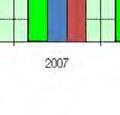


6 Vol. 17 [2012], Bund. D days 30 days R Sungai Seriang PROPOSED METHODOL LOGY FOR ULU KLANG STUDY Figure 5: Aerial photographh (1966 by Minerals andd Geosciencee Department) shows the River, Sungai Seriang and its Tributariess Figure 6: Monthly rainfalll records for the September, Octoberr and November 2008 at Bukit Antarabangsa Station
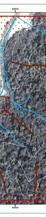
![Vol. 17 [2012], Bund. D 441 Observations before Landslide: Before the landslide took place, some general observations were noted on the topography of Taman Bukit Mewah.](/docs-images/87/97057538/images/7-0.jpg "The topographical information was collected using LiDAR (Light Detection and Ranging) while some field observations were carried out (by Public Works Department) in September 2007.")

7 Vol. 17 [2012], Bund. D 441 Observations before Landslide: Before the landslide took place, some general observations were noted on the topography of Taman Bukit Mewah. The topographical information was collected using LiDAR (Light Detection and Ranging) while some field observations were carried out (by Public Works Department) in September The field observation revealed that the soil at the landslide location was creeping and showing signs of instability i.e. trees leaning, ground movement, arcuate cracking on the road pavement and etc. Eyewitness Account: Relevant eyewitnesses were called forward for an interview with the investigations team. This was carried out to obtain information with regards to the history of the site and also accounts of the events that led to the landslide. SITE INVESTIGATION A detailed site investigation was undertaken to form the basis of this investigation. The site investigation consisted of surface and subsurface investigations. The surface investigation consisted of: a) Topographical & Terrestrial LiDAR survey (TLS) b) Geomorphological and Geological mapping c) Surface infiltration test and soil sampling Topographical & Terrestrial LiDAR Survey (TLS) Detailed topographical survey is important in determining the terrain model of the failed area. Terrestrial LiDAR survey (TLS) was carried out to map the failure zone. Figure 7 shows a 3D terrain model produced from TLS. Figure 7: 3D Terrain Model produced from Terrestrial LiDAR Survey (TLS)
![Vol. 17 [2012], Bund.](/docs-images/87/97057538/images/8-0.jpg "D 442 Geomorphological")


.")


8 Vol. 17 [2012], Bund. D 442 Geomorphological and Geological Mapping A team of geologists and geotechnical engineers carried out the geological and geomorphological mapping works. Among the observations included rows of abandoned houses very near to the failure area (see Figure 8). The failure also exposed a damagedd water pipe of 215mm in diameter and sewerage pipes. These exposed pipes were located underneath the abandoned houses. Figure 8: Failure area and location of the abandoned houses Surface Infiltration Tests, Instrumentation and Soil Sampling Surface Infiltration Test: Six (6) locations were selected where the surface infiltration tests were carried out to measure the in-situ infiltration capacity of the soil with two (2) tests assigned at each location. The double ring method was adopted to perform the tests (Ali et al, 2005; Huat, et al, 2006 ). In general, the infiltration capacity obtained for these locations ranged from 1x10⁻⁵m/s to 5x10⁻⁵m/s. Subsurface Investigation: A total of twenty five (25) borehole investigations weree carried out at the landslide area and its surroundings. To avoid furtherr disturbance to the slope, foam drilling method was used in most of the boreholes to retrieve appropriate samples for the laboratory testing, as wash boring method was not advisable. Most boreholes were terminated after encountering five (5) SPT-N values of 50. Undisturbed soil sampless collected by means of the 75mmm diameter thin-walled samplers were also proposedd for various laboratory tests. Among the laboratory tests conducted on the samples were Soil Index Properties Tests, Infiltration/
![Vol. 17 [2012], Bund. D 443 Permeability Tests, Consolidated Isotropic Undrained Triaxial (CIU), Compaction Test and Unconfined Compression Test (UCT) on the rock samples obtained.](/docs-images/87/97057538/images/9-0.jpg "Instrumentation monitoring was carried at the failure and surrounding areas. Ground movement monitoring, i.e., ground markers, prism movement markers, and inclinometers, were assigned to areas adjacent to the failure scar.")
 in the laboratory.")
9 Vol. 17 [2012], Bund. D 443 Permeability Tests, Consolidated Isotropic Undrained Triaxial (CIU), Compaction Test and Unconfined Compression Test (UCT) on the rock samples obtained. Instrumentation monitoring was carried at the failure and surrounding areas. Ground movement monitoring, i.e., ground markers, prism movement markers, and inclinometers, were assigned to areas adjacent to the failure scar. Piezometers were also installed to monitor the ground water level of the hill slope. Continuous samplings were also carried at some borehole locations for soil material logging (cut or fill material) in the laboratory. Based on the continuous sampling, it can be clearly seen that the top soil at the crest of the failed slope area consisted of loose fill, decayed wood, construction debris, etc. Groundwater level was recorded every day from the boreholes during the progress of SI works. Upon completion of the SI, monitoring was done twice weekly for the next one (1) month and after that once weekly. Upon the installation of the piezometer, it was observed that the groundwater dropped 1m to 3m below its highest recorded level (recorded at the toe approximately 0.54 meter below ground level), and ever since, has stabilized. This entire motion took two (2) to three (3) weeks to reach its stable state. Based on the subsurface investigation report and the borehole investigation, the subsoil profile of the site can be summarized as tabulated in Tables 2 and 3: Table 2: Subsoil Profile (Within the Failure Scar) Table 3: Subsoil profile (left hand side-see Figure 1) and (right hand side-see Figure 1) of failure area. A geophysical investigation was conducted 3 days after the failure. The investigation at the site involves the Resistivity Test and Seismic Refractory Test. These tests were conducted to determine the stratigraphy of the ground, ground water level and the soil saturation. The Minerals and Geoscience Department Malaysia s Report reveals the presence of highly weathered, fractured and saturated granitic bedrock ranging between 5 to 45m. This agrees well with the continuous sampling results and the borehole investigation that showed rock coring with average RQD of 50%. The investigation too revealed that at the crest of the failure area, some 10m thick fill material was detected. This result can be supported by rechecking the SPT-N values obtained based on boreholes located on the left and right hand side (see Figure 1) in between the landslide scar. Up to the depth of 15m, two (2) boreholes display variation of layers (silt, sand and clay)
10 Vol. 17 [2012], Bund. D 444 with SPT-N 0 to 10. Some resistivity lines detected pockets of saturated sandy material towards the right side (see Figure 1) of the failure scar. MODE AND MECHANISM OF FAILURE Seismic records obtained from Malaysian Meteorological Department show that there was no sign of earthquake motion on the day of the landslide, i.e., 6th December 2008, and also the month before. This eliminates the probable cause of failure due to earthquake. From the eyewitness account, the affected bungalow houses were described to have been floating up and down when they were swept by the failure debris. This clearly indicates that the debris was very fluid in nature, and the landslide slip plane must have been deep, well below the founding level of some of the houses. The debris traveling distance of approximately 214m also confirms that the debris was fluid-like. The water pipe exposed at the failure scar near the abandoned houses (Figure 9) was reported to be an active water pipe (confirmed by SYABAS (a private water supply provider for Selangor State) personnel during the eyewitness interview). Rapid water flow in the drain along Jalan Wangsa 11 (the road at the crest portion of the failure) was reported by one of the eyewitnesses, around 1.39 a.m. on 6th December 2008 even though no rain was recorded over several days before the failure. SYABAS was informed and the immediate action carried out was to cut off the water supply to the area (by shutting off the main valve at the service reservoir) at approximately 2.30a.m. on the same day prior to the landslide. The SYABAS technician mentioned that a water source was found flowing from the direction of the abandoned houses (at the mid level of the failed slope) towards the roadside drains in Jalan Wangsa 11. In the midst of preparation to go into the area for repair works was when the landslide occurred. From the mapping works carried out and the aerial photographs taken before and after failure, Jalan Bukit Antarabangsa (at the toe) was found to have heaved, and a few bungalows were displaced away from their original positions. The slide was deep-seated, where the sliding plane went below the road and the founding level of the first row of the bungalows (see Figures 9 and 10)
![Vol. 17 [2012], Bund.](/docs-images/87/97057538/images/11-1.jpg "D 445 Figure 9: The Main Access Road, Jalan")

 Slumps The cross-sections")
 slumps were involved in the")


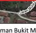
11 Vol. 17 [2012], Bund. D 445 Figure 9: The Main Access Road, Jalan Bukit Antarabangsa, Heaved up more than 1m above its Original level Figure 10: Cross Section Extracted from TLS and LIDAR showing the 3 (three) Slumps The cross-sections extracted from TLS indicate that at least three (3) slumps were involved in the landslide (see Figure 10). It is believed that the lower berm of the slope gave way first followed by the second and third slumps above due to over steepening. This mechanism of failure concurs with some eyewitness accounts of three (3) loud crashing sounds during the landslide event within a space of 3 to 5 minutes. Furthermore, based on the eyewitnesses accounts, the first loud crash resulted in the displacement of the bungalow houses (originally along Jalan Bukit Antarabangsa) to the main access road itself (bungalows were found sitting on the main access
12 Vol. 17 [2012], Bund. D 446 road i.e. Jalan Bukit Antarabangsa). The second and third crashes (the second and third slumps) resulted in further movement and damage to the houses. The ratio of the failure depth (approximately 15m) and the slope length (120m) was found to be greater than 0.1, thus the failure can be classified as deep-seated. Such a failure is usually governed by ground water and/or high pore water pressure within the slope (Othman, 1989; Huat et al, 2008; Low, 2011 ). BACK ANALYSIS TO SIMULATE FAILURE Geotechnical Model From the boreholes investigations, it was found that the soils were believed to be dumped/spoiled earth without proper compaction. To reflect the non-engineered fill with loose lenses, lower shear strength parameters were adopted in the slope stability analysis i.e. within the range of c = 2 to 4 kpa and φ = 25 o to 28 o. Failure Plane The estimation of the failure plane was based on the findings of the geomorphological mapping works and cross section extracted from TLS works. This is shown in Figure 10. The three (3) slumps formed were responsible for the three (3) loud crashing sounds heard by the eyewitnesses during the landslide event. The extent of the first slump (at the toe/ base) was based on the findings during the geomorphological mapping works after the incident whereby the main road (Jalan Bukit Antarabangsa) was found to have heaved up. Stability Analysis Three (3) cross-sections were simulated in the stability analysis using SLOPE/W (2007) computer program adopting Morgenstern-Price s method, satisfying both the force and moment requirements. The three (3) cross-sections studied are within the landslide area, i.e., center of the landslide, Sections 1-1 and 2-2 (right and left side of the failure-see Figure 11)
![Vol. 17 [2012], Bund.](/docs-images/87/97057538/images/13-0.jpg "D 447 Figure 11: Location of the Cross-Sections in the Analyses The findings during the geomorphological mapping point out that the main road (Jalan Bukit Antarabangsa) heaved due to high pore water")
13 Vol. 17 [2012], Bund. D 447 Figure 11: Location of the Cross-Sections in the Analyses The findings during the geomorphological mapping point out that the main road (Jalan Bukit Antarabangsa) heaved due to high pore water pressures in the slope. Based on eyewitness accounts, the first loud crashing sound displaced the bungalows to the middle of Jalan Bukit Antarabangsa. This proves that the first crashing sound indicated the failure of first slump at the slope toe. Therefore, in this stimulated analyses based on pore pressure ratio (Ru), the failure geometry of the surface slip that had taken place would be located at the toe of the slope (first slump). Various pore water pressure ratios (r u ) were applied in the analyses to obtain the Factor of Safety (FOS) at the toe of the slope (first slump). From the analysis, it can be concluded that the Ru value at failure is likely to range from 0.20 to 0.25 (see Figure 12). Hence, high pore water pressure is believed to have developed at the toe which triggered the initial deep-seated slide (the first slump). Subsequently, this over steepened the slopes above, causing the rest of the two slumps to slide down within minutes after the first slide. There are several causal factors contributing to the landslide. They are: a) Soil creep due to non-engineered fill on the slope developed tension cracks over the area. b) The soil creep over the years may have damaged the active water pipe along the abandoned houses and leaked the pipe. The leaks contributed to continuous soil saturation at the lower slope and this in turn, accelerated creep. c) Loose/non-compacted dumped earth with high void ratio placed in the natural valley is high in permeability. d) Prolonged rainfall during the month of October and November resulted in soil saturation, rise in ground water table and increases the rate of creep. e) Increased soil creep further damaged the drainage facilities and widened the existing cracks and opened up new tension cracks
14 Vol. 17 [2012], Bund. D 448 Factor of Safety (FOS) Pore Water Pressure Ratio (Ru) c=3kpa, friction angle=26degrees Figure 12: Factor of Safety (FOS) versus Pore Water Pressure Ratios CONCLUSIONS The landslide that took place on 6th December 2008 at Taman Bukit Mewah, Bukit Antarabangsa, Hulu Kelang, and Selangor can be classified as a deep-seated failure. This kind of failure is caused by high pore water pressure within the slope. From the failure assessment, it is concluded that the landslide can been attributed to a combination of the following factors:- a) Loose soil from earth dumping on the slope which took place during the development of the area. b) Prolonged rainfall during the months of October and November. c) Prolonged soil creep which widened existing cracks and opened up new tension cracks. d) Heavily leaked active water pipe along abandoned houses due to soil creep. REFERENCES 1. Ali, F and Harianto R. (2004) Unsaturated Residual Soil A chapter of the book entitled Tropical Residual Soils Engineering, Published by A.A. Balkema Publishers, Taylor & Francis Group, London. ISBN (2004) 2. Ali, F.H and Huat, B.B.K.(2006) Shallow Foundations A chapter of the book entitled Foundation Engineering: Design and Construction in Tropical Soils, Published by A.A. Balkema Publishers, Taylor & Francis Group, London. ISBN (2006). 3. Ali, Huat, B.B.K and Low T.H. (2005) Infiltration characteristics of granitic residual soil of various weathering grades, Amer. Jour. of Environmental Sciences, 1(1),
15 Vol. 17 [2012], Bund. D Huat, B.B.K., Ali, F.H, and Low, T. (2006) Water Infiltration Characteristics of Unsaturated Soil Slope and Its Effect on Suction and Stability, The International Journal of Geotechnical and Geological Engineering, 24, Huat, B.B.K., Ali,F.H., David H. B., Singh, H. and Omar, H. (2008) Landslides in Malaysia: Occurrences, Assessment, Analyses and Remediation, University Putra Malaysia Press ISBN Low, T.H. (2011) Area based landslide hazard assessment for hillside development, Ph.D thesis, University of Malaya, Malaysia, unpublished. 7. Othman, M.A. (1989) Highway Cut Slope Instability Problems in West Malaysia, Ph.D thesis, University of Bristol, United Kingdom, unpublished 8. Slope Engineering Branch of the Public Works Department Malaysia, (2008) Final Landslide Investigation Report-Investigation of Slope Failure at Taman Bukit Mewah, Bukit Antarabangsa, Hulu Klang, Selangor 6 December 2008 Volume I and II, unpublished. 9. Stability Modeling With Slope/ W (2007), (An Engineering Methodology) GEO- SLOPE International Ltd. Second Edition ejge
SI Planning & Laboratory Testing for Hill-Site Development
 SI Planning & Laboratory Testing for Hill-Site Development 21 April 2009 IEM Penang Ir. Tan Yean Chin G&P Geotechnics Sdn Bhd Cameron Highlands, 1961 Genting Highland Tower 1993 Bukit Antarabangsa, 1999
Zainuddin Md Yusoff*, Nur Anati Azmi, Haslinda Nahazanan, Nik Norsyahariati Nik Daud & Azlan Abd Aziz
 Malaysian Journal of Civil Engineering 28 Special Issue (1):35-41 (2016) TECHNICAL NOTE ENGINEERING GEOLOGICAL OF AN ACTIVE SLOPE IN KM46 SIMPANG PULAI, PERAK Zainuddin Md Yusoff*, Nur Anati Azmi, Haslinda
Infiltration Characteristics of Granitic Residual Soil of Various Weathering Grades
 American Journal of Environmental Sciences (): 64-68, 25 ISSN 553-345X Science Publications, 25 Infiltration Characteristics of Granitic Residual Soil of Various Weathering Grades Faisal Hj. Ali, 2 Bujang
Geotechnical Investigation and Monitoring Results of a Landslide Failure at Southern Peninsular Malaysia (Part 1: Investigating Causes of Failure)
") Geotechnical Investigation and Monitoring Results of a Landslide Failure at Southern Peninsular Malaysia (Part 1: Investigating Causes of Failure) Liew, S. S., Gue, S. S., Liong, C. H. Director, Gue &
Geotechnical Investigation and Monitoring Results of a Landslide Failure at Southern Peninsular Malaysia (Part 1: Investigating Causes of Failure) Liew, S. S., Gue, S. S., Liong, C. H. Director, Gue &
CHAPTER FIVE 5.0 STABILITY OF CUT SLOPES IN THE STUDY AREA. them limited by a thick canopy of vegetation and steep slope angles.
 CHAPTER FIVE 5.0 STABILITY OF CUT SLOPES IN THE STUDY AREA 5.1. Introduction Ukay Perdana area is a developing community with continuous building activities and road construction. There are thus only left
LANDSLIDES IN THE WHITE MOUNTAIN (GEOTECHNICAL STUDIES AND ENGINEERING TESTS)
") J. Al Azhar University Gaza 2004, Vol. 7, NO. 2 P 15-26 LANDSLIDES IN THE WHITE MOUNTAIN (GEOTECHNICAL STUDIES AND ENGINEERING TESTS) Isam G. Jardaneh (1), Jalal Al-Dabeek (2), Abdel hakeem Al-Jawhari
J. Al Azhar University Gaza 2004, Vol. 7, NO. 2 P 15-26 LANDSLIDES IN THE WHITE MOUNTAIN (GEOTECHNICAL STUDIES AND ENGINEERING TESTS) Isam G. Jardaneh (1), Jalal Al-Dabeek (2), Abdel hakeem Al-Jawhari
Monitoring and Characterization of the Meadowview Lane Landslide: Boyd County, KY
 Monitoring and Characterization of the Meadowview Lane Landslide: Boyd County, KY Matt Crawford Appalachian Coalition for Geologic Hazards in Transportation 13 th Annual Technical Forum Harrisonburg, VA
Two Case Studies on Soil Nailed Slope Failures
 Two Case Studies on Soil Nailed Slope Failures Liew, Shaw-Shong 1 & Liong, Chee-How 2 1 Director, Gue & Partners Sdn Bhd, Kuala Lumpur, Malaysia 2 Senior Engineer, Gue & Partners Sdn Bhd, Kuala Lumpur,
Prof. B V S Viswanadham, Department of Civil Engineering, IIT Bombay
 19 Module 5: Lecture -1 on Stability of Slopes Contents Stability analysis of a slope and finding critical slip surface; Sudden Draw down condition, effective stress and total stress analysis; Seismic
Landslide FE Stability Analysis
 Landslide FE Stability Analysis L. Kellezi Dept. of Geotechnical Engineering, GEO-Danish Geotechnical Institute, Denmark S. Allkja Altea & Geostudio 2000, Albania P. B. Hansen Dept. of Geotechnical Engineering,
This document is downloaded from DR-NTU, Nanyang Technological University Library, Singapore.
 This document is downloaded from DR-NTU, Nanyang Technological University Library, Singapore. Title Pore-water pressure characteristics of two instrumented residual soil slopes( Main article ) Author(s)
Slope Stability Evaluation Ground Anchor Construction Area White Point Landslide San Pedro District Los Angeles, California.
 Slope Stability Evaluation Ground Anchor Construction Area White Point Landslide San Pedro District Los Angeles, California Submitted To: Mr. Gene Edwards City of Los Angeles Department of Public Works
This report was prepared by Klohn Crippen Consultants Ltd. for Alberta Transportation Central Region under Contract No. CE053/2000.
 Alberta Transportation Central Region #401, 4902 51 Street Red Deer, Alberta T4N 6K8 June 7, 2002 Mr. Melvin Mayfield, P.Eng. Project Engineer Dear Mr. Mayfield: Central Region Landslide Assessment Site
9/23/2013. Introduction CHAPTER 7 SLOPE PROCESSES, LANDSLIDES, AND SUBSIDENCE. Case History: La Conchita Landslide
 Introduction CHAPTER 7 SLOPE PROCESSES, LANDSLIDES, AND SUBSIDENCE Landslide and other ground failures posting substantial damage and loss of life In U.S., average 25 50 deaths; damage more than $3.5 billion
Back Analysis of Slope Failure Using Finite Element with Point Estimate Method (FEM-PEM)
") Journal of Civil Engineering Research 2014, 4(3A): 31-35 DOI: 10.5923/c.jce.201402.04 Back Analysis of Slope Failure Using Finite Element with Point Estimate Method (FEM-PEM) Soon Min Ng *, Mohd Ashraf
Journal of Civil Engineering Research 2014, 4(3A): 31-35 DOI: 10.5923/c.jce.201402.04 Back Analysis of Slope Failure Using Finite Element with Point Estimate Method (FEM-PEM) Soon Min Ng *, Mohd Ashraf
Gotechnical Investigations and Sampling
 Gotechnical Investigations and Sampling Amit Prashant Indian Institute of Technology Gandhinagar Short Course on Geotechnical Investigations for Structural Engineering 12 14 October, 2017 1 Purpose of
Landslide Granice in Zagreb (Croatia)
") Landslides and Engineered Slopes Chen et al. (eds) 28 Taylor & Francis Group, London, ISBN 978--415-41196-7 Landslide Granice in Zagreb (Croatia) Z. Mihalinec Civil Engineering Institute of Croatia, Zagreb,
Landslides and Engineered Slopes Chen et al. (eds) 28 Taylor & Francis Group, London, ISBN 978--415-41196-7 Landslide Granice in Zagreb (Croatia) Z. Mihalinec Civil Engineering Institute of Croatia, Zagreb,
Yoshinori KAWAMURA, Oriental Consultants Global Co., Ltd.
 Landslides along National Roads in Central Highland in Sri Lanka: Review on Current Situation and Suggestion for Further Development of Landslide Mitigation along Highways in Sri Lanka Yoshinori KAWAMURA,
Experience in Stabilisation of Rock Slopes in Pahang Muhammad Hafeez Osman Intan Shafika Saiful Bahri Damanhuri Jamalludin Fauziah Ahmad
 Experience in Stabilisation of Rock Slopes in Pahang Muhammad Hafeez Osman Intan Shafika Saiful Bahri Damanhuri Jamalludin Fauziah Ahmad ABSTRACT Two cases regarding the histories of rock slopes repair
CENTRAL REGION GEOHAZARDS RISK ASSESSMENT SITE INSPECTION FORM
 SITE NUMBER AND NAME C55 H861:02 Slide LEGAL DESCRIPTION NW 14-40-14-W4 CENTRAL REGION GEOHAZARDS RISK ASSESSMENT SITE INSPECTION FORM HIGHWAY & KM NAD 83 COORDINATES N 5811217 E 437291 PREVIOUS INSPECTION
APPLICATION OF ELECTRICAL RESISTIVITY IMAGING TECHNIQUE IN THE STUDY OF SLOPE STABILITY IN BANDING ISLAND, PERAK
 313 APPLICATION OF ELECTRICAL RESISTIVITY IMAGING TECHNIQUE IN THE STUDY OF SLOPE STABILITY IN BANDING ISLAND, PERAK Siti Aishah Ismail*, Shaharin Ibrahim M.Sc (GS20247) 4 th Semester Introduction Landslides
patersongroup Consulting Engineers April 20, 2010 File: PG1887-LET.01R Novatech Engineering Consultants Suite 200, 240 Michael Cowpland Drive
 patersongroup April 20, 2010 File: PG1887-LET.01R Novatech Engineering Consultants Suite 200, 240 Michael Cowpland Drive Ottawa, Ontario K2M 1P6 Attention: Mr. Adam Thompson Consulting Engineers 28 Concourse
Mass Wasting. Revisit: Erosion, Transportation, and Deposition
 Mass Wasting Revisit: Erosion, Transportation, and Deposition While landslides are a normal part of erosion and surface processes, they can be very destructive to life and property! - Mass wasting: downslope
1 PROJECT BACKGROUND. August 14, Alberta Transportation Central Region #401, Street Red Deer, Alberta T4N 6K8
 August 14, 2013 Alberta Transportation Central Region #401, 4902 51 Street Red Deer, Alberta T4N 6K8 Mr. Dennis Grace, P.Eng. Construction Engineer Dear Mr. Grace: Central Region Geohazard Assessment 2013
Analysis of soil failure modes using flume tests
 Analysis of soil failure modes using flume tests A. Spickermann & J.-P. Malet Institute of Earth Physics, CNRS UMR 751, University of Strasbourg, Strasbourg, France Th.W.J. van Asch, M.C.G. van Maarseveen,
GEOTECHNICAL ENGINEERING INVESTIGATION HANDBOOK Second Edition
 GEOTECHNICAL ENGINEERING INVESTIGATION HANDBOOK Second Edition Roy E. Hunt Taylor & Francis Taylor & Francis Croup Boca Raton London New York Singapore A CRC title, part of the Taylor & Francis imprint,
Chapter 12 Subsurface Exploration
 Page 12 1 Chapter 12 Subsurface Exploration 1. The process of identifying the layers of deposits that underlie a proposed structure and their physical characteristics is generally referred to as (a) subsurface
Climate effects on landslides
 GEORAMP ONE DAY SYMPOSIUM Climate effects on landslides E. E. Alonso, M. Sondón, N. M. Pinyol Universitat Politècnica de Catalunya October 14th, 2016. UPC, Barcelona Infiltration (evaporation) and slope
Location. Mt Owen Complex. Overview. Mine Layout. Mining Method. Mitsubishi Lecture. In-Pit Lowwall Dump Design and Stability at Mt Owen Mine
 Location In-Pit Lowwall Dump Design and Stability at Mt Owen Mine Wayne Bartlett Senior Engineering Geologist Mt Owen Complex Overview In the past Mt Owen Mine lowwall dumps have failed. Lowwall dumps
Need of Proper Development in Hilly Urban Areas to Avoid
 Need of Proper Development in Hilly Urban Areas to Avoid Landslide Hazard Dr. Arvind Phukan, P.E. Cosultant/Former Professor of Civil Engineering University of Alaska, Anchorage, USA RI District Governor
Converse Consultants Geotechnical Engineering, Environmental & Groundwater Science, Inspection & Testing Services
 Converse Consultants Geotechnical Engineering, Environmental & Groundwater Science, Inspection & Testing Services Ms. Rebecca Mitchell Mt. San Antonio College Facilities Planning & Management 1100 North
Converse Consultants Geotechnical Engineering, Environmental & Groundwater Science, Inspection & Testing Services
 Converse Consultants Geotechnical Engineering, Environmental & Groundwater Science, Inspection & Testing Services July 27, 2017 Ms. Rebecca Mitchell Mt. San Antonio College Facilities Planning & Management
An Introduction to Field Explorations for Foundations
 An Introduction to Field Explorations for Foundations J. Paul Guyer, P.E., R.A. Paul Guyer is a registered mechanical engineer, civil engineer, fire protection engineer and architect with over 35 years
Appendix A Landslide Probability Classification Chart
 Appendices 119 Appendix A Landslide Probability Classification Chart Class I II III IV V VI Description Slopes which show no evidence of previous landslide activity and which by (1) stress analysis, (2)
3.12 Geology and Topography Affected Environment
 3 Affected Environment and Environmental Consequences 3.12 Geology and Topography 3.12.1 Affected Environment 3.12.1.1 Earthquakes Sterling Highway MP 45 60 Project Draft SEIS The Kenai Peninsula is predisposed
Impact : Changes to Existing Topography (Less than Significant)
") 4.2 Land Resources 4.2.1 Alternative A Proposed Action Impact 4.2.1-1: Changes to Existing Topography (Less than Significant) Development of the project site would involve grading and other earthwork as
4.2 Land Resources 4.2.1 Alternative A Proposed Action Impact 4.2.1-1: Changes to Existing Topography (Less than Significant) Development of the project site would involve grading and other earthwork as
HYDROLOGICAL CONDITION LEADING TO LANDSLIDE INITIATION
 HYDROLOGICAL CONDITION LEADING TO LANDSLIDE INITIATION Adrin Tohari Indonesian Institute of Sciences, Research Center for Geotechnology, Jln Sangkuriang, Bandung 413. Telp: 364. Email: adrin@cbn.net.id
STABILITY ANALYSIS OF EARTH DAM SLOPES SUBJECTED TO EARTHQUAKE USING ERT RESULTS INTERPRETATION
 STABILITY ANALYSIS OF EARTH DAM SLOPES SUBJECTED TO EARTHQUAKE USING ERT RESULTS INTERPRETATION Eko Andi Suryo Lecturer / Department of Civil Engineering, Faculty of Engineering / University of Brawijaya
Analysis of soil failure modes using flume tests
 Analysis of soil failure modes using flume tests A. Spickermann & J.-P. Malet CNRS UMR 7516, School and Observatory of Earth Sciences, University of Strasbourg, Strasbourg, France Th.W.J. van Asch, M.C.G.
OP-13. PROCEDURES FOR DESIGN OF EMBANKMENT
 Page 1 of 8 WORK INSTRUCTIONS FOR ENGINEERS TYC Compiled by : LSS Checked by : GSS Approved by : OP-13. PROCEDURES FOR DESIGN OF EMBANKMENT Page of 8 13.0 13.1. OVERALL PROCEDURES This section will briefly
River bank erosion risk potential with regards to soil erodibility
 River Basin Management VII 289 River bank erosion risk potential with regards to soil erodibility Z. A. Roslan 1, Y. Naimah 1 & Z. A. Roseli 2 1 Infrastructure University, Kuala Lumpur, Malaysia 2 Humid
An Hypothesis Concerning a Confined Groundwater Zone in Slopes of Weathered Igneous Rocks
 Symposium on Slope Hazards and Their Prevention: 8-10 May, 2000, Hong Kong, PRC An Hypothesis Concerning a Confined Groundwater Zone in Slopes of Weathered Igneous Rocks J. J. Jiao and A. W. Malone Department
PEACE RIVER EAST HILL - HWY 2:60 (PH2) SELECT PHOTOGRAPHS August 22, 2007 File: Photo E003. Station May 2007
 SELECT PHOTOGRAPHS August 22, 2007 File: Photo E003. Station May 2007") Photo E003 0+000 Viewing looking upslope at Site 4 from highway. Conditions unchanged from 2006. Photo E018 0+000 Localized erosion within road fill on upslope side of highway. Photo E022 0+250 Looking
Photo E003 0+000 Viewing looking upslope at Site 4 from highway. Conditions unchanged from 2006. Photo E018 0+000 Localized erosion within road fill on upslope side of highway. Photo E022 0+250 Looking
ENCE 3610 Soil Mechanics. Site Exploration and Characterisation Field Exploration Methods
 ENCE 3610 Soil Mechanics Site Exploration and Characterisation Field Exploration Methods Geotechnical Involvement in Project Phases Planning Design Alternatives Preparation of Detailed Plans Final Design
STABILITY OF RESIDUAL SOIL SLOPES BASED ON SPATIAL DISTRIBUTION OF SOIL PROPERTIES. Harianto Rahardjo*, Alfrendo Satyanaga
 STABILITY OF RESIDUAL SOIL SLOPES BASED ON SPATIAL DISTRIBUTION OF SOIL PROPERTIES Harianto Rahardjo*, Alfrendo Satyanaga * Professor, School of Civil and Environmental Engineering, Nanyang Technological
SLOPE STABILITY EVALUATION AND ACCEPTANCE STANDARDS
 INFORMATION BULLETIN / PUBLIC - BUILDING CODE REFERENCE NO.: LAMC 98.0508 Effective: 1-26-84 DOCUMENT NO. P/BC 2002-049 Revised: 11-1-02 Previously Issued As: RGA #1-84 SLOPE STABILITY EVALUATION AND ACCEPTANCE
Central Queensland Coal Project Appendix 4b Geotechnical Assessment. Environmental Impact Statement
 Central Queensland Coal Project Appendix 4b Geotechnical Assessment Environmental Impact Statement GEOTECHNICAL ASSESSMENT OF OPEN CUT MINING ADJACENT TO THE BRUCE HIGHWAY, CENTRAL QUEENSLAND COAL PROJECT
CHRACTERISTICS OF LANDSLIDE OCCURRED IN LOPARE, BOSNIA AND HERZEGOVINA
 CHRACTERISTICS OF LANDSLIDE OCCURRED IN LOPARE, BOSNIA AND HERZEGOVINA Jun Sugawara 1 and Takao Aizawa 2 1 WorleyParsons, Australia 2 Suncoh Consultants, Japan ABSTRACT This paper presents results of detailed
Pierce County Department of Planning and Land Services Development Engineering Section
 Page 1 of 7 Pierce County Department of Planning and Land Services Development Engineering Section PROJECT NAME: DATE: APPLICATION NO.: PCDE NO.: LANDSLIDE HAZARD AREA (LHA) GEOLOGICAL ASSESSMENT REPORT
RAINFALL-INDUCED SLOPE FAILURES: MECHANISM AND ASSESSMENT. H. Rahardjo, E.C. Leong & R.B. Rezaur
 Keynote Lecture: International Conference on "Management of the Land and Water Resource" MLWR, 20 22 October 2001, Hanoi, Vietnam. 281-291 RAINFALL-INDUCED SLOPE FAILURES: MECHANISM AND ASSESSMENT H. Rahardjo,
SLOPE STABILITY EVALUATION AND ACCEPTANCE STANDARDS
 INFORMATION BULLETIN / PUBLIC - BUILDING CODE REFERENCE NO.: LABC 7006.3, 7014.1 Effective: 01-01-2017 DOCUMENT NO.: P/BC 2017-049 Revised: 12-21-2016 Previously Issued As: P/BC 2014-049 SLOPE STABILITY
Guidelines for Site-Specific Seismic Hazard Reports for Essential and Hazardous Facilities and Major and Special-Occupancy Structures in Oregon
 Guidelines for Site-Specific Seismic Hazard Reports for Essential and Hazardous Facilities and Major and Special-Occupancy Structures in Oregon By the Oregon Board of Geologist Examiners and the Oregon
Nipigon River Landslide, Ontario, Canada
 Nipigon River Landslide, Ontario, Canada A. Abdelaziz, S. Besner, R. Boger, B. Fu, J. Deng, and A. Farina Presenter: Jian Deng, Ph.D, P.Eng Centre of Excellence for Sustainable Mining and Exploration,
Chapter 11 10/30/2013. Mass Wasting. Introduction. Factors That Influence Mass Wasting. Introduction. Factors That Influence Mass Wasting
 Introduction Chapter 11 Mass wasting - The downslope movement of material resulting from the force of gravity. Mass Wasting Mass wasting results when the force of gravity acting on a slope exceeds the
GEOTECHNICAL ENGINEERING II. Subject Code : 06CV64 Internal Assessment Marks : 25 PART A UNIT 1
 GEOTECHNICAL ENGINEERING II Subject Code : 06CV64 Internal Assessment Marks : 25 PART A UNIT 1 1. SUBSURFACE EXPLORATION 1.1 Importance, Exploration Program 1.2 Methods of exploration, Boring, Sounding
3/8/17. #20 - Landslides: Mitigation and Case Histories. Questions for Thought. Questions for Thought
 #20 - Landslides: Mitigation and Case Histories Web Exercise #3 (Volcanoes) Due Wednesday There is a 2-point penalty for every day the assignment is late. Exam 1 Scores Scores and exam key are posted Vaiont
9/13/2011 CHAPTER 9 AND SUBSIDENCE. Case History: La Conchita Landslide. Introduction
 CHAPTER 9 SLOPE PROCESSES, LANDSLIDES, AND SUBSIDENCE Case History: La Conchita Landslide La Conchita: small coastal community 80 km (50 mi) northwest of Los Angeles Landslide occurred on January 10, 2005
Landslide stability analysis using the sliding block method
 Landslide stability analysis using the sliding block method E. Lino, R. Norabuena, M. Villanueva & O. Felix SRK Consulting (Peru) S.A., Lima, Peru A. Lizcano SRK Consulting (Vancouver) S.A., British Columbia,
January 17, 2008 File:
 January 17, 2008 File: 15-85-73 Alberta Infrastructure and Transportation Room 301, Provincial Building 9621-96 Avenue Peace River, Alberta T8S 1T4 Attention: Mr. Ed Szmata PEACE REGION (SWAN HILLS AREA)
Relationship between Shear Strength and Soil Water Characteristic Curve of an Unsaturated Granitic Residual Soil
 Pertanika J. Sci. & Technol. 15(2): 113-120 (2007) ISSN: 0128-7680 Universiti Putra Malaysia Press Relationship between Shear Strength and Soil Water Characteristic Curve of an Unsaturated Granitic Residual
Engineer. Engineering. Engineering. (in-ja-neer ) A person trained and skilled in any of the various branches of engineering: a civil engineer
 A person trained and skilled in any of the various branches of engineering: a civil engineer") Engineer (in-ja-neer ) A person trained and skilled in any of the various branches of engineering: a civil engineer (Random House Webster s College Dictionary, 1991) CE100 Introduction to Civil Geotechnical
Engineer (in-ja-neer ) A person trained and skilled in any of the various branches of engineering: a civil engineer (Random House Webster s College Dictionary, 1991) CE100 Introduction to Civil Geotechnical
STABILITY OF SLOPES IN RESIDUAL SOILS Laurence D Wesley, University of Auckland (retired)
") STABILITY OF SLOPES IN RESIDUAL SOILS Laurence D Wesley, University of Auckland (retired) Abstract This paper examines and discusses a number of factors that make slope stability assessments, and slope
STABILITY OF SLOPES IN RESIDUAL SOILS Laurence D Wesley, University of Auckland (retired) Abstract This paper examines and discusses a number of factors that make slope stability assessments, and slope
Discussion of Response of a residual soil slope to rainfall 1
 979 DISCUSSION / DISCUSSION Discussion of Response of a residual soil slope to rainfall 1 Ana C. Londono Received 22 January 2006. Accepted 15 June 2006. Published on the NRC Research Press Web site at
OIKOS > landslide > mechanism >predisposing causes
 predisposing causes and trigger OIKOS > landslide > mechanism >predisposing causes Landslides are events that occur in space and time. As such, it is usually possible to identify both one or more landslide
APPROACH FILL DESIGN OF NORTH SASKATCHEWAN RIVER BRIDGE. A.F. Ruban, EBA Engineering Consultants Ltd., Edmonton, Alberta, Canada
 APPROACH FILL DESIGN OF NORTH SASKATCHEWAN RIVER BRIDGE A.F. Ruban, EBA Engineering Consultants Ltd., Edmonton, Alberta, Canada Paper prepared for presentation at the Slope and Embankment Engineering for
August 10, 2007 File:
 August 10, 2007 File: 15-85-72 Alberta Infrastructure and Transportation Room 301, Provincial Building 9621-96 Avenue Peace River, AB T8S 1T4 Attention: Mr. Ed Szmata PEACE REGION (PEACE HIGH LEVEL AREA)
GG101 Lecture 22: Mass Wasting. Soil, debris, sediment, and broken rock is called regolith.
 GG101 Lecture 22: Mass Wasting Mass Wasting is the movement of rock and soil down a slope due to the force of gravity. Soil, debris, sediment, and broken rock is called regolith. Mass wasting creates broad
Background. Valley fills Sites in the Area. Construction over Mine Spoil Fills
 Construction over Mine Spoil Fills Wayne A. Karem, PhD, PE, PG, D.GE 2014 KSPE Annual Conference Background Strip mining; mountaintop and contour mining Creates huge quantities of mine spoil The mine spoil
Slope Stability. loader
 Slope Stability Slope Stability loader Lower San Fernando Dam Failure, 1971 Outlines Introduction Definition of key terms Some types of slope failure Some causes of slope failure Shear Strength of Soils
INTI COLLEGE MALAYSIA
 EGC373 (F) / Page 1 of 5 INTI COLLEGE MALAYSIA UK DEGREE TRANSFER PROGRAMME INTI ADELAIDE TRANSFER PROGRAMME EGC 373: FOUNDATION ENGINEERING FINAL EXAMINATION : AUGUST 00 SESSION This paper consists of
1.8 Unconfined Compression Test
 1-49 1.8 Unconfined Compression Test - It gives a quick and simple measurement of the undrained strength of cohesive, undisturbed soil specimens. 1) Testing method i) Trimming a sample. Length-diameter
Mass Wasting. Requirements for Mass Wasting. Slope Stability. Geol 104: mass wasting
 Mass Wasting Movement of earth materials downslope, driven by Gravitational Forces. Landslides - general term for rock or soil movement. In U.S., on average, mass wasting causes 1 to 2 billion dollars
J. Paul Guyer, P.E., R.A.
 J. Paul Guyer, P.E., R.A. Paul Guyer is a registered mechanical engineer, civil engineer, fire protection engineer and architect with over 35 years experience in the design of buildings and related infrastructure.
SOIL INVESTIGATION REPORT. PROPOSED HOUSING DEVELOPMENT PROJECT Coral Spring, Trelawny, Jamaica.
 SOIL INVESTIGATION REPORT PROPOSED HOUSING DEVELOPMENT PROJECT Coral Spring, Trelawny, Jamaica. Prepared for: FCS Consultants 7a Barbados Avenue Kingston 5, Jamaica Prepared by: NHL Engineering Limited
Omaroro Lower Playing Field - Geotechnical Interpretive Report
 Report Omaroro Lower Playing Field - Geotechnical Interpretive Report Prepared for Wellington Water Limited Prepared by Beca Limited 1 December 2017 Omaroro Lower Playing Field - Geotechnical Interpretive
Appendix J. Geological Investigation
 Appendix J Geological Investigation Appendix J Geological Environment Table of Contents Page 1 INTRODUCTION...J-1 1.1 Purpose of the Investigation...J-1 1.2 Scope of the Investigation...J-1 2 METHODO OF
Environmental Geology Lab 5 - Mass Wasting Hazards
 Environmental Geology Lab 5 - Mass Wasting Hazards page - 1 Many landslides, slope failures or sinkholes (collapse structures formed in terrain underlain by limestone rocks) occur during or immediately
Project S4: ITALIAN STRONG MOTION DATA BASE. Deliverable # D3. Definition of the standard format to prepare descriptive monographs of ITACA stations
 Agreement INGV-DPC 2007-2009 Project S4: ITALIAN STRONG MOTION DATA BASE Responsibles: Francesca Pacor, INGV Milano Pavia and Roberto Paolucci, Politecnico Milano http://esse4.mi.ingv.it Deliverable #
IMAGING OF DEEP SINKHOLES USING THE MULTI-ELECTRODE RESISTIVITY IMPLANT TECHNIQUE (MERIT) CASE STUDIES IN FLORIDA
 CASE STUDIES IN FLORIDA") IMAGING OF DEEP SINKHOLES USING THE MULTI-ELECTRODE RESISTIVITY IMPLANT TECHNIQUE (MERIT) CASE STUDIES IN FLORIDA David Harro The G3 Group, 2509 Success Drive, Suite 1, Odessa, FL 33556, david.harro@geo3group.com
IMAGING OF DEEP SINKHOLES USING THE MULTI-ELECTRODE RESISTIVITY IMPLANT TECHNIQUE (MERIT) CASE STUDIES IN FLORIDA David Harro The G3 Group, 2509 Success Drive, Suite 1, Odessa, FL 33556, david.harro@geo3group.com
GIS Based Landslide Hazard Mapping Prediction in Ulu Klang, Malaysia
 ITB J. Sci. Vol. 42 A, No. 2, 2010, 163-178 163 GIS Based Landslide Hazard Mapping Prediction in Ulu Klang, Malaysia 1,2 Muhammad Mukhlisin, 1 Ilyias Idris, 1 Al Sharif Salazar, 1 Khairul Nizam & 1 Mohd
February 18, 2003 File: NORTH CENTRAL REGION LANDSLIDE ASSESSMENT HWY 43:16 WHITECOURT EAST HILL (NC1) 2002 ANNUAL INSPECTION REPORT
 2002 ANNUAL INSPECTION REPORT") February 18, 2003 File: 15-76-11 Alberta Transportation Room 223, Provincial Building 4709 44 Avenue Stony Plain, Alberta T7Z 1N4 Attention: Mr. Rob Lonson, P.Eng. NORTH CENTRAL REGION LANDSLIDE ASSESSMENT
February 18, 2003 File: 15-76-11 Alberta Transportation Room 223, Provincial Building 4709 44 Avenue Stony Plain, Alberta T7Z 1N4 Attention: Mr. Rob Lonson, P.Eng. NORTH CENTRAL REGION LANDSLIDE ASSESSMENT
PEACE REGION GRANDE PRAIRIE GEOHAZARD RISK ASSESSMENT SITE INSPECTION FORM NAD 83 COORDINATES N 6,178,811 E 403,309
 PEACE REGION GRANDE PRAIRIE GEOHAZARD RISK ASSESSMENT SITE INSPECTION FORM SITE NUMBER GP-4a LEGAL DESCRIPTION LSD 12-10-78-4-W6M SITE NAME Burnt River Bridge - West Approach Slide HIGHWAY & KM Hwy 49:06
Boreholes. Implementation. Boring. Boreholes may be excavated by one of these methods: 1. Auger Boring 2. Wash Boring 3.
 Implementation Boreholes 1. Auger Boring 2. Wash Boring 3. Rotary Drilling Boring Boreholes may be excavated by one of these methods: 4. Percussion Drilling The right choice of method depends on: Ground
THE PREDICTION OF FINAL SETTLEMENT FROM 1D-CONSOLIDATION TEST: A CASE STUDY
 THE PREDICTION OF FINAL SETTLEMENT FROM 1D-CONSOLIDATION TEST: A CASE STUDY Mohd Fakhrurrazi Bin Ishak 1 and Mohd Hazreek Bin Zainal Abidin 2 1 Faculty of Civil Engineering and Environmental engineering,
2. Initial Summary of Preliminary Expert Opinion of Converse and Psomas Reports
 UNITED WALNUT TAXPAYERS PRELIMINARY REVIEW OF NEGATIVE GEOTECHNICAL AND GEOLOGICAL ASPECTS OF CONSTRUCTING EARTHFILL PAD FOR A SOLAR FARM ON THE WEST PARCEL - DRAFT 1. Introduction A licensed Engineering
CHAPTER GEOLOGICALLY HAZARDOUS AREAS Applicability Regulations.
 CHAPTER 19.07 GEOLOGICALLY HAZARDOUS AREAS 19.07.010 Applicability. Geologically hazardous areas may pose a threat to the health and safety of citizens when incompatible development is sited in areas of
Portland Water Bureau. Preparing Portland s Water Supply for The Big One. July 11, Tim Collins, P.E., G.E.
 Portland Water Bureau Preparing Portland s Water Supply for The Big One July 11, 2018 Tim Collins, P.E., G.E. Presentation Outline Portland water system overview Pacific Northwest seismic hazards Building
January 12, 2006 File:
 January 12, 2006 File: 15-85-13 Alberta Infrastructure and Transportation Room 301, Provincial Building 9621-96 Avenue Peace River, Alberta T8S 1T4 Attention: Mr. Ed Szmata PEACE REGION (PEACE HIGH LEVEL
Stability Analysis and Stability Chart for Unsaturated Residual Soil Slope
 American Journal of Environmental Sciences 2 (4): 154-160, 2006 ISSN 1553-345X 2006 Science Pulications Staility Analysis and Staility Chart for Unsaturated Residual Soil Slope 1 Bujang B.K. Huat, 2 Faisal
3.18 GEOLOGY AND SOILS
 3.18 GEOLOGY AND SOILS This section discusses geologic resource concerns as they relate to the environment, public safety, and project design both during construction and after completion of the project.
AN APPROACH TO THE CLASSIFICATION OF SLOPE MOVEMENTS
 Training/workshop on Earthquake Vulnerability and Multi-Hazard Risk Assessment: Geospatial Tools for Rehabilitation and Reconstruction Effort 13 31 March 2006, Islamabad, Pakistan AN APPROACH TO THE CLASSIFICATION
Ch 4a Stress, Strain and Shearing
 Ch. 4a - Stress, Strain, Shearing Page 1 Ch 4a Stress, Strain and Shearing Reading Assignment Ch. 4a Lecture Notes Sections 4.1-4.3 (Salgado) Other Materials Handout 4 Homework Assignment 3 Problems 4-13,
Deformation And Stability Analysis Of A Cut Slope
 Deformation And Stability Analysis Of A Cut Slope Masyitah Binti Md Nujid 1 1 Faculty of Civil Engineering, University of Technology MARA (Perlis), 02600 Arau PERLIS e-mail:masyitahmn@perlis.uitm.edu.my
Rock Mass Strength Characteristics at Manjung Area
 ICCBT2008 Rock Mass Strength Characteristics at Manjung Area N. I. Mohd Pauzi*, Universiti Tenaga Nasional, MALAYSIA R. Che Omar, Universiti Tenaga Nasional, MALAYSIA R. Roslan, Universiti Tenaga Nasional,
International Journal of Modern Trends in Engineering and Research e-issn No.: , Date: April, 2016
 International Journal of Modern Trends in Engineering and Research www.ijmter.com e-issn No.:2349-9745, Date: 28-30 April, 2016 Landslide Hazard Management Maps for Settlements in Yelwandi River Basin,
September 3, 2009 File: NORTH CENTRAL REGION GEOHAZARD ASSESSMENT HWY 40:28 NORTH OF CADOMIN (NC50) 2009 ANNUAL INSPECTION REPORT
 2009 ANNUAL INSPECTION REPORT") GEOTECHNICAL ENVIRONMENTAL MATERIALS September 3, 2009 File: 15-16-226 Alberta Transportation 2 nd Floor, Provincial Building 111 54 Street Edson, Alberta T7E 1T2 Attention: Mr. Cliff Corner NORTH CENTRAL
GEOTECHNICAL ENVIRONMENTAL MATERIALS September 3, 2009 File: 15-16-226 Alberta Transportation 2 nd Floor, Provincial Building 111 54 Street Edson, Alberta T7E 1T2 Attention: Mr. Cliff Corner NORTH CENTRAL
LANDSLIDE HAZARDS. presented during the. TRAINING-WORKSHOP ON DISASTER RISK MANAGEMENT Rakdell Inn Virac, Catanduanes 03 July 2008
 LANDSLIDE HAZARDS presented during the TRAINING-WORKSHOP ON DISASTER RISK MANAGEMENT Rakdell Inn Virac, Catanduanes 03 July 2008 GEOLOGIC HAZARDS the probability of occurrence, within a specific period
KDOT Geotechnical Manual Edition. Table of Contents
 KDOT Geotechnical Manual 2007 Edition The KDOT Geotechnical Manual is available two volumes. Both volumes are very large electronic (pdf) files which may take several minutes to download. The table of
D1. A normally consolidated clay has the following void ratio e versus effective stress σ relationship obtained in an oedometer test.
 (d) COMPRESSIBILITY AND CONSOLIDATION D1. A normally consolidated clay has the following void ratio e versus effective stress σ relationship obtained in an oedometer test. (a) Plot the e - σ curve. (b)
SITE INVESTIGATION 1
 SITE INVESTIGATION 1 Definition The process of determining the layers of natural soil deposits that will underlie a proposed structure and their physical properties is generally referred to as site investigation.