BCGQ Mission Statement. Acquire new geoscientific knowledge in Québec within a sustainable development perspective of our mineral resources.
|
|
|
- Godwin Page
- 5 years ago
- Views:
Transcription
1
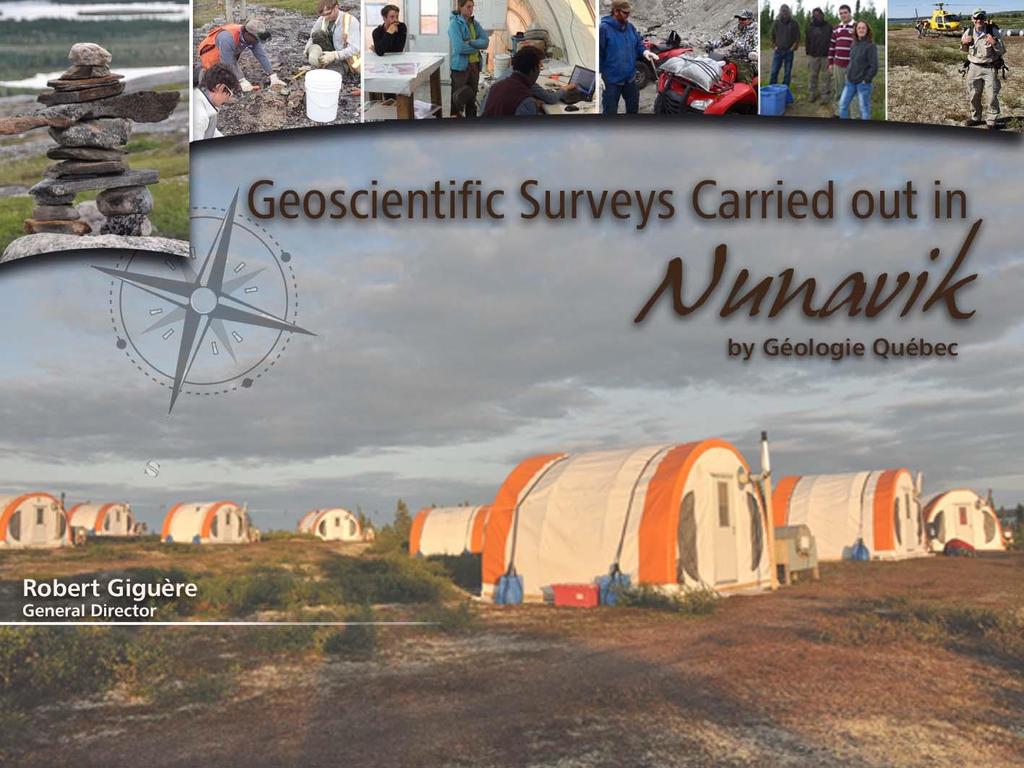
2 BCGQ Mission Statement Acquire new geoscientific knowledge in Québec within a sustainable development perspective of our mineral resources.

3 Financial Resources Natural Resources Fund, Mining Heritage Section
4 Financial Resources in Nunavik Natural Resources Fund * Total BCGQ budget (M$) Expenditures in Nunavik (M$)
5 Geoscientific surveys goals Acquire a basic understanding of Québec s overall territory Increase our surveys in the Plan Nord territory Improve our geoscientific knowledge in under-explored areas Improve our geological knowledge of areas with thick overburden sediments Highlight areas with high mineral potential Take into account the sustainable development of our mineral resources


6 Geoscientific data density map of Québec Raglan Mature areas Good geoscientific database Deep exploration challenges Schefferville Emerging areas Basic geoscientific database Need for refinement at the regional scale Uncharted areas Basic geoscientific knowledge needs to be acquired Isolated areas D. Lamothe Tiré de SIGÉOM
7 Carry out surveys within a sustainable development perspective: Minimize environmental footprint Maximize internal and external impact of surveys and new data Diversify uses for the survey results (useful not only for mineral exploration) Acquire a sufficient knowledge base in order to contribute to making the best possible decisions for land status Mining exploration Protection of wilderness areas Protecting safe drinking water
8 Annual geoscientific survey planning Public surveys, including stakeholders in the mineral sector Governmental requirements In-House proposals Five Year and Annual Survey Program Regional proposals Industry and other clients


9 Geoscientific Results in Nunavik Targets for mineral exploration


10 2016 Geoscientific Survey Program : Projects completed in


11 2017 Geoscientific Survey Program : All upcoming projects


12 Bedrock Surveys Team of 4 geologists and 4 students Helicopter-borne survey Base camp near a Twin Otter airstrip Description of rocks and minerals Fist-size rock sampling


13 Quaternary Surveys : Team by a geologist and a trainee Helicopter- borne Mapping of the sedimentary deposits Glacial movement analysis Tills et eskers sampling 10-20kg pail per sample Indicator minerals Till Sampling

14 Geophysical surveys Combined airborne surveys Magnetism Spectrometry Tool for mapping and prospecting Done by service companies trough open call for tenders Airport-based in Nunavik communities No ground contact 80 m altitude clearance 300 m altitude clearance in inhabited areas 200 m spacing between lines MAGNETOMETER
15 Nunavik Survey program budget for 2016 Project Geophysical surveys Geological surveys Quaternary surveys Investment 2,25 M $ 3,75 M $ 0,7 M $ Total investment 6,7 M $
 Rares metals (Churchill and Grenville) Nickel-copper and PGE Test new tools Indicator minerals Machine learning (artificial")
16 Geological Studies with Academic Partners Support geological surveys Geochronology Geochemistry Structural geology, metamorphism, tectonics Improve our understanding of mineral deposits to support exploration Gold (Abitibi and Baie James) Rares metals (Churchill and Grenville) Nickel-copper and PGE Test new tools Indicator minerals Machine learning (artificial intelligence)

17 Efforts to reduce our footprint Maximize efficiency of aircrafts Take out all garbage to nearest garbage deposit Carry out monthly water tests Dispose of waste water according to Quebec environmental regulation regulation On-site oil spill restraining equipment available Use biological cleaning soaps Avoid caribou calving grounds during critical periods Clean up all camp material after surveys are completed

18 SIGEOM An ever evolving database User friendlly interactive maps and web services New datasets for geochronology New datasets for quaternary geology New stratigraphic lexicon Heavy mineral database under construction Upcoming electronic report


19 Nunavik area: km 2 Active mining titles cover 2,28 % of Nunavik 26,2 % of Nunavik is under mining restriction 18 % Mining activity prohibited (red) or 8,2% permitted under restriction (green)
20 Conclusion Geoscientific surveys in Nunavik allow to: Acquire basic geophysical and geological knowledge in Nunavik 6,7 M $ will be invested in surveys in upcoming surveys in plus 6 studies in partnership with universities Identify areas with high mineral potential Land planning for protected areas Biodiversity studies, geological heritage sites and other land uses
Mineral Discoveries Using Big Data Analytics: Azimut s Exploration Edge
 Mineral Discoveries Using Big Data Analytics: Azimut s Exploration Edge Jean-Marc Lulin, PhD, P.Geo. Sprott Natural Resource Symposium July 2017 Azimut: Big Data Analytics in Exploration 1) Why use Big
Québec s Mining Industry. Presented by Frank Mariage February 4 th, 2015
 Québec s Mining Industry Presented by Frank Mariage February 4 th, 2015 Table of contents 1. Legal framework of the mining industry in Québec 2. Mining exploration in Québec 3. Mining production in Québec
Harvey Thorleifson, Director, Minnesota Geological Survey. Status of geological mapping needed for groundwater protection in Minnesota
 Harvey Thorleifson, Director, Minnesota Geological Survey Status of geological mapping needed for groundwater protection in Minnesota Minnesota is located between the Dakotas and Wisconsin, north of Iowa,
Mining Opportunities in Québec
 Mining Opportunities in Québec Pierre Verpaelst Ministère des Ressources naturelles et de la Faune du Québec Mohan Patel Investissement Québec Québec Overview Mining Industry in Québec Mineral Exploration
Sample Header for slide
 Sample Header for slide Consultants in Geology and Engineering North Rim Strategic Sourcing Tabetha Stirrett, P. Geo. October 22, 2014 Outline Exploration Phases in the mining industry How North Rim is
WHAT IS MINERAL EXPLORATION?
 INDABA PRESENTATION CAPE TOWN FEBRUARY 2017 AIM:SAV WHAT IS MINERAL EXPLORATION? AIM:SAV What is mineral exploration? 2 Exploration is the term used to describe a wide range of activities aimed at searching
Metallic Mineral Exploration in Minnesota: Typical Exploration Activities. Division of Lands and Minerals Minnesota Department of Natural Resources
 Metallic Mineral Exploration in Minnesota: Typical Exploration Activities Division of Lands and Minerals Minnesota Department of Natural Resources Metallic minerals can only be mined economically where
DEPARTMENT OF GEOLOGY AND MINERAL INDUSTRIES WAYS & MEANS SUBCOMMITTEE ON NATURAL RESOURCES MARCH 2, 2017
 DEPARTMENT OF GEOLOGY AND MINERAL INDUSTRIES WAYS & MEANS SUBCOMMITTEE ON NATURAL RESOURCES MARCH 2, 2017 1 ABOUT DOGAMI AGENCY MISSION, VISION & GOALS 2 Lidar image of a stream network along the Umpqua
Sustainable Management of Mineral Resources Project
 AIRBORNE GEOPHYSICS AS A TOOL TO PROM OTE M INERAL INVESTMENT IN AFRICA Stephen Re ford,k arl KwaiT2^Julius Nyakama3,Andre w Katum wehe4, Oumar Wane5 Paterson,Grant % Watson Limited,Toronto,Canada,Stephen.
GUIDE TO THE SOUTH ISLAND AEROMAGNETIC SURVEYS
 GUIDE TO THE SOUTH ISLAND AEROMAGNETIC SURVEYS New Zealand has a long history of mining, but much of the country remains relatively underexplored and has real potential for further mineral discoveries.
Innovations in Airborne Exploration Geophysics. Benedikt Steiner
 Innovations in Airborne Exploration Geophysics Benedikt Steiner What is exploration geophysics? 2 The use of the Earth s physical properties in locating geological features of interest to mining. Magnetics,
Corporate Presentation ORFORD MINING. March 2017
 Orford True North Mining Nickel Corporate Presentation ORFORD MINING March 2017 Cautionary Statements Concerning Forward-Looking Statements This presentation contains "forward-looking information" including
Photo: Jean Laforest, Qiqavik Property, Nunavik
 Photo: Jean Laforest, Qiqavik Property, Nunavik Kuujjuaq Mining Workshop April 2016 Cautionary Statements Concerning Forward-Looking Statements This presentation contains "forward-looking information"
Prospectors Making NEW Discoveries
 Prospectors Making NEW Discoveries Hans Smit Minerals North 2012 Burns Lake, British Columbia May 2012 BC Needs New Discoveries BC mines and most advanced mineral projects were found decades ago To ensure
Common Exploration Methods.
 Common Exploration Methods. The following list contains the most common methods which a company with a mineral prospecting licence in Northern Ireland might use to carry out a mineral prospecting programme.
Phase 1 Geoscientific Preliminary Assessment Southern Ontario, Sedimentary Communities
 Phase 1 Geoscientific Preliminary Assessment Southern Ontario, Sedimentary Communities Presented to: Community Liaison Committees (Brockton, Huron-Kinloss, South Bruce) March 2014 Project Description»
Tellus Survey Frequently Asked Questions:
 Tellus Survey 2017 - Frequently Asked Questions: 1. What is Tellus? Tellus is a ground and airborne geoscience mapping programme, collecting chemical and geophysical data that will inform the management
RESOURCE REPORTING THE FIRST STEP IN SUSTAINABLE MINING. Committee for Mineral Reserves International Reporting Standards
 RESOURCE REPORTING THE FIRST STEP IN SUSTAINABLE MINING 1 B Y J O H N C L I F F O R D ( D E P U T Y C H A I R M A N C R I R S C O ) A N D N I A L L W E A T H E R S T O N E ( C H A I R M A N C R I S C O
Administration of Mineral Rights
 Administration of Mineral Rights Deborah Archibald Industry, Tourism and Investment, GNWT Malcolm Robb Aboriginal Affairs and Northern Development Canada Business Today How applications are being treated
Placer Potential Map. Dawson L and U se P lan. Jeffrey Bond. Yukon Geological Survey
 Placer Potential Map Dawson L and U se P lan By Jeffrey Bond Yukon Geological Survey Dawson Land Use Plan Placer Potential Map 1.0 Introduction Placer mining has been an important economic driver within
Initial Borehole Drilling and Testing in or Near Ignace
 JUNE 2016 PRELIMINARY ASSESSMENT OF POTENTIAL SUITABILITY Initial Borehole Drilling and Testing in or Near Ignace DRAFT FOR DISCUSSION WITH COMMUNITIES In 2010, the Nuclear Waste Management Organization
Initial Borehole Drilling in the Hornepayne and Manitouwadge Area
 MAY 2017 PRELIMINARY ASSESSMENT OF POTENTIAL SUITABILITY Initial Borehole Drilling in the Hornepayne and Manitouwadge Area In 2010, the Nuclear Waste Management Organization (NWMO) began technical and
Advancing Geoscientific Capability. Geological Survey of Finland
 Advancing Geoscientific Capability Geological Survey of Finland GTK in brief The Geological Survey of Finland (GTK) is one of the largest European centres of excellence in assessment, research and the
GEO-MAPPING FOR ENERGY AND MINERALS (GEM) CALL FOR GRANT PROPOSALS. Geological Survey of Canada
 CALL FOR GRANT PROPOSALS. Geological Survey of Canada") EARTH SCIENCES SECTOR GEO-MAPPING FOR ENERGY AND MINERALS (GEM) CALL FOR GRANT PROPOSALS Geological Survey of Canada 2017 Her Majesty the Queen in Right of Canada 2014 Call for Grant Proposals: Geo-mapping
EARTH SCIENCES SECTOR GEO-MAPPING FOR ENERGY AND MINERALS (GEM) CALL FOR GRANT PROPOSALS Geological Survey of Canada 2017 Her Majesty the Queen in Right of Canada 2014 Call for Grant Proposals: Geo-mapping
The magnetic method: A frontline geophysical approach for gold exploration
 The magnetic method: A frontline geophysical approach for gold exploration Marc Boivin MBGeosolutions, Quebec QC Presented to the KEGS-PDAC 2010 Symposium All that Glitters: Geophysics for Precious Metals
CAS PROJECT LEMHI COUNTY, IDAHO
 CAS PROJECT LEMHI COUNTY, IDAHO 447 N 300 W, Suite 3 Kaysville, UT 84037 (801) 544-3421 ojgatten@nae-xploration.com Prepared by: North American Mine Services, LLC. May 25, 2017 CAS Project Summary The
Resource Management through Machine Learning
 Resource Management through Machine Learning Justin Granek Eldad Haber* Elliot Holtham University of British Columbia University of British Columbia NEXT Exploration Inc Vancouver, BC V6T 1Z4 Vancouver,
MINERAL OCCURRENCE DATA SYSTEM
 Current Research (2011) Newfoundland and Labrador Department of Natural Resources Geological Survey, Report 11-1, pages 341-345 MINERAL OCCURRENCE DATA SYSTEM G.J. Stapleton, J.L. Smith and H.M. Rafuse
Namibia Rare Earths Inc. Mobilizes for Airborne Survey Over Kunene Cobalt-Copper Project as Exploration Ramps Up
 Press Release Namibia Rare Earths Inc. Mobilizes for Airborne Survey Over Kunene Cobalt-Copper Project as Exploration Ramps Up Detailed airborne electromagnetic and magnetic survey comprising 3,700 line
Course Project Elective Elective (6 ec) Exams Holidays. Climate Modelling (1, 2) (6 ec) AM_ Orogenesis (5) (6 ec) AM_450190
 Exams Holidays. Climate Modelling (1, 2) (6 ec) AM_ Orogenesis (5) (6 ec) AM_450190") Course Project Elective Elective (6 ec) Exams Holidays Year Schedule Master Earth Sciences 2018-2019 Earth and Climate period 1 period 2 period 3 period 4 period 5 Climate Systems (1-4) (6 ec) AM_1124
Course Project Elective Elective (6 ec) Exams Holidays Year Schedule Master Earth Sciences 2018-2019 Earth and Climate period 1 period 2 period 3 period 4 period 5 Climate Systems (1-4) (6 ec) AM_1124
MINISTRY FOR INVESTMENTS AND DEVELOPMENT OF THE REPUBLIC OF KAZAKHSTAN. Investments into exploration in Kazakhstan
 MINISTRY FOR INVESTMENTS AND DEVELOPMENT OF THE REPUBLIC OF KAZAKHSTAN Investments into exploration in Kazakhstan Astana, 2017 Increasing the transparency of subsoil use sphere V Accession to the global
GEOCHEMISTRY UNIFORM SYLLABUS
 GEOCHEMISTRY UNIFORM SYLLABUS The Association of Professional Engineers and Geoscientists of the Province of British Columbia Note: 1. This Syllabus May Be Subject To Change 2. These Courses Are Required
What can I do with a major in Earth Information Science?
 Lewis-Clark State College offers a Bachelor of Arts or Science Degree in Earth Information Science through the Natural Sciences and Mathematics Division. You can learn more about the Natural Sciences and
Initial Borehole Drilling and Testing in Central Huron,
 JULY 2016 PRELIMINARY ASSESSMENT OF POTENTIAL SUITABILITY Initial Borehole Drilling and Testing in Central Huron, Huron-Kinloss and South Bruce DRAFT FOR DISCUSSION WITH COMMUNITIES In 2012, at the request
Rio Tinto Serbia Highlights Innovating to Develop New Resources
 [Descriptor] Month Q4 2014 YYYY - Q1 2015 Web www.riotintoserbia.com address [Labelling] NEWSLETTER Optional Issue body 7 Volume text area 7 can be placed here if required. Please delete any text areas
SUSTAINABLE GROWTH FROM GEOLOGY. gtk.fi
 SUSTAINABLE GROWTH FROM GEOLOGY gtk.fi Geological Survey of Finland The Geological Survey of Finland (GTK) is a leading European competence centre for the assessment and sustainable use of geological resources.
NATURAL RESOURCES CANADA
 Clean Growth Program Geological Survey of Canada (Calgary) Sonya Dehler, PhD Director NATURAL RESOURCES CANADA IQALUIT Canada Nunavut Geoscience Office Total of 400 staff, in seven locations across Canada
CHAMPION IRON REPORTS EXPLORATION RESULTS AT POWDERHORN PROJECT, NEWFOUNDLAND
 PRESS RELEASE CHAMPION IRON REPORTS EXPLORATION RESULTS AT POWDERHORN PROJECT, NEWFOUNDLAND Confirmed Continuity of High-Grade Zinc Zone and Addition of Gold to the Expanded Copper Zone Montreal, March
Endomines exploring the true potential of the Karelian Gold Line. 11th Fennoscandian Exploration and Mining Conference 1 November 2017
 Endomines exploring the true potential of the Karelian Gold Line 11th Fennoscandian Exploration and Mining Conference 1 November 2017 Disclaimer Statements in this presentation which are not purely historical
The Geological Potential of Central America and the Caribbean: A USGS Report
 The Geological Potential of Central America and the Caribbean: A USGS Report World Bank Workshop Recent Developments in Mining and Sustainable Development in Latin America March 5, 2014 Jane Hammarstrom
MINERAL OCCURRENCE DATA SYSTEM
 Current Research (2008) Newfoundland and Labrador Department of Natural Resources Geological Survey, Report 08-1, pages 237-241 MINERAL OCCURRENCE DATA SYSTEM G.J. Stapleton, J.L. Smith and T. van Nostrand
Richard Poulden, Executive Chairman of Wishbone Gold said:
 Wishbone Gold Plc / Index: AIM / Epic: WSBN / Sector: Natural Resources 17 July 2013 Wishbone Gold Plc ( Wishbone Gold or the Company ) Positive Exploration Update on Hanging Valley Prospect, Wishbone
about GCC
 about GCC Bldg 234, Flat 11, Al Barakat Street, Hail Al Janaubiyah P.O Box: 94, Postal Code: 123, Al Khaudh, Sultante of Oman Fax : +968 24543188 Mobile :+968 96666445 info@gcc-oman.com www.gcc-oman.com
Petroleum Exploration
 Petroleum Exploration Upstream Petroleum Exploration The role of exploration is to provide the information required to exploit the best opportunities presented in the choice of areas, and to manage research
DRAFT PROGRAM Registration of participants, welcome coffee, exhibition tour
 DRAFT PROGRAM 20 Feb 2018 09.00-10.00 Registration of participants, welcome coffee, exhibition tour 10.00 12.00 ROUND TABLE: INTERNATIONAL COOPERATION IN THE ARCTIC PROJECTS: CHALLENGES AND OPPORTUNITIES
The Need for Regional Geological Datasets
 The Need for Regional Geological Datasets Dr. Eibhlín Doyle PGeo Geological Survey of Ireland Regional Data Why What Who Future 2006 Why? Place developments in context Land use decision making Assist policy
Nachicapau Zn-Cu project THE NEXT MAJOR DISCOVERER IN QUEBEC
 Nachicapau Zn-Cu project THE NEXT MAJOR DISCOVERER IN QUEBEC Nachicapau Project - Location Willbob & Pallas Projects Kuujjuaq Located about 150km south of Kuujjuaq, the closest community (has a port) 215
Unit E: Planet Earth. Topic 2: The Rock Cycle and Characteristics of Rocks
 Unit E: Planet Earth Topic 2: The Rock Cycle and Characteristics of Rocks 1 2.1 Three Classes of Rocks: Igneous, Sedimentary, and Metamorphic A. How Rocks Are Formed B. Types of Rock 1. All rocks can be
Deep Mining Queensland (1)
") Deep Mining Queensland (1) New Initiatives in Exploration (18 th February, 2015) Dr Travis Murphy (M. Scott, D. Wood, & T. Webster) 1 UQ - Sustainable Minerals Institute 2 WH Bryan Mining and Geology Research
Deep Mining Queensland (1) New Initiatives in Exploration (18 th February, 2015) Dr Travis Murphy (M. Scott, D. Wood, & T. Webster) 1 UQ - Sustainable Minerals Institute 2 WH Bryan Mining and Geology Research
In the past century, prospectors discovered
 FEATURE Instrumentation GDD Inc. s Beep Map Is prospecting dead? By Edwin Gaucher, Eng., Ph.D. and Pierre Gaucher, Eng., MBA In the past century, prospectors discovered many mines while examining shorelines
Successfully Generating Robust Precious Metals and Zinc Projects. Sphinx Resources Ltd. March 2017
 Successfully Generating Robust Precious Metals and Zinc Projects Sphinx Resources Ltd. March 2017 Forward-Looking Statements This corporate presentation may contain forward-looking statements that are
For personal use only
 19 October 2011 AOM to expand into Shale Gas Exploration The Directors of (ASX:AOM) are pleased to announce the Company has entered into an agreement with Dr David Falvey to establish a subsidiary company,
Management of Geological Information for Mining Sector Development and Investment Attraction Examples from Uganda and Tanzania
 Mineral Wealth Conference 2016 Kampala / Uganda Management of Geological Information for Mining Sector Development and Investment Attraction Examples from Uganda and Tanzania Andreas Barth 1, Andreas Knobloch
Geological information for Europe : Towards a pan-european Geological Data Infrastructure
 Geological information for Europe : Towards a pan-european Geological Data Infrastructure Integrating geoscientific information for EU competitiveness Co-funded by the European Union European societal
Tellus Border Project Overview. Marie Cowan Ph.D Project Manager
 Tellus Border Project Overview Marie Cowan Ph.D Project Manager Presentation Outline History Goals Partners Project summary Legislative Framework Data Impacts Tellus History Proposed by GSNI, GSI, and
Mineral Wealth of Northern Quebec: How to Convert Potential into Economic Reality? Jean-Marc Lulin President & CEO April 2013 AZIMUT
 Mineral Wealth of Northern Quebec: How to Convert Potential into Economic Reality? Jean-Marc Lulin President & CEO April 2013 From Potential to Economic Reality 1) Status 2) Advantages 3) Constraints 4)
Plugged into High Tech Minerals
 Plugged into High Tech Minerals Forward Looking Statements Except for historical information, this presentation may contain certain forward looking statements and information relating to Berkwood that
ASX RELEASE. Drilling Commenced at Monax s Punt Hill Copper-Gold Project
 Exploration Office Warehouse I, 5 Butler Blvd BurbridgeBusinessPark Adelaide Airport SA 5950 Postal Address PO Box 247 Export Park SA 5950 ABN: 96 110 336 733 Tel: +61 8 8375 3900 Fax: +61 8 8375 3999
Project Development in Argentina. For Wind Energy and Minerals Using Spatial Data Modelling
 Project Development in Argentina For Wind Energy and Minerals Using Spatial Data Modelling Introduction Development of New Business Opportunities in Argentina Key Project for Kenex Since Mining 2010. Based
Independent Commission for Mines and Minerals, Kosova Rr. Armend Daci Nr.1 Prishtinë prishtn, Kosovo
 Journal of Materials Science and Engineering A 5 (7-8) (2015) 269-273 doi: 10.17265/2161-6213/2015.7-8.003 D DAVID PUBLISHING Mr.sc Xhevdet Kastrati * and Mr Sc. Ramiz Krasniqi Independent Commission for
Aboriginal communities strengthen governance with location-based tools in the 21st century
 Aboriginal communities strengthen governance with location-based tools in the 21st century Today, Aboriginal communities are taking advantage of the geomatics technologies that underpin popular online
The Pine Creek AEM Survey, Northern Territory
 The Pine Creek AEM Survey, Northern Territory (Data acquisition, processing, delivery and interpretation) M.A. Craig, M.T. Costelloe, S. Liu, S. Jaireth Onshore Energy and Minerals Division, Geoscience
THE POSSIBILITY OF INTEGRATING SUSTAINABILITY INTO LEGAL FRAMEWORK FOR USE OF OIL SHALE RESERVES
 Oil Shale, 2006, Vol. 23, No. 2 ISSN 0208-189X pp. 119 124 2006 Estonian Academy Publishers THE POSSIBILITY OF INTEGRATING SUSTAINABILITY INTO LEGAL FRAMEWORK FOR USE OF OIL SHALE RESERVES A. TEEDUMÄE
Drilling. What is the Activity?
 Drilling What is the Activity? Drilling is a critical activity in mineral exploration. There are several types of drilling. Diamond drilling is the most common type of drilling conducted in Ontario. It
CORPORATE PROFILE Airborne Geophysics for Mineral Exploration
 CORPORATE PROFILE Airborne Geophysics for Mineral Exploration Highlights Specialists in high resolution airborne geophysical surveys in mountainous terrain Precision GeoSurveys is a full-service airborne
Landscape Analysis of Mineral Resources A View from Home Tree ( Avatar )
") NRC Workshop on Landscape Approaches and Multi-Resource Analysis for Sustainable Natural Resource Management: June 2, 2015 Landscape Analysis of Mineral Resources A View from Home Tree ( Avatar ) Murray
NRC Workshop on Landscape Approaches and Multi-Resource Analysis for Sustainable Natural Resource Management: June 2, 2015 Landscape Analysis of Mineral Resources A View from Home Tree ( Avatar ) Murray
Three High Priority Targets Identified Through Modeling of Electromagnetic Data From 2011 SkyTEM Survey
 NORTH AMERICAN NICKEL INC. 301 260 W. Esplanade North Vancouver, B.C. V7M 3G7 Tel: (604) 986-2020 Toll Free: 1-866-816-0118 Three High Priority Targets Identified Through Modeling of Electromagnetic Data
A Discovery Company. Exploring for Canadian Diamonds
 A Discovery Company Exploring for Canadian Diamonds January, 2015 Forward Looking Statement Certain statements contained in this presentation may contain forward-looking information within the meaning
MPM Online Tool ArcSDM 5 Final Seminar May 4 th 2018, Rovaniemi
 http://gtkdata.gtk.fi/mpm/ ArcSDM 5 Final Seminar May 4 th 2018, Rovaniemi Funding 2 Vesa Nykänen/ArcSDM5 Seminar 4.5. 2018 http://gtkdata.gtk.fi/mpm/ 3 Vesa Nykänen/ArcSDM5 Seminar 4.5. 2018 http://gtkdata.gtk.fi/mpm/
Our Services. What We Do. How We Can Help. Contact us today: January (0)
") Listening and Understanding to Optimize our Efficiency Our Experience and Knowledge to Work for You Tailor-made Solutions to Meet your Needs Our Challenge is You Success What We Do Our Services GeoViz
Listening and Understanding to Optimize our Efficiency Our Experience and Knowledge to Work for You Tailor-made Solutions to Meet your Needs Our Challenge is You Success What We Do Our Services GeoViz
MESOZOIC BASINS. North Carolina Geological Survey
 MESOZOIC BASINS North Carolina Geological Survey The 1823 organic act which created the North Carolina Geological Survey (NCGS) tasked us to examine, describe and map the geology, geologic hazards, and
Exploring Eastern Africa. Africa Oil and Gas Conference October 2014
 Exploring Eastern Africa Africa Oil and Gas Conference October 2014 1 Exploring Eastern Africa Who is Rift Energy? Why East Africa? History of an exploration asset: Block L19 Kenya Growing the portfolio
For personal use only
 2 May 2018 METEORIC SECURES FURTHER HIGHLY PROSPECTIVE CANADIAN COBALT PROJECT Meteoric has secured the Beauchamp Cobalt Project 40km north of the Cobalt Camp, Ontario Beauchamp comprises 33.5km 2 being
Canada s opportunities
 Think Canada Opportunities in Canada s Resource Sector and Different Financing Instruments for Mining Projects December 11-12, 2013, Embassy of Canada, Dr. Bruno Wiest, Trade Commissioner (Science and
Kelly Creek Basin. EXPLORATION UPDATE June 23, Reno Office 10 Greg Street, Suite 170 Sparks, Nevada
 Kelly Creek Basin EXPLORATION UPDATE June 23, 2016 Reno Office 10 Greg Street, Suite 170 Sparks, Nevada 89431 775-359-7740 Vancouver Office 1500 885 West Georgia Street Vancouver, B.C. V6C 3E8 604-601-2006
Observation (EO) & Geomatics in Canada
 & Geomatics in Canada") Innovating to Increase the Impact of Earth Observation (EO) & Geomatics in Canada Natural Resources Canada February 25, 2014 Prashant Shukle, Director General Canada Centre for Mapping and Earth Observation
Innovating to Increase the Impact of Earth Observation (EO) & Geomatics in Canada Natural Resources Canada February 25, 2014 Prashant Shukle, Director General Canada Centre for Mapping and Earth Observation
Preliminary Mineral Exploration on the Pickett Mountain Property T6R6 WELS, Penobscot County, Maine. Public Information Session December 5, 2017
 Preliminary Mineral Exploration on the Pickett Mountain Property T6R6 WELS, Penobscot County, Maine Public Information Session December 5, 2017 Outline of Presentation Wolfden Resources Corporation Who
Realizing benefits of Spatial Data Infrastructure A user s perspective from Environment Agency - Abu Dhabi
 Realizing benefits of Spatial Data Infrastructure A user s perspective from Environment Agency - Abu Dhabi Anil Kumar Director, Environment Information Management 26 April 2012 Geospatial World Forum,
URANIUM RESEARCH ON NATIVE LANDS
 URANIUM RESEARCH ON NATIVE LANDS NSF HIGHLIGHTS TRACK 1 RESEARCH TITLE Uranium Transport and Site Remediation research crosses cultural borders to protect people and the environment OUTCOME Scientists
Project 81. Drill Ready Geophysical Targets & Trends. Timmins-Cochrane Northern Ontario Canada
 Project 81 Drill Ready Geophysical Targets & Trends Timmins-Cochrane Northern Ontario Canada FORWARD-LOOKING STATEMENT Certain statements contained in this presentation that are forwardlooking in nature
Distribution: Ministry of Employment and the Economy 2 copies Kuhmo Metals Oy, Outokumpu Vulcan Resources Ltd, Perth
 K uhmo Metals Oy Kummunkatu 34 83500 Outokumpu, Finland Facsimile: +358 13 830 228 Distribution: Ministry of Employment and the Economy 2 copies Kuhmo Metals Oy, Outokumpu 1 copy Vulcan Resources Ltd,
Namibia Critical Metals Commences Airborne EM Survey Over Kunene Cobalt-Copper Project
 Press Release Namibia Critical Metals Commences Airborne EM Survey Over Kunene Cobalt-Copper Project System tests completed and production flying underway for combined electromagnetic and magnetic survey
Grassroots Exploration for Gold in Labrador
 Grassroots Exploration for Gold in Labrador Roger Moss, Nikos Explorations Ltd., Shawn Ryan, RyanWood Exploration, John Clarke, GroundTruth Exploration. Mineral Resources Review November 1 st -4 th 2017
LNEG (Portuguese Geological Survey) EXPLORATION SURVEYS
 EXPLORATION SURVEYS") PORTUGAL LNEG (Portuguese Geological Survey) EXPLORATION SURVEYS JOÃO XAVIER MATOS GEOLOGIST, MINERAL RESOURCES and GEOPHYSICS RESEARCH UNIT PDAC CONVENTION 2011 TORONTO, 7th March 2011 The LNEG mission
PORTUGAL LNEG (Portuguese Geological Survey) EXPLORATION SURVEYS JOÃO XAVIER MATOS GEOLOGIST, MINERAL RESOURCES and GEOPHYSICS RESEARCH UNIT PDAC CONVENTION 2011 TORONTO, 7th March 2011 The LNEG mission
Costs and Benefits of Geological Mapping Contributions of Subhash Bhagwat. Illinois, Kentucky, Spain, and Nevada
 Costs and Benefits of Geological Mapping Contributions of Subhash Bhagwat Illinois, Kentucky, Spain, and Nevada Geology-for- Planning Boone and Winnebago Counties Seasoned Mapping and Derived Benefits
JOGMEC s Mineral Exploration Activities in Mongolia. By Hirotoshi KUNITOMO
 0 JOGMEC s Mineral Exploration Activities in Mongolia By Hirotoshi KUNITOMO Establishment of JOGMEC 1 Japan Oil, Gas and Metals National Corporation (JOGMEC) has been established on February 29, 2004,
A NEW MINING CAMP DISCOVERED WITH BEEP MATS AND INFINITEM.
 A NEW MINING CAMP DISCOVERED WITH BEEP MATS AND INFINITEM. A new copper-zinc mining camp (Gaumont, 2007) is being presently drilled off in central Quebec by Breakwater and Virginia Gold. Two new techniques
AURA TO COMMENCE EXPLORATION DRILLING PROGRAM ON ITS TASIAST SOUTH GOLD PROJECT COPPER AND NICKEL PROSPECTS WILL ALSO BE EXPLORED
 8 FEBRUARY 2017 AURA TO COMMENCE EXPLORATION DRILLING PROGRAM ON ITS TASIAST SOUTH GOLD PROJECT COPPER AND NICKEL PROSPECTS WILL ALSO BE EXPLORED KEY SHAREHOLDERS HAVE ELECTED EARLY EXCERSISE OF OPTIONS
ENVIRONMENTAL GEOSCIENCE UNIFORM SYLLABUS
 ENVIRONMENTAL GEOSCIENCE UNIFORM SYLLABUS The Association of Professional Engineers and Geoscientists of the Province of British Columbia Note: 1. This Syllabus May Be Subject To Change 2. These Courses
Michigan s Geology and Groundwater
 Michigan s Geology and Groundwater Ralph J. Haefner Deputy Director U.S. Geological Survey Michigan-Ohio Water Science Center Lansing, Michigan Outline About the USGS Geology 101 Michigan s geology Bedrock
indigeo Consultants Pvt Ltd Geophysical Surveys Geological Surveys GIS & Data Solutions Image Processing indigeo Company Profile, Page 1
 indigeo Consultants Pvt Ltd Geophysical Surveys Geological Surveys GIS & Data Solutions Image Processing MM Corner, 3 rd Floor #58, Banaswadi Main Road Bangalore 560033 INDIA Ph: +91 80 41638310 Mob: +91
Geodata flow TUKES GTK mineral exploration data - future prospecting capital!
 Geodata flow TUKES GTK mineral exploration data - future prospecting capital! Head of Unit, Regional Geodata and Interpretation Jouni Vuollo, GTK, 2016 Final report Six months Mineral exploration data
INTRODUCTION Prospectivity mapping Study area and methods
 Quaternary geological and till geochemical studies in verifying GIS-based prospectivity mapping in the Central Lapland Greenstone Belt, northern Finland Sarala Pertti, Nykänen Vesa, Sarapää Olli, Peltoniemi
SIXTH SCHEDULE REPUBLIC OF SOUTH SUDAN MINISTRY OF PETROLEUM, MINING THE MINING (MINERAL TITLE) REGULATIONS 2015
 REGULATIONS 2015") SIXTH SCHEDULE REPUBLIC OF SOUTH SUDAN MINISTRY OF PETROLEUM, MINING THE MINING ACT, 2012 THE MINING (MINERAL TITLE) REGULATIONS 2015 Guidelines should be prepared by the Directorate of Mineral Development
SIXTH SCHEDULE REPUBLIC OF SOUTH SUDAN MINISTRY OF PETROLEUM, MINING THE MINING ACT, 2012 THE MINING (MINERAL TITLE) REGULATIONS 2015 Guidelines should be prepared by the Directorate of Mineral Development
Isabelle D Amours and Martin Simard PRO
 DETERMINED FROM SPECTROMETRIC DATA Isabelle D Amours and Martin Simard PRO 2012-02 Exploration targets determined from spectrometric data in the Lac Le Moyne and Rivière Koksoak areas, Churchill Province
Bringing Earth Science to Life
 Bringing Earth Science to Life Earth History Geomorphology Surface Processes Soils Rocks Minerals Tectonics Using Natural Resources Careers www.edgeo.org In partnership with: Students investigate the
1/29/2018 OPENING FOR SPRING 2018 HISTORICAL GEOLOGY 20 LEC M/W 8:00AM 9:0AM, RM 705. Camp in Yosemite National Park May 18, 19 and 20
 ENVIRONMENTAL SCIENCE: The scientific study of our environment as well as our role in it. An interdisciplinary study that examines the role of humans on the earth. It is a physical, biological and social
3D Modelling of the Uppsala Esker
 3D Modelling of the Uppsala Esker Eva Jirner (SGU) Duncan McConnachie (WSP Sweden) 2017-05-31 ISO/TC211 Geographic Information/Geomatics A collabrative effort Orientation 3 Background Uppsala municiaplity
ASX Code: ORN Compelling Nickel-Copper Targets Defined at Fraser Range Project
 ASX Code: ORN www.oriongold.com.au Compelling Nickel-Copper Targets Defined at Fraser Range Project 1 Disclaimer and Forward-Looking Statements Certain statements contained in this presentation, including
Exploring Eastern Africa. East Africa Oil and Gas Summit, 2014 March 2014
 Exploring Eastern Africa East Africa Oil and Gas Summit, 2014 March 2014 1 Exploring Eastern Africa Who is Rift Energy? Why East Africa? History of an exploration asset: Block L19 Kenya Growing the portfolio