Field Methods to Determine/ Verify Bankfull Elevation, XS Area & Discharge
|
|
|
- Randall Bradley
- 5 years ago
- Views:
Transcription


1 Module # 6 Field Methods to Determine/ Verify Bankfull Elevation, XS Area & Discharge Iowa s River Restoration Toolbox Level 1 / Base Training

2 Overview of Basic Field Data Collection Site Map Cross Sections Longitudinal Profile Sediment Samples Reach Ave Pebble Count Riffle Armor Pebble Count Bar Sample Stream Assessment Harrelson, C.C., Rawlins, C.L., and Potyondy, J.P. Stream Channel Reference Sites: An Illustrated Guide to Field Technique: General Technical Report RM-245, Fort Collins, CO: U.S. Department of Agriculture - Forest Service, Rocky Mountain Forest and Range Experiment Station, 1994.
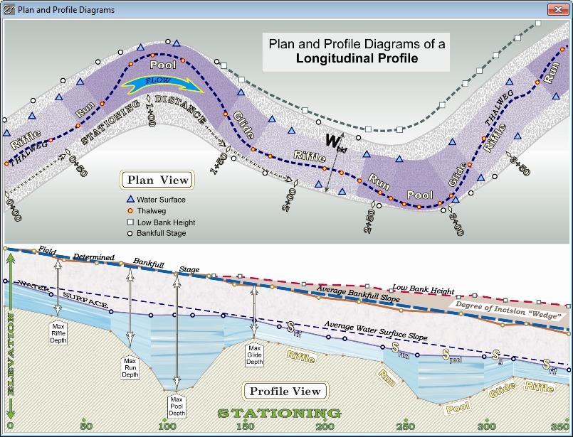
3 Site Map General Info Legend Photo Points Terraces Features Pool/Riffle Sequences Gravel & Sand Bars Abandoned Channels Measurements

4 Bankfull Discharge Controls Average, Long- Term Channel Form Corresponds to the Discharge that Channel Maintenance is Most Effective over the Long- Term Low Recurrence Interval Lower Recurrence Interval in Urban Watersheds flow bkf Buffalo Run, KY courtesy Stantec time
 Change in Vegetation Slope or Topographic Breaks or Changes Along the Bank Check Versus Water")
5 Bankfull Indicators Flat, Depositional Surface Adjacent to Active Channel Height of Depositional Features (Point Bars) Change in Vegetation Slope or Topographic Breaks or Changes Along the Bank Check Versus Water Level

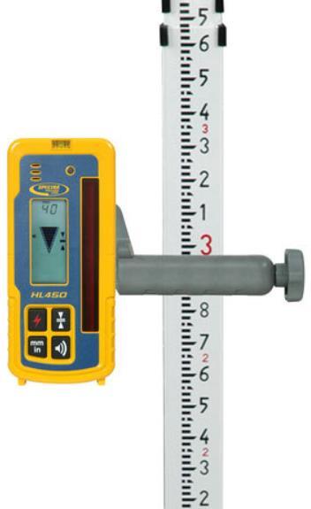

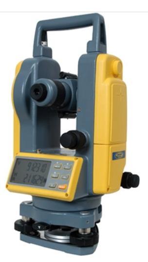
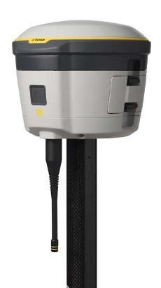
6 Survey Equipment

7 Cross Section Measurements Source: DL Rosgen
8 Cross Section Measurements
9 Cross Section Measurements Bankfull Call/Elevation Inner Berm Features Floodprone Width Bankfull Area Bankfull Width and Depth

10 Profile Survey Thalweg Water Surface Define Facets Bankfull Indicators Lowest Bank Terraces, Etc.

11 Measuring Water Depths Height of Thalweg Location Hold Rod at Water Surface Move to River s Edge

12 Profile Survey Bankfull Slope Facet Slopes Always Measure Water Surface Pool to Pool Spacing Pool Lengths Facet Maximum Depths Channel Bottom to Bankfull Elevation Low Bank Height or Valley Bottom
13
 Depositional (bedload transport) Estimate Distributions Used to Estimate Bed")
14 Particle Size Distributions Field Measurements of Channel Materials Reach Average (classification) Riffle Bed (armor layer) Depositional (bedload transport) Estimate Distributions Used to Estimate Bed Roughness
15 Pebble Counts & Bar Samples 1. Obtain a 100-particle pebble count on 10 transects from bankfull to bankfull throughout the reach (Classification) 3. Obtain Sieve Analysis at the location of the largest particle on lower 1/3 of point bar or other depositional feature 2. Obtain a 100-particle pebble count in the riffle bed (Sediment Transport)

16 Wolman Pebble Counts

17 Wolman Pebble Counts

18 Wolman Pebble Counts

19 Particle Size Distributions

20 Planform Geometry Measurements Wbkf = Bankfull Width Wblt = Belt Width Am = Amplitude Lm = Meander Wavelength Rc = Radius of Curvature

21 Sinuosity Channel Length/Valley Length -or- Valley Slope/Channel Slope

22 Design Reach Data Collection Dependant Upon Purpose of Project Impacted Reach (Minimum Data per Stream Type) Planform Measurements Riffle Cross Section Reach Average Pebble Count Riffle Bed Material Pebble Count Bar Sample Sieve Analysis Longitudinal Profile

23 Additional Design Reach Data Collection Site Constraints Upstream and Downstream Tie-In Tributaries Valley Type and Slope Available Material Onsite Potential Restoration Methods
 Best if Similar Valley Slope and Sediment Regime as Impacted/Design")
24 Reference Reach Criteria Stable Reference Stream in Same Hydro-Physiographic Region Same Stream Type as Intended Design Stable for Two Meander Wavelengths (20 Bankfull Widths) Best if Similar Valley Slope and Sediment Regime as Impacted/Design Reach
")
25 Reference Reach Data Collection Planform Measurements Facet Cross Sections (Riffle, Run, Pool & Glide) Longitudinal Profile through 2 Meander Wavelengths (Minimum) or 20 to 30 Bankfull Widths Reach Average Pebble Count Riffle Bed Material Pebble Count Bar Sample Sieve Analysis Pfankuch Channel Stability Assessment Site Controls (Bedrock, Wood)
26 Module # 6 Field Methods to Determine/ Verify Bankfull Elevation, XS Area & Discharge Iowa s River Restoration Toolbox Level 1 / Base Training
Vermont Stream Geomorphic Assessment. Appendix J. Vermont Regional Hydraulic Geometry Curves
 Vermont Stream Geomorphic Assessment Appendix J Vermont Regional Hydraulic Geometry Curves River Management Program Vermont Water Quality Division November, 2001 Natural Resources - J0 - VT Agency of Background
Stream Classification
 Stream Classification Why Classify Streams? Communication Tool Describe Existing Conditions & Trends Describe Restoration Goals Research Tool Morphologic Stream Classification Systems Schumm (1977) Alluvial
The how, why, and lessons learned
 The how, why, and lessons learned emulates natural river systems integrates fluvial processes over temporal and spatial scales of self-formed and self-maintained natural rivers reestablish the physical,
OBJECTIVES. Fluvial Geomorphology? STREAM CLASSIFICATION & RIVER ASSESSMENT
 STREAM CLASSIFICATION & RIVER ASSESSMENT Greg Babbit Graduate Research Assistant Dept. Forestry, Wildlife & Fisheries Seneca Creek, Monongahela National Forest, West Virginia OBJECTIVES Introduce basic
MEANDER MIGRATION MODEL ASSESSMENT FOR THE JANUARY 2005 STORM, WHITMAN PROPERTY, SAN ANTONIO CREEK, VENTURA COUNTY, CALIFORNIA
 MEANDER MIGRATION MODEL ASSESSMENT FOR THE JANUARY 2005 STORM, WHITMAN PROPERTY, SAN ANTONIO CREEK, VENTURA COUNTY, CALIFORNIA Prepared by Eric Larsen, Ph.D. Mark Rains, Ph.D. October 2006 INTRODUCTION
Why Stabilizing the Stream As-Is is Not Enough
 Why Stabilizing the Stream As-Is is Not Enough Several examples of alternatives to the County s design approach have been suggested. A common theme of these proposals is a less comprehensive effort focusing
Squaw Creek. General Information
 General Information is a tributary to the Salmon River. It enters the north side of the river about 0 miles downstream of North Fork, Idaho. The study reach is about a 30 ft length of stream about 2 miles
Business. Meteorologic monitoring. Field trip? Reader. Other?
 Business Meteorologic monitoring Field trip? Reader Other? Classification Streams Characterization Discharge measurements Why classify stream channels? Why Classify Stream Channels? Provides a common language
Application of Fluvial Geomorphologic Techniques At Abandoned Mine Sites 1. David A. Greenfield 2 Dennis M. Palladino 3
 Application of Fluvial Geomorphologic Techniques At Abandoned Mine Sites 1 David A. Greenfield 2 Dennis M. Palladino 3 ABSTRACT Watersheds that have been severely impacted by mining can no longer transport
Riparian Assessment. Steps in the right direction... Drainage Basin/Watershed: Start by Thinking Big. Riparian Assessment vs.
 Riparian Assessment vs. Monitoring Riparian Assessment What is a healthy stream? Determine stream/riparian health Determine change or trend, especially in response to mgmt Classification = designation
Stream Geomorphology. Leslie A. Morrissey UVM July 25, 2012
 Stream Geomorphology Leslie A. Morrissey UVM July 25, 2012 What Functions do Healthy Streams Provide? Flood mitigation Water supply Water quality Sediment storage and transport Habitat Recreation Transportation
Aquifer an underground zone or layer of sand, gravel, or porous rock that is saturated with water.
 Aggradation raising of the streambed by deposition that occurs when the energy of the water flowing through a stream reach is insufficient to transport sediment conveyed from upstream. Alluvium a general
Appendix E Rosgen Classification
 Appendix E Stream Type s Using the morphometric parameters described above, stream reaches are classified into 7 major stream types (Aa+ through G) based on s (1996) criteria. The relevant stream classifications
May 7, Roger Leventhal, P.E. Marin County Public Works Laurel Collins Watershed Sciences
 May 7, 2013 Roger Leventhal, P.E. Marin County Public Works Laurel Collins Watershed Sciences Background Funded in 2009 under EPA 2100 Grant for $30k and managed by SFEP Project Goals: Update original
Calculation of Stream Discharge Required to Move Bed Material
 Calculation of Stream Discharge Required to Move Bed Material Objective: Students will map two sections of a stream and calculate the depth, velocity, and discharge of flows required to move the stream
CR AAO Bridge. Dead River Flood & Natural Channel Design. Mitch Koetje Water Resources Division UP District
 CR AAO Bridge Dead River Flood & Natural Channel Design Mitch Koetje Water Resources Division UP District Old County Road AAO Bridge Map courtesy of Marquette County Silver Lake Basin McClure Basin
PolyMet NorthMet Project
 RS 26 Draft-01 December 8, 2005 RS26 Partridge River Level 1 Rosgen Geomorphic Survey Rosgen Classification Partridge River from Headwaters to Colby Lake Prepared for PolyMet NorthMet Project December
STREAM MODULES: SPREADSHEET TOOLS FOR RIVER EVALUATION, ASSESSMENT AND MONITORING **
 STREAM MODULES: SPREADSHEET TOOLS FOR RIVER EVALUATION, ASSESSMENT AND MONITORING ** D. E. Mecklenburg 1, A. Ward 2 Abstract Stream physical condition is increasingly a priority for resource managers.
NATURE OF RIVERS B-1. Channel Function... ALLUVIAL FEATURES. ... to successfully carry sediment and water from the watershed. ...dissipate energy.
 1 2 Function... Sevier River... to successfully carry sediment and water from the watershed....dissipate energy. 3 ALLUVIAL FEATURES 4 CHANNEL DIMENSION The purpose of a stream is to carry water and sediment
!"#$%&&'()*+#$%(,-./0*)%(!
*+#$%(,-./0*)%(!") 8:30 Sign in Hoosic River Revival Coalition!"#$%&&'()*+#$%(,-./0*)%(! 12-#30+4/#"5-(60 9:00 Welcome and Introductions 9:15 Goals for Today s Program: A Description of the Planning Process 9:30 First Session:
8:30 Sign in Hoosic River Revival Coalition!"#$%&&'()*+#$%(,-./0*)%(! 12-#30+4/#"5-(60 9:00 Welcome and Introductions 9:15 Goals for Today s Program: A Description of the Planning Process 9:30 First Session:
NATURAL RIVER. Karima Attia Nile Research Institute
 NATURAL RIVER CHARACTERISTICS Karima Attia Nile Research Institute NATURAL RIVER DEFINITION NATURAL RIVER DEFINITION Is natural stream of water that flows in channels with ih more or less defined banks.
Implementing a Project with 319 Funds: The Spring Brook Meander Project. Leslie A. Berns
 Implementing a Project with 319 Funds: The Spring Brook Meander Project Leslie A. Berns "...to acquire... and hold lands... for the purpose of protecting and preserving the flora, fauna and scenic beauties...
Technical Supplement 3E. Rosgen Stream Classification Technique Supplemental Materials. (210 VI NEH, August 2007)
") Technical Supplement 3E (210 VI NEH, August 2007) Issued August 2007 Cover photo: The Rosgen stream classification system uses morphometric data to characterize streams. Advisory Note Techniques and approaches
Technical Supplement 3E (210 VI NEH, August 2007) Issued August 2007 Cover photo: The Rosgen stream classification system uses morphometric data to characterize streams. Advisory Note Techniques and approaches
Spreadsheet Tools for Quantifying the Costs and Benefits of Two-Stage Channels
 Spreadsheet Tools for Quantifying the Costs and Benefits of Two-Stage Channels J. Witter, A. Ward, D. Mecklenburg, J. D Ambrosio, S. Roley, and J. Tank AWRA Agricultural Hydrology and Water Quality II
Ways To Identify Background Verses Accelerated Erosion
 Ways To Identify Background Verses Accelerated Erosion Establish Background Condition From Old Ground Photos, Aerial Photos, and Maps Compare Rate Over Time At the Same Location, or for Reaches Channel
Geomorphology Geology 450/750 Spring Fluvial Processes Project Analysis of Redwood Creek Field Data Due Wednesday, May 26
 Geomorphology Geology 450/750 Spring 2004 Fluvial Processes Project Analysis of Redwood Creek Field Data Due Wednesday, May 26 This exercise is intended to give you experience using field data you collected
Vermont Stream Geomorphic Assessment. Appendix E. River Corridor Delineation Process. VT Agency of Natural Resources. April, E0 - April, 2004
 Vermont Stream Geomorphic Assessment Appendix E River Corridor Delineation Process Vermont Agency of Natural Resources - E0 - River Corridor Delineation Process Purpose A stream and river corridor delineation
Design and Construction
 Design and Construction Stream Simulation With power point slides shamelessly stolen from: Forest Service AOP Training Course Bob Gubernick Paul Anderson John Kattell USDA Forest Service Interim Directive
Geomorphic Importance of Winter Peak Flows and Annual Snowmelt Hydrographs in a Sierra Nevada Boulder-Bedrock River
 Geomorphic Importance of Winter Peak Flows and Annual Snowmelt Hydrographs in a Sierra Nevada Boulder-Bedrock River Scott McBain and Bill Trush McBain & Trush, Inc. Clavey River and Cherry Creek vicinity
Why Geomorphology for Fish Passage
 Channel Morphology - Stream Crossing Interactions An Overview Michael Love Michael Love & Associates mlove@h2odesigns.com (707) 476-8938 Why Geomorphology for Fish Passage 1. Understand the Scale of the
Rosgen Classification Unnamed Creek South of Dunka Road
 Rosgen Classification Unnamed Creek South of Dunka Road Prepared for Poly Met Mining Inc. September 2013 Rosgen Classification Unnamed Creek South of Dunka Road Prepared for Poly Met Mining Inc. September
GLG598 Surface Processes and Landform Evolution K. Whipple Fall 2012 VERDE RIVER: FLOW MECHANICS, ROUGHNESS, AND SHEAR STRESS
 VERDE RIVER: FLOW MECHANICS, ROUGHNESS, AND SHEAR STRESS This lab will introduce you to some common field techniques and some general understanding of the geomorphic processes operating in a stream. The
Technical Memorandum. To: From: Copies: Date: 10/19/2017. Subject: Project No.: Greg Laird, Courtney Moore. Kevin Pilgrim and Travis Stroth
 Technical Memorandum To: From: Greg Laird, Courtney Moore Kevin Pilgrim and Travis Stroth 5777 Central Avenue Suite 228 Boulder, CO 80301 www.otak.com Copies: [Electronic submittal] Date: 10/19/2017 Subject:
MEANDER MIGRATION MODEL ASSESSMENT FOR THE 50- AND 100-YEAR STORMS, WHITMAN PROPERTY, SAN ANTONIO CREEK, VENTURA COUNTY, CALIFORNIA
 MEANDER MIGRATION MODEL ASSESSMENT FOR THE 50- AND 100-YEAR STORMS, WHITMAN PROPERTY, SAN ANTONIO CREEK, VENTURA COUNTY, CALIFORNIA Prepared by Eric Larsen, Ph.D. Mark Rains, Ph.D. October 2006 TABLE OF
Avoiding Geohazards in the Mid-Atlantic Highlands by Using Natural Stream Principles
 Avoiding Geohazards in the Mid-Atlantic Highlands by Using Natural Stream Principles J. Steven Kite, WVU Neal Carte, WVDOT Will Harman, Michael Baker Corp. Donald D. Gray, WVU Photo: W. Gillespie North
Session C1 - Applying the Stream Functions Pyramid to Geomorphic Assessments and Restoration Design
 University of Massachusetts - Amherst ScholarWorks@UMass Amherst International Conference on Engineering and Ecohydrology for Fish Passage International Conference on Engineering and Ecohydrology for Fish
Channel Pattern. Channel Pattern, Meanders, and Confluences. Description of Channel Pattern. Bridge (2003)
") Channel Pattern Channel Pattern, Meanders, and Confluences Outline Description of channel pattern Alternate bars Channel pattern continua and evolution Controls of channel pattern Description of Channel
Channel Pattern Channel Pattern, Meanders, and Confluences Outline Description of channel pattern Alternate bars Channel pattern continua and evolution Controls of channel pattern Description of Channel
DEPARTMENT OF NATURAL RESOURCES FISHERIES DIVISION
 MICHIGAN DEPARTMENT OF NATURAL RESOURCES FISHERIES DIVISION Technical Report 2008-1 September 2008 Regional Hydraulic Geometry Curve for the Upper Menominee River Jessica L. Mistak and Deborah A. Stille
GLG598 Surface Processes and Landform Evolution K. Whipple VERDE RIVER: FLOW MECHANICS, ROUGHNESS, AND SHEAR STRESS
 VERDE RIVER: FLOW MECHANICS, ROUGHNESS, AND SHEAR STRESS This lab will introduce you to some common field techniques and some general understanding of the geomorphic processes operating in a stream. The
CAUSES FOR CHANGE IN STREAM-CHANNEL MORPHOLOGY
 CAUSES FOR CHANGE IN STREAM-CHANNEL MORPHOLOGY Chad A. Whaley, Department of Earth Sciences, University of South Alabama, MobileAL, 36688. E-MAIL: caw408@jaguar1.usouthal.edu The ultimate goal of this
ADDRESSING GEOMORPHIC AND HYDRAULIC CONTROLS IN OFF-CHANNEL HABITAT DESIGN
 ADDRESSING GEOMORPHIC AND HYDRAULIC CONTROLS IN OFF-CHANNEL HABITAT DESIGN Conor Shea - Hydrologist U.S. Fish and Wildlife Service Conservation Partnerships Program Arcata, CA Learning Objectives Examine
North Carolina State University and North Carolina A&T State University commit themselves to positive action to secure equal opportunity regardless
 North Carolina State University and North Carolina A&T State University commit themselves to positive action to secure equal opportunity regardless of race, color, creed, national origin, religion, sex,
Step 5: Channel Bed and Planform Changes
 Step 5: Channel Bed and Planform Changes When disturbed, streams go through a series of adjustments to regain equilibrium with the flow and sediment supply of their watersheds. These adjustments often
Woodstock, Route 26 Stream Relocation Project
 MAINE DEPARTMENT OF TRANSPORTATION 2006 POST - CONSTRUCTION MONITORING REPORT: Woodstock, Route 26 Stream Relocation Project Year 1 of 5 Compensation for the Woodstock, Route 26 Highway Reconstruction
Big Wood River. General Information
 General Information The flows out of the southern portion of the Sawtooth National Recreation Area in central Idaho. The study reach is about a,200 ft length of river about.5 miles upstream from the discontinued
Fluvial Geomorphology
 Geomorphic Components of Riparian Ecosystems W. Barry Southerland, Ph.D. Fluvial Geomorphologist, CPESC #514 West National Technology Support Center Water Quality and Quantity Technology Development Team
Forest Service AOP Meeting Objectives of Stream Simulation: Examples and Talking Points
 Forest Service AOP Meeting Objectives of Stream Simulation: Examples and Talking Points Traci Sylte, P.E. Hydrology/Fluvial Geomorphology Lolo National Forest Is It True? Are Road Crossings a Dam with
Assessment. Assessment
 2001 SPRINGBROOK CREEK RESTORATION - THREE YEAR POST-CONSTRUCTION REVIEW - Presented by Bruce Henderson and Andy Harris 2005 River Restoration Northwest Symposium Skamania Lodge, Washington www.hendersonlandservices.com
Hydraulic Geometry Relationships for Rural North Carolina Coastal Plain Streams
 Hydraulic Geometry Relationships for Rural North Carolina Coastal Plain Streams Barbara A. Doll 1, Angela D. Dobbins 2, Jean Spooner 3, Daniel R. Clinton 4, David A. Bidelspach 4 ABSTRACT: Hydraulic geometry
The Importance of Riparian Vegetation in Channel Restoration: Moving Towards Quantification in Design
 The Importance of Riparian Vegetation in Channel Restoration: Moving Towards Quantification in Design Rob Millar Department of Civil Engineering The University of British Columbia "Nothing is as practical
Tom Ballestero University of New Hampshire. 1 May 2013
 Tom Ballestero University of New Hampshire 1 May 2013 1 Hydrology 2 Basic Hydrology Low flows most common Flows that fill the stream to the banks and higher are much less common Filling the stream to the
Impacts of Upstream Disturbances on Downstream Sediment Yield and Morphology in the Presence of Best Management Practices
 Impacts of Upstream Disturbances on Downstream Sediment Yield and Morphology in the Presence of Best Management Practices Ilkim Cavus M.S. Student Dr. Latif Kalin Professor Auburn University, School of
GEOL 332 Lab 4 Mad River River Bed
 Name: Date: Team Name: Team Members: Our goal today is to characterize some fluvial sediments, at two different sites along the Mad River, and within each site. We will form teams and describe sediments
Regional Curves of Hydraulic Geometry for Wadeable Streams. Marin and Sonoma Counties, San Francisco Bay Area. Data Summary Report.
 Regional Curves of Hydraulic Geometry for Wadeable Streams in Marin and Sonoma Counties, San Francisco Bay Area Data Summary Report May 10, 2013 Laurel Collins Watershed Sciences Berkeley, CA Roger Leventhal,
River Restoration and Rehabilitation. Pierre Y. Julien
 River Restoration and Rehabilitation Pierre Y. Julien Department of Civil and Environmental Engineering Colorado State University Fort Collins, Colorado River Mechanics and Sediment Transport Lima Peru
Hydraulic Geometry Curves and Bankfull Recurrence in the Pee Dee River Basin
 Hydraulic Geometry Curves and Bankfull Recurrence in the Pee Dee River Basin Smoot Z.T. 1, D.M. Park 2, A.D. Jayakaran 3, D.R. Hitchcock 3 AUTHORS: 1 Engineer in Training, Woolpert Inc., Columbia, SC 29210,
The Reference Reach - a Blueprint for Natural Channel Design. Dave Rosgen, P.H. 1
 The Reference Reach - a Blueprint for Natural Channel Design by Dave Rosgen, P.H. 1 Abstract The reference reach is used to develop natural channel design criteria based upon measured morphological relations
Stream Simulation: A Simple Example
 Stream Simulation: A Simple Example North Thompson Creek, CO Paul T. Anderson U.S.D.A. Forest Service Here s How We Started May 2011 2-1 USDA-Forest Service Here s How We Finished Forest Service Aquatic
Stream Restoration and Environmental River Mechanics. Objectives. Pierre Y. Julien. 1. Peligre Dam in Haiti (deforestation)
") Stream Restoration and Environmental River Mechanics Pierre Y. Julien Malaysia 2004 Objectives Brief overview of environmental river mechanics and stream restoration: 1. Typical problems in environmental
Stream Restoration and Environmental River Mechanics Pierre Y. Julien Malaysia 2004 Objectives Brief overview of environmental river mechanics and stream restoration: 1. Typical problems in environmental
Little Blackfoot TPA 2009 Sediment and Habitat Assessment QAQC Review March 9, 2010
 Little Blackfoot TPA 2009 Sediment and Habitat Assessment QAQC Review March 9, 2010 1.0 PROJECT OVERVIEW Sediment and habitat monitoring in the Little Blackfoot TPA was conducted in July of 2009 as outlined
Erosion Surface Water. moving, transporting, and depositing sediment.
 + Erosion Surface Water moving, transporting, and depositing sediment. + Surface Water 2 Water from rainfall can hit Earth s surface and do a number of things: Slowly soak into the ground: Infiltration
Fish Passage at Road Crossings
 Fish Passage at Road Crossings 1 Crossing Design Workshop Outline 1:00 to 2:00 Intro, Design Overview, Channel Width 2:00 to 2:15 Break 2:15 to 3:15 No-Slope, Stream Simulation Design 3:15 to 3:30 Break
Limitation to qualitative stability indicators. the real world is a continuum, not a dichotomy ~ 100 % 30 % ~ 100 % ~ 40 %
 Stream Stability Assessment & BEHI Surveys Joe Rathbun MDEQ Water Resources Division rathbunj@michigan.gov 517--373 517 373--8868 Stability Stream can transport its water and sediment inputs without changing
State of the River: Geomorphic Structure. Josh Wyrick, Ph.D. UC Davis
 State of the River: Geomorphic Structure Josh Wyrick, Ph.D. UC Davis 1 Geomorphic Structure Methodology Data Collection (topography, rating curve, hydraulics, substrate, vegetation & cover) GIS-Based Analyses
Lecture 10: River Channels
 GEOG415 Lecture 10: River Channels 10-1 Importance of channel characteristics Prediction of flow was the sole purpose of hydrology, and still is a very important aspect of hydrology. - Water balance gives
Assignment 1. Measuring River Characteristics- Vernon Creek. Applied Fluvial Geomorphology Field Techniques EESc 435
 Assignment 1 Measuring River Characteristics- Vernon Creek Applied Fluvial Geomorphology Field Techniques EESc 435 Amanda Jardine 30100093 Jaime McDonald 14177083 Erica Massey 50870088 April 28, 2012 Introduction
ALDER ESTABLISHMENT AND CHANNEL DYNAMICS IN A TRIBUTARY OF THE SOUTH FORK EEL RIVER, MENDOCINO COUNTY, CALIFORNIA 1
 ALDER ESTABLISHMENT AND CHANNEL DYNAMICS IN A TRIBUTARY OF THE SOUTH FORK EEL RIVER, MENDOCINO COUNTY, CALIFORNIA 1 William J. Trush, Edward C. Connor and Allen VV. Knight 2 Abstract: Riparian communities
Natural Shoreline Landscapes on Michigan Inland Lakes
 Natural Shoreline Landscapes on Michigan Inland Lakes Excerpts from Chapters 2 and 3 Photo Photo by Jane by Jane Herbert Herbert Did you know? Twenty-four species of amphibians, 25 species of reptiles,
Upper Truckee River Restoration Lake Tahoe, California Presented by Brendan Belby Sacramento, California
 Upper Truckee River Restoration Lake Tahoe, California Presented by Brendan Belby Sacramento, California Mike Rudd (Project Manager), Charley Miller & Chad Krofta Declines in Tahoe s Water Clarity The
MISSION CREEK WATERSHED (2002 Report Year 4)
") Stream Channel Monitoring Program for the MISSION CREEK WATERSHED (2002 Report Year 4) (Penticton Forest District) Prepared for RIVERSIDE FOREST PRODUCTS LTD. Prepared by DOBSON ENGINEERING LTD. #4, 1960
Stream Channel Monitoring Program for the MISSION CREEK WATERSHED (2002 Report Year 4) (Penticton Forest District) Prepared for RIVERSIDE FOREST PRODUCTS LTD. Prepared by DOBSON ENGINEERING LTD. #4, 1960
PRE-CONSTRUCTION REPORT FOR THE WARD BRANCH STREAM RESTORATION PROJECT
 Page 1 of 106 The Ozarks Environmental and Water Resources Institute (OEWRI) PRE-CONSTRUCTION REPORT FOR THE WARD BRANCH STREAM RESTORATION PROJECT Prepared By: Marc R. Owen, M.S., Research Specialist
FINAL GEOMORPHIC ASSESSMENT REPORT BIG WOOD RIVER BLAINE COUNTY, IDAHO
 FINAL GEOMORPHIC ASSESSMENT REPORT BIG WOOD RIVER BLAINE COUNTY, IDAHO Prepared For Trout Unlimited 300 North Main Street, Hailey, Idaho, 83333 Prepared By P. O. Box 8578, 140 E. Broadway, Suite 23, Jackson,
SELBY CREEK STREAM HABITAT RESTORATION AND RIPARIAN REVEGETATION PROJECT: GEOMORPHIC ANALYSIS AND REVIEW
 SELBY CREEK STREAM HABITAT RESTORATION AND RIPARIAN REVEGETATION PROJECT: GEOMORPHIC ANALYSIS AND REVIEW Submitted to Bioengineering Institute P.O. Box 1554 Laytonville, CA 95454 By Matthew O Connor, PhD,
Watershed Assessment of River Stability and Sediment Supply: Advancing the Science of Watershed Analysis
 Watershed Assessment of River Stability and Sediment Supply: Advancing the Science of Watershed Analysis 2009 MWEA Annual Conference Rob Myllyoja, CET rmyllyoja@hrc-engr.com Watershed Assessment of River
Field Observations and One-Dimensional Flow Modeling of Summit Creek in Mack Park, Smithfield, Utah
 Intermountain Center for River Rehabilitation and Restoration, Utah State University 31 July 2018 Field Observations and One-Dimensional Flow Modeling of Summit Creek in Mack Park, Smithfield, Utah I.
Stream Entrainment, Erosion, Transportation & Deposition
 Lecture 12 Zone 2 of the Fluvial System, Continued Stream Entrainment, Erosion, Transportation & Deposition Erosion in a Fluvial Landscape Corrosion Chemical Erosion Corrasion Mechanical Weathering Cavitation
(3) Sediment Movement Classes of sediment transported
 Sediment Movement Classes of sediment transported") (3) Sediment Movement Classes of sediment transported Dissolved load Suspended (and wash load ) Important for scouring algae Bedload (5-10% total load Moves along bed during floods Source of crushing for
(3) Sediment Movement Classes of sediment transported Dissolved load Suspended (and wash load ) Important for scouring algae Bedload (5-10% total load Moves along bed during floods Source of crushing for
Two-Stage Channel Design
 United States Department of Agriculture Natural Resources Conservation Service Stream Restoration Design Chapter 10 Issued August 2007 Cover photo: Low gradient, nonincising channels and ditches may be
A GEOMORPHOLOGICAL APPROACH TO RESTORATION OF INCISED RIVERS. David L. Rosgen 1
 Proceedings of the Conference on Management of Landscapes Disturbed by Channel Incision, 1997 S.S.Y. Wang, E.J. Langendoen and F.D. Shields, Jr. (eds.) ISBN 0-937099-05-8 A GEOMORPHOLOGICAL APPROACH TO
Appendix F Channel Grade Control Structures
 Stream Simulation Appendix F Channel Grade Control Structures This appendix briefly describes permanent grade control structures that are sometimes needed in the upstream and/or downstream reaches adjacent
Restoration of Goose Creek and Big Meadows. Conceptual Design Plan
 Prepared for: Kalispel Tribe of Indians Michelle Andersen Kalispel Tribal Fisheries Department PO Box 39 Usk, WA 99180 April, 2010 Submitted by: P.O. Box 1133, Bozeman, MT 59771-1133 p. 406-585-9500, f.406-582-9142
Do you think sediment transport is a concern?
 STREAM RESTORATION FRAMEWORK AND SEDIMENT TRANSPORT BASICS Pete Klingeman 1 What is Your Restoration Project Like? k? Do you think sediment transport is a concern? East Fork Lewis River, WA Tidal creek,
Variability Design. Part 654 Stream Restoration Design National Engineering Handbook. United States Department of Agriculture
 United States Department of Agriculture Natural Resources Conservation Service Stream Restoration Channel Alignment and Variability Issued August 2007 Cover photo: Where alteration of a stream or channel
GLG362/GLG598 Geomorphology K. Whipple October, 2009 I. Characteristics of Alluvial Channels
 I. Characteristics of Alluvial Channels Self-formed morphology set by entrainment, transport, and deposition They move unconsolidated sedimentary materials present in the valley fill flood plain/bank flow
Big River Borrow Pit Monitoring Project
 The Ozarks Environmental and Water Resources Institute (OEWRI) Missouri State University (MSU) Big River Mining Sediment Assessment Project Big River Borrow Pit Monitoring Project FINAL REPORT Field work
A classification of natural rivers
 CATENA Catena 22 (1994) 169-199 A classification of natural rivers David L. Rosgen Wildland Hydrology, 157649 U. S. Highway 160, Pagosa Springs, CO 81147 Abstract A classification system for natural rivers
Gradients in Restored Streams and the Implications on Hyporheic
 Examining Higher Hydraulic Gradients in Restored Streams and the Implications on Hyporheic Exchange Hong-Hanh Chu and Dr. Ted Endreny, g y, Department of Environmental Resources Engineering, SUNY ESF Overview
Watershed concepts for community environmental planning
 Purpose and Objectives Watershed concepts for community environmental planning Dale Bruns, Wilkes University USDA Rural GIS Consortium May 2007 Provide background on basic concepts in watershed, stream,
LANDFORMS OF THE LOWER YUBA RIVER
 LOWER YUBA RIVER ACCORD MONITORING AND EVALUATION PROGRAM LANDFORMS OF THE LOWER YUBA RIVER APRIL 2012 Prepared for: The Lower Yuba Accord River Management Team by Josh Wyrick, PhD., and Greg Pasternack,
Long Valley Meadow Restoration Project
 Long Valley Meadow Restoration Project USDA Forest Service Mogollon Rim Ranger District Coconino National Forest Coconino County, Arizona T13N, R9E, Section 12 and T13N, R10E, Sections 6 and 7 Gila and
The Equilibrium Channel & Channel Change. Peter Wilcock 3 August 2016
 The Equilibrium Channel & Channel Change Peter Wilcock 3 August 2016 1 The search for common empirical attributes of streams Luna B. Leopold M. Gordon ( Reds ) Wolman Watts Branch, MD A meandering stream
Hydraulics of bendway weirs
 River Basin Management IV 389 Hydraulics of bendway weirs C. Thornton 1, S. Abt 1, D. Baird 2 & R. Padilla 3 1 Colorado State University, Fort Collins, CO, USA 2 U.S. Bureau of Reclamation, Denver, CO,
HAW CREEK, PIKE COUNTY, MISSOURI-TRIB TO SALT RIVER ERODING STREAM THREATHENING COUNTY ROAD #107, FOURTEEN FT TALL ERODING BANK WITHIN 4 FT OF THE
 HAW CREEK, PIKE COUNTY, MISSOURI-TRIB TO SALT RIVER ERODING STREAM THREATHENING COUNTY ROAD #107, FOURTEEN FT TALL ERODING BANK WITHIN 4 FT OF THE ROAD, PROJECT CONSTRUCTED IN 1 DAY, MARCH 10, 2009 BY
River Morphology. EAD 511 River management
 River Morphology EAD 511 River management Introduction FLUVIAL GEOMORPHOLOGY Webster's New World Dictionary defines fluvial as: of, found in, or produced by a river or rivers. The same reference defines
DETAILED DESCRIPTION OF STREAM CONDITIONS AND HABITAT TYPES IN REACH 4, REACH 5 AND REACH 6.
 DETAILED DESCRIPTION OF STREAM CONDITIONS AND HABITAT TYPES IN REACH 4, REACH 5 AND REACH 6. The Eklutna River was divided into study reaches (figure 1) prior to this site visit. Prominent geologic or
Can fluvial-hydraulic models accurately predict bed load transport in gravel bed streams?
 Can fluvial-hydraulic models accurately predict bed load transport in gravel bed streams? Scott B. Katz 1,2, Catalina Segura 1,2 1 Water Resources Graduate Program, 2 Department of Forest Engineering,
Stop 1: Marmot Dam Stop 1: Marmot Dam
 Stop 1: Marmot Dam Stop 1: Marmot Dam Following the removal of Marmot Dam in 2007, the fate of the reservoir sediments has been monitored through a series of surveys and sediment transport measurements.
SCOPE OF PRESENTATION STREAM DYNAMICS, CHANNEL RESTORATION PLANS, & SEDIMENT TRANSPORT ANALYSES IN RELATION TO RESTORATION PLANS
 DESIGN METHODS B: SEDIMENT TRANSPORT PROCESSES FOR STREAM RESTORATION DESIGN PETER KLINGEMAN OREGON STATE UNIVERSITY CIVIL ENGINEERING DEPT., CORVALLIS 2 ND ANNUAL NORTHWEST STREAM RESTORATION DESIGN SYMPOSIUM
GEOG 642 May 2005 Project Partners: Shoshana Risman, Rich McNelis. Sausal Creek: Dimond Canyon Watershed Assessment
 GEOG 642 May 2005 Project Partners: Shoshana Risman, Rich McNelis Sausal Creek: Dimond Canyon Watershed Assessment I: Table of Contents List of Figures List of Tables 1.0 Introduction 2.0 Site Characterization
CASE STUDIES. Introduction
 Introduction The City of Winston-Salem faces the challenge of maintaining public infrastructure (e.g., water and sewer lines, storm drains, roads, culverts and bridges) while minimizing the potential impacts