Belgian Biodiversity Information Facility. BeBIF. The Belgian National Node of the worldwide biodiversity network GBIF.
|
|
|
- Melina Barker
- 5 years ago
- Views:
Transcription
1 Belgian Biodiversity Information Facility BeBIF The Belgian National Node of the worldwide biodiversity network GBIF PADD II (Brussels, March 2003) 1
2 Biodiversity informatics The science of organisation, sharing, dissemination and use of data, information, and knowledge on biological diversity Total number of species about 10 million 1.7 million species have been described and named Total number of specimens in museum collections 1-3 billion Also hiding a large number of not yet described species new species described each year This rate has not improved during the past 40 years to species lost each year to extinction This rate is 1000 times faster than the natural rate PADD II (Brussels, March 2003) 2
3 GBIF: Global Biodiversity Information facility GBIF is an international scientific co-operative project based on a multilateral agreement (MoU) between countries, economies and international organisations, dedicated to: Establishing an interoperable, distributed network of databases containing scientific biodiversity information, in order to: Make the world s scientific biodiversity data freely and universally available to all, with initial focus on species- and specimen-level data, with links to molecular, genetic and ecosystems levels PADD II (Brussels, March 2003) 3
4 The Story of GBIF 1996 Planning of GBIF starts January 1999 Working group of the MegaScience Forum of the OECD recommends establishing GBIF March 2001 GBIF formally established June 2001 Denmark chosen to host GBIF Secretariat November 2001 Executive Secretary James L. Edwards moves to Copenhagen and initiates Secretariat October 2002 First work programme approved 2004 Three-year review and necessary reorientation 2006 Initial 5 year commitment of participants over and future of GBIF will be reconsidered PADD II (Brussels, March 2003) 4
5 GBIF WORK PROGRAMMES Data Access and Database Interoperability (DADI) Electronic Catalogue of Names of Known Organisms (ECAT) Digitisation of Natural History Collections (DIGIT) Outreach and Capacity Building (OCB) Species Bank Digital Biodiversity Literature Resources PADD II (Brussels, March 2003) 5
6 GBIF VOTING PARTICIPANTS (as on 4 April 2003) 23 Voting Participants: Australia, Belgium, Canada, Costa Rica, Denmark, Finland, France, Germany, Iceland, Japan, Republic of Korea, Mexico, Netherlands, New Zealand, Nicaragua, Peru, Portugal, Slovenia, Spain, South Africa, Sweden, UK, USA Convention on Biological Diversity is also an ex officio (non-voting) member of Governing Board PADD II (Brussels, March 2003) 6
7 Associate Participants: Countries / Economies (as on 4 April 2002) Argentina, Austria, Bulgaria, Czech Republic, Ghana, Madagascar, Morocco, Pakistan, Poland, Slovak Republic, Switzerland, Taiwan, Tanzania, European Commission PADD II (Brussels, March 2003) 7
8 Associate Participants: Organizations (as on 4 April 2002) NatureServe All Species Foundation ASEANET BIONET-International BIOSIS CABI Bioscience EASIANET Expert Center for Taxonomic Identification Inter-American Biodiversity Information Network Integrated Taxonomic Information System United Nations Educational Scientific and Cultural Organisation, Man and the Biosphere Programme Ocean Biogeographic Information System Société de Bactériologie Systématique et Vétérinaire Species 2000 Taxonomic Databases Working Group United Nations Environment Programme, World Conservation Monitoring Centre The World Federation for Culture Collections The Wildscreen Trust PADD II (Brussels, March 2003) 8
9 PARTICIPANTS AGREE TO... Share biodiversity data Set up a node or nodes for sharing the data Formulate and implement GBIF work programme for their part Voting Participants (countries and economies) make yearly contribution based on Gross Domestic Product GBIF central budget is $3M Associate Participants (countries, economies, international organisations) cannot vote, but otherwise participate fully in GBIF activities and decisions Make additional investments in biodiversity information and the necessary infrastructure 90% of investment in GBIF happens within Participants, only 10% centrally for providing the linking mechanism PADD II (Brussels, March 2003) 9
10 GBIF Node Responsibilities 1. Network 2. Standards 3. Tools GBIF Metadata Registry and Portal 1. Network 2. Standards 3. Tools 4. Consolidated Data Only if no Official National Node!!! Data Node 1. Data 2. Metadata National Participant Node 1. Identify (local) Data Nodes 2. Forward registration metadata from Data 1. Nodes Encourage 3. National Language participation Interfaces 2. Manage registration of Data Nodes PADD II (Brussels, March 2003) 10
11 GBIF enables synergism among existing investments Responsibilities of GBIF Responsibilities of other organisations Biological Specimen Data Species Bank Catalogue of Names of Known Organisms Biodiversity Literature Resources Geospatial Data Ecosystems Data DDBJ/EMBL/GenBank Ecological Data Other Sequence Data (RNA, protein, ) Climate Data PADD II (Brussels, March 2003) 11
12 Biodiversity.be Four partners funded by the Federal Office for Scientific, Technical and Cultural Affairs (OSTC) The Belgian Biodiversity Platform (BBPF), the OSTC advisory organ on biodiversity research (analysis, development and promotion of biodiversity-related research in the scientific community). The Belgian Clearing-House Mechanism (CHM), the national portal site for information exchange on all matters related to the Convention on Biological Diversity Belnet-BIODIV, the electronic catalogue of Belgian resources in Belgium: research projects, experts, institutions, collections and databases, events, etc. Belgian BioCASE Node for metadata BeBIF, the Belgian Node of the Global Biodiversity Information Facility. An endeavour to build the prototype of a Belgian bioinformatics infrastructure to integrate Belgian biodiversity resources within an unified environment PADD II (Brussels, March 2003) 12
13 BeBIF: Belgian Biodiversity Information facility Fundings: OSTC (Federal Office for Scientific, Technical and Cultural Affairs) Staff: Promoter (Robert Herzog) Node Manager (Patricia Mergen) Data Analyst (Didier Piette) Analyst Programmer (Johan Duflost) PADD II (Brussels, March 2003) 13
14 Synonyms Taxonomic Tree Genus/Species Common names Localisation References Descriptions " Belgian " Biodiversity data as a contribution to the Catalog of life Tools to detect: Species not yet listed Other Synonyms Misspellings PADD II (Brussels, March 2003) 14

 BIANZO (BIodiversity of three representative groups of the")
15 Royal Belgian Institute of Natural Sciences Seven departments: Vertebrates: Systematics and biochemical taxonomy, Data processing and documentation Invertebrates: Malacology, Recent invertebrates Entomology: Insects, Insects and arachnomorphes Education and Nature:Freshwater biology, Biological evaluation, Educational and museological services Paleontology: Micropalaeontology and Palaeobotany, Fossil invertebrates, Fossil vertebrates, Anthropology, Prehistory, Mineralogy,Petrography Marine ecosystem management: Marine Enivronment Modelisation, Marine Ecosystem Management Geological survey: General Geology and Mineralogy, Applied Geology and Geo-Information Recent invertebrates (Laboratory of Carcinology) BIANZO (BIodiversity of three representative groups of the ANtarctic Zoobenthos) Amphipods, Echinoids, and Nematodes, sampling sites and periods are often the same or close. Our goal is to implement these databases in XML format on our server in order to interlink them to produce among other things a species list for common sampling sites and periods. Data will be made available through the National Participant Node portal PADD II (Brussels, March 2003) 15
 and the paleotropics (esp. Central Africa). Plant groups: Algae, bryophytes, fungi including lichens and vascular plants.")

16 National Botanic Garden of Belgium Plant systematics and related fields: Floristics, phytogeography, phylogeny, comparative morphology, pollen & spores and vegetation studies. Geographic range: Temperate Europe (esp. Belgium) and the paleotropics (esp. Central Africa). Plant groups: Algae, bryophytes, fungi including lichens and vascular plants. Drawing up of the global inventory of biodiversity. To maintain the floristic inventory up to date and to follow the spread of species is a priority for nature conservation. The Garden already works for about hundred years on the flora of Central Africa. On regular basis, new species are circumscribed and receive a name. Collaborative project: Prototype Image Server to integrate the Martius Herbarium and the Digital Flora brasiliensis Private Von Martius collection, general herbarium covering the world, half of it collected in Central and South America ( , specimens), species treated in Flora brasiliensis Data will be made available through the National Participant Node portal PADD II (Brussels, March 2003) 16


 Valorization of the museum collections for biodiversity studies 8 million")
, ornithology, herpetology, archaezoology, entomology (Diptera and")

17 Royal Museum for Central Africa Research focuses on three elements: - Field research in collaboration with local partners - Training and dissemination of information regarding biodiversity related topics - Research on the collections of the RMCA The African Biodiversity Information Centre (ABIC) Study of Cichilds in Lake Malawi Nocturnal spiders and the biodiversity of the rainforest Long term cooperation with national museums of Kenya (Nairobi) Partnership agreement with the Centre national de documentation et de recherche scientifiques des Comores (CNDRS) Valorization of the museum collections for biodiversity studies 8 million biological specimens, most important zoological collection in the world for Central Africa Fields: Ichthyology (lacustrine and palustrine), ornithology, herpetology, archaezoology, entomology (Diptera and Lepidoptera), other invertebrates (arachnology, acarology and Diplopoda) Data will be made available through the National Participant Node portal Make GBIF more widely known in Africa and likely result in new memberships PADD II (Brussels, March 2003) 17
18 Other relevant projects: ENBI: FP5, European Network for Biodiversity Information, Cluster I (Steering and Coordination activities) BEN: Belgian EMBnet Node to provide links to sequence related data BELNET-BIODIV: Common agreement to fully share data and to expose the metadata in GBIF standards XML format (BioCASE) BCCM: Collaboration with the Belgian Co-ordinated Collections of Micro-organisms to expose part of their data on our server under GBIF Standards. FBDB (Federation of Biogeographical Databases): XML and availability on the web FUNDP URBO: Main partner for the proposed GBIF Demonstration Project about biodiversity related data of the Reservoir Lakes of Robertville and Bütgenbach Collaborations with regional initiatives (Walloon, Flemish, Brussels) To play its role as national gateway to expose Belgian biodiversity data to the worldwide GBIF network, BeBIF has developed several strategies and informatic tools, which may be shared with the other participant and data nodes PADD II (Brussels, March 2003) 18
19 Technologies XML related technology (XSL, XPath, XInclude, XUpdate, XQuery ) Data Server SRS (Sequence Retrieval System), standby until more XML support exist (Open Source XML database; Prof W. Meier TU-Darmstadt) Python (CGI) Administrative tool : ZOPE PADD II (Brussels, March 2003) 19
20 QUERY HTML XPath Python Script exist XSL XML RESULTS - HTML - Tables - XML - Maps - XML PADD II (Brussels, March 2003) 20
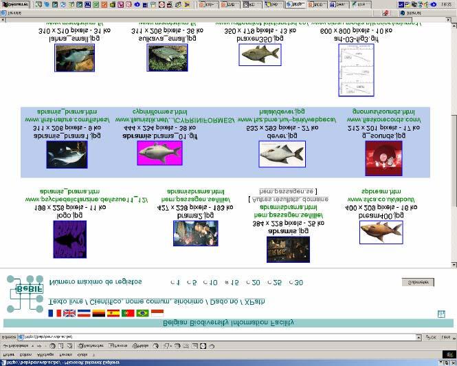
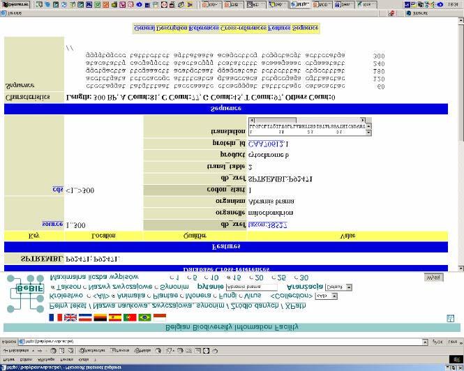
21 First trials with exist The script Python Receives the request Interrogates exist Parses the XML response of the loader exist Retrieves the data Generates the XML response Demo Table format Number of entries Easy multilingual interface Enabling XPath queries PADD II (Brussels, March 2003) 21
22 Advantages Drawbacks Advantages and drawbacks of exist Simple indexing engine Results are obtained within seconds Links between data bases with Xinclude Open source written in Java Not suited for flat files Not yet XUpdate Version 0.9 Version 1.0! BeBIF collaborates with exist conceptor (Prof. W. Meier) for enhancement PADD II (Brussels, March 2003) 22


23 PADD II (Brussels, March 2003) 23

24 PADD II (Brussels, March 2003) 24


25 PADD II (Brussels, March 2003) 25


26 PADD II (Brussels, March 2003) 26
27 How to become a BeBIF data node? (Plan for the future) 1. Apply officially or will be contacted 2. Get official ID, logins and passwords 3. Fill in the online Metadata form 4. a) Existing data or database systems : export of the data which can be made publicly available according to GBIF standards, with the assistance of the BeBIF staff b) New data or starting a new database: Use of the online data entry form, customized to your data and your needs. (Data directly transformed in XML) 5. Data are directly visible online, can be queried, edited by the owner, but not yet officially validated 6. Data will be validated by an OSTC panel of scientific and IT experts 7. Official Federal Data Quality Control Label PADD II (Brussels, March 2003) 27
28 DATA to be shared with GBIF Data Providers and Metadata: Fill in the Metadata online form, Information about the data and respect of IRP Species: Taxonomy, Scientific Names, Synonyms, Common Names, Belgian contribution to the Catalog of Life Specimens: Number of specimens hold, collected or observed Geographic location: As precise as possible (GPS recommended), restricted access for endangered species Any other biodiversity related data: Species or specimen descriptions, Identification keys, sampling site descriptions, list of publications Either transmitted to BeBIF or made publicly available on a local server managed in collaboration with the BeBIF team PADD II (Brussels, March 2003) 28

29 PADD II (Brussels, March 2003) 29
30 How to reach BeBIF /services/projects For any questions or feed-back Belgian Biodiversity Information Facility (BeBIF) Université Libre de Bruxelles Campus de la Plaine CP 257 Bâtiment NO, Bureau 4 O4 210 (Niveau 4) Boulevard du Triomphe, entrée ULB 2 B-1050 Bruxelles Bebif@ben.vub.ac.be Tél. : Fax : PADD II (Brussels, March 2003) 30
*CETAF : DOI: /RG
 Consortium of European Taxonomic Facilities STRATEGY AND STRATEGIC DEVELOPMENT PLAN * Executive Summary Exploring and documenting diversity in nature *CETAF Strategy and Strategic Development Plan 2015-2025:
African Coastal Atlas developments. 10 July 2008 EEA Copenhagen, Denmark
 African Coastal Atlas developments 10 July 2008 EEA Copenhagen, Denmark Africa Overview Africa has approximately 40 000 km of coast across 32 mainland countries and four island states. Africa's coastal
UNESCO Geopark Action. How to manage Geoparks!
 Regional Geoparks Meeting 13-15 November 2011 Trinidad, Flores, Uruguay Dr Margarete Patzak UNESCO, Division of Ecological and Earth Sciences UNESCO Geopark Action How to manage Geoparks! Araripe Geopark,
INSPIRing effort. Peter Parslow Ordnance Survey December Various European approaches to managing an SDI
 INSPIRing effort Peter Parslow Ordnance Survey December 2015 Various European approaches to managing an SDI WHAT IS INSPIRE? A European Union Directive A community effort: http://inspire.ec.europa.eu/
GBIF Info Session Brussels, 22 October 2010 BBPF
 GBIF Info Session Brussels, 22 October 2010 1 Agenda Part I Digitization Projects Saproxylic Beetles - Patrick Grootaert IFBL Plants (1939-1971) - Leo VanHecke Aves Birds Observations - Jean-Yves Paquet
The Atlas of Living Australia
 The Atlas of Living Australia The ALA is a national collaborative research infrastructure supported by the Australian Government. It is led by CSIRO in partnership with the Australian biological community.
EuroGeoSurveys & ASGMI The Geological Surveys of Europe and IberoAmerica
 EuroGeoSurveys & ASGMI The Geological Surveys of Europe and IberoAmerica Geological Surveys, what role? Legal mandate for data & information: Research Collection Management Interpretation/transformation
ORGANISATION FOR ECONOMIC CO-OPERATION AND DEVELOPMENT
 ORGANISATION FOR ECONOMIC CO-OPERATION AND DEVELOPMENT Pursuant to Article 1 of the Convention signed in Paris on 14th December 1960, and which came into force on 30th September 1961, the Organisation
the map Redrawing Donald Hobern takes a look at the challenges of managing biodiversity data [ Feature ]
![the map Redrawing Donald Hobern takes a look at the challenges of managing biodiversity data [ Feature ]](/thumbs/82/86628837.jpg "the map Redrawing Donald Hobern takes a look at the challenges of managing biodiversity data [ Feature ]") Redrawing the map Donald Hobern takes a look at the challenges of managing biodiversity data 46 Volume 12 > Number 9 > 2008 www.asiabiotech.com Cicadetta sp., Canberra, Australia, December 2007 Photograph
Redrawing the map Donald Hobern takes a look at the challenges of managing biodiversity data 46 Volume 12 > Number 9 > 2008 www.asiabiotech.com Cicadetta sp., Canberra, Australia, December 2007 Photograph
Global Geospatial Information Management Country Report Finland. Submitted by Director General Jarmo Ratia, National Land Survey
 Global Geospatial Information Management Country Report Finland Submitted by Director General Jarmo Ratia, National Land Survey Global Geospatial Information Management Country Report Finland Background
EuroGeoSurveys An Introduction
 EGS -ASGMI Workshop, Madrid, 2015 EuroGeoSurveys An Introduction 40 Years Listening to the Beat of the Earth Click to edit Master title Albania style EuroGeoSurveys Austria Lithuania Luxembourg Belgium
GSDI Global Spatial Data Infrastructure. Convergences between Geo Spatial Communities: key decision for decision making
 GSDI Global Spatial Data Infrastructure Convergences between Geo Spatial Communities: key decision for decision making April 14 th 2010 Bas Kok GSDI Past-President Director of International Affairs, Dutch
EUMETSAT. A global operational satellite agency at the heart of Europe. Presentation for the Spanish Industry Day Madrid, 15 March 2012
 EUMETSAT A global operational satellite agency at the heart of Europe Presentation for the Spanish Industry Day Madrid, Angiolo Rolli EUMETSAT Director of Administration EUMETSAT objectives The primary
Project EuroGeoNames (EGN) Results of the econtentplus-funded period *
 Results of the econtentplus-funded period *") UNITED NATIONS Working Paper GROUP OF EXPERTS ON No. 33 GEOGRAPHICAL NAMES Twenty-fifth session Nairobi, 5 12 May 2009 Item 10 of the provisional agenda Activities relating to the Working Group on Toponymic
UNITED NATIONS Working Paper GROUP OF EXPERTS ON No. 33 GEOGRAPHICAL NAMES Twenty-fifth session Nairobi, 5 12 May 2009 Item 10 of the provisional agenda Activities relating to the Working Group on Toponymic
40 Years Listening to the Beat of the Earth
 EuroGeoSurveys The role of EuroGeoSurveys in Europe-Africa geoscientific cooperation 40 Years Listening to the Beat of the Earth EuroGeoSurveys 32 Albania Lithuania Austria Luxembourg Belgium The Netherlands
United Nations Environment Programme
 UNITED NATIONS United Nations Environment Programme Distr. GENERAL 13 April 2016 EP ORIGINAL: ENGLISH EXECUTIVE COMMITTEE OF THE MULTILATERAL FUND FOR THE IMPLEMENTATION OF THE MONTREAL PROTOCOL Seventy-sixth
Economic and Social Council
 United Nations Economic and Social Council Distr.: General 18 July 2016 Original: English Committee of Experts on Global Geospatial Information Management Sixth session New York, 3-5 August 2016 Item 2
the Belgian Network for DNA Barcoding (BeBoL)
") the Belgian Network for DNA Barcoding (BeBoL) http://bebol.myspecies.info Massi Virgilio Joint Experimental Molecular Unit (RMCA-RBINS, Belgium) financed by the Fund for Scientific Research Flanders (FWO)
the Belgian Network for DNA Barcoding (BeBoL) http://bebol.myspecies.info Massi Virgilio Joint Experimental Molecular Unit (RMCA-RBINS, Belgium) financed by the Fund for Scientific Research Flanders (FWO)
Proceedings of Association of Pacific Rim Universities (APRU) Research Symposium on University Museums: Forming a University Museum Collection
 Research Symposium on University Museums: Forming a University Museum Collection") Proceedings of Association of Pacific Rim Universities (APRU) Research Symposium on University Museums: Forming a University Museum Collection Network as the Core of Frontier Research O-10 The Beaty Biodiversity
Proceedings of Association of Pacific Rim Universities (APRU) Research Symposium on University Museums: Forming a University Museum Collection Network as the Core of Frontier Research O-10 The Beaty Biodiversity
THE WASHINGTON COASTAL ATLAS
 THE ICAN COASTAL ATLAS MEDIATOR PROTOTYPE AND CONNECTING THE WASHINGTON COASTAL ATLAS Liz O Dea 1, Yassine Lassoued 2, Tanya Haddad 3, Declan Dunne 2 1 GIS Services Unit, WA State Dept. of Ecology 2 Coastal
The Catalogue of Life: towards an integrative taxonomic backbone for biodiversity. Frank A. Bisby, Yuri R. Roskov
 Nimis P. L., Vignes Lebbe R. (eds.) ù Biodiversity: Progress and Problems pp. 37-42. ISBN 978-88-8303-295-0. EUT, 2010. The Catalogue of Life: towards an integrative taxonomic backbone for biodiversity
a national geological survey perspective François ROBIDA BRGM (French Geological Survey)
") a national geological survey perspective François ROBIDA BRGM (French Geological Survey) Pre-Conference Seminar on Socio-Economic Value of Geospatial for National and Regional Development 21 August 2017,
a national geological survey perspective François ROBIDA BRGM (French Geological Survey) Pre-Conference Seminar on Socio-Economic Value of Geospatial for National and Regional Development 21 August 2017,
Major Opportunities in Spatial Data Infrastructure Communities
 Major Opportunities in Spatial Data Infrastructure Communities Bas Kok President GSDI June 17 th 2008 FIG Working Week: Integrating Generations 14-19 June 2008 Stockholm, Sweden http://www.gsdi.org 1 GSDI
THE SEVILLE STRATEGY ON BIOSPHERE RESERVES
 THE SEVILLE STRATEGY ON BIOSPHERE RESERVES 1 VISION FOR BIOSPHERE RESERVES IN THE 21 ST CENTURY The international Seville Conference on Biosphere Reserves, organised by UNESCO, adopted a two-pronged approach,
The Outer Space Legal Regime and UN Register of Space Objects
 The Outer Space Legal Regime and UN Register of Space Objects ITU-R Symposium and Workshop on the Small Satellite Regulation and Communication Systems Prague, Czech Republic, 2-4 March 2015 Niklas Hedman
Prof. Emmanuel Tsesmelis Deputy Head of International Relations CERN
 Welcome Hoşgeldiniz Prof. Emmanuel Tsesmelis Deputy Head of International Relations CERN Accelerating Science and Innovation The Mission of CERN Push back the frontiers of knowledge E.g. the secrets of
2012 OCEAN DRILLING CITATION REPORT
 2012 OCEAN DRILLING CITATION REPORT Covering Citations Related to the Deep Sea Drilling Project, Ocean Drilling Program, and Integrated Ocean Drilling Program from GeoRef Citations Indexed by the American
Governments that have requested pre-export notifications pursuant to article 12, paragraph 10 (a), of the 1988 Convention
, of the 1988 Convention") Annex X Governments that have requested pre-export notifications pursuant to article 12, paragraph 10 (a), of the 1988 Convention 1. Governments of all exporting countries and territories are reminded
Annex X Governments that have requested pre-export notifications pursuant to article 12, paragraph 10 (a), of the 1988 Convention 1. Governments of all exporting countries and territories are reminded
The Global Statistical Geospatial Framework and the Global Fundamental Geospatial Themes
 The Global Statistical Geospatial Framework and the Global Fundamental Geospatial Themes Sub-regional workshop on integration of administrative data, big data and geospatial information for the compilation
Evaluating Sustainability of the Georesources Observation System
 Evaluating Sustainability of the Georesources Observation System Michael Mente Federal Institute for Geosciences and Natural Resources Germany, Hannover GEOSS-CBC Meeting Athens April 27th 28th, 2009 GEOSS-CBC
UN-GGIM:Americas Regional Report
 UN-GGIM:Americas Regional Report 2016-2017 Seventh Session of UN-GGIM 2-4 August 2017, United Nations Headquarters, New York. Rolando Ocampo President of UN-GGIM: Americas Content Activities, Areas of
EU BON Building the European Biodiversity Observation Network
 EU BON Building the European Biodiversity Observation Network Christoph L. Häuser christoph.haeuser@mfn-berlin.de Museum für Naturkunde - Leibniz Institute for Research on Evolution and Biodiversity Berlin,
Briefing. H.E. Mr. Gyan Chandra Acharya
 Briefing by H.E. Mr. Gyan Chandra Acharya Under-Secretary-General and High Representative for the Least Developed Countries, Landlocked Developing Countries and Small Island Developing States Briefing
The ESPON Programme. Goals Main Results Future
 The ESPON Programme Goals Main Results Future Structure 1. Goals Objectives and expectations Participation, organisation and networking Themes addressed in the applied research undertaken in ESPON projects
ACCESSIBILITY TO SERVICES IN REGIONS AND CITIES: MEASURES AND POLICIES NOTE FOR THE WPTI WORKSHOP, 18 JUNE 2013
 ACCESSIBILITY TO SERVICES IN REGIONS AND CITIES: MEASURES AND POLICIES NOTE FOR THE WPTI WORKSHOP, 18 JUNE 2013 1. Significant differences in the access to basic and advanced services, such as transport,
CONTINENT WISE ANALYSIS OF ZOOLOGICAL SCIENCE PERIODICALS: A SCIENTOMETRIC STUDY
 CONTINENT WISE ANALYSIS OF ZOOLOGICAL SCIENCE PERIODICALS: A SCIENTOMETRIC STUDY Mr.Chopkar Hemraj D. Librarian NKSPT S Arts, Science & Commerce College, Badnapur. (MS) India Mr. Phatak Anil Shahaji Research
GBIF Global Biodiversity Information Facility. Dmitry Schigel, Tim Hirsch Arctic data and Global Biodiversity Information Facility
 GBIF Global Biodiversity Information Facility Dmitry Schigel, Tim Hirsch Arctic data and Global Biodiversity Information Facility WHAT IS GBIF? Intergovernmental collaboration founded in 2001 on the recommendation
WMO Update on Space Weather Activities. Jérôme Lafeuille (WMO Space Programme Office)
") WMO Update on Space Weather Activities Jérôme Lafeuille (WMO Space Programme Office) Terry Onsager (Co Chair WMO/ICTSW) WMO Inter-Programme Coordination Team on Space Weather (ICTSW) Established in May,
WMO Update on Space Weather Activities Jérôme Lafeuille (WMO Space Programme Office) Terry Onsager (Co Chair WMO/ICTSW) WMO Inter-Programme Coordination Team on Space Weather (ICTSW) Established in May,
Coastal Mapping Follow on? Bruno Frachon Corine Lochet Gaël Morvan
 Coastal Mapping Follow on? Bruno Frachon Corine Lochet Gaël Morvan Shared objectives; IHO DG MARE CPMR Development of a Joint European Coastal Mapping Programme (JECMaP) within the IHO EU network with
United Nations Environment Programme
 UNITED NATIONS United Nations Environment Programme Distr. GENERAL UNEP/OzL.Pro/ExCom/80/3 26 October 2017 EP ORIGINAL: ENGLISH EXECUTIVE COMMITTEE OF THE MULTILATERAL FUND FOR THE IMPLEMENTATION OF THE
The Arctic SDI - A circumpolar initiative -
 Arctic The Arctic - A circumpolar initiative - ULI, Uppsala October 4, 2011 www. arctic-sdi.org Owe Palmér Martin Skedsmo Project Management Group Lantmäteriet Norwegian Mapping Authority October 2011
The Global Runoff Data Centre (GRDC) Report on selected GRDC activities during the inter-sessional period Ulrich Looser
 Report on selected GRDC activities during the inter-sessional period Ulrich Looser") The Global Runoff Data Centre (GRDC) Report on selected GRDC activities during the inter-sessional period 2008-2012 Ulrich Looser Koblenz 09/2012 1 1. Introduction This report summarises some of the activities
The Global Runoff Data Centre (GRDC) Report on selected GRDC activities during the inter-sessional period 2008-2012 Ulrich Looser Koblenz 09/2012 1 1. Introduction This report summarises some of the activities
Masters in «Biology» at the ULB
 Education 1 Organism Biology The ULB organizes three masters in biology or closely linked with biology: Master in Organism Biology and Ecology Specialisations: Didactique: Didactics/education Approfondie:
Final report for the Expert Group on the Integration of Statistical and Geospatial Information, May 2015
 Final report for the Expert Group on the Integration of Statistical and Geospatial Information, May 2015 Global geographic classification and geocoding practices Executive summary This final report was
SDG s and the role of Earth Observation
 SDG s and the role of Earth Observation Christian Heipke IPI - Institute for Photogrammetry and GeoInformation Leibniz Universität Hannover Germany Secretary General, ISPRS 1. No Poverty 2. Zero Hunger
Agenda. Status of GI activities. NGII Framework. SDI from the national policy perspective
 Towards a National Geographic Information Infrastructure: Overcoming Impediments to the Development of SDI in Nepal R.R. Chhatkuli Email: chhatkuli@ngiip.gov.np & D.M. Kayastha Email: chhatkuli@ngiip.gov.np
The 26 th Session of the International Coordination Council of the Man and the Biosphere (MAB) Programme (10-13 June 2014 UNESCO) NATIONAL REPORT
 Programme (10-13 June 2014 UNESCO) NATIONAL REPORT") The 26 th Session of the International Coordination Council of the Man and the Biosphere (MAB) Programme (10-13 June 2014 UNESCO) NATIONAL REPORT Republic of Korea Following the 25 th session of MAB-ICC,
The 26 th Session of the International Coordination Council of the Man and the Biosphere (MAB) Programme (10-13 June 2014 UNESCO) NATIONAL REPORT Republic of Korea Following the 25 th session of MAB-ICC,
cooperating sites as the three initial units of a new Southern Appalachian Biosphere Reserve, approved by UNESCO in 1988.
 -» TOWARD A U.S. MODALITY OF BIOSPHERE RESERVES: THE SOUTHERN APPALACHIAN BIOSPHERE RESERVE William s_ P. Gregg, Chief, International Affairs Office, National Biological Service, Washington, D.C. Hubert
2017 Scientific Ocean Drilling Bibliographic Database Report
 2017 Scientific Ocean Drilling Bibliographic Database Report Covering records related to the Deep Sea Drilling Project, Ocean Drilling Program, Integrated Ocean Drilling Program, and International Ocean
Spatial Data Infrastructure Concepts and Components. Douglas Nebert U.S. Federal Geographic Data Committee Secretariat
 Spatial Data Infrastructure Concepts and Components Douglas Nebert U.S. Federal Geographic Data Committee Secretariat August 2009 What is a Spatial Data Infrastructure (SDI)? The SDI provides a basis for
Proper Data Management Responsibilities to Meet the Global Ocean Observing System (GOOS) Requirements
 Requirements") Data Buoy Cooperation Panel XXVI Oban, Scotland, UK 27 September 2010 Proper Data Management Responsibilities to Meet the Global Ocean Observing System (GOOS) Requirements William Burnett Data Management
Data Buoy Cooperation Panel XXVI Oban, Scotland, UK 27 September 2010 Proper Data Management Responsibilities to Meet the Global Ocean Observing System (GOOS) Requirements William Burnett Data Management
GLOBAL NETWORK OF NATIONAL GEOPARKS. Patrick J Mc Keever
 Patrick J Mc Keever A GEOPARK is an area with. geological heritage of international significance but also with. a sustainable development strategy or plan involving local communities. IS A GEOPARK JUST
IPWG recent accomplishments and future directions
 IPWG recent accomplishments and future directions Paul Kucera (NCAR, Boulder, USA) And Bozena Lapeta (IMWM Krakow, Poland) with additions by Volker Gärtner (EUMETSAT, IPWG Rapporteur) IPWG Objectives IPWG
Nigerian Capital Importation QUARTER THREE 2016
 Nigerian Capital Importation QUARTER THREE 2016 _ November 2016 Capital Importation Data The data on Capital Importation used in this report was obtained from the Central Bank of Nigeria (CBN). The data
Biodiversity data, current gaps and work package efforts
 Biodiversity data, current gaps and work package efforts Florian T. Wetzel 1, Veljo Runnel 2, Anton Güntsch 3, Urmas Köljalg 2 1 Museum für Naturkunde Berlin - Leibniz Institute for Evolution and Biodiversity
KENYA NATIONAL BUREAU OF STATISTICS Workshop on
 KENYA NATIONAL BUREAU OF STATISTICS Workshop on Capacity Building in Environment Statistics: the Framework for the Development of Environment Statistics (FDES 2013) Coordination with Sector Ministries
Statutory framework of the world network of biosphere reserves UNESCO General Conference 1996
 Statutory framework of the world network of biosphere reserves UNESCO General Conference 1996 Keywords: conservation, protected areas, biosphere reserves, policies, strategies. For the Mountain Forum's
EU GeoCapacity. Assessing European Capacity for Geological Storage of Carbon Dioxide. Thomas Vangkilde-Pedersen, GEUS
 EU GeoCapacity Assessing European Capacity for Geological Storage of Carbon Dioxide Thomas Vangkilde-Pedersen, GEUS GeoCapacity results and the future for geological storage of CO 2 EU GeoCapacity open
Radio astronomy in Africa: Opportunities for cooperation with Europe within the context of the African-European Radio Astronomy Platform (AERAP)
") Radio astronomy in Africa: Opportunities for cooperation with Europe within the context of the African-European Radio Astronomy Platform (AERAP) Square Kilometre Array (SKA) Global mega-science project
Radio astronomy in Africa: Opportunities for cooperation with Europe within the context of the African-European Radio Astronomy Platform (AERAP) Square Kilometre Array (SKA) Global mega-science project
A contribution to GEOSS from the SDI for Georesources in Africa
 A contribution to GEOSS from the SDI for Georesources in Africa A. TELLEZ-ARENAS BRGM, France in behalf of: Dr. Marc URVOIS Project Coordinator BRGM, France Mineral Resources Division INSPIRE Conference
世界在线植物志 (World Flora Online) 项目介绍
 项目介绍") Global Strategy for Plant Conservation 世界在线植物志 (World Flora Online) 项目介绍 覃海宁 中国科学院植物研究所 Email: hainingqin@ibcas.ac.cn Website: www.cvh.org.cn #gppc Global Strategy for Plant Conservation A programme of
Global Strategy for Plant Conservation 世界在线植物志 (World Flora Online) 项目介绍 覃海宁 中国科学院植物研究所 Email: hainingqin@ibcas.ac.cn Website: www.cvh.org.cn #gppc Global Strategy for Plant Conservation A programme of
2018/1 The integration of statistical and geospatial information. The Regional Committee of UN-GGIM: Americas:
 The following are the conclusions and recommendations of the Regional Committee of the United Nations on Global Geospatial Information Management for the Americas, during its Fifth Session, Thursday 8
An Eye in the Sky EUMETSAT. Monitoring Weather, Climate and the Environment
 An Eye in the Sky EUMETSAT Monitoring Weather, Climate and the Environment Slide: 1 Hazardous Weather Slide: 2 Hazardous Weather Slide: 3 Natural Disasters set off by severe weather Slide: 4 EUMETSAT Objectives...
Spatial Data Availability Energizes Florida s Citizens
 NASCIO 2016 Recognition Awards Nomination Spatial Data Availability Energizes Florida s Citizens State of Florida Agency for State Technology & Department of Environmental Protection Category: ICT Innovations
Arctic Spatial Data Infrastructure Enabling Access to Arctic Location-Based Information
 Arctic Spatial Data Infrastructure Enabling Access to Arctic Location-Based Information Arctic SDI Side Event Co-Chairs: Arvo Kokkonen Arctic SDI Board Chair & Director General, National Land Survey of
Appendix B: Detailed tables showing overall figures by country and measure
 44 country and measure % who report that they are very happy Source: World Values Survey, 2010-2014 except United States, Pew Research Center 2012 Gender and Generations survey and Argentina 32% 32% 36%
What is OneGeology in 2015?
 What is OneGeology in 2015? 25th May 2015 Marko Komac OneGeology Managing Director Presentation Outline Background quick OneGeology history Consortium The vehicle to achieve the goal Current status Where
Global Spatial Data Infrastructure Association
 http://www.gsdi.org Global Spatial Data Infrastructure Association a global forum to support exchange of ideas and encourage joint activities at the global level Members: Think global, act local Organization:
DNA Barcoding: A New Tool for Identifying Biological Specimens and Managing Species Diversity
 DNA Barcoding: A New Tool for Identifying Biological Specimens and Managing Species Diversity DNA barcoding has inspired a global initiative dedicated to: Creating a library of new knowledge about species
Statutory Framework of Biosphere Reserves. The Statutory Framework of the World Network of Biosphere Reserves
 Page 1 of 5 The Statutory Framework of the World Network of Biosphere Reserves Introduction Article 1 - Definition Article 2 - World Network of Biosphere Reserves Article 3 - Functions Article 4 - Criteria
KwaZulu-Natal Museum. A never ending journey of discovery. 237 Jabu Ndlovu Street, Pietermaritzburg
 KwaZulu-Natal Museum A never ending journey of discovery 237 Jabu Ndlovu Street, Pietermaritzburg 1 BACKGROUND Established by the Natal Society Library in 1897 Opened its doors to the public in 1904 KwaZulu-Natal
Atlas of Living Scotland New data infrastructure for research and citizen science
 Atlas of Living Scotland New data infrastructure for research and citizen science John Sawyer and Rachel Stroud CEO NBN Trust, j.sawyer@nbn.org.uk Who is the National Biodiversty Network? The National
The Canadian Ceoscience Knowledge Network. - A Collaborative Effort for Unified Access to Ceoscience Data
 The Canadian Ceoscience Knowledge Network - A Collaborative Effort for Unified Access to Ceoscience Data The Canadian Geoscience Knowledge Network A Collaborative Effort for Unified Access to Geoscience
Geological information for Europe : Towards a pan-european Geological Data Infrastructure
 Geological information for Europe : Towards a pan-european Geological Data Infrastructure Integrating geoscientific information for EU competitiveness Co-funded by the European Union European societal
Carpathians Unite mechanism of consultation and cooperation for implementation of the Carpathian Convention
 Carpathians Unite mechanism of consultation and cooperation for implementation of the Carpathian Convention Zbigniew Niewiadomski, UNEP/GRID-Warsaw Centre First Joint Meeting of the Carpathian Convention
NSDI as a tool for Secure land tenure
 NSDI as a tool for Secure land tenure General Overview To look at the progress in SDI development and its application in policy formulation and impact on land tenure. INTEGRATION OF INFORMATION POLICIES
Areas Beyond National Jurisdiction (ABNJ) 2016 Regional Leaders Program. March 22 to April 1, 2016 United Nations, New York
 2016 Regional Leaders Program. March 22 to April 1, 2016 United Nations, New York") Areas Beyond National Jurisdiction (ABNJ) 2016 Regional Leaders Program March 22 to April 1, 2016 United Nations, New York Welcome and Introductions Biliana Cicin-Sain President, Global Ocean Forum Vladimir
Areas Beyond National Jurisdiction (ABNJ) 2016 Regional Leaders Program March 22 to April 1, 2016 United Nations, New York Welcome and Introductions Biliana Cicin-Sain President, Global Ocean Forum Vladimir
REPORT ON ACTIVITIES UNDERTAKEN SINCE THE 25TH SESSION OF THE INTERNATIONAL COORDINATING COUNCIL OF THE MAN & THE BIOSPHERE PROGRAMME
 AFRICAN NETWORK OF BIOSPHERE RESERVES (AFRIMAB) REPORT ON ACTIVITIES UNDERTAKEN SINCE THE 25TH SESSION OF THE INTERNATIONAL COORDINATING COUNCIL OF THE MAN & THE BIOSPHERE PROGRAMME 26 TH MAB ICC SESSION
Use of the ISO Quality standards at the NMCAs Results from questionnaires taken in 2004 and 2011
 Use of the ISO 19100 Quality standards at the NMCAs Results from questionnaires taken in 2004 and 2011 Eurogeographics Quality Knowledge Exchange Network Reference: History Version Author Date Comments
Technical Specifications. Form of the standard
 Used by popular acceptance Voluntary Implementation Mandatory Legally enforced Technical Specifications Conventions Guidelines Form of the standard Restrictive Information System Structures Contents Values
International and regional network status
 WORLD METEOROLOGICAL ORGANIZATION JOINT MEETING OF CBS EXPERT TEAM ON SURFACE-BASED REMOTELY- SENSED OBSERVATIONS (Second Session) AND CIMO EXPERT TEAM ON OPERATIONAL REMOTE SENSING (First Session) CBS/ET-SBRSO-2
Support to Building the Inter-American Biodiversity Information Network Trust Fund #TF
 Support to Building the Inter-American Biodiversity Information Network Trust Fund #TF-030388 (Report 7) June 2004 Support to Building IABIN (Inter-American Biodiversity Information Network) Project Project
UNESCO Thematic Initiative. Astronomy and World Heritage
 Seminar on the Initiative Windows to the Universe: astronomical sites and protection of the skies of astronomical observation UNESCO Thematic Initiative Astronomy and World Heritage Anna P. Sidorenko Coordinator
LIST OF DOCUMENTS* GROUP OF EXPERTS ON GEOGRAPHICAL NAMES. Twenty-seventh session 15 June 2016 New York, 28 April 2 May 2014
 UNITED NATIONS GROUP OF EXPERTS ON GEOGRAPHICAL NAMES GEGN/29/5/Rev.4 Twenty-seventh session 15 June 2016 New York, 28 April 2 May 2014 LIST OF DOCUMENTS* * Prepared by the UNGEGN Secretariat Symbol Title/Country
Resolutions from the Tenth United Nations Conference on the Standardization of Geographical Names, 2012, New York*
 UNITED NATIONS GROUP OF EXPERTS ON GEOGRAPHICAL NAMES Twenty-eighth session New York, 28 April 2 May 2014 GEGN/28/9 English Resolutions from the Tenth United Nations Conference on the Standardization of
World Status of National Spatial Data Clearinghouses
 World Status of National Spatial Data Clearinghouses Joep Crompvoets and Arnold Bregt Abstract: In December 2001, a survey of the World Wide Web was carried out to assess systematically the state-of-the-art
EuroGeoSurveys. Minerals, metals and mining statistics: The role of Geological Surveys in building continental-scale official data sets
 EuroGeoSurveys Minerals, metals and mining statistics: The role of Geological Surveys in building continental-scale official data sets 40 Years Listening to the Beat of the Earth 1 EuroGeoSurveys 37 Geological
A COMPREHENSIVE WORLDWIDE WEB-BASED WEATHER RADAR DATABASE
 A COMPREHENSIVE WORLDWIDE WEB-BASED WEATHER RADAR DATABASE Oguzhan SİRECİ 1, Paul JOE 2, Serkan EMINOGLU 3, Kamuran AKYILDIZ 4 1 Turkish State Meteorological Service(TSMS), Kecioren, Ankara Turkey,osireci@gmail.com
The future of SDIs. Ian Masser
 The future of SDIs Ian Masser Presentation Considers two questions relating to the future development of SDIs throughout the world Where have we got to now? Where should we go from here? Identifies four
UNESCO Earth Science Education Initiative in Africa Initial Activities
 UNESCO Earth Science Education Initiative in Africa Initial Activities S. Felix Toteu 1 and Sarah Gaines 2 1 UNESCO Nairobi Office, Kenya 2 UNESCO Headquarters, Paris In Arusha, Tanzania on 8 May 2008
Status of implementation of the INSPIRE Directive 2016 Country Fiches. COUNTRY FICHE Netherlands
 Status of implementation of the INSPIRE Directive 2016 Country Fiches COUNTRY FICHE Netherlands Introduction... 1 1. State of Play... 2 1.1 Coordination... 2 1.2 Functioning and coordination of the infrastructure...
Economic and Social Council
 United Nation E/C.20/2012/4/Add.1 Economic and Social Council Distr.: General 2 July 2012 Original: English Committee of Experts on Global Geospatial Information Management Second session New York, 13-15
Economic and Social Council
 United Nations Economic and Social Council Distr.: General 2 July 2012 E/C.20/2012/10/Add.1 Original: English Committee of Experts on Global Geospatial Information Management Second session New York, 13-15
EUMETSAT EXPERIENCES IN RESPONDING TO THE REQUIREMENTS OF OPERATIONAL USERS
 EUMETSAT EXPERIENCES IN RESPONDING TO THE REQUIREMENTS OF OPERATIONAL USERS Outlook What is EUMETSAT How does EUMETSAT work Building capacity for a better utilisation of satellite data Example working
The Swedish National Geodata Strategy and the Geodata Project
 The Swedish National Geodata Strategy and the Geodata Project Ewa Rannestig, Head of NSDI Co-ordination Unit, Lantmäteriet, ewa.rannstig@lm.se Ulf Sandgren, Project Manager Geodata Project, Lantmäteriet,
KUNMING FORUM ON UNITED NATIONS GLOBAL GEOSPATIAL INFORMATION MANAGEMENT CITIES OF THE FUTURE: SMART, RESILIENT
 KUNMING FORUM ON UNITED NATIONS GLOBAL GEOSPATIAL INFORMATION MANAGEMENT CITIES OF THE FUTURE: SMART, RESILIENT and SUSTAINABLE Yunnan Zhenzhuang Guest House, Kunming, China 10 12 May 2017 BACKGROUND CONCEPT
Canadian Imports of Honey
 of 0409000029 - Honey, natural, in containers of a weight > 5 kg, nes (Kilogram) Argentina 236,716 663,087 2,160,216 761,990 35.27% 202.09% /0 76,819 212,038 717,834 257,569 35.88% 205.69% /0 United States
IAEG SDGs WG GI, , Mexico City
 IAEG SDGs WG GI, 12-14.12.2016, Mexico City UN-GGIM:Europe s perspective and activities to support better integration of geospatial information and statistics and the UN SDG monitoring Pier-Giorgio Zaccheddu,
GENERAL RECOMMENDATIONS. Session 7. Breakout discussion. discuss on regional and interregional. proposals 1. COLLABORATION BETWEEN PROGRAMMES
 Session 7 24 July 2016, 9.00-11.00 Breakout discussion on regional and interregional joint project proposals Mr Shahbaz Khan summarized the two days of presentations and exchanges and requested the participants
EuroGEOSS for Drought - Linking the European Drought Observatory to global and local scales
 EuroGEOSS for Drought - Linking the European Drought Observatory to global and local scales Barbara Hofer, Stefan Niemeyer, EC-JRC INSPIRE Conference 2010 Cracow June 24, 2010 Drought Relevance Droughts