FAO TECHNICAL WORKSHOP ON SPATIAL PLANNING FOR MARINE CAPTURE FISHERIES AND AQUACULTURE
|
|
|
- Edward Willis
- 5 years ago
- Views:
Transcription
1 FAO Fisheries and Aquaculture Report No. 961 RNE/FIRA/R961 (En) ISSN REGIONAL COMMISSION FOR FISHERIES Report of the FAO TECHNICAL WORKSHOP ON SPATIAL PLANNING FOR MARINE CAPTURE FISHERIES AND AQUACULTURE Doha, the State of Qatar, October 2010
2 Copies of FAO publications can be requested from: Sales and Marketing Group Office of Knowledge Exchange, Research and Extension Food and Agriculture Organization of the United Nations Fax: Web site:
3 FAO Fisheries and Aquaculture Report No. 961 RNE/FIRA/R961 (En) REGIONAL COMMISSION FOR FISHERIES Report of the FAO TECHNICAL WORKSHOP ON SPATIAL PLANNING FOR MARINE CAPTURE FISHERIES AND AQUACULTURE Doha, the State of Qatar, October 2010 FOOD AND AGRICULTURE ORGANIZATION OF THE UNITED NATIONS Rome, 2011
4 The designations employed and the presentation of material in this information product do not imply the expression of any opinion whatsoever on the part of the Food and Agriculture Organization of the United Nations (FAO) concerning the legal or development status of any country, territory, city or area or of its authorities, or concerning the delimitation of its frontiers or boundaries. The mention of specific companies or products of manufacturers, whether or not these have been patented, does not imply that these have been endorsed or recommended by FAO in preference to others of a similar nature that are not mentioned. ISBN All rights reserved. FAO encourages the reproduction and dissemination of material in this information product. Non-commercial uses will be authorized free of charge, upon request. Reproduction for resale or other commercial purposes, including educational purposes, may incur fees. Applications for permission to reproduce or disseminate FAO copyright materials, and all queries concerning rights and licences, should be addressed by to copyright@fao.org or to the Chief, Publishing Policy and Support Branch Office of Knowledge Exchange, Research and Extension FAO, Viale delle Terme di Caracalla, Rome, Italy FAO 2011
5 iii PREPARATION OF THIS DOCUMENT This document is the final report of the Regional Commission for Fisheries (RECOFI) Regional Technical Workshop on Spatial Planning for Marine Capture Fisheries and Aquaculture held from 24 to 28 October 2010 in Doha, the State of Qatar. The document contains the two major outputs arising from the workshop, i.e. (i) the RECOFI Regional Spatial Planning for Marine Capture Fisheries and Aquaculture Questionnaire Survey Analysis Report, and (ii) the Proposal for a Regional Programme for Implementing a Strategy on Spatial Planning for Marine Capture Fisheries and Aquaculture in RECOFI Member countries. This report was prepared by the Workshop Secretariat, José Aguilar-Manjarrez, Aquaculture Officer of the Aquaculture Service (FIRA), Fabio Carocci, Fishery Information Assistant, Marine and Inland Fisheries Service (FIRF) of the Department of Fisheries and Aquaculture of FAO, James McDaid Kapetsky, and Geoffery J. Meaden, FAO consultants. ACKNOWLEDGEMENTS Many thanks are due to the Department of Fisheries Wealth, Ministry of Environment, of the State of Qatar for the generous support and excellent hosting of the workshop. The Workshop Secretariat also wishes to thank Marianne Guyonnet and Claudia Aguado-Castillo for proof reading the document and supervising its publication.
6 iv FAO/Regional Commission for Fisheries. Report of the Regional Technical Workshop on Spatial Planning for Marine Capture Fisheries and Aquaculture. Doha, the State of Qatar, October FAO Fisheries and Aquaculture Report. No Rome, FAO p. ABSTRACT The Regional Technical Workshop on Spatial Planning for Marine Capture Fisheries and Aquaculture was conducted in response to recommendations made during the Fourth meeting of the Working Group on Aquaculture (WGA) of the Regional Commission for Fisheries (RECOFI) held in Muscat, the Sultanate of Oman (27 28 January 2009) and the Fifth Session of RECOFI held in Dubai, the United Arab Emirates (12 14 May 2009). The workshop, which took place in Doha, the State of Qatar (24 28 October), was hosted by the Department of Fisheries Wealth, Ministry of Environment, the State of Qatar. Twenty-one delegates participated representing seven RECOFI Member countries (the Kingdom of Bahrain, the Islamic Republic of Iran, the State of Kuwait, the Sultanate of Oman, the State of Qatar, the Kingdom of Saudi Arabia, and the United Arab Emirates) and FAO. The significant outputs of this regional technical workshop were: Awareness and capacity building on spatial planning for marine capture fisheries and aquaculture a significant activity was presented by the FAO Secretariat to provide participants with the acquired knowledge on the use of spatial planning tools to support the ecosystem approach to aquaculture and fisheries (EAA/EAF). Data from remote sensing covering the RECOFI area were also shown as an example of data availability in the region. A special presentation from the commercial sector provided an insight into the data and spatial analysis skills available among RECOFI countries that could be applied to fisheries and aquaculture. RECOFI Regional Spatial Planning for Marine Capture Fisheries and Aquaculture Questionnaire Survey Analysis Report eight RECOFI Member countries fully cooperated in the completion of a subject-related questionnaire which was presented and further discussed during the workshop and served as basis for the development of a Regional Programme for Implementing a Strategy on Spatial Planning for Marine Capture Fisheries and Aquaculture. Proposal for a Regional Programme for Implementing a Strategy on Spatial Planning for Marine Capture Fisheries and Aquaculture in RECOFI Member countries presented and further developed during the regional workshop based on the outcomes of the questionnaire survey, country presentations and the working group discussions. The draft Strategy outlined short-, medium- and long-term agreed plans of activities to implement Spatial Planning for Marine Capture Fisheries and Aquaculture in RECOFI Member countries and identified activities of regional interest and importance. Interim activities identified for implementation along with associated agency responsibilities prior to the next RECOFI session scheduled for May 2011.
7 v ACRONYMS AND ABBREVIATIONS GLOSSARY CONTENTS Page vii viii BACKGROUND 1 OPENING OF THE WORKSHOP 1 PURPOSE OF THE WORKSHOP 2 WORKSHOP PARTICIPATION 2 TECHNICAL SEMINAR 2 The role of spatial tools for an ecosystem approach to fisheries (EAF) 3 Geographic information systems to support the ecosystem approach to fisheries: an example of 3 the eastern Channel Habitat Atlas for Marine Resource Management (CHARM) The potential of spatial planning tools to support the ecosystem approach to aquaculture (EAA) 3 Estimating mariculture potential using GIS and remote sensing 4 Practical aspects of developing a GIS for aquaculture in New Zealand 4 Data and spatial analytical skills (government and commercial sector) available among the 4 RECOFI countries that could be applied to fisheries and aquaculture COUNTRY PRESENTATIONS 4 Kingdom of Bahrain 5 Islamic Republic of Iran 5 State of Kuwait 5 Sultanate of Oman 6 State of Qatar 6 Kingdom of Saudi Arabia 7 United Arab Emirates 7 MAIN ISSUES 8 Main issues in marine capture fisheries and aquaculture in the RECOFI region with particular 8 attention to issues that are spatial REVIEW OF THE QUESTIONNAIRE SURVEY ANALYSIS 8 Outcomes of the survey on regional spatial planning for marine capture fisheries and 8 aquaculture REVIEW OF THE PROPOSED CONTENT OF THE REGIONAL STRATEGY FOR SPATIAL PLANNING 8 WORKING GROUP DISCUSSIONS 9 Working groups mechanics and discussions 9 Strengths, weaknesses, opportunities, and threats analyses 9 Review of the proposed content of the regional strategy 9 Approval of the outline of the regional strategy 10 NASO maps collection and RAIS Web site 10
8 vi THE WAY FORWARD 10 CLOSING REMARKS 11 APPENDICES A. Workshop agenda 13 B. List of participants 15 C. Workshop prospectus 18 D. Aquaculture in the RECOFI region 22 E. Results of the strengths, weaknesses, opportunities, and threats analyses 24 F. Outcomes of the workshop deliberations on the timeframe, priority and agency with 27 primary responsibilities for the different elements of the regional strategy programme components G. Interim work and agency responsibilities 31 H. RECOFI Regional Spatial Planning for Marine Capture Fisheries and Aquaculture 32 Questionnaire Survey Analysis Report Annex 1 Questionnaire Survey Form 76 Annex 2 List of persons completing the Questionnaire Survey 85 I. Proposal for a Regional Programme for Implementing a Strategy on Spatial Planning 86 for Marine Capture Fisheries and Aquaculture in RECOFI Member countries Annex 1 Issues and challenges concerning mariculture development and 113 management in the RECOFI region Annex 2 Main activities competing for marine space 113 Annex 3 Marine Spatial Planning 114 Annex 4 Typical range of GIS-based functions and analyses 115 Annex 5 Typical uses of GIS in marine capture fisheries and aquaculture domains 116 Annex 6 Main considerations in designing a suitable GIS architecture 117 J. Group photograph of selected participants 118
9 vii ACRONYMS AND ABBREVIATIONS BCSR CCRF CD CGIS CHARM CPUE DBMS DVD EAA EAF EEZ ESRI FAO FIRA FIRF GIS GISFish GPS IT KISR KML LiDAR MERC MIS MOEW MPA MSP NASO NGO RAIS RECOFI ROPME RS SQL SQU SST SWLRI SWOT TIN UNEP UNESCO USAID VMS WAN WGA WGFM WWW Bahrain Centre for Studies and Research Code of Conduct for Responsible Fisheries Compact disc The Centre for Geographic Information System in the State of Qatar Channel Habitat Atlas for Marine Resource Management Catch per unit of effort Database management system Digital video disc Ecosystem approach to aquaculture Ecosystem approach to fisheries Exclusive Economic Zone Environmental Systems Research Institute Food and Agriculture Organization of the United Nations Aquaculture Service Marine and Inland Fisheries Service Geographic Information Systems Global Gateway to Geographic Information Systems, Remote Sensing and mapping for fisheries and aquaculture Global Positioning System Information technology Kuwait Institute for Scientific Research Keyhole Markup Language Light Detection And Ranging Marine Environment Research Centre Fisheries Marine Information System Ministry of Environment and Water Marine Protected Area Marine Spatial Planning National Aquaculture Sector Overview Non-governmental Organization Regional Aquaculture Information System Regional Commission for Fisheries Regional Organization for the Protection of the Marine Environment Remote sensing System Query Language Sultan Qaboos University Sea Surface Temperature Strategy for Water and Land Resources in Iraq Strengths, weaknesses, opportunities, and threats Triangulated Irregular Networks United Nations Environment Programme United Nations Educational, Scientific and Cultural Organization United States of America Agency for International Development Vessel Monitoring System Wide area network RECOFI Working Group on Aquaculture RECOFI Working Group on Fisheries Management World Wide Web
10 viii GLOSSARY SPATIAL TOOLS-RELATED TERMINOLOGY Geographic Information Systems (GIS). An integrated collection of computer software and data used to view and manage information about geographic places, analyse spatial relationships, and model spatial processes. A GIS provides a framework for gathering and organizing spatial data and related information so that it can be displayed and analysed. a Global Positioning System (GPS). A system of radio-emitting and -receiving satellites used for determining positions on the earth. The orbiting satellites transmit signals that allow a GPS receiver anywhere on earth to calculate its own location through trilateration. Developed and operated by the U.S. Department of Defense, the system is used in navigation, mapping, surveying, and other applications in which precise positioning is necessary. a Remote sensing. Collecting and interpreting information about the environment and the surface of the earth from a distance, primarily by sensing radiation that is naturally emitted or reflected by the earth s surface or from the atmosphere, or by sensing signals transmitted from a device and reflected back to it. Examples of remote-sensing methods include aerial photography, radar, and satellite imaging. a,b FISHERIES AND AQUACULTURE TERMINOLOGY Code of Conduct for Responsible Fisheries. FAO-formulated code, which sets out principles and international standards of behaviour for responsible aquaculture and fisheries practices with a view to ensuring the effective conservation, management and development of living aquatic resources, with due respect for the ecosystem and biodiversity. f Ecosystem approach to fisheries (EAF). An approach to fisheries management and development that strives to balance diverse societal objectives, by taking into account the knowledge and uncertainties about biotic, abiotic and human components of ecosystems and their interactions and applying an integrated approach to fisheries within ecologically meaningful boundaries. The purpose of EAF is to plan, develop and manage fisheries in a manner that addresses the multiple needs and desires of societies, without jeopardizing the options for future generations to benefit from the full range of goods and services provided by marine ecosystems. g Ecosystem approach to aquaculture (EAA). The ecosystem approach to aquaculture is a strategic approach to development and management of the sector aiming to integrate aquaculture within the wider ecosystem such that it promotes sustainability of interlinked social-ecological systems. This is essentially applying an ecosystem based management as proposed by CBD (UNEP/CBD/COP/5/23/ decision V/6, ) to aquaculture and also following Code of Conduct for Responsible Fisheries (CCRF) indications. h Mariculture. Cultivation, management and harvesting of marine organisms in their natural habitat or in specially constructed rearing units, e.g. ponds, cages, pens, enclosures or tanks. For the purpose of FAO statistics, mariculture refers to cultivation of the end product in seawater even though earlier stages in the life cycle of the concerned aquatic organisms may be cultured in brackish water or freshwater. d
11 ix Marine Spatial Planning (MSP). A process of analysing and allocating parts of three dimensional marine spaces to specific uses, to achieve ecological, economic, and social objectives that are usually specified through the political process; the MSP process usually results in a comprehensive plan or vision for a marine region. MSP is an element of sea use management. e Plan. A roadmap for the implementation of a strategy, that is, to achieve its objectives and implement strategy instruments. It is time-bound, contains specific programmes and activities and details the resources required to achieve them. c Programme. Broadly speaking, a programme is an element of a plan. c Policy. broad vision for the sector, reflecting its directions, priorities and development goals at various levels including provincial, national, regional and international. c Strategy. A roadmap for the implementation of a policy and contains specific objectives, targets and instruments to address issues that might stimulate or impede the comparative advantage of the sector and obstruct its development. c Sources: Spatial tools related terms a ESRI The ESRI Press dictionary of GIS terminology. Environmental Systems Research Institute, Inc. Redlands, California, USA ( esri.com/index.cfm?fa=knowledgebase.gisdictionary.gateway). b University of Nebraska-Lincoln Virtual Nebraska Glossary. Remote Sensing Glossary. Reference Information for Virtual Nebraska. ( Fisheries and aquaculture terminology c Brugère, C., Ridler, N., Haylor, G., Macfadyen, G. & Hishamunda, N Aquaculture planning: policy formulation and implementation for sustainable development. FAO Fisheries and Aquaculture Technical Paper. No Rome, FAO p. d Crespi, V. & Coche, A. (comps) Glossary of aquaculture/glossaire d aquaculture/glosario de acuicultura. Rome, FAO p. (Multilingual version including Arabic and Chinese) Includes a CD-ROM/Contient un CD-ROM/Contiene un CD-ROM. ( e Ehler, C. & Douvere F Visions for a Sea Change. Report of the First International Workshop on Marine Spatial Planning. Intergovernmental Oceanographic Commission and Man and the Biosphere Programme. IOC Manual and Guides No. 48, IOCAM Dossier. No. 4. Paris, UNESCO. Further details on UNESCO s marine spatial planning are available at: f FAO Fisheries Department Code of Conduct for Responsible Fisheries. Rome, FAO. 41p. ( g FAO Fisheries Department Fisheries management. 2. The ecosystem approach to fisheries. FAO Technical Guidelines for Responsible Fisheries. No. 4, Suppl. 2. Rome, FAO. 112 p. ( h Soto, D., Aguilar-Manjarrez, J. & Hishamunda, N. (eds) Building an ecosystem approach to aquaculture. FAO/Universitat de les Illes Balears Expert Workshop May 2007, Palma de Mallorca, Spain. FAO Fisheries and Aquaculture Proceedings. No. 14. Rome, FAO. 221p. (
12 x Additional sources: See Glossary section (pages ). In Aguilar-Manjarrez, J., Kapetsky, J.M. & Soto, D The potential of spatial planning tools to support the ecosystem approach to aquaculture. FAO/Rome. Expert Workshop November 2008, Rome, Italy. FAO Fisheries and Aquaculture Proceedings. No.17. Rome, FAO. 176p. ( See Glossary section (pages 87 97). In Carocci, F., Bianchi, G., Eastwood, P. & Meaden, G.J Geographic Information Systems to support the ecosystem approach to fisheries. FAO Fisheries and Aquaculture Technical Paper. No Rome, FAO. 120p. (
13 1 BACKGROUND 1. The Fifth Session of RECOFI (Dubai, the United Arab Emirates, May 2009) recommended that a joint workshop between the Working Group on Fisheries Management (WGFM) and the Working Group on Aquaculture (WGA) concerning the use of spatial planning tools (i.e. geographic information system [GIS], remote sensing and mapping) for marine capture fisheries and aquaculture should be undertaken, with the main focus being to conduct an assessment of spatial planning tools in the region, focusing on the issues and needs of both marine capture fisheries and aquaculture. The WGFM further identified training exercises on the handling of national data as an essential requisite to raise awareness and enhance spatial analytical capacity in the region. 2. The Fourth meeting of the Working Group on Aquaculture (WGA) of the Regional Commission for Fisheries (RECOFI) held from January 2009 in Muscat, the Sultanate of Oman, proposed to review the regional competence in the use of spatial planning tools, to organize an inception workshop that would synthesize the knowledge acquired in the region and to recommend a road map on how to move forward in aquaculture zoning. 3. During the Fifth Session of the Regional Commission for Fisheries (RECOFI), held from 12 to 14 May 2009 in Dubai, the United Arab Emirates, the Commission endorsed the implementation of activities towards the preparation of a Regional Programme for Implementing a Strategy on Spatial Planning for Marine Capture Fisheries and Aquaculture in RECOFI Member countries as part of the work plan of the Working Group on Aquaculture (WGA). The activities include: (i) assessment of institutional and human resource capacities on spatial planning for marine capture fisheries and aquaculture at the national level through a questionnaire survey, and (ii) organization of a regional workshop to conduct a technical seminar as part of capacity building to raise awareness on various issues and concepts of spatial planning, present the results of the survey, and brainstorm the development of a regional spatial planning strategy. 4. The preparatory work for the strategy document was finalized prior to the workshop between August and October It included: (i) finalization, implementation and analysis of the questionnaire survey (June July 2010); (ii) implementation of a regional technical workshop in Doha, the State of Qatar (24 28 October 2010); and (iii) preparation and finalization of a proposal for a Regional Programme for Implementing a Strategy on Spatial Planning for Marine Capture Fisheries and Aquaculture in RECOFI Member countries. 5. This report documents the outputs of the RECOFI Regional Technical Workshop on Spatial Planning for Marine Capture Fisheries and Aquaculture (hereafter termed the Technical Workshop ), which was held from 24 to 28 October 2010 at the Al Sadd Merweb Hotel, Doha, the State of Qatar. The workshop prospectus is attached as Appendix C. OPENING OF THE WORKSHOP 6. Dr Faleh Bin Nasser AlShani, General Director for Agriculture Research and Development welcomed the participants from the RECOFI Member countries and resource experts and expressed their pleasure in hosting this technical workshop. In his introductory note he mentioned the significant progress made among countries in the region in the development of spatial planning tools in areas such urban planning and agriculture as a result of population growth. He noted that similar spatial planning efforts should be made for marine capture fisheries and aquaculture. He highlighted that spatial tools can contribute to the sustainable development of marine capture fisheries and aquaculture by facilitating the implementation of integrated marine and coastal area management amongst countries of this region.
14 2 7. Dr José Aguilar-Manjarrez, Aquaculture Officer, Aquaculture Service (FIRA), Food and Agriculture Organization of the United Nations (FAO), welcomed the participants and resource experts and gave a brief background to the workshop. PURPOSE OF THE WORKSHOP The objectives of the workshop were to: a. undertake a technical seminar on important and emerging issues concerning spatial planning; receive feedback from each RECOFI country presentation on the present status of the use of spatially-based planning tools, including case studies, present issues and challenges; b. present the outcomes of the survey on regional spatial planning for marine capture fisheries and aquaculture; c. prepare and finalize a proposal and an initial action plan for a Regional Strategy on Spatial Planning for Marine Capture Fisheries and Aquaculture in RECOFI Member countries based on the outcomes of the regional survey, workshop brainstorming and deliberation. 8. The workshop agenda is presented in Appendix A. The Secretariat explained the workshop objectives, the process to be adopted, guidelines for the working group discussions and the expected outputs in detail. WORKSHOP PARTICIPATION 9. A total of 21 delegates participated representing seven RECOFI Member countries (the Kingdom of Bahrain, the Islamic Republic of Iran, the State of Kuwait, the Sultanate of Oman, the State of Qatar, the Kingdom of Saudi Arabia, and the United Arab Emirates) and FAO. The list of participants is enclosed in Appendix B. TECHNICAL SEMINAR 10. The Secretariat presented six technical presentations on current topics on spatial planning for marine capture fisheries and aquaculture. The presentations were flexible to allow for discussions and were developed to provide information to assist in developing the Regional Strategy. The presentations were on: The role of spatial tools for an ecosystem approach to fisheries (EAF) (F. Carocci). Geographic information systems to support the ecosystem approach to fisheries: an example of the eastern Channel Habitat Atlas for Marine Resource Management (CHARM) (G.J. Meaden). The potential of spatial planning tools to support the ecosystem approach to aquaculture (EAA) (J. Aguilar-Manjarrez). Estimating mariculture potential using GIS and remote sensing (J.M. Kapetsky). Practical aspects of developing a GIS for aquaculture in New Zealand (P. Longdill), and Data and spatial analytical skills (government and commercial sector) available among the RECOFI countries that could be applied to fisheries and aquaculture (P. Longdill).
15 3 The role of spatial tools for an ecosystem approach to fisheries (EAF) 11. The presentation on The role of spatial tools for an ecosystem approach to fisheries (EAF) 1 introduced participants to main concepts and principles of ecosystem approach to fisheries (EAF) in order to better understand why EAF is considered one of the guiding principles in developing the regional spatial planning strategy. The presentation showed how the concepts of an EAF were developed in the last decade from earlier international instruments to achieve sustainable development in aquatic ecosystems. The role of FAO in developing the Code of Conduct for Responsible Fisheries was outlined together with the initial development of the main principles for an EAF. How the spatial dimensions of EAF have become manifest was outlined, as well as the use of spatial tools such as GIS and Remote Sensing to implement an EAF. Geographic information systems to support the ecosystem approach to fisheries: an example of the eastern Channel Habitat Atlas for Marine Resource Management (CHARM) 12. In order to familiarize workshop attendees with the function and capabilities of GIS spatial planning tools in the context of marine capture fisheries, a presentation on the Geographic information systems to support the ecosystem approach to fisheries: an example of the eastern Channel Habitat Atlas for Marine Resource Management (CHARM) was given. Before discussing the atlas itself, a variety of GIS output slides were presented, whose purpose was to show the wide range of GIS capabilities in terms of scale, topic, complexity of analysis, etc., for which the GIS was able to provide meaningful output. However, the main purpose of this presentation was to illustrate GIS use in an ecosystem approach to fisheries (EAF). The presenter was a member of a project team exploring ways in which the English Channel (between France and the United Kingdom of Great Britain and Northern Ireland) could be managed, so as to allow all marine space users to function in a sustainable way. Because of major threats to the longer term sustainability of fish and fisheries, the project mainly concentrated on direct fisheries aspects such as habitat modelling, species distributions, fish production per area, etc., but other topics covered were the distribution of physical marine parameters, fishers perceptions of their fishing locations, plus legal and marketing issues, and marine fishing methods and vessels used. This project is an example of a top-down approach to EAF, but it was indicated that better approaches might come from questioning the local fishery populations as to what were the main issues for them. The potential of spatial planning tools to support the ecosystem approach to aquaculture (EAA) 13. During the presentation on The potential of spatial planning tools to support the ecosystem approach to aquaculture (EAA), the participants were presented with the definition and the three principles of the ecosystem approach to aquaculture (FAO, 2010) 2 as they relate to the spatial planning strategy. The presentation included a combination of concepts, methodological content and illustrative case studies to provide participants with a clear and easily understandable direction on the use of spatial planning tools to support the implementation of the EAA (Aguilar-Manjarrez, Kapetsky and Soto, 2010). 3 The case studies presented were global in coverage and were aimed to illustrate the tight integration of tools and EAA principles and their relevance to the sustainable development of aquaculture in RECOFI Member countries. 1 For additional details see: Carocci, F., Bianchi, G., Eastwood, P. & Meaden, G.J Geographic Information Systems to support the ecosystem approach to fisheries. FAO Fisheries and Aquaculture Technical Paper. No Rome, FAO. 120p. ( 2 FAO Aquaculture development. 4. Ecosystem approach to aquaculture. FAO Technical Guidelines for Responsible Fisheries. No. 5, Suppl. 4. Rome, FAO. 53p. ( 3 Aguilar-Manjarrez, J., Kapetsky, J.M. & Soto, D The potential of spatial planning tools to support the ecosystem approach to aquaculture. FAO/Rome. Expert Workshop November 2008, Rome, Italy. FAO Fisheries and Aquaculture Proceedings. No.17. Rome, FAO p. (
16 4 Estimating mariculture potential using GIS and remote sensing 14. In the presentation entitled Estimating mariculture potential using GIS and remote sensing the objectives were to characterize the estimation of aquaculture potential in relation to the roles of zoning and siting for mariculture and to demonstrate the use of GIS and remote sensing as applied to mariculture potential. For the latter purpose, the methodology and results of a recent study on global offshore mariculture potential of three indicator species was used as an example. It was concluded that the What?, Where? and the How much? of present and future mariculture could be established through spatial analyses. Questions pertained mainly to sources of data for such studies. Practical aspects of developing a GIS for aquaculture in New Zealand 15. The presentation entitled Practical aspects of developing a GIS for aquaculture in New Zealand comprised a case study of the development and application of a GIS model to support the siting of Aquaculture Management Areas within the Bay of Plenty, New Zealand. Specifically, the study considered offshore bivalve aquaculture. The presentation included examples of environmental factors (e.g. water temperatures, seabed habitats, chlorophyll-a) along with institutional and conflicting factors (e.g. shipping routes, protected areas, access ways) which may influence both adverse effects and potential productivity. The availability of the input data varied, and it was emphasized that wide and comprehensive consultation with stakeholders was necessary to define the constraints layers. Data and spatial analytical skills (government and commercial sector) available among the RECOFI countries that could be applied to fisheries and aquaculture 16. The presentation entitled Data and spatial analytical skills (government and commercial sector) available among the RECOFI countries that could be applied to fisheries and aquaculture highlighted some potential opportunities and barriers relating to spatial data availability and application. Broadly, the presentation noted that there were high quality and relevant datasets in existence (e.g. LiDAR, aerial imagery), often collected in association with urban development. Barriers limiting the full application (i.e. sharing) of such datasets are primarily institutional and would require co-operation at high levels of relevant Government departments to overcome. Environmental spatial datasets (e.g. water quality) could be expected to be less available, and could require dedicated collection or alternatively validation for those which are pre-existing. Recently, the rapid urban development of many of the RECOFI countries has contributed to high levels of spatial technical expertise within both the Government and private sectors. The presentation concluded by noting that for the successful application of spatial data to fisheries and aquaculture a triplet of requirements should be met: 1) relevant data (environmental, institutional, constraints, etc.), 2) spatial analytical technical skills, and 3) fisheries and aquaculture technical knowledge. COUNTRY PRESENTATIONS 17. In preparation for the workshop, each country was asked to prepare a one 20 minute presentation to summarize the following aspects: (1) the profile of their fisheries and aquaculture sectors; (2) one to three case studies where GIS and/or remote sensing have been used in relation to fisheries and/or aquaculture; (3) challenges, issues and opportunities for developing a GIS and remote sensing infrastructure to support the spatial planning strategy at national and regional level; and (4) a list of ongoing initiatives (i.e. ongoing or planned projects, studies, etc.) relevant to the scope of the workshop and the development of spatial planning strategy. During the preparation of this overview of country presentations, the Secretariat summarized all significant information presented in the original PowerPoint presentations. However, for a more complete summary additional supplementary information was extracted from FAOs Fishery and Aquaculture Country Profiles ( and from the National Aquaculture Sector Overview Fact sheets ( Original Power Point presentations as
17 5 completed by participants are available at the RAIS Web site ( and the summary of each country presentation along with the name of the presenter(s) are available below: Kingdom of Bahrain (AbdulKarim Habib Al-Radhi and Hussain Al-Hindi) Islamic Republic of Iran (Nima Sadeghian) State of Kuwait (Soud Hassan) Sultanate of Oman (Fatma Rashid Al-Kiyumi and Fahad Saleh Ibrahim) State of Qatar (Mohammad Flamarzi) Kingdom of Saudi Arabia (Anwar Essa Al-Sunaiher; Mahmood Al-Noori; Abdul Rahman Al- Turaif; Khalid Alshaye; and Abdullah AlMutari) United Arab Emirates (Ebrahim Al Jamali) Kingdom of Bahrain 18. Although total fish landings in the Kingdom of Bahrain have increased, catches of certain preferred species have declined dramatically in the last ten years. Currently, there are no commercial mariculture projects in operation in the Kingdom of Bahrain; mariculture activities are limited to the applied research activities of the National Mariculture Centre. The centre began as a pilot project in 1979 in cooperation with FAO. In recent years, the marine ecosystems around the Kingdom of Bahrain have been subjected to enormous stress as a result of increasing land reclamation and fishing activities. More recently, the impacts on the marine environment have been intensifying to such a level that they are threatening the well-being and very existence of the already fragile marine ecosystems. To help solve this problem, MARGIS I and II have been created as an online Marine Environmental GIS to be used as a tool for planning, decision-making, awareness and for education purposes ( Challenges to developing a fisheries GIS in the Fisheries Department mainly include a lack of infrastructure, GIS specialists and budget. Islamic Republic of Iran 19. The long Iranian coastline, coupled with a diversified climate in the land area suitable for various types of aquaculture systems, helps make the Islamic Republic of Iran the most important fishing nation in the region. However, catches from wild natural resources are very limited due to overfishing, pollution and illegal fishing. Attempts are in progress to improve matters through a fish stock enhancement programme, conservation, fishing management and a buy-back scheme to reduce the number of existing fishing licences. By contrast, aquaculture is very promising due to the vast areas suitable and the diverse climatic conditions. The Iranian Fisheries Organization is using a webbased Fisheries Marine Information System (FMIS), completely designed as open source that collects fisheries (aquaculture and fishery) statistics online for the entire country. The system allows for online access and generates a number of reports ( A National Fishing Ports GIS-based database has been created using ArcGIS software for better management and planning of fishing ports. Efforts are currently underway to create a GIS application using data extracted from the MIS. Challenges mainly include the limited awareness at mid- and senior management levels of the benefits that GIS can provide and the likely restrictions on the distribution of original maps and use of software. However, opportunities include a powerful IT software and network development team, good hardware and networking infrastructure and available data. State of Kuwait 20. The catches of major finfish species in the State of Kuwait, as well as in other adjacent countries, are in decline. Overexploitation may be a contributing factor in this decline, as well as changing environmental conditions. Cooperative management among all RECOFI Member countries of shared stocks is needed to address the overall management of these regional stocks. Aquaculture production offers much scope for future development in the State of Kuwait, and this activity is gaining growing support from the Government. Marine cage aquaculture (mariculture) offers
18 6 investment and employment opportunities for the future. However, the State of Kuwait is susceptible to various man-made stresses which may cause major obstacles to mariculture development. These include: oil reserves and oil industry related pollutants; desalination plants; accidental and intentional oil spills; exotic species invasions; sea-based construction and coast line alteration; modification of coastal hydrodynamics and water quality deterioration highlighting the important role of GIS and remote sensing in marine spatial planning. Sultanate of Oman 21. The fisheries sector in the Sultanate of Oman is considered to be a very important social resource, i.e. through its active contribution to domestic incomes and for providing Omani citizens with food and jobs. The fisheries sector is considered the most important source of animal protein for the nation. The future economic vision for the country is for continued development of the fisheries sector, raising its contribution to Gross domestic product (GDP) to 2 percent by The Ministry of Fisheries Wealth has introduced a system using remote sensing to monitor the movement of commercial fishing vessels. Aquaculture in the Sultanate of Oman is presently at an early stage of development, both in terms of basic or applied research and in private sector growth. The government drafted legislation regarding aquaculture in 2004 and in collaboration with FAO it developed a national strategy for aquaculture development in Since 1997, the Ministry of Fisheries Wealth has engaged in seven major research projects on fish and shellfish culture. Experience gained from Ministry-funded projects and subsequent technology transfer has stimulated entrepreneurial interest in commercial aquaculture ventures. 22. Four case studies were presented for the Sultanate of Oman: (1) remote sensing systems to monitor the movement of commercial vessels; (2) a fish resources assessment survey in the Arabian Sea coast of the Sultanate of Oman to provide spatial habitat information to support development of spatially related management opportunities; (3) available remote sensing data of sea surface temperature, currents, chlorophyll in the Arabian Sea coast of the Sultanate of Oman; and (4) a book, recently published by the Ministry of Fisheries Wealth, entitled Atlas of suitable sites for aquaculture projects in the Sultanate of Oman was produced to facilitate aquaculture industries select the right sites for their selected species of interest. The Atlas includes the entire coastline and illustrates satellite imagery information relevant for site suitability for aquaculture operations; stock enhancement and infrastructure needs for commercial aquaculture. The Atlas will be made available in the RAIS Web site and the Ministry of Fisheries Web site of the Sultanate of Oman ( State of Qatar 23. Although fish landings in the State of Qatar have increased in recent years, the State of Qatar s fishery is at maturity. The combination of increased fishing effort, limited coastline and coastal environmental issues makes for very limited development prospects for the wild-catch fishery. Aquaculture in the State of Qatar is in its early stages. However, since 1988, some efforts to develop the sector have been made. There are a few fish ponds in the private sector using extensive and semi-intensive culture systems. The continuous increase in fish consumption and the demand for fish in the State of Qatar needs to be addressed through aquaculture production. The Department of Fisheries is planning new experimental projects for the growth of the aquaculture industries as a profitable venture. The natural resources for aquaculture are yet to be exploited and they require pioneering efforts both from the government and the private sector. There are presently no commercial aquaculture activities in the country. The GIS centre in the State of Qatar is well equipped with infrastructure, data and technical personnel. Most applications developed at this centre are land-based and focused on urban planning, however, they have also developed some coastal and marine related applications, including sensitivity analysis, using GIS and the Internet that could be of immediate use for fisheries and aquaculture related applications.
19 7 Kingdom of Saudi Arabia 24. The Kingdom of Saudi Arabia occupies 80 percent of the Arabian Peninsula land surface, and the length of its coastal belt along the Red Sea and the Gulf exceeds kilometres. This makes the country a rich source for a wide range of fish and other marine products that are suitable for commercial exportation, particularly marine species, and this is attributed to favourable climatic conditions, availability of water, land and suitable environments. Trends for catches and fish landings have been stable in recent years. Major concerns for managing marine capture fisheries are overfishing and the management of the closed season for shrimp fishing, as well as closed fishing areas. Due to the potentially favourable environment for fish farming, the Ministry of Agriculture has identified aquaculture as a priority economic sector. This results from rich finfish and shellfish stock resources, some of which have been identified as suitable aquaculture candidates. Aquaculture in the Kingdom of Saudi Arabia is a relatively new activity. However, the Indian white prawn is, by far, the most important mariculture species in the region and is cultured only in the Kingdom of Saudi Arabia where the world s largest prawn farm exists on the Red Sea (see Appendix D). Development activities have included surveys for aquaculture sites; in fact, a database on locations of fish farms along with attribute information using a Google Earth application was presented. Challenges for developing capture fisheries include: lack of infrastructure (e.g. GIS software, hardware, Global Positioning System [GPS], Vessel Monitoring System [VMS]), lack of trained staff; and a need for the coordination of different departments. There are, however, opportunities for integrating the Kingdom of Saudi Arabia s fisheries data with GIS. There is a GIS and remote sensing section, under the Department of Information Technology at the Ministry of Agriculture; a satellite imagery reception station at the King Abdul Aziz City for Science and Technology; and a proposed online Vehicle/Boat Tracking and Monitoring application. United Arab Emirates 25. Apart from some small pelagic resources, the fish stocks of the United Arab Emirates are apparently fully or overexploited. As a result, there seems little prospect for further major development of the current industry. Furthermore, the declines in abundance of demersal fish stocks, perhaps contributed to by coastal development and urbanization, do not provide a sound basis for further development of the industry. With a view to preserving the natural environment for the development of fisheries, the Ministry of Environment and Water (MOEW) established the Marine Environment Research Centre (MERC) in Umm-Al-Qaiwain on the west coast of the United Arab Emirates in Aquaculture is one of the main developmental activities undertaken by the MERC since its inception. There are Sea Surface Temperature (SST) and Chlorophyll-a satellite imagery available for the country at ( A survey of demersal fishes to identify stock biomass, locations and physical water parameters has the potential to provide inputs to the spatial planning strategy in the region. Additionally, a recent census and monitoring of fish landing sites could provide opportunities to develop GIS capacity in the country. 26. To conclude the presentations, the Secretariat noted that among environments, aquaculture production in freshwater is the most important followed by marine and brackishwater production in much smaller amounts (Appendix D). The Kingdom of Saudi Arabia accounts for nearly all of the marine aquaculture production in the region, but not all of the production is from the RECOFI region ( Four other countries have some mariculture production and three countries have not yet developed mariculture. This suggests that mariculture development in the region is at very different stages among countries and that spatial planning will have to cater to individual needs in each country.
20 8 MAIN ISSUES Main issues in marine capture fisheries and aquaculture in the RECOFI region with particular attention to issues that are spatial 27. The presentation was entitled Main issues in marine capture fisheries and aquaculture in the RECOFI region with particular attention to issues that are spatial. The objectives were to emphasize that identification of issues is the first step in resolving them and that many of the issues in fisheries and aquaculture are entirely or partly spatial in nature and therefore, have solutions that can be resolved using spatial tools. It was shown that many of the spatial issues in the RECOFI region have counterparts that are shared globally. Issues in aquaculture pertaining to RECOFI Member countries, and more specifically, issues of farming fishes in cages in the RECOFI region were identified as well as other issues such as the lack of spatial planning. Marine capture fishery issues in the region were also identified from the questionnaire survey and from a review prepared for this workshop by the international consultants. Many of these issues deal with fishing practices and marine environments. These issues lend themselves to resolution by spatial management but that is presently hampered by a lack of data and by a limited application of spatial planning tools in the Region. REVIEW OF THE QUESTIONNAIRE SURVEY ANALYSIS Outcomes of the survey on regional spatial planning for marine capture fisheries and aquaculture 28. In the presentation Outcomes of the survey on regional spatial planning for marine capture fisheries and aquaculture an overview of a questionnaire survey was given. The objective of the survey was to obtain information on the national capacity for spatial planning, mostly in the contexts of using Geographic Information Systems (GIS), in having access to spatial data and in having various methods for supporting the IT systems involved. The results indicated that there are wide variations within and among the eight RECOFI countries in terms of their familiarity with spatial tools. Thus, while some countries were barely using GIS for any purpose, others already had sophisticated GIS operating, though rarely in the marine or fisheries sectors. The results of this survey will make a contribution towards the use of GIS for future spatial planning, though it was clear that additional information still needs to be obtained in order to get a more accurate and up-todate picture of national IT-based spatial planning capacities. REVIEW OF THE PROPOSED CONTENT OF THE REGIONAL STRATEGY FOR SPATIAL PLANNING 29. The introductory part of the strategy sets out its evolution beginning with a recommendation of the RECOFI for a joint workshop between the WGA and the WGFM on the use of spatial planning tools. As a background to the strategy, the status of both aquaculture and capture fisheries in the RECOFI area waters is described, thus providing part of the rationale for spatial planning. Also, outlined is the main purpose that is to present a strategy to enhance and accelerate spatial planning for mariculture and marine capture fisheries in the region. The vision of the strategy is To illustrate how spatial planning tools are one essential element to achieving sustainable clean, healthy, safe, productive and biologically diverse marine seas in the RECOFI region, and how they allow for mariculture and marine fishery production activities to be maximized whilst at the same time taking into account the other users of the marine space. The guiding principles that underlie the outlined components of the strategy are founded broadly on the ecosystem approach to aquaculture and the ecosystem approach to fisheries. The strategy is more narrowly guided by the principles of Marine Spatial Planning and finally by principles especially designed for the RECOFI region.
21 9 30. In a further presentation on a Regional strategy for spatial planning the future scenario on the means by which the RECOFI area might best be managed for fisheries and aquaculture was laid out. A justification was first provided as to why this strategy should be embedded within the overall context of a Marine Spatial Planning. Thus, it was explained that the marine space was becoming crowded in terms of marine resource exploiters, and that if these exploiters were all to be successful in the future, then activities would have to be rationalised with respect to their use of this space. There was clearly a need for capacity building in terms of these ideas, as well as in terms of education on the use and usefulness of GIS and remote sensing as ideal spatial planning tools. The rest of this spatial strategy was concerned with issues such as hardware and software needs, optimizing methods of communication, meeting data requirements and with implementing and managing the GIS work into the future. WORKING GROUP DISCUSSIONS Working groups mechanics and discussions 31. The Secretariat presented the working group discussion guidelines. It was reiterated that since one of the goals of this Technical Workshop was to undertake strategic planning, working groups were to brainstorm the outline of the Regional Programme for Implementing a Strategy on Spatial Planning for Marine Capture Fisheries and Aquaculture in RECOFI Member countries presented by the Secretariat. A general presentation was made clarifying the terminologies (e.g. programme, components, elements; planning and the planning process; difference between a policy and strategy; difference between a plan and a master plan). Furthermore, information was presented on the use of SWOT analyses (strengths, weaknesses, opportunities and threats) as a tool to assist in defining the current regional situation, creating understanding and assisting decision-making processes in a simple manner. 32. The working groups were tasked with: examining the overall strategy components and essential elements that are covered, from both regional and national perspectives and from the overall goal; and for each of the elements, identifying the specific activities, timeframe, responsibility, indicators and potential problems. 33. The workshop participants were divided into two working groups (WGs), with WG-1 comprising mainly of participants with technical expertise on marine capture fisheries, while WG- 2 included mainly individuals with expertise in aquaculture. Strengths, weaknesses, opportunities and threats analyses 34. To begin the strategy planning exercise, the working groups were guided to perform a simple Strengths, Weaknesses, Opportunities and Threats (SWOT) analyses, in which they brainstormed on these various categories as they relate to the development and success of a Regional Strategy for Spatial Planning. Two SWOT analyses were conducted. 35. The first SWOT analysis was facilitated by the Secretariat but conducted by the workshop participants to assess the internal and external factors potentially influencing the implementation of the strategy. A second SWOT analysis was conducted separately by the Secretariat to look at SWOT s potentially affecting the implementation of the proposed spatial planning strategy. The results of these analyses are presented in Appendix E. Review of the proposed content of the regional strategy 36. The working groups were invited to consider the components of the draft Regional Strategy, indicating for each activity the suggested timeframe (short-, medium- or long-term), the priority (high, medium or low) and the agency with primary responsibility. The results were then
22 10 presented in the plenary. A discussion followed in which the components, elements and activities of the draft Regional Strategy were revised. The results of the working group discussions are summarized in Appendix F. Approval of the outline of the regional strategy 37. During the final day of the workshop, the Secretariat presented the revised outline for the Regional Strategy, which now consisted of four programme components, 12 elements and 30 activities. Discussion then followed and the outline was unanimously accepted by the workshop participants. The Secretariat was charged with developing a final draft version for approval by workshop participants and the WGA and WGFM Focal Points. NASO maps collection and RAIS Web site 38. As part of the awareness and communication strategy in the RECOFI region, the Secretariat presented the newly-established National Aquaculture Sector Overview (NASO) maps collection Web site ( consisting of Google-based maps indicating the location of aquaculture sites and their characteristics at the administrative or farm level. To date, fourteen maps are available online including those for the Islamic Republic of Iran. 39. The presentation was well received by the attendees. In order to prepare, and display both the NASO maps collection Web site and the Regional Aquaculture Information System (RAIS) ( Google maps for each RECOFI Member country, the participants agreed to compile data at the farm level and complete the MS-Excel submission form, by contacting the Workshop Secretariat. The NASO maps collection is in its early stages but holds potential for use in a number of ways such as monitoring the status and trends of aquaculture development and addressing site selection and zoning issues. In addition to the NASO maps, it was agreed by the workshop participants that Web pages be created in the RAIS Web site to host and/or link spatial planning related data and information of relevance to RECOFI Member countries. It was also agreed that a starting point would be to use the existing databases in RAIS to store spatial planning related data and information in the RAIS virtual library and in the news and events sections. THE WAY FORWARD 40. During the final workshop session, the Secretariat presented the interim work, i.e. proposed future activities that will need to be accomplished to complete the proposal for a Regional Strategy and the agencies responsible for completing each task, along with a proposed timeframe (see Appendix G). The major outputs arising from the workshop are (included in this report as appendixes as indicated below): 4 1. RECOFI Regional Spatial Planning for Marine Capture Fisheries and Aquaculture Questionnaire Survey Analysis Report (Appendix H); 5 and 2. Proposal for a Regional Programme for Implementing a Strategy on Spatial Planning for Marine Capture Fisheries and Aquaculture in RECOFI Member countries (Appendix I). 6 4 Final drafts of these documents prepared by the Secretariat were distributed in early December 2010 to Workshop participants and RECOFI WGA and WGFM focal points for comment and approval. 5 To be cited as: Aguilar-Manjarrez, J., Carocci, F., Meaden, G.J. & Kapetsky, J.M RECOFI Regional Spatial Planning for Marine Capture Fisheries and Aquaculture Questionnaire Survey Analysis Report. In FAO/Regional Commission for Fisheries. Report of the Regional Technical Workshop on Spatial Planning for Marine Capture Fisheries and Aquaculture. Doha, the State of Qatar, October FAO Fisheries and Aquaculture Report. No Rome, FAO. pp To be cited as: RECOFI Proposal for a Regional Programme for Implementing a Strategy on Spatial Planning for Marine Capture Fisheries and Aquaculture in RECOFI Member countries. In FAO/Regional Commission for Fisheries. Report of the Regional Technical Workshop on Spatial Planning for Marine Capture Fisheries and Aquaculture. Doha, the State of Qatar, October FAO Fisheries and Aquaculture Report. No Rome, FAO. pp
23 11 CLOSING REMARKS 41. The workshop greatly benefitted from the interactions of delegates from the RECOFI Working Group on Aquaculture and the Working Group on Fisheries Management to better address a number of common spatial planning issues (e.g. data, models, training, experience) requiring synergies that need to be strengthened for the future implementation of the proposed regional strategy. 42. A key regional activity and a core component of the regional strategy will be to identify RECOFI Member countries and appropriate government agencies that are willing to cooperate in developing regional plans (Marine Spatial Plans) to improve the environmental, social and economic conditions of the RECOFI region and to agree on cooperation. It will be up to RECOFI members to address issues related to governance-related recommendations contained in the regional strategy at government level, including, most importantly, acceptance by RECOFI countries on current approaches to marine spatial planning, fishery zoning, and the adoption of EAA and EAF. 43. The workshop participants acknowledged the importance of planning and implementing national level activities, such as the identification of focal point/national coordinator/competent authority; national review of legislation, formation of a national committee, general planning for national strategy development, and collection of more detailed information, as a first steps towards improving spatial planning issues in the region. 44. A summary of the outcomes and recommendations derived from this technical workshop was presented at the Fifth meeting of the RECOFI WGA for discussion. The following activities derived from the proposed regional strategy, were recommended for inclusion in the WGA programme of work and budget for the next biennium (05/ /2013): (i) capacity building for spatial planning and spatial management; (ii) aquaculture inventory and zoning; (iii) access to spatial data and information; and (iv) use of the RAIS Web site as a platform to disseminate spatial data and information. 45. On behalf of the workshop participants, the Chairperson of the RECOFI-WGA, Mr Dawood Suleiman Al-Yahyai, gave thanks the efforts made by the Secretariat in organizing this technical workshop and invited all RECOFI-WGA/WGFM participants and focal points to circulate and discuss the draft Proposal for a Regional Programme for Implementing a Strategy on Spatial Planning for Marine Capture Fisheries and Aquaculture in RECOFI Member countries with all relevant national authorities in order to ensure a fruitful discussion during the next RECOFI session scheduled to take place in the next RECOFI session in May 2011.
24
25 13 APPENDIX A Workshop agenda Day Activities Presenter Saturday, 23 Arrival of participants in Doha, Qatar October Day 1 Sunday, 24 October Opening ceremony Faleh Bin Nasser AlShani/Aguilar Background and objectives of the workshop Aguilar Self-introduction of workshop participants Aguilar Technical seminar Geographic information systems to support the ecosystem Carocci approach to fisheries Eastern Channel Habitat Atlas for Marine Resource Meaden Management The potential of spatial planning tools to support the Aguilar ecosystem approach to aquaculture GIS and Remote Sensing for marine off-the-coast and Kapetsky/Aguilar offshore Aquaculture Lunch 13:30 17:00 (1) Practical aspects of developing a GIS for aquaculture in New Zealand, and (2) Data and spatial analytical skills (government and commercial sector) available among the RECOFI countries that could be applied to fisheries and aquaculture Peter Longdill (Guest lecturer) Presentations from participants. One presentation* per country delivered by one expert to share experiences illustrating examples of past/current work on spatial planning addressing the main issues Chair Day 2 Monday, 25 October 09:00 12:00 Presentations from participants continued Chair Lunch 13:30 17:00 Main issues in marine capture fisheries and aquaculture in the RECOFI region with particular attention to issues that are spatial Outcomes of the survey on regional spatial planning for marine capture fisheries and aquaculture Regional strategy for spatial planning Brief presentation on the outline of a regional strategy Brief background on the major elements of a regional strategy Working groups mechanics and discussions Two working groups; one on Marine Capture Fisheries and the other on Aquaculture Kapetsky/Meaden Meaden Kapetsky Meaden Kapetsky Chair
26 14 Day Activities Presenter Day 3 Tuesday, 26 October Continue regional strategy planning/working group discussions. Chair Lunch 13:30 17:00 Working group presentations Chair Discussions in plenary Chair Day 4 Wednesday, 27 October Field visits for participants Local organizer Edits to regional strategy by Secretariat based on the comments received by participants Day 5 Thursday, 28 October Presentation of regional strategy Kapetsky/Meaden NASO maps collection and RAIS Web site Discussion, adoption of strategy and way forward Closing remarks Friday, 29 October Departure of participants Crespi Chair et al. Aguilar/Dawood Suleiman Al- Yahyai * FAO Secretariat provided a simple template for each country expert to use as a guide to prepare a presentation.
27 15 List of participants APPENDIX B MEMBERS OF RECOFI BAHRAIN Al-Radhi Abdul Karim Habib Head, Fisheries Assessment Section General Directorate for the Protection of Marine Resources PO Box Manama Tel.: Fax: aradhi@pmew.gov.bh Hussain Jaffar Salman Alhindi Chief, Fish Culture Section Public Commission for the Protection of Marine Resources, Environment and Wild Life Directorate of Marine Resources PO Box Manama Tel.: Fax: hjs_100@hotmail.com IRAN (ISLAMIC REPUBLIC OF) Nima Sadeghian Head of Information Technology Section Iran Fisheries Organization (SHILAT) No. 236, Fatemi Ave. Tehran Tel.: Fax: Mob.: sadegian@gmail.com KUWAIT Hussain Soud A. Head of Aquaculture Section Public Authority of Agriculture and Fish Resources PO Box Safat Tel.: / Fax: soud500sl@hotmail.com Farhan A. Zbairan Director, Technical Affairs Public Authority of Agriculture Affairs and Fish Resources State of Kuwait Mob.: OMAN Fahad Saleh Ibrahim Aquaculture Centre, Directorate General of Fisheries Research Ministry of Fisheries Wealth PO Box 47 Muscat Tel.: Mob.: Fax: fahadajmi@gmail.com Fatma Rashid Hilal Al Kiyumi Senior Marine Biology Researcher Ministry of Fisheries Wealth PO Box 427 Muscat Tel.: Mob.: Fax: fatma.kiyumi@gmail.com fatmaalkiyumi120@yahoo.com QATAR Mohammad Flamarzi Head of Fisheries Developing Section Fisheries Department Ministry of Environment Doha Tel.: Mob.: Fax: aquaculturest2@hotmail.com Mohamed Abdallah Fishery Resources Expert Fisheries Department Ministry of Environment PO Box 8703 Doha Tel.: mohamad.abdallah@gmail.com
28 16 Abdula Rhaman Al-Ben Ali Biology Specialist Fisheries Department PO Box 8703 Doha Mob.: Khalid Al Khalaf Biology Specialist PO Box 5513 Doha Mob.: Reginaldo A. Paderon GIS Specialist Information Systems Management Department Ministry of Environment Doha Tel.: Sayed Jamal Bukhari Environmental Expert (GIS-EIS) Ministry of Environment PO Box 7634 Doha Tel.: Mob.: SAUDI ARABIA Abdullah Aziz Al-Muteri Fisheries Researcher Aquaculture Department Ministry of Agriculture PO Box Riyadh Tel.: ext.2234 Mob.: Fax: Anwar Essa Al-Sunaiher Director General of Aquaculture Department Ministry of Agriculture PO Box Riyadh Tel.: Fax: Abdul Rahman Ali Al Turaif Ministry of Agriculture PO Box Riyadh Khaled Ben Saleh Al Shaye Assistant General Director of Marine Fisheries Department Ministry of Agriculture PO Box Riyadh Tel.: /3096 Mob.: Mahmood Abduluaziz Al-Noori Head of Remote Sensing and GIS Information Technology Department Ministry of Agriculture Riyadh Mob.: Tel.: Ext 3280 Fax: UNITED ARAB EMIRATES Ebrahim Abdullah Al Jamali Director of Marine Environment Research Centre Ministry of Environment and Water Dubai Tel.: Fax: FOOD AND AGRICULTURE ORGANIZATION OF THE UNITED NATIONS (FAO) Viale delle Terme di Caracalla Rome, Italy José Aguilar-Manjarrez Aquaculture Officer Aquaculture Service Fisheries and Aquaculture Department Tel.: Fax:
29 17 Fabio Carocci Fishery Information Assistant Marine and Inland Fisheries Service Fisheries and Aquaculture Department Tel.: Fax.: Valerio Crespi Aquaculture Officer Aquaculture Service Fisheries and Aquaculture Department Tel.: Fax.: Alessandro Lovatelli Aquaculture Officer Technical Secretary of the RECOFI Working Group on Aquaculture Aquaculture Service Fisheries and Aquaculture Department Tel.: Fax.: James McDaid Kapetsky FAO International consultant Consultants in Fisheries and Aquaculture Sciences and Technologies (C-FAST, Inc.) 109 Brookhaven Trail Leland NC USA Tel.: Geoffery J. Meaden FAO International consultant Canterbury, the United Kingdom of Great Britain and Northern Ireland Gorewell, Selling Road, Old Wives Lees, Canterbury, CT4 8BD Tel.: +44-(0) Talal Al-Awadhi FAO National GIS Consultant Assistant Dean for Undergraduate College of Arts and Social Sciences Sultan Qaboos University PO Box 42 P.C. 311 Sultanate of Oman Tel.: Mob.: Fax: Peter Longdill Observer/Resource person Consultancy within Engineering Environmental Science and Economics COWI A/S PO Box Doha, the State of Qatar Tel.: Mob.: Fax.:
30 18 Workshop prospectus APPENDIX C Background The application of sustainable fisheries management practices, such as the ecosystem approach to fisheries, can be greatly improved by the availability of credible and timely information on biological, statistical, social, economic, policy, legal and institutional aspects, including their spatial distribution, and may form the basis for identification of effective measures to reduce negative impacts. The last session of the Regional Commission for Fisheries (RECOFI) recommended that a joint workshop between the Working Group on Fisheries Management (WGFM) and the Working Group on Aquaculture (WGA) concerning the use of spatial planning tools (i.e. geographic information system, remote sensing and mapping) for marine capture fisheries and aquaculture should be undertaken, with the main focus being to conduct an assessment of spatial planning tools in the region, focusing on the issues and needs of both marine capture fisheries and aquaculture. The WGFM further identified training exercises on the handling of national data as an essential requisite to raise awareness and enhance spatial analytical capacity in the region. Aquaculture is a food production subsector receiving considerable attention for its ability to assist in filling the growing fish supply gap. However, aquaculture cannot be practised everywhere; it requires a unique set of natural, social and economic resources. These resources must be wisely used if the development of the subsector is to be sustainable. The RECOFI WGA concurs that recommending and finding sites for fish cage farming or other aquatic practices in the region has been and will be a challenge for the authorities and the industry. The WGA further acknowledge that coastal zoning through the use of appropriate spatial tools would allow the identification and possible allocation of specific geographical areas for aquaculture practices, particularly in those countries that have limited natural resources which are in high demand by competing users. Furthermore, zoning would also simplify the process of farm site selection, and the results of such zoning could also be matched to other demands on the marine space. Purpose: The objectives of the workshop are to: a. undertake a technical seminar on important and emerging issues concerning spatial planning; receive feedback from each RECOFI country presentation on the present status of the use of spatially-based planning tools, including case studies, present issues and challenges; b. present the outcomes of the survey on regional spatial planning for marine capture fisheries and aquaculture; and c. prepare and finalize a proposal and an initial action plan for a Regional Strategy on Spatial Planning for Marine Capture Fisheries and Aquaculture in RECOFI Member countries based on the outcomes of the regional survey, workshop brainstorming and deliberation. Approach: The approach for this workshop combined training in the form of lectures and discussions with focus on the formulation of a regional strategy to lay a solid foundation for the future use of spatial tools in the region. However, additional more detailed hands-on training would be a subsequent stage as one of the key recommendations to the workshop. Participation: The regional workshop will be attended by representatives of the eight RECOFI Member countries (the Kingdom of Bahrain, the Islamic Republic of Iran, the Republic of Iraq, the State of Kuwait, the Sultanate of Oman, the State of Qatar, the Kingdom of Saudi Arabia and the United Arab Emirates), FAO staff and selected technical staff of relevant GIS centres in the State of Qatar. Attendance of the workshop is open to the WGA and WGFM focal points, but more importantly to relevant experts in the specific subject area (whether or not they are with the ministries/authorities relevant to the fisheries/aquaculture sector). Process: Plenary presentations, working group discussions, field trip.
31 19 Products: Awareness and capacity building on spatial planning. RECOFI Regional Spatial Planning for Marine Capture Fisheries and Aquaculture Questionnaire Survey Analysis Report. Draft proposal for a regional spatial planning development programme including activities at short-, medium- and long-term timeframes. This will provide possible national and regional recommendations for actions and targeted activities that will either (1) require funding, thus for consideration at the next RECOFI session in May 2011 and/or (2) may be funded independently by single RECOFI Member countries. Regional workshop report. Further information (hotel venue, participant list, and other logistic arrangements) on the workshop will be circulated as soon as available and any specific inquiries may be done by writing to: Workshop organizers José Aguilar-Manjarrez Aquaculture Officer Workshop Lead Organizer Tel.: jose.aguilarmanjarrez@fao.org Fabio Carocci Fishery Information Assistant Tel.: fabio.carocci@fao.org Talal Al-Awadhi FAO National consultant on GIS PO Box 42. P.C. 123 Sultan Cabos University Al-Koudh, the Sultanate of Oman Tel.: alawadhi@squ.edu.om For additional information or clarifications needed please contact Mr José Aguilar-Manjarrez. RECOFI Secretary Piero Mannini Senior Regional Fishery Officer RECOFI Secretary Tel.: piero.mannini@fao.org Alessandro Lovatelli Aquaculture Officer RECOFI-WGA Technical Secretary Tel.: alessandro.lovatelli@fao.org David Doulman Senior Liaison Officer WGFM Technical Secretary Tel.: david.doulman@fao.org
32 20 SHORT BIOGRAPHIES FAO TECHNICAL STAFF José Aguilar-Manjarrez Ph.D. ( ) and M.Sc. ( ) in Aquaculture planning and GIS from the University of Stirling in Scotland. Graduated in Oceanography in 1989 from the Faculty of Marine Sciences in Ensenada, Baja California Mexico. Fourteen years with the FAO/UN Fisheries and Aquaculture Department, first as a visiting scientist ( ) then as a consultant ( ) and from 2001 to date as an Aquaculture Officer at the Aquaculture Service (FIRA). His responsibilities at FAO-FIRA from 2001 to date cover two different areas: (i) GIS related activities and (ii) assistance to field projects on rural aquaculture in a number of countries in Latin America, Africa and Asia. Activities specific to GIS have broadly included: (a) the development of methodologies, technical papers, reviews and training materials on GIS applications to aquaculture such as FAO Fisheries and Aquaculture Technical Paper. No. 458 ( (b) the construction of geo-referenced information systems like GISFish ( and (c) the formulation, implementation and review of field projects that have a GIS and/or remote sensing component. Main current interest is in GIS and remote sensing approaches for estimating the potential of offshore aquaculture. Fabio Carocci FAO Fisheries Information Assistant, Marine and Inland Fisheries Service (FIRF). Graduated at the University of Rome in Geological Sciences, he has been engaged in the computer science applied to geography and cartography. His career has led him to specialize increasingly in the development of GIS data and applications to support the analysis of status of marine fish resources and formulation of fisheries management plan at international levels. He has also provided technical support to a number of field projects with GIS components at national and regional levels in different areas of the world. He has gained experience with training in GIS with particular emphasis on marine fisheries management, targeting different levels of expertise, from courses for postgraduates to seminars for fisheries managers. He is currently focusing on the development of principles and guidelines for the application of GIS in an ecosystem approach to fisheries. INTERNATIONAL CONSULTANTS James McDaid Kapetsky Founder and secretary-treasurer of Consultants in Fisheries and Aquaculture Sciences and Technologies, Inc., Leland NC, the United States of America that has been in business since As a senior fisheries resources officer in the FAO Inland Water Resources and Aquaculture Service (now the Aquaculture Service) he specialized in promoting the use of GIS, remote sensing and mapping applications in aquaculture and inland fisheries beginning in the early 1980s. After taking early retirement in 1999 he continued working in the same subject area mainly on contract to FAO but with other assignments with the US Agency for International Development and Hatfield Consultants, Ltd. In recent years he has focused on spatial approaches to improving estimates of marine aquaculture potential particularly in the open ocean. Kapetsky is an editor of GISFish, an FAO portal dedicated to spatial tools in fisheries and aquaculture ( author of book chapters on GIS in aquaculture and inland fisheries, respectively, and a co-author with Dr. J. Aguilar-Manjarrez of a number of FAO Fisheries and Aquaculture Technical Papers (FATP), an FAO Workshop Proceeding, symposium proceedings and symposium presentations. The most recent symposium presentation was Spatial data needs for the development and management of open ocean aquaculture ( the most recent FATP is GIS Remote Sensing and Mapping for the Development and Management of Marine Aquaculture ( and spatial perspectives on open ocean aquaculture potential in the United States of America eastern Exclusive Economic Zones has been submitted for publication.
33 21 Geoffery J. Meaden In 2008, Geoff retired from his post as Principal Lecturer in Geography at Canterbury Christ Church University in the United Kingdom of Great Britain and Northern Ireland. Geoff completed a first degree and Masters degree in London University. His Ph.D. was on seeking Optimum locations for fresh water fish farms in England and Wales. He has carried out a number of assignments for FAO and he is still doing assignments for FAO to date. At the University he directed a Fisheries GIS Unit for 12 years. This unit has undertaken a large number of small research projects. If you go to Google Scholar on your computer and type Fisheries GIS he comes up as the leading author in this field. Geoff was the lead author of two key publications at FAO which are still relevant and in great demand: Meaden and Kapetsky, 1991 ( and Meaden and Do Chi, 1996 (
34 22 Aquaculture in the RECOFI region APPENDIX D In overview, this annex helped set the stage for the development of the draft strategy through a summary of the status of aquaculture in the region including production, mariculture species, a spatial characterization of the physical environment and administrative boundaries for aquaculture in the RECOFI region, and an identification of the main issues. RECOFI region aquaculture production in relation to global aquaculture Among environments, aquaculture production in freshwater is the most important followed by marine and brackishwater environments (Table 1). Table 1. Average aquaculture production (tonnes) by environment from 2004 to 2008 in the RECOFI region (FAO, 2010) 7 Environments Country Marine Brackishwater Freshwater Total Bahrain Iran (Islamic Rep of) Iraq Kuwait Oman Qatar Saudi Arabia* United Arab Emirates Total RECOFI * Production from the Kingdom of Saudi Arabia may include both the Gulf and the Red Sea. Mariculture species in the RECOFI region The Indian white prawn is, by far, the most important mariculture species in the region though it is cultured only in the Kingdom of Saudi Arabia where the world s largest prawn farm exists on the Red Sea ( Most or all of the prawn production may come from the Red Sea coast (ftp://ftp.fao.org/fi/document/fcp/en/fi_cp_sa.pdf). The other mariculture species are finfishes of which the gilthead sea bream is the most important in tonnage and the most widely cultured with farming in five of the eight countries (Table 2). The implications for spatial planning for mariculture is that technical, environmental and economic data are available from mariculture practices in the region to support further investigations of the potential and needs for zoning and siting for this species, but less information will be available for the species of lesser importance and for those having less wide distributions. Some of the species already cultured in the region are of global importance (e.g. Sparus aurata, Lates clacarifer) so that if necessary technical, environmental and economic information required for spatial planning can be obtained from outside of the region. 7 FAO FishStat Plus Universal software for fishery statistical time series. Version 2.3. Fisheries and Aquaculture Department, Food and Agriculture Organization of the United Nations, Rome. (
35 23 Table 2 Mariculture production (tonnes) ranked by species and by country in 2008 in the RECOFI region (FAO FishStat, 2010) Country Common name Scientific name Tonnes 2008 Saudi Arabia* Indian white prawn Penaeus indicus United Arab Emirates Gilthead seabream Sparus aurata Saudi Arabia Gilthead seabream Sparus aurata 400 United Arab Emirates Sobaity seabream Sparidentex hasta 141 Kuwait Gilthead seabream Sparus aurata 60 Saudi Arabia Groupers nei Epinephelus spp 50 Oman Gilthead seabream Sparus aurata 34 Saudi Arabia Barramundi(=Giant seaperch) Lates calcarifer 18 Saudi Arabia Flathead grey mullet Mugil cephalus 10 Saudi Arabia Spinefeet(=Rabbitfishes) nei Siganus spp 5 Bahrain Orange-spotted grouper Epinephelus coioides 1 Bahrain Gilthead seabream Sparus aurata 1 * Production from the Kingdom of Saudi Arabia may include both the Gulf and the Red Sea. Available space that is suitable for mariculture is a fundamental criterion for estimating mariculture development potential. Two measures of that potential are coastline length and areas of exclusive economic zones. Coastline length represents the frontage available for development of mariculture supporting facilities and of mariculture installations adjacent to the shoreline. Coastline lengths range widely among the RECOFI countries suggesting that near shore future mariculture potential will also vary widely because of lesser or greater spatial limitations (Table 3). The Kingdom of Saudi Arabia, the regional leader in mariculture production (Table 1) has only a moderate coastline length on the Gulf, but a substantially longer coastline on the Red Sea. Table 3. Coastline lengths of the RECOFI countries Country Coastline (km) Iran (Islamic Rep of) Oman United Arab Emirates Saudi Arabia* 800 Qatar 563 Kuwait 499 Bahrain 161 Iraq 58 Total *An additional km are on the Red Sea Source: Central Intelligence Agency ( Spatial characteristics of the environment for marine aquaculture in the RECOFI region Maritime claims provide another measure of mariculture potential as representing the area from the coastline to the claim boundaries that is available for development while considering competing, conflicting and complementary uses of that space that are under national jurisdiction. All of the RECOFI Member countries claim Territorial Seas, usually 12 nm from the shoreline, and some of them claim Contiguous Zones, usually 22 miles from the shoreline (Central Intelligence Agency) 8. As with coastlines, the maritime claim areas vary greatly among the countries in the region suggesting that marine space for mariculture opportunities will also vary greatly among the RECOFI countries. As with coastlines, the maritime claim areas vary greatly among the countries in the region suggesting that marine space for mariculture opportunities will also vary greatly among the RECOFI countries. 8 See Maritime claims. The World Fact Book (
36 24 Results of the strengths, weaknesses, opportunities, and threats analyses Analyses from RECOFI workshop participants STRENGTHS Access to good quality data exists (including spatial and non-spatial data) in some countries Coordination exists within the region Recognition of the importance of having a long term plan and vision Experience exist in the region to run projects with GIS components WEAKNESSES Incomplete access to data for some countries Current lack of recognition of the importance of spatial planning in fisheries and aquaculture Insufficient suitably trained manpower at national level Skill on the use of spatial tools may not be adequate Funding Current vision is low and short term Some countries have little knowledge about data availability OPPORTUNITIES International support (e.g. FAO, other International or regional institutions, etc.) The use of RAIS (Regional Aquaculture Information System) as a tool to access and disseminate information related to the activities included in the strategy Existing regional bodies such as RECOFI and ROPME (Regional Organization for the Protection of the Marine Environment) to enforce cooperation among countries Access to Remote Sensing and GIS facilities in the region Funding opportunities Leverage on other successful projects APPENDIX E THREATS Lack of standards and specifications for GIS data Difficulties in data sharing and data access may delay or hinder GIS projects Lack of skilled manpower Strategy may not reflect the vision Policy at RECOFI level may conflict with national policies
37 25 Analyses by the Secretariat STRENGTHS Promotes unity among RECOFI Member countries Promotes sharing of data on potentially shared resources Encourages monitoring and enforcement of fishery activities Rationalises the use of the marine space Prevents conflicts between resource users Improves the aquatic marine environment Establishes and classifies distributions of marine ecosystems Allows for the collection of marine data Prevents further loss of important marine habitats Encourages a wider consultation and participation in decision-making Provides a boost to the use of important decision making tools Provides fisheries managers with more comprehensive and objective information Provides base-lines on marine fishery resources Provides the opportunity to set up Marine Conservations Zones Provides evidence for rationalising of the marine fleets or reducing fishery effort WEAKNESSES Difficulty in obtaining qualified GIS operatives Insufficient geo-referenced and appropriate spatial data Difficulty in introducing GIS methodology into what are mainly artisanal fisheries Availability of funding for the expensive data needed Lack of primary data collecting means and methods Lack of back-up or support services for marine GIS activities Need to place extensive legal statutes in place for international cooperation Wide need for general education into means and objectives for spatial planning Relatively low status afforded to fishery related activities Getting required level of regional cooperation to function effectively Agreeing to work using standard methodologies OPPORTUNITIES Provides the opportunity to reduce fishery costs by more accurate targeting Establishes reference points so as to monitor future fortunes of the fisheries Provides a means of identifying areas for conservation or reclamation Allows for quantification to support all analyses Provides a justification for reinforcing good relationships with neighbouring states Use of EAF methods allows for integration of activities with other social and economic sectors Increases communication and networking between RECOFI countries Provides an opportunity to expand IT capacity within each country Gives a very important justification for improving aquatic environments May allow for an improvement in valuable fish protein supplies Allows for development or rationalisation of fish marketing and processing facilities Provides a national and regional incentive to initiate sustainability thinking and actions Provides the evidence to justify vessel scrapping schemes
38 26 THREATS Could lead to a large loss of jobs as the fishing sector is rationalized Leads to competition for marine space The breadth of methodologies used could prove too daunting The requirement for integrated working patterns could be hard to sustain Legal requirements could prove very difficult to agree High potential costs might lead to budgetary threats There is a difficulty of realizing any benefits obtained from the GIS outputs High quality results might be expected too soon
39 Outcomes of the workshop deliberations on the timeframe, priority and agency with primary responsibilities for the different elements of the regional strategy programme components PROGRAMME COMPONENT 1 - Contribution to improved marine governance through marine spatial planning 9 Programme Elements 1. Regional Policy and Marine Spatial Planning 2. National needs and national GIS/remote sensing related capacities Activities 1. Identify RECOFI countries and appropriate government agencies who are willing to cooperate in developing wide-scale (regional) plans (Marine Spatial Plans) to improve the RECOFI region s environmental, social and economic condition, and to agree cooperation. 2. Conduct a high level RECOFI area workshop to formulate and then draft the purposes, objectives and aims for a RECOFI regional Marine Spatial Planning document covering all RECOFI marine space and incorporating all marine space users (see Annex 3 for higher level marine space objectives and Annex 2 for the competing sectors using marine space) Organize a series of national (and regional) seminars to inform all stakeholders on the needs, purposes and functioning of a Marine Spatial Plan. 4. Develop and then adopt the full Regional Marine Spatial Plans. 5. Agree broad scale regional fishery zoning for all RECOFI waters. 6. Convene a national level management workshop in order to determine marine management priorities and objectives among all sector stakeholders, which integrates with the regional level Marine Spatial Plans Develop and adopt national level Marine Spatial Planning documents. 8. Devise and adopt marine capture fisheries and mariculture activity zoning to be practised in the marine fishery zones allocated under the Marine Spatial Plans. 9. Establish national marine GIS committees to oversee GIS-based spatial management project work within the country at national and/or local levels. 12 Appoint a national representative to be a member of a RECOFI spatial planning committee (this committee might form an additional part of the WGA or WGFM work) Timeframe (S, M, L) S Priority (H, M, L) H Responsibility Notes: In the table Timeframe: S=Short, M=Medium and L=Long. Priority: H=High, M=Medium and L=Low. The term National refers to National Government. S/M M M M M M/L M/L S/M H M H M H H H/M H RECOFI RECOFI RECOFI/National RECOFI RECOFI/National National/WGA/WGFM National/WGA/WGFM National/WGA/WGFM National/WGA/WGFM 27 9 Although this Component is mostly about Marine Spatial Planning (MSP), it is dealing with the idea that governance is needed. Marine spatial planning is one element of ocean or sea use management; zoning plans and regulations are one of a set of management measures for implementing marine spatial planning. Zoning plans can then guide the granting or denial of individual permits for the use of marine space (see 10 This document might be developed from an existing MSP, e.g. see the UNESCO MSP outlines at Depending on local regulations this document might need to go out to consultation for comments and feedback. 11 It is suggested that a RECOFI representative should attend each national workshop. 12 This committee could be flexibly developed depending on the existing committee structure within the department hosting the marine fishery/aquaculture spatial planning/gis team. In some cases, the existing WGA or WGFM committees may be able to take decisions. APPENDIX F
40 Programme Elements 3. Legislation and regulation Activities 10. If RECOFI region-wide, part region-wide or national Marine Spatial Plans can be agreed then legislation would be developed and adopted to formalize this. 11. National level legislation may need to be enhanced covering the scope of any of the 12 marine spatial activities listed in Annex Put in place legislation to allow for the collection of marine capture fisheries or mariculture related data via either electronic means or from the recording of catch information at local landing sites (see Activity 21). All existing marine capture fisheries or aquaculture legislation may need updating in view of the more stringent rules that need enforcing if fisheries are to be better managed. Timeframe (S, M, L) M/L M/L M/L Priority (H, M, L) H H H Responsibility RECOFI/National National National 4. Regional and national cooperation and networking 13. RECOFI level meetings involving both WGA and WGFM to agree on methods and formats for improved communications and networking in the context of working cooperation across all sectors utilizing marine space. 14. National level and local level seminars to establish IT-based communication channels and to set up desired computing networks (WAN s) in the context of Marine Spatial Planning, e.g. investigate the use of the Regional Aquaculture Information System (RAIS) ( as a working communications network, and perhaps develop a similar Information System covering marine capture fisheries. S/M M H/M M RECOFI/National National PROGRAMME COMPONENT 2 Capacity building for spatial planning and management 28 Programme Elements 5. Awareness building and promotion of spatial planning to non-gis specialists 6. Regional or national basic training in GIS Activities 15. Assess capacity to carry out spatial analyses for marine capture fisheries and mariculture management and development. Based on this assessment create and deliver a range of appropriate promotional spatial planning based materials to regional and national personnel including those working in sectors listed in Annex Based on assessed requirements, conduct regional and/or national training workshops to explain the principles of spatial planning including the use of GIS, remote sensing and other related tools. This is aimed primarily at technical and management personnel in the fisheries field. 17. Identify sources of GIS training at national and/or regional scales. This could vary from short GIS Vendor-based courses to Further Education (College) level courses or to full GIS degree courses. Training should be provided and tailored to country requirements. Timeframe (S, M, L) Priority (H, M, L) Responsibility S/M H National/WGA/WGFM M/L M RECOFI/National S/M H RECOFI/National
41 PROGRAMME COMPONENT 3 Spatial planning projects and their data needs Programme Elements 7. GIS project management 8. Identifying GIS-based Pilot Projects and their data needs Activities 18. The national level GIS Committee to appoint a high quality candidate who will direct overall management of GIS project work. Other personnel may also need appointing. 19. Organize regional and national seminars (or workshops) to assess priorities for GISbased projects and what their data needs will be. Annex 5 illustrates the main potential topics on which GIS might be based, and Annex 4 shows the main range of GIS-based functions that might be deployed. Timeframe (S, M, L) Priority (H, M, L) Responsibility S/M H National M H RECOFI/National 9. Continuing data collection and storage 20. Project committees (established under Activity 9) should advise on data needs and possible data sources for each GIS project. A committee might include fishery managers, fishery scientists, aquaculturists, GIS workers and external personnel who might be relative to specific projects. 21. Implement any post-collection updating or data editing as required. 22. Establish secure database management systems for the storage, security and management of all data needed for GIS projects. M/L M/L M/L H H/M H National/WGA/WGFM National/WGA/WGFM National/WGA/WGFM 10. Integration of GIS related information and publications databases 23. Establish library archives of useful GIS based hardcopy materials, e.g. books, manuals, journals, exercises, etc. 24. Establish digital archives for data and information source materials, e.g. GISFish 13, National Universities, GeoNetwork 14, etc.). L M/L M H/M National National GISFish is FAO s Global Gateway to Geographic Information Systems, remote sensing and mapping for fisheries and aquaculture ( It is intended to assist users in locating web based data and information sources as well as to promote exchange of information and experience between users. 14 FAO GeoNetwork: GIS Gateway Thematic Spatial Databases and Information Systems. It provides a wide range of data sources at different scales and resolutions, plus spatial data from FAO, other UN Agencies, NGO s and other institutions (
42 PROGRAMME COMPONENT 4 GIS Implementation strategy Programme Elements 11. System s requirements, design, procurement and testing Activities 25. National GIS Committees to discuss with fisheries/aquaculture authorities the location(s) for GIS activity to be based, plus any remit for each location. 26. National level meetings possibly involving GIS personnel, the GIS Committee, consultants and fisheries management to develop the structural (needs) requirements for the GIS/remote sensing system (based on Annex 6). 27. Carry out GIS procurement and testing activities necessary to bring the system up to the needs requirement. Timeframe (S, M, L) S S/M M Priority (H, M, L) H H H Responsibility National National National 12. Continuity of GIS capacity within the strategy 28. Establish and implement all the working requirements and procedures, whereby GIS operations are able to sustainably function on a day to day basis at full capacity. This will include systems maintenance and updates. 29. Initiate a continuing sequence of GIS projects based on what is practicable in terms of skills, data needs, hardware and software. 30. For all participants in the GIS projects a programme of support and training should be drawn up, budgeted for and updated by the GIS manager. 15 M/L M/L M/L M H/M H/M National National National It is possible that some training may be needed with respect to fisheries and/or aquaculture as well as directed towards improving familiarity with GIS.
43 31 APPENDIX G Interim work and agency responsibilities During the final workshop session a proposed list of future activities and actions required to complete the proposal for a Regional Programme for Implementing a Strategy on Spatial Planning for Marine Capture Fisheries and Aquaculture in RECOFI Member countries and the agencies responsible for completing each task was discussed and agreed along with a proposed timeframe. Activities Finalization of the regional strategy Distribution of regional strategy to workshop participants for final comments Responsibility FAO WGA/ WGFM Countries Timeframe x November 2010 x x December 2010 (1 week for comments) Finalization of the workshop report x January 2011 Printing of workshop report x February 2011 Distribution of workshop report to x March 2011 participants of RECOFI Presentation to fifth RECOFI session x May 2011 Intersessional activities at national and regional levels Planning and implementation of identified national level activities (i.e. *(i) capacity building for spatial planning and management; (ii) aquaculture inventory and zoning; and (iii) access to spatial data and information). x x x Now to progress reporting during the next RECOFI meeting to take place in May 2011 WGFM: (i) *capacity building for spatial planning and management; (ii) Inventorying of fish landing sites for artisanal fisheries; (iii) spatial analysis of trawl survey results in the region; (iv) access to spatial data and information. x x x Planning of identified regional activities (e.g. identify RECOFI countries and appropriate government agencies who are willing to cooperate in developing regional plans (Marine Spatial Plans) to improve the Gulf s environmental, social and economic condition and to agree cooperation). x x Now to May 2011 *If adopted at RECOFI session and funding is made available
44 32 APPENDIX H RECOFI Regional Spatial Planning for Marine Capture Fisheries and Aquaculture Questionnaire Survey Analysis Report by José Aguilar-Manjarrez Fabio Carocci Geoffery J. Meaden James McDaid Kapetsky Aguilar-Manjarrez, J., Carocci, F., Meaden, G.J. and Kapetsky, J.M RECOFI Regional Spatial Planning for Marine Capture Fisheries and Aquaculture Questionnaire Survey Analysis Report. In FAO/Regional Commission for Fisheries. Report of the Regional Technical Workshop on Spatial Planning for Marine Capture Fisheries and Aquaculture. Doha, the State of Qatar, October FAO Fisheries and Aquaculture Report. No Rome, FAO. pp CONTENTS Background Purpose Survey structure and process Preparation of the survey summary and analysis Section 1 Section 2 Section 3 Section 4 Section 5 Section 6 Section 7 Section 8 Section 9 Section 10 Annexes Annex I Annex II Country needs for GIS, remote sensing and/or mapping for marine capture fisheries and aquaculture Spatial issues in marine capture fisheries in your country Spatial issues in aquaculture in your country Spatial capacities in the respective fisheries and aquaculture departments in your country Constraints to adopting spatial planning and management tools Linkages and cooperation Funding support/opportunities Research and publications Training opportunities Additional information Questionnaire Survey Form List of persons completing the questionnaire survey
45 33 BACKGROUND During the Fifth Session of the Regional Commission for Fisheries (RECOFI), held from 12 to 14 May 2009 in Dubai, the United Arab Emirates, the Commission endorsed the implementation of activities towards the preparation of a Regional Programme for Implementing a Strategy on Spatial Planning for Marine Capture Fisheries and Aquaculture in RECOFI Member countries. The activities include: (i) assessment of institutional and human resource capacities on spatial planning for Marine Capture Fisheries and Aquaculture at the national level through a questionnaire survey, and (ii) organization of a regional workshop to conduct a technical seminar as part of capacity building to raise awareness on various issues and concepts of spatial planning and to present the results of the survey, and brainstorm on the development of a regional spatial planning strategy. The preparatory work for the strategy document was finalized prior to the workshop between August and October It included: (i) finalization, implementation and analysis of the questionnaire survey (June July 2010); (ii) implementation of a regional technical workshop in Doha, the State of Qatar (24 28 October 2010); and (iii) preparation and finalization of a proposal for a Regional Programme for Implementing a Strategy on Spatial Planning for Marine Capture Fisheries and Aquaculture in RECOFI Member countries. PURPOSE The purpose of this survey was to obtain information on national capacity and the agencies mandated to implement Spatial Planning for Marine Capture Fisheries and Aquaculture programmes for the eight RECOFI Member countries (the Kingdom of Bahrain, the Islamic Republic of Iran, the Republic of Iraq, the State of Kuwait, the Sultanate of Oman, the State of Qatar, the Kingdom of Saudi Arabia and the United Arab Emirates). The survey also collects relevant information essential to the sustainable development of the aquaculture sector and seeks opinions on the components, elements that might be included in a regional spatial planning strategy. The results of this survey will help guide regional and national strategic planning for improving spatial planning and assuring adequate and support services to achieve sustainable aquaculture development. SURVEY STRUCTURE AND PROCESS The scope of the survey and the associated survey form were jointly developed by the Food and Agriculture Organization of the United Nations (FAO), Fisheries and Aquaculture Department, Aquaculture Service (FIRA) officer (J. Aguilar-Manjarrez); Marine and Inland Fisheries Service (FIRF) Fishery Information Assistant (F. Carocci); two FAO International Consultants (J.M. Kapetsky and G.J. Meaden); and a national consultant on GIS (Talal Al-Awadhi). The finalized questionnaire survey was sent by to the RECOFI Working Group on Aquaculture (WGA) and the Working Group on Fisheries Management (WGFM) National Focal and Alternate Points in June 2010, with instructions that it should be completed by the national competent authority or other senior government officers with primary responsibility for national aquaculture and/or fisheries issues, with the assistance of national aquaculture experts and concerned technical personnel. The completed survey was to be returned to FAO by the first week of July Using the completed survey returns, FAO s International Consultants were to prepare a document summarizing the results of the survey returns and an analysis of the complete results. The summary and analysis of survey returns, as well as an outline for a regional strategy based on the survey and other relevant sources of information, were then presented during the RECOFI Regional Workshop on Spatial Planning for Marine Capture Fisheries and Aquaculture, held in Doha, the State of Qatar, from 24 to 28 October The initial draft document served as a basis for discussion and further elaboration of a regional Spatial Planning for Marine Capture Fisheries and Aquaculture strategy, including recommendations for implementation, during a brainstorming exercise that was undertaken during the regional workshop.
46 34 The questionnaire survey contains ten sections pertaining to: (1) country needs for GIS, remote sensing and/or mapping for marine capture fisheries and aquaculture; (2) spatial issues in marine capture fisheries in your country; (3) spatial issues in aquaculture in your country; (4) spatial capacities in the respective fisheries and aquaculture departments in your country; (5) constraints to adopting spatial planning and management tools; (6) linkages and cooperation; (7) funding support/opportunities; (8) research and publications; (9) training opportunities; and (10) additional information (a blank Questionnaire Survey is enclosed as Annex I). PREPARATION OF THE SURVEY SUMMARY AND ANALYSIS Questionnaire survey forms were returned by the focal points of all eight RECOFI Member countries. A list of people completing the questionnaire survey is given as Annex II. Checking of forms for completeness and collation of data were carried out by the international consultants. During compilation of the survey results, missing or incomplete data for some questions were encountered and responses occasionally required further clarification. Lists of these issues were prepared for each country and all respondents were again contacted by and requested to provide further specific information, as needed. Responses to requests for clarification were returned by all countries completing the survey. The results of the survey are presented in this document in tabular form, the sequence of presentation of information follows the sequence of Sections and Questions used in the RECOFI Regional Spatial Planning for Marine Capture Fisheries and Aquaculture Questionnaire Survey form (see Annex I). During the preparation of this summary, responses have been edited for English language and to reduce length; however, all significant information provided in the original survey forms has been retained. For each of the ten sections of the questionnaire survey, a written summary of results detailing important features of the results is presented, which is followed by an analysis of the significance of the results with regard to current and future development of spatial planning in the RECOFI region. Original survey forms and clarification sheets as completed by the respondents for each country are retained by FAO. Results of the questionnaire survey have been summarized in tabular form and are cross-referenced to the original questionnaire surveys, with each table caption providing a reference to the sections of the questionnaire covered by that table. Additionally, where relevant, individual table column headings are accompanied by numbers (given in parentheses) indicating the precise question for which results are summarized.
47 35 SECTION 1. COUNTRY NEEDS FOR GIS, REMOTE SENSING AND/OR MAPPING FOR MARINE CAPTURE FISHERIES AND AQUACULTURE Summary of results The current needs of RECOFI Member countries for GIS, remote sensing and/or mapping for marine capture fisheries and aquaculture is summarized in Table 1A, and this table proceeds a more detailed study of the situation in individual RECOFI countries. There is consensus among RECOFI Member countries that there is likely to be a long term need for a GIS in their country. In all countries except the State of Kuwait there are existing persons trained in GIS who might help the country meet its needs. The Sultanate of Oman is the only country which gave a positive answer to all the general questions, but overall there was a very positive attitude towards the use of GIS and remote sensing, i.e. even though there is much to be done towards their inception for appropriate use in fisheries and/or aquaculture. Analysis GIS is perceived to be operating across organizations or institutions in about two/thirds of the responding countries, though from the answers obtained it would be difficult to say how many organizations this might involve. We suspect that this might be a very small number in some countries. Overwhelmingly, respondents noted the long term perceived need for GIS in their countries and this almost certainly indicates that the technology is viewed very positively. Although three quarters of respondents felt that there would be time to do GIS work, in two countries this was not the case. Thus, it is likely that in the Kingdom of Saudi Arabia and the United Arab Emirates there are already strong demands being put on GIS availability, and this problem could be related to there being very few trained GIS operatives available. GIS operatives who are available may find that they prefer to work in larger urban areas, whereas (certainly at a world scale) much fisheries related GIS work takes place at more isolated institutions. Generally, it appears that funding is available for GIS work. This is encouraging to note and probably results from the fact that GIS can be implemented for relatively low initial costs. However, data gathering costs can be quite substantial (depending upon what spatiallyrelated problems are being addressed) and wonder whether, at this stage in the GIS adoption process, participants in the survey are sufficiently familiar with data demands. We also consider that there will be much data (and perhaps GIS expertise) that can be shared between RECOFI members, certainly among those that are immediate neighbours, e.g. the Kingdom of Saudi Arabia, the Kingdom of Bahrain, the State of Qatar and the United Arab Emirates, or the State of Kuwait, the Kingdom of Saudi Arabia, the Republic of Iraq and South East Iran. When we examine actual GIS practices being followed in the fisheries or aquaculture sectors, it is noted that almost all RECOFI countries consider that they are not following the appropriate methods. There could be a number of reasons for this. Of course many of the fishery or aquaculture institutions will not even be using GIS methods per se so the use of appropriate methods would not apply. Furthermore, there is likely to be a genuine lack of knowledge as to what are appropriate methods. This is understandable in a situation where GIS is a new methodology and in a situation where methodological practices have been rapidly evolving. It is more than likely that fishery or aquaculture practices will not have been viewed as a spatial activity, and therefore, spatial tools will be a very unfamiliar concept. Additionally, we suspect that the need for fisheries management itself will only just be emerging in some RECOFI areas, and adoption of GIS as an aid to management cannot easily be instigated until formal management structures are suitably in place and/or wider management skills have accumulated. There was 100 percent agreement that there should be GIS capability that was specifically directed towards fisheries and/or aquaculture purposes. This is very encouraging because it shows that there is a strong needs recognition among RECOFI Member countries, and that the problems faced in sustaining fisheries or aquaculture are sufficient that purpose built GIS systems are seen as the best way forward. The fact that there was also 100 percent agreement that GIS be used and/or integrated with other existing IT functioning in marine capture fisheries or aquaculture organizations your country is reassuring in the sense that it indicates that in all RECOFI countries there are already in place suitable IT systems in appropriate organizations, and these are assessed as being capable of hosting additional GIS functionality. However, judging from the mainly negative answers given to Question 6, there could be insufficient information on which to adequately answer this question.
48 Table 1A. Country needs for GIS, remote sensing and/or mapping for marine capture fisheries and aquaculture Country Needs for GIS Country Bahrain Iran (Islamic Rep of) Iraq Kuwait Oman Qatar Saudi Arabia 1. Does the GIS in your country operate across organizations or institutions? Yes Yes No No Yes Yes Yes Do not know 2. Is there likely to be a long-term need for a GIS in your country? Yes Yes Yes Yes Yes Yes Yes Yes 3. Will there be time for existing personnel to do GIS work in your country? Yes Yes Yes Yes Yes Yes No No United Arab Emirates 4. Are there existing persons trained in GIS to meet your country's needs? Yes Yes Yes No Yes Yes No Do not know 5. Would funding be available in your country for any longer term GIS work? No Yes Yes Yes Yes Yes Yes Do not know 6. Does the marine capture fisheries or aquaculture organization in your country practise the appropriate methods for using GIS for fisheries and aquaculture? 7. Might your country need to use a GIS designed especially for marine capture fisheries or aquaculture? 8. Can a GIS be used and/or integrated with other existing IT functioning in marine capture fisheries or aquaculture organizations your country? No No No No Yes No Do not No know Yes Yes Yes Yes Yes Yes Yes Yes Yes Yes Yes Yes Yes Yes Yes Yes 36
49 37 Summary of Questionnaire (Parts ) Table 1B collates the answers from all RECOFI countries to parts 1.1 to 1.8 of the questionnaire. Although a range of answers were given with respect to spatially related problems affecting fisheries or aquaculture, aquaculture zoning and site selection, early detection and monitoring of harmful algal blooms and pollutants and diseases are the top three spatially related problems identified for aquaculture. For marine capture fisheries the most important problems relate to lack of marine data for use in a GIS, the lack of knowledge of species distributions or abundance (stock assessments) and of fishing effort, and the impact of natural and human activities on fisheries. There is a general but very basic appreciation by member countries of the role that GIS can play in aiding fisheries and aquaculture, and it is clear that in some countries the role and potential of GIS is not fully appreciated. Topics listed as being of high priority varied widely and tended to be country specific. Perceived data needs for improving the use of GIS were also very wide and were country specific. All member countries believe that GIS would strongly impact fisheries/aquaculture information needs in their country. Surprisingly, over half of the RECOFI countries thought that there were alternative ways to gather their fisheries/aquaculture GIS data needs, i.e. that necessary data could be acquired from existing sources. Basic, but mostly advanced, GIS training is needed in all member countries. Countries were almost equally divided as to whether there is some reliable external GIS advice available to them, and all countries thought that there was a suitable organization/institution that could take the lead in fisheries and/or aquaculture GIS work. Analysis (Parts ) 1.1. It is clear that RECOFI country members perceive of a wide range of spatially related problems with respect to both marine capture fisheries and marine and terrestrial aquaculture. Examining first those problems relating to aquaculture, it is clear that the search for suitable sites for pursuance of fish farming in both the open sea or in coastal areas is a major concern. Given the breadth and complexity of the site selection criteria, this is hardly surprising and this is by no means a problem limited to RECOFI Member countries. Further advice on site selection would be an absolute basic requirement accompanying any GIS implementation with its subsequent project work. Other spatially related problems seen as important relate to factors concerning actual and potential fish mortality. This includes the real threat from harmful algal blooms, other forms of fish diseases and the threats from pollution. It is likely that other anthropogenic factors would cause, or at least contribute to, high fish mortality such as major construction work associated with oil extraction and other developmental projects. A range of other isolated concerns were mentioned such as mapping sources of fresh water, problems caused by uncertain distributions of alien species and zoning for marinebased aquaculture. There are a number of major concerns when turning to perceived spatially-based problems associated with marine capture fisheries. Firstly, it is very clear that most RECOFI Member countries would like to have a much better knowledge of the natural distributions of the fishery resources in their marine areas, i.e. it is seen that data on stock and their distributions is essential. They would also like to be able to track and to manage fishing effort, i.e. since it clear that this is currently rarely managed or monitored. It is seen that both electronic logbooks and vessel monitoring systems may be a means to acquiring desirable spatially-related data, and that the required and necessary digital marine-related databases were generally lacking. As with aquaculture it is widely observed that there are a range of factors that are detrimental to fishery resources, e.g. red tides, coastal disturbance from development projects, pollution and probably other forms of ecosystems disturbance. Areas vulnerable to any of these factors need to be mapped. It is suspected that answers given by some countries may need to be revised in the sense that the questions may not have been properly understood. 1.2 When asked about what roles might a GIS reasonably play for fisheries and aquaculture in your country it was clear that responses varied from rather general to very specific. Typical of the general responses were to monitor changes over time, or helping management or the generation of maps and spatial information. Clearly, these are broad examples of the type of useful processes that can be performed by GIS or the information that can be derived from the output generated. However, it is perhaps more useful to examine the more specific responses that were given. The main examples of these can be listed as follows (in no particular order):
50 38 To observe spatial relationships between facets of the environment and ecosystems interactions. To provide spatially-related data to inform other relevant groups. To accomplish aquaculture site suitability or zoning mapping. To monitor aquaculture, e.g. of stocking density variations and the diffusion of aquaculture practices over time. To study variations in marine species distributions time and space. To plot the migrations and movements of species. To map the output from Vessel Monitoring Systems (VMS) and facilitating surveillance programmes. To help with contributions to integrated coastal zone management. To explore the magnitude of impacts of upwelling areas. To monitor the spread and impacts of algal blooms. To improve resources assessments. This array of responses shows a sound appreciation of the role that GIS might play in aiding both fisheries and aquaculture, and indeed all of these suggestions are likely to figure strongly in our final recommendations. All countries were able to contribute to this list in an apparently informed and perceptive way. There were however, several countries who mentioned factors such as developing or generating spatial databases. GIS per se will not enable this, though of course new datasets can be derived from the integration of existing datasets. 1.3 The responses to the question asking about the thematic areas that should be considered as high priorities to start an effective GIS in your country are quite varied in both their subject areas and in their quality, i.e. relative to this whole exercise. It seems clear that, there were interpretation problems in respect to the answer given by the Republic of Iraq since geographic areas were listed and not thematic areas. The responses from the Kingdom of Saudi Arabia appeared to relate to the terrestrial location of potential aquaculture facilities. Although the thematic areas mentioned by the Kingdom of Saudi Arabia could indeed be of use, this would only contribute to a very small part of the overall spatial data needed to improve fisheries management in their country. About half of the rest of the responses were positive and the others were perhaps too general. The general responses included Fisheries and marine resources, freshwater resources, fishing ground information, coastal fisheries, etc. Although these are indeed valuable general thematic areas to be concerned with, it was hoped that more detailed responses would be forthcoming. We admit that these answers might have derived from the rather general example that was provided in the questionnaire. Useful responses include thematic areas such as the site selection of sensitive areas for conservation or marine protection zones, the location of freshwater areas for aquaculture, mapping of coral and other habitats, mapping VMS data and identifying resources to aid aquaculture. It is very clear that, these will be prime needs when GIS-based management is implemented. 1.4 With respect to additional data required to operate an effective GIS for fisheries or aquaculture the responses were thematically varied, far ranging and ranged from very general to quite specific. For the State of Kuwait, the situation appears to be that they would be commencing any fisheries or aquaculture GIS from scratch and have no data for this. They may of course have access to, for instance, paper maps that could be readily digitised to supply some starting material. The Kingdom of Saudi Arabia only mentioned meteorological data and it is assumed that this is in reference to aquaculture location, both terrestrially-based and for marine cage sitings. The responses from the Kingdom of Bahrain and the Islamic Republic of Iran were brief and wide ranging and we surmise that there could either be a need for additional guidance on the use and needs for more specific data, i.e. perhaps depending on any prioritized GIS-based projects that could be started, or that there could be a perceived need for a large variety of data, so these countries had only answered very generally. Finally, the responses from the Republic of Iraq, the Sultanate of Oman and the State of Qatar were more detailed and specific. Examples of the data requirements mentioned by these three RECOFI members
51 39 were: fish movements; fish abundance; nursery and spawning grounds; fishing sites/areas (inland and marine); fishers availability; data on CPUE; vessel monitoring; bathymetry; water quality; land resources for aquaculture. These are precisely the types of data that could well be needed for a range of useful GIS-based projects. 1.5 The response to the question To what extent will GIS impact the fisheries/aquaculture information needs in your country? was overwhelming, with all responding countries noting a Strong impact. Clearly, with respect to fisheries and aquaculture, the present (realistic) data situation in most of the RECOFI area probably varies from almost nothing to some relevant datasets. It is very difficult to be precise on this because the range of possible GIS projects is so large, and because we are entering an era when an ecosystems approach to both aquaculture and capture fisheries is well recognized, with its consequential ambitious data requirements. It is therefore, encouraging that all countries are realistic about digital data needs. 1.6 Three RECOFI countries (the State of Kuwait, the State of Qatar and the United Arab Emirates) saw no alternative ways of obtaining the information/data needed for fisheries or aquaculture GIS work. It can be assumed that this means that they knew of no other sources in their countries who might hold useful data, or who might be willing to share required data with their fisheries/aquaculture departments. Although this might be true with respect to direct fisheries or aquaculture data, it is very likely that in fact useful data could be acquired concerning less direct factors. For instance, much GISbased work on aquaculture location relies on mapped layers showing factors such as main roads, electricity availability, location of markets, coastline location, bathymetry, etc. and this data might be readily available elsewhere. Two countries (the Sultanate of Oman and the Kingdom of Saudi Arabia) mentioned that third parties should be available to supply data, and the Kingdom of Saudi Arabia gave examples of these. Clearly, suppliers would need to be verified as would the quality of any data obtained. The specific information sources noted by the Kingdom of Bahrain could be doubtful with respect to the quality, the relevance and the required geo-referencing of any data obtained. Both the Islamic Republic of Iran and the Republic of Iraq mentioned the use of direct sampling of individuals either by means of some sort of questionnaire or interview, or in the Islamic Republic of Iran s case via the use of a web-based portal to collect sample data from individuals. Whilst these are respected ways of collecting information, and as recognized by the Republic of Iraq, considerable caution needs to be made with respect to the quality, reliability and standardization of the sampling data acquired. There is concern that no RECOFI Member country mentioned the data that should be available through the Ocean Data and Information Network for the Central Indian Ocean region. This network has been set up by the Intergovernmental Oceanographic Commission (of UNESCO) and covers seven of the eight RECOFI countries (i.e. excluding the Kingdom of Bahrain). This is an intensive programme to improve the collection and delivery of marine data, and it includes important facets such as setting up database systems, training in data management, cooperatively working with data, data standardization, etc. (see The State of Kuwait said that no alternative means were available of obtaining information relating to fisheries or aquaculture GIS work, yet two members of the Kuwait Institute for Scientific Research gave a paper at the International Marine Data and Information Systems, IMDIS 2008 entitled Establishment of Oceanography Data and Information Systems at Kuwait Institute for Scientific Research (KISR) for Kuwait s waters in the Northwestern Arabian Gulf. This paper clearly sets out the marine data that the State of Kuwait had compiled, much of which would be essential to GIS-based fisheries management work (See With respect to GIS training needs, it should be noted that the question is directed at persons who might already be employed within the fisheries or aquaculture sectors. Thus, in interpreting the answers it should be remembered that it might be easier to employ GIS trained people from outside of those sectors. Three countries (the Islamic Republic of Iran, the Republic of Iraq and the Sultanate of Oman) noted only that advanced training was needed. This presumably indicates that existing fisheries or aquaculture personnel have a sound basic knowledge of GIS and, given that basic data was available, some projects could soon be attempted (though in the Islamic Republic of Iran and the
52 40 Sultanate of Oman these had already been started). All other countries except for the State of Kuwait stated that both basic and advanced GIS training were needed. This could either indicate that some personnel had adequate basic GIS knowledge, whereas others needed training from scratch, or that the countries felt that both levels would be needed, perhaps in response to rapid advances that could be made or because clearly some advanced training would eventually be needed. Given previous indications that the State of Kuwait has little experience in fisheries or aquaculture GIS applications they then saw that basic training was needed at this stage. Undoubtedly training needs will vary greatly, not only between countries but also between individuals and according to the GIS software that might be deployed. 1.8 The situation regarding the availability of reliable external GIS advice in RECOFI countries is rather variable. Both, the State of Kuwait and the Islamic Republic of Iran thought that there would be various sources of advice, perhaps from consultants, research institutes, universities or national cartographic agencies. This is encouraging, though no doubt the exact possibilities and arrangements might need to be confirmed. The response from the Kingdom of Bahrain would need some qualification since, it is doubtful if practical advice could be obtained from all the sources given. However, again these sources would need to be verified. A full answer to the question on external advice has yet to be given from either the Kingdom of Saudi Arabia or the United Arab Emirates. The final three countries (the Sultanate of Oman, the State of Qatar and the Republic of Iraq) doubted whether reliable external advice would be available, though it was noticed in response to Section 9 of the questionnaire that there are sources of external training in the Sultanate of Oman, so advice might also be available. It is also surprising that external advice cannot be given in the Republic of Iraq through the United Nations Development Group Iraq Trust Fund - Project #:A5-23 Entitled Towards Sustainable Development of Inland Fisheries in Iraq. This project is managed by the FAO and the Iraqi Ministry of Agriculture, and the major GIS component to this project has recently been completed (see details on mdtf.undp.org/document/download/2620). 16 And with respect to the State of Qatar, the following was noted: In 1990, the State of Qatar established a National GIS Steering Committee and The Centre for Geographic Information System (CGIS) with a mandate of implementing GIS across the country in an organized and systematic fashion. This was reported in and we should legitimately ask what happened to this initiative. 17 Additionally, the Centre for GIS in the State of Qatar appears to be very willing to help with GIS developments in many different ways. However, it is our experience that external advice may be highly specific and liable to luck or chance. In other words, although it may prove invaluable in certain circumstances it is unwise to be reliant on it. Although the FAO provides a huge amount of information on GIS, and it can certainly advise on general aspects concerning GIS or remote sensing applications, it is doubtful that this organization has the resources to provide specific advice for particular GIS projects. 1.9 As listed in Table 1B, each country has given an indication of who will lead in future fisheries and aquaculture development. In most cases this is very clear, and Web sites for some of the organization have been provided. In the case of the Republic of Iraq, a lead authority is not clearly identified though suggestions are provided. The United Arab Emirates has yet to supply the information. Lead authorities are nearly all government departments so presumably arrangements for any GIS can readily be put in place (in terms of authorizations, clearances to data access and sharing, working arrangements with other departments, etc.). 16 As part of this project, three scientists were trained on GIS technology to assess productive areas in inland waterbodies and predict fish yields so that the planned fish stock enhancement programme can be carried out effectively. 17 This information came from a report by Qassim Mohammed Ali Al Ghanim (Head of the Centre for GIS) entitled Qatar's GIS - A Unique Model for Next Millennium GIS. Today 16 Government Agencies in the State of Qatar are using fully integrated GIS in their day-to-day activities. Agencies providing the following government services today functioning on the integrated GIS system are: Urban and Regional Planning and Development, Topographic Mapping, Roads, Electricity, Drainage, Water, Police Services, Agricultural Services, Telecommunications, National Statistics, Environment, Land Registration, Education, Health, Fisheries and Qatar University.
53 Table 1B. Country needs for GIS, remote sensing and/or mapping for marine capture fisheries and aquaculture (Questionnaire Parts ) Country (1.1) Please list at least 3 spatially related problems your country has in relation to capture fisheries and/or aquaculture? Bahrain Iran (Islamic Republic of) Iraq Capture fisheries Aquaculture Inventory of species and fishing Aquaculture zoning effort. Aquaculture sites Management of fisheries datasets Tracking the effects of pollutants (i.e. dredging and land reclamation). Due to long coastlines, we are facing difficulties both in stock assessment and data acquisition. Collecting logbook data of fishing fleet (90% of it traditional) makes management difficult. Fishing data is not according to fishing grounds. There is no landing site. Many fishermen using illegal tools to capture fish. Do not have enough information about stock density of commercial fish in inland or marine waters. Market The application of GIS and remote sensing in the field of aquaculture is still limited and it is not easily used. Do not have experience in practicing GIS and remote sensing. (1.2) What roles might a GIS reasonably play for fisheries and aquaculture in your country? A means of viewing changes over time in fisheries and aquaculture. Overlay datasets to draw conclusions on possible factors affecting fisheries and the marine habitat. Exchange fisheries data with other organizations for wise management of the marine environment Aquaculture zoning and monitoring. GIS collects different layers of information which helps high ranking fisheries officials in the planning of production, and helps reorganizing the resources in an effective way. By using GIS we can get information about the stock density of fish, the distribution of fish species in different inland waters, the lateral migration of some species and the spawning site of others. In aquaculture we can survey the area of aquaculture activity, the stocking density of species on different fish farms, and we can follow the growth rate of fish culture. (1.3) Which thematic areas should be considered as high priorities to start an effective GIS in your country (e.g. freshwater water resources)? Fisheries and marine resources Freshwater resources Site selection of sensitive and sanctuary areas (marine protected areas). Brackishwater and mariculture Fishing ground information Shatt Al-Arab River, Lake Tharthar, Hammer Marshes, Tigris and Euphrates Rivers, Huwaizah Marsh, Haditha Dam, Kūt Barrage, Mosul Dam. 41
54 Table 1B. Country needs for GIS, remote sensing and/or mapping for marine capture fisheries and aquaculture (Questionnaire Parts ) Country (1.1) Please list at least 3 spatially related problems your country has in relation to capture fisheries and/or aquaculture? Kuwait Oman Qatar Saudi Arabia United Arab Emirates External influences (Shatt Al-Arab and its associated marsh ecosystem) Internal activities (coastal developments; urbanization; recreation). Over-fishing; fishing gears. Location of fishing and landing sites Mapping the potential fishery zones along the Oman coast. Effects of red-tide infestation areas Spatial and temporal distribution of Marine fauna and flora distribution Spawning grounds of commercially important fishes. Environmental effects on the Fisheries resources. Mapping the hydrographical variability during different seasons. Coastal zone management Identify the marine protected areas of important species. Lack of adequate databases. Over-exploitation of trans-boundary fish stocks. Unmanaged excess fishing capacity. No spatial database for fishing Need fishing boat tracking. Need for bathymetric data in digital form for fishing areas. Harmful algal blooms and fish mortality. Marine pollution Marine invasive alien species Sources of underground freshwater. Potential aquaculture zones for marine and fresh water production. Aquaculture hazards e.g. harmful algal blooms, diseases, pollution, etc. Lack of databases. Land limitations for aquaculture Lack of human resources. Need of spatial data for aquaculture pond siting. Need site suitability analyzing models. (1.2) What roles might a GIS reasonably play for fisheries and aquaculture in your country? GIS would be most useful for our vessel monitoring system, formulation of an integrated coastal management system, the habitat suitability for aquaculture, and to gain knowledge on our marine ecosystem interactions. Example: GIS can determine areas where the up-welling phenomenon occurs and what sea resources are most affected like marine plants and animals; it can locate areas and the living aquatic resources affected by red-tides. Developing databases for capture fisheries and for aquaculture. Improving resource assessment and distribution. Facilitate monitoring, control and surveillance programs. Support decision makers in achieving sustainable development in the fisheries sectors. Site suitability mapping. Spatial database generation. Generation of maps and other spatial information. Not indicated Not indicated Not indicated Not indicated (1.3) Which thematic areas should be considered as high priorities to start an effective GIS in your country (e.g. freshwater water resources)? Conservation of marine living resources and coastal zone management Coastal and artisanal fisheries. Coral reefs and other protected marine habitats Freshwater areas for aquaculture development Management of marine living resources. Mapping land and water resources suitable for aquaculture activities. Fishing Vessels Monitoring System (VMS). Hydrological layers (drainage, sewage, etc.). Digital elevation model. Land use cover. 42
55 Table 1B Cont. Country needs for GIS, remote sensing and/or mapping for marine capture fisheries and aquaculture (Questionnaire Parts ) Country (1.4) What additional data might your country need to operate an effective GIS for fisheries or aquaculture? Bahrain Any data relating to the marine environment i.e. environment and oceanographic data, cartography, etc. (1.5) To what extent will GIS impact the fisheries/aquaculture information needs in your country? Strong impact (1.6) Are there alternative ways of obtaining the information that your country needs for fisheries and aquaculture management? Yes Information from Media, Diving and Coast Guard Traditional data collection analysis. (1.7) How much training in GIS might those employed in fisheries or aquaculture in your country need? Basic training Advanced training Iran (Islamic Republic of) Iraq Employment, income, ecological data and environmental data. The total area of fish farming, the stocking density of fish on different farms and the amount of harvested fish from different farms. In Fisheries we need data about the movement of different fish species at various life stages; also information about spawning sites and nursery grounds of inland and marine species. Moreover we must determine the fishing sites used in inland and Iraqi Marine waters. Strong impact Strong impact Yes A local (Persian language) web-based portal has been prepared which can help collect sample data from individuals ( Yes There are traditional methods to collect information through personal communication but these methods are less accurate compared to GIS methods. Traditional methods cannot be relied upon. Advanced training Advanced training 43
56 Table 1B Cont. Country needs for GIS, remote sensing and/or mapping for marine capture fisheries and aquaculture (Questionnaire Parts ) Country (1.4) What additional data might your country need to operate an effective GIS for fisheries or aquaculture? Kuwait Oman Qatar As no GIS, remote sensing and mapping facilities are available at present for marine capture fisheries and aquaculture management in Kuwait, the question of additional data requirements does not arise. Spatial and temporal data of fish stock assessments and spawning availability; bathymetric profiles; coastal information; hydrographic data from various seasons; potential fishery zones; fishing grounds data; statistical data related to CPUE; fishing vessel monitoring data. Geo-referenced data on fish abundance, fishing grounds, spawning/nursery grounds, land resources for aquaculture, water quality, etc. (1.5) To what extent will GIS impact the fisheries/aquaculture information needs in your country? (1.6) Are there alternative ways of obtaining the information that your country needs for fisheries and aquaculture management? Strong impact No Basic training Strong impact Yes Buying data from third parties such as environmental or meteorological organizations. In situ data collected from the field. (1.7) How much training in GIS might those employed in fisheries or aquaculture in your country need? Advanced training Strong impact No Basic training Advanced training Saudi Arabia Meteorological data Strong impact Yes Military Survey, Aramco, KACST Basic training Advanced training United Arab Emirates Not indicated Not indicated No Basic training Advanced training 44
57 Table 1B Cont. Country needs for GIS, remote sensing and/or mapping for marine capture fisheries and aquaculture (Questionnaire Parts ) Country (1.8) Is reliable external GIS advice available in your country? Bahrain Iran (Islamic Republic of) Yes Margis 1 and 2 Web site ( Bahrain Atlas Web site ( Geomatics, Arabian Gulf University ( Yes Consultants for organizing training courses by reliable local organizations like the National Cartographic Center ( (1.9) Who, in your country, will lead the fisheries/aquaculture GIS work into the future? General Directorate for the Protection of Marine Resources (URL not available). Iran Fisheries Organization ( or Iraq No When we get enough information about fish stocks in inland and marine waters and more information about the stocking density on fish farms, by using GIS, we can draw up plans to successfully develop fishery resources. The Ministry of Agriculture; The General Board for Fish Resource Development, along with Basra University - College of Agriculture (Fisheries Department) will lead in fisheries\aquaculture. Kuwait Yes KISR (Kuwait Institute for Scientific Research) ( Kuwait University and ROPME have GIS tools and facilities. These organizations may be considered as available for external GIS advice in Kuwait Public Authority of Agriculture Affairs and Fish Resources, State of Kuwait ( 45
58 Table 1B Cont. Country needs for GIS, remote sensing and/or mapping for marine capture fisheries and aquaculture (Questionnaire Parts ) Country (1.8) Is reliable external GIS advice available in your country? (1.9) Who, in your country, will lead the fisheries/aquaculture GIS work into the future? Oman No Ministry of Fisheries Wealth ( Qatar Saudi Arabia United Arab Emirates No The Centre for GIS State of Qatar (see Their Mission statement includes the following: To coordinate a systematic implementation of GIS in Qatar, which simplifies data transfer between all agencies, minimizes data redundancy, and ensures suitably trained personnel are available to operate and manage the various components of the system. It does this by developing national standards, specifications and procedures for the orderly collection, storage and retrieval of GIS data; by encouraging inter-agency cooperation; by providing a high speed fibre optic network (GISnet), accurate spatial reference bases, technical support and advice; by developing special products; by hosting training programs, seminars and conferences; and by publishing periodicals. Yes No Fisheries Department (Ministry of Environment) ( (it is in Arabic only) Information Technology Department jointly with Fishing Department (Ministry of Agriculture) ( Not indicated 46
59 47 SECTION 2. SPATIAL ISSUES IN MARINE CAPTURE FISHERIES IN YOUR COUNTRY Summary of results Table 2 summarizes the extent to which spatially related issues concerning marine capture fisheries are being addressed by the use of GIS, remote sensing and/or mapping in RECOFI Member countries. For each of many thematic areas, countries were asked whether GIS use was well-developed, of limited use, or not used. Seventy percent of the total answers in Table 2 are Do not use GIS ; 28 percent are Limited use of GIS, and 2 percent are Well-developed use of GIS. This is an overwhelming illustration of the very limited use that GIS presently has for marine capture fisheries work in the RECOFI area. The general areas where GIS is most being used pertain to the ecosystems and environment and to a lesser extent the use of GIS for communications purposes. The Sultanate of Oman has limited use of GIS to address most spatial issues for capture fisheries, and it stands out as being the only member country that is using GIS to address a wide range of issues. Most countries either do not use GIS or in some cases report limited use, with the State of Qatar being the only country with no use reported at all. Well-developed use of GIS is reported by the Kingdom of Bahrain to address: (i) threats to the environment and aquatic resources ; (ii) habitat suitability for aquatic resources ; and (iii) marine protected areas. However, judging by answers elsewhere in this questionnaire, this assessment might be somewhat optimistic. In the case of the Sultanate of Oman well-developed use of GIS is for monitoring and enforcement. Analysis As noted above, it is very clear that GIS is presently scarcely used in RECOFI Member countries for fisheries or aquaculture work, but as would be expected, there are perceived variations in the extent of GIS use. Countries can be ranked in their overall use of GIS for fisheries use in thematic areas, i.e. as listed by the total number of thematic areas that each country reported as either limited use or well used. The results are: Sultanate of Oman 17 Kingdom of Bahrain 12 Republic of Iraq 8 Kingdom of Saudi Arabia 8 Islamic Republic of Iran 5 State of Kuwait 3 United Arab Emirates 2 State of Qatar 0 Given the importance of fishing to the Sultanate of Oman (in terms of overall landings), then it is not surprising that they report relatively widespread use of GIS. It is somewhat surprising to find the limited reported use by the Islamic Republic of Iran and by the Kingdom of Saudi Arabia, i.e. given their extensive marine areas and their levels of IT development. Conversely, the fact that the Kingdom of Bahrain reports relatively widespread thematic use of GIS for fisheries purposes is surprising. It is of interest that the Kingdom of Bahrain says that it does not use GIS for Trawl survey analysis yet the following Web site gives various GIS-based maps showing 1990s data for shrimp catches ( It would be useful to know why this work is no longer acknowledged. Thematic areas that receive very little attention include GIS use for: fish population structure and dynamics ; acoustic surveys ; catch and effort spatial distribution ; fleet composition ; areas of conflicting use of marine space ; threats to the environment and aquatic resources, each of which reported only one country as having limited or well-developed use of GIS. Given that these are all really major areas of importance for fisheries management then this limited GIS usage may be quite surprising. However, the paucity of GIS use is probably a function of data deficiencies in these areas. In no fisheries or aquaculture thematic areas were more than half of RECOFI countries using GIS. Clearly, the information provided in Table 2 reveals that there is a huge potential for additional applications of GIS to fisheries related work.
60 48 Table 2. Spatial issues in marine capture fisheries Country Habitats (e.g. sea-bed physical and biological features, bottom type, degradation, stress, etc.) GIS for mapping of ecosystem/environment properties Physical/Chemical parameters (e.g. SST, chlorophyll-a, salinity) Water quality (e.g. red tides, pollution, etc.) Bahrain Limited use of GIS Limited use of GIS Limited use of GIS Iran (Islamic Republic of) Do not use GIS Do not use GIS Do not use GIS Iraq Limited use of GIS Do not use GIS Limited use of GIS Kuwait Limited use of GIS Limited use of GIS Limited use of GIS Oman Limited use of GIS Limited use of GIS Limited use of GIS Qatar Do not use GIS Do not use GIS Do not use GIS Saudi Arabia Do not use GIS Do not use GIS Do not use GIS United Arab Emirates Do not use GIS Do not use GIS Do not use GIS Table 2 Cont. Spatial issues in marine capture fisheries Country GIS for mapping of aquatic resources Distribution Fish population Trawl survey Acoustic surveys structure and dynamics analysis Bahrain Do not use GIS Do not use GIS Do not use GIS Do not use GIS Iran (Islamic Republic of) Limited use of GIS Do not use GIS Limited use of GIS Do not use GIS Iraq Limited use of GIS Do not use GIS Do not use GIS Do not use GIS Kuwait Do not use GIS Do not use GIS Do not use GIS Do not use GIS Oman Limited use of GIS Limited use of GIS Limited use of GIS Limited use of GIS Qatar Do not use GIS Do not use GIS Do not use GIS Do not use GIS Saudi Arabia Limited use of GIS Do not use GIS Do not use GIS Do not use GIS United Arab Emirates Do not use GIS Do not use GIS Do not use GIS Do not use GIS
61 Table 2 Cont. Spatial issues in marine capture fisheries Country GIS for mapping of human activities related to fisheries Fishing areas Catch and effort spatial distribution Landing sites Fleet composition Areas of conflicting use of marine space Threats to the environment and aquatic resources Bahrain Do not use GIS Do not use GIS Do not use GIS Do not use GIS Do not use GIS Well-developed use of GIS Iran (Islamic Republic of) Do not use GIS Do not use GIS Limited use of GIS Do not use GIS Do not use GIS Do not use GIS Iraq Do not use GIS Do not use GIS Do not use GIS Do not use GIS Do not use GIS Do not use GIS Kuwait Do not use GIS Do not use GIS Do not use GIS Do not use GIS Do not use GIS Do not use GIS Oman Limited use of GIS Limited use of GIS Limited use of GIS Limited use of GIS Limited use of GIS Do not use GIS Qatar Do not use GIS Do not use GIS Do not use GIS Do not use GIS Do not use GIS Do not use GIS Saudi Arabia Limited use of GIS Do not use GIS Do not use GIS Do not use GIS Do not use GIS Do not use GIS United Arab Emirates Limited use of GIS Do not use GIS Do not use GIS Do not use GIS Do not use GIS Do not use GIS Table 2 Cont. Spatial issues in marine capture fisheries Country GIS for modelling for fisheries management GIS for management and monitoring Stock assessment Habitat suitability for aquatic resources Ecosystem interactions Marine protected areas (conservation areas, no-take zones, etc) Monitoring and enforcement Management and planning... Web-Based Fisheries information system Bahrain Do not use GIS Well-developed use Limited use of GIS Well-developed use of Do not use GIS Limited use of GIS Limited use of GIS of GIS GIS Iran (Islamic Republic Limited use of Do not use GIS Do not use GIS Do not use GIS Do not use GIS Do not use GIS Do not use GIS of) 18 GIS Iraq Do not use GIS Limited use of GIS Do not use GIS Do not use GIS Do not use GIS Do not use GIS Limited use of GIS Kuwait Do not use GIS Do not use GIS Do not use GIS Do not use GIS Do not use GIS Do not use GIS Do not use GIS Oman Limited use of Do not use GIS Do not use GIS Limited use of GIS Well-developed use of Limited use of GIS Limited use of GIS 20 GIS GIS 19 Qatar Do not use GIS Do not use GIS Do not use GIS Do not use GIS Do not use GIS Do not use GIS Do not use GIS Saudi Arabia Do not use GIS Limited use of GIS Limited use of GIS Do not use GIS Do not use GIS Do not use GIS Limited use of GIS United Arab Emirates Do not use GIS Do not use GIS Do not use GIS Do not use GIS Limited use of GIS Do not use GIS Do not use GIS Regarding fishing harbours in the Islamic Republic of Iran, data of all fishing harbours are collected for the main dbase of GIS (Access format for SQL 2005). 19 The regional RECOFI representative coordinating the questionnaire disagrees that GIS is well-developed in the Sultanate of Oman for Monitoring and enforcement. 20 Not yet accessible by GIS users.
62 Table 2 Cont. Spatial issues in marine capture fisheries Country GIS for communication Other Educational and promotional Information Reporting systems material material Bahrain Limited use of GIS Limited use of GIS Limited use of GIS Iran (Islamic Republic Do not use GIS Limited use of GIS Do not use GIS of) Iraq Limited use of GIS Limited use of GIS Limited use of GIS Kuwait KIEIN (Kuwait Integrated Environmental Information Network) ( is functioning under KISR (Kuwait Institute for Scientific Research) ( KIEIN data is organized and stored in one unified central database, which is the geo-environmental database. This web-based application also offers some GIS tools to enable the user to reach the desired information. However, the KIEIN usage in marine capture fisheries and aquaculture management in Kuwait is almost nil or very limited. Oman Do not use GIS Do not use GIS Do not use GIS Qatar Do not use GIS Do not use GIS Do not use GIS Saudi Arabia Limited use of GIS Limited use of GIS Limited use of GIS United Arab Emirates Do not use GIS Do not use GIS Do not use GIS 50
63 51 SECTION 3. SPATIAL ISSUES IN AQUACULTURE IN YOUR COUNTRY Summary of results Table 3 summarizes the extent to which a range of spatially related issues concerning aquaculture are being addressed by the use of GIS, remote sensing and/or mapping in RECOFI Member countries. For each of these thematic areas, countries were asked whether GIS use was well-developed, of limited use, or not used. Eighty-three percent of the total answers in Table 3 are Do not use GIS ; 17 percent are Limited use of GIS, and in no cases was there a Well-developed use of GIS. This is an overwhelming illustration of the very limited use that GIS presently has for aquaculture work in the RECOFI region. The only aquaculture related issue in which more than a quarter of RECOFI countries said they made a limited use of GIS was for GIS training. The two countries making the widest use of GIS in aquaculture were the Kingdom of Bahrain and the Kingdom of Saudi Arabia but even here GIS was used in only a limited manner for less than half of the spatial categories. For two thirds of the 12 different spatial categories covering GIS use for aquaculture, either only one RECOFI country or none of the eight countries were using GIS. Three of the countries did not use GIS at all for aquacultural purposes, i.e. the State of Kuwait, the State of Qatar and United Arab Emirates. Analysis As mentioned above, overall, the use of GIS for aquaculture purposes is extremely limited as measured against the number of spatial issues in aquaculture being addressed by each country out of a total of 12 spatial issues: Kingdom of Bahrain and Kingdom of Saudi Arabia (5) Sultanate of Oman (3) Republic of Iraq (2) Islamic Republic of Iran (1) State of Kuwait, State of Qatar and United Arab Emirates (0) There does not appear to be a particular pattern of usage, and we suspect that some of the usage reported by the Kingdom of Saudi Arabia may be in fact for aquacultural purposes in the Red Sea. The relative importance of the 12 spatial issues will vary with the state of aquaculture development in each country. Suitability of site and zoning and strategic planning for development are appropriate issues to pursue as both of these imply broad spatial analysis including physical, social and economic aspects of aquaculture, and including estimates of aquaculture potential to precede siting and zoning. The thematic area that received least attention was that covered by GIS for multisectoral development and management that includes aquaculture. We suspect that multisectoral developments have not yet reached the stage where considerations of integrating aquaculture are relevant. More detail on the issues-related applications and on the fundamental issues that themselves may not be entirely spatial will be required in order to tailor training and awareness building (promotion) to each country s needs.
64 Table 3. Spatial issues in aquaculture in your country Country GIS training and promotion of GIS GIS aimed at development of aquaculture Training Promotion Suitability of site and Strategic planning Anticipating the Economics zoning for development consequences of aquaculture Bahrain Do not use GIS Do not use GIS Limited use of GIS Limited use of GIS Do not use GIS Do not use GIS Iran (Islamic Republic of) Do not use GIS Do not use GIS Limited use of GIS Do not use GIS Do not use GIS Do not use GIS Iraq Limited use of GIS Do not use GIS Do not use GIS Do not use GIS Do not use GIS Limited use of GIS Kuwait Do not use GIS Do not use GIS Do not use GIS Do not use GIS Do not use GIS Do not use GIS Oman Limited use of GIS Do not use GIS Limited use of GIS Do not use GIS Do not use GIS Do not use GIS Qatar Do not use GIS Do not use GIS Do not use GIS Do not use GIS Do not use GIS Do not use GIS Saudi Arabia Limited use of GIS Limited use of GIS Do not use GIS Do not use GIS Do not use GIS Do not use GIS United Arab Emirates Do not use GIS Do not use GIS Do not use GIS Do not use GIS Do not use GIS Do not use GIS Table 3 Cont. Spatial issues in aquaculture in your country Country GIS for aquaculture practice and management GIS for multisectoral development and management that includes aquaculture Inventory and monitoring of aquaculture and the environment Environmental impacts of aquaculture Restoration of aquaculture habitat Web-based aquaculture information system Management of aquaculture together with fisheries Planning for aquaculture among other uses of land and water Bahrain Do not use GIS Limited use of GIS Limited use of GIS Limited use of GIS Do not use GIS Do not use GIS Iran (Islamic Republic of) Do not use GIS Do not use GIS Do not use GIS Do not use GIS Do not use GIS Do not use GIS Iraq Do not use GIS Do not use GIS Do not use GIS Do not use GIS Do not use GIS Do not use GIS Kuwait Do not use GIS Do not use GIS Do not use GIS Do not use GIS Do not use GIS Do not use GIS Oman Limited use of GIS Do not use GIS Do not use GIS Do not use GIS Do not use GIS Do not use GIS Qatar Do not use GIS Do not use GIS Do not use GIS Do not use GIS Do not use GIS Do not use GIS Saudi Arabia Limited use of GIS Do not use GIS Do not use GIS Limited use of GIS Do not use GIS Limited use of GIS United Arab Emirates Do not use GIS Do not use GIS Do not use GIS Do not use GIS Do not use GIS Do not use GIS 52
65 53 SECTION 4. SPATIAL CAPACITIES IN THE RESPECTIVE FISHERIES AND AQUACULTURE DEPARTMENTS IN YOUR COUNTRY Summary of results The spatial capacities in the respective fisheries and aquaculture departments in RECOFI Member countries are summarized in Table 4. Spatial capacities were assessed in the following ways: The media of existing datasets; GIS/remote sensing hardware availability; GIS and remote sensing software for analysis and storage; Trained personnel available; Access to and storage of GIS and remote sensing data; and Data sharing within and among institutions. Regarding the types of media in which existing datasets are held, maps and documents on paper are available in all countries except the United Arab Emirates, while the Kingdom of Bahrain, the Islamic Republic of Iran, and the Sultanate of Oman are the only countries noting access to digital geographic data and the Sultanate of Oman and the Kingdom of Saudi Arabia are the only countries having remote sensing data. All countries except the United Arab Emirates have at least a small range of basic computing hardware for carrying out GIS work. All of the countries with the exception of the United Arab Emirates have recent ESRI 21 GIS software while the Kingdom of Bahrain, the Islamic Republic of Iran and the Republic of Iraq also have other GIS mapping software. The latter two countries, as well as the Sultanate of Oman and the Kingdom of Saudi Arabia also have specialized software for the analysis of remotely sensed data, and the Kingdom of Saudi Arabia is the only country that is using some Open Source (free) software. With the exception of the United Arab Emirates, data are stored on workstations in all RECOFI countries and the Kingdom of Bahrain, the Islamic Republic of Iran, the State of Qatar and the Kingdom of Saudi Arabia also have centralized storage capabilities. Data sharing within institutions is networked while external sharing is via the Internet. RECOFI countries have a rather mixed range of GIS competent personnel, though in all cases the total number is quite low, and indeed the Republic of Iraq, the State of Kuwait and the United Arab Emirates have no such personnel. Apart from the Republic of Iraq, the State of Qatar and the United Arab Emirates, other countries all had two or three other organizations within their country who could supply additional data that might be of use. Analysis All of the countries, except the United Arab Emirates possess basic GIS equipment (including some trained personnel), and have the same ESRI GIS software in common in order to enable GIS analyses in fisheries and/or aquaculture. They also have the capability to share data and exchange analyses across the same platforms. The case of the United Arab Emirates we find rather puzzling because there was an indication in Table 2 that limited use was made of GIS. However, if there are no facilities available, basic ESRI GIS software is now freely available for download, as well as many other choices for free GIS software, and sources for these can be found on the FAO s GISFish site under Freeware or by querying on the Internet. We would also advise that there are a large range of datasets that are available on the Internet. It is clear from Table 4 that most RECOFI countries are in a position to at least make a start with spatially-based fisheries and/or aquaculture management. In most cases the start will be restricted by lack of access to appropriate data and probably to available personnel, both of which could require some moderately high capitation to acquire. Indeed, reading carefully the comments on trained personnel, it is suspected that the persons mentioned will in practice have a wide range of experience and/or expertise and there could well be a need for re-training or to acquire people with required abilities. Countries where access to GIS/remote sensing type working is more limited might wish to think in terms of GIS collaboration with neighbouring countries, especially where a large proportion of their marine resources will consist of shared stocks. 21 ESRI, Environmental Systems Research Institute, is the world leader in professional geographic information systems (GIS). The company has authored the ArcGIS product family that includes the ArcInfo, ArcEditor, ArcView, ArcReader, ArcGIS Server, ArcGIS Engine software.
66 Table 4. Spatial capacities in the respective fisheries and aquaculture departments in your country (Questionnaire Parts ) Country (4.1) In what form are existing datasets available? Bahrain Iran (Islamic Republic of ) Iraq Kuwait Oman Qatar Paper maps, paper documents, digital documents, digital geographic data (e.g. vector). Paper maps, paper documents, digital documents, digital geographic data (e.g. vector). Paper maps, paper documents, digital documents Paper maps, paper documents Paper documents, digital documents, digital geographic data (e.g. vector). Remote sensing and hydrographic data Paper maps, paper documents, digital documents, (4.2) What hardware capabilities are available for GIS applications? Computers, GPS unit, Plotter, Printer, Digital camera, Scanner 22 Other: servers and internal network and Internet (it means they have dedicated server and internal network which can be utilized for GIS) Computers, GPS unit, Printer, Digital camera, Scanner Computers, GPS unit, Plotter, Printer, Digital camera, Scanner Computers, GPS unit, Printer, Digital camera, Scanner Computers, GPS unit, Plotter, Printer, Digital camera, Scanner Computers, GPS unit, Printer, Digital camera, Scanner (4.3) What GIS and/or remote sensing software is available (or used) for storage and analysis of spatial data? ArcGIS, ArcView, ArcInfo; MapInfo ArcGIS, ArcView, ArcInfo, ERDAS, MapInfo, Idrisi ArcGIS, ArcView, ArcInfo, ERDAS, MapInfo (4.4) How are GIS and remote sensing data maintained and accessed? Stored on computer workstations Stored and maintained using centralized database management systems (PC based DBMS, Relational database system, etc.) Stored and maintained using centralized database management systems (PC based DBMS, Relational database system, etc.) Stored on computer workstations (4.5) How are data shared within the same laboratory or among different institutions? Through networked infrastructures (LAN, Internet access, etc.) Metadata portals: provide Internet URLs of portals Through networked infrastructures (LAN, Internet access, etc.) Through networked infrastructures (LAN, Internet access, etc.) ArcGIS, ArcView, ArcInfo 23 Stored on computer workstations Through networked infrastructures (LAN, Internet access, etc.) ArcGIS, ArcView, ArcInfo Other: Sedas for remote sensing ArcGIS, ArcView, ArcInfo Stored on computer workstations Stored on computer workstations Stored and maintained using centralized database management systems (PC based DBMS, Relational database system, etc.) Through networked infrastructures (LAN, Internet access, etc.) Through networked infrastructures (LAN, Internet access, etc.) At present GIS is not available in the General Directorate for the Protection of Marine Resources. It is available in the General Directorate (Environment sector) where they have a small GIS unit. The Public Commission consists of two departments - Fisheries and Environment. 23 The Agriculture Sector, Public Authority of Agriculture Affairs and Fish Resources has the GIS software, but it does not use it for marine capture and aquaculture management purposes.
67 Country (4.1) In what form are existing datasets available? Saudi Arabia United Arab Emirates Paper maps, paper documents, digital documents, digital geographic data (e.g. vector) Remote sensing data (4.2) What hardware capabilities are available for GIS applications? Computers, GPS unit, plotter, printer, digital camera, scanner (4.3) What GIS and/or remote sensing software is available (or used) for storage and analysis of spatial data? ArcGIS, ArcView, ArcInfo, ERDAS. Other: Open Source products litre ILWIS (4.4) How are GIS and remote sensing data maintained and accessed? Stored and maintained using centralized database management systems (PC based DBMS, Relational database system, etc.) (4.5) How are data shared within the same laboratory or among different institutions? Through networked infrastructures (LAN, Internet access, etc.) No data No hardware No software Not indicated No sharing mechanisms Table 4 Cont. Spatial capacities in the respective fisheries and aquaculture departments in your country (Questionnaire Parts ) Country (4.6) What is the availability of GIS, remote sensing and/or mapping competent personnel? Bahrain GIS Unit is within another organization, General Directorate for Environmental Affairs. They have a few personnel running a small unit of about two staff. (4.7) Can you indicate other Institutions or Organizations in your country that may provide additional GIS and remote sensing data that can be used to help with fisheries or aquaculture projects? Yes Geomatics make MarGIS 1and 2 and Bahrain Atlas (MarGIS s project was sharing from many Ministries in Bahrain Government). Survey and Land registration Directorate. CIO (Central Informatics Organization) ( 55 Iran (Islamic Republic of) IT section is planning for it but, eight people are helping data collection of fishing for the dbase. Yes National Oceanography Center, Remote Sensing Organization of the Islamic Republic of Iran, Department of Environment, Ministry of Road and Transportation, Iran Fisheries Research Organization. Iraq None None Kuwait No availability of GIS for any competent personnel KISR (Kuwait Institute for Scientific Research), Kuwait University and ROPME have GIS tools and facilities but their capacity for marine capture fisheries and aquaculture are nil or very limited.
68 Country (4.6) What is the availability of GIS, remote sensing and/or mapping competent personnel? Oman Three technical staff and two officers Yes 24 Qatar Saudi Arabia United Arab Emirates Dr Jamal Bukhari GIS coordinator Ministry of Environment Dr Mohsin Al-Ansi Director Environmental Studies Center Qatar University Munaf Ahmed Al Sada Director The Centre for GIS Ministry of Municipality and Urban Planning Asif Nazir Agriculture Information Center Ministry of Environment Director. (Location not recorded) Head of Remote sensing and GIS. Four system Analysts Three GIS specialists and Programmer (contract basis) No personnel available (4.7) Can you indicate other Institutions or Organizations in your country that may provide additional GIS and remote sensing data that can be used to help with fisheries or aquaculture projects? Sultan Qaboos University. Geography Department ( US/Default.aspx) Remote sensing and GIS centre ( Ministry of transportation and communications ( None Yes Military Survey, Aramco, KACST None The information provided in Table 4 about the spatial capacities in the respective fisheries and aquaculture may be only limited to Sultan Qaboos University. However, in Table 4 (4.7) the Ministry of Defence, Muscat Municipality, College of Agriculture and Marine Sciences at Sultan Qaboos University, Department of Civil Engineering at Sultan Qaboos University, Petroleum Development Oman (PDO), and the Ministry of Regional Municipalities and Water Resources.
69 57 SECTION 5. CONSTRAINTS TO ADOPTING SPATIAL PLANNING AND MANAGEMENT TOOLS Summary of results The constraints to adopting spatial planning and management tools by RECOFI Member countries are summarized in Table 5. Nearly all RECOFI countries selected more than half of all the constraints from the questionnaire list, with the majority having six or seven of the ten constraints. This clearly indicates that there are a wide range of barriers to adopting GIS, with only the Kingdom of Saudi Arabia expecting relatively few problems. The greatest constraints are those related to knowledge of the use of GIS to aid aquaculture and fisheries, data requirements, the availability of GIS expertise and the potential for forming partnerships in order to enhance any GIS work. No other non-listed constraints were identified by RECOFI countries. Analysis In many ways it was not surprising that most countries answered Yes to the fact that Knowledge of GIS or remote sensing as a means to aiding decision-making in fisheries or aquaculture was a constraint to implementing an effective spatial planning programme in fisheries and/or aquaculture in your country. Thus, from looking at previous questionnaire answers it is clear that the use of spatial tools for fisheries and/or aquaculture work is still very limited and certainly in its infancy. This being the case then there might not have been an opportunity to become familiar with the potential that spatial tools have to offer for both management and research. Even those who have some knowledge may not be aware of the full potential, and thus, would be inclined to acknowledge that there could be many aspects concerning GIS and remote sensing functionality in the fisheries domain about which they knew very little. Given the previous questionnaire survey answers there is some doubt as to the fisheries GIS knowledge noted by the State of Qatar, though this could indicate that some GIS operative(s) there had some relatively wide knowledge of spatial tools but he/she was not in a position to use this. 25 It is also of little surprise that most countries acknowledged the restricted access to data as being a constraint to GIS-based work. At least this shows an appreciation of the amount of data that might be required to get a fully efficient GIS in place. However, even with limited data it should be possible to make some kind of start towards digital spatial planning, and Getting started should be a major factor to mention in the project s final report. It appears that there are sufficient paper-based maps that a start could be made on digitizing work, though in some cases it might be cheaper and quicker to buy in digital outlines from other sources. Every RECOFI country noted the lack of GIS expertise in the fields of fisheries and aquaculture. This is to be expected in an area that until recently has had little need for this type of expertise, but this constraint can be reasonably overcome through the provision of suitably oriented courses, through on-the-job training, through conference attendance and through exposure to relevant reading of case studies and other hard-copy or web-based literature. Each country will need to be alert to suitable individuals who show an appreciation and aptitude towards fisheries and/or aquaculture GIS. The situation with regard to constraints caused by GIS/remote sensing infrastructure provision is certainly much less of a problem than in most other areas. Thus, half of the countries (the Islamic Republic of Iran, the Republic of Iraq, the Sultanate of Oman and the Kingdom of Saudi Arabia) noted no infrastructure constraints, and this is clearly a useful position to be starting or advancing from. Even in the countries that acknowledge infrastructure limitations, according to answers given in Section 4 it is likely that some infrastructure facilities exist that might be utilized. With respect to utilising partnerships as a means of effectively taking forward GIS-based work, threequarters of the countries stated that this was a constraint. Whilst it is useful to know that this type of constraint is recognized, we anticipate that the actual constraints here might be quite varied, and as such more information may be needed or the constraints would need to be analysed and rectified on a 25 This has subsequently been found to be correct.
70 58 country by country basis. Thus, it is likely that larger countries might take for granted that they would be able to operate any spatial planning for fisheries/aquaculture GIS as an entirely self-contained enterprise, but at the same time they might realize that there would be advantages to having alliances between neighbouring countries in the sense that fisheries are likely to be functioning as part of a widely shared ecosystem (the Gulf). Under these circumstances it might be better to form working partnerships with selected RECOFI countries. At another level, smaller RECOFI countries (with respect to the scale of fisheries or aquaculture) will realize that there may be very little point in even contemplating operating their own GIS because the fishery resources available would certainly be utilizing cross-boundary territorial waters, i.e. certainly for the Republic of Iraq, the State of Kuwait, the Kingdom of Bahrain and the State of Qatar. Additionally, smaller countries may rightfully perceive that any GIS activity aimed at improving fisheries or aquaculture is best pursued in cooperation with other sectors or institutions within their own country. So, the issue of partnerships must be carefully considered, and we can certainly see strong arguments for some level of regional fisheries GIS being developed. It is of some concern to find that in five of the eight RECOFI countries there are constraints in terms of Institutional capacity and governance. This indicates that in those countries who recognize this problem there is still some considerable progress to be made in respect to how any future fisheries and aquaculture facility or department might best function. Clearly, the resolution of this problem ought to be a priority, especially in light of the fact that the use of spatial tools (remote sensing and GIS) were almost universally seen as something to aspire to. However, we also realize that, for some of countries, the constraint may be at a relatively low level in the sense that the problems might be simply connected to internal roles and responsibilities, rather than higher level constraints as to which institution(s) may be actively involved or will have overall responsibility. In respect to constraints imposed by the existing legal framework, half of the countries noted this as a problem. However, it is extremely difficult to analyse this because we recognize that the legal framework will usually be very specific to each country. If there are not clear and relevant legal powers in force, it will be important that these are established, and as such countries might need to take advice from the FAO as to what range of considerations need to be covered. The fact that five of the eight RECOFI countries noted that the clear identification of issues related to fisheries and aquaculture was a constraint to adopting spatial tools was unsurprising. It has already been noted (in Section1) that a wide range of fisheries and/or aquaculture spatially related issues were seen as priorities by the eight countries, so it is very likely that any single country will not yet have clearly identified a comprehensive range of the ways in which GIS might best assist them in fisheries management and research. It is very likely that these constraints can be rapidly reduced once familiarization programmes (courses, reading, on-the-job training, conference attendance, etc.) can be enacted. Constraints regarding the availability of GIS and remote sensing applications and models can be considered almost in tandem with the previous constraints regarding issues related to fisheries and aquaculture. Thus, at the present time the availability of applications and models may understandably be seen as a constraint, but with familiarization programmes then this constraint too can be quickly addressed. Having said this, and in view of the very limited knowledge of the potential for GIS and remote sensing use in fisheries and aquaculture, it was rather surprising that four of the eight countries said that there were no constraints in this area. Finally, there was no surprise to find that half of the RECOFI countries recognized the constraint of a clear understanding of interactions with other sectors. It is generally well perceived that, both fisheries and aquaculture function as a production activity within a wide business, social and ecologic environment. As such the interactions with other sections will be both widely variable and frequent. Some of these other sectors include: Oceanography Meteorology Biological sciences Sedimentology Ecosystems analyses
71 59 Marine vessels (construction and repair) Fisheries and aquaculture economics Fisheries research Spatial planning Optimum location analyses Land-use planning Social welfare Training and education Food production systems Information technology Etc. Whilst some of these sectors may be only of marginal interest, they can all offer valuable support to spatial planning, management and research in fisheries and aquaculture. Indeed it would be possible to conceive that a fisheries or aquaculture GIS facility could readily function within the confines of some of these sectors. It is most likely that anyone immersing themselves in this subject area will sooner or later become familiar with all of the listed sectors.
72 Table 5. Constraints in adopting spatial planning and management tools Major constraints Bahrain Iran (Islamic Republic of) Country Iraq Kuwait Oman Qatar Saudi Arabia 1. Knowledge of GIS or remote sensing as a means to aiding decision-making in fisheries or aquaculture Yes Yes Yes Yes Yes No No Yes 2. Data requirements (availability, access, spatial and temporal coverage, timely, etc.) No Yes Yes Yes Yes Yes Yes Yes 3. Expertise (skill, personnel, etc.) Yes Yes Yes Yes Yes Yes Yes Yes United Arab Emirates 4. Infrastructure (hardware, software, bandwidth, etc.) 5. Partnerships (at local or regional level, or with other sectors, etc.) Yes No No Yes No Yes No Yes Yes No No Yes Yes Yes Yes Yes 6. Institutional capacity and governance (e.g. clear definition of responsibilities and roles within the institutional governing bodies) Yes Yes No Yes Yes Yes No No 7. Legal framework (e.g. means for enforcement and control, overlapping jurisdictions) No Yes Yes No Yes No No Yes Clear identification of issues related to fisheries and aquaculture 9. Availability of GIS and remote sensing applications and models 10. Clear understanding of interactions with other sectors Yes Yes Yes Yes No No Yes No Yes No Yes Yes No Yes No No Yes Yes No Yes Yes No No No 11. Other (please specify): None None None None None None None None
73 61 SECTION 6. LINKAGES AND COOPERATION Summary of results Table 6 summarizes the results from Section 6 of the questionnaire which are questions relating to: stakeholders using marine space which might be willing to cooperate in spatial planning for aquaculture and fisheries; agencies within the country who might have GIS capacity or data relating to fisheries or aquaculture; and the possible means of access to any useful data. Regarding other (external) organizations that might be willing to cooperate in spatial planning for aquaculture and fisheries, the spectrum of possibilities considered by each country included the following entities. Country names (in brackets) indicate positive responses, and in most cases they identified specific organizations in each category: 1. Fishery research institutes (the Islamic Republic of Iran, the State of Kuwait). 2. Fishermen s cooperatives or organizations (the Islamic Republic of Iran, the Republic of Iraq). 3. University departments (the Islamic Republic of Iran, the Republic of Iraq, the Sultanate of Oman, the State of Qatar). 4. Remote sensing centers (the Islamic Republic of Iran, the State of Kuwait, the State of Qatar) 5. Land use or planning agencies (the Islamic Republic of Iran, the Republic of Iraq, the State of Kuwait, the State of Qatar). 6. Conservation agencies (the Islamic Republic of Iran, the State of Kuwait, the Sultanate of Oman, the State of Qatar). 7. Private companies (the Islamic Republic of Iran, the Republic of Iraq, the State of Kuwait). There were no responses received from the Kingdom of Bahrain and the United Arab Emirates. Regarding other agencies who might have GIS databases relating to fisheries or aquaculture, there were four in the State of Qatar, three in the Kingdom of Saudi Arabia, two each in the Kingdom of Bahrain and the State of Kuwait, and one each in the Islamic Republic of Iran, Iraq and the Sultanate of Oman. Regarding means of accessing suitable data, responses varied depending on how the question was interpreted. However, it appears that access to data is possible as a matter of policy in the countries that responded namely, the Kingdom of Bahrain, the Islamic Republic of Iran, the Republic of Iraq, the State of Kuwait, the Sultanate of Oman, and the State of Qatar. Analysis Of the organizations that might be willing to cooperate in spatial planning for aquaculture and fisheries, it appears that university departments, land use or planning agencies and conservation agencies are potentially the most useful source of cooperation. From amongst the seven options offered these would seem the most likely useful sources because they are public or charitable institutions with remits or duties to serve the public in the best way possible. Having said this, positive answers were restricted to the Islamic Republic of Iran, the Republic of Iraq, the State of Kuwait, the Sultanate of Oman and the State of Qatar, with two countries providing no feedback. There is the possibility that some of these sectors, e.g. conservation agencies, might not even exist in some countries. Indeed this latter reason might be why Fishery research institutes and Fishermen s cooperatives or organizations were each only noted by two countries. From this fairly basic analysis it does appear that approaches to any of the seven organization categories might be fruitful, especially since offers of cooperation can be made. We should note that of the many organizations suggested as possible sources of cooperation do not yet appear to have active Web sites, so other means of communication with them should be pursued. Having said this, an additional Table 6B lists a number of recently identified institutions (with their Web sites) where GIS is currently being practised. With respect to sources of additional data that could help with fisheries or aquaculture project work, a variety of institutions including remote sensing centres, university departments, conservation agencies and private companies were identified, and again positive contacts should be made with all of these types of institutions, especially when it is known that they are pursuing work in marine related activities. It is of importance to note that answers to question 6.3 revealed that a few RECOFI countries are indeed being proactive in their searches for relevant fisheries or aquaculture data. However, in many countries cooperation and exchange of information seems possible but it needs to be further explored and agreed.
74 Table 6A. Linkages and cooperation Country (6.1) List of other stakeholders using marine space who might cooperate (6.2) List of other Agencies with GIS capacity Bahrain Not indicated Marine Survey Department Geomatics, Arabian Gulf University Iran Databases relevant to the needs of (Islamic fisheries and aquaculture are available at Republic the National Oceanography Organization of) of Iran. Iraq Kuwait Fishery research institute: Iran Fisheries Organization (Web site under construction) Fishermen s cooperatives or organizations: Warmwater, Coldwater Aquaculture and Fishermen Associations of Iran No Web site University departments: Ministry of Higher Education ( Remote sensing centres: Remote Sensing Organization No Web site Land use/planning agencies: Forestry Organization in Ministry of Agriculture ( Conservation organizations: Department of Environment ( Private companies (e.g. wind farms, dredging, etc.): Engineering Consultants for Aquaculture Development Fishery research institute: (no additional information is available) Fishermen s cooperatives or organizations: Al-Nasar Society in Fao city of Basra Province (No Web site) University departments: Department of fisheries, College of Agriculture Basra University ( Remote sensing centres: Not specified (No Web site) Land use/planning agencies: Shatt Al-Arab River (No Web site), Iraqi territorial marine water Therthar and Habbania lake (No Web site), Iraqi marsh land ( Private companies (e.g. wind farms, dredging, etc.): AL-shrak Al Awasat fishery company (No Web site) Fishery Research Institute: KISR (Kuwait Institute for Scientific Research) ( University departments: Kuwait University ( Remote sensing centres: ROPME (Regional Organization for the Protection of the Marine Environment) ( Land use/planning agencies: Ministry of Public Works, Kuwait Port Authority ( (It is just available in Arabic language) Conservation organizations: Environment Public Authority ( (Under construction) Private companies (e.g. wind farms, dredging, etc.): United Fisheries of Kuwait ( National Fishing Company ( Basra University\College of Agriculture\Fisheries Department. KISR (Kuwait Institute for Scientific Research), Kuwait University, ROPME and Environment Public Authority ( (6.3) Describe how to access GIS data By written requests Picked up an advisor who started the database design and mapping. The problem is the large quantity of data which needs frequent updating. Through cooperation between the General Board for Fish Resources Development and other fisheries research centres in Iraqi Universities. With international organization like FAO and RECOFI. The Public Authority of Agriculture Affairs and Fish Resources (PAAFR) shall interact with the KISR, Kuwait University and ROPME to establish a state of art GIS, remote sensing and mapping data facilities for better management of Fisheries and Aquaculture purpose in the State of Kuwait. 62
75 Table 6A. Linkages and cooperation Country (6.1) List of other stakeholders using marine space who might cooperate Oman University departments: Sultan Qaboos University ( Conservation organizations: Ministry of Environment and Climate affairs (No Web site) Muscat Municipality Supreme Committee for Town Planning Ministry of Housing, Electricity and Water Ministry of Regional Municipalities and Water Resources Qatar University departments: Qatar University (Environmental Studies Center) ( Remote sensing centres (Environmental Studies Center) ( or ( Land use/planning agencies: The centre for GIS, Ministry of Municipality and Urban Planning ( Conservation organizations: ROPME ( Saudi Arabia United Arab Emirates Remote sensing centres (Environmental Studies Center): KACST ( (6.2) List of other Agencies with GIS capacity Marine Science and Fisheries Centre University departments, e.g. Sultan Qaboos University ( University departments: Qatar University (Environmental Studies Center) Remote sensing centres (Environmental Studies Center) Land use/planning agencies: The centre for GIS, Ministry of Municipality and Urban Planning Conservation organizations: ROPME Military survey (may have some spatial data especially digital maps) (No Web site) Aramco (ARAMCO company has one of the biggest GIS and Remote Sensing Department in RECOFI Member countries. No specific Web site but this site might be useful: KACST (it may provide IT support to them) ( Not indicated Not indicated Not indicated (6.3) Describe how to access GIS data Utilization of databases for fisheries and aquaculture Development collaborations with other government agencies with capabilities in GIS By correspondence with above mentioned departments 63
76 Table 6B. Web sites of key sectors such as planning, telecommunications, environment using GIS and remote sensing Name of the Organization Country Web site Abu Dhabi Urban Planning Council United Arab Emirates, Abu Dhabi Jaddag Municipality Saudi Arabia Ministry of National Economy Oman Muscat Municipality Oman Dubai Municipality United Arab Emirates, Dubai Abu Dhabi Municipality United Arab Emirates, Abu Dhabi The Urban and Development Authority Qatar Alriyadh Municipality Saudi Arabia Tehran Municipality Iran (Islamic Republic of) Kuwait Electronic Guide Kuwait Municipality of Ras al Khaimah United Arab Emirates Note: Compiled by FAO Secretariat. 64
77 65 SECTION 7. FUNDING SUPPORT/OPPORTUNITIES Summary of Results Funding support and opportunities to help develop GIS-based spatial planning were considered in the following ways: Financial opportunities to support improvements in GIS capacity according to four suggested main funding sources. The adequacy of the funding to meet current and future needs. Incremental funding required over the next five years if support was inadequate. Table 7 illustrates that all 8 RECOFI Member countries estimated that funding might be available from internal government sources; three countries (the Kingdom of Bahrain, the Islamic Republic of Iran, and the Sultanate of Oman) would be able to get support from special funding/projects, and two countries (the Islamic Republic of Iran and the Republic of Iraq) could secure funding from foreign assisted projects. Only three countries (the Republic of Iraq, the State of Kuwait and the State of Qatar) considered that funding would be adequate. Four countries thought that funding would be uncertain (the Kingdom of Bahrain, the Islamic Republic of Iran, the Kingdom of Saudi Arabia and the United Arab Emirates) and the Sultanate of Oman was the only country which considered that funding would be inadequate. This latter country thought that a 75 percent increase in funding would be required for spatial planning activities. Analysis It is encouraging that all the RECOFI countries indicated that funds for future aquaculture or fisheries GIS work might be available via internal governmental mechanisms, but of course at this stage it is not clear how or whether this would happen. The Kingdom of Bahrain, the Islamic Republic of Iran, and the Sultanate of Oman also mentioned the capacity to have access to external or foreign funding opportunities in order to increase their capability for spatial management in their countries. Nearly half of the countries consider the current funding provision to be adequate (probably meaning that assistance from their governments will be adequate as soon as a strategy to implement GIS capacity is in place), but this means that more than half of the countries certainly had some doubt about whether sufficient funding might be secured. It is pertinent to note that none of the questionnaire respondents considered that private investment would be secured for spatial planning, and this is interesting in light of the fact that private spatial planning activities having been carried out in the Red Sea region of the Kingdom of Saudi Arabia in support of shrimp aquaculture. The whole question of funding is clearly of vital importance, and it would need to be addressed as a strong priority.
78 Table 7. Funding support and opportunities Country (7.1) Financial opportunities to support GIS capacity improvement Bahrain From internal government funding From special funding/projects Iran (Islamic Republic of) From internal government funding From special funding/projects From foreign assisted projects Iraq From internal government funding From foreign assisted projects (7.2) Is the support considered adequate? Do not know Do not know Kuwait From internal government funding Yes Oman From internal government funding From special funding/projects No Qatar From internal government funding Yes Saudi Arabia From internal government funding Do not know United Arab Emirates From internal government funding Do not know Yes (7.3) If no, indicate percentage of increase required 75 percent 66
79 67 SECTION 8. RESEARCH AND PUBLICATIONS Summary of Results Existing research programmes and scientific publications produced or available within RECOFI countries covering GIS, remote sensing and/or mapping for marine capture fisheries and aquaculture are summarized in Table 8A. Only the Islamic Republic of Iran and the Sultanate of Oman report on existing research activities in these fields. In more general, marine terms (not directly related to fisheries or aquaculture), the Kingdom of Bahrain report on mapping and GIS activities in the region. A number of countries outline the role of the FAO (and RECOFI) in raising awareness in the region concerning the potential role of GIS and remote sensing in spatial planning for fisheries and aquaculture. Generally, relevant GIS/remote sensing research activity is at a very low level in the RECOFI region, and consequently few publications of relevance are produced. Analysis Only two RECOFI countries (the Islamic Republic of Iran and the Sultanate of Oman) originally reported any GIS-based research activity that includes fisheries and aquaculture management in its scope. This is unsurprising in that these are the two leading countries in terms of space availability for fishery activities. In other words, it is doubtful that fishery activities are currently carried out at a sufficient scale in many of the other countries to warrant spatially-based research activity. Having said this, there is work that has been carried out elsewhere, and evidence for this has been added to Table 8A. For instance, it is reported on the MARGIS Web site in the Kingdom of Bahrain ( that the Fisheries Studies Unit of the Bahrain Centre for Studies and Research (BCSR) conducted a National Fisheries Resources Survey during the period December 2005 to April From this study GIS-based maps were produced based on questionnaire responses from fishers participating in the main 29 fisheries (by species) in Bahrain waters. So this appears to have been a useful baseline fishery survey for that country, 26 one that must be valuable for future GIS work. Additionally, the BCSR appears to have produced a detailed marine ecosystems database of Bahrain waters ( which could also be considered as valuable research, and in 2001 a Marine and Coastal Environmental Database for the Kingdom of Bahrain was produced by UNESCO consultants for the BCSR ( 27 It is also known that GIS-based work has been done in the Sultanate of Oman that plots the spatial distribution of the catches of main marine species in RECOFI waters, 28 and work on both mangrove distributions and urban growth impacts is in evidence in the United Arab Emirates. Given these examples of work that has been pursued but not recorded in the questionnaire analyses, it could be questioned whether the use of the term research is not open to different interpretations. Thus, some questionnaire respondents may see research as an activity that pursues some kind of original idea or thinking, i.e. rather than a more general activity that might simply be finding out about unrecorded facts. For our purposes it is of course the latter 26 The survey also showed that catches in the 29 fisheries amounted to nearly tonnes, a figure that exceeded official government data by a factor of approximately five, suggesting that a large amount of illegal, unreported and unregulated (IUU) fishing activity was going on. 27 The work of Geomatec (a subsidiary of BCSR) and of the GIS Research Directorate of the CIO (Central Informatics Organization) should be perused and regularly followed up. 28 See: 1) Alakhzami, Y. K Spatial Data Integration for Marine Fisheries Management of Oman, University of Leicester, Department of Geography, Leicester. 248p. 2) Al-Kharusi, L.H Analysis of the space time variation of emperor (Lethrinus) in Omani water. Ph.D. Thesis, University of Leicester, Department of Geography, Leicester, UK. 243p. 3) Al-Kharusi, L.H. & Jarvis, C Analysis of the space time variation of emperor in the Arabian sea ( ). In Proceedings of GIS/Spatial Analysis in Fisheries and Aquatic Science (Vol. 3) (Ed.) Nishida, T., Kailola, P. J. & Hollingworth, C. E Fishery-Aquatic GIS Research Group. 4) Al-Kharusi, L.H Predicting the distribution and abundance of emperor fishes (Lethrinus spp.) in the Arabian Sea using two-stage generalized additive models and a geographic information system. Agricultural and Marine Science - Sultan Qaboos University. Volume 13 pp.7-22.
80 68 interpretation that is important. It appears that it will be in the interests of all RECOFI countries if further investigations are pursued in order to compile a more comprehensive record of spatially-based fisheries and aquaculture research. As mentioned in the summary above, it was to be expected that most countries do not have regular publications (e.g. journals, newsletters, ing lists) of relevance to applications of GIS, remote sensing and mapping for spatial planning and management. However, there are two ways in which the interpretation of question 8.3 might have varied between respondents. Firstly, some might have assumed that regular publications on the subject of GIS for spatial planning and management were being produced by any of the RECOFI countries, whilst other respondents might have interpreted this as subscribing to such publications. Whilst it is indeed highly unlikely that there would be regular publications listed under the first of these interpretations, we would be surprised if, under the second of the interpretations, some institutions within RECOFI Member countries did not subscribe to such journals, newsletters or ing lists. Thus, it is likely that many universities or public libraries in RECOFI Member countries will have access to journal or other articles through inter-library loan or on-line journal subscriptions. Secondly, Question 8.3 does not make it clear whether any particular RECOFI country produces publications that might include articles that could assist with applications of GIS and/or remote sensing to fisheries or aquaculture. For instance, the King Abdulaziz University in Jeddah, the Kingdom of Saudi Arabia publishes a journal called Marine Sciences that contains many useful papers pertaining to marine or fisheries subjects throughout the RECOFI region. 29 The Kingdom of Saudi Arabia also produces the Arabian Journal of Geo-Sciences. So, as with question 8.1, it is believed that the interpretation of this question needs to be clarified, because it is important that the existence, whereabouts and accessibility of potentially useful GIS and remote sensing literature is in the public domain. Another reason for the importance of this clarification is that, whilst much GIS or remote sensing material is available via the Internet from sources such as the FAO, access to journals can be much more difficult because this usually requires a subscription to be paid. As a means of gaining additional supporting information on the application of GIS/remote sensing to fisheries and aquaculture, it is important to mention the possibility of attending conferences and similar events (workshops, symposia, GIS user groups, etc.). Table 8B illustrates such events that appear to be taking place within RECOFI countries at present. These events would mostly be covering GIS rather generally, and if possible we would recommend attendance at the three yearly Symposium organized by the Fishery-Aquatic GIS Research Group (Saitama, Japan) under the heading GIS/Spatial Analyses in Fishery and Aquatic Sciences (see Similarly, the Sultan Qaboos University in the Sultanate of Oman publishes a journal called Journal of Agriculture and Marine Sciences that covers relevant fishery topics, though we could find no evidence of publications since The next in this series of Symposia will take place in August 2011 in Wellington, New Zealand.
81 Table 8A. Research and publications Country (8.1 and 8.2) Does your country have any research activities of relevance to GIS, remote sensing or mapping? (8.3a) Does your country have regular publications of relevance to GIS, Remote sensing or mapping? Bahrain No MARGIS 1 and 2 (URL) 31 Bahrain Atlas Web Site 32 Iran (Islamic Republic of) Yes, but very little. The Ecology Fisheries Research Center of Iran in Bandar Abbas has been working on some stock assessment projects for benthic resources in the Gulf and the Sea of Oman. Data have been transferred to digital maps (there are eight people working in Research Centers in southern provinces on the coast of the Gulf and the Sea of Oman) (8.3b) Where scientific information comes from on GIS, Remote sensing and mapping? Iraq No No In International Journal and Reports from FAO Kuwait No No From RECOFI initiatives Oman Yes, remote sensing is used mostly for hydrographic data, but not in other aspects like marine capture fisheries and aquaculture. Remote sensing data was used for the project: Assessment of mesoscale physical and biological interactions along the coast of Oman as the basis for understanding the periodic fisheries losses The Arabian Sea Survey by NIWA also provided some species distribution maps A number of research projects are carried out through The National Research Council (TRC) and His Majesty s Fund for research at the Sultan Qaboos University (SQU) Journal of Agricultural and Marine Sciences (see: Sultan Qaboos University takes journals (e.g. Engineering and Sciences, Agricultural and Marine Sciences) that include some applications in GIS and remote sensing International GIS organizations; other GCC countries. NOAA. Internet (Web sites) Qatar No No Through RECOFI activities and FAO publications Saudi Arabia No Marine Sciences 33 Limited information available on MOA (Ministry of Agriculture) Web site United Arab Emirates Do not know, however some evidence of research is available Fares M. Howari, Benjamin R. Jordan, Naima Bouhouche, Sandy Wyllie-Echeverria. (2009) Field and remote-sensing assessment of mangrove forests and seagrass Beds in the northwestern part of the United Arab Emirates. Journal of Coastal Research: January 2009, Vol. 25, No. 1, pp Bualhamam, M.R The study of urban growth impact in tourism area using remote sensing and GIS technique for north part of the United Arab Emirates. Journal of Geography and Regional Planning. Vol. 2(6), pp Research was done by the Department of Geography and Urban Planning, United Arab Emirates University Do not know MARGIS 1 and 2 is the development Plan Marine and Coastal Environmental Database for the Kingdom of Bahrain. See the following Web site: See 33 See 34 See This article contains information on fish spawning grounds.
82 Table 8B. Some conference and other GIS-based events held in RECOFI countries Name of Conference and Events Country Web site Map Middle East United Arab Emirates Kuwait GIS-ESRI User's Group Kuwait National GIS Symposium in Saudi Arabia Saudi Arabia ESRI GIS User conference Bahrain Sometimes hosted by RECOFI Member countries. It was in Muscat 2007 and in Bahrain in Oman GIS User Meeting Oman Note: Compiled by FAO Secretariat. 70
83 71 SECTION 9. TRAINING OPPORTUNITIES Summary The types of GIS/remote sensing training opportunities and training requirements within the RECOFI Member countries to service fishery or aquaculture needs are summarized in Table 9A (Summary of Questionnaire parts ). Only three of the countries reported post-graduate training opportunities in this area, though three-quarters of countries mentioned that there were short-course opportunities. Most of these latter courses are organized by software vendors. However, it is almost certain that none of this GIS training would be specific to fisheries and aquaculture. All countries specifically express the need to be trained and/or to be exposed to training in GIS and remote sensing (with the assumption that focus should be on fisheries and aquaculture). Unfortunately, neither of the main questions on the questionnaire were directed towards training opportunities on graduate programmes per se, and the answers to this might need to be investigated separately. Analysis As mentioned in the summary it is believed that most probably most respondents to the questions on any formal post-graduate training programmes (M.Sc. or Ph.D., national or overseas) in areas related to spatial planning in fisheries and aquaculture management (or on formal non-degree training programmes) would have answered with respect to general GIS training and not with respect GIS training related to fisheries and aquaculture. Thus, it seems almost certain that the latter would not exist not only in RECOFI Member countries but anywhere worldwide. It is quite possible that both the Kingdom of Saudi Arabia and the Islamic Republic of Iran would offer some postgraduate GIS/remote sensing but, unfortunately information on this was not procured. So there is probably a good opportunity to obtain advanced training in GIS and, since taught courses nearly always offer the opportunity of a dissertation, then there would be the possibility of taking on a project directed towards fisheries or aquaculture. Obviously, GIS can be readily used as a tool in most marine, fisheries or aquaculture Ph.D. theses. An important question not asked was the availability of training/education in graduate level GIS. Had this been asked, it is likely that most countries would have responded positively. We say this because most countries have universities running Geography or some kind of Geomatics or Geospatial courses, and nowadays these are certain to have GIS elements at undergraduate level. Table 9B illustrates examples of graduate level courses for which information was readily available. As with post-graduate courses, these courses are very unlikely to have a specific fisheries or aquaculture element. Most countries reported the existence of a range of short courses covering GIS, remote sensing and/or CAD. These courses are nearly all run by the GIS software vendors or as different types of modules offered by universities. It is highly probable that, there would also be individual courses offered by perhaps government departments or consultancy companies. Obviously, the content of the courses would vary enormously as would their duration, cost, eligibility and accessibility, and before enrolling on any short courses it is important to examine carefully whether they meet the needs of the user. It is highly unlikely that any of these courses would be specifically directed towards fisheries and/or aquaculture. Although both the Republic of Iraq and the State of Qatar noted that no such courses exist, we suspect that in practice GIS courses are offered in both countries. For instance, the Strategy for Water and Land Resources for Iraq (SWLRI) offers GIS training courses as part of the U.S. Agency for International Development (USAID) tools to help the Government of the Republic of Iraq determine water availability and needs throughout the country. Additionally, a private company called AtlasGIS, based in Baghdad, runs an extensive series of GIS and remote sensing courses (see In the State of Qatar, the Centre for GIS (the official mapping agency) organizes an extensive range of GIS short courses (see Each RECOFI country was asked to identify the level of training required for integrating GIS into your activities, with the choice being high, moderate or low, and with this choice referring to both the level of interest (in obtaining GIS training) and to the level of training (lots of training needed or perhaps little training needed). With respect to the level of interest in receiving GIS training,
84 72 without exception RECOFI countries noted that there was a high level of interest. It is to be hoped that this is reflection of a high degree of enthusiasm to explore the potential that GIS has to contribute towards improving fisheries and/or aquaculture management, though it could also signify a frustration with the existing status of GIS training potential within an area or country. Whichever interpretation is made, there is clearly a strong training need. With respect to the level of training perceived as being required, six RECOFI countries again noted that this need was high, with one country (the Islamic Republic of Iran) noting a moderate need, and with no indication being given by the United Arab Emirates. It is clear from these responses that countries generally see that lots of GIS/remote sensing training is required. Of course, it is difficult to put an exact interpretation on this because the types and extent of training may vary greatly from person to person, and there must be uncertainty among respondents as to the exact level of training required. It is suspected that some of the training needs may reflect uncertainties about spatially-based management and what this involves, as well as factors more directly concerned with GIS usage itself.
85 Table 9A. Training opportunities Country (9.1 and 9.2) Does your country have formal post-graduate training programmes relevant to spatial planning in fisheries or aquaculture? Bahrain The Arabian Gulf University (AGU) ( has a GIS Department having post-graduate training programmes (M.Sc. in Geomatics). (This question has been answered based on the National GIS consultant s experience. The AGU has an M.Sc. programme in GIS which can provide practiced spatial Iran (Islamic Republic of) planning in fisheries and aquaculture management). Do not know (9.3 and 9.4) Does your country have formal non-degree training programmes relevant to spatial planning in fisheries or aquaculture? Arabian Gulf University (AGU) ( they have short formal non-degree training programmes in the application of GIS (e.g. Introduction to GIS ). Most GIS software vendors (or GIS consultant companies in Dubai) offer short courses in GIS especially ArcGIS, e.g. Microcenter ( There are many institutions and training centres in the Islamic Republic of Iran that train GIS generally, specially short training courses in the use of ArcGIS. (9.5) What level of GIS training is required? Level of interest: High Level of training: High Level of interest: High Level of training: Moderate Iraq No No Level of interest: High Level of training: High Kuwait No Vendors offer short course in GIS, especially ArcGIS, e.g. OpenWare ( Level of interest: High Level of training: High Oman M.Sc. in Geomatics in Civil Engineering; Masters programme in Geography ( Applied GIS ) M.Sc in Geomatics. SQU (College of Engineering) ( engineering). Workshop and training programs are available in the Geography. Department and Remote Sensing Centre at Sultan Qaboos University, as well as at some private organizations such as ESRI Muscat ( Muscat GeoSystems ( HMR Consultants ( Software used is mainly ArcGIS, ArcView and Level of interest: High Level of training: High ArcInfo). Qatar No No Level of interest: High Level of training: High Saudi Arabia Do not know Short course in GIS, CAD and Remote sensing software and GIS Level of interest: High training, e.g. GeoSystems ( Department of Level of training: High City and Regional Planning, King Fahd University ( CAD and GIS Co., Ltd. ( United Arab Emirates The United Arab Emirates Government University has an M.Sc. programme in GIS and Remote sensing at the Geography Department where spatial planning in fisheries and aquaculture management can be followed. (wwww.uaeu.ac.ae/graduate/prg_gis/courses.htm). Some short courses on the application of GIS to fisheries and aquaculture management are available at the United Arab Emirates Government University. Most GIS software vendors offer short course in GIS, especially ArcGIS, e.g. GISTEC ( Level of interest: High 73
86 Table 9B. Some degree level courses GIS courses offered in RECOFI countries Type of Certificate Institute Name Web site B.Sc. in GIS as Minor subject Kuwait University, Geography Department B.Sc. in GIS as Minor subject Kingdom of Saudi Arabia University, Geography Department B.Sc. in GIS as Minor subject SQU, Oman, Geography Department Note: Compiled by FAO Secretariat. 74
87 75 SECTION 10. ADDITIONAL INFORMATION Summary of Results Since this additional information and comments are so varied they can best be read directly from Table 10. Analysis The general impression is that in most countries the potential for using GIS and remote sensing (in terms of personnel, infrastructure and possibly data) is high but it requires additional inputs and opportunities to improve skills and experience, particularly in the areas of fisheries and aquaculture. The initiative undertaken by RECOFI and by the present questionnaire is appreciated and expectations are considerably high. RECOFI is therefore, in a good position to boost the GIS capacity in the region and to develop strategies for the implementation of spatial planning tools in fisheries and aquaculture. Table 10. Country Bahrain Iran (Islamic Republic of) Iraq Kuwait Oman Qatar Saudi Arabia United Arab Emirates Additional information Additional information or comments The General Directorate for the Protection of Marine Resources wants to create a GIS unit to improve planning and management in the fisheries sector and for marine resources. There is a good potential in the way of computers, plotter and scanners in the Fisheries Organization of the Islamic Republic of Iran but there must be more GIS awareness and a will to use it for planning. No additional information provided. All information is mentioned in previous questions but a particular need is to implement GIS training in which there is a lack of experience and competence, as well as lack of expert personnel. At present the GIS, remote sensing and mapping facilities are not available for managing marine capture fisheries and for aquaculture purposes. The existing facility in the form of KIEIN (Kuwait Integrated Environmental Information Network), available with KISR, offers some GIS tools. However, the KIEIN usage in marine capture fisheries and aquaculture management in Kuwait is very limited. At present the remote sensing facility is available for hydrographic data, but we need to implement a GIS facility for the proper management of marine capture fisheries and for aquaculture development. Software and tools are available in the above mentioned institutions in our country but we need more specific data files concerning our interests to be able to use these tools according to our needs. No additional information provided. No additional information provided.
88 76 Annex 1 Questionnaire Survey Form RECOFI Regional Spatial Planning for Marine Capture Fisheries and Aquaculture Survey Background: The last session of the Regional Commission for Fisheries (RECOFI) recommended that a joint workshop should be undertaken between the Working Group on Fisheries Management (WGFM) and the Working Group on Aquaculture (WGA) on the topic of spatial planning tools (i.e. geographic information systems (GIS), remote sensing and mapping) for marine capture fisheries and aquaculture. The main objective is to assess the use of spatial planning tools in the region with the focus on the issues related to their use by both marine capture fisheries and aquaculture. The RECOFI session further identified training exercises on the handling of national data as an essential requisite to raise awareness and enhance spatial analytical capacity in the region. Purpose: The purpose of this survey is to obtain information on national capacities and on the agencies mandated to implement fisheries and aquaculture management, with particular emphasis on spatial tools for planning and analysis in each of the eight RECOFI Member countries. The results of this survey will be used to prepare a proposal and an initial action plan for a regional spatial planning development programme. The details of this plan will be finalized at a regional brainstorming workshop. The questionnaire survey contains ten sections pertaining to: (1) country needs; (2) spatial issues in marine capture fisheries; (3) spatial issues in aquaculture; (4) country capacity; (5) constraints; (6) linkages and cooperation; (7) funding support and opportunities; (8) research and publications; (9) training opportunities; and (10) additional information. Participation: Eight RECOFI Member countries (the Kingdom of Bahrain, the Islamic Republic of Iran, the Republic of Iraq, the State of Kuwait, the Sultanate of Oman, the State of Qatar, the Kingdom of Saudi Arabia and the United Arab Emirates) will participate in the survey. Questionnaire survey: The questionnaire survey, jointly developed by FAO staff, two international consultants, and one National consultant on GIS from the Sultanate of Oman will be distributed at the beginning of June The completed questionnaires are expected by the end of June Responsibility for completing the questionnaires: Through the RECOFI Working Group on Fisheries Management (WGFM) and the Working Group on Aquaculture (WGA) National Focal and Alternate Points, this survey should be completed by the national competent authority or other senior government officer(s) with primary responsibility for national fisheries and aquaculture issues, with the assistance of national fisheries and aquaculture experts, and in close consultation with a national consultant on GIS (focal point) and GIS personnel from each country. Product: FAO will analyse the survey returns, and the results will be presented during the regional workshop on spatial planning in Doha, the State of Qatar in October Participants from Member countries will have the opportunity to present the responses given to the questionnaire survey and to discuss the status, opportunities and challenges to develop spatial planning tools for fisheries and aquaculture. Analysis of the survey results will form the basis for the development of a regional spatial planning programme after a brainstorming exercise that will be undertaken during the regional workshop.
89 77 Details of person(s) completing the questionnaire survey COUNTRY: Name: Title: Status or position: Institution: Mailing address: Telephone: Facsimile: Signature of completing official: Date: Note: More than one person may be responsible for completing the questionnaire survey. SECTION 1. Country needs for GIS, remote sensing and/or mapping for marine capture fisheries and aquaculture Please summarize in the table below your general perception with regard to how GIS, remote sensing and mapping are currently utilized in your country in both private and public sectors. Also indicate how much support and capacity is needed to enhance their impact on capture fisheries and aquaculture management. Does the GIS in your country operate across organizations or institutions? Is there likely to be a long term need for a GIS in your country? Will there be time for existing personnel to do GIS work in your country? Are there existing persons trained in GIS to meet your country's needs? Would funding be available in your country for any longer term GIS work? Does the marine capture fisheries or aquaculture organization in your country practise the appropriate methods for using GIS for fisheries and aquaculture? Might your country need to use a GIS designed especially for marine capture fisheries or aquaculture? Can a GIS be used and/or integrated with other existing IT functioning in marine capture fisheries or aquaculture organizations your country? Yes No I Do not know 1.1. Please list at least 3 spatially related problems your country has in relation to capture fisheries and/or aquaculture? Capture fisheries Aquaculture 1.2. What roles might a GIS reasonably play for fisheries and aquaculture in your country?
90 Which thematic areas should be considered as high priorities to start an effective GIS in your country (e.g. freshwater water resources)? 1.4. What additional data might your country need to operate an effective GIS for fisheries or aquaculture? 1.5. To what extent will GIS impact the fisheries/aquaculture information needs in your country? No impact Little impact Strong impact Do not know 1.6. Are there alternative ways of obtaining the information that your country needs for fisheries and aquaculture management? No Yes If yes, how? 1.7. How much training in GIS might those employed in fisheries or aquaculture in your country need? Basic training Advanced training No need for training 1.8. Is reliable external GIS advice available in your country? No Yes If yes, how? 1.9. Who, in your country, will lead the fisheries/aquaculture GIS work into the future?
91 79 SECTION 2. Spatial issues in marine capture fisheries in your country For which of the following issues for capture fisheries management is your country using GIS, remote sensing or mapping?: GIS for mapping of ecosystem/environment properties Habitats (e.g. sea-bed physical and biological features, bottom type, degradation, stress, etc.) Physical/Chemical parameters (e.g. SST, chlorophyll-a, salinity) etc.) Water quality (e.g. red tides, pollution, etc.) GIS for mapping of aquatic resources Distribution of aquatic resources Fish population structure and dynamics Trawl surveys Acoustic surveys GIS for mapping of human activities related to fisheries Fishing areas Catch and effort spatial distribution Landing sites Fleet composition Areas of conflicting use of marine space Threats to the environment and aquatic resources GIS for modelling for fisheries management Stock assessment Habitat suitability for aquatic resources Ecosystem interactions GIS for management and monitoring Marine protected areas (conservation areas, no-take zones, etc.) Monitoring and enforcement (Vessel and monitoring Systems (VMS), Surveillance, etc.) Management and planning (Integrated Coastal Zone Management, Ocean zoning, Multi-use planning, etc.) Web-Based Fisheries information system GIS for communication Educational and promotional material Information material Reporting systems Do not use GIS Limited use of GIS Welldeveloped use of GIS
92 Other (please specify): SECTION 3. Spatial issues in Aquaculture in your country For which of the following spatial issues in Aquaculture development and management is your country using GIS, remote sensing and/or mapping? GIS training and promotion of GIS Training Promotion GIS aimed at development of aquaculture Suitability of site and zoning Strategic planning for development Anticipating the consequences of aquaculture Economics GIS for aquaculture practice and management Inventory and monitoring of aquaculture and the environment Environmental impacts of aquaculture Restoration of aquaculture habitat Web-based aquaculture information system GIS for multisectoral development and management that includes aquaculture Management of aquaculture together with fisheries Planning for aquaculture among other uses of land and water Do not use GIS Limited use of GIS Welldeveloped use of GIS Other (please specify):
93 81 SECTION 4. Spatial capacities in the respective fisheries and aquaculture departments in your country 4.1. In what form are existing datasets available? Please tick one or more boxes: Paper maps Paper documents Digital documents Digital Geographic Data (e.g. vector) Remote sensing data If other, please specify: 4.2. What hardware capabilities are available for GIS applications? Please tick one or more boxes: Computer(s) GPS Unit Plotter Printer Digital Camera Scanner If other, please specify: 4.3. What GIS and/or remote sensing software is available (or used) for storage and analysis of spatial data? Please tick one or more boxes: ArcGIS, ArcView, ArcInfo ERDAS MapInfo Idrisi If other, please specify: 4.4. How are GIS and remote sensing data maintained and accessed? Stored on computer workstations Stored and maintained using centralized database management systems (PC based DBMS, Relational database system, etc.)
94 How are data shared within the same laboratory or among different institutions? Through networked infrastructures (LAN, Internet access, etc.) Metadata portals: provide Internet URLs of portals: No sharing mechanisms Note: Metadata captures the basic characteristics of a data or information resource. It represents the who, what, when, where, why and how of the resource (example of metadata portal: What is the availability of GIS, remote sensing and/or mapping competent personnel? Please indicate number and function of personnel (director, officers, operators, etc.): 4.7. Can you indicate other Institutions or Organizations in your country that may provide additional GIS and remote sensing data that can be used to help with fisheries or aquaculture projects? None Yes, please specify (possibly including the contact person): SECTION 5. Constraints to adopting spatial planning and management tools 5.1. Indicate the major constraints you currently experience, or may experience, to implementing an effective spatial planning programme in fisheries and/or aquaculture in your country. Please tick each box that applies: Knowledge of GIS or remote sensing as a means to aiding decision-making in fisheries or aquaculture Data requirements (availability, access, spatial and temporal coverage, timely, etc.) Expertise (skill, personnel, etc.) Infrastructure (hardware, software, bandwidth, etc.) Partnerships (at local or regional level, or with other sectors, etc.) Institutional capacity and governance (e.g. clear definition of responsibilities and roles within the institutional governing bodies) Legal framework (e.g. means for enforcement and control, overlapping jurisdictions) Clear identification of issues related to fisheries and aquaculture Availability of GIS and remote sensing applications and models Clear understanding of interactions with other sectors Other (please specify): SECTION 6. Linkages and cooperation 6.1. List any other groups, parties, and/or organizations who utilize the marine space and who might wish to cooperate in any GIS work: Fishery research institute (please specify: ) Fishermen s cooperatives or organizations (please specify: ) University departments (please specify: ) Remote sensing centres (please specify: )
95 83 Land use/planning agencies (please specify: ) Conservation organizations (please specify: ) Private companies (e.g. wind farms, dredging, etc). Please specify ) If others, please specify: 6.2. Please list the other agencies within your country who may maintain GIS, remote sensing and mapping databases relevant to the needs of fisheries and aquaculture Please describe the institutional process by which you could gain access to GIS, remote sensing and mapping data for Fisheries and Aquaculture purposes. SECTION 7. Funding support/opportunities 7.1. Indicate the estimated sources of financial support your country may receive to increase its GIS capacity in GIS and remote sensing for fisheries and aquaculture management: From internal government funding From special funding/projects From foreign assisted projects Private investment Other (please specify): 7.2. Is this support considered adequate to meet current and future needs in fisheries and aquaculture management? 1. Yes No Do not know 7.3. If no, indicate percentage increase required over the next 5 years (by 2015): SECTION 8. Research and publications 8.1. Does your country have any research activity that includes fisheries and aquaculture management in its scope, paying particular attention to the application of GIS, remote sensing and mapping for spatial planning and management? Yes No Do not know 8.2. If yes, briefly describe this research, including the name and contact details of the responsible institute/s, the number of staff and students involved, and specific areas and themes of the involvement:
96 Does your country have regular publications (e.g. journals, newsletters, ing lists) of relevance to application of GIS, remote sensing and mapping for spatial planning and management? Yes No Do not know If yes, briefly describe them (title, language, main content, accessibility) If No, where might you find out about developments in GIS, remote sensing or mapping? SECTION 9. Training opportunities 9.1. Does your country have any formal post-graduate training programmes (M.Sc. or Ph.D., national or overseas) in areas related to spatial planning in fisheries and aquaculture management? Yes No Do not know 9.2. If yes, briefly describe these programmes, including the name and contact details of the responsible institute/s, the number of staff and students involved and specific areas of involvement: 9.3. Does your country have any formal non-degree training programmes (short courses, workstudy programmes etc.) in areas related to the application of GIS, remote sensing and mapping for fisheries and aquaculture management? Yes No Do not know 9.4. If yes, briefly describe these programmes, including the name and contact details of the responsible institute/s, the number of staff and students involved and specific areas of involvement: 9.5. Please identify the level of training required for integrating GIS into your activities: Level of interest High Moderate Low Level of training High Moderate Low SECTION 10. Additional information Provide any additional information about your country s capacities or capabilities with respect to managing marine capture fisheries or aquaculture using spatial tools that is not mentioned in the responses in the above questions:
97 85 Annex 2 List of persons completing the Questionnaire Survey BAHRAIN Adly Al-Ansari Chief, Fish Feed Section Directorate of Marine Resources PO Box Manama Tel.: Fax: adly10@hotmail.com IRAN (ISLAMIC REPUBLIC OF) Kazem Abdi Acting Director of Aquatic Animal Health Iran Veterinary Organization Seyed Jamaledin Asad Abadi Street Vali-Asr Avenue PO Box Tehran Tel.: Fax: ivoquarantine@ivo.org.ir IRAQ Musadak Delphi Ali Director General General Board of Fish Resource and Development Al-Wazariyh Bagdad Tel.: fisheries_iraq2005@yahoo.com KUWAIT Abdullah Eisa Biological Researcher Public Authority of Agriculture and Fish Resources PO Box Safat Tel.: abduallah14@msn.com OMAN Dawood Suleiman Salim Al-Yahaya Director of Aquaculture Centre Ministry of Fisheries Wealth PO Box 467 PC 100 Muscat Tel.: Fax: dyahyai@maf.gov.om QATAR Mohammad Flamarzi Fisheries Department PO Box 9100 Doha Tel.: Fax: aquaculturest2@hotmail.com SAUDI ARABIA Anwar Essa Al-Sunaiher General Director Aquaculture Department Ministry of Agriculture King Abdul Azziz Street PO Box Riyadh Tel.: Fax: sunaiher@yahoo.com UNITED ARAB EMIRATES Ashraf Mohamed Abbas Virology Consultant Ministry of Environment and Water PO Box 1509 Dubai Tel.: Fax: ashraf_vir@hotmail.co.uk
98 86 APPENDIX I Proposal for a Regional Programme for Implementing a Strategy on Spatial Planning for Marine Capture Fisheries and Aquaculture in RECOFI Member countries prepared by RECOFI Regional Technical Workshop on Spatial Planning for Marine Capture Fisheries and Aquaculture Doha, the State of Qatar October 2010 RECOFI Proposal for a Regional Programme for implementing a Strategy on Spatial Planning for Marine Capture Fisheries and Aquaculture in RECOFI Member countries. In FAO/Regional Commission for Fisheries. Report of the Regional Technical Workshop on RECOFI Regional Technical Workshop on Spatial Planning for Marine Capture Fisheries and Aquaculture. Doha, the State of Qatar October FAO Fisheries and Aquaculture Report. No Rome, FAO. pp CONTENTS Summary 88 Background 90 Purpose 92 Vision 93 Guiding principles 93 Programme component 1: Contribution to improved marine governance through marine spatial 95 planning Element 1: Regional Policy and Marine Spatial Planning 95 Element 2: National needs and national GIS/remote sensing related capacities 97 Element 3: Legislation and regulation 98 Element 4: Regional and national cooperation and networking 99 Programme component 2: Capacity building for spatial planning and management 99 Element 5: Awareness building and promotion of spatial planning to non-gis 100 specialists Element 6: Regional or national basic training in GIS 100 Programme component 3: Spatial planning projects and their data needs 101 Element 7: GIS project management 101 Element 8: Identifying GIS-based Pilot Projects and their data needs 101 Element 9: Continuing data collection and storage 103 Element 10: Integration of GIS related information and publications databases 104 Programme component 4: GIS Implementation strategy 104 Element 11: System s requirements, design, procurement and testing 105 Element 12: Continuity of the GIS capacity within the Strategy 105 Implementation strategy 106
99 87 Annex 1: Issues and challenges concerning mariculture development and management in the 113 RECOFI region Annex 2: Main activities competing for marine space 113 Annex 3: Marine Spatial Planning 114 Annex 4: Typical range of GIS-based functions and analyses 115 Annex 5: Typical uses of GIS in marine capture fisheries and in aquaculture domains 116 Annex 6: Main considerations in designing a suitable GIS architecture 117
100 88 SUMMARY This document outlines a regional strategy to allow for the spatially-based planning and management of marine capture fishery activities and mariculture 35 in the RECOFI region. The strategy will be presented to the Commission for their consideration during the RECOFI meeting scheduled for May This strategy is founded on the use of spatial tools to provide information essential for the management of the whole fishery environment and for the further development of mariculture and its management. As well as describing how the main spatial tools of geographic information systems (GIS) and remote sensing may best be implemented as a management aid in both the marine capture fishery and mariculture sectors, the strategy points to the need for a broader and more comprehensive management regime of all the RECOFI marine waters and of the various exploitive activities that operate in these waters. As a background to the strategy, the status of both marine capture fisheries and mariculture in the RECOFI area is described. Regarding the former it is noted that, although the RECOFI area and coastline lengths are relatively extensive, in practice very little mariculture development has taken place. There are certainly advantages in exploring the potential for increasing marine aquaculture in the region, and indeed there is evidence that this is already occurring. The use of spatial tools will be important in identifying likely spatially-based challenges to this expansion. Regarding marine capture fisheries it is abundantly clear that past levels of fish resource exploitation have greatly exceeded the levels of biomass extraction that the RECOFI waters can sustain. Apart from depleted stocks, the fisheries are all suffering from a number of other problems, most of which are spatially-based and thus, are capable of being investigated via the use of spatial planning tools. It must be recalled that the fish resources are no respecters of human imposed political or administrative boundaries, so unless comprehensive policies are deployed among all RECOFI area users, including the furtherance of cooperative and integrated working practices, then successful management results are unlikely to be achieved. This document also outlines the main purposes of the strategy; it describes a vision that is To illustrate how spatial planning tools are one essential element to achieving sustainable clean, healthy, safe, productive and biologically diverse marine seas in the RECOFI region, and how they allow for mariculture and marine fishery production activities to be maximized whilst at the same time taking into account the other users of the marine space. The strategy further gives a résumé of the guiding principles that underlie the outlined components of the strategy. These are based broadly on the ecosystem approach to aquaculture (EAA) and the ecosystem approach to fisheries (EAF), and also on the principles of Marine Spatial Planning, and collectively these three principles form the underlying context in which this whole strategy must be perceived. More directly, the strategy has been shaped by responses made by each country to a questionnaire dealing widely with administrative and technical aspects of using spatial tools in the RECOFI region, observations and deliberations made at the workshop, and through observations made by regional experts. The main part of the document provides details on the means of achieving the aims for this strategy, and the major sections of this document include: Background Purpose Vision Guiding principles 35 RECOFI covers all living marine resources in the Agreement area, with the exception of internal waters ( and therefore, the focus of this strategy is on mariculture, and this term will be used throughout this strategy. Only in the background of this strategy is reference made to aquaculture in order to provide a sectoral overview of mariculture.
101 89 Programme component 1: Contribution to improved marine governance through marine spatial planning Element 1: Regional Policy and Marine Spatial Planning Element 2: National needs and national GIS/remote sensing related capacities Element 3: Legislation and regulation Element 4: Regional and national cooperation and networking Programme component 2: Capacity building for spatial planning and management Element 5: Awareness building and promotion of spatial planning to non-gis specialists Element 6: Regional or national basic training in GIS Programme component 3: Spatial planning projects and their data needs Element 7: GIS project management Element 8: Identifying GIS-based Pilot Projects and their data needs Element 9: Continuing data collection and storage Element 10: Integration of GIS related information and publications databases Programme component 4: GIS Implementation strategy Element 11: System s requirements, design, procurement and testing Element 12: Continuity of GIS capacity within the strategy Implementation strategy Each Programme Component consists of elements specific to major tasks that are accomplished through the completion of a range of activities. These include regionally coordinated actions to be taken at regional, national and sometimes local levels by all RECOFI Member countries. Needs in common between marine capture fisheries and mariculture are recognized and accordingly many activities are integrated between the two sectors. The Programme Components, Elements and Activities are generally set out chronologically; though in many cases different Elements and Activities will take place concurrently and some Activities are continuing (Table 1 provides an initial indication of the sequential ordering of the activities). The document concludes with a suggested implementation strategy noting not only the essential components that will need to be in place but also the institutional measures that need to be taken at both national and regional levels if the strategy is to be successfully accomplished.
102 90 BACKGROUND The Fifth Session of RECOFI (Dubai, the United Arab Emirates, May 2009) recommended that a joint workshop should be undertaken between the Working Group on Fisheries Management (WGFM) and the Working Group on Aquaculture (WGA) concerning the use of spatial planning tools, i.e. GIS, remote sensing and mapping for marine capture fisheries and aquaculture, with the main focus being to conduct an assessment of how the use of spatial planning tools in the region might meet the needs of both marine capture fisheries and mariculture. The WGFM further identified training exercises on the handling of national data as an essential requisite to raise awareness and enhance spatial analytical capacity in the region. The need to seek improvements in management practices arises from the fact that production of fishery products from marine areas in the RECOFI region has been falling rapidly over the last decade, and this trend needs to be reversed. 36 With respect to aquaculture (mariculture), this is a food production sub-sector receiving considerable attention for its ability to assist in filling the growing fish supply gap. However, aquaculture cannot be practised everywhere; it requires a unique set of natural resources, as well as favorable social and economic conditions in order to flourish. The use of appropriate spatial tools would allow the identification and possible allocation of specific geographical areas for aquacultural practices. At present aquaculture is little practiced in most RECOFI countries. Of the average annual production (from 2004 to 2008) of tonnes, tonnes is freshwater fish produced almost entirely in the Islamic Republic of Iran and to a lesser extent the Republic of Iraq. Freshwater production is not considered under the current RECOFI strategy plans. The only other significant marine production is that made by the Kingdom of Saudi Arabia of marine prawns, but most of this is produced in their Red Sea area, which is outside the remit of this study. It is likely that current annual average mariculture production from all eight RECOFI country areas covered by this strategy would not exceed a few thousand tonnes, though annual production is quite variable. The main species produced are Gilthead seabream (Sparus aurata) and Indian white prawn (Penaeus indicus). It is probable that the RECOFI area has the potential for the production of much greater quantities of farm-reared marine fish, including a wider range of species, and the use of GIS to establish the best areas for this production will form a major component of any spatial strategy. The potential space for this increased production certainly exists in terms of length of coastline, area of Exclusive Economic Zones (EEZs) and, in the larger RECOFI countries, areas where there appears to be little competition for inshore or coastal waters. However, there are a number of perceived issues and challenges that must be addressed concerning mariculture management and development in the region (see Annex 1). Marine capture fisheries are an extensive activity throughout the RECOFI region with the fishery being dominated by small artisanal fishers. Because of the highly variable EEZ sizes and length of coastlines the total production varies greatly between countries. Larger countries such as the Islamic Republic of Iran and the Sultanate of Oman produced (in 2008) respectively, over tonnes and about tonnes, whereas the production in smaller states such as the Kingdom of Bahrain, the Republic of Iraq, the State of Kuwait and the State of Qatar is below tonnes per annum. However, it should be pointed out that these figures are in some cases not reliable with production figures sometimes being seven to ten years old. Fisheries of RECOFI Member countries mostly share similar characteristics, e.g. a wide variety of fishing methods are used, the dominance of shrimp fisheries, too much fishing effort and consequent declining catches, illegal fishing, poor monitoring and management, lack of stock assessments, extensive habitat destruction and shared stocks. There have been varied attempts at combating some of these problems, though on the whole fishery management measures have been insufficient. Most of the countries have some distinguishing features of their fisheries and these include: 36 For a recent and detailed account of the full range of problems currently being experienced in the Gulf waters, see Sheppard, C., Al-Husiani, M., Al-Jamali, F., Al-Yamani, F., Baldwin, R., Bishop, J., Benzoni, F., Dutrieux, E., Dulvy, NK., Durvasula, SR., Jones, DA., Loughland, R., Medio, D., Nithyanandan, M., Pilling, GM., Polikarpov, I., Price, AR., Purkis, S., Riegl, B., Saburova, M., Namin, K.S., Taylor, O., Wilson, S., & Zainal, K The Gulf: A young sea in decline. Marine Pollution Bulletin 60(1):
103 91 the Islamic Republic of Iran has extensive plans to increase their fishery, mostly through the exploitation of meso-pelagic deep water stocks, with an aspiration of increasing production to tonnes by 2009; Iraq s fishery is almost totally unregulated and there are major habitat problems following some of the measures taken as a result of changes of government; the Sultanate of Oman is also intending to increase its catches, i.e. such that fishery production doubles its share of national GDP by Its industrial fleets are well managed but there are large problems of managing its extensive and isolated coastal fisheries; the State of Qatar has entirely closed its shrimp fishery since 1993; the Kingdom of Saudi Arabia has targets to greatly increase its fish production through mariculture; and the United Arab Emirates has only recently introduced a form of fishery management. Given the long list of potential problems that need to be addressed in both the mariculture and marine capture sectors, it is prudent to identify the key needs and opportunities that RECOFI Member countries should address in order to improve the prospects for fish production throughout the RECOFI area (Text Box 1). The list of key needs and opportunities to advance spatial planning come from three sources: (a) responses to the questionnaire; (b) observations and deliberations made at the workshop; and (c) comments made by regional experts. Responses and comments may be summarized in terms of the needs expressed for a number of activities in the realm of spatial planning and also in terms of conditions favoring the implementation of spatial planning. Here we delimit the responses as they apply to both marine capture fisheries and mariculture, though of course there are further responses that could be stratified between these two sectors. Text Box 1 Common needs for GIS, remote sensing and mapping between the capture fisheries and mariculture sectors Based on results obtained from the questionnaire survey, the following list illustrates some of the main concerns noted by questionnaire respondents. Not all concerns are felt by all countries. A need to use a GIS designed especially for marine capture fisheries or mariculture is recognized by all countries. A need to zone marine activities. A need to classify, quantify and delimit various habitat types. Basic and/or advanced GIS/remote sensing training is needed in all member countries. Spatial issues are incompletely addressed in most countries and some countries are not addressing marine spatial issues at all. Spatial planning capacities vary from country to country and these generally need to be enhanced. Research and publications are lacking regionally, but the opportunities to access experience from GISFish and other sources is not known. There are a variety of constraints to achieving spatial planning and management, some of which could be mitigated through the process of implementing GIS and remote sensing: - Lack of knowledge of GIS and/or remote sensing as a means to aid decision-making in capture fisheries or aquaculture. - Lack of access or unavailability of data requirements. - Insufficient expertise. - Insufficient institutional capacity and governance (e.g. lacking clear definitions of responsibilities and roles within the institutional governing bodies). - Incomplete legal frameworks (e.g. means for enforcement and control, overlapping jurisdictions). - Lack of clear identification of issues relating to capture fisheries and aquaculture; and - Lack of clear understanding of interactions with other sectors.
104 92 PURPOSE At the Fifth Session of RECOFI in Dubai, the United Arab Emirates, in May 2009 it was identified that the RECOFI region could benefit from improved spatial management of its fishery and aquaculture activities. Resulting from this decision, the main purpose of this document is to present a draft strategy to enhance and accelerate spatial planning for marine capture fisheries and mariculture in the region. Although the general need for improved fisheries management in the RECOFI region has long been recognized, as has the fact that most management issues are spatially-based, until now there has been no formal recognition or evidence of the exact nature of the problems, i.e. that could be substantiated on the basis of collected factual observations. Evidence of this is provided in the form of the issues identified (Text Box 1 above), which themselves are derived from a comprehensive questionnaire survey of the nature and current status of marine capture fisheries and mariculture in the region. This evidence has been bolstered by invited comments on the responses to the questionnaire, a review of the literature and by statistics on aquaculture and fish production in the region, as well as by Internet searches relevant to GIS and remote sensing related to regional marine capture fisheries and mariculture. On the basis of this aggregated evidence, a regional spatial strategy has been developed for marine capture fisheries and mariculture. The strategy itself is the result of initial ideas developed by FAO experts and external consultants, ideas that have been developed and substantiated through workshop participation. The final document will be submitted to the RECOFI Commission for endorsement and possible funding support and it will be presented to national governments and other relevant organizations in the eight RECOFI countries for their possible financial and other support. The primary purpose of the strategy is set out in a short series of Programme Components comprising of: Contribution to improved marine governance through marine spatial planning. Capacity building for spatial planning and management. Spatial planning projects and their data needs. GIS implementation strategy. There are integrating threads that pervade all components, e.g. communications, management, education and training, cooperation and the need to operate at multiple scales. It is our intention that the strategy will go a long way towards not only improving fishery production and the marine ecosystems in the RECOFI region, but it will also inspire a new way of working in which the spatial inter-linkages between all functions controlling production are recognized as important ingredients in environmental and ecosystems sustainability. It is also recognized that multi-sectoral management, as in the case of the proposed Regional strategy, needs to be part of an ecosystem based management framework which inspires and instigates planning and decision-making processes at all levels, including socio-economic and institutional aspects. The output from the spatial strategy is intended to advance spatial planning in a number of important ways: Enhance the general appreciation by member countries of the role that GIS can play in the improvement of marine capture fisheries and mariculture. Satisfy mariculture and fishery information needs based on the positive impacts of GIS. Fund longer term GIS work in all countries. Provide funding support and funding opportunities from government sources in all countries with commercial entities and NGO s providing additional support in kind. Result in GIS operating across organizations and/or institutions in most countries. Allocate personnel to carry out GIS work in most countries. Use and/or integrate GIS with other existing IT functioning in marine capture fisheries or mariculture management or research work. Establish or further develop linkages and cooperation among institutions within and among countries, and between different sectors who are exploiting the marine space.
105 93 The use of spatial planning methods will foster the knowledge that location and spatial organization play an important role in the success of commercial and production activities. Promote training opportunities including formal training at universities and under the auspices of software vendors, as well as NGOs and in cooperation with other government departments and ministries. VISION The long-term vision of the Regional Strategy for Spatial Planning for Marine Capture Fisheries and Mariculture in the RECOFI region is: To illustrate how spatial planning tools are one essential element to achieving sustainable clean, healthy, safe, productive and biologically diverse marine seas in the RECOFI region, and how they allow for mariculture and marine fishery production activities to be maximized whilst at the same time taking into account the other users of the marine space. GUIDING PRINCIPLES There are two broad approaches that provide general guidance to achieving the vision for the Strategy for Spatial Planning for Marine Capture Fisheries and Mariculture. They are the ecosystem approach to aquaculture (FAO, 2010) 37 and the ecosystem approach to fisheries (FAO Fisheries Department, 2003). 38 An EAA is a strategy for the integration of the aquaculture (including mariculture) activity within the wider ecosystem such that it promotes sustainable development, equity, and resilience of interlinked social-ecological systems. The purpose of an EAF is to plan, develop and manage fisheries in a manner that addresses the multiple needs and desires of societies, without jeopardizing the options for future generations to benefit from the full range of goods and services provided by the aquatic ecosystems. An EAF strives to balance diverse societal objectives, by taking account of the knowledge and uncertainties of biotic, abiotic and human components of ecosystems and their interactions and by applying an integrated approach to fisheries within ecologically meaningful boundaries. Of more specific relevance to the RECOFI Spatial Planning Strategy, both the EAA and the EAF are supported by technical studies on the applications of GIS and remote sensing to aquaculture (Aguilar-Manjarrez, Kapetsky and Soto, 2010) 39 and fisheries (Carocci et al.,2009) 40 that can be used as general guidelines. Another guiding principle that is essential to achieving the vision for the RECOFI marine area is that encompassed by Marine Spatial Planning (MSP). MSP provides overall guidelines for use of the total marine space in terms of aims and objectives, and it suggests how sustainability of the space might best be achieved amongst the multiple users of any specified marine area. As such, an MSP will be more narrowly directed at spatial planning for marine capture fisheries and mariculture (plus other marine sectors) than the EAA and the EAF. MSP is a process that is: ecosystem-based (balancing ecological, economic, and social goals and objectives toward sustainable development); integrated across economic sectors and among governmental agencies; place-based or area-based; adaptive (capable of learning from experience); strategic and anticipatory (focused on the longer- 37 FAO Aquaculture development. 4. Ecosystem approach to aquaculture. FAO Technical Guidelines for Responsible Fisheries. No. 5, Suppl. 4. Rome, FAO. 53p. ( 38 FAO Fisheries Department The ecosystem approach to fisheries. FAO Technical Guidelines for Responsible Fisheries. No. 4, Suppl. 2. Rome, FAO. 112 p. ( 39 Aguilar-Manjarrez, J., Kapetsky, J.M. & Soto, D The potential of spatial planning tools to support the ecosystem approach to aquaculture. FAO/Rome. Expert Workshop November 2008, Rome, Italy. FAO Fisheries and Aquaculture Proceedings. No.17. Rome, FAO. 176p. ( 40 Carocci, F., Bianchi, G., Eastwood, P. & Meaden, G.J Geographic Information Systems to support the ecosystem approach to fisheries. FAO Fisheries and Aquaculture Technical Paper; No Rome, FAO. 120p. (
106 94 term); and participatory, with stakeholders actively in the process. (Marine Spatial Planning Initiative: Finally, the following principles were specifically developed to guide the preparation of this Regional Strategy: Whereas terrestrial areas in many countries have been subject to various levels of planning (spatial allocation and permission for land use designations), much of the world s marine space is now becoming congested and/or contested, the way of managing this problem is through marine spatial planning. This will involve cooperation with other users and exploiters of marine resources. Through over-fishing, poor fishery management, illegal fishing, degrading of marine ecosystems, etc., fishery resources have been depleted to such an extent that they are in urgent need of better forms of management. There is thus an urgent need to upgrade the resources of this valuable, high quality food source, through both improved fisheries management and aquaculture production. In the realm of mariculture, the problems also include degradation of the marine environment and it is understood that, if mariculture is to be sustainable, further development has to go hand in glove with marine spatial management. 41 As part of better management, it is now widely recognized that Marine Protection Areas (MPA s) need to be designated as a means of conserving species and habitats which provide the opportunity for marine stocks to be replenishe. All commercial activities, especially those involved in the extraction of raw materials or natural resources, need to be pursued on a sustainable basis, and that it is in the long term economic interests of the RECOFI countries to ensure that fishery resources are sustained at some level that maximizes yields. It is no longer appropriate to manage individual stocks of fish per se, but it makes far more sense to manage the whole fishery ecosystem, i.e. including the marine food webs, marine ecosystems and habitats plus the socio-economic groups that depend on the fishery and on other related or competing activities. Likewise, in mariculture development and management it is no longer sufficient to consider single species and one culture system, and instead all species-culture system combinations have to be taken into account when spatially planning for mariculture. Since fish and other targeted species cannot recognize political boundaries, fisheries management is best carried out at required spatial levels that include the need to co-manage fisheries with neighbouring countries or other administrative areas. Nearly all fishery and mariculture related problems are manifested in a 2, 3 or 4 dimensional spatial context and therefore, digital spatial tools are essential in order for management to best proceed. These tools include GIS, Remote Sensing plus an array of EAF and EAA tools. On a specific level, and taking into account the above, the eight RECOFI countries have agreed that measures must be taken to implement a spatial strategy for the management of their fishery resources and for the development and management of mariculture. Such management should proceed at a spatial scale that is commensurate with any specific problem being addressed, meaning that spatial scales may vary from the whole RECOFI-wide area, through sub-regional scales, national and down to very local scales. Other lesser guiding principles include factors such as the need to share fisheries data, to cooperate in the collection of data at national and regional levels, to ensure that the workforce employed in spatially-based management is always suitably trained and supported, that legal instruments will be instigated as necessary, and in the RECOFI area to substantially improve awareness of the plight of the marine ecosystems including prevailing fish stocks. 41 Unlike Marine Spatial Planning, which is the formalized name given to marine planning that considers the needs of managing the marine environment in the best interests of all its users, marine spatial management is a non-formal term used to denote marine management that considers the spatial context.
107 95 REGIONAL STRATEGY: PROGRAMME COMPONENTS, ELEMENTS AND ACTIVITIES PROGRAMME COMPONENT 1 CONTRIBUTION TO IMPROVED MARINE GOVERNANCE THROUGH MARINE SPATIAL PLANNING This first Programme Component outlines what is considered to be the essential core elements that need to be in place if successful fishery and aquaculture activities are to be sustained or established in the RECOFI area. It is concerned with setting up what might be considered as higher level infrastructures that can ensure that marine capture fisheries or mariculture activities can take place and thrive in an already stressed environmental area, one that is subject to increasing pressure from those who are also competing to further exploit a range of available resources. Although this Component is mostly about Marine Spatial Planning (MSP), it is dealing with the idea that governance is needed. Marine spatial planning is one element of ocean or sea use management; zoning plans and regulations are one of a set of management measures for implementing marine spatial planning. Zoning plans can then guide the granting or denial of individual permits for the use of marine space (see Element 1: Regional Policy and Marine Spatial Planning Here it is outlined, why a regional approach to spatial planning in the RECOFI region is highly desirable. At the world scale there is evidence that relatively enclosed seas such as the Gulf are likely to have fishery resources that are severely stressed. Examples of enclosed seas include the North, Adriatic, Yellow, Baltic and Black Seas. Stresses on the marine area result from there being a high perimeter to area ratio of land to water, i.e. giving the potential for much terrestrial activity to impact on relatively small or encircled waterbodies. These impacts are likely to be large, and on average they will negatively affect the ecosystems that sustain the fishery. Additionally, the water exchange rates will be very slow, e.g. approximately 80 years for the Black Sea. For a long time this stress situation barely affected the Gulf because the human populations in the area were low as was the known resource base. However, oil and gas wealth has brought development which in turn has led to rapid negative ecosystems affects. Indeed in the RECOFI survey respondents indicated that the negative effects of recent oil, tourism and building developments were becoming very apparent. Under these circumstances, it is considered vital that wide efforts are made by RECOFI Member countries to address this environmental degradation problem. A second reason for taking a Gulf wide approach is that current fisheries management relies on overseeing the complete ecosystems within which marine capture fisheries or mariculture takes place. As mentioned in the Guiding Principles above, the EAA or EAF approaches consider not just the management of single species, but also factors relating to the complete marine ecosystems, as well as the social and economic factors within which the fishery (or mariculture) may be operating. Of underlying importance is the fact that fish resources cannot recognize international boundaries and thus, they must variably occupy all or any of the sea waters in the RECOFI region. Variability here can be seen in terms of species, life stages and/or seasons. For these reasons it will be essential that good working relationships are established with other RECOFI partners, i.e. so that all future spatial planning and management can be pursued in an atmosphere of mutually beneficial attainment and progress. So linkages and cooperation were considered vital to the future success of all Gulf marine activities. Cooperation will be required at the international, regional and local levels, and not only should linkages be established between any of the 12 categories of marine resource user (see Annex 2), but links should be made between all the individual sectors in the fishery, and fishery related industries, i.e. different fleets, management areas, processors, suppliers, etc. It must be remembered that fishing itself is a highly interdisciplinary activity, so when taken in conjunction with the other marine resource users, the linkage networks may be extremely complex, but also of great importance. Before consideration is given to implementing a spatial planning strategy for marine capture fisheries or mariculture, it is vital that required legal and practical infrastructures and instruments for controlling and managing the marine space are established. For a marine space such as the RECOFI
108 96 area, it is desirable that governance should be operative at both regional and national levels, and indeed at a local level with respect to some fishery activities. In order that their marine space can be optimally utilized, world-wide many countries are now putting into place Marine Spatial Plans covering their Exclusive Economic Zones (EEZs), plans that are usually linked to similar plans developed by neighbouring countries. MSP s consist of policies that are developed to promote the best use of the marine area. 42 They are the equivalent of the national, regional and/or local terrestrial planning system that has long existed (in various formats) in many countries. The policies themselves might be in the form of a Marine Policy Statement that will facilitate and support the formulation of MSP s, ensuring that marine resources are used in a sustainable way and will, therefore: promote sustainable economic development; enable a move towards a low-carbon economy in order to mitigate the causes of climate change and ocean acidification, and adapt to their effects; ensure a sustainable marine environment that promotes healthy, functioning marine ecosystems and protects marine habitats, species and our most important heritage assets; and contribute to the societal benefits of the marine area, including the sustainable use of marine resources to address local social and economic issues. An example of the factors involved in MSP development is given in Annex 3(A) and high level marine objectives for marine spatial planning are included as Annex 3(B). 43 Annex 2 listed the main stakeholders who may be utilizing the marine space. It is clear that there could be pressures placed on this space from all or any of these activities and, of course, each activity can conflict with any other activity, as well as compete for the marine space. So a Marine Spatial Policy will attempt to ensure that wherever possible these activities will best take place within the structures formulated (as noted in the four bullets above). If it proves impossible to get all RECOFI members to agree on a unified spatial plan, then individual countries should develop their own territorial marine spatial policies, hopefully in conjunction with at least their neighbouring countries. Once a Marine Spatial Plan can be agreed upon then it will have to be enacted. This basically means that it needs to be put into a legislative framework and that all stakeholders in the plan (from the list above) are suitably informed. Programme activities: 1) Identify RECOFI countries and appropriate government agencies who are willing to cooperate in developing wide-scale (regional) plans (Marine Spatial Plans) to improve the RECOFI region s environmental, social and economic condition, and to agree cooperation. 2) Conduct a high level RECOFI area workshop to formulate and then draft the purposes, objectives and aims for a RECOFI Regional Marine Spatial Planning document covering all RECOFI marine space and incorporating all marine space users (see Annex 3 for higher level marine space objectives and Annex 2 for the competing sectors using marine space). 44 3) Organize a series of national (and regional) seminars to inform all stakeholders on the needs, purposes and functioning of a Marine Spatial Plan. 4) Develop and then adopt the full Regional Marine Spatial Plans. 5) Agree broad scale regional marine capture fisheries and mariculture zoning for all RECOFI waters. 42 For a listing of Marine Spatial Planning initiatives in 17 countries see: 43 A short guideline on Marine Spatial Planning has been published by the World Wildlife Fund for Nature and is available at The recently released United Kingdom version of a Marine Policy Statement can be viewed at marine-policy-statement.pdf 44 This document might be developed from an existing MSP, e.g. see the UNESCO MSP outlines at Depending on local regulations, this document might need to go out to consultation for comments and feedback.
109 97 Element 2: National needs and national GIS/remote sensing related capacities Having established that the marine space is shared by a range of users, and that if any or all of the activities are to be exploited in a sustainable way, there must be careful planning, it is now essential to translate this to national level decision-makers, working out how best fisheries management activities will fit into wider marine spatial planning, and how it will be pursued in its own right. For each RECOFI Member country it will be important that fisheries personnel understand who the range of marine users are, what are the competing spatial needs, what are the advantages to having a Marine Policy Statement, etc. All of this must be conveyed in terms of optimizing resources and sustaining future activities. From the practical management viewpoint at the national level it is anticipated that a marine conflict matrix might best be devised so that, for instance, the 12 key activities listed in Annex 2 can be matched off against each other and the degree of conflict can be assessed. This is important because some level of national marine zoning has to be achieved for the benefit of any permitted activities. As an example, it would be nearly impossible to locate offshore oil rigs in the centre of busy shipping lanes and conflicts are occurring in some RECOFI marine areas, whereby large areas are being reclaimed from the sea for tourism, industrial and transport developments, and these are having strong negative impacts on fish resources or on fish habitats such as coral reefs or mangroves. So, we anticipate the development of national and local marine spatial zoning plans, which themselves may develop from regional spatial planning mentioned in Element 1 above. Much of the marine space must be allocated for marine capture fisheries or mariculture activities, although in the immediate future this allocation process will not be possible, i.e. until the optimization of fishery space has been accomplished at a regional level. So for the immediate future fishery activities must, with incremental modifications, proceed as at present. This is not necessarily a problem in the sense that, in order to better assess the future location of fishing zones, it is likely that additional data will need to be collected and processed. It is envisaged that the national marine space allocated to marine capture fisheries or mariculture activities might not be established for at least a year, and even then this zoning should not be regarded as permanent. Thus, as with all other zoning, continual adjustments will be required to suit ecosystems, economic and social changes and to adjust to changes in perceptions of the relative sustainability of different activities. The fisheries space itself might need to be partitioned, though we cannot be precise on this. Models might be adopted such as that used in the People's Republic of China, whereby spatial allocation is made in terms of a number of different criteria (Chen, 1999). 45 For example, there is an inshore zone reserved almost exclusively for subsistence fishing by small vessels; then an offshore zone stretching out to the 200 mile EEZ where larger-scale activities (usually trawling) take place, and beyond the 200 mile limit the Chinese partake in high seas fisheries. Within both the inshore zone and the offshore zone there are areas that are designated for special purposes, e.g. areas that are closed at certain seasons, areas having stricter catch quotas than others, areas where certain fishing methods are allowed, and areas allowing fishing by foreign vessels, etc. In other countries, Marine Conservation Zones are being established in order to both conserve and eventually replenish species and to give the marine ecosystem a chance to recover from previous over-fishing. Elements 1 and 2 have made continual reference to spatial planning and/or marine zoning and evidence has been provided that there are numerous advantages to be gained from a rational organization of the marine space. In order to accomplish this organization in an effective and rational way, a range of digital spatial planning/analysis tools have been produced and these may collectively be referred to as Geographic Information Systems (GIS). As part of the Spatial Planning Strategy, the adoption of these tools is recommended and much of the rest of this Spatial Strategy is given over to outlining the means by which this could best be accomplished. As a first step towards mariculture zoning, overall potential for mariculture development should be assessed in order to identify the 45 Chen, Weizhong Marine resources, their status of exploitation and management in the People s Republic of China. FAO Fisheries Circular. No Rome, FAO. 60p. (ftp://ftp.fao.org/docrep/fao/007/x4119e/x4119e00.pdf).
110 98 species and culture systems with the most promise. Those with the best potential can then be allocated to the areas or zones deemed most suitable. Programme activities: 6) Convene a national level management workshop in order to determine marine management priorities and objectives among all sector stakeholders, which integrates with the regional level Marine Spatial Plans. 46 7) Develop and adopt national level Marine Spatial Planning documents. 8) Devise and adopt marine capture fisheries and mariculture activity zoning to be practised in the marine fishery zones allocated under the Marine Spatial Plans. 9) Establish national marine GIS committees to oversee GIS-based spatial management project work within the country at national and/or local levels. 47 Appoint a national representative to be a member of a RECOFI spatial planning committee (this committee might form an additional part of the WGA or WGFM work). Element 3: Legislation and regulation In order for Elements 1 and 2 to materialize and function, they will need to do so within a legal framework, and clearly a Marine Policy Statement will underlie any new laws that may need to be enacted. Undoubtedly, within each RECOFI country some form of fishery or marine resource exploitation legal framework already exists, but many aspects of this may need reinforcing. Individual RECOFI members will need to check that national laws can work alongside any wider laws based on cooperative working amongst states, and we recognize that there might be problems in unifying these resource exploitation rules on a RECOFI area-wide scale. We also recognize that some countries may not wish to formally cooperate with neighbouring RECOFI countries, but these countries may still need to ensure that legislation is in place that allows any national (rather than regional) Marine Spatial Planning to be successfully pursued. The management of any fishery that is to incorporate spatial planning by definition will need to have in place systems to record spatially variable fishery related activities and resource distributions. This means that it is essential that data is gathered and that it is geo-referenced. This probably means that a legal framework needs to be introduced to both allow for the collection of such data and perhaps to allow for the anonymity of individual contributors to any retained data. Additionally, given the firm emphasis mentioned by some countries (in the questionnaire survey) on the amount of unrecorded commercial fishing that is taking place, then there is a need to reinforce legislation and to back this up with the means of monitoring and enforcement. How might this be achieved? Since the European Union is soon to introduce fisheries electronic log-books to all vessels of over 10 metres in length, 48 it is recommended that as a major part of the RECOFI region s monitoring and enforcement activities, consideration should be given to the introduction of some kind of equivalent system. Such a log-book would replicate the functions of a VMS and provide additional geo-referenced data on catch distributions. We recognize that much of the fishing fleet in most RECOFI areas comprises of older, traditional (artisanal) vessels whose owners understandably might be unprepared to adopt digital technologies. But overwhelmingly, these would be small craft that are operating locally, and it is advised that wherever possible there should be a requirement that these fishers log their catches (by species and weight) at local landing sites. A legal framework might be required (or need to be enhanced) to allow for any electronic or local catch recording to take place. 46 It is suggested that a RECOFI representative should attend each national workshop. 47 This committee could be flexibly developed depending on the existing committee structure within the department hosting the Marine fishery/aquaculture spatial planning/gis team. In some cases, the existing WGA or WGFM committees may be able to take decisions. 48 See
111 99 Programme activities: 10) If RECOFI region-wide, part region-wide or national Marine Spatial Plans can be agreed then legislation would be developed and adopted to formalize this. 11) National level legislation may need to be enhanced covering the scope of any of the 12 marine spatial activities listed in Annex 2. 12) Put in place legislation to allow for the collection of marine capture fisheries or mariculture related data via either electronic means or from the recording of catch information at local landing sites (see Activity 21). All existing marine capture fisheries or aquaculture legislation may need updating in view of the more stringent rules that need enforcing if fisheries are to be better managed. Element 4: Regional and national cooperation and networking This Element is seen as running right through the Marine Spatial Strategy. It is mentioned here because it is essential that interested parties know not only about what is being discussed and planned, but that systems are in place (and known about) to inform on how cooperation, communications and networking are to proceed. This in turn is mentioned because (a) so many developmental (and other) projects have failed in the past because of poor communications, and because (b) the means of communication have grown exponentially over the past few decades so it is important to establish ground rules on standardizing of procedures. To enhance cooperation in the RECOFI region excellent lines of communication need to be progressively established at all levels within the structures that are established to optimize marine spatial planning. There are now a variety of communication channels that can enable and stimulate joint activities and can expedite tasks or project work, and similar communication channels can function at the various operative management levels. It is assumed that web-based networks will be established for the supply of information and the transference of data, etc. Networking itself can also take the form of participation in workshops, conferences, courses, and this type of activity will be essential if marine exploitation is to successfully progress. Another major advantage of working collaboratively is that successful working methods can be shared, data can be shared and standardized, and economies of scale can be achieved, e.g. through running joint courses and jointly promoted projects or through the arrangement of technical and informational exchanges. Programme activities: 13) RECOFI level meetings involving both WGA and WGFM to agree on methods and formats for improved communications and networking in the context of working cooperation across all sectors utilizing marine space. 14) National level and local level seminars to establish IT-based communication channels and to set up desired computing networks (WANs) in the context of Marine Spatial Planning, e.g. investigate the use of the Regional Aquaculture Information System (RAIS) ( as a working communications network, and perhaps develop a similar Information System covering marine capture fisheries. PROGRAMME COMPONENT 2: CAPACITY BUILDING FOR SPATIAL PLANNING AND MANAGEMENT The whole concept of spatial planning may be new to many of those who work not only in marine capture fisheries and mariculture, but also all the other marine sectors mentioned in Annex 2. If management through the use of spatial planning is to be successful, then it is vital that all leading participants in this activity are familiar with what is involved. In this case, the range of new ideas and concepts is likely to be quite wide. As previously mentioned, there is a need for Marine Spatial Planning and Marine Spatial Policies, but as well as these factors participants must be familiar with a range of other factors covering spatial planning tools including GIS, the hardware and software via which GIS is able to function, factors about data and geo-referencing, mapping, remote sensing and other data gathering programmes or tools, ecosystems approaches to fisheries and/or aquaculture, plus factors concerning the costs and benefits involved in adopting the spatial planning approach. It will
112 100 also be necessary to exemplify the types of functions that GIS is able to perform and the range of outputs that the system can deliver (see Annexes 4 and 5). In order to convey this vital information capacity building will be required. This means that, according to perceived needs, a variety of means will need to be developed to transmit the essentials of spatial planning, i.e. perhaps including seminars, workshops, literature, reading materials, courses, etc. Element 5: Awareness building and promotion of spatial planning to non-gis specialists In this element, Spatial Planning was not looked at in terms of how it is achieved, but only in terms of what is (or might be) achieved, and what happens to the output from the GIS system, i.e. because clearly the purpose of using GIS as a spatial planning tool is to produce output that can be of assistance to those working in higher levels of fishery or marine management and governance. It will be important that not only the GIS manager and his team is familiar with all or most of the facets of operating spatial management tools, but also that other members of the fisheries or aquaculture management, as well as some of those working in ancillary marine sectors, are both strongly briefed and have some awareness of the wide spectrum of GIS demands. This may involve familiarity with some or all of the following: how the software elements work and are integrated to make a complete system; the operational requirements of all hardware including networked elements; know the basics of data sources, data inputs and data management; have the ability to fully understand and clearly summarize any GIS analyses conducted; have an understanding of all the main functional attributes of GIS (Annex 4); have an understanding of the main aspects of marine capture fisheries or aquaculture management that might require GIS project work (Annex 5); have some knowledge of map visualisation, i.e. the requirements necessary to produce clear and effective mapping output; recognize how their particular working role fits into the whole GIS project, and what the responsibilities of other team members might be; have a good knowledge of channels of communication, including importantly who they need to be sharing data and GIS output with; have the ability to discuss GIS-based output with senior managers and external fisheries personnel; and etc. Clearly, this knowledge will be variably required by relevant personnel and in some cases it might only be gained from experience which might take years rather than months to acquire. Undoubtedly, the acquisition of this knowledge will entail a range of learning and support strategies. It is also clear that the particular mix of knowledge required will vary according to seniority and to the actual job description under which an employee is working. Programme activities: 15) Assess capacity to carry out spatial analyses for marine capture fisheries and mariculture management and development. Based on this assessment create and deliver a range of appropriate promotional spatial planning based materials to regional and national personnel including those working in sectors listed in Annex 2. 16) Based on assessed requirements, conduct regional and/or national training workshops to explain the principles of spatial planning including the use of GIS, remote sensing and other related tools. This is aimed primarily at technical and management personnel in the fisheries field. Element 6: Regional or national basic training in GIS The survey results show that there are wide variations in GIS capability amongst members of the RECOFI countries who are working in marine capture fisheries or mariculture. Since GIS will be an essential tool in spatial planning, then it is vital that there are a core of personnel who have the requisite GIS skills and experience. The amount of GIS training required will clearly vary according to individual needs. It will be essential to establish what the training requirements are and the extent to
113 101 which these needs can be met within each RECOFI country. It might be necessary to acquire needs through overseas training or through hiring non-national workers skilled in GIS. Programme activity: 17) Identify sources of GIS training at national and/or regional scales. This could vary from short GIS Vendor-based courses to further education (college) level courses or to full GIS degree courses. Training should then be provided and tailored to country requirements. PROGRAMME COMPONENT 3: SPATIAL PLANNING PROJECTS AND THEIR DATA NEEDS Once a recognition has been made that the use of spatial planning via the use of GIS and associated tools has been made, then it will be necessary to identify those fishery or mariculture issues that can best be examined as initial GIS-based projects. For this to happen in an informed way it will be vital to have identified an institution(s) to carry out the GIS work (see Element 11), and that there exists at that institution an experienced and enthusiastic leader to carry forward the GIS work. For the success of the GIS work itself, the most important cost consideration is that of data. This is especially so in the case of marine capture fisheries or mariculture work because data must be collected from a potentially hostile environment, one that is subject to constant change and an environment that needs to be considered in three or four dimensions. It is also important to recognize that the quality and quantity of input data will have a large impact on the reliability of all GIS output. This Programme Component also considers carefully important matters concerning data acquisition, data verification and editing and data storage, and it concludes with a consideration of the acquisition of additional GIS source materials. Element 7: GIS project management An essential ingredient to GIS success is enthusiastic, sound and knowledgeable management. In fact the most successful GIS implementations have taken place where someone has acted as a champion to the system, usually because that person has the insight to see that GIS will be a tool that can be utilized in so many different and useful ways. GIS management will involve not only enthusiasm but also the ability to: possess a sound knowledge of both fisheries/aquaculture and GIS; realize the full benefits of GIS in terms of achieving successful spatial management; make every effort to support the customer in terms of achieving success; support the GIS operation in terms of system s administration, maintenance, security, task allocations, technology acquisitions, etc.; has a thorough knowledge of data requirements and its acquisition; attain the necessary software development and technical support when required; has a strong ability to work with and to manage people; and take care of all aspects of project management. It is difficult to emphasize enough the importance of management to GIS project success, and this itself is mainly due to the relative complexity of what is being attempted allied to a realization of the importance that mapping output plays in the comprehension of spatial information. Programme activity: 18) The national level GIS Committee to appoint a high quality candidate who will direct overall management of GIS project work. Other personnel may also need appointing. Element 8: Identifying GIS-based Pilot Projects and their data needs One aspect of the information gained from the questionnaire analysis that informs much of this Spatial Strategy was that RECOFI countries have a wide and varied need for improved or additional fishery
114 102 management policies. 49 Without exception, these additional management needs, as expressed by representatives from all eight countries, had a spatial component. Basically, this implies that spatial planning tools such as GIS could be readily adopted as an aid to capture fisheries and mariculture management. It will clearly be up to each country to compile a list of their own spatial planning/fishery management priorities, and as already advised this should be done in conjunction with at least any neighbouring country(ies), though preferably within the context of the whole RECOFI area. This Element is an attempt to be practical and its accomplishment should provide ideas for GIS-based projects that can be readily initiated or planned for. When deciding on which GIS project(s) to prioritize, it is important that the following factors are considered: that the priority needs to address perceived problems have been established; that the project can be accomplished within the limitations imposed by the accessible hardware, software and personnel; that a knowledge of the variables that may influence the project s theme is known or can be established (see below); and that the required data to allow for the mapping of these variables is available or can be readily collected. Depending on the skills of the GIS operatives, projects should start from the relatively simple so as to allow expertise to be acquired, consolidated and accumulated. It may be advisable to have more than one project being undertaken at any one time because this may make work patterns easier to distribute, and because there are almost inevitable hold-ups caused whilst working through any individual GIS project. Selection of projects may need to be done with the aid of experts in the field of the project and this expertise often needs to come from some external agency or from a consultancy. Annex 5 provides a guide to the range of subject matter that GIS projects might focus on. It will be essential that any finished output should be scrutinized by an expert before it is released or made more public. This is because, if the GIS operative has little idea on the specific fishery problem being addressed, then he/she may have little idea of what the final output may need to look like, and if any simple error has been made in performing GIS analyses, these can often be spotted by a trained eye. For any GIS project a number of basic parameters must be defined, e.g. the spatial area to be covered (ecosystem and/or administrative boundaries), the resolution required (the degree of detail), the project time frame, the project partners, the project team, etc. However, the most important parameter is that of data needs and these will vary according to the project objectives. Since the project will be addressing a perceived problem, it is vital that a team is assembled who can not only define the basic parameters but who can together establish what production functions are thought to influence or control the problem. 50 For instance, the existence of live coral reef will have a dominant control on the distribution of many reef-based species. So, for a GIS project that may be investigating the decline of reef-based species, one of the data needs would relate to the distribution of the production function of live coral reefs. It is almost certain that any fisheries related problem will be influenced by a range of different production functions, and they will need to be identified and data showing their distribution must be obtained (see Element 9). Until recently, it was traditional to think that fish stocks and their distributions were primarily controlled by physical or biological factors such as water depth, water temperature, bottom sediment types, chlorophyll abundance, predator/prey interactions, etc. but with both the increased competition for marine space and marine resources, as well as the advent of an ecosystems approach to fisheries, it is now clear that stocks and their distributions are related to a much greater range of production functions. This means that data may also need to be acquired on a range of social and economic 49 These needs are expressed in Section 1 of the Survey Summary (Appendix G), so need not be repeated here. 50 Production functions are defined as those factors or variables that, in various combinations, influence the success of the production activity.
115 103 factors. Fishery/aquaculture managers will need to carefully consider the exact range of data for each project and, depending on GIS methods used, it might be necessary to estimate the relative importance of each data layer (production function) in influencing fish distributions and stocks. Other considerations concerning data needs may include the date when the data was collected, how much the data costs, is there a need for three-dimensional data, how reliable is the data, etc. There are two basic sources of data in the sense that it can either be purposefully collected for a specific project (known as primary data ) or it can consist of data that has been previously collected, usually for another purpose or project (known as secondary data ). 51 The use of one or other of these data sources will depend on whether or not appropriate data already exists and whether it is accessible (in terms of costs, confidentiality, availability, etc.). Collection of primary data has the advantage that it can exactly fit the objectives of the GIS project in terms of its spatial coverage, its resolution and precision, data classification categories used, timeliness, etc. However, primary data collection can be extremely expensive and time consuming. Secondary data may come in the form of tables, maps, diagrams, remotely sensed imagery, photographs, etc. and any of these can be in paper or digital formats. Data may be held within the institution doing the GIS project work, but frequently it will be held elsewhere and will thus, need locating. Although secondary data may be readily available and perhaps inexpensive, its use has a number of important disadvantages: prices for datasets can be very high; in many parts of the world little secondary data exists; some data has strict copyright rules that apply; there may be barriers to sharing geospatial data (privacy and confidentiality issues, licensing and ownership issues, liability issues and broader data sensitivities); it is rare to find the exact data being sought; there are variations in the standards of metadata provision; 52 data has been collected in an inappropriate way for a planned project, e.g. in terms of sampling strategy, species designations, survey frequency, etc.; and use of the Internet for data collection incurs an expectation that the user will be familiar with English as an international language for communications. Programme activities: 19) Organize regional and national seminars (or workshops) to assess priorities for GIS-based projects and what their data needs will be. Annex 5 illustrates the main potential topics on which GIS might be based, and Annex 4 shows the main range of GIS-based functions that might be deployed. Element 9: Continuing data collection and storage Having briefly outlined the variations between the broad data types, it will be essential that a fisheries/mariculture GIS department/office makes an early effort to assemble fisheries/mariculture related datasets. This assembly should comprise of searching or enquiring locally as to what data might be available, plus if resources permit, gathering any required data using primary collection methods. Examples of basic data include the location of fishing ports, harbours, location of fish processing plants, water salinity, temperature depth data, and fisheries survey data showing species or other distributions, any ecosystems related data, data on bottom sediments, etc. Nowadays, data is acquired almost exclusively in digital format though this does not mean that it can be immediately used, i.e. it might not be in the correct format, or cover the correct spatial area, etc. However, there is still much data held in paper based recording systems that can be usefully used and the main form of this are maps. Mapped data will need transferring into a digital format by the use of scanning and 51 An additional data type is proxy data. This is data which, in the absence of the true data, may be substituted. For instance, there is a high correlation between surface water temperatures and air temperatures, so if the former data are unavailable then the use of air temperature data could serve as a proxy. 52 Metadata is data about data, i.e. giving information such as when the data was collected, why it was collected, who collected it, details on accuracy, etc.
116 104 digitizing techniques. The actual acquisition of data is mostly accomplished electronically over the Internet, either via internal computer networks that can transfer data between departments, or externally via the World Wide Web (www). Some data is still transferred electronically via the use of compact disks (CDs) and digital video discs (DVDs). Searching for appropriate data can be a time consuming task although search engines are now very fast and comprehensive. There are sites such as the FAO s GISFish where information on appropriate databases and World Wide Web sources can be readily obtained. Data collected must be stored and in the case of GIS-based work this will mean that large amounts of hard-drive space may be necessary on any computer or server used. Digital data will comprise of files, collections of which make up databases. Databases need to be constantly kept up to date via various editing procedures and other management tasks that are performed within a database management system (DBMS). Keeping the data in a top condition is a generally unappreciated task that has to be constantly performed and is often accomplished by a full time DBMS manager. Programme activities: 20) Project committees (established under Activity 9) should advise on data needs and possible data sources for each GIS project. A committee might include fishery managers, fishery scientists, aquaculturists, GIS workers and external personnel who might be relative to specific projects. 21) Implement any post-collection updating or data editing as required. 22) Establish secure database management systems (DBMS) for the storage, security and management of all data needed for GIS projects. Element 10: Integration of GIS related information and publications databases As well as assembling data for direct GIS needs, the whole Spatial Planning system cannot successfully function without access to wider information. This is because the subject areas of GIS, remote sensing, aquaculture and fisheries are not only subject areas that involve wide areas of integrated or related themes, but also because developments within these four subject areas are taking place at a relatively rapid rate. It is therefore, most important that those who are working in these areas keep abreast of the latest developments. In order to accomplish this, two forms of archives should be established which may be broadly considered as hardcopy and softcopy (or digital), and these information sources should be regularly consulted. Programme activities: 23) Establish library archives of useful GIS-based hardcopy materials, e.g. books, manuals, journals, exercises, etc. 24) Establish digital archives for data and information source materials, e.g. GISFish, National Universities, GeoNetwork, 53 etc.). PROGRAMME COMPONENT 4: GIS IMPLEMENTATION STRATEGY The main objective of this Spatial Planning Strategy is to recommend ways in which spatial planning tools (specifically GIS and remote sensing) can best be introduced by the RECOFI countries as a means of achieving better management of the RECOFI area. Although some RECOFI Member countries may already have a GIS operating within the institution that may eventually undertake marine spatial planning and/or fisheries and mariculture management, this Programme Component is included both as a guide to those who may have little knowledge of GIS implementation requirements, and as a brief check list for those who might be uncertain about the implementation procedures that 53 FAO GeoNetwork: GIS Gateway Thematic Spatial Databases and Information Systems. It provides a wide range of data sources at different scales and resolutions, plus spatial data from FAO, other UN agencies, NGOs and other institutions (
117 105 were followed. It is important to note that inappropriate GIS implementation strategies are both a major cause of GIS failure and that the introduction of GIS can seriously impact on current working practices. Element 11: System s requirements, design, procurement and testing Having identified that GIS project work should usefully contribute to better marine resources management, then as inferred above, it is imperative that the GIS systems available are capable of completing the required tasks. In many cases this will not be a problem, but it is also likely that existing system s requirements will benefit from adjustments or additions. System s requirements and design involves a careful analysis of at least the factors listed in Annex 6. It might be necessary to get external advice on aspects of this, if only because some of these factors are continually undergoing rapid change. There are also considerations concerning which institution might best accommodate the GIS work. For smaller RECOFI countries there is unlikely to be a choice, but certainly in the larger countries GIS is already being practised at several locations. Once the system s design has been carefully developed then there are likely to be adjustments required to any existing GIS facility (in terms of the points listed above). This may involve an array of procurements covering additional data, hardware, software, personnel, etc. Most departments or organizations will have procurement procedures that need to be followed. If the existing staff feel unqualified to make the required adjustments to the system then this needs to be done with the help of external advisers. Once the GIS system is installed and is deemed capable of performing the planned GIS project work then the updated system will need to be tested and refined as necessary. Programme activities: 25) National GIS Committees to discuss with fisheries/aquaculture authorities the location(s) for GIS activity to be based, plus any remit for each location. 26) National level meetings possibly involving GIS personnel, the GIS Committee, consultants and fisheries management to develop the structural (needs) requirements for the GIS/remote sensing system (based on Annex 6). 27) Carry out GIS procurement and testing activities necessary to bring the system up to the needs requirement. Element 12: Continuity of the GIS capacity within the Strategy If they are to be successful, GIS projects should run smoothly and efficiently. The requisites for this to occur are encapsulated within the profession of project management, and this will include factors such as establishing user requirements, project design, work patterns, task allocations, budget management, software and hardware upgrading, system s safe-keeping and security, system s maintenance, data management, coping with organizational change, etc. The responsibility for these tasks may lie with the GIS manager, but it is of exceptional importance that this is overseen by someone in a higher managerial role. If the GIS system, and indeed the whole Spatial Management programme, is to function effectively in the future then it will only do so with continued support and training. Basically this support is concerned with keeping the GIS team and others up-to-date with progress and developments in GIS and knowing where team members can turn to for help and guidance. Support and training takes many forms including: instruction manuals and exercises; practical training courses; published information; conferences, workshops and exhibitions; other GIS users and professionals, work shadowing, 54 etc. Sources of training and support may come from: software houses; professional GIS organizations; universities or colleges; miscellaneous publishers; non-governmental organizations; consultants; equipment suppliers, etc. and hopefully from within the institution that is operating the GIS. In terms of all the Programme Elements this Element is certainly one of the most important, yet in many 54 Work shadowing is the process whereby an inexperienced person (or student) is attached to an experienced person for a continuous period of time, and he/she thereby gains experience of the range of tasks that may be necessary for a professional position.
118 106 institutions it is not perceived in this way. The importance lies in the fact that both GIS and fisheries per se are complex activities that can only function having regard to numerous supporting activities. To keep up to date with what is going on may be perceived itself as a challenging activity. Programme activities: 28) Establish and implement all the working requirements and procedures, whereby GIS operations are able to sustainably function on a day to day basis at full capacity. This will include systems maintenance and updates. 29) Initiate a continuing sequence of GIS projects based on what is practicable in terms of skills, data needs, hardware and software. 30) For all participants in the GIS projects a programme of support and training should be drawn up, budgeted for and updated by the GIS manager. 55 IMPLEMENTATION STRATEGY The implementation of this spatial strategy will occur at two levels, i.e. national and regional. The implementation strategy emphasizes the need for national-level actions to complete the identified activities required to address national issues and priorities in support of the Spatial Strategy. Completion of these national activities is essential to the implementation of the regional programme, which itself has been designed to procure maximum benefit for fisheries in the RECOFI region. However, it is important that a regional wide Marine Spatial Plan is conceived which provides an overall concept for varying uses of the marine space throughout the RECOFI region. National Level This strategy will support the attainment of the RECOFI aims of introducing spatial planning into the RECOFI area. A national strategy for marine capture fisheries and mariculture management based on GIS provides part of a comprehensive plan to both improve the prospects for marine capture fisheries and for mariculture within each state, and allows the various users/exploiters of marine resources to work together in a way that will secure a sustainable future for all sectors. National implementation plans will contain national government s recommendations for short-, medium- and long-terms action. The implementation plan for each RECOFI country will be different because it will reflect national needs and priorities such as the relative perceived importance of capture fisheries versus mariculture, the prevailing level of mariculture development, the main needs identified to bring improvements to fishery stocks, social and economic factors, etc. The national implementation strategy should contain a number of essential elements, as suggested by the regional RECOFI commission, that need to be reviewed. The National Strategy needs to be supported by legislation and regulations, plus institutional, human, financial and other resource requirements. Plenty of examples of national strategies on improving the use of the marine space exist as do the criteria required to achieve other spatially led goals such as the EAF or EAA approaches to Fisheries or Aquaculture, or to Marine Conservation Zoning or Marine Capture Fisheries zoning, and these could readily be used as reference sources. The National Strategy for the spatially led planning and management of marine capture fisheries and mariculture contains a wide range of elements necessary to achieve success including overall policy decision-making (inter-sectoral), regional and national cooperation, communications and networking, capacity building, training and support, project and data identification, data acquisition, IT system s requirements, management and operational needs, and project supervision. A competent authority in each country will need to be identified who will drive the process of national strategy formulation and development, and this will need to be done under direct government responsibility. It is this competent authority that is likely to be the focus of GISbased activities. The strategy will be progressed through various means such as national workshops guided by external expert advice, regional workshops to develop and implement RECOFI wide integrated spatial policies, and lower level means such as seminars, courses, etc. As part of this 55 It is possible that some training may be needed with respect to fisheries and/or aquaculture as well as directed towards improving familiarity with GIS.
119 107 national strategy process it will be important to identify and work with important stakeholders who may be working in other marine user and/or exploiter sectors. Table 1 indicates the activities that need to be led by national governments. Regional Level As the areas of marine capture fisheries and mariculture involve many issues that are trans-boundary in nature, a spatially-based planning and management system for these activities has to be supported by regional and international cooperation. Table 1 indicates activities that should be overseen at the regional level. If the RECOFI Commission approves of the plans contained in this document then it will be necessary to develop more detailed proposals for each activity. It will also be necessary to integrate the finalized and approved Regional Strategy into both the RECOFI working group programmes on aquaculture (WGA) and on fisheries management (WGFM). Table 1 is provided to give an indication of a possible time-line covering the period of deployment for the spatial strategy at both national and regional levels. Here deployment of all Components, Elements and Activities are indicated by Quarter (three months) over a three-year period. Although it can be seen that new activities might not be introduced after the first 18 months, the Table extends to three years because some of the activities may require up to three years for their full implementation and because some activities must be regarded as continuing. Table 1 also provides two rows for each Activity with the solid shading indicating the Quarter when the Activity should be deployed and the other row indicating anticipated seminars/meetings, workshops and Milestones. 56 Table 1 illustrates clearly that although the Activities are numbered sequentially in a logical progression, in fact many of them will be taking place concurrently, and that it may be a year before GIS projects are formally commenced. An indication of the level of implementation of each activity (national or regional) is also provided in Table 1. Focal points for coordinating spatial planning activities for marine capture fisheries and mariculture At the national level, it is recommended that each RECOFI country should instigate a Fisheries and Aquaculture Spatial Planning Committee (i.e. the national marine GIS committee ) that would be the focal point of all related GIS-based activities, and would be working under a clear mandate including the terms of reference. Each national marine GIS Committee will ensure appropriate linkages between the National Strategy and the regional level implementation of the Regional Strategy. An appropriate member of each of the eight RECOFI country national GIS committees would be appointed to a Regional Fisheries and Aquaculture Spatial Planning Committee whose responsibility would be to ensure integration and cooperation of the committee s determined terms of reference at a regional level. So the committee would be mandated to provide high level technical support at both national and regional levels and they would be the main artery for connections to the other sectors who are utilizing the marine space (listed in Annex 2). The exact working procedures, terms of reference, activities, funding, membership, etc. of both national and regional committees will be drawn up following approval by the Commission of this Strategy. Implementation process Figure 1. shows a schematic diagram of the strategy illustrating that it consists of four programme Components and 12 Elements. Two actions are fundamental throughout the strategy process: (i) to collect and use the best available information; and (ii) to have broad stakeholder participation. The process, steps and potential starting points are described in this figure. To implement the Strategy successfully, it will be necessary to ensure that relevant policy goals are translated into operational objectives and actions. As indicated in Table 1, some of the Elements are not strictly in temporal order; there is a considerable overlap between the timing of the Elements. Therefore, this schematic diagram is an approximate but not exact temporal sequence. 56 Milestones represent concrete or material outputs from a project or strategy, such as a report or when a major achievement has been accomplished such as the instigation of the GIS hardware and software architecture (system).

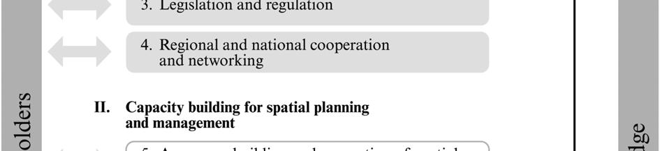


120 108 Figure 1 Implementation process
FAO TECHNICAL WORKSHOP ON A SPATIAL PLANNING DEVELOPMENT PROGRAMME FOR MARINE CAPTURE FISHERIES AND AQUACULTURE
 FAO Fisheries and Aquaculture Report No. 1039 RNE/FIRA/R1039 (En) ISSN 2070-6987 REGIONAL COMMISSION FOR FISHERIES Report of the FAO TECHNICAL WORKSHOP ON A SPATIAL PLANNING DEVELOPMENT PROGRAMME FOR MARINE
RECOFI Technical Workshop on Spatial Planning for Marine Capture Fisheries and Aquaculture Doha, Qatar October 2010
 RECOFI Technical Workshop on Spatial Planning for Marine Capture Fisheries and Aquaculture Doha, Qatar 24 28 October 2010 Disclaimer This is an unedited presentation given at the RECOFI Technical Workshop
REGIONAL COMMISSION FOR FISHERIES (RECOFI) Sixth Session. Rome, Italy, May 2011
 Sixth Session. Rome, Italy, May 2011") arch 2011 RECOFI/VI/2011/5 E REGIONAL COISSION FOR FISERIES (RECOFI) Sixth Session Rome, Italy, 10 12 ay 2011 REGIONAL STRATEGY ON SPATIAL PLANNING FOR ARINE CAPTURE FISERIES AND AQUACULTURE INTRODUCTION
arch 2011 RECOFI/VI/2011/5 E REGIONAL COISSION FOR FISERIES (RECOFI) Sixth Session Rome, Italy, 10 12 ay 2011 REGIONAL STRATEGY ON SPATIAL PLANNING FOR ARINE CAPTURE FISERIES AND AQUACULTURE INTRODUCTION
Courtesy of John Mitchell
 Shrimp trawl fisheries Marine fish stocks are under increasing threat from a range of spatially based problems that might be natural or involve socio-economic factors. To best manage spatial problems,
A TOOLKIT FOR MARINE SPATIAL PLANNING Version: 17 July, 2009
 A TOOLKIT FOR MARINE SPATIAL PLANNING Version: 17 July, 2009 NEED FOR MARINE SPATIAL PLANNING The health of marine ecosystems is declining, and use conflicts in the marine environment are increasing, in
Economic and Social Council
 United Nations Economic and Social Council Distr.: General 18 July 2016 Original: English Committee of Experts on Global Geospatial Information Management Sixth session New York, 3-5 August 2016 Item 2
Marine Spatial Planning: A Tool for Implementing Ecosystem-Based Management
 Marine Spatial Planning: A Tool for Implementing Ecosystem-Based Management Steven Murawski, Ph.D., Ecosystem Goal Team Lead National Oceanic and Atmospheric Administration NOAA November 16, 2009 1 To
INFORMATION RESOURCES FOR MARINE AND AQUATIC SCIENCES RESEARCH IN TRINIDAD AND TOBAGO
 INFORMATION RESOURCES FOR MARINE AND AQUATIC SCIENCES RESEARCH IN TRINIDAD AND TOBAGO Introduction Sharida Hosein The University of the West Indies Campus Libraries St Augustine, Trinidad and Tobago. West
THE SEVILLE STRATEGY ON BIOSPHERE RESERVES
 THE SEVILLE STRATEGY ON BIOSPHERE RESERVES 1 VISION FOR BIOSPHERE RESERVES IN THE 21 ST CENTURY The international Seville Conference on Biosphere Reserves, organised by UNESCO, adopted a two-pronged approach,
Outline National legislative & policy context Regional history with ESSIM ESSIM Evaluation Phase Government Integration via RCCOM Regional ICOM Framew
 What MSP Implementation could change in the Maritimes Region Tim Hall, Regional Manager Oceans and Coastal Management Division Ecosystem Management Branch Fisheries and Oceans Canada Maritimes Region BIO
Designing Networks of Marine Protected Areas in DFO s Three Atlantic Bioregions
 Designing Networks of Marine Protected Areas in DFO s Three Atlantic Bioregions Presentation for Indigenous Protected Areas Workshop Max Westhead, DFO and Adrian Gerhartz-Abraham, Dalhousie March 29, 2017
Country Fiche Estonia
 Country Fiche Estonia Deleted: October Updated May 2018 Deleted: 7 1. General information Size of internal waters (to the baseline) and territorial sea (12-nm zone from the baseline) approximately 25 200
Marine/Maritime Spatial Planning Andrej Abramić
 Marine/Maritime Spatial Planning Andrej Abramić EcoAqua SUMMER SCHOOL: Ecosystem approach to aquaculture 26-29th of October 2015 Research and Technology to enhance excellence in Aquaculture development
Country Fiche Latvia Updated October 2016
 Country Fiche Latvia Updated October 2016 1. General information Marine area under Latvian jurisdiction includes inland sea waters, Territorial sea (12 nautical miles from the baseline) and exclusive economic
Natura 2000 and spatial planning. Executive summary
 Natura 2000 and spatial planning Executive summary DISCLAIMER The information and views set out in this study are those of the author(s) and do not necessarily reflect the official opinion of the Commission.
Economic and Social Council
 United Nation E/C.20/2012/4/Add.1 Economic and Social Council Distr.: General 2 July 2012 Original: English Committee of Experts on Global Geospatial Information Management Second session New York, 13-15
TOWARDS CLIMATE-RESILIENT COASTAL MANAGEMENT: OPPORTUNITIES FOR IMPROVED ICZM IN BELIZE
 TOWARDS CLIMATE-RESILIENT COASTAL MANAGEMENT: OPPORTUNITIES FOR IMPROVED ICZM IN BELIZE CHANTALLE SAMUELS Coastal Zone Management Authority and Institute The Caribbean Community Climate Change Centre VULNERABILITY
HAMILTON DECLARATION ON COLLABORATION FOR THE CONSERVATION OF THE SARGASSO SEA
 HAMILTON DECLARATION ON COLLABORATION FOR THE CONSERVATION OF THE SARGASSO SEA Hamilton, Bermuda 11 March, 2014 WE, THE SIGNATORIES LISTED BELOW: Recognising that the islands of Bermuda are the only land
TOWARDS STRATEGIC SPATIAL PLANNING IN JAMAICA: THE NATIONAL SPATIAL PLAN
 TOWARDS STRATEGIC SPATIAL PLANNING IN JAMAICA: THE NATIONAL SPATIAL PLAN JIEP 5th Biennial Conference on the Environment: Balancing National Development and Environmental Protection June 6, 2011 Jamaica
Country Fiche Estonia
 Country Fiche Estonia Updated October 2017 1. General information Size of internal waters (to the baseline) and territorial sea (12-nm zone from the baseline) approximately 25 200 km 2. Exclusive economic
Marine Spatial Planning (MSP): A practical approach to ecosystembased
: A practical approach to ecosystembased") Marine Spatial Planning (MSP): A practical approach to ecosystembased management Erik Olsen, Institute of Marine Research, Norway Fanny Douvere, International Oceanographic Commission Overview Why we need
Marine Spatial Planning (MSP): A practical approach to ecosystembased management Erik Olsen, Institute of Marine Research, Norway Fanny Douvere, International Oceanographic Commission Overview Why we need
Cross-border Maritime Spatial Plan for the Black sea - Romania and Bulgaria project
 Cross-border Maritime Spatial Plan for the Black sea - Romania and Bulgaria project in Romania and Bulgaria Plan Presentation A first step in the management of the marine areas of Romania and Bulgaria
1. Baltic SCOPE Towards coherence and cross-border solutions in Baltic Maritime Spatial Plans
 NSHC 32th Conference Explanatory Note Dublin, Ireland Item E.2 MSP 21-23 June 2016 Germany Cross border MSP for the EEZ, a case study from the Baltic Sea The Federal Maritime and Hydrographic Agency of
HELSINKI COMMISSION Baltic Marine Environment Protection Commission
 HELSINKI COMMISSION Baltic Marine Environment Protection Commission HELCOM RECOMMENDATION 24/10 Adopted 25 June 2003, having regard to Article 20, Paragraph 1 b) of the 1992 Helsinki Convention IMPLEMENTATION
CAMP SLOVENIA. Mezek Slavko RRC Koper. Project coordinator November 2005
 CAMP SLOVENIA Mezek Slavko RRC Koper Project coordinator November 2005 http://camp.rrc-kp.si/ Content About MAP CAMP programme CAMP Slovenia Project background CAMP Slovenia Project area CAMP Slovenia
Jordan's Strategic Research Agenda in cultural heritage
 Jordan's Strategic Research Agenda in cultural heritage Analysis of main results Alessandra Gandini Amman, Jordan 3 rd November 2013 Main objectives The work performed had the main objective of giving
Economic and Social Council
 United Nations Economic and Social Council Distr.: General 2 July 2012 E/C.20/2012/10/Add.1 Original: English Committee of Experts on Global Geospatial Information Management Second session New York, 13-15
Areas Beyond National Jurisdiction (ABNJ) 2016 Regional Leaders Program. March 22 to April 1, 2016 United Nations, New York
 2016 Regional Leaders Program. March 22 to April 1, 2016 United Nations, New York") Areas Beyond National Jurisdiction (ABNJ) 2016 Regional Leaders Program March 22 to April 1, 2016 United Nations, New York Welcome and Introductions Biliana Cicin-Sain President, Global Ocean Forum Vladimir
Areas Beyond National Jurisdiction (ABNJ) 2016 Regional Leaders Program March 22 to April 1, 2016 United Nations, New York Welcome and Introductions Biliana Cicin-Sain President, Global Ocean Forum Vladimir
Economic and Social Council 2 July 2015
 ADVANCE UNEDITED VERSION UNITED NATIONS E/C.20/2015/11/Add.1 Economic and Social Council 2 July 2015 Committee of Experts on Global Geospatial Information Management Fifth session New York, 5-7 August
Briefing. H.E. Mr. Gyan Chandra Acharya
 Briefing by H.E. Mr. Gyan Chandra Acharya Under-Secretary-General and High Representative for the Least Developed Countries, Landlocked Developing Countries and Small Island Developing States Briefing
Aquaculture Spatial Planning: The case of Greece
 Aquaculture Spatial Planning: The case of Greece Nikos Anagnopoulos Panhellenic Association for Small-Medium sized Aquaculture Enterprises Panhellenic Association for Small-Medium sized Aquaculture Enterprises
Marine Spatial Planning Leslie-Ann McGee Battelle Memorial Institute
 Marine Spatial Planning Leslie-Ann McGee Battelle Memorial Institute Rev061708 1 Marine Spatial Planning What is it? Why is it different? Where is it currently being employed? What is happening in the
Topic 4: Changing cities
 Topic 4: Changing cities Overview of urban patterns and processes 4.1 Urbanisation is a global process a. Contrasting trends in urbanisation over the last 50 years in different parts of the world (developed,
International Journal of Scientific & Engineering Research, Volume 6, Issue 11, November ISSN
 International Journal of Scientific & Engineering Research, Volume 6, Issue 11, November-2015 42 Geospatial Mapping of Fish Farms in Anambra State Using GIS Approach Ojiako, J.C., Okafor, C. M., Igbokwe,
Maritime Spatial Planning
 Maritime Spatial Planning The Dutch experience Kopenhagen 28 november 2012 Lodewijk.Abspoel@minienm.nl North Sea 2 Outline History of MSP in the Netherlands Spatial Plan for the Dutch EEZ, principles and
The Swedish National Geodata Strategy and the Geodata Project
 The Swedish National Geodata Strategy and the Geodata Project Ewa Rannestig, Head of NSDI Co-ordination Unit, Lantmäteriet, ewa.rannstig@lm.se Ulf Sandgren, Project Manager Geodata Project, Lantmäteriet,
16540/14 EE/cm 1 DG E 1A
 Council of the European Union Brussels, 5 December 2014 (OR. en) 16540/14 ENV 965 CULT 139 NOTE From: To: Subject: General Secretariat of the Council Delegations Charter of Rome on Natural and Cultural
CONFERENCE STATEMENT
 Final draft CONFERENCE STATEMENT We, the elected representatives of Canada, Denmark/Greenland, the European Parliament, Finland, Iceland, Norway, Russia, Sweden and the United States of America; In collaboration
Economic and Social Council
 United Nations Economic and Social Council Distr.: General 23 May 2012 Original: English E/CONF.101/100 Tenth United Nations Conference on the Standardization of Geographical Names New York, 31 July 9
Maritime Spatial Planning in the Baltic Sea Region
 Maritime Spatial Planning in the Baltic Sea Region Talis Linkaits Head of VASAB Secretariat 20 May 2015 Helsinki A cooperation of ministers of the 11 Baltic Sea Region countries responsible for spatial
KUNMING FORUM ON UNITED NATIONS GLOBAL GEOSPATIAL INFORMATION MANAGEMENT CITIES OF THE FUTURE: SMART, RESILIENT
 KUNMING FORUM ON UNITED NATIONS GLOBAL GEOSPATIAL INFORMATION MANAGEMENT CITIES OF THE FUTURE: SMART, RESILIENT and SUSTAINABLE Yunnan Zhenzhuang Guest House, Kunming, China 10 12 May 2017 BACKGROUND CONCEPT
Evaluation Model for the Sustainable Development of European Coastal Zones
 Evaluation Model for the Sustainable Development of European Coastal Zones SUMMARY Interreg IIIC - South 2 INDEX 1.- INTRODUCTION... 3 2.- CONTEXT OF DEDUCE... 4 3.- CURRENT SITUATION AND CHALLENGES...
Economic Benefit Study on Value of Spatial Information Australian Experience
 Economic Benefit Study on Value of Spatial Information Australian Experience Dr Zaffar Sadiq Mohamed-Ghouse Director, International Relations Cooperative Research Centre for Spatial Information zsadiq@crcsi.com.au
Marine Spatial Planning in Hellas; Recent Facts and Perspectives
 XXV FIG CONGRESS Engaging the Challenges, Enhancing the Relevance Kuala Lumpur, Malaysia 16 21 June 2014 Marine Spatial Planning in Hellas; Recent Facts and Perspectives Mrs. Chaiditsa BOLANOU Surveying
8 th Arctic Regional Hydrographic Commission Meeting September 2018, Longyearbyen, Svalbard Norway
 8 th Arctic Regional Hydrographic Commission Meeting 11-13 September 2018, Longyearbyen, Svalbard Norway Status Report of the Arctic Regional Marine Spatial Data Infrastructures Working Group (ARMSDIWG)
ECONOMIC AND SOCIAL COUNCIL 13 July 2007
 UNITED NATIONS E/CONF.98/CRP.34 ECONOMIC AND SOCIAL COUNCIL 13 July 2007 Ninth United Nations Conference on the Standardization of Geographical Names New York, 21-30 August 2007 Item 17(b) of the provisional
REGIONAL SDI DEVELOPMENT
 REGIONAL SDI DEVELOPMENT Abbas Rajabifard 1 and Ian P. Williamson 2 1 Deputy Director and Senior Research Fellow Email: abbas.r@unimelb.edu.au 2 Director, Professor of Surveying and Land Information, Email:
R E P U B L I C O F C Y P R U S. NATIONAL REPORT OF CYPRUS TO THE 19 th MEDITERRANEAN AND BLACK SEAS HYDROGRAPHIC COMMISSION (MBSHC)
") R E P U B L I C O F C Y P R U S NATIONAL REPORT OF CYPRUS TO THE 19 th MEDITERRANEAN AND BLACK SEAS HYDROGRAPHIC COMMISSION (MBSHC) BATUMI MEETING 30 JUNE TO 02 JULY 2015 NATIONAL REPORT OF CYPRUS TO THE
R E P U B L I C O F C Y P R U S NATIONAL REPORT OF CYPRUS TO THE 19 th MEDITERRANEAN AND BLACK SEAS HYDROGRAPHIC COMMISSION (MBSHC) BATUMI MEETING 30 JUNE TO 02 JULY 2015 NATIONAL REPORT OF CYPRUS TO THE
Country Fiche Lithuania
 Country Fiche Lithuania Updated June 2018 1. General information The Lithuanian maritime space is delimited by the Decree of the Government of the Republic of Lithuania of 6 December, 2004, No. 1597 and
DELIVERING ECOSYSTEM- BASED MARINE SPATIAL PLANNING IN PRACTICE
 DELIVERING ECOSYSTEM- BASED MARINE SPATIAL PLANNING IN PRACTICE A first assessment for the UK and Ireland January 08 GLOBAL WARMING IMAGES / WWF ABOUT WWF WWF is the world s leading independent conservation
Resolution XIII.23. Wetlands in the Arctic and sub-arctic
 13th Meeting of the Conference of the Contracting Parties to the Ramsar Convention on Wetlands Wetlands for a Sustainable Urban Future Dubai, United Arab Emirates, 21-29 October 2018 Resolution XIII.23
Creating a Staff Development Plan with Esri
 Creating a Staff Development Plan with Esri Michael Green David Schneider Guest Presenter: Shane Feirer, University of California Esri UC 2014 Technical Workshop Agenda What is a Staff Development Plan?
Maritime Spatial Planning: Transboundary Cooperation in the Celtic Seas Looking Ahead
 Maritime Spatial Planning: Transboundary Cooperation in the Celtic Seas Looking Ahead Looking ahead MSP in the context of the European Maritime and Fisheries Fund (EMFF) and beyond SIMCelt Final Conference
RETA 6422: Mainstreaming Environment for Poverty Reduction Category 2 Subproject
 RETA 6422: Mainstreaming Environment for Poverty Reduction Category 2 Subproject A. Basic Data 1. Subproject Title: Poverty-Environment Mapping to Support Decision Making 2. Country Director: Adrian Ruthenberg
Natura 2000 in the marine environment: state of implementation and next steps
 Life on the blue planet: biodiversity research and the new European marine policies EPBRS European Platform on Biodiversity Research Strategy Porto, Portugal 7-9 November 2007 Natura 2000 in the marine
UN-GGIM: Strengthening Geospatial Capability
 Fifth Plenary Meeting of UN-GGIM: Europe Brussels, 6-7 June 2018 UN-GGIM: Strengthening Geospatial Capability Walking the talk to leave no one behind Greg Scott, UN-GGIM Secretariat Environmental Statistics
Spatially Enabled Society
 International Seminar on Land Administration Trends and Issues in Asia and the Pacific Region Spatially Enabled Society Abbas Rajabifard Vice Chair PCGIAP-WG3 Vice-President (President Elect), GSDI Association
Compact guides GISCO. Geographic information system of the Commission
 Compact guides GISCO Geographic information system of the Commission What is GISCO? GISCO, the Geographic Information System of the COmmission, is a permanent service of Eurostat that fulfils the requirements
Training on national land cover classification systems. Toward the integration of forest and other land use mapping activities.
 Training on national land cover classification systems Toward the integration of forest and other land use mapping activities. Guiana Shield 9 to 13 March 2015, Paramaribo, Suriname Background Sustainable
Implementing Rio+20: Integrated Planning For Sustainable Coastal Area Management In the Caribbean Region
 Expert Group Meeting Implementing Rio+20: Integrated Planning For Sustainable Coastal Area Management In the Caribbean Region Address by Ronny Jumeau Seychelles Ambassador for Climate change And SIDS Issues
ACTION PLAN FOR WORLD HERITAGE IN LATIN AMERICA AND THE CARIBBEAN ( )
") Annex ACTION PLAN FOR WORLD HERITAGE IN LATIN AMERICA AND THE CARIBBEAN (2014-2024) The current Regional Action Plan for Latin America and the Caribbean for 2014-2024 has been elaborated by the State Parties
Annex ACTION PLAN FOR WORLD HERITAGE IN LATIN AMERICA AND THE CARIBBEAN (2014-2024) The current Regional Action Plan for Latin America and the Caribbean for 2014-2024 has been elaborated by the State Parties
Economic and Social Council
 United Nations E/CN.3/2019/31 Economic and Social Council Distr.: General 19 December 2018 Original: English Statistical Commission Fiftieth session 5-8 March 2019 Item 4(i) of the provisional agenda*
Concept note. High-Level Seminar: Accelerating Sustainable Energy for All in Landlocked Developing Countries through Innovative Partnerships
 Concept note High-Level Seminar: Accelerating Sustainable Energy for All in Landlocked Developing Countries through Innovative Partnerships Date: 24 and 25 October 2016 Venue: Conference Room C3, Vienna
GEOGRAPHIC INFORMATION SYSTEMS Session 8
 GEOGRAPHIC INFORMATION SYSTEMS Session 8 Introduction Geography underpins all activities associated with a census Census geography is essential to plan and manage fieldwork as well as to report results
KENYA NATIONAL BUREAU OF STATISTICS Workshop on
 KENYA NATIONAL BUREAU OF STATISTICS Workshop on Capacity Building in Environment Statistics: the Framework for the Development of Environment Statistics (FDES 2013) Coordination with Sector Ministries
Building the Sustainable Network of Settlements on the Caspian Sea Region of Kazakhstan
 Building the Sustainable Network of Settlements on the Caspian Sea Region of Kazakhstan Introduction The Ecological Zoning and Identification of Ecological Capacity of Natural and Socio- Economic Potential
An Environmental Profile of the Island of Jost Van Dyke, British Virgin Islands
 An Environmental Profile of the Island of Jost Van Dyke, British Virgin Islands Executive Summary including Little Jost Van Dyke, Sandy Cay, Green Cay and Sandy Spit This publication was made possible
Land Use in the context of sustainable, smart and inclusive growth
 Land Use in the context of sustainable, smart and inclusive growth François Salgé Ministry of sustainable development France facilitator EUROGI vice president AFIGéO board member 1 Introduction e-content+
Marine Spatial Planning as an important tool for implementing the MSFD
 Marine Spatial Planning as an important tool for implementing the MSFD Risto Kalliola Tallinn, Nov. 16 th 2012 DEPARTMENT OF GEOGRAPHY AND GEOLOGY University of Turku, Finland Ten principles to provide
SWEDISH SDI DEVELOPMENT & IMPLEMENTATION OF INSPIRE
 SWEDISH SDI DEVELOPMENT & IMPLEMENTATION OF INSPIRE Christina Wasström, Lantmäteriet, 801 82 Gävle, Sweden, christina.wasstrom@lm.se ABSTRACT The Swedish Government and Parliament has given Lantmäteriet
Ministry of Health and Long-Term Care Geographic Information System (GIS) Strategy An Overview of the Strategy Implementation Plan November 2009
 Strategy An Overview of the Strategy Implementation Plan November 2009") Ministry of Health and Long-Term Care Geographic Information System (GIS) Strategy An Overview of the Strategy Implementation Plan November 2009 John Hill, Health Analytics Branch Health System Information
Ministry of Health and Long-Term Care Geographic Information System (GIS) Strategy An Overview of the Strategy Implementation Plan November 2009 John Hill, Health Analytics Branch Health System Information
Aboriginal communities strengthen governance with location-based tools in the 21st century
 Aboriginal communities strengthen governance with location-based tools in the 21st century Today, Aboriginal communities are taking advantage of the geomatics technologies that underpin popular online
Resolutions from the Tenth United Nations Conference on the Standardization of Geographical Names, 2012, New York*
 UNITED NATIONS GROUP OF EXPERTS ON GEOGRAPHICAL NAMES Twenty-eighth session New York, 28 April 2 May 2014 GEGN/28/9 English Resolutions from the Tenth United Nations Conference on the Standardization of
EUSAIR on sea topics from Slovenian perspective
 MINISTRY OF FOREIGN AFFAIRS REPUBLIC OF SLOVENIA EUSAIR on sea topics from Slovenian perspective Mag. Andreja Jerina National Coordinator 4 EU MRS: 270 millions of population 19 MS 12 non MS Sea basin
MR. George ALEXAKIS, parallel session 3. "Mediterranean Sea Region. laying the conditions. for sustainable growth and jobs"
 parallel session 3 "Mediterranean Sea Region laying the conditions for sustainable growth and jobs" MR. George ALEXAKIS, elected Regional Councillor of Crete, Greece and representative of Crete in CRPM.
IMA s ROLE IN COASTAL AND OCEAN GOVERNANCE IN TRINIDAD AND TOBAGO
 IMA s ROLE IN COASTAL AND OCEAN GOVERNANCE IN TRINIDAD AND TOBAGO Presented by Rahanna Juman, Deputy Director (Ag.) About the Institute of Marine Affairs Institute of Marine Affairs (IMA) was established,
The Governance of Land Use
 The planning system Levels of government and their responsibilities The Governance of Land Use COUNTRY FACT SHEET NORWAY Norway is a unitary state with three levels of government; the national level, 19
SPLAN-Natura Towards an integrated spatial planning approach for Natura th January, 2017 Brussels. Commissioned by DG Environment
 SPLAN-Natura 2000 Towards an integrated spatial planning approach for Natura 2000 Commissioned by DG Environment 17 th January, 2017 Brussels V. Simeonova (Ph.D.) Drivers towards integrating Biodiversity
Marine Spatial Planning in the Baltic Sea Region
 Marine Spatial Planning in the Baltic Sea Region Towards coherence and cross-border solutions in Baltic Maritime Spatial Plans Coordinator & Project manager Dr Ingela Isaksson Swedish Agency for Marine
Mediterranean Sea and Territorial Development, Opportunities and Risks
 EESC Hearing Towards an EU Macro-Regional Strategy for the Mediterranean Mediterranean Sea and Territorial Development, Opportunities and Risks Michaela Gensheimer Structure of Intervention Part I: What
The ESPON Programme. Goals Main Results Future
 The ESPON Programme Goals Main Results Future Structure 1. Goals Objectives and expectations Participation, organisation and networking Themes addressed in the applied research undertaken in ESPON projects
Arctic Spatial Data Infrastructure Enabling Access to Arctic Location-Based Information
 Arctic Spatial Data Infrastructure Enabling Access to Arctic Location-Based Information Arctic SDI Side Event Co-Chairs: Arvo Kokkonen Arctic SDI Board Chair & Director General, National Land Survey of
Implementing the Sustainable Development Goals: The Role of Geospatial Technology and Innovation
 Fifth High Level Forum on UN Global Geospatial Information Management Implementing the Sustainable Development Goals: The Role of Geospatial Technology and Innovation 28-30 November 2017 Sheraton Maria
INSPIRE in Sweden - an Important Part of the National Geodata Strategy
 INSPIRE in Sweden - an Important Part of the National Geodata Strategy Ewa RANNESTIG and Monica LAGERQVIST NILSSON, Sweden Key words: National Geodata Strategy, National Infrastructure for Spatial Information,
2018/1 The integration of statistical and geospatial information. The Regional Committee of UN-GGIM: Americas:
 The following are the conclusions and recommendations of the Regional Committee of the United Nations on Global Geospatial Information Management for the Americas, during its Fifth Session, Thursday 8
CONFERENCE STATEMENT
 CONFERENCE STATEMENT We, the elected representatives from Canada, Denmark/Greenland, Finland, Iceland, Norway, Russia, Sweden and the United States of America; In collaboration with the indigenous peoples
Maritime Spatial Planning Framework Directive Supported by INSPIRE
 Maritime Spatial Planning Framework Directive Supported by INSPIRE Andrej Abramić, Vanda Nunes de Lima, Paul Smits, Emanuele Bigagli, Chris Schubert European Commission Joint Research Centre Institute
FINDINGS OF THE ARCTIC METEOROLOGY SUMMIT
 FINDINGS OF THE ARCTIC METEOROLOGY SUMMIT 2018 WWW.FMI.FI CHAIR S SUMMARY: 1 2 3 We need to be curious to explore the known unknowns. Meteorology is an elemental part of international collaboration in
United Nations Group Of Experts On Geographical Names
 Rudolph MATINDAS, Indonesia or William WATT, Australia Key words: place names, UNGEGN SUMMARY UNGEGN Discussing the strategic aims of UNGEGN and its divisional structure, future direction, and the benefits
Discussion paper on spatial units
 Discussion paper on spatial units for the Forum of Experts in SEEA Experimental Ecosystem Accounting 2018 Version: 8 June 2018 Prepared by: SEEA EEA Revision Working Group 1 on spatial units (led by Sjoerd
Resolution 54/8 E/2011/28 E/CN.7/2011/15
 Noting the report of the International Narcotics Control Board for 2010 on precursors and chemicals frequently used in the illicit manufacture of narcotic drugs and psychotropic substances, 31 in which
Haida Gwaii Queen Charlotte Islands
 Haida Gwaii Queen Charlotte Islands H E R I T A G E T O U R I S M STRATE GY January 2003 Haida Gwaii/Queen Charlotte Islands Heritage Tourism Strategy Working Group The Haida Gwaii/Queen Charlotte Islands
RCOF Review [Regional Climate Outlook Forum for the Gulf of Guinea region of Africa - PRESAGG] Status Report
![RCOF Review [Regional Climate Outlook Forum for the Gulf of Guinea region of Africa - PRESAGG] Status Report](/thumbs/78/77466191.jpg "RCOF Review [Regional Climate Outlook Forum for the Gulf of Guinea region of Africa - PRESAGG] Status Report") RCOF Review 2017 [Regional Climate Outlook Forum for the Gulf of Guinea region of Africa - PRESAGG] Status Report Specific Climate features of concerned region This region typically covers the area below
RCOF Review 2017 [Regional Climate Outlook Forum for the Gulf of Guinea region of Africa - PRESAGG] Status Report Specific Climate features of concerned region This region typically covers the area below
A National Ocean Policy for Malaysia: Rationale and Proposed Components. Mohd Nizam Basiron and Cheryl Rita Kaur Maritime Institute of Malaysia
 A National Ocean Policy for Malaysia: Rationale and Proposed Components Mohd Nizam Basiron and Cheryl Rita Kaur Maritime Institute of Malaysia Outline of Presentation Objectives of Presentation Introduction
International Guidelines for Ecosystem-based, Marine Spatial Management
 International Guidelines for Ecosystem-based, Marine Spatial Management Charles Ehler and Fanny Douvere, Consultants Intergovernmental Oceanographic Commission and Man and the Biosphere Programme UNESCO
Mapping Maine s Working Waterfront: for Our Heritage and Economy
 Mapping Maine s Working Waterfront: for Our Heritage and Economy Abstract Mapping Maine s Working Waterfronts is a collaborative project led by the Island Institute that inventories the state s current
Analysis of Regional Fundamental Datasets Questionnaire
 Permanent Committee on GIS Infrastructure for Asia and the Pacific Working Group 2 Regional Fundamental Data Summary Report on Analysis of Regional Fundamental Datasets Questionnaire ABBAS RAJABIFARD and
CEMAT results - over the years
 CEMAT results - over the years Technical Conference on Functional Areas capitalization of local potential within the territorial development policies in Europe European Conference of Ministers responsible
Policy framework The Netherlands and the Polar Regions, Summary and priorities
 Policy framework The Netherlands and the Polar Regions, 2011-2015 Summary and priorities The policy outlined in this Policy Framework for the Polar Regions (2011-2015) is part of the government s orientation
Educational Qualification No ( No of Positions) 01. Geographic
 01. Geographic") ICZMP, State Project Management Unit-Orissa Plot # 108,Unit VII, Suryanagar,Bhubaneswar 751 003 ICZMP invites applications from eligible candidates for filling up of posts as mentioned below under the
ICZMP, State Project Management Unit-Orissa Plot # 108,Unit VII, Suryanagar,Bhubaneswar 751 003 ICZMP invites applications from eligible candidates for filling up of posts as mentioned below under the