Geographic IR Challenges
|
|
|
- Rosaline Caldwell
- 5 years ago
- Views:
Transcription
1 Geographic IR Challenges by Nuno Cardoso Faculty of Sciences, University of Lisbon, LASIGE Presentation held at SINTEF ICT, Oslo, Norway, 4th December, 2007
2 LaSIGE Laboratory Large-Scale Informatics System Laboratory 4 research groups: XLDB, Navigators, DIALNP, HCIM XLDB research lines: Information retrieval, text mining, natural language processing, web archiving and search, information visualization, bioinformatics XLDB's staff: Ana Paula Afonso, Ana Vaz, André Falcão, Catarina Rodrigues, Cátia Pesquita, Daniel Faria, Daniel Gomes, David Cruz, Francisco Couto, Hugo Bastos, Leonardo Andrade, Liliana Moreira, Luís Russo, Marcirio Chaves, Mário Silva, Nuno Cardoso, Paulo Carreira, Paulo Pombinho, Sérgio Freitas, Tiago Grego (In bold: Linguateca 's XLDB Node)
3 Linguateca, a project for Portuguese A distributed resource center for Portuguese language technology IRE model: Information Resources Evaluation Oslo 2.5 Braga São Carlos Porto 2 Odense Lisboa 2.8 COMPARA 4 (2.8) Lisboa LabEL Lisboa 3 XLDB Coimbra 3 XLDB / LaSIGE
4 Human capital of Linguateca (in bold: intersection with XLDB) Senior researchers: Diana Santos, José João Almeida, Eckhard Bick, Belinda Maia, Ana Frankenberg Garcia, Mário J. Silva, Paulo Gomes, Luís Costa Researchers: Luís Miguel Cabral, Susana Inácio, Rosário Silva, Paulo Rocha, Cláudia Freitas (PhD), Sérgio Matos (PhD), Hugo Oliveira, Pedro Martins, David Cruz PhD students: Marcirio Chaves, Alberto Simões, Nuno Seco, Anabela Barreiro, Nuno Cardoso Former: Rachel Aires (PhD, 2005), Signe Oksefjell, Susana Afonso, Raquel Marchi, Renato Haber, Alex Soares, Pedro Moura, Ana Sofia Pinto, Débora Oliveira, Isabel Marcelino, Cristina Mota, Luís Sarmento, António Silva, Rui Vilela In all, 36 (22) persons with some link to Linguateca (not counting trainees or undergraduate students)
5 Presentation overview 1) What is GIR? GIR terminology Motivation for GIR 2) GIR approaches The case of GeoTumba 3) GIR evaluation In-house evaluation of GIR components International evaluation contests: GeoCLEF 4) My PhD research plan 5
6 1) What is GIR? GIR terminology Motivation for GIR 6
7 GIR terminology Why is it important? We are dealing with words written in natural language that correspond to concepts. Mapping words in context to concepts is not straightforward... Language World (representation of) WORDS CONCEPTS 7
8 GIR terminology Words with geographic meaning: Placenames words used to name places. For example: Oslo, Trøndelag, Norway, Scandinavia, Syden, Middle East. Language Common nouns words denoting classes of places. For example: island, mountain, lake, city, country, continent. Relators words used to establish a relation between entities (verbs, prepositions, adverbs, etc). For example: near, located in, on the shores of, up. 8
9 GIR Terminology (cont.) Geographical concepts: Features (ISO-19109) an unambiguous location. It can be described by one or more placenames. For example: Paris. Feature Types (ISO-19109) classes of features. For example, island, mountain, lake (physical), city, continent, NUT-3 (administrative). A feature has only one feature type. Relations Links joining features OR feature types: part of, adjacent, capital of, etc. Examples: [Oslo] part-of [Norway], [city] part-of [country]. World (representation of) 9

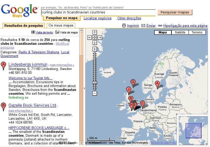
10 Geographic Information Retrieval Geographic Information Retrieval (GIR) = Information Retrieval (IR) + geographic reasoning! Goal: research methods to retrieve relevant information in a document collection. Relevance now comes twofold: Thematical (ex: Find me documents about curling! ) Geographical (ex: in the Scandinavian countries ) 10

11 Google search for curling... OK. 11

12 Google search for Curling IN Scandinavian countries 12
 Local Google (= Google Maps) How well are they handling our")
13 Web search engines go local... Local Yahoo! (local.yahoo.com) Local Google (= Google Maps) How well are they handling our geographic restrictions? 13

14 Curling in Norway, Yahoo! local... Ok, it's better to not even try IN Scandinavian countries... 14
15 !!! 15

16 No Norwegian curling clubs? 16
17 Motivation for GIR Users have information needs that have a given scope of interest. Present search engines do not understand placenames in queries as a different kind of relevance criteria. Documents should be retrieved according to topic relevance and geographic relevance. IR systems must adapt to the users, and not the users to the IR system! 17
18 2) GIR approaches Overview of IR and GIR The case of GeoTumba 18
19 How does a typical web IR system work? 1) Crawling: downloads all documents from the web; 2) Storage: pre-processes and stores documents locally; 3) Indexing and Ranking: generates term indexes and weighs documents; 4) Interface: processes queries and presents results to the user. 19
. Many systems with different approaches. - GeoCLEF 2007: 13 participants, 8 approaches!")
20 How does a web GIR system work?... can't tell! GIR is a recent area: First workshop: Analysis of Geographical References, hosted in NAACL-HLT in Annual GIR workshops started in Evaluation contests started in 2005 (GeoCLEF). Many systems with different approaches. - GeoCLEF 2007: 13 participants, 8 approaches! Mandl et al, Overview of GeoCLEF
21 The case of GeoTumba is a web search engine with geographic capabilities developed by the University of Lisbon. Research Team: Mário J. Silva (head), Ana Paula Afonso, Bruno Martins, David Cruz, Marcirio Chaves, Nuno Cardoso and Paulo Pombinho, Leonardo Andrade and Sérgio Freitas GREASE project since January Diana Santos and Chris Jones (advisors) Collaboration with SINTEF/Linguateca. 21
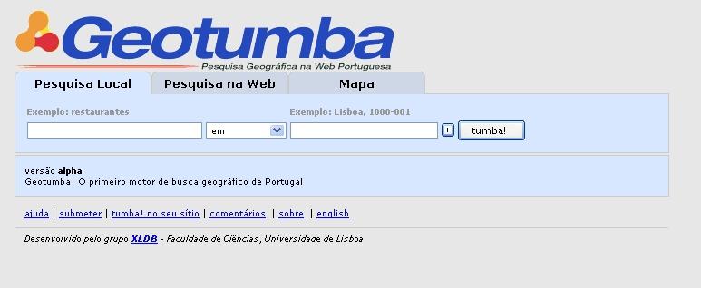
22 22

23 's main characteristics: Geographic knowledge: provided by a geographic ontology, GeoNET PT 01. Text mining for placenames, match them into features of the ontology. Assign a list of features to each document, the document geographic signature. The non-geographic part (curling) is ranked by text weighting scheme BM25; geographic part (Norway) is ranked by a set of heuristics. Doc. ranking score: 0.5 non-geo geo. 23
24 GIR system (2007) QueOnde Query parser Queries what spatial relat. where Query string: QuerCol Query expansion QE terms + Query signature Geographic Ontology d oc um t en s Faísca Text Mining Document signatures Geo Index Sidra5 Indexing Term Index Sidra5 Ranking Results 24
25 GIR system (2007) 1. Query parsing Queries Query string: QuerCol Query expansion QE terms + Query signature Geographic where> Splits into <what, spat.rel., Ontology Recognizes features & feature types Faísca s t Text en m Mining Example: cu do what spatial relat. where QueOnde Query parser Document signatures Sea traffic in Sea traffic Geo Index Sidra5 Sidra5 Portuguese islands = Ranking Indexing Term Results Index in Portugal islands 25
26 GIR system (2007) 2. Query expansion Queries QueOnde Query parser 1. Term expansion: what spatial relat. where Geographic Ontology Blind Relevance Feedback 2. Geographic expansion: Faísca Document do c s nt e based um Query string: QuerCol Query expansion QE terms + Query signature Example: Portugal islands Geo Index Text onmining query type,signatures driven by Sidra5 Madeira, Sidra5 Results Porto Santo, Ranking Indexing Term spatial rel., features & feat. types São Miguel, Faial, Pico, Index S. Jorge, Terceira, etc... 26


27 GIR system (2007) 3. Geographic knowledge QueOnde Query parser Queries what spatial relat. where Query string: QuerCol Query expansion QE terms + Query signature Geographic Ontology d oc um t en s Query Faísca Text Mining Document patterns parsing Geo Index signatures Sidra5 Indexing patterns Text mining Geographic query expansion Term Index Sidra5 Ranking Results 27
28 Our geographic ontology Encodes geographic knowledge and provides it to GIR components. Contains features, feature types and relationships among them. 28
29 Mapping placenames into features and feature types 1) sea traffic in Portugal 2) sea traffic in islands 3) sea traffic in Portuguese islands Europe ONTOLOGY Norway Lisbon Oslo Magerøya isl. 2) Svinør isl. 1) Portugal S. Miguel Isl. Madeira Isl. 3) 29
30 GIR open questions... How to represent geographic knowledge? How to use it properly on GIR components? How to handle ambiguity of placenames in documents and queries? How to classify documents geographically? How to measure the geographic affinity between queries and documents? How to present the results to the user? 30
31 3) GIR Evaluation In-house evaluation of GIR components International evaluation contests: GeoCLEF 31
32 Evaluation of GIR systems 1) In-house evaluation test each GIR component in a glass-box style evaluation. analyse points of failure, measure performance of each component. 2) Evaluation contests black-box style evaluation. compare different systems, several approaches. common evaluation environment. 32
33 GeoCLEF evaluation setup Text collections: newspapers in 3 languages Portuguese collection provided by Linguateca. Every year, 25 topics released in several languages. Relevance judgement made by humans Measure: Prec., Rec., MAP,... <top> <num> /51-gc</num> <title>oil and gas extraction found between the UK and the European Continent</title> <desc>to be relevant documents describing oil or gas production between the UK and the European continent will be relevant</desc> <narr>oil and gas fields in the North Sea will be relevant.</narr> </top> 33
34 Our evaluation results so far XLDB participated in GeoCLEF 2005, 2006 and 2007 (since its beginning). Main challenge: outperform IR. So far, GIR failed to outperform IR (same results for other groups). What are we doing wrong? approach? query processing? text mining? geographic ranking? scope assignment? Only detailed evaluation will tell... 34
35 XLDB in GeoCLEF 2007 IR outperformed by a IR/GIR mixed strategy. Our GIR only approach still worse than IR! In progress: Detailed analysis for each of the 25 topics. Thorough evaluation on each GIR component: query parsing, query expansion, text mining, index & ranking. 35
36 4) My PhD Research Plan 36
37 PhD Grant Automatic Query Reformulation for Web Geographic Search Engines PhD advisors: Diana Santos (Linguateca/SINTEF ICT) Mário J. Silva (University of Lisbon) Started 1st March year scholarship 37
38 Milestones 2007/2008 1st step: GeoCLEF experiments. 2 nd done. step: Evaluation. ongoing. a) Detailed error analysis of each topic. b) development of a good evaluation environment. 3rd step: Acquiring information about nonstandard placenames. planned. Example: SINTEF, Eiffel Tower, Ground Zero implies new NER system with relation extraction. Evaluate it in Second HAREM th 4 Step: GeoCLEF
39 2a) Kinds of possible errors Off-line processing: Document processing: failure to capture geographic evidence (placenames and relations), failure to reason into ontology features. Document Geographic Signatures: erroneous ranking of irrelevant geographic evidence. 39
40 2a) Kinds of possible errors On-line: Query parsing: failure to detect relevant terms, spatial relationship, feature and feature types. Term Expansion: adding unrelated terms, skipping related terms. Ontology Processing: failure to translate query scope into a list of features Document Ranking: failure to bring relevant documents to the top of the result list. Analyse one topic and identify points of failure. 40


41 2b) In-house evaluation environment Input: topics/queries and human relevance judgements. Output: evaluation reports. Desiderata: Measure each component separately. Logging and debugging capabilities for each point of failure. Invoke components under controlled scenarios. 41
42 2b) In-house evaluation environment Evaluation for different scenarios: Topic by topic debug a particular component or a query. By topic type measure system's ability to deal with a particular type of input. See Santos & Chaves (2005) type classification Overall measure global performance and contribution of each component to the overall results. 42
43 3) non-standard placenames Ex: SINTEF, Eiffel Tower, Ground Zero Develop a new NER system, REMBRANDT Detection of placenames in context Why? Try Norwegian Wood Exploit Wikipedia's link structure, category and annotation metadata, and entity relation detection. Participation in Second HAREM (March 2008) Independent evaluation contest, with already manually annotated corpora 43
44 4) GeoCLEF 2008 Improve GIR system with REMBRANDT Use evaluation environment to measure impact on performance Participation in GeoCLEF 2008 (May/June 2008) Special sub-task for Wikipedia 44

45 For GeoCLEF 2008: Pilot subtask: use Wikipedia snapshot as document collection: Richer resource for documents with geographic content; allows different types of topics. Documents about Riots in Los Angeles is more likely to be found in newspapers but documents about Vineyard areas near European rivers more likely to be reported in Wikipedia. 45
46 Epilogue GIR systems are useful and challenging Still on its early steps, still not clear what are the most promising approaches More message understanding & geographic reasoning must be made carefully How to measure progress: evaluation, evaluation, evaluation. 46
47 Geographic IR Challenges The End. by Nuno Cardoso Faculty of Sciences, University of Lisbon, LASIGE Presentation held at SINTEF ICT, Oslo, Norway, 4th December, 2007
48 Entity Relation Extraction for placenames Inclusion: (ex: Adelaide, Australia ): Australia suggests that Adelaide is a placename, not a proper name Grounding: (ex: SINTEF ICT is in the outskirts of Oslo ) - now, I know that documents mentioning SINTEF ICT may have Oslo as a potential scope of interest (Ex: research units near Oslo ). partof(adelaide, Australia) locatedin(sintef ICT, Oslo) Alternative: (ex: California as CA ) Alternative(CA, California) 48
Toponym Disambiguation using Ontology-based Semantic Similarity
 Toponym Disambiguation using Ontology-based Semantic Similarity David S Batista 1, João D Ferreira 2, Francisco M Couto 2, and Mário J Silva 1 1 IST/INESC-ID Lisbon, Portugal {dsbatista,msilva}@inesc-id.pt
4CitySemantics. GIS-Semantic Tool for Urban Intervention Areas
 4CitySemantics GIS-Semantic Tool for Urban Intervention Areas Nuno MONTENEGRO 1 ; Jorge GOMES 2 ; Paulo URBANO 2 José P. DUARTE 1 1 Faculdade de Arquitectura da Universidade Técnica de Lisboa, Rua Sá Nogueira,
Pair: 1 Paulo Sarmento - João Vide Barbosa. Score: 135,04 «Rank: 1. Rnd Tbl As Opp Board Contr Ld Result Score Round Acc Opponent name
 Pair: 1 Paulo Sarmento - João Vide Barbosa Score: 135,04 «Rank: 1 1 A 2 E-W 7 17 4 N -1 2-50 2,00 Barbosa - Teixeira 18 5 W = 2-450 2,80 19 5 S +1 K 480 4,40 20 2 S +1 2 140 2,80 21 4 N -1 8-100 3,20 22
Indexing Structures for Geographic Web Retrieval
 Indexing Structures for Geographic Web Retrieval Leonardo Andrade 1 and Mário J. Silva 1 University of Lisboa, Faculty of Sciences Abstract. Context-aware search in mobile web environments demands new
TALP at GeoQuery 2007: Linguistic and Geographical Analysis for Query Parsing
 TALP at GeoQuery 2007: Linguistic and Geographical Analysis for Query Parsing Daniel Ferrés and Horacio Rodríguez TALP Research Center Software Department Universitat Politècnica de Catalunya {dferres,horacio}@lsi.upc.edu
INSPIRE implementation in Portugal: the operational approach
 INSPIRE implementation in Portugal: the operational approach REIS, Rui; SANTOS, Ana Sofia; FONSECA, Alexandra; SILVA, Henrique; GOMES, Ana Luisa; FURTADO, Danilo; GEIRINHAS, João rui.reis@igeo.pt AGENDA
Citation for published version (APA): Andogah, G. (2010). Geographically constrained information retrieval Groningen: s.n.
: Andogah, G. (2010). Geographically constrained information retrieval Groningen: s.n.") University of Groningen Geographically constrained information retrieval Andogah, Geoffrey IMPORTANT NOTE: You are advised to consult the publisher's version (publisher's PDF) if you wish to cite from
University of Groningen Geographically constrained information retrieval Andogah, Geoffrey IMPORTANT NOTE: You are advised to consult the publisher's version (publisher's PDF) if you wish to cite from
Universities of Leeds, Sheffield and York
 promoting access to White Rose research papers Universities of Leeds, Sheffield and York http://eprints.whiterose.ac.uk/ White Rose Research Online URL for this paper: http://eprints.whiterose.ac.uk/4559/
Spatial Role Labeling CS365 Course Project
 Spatial Role Labeling CS365 Course Project Amit Kumar, akkumar@iitk.ac.in Chandra Sekhar, gchandra@iitk.ac.in Supervisor : Dr.Amitabha Mukerjee ABSTRACT In natural language processing one of the important
Information Retrieval and Organisation
 Information Retrieval and Organisation Chapter 13 Text Classification and Naïve Bayes Dell Zhang Birkbeck, University of London Motivation Relevance Feedback revisited The user marks a number of documents
Francisco M. Couto Mário J. Silva Pedro Coutinho
 Francisco M. Couto Mário J. Silva Pedro Coutinho DI FCUL TR 03 29 Departamento de Informática Faculdade de Ciências da Universidade de Lisboa Campo Grande, 1749 016 Lisboa Portugal Technical reports are
Progress on digitising Portuguese and Chilean surface data plus Spanish pilot balloon data
 Progress on digitising Portuguese and Chilean surface data plus Spanish pilot balloon data Maria Antónia Valente, Maria Clara Ventura, Pedro Gomes, Maria Helena Cordeiro, Maria João Rocha, Sérgio João,
Navigating to Success: Finding Your Way Through the Challenges of Map Digitization
 Library Faculty Presentations Library Faculty/Staff Scholarship & Research 10-15-2011 Navigating to Success: Finding Your Way Through the Challenges of Map Digitization Cory K. Lampert University of Nevada,
From Research Objects to Research Networks: Combining Spatial and Semantic Search
 From Research Objects to Research Networks: Combining Spatial and Semantic Search Sara Lafia 1 and Lisa Staehli 2 1 Department of Geography, UCSB, Santa Barbara, CA, USA 2 Institute of Cartography and
Microalgae production for commercial purposes in the Azores
 , Plant Biotechnology Ponta Delgada, 25 Janeiro, 2011 Microalgae production for commercial purposes in the Azores Xavier ED, Teves L, Mota G & Neto AI CIRN and Grupo de Biologia Marinha, Departamento Biologia,
Collaborative Systems for the Creation of Marine Services
 Collaborative Systems for the Creation of Marine Services INSPIRE 2016 Nuno Almeida Nuno Catarino Barcelona, 28 th September 2016 Elecnor Deimos is a trademark which encompasses Elecnor Group companies
Department of Computer Science and Engineering Indian Institute of Technology, Kanpur. Spatial Role Labeling
 Department of Computer Science and Engineering Indian Institute of Technology, Kanpur CS 365 Artificial Intelligence Project Report Spatial Role Labeling Submitted by Satvik Gupta (12633) and Garvit Pahal
Principles of IR. Hacettepe University Department of Information Management DOK 324: Principles of IR
 Principles of IR Hacettepe University Department of Information Management DOK 324: Principles of IR Some Slides taken from: Ray Larson Geographic IR Overview What is Geographic Information Retrieval?
Understanding Interlinked Data
 Understanding Interlinked Data Visualising, Exploring, and Analysing Ontologies Olaf Noppens and Thorsten Liebig (Ulm University, Germany olaf.noppens@uni-ulm.de, thorsten.liebig@uni-ulm.de) Abstract Companies
Collaborative NLP-aided ontology modelling
 Collaborative NLP-aided ontology modelling Chiara Ghidini ghidini@fbk.eu Marco Rospocher rospocher@fbk.eu International Winter School on Language and Data/Knowledge Technologies TrentoRISE Trento, 24 th
Text Mining. Dr. Yanjun Li. Associate Professor. Department of Computer and Information Sciences Fordham University
 Text Mining Dr. Yanjun Li Associate Professor Department of Computer and Information Sciences Fordham University Outline Introduction: Data Mining Part One: Text Mining Part Two: Preprocessing Text Data
PORTUGAL NATIONAL REPORT
 PORTUGAL NATIONAL REPORT 13 TH SOUTHERN AFRICA AND ISLANDS HYDROGRAPHIC COMMISSION MEETING Cape Town, South Africa 29 th 31 st August 2016 INSTITUTO HIDROGRÁFICO Miguel Arenga IHPT Head of the Hydrography
Spatial Information Retrieval
 Spatial Information Retrieval Wenwen LI 1, 2, Phil Yang 1, Bin Zhou 1, 3 [1] Joint Center for Intelligent Spatial Computing, and Earth System & GeoInformation Sciences College of Science, George Mason
INFO 4300 / CS4300 Information Retrieval. slides adapted from Hinrich Schütze s, linked from
 INFO 4300 / CS4300 Information Retrieval slides adapted from Hinrich Schütze s, linked from http://informationretrieval.org/ IR 26/26: Feature Selection and Exam Overview Paul Ginsparg Cornell University,
Many Ways to Name a Place
 Your web browser (Safari 7) is out of date. For more security, comfort and Activityapply the best experience on this site: Update your browser Ignore Many Ways to Name a Place What are the names for the
Smart Data Collection and Real-time Digital Cartography
 Smart Data Collection and Real-time Digital Cartography Yuji Murayama and Ko Ko Lwin Division of Spatial Information Science Faculty of Life and Environmental Sciences University of Tsukuba IGU 2013 1
Lecture 5: Web Searching using the SVD
 Lecture 5: Web Searching using the SVD Information Retrieval Over the last 2 years the number of internet users has grown exponentially with time; see Figure. Trying to extract information from this exponentially
The Relevance of Spatial Relation Terms and Geographical Feature Types
 The Relevance of Spatial Relation Terms and Geographical Feature Types Reporter Chunju Zhang Date: 2012-05-29 1 2 Introduction Classification of Spatial Relation Terms 3 4 5 Calculation of Relevance Conclusion
UBGI and Address Standards
 Workshop on address standards UBGI and Address Standards 2008. 5.25 Copenhagen, Denmark Sang-Ki Hong Convenor, WG 10 1 Evolution of Geographic Information Visualization Feature (Contents) Context Accessibility
Special Topics in Computer Science
 Special Topics in Computer Science NLP in a Nutshell CS492B Spring Semester 2009 Speaker : Hee Jin Lee p Professor : Jong C. Park Computer Science Department Korea Advanced Institute of Science and Technology
INSPIRE - A Legal framework for environmental and land administration data in Europe
 INSPIRE - A Legal framework for environmental and land administration data in Europe Dr. Markus Seifert Bavarian Administration for Surveying and Cadastre Head of the SDI Office Bavaria Delegate of Germany
Mining coreference relations between formulas and text using Wikipedia
 Mining coreference relations between formulas and text using Wikipedia Minh Nghiem Quoc 1, Keisuke Yokoi 2, Yuichiroh Matsubayashi 3 Akiko Aizawa 1 2 3 1 Department of Informatics, The Graduate University
13 Searching the Web with the SVD
 13 Searching the Web with the SVD 13.1 Information retrieval Over the last 20 years the number of internet users has grown exponentially with time; see Figure 1. Trying to extract information from this
9 Searching the Internet with the SVD
 9 Searching the Internet with the SVD 9.1 Information retrieval Over the last 20 years the number of internet users has grown exponentially with time; see Figure 1. Trying to extract information from this
CLRG Biocreative V
 CLRG ChemTMiner @ Biocreative V Sobha Lalitha Devi., Sindhuja Gopalan., Vijay Sundar Ram R., Malarkodi C.S., Lakshmi S., Pattabhi RK Rao Computational Linguistics Research Group, AU-KBC Research Centre
Can Vector Space Bases Model Context?
 Can Vector Space Bases Model Context? Massimo Melucci University of Padua Department of Information Engineering Via Gradenigo, 6/a 35031 Padova Italy melo@dei.unipd.it Abstract Current Information Retrieval
Institute of Geography and Spatial Planning (Portugal
 Institute of Geography and Spatial Planning (Portugal Institutional Information (Last update at: 05/0/015) School/Department name (Native language) AESOP reg Number AESOP Member Status University Address
THE DEVELOPMENT OF ROAD ACCIDENT DATABASE MANAGEMENT SYSTEM FOR ROAD SAFETY ANALYSES AND IMPROVEMENT
 THE DEVELOPMENT OF ROAD ACCIDENT DATABASE MANAGEMENT SYSTEM FOR ROAD SAFETY ANALYSES AND IMPROVEMENT By T. H. Law Radin Umar R. S. (Road Safety Research Center, Faculty of Engineering, University Putra
Test and Evaluation of an Electronic Database Selection Expert System
 282 Test and Evaluation of an Electronic Database Selection Expert System Introduction As the number of electronic bibliographic databases available continues to increase, library users are confronted
Geological information for Europe : Towards a pan-european Geological Data Infrastructure
 Geological information for Europe : Towards a pan-european Geological Data Infrastructure Integrating geoscientific information for EU competitiveness Co-funded by the European Union European societal
YIC2012 Young Investigators Conference
 YIC2012 Young Investigators Conference Proceedings of the First ECCOMAS Young Investigators Conference on Computational Methods in Applied Sciences in conjunction with the ECCOMAS 2nd PhD Olympiad held
CIDOC-CRM Method: A Standardisation View. Haridimos Kondylakis, Martin Doerr, Dimitris Plexousakis,
 The CIDOC CRM CIDOC-CRM Method: A Standardisation View Haridimos Kondylakis, Martin Doerr, Dimitris Plexousakis, Center for Cultural Informatics, Institute of Computer Science Foundation for Research and
Geospatial Information and Documents
 Geospatial Information and Documents PAKDD Workshop May 29 - June 1, 2012 Kuala Lumpur, Malaysia i EDITORIAL Geographical or spatial information is now included in most of exchanged data. Sometimes, it
From User Requirements Analysis to Conceptual Design of a Mobile Augmented Reality Tool to be used in an Urban Geography Fieldwork Setting
 From User Requirements Analysis to Conceptual Design of a Mobile Augmented Reality Tool to be used in an Urban Geography Fieldwork Setting Xiaoling Wang, Corné P.J.M. van Elzakker, Menno-Jan Kraak 2016
Parsing with CFGs L445 / L545 / B659. Dept. of Linguistics, Indiana University Spring Parsing with CFGs. Direction of processing
 L445 / L545 / B659 Dept. of Linguistics, Indiana University Spring 2016 1 / 46 : Overview Input: a string Output: a (single) parse tree A useful step in the process of obtaining meaning We can view the
Parsing with CFGs. Direction of processing. Top-down. Bottom-up. Left-corner parsing. Chart parsing CYK. Earley 1 / 46.
 : Overview L545 Dept. of Linguistics, Indiana University Spring 2013 Input: a string Output: a (single) parse tree A useful step in the process of obtaining meaning We can view the problem as searching
Improving Gene Functional Analysis in Ethylene-induced Leaf Abscission using GO and ProteInOn
 Improving Gene Functional Analysis in Ethylene-induced Leaf Abscission using GO and ProteInOn Sara Domingos 1, Cátia Pesquita 2, Francisco M. Couto 2, Luis F. Goulao 3, Cristina Oliveira 1 1 Instituto
Using the 2008 TerraViva! SEDAC Viewer in the Classroom
 Using the 2008 TerraViva! SEDAC Viewer in the Classroom Robert R. Downs Center for International Earth Science Information Network (CIESIN) The Earth Institute, Columbia University Prepared for presentation
3D Urban Information Models in making a smart city the i-scope project case study
 UDC: 007:528.9]:004; 007:912]:004; 004.92 DOI: 10.14438/gn.2014.17 Typology: 1.04 Professional Article 3D Urban Information Models in making a smart city the i-scope project case study Dragutin PROTIĆ
A Comparison of Approaches for Geospatial Entity Extraction from Wikipedia
 A Comparison of Approaches for Geospatial Entity Extraction from Wikipedia Daryl Woodward, Jeremy Witmer, and Jugal Kalita University of Colorado, Colorado Springs Computer Science Department 1420 Austin
GIR Experimentation. Abstract
 GIR Experimentation Andogah Geoffrey Computational Linguistics Group Centre for Language and Cognition Groningen (CLCG) University of Groningen Groningen, The Netherlands g.andogah@rug.nl, annageof@yahoo.com
Introduction to Coastal GIS
 Introduction to Coastal GIS Event was held on Tues, 1/8/13 - Thurs, 1/10/13 Time: 9:00 am to 5:00 pm Location: Roger Williams University, Bristol, RI Audience: The intended audiences for this course are
Map Reading: Grades 4 & 5
 Map Reading: Grades 4 & 5 Grades: 4,5 Team Size: 1-2 competitors Duration: 25 minutes Supervisors: Sriram Garapati, Rebecca Neill-Totsuka Summary Description Students will solve a mystery using different
Latent Variable Models in NLP
 Latent Variable Models in NLP Aria Haghighi with Slav Petrov, John DeNero, and Dan Klein UC Berkeley, CS Division Latent Variable Models Latent Variable Models Latent Variable Models Observed Latent Variable
Interactive Visualization Tool (InViTo)
") Interactive Visualization Tool (InViTo) Stefano Pensa To cite this report: Stefano Pensa (2012) Interactive Visualization Tool (InViTo), in Angela Hull, Cecília Silva and Luca Bertolini (Eds.) Accessibility
Interactive Visualization Tool (InViTo) Stefano Pensa To cite this report: Stefano Pensa (2012) Interactive Visualization Tool (InViTo), in Angela Hull, Cecília Silva and Luca Bertolini (Eds.) Accessibility
PV211: Introduction to Information Retrieval
 PV211: Introduction to Information Retrieval http://www.fi.muni.cz/~sojka/pv211 IIR 11: Probabilistic Information Retrieval Handout version Petr Sojka, Hinrich Schütze et al. Faculty of Informatics, Masaryk
Mining Newsgroups Using Networks Arising From Social Behavior by Rakesh Agrawal et al. Presented by Will Lee
 Mining Newsgroups Using Networks Arising From Social Behavior by Rakesh Agrawal et al. Presented by Will Lee wwlee1@uiuc.edu September 28, 2004 Motivation IR on newsgroups is challenging due to lack of
Metrics for Data Uniformity of User Scenarios through User Interaction Diagrams
 Metrics for Data Uniformity of User Scenarios through User Interaction Diagrams Douglas Hiura Longo and Patrícia Vilain Informatics and Statistics Department, Federal University of Santa Catarina, Florianopolis,
INTRODUCTION. In March 1998, the tender for project CT.98.EP.04 was awarded to the Department of Medicines Management, Keele University, UK.
 INTRODUCTION In many areas of Europe patterns of drug use are changing. The mechanisms of diffusion are diverse: introduction of new practices by new users, tourism and migration, cross-border contact,
Chapter 6 Test Northern Europe 1
 Name Score Chapter 6 Test Northern Europe Part 1 Labeling A. (5 pts.) Locate the countries in the word box below on the map of Northern Europe on the next page. Write the name of the country in the correct
Geographic Analysis of Linguistically Encoded Movement Patterns A Contextualized Perspective
 Geographic Analysis of Linguistically Encoded Movement Patterns A Contextualized Perspective Alexander Klippel 1, Alan MacEachren 1, Prasenjit Mitra 2, Ian Turton 1, Xiao Zhang 2, Anuj Jaiswal 2, Kean
IRDAT Fvg, evolving a regional Spatial Data Infrastructure according to INSPIRE
 IRDAT Fvg, evolving a regional Spatial Data Infrastructure according to INSPIRE Tutti i diritti riservati. Proprietà INSIEL SpA. A. Benvenuti, A. Chiarandini Insiel (Italy) M. Lunardis - Friuli Venezia
PORTUGAL NATIONAL REPORT
 PORTUGAL NATIONAL REPORT 14 TH MEETING OF THE EASTERN ATLANTIC HYDROGRAPHIC COMMISSION Cadiz, Spain 18 th 20 th October 2016 INSTITUTO HIDROGRÁFICO Miguel Arenga IHPT Head of the Hydrography Division 2016-10-18
A General Framework for Conflation
 A General Framework for Conflation Benjamin Adams, Linna Li, Martin Raubal, Michael F. Goodchild University of California, Santa Barbara, CA, USA Email: badams@cs.ucsb.edu, linna@geog.ucsb.edu, raubal@geog.ucsb.edu,
A SEMANTIC SCHEMA FOR GEONAMES. Vincenzo Maltese and Feroz Farazi
 DISI - Via Sommarive 14-38123 Povo - Trento (Italy) http://www.disi.unitn.it A SEMANTIC SCHEMA FOR GEONAMES Vincenzo Maltese and Feroz Farazi January 2013 Technical Report # DISI-13-004 A semantic schema
Spatio-Textual Indexing for Geographical Search on the Web
 Spatio-Textual Indexing for Geographical Search on the Web Subodh Vaid 1, Christopher B. Jones 1, Hideo Joho 2 and Mark Sanderson 2 1 School of Computer Science, Cardiff University, UK email: {c.b.jones,
Application of GIS in Public Transportation Case-study: Almada, Portugal
 Case-study: Almada, Portugal Doutor Jorge Ferreira 1 FSCH/UNL Av Berna 26 C 1069-061 Lisboa, Portugal +351 21 7908300 jr.ferreira@fcsh.unl.pt 2 FSCH/UNL Dra. FCSH/UNL +351 914693843, leite.ines@gmail.com
Design of Indicators to monitor Strategic priorities: Mapping Knowledge Clusters
 Design of Indicators to monitor Strategic priorities: Mapping Knowledge Clusters 5 th International Workshop Sharing the Best Practices in R&D and Education Statistics - Informing National and Institutional
Automated Geoparsing of Paris Street Names in 19th Century Novels
 Automated Geoparsing of Paris Street Names in 19th Century Novels L. Moncla, M. Gaio, T. Joliveau, and Y-F. Le Lay L. Moncla ludovic.moncla@ecole-navale.fr GeoHumanities 17 L. Moncla GeoHumanities 17 2/22
Lecture Notes on Inductive Definitions
 Lecture Notes on Inductive Definitions 15-312: Foundations of Programming Languages Frank Pfenning Lecture 2 September 2, 2004 These supplementary notes review the notion of an inductive definition and
Exploring Spatial Relationships for Knowledge Discovery in Spatial Data
 2009 International Conference on Computer Engineering and Applications IPCSIT vol.2 (2011) (2011) IACSIT Press, Singapore Exploring Spatial Relationships for Knowledge Discovery in Spatial Norazwin Buang
MME2013 CONFERENCE PROGRAM
 MME2013 CONFERENCE PROGRAM PROGRAM OF THE 2013 MATHEMATICAL METHODS IN ENGINEERING INTERNATIONAL CONFERENCE PORTO, PORTUGAL July 22-24, 2013 Registration OPEN: Monday, 09:00-13:00 Tuesday, 09:00-13:00
GEOGRAPHICAL INFORMATION SYSTEMS. GIS Foundation Capacity Building Course. Introduction
 GEOGRAPHICAL INFORMATION SYSTEMS. GIS Foundation Capacity Building Course. Introduction In recent times digital mapping has become part and parcel of our daily lives with experience from Google Maps on
Collaborative topic models: motivations cont
 Collaborative topic models: motivations cont Two topics: machine learning social network analysis Two people: " boy Two articles: article A! girl article B Preferences: The boy likes A and B --- no problem.
Enhancing the Curation of Botanical Data Using Text Analysis Tools
 Enhancing the Curation of Botanical Data Using Text Analysis Tools Clare Llewellyn 1,ClareGrover 1, Jon Oberlander 1,andElspethHaston 2 1 University of Edinburgh, Edinburgh, United Kingdom C.A.Llewellyn@sms.ed.ac.uk,
Design and Development of a Large Scale Archaeological Information System A Pilot Study for the City of Sparti
 INTERNATIONAL SYMPOSIUM ON APPLICATION OF GEODETIC AND INFORMATION TECHNOLOGIES IN THE PHYSICAL PLANNING OF TERRITORIES Sofia, 09 10 November, 2000 Design and Development of a Large Scale Archaeological
Progression of skills in Geography
 New Curriculum Holy Trinity CE Primary Academy 2013-14 Subject: Geography Skills: Progression of skills in Geography Geographical enquiry Teacher led enquiries, to ask and respond to simple closed questions.
Spatial Data Availability Energizes Florida s Citizens
 NASCIO 2016 Recognition Awards Nomination Spatial Data Availability Energizes Florida s Citizens State of Florida Agency for State Technology & Department of Environmental Protection Category: ICT Innovations
Your web browser (Safari 7) is out of date. For more security, comfort and the best experience on this site: Update your browser Ignore
 is out of date. For more security, comfort and the best experience on this site: Update your browser Ignore") Your web browser (Safari 7) is out of date. For more security, comfort and the best experience on this site: Update your browser Ignore Activitydevelop RESEARCH EXAMPL ES O F PHYSICAL GEO GRAPHY How do
Your web browser (Safari 7) is out of date. For more security, comfort and the best experience on this site: Update your browser Ignore Activitydevelop RESEARCH EXAMPL ES O F PHYSICAL GEO GRAPHY How do
Table of Contents. Enrollment. Introduction
 Enrollment Table of Contents Enrollment Introduction Headcount Summaries by College, Status, Gender, Citizenship, Race, and Level Headcount Enrollment by College, Department, Level, and Status by College,
Identification of Areas with Potential for Flooding in South America
 Identification of Areas with Potential for Flooding in South America Sergio Rosim, João Ricardo de Freitas Oliveira, Alexandre Copertino Jardim, Laércio Massaru Namikawa, Cláudia Maria de Almeida Image
Classification of Study Region in Environmental Science Abstracts
 Classification of Study Region in Environmental Science Abstracts Jared Willett, Timothy Baldwin, David Martinez and Angus Webb Department of Computing and Information Systems NICTA Victoria Research Laboratory
Ontology Summit 2016: SI Track: SI in the GeoScience Session 1: How is SI Viewed in the GeoSciences"
 Ontology Summit 2016: SI Track: SI in the GeoScience Session 1: How is SI Viewed in the GeoSciences" February 25, 2016 Some Introductory Comments on the Track Topic Gary Berg-Cross Ontolog, RDA US Advisory
Per capita Purchasing Power above the national average in 33 out of the 308 portuguese
 Study on the Local Purchasing Power 2015 10 November 2017 Per capita Purchasing Power above the national average in 33 out of the 308 portuguese municipalities and in the Metropolitan Areas of Lisboa and
GIS CONCEPTS ARCGIS METHODS AND. 3 rd Edition, July David M. Theobald, Ph.D. Warner College of Natural Resources Colorado State University
 GIS CONCEPTS AND ARCGIS METHODS 3 rd Edition, July 2007 David M. Theobald, Ph.D. Warner College of Natural Resources Colorado State University Copyright Copyright 2007 by David M. Theobald. All rights
Bentley Map Advancing GIS for the World s Infrastructure
 Bentley Map Advancing GIS for the World s Infrastructure Presentation Overview Why would you need Bentley Map? What is Bentley Map? Where is Bentley Map Used? Why would you need Bentley Map? Because your
Land-Line Technical information leaflet
 Land-Line Technical information leaflet The product Land-Line is comprehensive and accurate large-scale digital mapping available for Great Britain. It comprises nearly 229 000 separate map tiles of data
ESBN. Working Group on INSPIRE
 ESBN Working Group on INSPIRE by Marc Van Liedekerke, Endre Dobos and Paul Smits behalf of the WG members WG participants Marc Van Liedekerke Panos Panagos Borut Vrščaj Ivana Kovacikova Erik Obersteiner
Problems and Challenges
 2018 Esri Petroleum GIS Conference Problems and Challenges May 9 10, 2018 Houston, Texas George R. Brown Convention Center Disunity of drawing standards and format Large amount of work in Cartography,
Spatial Data Science. Soumya K Ghosh
 Workshop on Data Science and Machine Learning (DSML 17) ISI Kolkata, March 28-31, 2017 Spatial Data Science Soumya K Ghosh Professor Department of Computer Science and Engineering Indian Institute of Technology,
GEOGRAPHICAL NAMES AS PART OF THE GLOBAL, REGIONAL AND NATIONAL SPATIAL DATA INFRASTRUCTURES
 GEOGRAPHICAL NAMES AS PART OF THE GLOBAL, REGIONAL AND NATIONAL SPATIAL DATA INFRASTRUCTURES Željko HEĆIMOVIĆ, Željka JAKIR, Zvonko ŠTEFAN, Danijela KUKIĆ zeljko.hecimovic@cgi.hr, zeljka.jakir@cgi.hr,
COLLABORATIVE GI BASED APPROACH: Discussing GI relevance towards monitoring EU Legal Framework. Maria José VALE Raquel SARAIVA Rui REIS
 COLLABORATIVE GI BASED APPROACH: Discussing GI relevance towards monitoring EU Legal Framework Maria José VALE Raquel SARAIVA Rui REIS Summary INSPIRE directive and Spatial Data Infrastructure Data availability
A Discriminative Model for Semantics-to-String Translation
 A Discriminative Model for Semantics-to-String Translation Aleš Tamchyna 1 and Chris Quirk 2 and Michel Galley 2 1 Charles University in Prague 2 Microsoft Research July 30, 2015 Tamchyna, Quirk, Galley
An Internet-Based Integrated Resource Management System (IRMS)
") An Internet-Based Integrated Resource Management System (IRMS) Third Quarter Report, Year II 4/1/2000 6/30/2000 Prepared for Missouri Department of Natural Resources Missouri Department of Conservation
An Internet-Based Integrated Resource Management System (IRMS) Third Quarter Report, Year II 4/1/2000 6/30/2000 Prepared for Missouri Department of Natural Resources Missouri Department of Conservation
NAME: DATE: Leaving Certificate GEOGRAPHY: Maps and aerial photographs. Maps and Aerial Photographs
 NAME: DATE: Leaving Certificate Geography Maps and Aerial Photographs Please see Teachers Notes for explanations, additional activities, and tips and suggestions. Learning Support Vocabulary, key terms
Requirements Validation. Content. What the standards say (*) ?? Validation, Verification, Accreditation!! Correctness and completeness
 ?? Validation, Verification, Accreditation!! Correctness and completeness") Requirements Validation Requirements Management Requirements Validation?? Validation, Verification, Accreditation!! Check if evrything is OK With respect to what? Mesurement associated with requirements
Requirements Validation Requirements Management Requirements Validation?? Validation, Verification, Accreditation!! Check if evrything is OK With respect to what? Mesurement associated with requirements
Charter for the. Information Transfer and Services Architecture Focus Group
 for the Information Transfer and Services Architecture Focus Group 1. PURPOSE 1.1. The purpose of this charter is to establish the Information Transfer and Services Architecture Focus Group (ITSAFG) as
1 Introduction / Background
 HSSC3-03C rev1 3 rd IHO-HSSC Meeting IHB, Monaco, 8-10 November 2011 Report to HSSC-3 by the Correspondence Group on Definition and Length of Coastline Submitted by: France Executive Summary: This paper
Natural Language Processing
 SFU NatLangLab Natural Language Processing Anoop Sarkar anoopsarkar.github.io/nlp-class Simon Fraser University October 9, 2018 0 Natural Language Processing Anoop Sarkar anoopsarkar.github.io/nlp-class
Infrastructure for Spatial Information in Europe (INSPIRE)
") Infrastructure for Spatial Information in Europe (INSPIRE) 2011 GISCO Working Party 8-9.3.2012 INSPIRE is about improving access to spatial information: the environment doesn t stop at borders EU Geoportal
Infrastructure for Spatial Information in Europe (INSPIRE) 2011 GISCO Working Party 8-9.3.2012 INSPIRE is about improving access to spatial information: the environment doesn t stop at borders EU Geoportal