SMAP Data Product Overview
|
|
|
- Beverly Logan
- 5 years ago
- Views:
Transcription

1 SMAP Data Product Overview ESIP Summer 2014 Copper Mountain, Colorado Barry Weiss Jet Propulsion Laboratory California Institute of Technology Pasadena, CA July 9, 2014 Copyright 2014 California Institute of Technology. Government sponsorship acknowledged. JPL/Caltech proprietary. Not for public release or redistribution. This document has been reviewed for export control and it does NOT contain controlled technical data. For planning and discussion purposes only.

2 Mission Overview The proposed SMAP mission was in the first tier recommended by 2007 NRC Earth Science Decadal Survey Primary Science Objectives : Global, high-resolution mapping of soil moisture and its freeze/thaw state to: Link terrestrial water, energy and carbon cycle processes Estimate global water and energy fluxes at the land surface Quantify net carbon flux in boreal landscapes Extend weather and climate forecast skill Develop improved flood and drought prediction capability Observatory Features: 3-axis stabilized spacecraft with zero momentum biased attitude control Single string avionics and power control/distribution electronics Selected redundancy in ACS sensors, actuators, and telecom radios Deployable fixed solar array Command Telemetry & Doppler via S-band to NEN & SN Science data return at 130 Mbps via an X- band link to the NEN Hydrazine blow-down propulsion Proposed Mission Implementation: Partners JPL (project & payload mgmt, science, spacecraft, radar, mission operations, science processing) GSFC (science, radiometer, science processing) Risk D Category 2; Payload Risk Class C Launch Oct. 2014, the baseline plan launch vehicle is Delta-2 Orbit Polar sun synchronous; 685 km altitude Duration 3 years Payload L-band SAR (JPL) L-band radiometer (GSFC) Shared 6m rotating (13 rpm) antenna (JPL) BHW-1
 High resolution, moderate accuracy soil moisture Freeze/thaw state detection SAR mode: 3 km resolution Real-aperture mode: 30 x 6 km resolution")
 Moderate resolution, high accuracy soil moisture 40 km resolution Shared Antenna 6-m diameter deployable mesh antenna Conical scan at 13 rpm Constant")
3 Proposed SMAP Measurement Approach Instruments: Radar: L-band (1.26 GHz) High resolution, moderate accuracy soil moisture Freeze/thaw state detection SAR mode: 3 km resolution Real-aperture mode: 30 x 6 km resolution Radiometer: L-band (1.4 GHz) Moderate resolution, high accuracy soil moisture 40 km resolution Shared Antenna 6-m diameter deployable mesh antenna Conical scan at 13 rpm Constant incidence angle: 40 degrees 1000 km-wide swath Orbit: Sun-synchronous orbit 6 am local time descending 6 pm local time ascending 685 km altitude Global coverage once every three days Mission Operations: 3-year baseline mission BHW-2


4 SMAP Science SMAP will provide highresolution and frequent-revisit global observations of soil moisture and freeze/thaw state 3-day mapping coverage Soil moisture is defined in terms of volume of water per unit volume of soil Freeze/thaw state is defined as the phase of the water contained within the landscape including surface soil and vegetation SMAP measurements of soil moisture and freeze/thaw state address a wide range of Earth science applications Frozen Landscape Surface soil moisture [cm 3 /cm 3 ] NRC Earth Science Decadal Survey Report, 2007 BHW-3
5 Requirement SMAP Overview - ESIP SMAP Science Applications Decadal Survey Objective Application Science Requirement Weather Forecast Initialization of Numerical Weather Prediction (NWP) Hydrometeorology Climate Prediction Boundary and Initial Conditions for Seasonal Climate Prediction Models Hydroclimatology Testing Land Surface Models in General Circulation Models Drought and Agriculture Seasonal Precipitation Prediction Hydroclimatology Monitoring Regional Drought Monitoring Crop Outlook Flood Forecast Improvements River Forecast Model Initialization Hydrometeorology Flash Flood Guidance (FFG) NWP Initialization for Precipitation Forecast Human Health Seasonal Heat Stress Outlook Hydroclimatology Near-Term Air Temperature and Heat Stress Forecast Hydrometeorology Disease Vector Seasonal Outlook Hydroclimatology Disease Vector Near-Term Forecast (NWP) Hydrometeorology Boreal Carbon Freeze/Thaw Date Freeze/Thaw State Hydro-Meteorology Hydro- Climatology Carbon Cycle Baseline Mission Freeze/ Soil Moisture Thaw Minimum Mission Soil Freeze/ Moisture Thaw Resolution 4 15 km km 1 10 km 10 km 3 km 10 km 10 km Refresh Rate 2 3 days 3 4 days 2 3 days (a) 3 days 2 days 3 days 3 days Accuracy (c) % (b) % % (a) North of 45N latitude (b) Percent classification accuracy (binary freeze/thaw) (c) Volumetric water content, 1-σ in [cm 3 /cm 3 ] units BHW-4
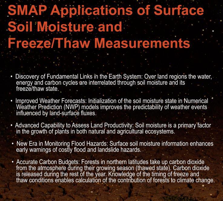
6 SMAP Applications BHW-5
7 Proposed SMAP Data Products Data Product Short Name Description Grid Resolution Granule Extent L1A_Radar Parsed Radar Instrument Telemetry Half Orbit L1A_Radiometer Parsed Radiometer Instrument Telemetry Half Orbit L1B_S0_LoRes Low Resolution Radar σ o in Time Order 5x30 km (10 slices) Half Orbit L1C_S0_HiRes High Resolution Radar σ o on Swath Grid 1 km Half Orbit L1B_TB Radiometer T B in Time Order 39x47 km Half Orbit L1C_TB Radiometer T B 36 km Half Orbit L2_SM_A Radar Soil Moisture ( includes Freeze-Thaw ) 3 km Half Orbit L2_SM_P Radiometer Soil Moisture 36 km Half Orbit L2_SM_AP Active-Passive Soil Moisture 9 km Half Orbit L3_FT_A Daily Global Composite Freeze/Thaw State 3 km North of 45 N L3_SM_A Daily Global Composite Radar Soil Moisture 3 km Global L3_SM_P Daily Global Composite Radiometer Soil Moisture 36 km Global L3_SM_AP Daily Global Composite Active-Passive Soil Moisture 9 km Global L4_SM Surface & Root Zone Soil Moisture 9 km Global L4_C Carbon Net Ecosystem Exchange 9 km North of 45 N BHW-6
Soil Moisture Active Passive (SMAP) Mission: a NASA Opportunity
 Mission: a NASA Opportunity") Soil Moisture Active Passive (SMAP) Mission: a NASA Opportunity Robert Gurney University of Reading WIF Workshop 17 th October 2012 National Aeronautics and Space Administration L-band Active/Passive Soil
Soil Moisture Active Passive (SMAP) Mission: a NASA Opportunity Robert Gurney University of Reading WIF Workshop 17 th October 2012 National Aeronautics and Space Administration L-band Active/Passive Soil
Introduction to SMAP. ARSET Applied Remote Sensing Training. Jul. 20,
 National Aeronautics and Space Administration ARSET Applied Remote Sensing Training http://arset.gsfc.nasa.gov @NASAARSET Introduction to SMAP Jul. 20, 2016 www.nasa.gov Outline 1. Mission objectives 2.
SMAP and SMOS Integrated Soil Moisture Validation. T. J. Jackson USDA ARS
 SMAP and SMOS Integrated Soil Moisture Validation T. J. Jackson USDA ARS Perspective Linkage of SMOS and SMAP soil moisture calibration and validation will have short and long term benefits for both missions.
Permanent Ice and Snow
 Soil Moisture Active Passive (SMAP) Ancillary Data Report Permanent Ice and Snow Preliminary, v.1 SMAP Science Document no. 048 Kyle McDonald, E. Podest, E. Njoku Jet Propulsion Laboratory California Institute
The NASA Soil Moisture Active Passive Mission (SMAP) Status and Early Results
 Status and Early Results") 20154 California Institute of Technology. Government sponsorship acknowledged. National Aeronautics and Space Administration The NASA Soil Moisture Active Passive Mission (SMAP) Status and Early Results
20154 California Institute of Technology. Government sponsorship acknowledged. National Aeronautics and Space Administration The NASA Soil Moisture Active Passive Mission (SMAP) Status and Early Results
Static Water Fraction
 Soil Moisture Active Passive (SMAP) Ancillary Data Report Static Water Fraction Preliminary, v.2 SMAP Science Document no. 045 Steven Chan Jet Propulsion Laboratory California Institute of Technology Pasadena,
NASA s Soil Moisture Active Passive (SMAP) Mission: Project Overview and Status
 Mission: Project Overview and Status") NASA s Soil Moisture Active Passive (SMAP) Mission: Project Overview and Status Peggy O Neill NASA GSFC SMAP Deputy Project Scientist 5th NAFE Workshop Monash University Melbourne, AUS February 24-25,
NASA s Soil Moisture Active Passive (SMAP) Mission: Project Overview and Status Peggy O Neill NASA GSFC SMAP Deputy Project Scientist 5th NAFE Workshop Monash University Melbourne, AUS February 24-25,
CLIMATE CHANGE AND REGIONAL HYDROLOGY ACROSS THE NORTHEAST US: Evidence of Changes, Model Projections, and Remote Sensing Approaches
 CLIMATE CHANGE AND REGIONAL HYDROLOGY ACROSS THE NORTHEAST US: Evidence of Changes, Model Projections, and Remote Sensing Approaches Michael A. Rawlins Dept of Geosciences University of Massachusetts OUTLINE
SMAP Early Adopters. Soil Moisture Active Passive Mission SMAP. Barry Weiss Jet Propulsion Laboratory California Institute of Technology
 National Aeronautics and Space Administration Soil Moisture Active Passive Mission SMAP SMAP Early Adopters Barry Weiss Jet Propulsion Laboratory California Institute of Technology SMAP Data Products Data
SMAP Level 2 & 3 Soil Moisture (Passive)
") Soil Moisture Active Passive (SMAP) Algorithm Theoretical Basis Document (ATBD) SMAP Level 2 & 3 Soil Moisture (Passive) (L2_SM_P, L3_SM_P) Initial Release, v.1 Peggy O Neill NASA Goddard Space Flight
Soil Moisture Active Passive (SMAP) Algorithm Theoretical Basis Document (ATBD) SMAP Level 2 & 3 Soil Moisture (Passive) (L2_SM_P, L3_SM_P) Initial Release, v.1 Peggy O Neill NASA Goddard Space Flight
Radio Frequency Earth Science
 Radio Frequency Earth Science Overview for Committee On Radio Frequency (CORF) National Academy of Science National Research Council April 27, 2005 Bill.Watson@NASA.Gov Program Executive for Ground Networks
Dual-Frequency Ku- Band Radar Mission Concept for Snow Mass
 Dual-Frequency Ku- Band Radar Mission Concept for Snow Mass Chris Derksen Environment and Climate Change Canada Study Team: Climate Research Division/Meteorological Research Division, ECCC Canadian Space
Soil Moisture Active Passive (SMAP) Algorithm Theoretical Basis Document L2 & L3 Radar/Radiometer Soil Moisture (Active/Passive) Data Products
 Algorithm Theoretical Basis Document L2 & L3 Radar/Radiometer Soil Moisture (Active/Passive) Data Products") Soil Moisture Active Passive (SMAP) Algorithm Theoretical Basis Document L2 & L3 Radar/Radiometer Soil Moisture (Active/Passive) Data Products Revision A December 9, 2014 Dara Entekhabi Massachusetts Institute
Soil Moisture Active Passive (SMAP) Algorithm Theoretical Basis Document L2 & L3 Radar/Radiometer Soil Moisture (Active/Passive) Data Products Revision A December 9, 2014 Dara Entekhabi Massachusetts Institute
APPENDIX 2 OVERVIEW OF THE GLOBAL PRECIPITATION MEASUREMENT (GPM) AND THE TROPICAL RAINFALL MEASURING MISSION (TRMM) 2-1
 AND THE TROPICAL RAINFALL MEASURING MISSION (TRMM) 2-1") APPENDIX 2 OVERVIEW OF THE GLOBAL PRECIPITATION MEASUREMENT (GPM) AND THE TROPICAL RAINFALL MEASURING MISSION (TRMM) 2-1 1. Introduction Precipitation is one of most important environmental parameters.
APPENDIX 2 OVERVIEW OF THE GLOBAL PRECIPITATION MEASUREMENT (GPM) AND THE TROPICAL RAINFALL MEASURING MISSION (TRMM) 2-1 1. Introduction Precipitation is one of most important environmental parameters.
SMAP Level 3 Radiometer Freeze/Thaw Data Products (L3_FT_P and L3_FT_P_E)
") Soil Moisture Active Passive (SMAP) Algorithm Theoretical Basis Document (ATBD) SMAP Level 3 Radiometer Freeze/Thaw Data Products (L3_FT_P and L3_FT_P_E) Revision A October 15, 2016 Scott Dunbar, Xiaolan
Soil Moisture Active Passive (SMAP) Algorithm Theoretical Basis Document (ATBD) SMAP Level 3 Radiometer Freeze/Thaw Data Products (L3_FT_P and L3_FT_P_E) Revision A October 15, 2016 Scott Dunbar, Xiaolan
Land data assimilation in the NASA GEOS-5 system: Status and challenges
 Blueprints for Next-Generation Data Assimilation Systems Boulder, CO, USA 8-10 March 2016 Land data assimilation in the NASA GEOS-5 system: Status and challenges Rolf Reichle Clara Draper, Ricardo Todling,
Soil frost from microwave data. Kimmo Rautiainen, Jouni Pulliainen, Juha Lemmetyinen, Jaakko Ikonen, Mika Aurela
 Soil frost from microwave data Kimmo Rautiainen, Jouni Pulliainen, Juha Lemmetyinen, Jaakko Ikonen, Mika Aurela Why landscape freeze/thaw? Latitudinal variation in mean correlations (r) between annual
Soil Moisture Active Passive (SMAP) Project Calibration and Validation for the L3_FT_A Validated-Release Data Product (Version 3)
 Project Calibration and Validation for the L3_FT_A Validated-Release Data Product (Version 3)") Soil Moisture Active Passive (SMAP) Project Calibration and Validation for the L3_FT_A Validated-Release Data Product (Version 3) Citation: Derksen, Chris 1, Xiaolan Xu 2, R. Scott Dunbar 2, Andreas Colliander
Soil Moisture Active Passive (SMAP) Project Calibration and Validation for the L3_FT_A Validated-Release Data Product (Version 3) Citation: Derksen, Chris 1, Xiaolan Xu 2, R. Scott Dunbar 2, Andreas Colliander
SMAP Level 4 Surface and Root Zone Soil Moisture (L4_SM) Data Product
 Data Product") Soil Moisture Active Passive (SMAP) Project Algorithm Theoretical Basis Document (ATBD) SMAP Level 4 Surface and Root Zone Soil Moisture (L4_SM) Data Product Initial Release, v.1 Rolf Reichle 1, Wade Crow
Soil Moisture Active Passive (SMAP) Project Algorithm Theoretical Basis Document (ATBD) SMAP Level 4 Surface and Root Zone Soil Moisture (L4_SM) Data Product Initial Release, v.1 Rolf Reichle 1, Wade Crow
Aeolus. A Mission to Map the Winds of Mars. Anthony Colaprete Amanda Cook NASA Ames Research Center
 Aeolus A Mission to Map the Winds of Mars Anthony Colaprete Amanda Cook NASA Ames Research Center Low-Cost Planetary Missions Conference 12, 2017 What is Aeolus? Science Aeolus will provide the very first
CGMS Baseline. Sustained contributions to the Global Observing System. Endorsed by CGMS-46 in Bengaluru, June 2018
 CGMS Baseline Sustained contributions to the Global Observing System Best Practices for Achieving User Readiness for New Meteorological Satellites Endorsed by CGMS-46 in Bengaluru, June 2018 CGMS/DOC/18/1028862,
DARE Mission and Spacecraft Overview
 DARE Mission and Spacecraft Overview October 6, 2010 Lisa Hardaway, PhD Mike Weiss, Scott Mitchell, Susan Borutzki, John Iacometti, Grant Helling The information contained herein is the private property
Meeting the Needs for Satellite OVW
 Meeting the Needs for Satellite OVW NEED Multiple scatterometers to extend the coverage of QuikSCAT and provide continuity UNDERWAY EUMETSAT ASCAT on METOP series 1 st is in orbit ISRO Oceansat-2 Timely
May 2012 Betsy Edwards Program Executive, Earth Science Division Science Mission Directorate, NASA HQ
 May 2012 Betsy Edwards Program Executive, Earth Science Division Science Mission Directorate, NASA HQ Purpose of Briefing To describe some of the current and near-term spectrum requirements from the NASA
Orbit Design Marcelo Suárez. 6th Science Meeting; Seattle, WA, USA July 2010
 Orbit Design Marcelo Suárez Orbit Design Requirements The following Science Requirements provided drivers for Orbit Design: Global Coverage: the entire extent (100%) of the ice-free ocean surface to at
Validating a Satellite Microwave Remote Sensing Based Global Record of Daily Landscape Freeze- Thaw Dynamics
 University of Montana ScholarWorks at University of Montana Numerical Terradynamic Simulation Group Publications Numerical Terradynamic Simulation Group 2012 Validating a Satellite Microwave Remote Sensing
A Regional Microsatellite Constellation with Electric Propulsion In Support of Tuscan Agriculture
 Berlin, 20 th - 24 th 2015 University of Pisa 10 th IAA Symposium on Small Satellites for Earth Observation Student Conference A Regional Microsatellite Constellation with Electric Propulsion In Support
Orbit and Transmit Characteristics of the CloudSat Cloud Profiling Radar (CPR) JPL Document No. D-29695
 JPL Document No. D-29695") Orbit and Transmit Characteristics of the CloudSat Cloud Profiling Radar (CPR) JPL Document No. D-29695 Jet Propulsion Laboratory California Institute of Technology Pasadena, CA 91109 26 July 2004 Revised
Orbit and Transmit Characteristics of the CloudSat Cloud Profiling Radar (CPR) JPL Document No. D-29695 Jet Propulsion Laboratory California Institute of Technology Pasadena, CA 91109 26 July 2004 Revised
JAXA s Contributions to the Climate Change Monitoring
 0 JAXA s Contributions to the Climate Change Monitoring June 7, 2011 Takao Akutsu Planning Manager Japan Aerospace Exploration Agency (JAXA) Japanese Main Activities of Earth Observation 1 GEOSS 10 years
Current and Upcoming NASA Hurricane Measurement Missions National Hurricane Conference
 NASA Science Mission Directorate Earth Science Division Applied Sciences Program Current and Upcoming NASA Hurricane Measurement Missions National Hurricane Conference April 18, 2017 Formulation Implementation
HY-2A Satellite User s Guide
 National Satellite Ocean Application Service 2013-5-16 Document Change Record Revision Date Changed Pages/Paragraphs Edit Description i Contents 1 Introduction to HY-2 Satellite... 1 2 HY-2 satellite data
The use and impacts of sea surface temperature from passive microwave measurements
 The use and impacts of sea surface temperature from passive microwave measurements Anne O Carroll 6/12/2017 ECMWF workshop on using low frequency passive microwave measurements in research and operational
Julia Figa-Saldaña & Klaus Scipal
 Julia Figa-Saldaña & Klaus Scipal julia.figa@eumetsat.int klaus.scipal@esa.int Meeting, Outline MetOp/EPS status MetOp/EPS Second Generation status 2016 scatterometer conference Other European ocean programme
Central Asia Regional Flash Flood Guidance System 4-6 October Hydrologic Research Center A Nonprofit, Public-Benefit Corporation
 http://www.hrcwater.org Central Asia Regional Flash Flood Guidance System 4-6 October 2016 Hydrologic Research Center A Nonprofit, Public-Benefit Corporation FFGS Snow Components Snow Accumulation and
Copyright 2015 California Institute of Technology. U.S. Government sponsorship acknowledged.
 Copyright 2015 California Institute of Technology. U.S. Government sponsorship acknowledged. DOCUMENT CHANGE LOG Revision Date Sections Changed Reason for Change ii Copyright 2015 California Institute
Evaluation strategies of coarse resolution SM products for monitoring deficit/excess conditions in the Pampas Plains, Argentina
 Evaluation strategies of coarse resolution SM products for monitoring deficit/excess conditions in the Pampas Plains, Argentina Francisco Grings, Cintia Bruscantini, Federico Carballo, Ezequiel Smucler,
Drought Monitoring with Hydrological Modelling
 st Joint EARS/JRC International Drought Workshop, Ljubljana,.-5. September 009 Drought Monitoring with Hydrological Modelling Stefan Niemeyer IES - Institute for Environment and Sustainability Ispra -
Advances in land data assimilation at NASA/GSFC
 ECMWF / GLASS Workshop on Land Surface Modelling and Data Assimilation and the Implications for Predictability 10 November 2009 Advances in land data assimilation at NASA/GSFC Rolf Reichle 1* M. Bosilovich
Monitoring surface soil moisture and freeze-thaw state with the high-resolution radar of the Soil Moisture Active/Passive (SMAP) mission
 mission") Monitoring surface soil moisture and freeze-thaw state with the high-resolution radar of the Soil Moisture Active/Passive (SMAP) mission Seungbum Kim, Jakob van Zyl, Kyle McDonald, and Eni Njoku Jet Propulsion
Monitoring surface soil moisture and freeze-thaw state with the high-resolution radar of the Soil Moisture Active/Passive (SMAP) mission Seungbum Kim, Jakob van Zyl, Kyle McDonald, and Eni Njoku Jet Propulsion
Vicky Chu, Jer Ling, Tom Lin, Joe Fong, Feng-Tai Huang, Guey-Shin Chang. April 15, 2011
 FORMOSAT-7/COSMIC-2 Overview Vicky Chu, Jer Ling, Tom Lin, Joe Fong, Feng-Tai Huang, Guey-Shin Chang April 15, 2011 Program Status AIT-TECRO Agreement on FORMOSAT-7/COSMIC-2 joint program has been signed
SSC13-VI-1 MISSION DESIGN CONCEPT
 SSC13-VI-1 INTRODUCTION TO FORMOSAT-7/COSMIC-2 MISSION Alex da Silva Curiel, Meryl Lambert, Doug Liddle, Prof Sir Martin Sweeting. Surrey Satellite Technology Ltd. Tycho House, Surrey Research Park, ;
The Orbit Control of ERS-1 and ERS-2 for a Very Accurate Tandem Configuration
 The Orbit Control of ERS-1 and ERS-2 for a Very Accurate Tandem Configuration Mats Rosengren European Space Operations Centre Robert Bosch Str 5 D64293 Darmstadt Germany Email: mrosengr@esoc.esa.de Abstract
Interpretation of Polar-orbiting Satellite Observations. Atmospheric Instrumentation
 Interpretation of Polar-orbiting Satellite Observations Outline Polar-Orbiting Observations: Review of Polar-Orbiting Satellite Systems Overview of Currently Active Satellites / Sensors Overview of Sensor
MONTE CARLO ANALYSIS OF THE COMMISSIONING PHASE MANEUVERS OF THE SOIL MOISTURE ACTIVE PASSIVE (SMAP) MISSION
 MISSION") MONTE CARLO ANALYSIS OF THE COMMISSIONING PHASE MANEUVERS OF THE SOIL MOISTURE ACTIVE PASSIVE (SMAP) MISSION Jessica L. Williams (1), Ramachandra S. Bhat (2), and Tung-Han You (3) (1) Jet Propulsion Laboratory,
MONTE CARLO ANALYSIS OF THE COMMISSIONING PHASE MANEUVERS OF THE SOIL MOISTURE ACTIVE PASSIVE (SMAP) MISSION Jessica L. Williams (1), Ramachandra S. Bhat (2), and Tung-Han You (3) (1) Jet Propulsion Laboratory,
Assimilation of satellite derived soil moisture for weather forecasting
 Assimilation of satellite derived soil moisture for weather forecasting www.cawcr.gov.au Imtiaz Dharssi and Peter Steinle February 2011 SMOS/SMAP workshop, Monash University Summary In preparation of the
CGMS Baseline In response to CGMS action/recommendation A45.01 HLPP reference: 1.1.8
 Prepared by WGIII Agenda Item: 7.1 Discussed in WGIII CGMS Baseline In response to CGMS action/recommendation A45.01 HLPP reference: 1.1.8 In CGMS-45, Working Group III agreed to hold a review of the CGMS
Interferometric Synthetic Aperture Radar (InSAR) and GGOS. Andrea Donnellan NASA/JPL February 21, 2007
 and GGOS. Andrea Donnellan NASA/JPL February 21, 2007") Interferometric Synthetic Aperture Radar (InSAR) and GGOS Andrea Donnellan NASA/JPL February 21, 2007 Sources for Science Objectives Fourth component of EarthScope Involvement: NSF, NASA, USGS, Universities
Interferometric Synthetic Aperture Radar (InSAR) and GGOS Andrea Donnellan NASA/JPL February 21, 2007 Sources for Science Objectives Fourth component of EarthScope Involvement: NSF, NASA, USGS, Universities
SOIL MOISTURE PRODUCTS FROM C-BAND SCATTEROMETERS: FROM ERS-1/2 TO METOP
 1 SOIL MOISTURE PRODUCTS FROM C-BAND SCATTEROMETERS: FROM ERS-1/2 TO METOP Zoltan Bartalis, Klaus Scipal, Wolfgang Wagner I.P.F. - Insitute of Photogrammetry and Remote Sensing, Vienna University of Technology,
Incorporation of SMOS Soil Moisture Data on Gridded Flash Flood Guidance for Arkansas Red River Basin
 Incorporation of SMOS Soil Moisture Data on Gridded Flash Flood Guidance for Arkansas Red River Basin Department of Civil and Environmental Engineering, The City College of New York, NOAA CREST Dugwon
Flash flood forecasting and warning infrastructures of National Meteorology and Hydrological Services of Cambodia
 Development and Implementation of the South East Asia Flash Flood Guidance System (SEAFFGS) Ha Noi, Viet Nam, 20-23 November 2017 Flash flood forecasting and warning infrastructures of National Meteorology
VLBA Astrometry of Planetary Orbiters
 VLBA Astrometry of Planetary Orbiters Dayton Jones (1), Ed Fomalont (2), Vivek Dhawan (2), Jon Romney (2), William Folkner (1), Robert Jacobson (1), Gabor Lanyi (1), and James Border (1) (1) Jet Propulsion
sentinel-3 A BIGGER PICTURE FOR COPERNICUS
 sentinel-3 A BIGGER PICTURE FOR COPERNICUS SATELLITES TO SERVE By providing a set of key information services for a wide range of practical applications, Europe s Copernicus programme has been put in place
Japanese Programs on Space and Water Applications
 Japanese Programs on Space and Water Applications Tamotsu IGARASHI Remote Sensing Technology Center of Japan June 2006 COPUOS 2006 Vienna International Centre Water-related hazards/disasters may occur
United States Multi-Hazard Early Warning System
 United States Multi-Hazard Early Warning System Saving Lives Through Partnership Lynn Maximuk National Weather Service Director, Central Region Kansas City, Missouri America s s Weather Enterprise: Protecting
Aquarius/SAC-D Soil Moisture Product using V3.0 Observations
 Aquarius/SAC-D Soil Moisture Product using V3. Observations R. Bindlish, T. Jackson, M. Cosh November 214 Overview Soil moisture algorithm Soil moisture product Validation Linkage between Soil Moisture
Future SAR mission concepts
 Future SAR mission concepts PREMIER M. Arcioni, M. Aguirre, P. Bensi, S. D Addio, K. Engel, F. Fois, F. Hélière, M. Kern, A. Lecuyot, C.C. Lin, M. Ludwig, K. Scipal, P. Silvestrin ESTEC, Keplerlaan 1,
EUMETSAT STATUS AND PLANS
 1 EUM/TSS/VWG/15/826793 07/10/2015 EUMETSAT STATUS AND PLANS François Montagner, Marine Applications Manager, EUMETSAT WMO Polar Space Task Group 5 5-7 October 2015, DLR, Oberpfaffenhofen PSTG Strategic
Earth Exploration-Satellite Service (EESS)- Active Spaceborne Remote Sensing and Operations
- Active Spaceborne Remote Sensing and Operations") Earth Exploration-Satellite Service (EESS)- Active Spaceborne Remote Sensing and Operations SRTM Radarsat JASON Seawinds TRMM Cloudsat Bryan Huneycutt (USA) Charles Wende (USA) WMO, Geneva, Switzerland
Earth Exploration-Satellite Service (EESS)- Active Spaceborne Remote Sensing and Operations SRTM Radarsat JASON Seawinds TRMM Cloudsat Bryan Huneycutt (USA) Charles Wende (USA) WMO, Geneva, Switzerland
ARCHIVED REPORT. Defense Meteorological Satellite Program - Archived 11/2005
 Electronic Systems Forecast ARCHIVED REPORT For data and forecasts on current programs please visit www.forecastinternational.com or call +1 203.426.0800 Defense Meteorological Satellite Program - Archived
Robert Shedd Northeast River Forecast Center National Weather Service Taunton, Massachusetts, USA
 Robert Shedd Northeast River Forecast Center National Weather Service Taunton, Massachusetts, USA Outline River Forecast Centers FEWS Implementation Status Forcing Data Ensemble Forecasting The Northeast
The Soil Moisture Active Passive (SMAP) Mission
 Mission") The Soil Moisture Active Passive (SMAP) Mission The MIT Faculty has made this article openly available. Please share how this access benefits you. Your story matters. Citation As Published Publisher Entekhabi,
The Soil Moisture Active Passive (SMAP) Mission The MIT Faculty has made this article openly available. Please share how this access benefits you. Your story matters. Citation As Published Publisher Entekhabi,
Earth Science Flight Mission Overview
 Earth Science Flight Mission Overview Nand Topiwala Science Mission Directorate NASA Headquarters April 25, 2007 Earth Science Missions Afternoon Constellation, or A-Train, Multi-Satellite Observatory
New NASA Ocean Observations and Coastal Applications
 New NASA Ocean Observations and Coastal Applications Duane Armstrong Chief, Applied Science & Technology Project Office August 20, 2014 1 Outline NASA s new Earth Science Ocean Science Missions for 2014
SAC-D. SMOS 4th Science Workshop April 2003, Porto Presented by Jordi Font, Prepared by Gary Lagerloef
 (Ocean Surface Salinity Measurement) Understanding the ocean s response to the global freshwater cycle SMOS 4th Science Workshop April 2003, Porto Presented by Jordi Font, Prepared by Gary Lagerloef 1
Water information system advances American River basin. Roger Bales, Martha Conklin, Steve Glaser, Bob Rice & collaborators UC: SNRI & CITRIS
 Water information system advances American River basin Roger Bales, Martha Conklin, Steve Glaser, Bob Rice & collaborators UC: SNRI & CITRIS Opportunities Unprecedented level of information from low-cost
New Opportunities in Urban Remote Sensing. Philip Christensen Arizona State University
 New Opportunities in Urban Remote Sensing Philip Christensen Arizona State University Advantages: Uniform, global data Role of Remote Sensing Repeatable at regular intervals over long periods of time Broad
NIDIS Intermountain West Drought Early Warning System August 8, 2017
 NIDIS Drought and Water Assessment 8/8/17, 4:43 PM NIDIS Intermountain West Drought Early Warning System August 8, 2017 Precipitation The images above use daily precipitation statistics from NWS COOP,
Radio occultation mission to Mars using cubesats
 Radio occultation mission to Mars using cubesats LCPM-12 2017 W. Williamson, A.J. Mannucci, C. Ao 2017 California Institute of Technology. Government sponsorship acknowledged. 1 Radio Occultation Overview
Radar mapping of snow melt over mountain glaciers in High Mountain Asia Mentor: Tarendra Lakhankar Collaborators: Nir Krakauer, Kyle MacDonald and
 Radar mapping of snow melt over mountain glaciers in High Mountain Asia Mentor: Tarendra Lakhankar Collaborators: Nir Krakauer, Kyle MacDonald and Nick Steiner How are Glaciers Formed? Glaciers are formed
Toward improving the representation of the water cycle at High Northern Latitudes
 Toward improving the representation of the water cycle at High Northern Latitudes W. A. Lahoz a, T. M. Svendby a, A. Griesfeller a, J. Kristiansen b a NILU, Kjeller, Norway b Met Norway, Oslo, Norway wal@nilu.no
Graduate Courses Meteorology / Atmospheric Science UNC Charlotte
 Graduate Courses Meteorology / Atmospheric Science UNC Charlotte In order to inform prospective M.S. Earth Science students as to what graduate-level courses are offered across the broad disciplines of
Soil Moisture Active Passive (SMAP) Project Calibration and Validation for the L3_FT_A Beta-Release Data Product
 Project Calibration and Validation for the L3_FT_A Beta-Release Data Product") Soil Moisture Active Passive (SMAP) Project Calibration and Validation for the L3_FT_A Beta-Release Data Product Prepared by: Xiaolan Xu Algorithm Development Team Lead for L3_FT_A Date Approved by: Simon
Soil Moisture Active Passive (SMAP) Project Calibration and Validation for the L3_FT_A Beta-Release Data Product Prepared by: Xiaolan Xu Algorithm Development Team Lead for L3_FT_A Date Approved by: Simon
Climate Change and Arizona s Rangelands: Management Challenges and Opportunities
 Climate Change and Arizona s Rangelands: Management Challenges and Opportunities Mike Crimmins Climate Science Extension Specialist Dept. of Soil, Water, & Env. Science & Arizona Cooperative Extension
Calibrating SeaWinds and QuikSCAT scatterometers using natural land targets
 Brigham Young University BYU ScholarsArchive All Faculty Publications 2005-04-01 Calibrating SeaWinds and QuikSCAT scatterometers using natural land targets David G. Long david_long@byu.edu Lucas B. Kunz
Indices and Indicators for Drought Early Warning
 Indices and Indicators for Drought Early Warning ADRIAN TROTMAN CHIEF, APPLIED METEOROLOGY AND CLIMATOLOGY CARIBBEAN INSTITUTE FOR METEOROLOGY AND HYDROLOGY IN COLLABORATION WITH THE NATIONAL DROUGHT MITIGATION
The Challenge of. Guy Brasseur
 The Challenge of Monitoring and Predicting Chemical Weather Guy Brasseur Introduction: What is Chemical Weather? What is Chemical Weather? Local, regional, and global distributions of important trace gases
Remote sensing of precipitation extremes
 The panel is about: Understanding and predicting weather and climate extreme Remote sensing of precipitation extremes Climate extreme : (JSC meeting, June 30 2014) IPCC SREX report (2012): Climate Ali
Long term performance monitoring of ASCAT-A
 Long term performance monitoring of ASCAT-A Craig Anderson and Julia Figa-Saldaña EUMETSAT, Eumetsat Allee 1, 64295 Darmstadt, Germany. Abstract The Advanced Scatterometer (ASCAT) on the METOP series of
REQUIREMENTS FOR WEATHER RADAR DATA. Review of the current and likely future hydrological requirements for Weather Radar data
 WORLD METEOROLOGICAL ORGANIZATION COMMISSION FOR BASIC SYSTEMS OPEN PROGRAMME AREA GROUP ON INTEGRATED OBSERVING SYSTEMS WORKSHOP ON RADAR DATA EXCHANGE EXETER, UK, 24-26 APRIL 2013 CBS/OPAG-IOS/WxR_EXCHANGE/2.3
Operational Hydrologic Ensemble Forecasting. Rob Hartman Hydrologist in Charge NWS / California-Nevada River Forecast Center
 Operational Hydrologic Ensemble Forecasting Rob Hartman Hydrologist in Charge NWS / California-Nevada River Forecast Center Mission of NWS Hydrologic Services Program Provide river and flood forecasts
The PRECIS Regional Climate Model
 The PRECIS Regional Climate Model General overview (1) The regional climate model (RCM) within PRECIS is a model of the atmosphere and land surface, of limited area and high resolution and locatable over
Observation Operators for sea ice thickness to L-band brightness temperatures
 Observation Operators for sea ice thickness to L-band brightness temperatures F. Richter, M. Drusch, L. Kaleschke, N. Maass, X. Tian-Kunze, G. Heygster, S. Mecklenburg, T. Casal, and many others ESA, ESTEC
Operational Aspects of Space Weather-Related Missions
 Operational Aspects of Space Weather-Related Missions Richard G. Marsden, ESA/SCI-SH Outline SOHO: Example of Near-Earth Observatory-class Mission Ulysses: Example of Deep Space Monitor-class Mission Solar
Aquarius Pioneering the L- band Passive and Ac6ve Microwave Remote Sensing of Sea Surface Salinity and Wind
 Aquarius Pioneering the L- band Passive and Ac6ve Microwave Remote Sensing of Sea Surface Salinity and Wind SIMON YUEH, WENQING TANG, ALEXANDER FORE, AKIKO HAYASHI Jet Propulsion Laboratory, California
Extremes Events in Climate Change Projections Jana Sillmann
 Extremes Events in Climate Change Projections Jana Sillmann Max Planck Institute for Meteorology International Max Planck Research School on Earth System Modeling Temperature distribution IPCC (2001) Outline
Paper Session III-B - Mars Global Surveyor: Cruising to Mars
 The Space Congress Proceedings 1997 (34th) Our Space Future - Uniting For Success May 1st, 1:00 PM Paper Session III-B - Mars Global Surveyor: Cruising to Mars Glenn E. Cunningham Project Manager Mars
Ocean Vector Winds in Storms from the SMAP L-Band Radiometer
 International Workshop on Measuring High Wind Speeds over the Ocean 15 17 November 2016 UK Met Office, Exeter Ocean Vector Winds in Storms from the SMAP L-Band Radiometer Thomas Meissner, Lucrezia Ricciardulli,
Impact on Agriculture
 Weather Variability and the Impact on Agriculture InfoAg 2017 Copyright 2017, awhere. All Rights Reserved The Problem: The Earth s Atmosphere is a Heat Engine In transition 1 C warming of atmosphere Triples
REVISION OF THE STATEMENT OF GUIDANCE FOR GLOBAL NUMERICAL WEATHER PREDICTION. (Submitted by Dr. J. Eyre)
") WORLD METEOROLOGICAL ORGANIZATION Distr.: RESTRICTED CBS/OPAG-IOS (ODRRGOS-5)/Doc.5, Add.5 (11.VI.2002) COMMISSION FOR BASIC SYSTEMS OPEN PROGRAMME AREA GROUP ON INTEGRATED OBSERVING SYSTEMS ITEM: 4 EXPERT
WORLD METEOROLOGICAL ORGANIZATION Distr.: RESTRICTED CBS/OPAG-IOS (ODRRGOS-5)/Doc.5, Add.5 (11.VI.2002) COMMISSION FOR BASIC SYSTEMS OPEN PROGRAMME AREA GROUP ON INTEGRATED OBSERVING SYSTEMS ITEM: 4 EXPERT
DETECTION AND FORECASTING - THE CZECH EXPERIENCE
 1 STORM RAINFALL DETECTION AND FORECASTING - THE CZECH EXPERIENCE J. Danhelka * Czech Hydrometeorological Institute, Prague, Czech Republic Abstract Contribution presents the state of the art of operational
Satellite Position Determination of LEO Spacecraft
 Satellite Position Determination of LEO Spacecraft S.C.Rathnakara ISRO Satellite Centre 5 th September, 2007 International Committee on Global Navigation Satellite Systems(ICG) Things to follow Brief background
Global Satellite Products & Services for Agricultural and Vegetation Health
 Global Satellite Products & Services for Agricultural and Vegetation Health Presented at the WMO Expert Meeting on National Early Warning System for Agricultural Weather Management George Mason University
Amita Mehta and Ana Prados
 Building Capacity in Utilizing NASA Remote Sensing Observations in SWAT for Water Resources and Agricultural Management Applications Amita Mehta and Ana Prados NASA - University of Maryland Baltimore County
Effective Utilization of Synthetic Aperture Radar (SAR) Imagery in Rapid Damage Assessment
 Imagery in Rapid Damage Assessment") Effective Utilization of Synthetic Aperture Radar (SAR) Imagery in Rapid Damage Assessment Case Study Pakistan Floods SUPARCO M. Maisam Raza, Ahmad H. Rabbani SEQUENCE Flood Monitoring using Satellite
Effective Utilization of Synthetic Aperture Radar (SAR) Imagery in Rapid Damage Assessment Case Study Pakistan Floods SUPARCO M. Maisam Raza, Ahmad H. Rabbani SEQUENCE Flood Monitoring using Satellite
sentinel-2 COLOUR VISION FOR COPERNICUS
 sentinel-2 COLOUR VISION FOR COPERNICUS SATELLITES TO SERVE By providing a set of key information services for a wide range of practical applications, Europe s Copernicus programme is providing a step
Transboundary water management with Remote Sensing. Oluf Jessen DHI Head of Projects, Water Resources Technical overview
 Transboundary water management with Remote Sensing Oluf Jessen DHI Head of Projects, Water Resources Technical overview ozj@dhigroup.com Transboundary water management Water management across national
NIDIS Intermountain West Regional Drought Early Warning System February 7, 2017
 NIDIS Drought and Water Assessment NIDIS Intermountain West Regional Drought Early Warning System February 7, 2017 Precipitation The images above use daily precipitation statistics from NWS COOP, CoCoRaHS,
Evapotranspiration monitoring with Meteosat Second Generation satellites: method, products and utility in drought detection.
 Evapotranspiration monitoring with Meteosat Second Generation satellites: method, products and utility in drought detection. Nicolas Ghilain Royal Meteorological Institute Belgium EUMeTrain Event week
Team X Study Summary for ASMCS Theia. Jet Propulsion Laboratory, California Institute of Technology. with contributions from the Theia Team
 Team X Study Summary for ASMCS Theia Jet Propulsion Laboratory, California Institute of Technology with contributions from the Theia Team P. Douglas Lisman, NASA Jet Propulsion Laboratory David Spergel,
FFGS Advances. Initial planning meeting, Nay Pyi Taw, Myanmar February, Eylon Shamir, Ph.D,
 FFGS Advances Initial planning meeting, Nay Pyi Taw, Myanmar 26-28 February, 2018 Eylon Shamir, Ph.D, EShamir@hrcwater.org Hydrologic Research Center San Diego, California FFG System Enhancements The following