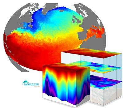
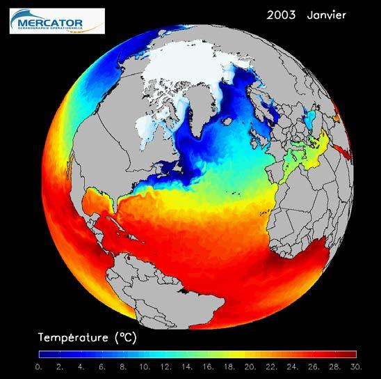
Copernicus Marine Environment Monitoring Service
|
|
|
- Mariah Cook
- 5 years ago
- Views:
Transcription


1 Copernicus Marine Environment Monitoring Service Mercator Ocean March 2017 Implemented by

 Service provider International")
2 Entrusted to Mercator Ocean by the European Commission Cliquez et modifiez le titre French non-profit company Owned by 5 national agencies Global Ocean Analysis and Forecasting center 20 years expertise in Operational Oceanography Producer ( science-based) Service provider International leadership and network

3 Networking ocean data producers Cliquez et modifiez le A network titre of European data providers State-of-the-art scientific knowledge Unique products portfolio
4 The Copernicus Marine Service in a nutshell An operational service. Full OPEN and FREE service for any application related to Ocean & Seas. A unique catalogue online. A Worldwide & European coverage. Data Download provided registration /CMEMS licence. Products Information & Quality Information. A service desk supported by a network of technical & marine experts. 4


5 CMEMS Subscribers typology CMEMS - Organisation details All Subscribers 2% University Educational Research Business Company ~ 9000 subscribers 13% 13% 56% National Met or Oceano Service Other 31 Millions transactions Ab. 300 Tb downloaded ( rolling Aug2015/July 2016) 16% Foundation 5
 Online questionnaires")


 Web functionalities done CMEMS release April 2016 o")

6 A user driven service Feedback collection Sent to service desk From projects (GMES-Pure) Online questionnaires Meetings InfoDays and User workshops Record Over a 4 year period 900 feedback from 400 users Analyse 3 analyses done Example: Main outputs o Additional or update of products Request o Access April 2015: to products to provide o Product sea documentation bottom temperature (for MSFD o use) Web functionalities done CMEMS release April 2016 o Communication to users o Service Request September 2015: to better promote the marine service first User Uptake calls on demonstrators, July

7 A user driven service A FORUM, for players engaged in creating sustainable value for our Oceans. AN OPEN DIALOGUE, with Policy makers, Industrials & Entrepreneurs, Regional Authorities & Stakeholders, Public Services and Scientists involved in Marine Environment and Blue Growth. A MAJOR EVENT, to take stock of the Copernicus Marine Service achievements and future prospects. 7


8 Catalogue of products. Global ocean and the European basins InSitu, Satellite Observations, Modelling products Physical & Biogeochemical variables Long time series (25 years) Real time products 140 products 8


9 From Copernicus bytes to the marine catalogue 1. Satellite products 2. In situ products 3. Modelling products


10 Essential Ocean Information / Variables Currents Temperature Salinity Sea surface elevation Sea ice Surface wind Waves Transparency Turbidity Reflectance Oxygen Primary production Plankton Nutrients
11 CMEMS satellite based products for the Baltic Sea OSI TAC WITS : Wind, Sea Ice and Temperature at the Sea Surface Service provides operational (Level 3 and 4) observational multi-mission data products derived rom upstream satellite earth observation (L2) data. OC TAC: Ocean colour thematic assembly centre provides worldwide global, pan-european and regional ocean colour products covering 7 defined CMEMS regions (e.g. Baltic Sea).
 SAR based ice thickness (4 hour after SAR acquisition, 500 m) SAR based ice drift (for each")
 the major instrument for FMI, additionally somedata from other SAR instruments (RADARSAT-2/RADARSAT- C,")
12 CMEMS OSI TAC WITS SEA ICE PRODUCTS ice chart ice concentration grid (spatial resolution 1 km, daily) ice chart average ice thickness grid (1 km, daily) SAR based ice thickness (4 hour after SAR acquisition, 500 m) SAR based ice drift (for each overlapping SAR image pair within 2 days, produced twice daily, 800 m) SAR based ice thickness mosaic, twice daily, 500 m SENTINEL-1 (a and b) the major instrument for FMI, additionally somedata from other SAR instruments (RADARSAT-2/RADARSAT- C, Cosmo-SkyMED, TerraSAR-X/TanDEM-X).


13 CMEMS OSI TAC WITS SEA ICE PRODUCTS The DMI Sea Surface Temperature analysis aims at providing daily gap-free maps of sea surface temperature, referred as L4 product, at 0.02deg. x 0.02deg. horizontal resolution, using satellite data from infra-red and microwave radiometers. Uses SST nighttime satellite products from these sensors: NOAA AVHRR, Metop AVHRR, Terra MODIS, Aqua MODIS, Aqua AMSR-E, Envisat AATSR, MSG Seviri See poster by Jacob Hoeyer: A Satellite-Based SST Climate Data Record for the Baltic Sea
14 Legacy, current and future OC sensors The OC TAC relies on current and legacy OC sensors: MERIS from ESA, SeaWiFS and MODIS/Aqua from NASA, and VIIRS/NPP from NOAA. In 2017, OLCI data will be ingested by CMEMS for NRT L3&L4 global and regional products for the European Seas. The ESA OC-CCI SeaWiFS-like data set ( ) is used to produce a consistently reprocessed time series for global products (4km) and regional products for the European Seas (1km). Because of their spectral bandsets, SeaWiFS, Aqua and VIIRS are not suitable for optically complex conditions like those of the Baltic Sea: - the ESA OC-CCI SeaWiFS-like data set is not suitable - data gap ( ) between the end of MERIS and OLCI
15 Algorithms and data availability for the Baltic Sea Current algorithms for Chlorophyll: Current NRT product from MODIS data is based on Neural Netwotk on (R 2 =~0.2) Current REP product from ESA OC-CCI SeaWiFS-like is based on a Blue/Green Ratio data (R 2 =~0.4) These uncertainties derive from the spectral bandset and the atmospheric correction Accuracy is likely to improve for NRT OLCI products in 2017 CMEMS OCTAC can implement and serve operationally community vetted algorithms: Need for regionally (spatially/seasonally) tuned algorithms (for Chlorophyll, Cyanobacteria, CDOM, TSS, Secchi) to be applied to MERIS/OLCI for the Baltic to best serve the community needs Need for a pooled set of all available Inherent and Apparent Optical properties for community algorithm development and validation Other (semi-)operational services are available for the Baltic Sea (IOP, SYKE, SMHI, BC): How do we ensure that we all provide the same answers to the users?
16 CMEMS BAL MFC NRT and RAN products Ocean NRT HBM+ERGOM The Baltic Sea physical model product provides forecasts for the physical conditions in the Baltic Sea. The Baltic forecast is updated twice daily providing a 60 h forecast with hourly data for sea level variations, ice concentration and thickness at the surface, and temperature, salinity and horizontal velocities for the 3D field. The Baltic Sea biogeochemical model product provides forecasts for the biogeochemical conditions in the Baltic Sea, with hourly data for the parametres dissolved oxygen, nitrate, phosphate, chl-a. The product is produced by the biogeochemical model ERGOM (Neumann, 2000) one way coupled to the Baltic 3D ocean model RAN HIROMB The reanalysis for the Baltic Sea was produced in 2014 at SMHI with the circulation model HIROMB (High-Resolution Operational Model for the Baltic). The data assimilation scheme used was a 3D Ensemble Variational data assimilation scheme. The product provides data on a 3 nautical miles grid (5.5 km) for the physical conditions Wave NRT (from April 2017)
17 CMEMS BAL MFC Use of satellite data For validation: In pre-operational validadation HBM results are evaluated against, satellite based SST and ice products We would like to use ocean colour products better quality needed. In future we d like to use altimeter SWH products for validation of wave forecasts For assimilation: Presently used in reanalyses In future will be used in assimation of NRT forecasts

18 CMEMS Ocean State Report Written by 80 European scientific experts from more than 25 institutions, this first Ocean State Report issue is a step forward into the development of regular annual reporting on the state and health of the Global Ocean and European Seas based on marine environment monitoring capabilities of the Copernicus Marine Environment Monitoring Service. Download the Ocean State Report 2016 from the Journal of Oceanography site: X

19 FEEL LIKE JOINING THE COPERNICUS MARINE BLUE COMMUNITY? Contact Share on Cliquez et modifiez le titre Join the Partnership Meeting Place Discover on Follow #CMEMSlike
CopernicusEU. the EU's Earth Observation Programme. Sara Zennaro Atre Delegation of the European Union to Japan
 Copernicus the EU's Earth Observation Programme Sara Zennaro Atre Delegation of the European Union to Japan Status Overview, Sept 2016 & Ocean Policies Seminar 4 October 2016 ollow us on: Copernicus EU
A state of the art and user driven Copernicus service Physics and Biogeochemistry
 C M E M S P r e s e n t a n d F u t u r e R e q u i r e m e n t s f o r I n - S i t u a n d S a t e l l i t e O b s e r v a t i o n s Antonio REPPUCCI; Pierre Yves LE TRAON Mercator Ocean International
C o p e r n i c u s M a r i n e S e r v i c e i n s u p p o r t t o s u s t a i n a b l e B l u e G r o w t h
 Implemented by C o p e r n i c u s M a r i n e S e r v i c e i n s u p p o r t t o s u s t a i n a b l e B l u e G r o w t h European Commission, DG MARE 19 Januray 2018 C O P E R N I C U S I N B R I E
MERSEA Marine Environment and Security for the European Area
 MERSEA Marine Environment and Security for the European Area Development of a European system for operational monitoring and forecasting of the ocean physics, biogeochemistry, and ecosystems, on global
Ocean meets Regions conference Committee of the Regions, Brussels 21 November 2017 Cecilia Donati. Marine Monitoring.
 Implemented by C o p e r n i c u s M a r i n e S e r v i c e : a E u r o p e a n t o o l i n s u p p o r t o f P u b l i c A d m i n i s t r a t i o n f o r a s u s t a i n a b l e B l u e G r o w t h
Ocean and Sea Ice TAC
 Ocean and Sea Ice TAC A CMEMS Element provided by the WITS Consortium (Wind, Ice and Temperature at the Sea Surface) Bruce Hackett, on behalf of the WITS team Presented at CMEMS User Workshop, Brussels,
The GMES/MyOcean Marine Service and its applications
 The GMES/MyOcean Marine Service and its applications P.Y. Le Traon (Ifremer) P. Bahurel (Mercator Ocean) First BreTel Workshop May 31st, 2012 - St Malo Outline The GMES Marine Service and MyOcean What
Arctic Regional Ocean Observing System Arctic ROOS Report from 2012
 Arctic Regional Ocean Observing System Arctic ROOS Report from 2012 By Stein Sandven Nansen Environmental and Remote Sensing Center (www.arctic-roos.org) Focus in 2012 1. Arctic Marine Forecasting Center
QUALITY INFORMATION DOCUMENT For OSI TAC SST products , 007, 008
 QUALITY INFORMATION DOCUMENT For OSI TAC SST products 010-003, 007, 008 Issue: 1.5 Contributors: Jacob L. HOYER (DMI), Hanne HEIBERG (met.no), Jean-Francois PIOLLÉ (IFREMER), Bruce Hackett (MET Norway)
sentinel-3 A BIGGER PICTURE FOR COPERNICUS
 sentinel-3 A BIGGER PICTURE FOR COPERNICUS SATELLITES TO SERVE By providing a set of key information services for a wide range of practical applications, Europe s Copernicus programme has been put in place
Operational systems for SST products. Prof. Chris Merchant University of Reading UK
 Operational systems for SST products Prof. Chris Merchant University of Reading UK Classic Images from ATSR The Gulf Stream ATSR-2 Image, ƛ = 3.7µm Review the steps to get SST using a physical retrieval
The Mediterranean Operational Oceanography Network (MOON): Products and Services
: Products and Services") The Mediterranean Operational Oceanography Network (MOON): Products and Services The MOON consortia And Nadia Pinardi Co-chair of MOON Istituto Nazionale di Geofisica e Vulcanologia Department of Environmental
The Mediterranean Operational Oceanography Network (MOON): Products and Services The MOON consortia And Nadia Pinardi Co-chair of MOON Istituto Nazionale di Geofisica e Vulcanologia Department of Environmental
P r o d u c t p o r t f o l i o a n d d a t a a c c e s s
 P r o d u c t p o r t f o l i o a n d d a t a a c c e s s Copernicus Environment Service Copernicus EU Copernicus EU Copernicus EU www.copernicus.eu I N T R O D U C T I O N O F U S E C A S E User Uptake
Climate reanalysis and reforecast needs: An Ocean Perspective
 Climate reanalysis and reforecast needs: An Ocean Perspective Hao Zuo with M. Balmaseda, S. Tietsche, P. Browne, B. B. Sarojini, E. de Boisseson, P. de Rosnay ECMWF Hao.Zuo@ecmwf.int ECMWF January 23,
GEOSC/METEO 597K Kevin Bowley Kaitlin Walsh
 GEOSC/METEO 597K Kevin Bowley Kaitlin Walsh Timeline of Satellites ERS-1 (1991-2000) NSCAT (1996) Envisat (2002) RADARSAT (2007) Seasat (1978) TOPEX/Poseidon (1992-2005) QuikSCAT (1999) Jason-2 (2008)
Marine Monitoring. The Copernicus Marine Service
 Marine The Copernicus Marine Service Why is the marine sector so important? Marine Blue Economy, 5 million jobs, gross added value almost 500bn/year 90% of international trade is maritime Half of the world's
Sea ice charts and SAR for sea ice classification. Patrick Eriksson Juha Karvonen Jouni Vainio
 Sea ice charts and SAR for sea ice classification Patrick Eriksson Juha Karvonen Jouni Vainio ECMWF Ocean Workshop, 22-25 January 2018 Ice service from past to present Finland has long experience in ice
T h e C o p e r n i c u s m a r i n e s e r v i c e. DG-GROW, Copernicus. Copernicus EU
 T h e C o p e r n i c u s m a r i n e s e r v i c e DG-GROW, Copernicus Copernicus EU Copernicus EU Copernicus EU www.copernicus.eu 2 W h y is t h e m a r i n e s e c t o r so i m p o r t a n t? Blue Economy,
C M E M S O c e a n C o l o u r S a t e l l i t e P r o d u c t s
 Implemented by C M E M S O c e a n C o l o u r S a t e l l i t e P r o d u c t s This slideshow gives an overview of the CMEMS Ocean Colour Satellite Products Marine LEVEL1 For Beginners- Slides have been
Ice surveys, meteorological and oceanographic data What is available and up-to-date?
 Ice surveys, meteorological and oceanographic data What is available and up-to-date? Leader of the Norwegian Ice Service +47 77 62 13 15 - nick.hughes@met.no Norwegian Meteorological Institute met.no 1
E-AIMS. SST: synthesis of past use and design activities and plans for E-AIMS D4.432
 Research Project co-funded by the European Commission Research Directorate-General 7 th Framework Programme Project No. 312642 E-AIMS Euro-Argo Improvements for the GMES Marine Service SST: synthesis of
Current status of the remote sensing ocean observing system
 Current status of the remote sensing ocean observing system Pierre-Yves Le Traon Ifremer & Mercator ocean with contributions from G. Dibarboure, Y. Faugere, M.H. Rio, B. Chapron, J. Johannessen, L. Santolieri,
OSE/OSSEs at NOAA. Eric Bayler NOAA/NESDIS/STAR
 OSE/OSSEs at NOAA Eric Bayler NOAA/NESDIS/STAR OSE/OSSEs at NOAA NOAA Leadership view: Relatively inexpensive way to: Assess the impact of potential new observations Refine and redirect current observing
Ice Surface temperatures, status and utility. Jacob Høyer, Gorm Dybkjær, Rasmus Tonboe and Eva Howe Center for Ocean and Ice, DMI
 Ice Surface temperatures, status and utility Jacob Høyer, Gorm Dybkjær, Rasmus Tonboe and Eva Howe Center for Ocean and Ice, DMI Outline Motivation for IST data production IST from satellite Infrared Passive
For Baltic Sea Physical Analysis and Forecasting Product BALTICSEA_ANALYSIS_FORECAST_PHY_003_006
 For Baltic Sea Physical Analysis and Forecasting Product Contributors: V. Huess Issue: 2.0 CMEMS version scope : Version 4.0 Approval Date by the CMEMS products team : 12 March 2018 CHANGE RECORD Issue
Julia Figa-Saldaña & Klaus Scipal
 Julia Figa-Saldaña & Klaus Scipal julia.figa@eumetsat.int klaus.scipal@esa.int Meeting, Outline MetOp/EPS status MetOp/EPS Second Generation status 2016 scatterometer conference Other European ocean programme
The MyOcean Service, precursor of the Copernicus Marine Environment Monitoring Service
 The MyOcean Service, precursor of the Copernicus Marine Environment Monitoring Service P.Y. Le Traon (with many inputs from J. Dorandeu) Mercator Océan Outline Copernicus$Marine$Service$and$Mercator$Ocean$
ERA5 and the use of ERA data
 ERA5 and the use of ERA data Hans Hersbach, and many colleagues European Centre for Medium-Range Weather Forecasts Overview Overview of Reanalysis products at ECMWF ERA5, the follow up of ERA-Interim,
OPEC Annual Meeting Zhenwen Wan. Center for Ocean and Ice, DMI, Denmark
 OPEC Annual Meeting 2012 Zhenwen Wan Center for Ocean and Ice, DMI, Denmark Outlines T2.1 Meta forcing and river loadings. Done, Tian T2.3 Observation data for 20 years. Done, Zhenwen T2.4.1 ERGOM upgrade:
EUMETSAT SAF NETWORK. Lothar Schüller, EUMETSAT SAF Network Manager
 1 EUMETSAT SAF NETWORK Lothar Schüller, EUMETSAT SAF Network Manager EUMETSAT ground segment overview METEOSAT JASON-2 INITIAL JOINT POLAR SYSTEM METOP NOAA SATELLITES CONTROL AND DATA ACQUISITION FLIGHT
EUMETSAT Beitrag zu CAMS und C3S. Jörg Schulz. Credits to many EUMETSAT Staff
 ETSAT Beitrag zu CAMS und C3S Jörg Schulz Credits to many ETSAT Staff The Copernicus Programme at ETSAT ETSAT is entrusted by the European Commission; ETSAT s Delegation Agreement is organised in 3 major
esurge A Storm Surge Demonstration Project
 esurge A Storm Surge Demonstration Project Helen Snaith British Oceanographic Data Centre, National Oceanography Centre, UK The Impact of Storm Surges Great flood in the Netherlands History: Zeeland, 31
Some NOAA Products that Address PSTG Satellite Observing Requirements. Jeff Key NOAA/NESDIS Madison, Wisconsin USA
 Some NOAA Products that Address PSTG Satellite Observing Requirements Jeff Key NOAA/NESDIS Madison, Wisconsin USA WMO Polar Space Task Group, 4 th meeting, Greenbelt, 30 September 2014 Relevant Missions
Ocean data assimilation for reanalysis
 Ocean data assimilation for reanalysis Matt Martin. ERA-CLIM2 Symposium, University of Bern, 14 th December 2017. Contents Introduction. On-going developments to improve ocean data assimilation for reanalysis.
EUMETSAT STATUS AND PLANS
 1 EUM/TSS/VWG/15/826793 07/10/2015 EUMETSAT STATUS AND PLANS François Montagner, Marine Applications Manager, EUMETSAT WMO Polar Space Task Group 5 5-7 October 2015, DLR, Oberpfaffenhofen PSTG Strategic
U s i n g t h e E S A / E U M E T C A S T N a v i g a t o r s
 U s i n g t h e E S A / E U M E T C A S T N a v i g a t o r s Copernicus User Uptake Information Sessions Copernicus EU Copernicus EU Copernicus EU www.copernicus.eu I N T R O D U C T I O N O F U S E C
Baltic Sea Physical Reanalysis Product BALTICSEA_REANALYSIS_PHYS_003_008
 Baltic Sea Physical Reanalysis Product Contributors: Lars Axell Issue: 1.5 CMEMS version scope : Version 3.0 Approval Date : CHANGE RECORD Issue Date Description of Change Author Validated By 1.0 2014-12-
Sentinel-1 Mission Status
 Sentinel-1 Mission Status Pierre Potin, Sentinel-1 Mission Manager, ESA Luca Martino, Technical Support Engineer, ESA... and the Sentinel-1 operations team PSTG SAR Coordination Working Group 14 December
Operational ice modelling and forecasting, sea ice data assimilation, impact of satellite observations
 Operational ice modelling and forecasting, sea ice data assimilation, impact of satellite observations L. Bertino, J. Xie, E. Olason, P. Rampal, S. Bouillon, NERSC M. Müller, A. Melsom, G. Sutherland,
Copernicus Climate Change Service. Jean-Noël Thépaut Dick Dee
 Copernicus Climate Change Service Jean-Noël Thépaut Dick Dee C3S components Climate Data Store Sectoral Information System Evaluation and Quality Control Outreach and Dissemination ECVs past, present and
Atmospheric correction in presence of sun glint: the POLYMER Algorithm
 Atmospheric correction in presence of sun glint: the POLYMER Algorithm Dominique Jolivet François Steinmetz Pierre-Yves Deschamps Jan 17, 2011 Atelier National Couleur de l'eau - GIS COOC c 2011 Atmospheric
GREEN Grog : Global Reanalysis of Ocean. biogeochemistry :
 Colloque LEFE Clermont-Ferrand, 28-30 mars 2018 GREEN Grog : Global Reanalysis of Ocean biogeochemistry : Isabelle Dadou (LEGOS) Marion Gehlen (IPSL/LSCE) marion.gehlen@lsce.ipsl.fr and the GREEN Grog
How DBCP Data Contributes to Ocean Forecasting at the UK Met Office
 How DBCP Data Contributes to Ocean Forecasting at the UK Met Office Ed Blockley DBCP XXVI Science & Technical Workshop, 27 th September 2010 Contents This presentation covers the following areas Introduction
Validation of sea ice concentration in the myocean Arctic Monitoring and Forecasting Centre 1
 Note No. 12/2010 oceanography, remote sensing Oslo, August 9, 2010 Validation of sea ice concentration in the myocean Arctic Monitoring and Forecasting Centre 1 Arne Melsom 1 This document contains hyperlinks
OSI SAF Sea Ice products
 OSI SAF Sea Ice products Lars-Anders Brevik, Gorm Dybkjær, Steinar Eastwood, Øystein Godøy, Mari Anne Killie, Thomas Lavergne, Rasmus Tonboe, Signe Aaboe Norwegian Meteorological Institute Danish Meteorological
The Global Monitoring for the Environment
 Medspiration Olivier Arino Head of Project Section, Exploitation Division, Science, Application and New Technologies Department, Directorate of Earth Observation Programme, ESRIN, Frascati, Italy Craig
Infrastructure monitoring using SAR interferometry
 Infrastructure monitoring using SAR interferometry Hossein Nahavandchi Roghayeh Shamshiri Norwegian University of Science and Technology (NTNU), Department of Civil and Environmental Engineering Geodesy
Floating Ice: Progress in Addressing Science Goals
 Polar Floating Ice: Progress in Addressing Science Goals Stephen Howell 1, Leif Toudal Pedersen 2 and Roberto Saldo 3 1 Environment Canada, Climate Research Division, Toronto, Canada 2 Danish Meteorological
Earth Observation + Artificial Intelligence = Smart Society 2.0
 Earth Observation + Artificial Intelligence = Smart Society 2.0 Dag Anders Moldestad Norwegian Space Centre Dag.anders.moldestad@spacecentre.no 22 51 18 09 Automatic sea ice analysis based on AMSR2 & Sentinel-1
FINDINGS OF THE ARCTIC METEOROLOGY SUMMIT
 FINDINGS OF THE ARCTIC METEOROLOGY SUMMIT 2018 WWW.FMI.FI CHAIR S SUMMARY: 1 2 3 We need to be curious to explore the known unknowns. Meteorology is an elemental part of international collaboration in
USE OF ENVISAT AATSR WITHIN THE GODAE HIGH RESOLUTION SST PILOT PROJECT (GHRSST-PP).
.") USE OF ENVISAT AATSR WITHIN THE GODAE HIGH RESOLUTION SST PILOT PROJECT (GHRSST-PP). Craig Donlon (1) (1) International GHRSSTPP Project Office, Met Office Hadley Centre, FitzRoy Road, Exeter, (United
USE OF ENVISAT AATSR WITHIN THE GODAE HIGH RESOLUTION SST PILOT PROJECT (GHRSST-PP). Craig Donlon (1) (1) International GHRSSTPP Project Office, Met Office Hadley Centre, FitzRoy Road, Exeter, (United
Assimilation of SST data in the FOAM ocean forecasting system
 Assimilation of SST data in the FOAM ocean forecasting system Matt Martin, James While, Dan Lea, Rob King, Jennie Waters, Ana Aguiar, Chris Harris, Catherine Guiavarch Workshop on SST and Sea Ice analysis
Usage of in situ SST measurements in match-up databases and Sentinel-3 SLSTR cal/val
 Usage of in situ SST measurements in match-up databases and Sentinel-3 SLSTR cal/val Jean-François Piollé (Ifremer) Gorm Dybkjaer (DMI), Anne Marsouin (Météo-France) & OSI SAF Team Igor Tomazic, Anne O
EUMETSAT Climate Activities
 EUMETSAT Climate Activities Jörg Schulz EUMETSAT s Role in Climate Monitoring EUMETSAT has a prominent role in the world for providing services relevant to climate: EUMETSAT maintains some of the longest
NOAA Great Lakes CoastWatch Program
 Great Lakes Workshop Series on Remote Sensing of Water Quality May 7-8, 2014 NOAA GLERL, 4840 South State Rd, Ann Arbor, MI NOAA Great Lakes CoastWatch Program CoastWatch is a nationwide National Oceanic
EO4SEE - THE PATHFINDER OF OPERATIONAL SATELLITE MONITORING FOR THE REGION OF THE BLACK SEA AND CENTRAL EUROPE
 EO4SEE: Pathfinder assessment for regional high volume data access, processing and information service delivery platforms - South East Region EO4SEE - THE PATHFINDER OF OPERATIONAL SATELLITE MONITORING
Multi-Sensor Satellite Retrievals of Sea Surface Temperature
 Multi-Sensor Satellite Retrievals of Sea Surface Temperature NOAA Earth System Research Laboratory With contributions from many Outline Motivation/Background Input Products Issues in Merging SST Products
QUALITY INFORMATION DOCUMENT For OSI TAC Sea Ice products , -002, -003, -004, -006, -007, -009, -010, -011, -012
 QUALITY INFORMATION DOCUMENT For OSI TAC Sea Ice products 011-001, -002, -003, -004, -006, -007, -009, -010, -011, -012 Issue: 2.5 Contributors: Steinar Eastwood (MET Norway), Juha Karvonen (FMI), Frode
National Satellite Data Centre and Finnish Sentinel Collaborative Ground Segment. Jyri Heilimo Finnish Meteorological Instute
 National Satellite Data Centre and Finnish Sentinel Collaborative Ground Segment Jyri Heilimo Finnish Meteorological Instute Sodankylä National Satellite Data Centre National satellite data centre providing
Primary Production using Ocean Color Remote Sensing. Watson Gregg NASA/Global Modeling and Assimilation Office
 Primary Production using Ocean Color Remote Sensing Watson Gregg NASA/Global Modeling and Assimilation Office watson.gregg@nasa.gov Classification of Ocean Color Primary Production Methods Carr, M.-E.,
Ocean currents from altimetry
 Ocean currents from altimetry Pierre-Yves LE TRAON - CLS - Space Oceanography Division Gamble Workshop - Stavanger,, May 2003 Introduction Today: information mainly comes from in situ measurements ocean
Climate Change Service
 Service Status of Earth Observation ECVs The C3S & ECV teams Presented by: Joaquín Muñoz Sabater Data Store content Scientific basis: Essential Variables as defined by GCOS GCOS Status Report and Implementation
Sentinel 2 Pre-processing Requirements for coastal and inland waters
 Sentinel 2 Pre-processing Requirements for coastal and inland waters K A I S Ø R E NSEN NIVA CARSTEN B R O CKMANN Ecological and chemical classification of water bodies in Norway Water quality - products
PRODUCT USER MANUAL For GLOBAL Ocean Waves Analysis and Forecasting Product GLOBAL_ANALYSIS_FORECAST_WAV_001_027
 PRODUCT USER MANUAL For GLOBAL Ocean Waves Analysis and GLOBAL_ANALYSIS_FORECAST_WAV_001_027 Contributors: E. Fernandez, L. Aouf CMEMS version scope : 4 Approval Date by CMEMS products team : 22/03/2018
Overview of data assimilation in oceanography or how best to initialize the ocean?
 Overview of data assimilation in oceanography or how best to initialize the ocean? T. Janjic Alfred Wegener Institute for Polar and Marine Research Bremerhaven, Germany Outline Ocean observing system Ocean
Snow Cover Applications: Major Gaps in Current EO Measurement Capabilities
 Snow Cover Applications: Major Gaps in Current EO Measurement Capabilities Thomas NAGLER ENVEO Environmental Earth Observation IT GmbH INNSBRUCK, AUSTRIA Polar and Snow Cover Applications User Requirements
Recent Data Assimilation Activities at Environment Canada
 Recent Data Assimilation Activities at Environment Canada Major upgrade to global and regional deterministic prediction systems (now in parallel run) Sea ice data assimilation Mark Buehner Data Assimilation
A c c e s s t o C o p e r n i c u s D a t a
 A c c e s s t o C o p e r n i c u s D a t a Overview and Introduction Copernicus EU Copernicus EU Copernicus EU www.copernicus.eu C O P E R N I C U S I N B R I E F Copernicus Copernicus, a flagship programme
EUMETSAT Activities Related to Climate
 EUMETSAT Activities Related to Climate Jörg Schulz joerg.schulz@eumetsat.int Slide: 1 What we do USER REQUIREMENTS European National Meteorological Services Operating Agency! European Space Industry Private
AMVs in the operational ECMWF system
 AMVs in the operational ECMWF system Kirsti Salonen and Niels Bormann Slide 1 AMV sample coverage: monitored GOES-15 GOES-13 MET-10 MET-7 MTSAT-2 NOAA-15 NOAA-18 NOAA-19 FY-2D FY-2E AQUA TERRA METOP-A
The CEOS Atmospheric Composition Constellation (ACC) An Example of an Integrated Earth Observing System for GEOSS
 An Example of an Integrated Earth Observing System for GEOSS") The CEOS Atmospheric Composition Constellation (ACC) An Example of an Integrated Earth Observing System for GEOSS Presentation Authors: E. Hilsenrath NASA, C. Zehner ESA, J. Langen ESA, J. Fishman NASA
The CEOS Atmospheric Composition Constellation (ACC) An Example of an Integrated Earth Observing System for GEOSS Presentation Authors: E. Hilsenrath NASA, C. Zehner ESA, J. Langen ESA, J. Fishman NASA
CAMS. Vincent-Henri Peuch (ECMWF) Atmosphere Monitoring. Copernicus EU.
 Atmosphere Monitoring. Copernicus EU.") CAMS COPERNICUS ATMOSPHERE M O NITO RING SERVICE Vincent-Henri Peuch (ECMWF) Copernicus EU Copernicus EU Copernicus EU www.copernicus.eu W H A T I S C O P E R N I C U S? Copernicus Copernicus is a flagship
CAMS COPERNICUS ATMOSPHERE M O NITO RING SERVICE Vincent-Henri Peuch (ECMWF) Copernicus EU Copernicus EU Copernicus EU www.copernicus.eu W H A T I S C O P E R N I C U S? Copernicus Copernicus is a flagship
ESA s Earth Observation Programmes
 ESA s Earth Observation Programmes 2015 DRAGON Symposium Interlaken, 23 June 2015 Maurice Borgeaud Head of the Department Science, Applications, and Future Technologies ESA Earth Observation Programmes
Climate Change. Climate Change Service
 Service The C3S m ission To support European adaptation and mitigation policies by: Providing consistent and authoritative information about climate Building on existing capabilities and infrastructures
C o p e r n i c u s a n d W I G O S
 C o p e r n i c u s a n d W I G O S Jean-Noël Thépaut & Mark Dowell 24 October 2017 GEO XIV, Washington DC, 23-28 October 2017 T h e C o p e r n i c u s P r o g r a m m e Copernicus is the European Union
OCEANOGRAPHIC DATA MANAGEMENT
 OCEANOGRAPHIC DATA MANAGEMENT Presented to: Environmental Disaster Data Management Meeting Russ Beard Director, National Coastal Data Development Center Interim Science Coordinator, Gulf Restoration Council
C o a s t a l p o l l u t i o n
 C o a s t a l p o l l u t i o n Copernicus for Coastal Zone Management and Marine Environment Monitoring Service Copernicus EU Copernicus EU Copernicus EU www.copernicus.eu I N T R O D U C T I O N Main
The role of GPS-RO at ECMWF" ! COSMIC Data Users Workshop!! 30 September 2014! !!! ECMWF
 The role of GPS-RO at ECMWF"!!!! COSMIC Data Users Workshop!! 30 September 2014! ECMWF WE ARE Intergovernmental organisation! 34 Member and Cooperating European states! 270 staff at ECMWF, in Reading,
Applications of Data Assimilation in Earth System Science. Alan O Neill University of Reading, UK
 Applications of Data Assimilation in Earth System Science Alan O Neill University of Reading, UK NCEO Early Career Science Conference 16th 18th April 2012 Introduction to data assimilation Page 2 of 20
Generating a Climate data record for SST from Passive Microwave observations
 ESA Climate Change Initiative Phase-II Sea Surface Temperature (SST) www.esa-sst-cci.org Generating a Climate data record for SST from Passive Microwave observations Jacob L. Høyer, Jörg Steinwagner, Pia
UN COPUOS 52 nd session of the Scientific and Technical Subcommittee. COPERNICUS - an European Achievement. S. Jutz Head, ESA Copernicus Space Office
 UN COPUOS 52 nd session of the Scientific and Technical Subcommittee COPERNICUS - an European Achievement S. Jutz Head, ESA Copernicus Space Office 11 Feb 2015, Vienna 1 2 What is Copernicus? European
IMPORTANCE OF SATELLITE DATA (FOR REANALYSIS AND BEYOND) Jörg Schulz EUMETSAT
 Jörg Schulz EUMETSAT") IMPORTANCE OF SATELLITE DATA (FOR REANALYSIS AND BEYOND) Jörg Schulz EUMETSAT Why satellite data for climate monitoring? Global coverage Global consistency, sometimes also temporal consistency High spatial
IMPORTANCE OF SATELLITE DATA (FOR REANALYSIS AND BEYOND) Jörg Schulz EUMETSAT Why satellite data for climate monitoring? Global coverage Global consistency, sometimes also temporal consistency High spatial
Ocean Monitoring and Forecasting core services,
 MY OCEAN Marine Core Service Ocean Monitoring and Forecasting core services, the MyOcean example Pierre BAHUREL MyOcean coordinator Mercator Ocean, France Session 5B "The way forward: delivering societal
Observing System Requirements for the Harmful Algal Bloom Forecast System in the Gulf of Mexico
 Observing System Requirements for the Harmful Algal Bloom Forecast System in the Gulf of Mexico July 2007 Background The Harmful Algal Bloom (HAB) Forecast System provides nowcasts and forecasts of Karenia
M o n i t o r i n g O c e a n C o l o u r P y t h o n p r o c e d u r e f o r d o w n l o a d
 M o n i t o r i n g O c e a n C o l o u r P y t h o n p r o c e d u r e f o r d o w n l o a d Copernicus User Uptake Information Sessions Copernicus EU Copernicus EU Copernicus EU www.copernicus.eu I N
Satellite-based Lake Surface Temperature (LST) Homa Kheyrollah Pour Claude Duguay
 Homa Kheyrollah Pour Claude Duguay") Satellite-based Lake Surface Temperature (LST) Homa Kheyrollah Pour Claude Duguay Lakes in NWP models Interaction of the atmosphere and underlying layer is the most important issue in climate modeling
Satellite-based Lake Surface Temperature (LST) Homa Kheyrollah Pour Claude Duguay Lakes in NWP models Interaction of the atmosphere and underlying layer is the most important issue in climate modeling
Applications of Data Assimilation in Earth System Science. Alan O Neill Data Assimilation Research Centre University of Reading
 Applications of Data Assimilation in Earth System Science Alan O Neill Data Assimilation Research Centre University of Reading DARC Current & Future Satellite Coverage Formation Flying - Afternoon Constellation
The application of satellite-derived SST, sea Ice and other parameters in global modelling
 The application of satellite-derived SST, sea Ice and other parameters in global modelling Craig Donlon, National Centre for Ocean Forecasting, Met Office, Exeter, United Kingdom craig.donlon@metoffice.gov.uk
Application of EO for Environmental Monitoring at the Finnish Environment Institute
 Application of EO for Environmental Monitoring at the Finnish Environment Institute Data Processing (CalFin) and Examples of Products Markus Törmä Finnish Environment Institute SYKE markus.torma@ymparisto.fi
OCEAN WAVE FORECASTING AT E.C.M.W.F.
 OCEAN WAVE FORECASTING AT E.C.M.W.F. Jean-Raymond Bidlot Marine Prediction Section Predictability Division of the Research Department European Centre for Medium-range Weather Forecasts Slide 1 Ocean waves:
EONav Satellite data in support of maritime route optimization
 EONav Satellite data in support of maritime route optimization Leif Eriksson Department of Space, Earth and Environment Chalmers University of Technology Outline Why is maritime navigation support needed?
COMBINING EUMETSAT AND SENTINEL MISSIONS TO CREATE NEW OPPORTUNITIES MONITORING WEATHER AND CLIMATE FROM SPACE
 COPERNICUS @EUMETSAT COMBINING EUMETSAT AND SENTINEL MISSIONS TO CREATE NEW OPPORTUNITIES MONITORING WEATHER AND CLIMATE FROM SPACE COPERNICUS A EUROPEAN RESPONSE TO THE CHALLENGE OF GLOBAL MONITORING
Regional services and best use for boundary conditions
 Regional services and best use for boundary conditions MACC-III User Workshop Roma, 11 May 2015 Virginie Marécal (Météo-France) Laurence Rouïl (INERIS) and the MACC regional consortium Regional services
The Polar Ice Sheets Monitoring Project A Coordinated Response from Space Agencies
 The Polar Ice Sheets Monitoring Project A Coordinated Response from Space Agencies Yves Crevier / Members of the PSTG SAR Coordination WG Canadian Space Agency CEOS SIT-28 Meeting Hampton, Virginia, USA
The ESA Earth observation programmes overview and outlook
 The ESA Earth observation programmes overview and outlook Dr. Volker Liebig Director, ESA EO Programmes ILA 2008, Berlin ENVISAT mission: 6 years! Bam earthquake Tectonic uplift (Andaman) Arctic 2007 First
QUALITY INFORMATION DOCUMENT For Arctic Ice Extent Indicator. ARC_SEAICE_INDEX_002
 QUALITY INFORMATION DOCUMENT For Arctic Ice Extent Indicator. Issue: 1.2 Contributors: Steinar Eastwood, Lars-Anders Breivik, Bruce Hackett, Thomas Lavergne, Gorm Dybkjær, Cecilie Wettre Approval Date
Arctic Observing Systems Challenges, New opportunities and Integration
 Arctic Observing Systems Challenges, New opportunities and Integration Japan Norway Arctic Science Week 03 June 2016 By Stein Sandven, NERSC Building an integrated Arctic Observing System Need to collect,
Minutes of the First Meeting. of the IOCCG Working Group. L1 Requirements for Ocean-Colour Remote Sensing. April 20-21, 2010
 Minutes of the First Meeting of the IOCCG Working Group L1 Requirements for Ocean-Colour Remote Sensing April 20-21, 2010 Bethesda, Maryland (Washington, D.C.), USA Participants: - Charles R. McClain (chair,
Towards eenvironment Prague, March GMES Space Component. Josef Aschbacher Head, ESA GMES Space Office
 Towards eenvironment Prague, 25-27 March 2009 GMES Space Component Josef Aschbacher Head, ESA GMES Space Office Prague from Space Segment 2 05 Nov 2003 CNES 2003 GISAT 2007 ESA GSELAND GMES is an EU led
EUMETSAT SAF NETWORK. Lothar Schüller, EUMETSAT SAF Network Manager
 1 EUMETSAT SAF NETWORK Lothar Schüller, EUMETSAT SAF Network Manager EUMETSAT ground segment overview METEOSAT JASON-2 INITIAL JOINT POLAR SYSTEM METOP NOAA SATELLITES CONTROL AND DATA ACQUISITION FLIGHT