Hydrometeorological support of the safety of marine activity in the Arctic
|
|
|
- Douglas Anderson
- 5 years ago
- Views:
Transcription
1 International Conference "Through the Northern Sea Route to strategic stability in the Arctic" Hydrometeorological support of the safety of marine activity in the Arctic Alexander Frolov Head of Roshydromet 2011

 The total area")
2 The Arctic 2 The Arctic area is about 27 mil. km 2 Arctic Ocean area is 17,75 mil. km 2 Arctic sea ice extent is from 16,0 in winter to 4,5 mil. km 2 in summer (minimum ice extent was in 2007) The total area of Arctic ice caps and glaciers is about 2 mil. km 2


3 Natural hazardous events in the Arctic 3 HYDROMETEOROLOGICAL Storms, squalls, fogs, snowfalls, surges, strong tidal changes of sea level and currents, floods, and shallowing of the rivers CLIMATIC Seasonal thawing of the permafrost, coastal erosion ICE Ice accretion on ships, early appearance of ice, strong ice drift, ice ridging, ice gouging and ice interaction with marine engineering structures SOLAR WIND Geomagnetic perturbations in the ionosphere and magnetosphere Growth of the number of natural hazards in the Arctic


4 Marine activities in the Arctic 4 Navigation, marine and river transportation Exploration of marine mineral and energy resources Transportation at the NSR: ,6 mil. ton, ,5 mil. ton, ,1 mil. ton. Expected in mil. ton. Production of natural gas, apatite concentrate, nonferrous and precious metals. The Arctic holds 90% of the recoverable hydrocarbon resources of the continental shelf of the Russian Federation, including 70% of them in the Barents and Kara Seas. Exploration and protection of marine bioresources Bioresources of the Russian Arctic contain 6.5% of the total resources of the Russian fishery or thousand tons Strengthen of defensive capacity Defense and promotion of the interests of the Russian Federation in the World Ocean. Support of the status of sea power and the development and effective use of navy potential of the Russian Federation Marine scientific studies Studies of climate, sea ice, ecosystems and contaminants in the marine environment
 Data collecting and transferring to the data acquisition centers Synthesis and analysis of data production of forecasts Delivery of forecats")
5 Development of the forecasts of natural hazardous events 5 5 Timely providing with actual and prognostic information Timely adoption of administrative decisions Effective forecasting Minimizing damage Observations (of sufficient quantity and quality) Data collecting and transferring to the data acquisition centers Synthesis and analysis of data production of forecasts Delivery of forecats and information to consumers Tools to improve forecasting Modernization and development of the monitoring network Recovering of space based observing system Development of modern technologies for data collection and processing The implementation of new technologies for information users


6 The Polar Earth observing network 6 Roshydromet observing network Foring observing network


7 Development Russian observing network 7 Development observing network Present observing network

8 Arctic atmosphere observatories international network 8 8


9 Projects, executed in Hydrometeorological Observatory Tiksi 9 Unification the data standard meteorological observations Creation of homogeneous climatic datasets of meteorological data. Participation in CRN program. Transmission of data to GTS WMO Study of surface radiation balance Monitoring of UV radiation and total ozone content Surface heat balance, turbulent heat and energy, and CO2 /Methane fluxes. Creation of homogeneous climatic datasets of radiation data. Participation in BSRN program Study of UV radiation intensity in dependence of total ozone content and aerosol optical thickness. Transmission of data to WMO Study of air surface interaction Monitoring of atmospheric pollutions Programs AMAP and Global Monitoring POPs (UNEP) Study of atmospheric pollution in the Arctic.

10 Development of Russian Doppler weather radar 10 Polarimetric Doppler Weather Radar OJSC "Concern PVO "Almaz Antey" RESEARCH AND PRODUCTION CORPORATION LIANOZOVO ELECTROMECHANICAL PLANT 1. Obtaining the normal radar meteorological information: cloudiness, precipitation, thunderstorms 2. Getting a fundamentally new weather information: squalls, tornadoes Improving the accuracy and timeliness of forecasts and warnings of severe weather events


11 Cloudiness and hazardous events 11 Weather phenomena, including shower, rain, thunderstorm, hail, squall Visibility at precipitation Upper and lower limits of cloudiness


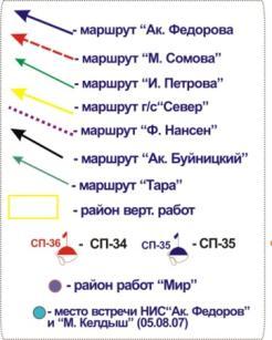
12 «North Pole» ice drifting stations 12 Atmospheric studies Oceanographic studies
 Instrument MSU-MR: 6 channels")
 4 satellites ( 15,17,18,19) Instrument")
 2 satellites ( 1,2) Instrument")
 100 km 4.")
 100 km 5.")


13 International Arctic Observation Satellite System METEOR-3М 1 (Russia) Instrument MSU-MR: 6 channels Resolution 1 km Swath 2800 km 2. NOAA Mission (USA) 4 satellites ( 15,17,18,19) Instrument AVHRR: 5 channels Resolution 1,1 km Swath 3000 km 3. Radarsat Mission (Canada) 2 satellites ( 1,2) Instrument SAR: Microwave: C-band (5,6 sm) Resolution 7,5-100 m Swath (resolution 25 m) 100 km 4. ENVISAT (EU) Instrument АSAR: Microwave: C band (5,6 sm) Resolution m Swath (resolution 30 m) 100 km 5. EOS Mission (USA) 2 satellites (TERRA & AQUA) Instrument MODIS: 36 channels Resolution m Swath 2330 km 6. MetOp (EU) Instrument ASCAT: Microwave: C-band (5,6 sm) Resolution 25 km Swath 2х550 km 7. FY-1 (China) Instrument MVISR: 10 channels Resolution 1,1km Swath 3200 km 8. DMSP Mission (USA) 5 satellites (F14,15,16,17,18) Instrument SSM/IS: 24 channels Resolution: 25х17 km - 70х42 km Swath 1700 km
 (запущен 20.0.01.")
14 Future Russian Observation Satellite System 14 (запущен г.) (запущен г.)

15 Satellite System ARKTIKA 15


16 Automated ice informational system for the Arctic (ALISA) 16 Goals: year round monitoring of sea ice and hydrometeorological conditions; hydrometeorological operational support of maritime activities Purposes: diagnosis and forecast of sea ice and hydrometeorological conditions; development of recommendations on the choice of route options for navigation; informational hydrometeorological support for maritime operations Consumers: Federal and state agencies Navy Shipping companies


17 Sea ice forecast 17 Forecast of ice distribution Forecast of hummocks concentration Forecast of compression Recommended routes
 in the Arctic 18")


.")
18 Global Maritime Distress Safety System (GMDSS) in the Arctic 18 Zones for preparation of meteorological and ice SafetyNET and NAVTEX bulletins (Canada, METAREA XVII XVIII, Norway, METAREA XIX, Russia, METAREA XX XXI). Average accuracy of forecasts (%)
 19 Main tasks to ensure interaction between marine information systems of Russia to form the unified information space on oceans and coastal zones to support the maritime")
 1500 user requests")
19 Unified State System of Information on World Ocean Decision of the Government of the Russian Federation of No 836, add. 2007) 19 Main tasks to ensure interaction between marine information systems of Russia to form the unified information space on oceans and coastal zones to support the maritime activity via access to integrated data and product to enable system to system data exchange with foreign/international information systems ESIMO (version 1/2008, current status) 19 data centers from 12 Ministries/Agencies and RAS information on 286 marine parameters of 16 disciplines 1450 on line resources (183 data bases, more 40 % realtime) 1500 user requests daily and data down loading 70 Gb monthly

 1500 user requests daily")

20 Unified State System of Information on World Ocean Decision of the Government of the Russian Federation of No 836, add. 2007) ESIMO (version 1/2008, current status) 19 data centers from 12 Ministries/Agencies and RAS information on 286 marine parameters of 16 disciplines 1450 on-line resources (183 data bases, more 40 % real-time) 1500 user requests daily and data down-loading 70 Gb monthly Main tasks to ensure interaction between marine information systems of Russia to form the unified information space on oceans and coastal zones to support the maritime activity via access to integrated data and product to enable system to system data exchange with foreign/international information systems


21 Marine System s Interaction and Integration Service 21 ESIMO resource registration Monitoring of system operation Data and product management


22 Search and Access Service 22 Data search criteria's On line access and delivering data Data viewing and down loading


23 GIS Analysis Service/1 23 Joint analysis of maritime ship trafic and hydrometeo conditions

, 4.08.")
24 GIS Analysis Service/2 24 Joint analysis of maritime ship positions and clouds (MODIS),

 Storm frequency (June,")


 Transhipment cargoes in the ports of")
 Frequency of cyclones for 2000")
25 Applied Tasks Service Interactive assessment and forecast of oil pollution for Arctic region Storm indicators on Barents sea 25 Storm frequency ( ) Storm frequency (June, User interface for service OilMARS Example of AT Oil Pollution realoization Maritime transportation operations and weather phenomena Storm intensity (pressure anomalies, ) Transhipment cargoes in the ports of Russian Arctic Winter Storm intensity (June, Summer 2011) Frequency of cyclones for (Barents Sea)


in")
26 Technology of modeling and forecast of oil pollutions 26 View of interface OilMARS Oil tanker «Prestige». The results of calculation pollution redistribution during November 17, 2002 and image from ASAR/ENVISAT. Distribution of oil concentration (mg/м 3 )in the Kara (a, c) and Laptev Seas (b, d) Example of operative prognostic calculation


27 New innovative technology of hydrometeorological support of ice navigation (AKMON) 27 AKMON is replicated hardware and software complex developed in Roshydromet to create information systems for monitoring and forecasting of atmospheric and hydrospheric conditions using a network of workstations for preparation of information and redistribution of information products to customers Tasks: Support for ice conditions management; Sea ice cover monitoring; Planning of operations possibility, duration, costs etc; Operative planning and control; Relay of information to the end user terminal using navigational compatible formats (on the bridge of icebreaker, cargo vessel); Choice of variant and navigation route. End user terminal allows to overlay following information in ENC system: Satellite imagery; Ice analysis charts; Ice forecast charts; Navigational recommendations; Synoptic charts and weather forecasts


28 New systems of sea ice mapping in Electronic Navigational Charts (ENC) Navy Sailor 4000 Ice Option 28 Regional ice chart Review ice chart Ice layer (detailed ice chart) in ENC

29 The IPY Chart 29


30 IPY 2007/08: marine expeditions Expeditions in 2007 Expeditions in 2008 Russian marine research 30 Non Russian marine research
31 Thank you for attention!
The known requirements for Arctic climate services
 The known requirements for Arctic climate services based on findings described in STT White paper 8/2015 Johanna Ekman / EC PHORS STT Regional drivers The Arctic region is home to almost four million people
Arctic observational network
 Arctic observational network Alexander Makshtas Arctic and Antarctic Research Institute Russian drifting stations in XX and XXI centures 003-013 195-1991 Lidar Echo-sounder Echo-sounder emitter Radiation
NOAA/NESDIS Contributions to the International Polar Year (IPY)
") NOAA/NESDIS Contributions to the International Polar Year (IPY) WMO Space Task Group for IPY 5-66 May 2008 Frascati, Italy Jeff Key and Pablo Clemente-Col Colón Overview NESDIS is responsible for operational
NOAA/NESDIS Contributions to the International Polar Year (IPY) WMO Space Task Group for IPY 5-66 May 2008 Frascati, Italy Jeff Key and Pablo Clemente-Col Colón Overview NESDIS is responsible for operational
ALASKA DEEP-DRAFT ARCTIC PORT EVALUATION
 ALASKA DEEP-DRAFT ARCTIC PORT EVALUATION Joint Study of Federal and State June 20, 2012 Opportunity and Constraint Warming of Arctic region is leading to new maritime opportunities. Thawing of permafrost
Add NOAA nowcoast Layers to Maps
 WebEOC Maps Add-on Quick Reference Guide Add NOAA nowcoast Layers to Maps Overview With Maps Add-on, you can configure an unlimited number of map layers. These layers allow you to control the data you
Country Report - Singapore
 Country Report - Singapore The 5th Meeting of the Coordinating Group Vladivostok city, Russky Island, Russia Far Eastern Federal University of the RA II WIGOS Satellite Project 21 October 2017 Outline
Ocean Observation from Haiyang Satellites:
 SPACE SCIENCE ACTIVITIES IN CHINA Ocean Observation from Haiyang Satellites: 2012 2014 AUTHORS JIANG Xingwei LIN Mingsen National Satellite Ocean Application Service, Beijing 100081 ABSTRACT During 2012
Exercise Brunswick ALPHA 2018
 ALPHA Exercise Brunswick ALPHA 2018 Who we are (our structure) What we do (our forecasts) How you can access the information Tropical cyclone information (basic) Overview of the products used for Exercise
ECCC. Environment and Climate Change Canada. Organization contact. Paul Pestieau.
 ECCC Environment and Climate Change Canada http://www.ec.gc.ca Organization contact Paul Pestieau paul.pestieau@canada.ca Other contact 613-990-6855 Areas of contribution User-aspects and verification
Changing Marine Access in the Arctic Ocean: The Arctic Climate Impact Assessment Panama Canal Authority 11 January 2005
 Changing Marine Access in the Arctic Ocean: The Arctic Climate Impact Assessment Panama Canal Authority 11 January 2005 Lawson Brigham Deputy Director, U.S. Arctic Research Commission ACIA Contributing
Ice surveys, meteorological and oceanographic data What is available and up-to-date?
 Ice surveys, meteorological and oceanographic data What is available and up-to-date? Leader of the Norwegian Ice Service +47 77 62 13 15 - nick.hughes@met.no Norwegian Meteorological Institute met.no 1
NOAA Great Lakes CoastWatch Program
 Great Lakes Workshop Series on Remote Sensing of Water Quality May 7-8, 2014 NOAA GLERL, 4840 South State Rd, Ann Arbor, MI NOAA Great Lakes CoastWatch Program CoastWatch is a nationwide National Oceanic
Interpretation of Polar-orbiting Satellite Observations. Atmospheric Instrumentation
 Interpretation of Polar-orbiting Satellite Observations Outline Polar-Orbiting Observations: Review of Polar-Orbiting Satellite Systems Overview of Currently Active Satellites / Sensors Overview of Sensor
EUMETSAT STATUS AND PLANS
 1 EUM/TSS/VWG/15/826793 07/10/2015 EUMETSAT STATUS AND PLANS François Montagner, Marine Applications Manager, EUMETSAT WMO Polar Space Task Group 5 5-7 October 2015, DLR, Oberpfaffenhofen PSTG Strategic
E x a m p l e s o f t o o l s f o r s e a s i t u a t i o n a l a w a r e n e s s u s i n g C M E M S d a t a. Copernicus EU
 E x a m p l e s o f t o o l s f o r s e a s i t u a t i o n a l a w a r e n e s s u s i n g C M E M S d a t a Copernicus EU Copernicus EU Copernicus EU www.copernicus.eu S e a S i t u a t i o n a l A w
NATIONAL REPORT OF HYDROGRAPHIC SERVICE OF THE RUSSIAN FEDERATION NAVY
 2nd Meeting Arctic Regional Hydrographic Commission Copenhagen Denmark September 28-29, 2011 ARHC2-02B National report Russian Federation NATIONAL REPORT OF HYDROGRAPHIC SERVICE OF THE RUSSIAN FEDERATION
SAWS: Met-Ocean Data & Infrastructure in Support of Industry, Research & Public Good. South Africa-Norway Science Week, 2016
 SAWS: Met-Ocean Data & Infrastructure in Support of Industry, Research & Public Good South Africa-Norway Science Week, 2016 Marc de Vos, November 2016 South Africa: Context http://learn.mindset.co.za/sites/default/files/resourcelib/e
Services Requirements Paper Executive Council Panel of Experts on Polar & High Mountain Observations, Research, and Services
 Services Requirements Paper Executive Council Panel of Experts on Polar & High Mountain Observations, Research, and Services Aimee M. Devaris Regional Director U.S. National Oceanic and Atmospheric Administration
CONTENTS. Foreword... Summary (English, French, Russian, Spanish) 1. Introduction by R. Schneider
 1. Introduction by R. Schneider") CONTENTS Page Foreword............ IX Summary (English, French, Russian, Spanish) XI 1. Introduction by R. Schneider.. 1 1.1 1.1.1 1.1.2 1.1.3 1.1.4 1.1.5 1.1.6 1.2 1.2.1 1.2.2 1.2.3 The present position
CONTENTS Page Foreword............ IX Summary (English, French, Russian, Spanish) XI 1. Introduction by R. Schneider.. 1 1.1 1.1.1 1.1.2 1.1.3 1.1.4 1.1.5 1.1.6 1.2 1.2.1 1.2.2 1.2.3 The present position
An Arctic Perspective NCEI's Prototype Arctic Data Viewer
 An Arctic Perspective NCEI's Prototype Arctic Data Viewer NCEI Arctic Action Team Kate Rose NOAA National Environmental Satellite, Data, and Information Service National Centers for Environmental Information
WMO Integrated Global Observing Systems (WIGOS) and the QA4EO
 and the QA4EO") WMO OMM World Meteorological Organization Working together in weather, climate and water WMO Integrated Global Observing Systems (WIGOS) and the QA4EO J. Lafeuille WMO Space Programme WMO www.wmo.int Outline
WMO OMM World Meteorological Organization Working together in weather, climate and water WMO Integrated Global Observing Systems (WIGOS) and the QA4EO J. Lafeuille WMO Space Programme WMO www.wmo.int Outline
Maritime Weather Information: Automatic Reporting, A New Paradigm
 Maritime Weather Information: Automatic Reporting, A New Paradigm Joe Sienkiewicz, NOAA/NWS Ocean Prediction Center Responsibilities under SOLAS Met Services Contracting governments Observations Limited
NWSEO CALLS FOR NATIONAL CLIMATE SERVICE TO BE MADE PART OF THE NATIONAL WEATHER SERVICE
 APRIL 2009 NWSEO CALLS FOR NATIONAL CLIMATE SERVICE TO BE MADE PART OF THE NATIONAL WEATHER SERVICE At its recent winter meeting, the NWSEO National Council decided to urge the Administration and Congress
On strategy for the development of the Russian Federation activities in the Antarctic for the period until 2020 and longer-term perspective
 Agenda Item: ATCM 5 Presented by: Original: Russian Federation Russian, English On strategy for the development of the Russian Federation activities in the Antarctic for the period until 2020 and longer-term
Space for the Arctic
 Space for the Arctic Bo Andersen Norwegian Polar Committee & Norwegian Space Centre 1 My Mantra for Space Few, if any of the global challenges can be resolved by space alone But Few, if any can be resolved
NOAA Arctic Priorities and Potential Contributions to PPP/YOPP. Randall Dole NOAA Earth System Research Laboratory Physical Sciences Division
 NOAA Arctic Priorities and Potential Contributions to PPP/YOPP Randall Dole NOAA Earth System Research Laboratory Physical Sciences Division 1 NOAA s Arctic Goals Forecast Sea Ice Strengthen Foundational
Direct Readout at the Meteorological Service of Canada
 Direct Readout at the Meteorological Service of Canada CSPP Users Meeting 2015 Darmstadt, Germany April 14-16, 2015 David Bradley Manager, Earth Observation and Geomatics Meteorological Service of Canada
Graduate Courses Meteorology / Atmospheric Science UNC Charlotte
 Graduate Courses Meteorology / Atmospheric Science UNC Charlotte In order to inform prospective M.S. Earth Science students as to what graduate-level courses are offered across the broad disciplines of
An Overview of NOAA s Satellite, Data, and Information Stewardship Program
 An Overview of NOAA s Satellite, Data, and Information Stewardship Program John J. Bates and Mitch Goldberg National Oceanic and Atmospheric Administration National Environmental Satellite Data and Information
Climates of NYS. Definitions. Climate Regions of NYS. Storm Tracks. Climate Controls 10/13/2011. Characteristics of NYS s Climates
 Definitions Climates of NYS Prof. Anthony Grande 2011 Weather and Climate Weather the state of the atmosphere at one point in time. The elements of weather are temperature, air pressure, wind and moisture.
Detection, tracking and study of polar lows from satellites Leonid P. Bobylev
 Detection, tracking and study of polar lows from satellites Leonid P. Bobylev Nansen Centre, St. Petersburg, Russia Nansen Centre, Bergen, Norway Polar lows and their general characteristics International
DRR-related mandates and relevant activities and projects of RA III
 DRR-related mandates and relevant activities and projects of RA III 2015 Meeting of the Disaster Risk Reduction Focal Points of WMO Regional Associations, Technical Commissions and Programmes (DRR FP RA-TC-TP)
Storm and Storm Systems Related Vocabulary and Definitions. Magnitudes are measured differently for different hazard types:
 Storm and Storm Systems Related Vocabulary and Definitions Magnitude: this is an indication of the scale of an event, often synonymous with intensity or size. In natural systems, magnitude is also related
CHAPTER 13 WEATHER ANALYSIS AND FORECASTING MULTIPLE CHOICE QUESTIONS
 CHAPTER 13 WEATHER ANALYSIS AND FORECASTING MULTIPLE CHOICE QUESTIONS 1. The atmosphere is a continuous fluid that envelops the globe, so that weather observation, analysis, and forecasting require international
Preparing for NOAA s Next Generation GOES-R & JPSS
 Preparing for NOAA s Next Generation GOES-R & JPSS Mark Paese Deputy Assistant Administrator NOAA Environmental Satellite & Information Service (NESDIS) WMO Cg-17: Ensuring User Readiness for New Generation
NGGPS Community Sea Ice Model Recommendation Workshop. Rebecca Heim / Gene Petrescu NOAA/NWS Alaska Region
 NGGPS Community Sea Ice Model Recommendation Workshop Rebecca Heim / Gene Petrescu NOAA/NWS Alaska Region NWS Alaska Region Ice Services Excerpts from NOAAs Arctic Action Plan NOAA s National Weather Service
CopernicusEU. the EU's Earth Observation Programme. Sara Zennaro Atre Delegation of the European Union to Japan
 Copernicus the EU's Earth Observation Programme Sara Zennaro Atre Delegation of the European Union to Japan Status Overview, Sept 2016 & Ocean Policies Seminar 4 October 2016 ollow us on: Copernicus EU
Use the terms from the following list to complete the sentences below. Each term may be used only once.
 Skills Worksheet Directed Reading Section: Air Masses Use the terms from the following list to complete the sentences below. Each term may be used only once. high pressure poles low pressure equator wind
Weather Unit Part 2: Meteorology
 Name: Earth Science Date: Period: Weather Unit Part 2: Meteorology 1 The map below shows North America and its surrounding bodies of water. Country borders are shown. On the map, label the following locations:
EONav Satellite data in support of maritime route optimization
 EONav Satellite data in support of maritime route optimization Leif Eriksson Department of Space, Earth and Environment Chalmers University of Technology Outline Why is maritime navigation support needed?
Second Session of the Pan-Arctic Regional Climate Outlook Forum (PARCOF-2), virtual forum, October 2018
, virtual forum, October 2018") Second Session of the Pan-Arctic Regional Climate Outlook Forum (PARCOF-2), virtual forum, October 2018 Consensus Statement for the Arctic Winter 2018-2019 Season Outlook Climate change in the Arctic is
Second Session of the Pan-Arctic Regional Climate Outlook Forum (PARCOF-2), virtual forum, October 2018 Consensus Statement for the Arctic Winter 2018-2019 Season Outlook Climate change in the Arctic is
Joint Polar Satellite System. 3 rd Post-EPS User Consultation Workshop Mike Haas
 3 rd Post-EPS User Consultation Workshop Mike Haas Overview Introduction - Policy Drivers - Management System Description - Space Segment - Ground Segment Partnerships Status Benefits 2 Introduction (Policy
INCA-CE achievements and status
 INCA-CE achievements and status Franziska Strauss Yong Wang Alexander Kann Benedikt Bica Ingo Meirold-Mautner INCA Central Europe Integrated nowcasting for the Central European area This project is implemented
25.1 Air Masses. Section 25.1 Objectives
 Section 25.1 Objectives Explain how an air mass forms. List the four main types of air masses. Describe how air masses affect the weather of North America. Air Masses 25.1 Air Masses Differences in air
Deutscher Wetterdienst
 WakeNet3-Greenwake Workshop Wake Vortex & Wind Monitoring Sensors in all weather conditions DWD s new Remote Wind Sensing Equipment for an Integrated Terminal Weather System (ITWS) Frank Lehrnickel Project
Joint Meeting of RA II WIGOS Project and RA V TT-SU on 11 October 2018 BMKG Headquarter Jakarta, Indonesia. Mrs. Sinthaly CHANTHANA
 Joint Meeting of RA II WIGOS Project and RA V TT-SU on 11 October 2018 BMKG Headquarter Jakarta, Indonesia Mrs. Sinthaly CHANTHANA Lao PDR Background Department of Meteorology and Hydrology ( DMH ) in
EPS-SG Candidate Observation Missions
 EPS-SG Candidate Observation Missions 3 rd Post-EPS User Consultation Workshop Peter Schlüssel Slide: 1 EPS-SG benefits to activities of NMSs Main Payload High-Resolution Infrared Sounding Microwave Sounding
Weather Satellite Data Applications for Monitoring and Warning Hazard at BMKG
 The 5th Meeting of the Coordinating Group of the RA II WIGOS Satellite Project 21 October 2017, Vladivostok city, Russky Island, Russia Far Eastern Federal University Weather Satellite Data Applications
Flood SensorWeb Dan Mandl / Fritz Policelli NASA/GSFC
 Flood SensorWeb Dan Mandl / Fritz Policelli NASA/GSFC 10-16-08 1 Purpose Vision of Flood Sensor Web Present status of Flood SensorWeb initiative Some relevant examples from Fire SensorWeb efforts Goal
Sea Ice Characteristics and Operational Conditions for Ships Working in the Eastern Zone of the NSR
 The Arctic 2030 Project: Feasibility and Reliability of Shipping on the Northern Sea Route and Modeling of an Arctic Marine Transportation & Logistics System 3-rd. Industry Seminar: Sea-Ice & Operational
MERSEA Marine Environment and Security for the European Area
 MERSEA Marine Environment and Security for the European Area Development of a European system for operational monitoring and forecasting of the ocean physics, biogeochemistry, and ecosystems, on global
Understanding Weather and Climate Risk. Matthew Perry Sharing an Uncertain World Conference The Geological Society, 13 July 2017
 Understanding Weather and Climate Risk Matthew Perry Sharing an Uncertain World Conference The Geological Society, 13 July 2017 What is risk in a weather and climate context? Hazard: something with the
CANADIAN HYDROGRAPHIC SERVICE & OCEANOGRAPHIC SERVICES
 CANADIAN HYDROGRAPHIC SERVICE & OCEANOGRAPHIC SERVICES Presentation to Warming of the North Conference Ottawa, March 2 nd, 2015 Denis Hains, Director General & Hydrographer General of Canada TIP OF THE
EFFECTIVE TROPICAL CYCLONE WARNING IN BANGLADESH
 Country Report of Bangladesh On EFFECTIVE TROPICAL CYCLONE WARNING IN BANGLADESH Presented At JMA/WMO WORKSHOP ON EFFECTIVE TROPICAL CYCLONE WARNING IN SOUTHEAST ASIA Tokyo, Japan,11-14 March 2014 By Sayeed
ADVANTAGES OF GIS-INTEGRATED MARITIME DATA IN THE BLACK SEA REGION FOR MULTIPURPOSE USE
 INTERAGENCY INTERACTION IN CRISIS MANAGEMENT AND DISASTER RESPONSE 2017 ADVANTAGES OF GIS-INTEGRATED MARITIME DATA IN THE BLACK SEA REGION FOR MULTIPURPOSE USE Lyubka Pashova 1, Anna Kortcheva 2, Vasko
Wave processes in Arctic Seas, observed from TerraSAR-X
 DISTRIBUTION STATEMENT A. Approved for public release; distribution is unlimited. Wave processes in Arctic Seas, observed from TerraSAR-X Susanne Lehner DLR German Air and Space Research Center Earth Observation
MODERN TECHNOLOGIES IN HYDRO-METEOROLOGICAL INFORMATION SYSTEMS
 MODERN TECHNOLOGIES IN HYDRO-METEOROLOGICAL INFORMATION SYSTEMS MARK HEGGLI, INNOVATIVE HYDROLOGY CONSULTING METEOROLOGIST/HYDROLOGIST TO THE WORLD BANK AREAS OF TECHNOLOGY ADVANCEMENT RECENT TECHNOLOGY
Definitions Weather and Climate Climates of NYS Weather Climate 2012 Characteristics of Climate Regions of NYS NYS s Climates 1.
 Definitions Climates of NYS Prof. Anthony Grande 2012 Weather and Climate Weather the state of the atmosphere at one point in time. The elements of weather are temperature, t air pressure, wind and moisture.
Challenges for SAR operations in the Barents Sea. Tor Einar Berg, Beate Kvamstad
 Challenges for SAR operations in the Barents Sea Tor Einar Berg, Beate Kvamstad MARINTEK, Trondheim, Norway, Tor.E.Berg@marintek.sintef.no This paper gives a brief overview of challenges in SAR operations
Sea ice charts and SAR for sea ice classification. Patrick Eriksson Juha Karvonen Jouni Vainio
 Sea ice charts and SAR for sea ice classification Patrick Eriksson Juha Karvonen Jouni Vainio ECMWF Ocean Workshop, 22-25 January 2018 Ice service from past to present Finland has long experience in ice
Status of cataloguing high impact events in Europe
 Status of cataloguing high impact events in Europe Stefan Rösner supported by Buhalqem Mamtimin, Maya Körber Division Regional Climate Monitoring, Deutscher Wetterdienst 1 WMO Regional Association VI Test
Validation of sea ice concentration in the myocean Arctic Monitoring and Forecasting Centre 1
 Note No. 12/2010 oceanography, remote sensing Oslo, August 9, 2010 Validation of sea ice concentration in the myocean Arctic Monitoring and Forecasting Centre 1 Arne Melsom 1 This document contains hyperlinks
Alaska Ocean Observing System 101 Anchorage, Alaska
 Alaska Ocean Observing System 101 Anchorage, Alaska Molly McCammon, Director Alaska Ocean Observing System (AOOS) A Regional Observing System within the Integrated Ocean Observing System www.aoos.org IOOS
Marine Situational Awareness and Environmental Monitoring using Satellites
 1 The Ny-ålesund Symposium 2013 The Changing Arctic Opportunity or Threat Marine Situational Awareness and Environmental Monitoring using Satellites Rolf Skatteboe President, Kongsberg Satellite Services
RUSSIAN EARTH OBSERVATION MISSIONS: satellites, ground segment and data access evolution
 RUSSIAN EARTH OBSERVATION MISSIONS: satellites, ground segment and data access evolution Tamara Ganina Deputy Chief of Prospective Development Dep. WGISS-40 UKSA, Harwell, UK September 28 October 2, 2015
Using Satellite Passive Microwave Data to Study Arctic Polar Lows
 Using Satellite Passive Microwave Data to Study Arctic Polar Lows Elizaveta V. Zabolotskikh 1,2, Leonid P. Bobylev 1,3, Vladimir Kudryavtsev 1,2, and Leonid Mitnik 4 1Nansen Centre, St. Petersburg, Russia
Challenges Faced by the Marine Contractors Working in Western and Southern Barents Sea Lecture at CESOS, NTNU, 14th August 2013
 Challenges Faced by the Marine Contractors Working in Western and Southern Barents Sea Lecture at CESOS, NTNU, 14th August 2013 Ove T. Gudmestad, University of Stavanger Motivation The Cold climate areas
Recent Data Assimilation Activities at Environment Canada
 Recent Data Assimilation Activities at Environment Canada Major upgrade to global and regional deterministic prediction systems (now in parallel run) Sea ice data assimilation Mark Buehner Data Assimilation
MONITORING THE ATMOSPHERE, OCEAN AND CLIMATE FROM SPACE
 MONITORING THE ATMOSPHERE, OCEAN AND CLIMATE FROM SPACE TRANSFORMING OUR WORLD MONITORING WEATHER AND CLIMATE FROM SPACE MONITORING THE ATMOSPHERE, OCEAN AND CLIMATE FROM SPACE FOR TRANSFORMING OUR WORLD
Use of Satellite Earth Observations, in situ data and numerical model capabilities for oil spill contingency. Page 1
 Use of Satellite Earth Observations, in situ data and numerical model capabilities for oil spill contingency Page 1 Oil spill service Page 2 Interest of Earth-Observation (EO) data for oil and gas companies
HY-2A Satellite User s Guide
 National Satellite Ocean Application Service 2013-5-16 Document Change Record Revision Date Changed Pages/Paragraphs Edit Description i Contents 1 Introduction to HY-2 Satellite... 1 2 HY-2 satellite data
Sustaining Arctic Observing Networks SAON
 Sustaining Arctic Observing Networks SAON Atmosphere Breakout Group Stockholm, Sweden November 12 14, 2007 Lisa Darby (NOAA) & Jussi Paatero (FMI) What role does the atmosphere play in the reduction of
New NASA Ocean Observations and Coastal Applications
 New NASA Ocean Observations and Coastal Applications Duane Armstrong Chief, Applied Science & Technology Project Office August 20, 2014 1 Outline NASA s new Earth Science Ocean Science Missions for 2014
WMO Liaison Report. Submitted by WMO SUMMARY
 WWNWS WWNWS1/3/3/3 Meeting 1 30 July 2009 Agenda Item 3.3.3 WMO Liaison Report Submitted by WMO SUMMARY Executive Summary: This document provides the report of the major activities, challenges and requirements
Guide for planning international transit voyages on the NSR
 The Arctic 2030 Project: Feasibility and Reliability of Shipping on the Northern Sea Route and Modeling of an Arctic Marine Transportation & Logistics System 1-st Industry Seminar: NSR s Legislation, Tariff
VOYAGE (PASSAGE) PLANNING
 PLANNING") VOYAGE (PASSAGE) PLANNING Introduction O Passage planning or voyage planning is a procedure of developing a complete description of a vessel's voyage from start to finish. O Production of a passage plan
VOYAGE (PASSAGE) PLANNING Introduction O Passage planning or voyage planning is a procedure of developing a complete description of a vessel's voyage from start to finish. O Production of a passage plan
National Report on Weather Forecasting Service
 MINISTRY OF WATER RESOURCES AND METEOROLOGY DEPARTMENT OF METEOROLOGY, CAMBODIA National Report on Weather Forecasting Service Tokyo, 11-15 March 2014 Department of Meteorology, Cambodia Presentation Outline
International Arctic Systems for Observing the Atmosphere IPY Activity 196 Taneil Uttal NOAA Earth Systems Laboratory.
 International Arctic Systems for Observing the Atmosphere IPY Activity 196 Taneil Uttal NOAA Earth Systems Laboratory www.iasoa.org http://ipy.arcticportal.org/ IASOA Beginnings Lots of high level governments
Instrumentation planned for MetOp-SG
 Instrumentation planned for MetOp-SG Bill Bell Satellite Radiance Assimilation Group Met Office Crown copyright Met Office Outline Background - the MetOp-SG programme The MetOp-SG instruments Summary Acknowledgements:
Effective Utilization of Synthetic Aperture Radar (SAR) Imagery in Rapid Damage Assessment
 Imagery in Rapid Damage Assessment") Effective Utilization of Synthetic Aperture Radar (SAR) Imagery in Rapid Damage Assessment Case Study Pakistan Floods SUPARCO M. Maisam Raza, Ahmad H. Rabbani SEQUENCE Flood Monitoring using Satellite
Effective Utilization of Synthetic Aperture Radar (SAR) Imagery in Rapid Damage Assessment Case Study Pakistan Floods SUPARCO M. Maisam Raza, Ahmad H. Rabbani SEQUENCE Flood Monitoring using Satellite
EUMETSAT SAF NETWORK. Lothar Schüller, EUMETSAT SAF Network Manager
 1 EUMETSAT SAF NETWORK Lothar Schüller, EUMETSAT SAF Network Manager EUMETSAT ground segment overview METEOSAT JASON-2 INITIAL JOINT POLAR SYSTEM METOP NOAA SATELLITES CONTROL AND DATA ACQUISITION FLIGHT
National Climatic Data Center Data Management Issues Tom Karl Director, NOAA s National Climatic Data Center
 National Climatic Data Center Data Management Issues Tom Karl Director, NOAA s National Climatic Data Center Opening Meeting NOAA Science Advisory Board s Data Archiving and Access Requirements Working
CLIMATE CHANGE ADAPTATION BY MEANS OF PUBLIC PRIVATE PARTNERSHIP TO ESTABLISH EARLY WARNING SYSTEM
 CLIMATE CHANGE ADAPTATION BY MEANS OF PUBLIC PRIVATE PARTNERSHIP TO ESTABLISH EARLY WARNING SYSTEM By: Dr Mamadou Lamine BAH, National Director Direction Nationale de la Meteorologie (DNM), Guinea President,
Report. Northern Africa. RAIDEG-8, 1-2 Nov 2017
 Report Northern Africa RAIDEG-8, 1-2 Nov 2017 Report Northern Africa RAIDEG-8, 1-2 Nov 2017 Important Note: Formal letters have been sent from the PR of Morocco with WMO to PRs of Algeria, Tunisia, Libya
NOAA s Regional Climate Science & Information: Opportunities and Challenges
 NOAA s Regional Climate Science & Information: Opportunities and Challenges Dr. Wayne Higgins Climate Program Office, Director Office of Oceanic and Atmospheric Research National Oceanic and Atmospheric
Current status and plans for developing sea ice forecast services and products for the WMO Arctic Regional Climate Centre Sea Ice Outlook
 Current status and plans for developing sea ice forecast services and products for the WMO Arctic Regional Climate Centre 2018 Sea Ice Outlook 13 WMO Global Producing Centres providing seasonal forecasts
REVISION OF THE STATEMENT OF GUIDANCE FOR GLOBAL NUMERICAL WEATHER PREDICTION. (Submitted by Dr. J. Eyre)
") WORLD METEOROLOGICAL ORGANIZATION Distr.: RESTRICTED CBS/OPAG-IOS (ODRRGOS-5)/Doc.5, Add.5 (11.VI.2002) COMMISSION FOR BASIC SYSTEMS OPEN PROGRAMME AREA GROUP ON INTEGRATED OBSERVING SYSTEMS ITEM: 4 EXPERT
WORLD METEOROLOGICAL ORGANIZATION Distr.: RESTRICTED CBS/OPAG-IOS (ODRRGOS-5)/Doc.5, Add.5 (11.VI.2002) COMMISSION FOR BASIC SYSTEMS OPEN PROGRAMME AREA GROUP ON INTEGRATED OBSERVING SYSTEMS ITEM: 4 EXPERT
National Satellite Data Centre and Finnish Sentinel Collaborative Ground Segment. Jyri Heilimo Finnish Meteorological Instute
 National Satellite Data Centre and Finnish Sentinel Collaborative Ground Segment Jyri Heilimo Finnish Meteorological Instute Sodankylä National Satellite Data Centre National satellite data centre providing
ESCI 110: 2 s.h. Introduction to Earth Sciences Programs ESCI 322: 3 s.h. Environmental Hydrology ESCI 241: 4 s.h. Meteorology (G2, L)
") ESCI 110: 2 s.h. Introduction to Earth Sciences Programs General introduction to each of the earth sciences disciplines and to college life. 2 hrs. lec. Offered in fall. Restricted to earth sciences majors.
ESCI 110: 2 s.h. Introduction to Earth Sciences Programs General introduction to each of the earth sciences disciplines and to college life. 2 hrs. lec. Offered in fall. Restricted to earth sciences majors.
IMPORTANCE OF SATELLITE DATA (FOR REANALYSIS AND BEYOND) Jörg Schulz EUMETSAT
 Jörg Schulz EUMETSAT") IMPORTANCE OF SATELLITE DATA (FOR REANALYSIS AND BEYOND) Jörg Schulz EUMETSAT Why satellite data for climate monitoring? Global coverage Global consistency, sometimes also temporal consistency High spatial
IMPORTANCE OF SATELLITE DATA (FOR REANALYSIS AND BEYOND) Jörg Schulz EUMETSAT Why satellite data for climate monitoring? Global coverage Global consistency, sometimes also temporal consistency High spatial
NOAA Nautical Charts and Coastal and Marine Spatial Planning. Meredith Westington Chief Geographer NOAA/NOS/Office of Coast Survey
 NOAA Nautical Charts and Coastal and Marine Spatial Planning Meredith Westington Chief Geographer NOAA/NOS/Office of Coast Survey Ocean Policy Task Force What is CMSP? A comprehensive, adaptive, integrated,
Progress on GCOS-China CMA IOS Development Plan ( ) PEI, Chong Department of Integrated Observation of CMA 09/25/2017 Hangzhou, China
 PEI, Chong Department of Integrated Observation of CMA 09/25/2017 Hangzhou, China") Progress on GCOS-China CMA IOS Development Plan (2016-2020) PEI, Chong Department of Integrated Observation of CMA 09/25/2017 Hangzhou, China 1. Progress on GCOS-China 1 Organized GCOS-China GCOS-China
Progress on GCOS-China CMA IOS Development Plan (2016-2020) PEI, Chong Department of Integrated Observation of CMA 09/25/2017 Hangzhou, China 1. Progress on GCOS-China 1 Organized GCOS-China GCOS-China
A two-season impact study of the Navy s WindSat surface wind retrievals in the NCEP global data assimilation system
 A two-season impact study of the Navy s WindSat surface wind retrievals in the NCEP global data assimilation system Li Bi James Jung John Le Marshall 16 April 2008 Outline WindSat overview and working
MANAGEMENT OF THE NIEMEN RIVER BASIN WITH ACCOUNT OF ADAPTATION TO CLIMATE CHANGE. Hydro-meteorological Monitoring System
 MANAGEMENT OF THE NIEMEN RIVER BASIN WITH ACCOUNT OF ADAPTATION TO CLIMATE CHANGE Hydro-meteorological Monitoring System Draft Interim Report Milestone 1 Giovanni Crema 18 October 2012 Scope of work assessment
Mersea Oil Spill Drift Forecast Demonstrations in TOP2
 Mersea Oil Spill Drift Forecast Demonstrations in TOP2 Bruce Hackett (met.no), George Zodiatis (UCY), Pierre Daniel (MeteoFrance), Francois Parthiot (Cedre) Presented at 3rd Mersea Plenary Meeting, CNR,
Chapter 12: Meteorology
 Chapter 12: Meteorology Section 1: The Causes of Weather 1. Compare and contrast weather and climate. 2. Analyze how imbalances in the heating of Earth s surface create weather. 3. Describe how and where
Operational ice charting in mid-latitudes using Near-Real-Time SAR imagery
 Operational ice charting in mid-latitudes using Near-Real-Time SAR imagery Sergey Vernyayev Ice Engineer ICEMAN.KZ Carles Debart Project Manager Energy, Environment and Security Yevgeniy Kadranov Ice charting
The Arctic Climate System GEOG 4271/5271. Mark C. Serreze Department of Geography University of Colorado, Boulder CO
 The Arctic Climate System GEOG 4271/5271 Mark C. Serreze Department of Geography University of Colorado, Boulder CO serreze@nsidc.org Why study the Arctic climate system? The fascinating processes that
Floating Ice: Progress in Addressing Science Goals
 Polar Floating Ice: Progress in Addressing Science Goals Stephen Howell 1, Leif Toudal Pedersen 2 and Roberto Saldo 3 1 Environment Canada, Climate Research Division, Toronto, Canada 2 Danish Meteorological
Observed State of the Global Climate
 WMO Observed State of the Global Climate Jerry Lengoasa WMO June 2013 WMO Observations of Changes of the physical state of the climate ESSENTIAL CLIMATE VARIABLES OCEANIC ATMOSPHERIC TERRESTRIAL Surface