Shattering a plate boundary: the 2016 Mw 7.8 Kaikōura earthquake
|
|
|
- Chastity Little
- 5 years ago
- Views:
Transcription


1 Shattering a plate boundary: the 2016 Mw 7.8 Kaikōura earthquake Presenter: Pilar Villamor, On behalf of many, many others...

2 14 November 2016 Kaikōura Earthquake This talk - Background - During the Kaikōura Earthquake - Seismicity - Surface Rupture, coastal deformation - InSAR and GNSS - Ground motions - Rupture model, energy release - Landslides, tsunami, liquefaction - After the Kaikōura Earthquake - Postseismic deformation - Slow slip events Photo: Sally Dellow, Surface rupture of the Papatea Fault displacing the coastal platform, road, railway and hill country.


3 Background The 14 Nov event occurred in the region between the Hikurangi subduction system of the North Island and the oblique collisional regime of the South Island (Alpine Fault) Major elements of New Zealand Plate Boundary Hikurangi Subduction Zone North Island Dextral Fault Belt Alpine Fault Marlborough Fault System
4


5 ACTIVE FAULTS Known active faults and rates North Canterbury faults Onshore Hundalee, c mm/yr The Humps,?? Lowry, c mm/yr Kaiwara, c mm/yr Offshore NorthCant10, c. 1-3 NorthCant13 c. 0.3 mm/yr NorthCant8, c mm/yr Marlborough faults dextral slip rates Onshore Wairau, c. 3 mm/yr Awatere, c. 6 mm/yr Clarence, c. 3 mm/yr Hope Fault, c mm/yr Kekerengu, c mm/yr Offshore Needles, c. 16 mm/yr Chancet, c. 3 mm/yr Vernon, c. 4.5 mm/yr Nicholson B., c. 11 mm/yr Boo Boo, c. 11 mm/yr


6 GNSS: Interseismic velocity from data spanning Sigrun Hreinsdottir et al 2017 Faults from NZ active fault database; Velocities in ITRF14-Pacific plate fixed reference frame


7 The 14 November 2016 Mw 7.8 Kaikōura Earthquake Location and aftershocks Duration: Shaking lasted about 2 minutes Total of 17,492 earthquakes 549 of those earthquakes were M were M have been M6.0 or greater.. Epicentre location: ~100 km from Christchurch ~200 km from Wellington Near Waiau John Ristau Focal Mechanisms Mainshock thrust mechanism Aftershock mechanisms thrust and strike-slip Epicentre M w 7.8 Stephen Bannister in Kaiser et al 2017

8 Effects on the landscape Surface fault rupture Over a dozen major faults ~180 km rupture length up to ~12 m of displacement Coastal uplift ~100 km of coast uplifted Variable, up to ~5 m Tsunami Local run-up up to ~7 m Landslides Tens of thousands Many landslide dams Liquefaction Locally significant, but Nothing approaching severity of liquefaction in Christchurch during the Canterbury EQ sequence 21 faults, 180 km of surface rupture Litchfield et al., in review


9 Hundalee Fault Photo: Mark Stirling NE trend thrust, ~ 1m vertical Photo: Mark Stirling E-W trend thrust, cumulative ~ 2m vertical


10 Photos: Kate Pedley Leader Fault The Woodchester Wall Narges et al., 2017; Nicol et al., in prep. Photo: Andy Nicol


11 Kekeregu fault 12 m max Photo: Tim Little Kearse et al., 2017 and submitted Little et al., 2017 and submitted Photo: Julian Thomson Photo: Tim Little

12 Papatea Fault Eastern coastal trace (left-lateral, reverse) NZ faults tend to have large SEDs for rupture length Photo: Julian Thomson Lagridge et al., 2017, in review Litchfield et al., 2017, in review


13 Post-Nov 14 multibeam mapping and sub-bottom profiling of the Needles and Chancet faults TOPAS PS18 Sub-bottom Profiles Fault rupture Needles Fault rupture preliminary Fault rupture Kekerengu Fault, Little 2015-NHRP Kearse et al., in review Vertical offset up to 1.4 m up to NW

 Clark et")
14 Coastal deformation: uplift and subsidence Approximately 110 km of the coastline underwent deformation Most areas went up, and by a substantial amount A significant stretch of low amplitude coastal subsidence north of the Clarence River Deformation characterised by high variability DAY 1: red subtidal algae Sharp changes around fault ruptures 3 major & 5 minor fault ruptures across coast Broad uplift around Kaikoura Peninsula & northwards related to an offshore fault (Photo: Nicola Litchfield) Clark et al., 2017


15 Surface coseismic deformation: GNSS and INSAR GNSS vertical Satellite interferograms Sentinel-1A - Ascending ALOS-2 - descending GNSS horizontal 5 cm fringes Sigrun Hreinsdottir 03/11/16 15/11/ /10/16 16/11/2016 Sigrun Hreinsdottir Hmax: 6m; Vmax: 2m Next slide Hamling et al. (2017)


 Nissen et al.")
16 Surface deformation: new techniques.. Slightly different results - Optical pixel tracking using various types of satellite images, orthophotos, etc. - 3D differential analysis on satellite images and lidar data; Different 3D differential codes The Papatea Fault Klinger et al., 2017 (PATA Days) Mckenzie et al., 2017 (PATA Days) Nissen et al., 2017 (PATA Days) We are starting to have a much better understanding of co-seismic kinematics, rather that assuming typical halfspace elastic dislocations, e.g, Papatea Bock

17 Fault ruptures in the North Canterbury contractional domain Beautiful example of rupture on non-mature faults Dextral and sinistral strike-slip, reverse N-S trends are along Mesozoic fabric, NW trends current tectonic regime, Moroshita et al., 2017


18 Ground Motions: Intensity New Zealand ShakeMap: MM VIII Isolated pockets of MM IX Nick Horspool GeoNet, felt reports
 Horizontal PGA > 1g recorded in the top of the South Island (Ward, Kekerengu) and the epicentral region (Waiau).")
19 Ground Motion: Large Peak Ground Acceleration Anna Kaiser 3 minutes PGA confirmed up to 1.3g (Ward station) Horizontal PGA > 1g recorded in the top of the South Island (Ward, Kekerengu) and the epicentral region (Waiau). Lower accelerations recorded in Kaikoura Ground shaking significantly lower in Christchurch than Wellington due to northward rupture from epicentre and distribution of fault slip
20 When and where was the energy released? N Video Yoshi Kaneko & Julian Thomson;


21 Numerous fault source models Using one or various of: Source models unknown: rupture of the Kekerengu fault Clark et al., 2017; Hamling et al., 2017 Double displacement in depth Holden et al., accepted Fault ruptured twice - surface deformation from satellite images - near field seismology - teleseismic data Zhang et al., 2017 Different fault rupture mode in depth


 Wang et al.")

22 Source models unknowns: role of the subduction Cesca et al., 2017 interface (interface or shallow dipping crustal plane) Wang et al., 2017 Clark et al., 2017; Hamling et al., 2017 Holden et al., accepted Bai et al., 2017
23 Source models unknowns: role of the Papatea fault Papatea: energy released? Holden et al., accepted Benites et al in prep.: Modelling the near field strong ground motion. Papatea Fault breaks with Mw = 6.9 Non-double couple at Papatea

24 Postseismic slip 16 Dec Feb Nov Dec 2016 Hreinsdottir et al in prep


25 AFTER SLIP & SLOW SLIP EVENTS Time-dependent geodetic inversions (cgps and InSAR) done with TDefnode. Kapiti slow slip event and afterslip beneath northern South Island still ongoing. Afterslip = Mw 7.3, Kapiti SSE = Mw 7.1 Slip on interface beneath northern SI required by a large uplift/subsidence pair in northern South Island, and eastward motion of sites east of Kekerengu/Jordan Thrust Kapiti SSE Wallace, Hreinsdottir in prep. Wallace et al., 2017 Nature
26 Temporal evolution of afterslip on the plate interface and Kapiti SSE Wallace et al., 2017 Nature
27 Insights thoughts for discussion Hazards assessment challenges: - Multi-fault ruptures: How can we account for this complexity in seismic hazard model? Do we need to allow for multiple-segments if we cannot rule out that scenario? (E.g, JordaN-Kek-Needles) - - How much complexity have we missed in historic events that had no INSAR, GNSS, dense seismic instrumentation? In paleo-events? Are earthquakes complex by nature? - Is this earthquake representative of the type of ruptures in this region or the odd event? (Papatea Ft) - Coseismic coastal uplift how would have we interpreted this event as a prehistoric one? A subduction event? Separate crustal events? - What other tectonic environments can this complexity be predicted? Fault mechanics/ fault slip models - Dynamic and static triggering. Connection between co-seismically rupturing faults (why did the Hope Fault not rupture)? - direct impact on how we model fault sources for hazard - Multidisciplinary approach to better understand fault slip models: we are doing really well but nature is continuously challenging us. Data type and quality, and an oversimplified crustal rheology can account for variety in the models.

28 Acknowledgments THANKS!!!!!
The Seismic Hazardscape of New Zealand
 The Seismic Hazardscape of New Zealand Mark Stirling Professor of Earthquake Science Introduction Plate tectonic setting of New Zealand Seismic hazards for University of Otago campuses Kaikoura earthquake
The 14 Nov 2016 Mw 7.8 Kaikoura Earthquake: Surface rupture... and much more
 The 14 Nov 2016 Mw 7.8 Kaikoura Earthquake: Surface rupture... and much more Pilar Villamor on behalf of the Earthquake Geology Response Team (54): Adrian Benson, Alan Bischoff, Alex Hatem, Andrea Barrier,
Journal of Geophysical Research - Solid Earth
 Journal of Geophysical Research - Solid Earth Supporting Information for Transpressional Rupture Cascade of the 2016 M w 7.8 Kaikoura Earthquake, New Zealand Wenbin Xu 1*, Guangcai Feng 2*, Lingsen Meng
2016 Kaikoura Earthquake (NZ) Effects & Phenomena. Trevor Matuschka With special acknowledgement Dan Forster (Damsafety Intelligence)
 Effects & Phenomena. Trevor Matuschka With special acknowledgement Dan Forster (Damsafety Intelligence)") 2016 Kaikoura Earthquake (NZ) Effects & Phenomena Trevor Matuschka With special acknowledgement Dan Forster (Damsafety Intelligence) Contents 1. Kaikoura Earthquake where and what happened 2. Seismic and
2016 Kaikoura Earthquake (NZ) Effects & Phenomena Trevor Matuschka With special acknowledgement Dan Forster (Damsafety Intelligence) Contents 1. Kaikoura Earthquake where and what happened 2. Seismic and
The 14 Nov 2016 M 7.8 Kaikoura, South Island, New Zealand Earthquake: Notes from the Field. Mark Hemphill-Haley - Humboldt State University
 The 14 Nov 2016 M 7.8 Kaikoura, South Island, New Zealand Earthquake: Notes from the Field Mark Hemphill-Haley - Humboldt State University ACKNOWLEDGEMENTS GEOTECHNICAL EXTREME EVENTS RECONNAISSANCE http://www.geerassociation.org
This is a repository copy of Complex multi-fault rupture during the 2016 Mw 7.8 Kaikōura earthquake, New Zealand.
 This is a repository copy of Complex multi-fault rupture during the 2016 Mw 7.8 Kaikōura earthquake, New Zealand. White Rose Research Online URL for this paper: http://eprints.whiterose.ac.uk/113736/ Version:
M7.8 Kaikōura earthquake one year on
 SPECIAL EDITION November 2017 M7.8 Kaikōura earthquake one year on 23 1 Contact details GeoNet website: www.geonet.org.nz Email: info@geonet.org.nz Address: GNS Science, PO Box 30-368, Lower Hutt 5040,
Jocelyn Karen Campbell
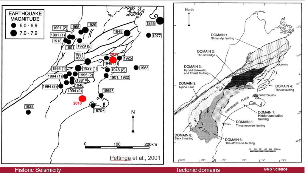
 THE UNCERTAINTIES IN ASSESSING THE IMPACT OF REGIONAL SEISMICITY AT THE WIL SITE Statement of Evidence by Jocelyn Karen Campbell A CANTERBURY FAULTS coded by type CHARACTERISTICS OF THRUST FAULTS IN CANTERBURY
Case Study of Japan: Crustal deformation monitoring with GNSS and InSAR
 Technical Seminar Reference Frame in Practice, Case Study of Japan: Crustal deformation monitoring with GNSS and InSAR Basara Miyahara miyahara-b96ip@milt.go.jp Geospatial Information Authority of Japan
The Impact of the 2010 Darfield (Canterbury) Earthquake on the Geodetic Infrastructure in New Zealand 1
 Earthquake on the Geodetic Infrastructure in New Zealand 1") The Impact of the 2010 Darfield (Canterbury) Earthquake on the Geodetic Infrastructure in New Zealand 1 Graeme BLICK, John BEAVAN, Chris CROOK, Nic DONNELLY Keywords: Darfield Earthquake, control, survey,
The Impact of the 2010 Darfield (Canterbury) Earthquake on the Geodetic Infrastructure in New Zealand 1 Graeme BLICK, John BEAVAN, Chris CROOK, Nic DONNELLY Keywords: Darfield Earthquake, control, survey,
crustal structure experiment beneath Wairarapa - Wellington area: results from SAHKE
 crustal structure experiment beneath Wairarapa - Wellington area: results from SAHKE Tim Stern and SAHKE team* * VUW, GNS, University of Southern California, University of Tokyo(Japan) SAHKE = Seismic
The March 11, 2011, Tohoku-oki earthquake (Japan): surface displacement and source modelling
: surface displacement and source modelling") The March 11, 2011, Tohoku-oki earthquake (Japan): surface displacement and source modelling Salvatore Stramondo Bignami C., Borgstrom S., Chini M., Guglielmino F., Melini D., Puglisi G., Siniscalchi V.,
The March 11, 2011, Tohoku-oki earthquake (Japan): surface displacement and source modelling Salvatore Stramondo Bignami C., Borgstrom S., Chini M., Guglielmino F., Melini D., Puglisi G., Siniscalchi V.,
THE M W KAIKŌURA EARTHQUAKE: SURFACE FAULT RUPTURE AND SEISMIC HAZARD CONTEXT
 Bulletin of the New Zealand Society for Earthquake Engineering, Vol. 50, No. 2, June 2017 73 THE M W 7.8 2016 KAIKŌURA EARTHQUAKE: SURFACE FAULT RUPTURE AND SEISMIC HAZARD CONTEXT Mark W. Stirling 1, N.
Modelling Strong Ground Motions for Subduction Events in the Wellington Region, New Zealand
 Proceedings of the Ninth Pacific Conference on Earthquake Engineering Building an Earthquake-Resilient Society 14-16 April, 2011, Auckland, New Zealand Modelling Strong Ground Motions for Subduction Events
Case study of Japan: Reference Frames in Practice
 Case study of Japan: Reference Frames in Practice Basara Miyahara and Koji Matsuo Sponsors: 1 Outline Introduction - Geodetic reference frame of Japan - GEONET : continuous GNSS observation system Geometric
Incorporating simulated Hikurangi subduction interface spectra into probabilistic hazard calculations for Wellington
 Incorporating simulated Hikurangi subduction interface spectra into probabilistic hazard calculations for Wellington G.H. McVerry & C. Holden GNS Science, Lower Hutt, New Zealand. 2014 NZSEE Conference
The 2016 Valentine s Day Mw 5.7 Christchurch earthquake: Preliminary report
 The 2016 Valentine s Day Mw 5.7 Christchurch earthquake: Preliminary report A. Kaiser, C. Holden, I. Hamling, S. Hreinsdottir, N. Horspool, C. Massey, P. Villamor, D. Rhoades, B. Fry, E; D Anastasio, R.
The Tectonic Setting of New Zealand
 The Tectonic Setting of New Zealand we are here Subduction-driven tectonics The New Zealand continent Papua New Guinea Australia 3,000,000 sq km micro-continent back-arc basin trench volcanism faults accretionary
SOURCES, GROUND MOTION AND STRUCTURAL RESPONSE CHARACTERISTICS IN WELLINGTON OF THE 2013 COOK STRAIT EARTHQUAKES
 188 SOURCES, GROUND MOTION AND STRUCTURAL RESPONSE CHARACTERISTICS IN WELLINGTON OF THE 2013 COOK STRAIT EARTHQUAKES C. Holden 1, A. Kaiser 1, R. Van Dissen 1 and R. Jury 2 SUMMARY The Cook Strait earthquake
Illustrations of historic and pre-historic surface rupture of active faults in New Zealand
 Illustrations of historic and pre-historic surface rupture of active faults in New Zealand R. Van Dissen, P.R., Wood, K. erryman, & S. Nathan Institute of Geological & Nuclear Sciences, Lower Hutt, New
Source studies of the ongoing ( ) sequence of recent large earthquakes in Canterbury
 sequence of recent large earthquakes in Canterbury") Source studies of the ongoing (00-0) sequence of recent large earthquakes in Canterbury C. Holden & J. Beavan GNS Science New Zealand) SUMMARY: On September, 00, a surface rupturing crustal earthquake
Source studies of the ongoing (00-0) sequence of recent large earthquakes in Canterbury C. Holden & J. Beavan GNS Science New Zealand) SUMMARY: On September, 00, a surface rupturing crustal earthquake
Basics of the modelling of the ground deformations produced by an earthquake. EO Summer School 2014 Frascati August 13 Pierre Briole
 Basics of the modelling of the ground deformations produced by an earthquake EO Summer School 2014 Frascati August 13 Pierre Briole Content Earthquakes and faults Examples of SAR interferograms of earthquakes
Crustal deformation by the Southeast-off Kii Peninsula Earthquake
 Crustal deformation by the Southeast-off Kii Peninsula Earthquake 51 Crustal deformation by the Southeast-off Kii Peninsula Earthquake Tetsuro IMAKIIRE, Shinzaburo OZAWA, Hiroshi YARAI, Takuya NISHIMURA
This seminar is jointly presented by the Body Corporate Chairs Group, the Wellington Inner City Associa>on and the Wellington City Council.
 This seminar is jointly presented by the Body Corporate Chairs Group, the Wellington Inner City Associa>on and the Wellington City Council. Please note that these slides do not represent legal advice but
Representative ground-motion ensembles for several major earthquake scenarios in New Zealand
 Representative ground-motion ensembles for several major earthquake scenarios in New Zealand K. Tarbali & B.A. Bradley Department of Civil and Natural Resources Engineering, University of Canterbury, Christchurch.
Earthquakes and Seismotectonics Chapter 5
 Earthquakes and Seismotectonics Chapter 5 What Creates Earthquakes? The term Earthquake is ambiguous: Applies to general shaking of the ground and to the source of the shaking We will talk about both,
Geodesy (InSAR, GPS, Gravity) and Big Earthquakes
 and Big Earthquakes") Geodesy (InSAR, GPS, Gravity) and Big Earthquakes Mathew Pritchard Teh-Ru A. Song Yuri Fialko Luis Rivera Mark Simons UJNR Earthquake Research Panel, Morioka, Japan - Nov 6, 2002 Goals Accurate and high
Geodesy (InSAR, GPS, Gravity) and Big Earthquakes Mathew Pritchard Teh-Ru A. Song Yuri Fialko Luis Rivera Mark Simons UJNR Earthquake Research Panel, Morioka, Japan - Nov 6, 2002 Goals Accurate and high
Sendai Earthquake NE Japan March 11, Some explanatory slides Bob Stern, Dave Scholl, others updated March
 Sendai Earthquake NE Japan March 11, 2011 Some explanatory slides Bob Stern, Dave Scholl, others updated March 14 2011 Earth has 11 large plates and many more smaller ones. Plates are 100-200 km thick
Time-varying and long-term mean aftershock hazard in Wellington
 Time-varying and long-term mean aftershock hazard in Wellington A. Christophersen, D.A. Rhoades, R.J. Van Dissen, C. Müller, M.W. Stirling, G.H. McVerry & M.C. Gerstenberger GNS Science, Lower Hutt, New
Chapter 2. Earthquake and Damage
 EDM Report on the Chi-Chi, Taiwan Earthquake of September 21, 1999 2.1 Earthquake Fault 2.1.1 Tectonic Background The island of Taiwan is located in the complex junction where the Eurasian and Philippine
INGV. Giuseppe Pezzo. Istituto Nazionale di Geofisica e Vulcanologia, CNT, Roma. Sessione 1.1: Terremoti e le loro faglie
 Giuseppe Pezzo Istituto Nazionale di Geofisica e Vulcanologia, CNT, Roma giuseppe.pezzo@ingv.it The study of surface deformation is one of the most important topics to improve the knowledge of the deep
2 Model and Methods We employ a fully-dynamic rupture simulation using the Fast-Domain-Partitioning Boundary Integral equation method (FDP-BIEM)
") 1 2 3 4 5 6 7 8 9 10 11 12 13 14 15 16 17 18 19 20 21 22 23 24 25 26 27 28 29 30 31 32 33 34 Dynamic rupture simulation reproduces spontaneous multi-fault rupture and arrest during the 2016 Mw 7.9 Kaikoura
1 2 3 4 5 6 7 8 9 10 11 12 13 14 15 16 17 18 19 20 21 22 23 24 25 26 27 28 29 30 31 32 33 34 Dynamic rupture simulation reproduces spontaneous multi-fault rupture and arrest during the 2016 Mw 7.9 Kaikoura
Slide 1: Earthquake sequence (with colour coding around big events and subsequent period). Illustrates migration to the east initially into
. Illustrates migration to the east initially into") Slide 1: Earthquake sequence (with colour coding around big events and subsequent period). Illustrates migration to the east initially into Christchurch, but now moving away (23 December in particular).
Slide 1: Earthquake sequence (with colour coding around big events and subsequent period). Illustrates migration to the east initially into Christchurch, but now moving away (23 December in particular).
Ground Motion Comparison of the 2011 Tohoku, Japan and Canterbury earthquakes: Implications for large events in New Zealand.
 Ground Motion Comparison of the 211 Tohoku, Japan and 21-211 Canterbury earthquakes: Implications for large events in New Zealand. B. A. Bradley University of Canterbury, Christchurch, New Zealand. 212
Preliminary report on the Canterbury Earthquake South Island of New Zealand , M 6.3
 Preliminary report on the Canterbury Earthquake South Island of New Zealand 21.02.2011, M 6.3 Kyriazis Pitilakis and the group of - Aristotle University Thessaloniki, Greece. General 2 General 147 people
Kinematics of the Southern California Fault System Constrained by GPS Measurements
 Title Page Kinematics of the Southern California Fault System Constrained by GPS Measurements Brendan Meade and Bradford Hager Three basic questions Large historical earthquakes One basic question How
Earthquakes and Earthquake Hazards Earth - Chapter 11 Stan Hatfield Southwestern Illinois College
 Earthquakes and Earthquake Hazards Earth - Chapter 11 Stan Hatfield Southwestern Illinois College What Is an Earthquake? An earthquake is the vibration of Earth, produced by the rapid release of energy.
GPS Strain & Earthquakes Unit 5: 2014 South Napa earthquake GPS strain analysis student exercise
 GPS Strain & Earthquakes Unit 5: 2014 South Napa earthquake GPS strain analysis student exercise Strain Analysis Introduction Name: The earthquake cycle can be viewed as a process of slow strain accumulation
The National Seismic Hazard Model, NZS1170, & the M7.1, 4 Sept 2010 Darfield Earthquake. Mark Stirling, Graeme McVerry, & Matt Gerstenberger
 The National Seismic Hazard Model, NZS1170, & the M7.1, 4 Sept 2010 Darfield Earthquake Mark Stirling, Graeme McVerry, & Matt Gerstenberger Plate Tectonic Setting Christchurch Earthquake epicentre Crustal
Differentiating earthquake tsunamis from other sources; how do we tell the difference?
 Differentiating earthquake tsunamis from other sources; how do we tell the difference? David Tappin (1), Stephan Grilli (2), Jeffrey Harris (2), Timothy Masterlark (3), James Kirby (4), Fengyan Shi Shi
Earthquakes. Building Earth s Surface, Part 2. Science 330 Summer What is an earthquake?
 Earthquakes Building Earth s Surface, Part 2 Science 330 Summer 2005 What is an earthquake? An earthquake is the vibration of Earth produced by the rapid release of energy Energy released radiates in all
Widespread Ground Motion Distribution Caused by Rupture Directivity during the 2015 Gorkha, Nepal Earthquake
 Widespread Ground Motion Distribution Caused by Rupture Directivity during the 2015 Gorkha, Nepal Earthquake Kazuki Koketsu 1, Hiroe Miyake 2, Srinagesh Davuluri 3 and Soma Nath Sapkota 4 1. Corresponding
What is an Earthquake?
 Earthquakes What is an Earthquake? Earthquake - sometimes violent shaking of ground caused by movement of Earth s tectonic plates; creates seismic waves Often followed by smaller earthquakes (aftershocks);
Magnitude 6.3 SOUTH ISLAND OF NEW ZEALAND
 A magnitude 6.3 earthquake shook the southern New Zealand city of Christchurch. At least 100 people are reported dead, and there are reports of collapsed buildings, cracked streets and flooding due to
Mw 7.8, Southwest of Sumatra, Indonesia Wed, 2 March 2016 at 12:49:48 UTC M /03/03
 Earthquake overview AFGHANISTA N PAKISTA N INDIA A moment magnitude (Mw) 7.8 earthquake struck in South West, Indonesia. The epicentre was centered about 800 km West South West of Padang, Sumatra province,
The Earthquake of Padang, Sumatra of 30 September 2009 scientific information and update
 The Earthquake of Padang, Sumatra of 30 September 2009 scientific information and update 01-October-2009 Christophe Vigny Directeur de recherches at CNRS Laboratoire de Géologie Geoscience Dept. Of ENS,
Three Fs of earthquakes: forces, faults, and friction. Slow accumulation and rapid release of elastic energy.
 Earthquake Machine Stick-slip: Elastic Rebound Theory Jerky motions on faults produce EQs Three Fs of earthquakes: forces, faults, and friction. Slow accumulation and rapid release of elastic energy. Three
How GNSS CORS in Japan works for geodetic control and disaster mitigations
 ICG Working Group D Reference Frames, Timing and Applications How GNSS CORS in Japan works for geodetic control and disaster mitigations ICG11, Nov. 7-11, 2016, Sochi, Russia Hiromichi TSUJI Geodetic Observation
Earthquakes Chapter 19
 Earthquakes Chapter 19 Does not contain complete lecture notes. What is an earthquake An earthquake is the vibration of Earth produced by the rapid release of energy Energy released radiates in all directions
Two Contrasting InSAR Studies of Recent Earthquakes in Tibet
 Two Contrasting InSAR Studies of Recent Earthquakes in Tibet Barry Parsons Department of Earth Sciences University of Oxford John Elliott, Wanpeng Feng,, James Jackson, Zhenhong Li, Xinjian Shan, Alastair
2. Tsunami Source Details
 2. Tsunami Source Details The Northland area faces a range of potential tsunamigenic sources that include several local and distant fault systems and underwater landslides. A NIWA study (Goff et al. 2006)
Ground motion modelling of a large subduction interface earthquake in Wellington, New Zealand
 Ground motion modelling of a large subduction interface earthquake in Wellington, New Zealand C. Holden, J. Zhao & M. Stirling Institute of Geological Sciences Ltd, Avalon, Lower Hutt. 2013 NZSEE Conference
UGRC 144 Science and Technology in Our Lives/Geohazards
 UGRC 144 Science and Technology in Our Lives/Geohazards Session 3 Understanding Earthquakes and Earthquake Hazards Lecturer: Dr. Patrick Asamoah Sakyi Department of Earth Science, UG Contact Information:
NEW ZEALAND EARTHQUAKES AND PLATE
 87 NEW ZEALAND EARTHQUAKES AND PLATE TECTONIC THEORY R.I. Walcott * ABSTRACT The rates and direction of shear strain from geodetic data and the direction of slip from earthquake mechanism studies in New
THE M W 6.7 GEORGE SOUND EARTHQUAKE OF OCTOBER 15, 2007: RESPONSE AND PRELIMINARY RESULTS
 129 THE M W 6.7 GEORGE SOUND EARTHQUAKE OF OCTOBER 15, 2007: RESPONSE AND PRELIMINARY RESULTS Tanja Petersen 1, John Ristau 1, John Beavan 1, Paul Denys 2, Mike Denham 2, Bryan Field 1, Caroline François-Holden
S. Toda, S. Okada, D. Ishimura, and Y. Niwa International Research Institute of Disaster Science, Tohoku University, Japan
 The first surface-rupturing earthquake in 20 years on a HERP major active fault: Mw=6.2 2014 Nagano, Japan, event along the Itoigawa-Shizuoka Tectonic Line is not characteristic S. Toda, S. Okada, D. Ishimura,
Coulomb stress changes due to Queensland earthquakes and the implications for seismic risk assessment
 Coulomb stress changes due to Queensland earthquakes and the implications for seismic risk assessment Abstract D. Weatherley University of Queensland Coulomb stress change analysis has been applied in
Regional Geodesy. Shimon Wdowinski. MARGINS-RCL Workshop Lithospheric Rupture in the Gulf of California Salton Trough Region. University of Miami
 MARGINS-RCL Workshop Lithospheric Rupture in the Gulf of California Salton Trough Region Regional Geodesy Shimon Wdowinski University of Miami Rowena Lohman, Kim Outerbridge, Tom Rockwell, and Gina Schmalze
Working group. Study of the evolution of the seismic cycle of stress and strain to. Main areas of study. Research lines
 Study of the evolution of the seismic cycle of stress and strain to the El Salvador Fault Zone (ESFZ) Alejandra Staller Universidad Politécnica de Madrid Research group on Seismic Engineering Working group
22 Bulletin of the Geospatial Information Authority of Japan, Vol.59 December, 2011 Fig. 1 Crustal deformation (horizontal) associated with the 2011 o
 associated with the 2011 o") The Crustal Deformation and Fault Model of the 2011 off the Pacific Coast of Tohoku Earthquake 21 The Crustal Deformation and Fault Model of the 2011 off the Pacific Coast of Tohoku Earthquake Tetsuro
The Crustal Deformation and Fault Model of the 2011 off the Pacific Coast of Tohoku Earthquake 21 The Crustal Deformation and Fault Model of the 2011 off the Pacific Coast of Tohoku Earthquake Tetsuro
to: Interseismic strain accumulation and the earthquake potential on the southern San
 Supplementary material to: Interseismic strain accumulation and the earthquake potential on the southern San Andreas fault system by Yuri Fialko Methods The San Bernardino-Coachella Valley segment of the
The 2003, M W 7.2 Fiordland Earthquake, and its nearsource aftershock strong motion data
 The 2003, M W 7.2 Fiordland Earthquake, and its nearsource aftershock strong motion data P. McGinty Institute of Geological & Nuclear Sciences, PO Box 30-368, Lower Hutt, New Zealand 2004 NZSEE Conference
Can geodetic strain rate be useful in seismic hazard studies?
 Can geodetic strain rate be useful in seismic hazard studies? F. Riguzzi 1, R. Devoti 1, G. Pietrantonio 1, M. Crespi 2, C. Doglioni 2, A.R. Pisani 1 Istituto Nazionale di Geofisica e Vulcanologia 2 Università
Slip in the Canterbury earthquakes, New Zealand
 JOURNAL OF GEOPHYSICAL RESEARCH, VOL. 117,, doi:10.1029/2011jb008868, 2012 Slip in the 2010 2011 Canterbury earthquakes, New Zealand J. R. Elliott, 1 E. K. Nissen, 2 P. C. England, 1 J. A. Jackson, 2 S.
Earthquakes in Barcelonnette!
 Barcelonnette in the Ubaye valley : the landscape results of large deformations during the alpine orogene (40 5 Myr in this area) and the succession of Quaternary glaciations. The sedimentary rocks are
Tsunami Simulation of 2009 Dusky Sound Earthquake in New Zealand
 Tsunami Simulation of 2009 Dusky Sound Earthquake in New Zealand Polina Berezina 1 Institute of Geology, Taras Shevchenko National University of Kyiv, Kyiv, Ukraine Supervisor: Prof. Kenji Satake Earthquake
The Quaternary Tectonic Framework of New Zealand and Relationship to Earthquake Hazard. Kelvin R. BERRYMAN *
 Journal of Geography 103(7) 799-808 1994 The Quaternary Tectonic Framework of New Zealand and Relationship to Earthquake Hazard Kelvin R. BERRYMAN * Abstract New Zealand straddles the boundary between
Preliminary Study of Possible Tsunami Hazards in Taiwan Region
 Preliminary Study of Possible Tsunami Hazards in Taiwan Region Xiaoming Wang and Philip L.-F. Liu Cornell University (First Draft on May 25 2006) (Second Draft on June 1 2006) (Final Update on June 8 2006)
Lecture Outline Wednesday-Monday April 18 23, 2018
 Lecture Outline Wednesday-Monday April 18 23, 2018 Questions? Lecture Final Exam Lecture Section 1 Friday May 4, 8:00-10:00am Lecture Section 2 Friday May 4, 3:10-5:10 pm Final Exam is 70% new material
Geometry of co-seismic surface ruptures and tectonic meaning of the 23 October 2011 Mw 7.1 Van earthquake (East Anatolian Region, Turkey)
") Geometry of co-seismic surface ruptures and tectonic meaning of the 23 October 2011 Mw 7.1 Van earthquake (East Anatolian Region, Turkey) Bülent Dogan & Ahmet Karakaș. Journal of Structural Geology, 46(2013),
Geometry of co-seismic surface ruptures and tectonic meaning of the 23 October 2011 Mw 7.1 Van earthquake (East Anatolian Region, Turkey) Bülent Dogan & Ahmet Karakaș. Journal of Structural Geology, 46(2013),
Imaging Unknown Faults in Christchurch, New Zealand, after a M6.2 Earthquake
 Imaging Unknown Faults in Christchurch, New Zealand, after a M6.2 Earthquake D.C. Lawton* (University of Calgary), M.B. Bertram (University of Calgary), K.W. Hall (University of Calgary), K.L. Bertram
Magnitude 6.5 OFFSHORE NORTHERN CALIFORNIA
 A powerful offshore earthquake that struck near the Northern California coast left a hodgepodge of debris for communities to sort through Sunday but spared residents any serious injury. After 25,000 people
Dear editors and reviewer(s), thank for your comments and suggestions. Replies as follows:
, thank for your comments and suggestions. Replies as follows:") 1 2 3 4 5 6 7 8 9 10 11 12 13 14 15 16 17 18 19 20 21 22 23 24 25 26 27 28 29 30 31 32 33 34 35 36 37 38 39 40 41 42 Dear editors and reviewer(s), thank for your comments and suggestions. Replies as follows:
1 2 3 4 5 6 7 8 9 10 11 12 13 14 15 16 17 18 19 20 21 22 23 24 25 26 27 28 29 30 31 32 33 34 35 36 37 38 39 40 41 42 Dear editors and reviewer(s), thank for your comments and suggestions. Replies as follows:
GROUND MOTION MAPS BASED ON RECORDED MOTIONS FOR THE EARTHQUAKES IN THE CANTERBURY EARTHQUAKE SEQUENCE
 GROUND MOTION MAPS BASED ON RECORDED MOTIONS FOR THE EARTHQUAKES IN THE CANTERBURY EARTHQUAKE SEQUENCE Robert Buxton 1, Graeme McVerry 2, Tatiana Goded 3 ABSTRACT: There has been a demand for maps of estimated
RELOCATION OF THE MACHAZE AND LACERDA EARTHQUAKES IN MOZAMBIQUE AND THE RUPTURE PROCESS OF THE 2006 Mw7.0 MACHAZE EARTHQUAKE
 RELOCATION OF THE MACHAZE AND LACERDA EARTHQUAKES IN MOZAMBIQUE AND THE RUPTURE PROCESS OF THE 2006 Mw7.0 MACHAZE EARTHQUAKE Paulino C. FEITIO* Supervisors: Nobuo HURUKAWA** MEE07165 Toshiaki YOKOI** ABSTRACT
Title. Author(s)Heki, Kosuke. CitationScience, 332(6036): Issue Date Doc URL. Type. File Information. A Tale of Two Earthquakes
Heki, Kosuke. CitationScience, 332(6036): Issue Date Doc URL. Type. File Information. A Tale of Two Earthquakes") Title A Tale of Two Earthquakes Author(s)Heki, Kosuke CitationScience, 332(6036): 1390-1391 Issue Date 2011-06-17 Doc URL http://hdl.handle.net/2115/48524 Type article (author version) File Information
Title A Tale of Two Earthquakes Author(s)Heki, Kosuke CitationScience, 332(6036): 1390-1391 Issue Date 2011-06-17 Doc URL http://hdl.handle.net/2115/48524 Type article (author version) File Information
Supplementary Material
 1 Supplementary Material 2 3 4 Interseismic, megathrust earthquakes and seismic swarms along the Chilean subduction zone (38-18 S) 5 6 7 8 9 11 12 13 14 1 GPS data set We combined in a single data set
Earthquakes and Faulting
 Earthquakes and Faulting Crustal Strength Profile Quakes happen in the strong, brittle layers Great San Francisco Earthquake April 18, 1906, 5:12 AM Quake lasted about 60 seconds San Francisco was devastated
Description of faults
 GLG310 Structural Geology Description of faults Horizontal stretch Crustal thickness Regional elevation Regional character Issues Normal Thrust/reverse Strike-slip >1 1 in one direction and < 1 in
Earthquakes Earth, 9th edition, Chapter 11 Key Concepts What is an earthquake? Earthquake focus and epicenter What is an earthquake?
 1 2 3 4 5 6 7 8 9 10 Earthquakes Earth, 9 th edition, Chapter 11 Key Concepts Earthquake basics. "" and locating earthquakes.. Destruction resulting from earthquakes. Predicting earthquakes. Earthquakes
Magnitude 7.0 PAPUA, INDONESIA
 A 7.0 magnitude earthquake struck eastern Indonesia's mountainous West Papua province on Saturday but there were no immediate reports of casualties or damage. The region is sparsely populated. According
The Canterbury Earthquakes: Scientific answers to critical questions
 OFFICE OF THE PRIME MINISTER S SCIENCE ADVISORY COMMITTEE The Canterbury Earthquakes: Scientific answers to critical questions The Canterbury region has had six months of unexpected and extremely difficult
San Andreas Movie Can It Happen?
 San Andreas Movie Can It Happen? Learning Objectives (LO) Lecture 14: Faults and Quakes Read: Chapter 10 and 11 Homework #12 due Thursday 12pm What we ll learn today:! 1. Compare strike-slip to dip-slip
Synthetic Seismicity Models of Multiple Interacting Faults
 Synthetic Seismicity Models of Multiple Interacting Faults Russell Robinson and Rafael Benites Institute of Geological & Nuclear Sciences, Box 30368, Lower Hutt, New Zealand (email: r.robinson@gns.cri.nz).
GEOLOGY MEDIA SUITE Chapter 13
 UNDERSTANDING EARTH, SIXTH EDITION GROTZINGER JORDAN GEOLOGY MEDIA SUITE Chapter 13 Earthquakes 2010 W.H. Freeman and Company Three different types of seismic waves are recorded by seismographs Key Figure
Open Access FULL PAPER. Zhongshan Jiang, Dingfa Huang *, Linguo Yuan, Abubakr Hassan, Lupeng Zhang and Zhongrong Yang
 https://doi.org/1.1186/s4623-18-827-3 FULL PAPER Open Access Coseismic and postseismic deformation associated with the 216 Mw 7.8 Kaikoura earthquake, New Zealand: fault movement investigation and seismic
Scientific Research on the Cascadia Subduction Zone that Will Help Improve Seismic Hazard Maps, Building Codes, and Other Risk-Mitigation Measures
 Scientific Research on the Cascadia Subduction Zone that Will Help Improve Seismic Hazard Maps, Building Codes, and Other Risk-Mitigation Measures Art Frankel U.S. Geological Survey Seattle, WA GeoPrisms-Earthscope
14 S. 11/12/96 Mw S. 6/23/01 Mw S 20 S 22 S. Peru. 7/30/95 Mw S. Chile. Argentina. 26 S 10 cm 76 W 74 W 72 W 70 W 68 W
 175 Chapter 5 Comparision of co-seismic and post-seismic slip from the November 12, 1996, M w 7.7 and the June 23, 2001, M w 8.4 southern Peru subduction zone earthquakes 176 Abstract We use InSAR and
Elastic Rebound Theory
 Earthquakes Elastic Rebound Theory Earthquakes occur when strain exceeds the strength of the rock and the rock fractures. The arrival of earthquakes waves is recorded by a seismograph. The amplitude of
Positioning in Active Deformation Zones - Implications for NetworkRTK and GNSS Processing Engines
 Positioning in Active Deformation Zones - Implications for NetworkRTK and GNSS Processing Engines This is a Peer Reviewed Paper Paul DENYS and Chris PEARSON, New Zealand Key words: Active deformation,
Low-Latency Earthquake Displacement Fields for Tsunami Early Warning and Rapid Response Support
 Low-Latency Earthquake Displacement Fields for Tsunami Early Warning and Rapid Response Support Hans-Peter Plag, Geoffrey Blewitt Nevada Bureau of Mines and Geology and Seismological Laboratory University
Gisborne 2007 earthquake tectonics and strong-motion records. In the Pacific plate subducting beneath the North Island
 Gisborne 2007 earthquake tectonics and strong-motion records Graeme McVerry and GNS Hazards Group and GeoNet 20 December 2007 Gisborne earthquake Occurred at 8:55 pm (NZ local time) Centred offshore at
THE EFFECT OF THE LATEST SUMATRA EARTHQUAKE TO MALAYSIAN PENINSULAR
 JURNAL KEJURUTERAAN AWAM (JOURNAL OF CIVIL ENGINEERING) Vol. 15 No. 2, 2002 THE EFFECT OF THE LATEST SUMATRA EARTHQUAKE TO MALAYSIAN PENINSULAR Assoc. Prof. Dr. Azlan Adnan Hendriyawan Structural Earthquake
Deformation cycles of great subduction earthquakes in a viscoelastic Earth
 Deformation cycles of great subduction earthquakes in a viscoelastic Earth Kelin Wang Pacific Geoscience Centre, Geological Survey of Canada School of Earth and Ocean Science, University of Victoria????
John Shaw CRUSTAL DEFORMATION MODEL: OBLIQUE CONVERGENCE IN THE INNER CALIFORNIA BORDERLANDS ACCOMMODATED BY ACTIVE STRIKE-SLIP AND REVERSE FAULTS
 CRUSTAL DEFORMATION MODEL: OBLIQUE CONVERGENCE IN THE INNER CALIFORNIA BORDERLANDS ACCOMMODATED BY ACTIVE STRIKE-SLIP AND REVERSE FAULTS August 2013 SONGS SSC SSHAC Workshop # 2 (August 12-14, 2013) Crustal
Introduction Faults blind attitude strike dip
 Chapter 5 Faults by G.H. Girty, Department of Geological Sciences, San Diego State University Page 1 Introduction Faults are surfaces across which Earth material has lost cohesion and across which there
Journal of Geophysical Research Letters Supporting Information for
 Journal of Geophysical Research Letters Supporting Information for InSAR observations of strain accumulation and fault creep along the Chaman Fault system, Pakistan and Afghanistan H. Fattahi 1, F. Amelung
RELATION BETWEEN RAYLEIGH WAVES AND UPLIFT OF THE SEABED DUE TO SEISMIC FAULTING
 13 th World Conference on Earthquake Engineering Vancouver, B.C., Canada August 1-6, 24 Paper No. 1359 RELATION BETWEEN RAYLEIGH WAVES AND UPLIFT OF THE SEABED DUE TO SEISMIC FAULTING Shusaku INOUE 1,
Elastic rebound theory
 Elastic rebound theory Focus epicenter - wave propagation Dip-Slip Fault - Normal Normal Fault vertical motion due to tensional stress Hanging wall moves down, relative to the footwall Opal Mountain, Mojave
Lifelines mitigation in Hawke s Bay
 Lifelines mitigation in Hawke s Bay N.L. Evans Opus International Consultants (Member) NZSEE 2002 Conference ABSTRACT: This paper summarizes the findings of the recently completed Hawke s Bay Engineering