PROTECTING MONUMENTS AND HISTORICAL SETTINGS FROM THE NEXT EARTHQUAKE
|
|
|
- Marlene Regina Farmer
- 5 years ago
- Views:
Transcription


1 PROTECTING MONUMENTS AND HISTORICAL SETTINGS FROM THE NEXT EARTHQUAKE R.PAPADHMHTRIOU, L.PELLI EUROPEAN CENTER OF PREVENTING & FORECASTING OF EARTHQUAKES
2 Confronting the problem SEISMIC RISK R SEISMIC HAZARD (H) VULNERABILITY (V) * AT RISK VALUE (V) SEISMICITY TECTONIC STATUS DEGREE OF WEAKNESS OF SOCIAL INFRASTRUCTURE DEGREE OF WEAKNESS OF BUILT-UP AREA R=H*V*V

3 R=H*V*V Vulnerability expresses the Seismic Response of The Monument to Seismic Event with unknown Characteristics with the degree of uncertainty in the determination of the structural Characteristics Reduction of the Vulnerability!!!
4 Master Plan for Seismic Hazard Estimation Available data Collection Implementation of a GIS interface Joint assessment evaluation of available information Monument case studies using different seismological methodologies

5 SEISMICITY IN GREECE 550 BC 1900 AD

6 SEISMICITY IN GREECE

7 NEW SEISMIC ZONES IN GREECE
8 ATHENS EARTHQUAKE SEPTEMBER 7, 1999
9 GREEK MONUMENT DATA BASE (Source: Hellenic Ministry of Culture)
10 Number of Greek Monuments - Museums Archaeological Sites Byzantine Monuments Recent Monuments Museums GREEK MONUMENT DATA BASE (Source: Hellenic Ministry of Culture)

11 GREEK MONUMENTS - SEISMIC ZONES
12 Monuments - Seismic Zones Archaeological Byzantine Recent Seismic Zone 4

13 GREEK MONUMENT DATA BASE Preliminary Site Characterization
14 Monuments - Geological Setting Archaeological Byzantine Recent Bedrock Intermediate Soil


15 Factors that contribute to vulnerability Abandonment Unsuccessful Interventions Age Earthquake Natural & Chemical Damages Creep Fire Soil Alterations e.g. Liquefaction, Subsidence Underground Water, Faults e t c) Damp Air Pollution Tsunamis & others
16 PROTECTING MONUMENTS AND HISTORICAL SETTINGS Resistance of the Monument to various stress-factors Some of the causes leading to the weakness of the Monument Earthquake Age Unsuccessful interventions Abandonment Initial strength Minimum of the required repair & reinforcemen t Durability t Weakness chart during time of Historical Building
17 FROM THE NEXT EARTHQUAKE - VULNERABILITY MODELS Statistical buildings are classified by typology and other constructive details; the statistical distribution of damage grades is given by DPM (Damage Probability Matrix) or fragility curves; the seismic input may be in PGA or Intensity; the method is based on the observed vulnerability. Mechanical-based the vulnerability of a set of buildings is given by a capacity curve, obtained by push-over analyses on prototype buildings; the most probable damage state is obtained by a proper comparison with the demand spectrum. METHODS CURRENT BUILDINGS MONUMENTS Statistical model Mechanical-based method ALL BUILDINGS IN THE TOWN A methodology based on the EMS-98 classification, with a vulnerability refinement through behaviour modifiers HISTORICAL CENTRE Vulnerability of the old aggregates, due to interactions and irregularity ALL BUILDINGS IN THE TOWN Simplified capacity curves for each European building type (HAZUS + new curves for European masonry, r.c., ) HISTORICAL CENTRE Simplified capacity curves for some collapse mechanisms, typical of historical centres (façade overturning) ALL MONUMENTS IN THE TOWN Probabilistic evaluation of the damage (fragility curves), by observed vulnerability (past earthquakes) and expertise. - MACROELEMENTS APPROACH Simplified capacity curves for some collapse mechanisms in the churches (façade overturning, triumphal arch) MAIN MONUMENTS Capacity curves from n.l. analysis (simplified or f.e.m.)


18 FROM THE NEXT EARTHQUAKE HELIKE An earthquake in 373 b.c. generated a trsunami that destroyed and submerged Helike in the waters of a coastal lagoon. In 2001, archaeologists discovered the first traces of the long-lost site of Helike, a classical Greek city buried in an alluvial plain on the southwest shores of the Gulf of Corinth. SEISMIC ZONES - TSUNAMIS G. Papadopoulos, 2000


19 Reduction of the Vulnerability Short Term Measures Removal of Risk Elements Securing of Serviceability Levels Protection against Fires Post Earthquake Assessment of Monuments

20 Reduction of the Vulnerability Long-Term Measures Syntax of the Principles of Structural Restoration of Cultural Heritage Buildings Reinforcement of Monuments Preseismic Control of Monuments Monitoring Examination of the A-Seismic structural Techniques of Traditional Settlements Innovative Anti-seismic Techniques e.g. Seismic Isolation and Passive Energy Dissipation Systems Soil Amelioration Confronting of Coastal Risks e.g.tsunamis Assignment of Scientific Research Projects Raising the public awareness in favour of Structural Safety of Monuments against Earthquakes
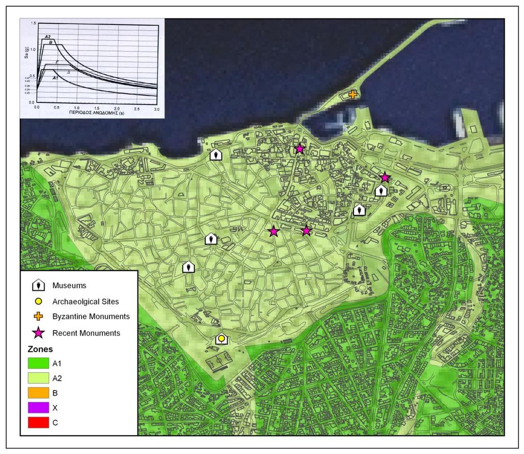
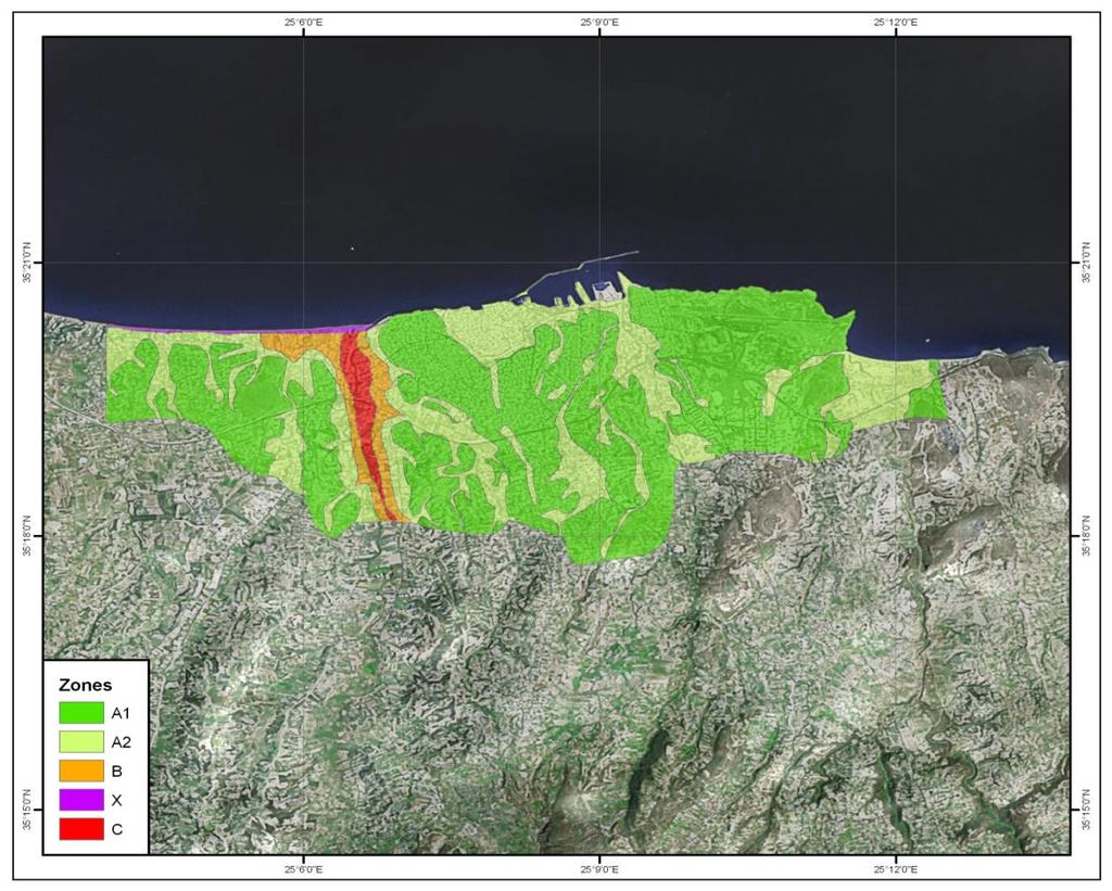
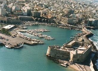
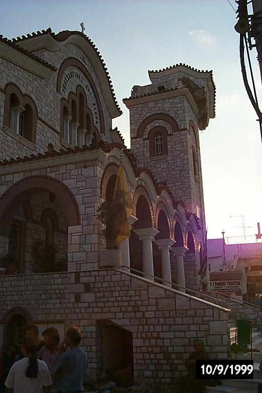
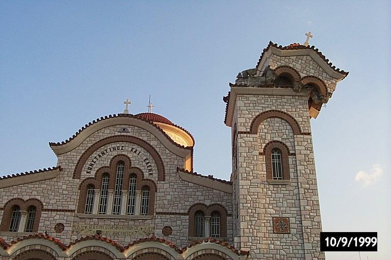
21 HERAKLEION Microzonation Studies: Heraklion Case


22 KNOSSOS The old (first) palace was built in around 2000 B.C. but it was completely destroyed by an earthquake in 1700 B.C. The new (second) palace, more complex in plan, strongly resembling a labyrinth, was constructed immediately afterwards. Knossos Case Study Within the critical periods of sec and with probability 90% of not being exceeded in the next 50 and 100 years, the values of spectral acceleration are found to be 0.21 and 0.24g, respectively.


23 Micro tremor Study Church of Panaghia Kapnikarea The church of Panaghia Kapnikarea is built on the ruins of an ancient temple, dedicated to a female goddess, possibly Athena or Demeter. It was founded at the beginning of the 11th century (around 1050 A.D.) and was probably named after its donor. The influence of man-made seismic energy sources was examined, especially the one by the metro. Seismographs were installed and the dominant frequency in two dimensions was determined.
24 Amplification PROTECTING MONUMENTS AND HISTORICAL SETTINGS Smoothed Response Spectra of the Building for the two horizontal Components. N-S: 2 peaks, sec ( Hz) Frequency (Hz) E-W: 2 peaks, 0.1 sec (10 Hz) Maximum values are observed in both components at 0.17 sec (5.8 Hz) (Dominant Frequency of the Building).
25 Amplitude (μm) PROTECTING MONUMENTS AND HISTORICAL SETTINGS Ground Velocity Diagrams for the Dominant Period 0.17 sec (Frequency 5.8 Hz). 3.5 Kap2 Spectral amplitude temporal distribution (Channel 1) - f0=1.5 Hz Smoothed Amplitude :00 15:00 17:00 19:00 21:00 23:00 1:00 3:00 5:00 7:00 9:00 HH:MM 11:00 13:00 15:00 17:00 19:00 21:00 23:00 1:00 3:00 5:00 Increased loading during the rush hours of the metro (6 a.m. - 9 p.m.)
26 Amplitude (m/sec) PROTECTING MONUMENTS AND HISTORICAL SETTINGS Smoothed Amplitude Spectra (Component N-S) Mean noise level - metro operating hours Mean noise level - night hours Minimum observed noise level Additional stress loading is observed due to the metro at the dominant frequencies of the building. Frequency (Hz)
27 Seismological Studies contribute to the effort of protection of the Greek cultural Heritage and especially : A. MONUMENT S SEISMIC HAZARD ESTIMATION Probabilistic and deterministic estimation of the maximum anticipated values of ground motion (acceleration, velocity and displacement). B. MICROZONATION AROUND A MONUMENT Ground noise analysis, geophysics, boreholes Estimation of: the influence of local geology conditions and the maximum spectral values of ground motion. The eigenperiod of the monument must significantly differ with these values, in order to avoid resonance phenomena. C. MONUMENT S SEISMIC HAZARD ESTIMATION CONCERNING: Tsunamis, Liquefaction phenomena, Landslides, caused by earthquakes.
PROTECTING MONUMENTS AND HISTORICAL SETTINGS FROM THE NEXT EARTHQUAKE
 PROTECTING MONUMENTS AND HISTORICAL SETTINGS FROM THE NEXT EARTHQUAKE E. PAPADIMITRIOU & L. PELLI EUROPEAN CENTER OF PREVENTING & FORECASTING OF EARTHQUAKES Confronting the problem SEISMIC RISK R SEISMIC
IAEA SAFETY STANDARDS Geotechnical Aspects of Site Evaluation and Foundations in NPPs, NS-G-3.6
 IAEA SAFETY STANDARDS Geotechnical Aspects of Site Evaluation and Foundations in NPPs, NS-G-3.6 Regional Workshop on Volcanic, Seismic, and Tsunami Hazard Assessment Related to NPP Siting Activities and
The Role of Local Site Conditions in The Seismic Assessment of Historical Monuments
 The Role of Local Site Conditions in The Seismic Assessment of Historical Monuments J. Cvetanovska, V. Sesov, I. Gjorgiev & K. Edip Univeristy Ss. Cyril and Methodius, Institute of Earthquake Engineering
Development of U. S. National Seismic Hazard Maps and Implementation in the International Building Code
 Development of U. S. National Seismic Hazard Maps and Implementation in the International Building Code Mark D. Petersen (U.S. Geological Survey) http://earthquake.usgs.gov/hazmaps/ Seismic hazard analysis
UGRC 144 Science and Technology in Our Lives/Geohazards
 UGRC 144 Science and Technology in Our Lives/Geohazards Session 3 Understanding Earthquakes and Earthquake Hazards Lecturer: Dr. Patrick Asamoah Sakyi Department of Earth Science, UG Contact Information:
PROBABILITY-BASED DESIGN EARTHQUAKE LOAD CONSIDERING ACTIVE FAULT
 PROBABILITY-BASED DESIGN EARTHUAKE LOAD CONSIDERING ACTIVE FAULT Jun KANDA And Ichiro SATOH SUMMARY The probability-based structural design can provide a specific safety performance demand for the earthquake
I. Locations of Earthquakes. Announcements. Earthquakes Ch. 5. video Northridge, California earthquake, lecture on Chapter 5 Earthquakes!
 51-100-21 Environmental Geology Summer 2006 Tuesday & Thursday 6-9:20 p.m. Dr. Beyer Earthquakes Ch. 5 I. Locations of Earthquakes II. Earthquake Processes III. Effects of Earthquakes IV. Earthquake Risk
Downtown Anchorage Seismic Risk Assessment & Land Use Regulations to Mitigate Seismic Risk
 Prepared for: The Municipality of Anchorage Planning Department and the Geotechnical Advisory Commission Downtown Anchorage Seismic Risk Assessment & Land Use Regulations to Mitigate Seismic Risk Prepared
Special edition paper Development of Shinkansen Earthquake Impact Assessment System
 Development of Shinkansen Earthquake Impact Assessment System Makoto Shimamura*, Keiichi Yamamura* Assuring safety during earthquakes is a very important task for the Shinkansen because the trains operate
Important Concepts. Earthquake hazards can be categorized as:
 Lecture 1 Page 1 Important Concepts Monday, August 17, 2009 1:05 PM Earthquake Engineering is a branch of Civil Engineering that requires expertise in geology, seismology, civil engineering and risk assessment.
Micro Seismic Hazard Analysis
 Micro Seismic Hazard Analysis Mark van der Meijde INTERNATIONAL INSTITUTE FOR GEO-INFORMATION SCIENCE AND EARTH OBSERVATION Overview Site effects Soft ground effect Topographic effect Liquefaction Methods
RECENT DEVELOPMENTS IN THE TSUNAMI RESEARCH IN GREECE: A SHORT REVIEW GERASSIMOS A. PAPADOPOULOS
 CHAPTER 7 RECENT DEVELOPMENTS IN THE TSUNAMI RESEARCH IN GREECE: A SHORT REVIEW GERASSIMOS A. PAPADOPOULOS Institute of Geodynamics, National Observatory of Athens, 11810 Athens, Greece In: S. L. SOLOVIEV,
SHAKE MAPS OF STRENGTH AND DISPLACEMENT DEMANDS FOR ROMANIAN VRANCEA EARTHQUAKES
 SHAKE MAPS OF STRENGTH AND DISPLACEMENT DEMANDS FOR ROMANIAN VRANCEA EARTHQUAKES D. Lungu 1 and I.-G. Craifaleanu 2 1 Professor, Dept. of Reinforced Concrete Structures, Technical University of Civil Engineering
REAL-TIME ASSESSMENT OF EARTHQUAKE DISASTER IN YOKOHAMA BASED ON DENSE STRONG-MOTION NETWORK
 REAL-TIME ASSESSMENT OF EARTHQUAKE DISASTER IN YOKOHAMA BASED ON DENSE STRONG-MOTION NETWORK Saburoh MIDORIKAWA 1 And Susumu ABE 2 SUMMARY This paper describes a system for REal-time Assessment of earthquake
Seismic Response Analysis of selected sites in Wenxian urban area, China
 Seismic Response Analysis of selected sites in Wenxian urban area, China Y. Lu, K. Liu & Q. Li Earthquake Administration of Gansu Province (Key Laboratory of Loess Earthquake Engineering, CEA),China Y.
Gravity dam and earthquake
 Gravity dam and earthquake Tardieu s Dynamic simplified method Patrick LIGNIER, Tractebel Engineering Coyne et Bellier Château des Comtes de Challes 9 octobre 2014 CONTENTS 2 Vulnerability of gravity dam
Harmonized European standards for construction in Egypt
 Harmonized European standards for construction in Egypt EN 1998 - Design of structures for earthquake resistance Jean-Armand Calgaro Chairman of CEN/TC250 Organised with the support of the Egyptian Organization
Characterization and modelling of seismic action
 COST C26: Urban Habitat Constructions under Catastrophic Events Final Conference, 16-18 September 2010, Naples, Italy Characterization and modelling of seismic action Report of WG2: Earthquake resistance
COMPREHENSIVE GIS-BASED SOLUTION FOR ROAD BLOCKAGE DUE TO SEISMIC BUILDING COLLAPSE IN TEHRAN
 COMPREHENSIVE GIS-BASED SOLUTION FOR ROAD BLOCKAGE DUE TO SEISMIC BUILDING COLLAPSE IN TEHRAN B. Mansouri 1, R. Nourjou 2 and K.A. Hosseini 3 1 Assistant Professor, Dept. of Emergency Management, International
Training System and Information Network for Earthquake Disaster Mitigation. Taiki SAITO. Building Research Institute (BRI)
") 1 Training System and Information Network for Earthquake Disaster Mitigation Taiki SAITO Chief Research Engineer, International Institute of Seismology and Earthquake Engineering (IISEE), Building Research
1 Training System and Information Network for Earthquake Disaster Mitigation Taiki SAITO Chief Research Engineer, International Institute of Seismology and Earthquake Engineering (IISEE), Building Research
Earthquakes and Earth s Interior
 - What are Earthquakes? Earthquakes and Earth s Interior - The shaking or trembling caused by the sudden release of energy - Usually associated with faulting or breaking of rocks - Continuing adjustment
Preliminary Earthquake Risk Management Strategy Plan of Eskisehir, Turkey by using GIS
 Preliminary Earthquake Risk Management Strategy Plan of Eskisehir, Turkey by using GIS Metin Altan, Ferah Özturk and Can Ayday Space and Satellite Sciences Research Institute Anadolu University, TURKEY
By Prof. Filippos Vallianatos, Technological Educational Institute of Crete
 Report of the Short Term Visit in CNR ITABC, Rome Italy By Prof. Filippos Vallianatos, Technological Educational Institute of Crete Period of Visit April 16, 2015 to April 29, 2015 As it is not possible
SEISMIC HAZARD ANALYSIS. Instructional Material Complementing FEMA 451, Design Examples Seismic Hazard Analysis 5a - 1
 SEISMIC HAZARD ANALYSIS Instructional Material Complementing FEMA 451, Design Examples Seismic Hazard Analysis 5a - 1 Seismic Hazard Analysis Deterministic procedures Probabilistic procedures USGS hazard
EARTHQUAKE HAZARD ASSESSMENT IN KAZAKHSTAN
 EARTHQUAKE HAZARD ASSESSMENT IN KAZAKHSTAN Dr Ilaria Mosca 1 and Dr Natalya Silacheva 2 1 British Geological Survey, Edinburgh (UK) imosca@nerc.ac.uk 2 Institute of Seismology, Almaty (Kazakhstan) silacheva_nat@mail.ru
Three Fs of earthquakes: forces, faults, and friction. Slow accumulation and rapid release of elastic energy.
 Earthquake Machine Stick-slip: Elastic Rebound Theory Jerky motions on faults produce EQs Three Fs of earthquakes: forces, faults, and friction. Slow accumulation and rapid release of elastic energy. Three
Distribution Restriction Statement Approved for public release; distribution is unlimited.
 CECW-ET Engineer Manual 1110-2-6050 Department of the Army U.S. Army Corps of Engineers Washington, DC 20314-1000 EM 1110-2-6050 30 June 1999 Engineering and Design RESPONSE SPECTRA AND SEISMIC ANALYSIS
Earthquake Risk in Canada and the National Building Code
 Earthquake Risk in Canada and the National Building Code Tuna Onur, Ph.D. Onur Seemann Consulting, Inc. NICC, Vancouver, BC, 28-30 September 2016 Southwestern Canada: Cascadia Subduction Zone + Crustal
EARTH OBSERVATION SERVICES IN REPUBLIC OF MOLDOVA
 EARTH OBSERVATION SERVICES IN REPUBLIC OF MOLDOVA Vasile ALCAZ 1 Ion APOSTOL 2 1 Institute of Geology and Seismology Moldavian Academy of Sciences 2 Ministry of Environment and Natural Resources Republic
Uniform Hazard Spectrum(UHS) for performance based seismic design
 for performance based seismic design") Uniform Hazard Spectrum(UHS) for performance based seismic design *Jun-Kyoung Kim 1), Soung-Hoon Wee 2) and Seong-Hwa Yoo 2) 1) Department of Fire Protection and Disaster Prevention, Semyoung University,
Uniform Hazard Spectrum(UHS) for performance based seismic design *Jun-Kyoung Kim 1), Soung-Hoon Wee 2) and Seong-Hwa Yoo 2) 1) Department of Fire Protection and Disaster Prevention, Semyoung University,
An entire branch of Earth science, called, is devoted to the study of earthquakes.
 Lesson One Essential Question Where do earthquakes take place? What causes earthquakes? What are three different types of faults that occur at plate boundaries? How does energy from earthquakes travels
Earthquakes. Earthquake Magnitudes 10/1/2013. Environmental Geology Chapter 8 Earthquakes and Related Phenomena
 Environmental Geology Chapter 8 Earthquakes and Related Phenomena Fall 2013 Northridge 1994 Kobe 1995 Mexico City 1985 China 2008 Earthquakes Earthquake Magnitudes Earthquake Magnitudes Richter Magnitude
Effects of Surface Geology on Seismic Motion
 4 th IASPEI / IAEE International Symposium: Effects of Surface Geology on Seismic Motion August 23 26, 2011! University of California Santa Barbara MICROZONATION OF MONTREAL, VARIABILITY IN SOIL CLASSIFICATION
The effect of earthquakes vertical components on ancient multi-drum structures
 The effect of earthquakes vertical components on ancient multi-drum structures Loizos Papaloizou Department of Civil and Environmental Engineering, University of Cyprus Petros Komodromos Department of
Seismic Hazard Switzerland. When, where, and how often does certain shaking occur in Switzerland?
 Seismic Hazard Switzerland When, where, and how often does certain shaking occur in Switzerland? Hazard The hazard map shows where and how often certain incidents of horizontal acceleration are likely.
LSN a new methodology for characterising the effects of liquefaction in terms of relative land damage severity
 van Ballegooy, S., Lacrosse, V., Jacka, M. & Malan, P. (2013) Proc. 19 th NZGS Geotechnical Symposium. Ed. CY Chin, Queenstown LSN a new methodology for characterising the effects of liquefaction in terms
CHAPTER 3 METHODOLOGY
 32 CHAPTER 3 METHODOLOGY 3.1 GENERAL In 1910, the seismological society of America identified the three groups of earthquake problems, the associated ground motions and the effect on structures. Indeed
WP2: Framework for Seismic Hazard Analysis of Spatially Distributed Systems
 Systemic Seismic Vulnerability and Risk Analysis for Buildings, Lifeline Networks and Infrastructures Safety Gain WP2: Framework for Seismic Hazard Analysis of Spatially Distributed Systems Graeme Weatherill,
CE6701 STRUCTURAL DYNAMICS AND EARTHQUAKE ENGINEERING QUESTION BANK UNIT I THEORY OF VIBRATIONS PART A
 CE6701 STRUCTURAL DYNAMICS AND EARTHQUAKE ENGINEERING QUESTION BANK UNIT I THEORY OF VIBRATIONS PART A 1. What is mean by Frequency? 2. Write a short note on Amplitude. 3. What are the effects of vibration?
Understanding Seismic Hazard Needs for Infrastructure Risk Analysis: Lessons from SYNER-G
 Systemic Seismic Vulnerability and Risk Analysis for Buildings, Lifeline Networks and Infrastructures Safety Gain Understanding Seismic Hazard Needs for Infrastructure Risk Analysis: Lessons from SYNER-G
Interpretive Map Series 24
 Oregon Department of Geology and Mineral Industries Interpretive Map Series 24 Geologic Hazards, Earthquake and Landslide Hazard Maps, and Future Earthquake Damage Estimates for Six Counties in the Mid/Southern
Tectonic Hazard Evaluations for Korean Nuclear Sites
 Tectonic Hazard Evaluations for Korean Nuclear Sites June 13-17, 2011 Jakarta, INDONESIA Hyunwoo LEE (heanu@kins.re.kr) Korea Institute of Nuclear Safety 1 2 3 4 5 Introduction Tectonic Environment of
Damage Estimation of the Road Bridge Structure Using the Seismic Hazard map for BCM in Hokkaido, Japan
 Damage Estimation of the Road Bridge Structure Using the Seismic Hazard map for BCM in Hokkaido, Japan T. Sato & H. Nishi Civil Engineerring Research Institute for Cold Region, PWRI,Japan T. Ikeda & Y.
Baldwin County, Alabama
 2015 Baldwin County, Alabama Multi-Hazard Mitigation Plan I. Comprehensive Plan A multi-jurisdiction plan City of Bay Minette City of Daphne Town of Elberta City of Fairhope City of Foley City of Gulf
A METHODOLOGY FOR ASSESSING EARTHQUAKE-INDUCED LANDSLIDE RISK. Agency for the Environmental Protection, ITALY (
 A METHODOLOGY FOR ASSESSING EARTHQUAKE-INDUCED LANDSLIDE RISK Roberto W. Romeo 1, Randall W. Jibson 2 & Antonio Pugliese 3 1 University of Urbino, ITALY (e-mail: rwromeo@uniurb.it) 2 U.S. Geological Survey
Seismic site response analysis for Australia
 Seismic site response analysis for Australia Anita Amirsardari 1, Elisa Lumantarna 2, Helen M. Goldsworthy 3 1. Corresponding Author. PhD Candidate, Department of Infrastructure Engineering, University
Earthquakes. Building Earth s Surface, Part 2. Science 330 Summer What is an earthquake?
 Earthquakes Building Earth s Surface, Part 2 Science 330 Summer 2005 What is an earthquake? An earthquake is the vibration of Earth produced by the rapid release of energy Energy released radiates in all
Chapter 6 Seismic Design of Bridges. Kazuhiko Kawashima Tokyo Institute of Technology
 Chapter 6 Seismic Design of Bridges Kazuhiko Kawashima okyo Institute of echnology Seismic Design Loading environment (dead, live, wind, earthquake etc) Performance criteria for gravity (deflection, stresses)
ENGINEERING-SEISMOLOGICAL ASPECTS OF EARTHQUAKE SCENARIO DEVELOPMENT ON THE EXAMPLE OF TASHKENT, UZBEKISTAN
 International Journal of Geology, Earth & Environmental Sciences ISSN: 2277-281 (Online) 218 Vol. 8 (2) May-August, pp. 3-35/Alixanovich ENGINEERING-SEISMOLOGICAL ASPECTS OF EARTHQUAKE SCENARIO DEVELOPMENT
Cyclic fatigue demands on structures subjected to the Canterbury Earthquake Sequence
 Cyclic fatigue demands on structures subjected to the -11Canterbury Earthquake Sequence J.B. Mander Texas A&M University, College Station, Texas, USA. G.W. Rodgers Dept. of Mechanical Engineering, University
Comparison of CPT Based Liquefaction Potential and Shear Wave Velocity Maps by Using 3-Dimensional GIS
 Comparison of CPT Based Liquefaction Potential and Shear Wave Velocity Maps by Using 3-Dimensional GIS Muammer Tün, Uğur Avdan, Metin Altan, Can Ayday Anadolu University, Satellite and Space Sciences Research
Dynamic modelling in slopes using finite difference program
 Bulletin of the Department of Geology Bulletin of the Department of Geology, Tribhuvan University, Kathmandu, Nepal, Vol. 12, 2009, pp. 89 94 Dynamic modelling in slopes using finite difference program
What will a Magnitude 6.0 to 6.8 Earthquake do to the St. Louis Metro Area?
 What will a Magnitude 6.0 to 6.8 Earthquake do to the St. Louis Metro Area? J. David Rogers Natural Hazards Mitigation Center University of Missouri-Rolla USGS Mid-Continent Geographic Science Center Missouri
P60 High Resolution Geophysics Inside Machado de Castro Museum - Coimbra, Centre Portugal
 P60 High Resolution Geophysics Inside Machado de Castro Museum - Coimbra, Centre Portugal C. Grangeia (University of Aveiro), M.J. Senos Matias* (University of Aveiro), F. Figueiredo (University of Coimbra),
Luca Guerrieri Valerio Comerci Eutizio Vittori
 Earthquake Environmental Effects induced by the 1908 December 28 th Messina earthquake: an in-situ contribute to the Messina supersite (GEO Task DI-09-01a Vulnerability Mapping and Risk Assessment Luca
EARTHQUAKE CLUSTERS, SMALL EARTHQUAKES
 EARTHQUAKE CLUSTERS, SMALL EARTHQUAKES AND THEIR TREATMENT FOR HAZARD ESTIMATION Gary Gibson and Amy Brown RMIT University, Melbourne Seismology Research Centre, Bundoora AUTHORS Gary Gibson wrote his
The Hellenic Seismological Network of Crete (HSNC): Monitoring results and the new strong motion network
: Monitoring results and the new strong motion network") The Hellenic Seismological Network of Crete (HSNC): Monitoring results and the new strong motion network Georgios Chatzopoulos 1, Ilias Papadopoulos 1 and Filippos Vallianatos 1 1 Technological Educational
The Hellenic Seismological Network of Crete (HSNC): Monitoring results and the new strong motion network Georgios Chatzopoulos 1, Ilias Papadopoulos 1 and Filippos Vallianatos 1 1 Technological Educational
J M MIRANDA UNIVERSITY OF LISBON THE USE OF REMOTE SENSING FOR EARTHQUAKE RISK ASSESSMENT AND MITIGATION
 1 THE USE OF REMOTE SENSING FOR EARTHQUAKE RISK ASSESSMENT AND MITIGATION 2 the observation of strong ground motion and aftershock sequences as well as the investigation of the destruction from these earthquakes
SEISMIC RESPONSE OF THE COLUMNS OF TWO ANCIENT GREEK TEMPLES IN RHODES AND LINDOS. Aristotle University, Thessaloniki, Greece
 SEISMIC RESPONSE OF THE COLUMNS OF TWO ANCIENT GREEK TEMPLES IN RHODES AND LINDOS ABSTRACT K.Pitilakis (1) and E. Tavouktsi (2) (1) Professor, (kpitilak@civil.auth.gr), (2) Civil Engineer, MSc, (etavouk@civil.auth.gr)
SITE EFFECTS STUDY USING AMBIENT VIBRATIONS H/V AT ALGIERS BAY (ALGERIA)
") SITE EFFECTS STUDY USING AMBIENT VIBRATIONS H/V AT ALGIERS BAY (ALGERIA) Djamel Machane 1 Ghani Cheikh Lounis, Mustapha Hellel, Rabah Bensalem, El Hadi Oubaiche, Hakim Moulouel, Sahra Ourari, Thabet Zemmouri,
SITE EFFECTS STUDY USING AMBIENT VIBRATIONS H/V AT ALGIERS BAY (ALGERIA) Djamel Machane 1 Ghani Cheikh Lounis, Mustapha Hellel, Rabah Bensalem, El Hadi Oubaiche, Hakim Moulouel, Sahra Ourari, Thabet Zemmouri,
Finite element fault rupture propagation modelling in the Corinth Canal Greece
 Coastal Engineering VII, WIT Press, Southampton, pp. 305-311 Finite element fault rupture propagation modelling in the Corinth Canal Greece F. Gkika, G-A. Tselentis & L. Danciu Seismological Laboratory,
Assessment of the Post-earthquake Safety and the Maximum Anti-Seismic Capability of Zipingpu Concrete Face Rockfill Dam
 Assessment of the Post-earthquake Safety and the Maximum Anti-Seismic Capability of Zipingpu Concrete Face Rockfill Dam Jian-ming Zhao, Jinsheng Jia, Yanfeng Wen China Institute of Water Resources and
NATO SfP PROJECT: SEISMIC HAZARD AND RISK ASSESSMENT FOR SOUTHERN CAUCASUS-EASTERN TURKEY ENERGY CORRIDOR
 NATO SfP PROJECT: SEISMIC HAZARD AND RISK ASSESSMENT FOR SOUTHERN CAUCASUS-EASTERN TURKEY ENERGY CORRIDOR Gülüm Tanırcan 1, Bilge Siyahi 2, Eren Uçkan 1 and Erdal Şafak 1 1-Boğaziçi University, KOERI,
Copernicus Overview and Emergency Management Service
 Copernicus Overview and Emergency Management Service Frédéric BASTIDE European Commission Open informal session of the United Nations Inter-Agency Meeting on Outer Space Activities 12 March 2013, Geneva
Cascadia megathrust earthquakes: reducing risk through science, engineering, and planning
 Cascadia megathrust earthquakes: reducing risk through science, engineering, and planning NSF Hazards SEES EAR-1331412 Urban Science and Engineering Workshop 21 July 2014 Everything to do with M9 Cascadia
Jordan's Strategic Research Agenda in cultural heritage
 Jordan's Strategic Research Agenda in cultural heritage Analysis of main results Alessandra Gandini Amman, Jordan 3 rd November 2013 Main objectives The work performed had the main objective of giving
State of art of seismic design and seismic hazard analysis for oil and gas pipeline system
 Earthq Sci (2010)23: 259 263 259 Doi: 10.1007/s11589-010-0721-y State of art of seismic design and seismic hazard analysis for oil and gas pipeline system Aiwen Liu Kun Chen and Jian Wu Institute of Geophysics,
Application of a GIS for Earthquake Hazard Assessment and Risk Mitigation in Vietnam
 Application of a GIS for Earthquake Hazard Assessment and Risk Mitigation in Vietnam Nguyen Hong Phuong Earthquake Information and Tsunami Warning Centre, VAST OUTLINE Introduction Fault Source Model and
M 7.1 EARTHQUAKE 5KM ENE OF RABOSO, MEXICO EXACT LOCATION: N W DEPTH: 51.0KM SEPTEMBER 19, 1:14 LOCAL TIME
 M 7.1 EARTHQUAKE 5KM ENE OF RABOSO, MEXICO EXACT LOCATION: 18.584 N 98.399 W DEPTH: 51.0KM SEPTEMBER 19, 2017 @ 1:14 LOCAL TIME Photo: Eduardo Verdugo / AP Photo: Alfredo Estrella/ Agence France-Presse/
Geographic Information Systems
 Geographic Information Systems What is a Geographic Information System (GIS)? definition of GIS - An internally referenced, automated, spatial information system for data mapping, management, and analysis
Guidelines for Site-Specific Seismic Hazard Reports for Essential and Hazardous Facilities and Major and Special-Occupancy Structures in Oregon
 Guidelines for Site-Specific Seismic Hazard Reports for Essential and Hazardous Facilities and Major and Special-Occupancy Structures in Oregon By the Oregon Board of Geologist Examiners and the Oregon
KNOWLEDGE NOTE 5-1. Risk Assessment and Hazard Mapping. CLUSTER 5: Hazard and Risk Information and Decision Making. Public Disclosure Authorized
 Public Disclosure Authorized Public Disclosure Authorized Public Disclosure Authorized Public Disclosure Authorized KNOWLEDGE NOTE 5-1 CLUSTER 5: Hazard and Risk Information and Decision Making Risk Assessment
Seismic study of land subsidence and Vulnerability of Rural Buildings by using geophysics methods, near Shiraz city
 International Research Journal of Applied and Basic Sciences 2013 Available online at www.irjabs.com ISSN 2251-838X / Vol, 7 (11): 718-724 Science Explorer Publications Seismic study of land subsidence
WHAT SEISMIC HAZARD INFORMATION THE DAM ENGINEERS NEED FROM SEISMOLOGISTS AND GEOLOGISTS?
 WHAT SEISMIC HAZARD INFORMATION THE DAM ENGINEERS NEED FROM SEISMOLOGISTS AND GEOLOGISTS? Martin WIELAND 1 ABSTRACT For large dam projects a site-specific seismic hazard analysis is usually recommended.
PROBABILISTIC LIQUEFACTION HAZARD ANALYSIS IN JAPAN
 SECED 2015 Conference: Earthquake Risk and Engineering towards a Resilient World 9-10 July 2015, Cambridge UK PROBABILISTIC LIQUEFACTION HAZARD ANALYSIS IN JAPAN Tetsushi KURITA 1 and Sei ichiro FUKUSHIMA
Study on the Effect of Loess Sites on Seismic Ground Motion and Its Application in Seismic Design
 6 th International Conference on Earthquake Geotechnical Engineering 1-4 November 2015 Christchurch, New Zealand Study on the Effect of Loess Sites on Seismic Ground Motion and Its Application in Seismic
Earthquakes and Earthquake Hazards Earth - Chapter 11 Stan Hatfield Southwestern Illinois College
 Earthquakes and Earthquake Hazards Earth - Chapter 11 Stan Hatfield Southwestern Illinois College What Is an Earthquake? An earthquake is the vibration of Earth, produced by the rapid release of energy.
BELFAST SEWERS PROJECT
 BELFAST SEWERS PROJECT Adam Green - Atkins Tunnelling Scheme Overview New stormwater interceptor Tunnel Scheme within Belfast City Centre to alleviate flooding and divert storm water flows from existing
EARTHQUAKE MODELLING. Algiers, Belhassen Tonat
 EARTHQUAKE MODELLING Algiers, 10.11.2011 Belhassen Tonat Basic terms Plate tectonics Basic terms Average Number of Earthquakes/Year (Global) Magnitude Average Annually 8 and higher 1 ¹ 7-7.9 17 ² 6-6.9
log 4 0.7m log m Seismic Analysis of Structures by TK Dutta, Civil Department, IIT Delhi, New Delhi. Module 1 Seismology Exercise Problems :
 Seismic Analysis of Structures by TK Dutta, Civil Department, IIT Delhi, New Delhi. Module Seismology Exercise Problems :.4. Estimate the probabilities of surface rupture length, rupture area and maximum
Borah Peak Earthquake HAZUS Scenario Project Executive Summary Idaho Bureau of Homeland Security Idaho Geological Survey Western States Seismic
 Borah Peak Earthquake HAZUS Scenario Project Executive Summary Idaho Bureau of Homeland Security Idaho Geological Survey Western States Seismic Policy Council 12/30/2008 The HAZUS-MH analysis of the Borah
Design of Earthquake-Resistant Structures
 NATIONAL TECHNICAL UNIVERSITY OF ATHENS LABORATORY OF EARTHQUAKE ENGINEERING Design of Earthquake-Resistant Structures Basic principles Ioannis N. Psycharis Basic considerations Design earthquake: small
prof. GIULIO ZUCCARO PLINIVS Study Centre for Hydrogeological, Volcanic and Seismic Engineering (Competence Centre for Italian Civil Protection)
") Rome (Italy), Department of Italian Civil Protection 79dC. VESUVIUS, Italy Workshop on Science, uncertainty and decision making in the mitigation of natural risks 1944. VESUVIUS, Italy October 8 9 10,
Rome (Italy), Department of Italian Civil Protection 79dC. VESUVIUS, Italy Workshop on Science, uncertainty and decision making in the mitigation of natural risks 1944. VESUVIUS, Italy October 8 9 10,
Evaluation of Geotechnical Hazards
 Evaluation of Geotechnical Hazards by Geoffrey R. Martin Appendix B: Evaluation of Geotechnical Hazards Describes Evaluation Procedures Soil Liquefaction Soil Settlement Surface Fault Rupture Flooding
Seismic Geotechnical Hazard Zonation Of Geological Factors
 1 st Workshop of M.E.E.T.I.N.G Project Seismic Geotechnical Hazard Zonation Of Geological Factors Maja Oštri, dipl.ing.geol Dubrovnik, March 3rd-4th 2008 SUBJECT OF THE INVESTIGATION? Geological Factors
Emergency Management Service (EMS) mapping
 mapping") GMES Emergency Management Service (EMS) mapping Frédéric BASTIDE GMES unit, European Commission UN-SPIDER Expert Meeting: "Crowdsource Mapping for Disaster Risk Management and Emergency Response" 3-5 December,
GMES Emergency Management Service (EMS) mapping Frédéric BASTIDE GMES unit, European Commission UN-SPIDER Expert Meeting: "Crowdsource Mapping for Disaster Risk Management and Emergency Response" 3-5 December,
Severe accident risk assessment for Nuclear. Power Plants
 PSA 2017- September 2017 IRSN Severe accident risk assessment for Nuclear * Power Plants * Enhancing nuclear safety An original approach to derive seismic fragility curves - Application to a PWR main steam
STUDY ON MICROTREMOR CHARACTERISTICS BASED ON SIMULTANEOUS MEASUREMENTS BETWEEN BASEMENT AND SURFACE USING BOREHOLE
 STUDY ON MICROTREMOR CHARACTERISTICS BASED ON SIMULTANEOUS MEASUREMENTS BETWEEN BASEMENT AND SURFACE USING BOREHOLE Takahisa ENOMOTO 1, Toshio KURIYAMA 2, Norio ABEKI 3, Takahiro IWATATE 4, Manuel NAVARRO
Presidency of the Council of Ministers
 Recovery Status Report from Italy EQ of April 2009 Geneva, June 17h, 2009 IRP/ILO SPECIAL EVENT Integrating Social, Economic, and Environmental Concerns in Post-disaster Recovery Promoting Effective Build-Back
Site Response Analysis with 2D-DDA
 Site Response Analysis with 2D-DDA Yossef H. Hatzor Sam and Edna Lemkin Professor of Rock Mechanics Dept. of Geological and Environmental Sciences Ben-Gurion University of the Negev, Beer-Sheva, Israel
GEOTECHNICAL ENGINEERING INVESTIGATION HANDBOOK Second Edition
 GEOTECHNICAL ENGINEERING INVESTIGATION HANDBOOK Second Edition Roy E. Hunt Taylor & Francis Taylor & Francis Croup Boca Raton London New York Singapore A CRC title, part of the Taylor & Francis imprint,
The quarter-wavelength average velocity: a review of some past and recent application developments
 The quarter-wavelength average velocity: a review of some past and recent application developments V. Poggi, B. Edwards & D. Fäh Swiss Seismological Service, ETH Zürich, Switzerland SUMMARY: In recent
ENSURE. Coordinator: Hormoz MODARESSI Website:
 ENSURE Coordinator: Hormoz MODARESSI h.modaressi@brgm.fr Website: http://ensureproject.eu/ The project is financed by the European Commission under the 7th Framework Programme for Research and Technological
SEISMIC RISK ANALYSIS OF L AQUILA GAS DISTRIBUTION NETWORK Paper ID. 2999
 SEISMIC RISK ANALYSIS OF L AQUILA GAS DISTRIBUTION NETWORK Paper ID. 2999 Simona Esposito, Iunio Iervolino Department of Structural Engineering, University of Naples Federico II A gas distribution system
Site effect studies in Khorog (Tajikistan)
") Marco Pilz, Dino Bindi, Bolot Moldobekov, Sagynbek Orunbaev, Shahid Ullah, Stefano Parolai Site effect studies in Khorog (Tajikistan) Scientific Technical Report STR14/10 www.gfz-potsdam.de Recommended
Marco Pilz, Dino Bindi, Bolot Moldobekov, Sagynbek Orunbaev, Shahid Ullah, Stefano Parolai Site effect studies in Khorog (Tajikistan) Scientific Technical Report STR14/10 www.gfz-potsdam.de Recommended
Students will be able, using GIS, to locate the largest and most destructive earthquakes;
 Exploring Earthquake Hazards with GIS Laboratory for Introduction to Geophysics, Spring 2007 Prof. Constantin Cranganu Brooklyn College of the City University of New York Learning Objectives: Students
PROBABILISTIC SEISMIC HAZARD MAPS AT GROUND SURFACE IN JAPAN BASED ON SITE EFFECTS ESTIMATED FROM OBSERVED STRONG-MOTION RECORDS
 13 th World Conference on Earthquake Engineering Vancouver, B.C., Canada August 1-6, 2004 Paper No. 3488 PROBABILISTIC SEISMIC HAZARD MAPS AT GROUND SURFACE IN JAPAN BASED ON SITE EFFECTS ESTIMATED FROM
Seismic Evaluation of Auxiliary Buildings and Effects of 3D Locational Dynamic Response in SPRA
 Seismic Evaluation of Auxiliary Buildings and Effects of 3D Locational Dynamic Response in SPRA PSA 2017, Pittsburgh September 25 th, 2017 Brian Cohn Jieun Hur, Eric Althoff, Halil Sezen, and Richard Denning
Earthquakes Earth, 9th edition, Chapter 11 Key Concepts What is an earthquake? Earthquake focus and epicenter What is an earthquake?
 1 2 3 4 5 6 7 8 9 10 Earthquakes Earth, 9 th edition, Chapter 11 Key Concepts Earthquake basics. "" and locating earthquakes.. Destruction resulting from earthquakes. Predicting earthquakes. Earthquakes
Seismometer. Stefanie Donner
 Seismometer Stefanie Donner Some history instrument for measuring the seasonal winds and the movements of the Earth Zhang Heng, China 132 AD #2 Some history 1755 the Great Lisbon earthquake Subsequent