CO 2 Storage Potential in the Mt Simon Sandstone, Western Kentucky. Rick Bowersox January 22, 2008
|
|
|
- Cecily Leonard
- 6 years ago
- Views:
Transcription
1 CO 2 Storage Potential in the Mt Simon Sandstone, Western Kentucky Rick Bowersox January 22, 2008
2 Presentation Outline Overview of Western Kentucky geology Review of CO 2 storage reservoir issues in western Kentucky Geology of the Mt Simon Sandstone Some issues with the Mt Simon Sandstone as a CO 2 storage reservoir in western Kentucky Alternative CO 2 storage reservoirs in western Kentucky
3 Rough Creek Fault System Northern Area of Interest Rough Creek Graben Pennyrile Fault System Southern Area of Interest Western Kentucky Coal Field Our site evaluation needs to consider that there are at least three distinct geologic areas of interest in and adjacent to the Western Kentucky Coal Field.


4 Depth to the Precambrian basement Western Kentucky Coal Field There are major differences in depths to potential CO 2 storage reservoirs in the project area.
5 System Ordovician Series Upper? Middle Rock units Maquoketa Gp Plattin Fm Pecatonica Fm Black River Gp (High Bridge Gp) Joachim Dol Wells Creek-Dutchtown Fm St. Peter Ss Lexington Ls Western Kentucky Stratigraphic Units with CO 2 Storage Potential Lower Beekmantown Fm Copper Ridge Dol. Gunter Ss Knox Gp. Potential CO 2 sinks/ reservoirs Caprockcontainment interval Cambrian Upper? Middle Lower Eau Claire Fm Mount Simon Ss? Unconformity Sink or seal (depends on location) Metamorphic and igneous rocks (mostly seal) Proterozoic Granite-Rhyolite Complex

6 CO 2 Storage Issues Seal Fault Old Wellbore Migration IPCC (2005)
7 System Ordovician Series Upper? Middle Rock units Maquoketa Gp Plattin Fm Pecatonica Fm Black River Gp (High Bridge Gp) Joachim Dol Wells Creek-Dutchtown Fm St. Peter Ss Lexington Ls Western Kentucky Stratigraphic Units with Reservoir Seal Potential Lower Beekmantown Fm Copper Ridge Dol. Gunter Ss Knox Gp. Potential CO 2 sinks/ reservoirs Caprock seal containment interval Cambrian Upper? Middle Lower Eau Claire Fm Mount Simon Ss? Unconformity Sink or seal (depends on location) Metamorphic and igneous rocks (mostly seal) Proterozoic Granite-Rhyolite Complex
8 Fault Proximity Issues Well depths (ft) 2,500-4,000 4,000-5,000 5,000-6,000 6,000-8,000 >8,000 Faults and deep wells Rough Creek Fault System Faults Pennyrile Fault System Western Kentucky Coal Field Faults can act as both storage reservoir seals and pathways for CO 2 leakage to shallower intervals and the surface.
9 Old Well Bore Issues Well depths (ft) 2,500-4,000 4,000-5,000 5,000-6,000 6,000-8,000 >8,000 Existing wells >2,500 ft Faults Western Kentucky Coal Field Old well bores with inadequate abandonment are a potential leakage pathway to the surface.

10 Geology of the Mt Simon Sandstone Wickstrom et al (2003) MIDCARB The Mt. Simon Sandstone is the deep saline reservoir being targeted for CO 2 storage in much of the Midwest. It is deepest in the subsurface and thinnest in western Kentucky.
11 Inferred Transport of the Mt Simon and Lamotte Sandstones in the Illinois Basin and adjacent regions. (Ojakangas, 1963, Fig. 9)
 Western Kentucky Makowitz and Milliken")
 Quartz-overgrowth cement forms in sandstones at temperatures >90-100 C")
12 Mount Simon Sandstone Reservoir A C B A Original quartz grain B Quartz overgrowth C Porosity (blue) Western Kentucky Makowitz and Milliken (2003, Fig. 2) Quartz-overgrowth cement forms in sandstones at temperatures > C (>200 F). (Bjørlykke and Egeberg, 1993) Makowitz et al. (2006, Fig. 5)


13 Porosity development in the Mt Simon Sandstone. (Hoholick et al., 1984)

14 CO 2 Core Flood Tests O Connor and Rush (2005)
 with euhedral quartz overgrowth (O). Quartz grains are rimmed with secondary hematite cement. Dark areas between grains is smectitic clay-lined porosity.")
15 Mount Simon Sandstone Reservoir Q 100 µm O Kersting (1982, Fig. C-2) Cutting at 6660 ft from Allied Chemical well #1 Fee, Vermillion County, Illinois. Quartz grains (Q) with euhedral quartz overgrowth (O). Quartz grains are rimmed with secondary hematite cement. Dark areas between grains is smectitic clay-lined porosity. Data from wells drilled in deeper portions of the Illinois Basin indicate that cements in the Mt. Simon Sandstone are quartz and potassium feldspar overgrowths with lesser hematite, kaolinite, chlorite, chert, and carbonate (Metarko, 1980; Hoholick et al, 1984; Makowitz and Milliken, 2003; Makowitz, 2004; Kunledare, 2005).
16 >-14,000-13,000 to -13,999-12,000 to -12,999-11,000 to -11,999-10,000 to -10,999-9,000 to -9,999-8,000 to -8,999-7,000 to -7,999-6,000 to -6,999-5,000 to -5,999-4,000 to -4,999 <-4000 Mt. Simon structure Well Fault Miles..... CALDWELL Western Kentucky Coal Field Sea level datum However in the vicinity of the Western Kentucky Coal Field the Mt Simon Sandstone is at a depth that reduces its potential for CO 2 storage.
17 Mt. Simon Sandstone thickness > 800 ft ft ft ft ft ft ft ft ft Well data Miles..... Western Kentucky Coal Field The Mt Simon Sandstone occurs north of the Rough Creek Graben and generally north of the Western Kentucky Coal Field. The thickest potential CO2 storage reservoir in the Mt Simon Sandstone is also where it is at its greatest depth.
18 GR - Caliper Depth (ft) The Exxon Jimmy Bell #1 Bulk Density well was drilled on the northern margin of the Rough Creek Graben in Webster County. It encountered 750 ft of low porosity Mt Simon Sandstone at a depth of 13, 490 ft immediately above granitic basement rocks Location
.")
 100 µm Cutting from 14,220 ft shows microquartz (M) filling the pores between quartz grains")
19 Exxon Jimmy Bell #1 100 µm A Q C Cutting from 13,700 ft shows quartz grains (Q) with concave contacts due to pressure dissolution at grain boundaries rimmed with smectitic clays (C). Authigenic apatite crystals (A) grew between quartz grains. Kersting (1982, Fig. C-12) 100 µm Cutting from 14,220 ft shows microquartz (M) filling the pores between quartz grains (Q). Q M Kersting, (1982, Fig. C-7)
20 CAL 5 15 GR Depth (ft) KY OPERATING, INC 1 RIORDAN, TRUMAN D TD : 8, NPHI RHOB 3 <10.8 km> Depth (ft) <13.9 KM> CAL 5 15 GR K II, INC 1 BROOKS, J H TD : 8, CNC RHOB 3 Sandstone Top of Mt. Simon datum CAL 5 15 GR Depth (ft) KENTUCKY OPERATING MW, LLC 1 SHERRARD, VIRGINIA TD : 7,093 RHOB 2 3 Mt. Simon Three shallower tests of Mt. Simon Sandstone drilled just east of the coal field suggest limited reservoir potential. Location

21 CALI 5 15 GR Depth 2000 Core 2 Core 3 Core 4 Core 5 DT SNP RHOB 2 3 Beekmantown Mt. Simon DuPont #1 WDW Mt Simon Sandstone test Location Core 6 Core 7 Core 8 Core 9 Core 10 Knox Group Core 11 Core 12 Core Core 15 Copper Ridge Dol. Eau Claire Mt. Simon Core 16 Precambrian Basement The DuPont #1 WDW injection well was drilled near Louisville and encountered 761 ft of Mt Simon Sandstone at a depth of 5193 ft. After testing, the Mt Simon was abandoned and the well recompleted on injection in the Knox Limestone.


22 DuPont #1 WDW Although a core from this well showed low porosities averaging 5.5%, analysis of electric logs suggests that there was ~150 ft of Mt Simon Sandstone with porosity >10% in the well. There is also evidence suggesting that the Mt Simon Sandstone reservoir was damaged by fresh water injection during testing. DuPont #1 WDW, Louisville, KY, ~5730 ft
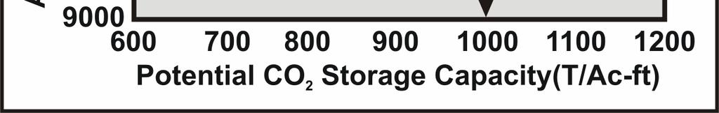
23 Minimum Criteria for a CO 2 Storage Zone Base of the sealing interval 2500 ft Sufficient lithostatic pressure to ensure CO 2 remains in a supercritical state at 1070 psia and 88 F Sufficient sealing strata overlying the storage zone to mitigate the possibility of leakage to shallower intervals and the surface Porous and permeable storage zone Storage capacity of supercritical CO 2 ~10,000 T/Ac-ft for each incremental percent porosity Greater porosity and permeability at shallower depths allow lower injection pressures and costs Remote from geologic and man-made features that might compromise the integrity of the storage reservoir Faults and fractured intervals Mine shafts Buildings


24 Mt Simon Sandstone Reservoir Depth and Pressure
 Makowitz (2004; 27 samples) Kunledare (2005; 690 samples) DuPont #1 WDW (13 samples) Exxon Jimmy Bell #1 Makowitz and Milliken (2003, Fig.")
25 Mt Simon Sandstone Porosity Porosity (%) DuPont WDW #1 Depth (ft) Potential CO 2 Storage Interval Data sources (828 samples): Metarko (1980; 89 samples) Shebl (1985; 9 samples) Makowitz (2004; 27 samples) Kunledare (2005; 690 samples) DuPont #1 WDW (13 samples) Exxon Jimmy Bell #1 Makowitz and Milliken (2003, Fig. 10A)
.")
26 Western Kentucky Reservoir Temperature CO 2 Solubility versus Pressure/Temperature MIDCARB The western Kentucky geothermal gradient is ~1 F/100 ft of depth (36 measurements). In the prospective range of the CO2 storage reservoir the temperature will be ~ F.
27 Western Kentucky Reservoirs P-T Trend Western Kentucky Reservoirs Trend


28

 www.kgs.ku.")
29 Water in the Mt Simon Sandstone reservoir of western Kentucky is extremely high salinity, about six times that of sea water. DuPont #1 WDW CO 2 Solubility versus Salinity MIDCARB Metarko (1980, Fig. 10)

30 Mt Simon Sandstone Reservoir Well depths (ft) 2,500-4,000 4,000-5,000 5,000-6,000 6,000-8,000 >8,000 Existing wells >2,500 ft Faults Western Kentucky Coal Field The Mt Simon Sandstone reservoir is in an area of considerable faulting and existing oil field development
31 Alternative Storage Possibilities Strata outside of the Rough Creek Graben Knox Group carbonate reservoirs St Peter Sandstone High Bridge Group carbonate reservoirs Potential for re-entering, deepening, and sampling abandoned exploratory wells Strata inside the Rough Creek Graben Central to the Western Kentucky Coal Field Few deep tests Unknown reservoir characteristics Potential for re-entering, deepening, and sampling abandoned exploratory wells
32 Rough Creek Fault System Northern Area of Interest Rough Creek Graben Pennyrile Fault System Southern Area of Interest Western Kentucky Coal Field There are at least three distinct geologic areas of interest in and adjacent to the Western Kentucky Coal Field with potential CO 2 storage reservoirs.
33 System Ordovician Series Upper? Middle Rock units Maquoketa Gp Plattin Fm Pecatonica Fm Black River Gp (High Bridge Gp) Joachim Dol Wells Creek-Dutchtown Fm St. Peter Ss Lexington Ls Western Kentucky Stratigraphic Units with CO 2 Storage Potential Lower Beekmantown Fm Copper Ridge Dol. Gunter Ss Knox Gp. Potential CO 2 sinks/ reservoirs Caprockcontainment interval Cambrian Upper? Middle Lower Eau Claire Fm Mount Simon Ss? Unconformity Sink or seal (depends on location) Metamorphic and igneous rocks (mostly seal) Proterozoic Granite-Rhyolite Complex

34 Rough Creek Graben Har-Ken Peabody Coal #14 TD 6700 Surface 10,000 20,000 Bertagne and Leising (1991, Fig. 15-8) with annotation


35 St Peter Sandstone St. Peter Sandstone is dominantly a fine-grained quartz sandstone with shale and carbonate interbeds. Cements are carbonates, authigenic anhydrite, and silica (Hoholick, 1980; Hoholick et al., 1984)


36 Knox Group Carbonates Algal vugular porosity Dissolution and brecciation porosity Fracture porosity All cores are from the DuPont #1 WDW, Louisville, Kentucky

37 Re-entry Candidate Har-Ken well Peabody Coal #14 Muhlenberg County Drilled to 6700 ft in March inch conductor pipe at 30 ft 10¾ inch casing cemented at 184 ft 7 7 /8 inch hole drilled to TD Nine intervals tested by open hole DST ft Plugged and abandoned in April 1985 Casing cut off 3 ft below surface Cement plug 3-80 ft Mud ft Cement plug ft Mud ft Cement plug ft Mud ft TD
38 Conclusions There are several potential storage issues to address when choosing a CO2 storage test site The Mt Simon Sandstone is a potential candidate as a storage reservoir but is not the only one There are many deeper abandoned exploratory wells in the Western Kentucky Coal Field to review for re-entry and testing of CO 2 storage potential in reservoirs other than the Mt Simon Sandstone
39 Conclusions Now what is the message there? The message is that there are known knowns. There are things we know that we know. There are known unknowns. That is to say, there are things that we now know we don't know. But there are also unknown unknowns. There are things we don't know we don't know. So when we do the best we can, we pull all this information together and we then say, Well that's basically what we see as the situation, that is really only the known knowns and the known unknowns. And each year, we discover a few more of those unknown unknowns. Secretary of Defense Donald Rumsfeld, Press Conference at NATO Headquarters, Brussels, Belgium, June 6, 2002
40
Western Kentucky Deep Saline Reservoir CO 2 Storage Test. Principal Investigators: J. Richard Bowersox - Lexington David A. Williams - Henderson
 Western Kentucky Deep Saline Reservoir CO 2 Storage Test Principal Investigators: J. Richard Bowersox - Lexington David A. Williams - Henderson July 22, 2008 Electric power generating and industrial plants
Seismic Data and Drilling in Hancock Co., Kentucky February 21, 2008
 Seismic Data and Drilling in Hancock Co., Kentucky February 21, 2008 J.A. Drahovzal 2/21/08 1 Hancock County (H1) Information Provided at 2/7/08 Meeting Depth of Top (t) and Thickness (th) in feet t Kn
Western Kentucky Deep Saline Reservoir CO 2 Storage Test. Principal Investigators: J. Richard Bowersox - Lexington David A. Williams - Henderson
 Western Kentucky Deep Saline Reservoir CO 2 Storage Test Principal Investigators: J. Richard Bowersox - Lexington David A. Williams - Henderson October 2, 2008 Electric power generating and industrial
Where to Drill in Western Kentucky February
 Where to Drill in Western Kentucky? February 7. 2008 J.A. Drahovzal 2/7/08 Assumptions to Date and Questions Drill no more than 8,000 feet Drill multi-horizons (at least 2 major horizons) Do we want to
Western Kentucky Deep Saline Reservoir CO 2 Storage Test. Principal Investigators: J. Richard Bowersox - Lexington David A. Williams - Henderson
 Western Kentucky Deep Saline Reservoir CO 2 Storage Test Principal Investigators: J. Richard Bowersox - Lexington David A. Williams - Henderson August 12, 2008 Electric power generating and industrial
Western Kentucky CO 2 Storage Test
 Western Kentucky CO 2 Storage Test Principal Investigators: Rick Bowersox - Lexington Dave Williams - Henderson KGS First Friday Seminar Lexington, Kentucky March 4, 2011 The project proceeded in two phases:
Kentucky Geological Survey Marvin Blan #1 Hancock County, Kentucky Geologic Review. J. Richard Bowersox David A. Williams Kentucky Geological Survey
 Kentucky Geological Survey Marvin Blan #1 Hancock County, Kentucky Geologic Review J. Richard Bowersox David A. Williams Kentucky Geological Survey KYCCS Western Kentucky Project Review Lexington, Kentucky
East Bend Test Site Core Team
 MRCSP Cincinnati Arch-East Bend Site Geologic Field Test in Mt. Simon Sandstone EPA Region 5 Regional Carbon Sequestration Meeting March 21-22, 2007, Pokagon State Park, Indiana East Bend Test Site Core
Source Sink Pipeline
 An Overview of Carbon Storage presented by Robert J. Finley Advanced Energy Technology Initiative Illinois State Geological Survey University of Illinois USA IEA Summer School Longyearbyen, Norway August,
Minewater Management Annual Meeting Marion, Illinois. August 13, 2013
 Minewater Management 2013 Annual Meeting Marion, Illinois August 13, 2013 Coal Mine Water Sources Water Sources Typical Surface Control Pond Typical Sand Pit Surface Sand Pit Control Ponds Public Review
Cement in Cambrian Sandstone : Assessing the Potential for the Generation of Respirable Silica
 Cement in Cambrian Sandstone : Assessing the Potential for the Generation of Respirable Silica J. Brian Mahoney Kent M. Syverson Department of Geology University of Wisconsin-Eau Claire Geologic Setting
Seismic-Data Interpretations near the Blan Carbon Sequestration Test Well in Hancock Co., Kentucky
 Seismic-Data Interpretations near the Blan Carbon Sequestration Test Well in Hancock Co., Kentucky KYCCS Western Kentucky Deep Test Review Meeting Friday, October 23, 2009 James A. Drahovzal Consulting
Methodology: Ranking, Site Assessments & Volumetrics
 Methodology: Ranking, Site Assessments & Volumetrics INTRODUCTION Queensland CO 2 Storage Atlas Aim to identify with highest possible certainty prospective basins for geological storage in onshore Queensland
Basin-Scale Hydrological Impact of Geologic Carbon Sequestration in the Illinois Basin: A Full-Scale Deployment Scenario
 Basin-Scale Hydrological Impact of Geologic Carbon Sequestration in the Illinois Basin: A Full-Scale Deployment Scenario Quanlin Zhou, Jens Birkholzer Earth Sciences Division Lawrence Berkeley National
The Illinois Basin Decatur Project Decatur, Illinois USA: Overview and Impacts. Sallie E. Greenberg
 The Illinois Basin Decatur Project Decatur, Illinois USA: Overview and Impacts Sallie E. Greenberg Midwest Geological Sequestration Consortium SECARB Annual Meeting 12 March 2015 Acknowledgements The Midwest
Geology of the Kentucky Geological Survey Marvin Blan No. 1 Well, East-Central Hancock County, Kentucky
 University of Kentucky UKnowledge Kentucky Geological Survey Report of Investigations Kentucky Geological Survey 2014 Geology of the Kentucky Geological Survey Marvin Blan No. 1 Well, East-Central Hancock
Geologic Considerations of Shallow SAGD Caprock; Seal Capacity, Seal Geometry and Seal Integrity, Athabasca Oilsands, Alberta Canada
 Geologic Considerations of Shallow SAGD Caprock; Seal Capacity, Seal Geometry and Seal Integrity, Athabasca Oilsands, Alberta Canada Gordon T. Stabb, Michael Webb Durando Resources Corp, Suncor Energy
Tim Carr - West Virginia University
 Tim Carr - West Virginia University Elements Source Rock Migration Route Reservoir Rock Seal Rock Trap Processes Generation Migration Accumulation Preservation 2 Reservoir Porous & Permeable Rock Suitable
WAMUNYU EDWARD MUREITHI I13/2358/2007
 WAMUNYU EDWARD MUREITHI I13/2358/2007 Olkaria geothermal area is situated south of Lake Naivasha on the floor of the southern segment of the Kenya rift. The geology of the Olkaria Geothermal area is subdivided
Dakota Sandstone. of the Moxa Arch and Surrounding Green River Basin
 Dakota Sandstone of the Moxa Arch and Surrounding Green River Basin Dakota Sandstones of the Green River Basin Overview The Dakota sandstones of the Moxa Arch and surrounding Green River Basin remain attractive
ILLINOIS GROUNDWATER - BEDROCK
 ILLINOIS GROUNDWATER - BEDROCK Northern Illinois Fresh Water Water Supply Shallow Bedrock Aquifers < 500 depth Deep Bedrock Aquifers > 500 depth Southern Illinois Saline water Oil Fracking Coal Waste injection
Iowa s Precambrian and Cambrian. University of Northern Iowa Dr. Chad Heinzel
 Iowa s Precambrian and Cambrian University of Northern Iowa Dr. Chad Heinzel Concept of Geologic Formations A body/layer of rock that consists dominantly of a certain lithologic rock type Maybe combined
Lower Skinner Valley Fill Sandstones: Attractive Exploration Targets on the Northeast Oklahoma Platform*
 Lower Skinner Valley Fill Sandstones: Attractive Exploration Targets on the Northeast Oklahoma Platform* By Jim Puckette 1 Search and Discovery Article #10050 (2003) *Adapted from presentation to Tulsa
High-resolution Sequence Stratigraphy of the Glauconitic Sandstone, Upper Mannville C Pool, Cessford Field: a Record of Evolving Accommodation
 Page No. 069-1 High-resolution Sequence Stratigraphy of the Glauconitic Sandstone, Upper Mannville C Pool, Cessford Field: a Record of Evolving Accommodation Thérèse Lynch* and John Hopkins, Department
Geologic Structure and Seismic Analysis
 Geologic Structure and Seismic Analysis Kentucky Geological Survey James A. Drahovzal, John B. Hickman and Paul D. Lake Trenton Black-River Research Consortium September 9, 2004 Pittsburgh, PA Structure
Follow this and additional works at: Part of the Geology Commons
 Western Michigan University ScholarWorks at WMU Michigan Geological Repository for Research and Education Geosciences 2016 Geology of Michigan William B. Harrison III Michigan Geological Repository for
MIDWEST REGIONAL CARBON SEQUESTRATION PARTNERSHIP PHASE II STORAGE CAPACITY POTENTIAL OVERVIEW
 FINAL MIDWEST REGIONAL CARBON SEQUESTRATION PARTNERSHIP PHASE II STORAGE CAPACITY POTENTIAL OVERVIEW SUMMARY OF PHASE II TOPICAL REPORTS DOE-NETL Cooperative Agreement DE-FC26-05NT42589 Submitted by: Battelle
R ENW Services - Geophysics & GIS
 Yankton Block 1 Vermillion Block 2 N 2 0 1 Block 3 Elk Point 2 3 4 5 6 MILES Block 4 R20-2002-01 0 1 2 3 4 5 6 7 8 9 10 KILOMETERS Block 5 Figure courtesy of ENW Services - Geophysics & GIS Block 6 Test
GEOLOGICAL JOHN C. FRYE, Chief URBANA
 STATE OF ILLINOIS WILLIAM G. STRATTON, Governor DEPARTMENT OF REGISTRATION AND EDUCATION VERA M. BINKS, Director STATE DIVISION OF THE GEOLOGICAL JOHN C. FRYE, Chief URBANA SURVEY ILLINOIS PETROLEUM 72
5 IEAGHG CCS Summer School. Geological storage of carbon dioxide (a simple solution)
") Storage 1- Reservoirs, Traps, Seals and Storage Capacity for Storage Geological storage of carbon dioxide (a simple solution) Professor John Kaldi Chief Scientist, CO2CRC Australian School of Petroleum,
Storage 1- Reservoirs, Traps, Seals and Storage Capacity for Storage Geological storage of carbon dioxide (a simple solution) Professor John Kaldi Chief Scientist, CO2CRC Australian School of Petroleum,
Atlantic Rim Coalbed Methane Play: The Newest SuccessfulCBM Play in the Rockies
 Atlantic Rim Coalbed Methane Play: The Newest SuccessfulCBM Play in the Rockies Robert A. Lamarre Lamarre Geological, Denver, Colorado Stephen K. Ruhl Anadarko Petroleum Corporation, The Woodlands, Texas
By: Jared T. Freiburg Illinois State Geological Survey 5/17/ cm
 Current Research on the Mt. Simon Geology; Refining the Lower Mt. Simon Depositional Interpretation By: Jared T. Freiburg Illinois State Geological Survey freiburg@illinois.edu 5/17/2016 2.5 cm Collaborators
Handout 2 of 14. (Topic 1.2) The Cycle of Change
 The Cycle of Change") Student: Date received: Handout 2 of 14 (Topic 1.2) The Cycle of Change The Bernese Alps (central Switzerland) as viewed from the southeast from the Earth Observatory (http://earthobservatory.nasa.gov/newsroom/newimages/images/iss013-
Student: Date received: Handout 2 of 14 (Topic 1.2) The Cycle of Change The Bernese Alps (central Switzerland) as viewed from the southeast from the Earth Observatory (http://earthobservatory.nasa.gov/newsroom/newimages/images/iss013-
Devonian Petroleum Systems and Exploration Potential, Southern Alberta, Part 3 Core Conference
 Devonian Petroleum Systems and Exploration Potential, Southern Alberta, Part 3 Core Conference Andy Mort (1), Leonard Stevens (2), Richard Wierzbicki (2) Abstract Part 1: Devonian Petroleum Systems Dr.
Licence P1368: Relinquishment Report (end of 2 nd term) Hurricane Exploration PLC
 Hurricane Exploration PLC") Licence P1368: Relinquishment Report (end of 2 nd term) Hurricane Exploration PLC March 2012 1. Header Licence Number: P1368 Licence Round: 23 rd Licence Type: Frontier Block Numbers: 202/4, 202/5, 204/30,
Licence P1368: Relinquishment Report (end of 2 nd term) Hurricane Exploration PLC March 2012 1. Header Licence Number: P1368 Licence Round: 23 rd Licence Type: Frontier Block Numbers: 202/4, 202/5, 204/30,
What is the scope for carbon capture and storage in Northern Ireland. Michelle Bentham
 What is the scope for carbon capture and storage in Northern Ireland Michelle Bentham Kingsley Dunham Centre Keyworth Nottingham NG12 5GG Tel 0115 936 3100 What is Carbon Capture and Storage? Capture of
Plumbing the Depths of the Pelican Field
 Plumbing the Depths of the Pelican Field Thurza Frenz Pelican Talk Objectives To discuss the development of the northern area of the Pelican Field, in particular: The relationship between reservoir quality,
S^aaav. DOE Award Number: DE-FG26-99FT E. Peabody Dr. Champaign, IL Champaign, IL Reservoir Characterization & 3D Models
 557 IL6of 2002-1 ^M S^aaav Reservoir Characterization & 3D Models of Mt Simon Gas Storage Fields in the Illinois Basin Annual Technical Progress Report Reporting Period Start Date: October 1, 2000 Reporting
The McCully gas field in southern New Brunswick was discovered in the year 2000 on a joint drilling exploration venture by Corridor Resources Inc.
 1 The McCully gas field in southern New Brunswick was discovered in the year 2000 on a joint drilling exploration venture by Corridor Resources Inc. and Potash Corporation of Saskatchewan. Located about
Practice Test Rocks and Minerals. Name. Page 1
 Name Practice Test Rocks and Minerals 1. Which rock would be the best source of the mineral garnet? A) basalt B) limestone C) schist D) slate 2. Which mineral is mined for its iron content? A) hematite
Reservoir Characterization & 3D Models of Mt. Simon Gas Storage Fields in the Illinois Basin. Annual Technical Progress Report
 Reservoir Characterization & 3D Models of Mt. Simon Gas Storage Fields in the Illinois Basin Annual Technical Progress Report Reporting Period Start Date: October 1, 2001 Reporting Period Ending Date:
Sequence Stratigraphy of the Upper Cretaceous Niobrara Formation, A Bench, Wattenberg Field, Denver Julesburg Basin, Colorado*
 Sequence Stratigraphy of the Upper Cretaceous Niobrara Formation, A Bench, Wattenberg Field, Denver Julesburg Basin, Colorado* Lisa E. Remington LaChance 1 and Mark C. Robinson 1 Search and Discovery Article
1. Base your answer to the following question on The diagram below represents a part of the crystal structure of the mineral kaolinite.
 1. Base your answer to the following question on The diagram below represents a part of the crystal structure of the mineral kaolinite. An arrangement of atoms such as the one shown in the diagram determines
Seismic mapping of the Utsira Formation. Petrophysical interpretations and fracture gradient estimates.
 Presentation March 4 th 2009 OG21 Innovation Seminar: TTA2 Exploration and reservoir Characterization Venue: StatoilHydro, Sandsli CO 2 Sequestration A geophysical and geological study related to CO 2
Geologic and Reservoir Characterization and Modeling
 Geologic and Reservoir Characterization and Modeling Scott M. Frailey and James Damico Illinois State Geological Survey Midwest Geologic Sequestration Science Conference November 8 th, 2011 Acknowledgements
Quartz Cementation in Mudrocks: How Common Is It?
 Quartz Cementation in Mudrocks: How Common Is It? Kitty L. Milliken Barnett Shale SE/CL image Woodford Shale SE/CL image Cements are Pore-filling Precipitates Specific definition differs with research
APPENDIX C GEOLOGICAL CHANCE OF SUCCESS RYDER SCOTT COMPANY PETROLEUM CONSULTANTS
 APPENDIX C GEOLOGICAL CHANCE OF SUCCESS Page 2 The Geological Chance of Success is intended to evaluate the probability that a functioning petroleum system is in place for each prospective reservoir. The
WESTCARB Phase I Results Review
 WESTCARB Phase I Results Review Arizona Geologic Characterization Errol Montgomery Principal Errol L. Montgomery & Associates (520) 881-4912 emontgomery@elmontgomery.com November 9, 2005 Site Characterization
Competing Effect of Pore Fluid and Texture -- Case Study
 Competing Effect of Pore Fluid and Texture -- Case Study Depth (m) Sw Sxo. m Poisson's Ratio.. GOC.1 5 7 8 9 P-Impedance OWC 15 GR.. RHOB.5 1 Saturation...5. 1. 1.5 Vs (km/s).. Poisson's Ratio 5 7 P-Impedance
Midwest Regional Carbon Sequestration Partnership
 Midwest Regional Carbon Sequestration Partnership DOE/NETL Cooperative Agreement # DE-FC26-0NT42589 Neeraj Gupta, Battelle (gupta@battelle.org) Carbon Storage R&D Review Meeting Transforming Technology
Technology of Production from Shale
 Technology of Production from Shale Doug Bentley, European Unconventional, Schlumberger May 29 th, 2012 Johannesburg, South Africa What are Unconventional Reservoirs Shale both Gas & Oil Coal Bed Methane
Sediment and sedimentary rocks Sediment
 Sediment and sedimentary rocks Sediment From sediments to sedimentary rocks (transportation, deposition, preservation and lithification) Types of sedimentary rocks (clastic, chemical and organic) Sedimentary
PRECAMBRIAN CRYSTALLINE AQUIFER (METAMORPHIC ROCKS)
") HAYWARD QUADRANGLE: Groundwater Production by Aquifer In the 56-square-mile area of the Hayward Quadrangle, groundwater is produced from metamorphic crystalline rocks of the Precambrian basement (in the
HAYWARD QUADRANGLE: Groundwater Production by Aquifer In the 56-square-mile area of the Hayward Quadrangle, groundwater is produced from metamorphic crystalline rocks of the Precambrian basement (in the
TRUST. Figure 1: Location of the shallow seismic wells, the injection well (H18A) and the monitoring well (H18B).
 and the monitoring well (H18B).") TRUST Figure 1: Location of the shallow seismic wells, the injection well (H18A) and the monitoring well (H18B). Figure 2: Drilling of a shallow seismic well. TRUST Figure 3: the heat exchanger Figure
TRUST Figure 1: Location of the shallow seismic wells, the injection well (H18A) and the monitoring well (H18B). Figure 2: Drilling of a shallow seismic well. TRUST Figure 3: the heat exchanger Figure
The North Dakota Bakken Play - Observations. Julie A. LeFever North Dakota Geological Survey
 The North Dakota Bakken Play - Observations Julie A. LeFever North Dakota Geological Survey The Basics Bakken Formation in North Dakota Upper & Lower Black Shale World Class Source Rock TOC s as high as
FINAL TECHNICAL REPORT PHASE II
 FINAL TECHNICAL REPORT PHASE II GEOTHERlV1AL RESOURCE EXPLORATION & DEFINITION SB Geo Inc. DE-FC04-00AL66975 September 18 2001 SLIM HOLE 24-33 Steamboat Springs Nevada Colin Goranson Geothermal Resource
IP 121 ILLINOIS PETROLEUJM Illinois Institute of Natdral Resources STATE GEOWGICA SURVEY DIVISION' Jack A. Simon. Chief
 IP 121 ILLINOIS PETROLEUJM 121 1981 Illinois Institute of Natdral Resources STATE GEOWGICA SURVEY DIVISION' Jack A. Simon. Chief Stevenson, D. L. (David L.) Geologic structure of the base of the New Albany
General Geologic Setting and Seismicity of the FHWA Project Site in the New Madrid Seismic Zone
 General Geologic Setting and Seismicity of the FHWA Project Site in the New Madrid Seismic Zone David Hoffman University of Missouri Rolla Natural Hazards Mitigation Institute Civil, Architectural & Environmental
An Overview of Carbon Sequestration in Pennsylvania. John A. Harper Pennsylvania Geological Survey
 An Overview of Carbon Sequestration in Pennsylvania John A. Harper Pennsylvania Geological Survey Are you sure you re comfortable? Let s dive right in! Principal Global CO2 Sequestration Targets Terrestrial
Senior Thesis. Subsurface Stratigraphy of Middle Cambrian-Middle Ordovician Rocks in Central Morrow County, Ohio. by William Camphire
 Senior Thesis Subsurface Stratigraphy of Middle Cambrian-Middle Ordovician Rocks in Central Morrow County, Ohio by William Camphire Submitted in partial fulfillment of the requirmcnts for the degree of
SECARB Phase III ANTHROPOGENIC TEST: Risk Management through Detailed Geologic Characterization and Modeling
 SECARB Phase III ANTHROPOGENIC TEST: Risk Management through Detailed Geologic Characterization and Modeling Prepared by: David Riestenberg, George Koperna, and Vello Kuuskraa, Advanced Resources International,
Structural Geology of the Mountains
 Structural Geology of the Mountains Clinton R. Tippett Shell Canada Limited, Calgary, Alberta clinton.tippett@shell.ca INTRODUCTION The Southern Rocky Mountains of Canada (Figure 1) are made up of several
An Assessment of Geological Carbon Sequestration in the Illinois Basin: The Illinois Basin-Decatur Site
 An Assessment of Geological Carbon Sequestration in the Illinois Basin: The Illinois Basin-Decatur Site presented by Robert J. Finley and the MGSC Project Team April 15, 2009 Illinois Sustainable Technology
Evaluating Suitability of Appalachian Basin Reservoirs for NGLs Storage Jessica Moore, West Virginia Geological & Economic Survey
 1 THE APPALACHIAN STORAGE HUB STUDY: Evaluating Suitability of Appalachian Basin Reservoirs for NGLs Storage Jessica Moore, West Virginia Geological & Economic Survey 2 ASH STUDY OUR GOAL Complete a geologic
GeothermEx, Inc. GEOTHERMAL RESERVOIR ASSESSMENT METHODOLOGY FOR THE SCIENTIFIC OBSERVATION HOLE PROGRAM, KILAUEA EAST RIFT ZONE, HAWAII TASK 1 REPORT
 (415) 527 9876 CABLE ADDRESS- GEOTHERMEX TELEX 709152 STEAM UD FAX (415) 527-8164 Geotherm Ex, Inc. RICHMOND. CALIFORNIA 94804-5829 GEOTHERMAL RESERVOIR ASSESSMENT METHODOLOGY FOR THE SCIENTIFIC OBSERVATION
MIDDLE DEVONIAN PLAY MICHIGAN BASIN OF ONTARIO. Duncan Hamilton
 MIDDLE DEVONIAN PLAY MICHIGAN BASIN OF ONTARIO Duncan Hamilton 1 Middle Devonian Pools of the Michigan Basin 375+ Million Barrels Michigan 45+ million Barrels Ontario 2 Outline of Presentation History
TEMPERATURE LOGGING IN PERFORATED WELLS
 PROCEEDINGS, Thirty-First Workshop on Geothermal Reservoir Engineering Stanford University, Stanford, California, January 30-February 1, 2006 SGP-TR-179 TEMPERATURE LOGGING IN PERFORATED WELLS Per-Gunnar
Depositional History and Petroleum Potential of Ombilin Basin, West Sumatra - Indonesia, Based on Surface Geological Data*
 Depositional History and Petroleum Potential of Ombilin Basin, West Sumatra - Indonesia, Based on Surface Geological Data* Yahdi Zaim 1, Litto Habrianta 2, Chalid I. Abdullah 1, Aswan 1, Yan Rizal 1, Nurcahyo
Subsurface Maps. K. W. Weissenburger. Isopach. Isochore. Conoco, Inc. Ponca City, Oklahoma, U.S.A.
 Subsurface Maps K. W. Weissenburger Conoco, Inc. Ponca City, Oklahoma, U.S.A. INTRODUCTION Reservoir properties are mapped to promote optimal field development. Subsurface maps dictate well placement and
Well Logging Importance in Oil and Gas Exploration and Production
 Well Logging Importance in Oil and Gas Exploration and Production Dr. R. Giri Prasad 1 1 Associate Professor, Dept. of Petroleum Engineering, Aditya Engineering College, hod_pt@aec.edu.in I. INTRODUCTION
Subsurface Geology and Resource Exploration
 LAB 11. Subsurface Geology and Resource Exploration Locating earth resources such as aluminum, copper, gold and gemstones has been an important job for geologists for a long time. This lab deals with the
Drill Cuttings Analysis: How to Determine the Geology of a Formation and Reservoir
 Drill Cuttings Analysis: How to Determine the Geology of a Formation and Reservoir Chuck Stringer ASA Manager Southern Region 2015 TECH MKT_2014-BD-REG-1673 1 The one item that has lacked serious consideration
Process, Zeit Bay Fields - Gulf of Suez, Egypt*
 PS Pressure Regime Evaluation, Role, and Contribution in Well Planning and Formation Evaluation Process, Zeit Bay Fields - Gulf of Suez, Egypt* Saber Moustafa Selim 1, Khaled Mohamed Abdallah 1, and Khalaf
WESTCARB Regional Partnership
 WESTCARB Regional Partnership Subsurface Flow Modeling at King Island Christine Doughty, CADoughty@lbl.gov Curtis Oldenburg, CMOldenburg@lbl.gov Staff Scientists Lawrence Berkeley National Laboratory WESTCARB
Steve Cumella 1. Search and Discovery Article # (2009) Posted July 30, Abstract
 Posted July 30, Abstract") AV Geology of the Piceance Basin Mesaverde Gas Accumulation* Steve Cumella 1 Search and Discovery Article #110106 (2009) Posted July 30, 2009 *Adapted from oral presentation at AAPG Annual Convention,
AV Geology of the Piceance Basin Mesaverde Gas Accumulation* Steve Cumella 1 Search and Discovery Article #110106 (2009) Posted July 30, 2009 *Adapted from oral presentation at AAPG Annual Convention,
Petroleum geology framework, West Coast offshore region
 Petroleum geology framework, West Coast offshore region James W. Haggart* Geological Survey of Canada, Vancouver, BC jhaggart@nrcan.gc.ca James R. Dietrich Geological Survey of Canada, Calgary, AB and
in Madison County, New York Natural Gas Development
 Natural Gas Development in Madison County, New York Bruce Selleck Department of Geology Colgate University Hamilton, NY 13346 bselleck@mail.colgate.edu Natural Gas Development in Madison County, New York
Reservoir Rock Properties COPYRIGHT. Sources and Seals Porosity and Permeability. This section will cover the following learning objectives:
 Learning Objectives Reservoir Rock Properties Core Sources and Seals Porosity and Permeability This section will cover the following learning objectives: Explain why petroleum fluids are found in underground
The Capitan Aquifer - Ellenburger Production Wells Geothermal Engine Source?
 GEOTHERMAL ENERGY UTILIZATION ASSOCIATED WITH OIL & GAS DEVELOPMENT June 17-18, 2008 Southern Methodist University Dallas, Texas The Capitan Aquifer - Ellenburger Production Wells Geothermal Engine Source?
Geologic Characterization of Stratigraphic Sequences in the Upper Ohio River Valley for Determination of Brine Storage Capacity
 Mark Moody Senior Field Geologist Columbus, Ohio Geologic Characterization of Stratigraphic Sequences in the Upper Ohio River Valley for Determination of Brine Storage Capacity 1 Outline Brine disposal
Exploration, Drilling & Production
 Nontechnical Guide to PETMOLEUM Geology, Exploration, Drilling & Production Third Edition Norman J. Hyne, Ph.D. Contents Preface *i Introduction 1 The Nature of Gas and Oil 1 Petroleum 1 The Chemistry
L.O: THE CRUST USE REFERENCE TABLE PAGE 10
 USE REFERENCE TABLE PAGE 10 1. The oceanic crust is thought to be composed mainly of A) granite B) sandstone C) basalt D) rhyolite 2. To get sample material from the mantle, drilling will be done through
DEVONIAN OIL AND GAS PLAYS OF THE MICHIGAN BASIN
 DEVONIAN OIL AND GAS PLAYS OF THE MICHIGAN BASIN William B. Harrison, III Michigan Geological Repository for Research and Education (MGRRE) Western Michigan University-Michigan Geological Survey 1 Devonian
Development and Implementation of a Monitoring Plan at a 1-million Tonne CCS Demonstration: Decatur, Illinois USA
 Development and Implementation of a Monitoring Plan at a 1-million Tonne CCS Demonstration: Decatur, Illinois USA Robert J. Finley, Principal Investigator Midwest Geological Sequestration Consortium Director,
MUHAMMAD S TAMANNAI, DOUGLAS WINSTONE, IAN DEIGHTON & PETER CONN, TGS Nopec Geological Products and Services, London, United Kingdom
 Geological and Geophysical Evaluation of Offshore Morondava Frontier Basin based on Satellite Gravity, Well and regional 2D Seismic Data Interpretation MUHAMMAD S TAMANNAI, DOUGLAS WINSTONE, IAN DEIGHTON
Dr. Kenneth B. Taylor, P.G.
 North Carolina Forestry Association 2013 Annual Meeting October 3, 2013 Shale Gas 101: Natural Gas Exploration / Development: A North Carolina Perspective presented by Dr. Kenneth B. Taylor, P.G. State
Pressure Regimes in Deep Water Areas: Cost and Exploration Significance Richard Swarbrick and Colleagues Ikon GeoPressure, Durham, England
 Pressure Regimes in Deep Water Areas: Cost and Exploration Significance Richard Swarbrick and Colleagues Ikon GeoPressure, Durham, England FINDING PETROLEUM 26 th September 2012 OUTLINE of PRESENTATION
Modeling pressure response into a fractured zone of Precambrian basement to understand deep induced-earthquake hypocenters from shallow injection
 Modeling pressure response into a fractured zone of Precambrian basement to understand deep induced-earthquake hypocenters from shallow injection S. Raziperchikolaee 1 and J. F. Miller 1 Abstract Analysis
Fundamentals Of Petroleum Engineering FORMATION EVALUATION
 Fundamentals Of Petroleum Engineering FORMATION EVALUATION Mohd Fauzi Hamid Wan Rosli Wan Sulaiman Department of Petroleum Engineering Faculty of Petroleum & Renewable Engineering Universiti Technologi
RELINQUISHMENT REPORT. License P1546 Block April 2009
 RELINQUISHMENT REPORT License P1546 Block 110-01 14 April 2009 Sherritt International Oil and Gas Limited 2000, 425-1 st street S.W., Calgary, Alberta Canada T2P 3L8 Telephone (403) 260-2900 Fax (403)
Outcrop Analog Lower Paleozoic Hydrothermal Dolomite Reservoirs, Mohawk Valley, New York
 Outcrop Analog Lower Paleozoic Hydrothermal Dolomite Reservoirs, Mohawk Valley, New York Fortuna Energy Inc. Richard Nyahay, Brian Slater, and Taury Smith New York State Museum Introduction Trenton Black
BARAKA SEEKS HELIUM & CONVENTIONAL HYDROCARBON POTENTIAL
 ASX ANNOUNCEMENT/MEDIA RELEASE 21 ST May 2018 BARAKA SEEKS HELIUM & CONVENTIONAL HYDROCARBON POTENTIAL Baraka Energy & Resources Limited (ASX: BKP) (Baraka) or (the Company) having now been recapitalized
OVERVIEW OF THE WAIRAKEI-TAUHARA SUBSIDENCE INVESTIGATION PROGRAM
 PROCEEDINGS, Thirty-Sixth Workshop on Geothermal Reservoir Engineering Stanford University, Stanford, California, January 31 - February 2, 2011 SGP-TR-191 OVERVIEW OF THE WAIRAKEI-TAUHARA SUBSIDENCE INVESTIGATION
Colorado s Underground Injection Control Program: Prevention and Mitigation of Induced Seismicity
 Colorado s Underground Injection Control Program: Prevention and Mitigation of Induced Seismicity Energy & Environment Symposium April 2015 Robert P. Koehler, PhD. UIC Lead OVERVIEW What is a UIC well?
GEOLOGIC FINDINGS OF THE BENEDUM FOUNDATION S APPALACHIAN STORAGE HUB STUDY
 1 GEOLOGIC FINDINGS OF THE BENEDUM FOUNDATION S APPALACHIAN STORAGE HUB STUDY Kristin M. Carter, P.G., C.P.G. Assistant State Geologist Pennsylvania Geological Survey (Pittsburgh, PA) krcarter@pa.gov ACKNOWLEDGEMENTS
Comparison of Using Combination of Acetic Acid and Hydrochloric Acid with Only Hydrochloric Acid as Matrix Pre Flush
 International Journal of Petroleum and Geoscience Engineering (IJPGE), 1 ISSN xxxx-xxxx Academic Research Online Publisher Research Article Comparison of Using Combination of Acetic Acid and Hydrochloric
11/22/2010. Groundwater in Unconsolidated Deposits. Alluvial (fluvial) deposits. - consist of gravel, sand, silt and clay
 deposits. - consist of gravel, sand, silt and clay") Groundwater in Unconsolidated Deposits Alluvial (fluvial) deposits - consist of gravel, sand, silt and clay - laid down by physical processes in rivers and flood plains - major sources for water supplies
Groundwater in Unconsolidated Deposits Alluvial (fluvial) deposits - consist of gravel, sand, silt and clay - laid down by physical processes in rivers and flood plains - major sources for water supplies
HYDROGEOLOGICAL PROPERTIES OF THE UG2 PYROXENITE AQUIFERS OF THE BUSHVELD COMPLEX
 R. Gebrekristos, P.Cheshire HYDROGEOLOGICAL PROPERTIES OF THE UG2 PYROXENITE AQUIFERS OF THE BUSHVELD COMPLEX R. Gebrekristos Digby Wells Environmental P. Cheshire Groundwater Monitoring Services Abstract
Ministry of Oil and Minerals Petroleum Exploration & Production Authority BLOCK 85 (Al Uqlah North)
") Ministry of Oil and Minerals Petroleum Exploration & Production Authority BLOCK 85 (Al Uqlah North) The Al Uqlah North Block (85) occupies an area of 597 km 2 in the Sabatayn Basin in the province of Shabwah
Ministry of Oil and Minerals Petroleum Exploration & Production Authority BLOCK 85 (Al Uqlah North) The Al Uqlah North Block (85) occupies an area of 597 km 2 in the Sabatayn Basin in the province of Shabwah
Engineering Geology. Metamorphic Rocks. Hussien Al - deeky
 Metamorphic Rocks Hussien Al - deeky 1 Definition Metamorphic rock is the result of the transformation of an existing rock type, the protolith (parent rock), in a process called metamorphism, which means