"Impact on infrastructure by Gorkha earthquake 2015 induced landslides"
|
|
|
- Griselda Wells
- 6 years ago
- Views:
Transcription

1 J-Rapid Final Workshop 21 June, 2016, Kathmandu Inventory mapping of landslides induced by the Gorkha earthquake 2015 and a proposal for hazard mapping of future landslides for making a plan of better reconstruction "Impact on infrastructure by Gorkha earthquake 2015 induced landslides" Masahiro CHIGIRA Masahiro CHIGIRA Professor, Disaster Prevention Research Institute, Professor, Disaster Prevention Research Institute, Kyoto University Kyoto University Vishnu DANGOL Vishnu DANGOL Professor, Department of Geology, Professor, Department of Geology, Tribhuvan University Tribhuvan University
2 Objective 1. to make an inventory mapping on landslides, cracks, and landslide dams induced by the Nepal earthquake and to investigate their formative mechanisms 2. to detect displaced areas of slope surfaces, of which future susceptibility to landslides would be evaluated on the basis of geology, geomorphology, and groundwater conditions. 3. propose a methodology of hazard mapping for earthquake-induced landslides in Nepal.
3 Members (Japan side) 1. Masahiro CHIGIRA (Kyoto Univ.) PI Applied Geology 2. Daisuke HIGAKI (Hirosaki Univ.) Landslide control 3. Hiroshi YAGI (Yamagata Univ.) Landslide susceptibility mapping 4. Akihiko WAKAI (Gunma Univ.) Geotechnical analysis of landslide 5. Hiroshi, P. SATO (Nihon Univ.) Remote sensing 6. Go, SATO (Teikyo Heisei Univ.) Geomorphology 7. Ching-Ying, TSOU (Hirosaki Univ.) GIS analysis 8. Akiyo YATAGAI (Res. Inst. Humanity and Nature) Meteorology
4 Members (Nepali side) 1. Vishnu DANGOL (Tribhuvan Univ.) PI Applied Geology 2. Smajwal BAJRACHARYA (ICIMOD) Remote sensing 3. Shanmukhesh Chandra AMATYA (DWIDP) Hydrogeology 4. Tuk Lal ADHIKARI (ITECO-Nepal) Geotechnical
5 Field survey Trishuli River catchment from Trishuli to Syabrubesi (29 October to 1 November, 2015) Sun Kosi and Bhote Kosi River catchments from Bansaghu to Kodari. (2 to 4 November, 2015) Budhi Gandaki River catchment from Arughat to Litin (6 and 7 March, 2016) Dauradi River catchment from Jhulunge Bajar to Barpak (7 and 8 March, 2016)
6 Inventory mapping of landslides Inventory Complied Data Used Note Topographic classification Knickpoint ASTER GDEM Data contributed by METI and NASA Slope break AW3D DEM derived AW3D DEM of JAXA Constant Vertical Exaggeration Stereoscopic Map (CVES Map) Deep-seated landslide Deep-seated landslide Stereo-pair aerial photos Complied by Dr. Go Sato Slope failure with scar The 2015 newly formed scar Earthquakeinduced slope enlargement of a preexisting failure scar Pre-existing slope failure not enlarged by the earthquake CVES Map Pre-earthquake: Google Earth Imagery (Dec. 12, 2014) Post-earthquake: Google Earth Imagery (May. 3, 2015) & LANDSAT 8 satellite imagery (June 1, 2015/covering the upstream Trishuli River) Used for the area not covered by stereo-pair aerial photos Complied with the reference inventory of the Japan Landslide Society Presented as points

7 Geological setting of the affected area Higher Himalaya MCT Lesser Himalaya Kathmandu

8 Mapped landslides 6,527 new landslides 558 enlarged landeslides 5,159 (ICIMOD-NELS)

9 Cumulative landslide frequency and the landslide size Data added to Chigira et al. (2010, Geomorphology)
10 What type of landslides occurred?

11 Shallow disrupted landslides in most cases No gigantic landslides like those induced by the 2009 Wenchuan earthquake Bhote Koshi catchment


12 Rockfall 400m fall from a slope break Dadakateri From a river terrace (Kodari)


13 Cracks Mostly have not developed after the quake Cracks on a sharp ridge in Barpak Cracks on debris slopes (Bhote Koshi catchment)

14 Large landslides, which had been continually moving were not reactivated. Dahlan landslide Mica schist
15 Where did they occur?

")
16 Inner valleys (valley in valley) Inner valley
17 Inner valley

18 Landslides


19 Inner valley development Loosening of the valley wall Rapid River incision River Incision Valley widening Loosened rock masses have been removed by the shaking

20 Failure within a landslide body Trishuli River

21 Steep infacing-slopes Slate, Bhote Koshi catchment


22 hat Terrace scarps


23 Along a road Before the EQ

24 Landslides & Geology Gneiss (Bhote Koshi catchment) Schist Malekhu Limestone Benighat Slate Roban phyllite Dhading Dolomite 4 km Kuncha F. phyllite Fagfog Quartzite Pinkish phyllite


25 Number of landslides by each geological zone Occupancy ratio of landslides by each geological zone Landslides are dominating in areas of gneiss, slate, dolomite, quartzite Rare in areas of schist, phyllite Geology & Landslides

26 Landslides and slope angles Landslide numbers % Areal ratios of landslides ~5 6~10 11~15 16~20 21~25 26~30 31~35 36~40 41~45 46~50 51~55 56~60 61~ ~5 6~10 11~15 16~20 21~25 26~30 31~35 36~40 41~45 46~50 51~55 56~60 61~65

27 Subsequent rainfalls enlarged some landslide scars

28 Large landslide bodies were not reactivated (Trishuli River) The 2015 Earthquakeinduced slope failure newly formed scar enlargement of a pre-existing scar Pre-existing slope failure not enlarged by the earthquake Deep-seated landslide

29 InSAR image to detect small displacements on the order of cm Second (after the EQ) observation Crustal deformation First (before the EQ) observation In the case of LoS shortened, Blue -> Yellow -> Red: The ground was uplifted or close to the satellite 29

30 Comparing before and after the earethquake Mixture of noise and crustal displacement, But the red circle shows local surface displacement. Blue->Red->Yellow, away from the satellite In the red circle

31 Bansaghu Talus slope New cracks but no development after the quake Transient adjustment of rock fragments Groundwater level was shallow but the slope was not seriously destabilized.


32 After the quake No change was found in the red circle InSAR is very helpful to monitor displacements after an earthquake


 7.0km 5.")

33 Quantitative seismic response analysis with FEM. Input waveform (near the base camp of Mt. Everest, Ev-K2-CNR Association) 7.0km 5.8km Discretized finite element meshes for the analytical area along the Trisuli River.


34 Calculated maximum value of horizontal acceleration at ground surface. Calculated maximum value of shear stress in surficial layer. Landslides occurred on slopes with amplified acceleration and/or mobilized shear stress

35 Annual precipitation and landslides
 Pokhar a Kathmandu Okhaldhung a 1000 800 600 400 200 0")
36 Daily and accumulated precipitation for 1 Jan 30 July, Pokhara Kathmandu mean mean_accum _accum mean mean_accum _accum (7years) Pokhar a Kathmandu Okhaldhung a Okhaldhunga Simar a mean mean_accum _accum


37 Antecedent rainfall amounts Noto Hanto Chuetsu-oki Mid-Niigata 150 Gorkha earthquake 10 days before the quake
38 Proposal of the methodology for the Hazard mapping of earthquake-induced landslides on the basis of Slope angles Inner valleys, infacing slopes, and terrace edges and Geology


39 Mapped landslides 6527 new landslides 558 enlarged landeslides


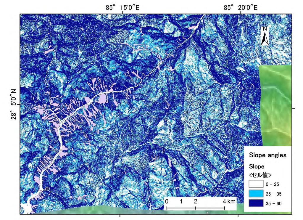
40 Slope angles
")
41 Slope (35 45deg)
+Inner")
42 Slope (35 45deg)+Inner Valley
+Inner")
43 Slope (35 45deg)+Inner Valley+Carbonate

44 Slope (35 45deg)+Inner Valley+Carbonate +Landslides Other carbonates, sandstone, gneiss, slate, terraces, infacing slopes are not shown
45 Conclusions Landslides induced by the 2015 Gorkha earthquake were mostly shallow disrupted landslides. Landslide dams hardly caused serious threats Landslides occurred mostly on steep slopes in inner valleys, on geologically controlled steep slopes like infacing slopes, and on terrace edges Earthquake shaking was amplified on convex slope breaks on steep slopes Most susceptible rocks to landslide were carbonate, sandstone, gneiss and slate, while phyllite may be not Some earthquake-induced landslides were enlarged by subsequent rainfalls Earthquake-induced cracks have not always developed by subsequent rainfalls Deep-seated large landslide bodies were hardly reactivated The effects of rainfalls before the earthquake were not clearly identified, but landslides would be much more when the earthquake occurred during a rainy season We propose hazard mapping of earthquake-induced landslides on the basis of topographic features and geology

46 Impact on Infrastructure by Gorkha Earthquake 2015 Induced Landslides D. Pathak 1,3, S. R. Bajracharya 1,2 and V. Dangol 1,3 1 Tribhuvan University; 2 ICIMOD, and 3 Nepal Landslide Society
47 Background The 7.6 (ML) magnitude Gorkha Earthquake of 25 April, 2015 followed by numerous aftershocks has affected 31 affected districts, among which the impact was quite serious in 17 districts. This presentation describes some damages to infrastructure like road, bridge, hydropower, settlements due to earthquake induced landslides. The work was carried out through the use of satellite imageries and field visits at selected sites by Nepal Landslide Society for ICIMOD.
48 Study districts


49 Damage to road from earthquake induced landslide in Dhading after earthquake before earthquake The earthquake triggered old landslide


50 Landslide triggered by earthquake at the bend in Pasang Lhamu highway, Rasuwa after earthquake before earthquake
51 Damaged Road Sections due to the EQ induced landslides Road Name Damaged length, m Araniko Highway 11, Pasang Lhamu Highway 4, Chanaute-Barpak 3, Mailung Bazar Road 3, Chaku to inner village 2, Chaku Khola HPP Access Road 2, Lamusangu-Ramechhap Highway 1, Charikot-Lamabagar Road 1, Singati-Bigu Road 1, BP Highway Listi Road Melamchi-Helmbu Road Bhirkot-Hanwa Road Besisahar-Chame Road Dolalghat-Chautara Road Namdu-Jugu Road Bhitkot-Jhule Road Helambu Road Barpak-Gumda Road Balephi-Jalbire Road Gorkha-Ghyampesal Road Busti-Mirge Road Sipring HP Access Road Mid Bhotekoshi Access Road Camp Area Upper Hadi HPP Access Road 26.10

52 Total road damaged: 38 km Araniko Highway: 11.3 km. Chanaute-Barpak road section : 3.6 km portion. Damages to roads due to earthquake induced landslides

53 Many buildings damaged by earthquake induced landslides, mainly in Sindhupalchowk, Lamjung and Rasuwa districts Buildings damaged by earthquake induced landslides
54 The avalanche at Langtang valley caused huge loss of lives and property

55 School buildings damaged by or vulnerable to EQ induced landslides

56 Hydropower Projects affected by EQ induced landslides


57 EQ induced landslides: Damages to HP Projects Landslide damages to penstock alignment of Sanima HP Project. Damages to penstock and PH sites of Bhotekoshi HP Project due to earthquake induced landslides.


58 EQ induced landslides: Damages to HP Projects PH site of Aankhu Khola HP Project affected by landslide at the upslope Landslides affecting the HP Projects on Chaku Khola


59 Landslides affecting the Bhotekoshi HP Project
60 Hydro Power Projects affected by earthquake induced landslides S.N Name of Project Location (District) 1 Upper Bhotekoshi Khola Capacity (kw) Sindhupalchowk 45,000 2 Sunkoshi Khola Sindhupalchowk 2,500 impact to Project Penstock burst due to the rock fall, power house submerged due to the penstock burst, accessibility disrupted. Landslide at penstock alignment and landslide at headworks areas, no access to power plant. 3 Baramchi Khola Sindhupalchowk 4,200 Penstock pipe burst, no access to power plant. 4 Upper Hadi Khola Sindhupalchowk Middle Chaku Sindhupalchowk 1,800 Accessibility disrupted 6 Lower Chaku Khola Sindhupalchowk 1,765 Accessibility disrupted 7 Bhairab Kunda Sindhupalchowk 3,000 8 Ankhu Khola Dhading 8,400 9 Radhi Khola Lamjung 4, Siuri Khola Lamjung 4,950 Rock fall at switchyard; Head-race steel pipe cracks at several parts. Tunnel leakage, penstock burst, switchyard damage, transmission line damage. Substation, Powerhouse fully damaged by landslide, 11 poles damaged. Headrace pipe deformed by rock fall, foundation settlement. Headrace pipe is damaged and affected due to rock fall, Anchor blocks and saddle is found have small crack and foundation settlement. 11 Sipring Khola Dolkha 9,658 Landslide at penstock alignment. 12 Mailung Khola Rasuwa 5,000 Significant damage in Headworks, desander, Penstock pipe and powerhouse.
61 Conclusions The Gorkha earthquake 2015 not only resulted in the destruction of buildings and infrastructures, but also caused landslides that damaged the infrastructures, mainly road and hydropower projects as well as residential and school buildings. Burial of the entire Langtang village, blocking of Kaligandaki River, damages to hydropower projects and damages to Araniko and Rasuwagadhi Highways connecting to China were the major noticeable events due to the earthquake induced landslide. In addition, numerous stretches of the feeder roads and trails were also damaged.
Earthquake-induced landslide distribution and hazard mapping. Megh Raj Dhital Central Department of Geology, Tribhuvan University
 Earthquake-induced landslide distribution and hazard mapping Megh Raj Dhital Central Department of Geology, Tribhuvan University Contents Geological setting of Gorkha earthquake Peak ground acceleration
Geotechnical damage in rural areas caused by the 2015 Gorkha Nepal Earthquake
 Tokyo, 1 June 2015 Geotechnical damage in rural areas caused by the 2015 Gorkha Nepal Earthquake Chiaro Gabriele JSPS RESEARCH FELLOW, University of Tokyo Lecturer, University of Canterbury, New Zealand
Urgent Report of the Landslide Disasters by the Mid Niigata Prefecture Earthquake in 2004, Japan
 Urgent Report of the Landslide Disasters by the Mid Niigata Prefecture Earthquake in 2004, Japan Investigation Commission of the Japan Landslide Society and the Japanese Society of Engineering Geology
Disaster Mitigation of Debris Flows, Slope Failures and Landslides 797
 Disaster Mitigation of Debris Flows, Slope Failures and Landslides 797 Application of Probabilistic Approach in Rock Slope Stability Analysis An Experience from Nepal Shubh Pathak, 1) Ram Krishna Poudel
Using Weather and Climate Information for Landslide Prevention and Mitigation
 Using Weather and Climate Information for Landslide Prevention and Mitigation Professor Roy C. Sidle Disaster Prevention Research Institute Kyoto University, Japan International Workshop on Climate and
MultiHazard Process Chains: Nepal and other hotspots
 MultiHazard Process Chains: Nepal and other hotspots Jeffrey S. Kargel (Thanks to NASA Disasters program and David Green for support) 6 Sep 2016 Glaciers Glacial Lakes Seismicity Meteorological floods
Study of Suspended Sediment and Its Mineral Content Analysis with Impact on Hydropower Design: A Case Study of Rahughat Hydroelectric Project
 Journal of Geological Resource and Engineering 2 (2017) 82-86 doi:10.17265/2328-2193/2017.02.005 D DAVID PUBLISHING Study of Suspended Sediment and Its Mineral Content Analysis with Impact on Hydropower
How to manage risk through integrated geohazard assessment. Prof. John M. Reynolds Reynolds International Ltd, Mold, UK
 How to manage risk through integrated geohazard assessment Prof. John M. Reynolds Reynolds International Ltd, Mold, UK Talk outline Introduction Types of disasters within the Himalayas Integrated Geohazard
Geotechnical Risks and Management Systems: An FHWA Perspective
 October 13, 2010 2010 STGE Conference Charleston, WV Geotechnical Risks and Management Systems: An FHWA Perspective Silas C. Nichols, PE, Senior Bridge Engineer - Geotechnical Federal Highway Administration
Landslide Susceptibility, Hazard, and Risk Assessment. Twin Hosea W. K. Advisor: Prof. C.T. Lee
 Landslide Susceptibility, Hazard, and Risk Assessment Twin Hosea W. K. Advisor: Prof. C.T. Lee Date: 2018/05/24 1 OUTLINE INTRODUCTION LANDSLIDE HAZARD ASSESSTMENT LOGISTIC REGRESSION IN LSA STUDY CASE
LANDSLIDE HAZARDS. presented during the. TRAINING-WORKSHOP ON DISASTER RISK MANAGEMENT Rakdell Inn Virac, Catanduanes 03 July 2008
 LANDSLIDE HAZARDS presented during the TRAINING-WORKSHOP ON DISASTER RISK MANAGEMENT Rakdell Inn Virac, Catanduanes 03 July 2008 GEOLOGIC HAZARDS the probability of occurrence, within a specific period
BIOGRAPHY. 1.0 Name: Prakash Chandra Ghimire
 BIOGRAPHY 1.0 Name: Prakash Chandra Ghimire 2.0 Date of birth: 2028-02-06 B.S (1971-05-20 A.D.) 3.0 Address: Permanent Address: Banglachuli-3, Dang, Nepal Temporary Address: Lalitpur Metropolitan City,
Geology 229 Engineering Geology Lecture 27. Earthquake Engineering (Reference West, Ch. 18)
") Geology 229 Engineering Geology Lecture 27 Earthquake Engineering (Reference West, Ch. 18) Earthquake Engineering 1. General introduction of earthquakes 2. Seismic Hazards 3. Strong ground motion Exactly
Geology 229 Engineering Geology Lecture 27 Earthquake Engineering (Reference West, Ch. 18) Earthquake Engineering 1. General introduction of earthquakes 2. Seismic Hazards 3. Strong ground motion Exactly
Adopted projects related to the April 2015 Nepal earthquake
 Attachment Adopted projects related to the April 2015 Nepal earthquake Title of the Project Japan based Principal Investigator Nepal based Principal Investigator Title Affiliation Outline 1 Investigation
Hiromitsu Yamagishi Netra Prakash Bhandary Editors. GIS Landslide
 GIS Landslide Hiromitsu Yamagishi Netra Prakash Bhandary Editors GIS Landslide 123 Editors Hiromitsu Yamagishi Shin Engineering Consultant Co. Ltd. Sapporo Japan Netra Prakash Bhandary Ehime University
Earthquake hazards. Aims 1. To know how hazards are classified 2. To be able to explain how the hazards occur 3. To be able to rank order hazards
 Earthquake hazards Aims 1. To know how hazards are classified 2. To be able to explain how the hazards occur 3. To be able to rank order hazards Types of hazard Primary A direct result of the earthquake
Preparing Landslide Inventory Maps using Virtual Globes
 Introduction: A landslide is the movement of a mass of rock, debris, or earth down a slope, under the influence of gravity. Landslides can be caused by different phenomena, including intense or prolonged
Geohazards in the Himalaya GEOL 3000 (3 Credits / 45 class hours)
") Geohazards in the Himalaya GEOL 3000 (3 Credits / 45 class hours) SIT Study Abroad Program: Nepal: Geoscience in the Himalaya PLEASE NOTE: This syllabus represents a recent term. Because courses develop
Geohazards in the Himalaya GEOL 3000 (3 Credits / 45 class hours) SIT Study Abroad Program: Nepal: Geoscience in the Himalaya PLEASE NOTE: This syllabus represents a recent term. Because courses develop
Earthquake Emergency Preparedness in Central-Hungary
 UN-SPIDER Fourth United Nations International UN-SPIDER Bonn Workshop on Disaster Management and Space Technology: The 4C Challenge:Communication Coordination Cooperation Capacity Development Bonn, Germany,
Terms of Reference (ToR)
") Terms of Reference (ToR) for Mapping and Hazard Assessment of Earthquake Induced Landslides and Recommendations for Mitigation Measures for Post-Earthquake Recovery Work in Nuwakot District 1. Background
Terms of Reference (ToR) for Mapping and Hazard Assessment of Earthquake Induced Landslides and Recommendations for Mitigation Measures for Post-Earthquake Recovery Work in Nuwakot District 1. Background
Need of Proper Development in Hilly Urban Areas to Avoid
 Need of Proper Development in Hilly Urban Areas to Avoid Landslide Hazard Dr. Arvind Phukan, P.E. Cosultant/Former Professor of Civil Engineering University of Alaska, Anchorage, USA RI District Governor
The Impact of Nepal s 2015 Gorkha Earthquake-Induced Geohazards
 ICIMOD Research Report 2016/1 The Impact of Nepal s 2015 Gorkha Earthquake-Induced Geohazards The Impact of Nepal s 2015 Gorkha Earthquake-Induced Geohazards 1 About ICIMOD The International Centre for
Geohazards in the Himalaya GEOL 3000 (3 Credits / 45 class hours)
") Geohazards in the Himalaya GEOL 3000 (3 Credits / 45 class hours) SIT Study Abroad Program: Nepal: Geoscience in the Himalaya PLEASE NOTE: This syllabus represents a recent term. Because courses develop
Geohazards in the Himalaya GEOL 3000 (3 Credits / 45 class hours) SIT Study Abroad Program: Nepal: Geoscience in the Himalaya PLEASE NOTE: This syllabus represents a recent term. Because courses develop
GIS Application in Landslide Hazard Analysis An Example from the Shihmen Reservoir Catchment Area in Northern Taiwan
 GIS Application in Landslide Hazard Analysis An Example from the Shihmen Reservoir Catchment Area in Northern Taiwan Chyi-Tyi Lee Institute of Applied Geology, National Central University, No.300, Jungda
The sketch map of field investigations in Wenchuan earthquake hit region, Chengdu City.
 The sketch map of field investigations in Wenchuan earthquake hit region, Chengdu City. 1 Environmental and Geological Condition 1.1 Geomorphology BaiSha River Basin is located in Dujiangyan County, and
Identification of temporary evacuation sites and relocation of dangerous settlements in the Dolakha District: An approach by hazard mapping
 J-RAPID Workshop, 21-22 June 2016 Identification of temporary evacuation sites and relocation of dangerous settlements in the Dolakha District: An approach by hazard mapping PI Nepal side: Lalu Paudel
EIT-Japan Symposium 2011 on Human Security Engineering
 EIT-Japan Symposium 2011 on Human Security Engineering 2011 Disastrous Landslides at Khao Panom, Krabi, Thailand Suttisak Soralump Geotechnical Engineering Research and Development Center (GERD) Faculty
Landslide dams and their hazard after the 25 April 2015 Gorkha Earthquake in Central Nepal
 Lowland Technology International 2016; 18 (2): 129-140 International Association of Lowland Technology (IALT): ISSN 1344-9656 Research Paper Landslide dams and their hazard after the 25 April 2015 Gorkha
20. Engineering geological issues of the Nepal Himalaya
 20. Engineering geological issues of the Nepal Himalaya Ranjan Kumar Dahal (Kagawa University, Japan and Tribhuvan University, Nepal) Shuichi Hasegawa (Kagawa University), Minoru Yamanaka (Kagawa University)
AN APPROACH TO THE CLASSIFICATION OF SLOPE MOVEMENTS
 Training/workshop on Earthquake Vulnerability and Multi-Hazard Risk Assessment: Geospatial Tools for Rehabilitation and Reconstruction Effort 13 31 March 2006, Islamabad, Pakistan AN APPROACH TO THE CLASSIFICATION
WHAT SEISMIC HAZARD INFORMATION THE DAM ENGINEERS NEED FROM SEISMOLOGISTS AND GEOLOGISTS?
 WHAT SEISMIC HAZARD INFORMATION THE DAM ENGINEERS NEED FROM SEISMOLOGISTS AND GEOLOGISTS? Martin WIELAND 1 ABSTRACT For large dam projects a site-specific seismic hazard analysis is usually recommended.
Mass Wasting. Mass Wasting. Earth s s External Processes
 1 Mass Wasting Presentation Modified from Instructor Resource Center on CD-ROM, Foundations of Earth Science, 4 th Edition, Lutgens & Tarbuck Mass Wasting 2 Down-slope movement of rock, loose material
Landslide Hazard Mapping of Nagadhunga-Naubise Section of the Tribhuvan Highway in Nepal with GIS Application
 Journal of Geographic Information System, 2014, 6, 723-732 Published Online December 2014 in SciRes. http://www.scirp.org/journal/jgis http://dx.doi.org/10.4236/jgis.2014.66059 Landslide Hazard Mapping
Interpretive Map Series 24
 Oregon Department of Geology and Mineral Industries Interpretive Map Series 24 Geologic Hazards, and Hazard Maps, and Future Damage Estimates for Six Counties in the Mid/Southern Willamette Valley Including
Report on Disaster statistics of Nepal
 Report on Disaster statistics of Nepal Submitted by Altaf Rehman Submitted to Dr. Naveed Ahmed University of engineering and technology Peshawar Assignment 1 Section A Registration id 14PWCIV456 Page 1
Slope Mass Rating Around Malekhu-Thopal Khola Corrider, Malekhu, Central Nepal Lesser Himalaya
 American Journal of Science, Engineering and Technology 2017; 2(1): 6-14 http://www.sciencepublishinggroup.com/j/ajset doi: 10.11648/j.ajset.20170201.12 Slope Mass Rating Around Malekhu-Thopal Khola Corrider,
EARTHQUAKE-INDUCED LANDSLIDES - AN OVERVIEW AND MITIGATION MEASURES OF DISASTERS CAUSED BY THEM
 EARTHQUAKE-INDUCED LANDSLIDES - AN OVERVIEW AND MITIGATION MEASURES OF DISASTERS CAUSED BY THEM Prof. Emeritus Dr. Hideaki Marui, Niigata University Research Institute for Natural Hazards and Disaster
DISASTER HAZARDS IN BHUTAN By Tshewang Rinzin January Reducing Disaster Risks for a Safe and Happy Bhutan
 DISASTER HAZARDS IN BHUTAN By Tshewang Rinzin 26-27 January 2009 Reducing Disaster Risks for a Safe and Happy Bhutan Disaster Hazards in Bhutan Earthquakes Glacial Lake Outburst Flood (GLOF) Floods in
Important Concepts. Earthquake hazards can be categorized as:
 Lecture 1 Page 1 Important Concepts Monday, August 17, 2009 1:05 PM Earthquake Engineering is a branch of Civil Engineering that requires expertise in geology, seismology, civil engineering and risk assessment.
Sino-Nepal Joint Research Centre for Geography
 Sino-Nepal Joint Research Centre for Geography Central Department of Geography, Tribhuvan University, Kathmandu, Nepal Institute of Mountain Hazards and Environment, Chinese Academy of Sciences, Chengdu,
Geotechnical Risks and Slope Management Systems: An FHWA Perspective
 August 20, 2010 10 th Annual Technical Forum Geohazards Impacting Transportation in the Appalachian Region Geotechnical Risks and Slope Management Systems: An FHWA Perspective Silas C. Nichols, PE, Senior
Tsukuba, Japan International Institute of Seismology and Earthquake Engineering Building Research Institute STUDY TRIP TO ITAKO CITY
 Tsukuba, Japan International Institute of Seismology and Earthquake Engineering Building Research Institute STUDY TRIP TO ITAKO CITY A Technical Report By MARTINEZ BRAVO Delvin Abdiel (MEE10515) Disaster
Geospatial Approach for Delineation of Landslide Susceptible Areas in Karnaprayag, Chamoli district, Uttrakhand, India
 Geospatial Approach for Delineation of Landslide Susceptible Areas in Karnaprayag, Chamoli district, Uttrakhand, India Ajay Kumar Sharma & Anand Mohan Singh Overview Landslide - movement of a mass of rock,
Assessment of the Incidence of Landslides Using Numerical Information
 PAPER Assessment of the Incidence of Landslides Using Numerical Information Atsushi HASEGAWA Takehiro OHTA, Dr. Sci. Assistant Senior Researcher, Senior Researcher, Laboratory Head, Geology Laboratory,
Down-stream process transition (f (q s ) = 1)
 = 1)") Down-stream process transition (f (q s ) = 1) Detachment Limited S d >> S t Transport Limited Channel Gradient (m/m) 10-1 Stochastic Variation { Detachment Limited Equilibrium Slope S d = k sd A -θ d S
Down-stream process transition (f (q s ) = 1) Detachment Limited S d >> S t Transport Limited Channel Gradient (m/m) 10-1 Stochastic Variation { Detachment Limited Equilibrium Slope S d = k sd A -θ d S
Mass Movements. Rock Weathering. Accumulation of Debris on Slopes. Landslides 12/8/2014
 Mass Movements Already talked a little about landslides with earthquakes AKA mass wasting A mass movement is any displacement of large amounts of soil down slopes over (often) a comparatively short period
Y. Shioi 1, Y. Hashizume 2 and H. Fukada 3
 Y. Shioi 1, Y. Hashizume 2 and H. Fukada 3 1 Emeritus Professor, Hachinohe Institute of Technology, Hachinohe, Japan 2 Chief Engineer, Izumo, Misawa, Aomori, Japan 3 Profesr, Geo-Technical Division, Fudo
Rainfall-induced Landslides in Nepal
 Invited Commentary International Journal of Japan Erosion Control Engineering, Vol.5, No.1, 2012 Rainfall-induced Landslides in Nepal Ranjan Kumar DAHAL 1, 2 1 Department of Geology, Tribhuvan University,
5/3/2018 Susceptibility analysis of landslide due to earthquake due in Gorkha (25th April 2015) Animesh Bahadur Pradhan GIS IN WATER RESOURCES CE 547
 Animesh Bahadur Pradhan GIS IN WATER RESOURCES CE 547") Susceptibility 5/3/2018 analysis of landslide due to earthquake due in Gorkha (25th April 2015) Animesh Bahadur Pradhan GIS IN WATER RESOURCES CE 547 Contents 1. Acknowledgement:... 2 2. Motivation and
Susceptibility 5/3/2018 analysis of landslide due to earthquake due in Gorkha (25th April 2015) Animesh Bahadur Pradhan GIS IN WATER RESOURCES CE 547 Contents 1. Acknowledgement:... 2 2. Motivation and
Widespread Ground Motion Distribution Caused by Rupture Directivity during the 2015 Gorkha, Nepal Earthquake
 Widespread Ground Motion Distribution Caused by Rupture Directivity during the 2015 Gorkha, Nepal Earthquake Kazuki Koketsu 1, Hiroe Miyake 2, Srinagesh Davuluri 3 and Soma Nath Sapkota 4 1. Corresponding
Pengcheng Su (*,**,***), Fangqian Wei (**,***), Zunlan Cheng (**,***) & Jingjing Liu (*,**,***)
, Fangqian Wei (**,***), Zunlan Cheng (**,***) & Jingjing Liu (*,**,***)") DOI: 10.4408/IJEGE.2011-03.B-084 Debris flows in Mozi gully, China following the 2008 Wenchuan earthquake Pengcheng Su (*,**,***), Fangqian Wei (**,***), Zunlan Cheng (**,***) & Jingjing Liu (*,**,***)
DOI: 10.4408/IJEGE.2011-03.B-084 Debris flows in Mozi gully, China following the 2008 Wenchuan earthquake Pengcheng Su (*,**,***), Fangqian Wei (**,***), Zunlan Cheng (**,***) & Jingjing Liu (*,**,***)
OIKOS > landslide > mechanism >predisposing causes
 predisposing causes and trigger OIKOS > landslide > mechanism >predisposing causes Landslides are events that occur in space and time. As such, it is usually possible to identify both one or more landslide
Comparison between the two triggered landslides in Mid-Niigata, Japan by July 13 heavy rainfall and October 23 intensive earthquakes in 2004
 Recent DOI 10.1007/s10346-007-0093-0 Received: 19 January 2007 Accepted: 30 August 2007 Springer-Verlag 2007 Hiromitsu Yamagishi. Junko Iwahashi Comparison between the two triggered landslides in Mid-Niigata,
Quantitative Slope Stability Mapping With ArcGIS: Prioritize Highway Maintenance
 Quantitative Slope Stability Mapping With ArcGIS: Prioritize Highway Maintenance Pankaj Bhattarai, Binod Tiwari, Hideaki Marui and Kiyomichi Aoyama Abstract Use of GIS in hazard zonation mapping is popular.
Nepal earthquake of April 25, 2015
 University of Wollongong Research Online Faculty of Engineering and Information Sciences - Papers: Part A Faculty of Engineering and Information Sciences 2015 Nepal earthquake of April 25, 2015 T G Sitharam
DAMAGE DETECTION OF THE 2008 SICHUAN, CHINA EARTHQUAKE FROM ALOS OPTICAL IMAGES
 DAMAGE DETECTION OF THE 2008 SICHUAN, CHINA EARTHQUAKE FROM ALOS OPTICAL IMAGES Wen Liu, Fumio Yamazaki Department of Urban Environment Systems, Graduate School of Engineering, Chiba University, 1-33,
Section Forces Within Earth. 8 th Grade Earth & Space Science - Class Notes
 Section 19.1 - Forces Within Earth 8 th Grade Earth & Space Science - Class Notes Stress and Strain Stress - is the total force acting on crustal rocks per unit of area (cause) Strain deformation of materials
The Effects of Hydraulic Structures on Streams Prone to Bank Erosion in an Intense Flood Event: A Case Study from Eastern Hokkaido
 Symposium Proceedings of the INTERPRAENENT 2018 in the Pacific Rim The Effects of Hydraulic Structures on Streams Prone to Bank Erosion in an Intense Flood Event: A Case Study from Eastern Hokkaido Daisuke
CEOS Landslide Pi lot Working Group: An Overview
 Committee on Earth Observation Satellites CEOS Landslide Pi lot Working Group: An Overview September 4 th, 2017 Co-leads of landslide pilot Dr. Dalia Kirschbaum, NASA Goddard Space Flight Center, Maryland,
DETECTION OF CRUSTAL DEFORMATION OF THE NORTHERN PAKISTAN EARTHQUAKE BY SATELLITE DATA. Submitted by Japan **
 UNITED NATIONS E/CONF.97/5/CRP. 5 ECONOMIC AND SOCIAL COUNCIL Seventeenth United Nations Regional Cartographic Conference for Asia and the Pacific Bangkok, 18-22 September 2006 Item 6 (b) of the provisional
Mass movement problems along Prithvi Highway, Nepal
 ~rir-jk~ufmf~1~tu. m23 ~- (zoo1~~i Ann. Hep. Saigai- ken. :'.'Jiigata Cniv. Nu23(2001) Mass movement problems along Prithvi Highway, Nepal by Pankaj BHATT ARAI* 1 and Kiyomichi A OYAMA* 2 Abstract Because
Response on Interactive comment by Anonymous Referee #1
 Response on Interactive comment by Anonymous Referee #1 Sajid Ali First, we would like to thank you for evaluation and highlighting the deficiencies in the manuscript. It is indeed valuable addition and
Three Fs of earthquakes: forces, faults, and friction. Slow accumulation and rapid release of elastic energy.
 Earthquake Machine Stick-slip: Elastic Rebound Theory Jerky motions on faults produce EQs Three Fs of earthquakes: forces, faults, and friction. Slow accumulation and rapid release of elastic energy. Three
Assessment of regional rainfall-induced landslides using 3S-based hydro-geological model
 Landslides and Engineered Slopes Chen et al. (eds) 2008 Taylor & Francis Group, London, ISBN 978-0-415-41196-7 Assessment of regional rainfall-induced landslides using 3S-based hydro-geological model C.H.
Analysis of geological and geomorphological characteristics of landslides triggered by 2004 Chuetsu earthquake in Japan
 Analysis of geological and geomorphological characteristics of landslides triggered by Chuetsu earthquake in Japan Surangani BANDARA, * Satoru OHTSUKA, Tsukasa IWABE, Yasuyuki MIYAKI, and Koichi ISOBE
The Geographical features of the Hiroshima landslide disaster triggered by heavy rainfall on August 20, 2014
 The Geographical features of the Hiroshima landslide disaster triggered by heavy rainfall on August 20, 2014 Shoji DOSHIDA (1) and Kiminori ARAIBA (1) (1) National Research Institute of Fire and Disaster,
Comparison between predicted and actual rock mass conditions: a review based on tunnel projects in Nepal Himalaya
 Comparison between predicted and actual rock mass conditions: a review based on tunnel projects in Nepal Himalaya K. K. Panthi and B. Nilsen Department of Geology and Mineral Resources Engineering, Norwegian
A Roundup of Recent Debris Flow Events in Taiwan
 2015 International Workshop on Typhoon and Flood APEC Experience Sharing on Hazardous Weather Events and Risk Management A Roundup of Recent Debris Flow Events in Taiwan Hsiao-Yuan(Samuel) Yin Ph.D. sammya@mail.swcb.gov.tw
Geoscientific Instrumentation in River Valley Projects
 J. Ind. Geophys. Union ( July 2008 ) Vol.12, No.3, pp.141-147 Geoscientific Instrumentation in River Valley Projects G.C.Pargaien Energy Infratech Private Limited, 145-146, Udyog Vihar, Phase IV, Gurgaon
THE CONSTRUCTION OF EARTHQUAKE DAMAGE DATA ARCHIVES FOR EARTHQUAKE DISASTER MITIGATION
 THE CONSTRUCTION OF EARTHQUAKE DAMAGE DATA ARCHIVES FOR EARTHQUAKE DISASTER MITIGATION T. Ikeda 1, K. Konagai 2 And S. Takatsu 3 ABSTRACT: 1 Senior Researcher, Technical Research Institute, Tobishima Corporation,
Description of faults
 GLG310 Structural Geology Description of faults Horizontal stretch Crustal thickness Regional elevation Regional character Issues Normal Thrust/reverse Strike-slip >1 1 in one direction and < 1 in
Paper presented in the Annual Meeting of Association of American Geographers, Las Vegas, USA, March 2009 ABSTRACT
 Paper presented in the Annual Meeting of Association of American Geographers, Las Vegas, USA, March 2009 ABSTRACT CHANGING GEOMORPHOLOGY OF THE KOSI RIVER SYSTEM IN THE INDIAN SUBCONTINENT Nupur Bose,
Integrated and Multi-Hazard Disaster Management
 GeoSmart Asia 2016: GI for Disaster Preparedness and Risk Reduction Bandung, Indonesia 12 October 2016 Integrated and Multi-Hazard Disaster Management Lim Choun Sian & Nurfashareena Muhamad Centre for
UGRC 144 Science and Technology in Our Lives/Geohazards
 UGRC 144 Science and Technology in Our Lives/Geohazards Session 3 Understanding Earthquakes and Earthquake Hazards Lecturer: Dr. Patrick Asamoah Sakyi Department of Earth Science, UG Contact Information:
Name: KEY. Examine all possible answers; some may not satisfy the question criteria and should be left blank. mica crystals big enough to see
 GE 50 Exam #3, FS07 Name: KEY_ Examine all possible answers; some may not satisfy the question criteria and should be left blank. 1. Match the metamorphic rock with its foliated texture. [10 pts] slate
Nationwide Master Plan Study on Storage-type Hydroelectric Power Development in Nepal. Final Report Appendix (1/2)
") Nepal Electricity Authority Nepal Nationwide Master Plan Study on Storage-type Hydroelectric Power Development in Nepal Appendix (1/2) February 2014 Japan International Cooperation Agency Electric Power
Nepal Electricity Authority Nepal Nationwide Master Plan Study on Storage-type Hydroelectric Power Development in Nepal Appendix (1/2) February 2014 Japan International Cooperation Agency Electric Power
EXTRACTION OF FLOODED AREAS DUE THE 2015 KANTO-TOHOKU HEAVY RAINFALL IN JAPAN USING PALSAR-2 IMAGES
 EXTRACTION OF FLOODED AREAS DUE THE 2015 KANTO-TOHOKU HEAVY RAINFALL IN JAPAN USING PALSAR-2 IMAGES F. Yamazaki a, *, W. Liu a a Chiba University, Graduate School of Engineering, Chiba 263-8522, Japan
SIMPLE GUIDELINES TO MINIMISE EXPOSURE TO EARTHQUAKE-TRIGGERED LANDSLIDES
 SIMPLE GUIDELINES TO MINIMISE EXPOSURE TO EARTHQUAKE-TRIGGERED LANDSLIDES David Milledge, Nick Rosser, Katie Oven, Amod Mani Dixit, Ranjan Dhungel, Gopi Krishna Basyal, Sujan Raj Adhikari and Alexander
Downloaded from Downloaded from
 IV SEMESTER BACK-PAPER EXAMINATION-2004 Q. [1] [a] Describe internal structure of the earth with a neat sketch. Write down the major land forms and their characteristics on the earth surface. [8] [b] What
Structures Group Report
 Structures Group Report Ian Buckle, Co-leader University of Nevada Reno Kazuhiko Kawashima, Co-leader Tokyo Institute of Technology J-RAPID Final Symposium, Sendai, March 6-7, 2013 Structures Presentations
A METHODOLOGY FOR ASSESSING EARTHQUAKE-INDUCED LANDSLIDE RISK. Agency for the Environmental Protection, ITALY (
 A METHODOLOGY FOR ASSESSING EARTHQUAKE-INDUCED LANDSLIDE RISK Roberto W. Romeo 1, Randall W. Jibson 2 & Antonio Pugliese 3 1 University of Urbino, ITALY (e-mail: rwromeo@uniurb.it) 2 U.S. Geological Survey
Skeletal remains of what was a debris-covered glacier near Mt. Everest
 Annual satellite imaging of the world s glaciers Assessment of glacier extent and change GLIMS Development and population of a digital glacier data inventory HIGH ICE Skeletal remains of what was a debris-covered
Liquefaction and Foundations
 Liquefaction and Foundations Amit Prashant Indian Institute of Technology Gandhinagar Short Course on Seismic Design of Reinforced Concrete Buildings 26 30 November, 2012 What is Liquefaction? Liquefaction
Engineer. Engineering. Engineering. (in-ja-neer ) A person trained and skilled in any of the various branches of engineering: a civil engineer
 A person trained and skilled in any of the various branches of engineering: a civil engineer") Engineer (in-ja-neer ) A person trained and skilled in any of the various branches of engineering: a civil engineer (Random House Webster s College Dictionary, 1991) CE100 Introduction to Civil Geotechnical
Engineer (in-ja-neer ) A person trained and skilled in any of the various branches of engineering: a civil engineer (Random House Webster s College Dictionary, 1991) CE100 Introduction to Civil Geotechnical
R.Suhasini., Assistant Professor Page 1
 UNIT I PHYSICAL GEOLOGY Geology in civil engineering branches of geology structure of earth and its composition weathering of rocks scale of weathering soils - landforms and processes associated with river,
INTRODUCTION. Climate
 INTRODUCTION Climate Landslides are serious natural disasters in many parts of the world. Since the past 30 years, rainfall triggered landslides and debris flows had been one of the natural disasters of
On the need to integrate Disaster Risk Management within the hydropower sector
 On the need to integrate Disaster Risk Management within the hydropower sector John M. Reynolds Reynolds International Ltd Suite 2, Broncoed House Broncoed Business Park Wrexham Road Mold Flintshire CH7
Hydro-meteorological Analysis of Langtang Khola Catchment, Nepal
 Hydro-meteorological Analysis of Langtang Khola Catchment, Nepal Tirtha R. Adhikari 1, Lochan P. Devkota 1, Suresh.C Pradhan 2, Pradeep K. Mool 3 1 Central Department of Hydrology and Meteorology Tribhuvan
Estimation of Damage Ratios of Wooden Houses and Water Distribution Pipelines in an Earthquake Scenario for the Tokyo Metropolitan Region
 The 2011 World Congress on Advances in Structural Engineering and Mechanics (ASEM'11 + ) Seoul, Korea, 18-22 September, 2011 Estimation of Damage Ratios of Wooden Houses and Water Distribution Pipelines
8 Current Issues and Research on Sediment Movement in the River Catchments of Japan
 8 Current Issues and Research on Sediment Movement in the River Catchments of Japan YUTAKA ICHIKAWA INTRODUCTION Prediction of sediment movement is one of the challenging tasks in water-related research.
Natural hazards in Glenorchy Summary Report May 2010
 Natural hazards in Glenorchy Summary Report May 2010 Contents Glenorchy s hazardscape Environment setting Flood hazard Earthquakes and seismic hazards Hazards Mass movement Summary Glossary Introduction
International Journal of Modern Trends in Engineering and Research e-issn No.: , Date: April, 2016
 International Journal of Modern Trends in Engineering and Research www.ijmter.com e-issn No.:2349-9745, Date: 28-30 April, 2016 Landslide Hazard Management Maps for Settlements in Yelwandi River Basin,
INTERNATIONAL JOURNAL OF GEOMATICS AND GEOSCIENCES Volume 1, No 1, 2010
 An Integrated Approach with GIS and Remote Sensing Technique for Landslide Hazard Zonation S.Evany Nithya 1 P. Rajesh Prasanna 2 1. Lecturer, 2. Assistant Professor Department of Civil Engineering, Anna
ASTER DEM Based Studies for Geological and Geomorphological Investigation in and around Gola block, Ramgarh District, Jharkhand, India
 International Journal of Scientific & Engineering Research, Volume 3, Issue 2, February-2012 1 ASTER DEM Based Studies for Geological and Geomorphological Investigation in and around Gola block, Ramgarh
Debris flow: categories, characteristics, hazard assessment, mitigation measures. Hariklia D. SKILODIMOU, George D. BATHRELLOS
 Debris flow: categories, characteristics, hazard assessment, mitigation measures Hariklia D. SKILODIMOU, George D. BATHRELLOS Natural hazards: physical phenomena, active in geological time capable of producing
NPTEL Video Course on Geotechnical Earthquake Engineering
 NPTEL Video Course on Geotechnical Earthquake Engineering by Prof. Deepankar Choudhury Professor, Dept. of Civil Engg., Indian Institute of Technology (IIT) Bombay Powai, Mumbai 400076, India. Email: dc@civil.iitb.ac.in
EFFECT OF TWO SUCCESIVE CHECK DAMS ON DEBRIS FLOW DEPOSITION
 DOI: 10.4408/IJEGE.2011-03.B-116 EFFECT OF TWO SUCCESIVE CHECK DAMS ON DEBRIS FLOW DEPOSITION Farouk Maricar (*), Haruyuki Hashimoto (*), Shinya Ikematsu (*) & Tomohiro Miyoshi (*) (*) Department of Civil
Geologic Hazards. Montour County Multi-jurisdictional. General. Earthquake
 Geologic Hazards General s are very rare in Pennsylvania and have caused little damage with no reported injuries or causalities. s that do occur in Pennsylvania happen deep within the Earth s crust. This
Manika Maharjan, Ph.D.
 Associate Civil Engineering 475 14th Street, Suite 400 Oakland, CA 94612 (510) 268-5001 tel mmaharjan@exponent.com Professional Profile Dr. Maharjan specializes in geotechnical engineering and earthquake