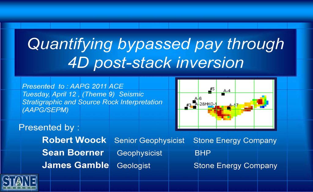
Quantifying Bypassed Pay Through 4-D Post-Stack Inversion*
|
|
|
- Rodger Robertson
- 6 years ago
- Views:
Transcription
1 Quantifying Bypassed Pay Through 4-D Post-Stack Inversion* Robert Woock 1, Sean Boerner 2 and James Gamble 1 Search and Discovery Article #40799 (2011) Posted August 12, 2011 *Adapted from oral presentation at AAPG Annual Convention and Exhibition, Houston, Texas, USA, April 10-13, Stone Energy, Lafayette, LA, United States (woockrd@stoneenergy.com) 2 Formerly CGGVeritas Abstract In this study, we performed a 4D inversion study to identify remaining potential within three sands of the Amberjack field, Gulf of Mexico. Petrophysical analysis was critical in determining the changes in reservoir properties due to pressure and fluid changes in each of the sands. This analysis showed that changes in acoustic impedance could be tied to changes in pressure as well as changes in the fluid saturation from oil to brine. Post-stack seismic volumes from a base and monitor survey were processed and calibrated to minimize differences between the two surveys. Post-stack acoustic impedance (P-Impedance) inversion was performed on both surveys and a difference volume was calculated between the post-stack inversion results. Maps were generated of acoustic impedance, acoustic impedance difference, and top reservoir depths for each of the sands. Cutoffs were applied to these maps to match hydrocarbons that had been produced from the reservoir. Once the cutoffs were established, remaining potential maps could be generated. Reference Yielding, G., A.M. Roberts, J.S. thatcher, J. Walsh, B. Freeman, M.E. Badley, and J. Watterson, 1991, Fault interpretation during seismic interpretation and reservoir evaluation: 1 st AAPG/SPE Archie Conference Proceedings The integration of Geology, Geophysics, Petrophysics, and Petroleum Engineering in reservoir delineation, description, and management, p Copyright AAPG. Serial rights given by author. For all other rights contact author directly.
2

3 Notes by Presenter: The field is located about 20 miles off the edge of the Louisiana birds foot delta. MC block 109, Stone 100% WI, the Amberjack Fixed Platform has 35 well Slots and sits in 1,030 ft of Water Production came Online in 1991.

4 Notes by Presenter: This is the Amberjack Well Utilization Chart. Note the heavy dependence on G and J production. P sand production was limited to two boreholes, but cummed over 5 million BO. Due to the limited number of reclaimable slots, redevelopment required exacting target selection processes. 4D was seen as necessary to identify and quantify many of the potential targets.

5 Notes by Presenter: This is the G- sand top structure for the MC109 Amberjack field. This presentation will focus on the southern fault block. We will examine a couple lines running updip from west to east through the Sohio 3, the A-30, and the A-17 wells. At the time of the 4D, there were no penetrations of the updip portion of this fault block (as seen in yellow).

6 Notes by Presenter: This is the G sand cross-section and seismic expression in reflectivity from the Sohio #3 well to the A-17 well. Clinoforms are clearly delineated along this tract. All three wells have exhibited separate API values and pressure histories confirming compartmentalization.

7 Notes by Presenter: Syndepositional growth faults are common in shelf edge delta complexes, with associated rotation of bedding planes in the hanging wall. Note the growth structure in this field seismic line. As noted by prior authors, the interpretation of intra-reservoir growth faults were derived from a combination of seismic mapping, literature research and the use of outcrop analogues such as the Ferron Sandstone in Utah.
. Several well have already proven the accuracy and value of the 4D.")
8 Notes by Presenter: This line moves further updip in the same fault block, from a potential bypassed clinoform, through the A-030 and A-017 wells, and into the Elrond prospect (now drilling). Several well have already proven the accuracy and value of the 4D. We will see some results at the end of this presentation.

9 Notes by Presenter: These pictures are taken from an earlier publication. The project team remapped these overlapping shapes as voxel clinoform bodies. The colors represent coeval depositional events. API and GOR climbs in updip isolated clinoforms. The empty areas may be potential target areas for redevelopment.
 and monitor 3D (Proprietary 2002) survey were calibrated to minimize differences 3.")
10 Notes by Presenter: Our 4D inversion on three sands, G, J, and P included these steps: 1. Petrophysical analysis conducted to determining the acoustic impedance of pressure and fluid saturation 2. Post-stack seismic volumes from a base 3D (WG 1994) and monitor 3D (Proprietary 2002) survey were calibrated to minimize differences 3. Post-stack acoustic impedance (P-Impedance) inversion was processed on both surveys 4. A difference volume was calculated between the post-stack inversion results. 5. Maps were generated of acoustic impedance, acoustic impedance difference, and top reservoir depths. 6. Cutoffs were applied to match initial saturations and hydrocarbons that had been produced from the reservoir. 7. Remaining potential maps were generated from calibrated difference maps.
 in initial and at time 2.")
11 Notes by Presenter: Petrophysical analysis was critical in determining the changes in reservoir properties due to pressure and fluid changes associated with production activities. We quantified the acoustic impedance values tied to pressure and fluid saturation (oil and brine) in initial and at time 2. Here are shown the edited insitu G sand logs from two of the key wells used in our petrophysical analysis.

12 Notes by Presenter: Petrophysical modeling plots show the measurable changes from typical G-sand production histories on Density, P-Velocity, Bulk Modulus, and Dry frame modulus. Deviations from the horizontal lines are the measurable signals that can be searched for in the 4D difference volumes. The two G sand logs show modeled pressure and fluid changes from initial to monitor time conditions. The horizontal axis for the x-plots is net effective stress. Virtually all the Petrophysical signal comes from the reservoir fluids. The lower right box confirms the dry frame bulk modulus of each reservoir is fairly stiff in this stress range.
 and final pressure conditions (right).")
13 Notes by Presenter: Cross-plots were used to quantify the modeled and observed petrophysical changes. Here we see G-sand fluid properties at initial pressure conditions (left) and final pressure conditions (right). Note the change in reservoir rocks relative to the background (shale) from a decrease in pressure.

14 Notes by Presenter: This handy bar chart illustrates the scale and sign of the G sand properties differentials relative to the maximum impedance signal. These deltas are the results of changes in pressure and oil saturation from initial to final conditions. Reducing pressure decreases P- impedance. Replacing oil with brine increases P-impedance. Replacing oil with brine with the maximum observed pressure drop tends to slightly increase the total P-impedance. From the lack of a density response to pressure we see the utility of the prestack density volume from the monitor survey in helping distinguish which reservoirs had clean pressure signals and which had some combination of pressure and brine signals.

15 Notes by Presenter: Geophysical modeling analyses on selected wells were computed. This excerpt shows some of the input and offset modeling to determining the AVO response of pressure and fluid saturation. This work included time matching of the production history to the seismic acquisitions. The modeling was used to calibrate the 3D Monitor prestack time density volume as well as the post stack volumes used for the 4D difference studies. The pressures correspond to the end of the Western Geco 3D acquisition in October 1995, and the BP monitor 3D acquisition ending in January 2003.

16 Notes by Presenter: The base reflectivity is differenced with the monitor reflectivity. Roman columns and arch structures are resolved. A filtering scheme was developed to collapse the columns to the edges of the arch which developed above the producing sand. Lag Shadowing appears to occur over a 150ms window. Efforts to incorporate the time lag signature into the petrophysical analysis were only successful to the extent we achieved excellent registration. The distribution of lag affects appears to indicate they include mechanical changes to the encapsulating lithologies. Lag effects were compensated by filtered time shifts which preserved the petrophysical properties in the target intervals. As a conjecture we suggest the remaining arch might be described as mechanical alterations due to reservoir volume change resulting from production. We have no other explanation at this time.
 inversion was performed on both surveys. To check the calibration we start in the upper left image.")
17 Notes by Presenter: Post-stack seismic volumes from a base and monitor survey were calibrated to minimize differences. Post-stack acoustic impedance (P-Impedance) inversion was performed on both surveys. To check the calibration we start in the upper left image. Here the well tract is visible but it is replaced in the upper right image by a band limited P-impedance tract that blends into this monitor inversion. The bottom left box shows the P-impedance post stack inversion results without the overlay of the synthetic traces. Those synthetic traces were produced in the inversion process. The work flow shown is one of many which map out the processing steps involved in the inversion.

18 Notes by Presenter: A difference volume, seen in the upper left image of a volume slice, was calculated between the post-stack inversion results. It s the delta acoustic-impedance which we can compare with our petrophysical models to see what has happened within our reservoirs. We re not done yet, but we can almost see the end of this stage of our project. The top right image is the 3D rendered G sand top, on the lower left image the horizon is shown with the impedance differences extracted from the volume. The lower right image shows a slice through one of the impedance time volumes where the G sand stands out. Maps of acoustic impedance and acoustic impedance difference were then generated for each of the sands.

19 Notes by Presenter: Here are those maps for our G-sand. The map of the inverted acoustic impedance is shown on the left. Low acoustic impedance values would indicate the presence of reservoir. Compare to the Acoustic impedance difference map on the right. Prior to the next step, Top reservoir depth maps were derived, and along with the geologist s pay sand isopachs, we sampled the impedance and difference volume to produce reservoir volumes. These were matched to the hydrocarbon volumes that had been produced from the reservoir. Note the boxed area where it appears we have an unswept area. This is the updip area in the southern fault block we talked about earlier. In our next step we estimated the unswept volumes for screening purposes.
 volumes are attributed to the original inversion volume.")
20 Notes by Presenter: Cutoffs were calculated through a speadsheet program. These cutoffs were applied to our inversion derived maps to match hydrocarbons that had been produced from the reservoir: Original (T1) volumes are attributed to the original inversion volume. Impedance difference volumes are calibrated to produced volumes. The remainder is possible bypassed pay Inspection is required to determine the distribution and connectivity of bypassed volumes.

21 Notes by Presenter: Finally we see the distribution of original volumes in the map on the left. The color bar is expressed as porosity feet, with the hot colors being thicker. Once the cutoffs were established for the inversion difference volume to match hydrocarbons that had been produced from the reservoir, remaining potential maps could be generated. This map, seen on the right is used to prospect for bypassed and virgin pay reservoirs. The derived volumes are useful as Gross recoverable estimates, but do not necessarily break down the individual isolated compartments. There s much work still to be done by the whole integrated team to mature prospects from this point. Let s look at some drilling results, just coming in with our ongoing drilling program at the Amberjack platform.
 found oil productive and estimated to be at virgin pressure. 4. Next well (Elrond) proposed to target full G sand updip to production.")
22 Notes by Presenter: 1. A recent well targeted J-sands with suspected virgin pressures. But it did clip our G sand target near the northern bounding fault. 2. A15ST1BP1 targeted 4D virgin J sand reservoirs in FB1. 3. G Sand (lower) found oil productive and estimated to be at virgin pressure. 4. Next well (Elrond) proposed to target full G sand updip to production. 5. It s important to note that economics will drive drilling programs to favor virgin reservoirs because of their high initial flow rates. 6. But there are Drilling, producing, and regulatory issues related to updip undrained reserves. Oil vs. gas; economic impact of equivalent volumes Regulatory hurdle to complete gas updip of existing oil production 7. 4D helps by providing evidence to build a better geologic reservoir model which demonstrated the isolation of these target clinoforms.

23 Notes by Presenter: 1. This is the Vili well as seen with G Sand (lower) and J sand penetrations in the 2nd 4D updip test; drilled and completed in late G sands were found with virgin pressure. 3. The Initial Production Pressure in this J sand also proves up a virgin reservoir updip of earlier penetrations. 4. Let's now check out the production pressure plots for this fault block.

24 Notes by Presenter: Here we have the pressure history plots for Fault Block 1. The G sand is on the left and J sand on the right. The lower member of the G Sand was found oil productive and estimated to be at virgin pressure based on drilling parameters and log response. Although no MDT pressures for the G sand were obtain in the Vili well, a more recent well, the A-17 ST (yellow triangles) has confirmed this as virgin pressure. There are several factors to consider in explaining why the initial pressures plot higher than the older wells downdip but we are not yet certain of our answer. The blue triangle shows the A15ST1BP1 (Vili) initial pressure. Note the J sand plot on the right where the well targeted virgin J sand reservoirs updip to the other FB1 wells. Again the new J sand reservoirs are plotting at or above older wells downdip. Though we have found some downdip bypassed pay targets, it s easy to favor updip virgin reservoirs in this initial 4D drilling program. The table at the bottom shows why this is important. In its first three months of production the Vili well had produced over 240 thousand Barrels of Oil and 165 thousand MCF gas.

25
OTC OTC PP. Abstract
 OTC OTC-19977-PP Using Modern Geophysical Technology to Explore for Bypassed Opportunities in the Gulf of Mexico R.A. Young/eSeis; W.G. Holt, G. Klefstad/ Fairways Offshore Exploration Copyright 2009,
Relinquishment Report
 Relinquishment Report Licence P1403 Block 13/22d Chevron North Sea Limited Korean National Oil Company Chevron North Sea Limited December 2009 1 SYNOPSIS... 3 2 INTRODUCTION. 3 2.1 Licence Terms.. 3 2.2
We apply a rock physics analysis to well log data from the North-East Gulf of Mexico
 Rock Physics for Fluid and Porosity Mapping in NE GoM JACK DVORKIN, Stanford University and Rock Solid Images TIM FASNACHT, Anadarko Petroleum Corporation RICHARD UDEN, MAGGIE SMITH, NAUM DERZHI, AND JOEL
Lithology prediction and fluid discrimination in Block A6 offshore Myanmar
 10 th Biennial International Conference & Exposition P 141 Lithology prediction and fluid discrimination in Block A6 offshore Myanmar Hanumantha Rao. Y *, Loic Michel, Hampson-Russell, Kyaw Myint, Ko Ko,
THE USE OF SEISMIC ATTRIBUTES AND SPECTRAL DECOMPOSITION TO SUPPORT THE DRILLING PLAN OF THE URACOA-BOMBAL FIELDS
 THE USE OF SEISMIC ATTRIBUTES AND SPECTRAL DECOMPOSITION TO SUPPORT THE DRILLING PLAN OF THE URACOA-BOMBAL FIELDS Cuesta, Julián* 1, Pérez, Richard 1 ; Hernández, Freddy 1 ; Carrasquel, Williams 1 ; Cabrera,
Hydrocarbon Volumetric Analysis Using Seismic and Borehole Data over Umoru Field, Niger Delta-Nigeria
 International Journal of Geosciences, 2011, 2, 179-183 doi:10.4236/ijg.2011.22019 Published Online May 2011 (http://www.scirp.org/journal/ijg) Hydrocarbon Volumetric Analysis Using Seismic and Borehole
Thin Sweet Spots Identification in the Duvernay Formation of North Central Alberta*
 Thin Sweet Spots Identification in the Duvernay Formation of North Central Alberta* Ritesh K. Sharma 1 and Satinder Chopra 1 Search and Discovery Article #10902 (2017)** Posted January 16, 2017 *Adapted
The elastic properties such as velocity, density, impedance,
 SPECIAL SECTION: Rr ock Physics physics Lithology and fluid differentiation using rock physics template XIN-GANG CHI AND DE-HUA HAN, University of Houston The elastic properties such as velocity, density,
Downloaded 09/16/16 to Redistribution subject to SEG license or copyright; see Terms of Use at
 Data Using a Facies Based Bayesian Seismic Inversion, Forties Field, UKCS Kester Waters* (Ikon Science Ltd), Ana Somoza (Ikon Science Ltd), Grant Byerley (Apache Corp), Phil Rose (Apache UK) Summary The
AFI (AVO Fluid Inversion)
") AFI (AVO Fluid Inversion) Uncertainty in AVO: How can we measure it? Dan Hampson, Brian Russell Hampson-Russell Software, Calgary Last Updated: April 2005 Authors: Dan Hampson, Brian Russell 1 Overview
AFI (AVO Fluid Inversion) Uncertainty in AVO: How can we measure it? Dan Hampson, Brian Russell Hampson-Russell Software, Calgary Last Updated: April 2005 Authors: Dan Hampson, Brian Russell 1 Overview
Testing of the Strawn Sand, White Hat 20#3, Mustang Prospect, Permian Basin, Texas
 Date: 11 April 2019 ASX Code: WEL Directors John Kopcheff Non-Executive Chairman Neville Henry Managing Director Peter Allchurch Non-Executive Director Larry Liu Non-Executive Director Lloyd Flint Company
Integrating rock physics and full elastic modeling for reservoir characterization Mosab Nasser and John B. Sinton*, Maersk Oil Houston Inc.
 Integrating rock physics and full elastic modeling for reservoir characterization Mosab Nasser and John B. Sinton*, Maersk Oil Houston Inc. Summary Rock physics establishes the link between reservoir properties,
Serica Energy (UK) Limited. P.1840 Relinquishment Report. Blocks 210/19a & 210/20a. UK Northern North Sea
 Limited. P.1840 Relinquishment Report. Blocks 210/19a & 210/20a. UK Northern North Sea") Serica Energy (UK) Limited P.1840 Relinquishment Report Blocks 210/19a & 210/20a UK Northern North Sea January 2013 1 Header Licence: P.1840 Round: Licence Type: 26th Round Traditional "Drill-or-Drop"
Serica Energy (UK) Limited P.1840 Relinquishment Report Blocks 210/19a & 210/20a UK Northern North Sea January 2013 1 Header Licence: P.1840 Round: Licence Type: 26th Round Traditional "Drill-or-Drop"
Update - Testing of the Strawn Sand, White Hat 20#3, Mustang Prospect, Permian Basin, Texas
 Date: 15 April 2019 ASX Code: WEL Directors John Kopcheff Non-Executive Chairman Neville Henry Managing Director Peter Allchurch Non-Executive Director Larry Liu Non-Executive Director Lloyd Flint Company
Oil and Natural Gas Corporation Ltd., VRC(Panvel), WOB, ONGC, Mumbai. 1
, WOB, ONGC, Mumbai. 1") P-259 Summary Data for identification of Porosity Behaviour in Oligocene Lime Stone of D18 Area Of Western Offshore, India V.K. Baid*, P.H. Rao, P.S. Basak, Ravi Kant, V. Vairavan 1, K.M. Sundaram 1, ONGC
P-259 Summary Data for identification of Porosity Behaviour in Oligocene Lime Stone of D18 Area Of Western Offshore, India V.K. Baid*, P.H. Rao, P.S. Basak, Ravi Kant, V. Vairavan 1, K.M. Sundaram 1, ONGC
Fault seal analysis: a regional calibration Nile delta, Egypt
 International Research Journal of Geology and Mining (IRJGM) (2276-6618) Vol. 3(5) pp. 190-194, June, 2013 Available online http://www.interesjournals.org/irjgm Copyright 2013 International Research Journals
Evolution of the Geological Model, Lobster Field (Ewing Bank 873)
") Evolution of the Geological Model, Lobster Field (Ewing Bank 873) M.K. Burk, Marathon Oil Company G.L. Brown, Marathon Oil Company D.R. Petro, Marathon Oil Company Throughout the life of a field an accurate
Evolution of the Geological Model, Lobster Field (Ewing Bank 873) M.K. Burk, Marathon Oil Company G.L. Brown, Marathon Oil Company D.R. Petro, Marathon Oil Company Throughout the life of a field an accurate
The Marrying of Petrophysics with Geophysics Results in a Powerful Tool for Independents Roger A. Young, eseis, Inc.
 The Marrying of Petrophysics with Geophysics Results in a Powerful Tool for Independents Roger A. Young, eseis, Inc. While the application of new geophysical and petrophysical technology separately can
Risk Factors in Reservoir Simulation
 Risk Factors in Reservoir Simulation Dr. Helmy Sayyouh Petroleum Engineering Cairo University 12/26/2017 1 Sources Of Data Petro-physical Data Water saturation may be estimated from log analysis, capillary
An Overview of the Tapia Canyon Field Static Geocellular Model and Simulation Study
 An Overview of the Tapia Canyon Field Static Geocellular Model and Simulation Study Prepared for Sefton Resources Inc. Jennifer Dunn, Chief Geologist Petrel Robertson Consulting Ltd. Outline Background
Shaly Sand Rock Physics Analysis and Seismic Inversion Implication
 Shaly Sand Rock Physics Analysis and Seismic Inversion Implication Adi Widyantoro (IkonScience), Matthew Saul (IkonScience/UWA) Rock physics analysis of reservoir elastic properties often assumes homogeneity
21/29c Relinquishment Document
 /9c Relinquishment Document ) icence information icence : P.5 lock(s) : /9c South West ocation : Western Platform, CNS Operator : EnCore Petroleum (5.6%) Co-venturers : Petro-Canada (5.00%) Nexen (8.98%)
SAND DISTRIBUTION AND RESERVOIR CHARACTERISTICS NORTH JAMJUREE FIELD, PATTANI BASIN, GULF OF THAILAND
 SAND DISTRIBUTION AND RESERVOIR CHARACTERISTICS NORTH JAMJUREE FIELD, PATTANI BASIN, GULF OF THAILAND Benjawan KIinkaew Petroleum Geoscience Program, Department of Geology, Faculty of Science, Chulalongkorn
SEG/New Orleans 2006 Annual Meeting
 Carmen C. Dumitrescu, Sensor Geophysical Ltd., and Fred Mayer*, Devon Canada Corporation Summary This paper provides a case study of a 3D seismic survey in the Leland area of the Deep Basin of Alberta,
RC 1.3. SEG/Houston 2005 Annual Meeting 1307
 from seismic AVO Xin-Gong Li,University of Houston and IntSeis Inc, De-Hua Han, and Jiajin Liu, University of Houston Donn McGuire, Anadarko Petroleum Corp Summary A new inversion method is tested to directly
Delineating a sandstone reservoir at Pikes Peak, Saskatchewan using 3C seismic data and well logs
 Delineating a sandston reservoir at Pikes Peak Delineating a sandstone reservoir at Pikes Peak, Saskatchewan using 3C seismic data and well logs Natalia L. Soubotcheva and Robert R. Stewart ABSTRACT To
Bulletin of Earth Sciences of Thailand. Evaluation of the Petroleum Systems in the Lanta-Similan Area, Northern Pattani Basin, Gulf of Thailand
 Evaluation of the Petroleum Systems in the Lanta-Similan Area, Northern Pattani Basin, Gulf of Thailand Sirajum Munira Petroleum Geoscience Program, Department of Geology, Faculty of Science, Chulalongkorn
The role of seismic modeling in Reservoir characterization: A case study from Crestal part of South Mumbai High field
 P-305 The role of seismic modeling in Reservoir characterization: A case study from Crestal part of South Mumbai High field Summary V B Singh*, Mahendra Pratap, ONGC The objective of the modeling was to
Reservoir properties inversion from AVO attributes
 Reservoir properties inversion from AVO attributes Xin-gang Chi* and De-hua Han, University of Houston Summary A new rock physics model based inversion method is put forward where the shaly-sand mixture
Kondal Reddy*, Kausik Saikia, Susanta Mishra, Challapalli Rao, Vivek Shankar and Arvind Kumar
 10 th Biennial International Conference & Exposition P 277 Reducing the uncertainty in 4D seismic interpretation through an integrated multi-disciplinary workflow: A case study from Ravva field, KG basin,
Simultaneous Inversion of Clastic Zubair Reservoir: Case Study from Sabiriyah Field, North Kuwait
 Simultaneous Inversion of Clastic Zubair Reservoir: Case Study from Sabiriyah Field, North Kuwait Osman Khaled, Yousef Al-Zuabi, Hameed Shereef Summary The zone under study is Zubair formation of Cretaceous
Downloaded 11/02/16 to Redistribution subject to SEG license or copyright; see Terms of Use at Summary.
 in thin sand reservoirs William Marin* and Paola Vera de Newton, Rock Solid Images, and Mario Di Luca, Pacific Exploración y Producción. Summary Rock Physics Templates (RPTs) are useful tools for well
A E. SEG/San Antonio 2007 Annual Meeting. exp. a V. a V. Summary
 Time-lapse simulator-to-seismic study - Forties field, North Sea. Christophe Ribeiro *, Cyrille Reiser, Philippe Doyen, CGGeritas, London, UK August Lau, Apache Corp., Houston, US, Steve Adiletta, Apache
DHI Analysis Using Seismic Frequency Attribute On Field-AN Niger Delta, Nigeria
 IOSR Journal of Applied Geology and Geophysics (IOSR-JAGG) e-issn: 2321 0990, p-issn: 2321 0982.Volume 1, Issue 1 (May. Jun. 2013), PP 05-10 DHI Analysis Using Seismic Frequency Attribute On Field-AN Niger
RELINQUISHMENT REPORT. UK Traditional Licence P Blocks 12/16b & 12/17b. First Oil Expro Limited (Operator, 46.67%)
") RELINQUISHMENT REPORT UK Traditional Licence P.1887 Blocks 12/16b & 12/17b First Oil Expro Limited (Operator, 46.67%) Nautical Petroleum Limited (26.67%) North Sea Energy (UK NO2) Limited (26.67%) February
RELINQUISHMENT REPORT UK Traditional Licence P.1887 Blocks 12/16b & 12/17b First Oil Expro Limited (Operator, 46.67%) Nautical Petroleum Limited (26.67%) North Sea Energy (UK NO2) Limited (26.67%) February
Relinquishment Report for Licence Number P1356, Block 48/8c March 2008
 Relinquishment Report for Licence Number P1356, Block 48/8c March 2008 Table of Contents 1.0 Header...3 2.0 Synopsis...3 3.0 Exploration Activities...4 4.0 Prospectivity Analysis...11 5.0 Conclusions...12
Sadewa Field is in Kutei Basin in the Makassar Strait between
 SPECIAL Asia SECTION: Pacific A s i a P acific Distinguishing gas sand from shale/brine sand using elastic impedance data and the determination of the lateral extent of channel reservoirs using amplitude
Geologic influence on variations in oil and gas production from the Cardium Formation, Ferrier Oilfield, west-central Alberta, Canada
 Geologic influence on variations in oil and gas production from the Cardium Formation, Ferrier Oilfield, west-central Alberta, Canada Marco Venieri and Per Kent Pedersen Department of Geoscience, University
Multiattributes and Seismic Interpretation of Offshore Exploratory Block in Bahrain A Case Study
 Multiattributes and Seismic Interpretation of Offshore Exploratory Block in Bahrain A Case Study Suresh Thampi, Aqeel Ahmed, Yahya Al-Ansari, Ali Shehab, Ahmed Fateh, Anindya Ghosh, Ghada Almoulani. The
Rock physics and AVO analysis for lithofacies and pore fluid prediction in a North Sea oil field
 Rock physics and AVO analysis for lithofacies and pore fluid prediction in a North Sea oil field Downloaded 09/12/14 to 84.215.159.82. Redistribution subject to SEG license or copyright; see Terms of Use
Time-lapse seismic modelling for Pikes Peak field
 Time-lapse seismic modelling for Pikes Peak field Ying Zou*, Laurence R. Bentley and Laurence R. Lines University of Calgary, 2500 University Dr, NW, Calgary, AB, T2N 1N4 zou@geo.ucalgary.ca ABSTRACT Predicting
We LHR3 06 Detecting Production Effects and By-passed Pay from 3D Seismic Data Using a Facies Based Bayesian Seismic Inversion
 We LHR3 06 Detecting Production Effects and By-passed Pay from 3D Seismic Data Using a Facies Based Bayesian Seismic Inversion K.D. Waters* (Ikon Science Ltd), A.V. Somoza (Ikon Science Ltd), G. Byerley
Sequence Stratigraphy of the Upper Cretaceous Niobrara Formation, A Bench, Wattenberg Field, Denver Julesburg Basin, Colorado*
 Sequence Stratigraphy of the Upper Cretaceous Niobrara Formation, A Bench, Wattenberg Field, Denver Julesburg Basin, Colorado* Lisa E. Remington LaChance 1 and Mark C. Robinson 1 Search and Discovery Article
For personal use only
 Date: 18 February 2019 ASX Code: WEL Directors John Kopcheff Non-Executive Chairman Neville Henry Managing Director Peter Allchurch Non-Executive Director James Hodges Non-Executive Director Larry Liu
Use of Seismic Inversion Attributes In Field Development Planning
 IOSR Journal of Applied Geology and Geophysics (IOSR-JAGG) e-issn: 2321 0990, p-issn: 2321 0982.Volume 6, Issue 2 Ver. II (Mar. Apr. 2018), PP 86-92 www.iosrjournals.org Use of Seismic Inversion Attributes
RWE Dea UK SNS Limited (50%), Faroe Petroleum (UK) Limited
, Faroe Petroleum (UK) Limited") 1. Licence information Licence Number P1975 Licence Round 27 th (2012) Licence Type Traditional Blocks 3/28c & 9/3e Licensees Work Programme 2. Synopsis RWE Dea UK SNS Limited (50%), Faroe Petroleum (UK)
1. Licence information Licence Number P1975 Licence Round 27 th (2012) Licence Type Traditional Blocks 3/28c & 9/3e Licensees Work Programme 2. Synopsis RWE Dea UK SNS Limited (50%), Faroe Petroleum (UK)
An Analytic Approach to Sweetspot Mapping in the Eagle Ford Unconventional Play
 An Analytic Approach to Sweetspot Mapping in the Eagle Ford Unconventional Play Murray Roth*, Transform Software and Services, Denver, Colorado, Murray@transformsw.com Michael Roth, Transform Software
Downloaded 10/02/18 to Redistribution subject to SEG license or copyright; see Terms of Use at
 Multi-scenario, multi-realization seismic inversion for probabilistic seismic reservoir characterization Kester Waters* and Michael Kemper, Ikon Science Ltd. Summary We propose a two tiered inversion strategy
5 ORIGINAL HYDROCARBONS IN PLACE
 5 ORIGINAL HYDROCARBONS IN PLACE The deterministic estimation of oil in place for the White Rose Field was completed using 3-D geological modelling in the RMS software package. This procedure involves
New Frontier Advanced Multiclient Data Offshore Uruguay. Advanced data interpretation to empower your decision making in the upcoming bid round
 New Frontier Advanced Multiclient Data Offshore Uruguay Advanced data interpretation to empower your decision making in the upcoming bid round Multiclient data interpretation provides key deliverables
An overview of AVO and inversion
 P-486 An overview of AVO and inversion Brian Russell, Hampson-Russell, CGGVeritas Company Summary The Amplitude Variations with Offset (AVO) technique has grown to include a multitude of sub-techniques,
An empirical method for estimation of anisotropic parameters in clastic rocks
 An empirical method for estimation of anisotropic parameters in clastic rocks YONGYI LI, Paradigm Geophysical, Calgary, Alberta, Canada Clastic sediments, particularly shale, exhibit transverse isotropic
A031 Porosity and Shale Volume Estimation for the Ardmore Field Using Extended Elastic Impedance
 A31 Porosity and Shale Volume Estimation for the Ardmore Field Using Extended Elastic Impedance A.M. Francis* (Earthworks Environment & Resources Ltd) & G.J. Hicks (Earthworks Environment & Resources Ltd)
Probabilistic seismic inversion using pseudo-wells
 Seismic Rock Physics Seminar Probabilistic seismic inversion using pseudo-wells Patrick Connolly*, PCA Ltd Patrick Connolly Associates Ltd. geophysics for integration Outline ODiSI: probabilistic inversion
The SPE Foundation through member donations and a contribution from Offshore Europe
 Primary funding is provided by The SPE Foundation through member donations and a contribution from Offshore Europe The Society is grateful to those companies that allow their professionals to serve as
Comparative Study of AVO attributes for Reservoir Facies Discrimination and Porosity Prediction
 5th Conference & Exposition on Petroleum Geophysics, Hyderabad-004, India PP 498-50 Comparative Study of AVO attributes for Reservoir Facies Discrimination and Porosity Prediction Y. Hanumantha Rao & A.K.
The Stratigraphic Trap in the Benchamas Field Pattani Basin, Gulf of Thailand
 The Stratigraphic Trap in the Benchamas Field Pattani Basin, Gulf of Thailand Jurairat Buangam Petroleum Geoscience Program, Department of Geology, Faculty of Science, Chulalongkorn University, Bangkok
Osareni C. Ogiesoba 1. Search and Discovery Article #10601 (2014)** Posted May 31, 2014
** Posted May 31, 2014") Seismic Multiattribute Analysis for Shale Gas/Oil within the Austin Chalk and Eagle Ford Shale in a Submarine Volcanic Terrain, Maverick Basin, South Texas* Osareni C. Ogiesoba 1 Search and Discovery Article
Seismic Multiattribute Analysis for Shale Gas/Oil within the Austin Chalk and Eagle Ford Shale in a Submarine Volcanic Terrain, Maverick Basin, South Texas* Osareni C. Ogiesoba 1 Search and Discovery Article
Main Challenges and Uncertainties for Oil Production from Turbidite Reservoirs in Deep Water Campos Basin, Brazil*
 Main Challenges and Uncertainties for Oil Production from Turbidite Reservoirs in Deep Water Campos Basin, Brazil* Carlos H. Bruhn 1, Antonio Pinto 1, and Paulo R. Johann 1 Search and Discovery Article
Derived Rock Attributes Analysis for Enhanced Reservoir Fluid and Lithology Discrimination
 IOSR Journal of Applied Geology and Geophysics (IOSR-JAGG) e-issn: 2321 0990, p-issn: 2321 0982.Volume 5, Issue 2 Ver. I (Mar. - Apr. 2017), PP 95-105 www.iosrjournals.org Derived Rock Attributes Analysis
Downloaded 09/09/15 to Redistribution subject to SEG license or copyright; see Terms of Use at
 Reservoir properties estimation from marine broadband seismic without a-priori well information: A powerful de-risking workflow Cyrille Reiser*, Matt Whaley and Tim Bird, PGS Reservoir Limited Summary
Quick Look Interpretation Techniques
 Quick Look Interpretation Techniques Odd Number of Contours A basic rule of contouring is that ALL contours on a continuous surface must close or end at the edge of the map. This rule seems so obvious
Seismic reservoir characterization of a U.S. Midcontinent fluvial system using rock physics, poststack seismic attributes, and neural networks
 CORNER INTERPRETER S Coordinated by Linda R. Sternbach Seismic reservoir characterization of a U.S. Midcontinent fluvial system using rock physics, poststack seismic attributes, and neural networks JOEL
Subsurface Geology and Resource Exploration
 LAB 11. Subsurface Geology and Resource Exploration Locating earth resources such as aluminum, copper, gold and gemstones has been an important job for geologists for a long time. This lab deals with the
Seismic reservoir and source-rock analysis using inverse rock-physics modeling: A Norwegian Sea demonstration
 66 Seismic reservoir and source-rock analysis using inverse rock-physics modeling: A Norwegian Sea demonstration Kenneth Bredesen 1, Erling Hugo Jensen 1, 2, Tor Arne Johansen 1, 2, and Per Avseth 3, 4
Downloaded 01/29/13 to Redistribution subject to SEG license or copyright; see Terms of Use at
 An integrated study of a Mississippian tripolitic chert reservoir Osage County, Oklahoma, USA Benjamin L. Dowdell*, Atish Roy, and Kurt J. Marfurt, The University of Oklahoma Summary With the advent of
Seismic Attributes and Their Applications in Seismic Geomorphology
 Academic article Seismic Attributes and Their Applications in Seismic Geomorphology Sanhasuk Koson, Piyaphong Chenrai* and Montri Choowong Department of Geology, Faculty of Science, Chulalongkorn University,
Using Curvature to Map Faults, Fractures
 Using Curvature to Map Faults, Fractures by SATINDER CHOPRA and KURT J. MARFURT Editor s note: Chopra is with Arcis Corp., Calgary, Canada; Marfurt is with the University of Oklahoma. Both are AAPG members.
PETROLEUM GEOSCIENCES GEOLOGY OR GEOPHYSICS MAJOR
 PETROLEUM GEOSCIENCES GEOLOGY OR GEOPHYSICS MAJOR APPLIED GRADUATE STUDIES Geology Geophysics GEO1 Introduction to the petroleum geosciences GEO2 Seismic methods GEO3 Multi-scale geological analysis GEO4
Overview of Selected Shale Plays in New Mexico*
 Overview of Selected Shale Plays in New Mexico* Ron Broadhead 1 Search and Discovery Article #10627 (2014)** Posted August 18, 2014 *Adapted from presentation at RMAG luncheon meeting, Denver, Colorado,
Keywords. PMR, Reservoir Characterization, EEI, LR
 Enhancing the Reservoir Characterization Experience through Post Migration Reprocessed (PMR) Data A case study Indrajit Das*, Ashish Kumar Singh, Shakuntala Mangal, Reliance Industries Limited, Mumbai
Net-to-gross from Seismic P and S Impedances: Estimation and Uncertainty Analysis using Bayesian Statistics
 Net-to-gross from Seismic P and S Impedances: Estimation and Uncertainty Analysis using Bayesian Statistics Summary Madhumita Sengupta*, Ran Bachrach, Niranjan Banik, esterngeco. Net-to-gross (N/G ) is
Relinquishment Report. for. Licences: P.1596 (Blocks 205/3, 205/4a) P.1836 (Block 205/2b) P.1837 (Block 205/5b)
 P.1836 (Block 205/2b) P.1837 (Block 205/5b)") Relinquishment Report for Licences: P.1596 (Blocks 205/3, 205/4a) P.1836 (Block 205/2b) P.1837 (Block 205/5b) November 2013 1 of 9 CONTENT 1. Header 2. Synopsis 3. Exploration Activities 4. Prospectivity
Relinquishment Report for Licences: P.1596 (Blocks 205/3, 205/4a) P.1836 (Block 205/2b) P.1837 (Block 205/5b) November 2013 1 of 9 CONTENT 1. Header 2. Synopsis 3. Exploration Activities 4. Prospectivity
Downloaded 11/20/12 to Redistribution subject to SEG license or copyright; see Terms of Use at
 AVO crossplot analysis in unconsolidated sediments containing gas hydrate and free gas: Green Canyon 955, Gulf of Mexico Zijian Zhang* 1, Daniel R. McConnell 1, De-hua Han 2 1 Fugro GeoConsulting, Inc.,
3D Seismic Reservoir Characterization and Delineation in Carbonate Reservoir*
 3D Seismic Reservoir Characterization and Delineation in Carbonate Reservoir* M. N. Alamsyah 1, Bambang W. Handono 1, and Andri Syafriya 1 Search and Discovery Article #41760 (2016) Posted January 25,
Steve Cumella 1. Search and Discovery Article # (2009) Posted July 30, Abstract
 Posted July 30, Abstract") AV Geology of the Piceance Basin Mesaverde Gas Accumulation* Steve Cumella 1 Search and Discovery Article #110106 (2009) Posted July 30, 2009 *Adapted from oral presentation at AAPG Annual Convention,
AV Geology of the Piceance Basin Mesaverde Gas Accumulation* Steve Cumella 1 Search and Discovery Article #110106 (2009) Posted July 30, 2009 *Adapted from oral presentation at AAPG Annual Convention,
Available online Journal of Scientific and Engineering Research, 2018, 5(1):1-10. Research Article
:1-10. Research Article") Available online www.jsaer.com, 2018, 5(1):1-10 Research Article ISSN: 2394-2630 CODEN(USA): JSERBR Evaluation of Reservoir Production Performance Using 3-D Seismic Mapping and Well Logs Analysis (A Case
Available online www.jsaer.com, 2018, 5(1):1-10 Research Article ISSN: 2394-2630 CODEN(USA): JSERBR Evaluation of Reservoir Production Performance Using 3-D Seismic Mapping and Well Logs Analysis (A Case
AVO analysis of 3-D seismic data at G-field, Norway
 Available online at www.pelagiaresearchlibrary.com Advances in Applied Science Research, 2014, 5(5):148-164 ISSN: 0976-8610 CODEN (USA): AASRFC AVO analysis of 3-D seismic data at G-field, Norway Fredrick
Interpretation and Reservoir Properties Estimation Using Dual-Sensor Streamer Seismic Without the Use of Well
 Interpretation and Reservoir Properties Estimation Using Dual-Sensor Streamer Seismic Without the Use of Well C. Reiser (Petroleum Geo-Services), T. Bird* (Petroleum Geo-Services) & M. Whaley (Petroleum
Quantitative Interpretation
 Quantitative Interpretation The aim of quantitative interpretation (QI) is, through the use of amplitude analysis, to predict lithology and fluid content away from the well bore. This process should make
Modeling Optimizes Asset Performance By Chad Baillie
 MARCH 2016 The Better Business Publication Serving the Exploration / Drilling / Production Industry Modeling Optimizes Asset Performance By Chad Baillie MISSOURI CITY, TX. As more well and completion data
P1645 Fig 1: Licence P1645 Introduction
 Licence Number: P.1645 commenced 12 th November 2008 Licence Round: 25 th Licence Type: Traditional Block Number: 9/8b Operator: EnQuest (60%) Partners: Norwegian Energy Company (Noreco) UK Ltd 40% Work
MITIGATE RISK, ENHANCE RECOVERY Seismically-Constrained Multivariate Analysis Optimizes Development, Increases EUR in Unconventional Plays
 White Paper MITIGATE RISK, ENHANCE RECOVERY Seismically-Constrained Multivariate Analysis Optimizes Development, Increases EUR in Unconventional Plays SM Seismically-Constrained Multivariate Analysis Optimizes
Multiattribute seismic analysis on AVO-derived parameters A case study
 Multiattriute seismic analysis on AVO-derived parameters A case study SATINDER CHOPRA, Core La Reservoir Technologies, Calgary, Canada DOUG PRUDEN, GEDCO, Calgary, Canada Prospecting for reservoir zones
SPE DISTINGUISHED LECTURER SERIES is funded principally through a grant of the SPE FOUNDATION
 SPE DISTINGUISHED LECTURER SERIES is funded principally through a grant of the SPE FOUNDATION The Society gratefully acknowledges those companies that support the program by allowing their professionals
High Resolution Field-based Studies of Hydrodynamics Examples from the North Sea
 High Resolution Field-based Studies of Hydrodynamics Examples from the North Sea Stephen O Connor 1, Richard Swarbrick 2 and Sam Green 1 1 Ikon GeoPressure, Durham, UK 2 Swarbrick Geopressure Consultancy,
Towed Streamer EM Integrated interpretation for accurate characterization of the sub-surface. PETEX, Tuesday 15th of November 2016
 Towed Streamer EM Integrated interpretation for accurate characterization of the sub-surface. PETEX, Tuesday 15th of November 2016 Joshua May Sales and Marketing Manager Agenda Introduction to Towed Streamer
Integrating reservoir flow simulation with time-lapse seismic inversion in a heavy oil case study
 Integrating reservoir flow simulation with time-lapse seismic inversion in a heavy oil case study Naimeh Riazi*, Larry Lines*, and Brian Russell** Department of Geoscience, University of Calgary **Hampson-Russell
Porosity. Downloaded 09/22/16 to Redistribution subject to SEG license or copyright; see Terms of Use at
 Geostatistical Reservoir Characterization of Deepwater Channel, Offshore Malaysia Trisakti Kurniawan* and Jahan Zeb, Petronas Carigali Sdn Bhd, Jimmy Ting and Lee Chung Shen, CGG Summary A quantitative
QUANTITATIVE INTERPRETATION
 QUANTITATIVE INTERPRETATION THE AIM OF QUANTITATIVE INTERPRETATION (QI) IS, THROUGH THE USE OF AMPLITUDE ANALYSIS, TO PREDICT LITHOLOGY AND FLUID CONTENT AWAY FROM THE WELL BORE This process should make
Summary. Seismic Field Example
 Water-saturation estimation from seismic and rock-property trends Zhengyun Zhou*, Fred J. Hilterman, Haitao Ren, Center for Applied Geosciences and Energy, University of Houston, Mritunjay Kumar, Dept.
Integrated Reservoir Characterisation - a successful interdisciplinary working model
 Integrated Reservoir Characterisation - a successful interdisciplinary working model Satinder Chopra*, Scott Singleton*, Craig Hall**, Randy Nickerson + and David Carlson +, *Core Laboratories Reservoir
Article 11 Monte Carlo Simulation/Risk Assessment (cont.)
") RESE SERVOIR ENG NGINE INEERING FOR GEOLO OLOGIS ISTS Article 11 Monte Carlo Simulation/Risk Assessment (cont.) by Ray Mireault, P. Eng. and Lisa Dean, P. Geol., Fekete Associates Inc. The second article
RESE SERVOIR ENG NGINE INEERING FOR GEOLO OLOGIS ISTS Article 11 Monte Carlo Simulation/Risk Assessment (cont.) by Ray Mireault, P. Eng. and Lisa Dean, P. Geol., Fekete Associates Inc. The second article
2011 SEG SEG San Antonio 2011 Annual Meeting 771. Summary. Method
 Geological Parameters Effecting Controlled-Source Electromagnetic Feasibility: A North Sea Sand Reservoir Example Michelle Ellis and Robert Keirstead, RSI Summary Seismic and electromagnetic data measure
1. LICENCE INFORMATION. P209 Block 9/29a ALL. U.K. Block 9/29a (Part Block) Operator/Partners TAQA Bratani Ltd 81%, RWE DEA UK 19%
 Operator/Partners TAQA Bratani Ltd 81%, RWE DEA UK 19%") 1. LICENCE INFORMATION Licence P209 Block 9/29a ALL Licence Round 4th round Blocks U.K. Block 9/29a (Part Block) Licence Type Traditional (Production) Well Operator TAQA Bratani Ltd Operator/Partners TAQA
1. LICENCE INFORMATION Licence P209 Block 9/29a ALL Licence Round 4th round Blocks U.K. Block 9/29a (Part Block) Licence Type Traditional (Production) Well Operator TAQA Bratani Ltd Operator/Partners TAQA
Facies Classification Based on Seismic waveform -A case study from Mumbai High North
 5th Conference & Exposition on Petroleum Geophysics, Hyderabad-2004, India PP 456-462 Facies Classification Based on Seismic waveform -A case study from Mumbai High North V. B. Singh, D. Subrahmanyam,
Search and Discovery Article #10532 (2013)** Posted October 21, Abstract
** Posted October 21, Abstract") Utilizing the Delta Log R Method for Determining Total Organic Carbon of the Niobrara Formation, B Bench, Denver-Julesburg Basin, Colorado and Wyoming* Madeline K. Beitz 1, Robert Cunningham 2, and Lisa
Utilizing the Delta Log R Method for Determining Total Organic Carbon of the Niobrara Formation, B Bench, Denver-Julesburg Basin, Colorado and Wyoming* Madeline K. Beitz 1, Robert Cunningham 2, and Lisa
EAS 233 Geologic Structures and Maps Winter Miscellaneous practice map exercises. 1. Fault and separation:
 Miscellaneous practice map exercises 1. Fault and separation: With respect to Map 1, what are (a) the orientation of the fault, and (b) the orientation of bedding in the units cut by the fault. (c) Mark
Subsurface Maps. K. W. Weissenburger. Isopach. Isochore. Conoco, Inc. Ponca City, Oklahoma, U.S.A.
 Subsurface Maps K. W. Weissenburger Conoco, Inc. Ponca City, Oklahoma, U.S.A. INTRODUCTION Reservoir properties are mapped to promote optimal field development. Subsurface maps dictate well placement and
A Petroleum Geologist's Guide to Seismic Reflection
 A Petroleum Geologist's Guide to Seismic Reflection William Ashcroft WILEY-BLACKWELL A John Wiley & Sons, Ltd., Publication Contents Preface Acknowledgements xi xiii Part I Basic topics and 2D interpretation