Canol Formation Oil Shale, Exhumation Charge, and Regional Geology of the Central Mackenzie, NWT
|
|
|
- Sabrina Gardner
- 5 years ago
- Views:
Transcription


1 Photo: Canol Fm near Arctic Red River Canol Formation Oil Shale, Exhumation Charge, and Regional Geology of the Central Mackenzie, NWT Hadlari T. Geological Survey of GSC 2018
 Andrew Durbano (compilation and drafting) Key publications by: Dale Issler (Thermochronology) Leanne Pyle (Petroleum Geology) Karen Fallas and Bernard MacLean (Geological")
2 Introduction Research made possible by the Geoscience for Energy and Minerals Program (GEM) Contributions by: Omid Ardakani (Organic Petrology) Jennifer Galloway, Kyle Sulphur, Kimberley Bell (Palynology) Andrew Durbano (compilation and drafting) Key publications by: Dale Issler (Thermochronology) Leanne Pyle (Petroleum Geology) Karen Fallas and Bernard MacLean (Geological maps)


3 Starting Point Norman Wells oilfield has produced well over 200 million barrels of oil since 1921 Source Rock Canol Formation, Devonian Reservoir Rock Kee Scarp Reef, Ramparts Fm, Devonian Conventional view of oil generation L. Cretaceous Tertiary The conventional perspective leads to certain contradictions, we will discuss these and then look more closely at the geological datasets
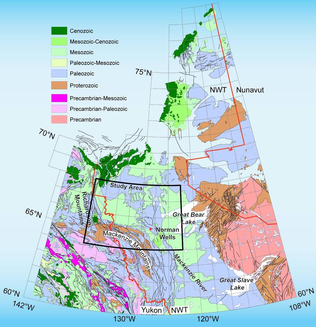
4 Geological Framework

5 West Paleozoic Mackenzie Platform East Keele Tectonic Zone Geological Framework
6 Geological Framework

7 200 m Upper Cret. Lower Cret. Paleoz. cbts Devonian Clastics KTZ / Keele Arch KTZ: Canol and Ramparts Fm were near surface in the Early Cretaceous.

8 Canol Fm Imperial Fm, clastic Canol Fm Hare Indian Fm In outcrop Canol Formation is a cliff-forming rock Bluefish Mbr Near Arctic Red River
: XRD indicates Canol Fm comprises 82-90% modal")
9 The resistance to weathering is due to chert and dolomite Pyle et al (NTGO Report): XRD indicates Canol Fm comprises 82-90% modal quartz
 Chert Layers")
10 Silica? (1974) Chert Layers Cross-Nichols 20x magnification

11 (1987) Organic geochemistry of oil from Norman Wells was compared with Canol Fm and Bluefish Mbr Canol Fm is source rock, not Bluefish Mbr. Thermal maturation during L. Cretaceous-Tertiary sediment loading If oil was generated in the Cret-Tertiary, then why Canol Fm and not Hare Indian Fm (Bluefish Mbr)? Source Rock

12 Reservoir is a Devonian Reef underlain by the Bluefish Mbr and draped by the Canol Formation Yose et al. (2001) Reservoir
 and not biodegraded Yose et al.")
13 Fractured carbonate reservoir (Laramide) Light oil (38 API) and not biodegraded Yose et al. (2001) Reservoir

14 Cretaceous thermal maturity from Rock-Eval Consistent with L.Cretaceous-Tertiary maximum temperatures and therefore oil generation Basal Cretaceous thermal maturity map (Tmax) Tmax Hadlari et al Peel Project Volume

15 AFT Thermal History Vitrinite Thermal Maturity Gap Thermal history from East Mackay well indicates pre-cretaceous maximum temperature and therefore oil generation Issler et al. (2005)
16 Starting Point: Two models Pre-Cretaceous oil generation Fits AFT data from Devonian sandstone Problems: How was light oil retained in the reservoir with no biodegradation for >200 Ma? sub-cret. unconformity Why was it only preserved in the reef at Norman Wells? L.Cretaceous-Tertiary oil generation Explains oil quality, Cret. Rock-Eval, structure Problems: Need to discount AFT data and the vitrinite well data Should have been a flood of oil generated from Devonian source rocks * Why was it only preserved in the reef at Norman Wells? 2009
17 New Approach 1) Can we better understand the thermal history? Palynology of Cretaceous Rock-Eval samples Organic petrology of Cretaceous Rock-Eval samples AFT dataset, a closer look 2) How does the structure relate? Regional tectonics The Norman Range 3) Integrate advances in unconventional resources? Shale oil and hydraulic fracturing Canol Formation and Norman Wells Point of departure: all the data are valid, how do they fit together?
18 Palynology of Cretaceous Rock-Eval samples Radioactive shale of Slater River Fm Tmax ~420 L.Cretaceous strata contain abundant Devonian spores (Sweet / Galloway) Hadlari et al. (2009) Tmax AR Sweet Thermal maturity is inherited via recycling from the Devonian


19 Lower Cretaceous Martin House Fm Upper Cretaceous Trevor Fm Reworked Indigeneous Contribution by: J. Galloway
20 Trevor Fm Slater R. Fm MFS Arctic Red Fm By: Kyle Sulphur (U. Calgary) and J. Galloway (GSC)


21 Organic Petrology of Cretaceous Rock-Eval samples Tmax 433 TOC 1.85% reworked vitrinite same view under UV light Relatively high Tmax directly above the mid-cretaceous unconformity. MFS has Tmax ~420 green/yellow fluorescing algae C ; 09-TH-02-C; Slater River Formation Immature / early maturity By: Omid Ardakani (GSC)


22 Organic Petrology of Canol Fm sample engulfed host rock solid bitumen solid bitumen 50 µm 200 µm C ; 07-TH-03-A; Canol Formation solid bitumen Dry gas zone: Canol sample from the Mackenzie Mtn front 50 µm By: Omid Ardakani (GSC)

23 An aside Integrate palynology and detrital zircon analysis to show the sometimes dominant role of sediment recycling Erosion of Dev.- Miss. strata was the dominant sediment source for Upper Cretaceous strata Consistent with recycling organic matter from Dev- Miss strata
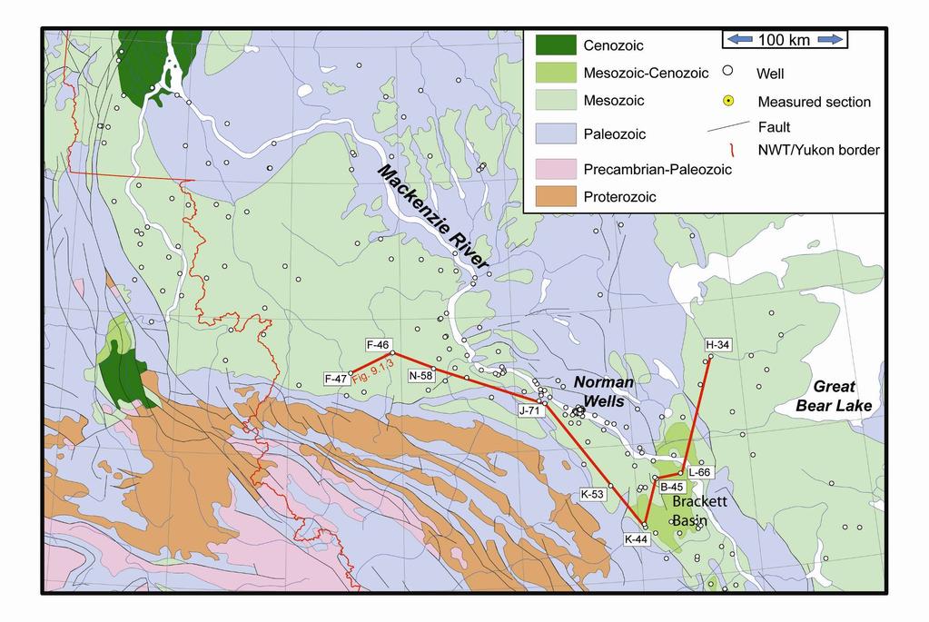
24 Outcrop Well Correlation Slater River Fm Hadlari et al. (2009) Tmax
25 Outcrop Well Correlation East MacKay I-77 Slater River Fm Hadlari et al. (2009) Tmax Issler et al. (2005)
26 Outcrop Well Correlation East MacKay I-77 Vitrinite reflectance shows thermal maturity gap across sub-cretaceous unconformity Hadlari et al. (2009) Tmax Issler et al. (2005) Issler et al. (2005)
27 AFT Thermal History Devonian sample Issler et al (2005) Cretaceous sample Slater R. Fm immature Powell et al (2018)
 Cretaceous")
28 AFT Thermal History L.Cret burial Devonian sample Issler et al (2005) Cretaceous sample Slater R. Fm immature Powell et al (2018)
 Strain from Yakutat collision is")

29 Regional Structure Mazzotti and Hyndman (2002) Strain from Yakutat collision is presently translated across the Cordillera, by a lower crustal detachment, to the Mackenzie Mountains

30 Regional Structure The Norman Range is presently seismically active Hyndman et al. (2005)

31 How Norman Wells is unique Hanging wall of a thrust fault Young foreland structure, presently active Shallow m depth Yose et al. (2001) Reservoir
32 Summary of geological constraints 1. Devonian source rock, Canol Fm Siliceous and organic-rich 2. Maximum burial in early Mesozoic Pre-Cretaceous oil generation 3. Fractured carbonate reservoir Light non-biodegraded oil 4. Thrust fault hanging wall Young structure, Tertiary The years were marked by much discussion of shale oil systems, organoporosity, and fracking
33 Oil Shale: Strength increases linearly with pressure Strength decreases nonlinearly with temperature due to mechanical properties of kerogen, suppressing fracture [strength] Zeuch (1983) Rheology of oil shale
34 1 Imperial 3 km depth, Eocene Hare Indian Ramparts Canol Exhumation starts Older Paleozoic 2 Exhumation Fault initiation Post-Eocene Rocks are shallower as exhumation proceeds 3 Exhumation Fault is active Canol is brittle fractures form Up-dip oil migration, Oil pools in reef 2012 CSPG


35 Exhumation Model Assumption: Oil was generated from all Devonian source rocks prior to the Cretaceous, migrated, and subsequently lost. A fraction is retained within the Canol Fm, hence oil shale. Hadlari (2015)
36 Exhumation Model During exhumation Canol Formation passes through a brittle-ductile transition. Fracturing and overpressure due to exhumation result in up-dip oil migration until it pools in the reservoir. English (2016) Exhumation charge Hadlari (2015)

37 Additional Pieces Is that all? Not quite: Mapping of Canol Formation Rock-Eval data Cross-plots of Rock-Eval data
38 Data: Canol Formation Rock-Eval data of the Mackenzie Corridor, southern NT to the southern Mackenzie Delta, extracted from Fowler et al (2003) GSC Open File 1579
39 Depth of Norman Wells reservoir Data: Canol Formation Rock-Eval data of the Mackenzie Corridor, southern NT to the southern Mackenzie Delta, extracted from Fowler et al (2003) GSC Open File 1579
 Thermal Maturity map")
40 Data: Fowler et al (2003) GSC Open File 1579 Pyle et al (2014) NTGO Open File Pyle et al (2015) Thermal Maturity map (Tmax)
41 Depth Data: Fowler et al (2003) Pyle et al (2014)
42 Depth Depth Attribute the S2 anomaly to carryover from S1 (cf Jarvie 2012) Data: Fowler et al (2003) Pyle et al (2014)
43 Depth Data: Fowler et al (2003) Pyle et al (2014)
44 Oil migration Depth Data: Fowler et al (2003) Pyle et al (2014)
45 Next step: 1) Subset of the data, Central and northern Mackenzie 2) Average multiple measurements from each well location 3) Map the distribution of S1 and S1/TOC 4) Calculate the distance to the nearest known fault
 S1 map of the")
46 Great Bear Lake Mackenzie Mountains Durbano et al (2017) S1 map of the Canol Fm
 S1/TOC map of the")
47 Great Bear Lake Mackenzie Mountains Durbano et al (2017) S1/TOC map of the Canol Fm
48 vs Depth (S1+S2) /TOC Depth (m)
49 vs Depth (S1+S2) /TOC (S1+S2) /TOC
50 vs Depth (S1+S2) /TOC near (S1+S2) /TOC Far from a fault
51 (S1+S2) /TOC near (S1+S2) /TOC Far from a fault
52 (S1+S2) /TOC Depth (m)
53 (S1+S2) /TOC Depth (m)
54 (S1+S2) /TOC Depth (m)
55 Is this the ductile-brittle transition zone for the Canol Fm? (S1+S2) /TOC Depth (m)
 Unique characters of the prolific Norman Wells oilfield are the lithology/rheology of the source rock, the shallow structural")
56 Conclusion There is much to do in terms of reviewing the methodology We can say: 1) Peak thermal maturity was achieved prior to the Cretaceous Hydrocarbons were generated, expelled, and multiple exploration wells indicate that they have been lost to the system 2) Unique characters of the prolific Norman Wells oilfield are the lithology/rheology of the source rock, the shallow structural setting, and active tectonics 3) The model of very young exhumation charge is consistent with available data
Structural Style in the Peel Region, NWT and Yukon
 Structural Style in the Peel Region, NWT and Yukon Adriana Taborda* Husky Energy and University of Calgary, Calgary, AB Adriana.Taborda@huskyenergy.ca and Deborah Spratt University of Calgary, Calgary,
Benefits of Integrated Seismic and Gravity Exploration: An example from Norman Wells, NWT
 Benefits of Integrated Seismic and Gravity Exploration: An example from Norman Wells, NWT J. Helen Isaac* and Donald C. Lawton Fold-Fault Research Project, University of Calgary 2500 University Drive NW,
Calcite Cements in Middle Devonian Dunedin Formation:
 Geochemistry of the Fracture-Filling Dolomite and Calcite Cements in Middle Devonian Dunedin Formation: Implication for the Strata Dolomitization Model Sze-Shan Yip 1, Hairuo Qing 1 and Osman Salad Hersi
GeoConvention 2012: Vision 1
 Cretaceous possibilities: Sedimentology and reservoir potential of the Early Cretaceous Isachsen Formation of the Sverdrup Basin, Ellef Ringnes Island, Arctic Canada Dylan Tullius Department of Geoscience
Scotian Basin Petroleum and Source Rocks (an explorationist s perspective)
") Scotian Basin Petroleum and Source Rocks (an explorationist s perspective) David E. Brown Senior Advisor, Geology Canada-Nova Scotia Offshore Petroleum Board 21 January 2014 1 PREVIOUS RESEARCH Since early
Scotian Basin Petroleum and Source Rocks (an explorationist s perspective) David E. Brown Senior Advisor, Geology Canada-Nova Scotia Offshore Petroleum Board 21 January 2014 1 PREVIOUS RESEARCH Since early
Upper Ordovician reefs in the Hudson Bay Basin: Porosity evolution and hydrocarbon charge
 Upper Ordovician reefs in the Hudson Bay Basin: Porosity evolution and hydrocarbon charge Denis Lavoie 1, Ariane Castagner 2, Omid Haeri Ardakani 3, André Desrochers 2 1 Geological Survey of Canada, Québec
Structural Geology of the Mountains
 Structural Geology of the Mountains Clinton R. Tippett Shell Canada Limited, Calgary, Alberta clinton.tippett@shell.ca INTRODUCTION The Southern Rocky Mountains of Canada (Figure 1) are made up of several
Background Geological Information YUKON CALL FOR BIDS # 3 Parcel in Peel Plateau
 Background Geological Information YUKON CALL FOR BIDS # 3 Parcel in Peel Plateau Oil and Gas Resources Branch Yukon Department of Economic Development Suite 209, 212 Main Street Whitehorse, Yukon Y1A 2B1
Geologic influence on variations in oil and gas production from the Cardium Formation, Ferrier Oilfield, west-central Alberta, Canada
 Geologic influence on variations in oil and gas production from the Cardium Formation, Ferrier Oilfield, west-central Alberta, Canada Marco Venieri and Per Kent Pedersen Department of Geoscience, University
Dr. Kenneth B. Taylor, P.G.
 North Carolina Forestry Association 2013 Annual Meeting October 3, 2013 Shale Gas 101: Natural Gas Exploration / Development: A North Carolina Perspective presented by Dr. Kenneth B. Taylor, P.G. State
Petroleum Potential of the Application Area L12-4
 Petroleum Potential of the Application Area L12-4 The Application Area (L12-4) is underlain by the western Officer Basin, beneath the Gunbarrel Basin. The general basin architecture is outlined in Figure
SEDIMENTARY BASINSS S CANADA NORTH OF 60
 AAPG 2005 ANNUAL CONVENTION EXPLORING ENERGY SYSTEMS JUNE 20, 2005 - CALGARY, ALBERTA Updated to December 31, 2007 Canada's Discovered Oil and Gas Resources North of 60 Kenneth J. Drummond SEDIMENTARY
Depositional History and Petroleum Potential of Ombilin Basin, West Sumatra - Indonesia, Based on Surface Geological Data*
 Depositional History and Petroleum Potential of Ombilin Basin, West Sumatra - Indonesia, Based on Surface Geological Data* Yahdi Zaim 1, Litto Habrianta 2, Chalid I. Abdullah 1, Aswan 1, Yan Rizal 1, Nurcahyo
Canol Forma on and Bluefish Member Shale Play Summary Central Mackenzie Valley
 Canol Forma on and Bluefish Member Shale Play Summary Central Mackenzie Valley Summary Organic rich Devonian shales of the Canol Forma on in the Central Mackenzie Valley (CMV) explora on region sourced
Overview of Selected Shale Plays in New Mexico*
 Overview of Selected Shale Plays in New Mexico* Ron Broadhead 1 Search and Discovery Article #10627 (2014)** Posted August 18, 2014 *Adapted from presentation at RMAG luncheon meeting, Denver, Colorado,
Devonian Petroleum Systems and Exploration Potential, Southern Alberta, Part 3 Core Conference
 Devonian Petroleum Systems and Exploration Potential, Southern Alberta, Part 3 Core Conference Andy Mort (1), Leonard Stevens (2), Richard Wierzbicki (2) Abstract Part 1: Devonian Petroleum Systems Dr.
EAS 233 Geologic Structures and Maps Winter Miscellaneous practice map exercises. 1. Fault and separation:
 Miscellaneous practice map exercises 1. Fault and separation: With respect to Map 1, what are (a) the orientation of the fault, and (b) the orientation of bedding in the units cut by the fault. (c) Mark
Continental Landscapes
 Continental Landscapes Landscape influenced by tectonics, climate & differential weathering Most landforms developed within the last 2 million years System moves toward an equilibrium Continental Landscapes
The Duvernay, Horn River and Canol Shales
 Western Canada s Giant Gas and Liquids Fairway: The Duvernay, Horn River and Canol Shales Brad J. Hayes Petrel Robertson Consulting Ltd. CERI 2015 Natural Gas Conference 1 Introduction Emerging unconventional
Dylan Tullius 1, Jennifer Galloway 2, Hamed Sanei 2, Andrew Leier 1, and Per Kent Pedersen 1
 Cretaceous Possibilities: Sedimentology and Reservoir Potential of the Lower Cretaceous Isachsen Formation of the Sverdrup Basin, Ellef Ringnes Island, Arctic Canada* Dylan Tullius 1, Jennifer Galloway
The Paleozoic Hudson Bay Basin in Northern Canada: New Insights Into Hydrocarbon Potential of the Last North-America Conventional Frontier Basin*
 The Paleozoic Hudson Bay Basin in Northern Canada: New Insights Into Hydrocarbon Potential of the Last North-America Conventional Frontier Basin* Denis Lavoie 1, Nicolas Pinet 1, Jim Dietrich 2 and Zhuoheng
A Standardized Approach to Optical Thermal Maturity Assessment with Application to the Beaufort-Mackenzie Basin, Arctic Canada
 A Standardized Approach to Optical Thermal Maturity Assessment with Application to the Beaufort-Mackenzie Basin, Arctic Canada D.R. Issler*, Geological Survey of Canada, 3303-33 rd St. NW, Calgary, AB
Geochemical Appraisal using Vitrinite Reflectance and Rock-Eval Data, of Shishtu and Sardar Formations Central Iran
 Geochemical Appraisal using Vitrinite Reflectance and Rock-Eval Data, of Shishtu and Sardar Formations Central Iran Jahangard. A. A, Alizadeh. B, Hosseini. S. H. Department of Geology, Faculty of Earth
Source Rock Characterization of the Carboniferous Golata Formation and Devonian Besa River Formation Outcrops, Liard Basin, Northwest Territories
 Source Rock Characterization of the Carboniferous Golata Formation and Devonian Besa River Formation Outcrops, Liard Basin, Northwest Territories Jonathan Rocheleau Northwest Territories Geoscience Office
Maturity Modeling of Gomin and South Gomin fields Southern Pattani Basin, Gulf of Thailand
 Maturity Modeling of Gomin and South Gomin fields Southern Pattani Basin, Gulf of Thailand Patinya Jaithan Petroleum Geoscience Program, Department of Geology, Faculty of Science, Chulalongkorn University,
Ministry of Oil and Minerals Petroleum Exploration & Production Authority BLOCK 80 (WADI SARR)
") Ministry of Oil and Minerals Petroleum Exploration & Production Authority BLOCK 80 (WADI SARR) The Wadi Sarr Block (80) occupies an area of 1961 km 2 on the Sayun- Masilah Basin in the central Yemen. Block
Ministry of Oil and Minerals Petroleum Exploration & Production Authority BLOCK 80 (WADI SARR) The Wadi Sarr Block (80) occupies an area of 1961 km 2 on the Sayun- Masilah Basin in the central Yemen. Block
Short Course. Petroleum Geochemistry & Basin Evaluation. Available to EGI Corporate Associate Members. Overview. Objectives.
 Short Course Instructor: David Thul, M.Sc. Manager of Petroleum Geochemistry Petroleum Geochemistry & Basin Evaluation Available to EGI Corporate Associate Members Course Structure Lectures, presentation
Using Thermal Maturity to Identify the Most Productive Part of the Oil Window to Target in the Woodford Shale
 2 nd Annual Woodford Liquids-Rich January 28, 2015 Horizontal Targets Congress 2015 Using Thermal Maturity to Identify the Most Productive Part of the Oil Window to Target in the Woodford Shale Brian J.
Subsurface Aquifer Study to Support Unconventional Oil and Gas Development, Liard Basin, Northeastern British Columbia (NTS 094J, K, N, O)
") Subsurface Aquifer Study to Support Unconventional Oil and Gas Development, Liard Basin, Northeastern British Columbia (NTS 094J, K, N, O) B.J.R. Hayes, Petrel Robertson Consulting Ltd., Calgary, AB, bhayes@petrelrob.com
Subsurface Aquifer Study to Support Unconventional Oil and Gas Development, Liard Basin, Northeastern British Columbia (NTS 094J, K, N, O) B.J.R. Hayes, Petrel Robertson Consulting Ltd., Calgary, AB, bhayes@petrelrob.com
BALOCHISTAN FOLDBELT BASIN
 INTRODUCTION BALOCHISTAN FOLDBELT BASIN The Kharan-3 block is located in the Kharan Trough of Balochistan Basin. GEOLOGICAL SETTING The Balochistan Province is an Upper Cretaceous to Recent structurally
Debra K. Gomez 1 and David Brewster 2. Search and Discovery Article #10843 (2016)** Posted March 21, Abstract
** Posted March 21, Abstract") PS Petroleum Potential Onshore Southern Madagascar, Morandava Basin, Block 3114* Debra K. Gomez 1 and David Brewster 2 Search and Discovery Article #10843 (2016)** Posted March 21, 2016 *Adapted from poster
PS Petroleum Potential Onshore Southern Madagascar, Morandava Basin, Block 3114* Debra K. Gomez 1 and David Brewster 2 Search and Discovery Article #10843 (2016)** Posted March 21, 2016 *Adapted from poster
GLY 155 Introduction to Physical Geology, W. Altermann. Press & Siever, compressive forces. Compressive forces cause folding and faulting.
 Press & Siever, 1995 compressive forces Compressive forces cause folding and faulting. faults 1 Uplift is followed by erosion, which creates new horizontal surface. lava flows Volcanic eruptions cover
Cretaceous Shale Gas Prospects of Southwestern Manitoba: Preliminary Results...
 Cretaceous Shale Gas Prospects of Southwestern Manitoba: Preliminary Results................... Michelle P.B. Nicolas and James D. Bamburak Manitoba Geological Survey Winnipeg, Manitoba Study Area SW Manitoba
Structural Deformation and Karst in the Devonian Waterways Formation: Examples from Outcrops along the Athabasca River*
 Structural Deformation and Karst in the Devonian Waterways Formation: Examples from Outcrops along the Athabasca River* Chris L. Schneider 1 and Matthias Grobe 2 Search and Discovery Article #51073 (2015)
Exploration, Drilling & Production
 Nontechnical Guide to PETMOLEUM Geology, Exploration, Drilling & Production Third Edition Norman J. Hyne, Ph.D. Contents Preface *i Introduction 1 The Nature of Gas and Oil 1 Petroleum 1 The Chemistry
The McCully gas field in southern New Brunswick was discovered in the year 2000 on a joint drilling exploration venture by Corridor Resources Inc.
 1 The McCully gas field in southern New Brunswick was discovered in the year 2000 on a joint drilling exploration venture by Corridor Resources Inc. and Potash Corporation of Saskatchewan. Located about
Drill Cuttings Analysis: How to Determine the Geology of a Formation and Reservoir
 Drill Cuttings Analysis: How to Determine the Geology of a Formation and Reservoir Chuck Stringer ASA Manager Southern Region 2015 TECH MKT_2014-BD-REG-1673 1 The one item that has lacked serious consideration
Mackenzie Delta: Fresh Look At An Emerging Basinpart 1
 Mackenzie Delta: Fresh Look At An Emerging Basinpart 1 ABSTRACT Introduction Christopher L. Bergquist*, Peter P. Graham*, Keith R. Rawlinson and Dennis H. Johnston Devon Canada, 301 400-3rd Avenue SW,
Petroleum geology framework, West Coast offshore region
 Petroleum geology framework, West Coast offshore region James W. Haggart* Geological Survey of Canada, Vancouver, BC jhaggart@nrcan.gc.ca James R. Dietrich Geological Survey of Canada, Calgary, AB and
Controls on facies distributions in the Charlie Lake Formation, Peace River Arch, Alberta
 Controls on facies distributions in the Charlie Lake Formation, Peace River Arch, Alberta E.L. Percy 12, C. Frostad 2, A. Juska 2, C. Schmidt 2, C. Sitzler 2, and J.P. Zonneveld 3 University of Calgary,
Hydrocarbon Pools Of The Southeastern Great Slave Plain, Northwest Territories
 Hydrocarbon Pools Of The Southeastern Great Slave Plain, Northwest Territories Introduction E.P. Janicki* C.S. Lord Northern Geoscience Centre, Yellowknife, NWT ed_janicki@gov.nt.ca The geology of hydrocarbon
Thin Sweet Spots Identification in the Duvernay Formation of North Central Alberta*
 Thin Sweet Spots Identification in the Duvernay Formation of North Central Alberta* Ritesh K. Sharma 1 and Satinder Chopra 1 Search and Discovery Article #10902 (2017)** Posted January 16, 2017 *Adapted
Search and Discovery Article #10327 (2011) Revision posted September 26, 2011; original posted May 31, 2011
 Revision posted September 26, 2011; original posted May 31, 2011") Hydrocarbon Systems in the Intracratonic Hudson Bay Basin: A New Prospective Frontier in the Canadian North* (Geological Setting and Petroleum Potential of the Paleozoic Hudson Platform, Northern Canada**)
Hydrocarbon Systems in the Intracratonic Hudson Bay Basin: A New Prospective Frontier in the Canadian North* (Geological Setting and Petroleum Potential of the Paleozoic Hudson Platform, Northern Canada**)
Petroleum System Modelling applied to the evaluation of HC in Place in Unconventional Gas Shale prospects
 Petroleum System Modelling applied to the evaluation of HC in Place in Unconventional Gas Shale prospects Domenico Grigo 28 April, 2011 www.eni.it applied to Gas Shale Prospect characterisation Why? In
A comparison of structural styles and prospectivity along the Atlantic margin from Senegal to Benin. Peter Conn*, Ian Deighton* & Dario Chisari*
 A comparison of structural styles and prospectivity along the Atlantic margin from Senegal to Benin Overview Peter Conn*, Ian Deighton* & Dario Chisari* * TGS, Millbank House, Surbiton, UK, KT6 6AP The
MESOZOIC BASINS. North Carolina Geological Survey
 MESOZOIC BASINS North Carolina Geological Survey The 1823 organic act which created the North Carolina Geological Survey (NCGS) tasked us to examine, describe and map the geology, geologic hazards, and
Structural Geology Lab. The Objectives are to gain experience
 Geology 2 Structural Geology Lab The Objectives are to gain experience 1. Drawing cross sections from information given on geologic maps. 2. Recognizing folds and naming their parts on stereoscopic air
Overview of Woodford Gas-Shale Play in Oklahoma, 2008 Update
 Oklahoma Gas Shales Conference October 22, 2008 Overview of Woodford Gas-Shale Play in Oklahoma, 2008 Update Brian J. Cardott Oklahoma Geological Survey Number of Wells 300 250 200 Oklahoma Shale-Gas Well
Structure of the western Brooks Range fold and thrust belt, Arctic Alaska
 Trabajos de Geología, Universidad de Oviedo, 29 : 218-222 (2009) Structure of the western Brooks Range fold and thrust belt, Arctic Alaska J. DE VERA 1* AND K. MCCLAY 2 1Now at: Shell, Rijswijk, Netherlands.
Meandering Miocene Deep Sea Channel Systems Offshore Congo, West Africa
 Meandering Miocene Deep Sea Channel Systems Offshore Congo, West Africa S. Baer* (PGS), J. E. Comstock (PGS), K. Vrålstad (PGS), R. Borsato (PGS), M. Martin (PGS), J.P. Saba (SNPC), B. Débi-Obambé (SNPC)
Rock Eval, Total Organic Carbon of the 29 rock samples from Mali. Unfiled Report April
 Rock Eval, Total Organic Carbon of the 29 rock samples from Mali Unfiled Report April 26 2011 Dear Sir, We have analyzed your 29 rock samples from Mali. The rock samples were pyrolyzed using our Rock-Eval
Modeling of Hydrocarbon generation and expulsion from Tannezuft and Aouinet Ouinine Formations in southern Tunisia North Africa
 Page No. 036-1 Modeling of Hydrocarbon generation and expulsion from Tannezuft and Aouinet Ouinine Formations in southern Tunisia North Africa Mounir Ferjaoui, Abdelaziz Meskini, and Mohamed Hedi Acheche
Structural Geology Lab. The Objectives are to gain experience
 Geology 2 Structural Geology Lab The Objectives are to gain experience 1. Drawing cross sections from information given on geologic maps. 2. Recognizing folds and naming their parts on stereoscopic air
entered a rapid development phase. Annual increased proven reserves are above 500 billion cubic meters (bcm) from 2003, and annual natural gas product
 from 2003, and annual natural gas product") (), entered a rapid development phase. Annual increased proven reserves are above 500 billion cubic meters (bcm) from 2003, and annual natural gas production has increased from 50bcm in 2000 to nearly
(), entered a rapid development phase. Annual increased proven reserves are above 500 billion cubic meters (bcm) from 2003, and annual natural gas production has increased from 50bcm in 2000 to nearly
Shale Gas Potential in the Eastern Cordillera of Colombia*
 Shale Gas Potential in the Eastern Cordillera of Colombia* Mario Garcia-Gonzalez 1 Search and Discovery Article #10286 (2010) Posted December 17, 2010 *Adapted from oral presentation at AAPG International
NXT Energy Solutions Inc.
 SFD Case Example:, Western Canada (Stratigraphic Trapping) Lower Cretaceous Fluvial channel system of the Mannville Group is one of the most prolific hydrocarbon bearing strata in the province of Alberta.
The Shale Spectrum: Interdisciplinary understanding across oil shale, oil-bearing shale and gas shale plays
 The Center for Oil Shale Technology & Research & The Colorado School of Mines 31sᵗOil Shale Symposium October 17-21, 2011 at the Cecil H. & Ida Green Center, Colorado School of Mines, Golden, Colorado
OIL AND GAS PLAYS OF THE MICHIGAN BASIN, SOUTHERN ONTARIO. Terry Carter, Consulting Geologist London, Ontario
 OIL AND GAS PLAYS OF THE MICHIGAN BASIN, SOUTHERN ONTARIO Terry Carter, Consulting Geologist London, Ontario 1 Ontario Petroleum Industries Oil and Natural Gas 1250 oil wells, 1200 gas wells, annual production
MUHAMMAD S TAMANNAI, DOUGLAS WINSTONE, IAN DEIGHTON & PETER CONN, TGS Nopec Geological Products and Services, London, United Kingdom
 Geological and Geophysical Evaluation of Offshore Morondava Frontier Basin based on Satellite Gravity, Well and regional 2D Seismic Data Interpretation MUHAMMAD S TAMANNAI, DOUGLAS WINSTONE, IAN DEIGHTON
Recap and Integrated Rock Mechanics and Natural Fracture Study on the Bakken Formation, Williston Basin Abstract Figure 1:
 Recap and Integrated Rock Mechanics and Natural Fracture Study on the Bakken Formation, Williston Basin Cosima Theloy, Department of Geology & Geological Engineering Abstract The late Devonian to early
Ministry of Oil and Minerals Petroleum Exploration & Production Authority BLOCK 85 (Al Uqlah North)
") Ministry of Oil and Minerals Petroleum Exploration & Production Authority BLOCK 85 (Al Uqlah North) The Al Uqlah North Block (85) occupies an area of 597 km 2 in the Sabatayn Basin in the province of Shabwah
Ministry of Oil and Minerals Petroleum Exploration & Production Authority BLOCK 85 (Al Uqlah North) The Al Uqlah North Block (85) occupies an area of 597 km 2 in the Sabatayn Basin in the province of Shabwah
Tetsuya Fujii. Bachelor of Geology, Shinshu University, Japan Master of Geophysics, the University of Tokyo, Japan
 USING 2D AND 3D BASIN MODELLING AND SEISMIC SEEPAGE INDICATORS TO INVESTIGATE CONTROLS ON HYDROCARBON MIGRATION AND ACCUMULATION IN THE VULCAN SUB-BASIN, TIMOR SEA, NORTH-WESTERN AUSTRALIA By Tetsuya Fujii
Petroleum Systems Modelling for Petroleum Prospectivity Analysis in the Cooper Basin, Australia
 Petroleum Systems Modelling for Petroleum Prospectivity Analysis in the Cooper Basin, Australia Lisa Hall 1, Tony Hill 2, Tehani Palu 1, Chris Boreham 1, Dianne Edwards 1, Alison Troup 3, Liuqi Wang 1,
Could the Himalaya be Self-Sufficient in Conventional and Unconventional Hydrocarbon Resources
 Could the Himalaya be Self-Sufficient in Conventional and Unconventional Hydrocarbon Resources Sustainable Resource Development in the Himalaya Leh, 24-26 June, 2014 Naveen Hakhoo Distribution of proved
Evaluation of geological characteristics of the New Albany Shale as a potential liquids-from- shale play in the Illinois Basin
 2014 Eastern Unconventional Oil and Gas Symposium - November 5-7, 2014 in Lexington, Kentucky, USA http://www.euogs.org Evaluation of geological characteristics of the New Albany Shale as a potential liquids-fromshale
Hydrogen Index as a Maturity Proxy - Some Pitfalls and How to Overcome Them*
 Hydrogen Index as a Maturity Proxy - Some Pitfalls and How to Overcome Them* Mark H. Tobey 1 and Catherine E. Campbell 2 Search and Discovery Article #41964 (2016)** Posted December 12, 2016 *Adapted from
Answers: Internal Processes and Structures (Isostasy)
") Answers: Internal Processes and Structures (Isostasy) 1. Analyse the adjustment of the crust to changes in loads associated with volcanism, mountain building, erosion, and glaciation by using the concept
Answers: Internal Processes and Structures (Isostasy) 1. Analyse the adjustment of the crust to changes in loads associated with volcanism, mountain building, erosion, and glaciation by using the concept
Comment on: Cenozoic evolution of the eastern Danish North Sea by M. Huuse, H. Lykke-Andersen and O. Michelsen, [Marine Geology 177, 243^269]
![Comment on: Cenozoic evolution of the eastern Danish North Sea by M. Huuse, H. Lykke-Andersen and O. Michelsen, [Marine Geology 177, 243^269]](/thumbs/93/112023617.jpg "Comment on: Cenozoic evolution of the eastern Danish North Sea by M. Huuse, H. Lykke-Andersen and O. Michelsen, [Marine Geology 177, 243^269]") Marine Geology 186 (2002) 571^575 Discussion Comment on: Cenozoic evolution of the eastern Danish North Sea by M. Huuse, H. Lykke-Andersen and O. Michelsen, [Marine Geology 177, 243^269] P. Japsen, T.
Marine Geology 186 (2002) 571^575 Discussion Comment on: Cenozoic evolution of the eastern Danish North Sea by M. Huuse, H. Lykke-Andersen and O. Michelsen, [Marine Geology 177, 243^269] P. Japsen, T.
Block 43B - Onshore Oman
 Block 43B - Onshore Oman SUMMARY Block 43B is an 11,967 km 2 area located along the coastal area of Oman north of the Hajar Mountains. This is an unexplored region, both geographically and stratigraphically.
Tim Carr - West Virginia University
 Tim Carr - West Virginia University Exploration s Ultimate Goal is to Answer Four Questions: Where to Drill? What to Expect? How Certain? How Profitable? Location & Depth HC Volumes Chance of Success
GEOLOGIC MAPS PART II
 EARTH AND ENVIRONMENT THROUGH TIME LABORATORY - EES 1005 LABORATORY FIVE GEOLOGIC MAPS PART II Introduction Geologic maps of orogenic belts are much more complex than maps of the stable interior. Just
QUALITATIVE INTERPRETATION OF POTENTIAL FIELD PROFILES: SOUTHERN NECHAKO BASIN
 QUALITATIVE INTERPRETATION OF POTENTIAL FIELD PROFILES: SOUTHERN NECHAKO BASIN By Melvyn E. Best Bemex Consulting International 5288 Cordova Bay Road Victoria, B.C. V8Y 2L4 KEYWORDS: potential fields,
Mike Solt, a WVU GEOL alumnus just sent a message, which might be of interest to those of you looking for an internship this summer:
 Mike Solt, a WVU GEOL alumnus just sent a message, which might be of interest to those of you looking for an internship this summer: My company, Langan Engineering, is offering a summer internship in Philadelphia.
Pyrolysis and TOC Identification of Tight Oil Sweet Spots TALK OUTLINE
 Pyrolysis and TOC Identification of Tight Oil Sweet Spots Albert Maende* and W. David Weldon, Wildcat Technologies, LLC, Humble, TX, United States. TALK OUTLINE Formation area of study Type of data, analytical
Vail et al., 1977b. AAPG 1977 reprinted with permission of the AAPG whose permission is required for further use.
 Well 5 Well 4 Well 3 Well 2 Well 1 Vail et al., 1977b AAPG 1977 reprinted with permission of the AAPG whose permission is required for further use. Well 5 Well 4 Well 3 Well 2 Well 1 Vail et al., 1977b
An Integrated Petrophysical Approach for Shale Gas Reservoirs
 An Integrated Petrophysical Approach for Shale Gas Reservoirs Richard Arnold & Matt Bratovich Baker Hughes Reservoir Development Services 1 2014 B A K E R H U G H E S I N C O R P O R A TED. A LL R I G
Mesozoic Tectonics of the Blue Mountains Province
 Mesozoic Tectonics of the Blue Mountains Province Main Events Middle Triassic: normal subduction and facing arcs Late Triassic: arc-arc collision (?) Jurassic: long-lived terrane-continent collision (?)
Image: G. Parker. Presenters: Henry Chan, Kayla Ireland, Mara Morgenstern, Jessica Palmer, Megan Scott
 Image: G. Parker Presenters: Henry Chan, Kayla Ireland, Mara Morgenstern, Jessica Palmer, Megan Scott Is the Ross Formation a suitable analog for sand-rich turbidite plays in passive margin basins? Play:
Unusual Natural Fracture Styles in the Lower Banff Formation Monarch Area, Southern Alberta
 Unusual Natural Fracture Styles in the Lower Banff Formation Monarch Area, Southern Alberta Bill Gatenby and Mike Staniland Introduction Recent big-dollar Crown land sales in southern Alberta have been
Update on the Berea Sandstone Oil Play in Kentucky
 Update on the Berea Sandstone Oil Play in Kentucky Stephen F. Greb, David C. Harris, Thomas M. (Marty) Parris, Cortland F. Eble, and Brandon C. Nuttall Kentucky Geological Survey, University of Kentucky
Maturity assessment of Middle Cambrian organic-rich rocks in the southern Georgina Basin using geochemical and petrographic comparisons
 Maturity assessment of Middle Cambrian organic-rich rocks in the southern Georgina Basin using geochemical and petrographic comparisons Chris Boreham 1, Jane Newman 2 and Dianne Edwards 1 1 Onshore Energy
Elevation s Barnett Oil Play: Its Genesis and Why it Works. April 25, 2018
 Elevation s Barnett Oil Play: Its Genesis and Why it Works April 25, 2018 UL Permian Basin Position Posted: 2018 Horizontal Spuds (IHS Energy) UL 2018 Partners Forum - April 25, 2018 2 April 2013 (Elevation
Petroleum Resource Assessment, Eagle Plain Basin and Environs, Yukon Territory, Canada
 Petroleum Resource Assessment, Eagle Plain Basin and Environs, Yukon Territory, Canada Kirk. G. Osadetz 1, Zhuoheng Chen 1, and Timothy D. Bird 2,3 1 Geological Survey of Canada Calgary, 3303 33rd St.
DETRITAL ZIRCON GEOCHRONOLOGY AND PROVENANCE OF MIDDLE AND UPPER DEVONIAN STRATA, NORTHERN APPALACHIAN BASIN OF NEW YORK STATE
 DETRITAL ZIRCON GEOCHRONOLOGY AND PROVENANCE OF MIDDLE AND UPPER DEVONIAN STRATA, NORTHERN APPALACHIAN BASIN OF NEW YORK STATE SELLECK, Bruce W. 1, CHIARENZELLI, Jeff 2, KRATZMANN, David J. 2, CHRISTOFFERSEN,
The Niobrara Petroleum System, Rocky Mountain Region. Steve Sonnenberg & James Taylor Colorado School of Mines
 The Niobrara Petroleum System, Rocky Mountain Region Steve Sonnenberg & James Taylor Colorado School of Mines The Niobrara-Mancos Oil & Gas Play, Rocky Mountain Region Niobrara and Mancos Production, Rocky
Research of geological characteristics in Bashijiqike formation of Keshen-2 gas reservoir, Tarim basin, China
 Research of geological characteristics in Bashijiqike formation of Keshen-2 gas reservoir, Tarim basin, China Abstract: CHU Guangzhen Research Institute of Petroleum Exploration and Development - Langfang
Permission to Reproduce
 Permission to Reproduce Materials may be reproduced for personal, educational and/or non-profit activities, in part or in whole and by any means, without charge or further permission from the National
Petroleum Systems (Part One) Source, Generation, and Migration
 Source, Generation, and Migration") Petroleum Systems (Part One) Source, Generation, and Migration GEOL 4233 Class January 2008 Petroleum Systems Elements Source Rock Migration Route Reservoir Rock Seal Rock Trap Processes Generation Migration
Petroleum Systems (Part One) Source, Generation, and Migration GEOL 4233 Class January 2008 Petroleum Systems Elements Source Rock Migration Route Reservoir Rock Seal Rock Trap Processes Generation Migration
Play Fairway Analysis and Petroleum System Modeling. Bernard Colletta Exploration Project Director
 Play Fairway Analysis and Petroleum System Modeling Bernard Colletta Exploration Project Director Objectives Promote further exploration of the Nova Scotia margin Better understanding of the geology of
Development of Petroleum Systems in Northern Alaska Timing of Petroleum System Events Controls Presence of Accumulations*
 Development of Petroleum Systems in Northern Alaska Timing of Petroleum System Events Controls Presence of Accumulations* Oliver Schenk 1, Kenneth J. Bird 2, Kenneth E. Peters 3, and Leslie B. Magoon 2
Evaluation of Neocomian Shale source rock In Komombo Basin, Upper Egypt
 Evaluation of Neocomian Shale source rock In Komombo Basin, Upper Egypt Abdelhady, A. 1, Darwish, M. 2, El Araby, A. 3 and Hassouba, A. 4 1 DEA Egypt, Cairo, Egypt 2 Geology Department, Faculty of Science,
RELINQUISHMENT REPORT. License P1546 Block April 2009
 RELINQUISHMENT REPORT License P1546 Block 110-01 14 April 2009 Sherritt International Oil and Gas Limited 2000, 425-1 st street S.W., Calgary, Alberta Canada T2P 3L8 Telephone (403) 260-2900 Fax (403)
REPORT OF GEOLOGICAL MAPPING ON THE MICHEL COAL LICENSE #5177. LOCATION: KOOTENAY LAND DISTRICT NTS 82-G-7 4Y028 Lat f Long.
 i *. REPORT OF GEOLOGICAL MAPPING ON THE MICHEL COAL LICENSE #5177 LOCATION: KOOTENAY LAND DISTRICT NTS 82-G-7 4Y028 Lat. 114 40f Long. ESSO RESOURCES CANADA LIMITED WARD E. KILBY WORK: OCTOBER 17 - OCTOBER
NATURAL RESOURCES CANADA
 Clean Growth Program Geological Survey of Canada (Calgary) Sonya Dehler, PhD Director NATURAL RESOURCES CANADA IQALUIT Canada Nunavut Geoscience Office Total of 400 staff, in seven locations across Canada
Origin and Evolution of Formation Waters in the West-Central Part of the Alberta Basin
 Page No. 004-1 Origin and Evolution of Formation Waters in the West-Central Part of the Alberta Basin Karsten Michael* University of Alberta, 1-26 ESB, Edmonton, AB T6G 2E3 karsten@ualberta.ca and Stefan
Ministry of Oil and Minerals Petroleum Exploration & Production Authority BLOCK 6 (Iryam)
") Ministry of Oil and Minerals Petroleum Exploration & Production Authority BLOCK 6 (Iryam) The Iryam Block (6) occupies an area of 3,911 km 2 in the Sabatayn Basin in the province of Shabwah in central
Ministry of Oil and Minerals Petroleum Exploration & Production Authority BLOCK 6 (Iryam) The Iryam Block (6) occupies an area of 3,911 km 2 in the Sabatayn Basin in the province of Shabwah in central
Kinetics of the Opal-A to Opal-CT Phase Transition in Low- and High-TOC Siliceous Shale Source Rocks*
 Kinetics of the Opal-A to Opal-CT Phase Transition in Low- and High-TOC Siliceous Shale Source Rocks* Danica Dralus 1, Michael D. Lewan 2, and Kenneth Peters 3 Search and Discovery Article #41708 (2015)**
Sediment and sedimentary rocks Sediment
 Sediment and sedimentary rocks Sediment From sediments to sedimentary rocks (transportation, deposition, preservation and lithification) Types of sedimentary rocks (clastic, chemical and organic) Sedimentary
BULLETIN OF CANADIAN PETROLEUM GEOLOGY VOL. 53, NO. 4 (DECEMBER, 2005), P
, P") BULLETIN OF CANADIAN PETROLEUM GEOLOGY VOL. 53, NO. 4 (DECEMBER, 2005), P. 405-431 Post-Early Devonian thermal constraints on hydrocarbon source rock maturation in the Keele Tectonic Zone, Tulita area,
BULLETIN OF CANADIAN PETROLEUM GEOLOGY VOL. 53, NO. 4 (DECEMBER, 2005), P. 405-431 Post-Early Devonian thermal constraints on hydrocarbon source rock maturation in the Keele Tectonic Zone, Tulita area,
Abstract. 1. Introduction. Dan Kohlruss 1 and Kosta Stamatinos 2
 Preliminary Bulk Density Mapping of the Upper and Lower Bakken Member Shales of Southeastern Saskatchewan: A Potential Indicator for Oil Generation and Expulsion Dan Kohlruss 1 and Kosta Stamatinos 2 Kohlruss,