UCGE Reports Number 20148
|
|
|
- Marilyn Lane
- 6 years ago
- Views:
Transcription

1 UCGE Reports Number Department of Geomatics Engineering Development of a Distributed Geoprocessing Service Model (URL: by Shuxin Yuan December 2000
2 UCGE Reports Number Department of Geomatics Engineering Development of a Distributed Geoprocessing Service Model (URL: by Shuxin Yuan December 2000
3 THE UNIVERSITY OF CALGARY DEVELOPMENT OF A DISTRIBUTED GEOPROCESSING SERVICE MODEL by SHUXIN YUAN A THESIS SUBMITTED TO THE FACULTY OF GRADUATE STUDIES IN PARTIAL FULFILLMENT OF THE REQUIREMENTS FOR THE DEGREE OF MASTER OF SCIENCE DEPARTMENT OF GEOMATICS ENGINEERING CALGARY, ALBERTA DECEMBER, 2000 Shuxin Yuan 2000
4 ABSTRACT GIS services can be classified into geodata services and geoprocessing services. Most existing GIS service systems focus more on providing geodata services than geoprocessing services, and offer very limited geoprocessing functions. It has been realized that, in GIS services, distributed geoprocessing is very critical to help users in geodata manipulation, such as format and reference system conversions, editing, and analysis. In this research, a new GIS service model is developed to support distributed geoprocessing. It is expected that this model will contribute to the development of making GIS functions accessible to network users on a per request basis. The new model is designed to allow geoprocessing components to be distributed anywhere in the Internet and be accessible at client sites whenever they are requested. Some new concepts such as component registration and component meta-information are introduced. A prototype implementation based on Java technologies has been developed to demonstrate and test the model. iii
5 ACKNOWLEDGEMENTS I wish to express my deep gratitude to my supervisor, Dr. C. Vincent Tao, for his advice, guidance, encouragement, and support throughout my graduate studies. I am also grateful to Dr. J. A. R. Blais for his early critiques during my thesis research work. My appreciation also goes to my fellow graduate students, Mr. Chuangyun Fei for his cooperation, discussions and suggestions in the GeoEye related software improvements, and Mr. Ronald Ramsaran for his proofreading of the draft of this thesis. I am also grateful to the secretaries, technicians and computer specialists and graduate students in the Remote Sensing and GIS Lab of the Department of Geomatics Engineering, who, in one way or other, helped me during my graduate studies. Finally my appreciation and thanks go to my family, my dearest wife, Guiping Wang, and my lovely son, Hao, for their endless love, devotion and support, which make this thesis possible. iv
6 TABLE OF CONTENTS APPROVAL PAGE...ii ABSTRACT...iii ACKNOWLEDGEMENTS...iv TABLE OF CONTENTS... v LIST OF FIGURES...viii LIST OF TABLES...xi TERMS AND ACRONYMS...xii CHAPTER 1 INTRODUCTION Research Background Objectives and Limitations Outline... 8 CHAPTER 2 DISTRIBUTED GIS SERVICES GIS Software Development Historic Stages in GIS Development GIS Trends Network-centric GIS Network-centric GIS architectures Web GIS Technologies Existing Problems Distributed GIS v
7 2.3.1 Distributed Object Technologies Open GIS Framework and Specifications Technical Issues for Distributed Geoprocessing Services CHAPTER 3 DISTRIBUTED GEOPROCESSING SERVICE MODEL DESIGN General Design An Ideal Conceptual Model for Distributed Geoprocessing General Analysis and Solutions Architecture Geospatial Data Model Abstract Geospatial Data Model Data Structure Objects Geometry Objects Geospatial Reference System Objects Distributed Geoprocessing Component Registration Model Distributed Geoprocessing Scenarios Distributed Geoprocessing Registration Model Geoprocessing Component Meta-information CHAPTER 4 MODEL PROTOTYPE IMPLEMENTATION GeoEye Implementation of Foundation Classes and Client Interfaces Foundation Classes The Applet and Client Interfaces GeoServnet Implementation of Servers vi
8 4.2.1 Web Server Program Component Registration Server Component Wrapper Component User Interfaces Examples The Implementation of Distributed Geoprocessing Components Distributed Geoprocessing Component Examples Potential Use of the Distributed Geoprocessing Service Model CHAPTER 5 CONCLUSIONS AND RECOMMENDATIONS Conclusions Recommendations REFERENCES Appendix A Data Model Notation Appendix B UTM Projection Formulas vii
9 LIST OF FIGURES No. Page Figure 1: Different Structures of Tradictional Client-Server GIS and Distributed GIS... 3 Figure 2: GIS Movement Towards Component GIS Figure 3: Desktop, Traditional Client/Server GIS and Distributed GIS Figure 4: Different Levels of GIS Users in the Progress of GIS toward Open Figure 5: Typical Multi-Tiers System Architecture Figure 6: CGI approach in Web GIS Figure 7: Plug-ins and Intelligent Graphics Figure 8: Internet Program Downloading Figure 9: OpenGIS Interfaces in a GIS (Partial: Buehler 1998) Figure 10: Technologies for Distributed GIS Services (Sources: Müller 1999) Figure 11: Conceptual Model of Distributed Geoprocessing Figure 12: Typical 3-tier Object Distribution Figure 13: 3-Tier Objects Distribution in Distributed GIS Model Figure 14: Java RMI object passing procedure Figure 15: Java Solutions for Client and Server in Distributed Geoprocessing Figure 16: Componentization of DGIS Service System Figure 17: A Distributed Geoprocessing Model Using Java Applet and Java RMI Figure 18: Abstract Geospatial Data Model for the Prototype Distributed GIS Figure 19: Structure of the Geospatial Data Model viii
10 Figure 20: Geometry Hierarchy in OpenGIS Specification (Source: OpenGIS 1999b) Figure 21: Geometry Objects in the Prototype System Figure 22: Spatial Reference System Object Model (Source: OpenGIS 1999b) Figure 23: Scenario: A Distributed Geoprocessing Service User Figure 24: Relationships of Client and Servers in Geoprocessing Registration Model Figure 25: Java Object Communication Solutions in Geoprocessing Model Figure 26: The Integration of Geospatial Data and Their Attributes Figure 27: GeoEye Applet User Interfaces with Image and Shape Layer Figure 28: GeoEye Applet User Interfaces with Object Identifying Figure 29: Servlet Object Communication between Client and Web Server Figure 30: Remote Shape Data Access Interface Figure 31: Geoprocessing Component Registration Process Figure 32: Component Registration Form in a Web Browser Figure 33: Component Wrapper Figure 34: The Difference of Two Types of Components Figure 35: Component Selection User Interface Figure 36: Extended Applet Interface Figure 37: Remote Geodata Access Component Interface Figure 38: Application Examples Implemented in the Prototype System Figure 39: Geo-reference System Transformation User Interface Figure 40: Potential Uses of the Distributed Geoprocessing Model Figure 41: Integration of Geodata Services and Geoprocessing Services ix
11 Figure 42: Geospatial Domain Services (Source: OpenGIS 1999a) Figure 43: Geoprocessing Services in Their Categories (Source: OpenGIS 1999a) x
12 LIST OF TABLES No. Page Table 1: A Comparison of CORBA, DCOM, and Java RMI Characteristics Table 2: Possibility of Geodata and Geoprocessing Distribution Table 3: GeoEye Functions Table 4: Example of Component Meta-Information in the Database xi
13 TERMS AND ACRONYMS The following lists some terms and acronyms frequently used in this thesis. ActiveX A component technology developed by Microsoft. It is developed upon the Object Linking and Embedding (OLE) technology and used in Microsoft Component Object Model (COM) and Distributed Component Object Model (DCOM) architecture. API Applet Bean Application Program Interface. A type of java program running in the client web browser. A type of java component that is inter-operable with other java components. Client/Server Refers to a traditional network computing model, in which a server has many clients. Resources are centralized in the server, and the server does most computing. The client provides user interfaces to the user. CGM Computer Graphics Metafile. A standard used to represent vector graphics. COM/DCOM Component Object Model (COM) and Distributed Component Object Model (DCOM) architecture developed by Microsoft. CORBA The Common Object Request Broker Architecture developed by Object Management Group xii
14 DGIS DLL Geodata Distributed Geographic Information System Dynamic Link Library Geographically related data Geoprocessing Processing of geographically related data GIS GUI HTML Geographic Information System / Geographic Information Services Graphic User Interface HyperText Makeup Language. A standard used for transferring text and images in the Internet IT IIOP Information Technology Internet Inter-ORB Protocol used in CORBA. ORB stands for Object Request Brokers. JDBC/ODBC Java Database Connectivity / Open Database Connectivity. A technology used in Java to access database information. LAN PC RMI Local Area Network Personal Computer Remote Method Invocation. Architecture used in Java technology for distributed computing. Servlet A Java program running in a web server machine, act as middleware between application server and web server. SVG Scaleable Vector Graphics. A standard developed to embed in XML for vector graphics. xiii
15 Thick Client Refers to a client/server computing model, in which the client perform most computing tasks. Thin Client Refers to a client/server computing model in which the server perform most computing tasks. WAN Wrapper Wide Area Network. An interface that is used to connect a component to other components or programs. WWW XML World Wide Web. Usually refers to the Internet. Extensible Markup Language. A new standard used for Internet communication. More advanced than HTML. xiv
16 1 CHAPTER 1 INTRODUCTION 1.1 Research Background Geographic information services, or GIS (Geographic Information System) services, are referred to the providing of geographic information to users. In a network environment, especially the Internet, such services can be provided much easier and faster with the adoption of web-enabled GIS. As described in The OpenGIS Guide (Buehler and McKee, 1998), GIS services contain two basic types: 1) access and process the geographic types defined in the Geodata Model, and 2) provide capabilities to share geodata within communities of users who use a common set of geographic feature definitions and translate between different communities of users that use different sets of geographic feature definitions. The first type of services is referred to as the geoprocessing services, which focuses on providing geoprocessing functionality to users. The second type of services is referred to as the geodata services, which addresses the issues for distributing georeferenced data to consumers. In the past several years, following the rapid development of Information Technologies (IT), especially with the introducing of the Internet/Intranet, distributed object computing and object database technologies, GIS software development has evolved many phases.
17 The biggest evolution, in the author's opinion, is that it shifted its paradigm from desktopcentric GIS to network-centric GIS so as to provide the increasing network users with geo-referenced information and geoprocessing tools. Due to the wide accessibility of the Internet, GIS software vendors, information providers and users became more and more interested in Internet GIS services. Great efforts had been given to the geodata services. Now on-line Internet GIS services are no longer a novel idea, but a reality in terms of publishing centralized geodata over the Internet. Many on-line geodata catalog and query services are now available over the Internet. These services are based on different geodata publishing systems produced by different vendors with different technologies. These systems usually use the client-server model, in which clients submit requests and the server processes the requests and returns the results. GIS data can be transmitted and displayed on web browsers. 2 On the other hand, geoprocessing services have not gained enough attentions. Fewer efforts have been made in this field. In the existing GIS service systems, GIS functionality provided to the clients is limited to a very narrow range, typically data query and data display. However, on-line geoprocessing services are also of very significant value to the users. It plays an important role in many applications. A typical application scenario is that the client has his own geodata sets and only wants to rent some GIS processing tools to process them, such as data format conversion, reference system transformation, data editing, data analysis and modeling. Expanding this use case to a more complicated scenario, the client may combine geodata from several different
18 places and process them by using geoprocessing tools available in the network and save the results in the local site. A typical geodata publishing system cannot solve this problem. To tackle this problem, different technologies should be applied such as distributed object technologies. A distributed GIS model is required. The difference between a distributed GIS and a traditional client-server GIS is shown in Figure 1. 3 Client Client GIS Components GIS Interface Result GIS Interface GIS Components Request GIS System Server GIS Components GIS Components Servers (a) Traditional Client-Server GIS (b) Distributed GIS Figure 1: Different Structures of Traditional Client-Server GIS and Distributed GIS Distributed GIS has become the trend of GIS software development. Unlike the traditional client-server architecture used in most geodata service systems, distributed GIS allows GIS components to be distributed in different locations of the entire network, not only data components, but also GIS functional objects. GIS software is no longer a large single integrated system. It can be decomposed into many interoperable functional components using componentware technology. In a typical client/server system, both
19 geodata sets and geoprocessing tools are located at the server site. The client only sends requests to the server. The server receives the request, conducts the corresponding computation and sends the result to the client. In this architecture, every GIS computation, including the basic ZOOM and PAN functions, is performed on the server. In this case, the server is referred to as thick-server and the client is referred to as thinclient. Since the result have to be transmitted back to the client every time when the server finishes the computation, the network traffic is very heavy, especially when the result is transmitted in the form of raster images. The client-server model may be efficient in terms of providing centralized geodata services, but it does not have the ability to process the data on other sites. A distributed GIS model may change this situation. In a distributed model, a client may use GIS resources distributed anywhere in the network, not just from the server in the client-server model. The role of a client is not only sending the requests to the server, but also performing some basic GIS operations, such as display operations (PAN, ZOOM), etc. 4 Distributed geoprocessing service model study is an important part of distributed GIS research. To provide GIS functionality over a heterogeneous network environment, distributed object technologies will be involved in the development. The object distribution architecture and the GIS data model are the key parts of the model study that affect the structure and the performance of the service model. A distributed geoprocessing model should be flexible for taking advantages of both geodata and GIS functional resources distributed on the network. It may also balance the computation
20 burden between the client and servers. Neither a thin-client structure (in which a server do everything) nor a thick-client structure (in which the client do everything) meets this requirement. 5 Among the several alternative solutions of the distributed object model, the Java technology is the fastest and easiest way for distributed system implementation. Due to the Windows platform limitation of Microsoft s Distributed Component Object Model (DCOM), and the implementation complication of Object Management Group s (OMG) the Common Object Request Broker Architecture (CORBA) (Alberson 1998), Java technology are more widely used in the Internet GIS applications. The Java family provides a series of ease-of-use solutions for platform independent distributed systems. Java Applet provides the clients with user interfaces and shared classes through the Java enabled web browsers. Java Servlet provides an efficient way of communication between application server and web server. Java Bean provides an interoperable way to produce interoperable components. Java Database Connectivity (JDBC) or JDBC-ODBC (Open Database Connectivity) provides a universal means of connection between the internal objects and the external database. Java RMI enables the remote object method invocation, which is the basis of Java distributed computing. In this research, a distributed geoprocessing service model is proposed. This new model is designed and implemented based upon pure Java technologies, which allows the geoprocessing components to be distributed anywhere and transferred to the client
21 whenever the geoprocessing service is request. Geodata at either client or server site can be processed via a Java enabled Internet browser and the processed result can be saved in the client machine. The model proposed is intended to improve the performance of clientserver communication and to make the entire geoprocessing functions accessible over the Internet Objectives and Limitations The major objective of this research is to develop an efficient distributed object model for providing geoprocessing services to GIS clients over the Internet. The focus of the research is on the system architecture design, implementation and testing, methodology study for geoprocessing component distribution and registration, and client interfaces implementation for remote object invocation. The following lists the objectives of the thesis research: = Study the distributed object technology. Propose a novel distributed geoprocessing model that can distribute geoprocessing components on different sites of the Internet and use both geodata and geoprocessing resources available in the entire Internet. = = Use Java technologies in design and implementation of the model. Design and implement a simplified geodata model and shared classes in pure Java. Since there are no existing GIS componentware or classes available in Java, every class and method have to be implemented from the ground up.
22 7 = = Use the OpenGIS specifications in the model design and implementation. Implement a prototype geoprocessing service system to test the model design and demonstrate the performance of the model. = Develop geoprocessing service application examples to demonstrate and test the model. Distributed GIS is a large topic that has many issues to be considered. However, due to the time limitation of the research, many of these issues are not included into this research scope. The followings are some of the limitations considered towards the research. = This research does not intend to develop a complete GIS system although a simplified geodata model is developed in the prototype system. A complete GIS is a complicated software system that comprises many components and functions. = This research focuses on the geoprocessing services instead of geodata services. Many issues in geodata services, such as metadata, geodata catalog and publishing, etc. are not discussed in the thesis. = This research focuses on the Internet on-line geoprocessing service model design and prototype implementations. Specific issues and functions, such as distributed data transaction, security issues, etc. are not included in the current research.
23 8 1.3 Outline The thesis consists of five chapters, including this introductory chapter. Chapter Two is a review of current GIS development status and trends, in both industrial and academic aspect, and focuses on the technologies used in web-enabled GIS. Distributed object technologies, its use in GIS, as well as Open GIS Specifications are introduced and discussed. Current Internet on-line GIS service applications, architectures, technologies and problems are analyzed in this chapter. Chapter Three introduces the design of the geoprocessing service model. This model design includes a conceptual model design, geodata model design, and system architecture design. Geodata model covers GIS geometry, geodata structure and reference system. The system architecture contains client-server communication, geoprocessing component distribution and registration. Chapter Four introduces the implementation of the model designed shown in Chapter three. In this chapter, Java implementation strategy of client and server side programs, component registration system, user interfaces, and the results achieved are introduced. Some component examples that test and demonstrate how the model works are also introduced. The potential uses of the model are discussed at the end of this chapter.
24 Chapter Five concludes the research. Some conclusions are drawn according to the implementation and test of the prototype system. Also recommendations for the continuing research are given. 9
25 10 CHAPTER 2 DISTRIBUTED GIS SERVICES 2.1 GIS Software Development A GIS is an organized collection of computer hardware, software, geographic data, and personnel designed to efficiently capture, store, update, manipulate, analyze, and display all forms of geographically referenced information (ESRI 1990). From a software engineering point of view, GIS is a computer system designed to allow users to collect, manage, and analyze large volumes of geographically referenced spatial data and associated attribute data. The major components of a GIS are the geographically referenced data and the geoprocessing functionality. The major software components of a GIS include user interfaces (UI), spatial data manipulation, spatial analysis, database creation, data-entry and database management capability, and data visualization functions. Initiated in 1960's (Coppock and Rhind, 1995), GIS software experienced several development phases and gradually evolved into the mainstream of Information Technology. With the rapid development of computer network technology and the fact that more and more individuals and organizations adopted GIS as their solutions, the demands for an open, network-centric distributed GIS became the common concern of GIS software vendors, geographic information providers and GIS users. As more and more people tend to use geographically referenced information and GIS software, GIS
26 services that provide geographical information to broader users became a hot issue in the recent years, especially GIS services over the Internet. Driven by both technology development and GIS market, GIS software has changed its paradigm several times: From the initial GIS functional packages to the integrated huge system and from modular GIS to component GIS, as shown in Figure 2. From desktop GIS to network-centric GIS, and now from traditional client/server GIS to Distributed GIS (DGIS), as shown in Figure 3. Each of these changes marked a big progress in the history of GIS development. 11 (a) GIS Packages (b) Integrated GIS (c) Component GIS Figure 2: GIS Movement Towards Component GIS PC Clients Server Clients Servers GIS System GIS GIS Interface Interface GIS System GIS GIS Interface Interface GIS Components GIS Components (a) Desktop GIS (b) Traditional Client/Server GIS (c) Distributed GIS Figure 3: Desktop, Traditional Client/Server GIS and Distributed GIS
27 Historic Stages in GIS Development In the history of GIS software development, GIS software experienced the following development stages: GIS functional packages, Integrated GIS, Modular GIS, Core GIS, and Component GIS. The general trend of GIS is towards the Open GIS in a heterogeneous network environment. In the early development stage of GIS software, constrained by technology limitations, GIS software actually is only some geoprocessing functional packages. These individual packages could not efficiently cooperate and an integrated system had not been formed. Later, with the maturity of the computer technologies, GIS packages naturally integrated into large systems. The advantage of an integrated GIS was that it integrated various GIS functions into an independent system, making it easier to operate and conduct more complicated GIS tasks. The disadvantage of it is that the system tends to be too large, so it is costly, hard to maintain and difficult to integrate with other systems. The integrated GIS is an important benchmark in GIS history, since it made GIS a real system instead of some software packages. A good representative of the integrated GIS would be ESRI's Arc/Info (ESRI 1995). Another development of GIS software that emerged later is the Modular GIS, represented by Intergraph's MGE (Intergraph 1995). The basic idea of the Modular GIS is to divide GIS into a series of functional modules executed on a fundamental environment (such as
28 MicroStation). Different from an Integrated GIS, which also may be considered as formed by several modules, Modular GIS planed its modules in a more detailed style. This is very useful for the development of a complicated GIS and makes the software maintenance easier. Modular GIS overcame some disadvantages from integrated GIS, however, it is still hard to integrate with other applications. 13 To overcome these disadvantages of GIS, the Core GIS concept was proposed (Zhang 1995). The core GIS was designed as an extension to the operation system. In Windows platform, it is a collection of Dynamic Linking Library (DLL). In a specific GIS application, developers access the GIS function library through Application Program Interface (API). The GIS functions in DLL can be reuse in different applications, which provides great flexibility for the system integration. However, the core GIS requires developers to be knowledgeable of DLL functionality. The application development is somehow difficult and does not fit the visual programming requirements. Component technology is an important innovation in software development, which changed the trace of GIS development. Component GIS has become a strong trend in GIS software development. In component GIS, GIS is again partitioned into many lightweight standalone software pieces. However, these software pieces are not the traditional software packages or modules, but vivid, inter-operable software components that can be freely "plug and play" in GIS applications. Based on a certain component technology and standard such as ActiveX in COM/DCOM architecture and Java Bean, a
29 component can communicate with other components through its visual interface to the outside. This feature makes the regrouping of GIS components flexible enough in system integration. Currently, most GIS software venders realized the importance of the component GIS and its implications. Developing component GIS software became an important strategy of GIS products. Some examples of component GIS products are Intergraph's GeoMedia, Esri's MapObjects, etc., which are adopted in many GIS applications, ranged from simple desktop-centric GIS applications to network-centric GIS application over the Internet (Engen 1997 and Intergraph 1999). 14 As clear as the trace of GIS software development from the initial GIS functional packages to Integrated GIS and to GIS components, GIS software made another deep trace in its general architecture developments. That is from host-centric systems to desktop-centric applications and further to the network-centric GIS. In its initial days when the integrated GIS came out, GIS turned out to be very complicated system that had very high performance requirements to the computer that loaded it. Only can high performance mainframe computers afford these requirements due to the status of computer development at that time. Host-centric architecture was characterized by centrally located host or mainframe computers that performed all the computations, data storage and management, and screen interfaces generation and interaction. End user interacted with and shared the resources of the host via terminals,
30 which had no capability to save information locally, perform local processing, or directly control the user interfaces. 15 Subsequently, with the rapid improvement in computer processor speed and the increase in computer memory, Personal Computer (PC) was introduced and broadly accepted in early 1980's. GIS application architectures shifted to desktop-centric, with a large number of applications residing on the end user s desktop machine, which may be connected to a local-area network for file and peripheral device sharing. Compare to the host-centric GIS architecture, desktop-centric GIS replicate all application processing, data management, and user interfaces and interaction functions on each desktop computer. While the adoption of local-area networks provides a way to share data and peripherals devices, application architectures remain very desktop heavy (Autodesk 1997). As a result of the broad adoption and acceptance of network and application standards introduced and supported by the Internet, the world of information systems is entering into a third era of computing, an era based on network-centric application architectures. Network-centric architecture has dramatically impacted GIS industry. For the first time, cost-effective, enterprise-wide mapping and geographically enabled applications can be deployed to large numbers of end users. For the development and deployment of GIS applications to multiple users, network-centric GIS show significant, measurable benefits combined with high returns on investment. Network-centric GIS applications exhibit dramatically lower initial implementation and ongoing support costs, more efficient use
31 of network computing resources, and enhanced access to corporate data resources. Applications that are network-centric also display higher levels of application performances, feature new distributed-processing features, and justify the extension of specific technologies such as GIS to a broader audience of end users (Autodesk 1997). 16 Client/Server architecture was adopted as the typical model of network-centric applications. In this model, many clients linked to a centric application server that contains application logic and have the connectivity to the centralized database. The concepts of "thin client" and "thick client" came out in this period in terms of the distribution of computing burdens between the client and the server. If the server does most of the processing, then it is a thin-client architecture. Conversely, if the client does most of the job, it is a thick-client application. Either thin-client or thick client architecture has many drawbacks in terms of taking advantage of network computing resources, such as data and processing tools. With the expanding of networks, especially the widely adopted Internet, the computing resources are distributed world wide in the network. How to take good advantage of these resources becomes more and more important. The typical client/server architecture cannot solve this problem. Only recently, distributed computing technologies with open infrastructures made it possible. In the GIS community, Distributed GIS became a hot issue, open GIS architecture became the focus in both academic research and GIS industry.
32 GIS Trends As component GIS became the standard in the GIS industry, network-centric GIS became a common concern of GIS software vendors, information providers and GIS users. GIS applications shows a very strong trend from proprietary systems to open systems. As shown in Figure 4, as GIS becomes more open, GIS user range expands from the GIS specialist to GIS professionals and further to the general public. GIS Specialists Doer System Building and Cartography Traditional Proprietary GIS GIS Professionals User Analysis and Modeling Desktop or Component GIS General Public Viewer Information Dissemination Networkcentric and Internet GIS Figure 4: Different Levels of GIS Users in the Progress of GIS toward Open In the early stage of GIS development, GIS applications were often niche systems for certain GIS applications, and they were GIS specialist-oriented. The user group was very narrow and knowledgeable of GIS concepts. Since the main purpose of the application was to establish a certain application system, usually digitize paper maps, organize the
33 data and output map results in the cartography style, this group of users were referred to as GIS Doers (Intergraph 1997). GIS functionality was focused on the data input, data processing, data management, and data presentation and output, such as digitizing, editing, topology building, map plotting, etc. Later when GIS system became more general to fit more applications, the request of GIS knowledge for the doers became even heavier if a good outcome was expected. 18 When GIS shifted its paradigm from mainframe computers to desktop computers, GIS users expanded to a larger group, the GIS professionals, which used GIS to solve their specific problems, such as data analysis and modeling. This group of users is often referred to as GIS user. System functions also expanded from system building to spatial analysis and modeling. As component GIS was widely adopted, GIS became much easier for the user to integrate GIS with other systems. Today, the network-centric GIS, especially the Internet GIS, brings large group of users to GIS technology. These users are the general public that is usually referred to as the GIS Viewers. They have little or no knowledge about GIS technology, but can use GIS. For the viewers, the interests are in getting geo-referenced information and doing some analysis. As shown in Figure 4, this group of users forms the largest percentage of GIS users, so it is located at the bottom of the user pyramid.
34 The expansion of GIS end user not only brought a great market prospect but also triggered many technical challenges to the GIS industry. Many important issues are involved in the progress of becoming open. The top challenge is the interoperability of both geodata and geoprocessing software components (Buehler and McKee, 1998). The network-centric GIS architecture and distributed GIS services model are among the most important research topics (Smith 1996) Network-centric GIS The network-centric GIS introduced a new paradigm that enabled a broader variety of GIS applications and expanded GIS users. The new and innovative architecture delivered GIS for wide distribution across enterprises and organizations and made GIS accessible over the ubiquitous Internet Network-centric GIS architectures The development of network technology facilitated the applications of network-centric GIS in two network levels: the Enterprise level and the Internet level. An enterprise network might be either the Local Area Network (LAN) or the Wide Area Network (WAN) and the Internet is also referred to as the World Wide Web (WWW). More specifically, GIS software exists in the following forms of network:
35 = Host-Terminal network: This is the old model of networking in which a mainframe computer acts as the host and many terminals are used to access the data and GIS functions. Since every computation is calculated in the host and the terminals are only used for display and interactions, this model has very high performance requirements to the host. The major problem of this model is its slow response speed, high cost, and difficulty of development. Current networked GIS discarded this model. = Client-Server network: This model of network is widely exist within enterprises, in which some computers act as servers as well as others act as clients. The server computers usually have more power than the client and manage the centralized resources. Different from the old host-terminal model, the client machines in this model also have some resources and computational power that might be used to relieve the load of servers. This characteristic of client-server network made it faster, more flexible and less costly than the host-terminal network. Actually, the clientserver network is the major form of network in the enterprises currently. = The Internet: It is the largest network over the world that links many smaller networks together. The major characteristic of it is its wide adoption and good connectivity and accessibility. The Internet is the ideal network for information dissemination. 20 In GIS systems, like in other information systems, the major architecture adopted is the typical three-tier architecture in which a GIS application are partitioned into three tiers and distributed in different locations (Larman 1998 and Charles, et al, 1999), as shown in Figure 5:
36 21 Client GUI GUI GUI Presentation Tier Network Middleware Communication Interface Communication Interface GIS Server Components GIS Server Components Application Logic Tier Server Database Adaptor Database Adaptor Database Database Storage Tier Figure 5: Typical Multi-Tiers System Architecture = The Presentation Tier: contains the system User Interfaces for system operations. According to model-view separation principle in object oriented analysis and design (Larman 1998), the presentation objects should be invisible to application domain objects. In a network-centric GIS, the presentation tier should be located in the client side. = The Application Logic Tier: contains the GIS domain components that model and process GIS data. This tier is the central part of a GIS system that links the presentation and the storage tier and performs the geoprocessing. It may be further
37 divided into many sub-tiers that form a multi-tier system. These sub-tiers might be network communication middleware, database interface, domain objects, and so on. In a network-centric GIS, the application logic tier is located in the application server in the server side. = The Storage Tier: contains the databases that store the GIS data in data servers. This tier is linked to the application logic tier via the database connection objects in the application tier. 22 In a networked environment, a middleware that is responsible for the information communication between clients and servers is usually used in the network-centric GIS (see Figure 5). The client-middleware-server architecture is good to increase the interoperability of the proprietary systems, especially when the system is designed to use in a heterogeneous network environment (Wiederhold 1999), such as the Internet. Some network-centric GIS systems are extended from traditional proprietary systems, which simply have the proprietary GIS running at the server site, and add a client interface at the client side and a middleware at the server side to communicate between the client and the proprietary GIS software. The thin client architecture is used in this case. In a thin client system, the clients only have user interfaces to communicate with the server and display the results. All the processing is done on the server.
38 Recent development in object oriented programming make it possible to produce software components and send them to the client before the running in the client machine, such as Java classes, ActiveX components and plug-ins. This comes out the thick client GIS. Java applet, Netscape plug-ins and Microsoft ActiveX component technology were involved in the structure. In the thick client architecture, the client machine does most processing work locally. 23 Both thin and thick client systems have some advantages and drawbacks, but they are not the best solution in terms of taking advantage of network resources. An ideal architecture should be a distributed architecture which can distributed both data and processing components anywhere within the entire network. We will discuss this in session 2.3 about Distributed GIS Web GIS Technologies The rapid expansion of the Internet provides GIS communities with a new technology for disseminating Geographical Information (GI) to the general public. Web GIS or the Internet GIS is a new phenomenon in the recent years and become more and more popular (Jaakko, et al, 1999). A lot of approaches were introduced into GIS mainly to provide geographical information (geodata) in the Internet. The following depicts some of these techniques:
39 24 I. Common Gateway Interface (CGI) CGI is the first generation technique applied to the Internet GIS. It was the standard way that connected the GIS application and the HyperText Mackup Language (HTML) in the web server to provide GIS information to the clients (Xia and Chao, 1995). HTML is a static text file, and it is designed for displaying text and image data in web browsers instead of processing the data, so it cannot produce dynamic information, such as GIS data processing. As shown in Figure 6, CGI actually acts as the middleware between the web server and the GIS server. It accepts user's requests from HTML and then passes them to the GIS application. When the application finish the processing, the result is passed back to CGI. CGI dynamically generates HTML file that attaches the map on it and sends it to the web server. The web server then sends the HTML to the clients. Web GIS Client 1 Web GIS Client 2 Web GIS Client n Request Internet Image maps HTML documents Web Server CGI GIS Server Figure 6: CGI approach in Web GIS
40 Since HTML only supports text information and static images, maps can only be transferred to the clients in image form. 25 The biggest advantage of CGI approach is its browser independence due to the standard HTML. Also the exist proprietary GIS systems can be easily extended to be GIS servers. However, the use of static maps in raster form, displayed in a web browser not providing any analysis functions, severely limits the facilities available to the end users (Jaakko, et al, 1999). The inability of CGI approach at providing vector data and GIS functionality directly to the clients makes it hardly meet the requirement of Web GIS development. New generation approaches that may achieve the same goal but has more flexibility were introduced in terms of providing functionality and variant data types to the clients, such as Java Servlet. II. Plug-ins Internet GIS based on the plug-ins method is the second generation web GIS (Xia and Chao, 1999). CGI based systems only provide clients with very limited GIS functionality, basically map navigation and viewing but lacks geodata processing capability. All of GIS processing including the simple ZOOM and PAN functions have to be done at the server side and the information provided to the clients is only static images. To solve this problem, some GIS functions should be moved to the client side and the basic vector data format should be supported. This functionality location change from the server to the client will greatly improve the response speed of the system and decrease the network
41 traffic. One of the methods called "plug-ins" implements the principle by installing GIS software extensions to the web browser and exchanging information with the browser during user's operations. Plug-ins is a kind of Application Program Interface (API) provided by Netscape Communications Corporation to extend the browser's functions. GIS functionality plugged into a browser lets the browser has the ability of recognizing vector GIS data, and make it possible to process the geodata locally. Figure 7 illustrates the general process of plug-ins based web GIS systems. 26 Client (Web Browser) GIF HTML GIS Plug-In Intelligent Document Internet HTML Web Server GIF Intelligent Document GIS Server GeoData Figure 7: Plug-ins and Intelligent Graphics
42 Different from CGI approach, plug-ins needs to be installed locally. The compatibility in different platforms and version changes make it a problem, and this causes the inconvenience in system update. 27 III. Intelligent document To date, most Internet GIS systems are focused on geodata catalog and geodata providing services. The main purpose of these systems is to let the user browse and use their georeferenced data, including both spatial and non-spatial. The large volume of spatial data and the lack of GIS functionality support of web browser were considered as the bottleneck in the Internet GIS services. Lots of efforts have been made to overcome the bottleneck problem and at last a compressed, vector data formatted, and self-contained intelligent document became the solution (Autodesk 1997, Intergraph 2000). These intelligent document is designed to be efficient for network transportation and it may comprise all necessary information, including general map properties, security information, map layer properties, raw map data, and user interface specifications. By expanding standard browser's functionality, map document can be intelligent in terms of containing self-processing tools and relevant information. Maintaining all the necessary information in one file an intelligent document makes it much easier to support multiple users, since a single file update or refresh can update both a complete application and its associated data. This intelligent document would contain application-specific "meta-infomation" in addition to application data, including
43 information on how the client application that loads the document behaves during the presentation of the document (Autodesk 1997). 28 WebCGM is an intelligent graphics profile of the Computer Graphics Metafile (CGM) standard, tailored to the requirements for scalable 2D vector graphics in electronic documents on the World Wide Web (Gebharlt and Henderson, 1999). It can be used to represent GIS information within Web documents. WebCGM is an "intelligent graphics" profile, which means that in addition to spatial content, the profile includes non-spatial contents. The non-spatial content allows the definition of hierarchies of application objects, as well as the association of metadata, such as link specifications and layer definitions, with the objects. So far plug-ins is needed to let the standard browsers understand the intelligent file and provide GIS functionality support, see Figure 7. Many web GIS vendors have their own WebCGM based formats and plug-ins solutions, such as Autodesk MapGuide has MWF (Map Window File) and MapGuide plug-ins (Autodesk 1997), Intergraph GeoMedia Web Map has the Map Definition File (MDF) and ActiveCGM (Intergraph 2000), etc. The adoption of another standard intelligent graphics document, the Scalable Vector Graphics (SVG) in the next generation browser file, the Extensible Markup Language (XML), will make the plug-ins that interprets the document unnecessary, since the next
44 generation browser will understand the SVG file. Similar to WebCGM, SVG graphics can be dynamic and interactive. 29 Intelligent document can be efficient in terms of geodata publishing, but the GIS functionality supported is still limited. The most frequently used functions could be supported by browsers, however, we cannot count on browsers to support all geoprocessing functions. In this case, other approaches will be needed. IV. Internet Programming Languages Plug-ins can extend browser's functionality to process spatial data efficiently, however, this method have many drawbacks. Firstly, it will greatly increase the burden of the client and let the client become very fat (fat client), because most software vendors will have their own plug-ins to make Internet-enabled products. This is not compatible with the principle in the design of the standard browser, which is intended to be a thin client. Secondly, the management of too many plug-ins will become a big issue, as everyone can install the new version of plug-ins through the Internet. Internet programming language can be used to solve these problems. The most popular Internet programming language is the Java language developed by Sun Corporation. Java is a new generation object-oriented (OO) language. It inherited the advantages of other object-oriented language such as C++ and Smalltalk but discarded the weak points of them, such as complexity, security problems, etc. Instead of producing
45 binary codes for a specific platform, Java compiler produce byte codes that can run on any Java Virtual Machine (JVM). This makes Java platform independent, which is one of the most important issues in the heterogeneous Internet. Another important issue is the network security management, which Java controlled very well compare with other languages. 30 Java provides a series of solutions to replace old technologies: At the client side, it has Java Applet that can be downloaded to the client machine at run time. At the Server side, it has Servlet that can be used to replace CGI interface. In the client-server communication, it provides Java Remote Methods Invocation (RMI), which can be used to implement distributed computing tasks. Another Internet programming technique is Microsoft's ActiveX, which is developed upon the OLE control (OCX). ActiveX can extend standard browser's functionality by loading the ActiveX components at run time. For example, GIS tools can be implemented in ActiveX components and embedded in the HTML file. The GIS tools can be loaded in the client machine when the client visits the web page. The functionality-expanded browser then can display and process the spatial geodata. Figure 8 shows the major difference between Internet programming language method and other approaches described above is that, it allows the executable program to be transferred and run in the client machine at run time. The traditional software installation
46 at the client side is ignored. This big change has a lot of advantages. It makes the deployment and version management of the software easier. Since the program is running on the client machine, the large volume spatial data is transferred only when the client needs new data from the server. This not only improved the response time greatly but also decreased the network traffic, which would be very heavy in other cases. Another important advantage of the Internet Programming Language method is that the whole structure of the program can be very flexible and scalable, this is very useful for developing distributed GIS models. 31 Web Browser I n t e r n e t HTML GIF GIS Program Web Server Figure 8: Internet Program Downloading Existing Problems By 1996, on-line web mapping tools were becoming available from virtually all of major GIS vendors, and they were a hot item (Thoen 1999). Unfortunately, almost all of current web GIS products are still only for geodata publishing purposes. Geoprocessing tools
47 keeps as a weak point. It is expected that during the next decades, the market place will expand, bring many new tools to more users, and extend to the edge of corporate environments. All enterprise users will have access to geospatial data via web-enabled GIS tools (Asbury 1999). 32 The two types of GIS services, geodata services and geoprocessing services, should not be separated. The weakness in geoprocessing services will definitely have negative impact upon the geodata services. The geoprocessing services are of the equal importance with the geodata services. Currently, most Internet GIS products and applications are focused on geodata services: geodata catalog and geodata publishing. The approaches depicted above may be efficient in terms of providing centralized geodata services, however, they are not good enough for providing geoprocessing services. Even with hybrid method that combines CGI, plug-ins, intelligent graphics documents, and Internet Programming Languages, without a new distributed object model, only very limited GIS functionality can be provided to clients. The current client/server model, either a thin client or a thick client model, cannot meet the requirements of geoprocessing services, in which the interoperability of GIS components is the key issue. An open and distributed Internet GIS model needs to be developed. Distributed object technologies can help in building an open architecture for GIS, in which a proprietary large GIS system will be split into many small interoperable GIS components. These components can be distributed in arbitrary sites within the network
48 and will be able to process geodata distributed in the entire network. A "geodata anywhere, geoprocessing anywhere" model will be ideal for the providing GIS services, in which third party geoprocessing software components and geodata can be easily added into the GIS services (Tao and Yuan 2000a and 2000b) Distributed GIS Recent developments in information technology have resulted in a number of distributed object computing architectures that provide the framework required for building distributed applications that use distributed objects. The framework also supports a large number of servers and applications running concurrently. Many of such frameworks provide natural mechanism for interoperability (Kafatos, et al, 1999). For example, COM/DCOM architecture in windows platform, CORBA in a completely open environment and Java RMI in Java Virtual Machine (JVM) are the most popular protocols that are used in different cases. These architectures can be applied to GIS to improve the traditional client/server GIS model and develop a scalable distributed GIS model. Some attempts have been made in the academic area (Zhang 1998, Evans 1999, Charles, et al, 1999). The following sections will discuss these architectures in more detail.
49 Distributed Object Technologies Distributed object computing extends an object-oriented programming system by allowing objects to be distributed across a heterogeneous network. Each of these distributed object components inter-operates as a unified whole. Currently, the three most popular industry standards for fulfilling distributed computing tasks are Microsoft's Distributed Component Object Model (DCOM), Object Management Group's (OMG's) Common Object Request Broker Architecture (CORBA) and Sun's Java Remote Method Invocation (Java RMI). DCOM is an extension of the Component Object Model (COM) to the networked environments. It supports remote objects by running on a protocol called the Object Remote Procedure Call (ORPC). This ORPC layer is built on top of RPC and interacts with COM's run-time services (Gopalan HTML). The key features engineered into the COM/DCOM architecture comprise language independent and static/dynamic invocation of objects (Albertson 1998). Since the COM specification is at the binary level, it allows DCOM server components to be written in diverse programming languages like C++, Java, Visual Basic and so on. As long as a platform supports COM services, DCOM can be used on that platform. DCOM is now heavily used on the Windows platform (Gopalan HTML) and many practical enterprise level systems are based on this architecture. Unfortunately, it is still limited within the Windows platform currently and hardly used in the heterogeneous Internet.
50 35 CORBA, based on the Object Oriented (OO) technology from its very beginning, may be the most effective tool, to-date, for developing a large-scale, open-architecture, heterogeneous distributed systems. A CORBA implementation employs Object Request Brokers (ORBs), located on both the client and the server, to create and manage clientserver communications between objects (Albertson 1998). CORBA replies on Internet Inter-ORB Protocol (IIOP) to inter-operate with objects. The ORB acts as a central Object Bus over which each CORBA object interacts transparently with other objects (Remote or Local). A CORBA object has an interface and supports implement language, operation system as well as platform independence. The problem with this architecture is that it is relatively new and probably too complicated to implement. Fewer practical systems have come out. On the other hand, Java technology provides an easy way of platform independent. Java RMI may be the simplest and fastest way to implement a distributed object architecture, due to its easy-to-use native Java model. Therefore, it is a good choice for Rapid Application Development (RAD) and small-size prototype application (Albertson 1998). Java RMI relies on Java Remote Method Protocol (JRMP) and Java Object Serialization, which allows objects to be marshaled as a stream. Since Java Object Serialization is specific to Java, both the Java RMI server objects and the client objects have to be written in Java. This language limitation of Java RMI applications makes it difficult to communicate with existing legacy applications. Efforts are still being made to build
51 bridges to solve the problem and there are some good results coming out. For instance, the Java RMI components can shift to CORBA components through certain bridges. 36 The three distributed object architectures that use different methods implement the same idea: Distributing objects are inter-operable across the network. Table 1 gives a brief comparison among the characteristics of the three architectures: Table 1: A Comparison of CORBA, DCOM, and Java RMI Characteristics DCOM CORBA Java RMI Protocol ORPC IIOP JRMP Language independent independent Java Platform Windows independent independent Tech. basis COM ORB Object Serialization Popularity Windows Applications Enterprise Applications Large Scale Applications Rapid Applications Small Applications Performance High Low Medium In choosing the "right" architecture for the distributed GIS model development, the performance of these architectures is another important factor to support the decisionmaking. An experiment to examine the network communication efficiencies among the two platform independent architectures, CORBA and Java RMI, as well as light-weight, but more primitive communication solutions such as socket and ftp, had been made by
52 the Center for Earth Observing and Space Research. The experiment result shows that CORBA seems to be four times slower than RMI, 10 times slower than sockets, and 40 times than ftp in a LAN environment. Due to the large overhead over the Internet, the performance gap between these technologies becomes smaller. However, as understood from the LAN experiment, The performance of CORBA is much slower than RMI. It is possible to infer that CORBA's performance is perhaps three to four times worse than RMI (Kafatos 1999) Open GIS Framework and Specifications As network-centric GIS booms, many Internet GIS service systems, primarily geodata service systems, became available (Limp 1999). When clients need to get GIS resources from different sites distributed all over the world, the interoperability of geodata and geoprocessing then becomes an important issue. The objective of interoperation is to increase the value of information when information from multiple sources is accessed, related, and combined (Wielderhold 1999). From geodata point of view, the interoperation of information solves the integration of geodata from multiple sources, which overlaps with the topic of data warehousing or geodata services. From geoprocessing point of view, the interoperability involves the integration of software components that come from different sites, which is the key issue of distributed geoprocessing services in the network.
53 The Open GIS Consortium, OGC, was founded in August 1994 when the component technology was the major innovation. Since that time, the world has been exposed to another paradigm shifting technology: the Internet. From the perspective of end-users, this is far more profound a development than the ability of components that make the task of building software easier (Cuthbert 1999). The major objective of OGC is to develop a series of specifications to increase the interoperability of geospatial data and geoprocessing software components. The OGC provides an open process for defining specifications designed to help promote interoperability between geospatial data and geoprocessing and allow the development of multi-tier solutions. The concept of open refers to the fact that these tiers need not all be implemented by the same vendor/developer. The GIS Service was proposed in the Open GIS Guide (Buehler and McKee, 1998) as an important concept for the open GIS architecture in an open network environment, such as the Internet. GIS services become so popular in both GIS industry and academic research that some scholars even consider that GIS has come into a brand new era: From the Geographic Information Systems (GISystems) to the Geographic 38 Information Services (GIServices) (Müller 1999, Tao and Yuan 2000a). This consideration is reasonable since GIS is undergoing a series of evolutions in this Internet era: large GIS systems are spitting up into smaller components, Internet GIS, Distributed GIS Service systems are booming. Open GIS means open and interoperable geoprocessing, or the ability to share heterogeneous geodata and geoprocessing resources transparently in a network
54 environment (Schell 1999). The OpenGIS specifications will cover all of important aspects of GIS towards open. From abstract specifications to implementation specification, from semantics to software components, from common geodata model to common service model, it defines a series of interfaces in different levels. From software engineering perspective, these interfaces define the middlewares between data sources, GIS application components, and user interface. Figure 9 illustrates the role OpenGIS interfaces will play in an open GIS system. GIS services systems should follow the OpenGIS concepts and interfaces to increase the interoperability of geodata and geoprocessing components. 39 Paint Display Zoom Pan Overview User Interface OGIS display interfaces to be defined Geocoding GeoRefSys TIN Imaging Buffering GIS Application Components OGIS interfaces defined in Simple Features Shape ArcInfo MGE Map Info Geodata Source Figure 9: OpenGIS Interfaces in a GIS (Partial: Buehler 1998)
55 Technical Issues for Distributed Geoprocessing Services The technologies underlying Distributed GIS Services can be grouped into four categories: user interface, communication, connectivity, and service infrastructure. Combination of these four categories defines a GIS service model. For example, if one takes a web browser as user interface, HTTP as communication protocol, CGI for connectivity, and geodata catalog as service infrastructure, then one obtains the typical geodata service model. User interfaces for Internet services include simple web browser, program interfaces embedded in a web browser, or stand-alone programs that embedded communication protocols for remote services. Among the most important technologies for browserembedded GUIs are makeup document languages (HTML, HTML forms, and XML), JavaScript, plug-ins, ActiveX components, and Java Applets. Communication refers to the protocol or method used in client-server communication. Examples of communication include stream socket protocols, Internet application protocols (HTTP, FTP, SMTP), remote function calls (RPC, DCE) and distributed object environment (RMI, CORBA, COM/DCOM). The term connectivity refers to the different ways of wrapping existing software in order to make it accessible via one of the communication protocols, such as CGI script which
56 connects GIS and web server, callable libraries which invoke via a daemon, object wrappers that give the software an OO interface. The service infrastructure refers to service framework such as repositories, catalog, service registration and execution planning (Müller 1999). 41 Figure 10 summarizes the different levels of solutions for user interfaces, communication and connectivity conbinations. Increasing distance from origin represents higher level complexity and functionality. As shown in the figure, solutions formed from the same level are more feasible and efficient than those formed from different levels. User Interface ActiveX controls Java Applets Java Scripts HTML forms Sockets CGI Communication RMI, CORBA, COM/DCOM HTTP, FTP, SMTP Callable Libraries Distributed Objects Connectivity Figure 10: Technologies for Distributed GIS Services (Sources: Müller 1999) For the development of a distributed geoprocessing service model, important issues include: The choice of distributed object technologies that will be applied to the model; The method used for user interface;
57 42 The way of defining geospatial components; The service infrastructure that will be used to support the open access of both geodata and geoprocessing components. In the next chapter, the solutions for these issues will be given and a distributed geoprocessing service model will be established as the result.
58 43 CHAPTER 3 DISTRIBUTED GEOPROCESSING SERVICE MODEL DESIGN 3.1 General Design This section depicts the general considerations of the systems design: an ideal conceptual model, possibility analysis and solutions, and general architecture An Ideal Conceptual Model for Distributed Geoprocessing The general idea of the distributed GIS service model is that a client program, either in an Internet browser or an independent application, should be able to access the resources distributed in the entire network. The resources here refer to both geodata and geoprocessing components available in the network. The client and the server in this context do not refer to a specific machine. Any machine, when it requests the remote resources during the processing, is a client, and any machine that provides such resources is a server. In a specific program, a client may connect to several servers if needed and a specific machine may be the client at one time and the server at another time. An ideal distributed GIS service model should be a "geodata anywhere, geoprocessing anywhere" model, which means the geodata and geoprocessing tools could be distributed with the largest flexibility virtually anywhere in the network. The geodata and
59 geoprocessing components do not have to be in the same site, but they should be able to cooperate or integrate whenever they are needed to finish a specific task. Figure 11 illustrates this conceptual model. 44 Browser Data Client Application GIS Components GIS Components GIS Components Network GIS Components GIS Components GIS Components Data GIS Server Machine Data GIS Server Machine Web Server Machine Figure 11: Conceptual Model of Distributed Geoprocessing In Figure 11, GIS components are transferred across the network, which may be geodata components, geoprocessing components, or both. According to the actual needs in a task, these components could be as simple as basic data primitives such as integers or doubles, or be as complicated as a whole map, be as small as a single class, or be as large as a whole package or system. In this conceptual model, there is no GIS System concept, but instead GIS Service concept. A GIS system is splitted up into many interoperable components and may be distributed in different sites. Distributed geodata sets can be
60 accessed by geoprocessing components that contain behaviors to manipulate the geodata sets depending on the actual data model. This is a complete distributed model in which any physical machine can communicate with other machines in the network General Analysis and Solutions The design of the distributed geoprocessing service model is based on the following fundamental considerations: I. Possibilities of Geodata and Geoprocessing Distribution According to the ideal conceptual model that support "geodata anywhere, geoprocessing anywhere", the geodata and geoprocessing functions could be distributed in different sites (Tao and Yuan, 2000b). The following gives the possibilities of distribution (P) of the geodata and geoprocessing tools in one location, no matter it is at a client site or at a server site. Let D represent geodata, and F indicate geoprocessing tools (Functions). Using the following notations: D a : all of geodata, D p : part of geodata, F a : all of geoprocessing tools, F p : part of geoprocessing tools, and null: none of geodata or geoprocessing tools. Then, we have: D = { D, a D p, null } and F = { F a, F p, null }
61 46 P = D F = { ( D a, ( D a, F a ) ( D p, F p ) ( D p, F a ) (null, F a ) F p ) ( null, F p ) ( D a, null ) ( D p, null ) ( null, null ) } ( 3-1 ) Table 2 gives a detailed description of these possibilities: Table 2: Possibility of Geodata and Geoprocessing Distribution ( null, null ) Only exist at the client side, which means that neither geodata nor geoprocessing tools exist at the client side. The client in the typical client/server GIS model fit this case. In this case, the client is a thin client. ( D a, F a ) Typically exist at the server side in an typical client/server GIS architecture, which means that all geodata and geoprocessing functions are provided by the server. Since the server has everything, its clients should be thin clients (see the (null, null) case). Standalone GIS systems also fit this case. ( D p, F a ) A site has partial geodata but all geoprocessing components. It could be a GIS server that does everything for its clients or could be a GIS client that is very thick. ( D a, F p ) The site has part of geoprocessing components but all of the geodata. It could be a client or a server in a distributed system. ( D p, F p ) The site has partial geodata and partial geoprocessing components. This could be a typical case for both client and server in a distributed system.
62 47 (null, F a ) The site has all geoprocessing components but none of geodata. The geodata are separated from the geoprocessing and distributed in other places. Similar to the case ( D, p F ) and ( D, a a F a ), since the functional components are centralized only at one site (client or server), the client will be either a thin client or a thick client. (null, F p ) Typical case in a distributed GIS system. The site does not have any geodata, but has some of geoprocessing components. ( D a, null) This may probably exist as a data center. Geoprocessing may be provided by other sites. ( D p, null) Partial geodata but no geoprocessing tools. As in case (null, F a ), (null, F ), ( D, null), and ( D, null), it is quite clear that the p a p geodata and the geoprocessing tools are not always located in the same location. Both geodata and geoprocessing components could be distributed. A distributed GIS service model should be able to deal with distributed geodata and geoprocessing components. II. Three-tier Location Adjustment In the typical three-tier architecture (see Figure 12), the application logic objects only exist in the middle tier. The presentation tier and storage tier do not have application domain objects. In a typical client/server system, the presentation tier is located on the client machine and the application logic and storage tiers are located at the server side.
63 48 Presentation layer (User Interface Objects) Client Application logic (GIS Domain Objects) Storage layer (Geodata Access Objects) Middleware Database S e r v e r Figure 12: Typical 3-tier Object Distribution In a distributed GIS system, locations of geodata and the geoprocessing components need to be flexible: the geodata storage and application tiers will be split up and distributed at different sites. For the client, the presentation tier is always located there, but it may also contain some application domain objects and data access objects. It is possible for a client to have all the three tiers. Figure 13 illustrate the redistribution of the three-tier objects in the distributed GIS: GUI Objects GUI Objects (Client 1) GIS Domain Objects (Client 2) Geodata Access Objects GIS Domain Objects Network GIS Domain Objects Geodata Access Objects Geodata Access Objects GIS Domain Objects (Server 1) (Server 2) (Server 3) Figure 13: 3-Tier Objects Distribution in Distributed GIS Model
64 49 III. Distributed Object Technologies Distributed geoprocessing model depends largely upon distributed object technologies. As depicted in section 2.3.1, since Java RMI provides an ease-of-use and relatively efficient way for distributed object computing (compare with CORBA), Java RMI is a good option for the solution of remote object communication. In fact, as a new generation object oriented programming language, Java is widely known as the Internet language due to its platform independent and good network security features (Gopalan HTML). In this development of distributed geoprocessing model, we chose Java technologies to provide the fundamental support to the model. The Java family provides a series of ease-of-use solutions for distributed computing. Java Applet can provide user interface and application classes to the client through the Javaenabled browsers. Java Bean provides a way of producing interoperable components. Java RMI enables the remote object invocation. JDBC or JDBC-ODBC provides a universal means of connection between the internal objects and the external databases (see Figure 15). Java RMI is a pure Java distributed computing solution. In its architecture, code on a client computer invokes a method of an object on a server. The client-server terminology applies to a single method call only. The machine that calls the remote method is the client and the computer that hosts the objects and processes the call is the server (Cornell and Horstmann, 1997). The client and server are not fixed in roles and it is entirely
65 possible to change their roles in one application. In the Java RMI model, the geoprocessing functions may be distributed in any machine of the network and the resources of the network can be fully utilized. 50 As shown in Figure 14, Java objects are passed between the client and server in the form of marshaled Stub or Skeleton objects. A typical scenario of remote object passing is as the following: when the client code needs to invoke a remote method in a remote object, the parameter objects are encapsulated into a stub object. This object is then marshaled and passed to the server. On the server side, a skeleton object that makes sense out of the parameters in the marshaled stub object, and passes the parameters to the actual object to execute the remote method. After finishing the calculation, the returned object is then passed to the client in the same way. Parameter Stream Stub Object Skeleton Object Server Object Return Stream Application Client Network Server Remote Objects Figure 14: Java RMI object passing procedure By applying Java technologies to the distributed geoprocessing service model, we can end up with a computing architecture. As shown in Figure 15, Java technologies provide solutions for both client and server sides.
66 51 GUI: Applet Java RMI Components: Beans/Classes Components: Beans/Classes JDBC/ODBC Geodata JDBC/ODBC Geodata (A Client) Java RMI or Servlet (A Server) Figure 15: Java Solutions for Client and Server in Distributed Geoprocessing For the Internet, Java applet is a good choice and used by many service providers to provide user interfaces as well as associated classes to the clients. When a user visits a web page with embedded applets, the user interfaces and the support classes are downloaded into the client machine and run locally. Once the basic application logic and data access objects are transferred to the client machine, the client will have all the 3 tiers and can do many works locally. A client can also access the remote geoprocessing components or data sets that are available in the Internet if he wants to perform a task that the local components do not support. The Java RMI provides a flexible and efficient solution to the remote communication and object transfer. An alternative method of Java RMI for remote data accessing is Java Servlet, in the case that the geodata server and the web server physically locate in the same machine. Java Servlet is a very similar to the CGI method in principle, but it is a more advanced technology in which objects can be transferred directly between the applet and servlet. IV. DGIS Componentization Issues
67 52 GIS Componentization becomes one of the major GIS trends and keeps a hot topic in GIS community in recent years. A lot of articles discussed the importance, implementation methods of designing and building reusable, interoperable GIS components (Kuhns 1998, Tang 1998, and Engen 1997) and different GIS software vendor have their own solutions (ESRI 1999, Intergraph 1999, and MapInfo 1999). For the developing of a distributed GIS service model, the componentization of GIS is a more critical issue than that in building a desktop GIS application. The reusability and interoperability of component must be extended to the entire network. The OpenGIS abstract specifications have a topic on OpenGIS Service Archetecture, in which GIS functionality is split up to many services (OpenGIS consortium 1999a). These services are: Geospatial Domain Access Services Feature Generalization Services Geospatial Information Extraction Services Geospatial Coordinate Transformation Services Geospatial Annotation Services Image Manipulation Services Feature Manipulation Services Geospatial Analysis Services Image Geometry Model Services Geospatial Symbol Management Image Map Generation Services Image Synthesis Services Image Understanding Services Geospatial Display Services
68 This classification is somehow in a general sense and is from the potential application perspective. From a software engineering perspective, GIS components may be grouped into two classes: the common objects and service specific objects. The common objects provide a fundamental support for GIS services, as listed above. The service specific objects support specific services only. 53 The common objects should include basic GIS geometry objects (Point, Polyline, Polygon, etc.), basic GIS data structure objects (such as Map, Abstract Layer, Recordset, etc.) and GIS service interface objects. The abstract layer should be the super class of all concrete layers such as ShapeLayer, ImageLayer, TINLayer, etc. The concrete layer definition should be grouped into the service specific objects that provide the specific service. If the system choose to support a certain type of geodata, the corresponding layer definition and the specific data access objects can also be included into the common objects. For Instance, if the service system choose to support shape file as in its basic part, the ShapeLayer definition and shape file access objects should be included into the common objects of the system. Some services such as Geospatial Display Services are the most basic service that should be always available to the clients. They are "most basic" because without them, the clients could not do anything. Objects support these services should also be a part of the Common Objects.
69 Service specific objects should be based upon the common objects, but separated from them. It could be the extension of the system when a client requests the specific service. Different services should be independent but interoperable. The communication between different services should be based on the common objects. For instance, if a client chooses the Geospatial Coordinate Transformation Services, the Geospatial Reference Objects should be accessible to the client by either extending the client objects locally or using objects remotely. 54 Figure 16 summarizes the above discussions. Distributed GIS Service Componentization GeoCoding Service Support Objects GeoCoding Service Support Objects GeoReference Objects Symbolization Objects Geospatial Analysis Objects Service Specific Objects Data Access Service Objects Structure Objects Geodata Display Support Geometry Objects Shape Data Access Objects Common Objects Figure 16: Componentization of DGIS Service System
70 Architecture From those considerations described in the last section, A Java applet and RMI based distributed geoprocessing model is developed. As illustrated in Figure 17, Java applet is used for providing clients with the presentation layer as well as the common GIS domain objects. Geodata Sets Remote Method Invocation (RMI) Geoprocessing Servers GIS Components Skeletons (Stubs) Applet Extensions Geodata Sets Geoprocessing Registration Result Remote call Extension Upload Client HTML Applet Stubs Geodata Download Web Server HTML Applet Stubs Extensions Comp-Meta Component Registration Server Registration Servlet RMI / Servlet Figure 17: A Distributed Geoprocessing Model Using Java Applet and Java RMI In Figure 17, the relationships among the web server, the component registration server, a collection of geoprocessing servers, and a web client are given. Possible geodata
71 locations are also shown in the figure. Arrows in this figure represent the directions of data or component flows. 56 Since an applet must be embedded in a web page, a web server is used in the model. User interfaces, the common GIS classes, applet extensions, and remote object interfaces (stubs) are downloaded to the client machine when the client visits the web page. Multiple geoprocessing servers may be involved to offer the client with different geoprocessing tools via Java Remote Method Invocation (RMI) or the Java Applet Extensions. These tools shall be registered in a geoprocessing component registration server before they can be accessed. Component Meta-Information stored in the component mata-infomation database will be provided to clients either using RMI or Java Servlet. The applet extensions or component interfaces should be uploaded to the web server so that the clients can download them at run time. A geoprocessing server may also make remote calls to other geoprocessing servers for support, so even a single geoprocessing function can be distributed over the network. In this model, geodata and geoprocessing components are accessible by a client via Java RMI and Java applet. This model is a dynamic model in terms of providing clients with scalable geodata and geoprocessing component accessibility. The applet contains user interfaces and most frequently used geoprocessing tools (provided by the GIS common objects) at the beginning, and it makes the local data access possible and common GIS
72 operations much faster. This is not a thick client because the common objects could be light-weighted and extendable by RMI remote computing. 57 This model is compatible with the ideal conceptual model in Figure 11. "Geodata anywhere and geoprocessing anywhere" can be implemented by allowing any other server components to be registered into the model. The component registration is the key part of the model and it will be depicted later in more details in section Geospatial Data Model A geospatial data model is a computerized representation or abstraction of real-world entities and phenomena. It defines basic GIS data types and their structure, which forms the foundation of a GIS system. Since many users of geographic information view the world in two dimensions, 2D geospatial data models are adopted in most GIS systems. Three major approaches are usually used to model the geospatial data in different systems: feature-based, georelational and object-oriented approach (Gardels HTML). Among them, the georelational approach is mostly used which combines features, maps, images and databases. Essentially, georelational systems manage spatial and non-spatial data separately and every spatial entity is linked to a database record using a unique ID. The object-oriented data model is an emerging alternative for the current georelational model, in which both spatial and non-spatial information elements are considered as attributes of geographic objects. Some researches (Abel 1998) and commercial systems
73 (ESRI 2000) adopt this approach as their common data model. This thesis is not intent to develop a novel geospatial data model, but practices the existing approaches the georelational and object-oriented approach to support the distributed geoprocessing model. 58 The following sections depict the geospatial data model designed for a prototype system of the above proposed distributed geoprocessing service model, from the abstract data model to the geospatial data organization, from basic geospatial geometry to reference system. Unified Modeling Language (UML) notation, which is described in Appendix A, is used the figures that represent the data models Abstract Geospatial Data Model Basically, the prototype system to be built for this geoprocessing service model follows the typical Map-Layer-Geometry structure. Noticed that most current geodata are organized in georelational formats and the fact that object-oriented data model will be the next generation geospatial data model, in the prototype system, geometry objects are designed to be either separated with their attribute records or integrated into geo-objects according to the specific applications. In a distributed environment, the geodata objects will provide clients and servers with the basic understanding of the geodata during the communication, as the geo-objects are passed in the network as parameters. The
74 following conceptual data model defines the basic geospatial types and their relationships in the prototype system, as illustrated in Figure * Attribute Record 1 links-to Georeference System MetaData Entity Remote Object * Id # has matches 1 Geo-Object Geometry Id 1..* Name # forms attaches-to 1 Map has 1 1..* 1 Layer Type # contains * *!describes links-to url 1 contains 1..* Remote Methods Figure 18: Abstract Geospatial Data Model for the Prototype Distributed GIS (See Appendix A for data Model Notation) In this model, basic geodata types are defined, such as geospatial geometry objects (Point, Polyline, Polygon, etc.), geospatial reference system objects (Datum, Ellipsoid, Projection, etc.), Metadata entities (Accuracy, etc.), and so on. A Geo-Object type is defined to integrate the geometry and the corresponding attribute records into single geospatial objects, such as a river which contains many sub-rivers or a city that may contain a lot of sub-objects. The geospatial reference system is applied to Map only since layers in one map usually have a unified reference system. Both Map and Layer objects
75 may have Metadata entities to describe the data quality and other meta information of the map or layers. 60 Unlike a desktop GIS data model, remote objects are included in the data model in order to support remote communications. Remote objects that link to the internal objects (such as Map or Layer) provide remote methods to clients. The dotted lines that link to the remote object in Figure 18 are only examples of the relationships between remote objects and internal objects. In fact, any internal object may connect to the remote objects if the remote methods are required Data Structure Objects The above abstract model is controlled by the Map-Layer-Object structure, in which the Map is the top-level type that connects to the user interface objects. A map may contain multiple Layers, which may be in different layer types. A layer may contain many Geoobjects or geometry elements that connected to the attribute records. The Layer should be an abstract class of all concrete layers and defines the common features of them. Each concrete layer has its interface to the data access objects. Figure 19 shows this structure.
76 61 GUIs Applet, Frame, Dialogs: Display-Controls, Layer-Controls, Attribute-Query, ect. Map (Component) Geospatial Metadata Layer (Abstract) GeoSpatial Reference System ImageLayer ShapeLayer OtherLayers Image Object Attribute Records Geo- Objects Geometry Elements Other Objects Image File DBF Shape Access Objects Shape Files: Geospatial Data DBMS Figure 19: Structure of the Geospatial Data Model (See Appendix A for data Model Notation) As shown in Figure 19: Each concrete layer has its own data access objects which connect spatial data files or database with geometry elements and attribute records of the
77 layer, or geo-objects that integrate geometry elements and attribute records of the layer. Take the ShapeLayer for example: ShapeLayer is a concrete layer type for manipulating ESRI Shape data. The shape data are composed of two parts: The spatial data stored in plain files and their corresponding attributes are stored separately in dbase database. So the data access objects of ShapeLayer contain two parts: Attribute Records for the attributes from DBF database and Shape Access Objects for the spatial data from shape spatial data files. The spatial data form the geometry objects and the attribute data form the Attribute Records Object. These two kinds of objects can be related via the unique ID and attach to the ShapeLayer directly or integrate into more complicated geo-objects as needed and attach the geo-objects to the ShapeLayer. One ShapeLayer may contains many geometry objects and many attribute records, or many geo-objects, and one geoobject may contain many geometry objects and many attribute records. 62 In Figure 19, the shaded boxes are the abstract data types. They will be implemented as abstract classes in the implementation. The boxes and the association lines in dashed lines are for the extension of the geospatial data model. They will not be implemented in the prototype system for this thesis. Refer to Appendix A for the data model notations used in this thesis Geometry Objects
78 As the most basic part of a GIS system, geographical geometry had experienced several decades' development and came to mature. Different GIS systems currently apply similar geometry model in their geodata model, despite there are minor differences between them. The typical geometry model uses Point, Polyline and Polygon as the primitive data types of two-dimension geometry, and defines 2D spatial relationships among them as operations (methods). The OpenGIS specifications also followed this typical model, but defined many interfaces to standardize the operations. There are two implementation specifications in OpenGIS specifications: OpenGIS Simple Features Specification for OLE/COM (OpenGIS Consortium 1999b) and OpenGIS Simple Features Specification for CORBA (OpenGIS Consortium 1998). However, there is no current implementation specification available for Java. 63 The geometry objects for this prototype system are defined at the beginning of the research, and at that time the OpenGIS Simple Features Implementation Specifications were not available. However, the basic structure of the geometry model is similar to the specifications as a result, despite the differences in names, function parameters and locations. It is much better to completely adopt an OpenGIS specification. However, due to the time limitation and the fact that there is no specification for Java currently, it is kept as a future work. Figure 20 gives the geometry structure defined in OpenGIS specifications. In this structure, all geospatial elements are derived from an abstract root type: Geometry. The
79 type Curve, Surface, GeometryCollection, MultiSurface, and MlitCurve are also abstract type only for the purpose of structure extension. The concrete types are Point, LineString (multi-point line), LinearRing (closed multi-point line), Line (two-point line), Polygon, MultiPoint, MultiLineString, and MultiPolygon. The type SpatialReferenceSystem is attached to the geometry so that each geometry objects may have different spatial reference systems. 64 Geometry SpatialReferenceSystem Point Curve Surface GeometryCollection LineString Polygon MultiSurfac MultiCurve MultiPoint 1+ Line LinearRing 1+ MultiPolygon MultiLineString Figure 20: Geometry Hierarchy in OpenGIS Specification (Source: OpenGIS 1999b) (See Appendix A for data Model Notation) Figure 21 is the geometry structure designed for the prototype system of the distributed geoprocessing service model. In this structure, abstract types only for further system extension are not defined, such as Curve, Surface in OpenGIS simple feature
80 specification. However, the concrete types such as Polygon, Polyline and Point are defined in the same manner with the specification. Spatial reference system is not applied to each individual geometry object, but applied to the Map that contain them. Most types defined in the structure have their correspondences in the OpenGIS simple feature specification, except two of them: GeoPolyParts and GeoRectangle. The GeoRectangle object is designed to model the bounding box of geometry objects and that of Map and Layers. The GeoPolyparts object is used to model the sub-element of a GeoPolygon or GeoPolyline. The role it plays is similar to the LinearRing in Polygon in the OpenGIS implementation specification. 65 GeoObject GeoPoint GeoCollection Geo- PolyParts 1+ Geo- Polygon 1+ GeoPoint- List Geo- Rectangle Geo- Polyline GeoPolygon- List GeoPolyline- List 1+ Figure 21: Geometry Objects in the Prototype System (See Appendix A for data Model Notation)
81 Geospatial Reference System Objects An important feature of GIS is that the data in GIS should be spatially referenced in a spatial coordinate system. A GIS object is the abstraction of a real world feature or phenomenon, which contains the location information and the corresponding attributes. The location information, technically the spatial data, is defined in coordinate pairs in a spatial coordinate system, in which the object is associated with a location on the Earth. Using the concept of reference systems, spatial object primitives such as geographically registered geometry are tied to the real world. Spatial objects are then decorated in a controlled manner with attributes. Defining spatial reference system objects involves many geographical concepts that describe a data set. These concepts include coordinate system, datum, unit, projection, etc. Fortunately, the spatial reference system model for the prototype system was later developed after the development of geometry model described above, and by that time the OpenGIS simple feature implementation specification for OLE/COM had come out. It is good idea to adopt the spatial reference system model defined in the specification. Figure 22 illustrates the spatial reference objects and their relationships.
82 67 SpatialReference GeodeticSpatialReference Unit Datum ProjectedCS GeographicCS LinearUnit AngularUnit HorizontalDatum Projection Ellipsoid Figure 22: Spatial Reference System Object Model (Source: OpenGIS 1999b) (See Appendix A for data Model Notation) In this model, only two-dimension horizontal reference systems are defined. The SpatialReference is an abstract type of any spatial reference system at the top level. From GeodeticSpatialRefence type, it is the reference systems we used in GIS systems. All geodetic reference systems have Unit and datum properties, and it can be classified into two types: the projected coordinate system (ProjectedCS) and the geographical coordinate system (GeographicCS). The ProjectedCS object models the coordinate systems that have been projected to the plane, such as UTM coordinate system. The GeographicCS object models the global coordinate systems such as latitude and longitude. According to the data sets that come from different sources, different coordinate systems can be applied to different data sets and the transformation among
83 different coordinate systems can be performed using the objects defined in the reference system object model Distributed Geoprocessing Component Registration Model In the distributed geoprocessing model architecture illustrated in section 3.1.3, Figure 17, the distributed component registration model is the key part for supporting distributed object computing. In the following sections, the distributed component registration model will be discussed in more detail Distributed Geoprocessing Scenarios To clearly describe the model, three typical scenarios are used to illustrate how the distributed geoprocessing components serve for clients. I. Virtual Geoprocessing Library A geospatial information provider has a geodata catalog service over the Internet that provides geospatial information to users with diverse geodata distributed all over the world. The service worked successfully for years until recently a lot of clients complained that they did not have geoprocessing tools to process the geodata to meet their specific requirements. They cannot afford the full license of heavy-weighted large GIS systems. The inability to offer geoprocessing tools affects the use of the geodata,
84 which in turn affects the catalog service. In this situation, the geospatial information provider decides to enhance the system by building a virtual geoprocessing library, which got strong support from his technical committee. 69 A few months later, the virtual geoprocessing library project finished. Similar to the geodata catalog service in principle, virtual geoprocessing library manages the metainformation of geoprocessing components that distributed in the Internet. The metainformation is registered into the library by the component provider through the web pages. The library is virtual because it does not have to contain the components physically, but instead a catalog of these components. A convenient user interface displaying geodata and geoprocessing components catalog is provided to the users through the Internet. Program common classes and interfaces are developed and available to any third party component developers. At first stage, the library builder developed some frequently used components to serve the users, and received very good responses. Later many third party developers joined the library to develop the distributed geoprocessing components, with more and more geospatial users joining the library to "rent" both geodata and geoprocessing tools. The library then becomes another successful story of that geospatial information provider. II. Non-regular Geospatial Information User
85 A small consulting company recently was awarded a contract that involves the use of some geodata sets. However, the data sets are in different coordinate systems, so they must have these data sets transformed to the required coordinate system before the data sets become useful for their project. Unfortunately, the company does not have the tools to do this simple processing. There are two options for this company: purchase a full GIS system but in which only one command will be useful to them, or contract out to a GIS professional company to do this job for them. Both options are not economical which is not acceptable to this small company. 70 Occasionally, a technical person found that there is a Virtual Geoprocessing Library that "lends" geoprocessing tools through the Internet. He accessed the library web site, a list of available geoprocessing tools were listed in categories for his choice. He searched in the Spatial Reference category, read the meta-information about the tools, and finally found that a reference transformation component right meets their requirements. After choosing this tool, a GIS interface with a reference system transformation button popped up and asked them to load the his data set. After loaded the data, he pushed the transform button. The data set was transformed and saved to the local disk. The project manager was pleased because they found a way to get the job done economically (See Figure 23).
86 71 Virtual Geoprocessing Library Why should I pay for a full GIS license? Figure 23: Scenario: A Distributed Geoprocessing Service User III. Geoprocessing Component Developer Mr. XYZ has been a successful GIS consultant for many years. In these years, he developed many geoprocessing tools. Knowing that there is a virtual geoprocessing library that allows third party developer to "rend" geoprocessing components to users, Mr. XYZ decided to take the chance. He first downloaded the program interfaces and common classes from the library, using them developed a wrapper for his existing geoprocessing components. Then he run these tools on his own machine that had an Internet connection, and registered these components into the library through the web page by providing the information about the connection and the components. After that he noticed that a lot of people used his software and he kept receiving money from his renting. Mr. XYZ is very happy for helping people and making money from his existing software. He decides to develop more convenient geoprocessing tools to serve people in the Internet.
87 Distributed Geoprocessing Registration Model The distributed geoprocessing component registration model is the core of the whole service architecture illustrated in Figure 17, section that makes "Geoprocessing anywhere" possible. A geoprocessing component registration server is introduced to manage the meta-information of each component. Together with an arbitrary client, a geoprocessing server, and the web server, a pyramid relationship between client and servers is formed, shown in Figure 24. In this model, taking the Virtual Geoprocessing Library as an example, the web server and the geoprocessing registration server are located in the "library" and bounded together. External geoprocessing components can be connected to the library by registering the meta-information of the components into the library categories the component meta-information database before the components are accessed. Any client can look up the component meta-information database, read component descriptions, choose, connect and use specific components. The client and the geoprocessing server can be many in the component registration model. Each individual client and a geoprocessing server can form a pyramid with the web server and the registration server, as illustrated in Figure 24.
88 73 Client (Applet) Remote Call Results Registered Geoprocessing Component Meta-Info Remote Connection and Method Invocation Web Server Look up Components Geoprocessing Servers Interfaces download Components Registration Meta-Info Geoprocessing Registration Server Figure 24: Relationships of Client and Servers in Geoprocessing Registration Model In the Java solution of the model, the client program is an extendable applet, which may bind components to the user interfaces of the applet. Different object communication methods may be used between the applet, geoprocessing components, and registration server, as shown in Figure 25.
89 74 Client Applet RMI Geoprocessing Components Application Server Applet Extension Register Servlet RMI/Servlet Component Meta-Info DB Registration Server Figure 25: Java Object Communication Solutions in Geoprocessing Model The web server is not demonstrated in Figure 25 because it is not critical in the component registration model. However, many processes will involve the web server, such as class downloading to the client, HTML registration form for the application server, etc. Components can be registered into component meta-information database by Servlet methods, which can accept and process the inputs from HTML forms and place the information into the database. The client applet may get the meta-information records from the registration server by Java Servlet. The meta-information should contain component connection information so the component can be connected to the applet via RMI to extend its functionality. Component interface objects should be uploaded to the web server in the process of component registration so that they can be downloaded as a kind of applet extension to the client and used in the remote methods looking-up process. Having the above solutions for the component registration model, the next step is to decide the contents of the component meta-information.
90 Geoprocessing Component Meta-information Geoprocessing component meta-information is a new concept that deserves a lot of research efforts. Similar to geodata catalog services, in which geospatial metadata plays a core role, geoprocessing component meta-information will play a key role in geoprocessing services. Geospatial metadata contains much information about the geodata, including identification information, data quality information, spatial data organization information, spatial reference information, entity and attribute information, distribution information, metadata reference information, contact information, etc. In other words, it provides users with information to share the geodata. There are several geospatial metadata standards that are in use, such as the Content Standard for Digital Geospatial Metadata (FGDC 1998). One could say that it was geospatial metadata that made the sharing of geodata possible. Similarly, the geoprocessing component metainformation will be inevitable in a geoprocessing service model. The following study on this topic is very preliminary and the author hope that this preliminary study can provide a starting point for the further research and bring the distributed geoprocessing service to a higher lever. Meta-information of a geoprocessing component should contain information about: 1. how to identify the software component, 2. how to find and connect to the software component,
91 76 3. what the component can do, 4. how the component works in principle, 5. how to use the component, 6. what is the quality of the component, and 7. whether other components are referenced by the component, etc. The first item is inevitable from software engineering perspective, and the others are necessary to help people recognize and use the component. According to the above principles, we can define the following component metainformation items, which not all of them are used in the prototype system. Note: The following definition is very preliminary and maybe partial. Symbol meanings: Items included in "( )" are optional in some cases. Elements included in "[ ]" are data types for the items. "m{item }n" means that "item" iterates from "m" to "n". Type "Complex" means it consists of more items. Componen_meta-information = Identification_Info [Complex] + Software_connection_Info [Complex] + Fuctionality_Info [Complex] +
92 77 Principle_Info [Complex] + Instruction_Info [Complex] + Quality_Info [Complex] + 0{Component_Reference_Info [Complex] }n + (Contact_ Info [Complex]) In which: Identification_Info = Component_Name [String] + Component_Version [String]+ Author_Info [Complex] Author_Info = Author_Name [String] + (Password [String]) Software_connection_Info = Component_URL [String]+ Port_Number [Interger]+ Component_Type * [String] + Interface_Class_Name ** [String] + (Database_Info [Complex]) Database_Info = Database_URL [String] + Database_UserId [String] + Database_PassWord [String] Component_Type * : Type of the component in software engineering point of view, such as Applet_Extension, RMI_Component, etc.
93 Interface_Class_Name ** : Name of component wrapper class or interface at top level to link to the Applet. 78 Fuctionality_Info = Component_Functionality_Category * [String] + Component_Functionality_Description [String] Component_Functionality_Category * : Component classification from application point of view. Such as Data Format Conversion, Geospatial Reference Conformation, Spatial Analysis, Modelling, etc. Principle_Info = Algorithms_Description [String] + Component_Geographic_Location [String] + Communication_Approach * [String] Communication_Approach * : Socket, Servlet, RMI, etc. Instruction_Info = Requirement_Description [String] + Input_Description [String] + Output_Description [String] + Operation_Description [String] Quality_Info = Performance_Description [String] + Processing_Accuracy_Description [String] +
94 79 Component_Stability [String] Component_Reference_Info = Identification_Info [Complex] + Quality_Info [Complex] Contact_Info = Contact_Person_Name [String] + Address [String] + Post_Code [String] + Phone [String] + _Address [String].
95 80 CHAPTER 4 MODEL PROTOTYPE IMPLEMENTATION 4.1 GeoEye Implementation of Foundation Classes and Client Interfaces A prototype service system, which was implemented to test and demonstrate the model designed in Chapter Three, was started from the foundation classes and the applet an client-side user interface that can run in an Internet browser. A client side program, which was trademarked by the University of Calgary in the name of GeoEye, was developed at this stage (GeoEye has been licensed by the University Technologies International Inc.). Since the application in Java technologies is still a new phenomenon in GIS software development, the whole system was entirely developed from ground up. The implementation of GeoEye is described in the following sections Foundation Classes Foundation classes define system common objects described in section (part d, Figure 16) and section 3.2 (Figure 19). The system common objects include basic GIS geometry, data structure objects and basic data access objects, which define an internal data model that provides clients and servers with a basic understanding of geodata in the system. In the process of client/server communication, common objects can be used as parameters and results from remote geoprocessing.
96 Foundation classes implemented include gismodel package that contains classes such as MapBean (a Java Bean Component that models the concept of Map), Layer, etc., gismodel.base package that contains geometry definitions, gidmodel.layers.shape package that defines classes to access ESRI Shape File, etc. 81 Manipulation Methods and Events that define the behaviors of the common objects are defined in these foundation classes, such as map Display Controls (Paint, Zoom, Pan, Overview, Etc.), Layer Controls (Add, Remove, Rename, ChangeProperties, Etc.), Object Operations (Select, Identify, AttributeTable, Etc.), and Spatial Relationship Functions (PointInPolygon, PointOnLine, LineInPolygon, etc.). In the implementation of GeoEye, ESRI Shape file was chosen to be the first geodata format to support. Like most other geodata formats, it use the geometry-centric georelational data model to organize the data, in which spatial objects the geometry are stored in file based system while their associate attribute data are maintained in a relational database. Data integrity had been the major concern of the data model implementation due to the separated management and organization of spatial data elements and attribute data elements in geodata sets. A clear trend in GIS software development is to develop an object-based data model, in which a geographic object is defined by geometry features, attributes as well as its behaviors. Figure 26 shows an integration of geometry objects and their corresponding
97 attribute records, which had been implemented in the prototype system (Yuan and Tao, 2000). In the integration, the attributes of a spatial object that are stored in an external relational database are bounded to a GeoRecord object that aggregates into a collection object, GeoRecordSet, and is attached to the Layer object directly. 82 Attributes Jdbcodbc ResultSet GeoRecordSet Layer TableDesc DataRow GeoRecord Geometry Object Column Field Map Figure 26: The Integration of Geospatial Data and Their Attributes (See Appendix A for data Model Notation) The attributes in a database are accessed by JDBC/ODBC provided by Java language, the query result forms a ResultSet in which attribute records are extracted from database. A DataRow object stores one record of attributes that is matched to a geometry object by the unique Id. A Field object is used to model both attribute Column of a DataRow and the geometry object. That is, a Field object may be a geometry object, or one of its attributes. The GeoRecord integrates the geometry Field and many attribute Fields into one object that is ready for manipulations.
98 The Applet and Client Interfaces The client program is sent to users via the GeoEye applet, which includes client user interfaces and the foundation classes. Functions implemented in it are listed in Table 3: Table 3: GeoEye Functions Geodata Access = Local and Remote (Web Server) Shape File access = Access both spatial and non-spatial data Image layer support = Support GIF and JPEG images = Georeference image as map background Map display control Map overview window = Repaint, Zoom (In/Out/Window/Extent), and Pan. = Overview window On/Off, Resize, and Relocate = Layer On/Off in overview window = Display and Drag current map display position, etc. Layer control = Layer On/Off, Add/Remove Layers = Layer Reorder, Rename, Change Layer Color, etc. Attributes manipulation Drawings Project Management = Identify, Select by Point/Box, Attribute Table, etc. = Draw and Save Point, Polyline, and Polygon object. = Save and Reload project file. Figure 27 and 28 are the screen shots of GeoEye Applet.


99 84 Figure 27: GeoEye Applet User Interfaces with Image and Shape Layer Figure 28: GeoEye Applet User Interfaces with Object Identifying
100 85 In Figure 27 and 28: : Map display area : Layer control area : Map overview window : Map Operation Buttons : Attribute display window for Identify : Status bar that displays mouse coordinates, scale, and the current layer. 4.2 GeoServnet Implementation of Servers GeoServnet, as its name implied, will be the server implementation of the proposed distributed geoprocessing model. Servers in GeoServnet include a GIS web server, a component registration server and distributed geoprocessing servers. In this section, the implementation of web server program and the component registration server will be depicted. The implementation of distributed geoprocessing servers will be discussed in next section Web Server Program The GIS web server is in the center of the model. It contains basic applet classes, remote component interfaces and applet extensions of geoprocessing servers. It physically exists in the same machine with the component registration server. Geodata resources in the web server should be accessible to the GeoEye clients. A geodata access service example the access of ESRI Shape data was developed in the web server. Java
101 Servlet are used in the object communication between the GeoEye Applet and the Servlet. Objects are passed through the Internet. 86 Figure 29 illustrates the object communication processes when the client requests remote data from the web server. RequestObjects is used to pass the request commands to the web server, and different results can return to the client according to the different requests. The first two requests happen when users looking for and access the data in the remote data access interface (see Figure 30) and the third request happens when the user operates the attributes of a layer, such as identify or display attribute table. RequestObject(command = "ShapeList") Return: String[] layerlist Client Applet RequestObject(command = "map") Return: Vector(Layers) Web Server Servlet Jdbc/Odbc RequestObject(command ="Attribute:layerName") Return: QueryTable object DBF Figure 29: Servlet Object Communication between Client and Web Server

102 87 Figure 30: Remote Shape Data Access Interface The Servlet program running on the web server is responsible for the shape data cataloging, shape data access and Jdbc-Odbc database connection. It responses to user's requests by communicating with applet directly. Other responsibilities of web server in the model include providing web pages to component developers for downloading Foundation Classes and uploading component interface classes, which will not be addressed in this thesis Component Registration Server
103 Geoprocessing component registration is implemented through a FORM embedded in a standard HTML file that links with a Java Servlet running in the web server. The FORM collects and sends component information to the web server. The servlet in the server puts the information into the component meta-information database. Figure 31 illustrates this principle. Figure 32 illustrates the component registration FORM. 88 Web Browser Web Server Jdbc/Odbc HTML Registration FORM Network Component Registration Servlet Component Meta-Info Database Figure 31: Geoprocessing Component Registration Process

104 89 Figure 32: Component Registration Form in a Web Browser The component meta-information in the above registration FORM can be extended to contain more information to help users use the component. The current FORM is only an example and focuses on software engineering aspect. When a component is registered successfully, its meta-information is saved to a metainformation database. Microsoft Access database is used for this purpose in the implementation. Table 4 is a part of the main table in the meta-information database.
105 90 Table 4: Example of Component Meta-Information in the Database Component Wrapper With all the meta information about the component, the next step to make the component accessible to clients is to connect the component with the client user interface the GeoEye Applet. Since components may be developed independently without informing the client program, the GeoEye Applet may not have the detail information of the components, such as class names, function names, parameters, return types, etc. However, the concept of component wrapper with specific software interfaces to the outside may be used to solve this problem. These software interfaces, which can make an agreement between two parties, the component and the client program, should be the only way that makes the communication possible between the component and client program. Figure 33 GeoEye Applet User Interfaces Component Classes demonstrates this idea. Figure 33: Component Wrapper
106 91 The component wrapper actually is a kind of class interface between the client and the server. The implementation of the component wrapper should comply with certain predefined rules. In the current model implementation, the component wrapper interfaces predefined an abstract class AbstractComponent that only has an abstract function void play(void) in it. A concrete component wrapper implementation just need to implement a class that derives from AbstractComponent (AbstractComponent class should not be changed) and implement the specific function void play(void) to start the component. For example, in the implementation of Geo-reference component wrapper, the following codes can be used to connect to the component: public class GeoReference extends AbstractComponent { // component wrapper class public GeoReference() { } // A public null class construction public void play(){ //each component wrapper class should implement this method ReferenceControl refdlg = new ReferenceControl ( getframe(), getmap(), "Spatial Reference System"); // connection to component user interface if(!refdlg.isshowing()) refdlg.show(); else refdlg.hide(); } // end of play() method } // end of class definition
107 This specific wrapper class connects the wrapper with the existing component user interface class the ReferenceControl class, which in turn makes the component visible to the clients since the client applet knows that each component have an interface function named play(void). Also the wrapper class name must be registered into the component meta-information database so that it can be available in the client program. 92 In the client applet, the wrapper is used to access the component. As an example, the following codes in the applet can be used to activate the component: // get the wrapper name from the meta-information database Class theclass = Calss.forName(wrapperClassName); // get the wrapper class Object theobject = theclass.newinstance(); // get the wrapper object if(theobject instanceof AbstractComponent) { // use the AbstractComponent instead of concrete component AbstractComponent ext = (AbstractComponent)theObject; ext.setframe(this); // this is predefined in AbstractComponent ext.setmap(map); // this is predefined in AbstractComponent ext.play(); // The function that activates the component } // other processes Two types of geoprocessing components can be implemented in the current model
108 Applet extensions and RMI remote components. For the applet extensions, all of component classes including the component wrapper classes should be uploaded to the web server during the component registration process and downloaded to clients as a part of the applet at run time, when a client requested the specific component. For the RMI remote components, an applet extension also need to be uploaded to the web server, however, the extension may only include the component wrapper classes and remote invocation interfaces, such as remote object stubs. The component itself is still located in the geoprocessing server. The client can connect to the remote component via the remote interfaces in the wrapper and communicate with it by using Remote Method Invocation (RMI). Figure 34 illustrates the difference between these two types of components: 93 Applet User Interfaces Applet User Interfaces Client Site Client Site Geoprocessing Server Extension Component Extension Remote Interfaces RMI Component a: Applet extension b: RMI extension Figure 34: The Difference of Two Types of Components


109 Component User Interfaces An important responsibility of the client program is to get the component metainformation from the database in the component registration server, and provide user with convenient operation interface to select components that right meet their needs. Figure 35 is an example implementation of the interface for user's choice. Figure 35: Component Selection User Interface

110 In the interface, available components are classified into several groups according to their functionality. Component meta-information is transformed into component descriptions to help the users make their decisions. 95 After users have made their choice, the components are connected to the GeoEye Applet interface by adding additional buttons for the extension, see Figure 36. When the user push the extension buttons, the extension classes (wrapper only or the component itself) will be downloaded to the client and running on the client machine as an extended part of the original applet. As shown in Figure 37, a component interface for remote data access displayed. Figure 36: Extended Applet Interface

111 96 Figure 37: Remote Geodata Access Component Interface 4.3 Examples The Implementation of Distributed Geoprocessing Components The geoprocessing components to be implemented under this model can be very diverse, however, only some simple examples are implemented to demonstrate and test the model Distributed Geoprocessing Component Examples The purpose of the development of geoprocessing component examples is to demonstrate the application of the model and test the model performance. Simple examples used in
112 the implementation are the remote ESRI Shape File access and Geo-Reference System Transformation components. Different types of applet extensions have been tested in different servers. As shown in Figure 38, simple approaches such as Java Servlet and applet extension are applied in the web server. In the geoprocessing server, the same example components are used in different component wrappers and communication method, the Java RMI, which demonstrate the distributed computing ability of the model. 97 Web Server Geo-reference Transformation Applet Extension Remote Component Examples Geoprocessing Component Server Geodata Access Geo-reference Transformation Geodata Access Java Servlet Applet Extension + RMI Applet Extension + RMI Figure 38: Application Examples Implemented in the Prototype System The shape data access component is a very simple example to demonstrate the capability of "data anywhere" of the model. Each geoprocessing server, if it has geodata that wants to be provided to the clients, should have its own geodata providing components. These components could be as simple as a certain type of geodata access component as in the sample implementation, or as complex as a geodata catalog service component that can provide diverse distributed geodata to the clients.
113 98 Generally two types of applet extensions can be adopted to develop the components. For the components that have simple functionality and short code length, such as data format conversion, geo-reference system transformation, etc. direct applet extension should be the best choice, since they can avoid large remote geodata transportation. However, if the geodata exist on a remote server and geodata transportation cannot be avoided therefore, a RMI component may be the best choice. Especially, on the web server, Java servlet is a convenient choice for providing these services. In the model design, data access objects and the geo-reference system are designed relatively independent from the internal data model. During the implementation, they are developed in components which can be separated from other common objects such as geometry objects, Layer, Map, etc. This is the reason why they are used as component examples. The user interface and client/server communication sequence of shape data access component in a geoprocessing server is the same as the one used in shape data access servlet in the web server, as shown in Figure 29, 30, section The difference is that Java RMI is used in communications instead of applet-servlet communications. Geo-reference system transformation component has been implemented and tested in both applet extension and Java RMI component. The user interface and component
114 classes are the same in these two types of extensions. The efficiency of the applet extension is much better since it is running locally in the client machine and there is no need to transfer the large geodata. However, geodata transportation is inevitable if RMI extension method is used. The followings list the sequence of the client/server communication during the RMI process: (1) the user fills in the geo-reference system information in the given interface and press the Transform button (see Figure 39); (2) the client program sends the current map and the new geo-reference object to the geoprocessing server (the existing geo-reference information is stored in the Map); (3) the server receives the map and the new geo-reference object; (4) the server performs the transformation and return the result map to the client; and (5) the client replaces the old map with the new one and displays it. 99 The current geo-reference component supports horizontal geospatial coordinate transformation, including transformation between geographical coordinated system (Latitude-longitude) and projected coordinate system such as UTM, change of datum (NAD27, NAD83), unit (linear and angular) and projections.

115 100 Figure 39: Geo-reference System Transformation User Interface Formulas used in UTM projection in the geo-reference component is the most practical form of equations, in which a set of series approximations converge rapidly to the correct centimeter or less at full scale in a zone extending 3 to 4 of longitude from the central meridian. Beyond this, the forward series as given is accurate to about a centimeter at 7 longitude, but the inverse series does not have sufficient terms for this accuracy (Snyder 1987). The formulas are given in Appendix B. The above component examples demonstrated that the proposed distributed geoprocessing service model is "data anywhere and geoprocessing anywhere model". The geodata accessibility and the functionality of the geoprocessing component depend on
116 101 how the components are developed. The extendibility of the model by distributed geoprocessing components is the key feature of the service model Potential Use of the Distributed Geoprocessing Service Model Although only simple component examples are developed so far for this model implementation, there are many potential uses of the model in both GIS industry and research. Figure 40 illustrates the classification of these potential applications. Model Applications Industry Research Internet GIS Services Intranet Applications Method Comparison Continuing Research Geodata Provider GIS Software Vendor Team work Distributed Applications Algorithms Research Long-term Project Figure 40: Potential Uses of the Distributed Geoprocessing Model In Industry For geodata providers, they can apply the model to extend their old geodata catalog service by adding some geoprocessing components to let users operate the data. The old geodata catalog service may become a sub-system or a component of the model. If a provider has street maps and the corresponding address database of a city, in addition to the old services that only allows users to search and view the maps, they can add
117 102 geoprocessing services such as geocoding, best route analysis to help users use their data to make decisions. Figure 41 demonstrates the integration of geodata catalog service and other geoprocessing services. Client Client Server Side Distributed GIS Services Catalog Geodata Access Components: Geodata Catalog Geoprocessing Components Geocoding Geodata Client Spatial Analysis Components: Best Route Figure 41: Integration of Geodata Services and Geoprocessing Services The integration of distributed geodata access and distributed geoprocessing is very important in GIS service providing systems. Further research in this area will be of great value to GIS industry. For GIS software vendors, no matter GIS software companies or individual developers, under the proposed geoprocessing service model, the development of GIS software will be component oriented instead of large system oriented. The components may be "rent" to users instead of being sold. The components will be maintained at the vendor's site, so updating and upgrading of the component become easier.
, 15 categories of GIS services are defined, as shown in Figure 42: Figure 42: Geospatial Domain Services (Source: OpenGIS 1999a) Some of the above")
118 103 The components that can be developed under the proposed model may cover a very wide area. Many geospatial domain services can be developed using this model. In OpenGIS Service Architecture (OpenGIS 1999a), 15 categories of GIS services are defined, as shown in Figure 42: Figure 42: Geospatial Domain Services (Source: OpenGIS 1999a) Some of the above services are divided into more specific services, such as Geospatial Domain Access Services (GDAS), Geospatial Feature Manipulation Services (GFMS), Feature Analysis Services (FAS), and so forth. Figure 43 gives the extensions of these categories. These services can be further divided into smaller services according to needs.

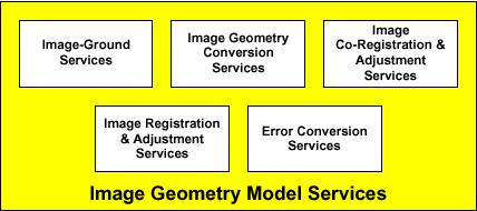

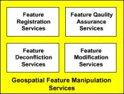


119 Figure 43: Geoprocessing Services in Their Categories (Source: OpenGIS 1999a) 104
A Model of GIS Interoperability Based on JavaRMI
 A Model of GIS Interoperability Based on Java Gao Gang-yi 1 Chen Hai-bo 2 1 Zhejiang University of Finance & Economics, Hangzhou 310018, China 2 College of Computer Science and Technology, Zhejiang UniversityHangzhou
A Technique for Importing Shapefile to Mobile Device in a Distributed System Environment.
 A Technique for Importing Shapefile to Mobile Device in a Distributed System Environment. 1 Manish Srivastava, 2 Atul Verma, 3 Kanika Gupta 1 Academy of Business Engineering and Sciences,Ghaziabad, 201001,India
Enabling ENVI. ArcGIS for Server
 Enabling ENVI throughh ArcGIS for Server 1 Imagery: A Unique and Valuable Source of Data Imagery is not just a base map, but a layer of rich information that can address problems faced by GIS users. >
WEB-BASED SPATIAL DECISION SUPPORT: TECHNICAL FOUNDATIONS AND APPLICATIONS
 WEB-BASED SPATIAL DECISION SUPPORT: TECHNICAL FOUNDATIONS AND APPLICATIONS Claus Rinner University of Muenster, Germany Piotr Jankowski San Diego State University, USA Keywords: geographic information
Innovation. The Push and Pull at ESRI. September Kevin Daugherty Cadastral/Land Records Industry Solutions Manager
 Innovation The Push and Pull at ESRI September 2004 Kevin Daugherty Cadastral/Land Records Industry Solutions Manager The Push and The Pull The Push is the information technology that drives research and
PaikkaOppi - a Virtual Learning Environment on Geographic Information for Upper Secondary School
 PaikkaOppi - a Virtual Learning Environment on Geographic Information for Upper Secondary School Jaakko Kähkönen*, Lassi Lehto*, Juha Riihelä** * Finnish Geodetic Institute, PO Box 15, FI-02431 Masala,
ArcGIS. for Server. Understanding our World
 ArcGIS for Server Understanding our World ArcGIS for Server Create, Distribute, and Manage GIS Services You can use ArcGIS for Server to create services from your mapping and geographic information system
RESEARCG ON THE MDA-BASED GIS INTEROPERABILITY Qi,LI *, Lingling,GUO *, Yuqi,BAI **
 RESEARCG ON THE MDA-BASED GIS INTEROPERABILITY Qi,LI *, Lingling,GUO *, Yuqi,BAI ** * Digital Earth Studio, Peking University, Beijing, 100871 liqi@pku.edu.cn, guolingling@cybergis.org.cn ** Network Department,
GENERALIZATION IN THE NEW GENERATION OF GIS. Dan Lee ESRI, Inc. 380 New York Street Redlands, CA USA Fax:
 GENERALIZATION IN THE NEW GENERATION OF GIS Dan Lee ESRI, Inc. 380 New York Street Redlands, CA 92373 USA dlee@esri.com Fax: 909-793-5953 Abstract In the research and development of automated map generalization,
Technical Trends in Geo Information
 Technical Trends in Geo Information Joachim WIESEL 1 Introduction Geo Information Systems as a small part of the IT-Industry is a fast changing technology, driven by market demands and technical advances.
Canadian Board of Examiners for Professional Surveyors Core Syllabus Item C 5: GEOSPATIAL INFORMATION SYSTEMS
 Study Guide: Canadian Board of Examiners for Professional Surveyors Core Syllabus Item C 5: GEOSPATIAL INFORMATION SYSTEMS This guide presents some study questions with specific referral to the essential
Design and implementation of a new meteorology geographic information system
 Design and implementation of a new meteorology geographic information system WeiJiang Zheng, Bing. Luo, Zhengguang. Hu, Zhongliang. Lv National Meteorological Center, China Meteorological Administration,
How to Pick a GIS. GIS Software Chapter 8 in Longley, Goodchild, Maguire, and Rhind,, 2001
 How to Pick a GIS GIS Software Chapter 8 in Longley, Goodchild, Maguire, and Rhind,, 2001 How to Pick a GIS Evolution of GIS software Architecture of GIS software Types of software Example products The
Crime Analyst Extension. Christine Charles
 Crime Analyst Extension Christine Charles ccharles@esricanada.com Agenda Why use Crime Analyst? Overview Tools Demo Interoperability With our old software it could take a police officer up to forty minutes
A Prototype of a Web Mapping System Architecture for the Arctic Region
 A Prototype of a Web Mapping System Architecture for the Arctic Region Han-Fang Tsai 1, Chih-Yuan Huang 2, and Steve Liang 3 GeoSensorWeb Laboratory, Department of Geomatics Engineering, University of
ArcGIS Enterprise: What s New. Philip Heede Shannon Kalisky Melanie Summers Sam Williamson
 ArcGIS Enterprise: What s New Philip Heede Shannon Kalisky Melanie Summers Sam Williamson ArcGIS Enterprise is the new name for ArcGIS for Server What is ArcGIS Enterprise ArcGIS Enterprise is powerful
Geometric Algorithms in GIS
 Geometric Algorithms in GIS GIS Visualization Software Dr. M. Gavrilova GIS Software for Visualization ArcView GEO/SQL Digital Atmosphere AutoDesk Visual_Data GeoMedia GeoExpress CAVE? Visualization in
Introduction to ArcGIS Server Development
 Introduction to ArcGIS Server Development Kevin Deege,, Rob Burke, Kelly Hutchins, and Sathya Prasad ESRI Developer Summit 2008 1 Schedule Introduction to ArcGIS Server Rob and Kevin Questions Break 2:15
ORGANIZING AND MANAGING OF DISTRIBUTED GEOGRAPHICAL INFORMATION
 ORGANIZING AND MANAGING OF DISTRIBUTED GEOGRAPHICAL INFORMATION Jianya Gong Wuhan Technical University of Surveying and Mapping, Wuhan, China Jgong@rcgis.wtusm.edu.cn KEY WORDS: GIS; distributed; Internet
Experiences and Directions in National Portals"
 FIG Seminar on e-land Administration Innsbruck/Austria 2-4 June 2004 "ESRI's Experiences and Directions in National Portals" Kevin Daugherty Cadastral/Land Records Manager ESRI Topic Points Technology
GIS at UCAR. The evolution of NCAR s GIS Initiative. Olga Wilhelmi ESIG-NCAR Unidata Workshop 24 June, 2003
 GIS at UCAR The evolution of NCAR s GIS Initiative Olga Wilhelmi ESIG-NCAR Unidata Workshop 24 June, 2003 Why GIS? z z z z More questions about various climatological, meteorological, hydrological and
CHAPTER 22 GEOGRAPHIC INFORMATION SYSTEMS
 CHAPTER 22 GEOGRAPHIC INFORMATION SYSTEMS PURPOSE: This chapter establishes the administration and use of to improve the quality and accessibility of Department s spatial information and support graphical
You are Building Your Organization s Geographic Knowledge
 You are Building Your Organization s Geographic Knowledge And Increasingly Making it Available Sharing Data Publishing Maps and Geo-Apps Developing Collaborative Approaches Citizens Knowledge Workers Analysts
Portal for ArcGIS: An Introduction. Catherine Hynes and Derek Law
 Portal for ArcGIS: An Introduction Catherine Hynes and Derek Law Agenda Web GIS pattern Product overview Installation and deployment Configuration options Security options and groups Portal for ArcGIS
Features and Benefits
 Autodesk LandXplorer Features and Benefits Use the Autodesk LandXplorer software family to help improve decision making, lower costs, view and share changes, and avoid the expense of creating physical
A decade of geoinformation sharing at ETH Zurich
 A decade of geoinformation sharing at ETH Zurich Ionuț Iosifescu-Enescu, Cristina Iosifescu-Enescu, Nadia H. Panchaud, Angeliki Tsorlini, Lorenz Hurni {iosifescu,ciosifescu,nadia.panchaud,atsorlini,lhurni}@ethz.ch
Imagery and the Location-enabled Platform in State and Local Government
 Imagery and the Location-enabled Platform in State and Local Government Fred Limp, Director, CAST Jim Farley, Vice President, Leica Geosystems Oracle Spatial Users Group Denver, March 10, 2005 TM TM Discussion
DYNAMIC PORTRAYAL AND DIRECT LOCATION METHOD FOR
 DYNAMIC PORTRAYAL AND DIRECT LOCATION METHOD FOR NEW GEOGRAPHIC INFORMATION PROCESSING WEB SERVICE Hiroyuki Ohno, Norishige Kubo, Noriyuki Takakuwa Hidenori Fujimura, Takayuki Ishizeki Geographical Survey
How does ArcGIS Server integrate into an Enterprise Environment? Willy Lynch Mining Industry Specialist ESRI, Denver, Colorado USA
 How does ArcGIS Server integrate into an Enterprise Environment? Willy Lynch Mining Industry Specialist ESRI, Denver, Colorado USA wlynch@esri.com ArcGIS Server Technology Transfer 1 Agenda Who is ESRI?
Bentley Map V8i (SELECTseries 3)
") Bentley Map V8i (SELECTseries 3) A quick overview Why Bentley Map Viewing and editing of geospatial data from file based GIS formats, spatial databases and raster Assembling geospatial/non-geospatial data
Bentley Map V8i (SELECTseries 3) A quick overview Why Bentley Map Viewing and editing of geospatial data from file based GIS formats, spatial databases and raster Assembling geospatial/non-geospatial data
THE SPATIAL DATA SERVER BASED ON OPEN GIS STANDARDS IN HETEROGENEOUS DISTRIBUTED ENVIRONMENT
 Geoinformatics 2004 Proc. 12th Int. Conf. on Geoinformatics Geospatial Information Research: Bridging the Pacific and Atlantic University of Gävle, Sweden, 7-9 June 2004 THE SPATIAL DATA SERVER BASED ON
Spatial information sharing technology based on Grid
 Spatial information sharing technology based on Grid Hong-bin ZHANG a,b,c,1, Bao-rui CHEN a,b,c,3,gang LI b,c,2, Xiao-ping XIN a,b,c,* a Hulunber Grassland Ecosystem Observation and Research Station, Beijing
FREIS: A WEB-BASED RESOURCES AND ENVIRONMENT INFORMATION SYSTEM FOR AGRO-ECOSYSTEM MANAGEMENT
 FREIS: A WEB-BASED RESOURCES AND ENVIRONMENT INFORMATION SYSTEM FOR AGRO-ECOSYSTEM MANAGEMENT Mingxin Men *, Yuepu Qi, Boyang Du, Hao Xu College of Agricultural Resources and Environmental Sciences, Hebei
K. Zainuddin et al. / Procedia Engineering 20 (2011)
") Available online at www.sciencedirect.com Procedia Engineering 20 (2011) 154 158 The 2 nd International Building Control Conference 2011 Developing a UiTM (Perlis) Web-Based of Building Space Management
Available online at www.sciencedirect.com Procedia Engineering 20 (2011) 154 158 The 2 nd International Building Control Conference 2011 Developing a UiTM (Perlis) Web-Based of Building Space Management
Paper UC1351. Conference: User Conference Date: 08/10/2006 Time: 8:30am-9:45am Room: Room 23-B (SDCC)
") Conference: User Conference Date: 08/10/2006 Time: 8:30am-9:45am Room: Room 23-B (SDCC) Title of Paper: Increasing the Use of GIS in the Federal Government Author Name: Miss Abstract This presentation
Conference: User Conference Date: 08/10/2006 Time: 8:30am-9:45am Room: Room 23-B (SDCC) Title of Paper: Increasing the Use of GIS in the Federal Government Author Name: Miss Abstract This presentation
Write a report (6-7 pages, double space) on some examples of Internet Applications. You can choose only ONE of the following application areas:
 on some examples of Internet Applications. You can choose only ONE of the following application areas:") UPR 6905 Internet GIS Homework 1 Yong Hong Guo September 9, 2008 Write a report (6-7 pages, double space) on some examples of Internet Applications. You can choose only ONE of the following application
UPR 6905 Internet GIS Homework 1 Yong Hong Guo September 9, 2008 Write a report (6-7 pages, double space) on some examples of Internet Applications. You can choose only ONE of the following application
ESRI Survey Summit August Clint Brown Director of ESRI Software Products
 ESRI Survey Summit August 2006 Clint Brown Director of ESRI Software Products Cadastral Fabric How does Cadastral fit with Survey? Surveyors process raw field observations Survey measurements define high-order
GOVERNMENT GIS BUILDING BASED ON THE THEORY OF INFORMATION ARCHITECTURE
 GOVERNMENT GIS BUILDING BASED ON THE THEORY OF INFORMATION ARCHITECTURE Abstract SHI Lihong 1 LI Haiyong 1,2 LIU Jiping 1 LI Bin 1 1 Chinese Academy Surveying and Mapping, Beijing, China, 100039 2 Liaoning
SERVICE-BASED APPROACH TO GEOPORTALS ARCHITECTURE
 SERVICE-BASED APPROACH TO GEOPORTALS ARCHITECTURE Evgeny Panidi Saint-Petersburg State University Saint-Petersburg, Russia, panidi@yandex.ru Abstract. This paper describes the author s view on service-based
Leveraging Web GIS: An Introduction to the ArcGIS portal
 Leveraging Web GIS: An Introduction to the ArcGIS portal Derek Law Product Management DLaw@esri.com Agenda Web GIS pattern Product overview Installation and deployment Configuration options Security options
Introduction to Portal for ArcGIS. Hao LEE November 12, 2015
 Introduction to Portal for ArcGIS Hao LEE November 12, 2015 Agenda Web GIS pattern Product overview Installation and deployment Security and groups Configuration options Portal for ArcGIS + ArcGIS for
Changes in Esri GIS, practical ways to be ready for the future
 Changes in Esri GIS, practical ways to be ready for the future John Sharrard, Esri April 16, 2015 The only thing that is constant is change. Heraclitus, ca. 500 B.C. My story (of experiencing change) Changes
Bentley Map Advancing GIS for the World s Infrastructure
 Bentley Map Advancing GIS for the World s Infrastructure Presentation Overview Why would you need Bentley Map? What is Bentley Map? Where is Bentley Map Used? Why would you need Bentley Map? Because your
The File Geodatabase API. Craig Gillgrass Lance Shipman
 The File Geodatabase API Craig Gillgrass Lance Shipman Schedule Cell phones and pagers Please complete the session survey we take your feedback very seriously! Overview File Geodatabase API - Introduction
The Emerging Role of Enterprise GIS in State Forest Agencies
 The Emerging Role of Enterprise GIS in State Forest Agencies Geographic Information System (GIS) A geographic information system (GIS) is a computer software system designed to capture, store, manipulate,
Developing An Application For M-GIS To Access Geoserver Through Mobile For Importing Shapefile
 Developing An Application For M-GIS To Access Geoserver Through Mobile For Importing Shapefile Ritik Sharma,A,1, Shubhangi Garg B,2, Yogesh Kumar c,3, Jeevash Mutreja d,4 a ABES Engg.College Ghaziabad
GIS for the Beginner on a Budget
 GIS for the Beginner on a Budget Andre C. Bally, RLA, GIS Coordinator, Harris County Public Infrastructure Department Engineering Division This presentation, GIS for Beginners on a Budget. will briefly
Overview of Geospatial Open Source Software which is Robust, Feature Rich and Standards Compliant
 Overview of Geospatial Open Source Software which is Robust, Feature Rich and Standards Compliant Cameron SHORTER, Australia Key words: Open Source Geospatial Foundation, OSGeo, Open Standards, Open Geospatial
Introduction to ArcGIS Server - Creating and Using GIS Services. Mark Ho Instructor Washington, DC
 Introduction to ArcGIS Server - Creating and Using GIS Services Mark Ho Instructor Washington, DC Technical Workshop Road Map Product overview Building server applications GIS services Developer Help resources
A Summary of State DOT GIS Activities. Presented at the 2000 AASHTO GIS-T Symposium Minneapolis, MN
 A Summary of State DOT GIS Activities Presented at the 2000 AASHTO GIS-T Symposium Minneapolis, MN Information Sources E-mail survey of state DOT GIS managers 49 State DOTs responded in 2000 Results compared
Oregon Department of Transportation. Geographic Information Systems Strategic Plan
 Oregon Department of Transportation Geographic Information Systems Strategic Plan Adopted May, 2000 By the GIS Steering Committee Last printed 10/2/2012 4:20:00 PM Page Geographic Information Systems Strategic
ArcGIS is Advancing. Both Contributing and Integrating many new Innovations. IoT. Smart Mapping. Smart Devices Advanced Analytics
 ArcGIS is Advancing IoT Smart Devices Advanced Analytics Smart Mapping Real-Time Faster Computing Web Services Crowdsourcing Sensor Networks Both Contributing and Integrating many new Innovations ArcGIS
Oakland County Parks and Recreation GIS Implementation Plan
 Oakland County Parks and Recreation GIS Implementation Plan TABLE OF CONTENTS 1.0 Introduction... 3 1.1 What is GIS? 1.2 Purpose 1.3 Background 2.0 Software... 4 2.1 ArcGIS Desktop 2.2 ArcGIS Explorer
Esri Training by Microcenter Prepare to Innovate. Microcenter Course Catalog
 Esri Training by Microcenter Prepare to Innovate 2015 Instructor-Led Courses Microcenter Course Catalog ArcGIS Foundational Courses Designed to meet the learning needs of professionals whose GIS experience
ISO Series Standards in a Model Driven Architecture for Landmanagement. Jürgen Ebbinghaus, AED-SICAD
 ISO 19100 Series Standards in a Model Driven Architecture for Landmanagement Jürgen Ebbinghaus, AED-SICAD 29.10.2003 The Company 100% SIEMENS PTD SIEMENS Business Services Shareholder & Strategic Business
DP Project Development Pvt. Ltd.
 Dear Sir/Madam, Greetings!!! Thanks for contacting DP Project Development for your training requirement. DP Project Development is leading professional training provider in GIS technologies and GIS application
CPSC 695. Future of GIS. Marina L. Gavrilova
 CPSC 695 Future of GIS Marina L. Gavrilova The future of GIS Overview What is GIS now How GIS was viewed before Current trends and developments Future directions of research What is GIS? Internet's definition
The Geo Web: Enabling GIS on the Internet IT4GIS Keith T. Weber, GISP GIS Director ISU GIS Training and Research Center.
 The Geo Web: Enabling GIS on the Internet IT4GIS Keith T. Weber, GISP GIS Director ISU GIS Training and Research Center In the Beginning GIS was independent The GIS analyst or manager was typically a oneperson
Discovery and Access of Geospatial Resources using the Geoportal Extension. Marten Hogeweg Geoportal Extension Product Manager
 Discovery and Access of Geospatial Resources using the Geoportal Extension Marten Hogeweg Geoportal Extension Product Manager DISCOVERY AND ACCESS USING THE GEOPORTAL EXTENSION Geospatial Data Is Very
Why GIS & Why Internet GIS?
 Why GIS & Why Internet GIS? The Internet bandwagon Internet mapping (e.g., MapQuest) Location-based services Real-time navigation (e.g., traffic) Real-time service dispatch Business Intelligence Spatial
Introducing ArcGIS Engine
 1 Introducing ArcGIS Engine ESRI ArcGIS Engine is a platform for building custom standalone geographic information system (GIS) applications that support multiple application programming interfaces (APIs),
Web GIS: Architectural Patterns and Practices. Shannon Kalisky Philip Heede
 Web GIS: Architectural Patterns and Practices Shannon Kalisky Philip Heede Web GIS Transformation of the ArcGIS Platform Desktop Apps Server GIS Web Maps Web Scenes Layers Web GIS Transformation of the
DATA SOURCES AND INPUT IN GIS. By Prof. A. Balasubramanian Centre for Advanced Studies in Earth Science, University of Mysore, Mysore
 DATA SOURCES AND INPUT IN GIS By Prof. A. Balasubramanian Centre for Advanced Studies in Earth Science, University of Mysore, Mysore 1 1. GIS stands for 'Geographic Information System'. It is a computer-based
The Geodetic Infrastructure Management Via Web-Based Mapping Technology in Morocco
 The Geodetic Infrastructure Management Via Web-Based Mapping Technology in Morocco Moha EL-AYACHI, Khalid EL HAJARI, Said ALAOUI, and Omar JELLABI, Morocco Key words: infrastructure, web mapping, governance,
Portals: Standards in Action
 Portals: Standards in Action David Danko ISO TC 211 Metadata Project Leader GIS Standards Consultant-ESRI. Metadata Portals Portal gateway, place of entry Producers Advertise, expose products Share information
NEC PerforCache. Influence on M-Series Disk Array Behavior and Performance. Version 1.0
 NEC PerforCache Influence on M-Series Disk Array Behavior and Performance. Version 1.0 Preface This document describes L2 (Level 2) Cache Technology which is a feature of NEC M-Series Disk Array implemented
Web Visualization of Geo-Spatial Data using SVG and VRML/X3D
 Web Visualization of Geo-Spatial Data using SVG and VRML/X3D Jianghui Ying Falls Church, VA 22043, USA jying@vt.edu Denis Gračanin Blacksburg, VA 24061, USA gracanin@vt.edu Chang-Tien Lu Falls Church,
UNIT 4: USING ArcGIS. Instructor: Emmanuel K. Appiah-Adjei (PhD) Department of Geological Engineering KNUST, Kumasi
 Department of Geological Engineering KNUST, Kumasi") UNIT 4: USING ArcGIS Instructor: Emmanuel K. Appiah-Adjei (PhD) Department of Geological Engineering KNUST, Kumasi Getting to Know ArcGIS ArcGIS is an integrated collection of GIS software products ArcGIS
UNIT 4: USING ArcGIS Instructor: Emmanuel K. Appiah-Adjei (PhD) Department of Geological Engineering KNUST, Kumasi Getting to Know ArcGIS ArcGIS is an integrated collection of GIS software products ArcGIS
SOFTWARE ARCHITECTURE DESIGN OF GIS WEB SERVICE AGGREGATION BASED ON SERVICE GROUP
 SOFTWARE ARCHITECTURE DESIGN OF GIS WEB SERVICE AGGREGATION BASED ON SERVICE GROUP LIU Jian-chuan*, YANG Jun, TAN Ming-jian, GAN Quan Sichuan Geomatics Center, Chengdu 610041, China Keywords: GIS; Web;
Esri UC2013. Technical Workshop.
 Esri International User Conference San Diego, California Technical Workshops July 9, 2013 CAD: Introduction to using CAD Data in ArcGIS Jeff Reinhart & Phil Sanchez Agenda Overview of ArcGIS CAD Support
Spatial analysis in XML/GML/SVG based WebGIS
 Spatial analysis in XML/GML/SVG based WebGIS Haosheng Huang, Yan Li huang@cartography.tuwien.ac.at and yanli@scnu.edu.cn Research Group Cartography, Vienna University of Technology Spatial Information
THE DESIGN AND IMPLEMENTATION OF A WEB SERVICES-BASED APPLICATION FRAMEWORK FOR SEA SURFACE TEMPERATURE INFORMATION
 THE DESIGN AND IMPLEMENTATION OF A WEB SERVICES-BASED APPLICATION FRAMEWORK FOR SEA SURFACE TEMPERATURE INFORMATION HE Ya-wen a,b,c, SU Fen-zhen a, DU Yun-yan a, Xiao Ru-lin a,c, Sun Xiaodan d a. Institute
Desktop GIS for Geotechnical Engineering
 Desktop GIS for Geotechnical Engineering Satya Priya Deputy General Manager (Software) RMSI, A-7, Sector 16 NOIDA 201 301, UP, INDIA Tel: +91-120-2511102 Fax: +91-120-2510963 Email: Satya.Priya@rmsi.com
Integrating GIS and Traditional Databases with MapObjects Technology
 Danielle Berman Integrating GIS and Traditional Databases with MapObjects Technology The expanding presence of geographic information system (GIS) offices within organizations has helped to enhance the
Geographical Information System in Managing Mega Infrastructure Projects
 Geographical Information System in Managing Mega Infrastructure Projects Ankita Adhikary, M.Sc. Geomatics and Space Application, CEPT University Ahmedabad G eographic Information System (GIS) is a computer
GIS and the Other Enterprise Database
 GIS-T T Symposium GIS and the Other Enterprise Database March 31, 2004 Rapid City, South Dakota 1 Introduction Personal thoughts on recent evolution of GIS Shift in perspective from GIScentric to asset-centric
University of Lusaka
 University of Lusaka BSPH 315 Health Mapping & GIS Topic: Background of GIS Content: 1. Aim of the course 2. What do you know about GIS? 3. Difference between geographic data and geographic information
GIS Based Transit Information System for Metropolitan Cities in India
 PAPER REFERENCE NO.: PN-250 GIS Based Transit Information System for Metropolitan Cities in India Pal, Sarvjeet. a and Singh, Varun. b a M. Tech. (GIS & Remote Sensing); GIS Cell; Motilal Nehru National
Technical Specifications. Form of the standard
 Used by popular acceptance Voluntary Implementation Mandatory Legally enforced Technical Specifications Conventions Guidelines Form of the standard Restrictive Information System Structures Contents Values
Portal for ArcGIS: An Introduction
 Portal for ArcGIS: An Introduction Derek Law Esri Product Management Esri UC 2014 Technical Workshop Agenda Web GIS pattern Product overview Installation and deployment Security and groups Configuration
Introduction to Portal for ArcGIS
 Introduction to Portal for ArcGIS Derek Law Product Management March 10 th, 2015 Esri Developer Summit 2015 Agenda Web GIS pattern Product overview Installation and deployment Security and groups Configuration
Building a National Data Repository
 Building a National Data Repository Mladen Stojic, Vice President - Geospatial 1/30/2013 2012 Intergraph Corporation 1 Information has meaning and gives power only when shared and distributed. Information,
Modern Education at Universities: Improvements through the Integration of a Spatial Data Infrastructure SDI into an e-learning Environment
 Modern Education at Universities: Improvements through the Integration of a Spatial Data Infrastructure SDI into an e-learning Environment Ingo Simonis Institute for Geoinformatics, University of Muenster
Development of Univ. of San Agustin Geographic Information System (USAGIS)
") , pp.170-176 http://dx.doi.org/10.14257/astl.2014.48.27 Development of Univ. of San Agustin Geographic Information System (USAGIS) Rosslin John H. Robles Chair, Computer Science Department, University
, pp.170-176 http://dx.doi.org/10.14257/astl.2014.48.27 Development of Univ. of San Agustin Geographic Information System (USAGIS) Rosslin John H. Robles Chair, Computer Science Department, University
Web georeference of historical maps
 Vassilios Tsioukas Web georeference of historical maps Keywords: Historical maps, Georeference, Cartography, Cartographic Heritage Summary The creation of an application to perform the geo-referencing
Smart Data Collection and Real-time Digital Cartography
 Smart Data Collection and Real-time Digital Cartography Yuji Murayama and Ko Ko Lwin Division of Spatial Information Science Faculty of Life and Environmental Sciences University of Tsukuba IGU 2013 1
Spatial Data Infrastructure Concepts and Components. Douglas Nebert U.S. Federal Geographic Data Committee Secretariat
 Spatial Data Infrastructure Concepts and Components Douglas Nebert U.S. Federal Geographic Data Committee Secretariat August 2009 What is a Spatial Data Infrastructure (SDI)? The SDI provides a basis for
A Spatial Data Infrastructure for Landslides and Floods in Italy
 V Convegno Nazionale del Gruppo GIT Grottaminarda 14 16 giugno 2010 A Spatial Data Infrastructure for Landslides and Floods in Italy Ivan Marchesini, Vinicio Balducci, Gabriele Tonelli, Mauro Rossi, Fausto
Hosted by Esri Official Distributor
 Hosted by Esri Official Distributor Esri European User Conference October 15-17, 2012 Oslo, Norway Hosted by Esri Official Distributor Interoperability and Standards Support in ArcGIS 10.1 Roberto Lucchi
FIRE DEPARMENT SANTA CLARA COUNTY
 DEFINITION FIRE DEPARMENT SANTA CLARA COUNTY GEOGRAPHIC INFORMATION SYSTEM (GIS) ANALYST Under the direction of the Information Technology Officer, the GIS Analyst provides geo-spatial strategic planning,
The World Bank and the Open Geospatial Web. Chris Holmes
 The World Bank and the Open Geospatial Web Chris Holmes Geospatial is Everywhere QuickTime and a TIFF (Uncompressed) decompressor are needed to see this picture. Spatial Data Infrastructure (SDI) the sources,
PC ARC/INFO and Data Automation Kit GIS Tools for Your PC
 ESRI PC ARC/INFO and Data Automation Kit GIS Tools for Your PC PC ARC/INFO High-quality digitizing and data entry Powerful topology building Cartographic design and query Spatial database query and analysis
Creation of an Internet Based Indiana Water Quality Atlas (IWQA)
") Department of Environmental Management Creation of an Internet Based Water Quality Atlas (IWQA) May 4, 2005 IUPUI 1200 Waterway Blvd., Suite 100 polis, 46202-5140 Water Quality Atlas John Buechler, Neil
Department of Environmental Management Creation of an Internet Based Water Quality Atlas (IWQA) May 4, 2005 IUPUI 1200 Waterway Blvd., Suite 100 polis, 46202-5140 Water Quality Atlas John Buechler, Neil
Implementing an online spatial database using the GRASS GIS environment
 Proceedings of the Open source GIS - GRASS users conference 2002 - Trento, Italy, 11-13 September 2002 Implementing an online spatial database using the GRASS GIS environment Venkatesh Raghavan*, Shinji
A Governance Framework for Geographic Data, Services, and Applications. Colin MacDonald Esri UC 2017
 A Governance Framework for Geographic Data, Services, and Applications Colin MacDonald Esri UC 2017 Some Context Nova Scotia, Canada Population ~1,000,000 Photos copyright Province of Nova Scotia Geomatics
Thales Canada, System Division. BattleView: Integrating ArcGIS Into Canadian Army s Command And Control Application
 BattleView: Integrating ArcGIS Into Canadian Army s Command And Control Application BattleView Overview Canadian Army s command and control (C2) application Deployed in army headquarters unit and above
Web GIS Deployment for Administrators. Vanessa Ramirez Solution Engineer, Natural Resources, Esri
 Web GIS Deployment for Administrators Vanessa Ramirez Solution Engineer, Natural Resources, Esri Agenda Web GIS Concepts Web GIS Deployment Patterns Components of an On-Premises Web GIS Federation of Server
7th FIG Regional Conference Spatial Data Serving People: Land Governance and the Environment - Building the Capacity
 7th FIG Regional Conference Spatial Data Serving People: Land Governance and the Environment - Building the Capacity Hanoi, Vietnam, 19-22 October 2009 ------------------ TS 3A - SDI in Support of Urban
DATA SCIENCE SIMPLIFIED USING ARCGIS API FOR PYTHON
 DATA SCIENCE SIMPLIFIED USING ARCGIS API FOR PYTHON LEAD CONSULTANT, INFOSYS LIMITED SEZ Survey No. 41 (pt) 50 (pt), Singapore Township PO, Ghatkesar Mandal, Hyderabad, Telengana 500088 Word Limit of the
FUNDAMENTALS OF GEOINFORMATICS PART-II (CLASS: FYBSc SEM- II)
") FUNDAMENTALS OF GEOINFORMATICS PART-II (CLASS: FYBSc SEM- II) UNIT:-I: INTRODUCTION TO GIS 1.1.Definition, Potential of GIS, Concept of Space and Time 1.2.Components of GIS, Evolution/Origin and Objectives
FUNDAMENTALS OF GEOINFORMATICS PART-II (CLASS: FYBSc SEM- II) UNIT:-I: INTRODUCTION TO GIS 1.1.Definition, Potential of GIS, Concept of Space and Time 1.2.Components of GIS, Evolution/Origin and Objectives