Marine SDI supporting MyGDI
|
|
|
- Kristin Holt
- 6 years ago
- Views:
Transcription


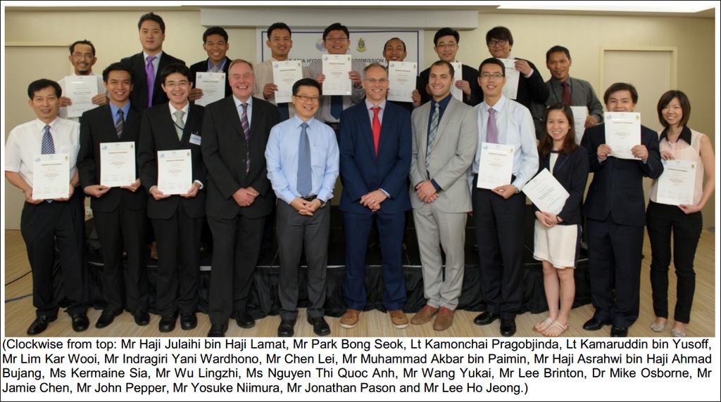
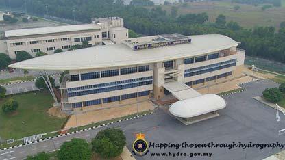
1 IHO MSDI Demonstration Workshop and Open Forum Marine SDI supporting MyGDI Kamaruddin Yusoff National Hydrographic Centre 26 Jan 2016
2
 Hosted by the Maritime and Port Authority of Singapore (MPA) 16 students from China,")
 Hosted by the Korea Hydrographic and Oceanographic Administration (KHOA) 15 students from Hong")
3 EAHC Capacity Building Programme - MSDI and Database Management Bangkok, Thailand (20 24 Jun 2011) Hosted by the Hydrographic Department of the Royal Thai Navy (NDRTN) 20 students from China, Indonesia, Japan, Malaysia, Philippines, Korea, Singapore, Vietnam and Thailand Singapore (7 11 Oct 2013) Hosted by the Maritime and Port Authority of Singapore (MPA) 16 students from China, Indonesia, Japan, Malaysia, Republic of Korea, Philippines, Singapore and Thailand. including participants from Brunei Darussalam and Vietnam Incheon, Republic of Korea (5 9 November 2012) Hosted by the Korea Hydrographic and Oceanographic Administration (KHOA) 15 students from Hong Kong, Indonesia, Japan, Korea, Malaysia, Philippines and Thailand Shanghai, China (18 22 Jan 2016) Hosted by the China Maritime Safety Administration (MSA) 21 students from China, Indonesia, Japan, Malaysia, Republic of Korea, Philippines, Singapore and Thailand. including participants from Vietnam 72 person
 MaCGDI was formed in 2002 to promote the development and implementation of MyGDI MaCGDI plays crucial roles to spearhead the geospatial industry in")
4 Malaysia Geospatial Data Infrastructure (MyGDI) MyGDI as a National Spatial Data Infrastructure (NSDI) Malaysian Center for Geospatial Data Infrastructure(MaCGDI) is a center under Ministry of Natural Resources and Environment (NRE) MaCGDI was formed in 2002 to promote the development and implementation of MyGDI MaCGDI plays crucial roles to spearhead the geospatial industry in Malaysia.

5 Pencapaian WHY MyGDI? 1 Increase efficiency, reduce duplication of effort and support decision making of government and business 2 Recognition of Geospatial Information as Infrastructure 3 Fundamental datasets underpin Business Information
6 To provide mechanism/infrastructure to facilitate the utilisation and sharing of geospatial data among the agencies that use and supply the data; To assist in the sharing of geospatial information between agencies by providing the latest state of the art information technology hence allowing the dissemination of current and accurate information; MyGDI Objectives To prevent redundancies of effort in collecting, processing, maintaining, preparing and distributing of geospatial information among related agencies; To encourage wider use of geospatial data at the state and national levels; To stimulate and enhancing the awareness about the value of geospatial data and the relevant technology; and To contribute towards strenghtening the development of national geospatial data through collaboration.
7 Avoiding duplication of efforts in the collection and production of geospatial data; Providing consistency in the usage of geospatial data through formulation of policies and standards; MyGDI Benefits Enhancing the levels of utilization and awareness of geospatial data besides increasing the varieties of value added products; Expediting the implementation of electronic government Propagating the local geospatial data industry; and Strengthening institutional capacity to produce knowledge workers through human resource development programme.

8 Pencapaian MyGDI COMPONENTS
9 Pencapaian MyGDI GOVERNANCE New Marine Geospatial (Marine SDI) Coordinating Committee


10 Framework Data Categories Aeronautical Built Environment Demarcation Geology Hydrography Hypsography Soil Transportation Utility Vegetation Special Use General DCA JUPEM JUPEM JMG NHC JUPEM DOA JKR JUPEM DOA JUPEM JUPEM


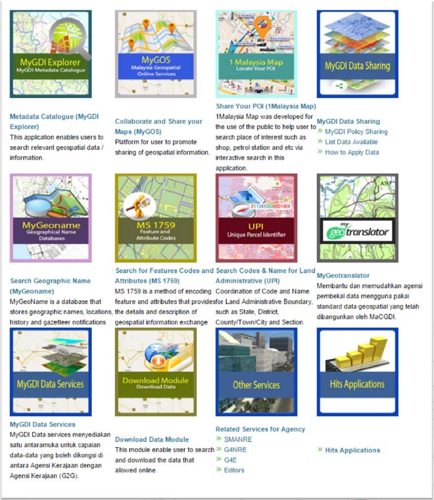
11 MyGDI Applications MyGeotranslator
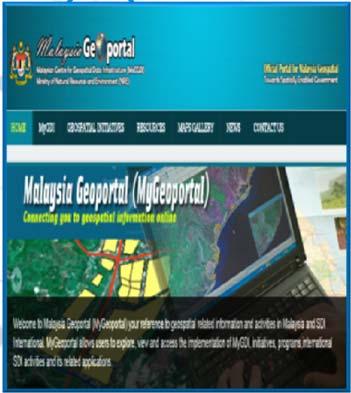
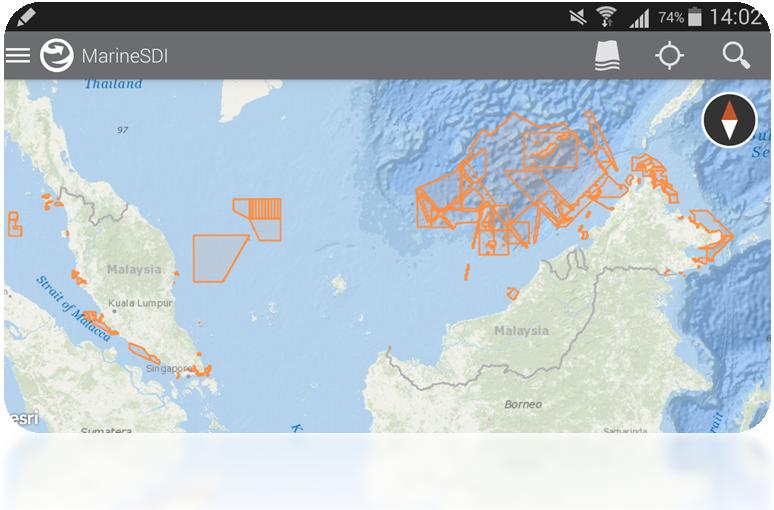
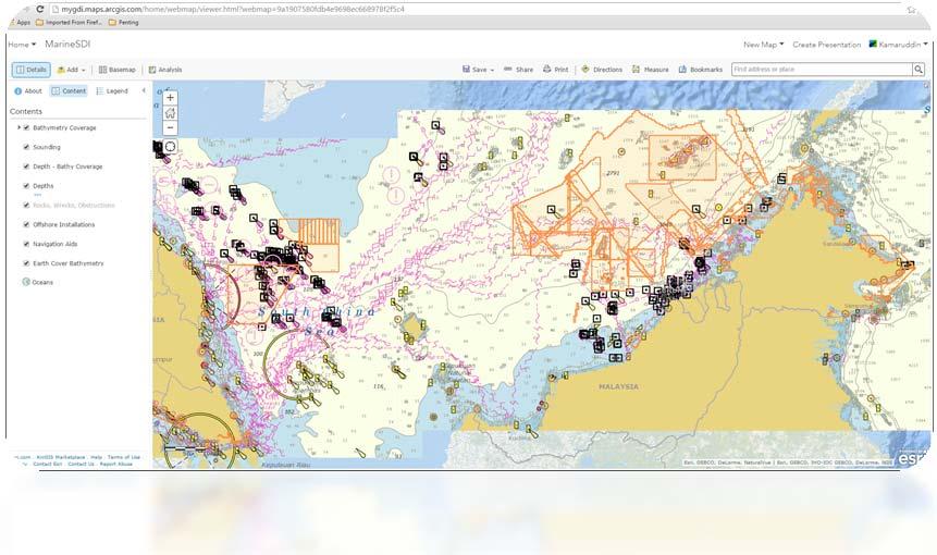
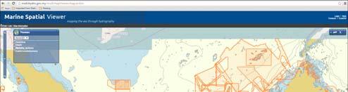
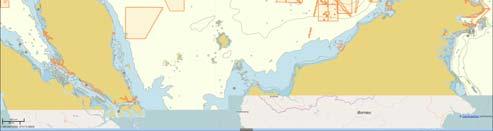
12 Pencapaian MyGEOPORTAL Malaysia Geoportal is the visible frontend to MyGDI, the gateways through which users access the geospatial information services Access and distribution of geospatial information is at the heart of MyGDI project. The success of MyGDI Data Explorer is the ease of use which it allows users to locate and access geospatial resources. This portal allows Users to explore, view and access the implementation of MyGDI, initiatives and its related applications.


13 MyGDI EXPLORER MyGDI Explorer is a metadata catalogue services which enables user to explore, discover, view and evaluate geospatial data from anywhere and at anytime.

14 GIS4CITIZEN - 1MALAYSIA MAP
 A platform for user to promote sharing of geospatial information.")

15 Malaysia Geospatial Online Services (MyGOS) Malaysia Geospatial Online Services (MyGOS) A platform for user to promote sharing of geospatial information. It enables you to turn your data into web enabled services that your whole organization members can use. Online mapping platform Content management platform Collaborative and sharing platform


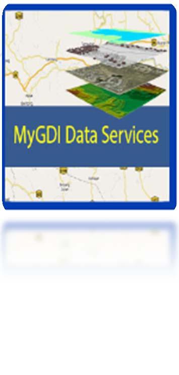
16 MyGDI Data Services MyGDI Data Services menyediakan mekanisme perkongsian maklumat di antara agensi-agensi kerajaan bagi data-data utama (fundamental datasets) geospatial terutamanya data daripada projek National Geospatial Data Center (NGDC). Platform ini juga boleh digunakan untuk agensi Kerajaan yang lain berkongsi data mereka.

17 What Malaysia is the maritime nations? `The Making Of Malaysia As A Maritime Nation' is appropriate and relevant as it highlights Malaysia's aspiration to be a maritime nation in the true sense.. Because of our history and the close proximity of many Malaysians to the sea we are inclined to regard Malaysia as a maritime nation. We are situated on the trade routes between India and China, between Europe and the East and naturally served as a port of call between monsoons for supplies and crew for all ships plying this route. Tun Dr. Mahathir, 1997 (Malaysia s Conference) First International Maritime
 Maritime Area")


18 Land Area (35.0%) Maritime Area (65.0%) Internal Waters Territorial Waters EEZ Continental Shelf Total 94, 132 km square 65, 035 km square 379, 820 km square 439, 373 km square 598, 540 km square Malaysia as a Maritime Country Marine SDI
19 Marine Governance PRIME MINISTER DEPT National Security Council Economic Planning Unit Maritime Enforcement Agency MINISTRY OF SCIENCE, TECHNOLOGY AND INNOVATION National Oceanography Directorate Meteorological Dept Remote Sensing Agency MINISTRY OF NATURAL RESOURCES AND ENVIRONMENT Centre for Geospatial Data Infrastructure Dept of Environment Dept of Marine Park MINISTRY OF TRANSPORT Marine Dept Port Authority Maritime Institute of Malaysia (MIMA) MINISTRY OF AGRICULTURE AND AGRO-BASED INDUSTRY Dept of Fisheries Fisheries Development Authority MINISTRY OF DEFENCE Royal Malaysian Navy National Hydrographic Centre MINISTRY OF FOREIGN AFFAIRS Multilateral Economic and Environment Division MINISTRY OF HOUSING AND LOCAL GOVERNMENT Town and Country Planning Dept MINISTRY OF INFORMATION, COMMUNICATION AND CULTURE Department of Natural Heritage MINISTRY OF RURAL AND REGIONAL DEVELOPMENT Sustainable Islands and Island Communities MINISTRY OF TOURISM Coastal and Marine Tourism MINISTRY OF ENERGY, GREEN TECHNOLOGY AND WATER Ocean Renewable Energy


20 Situational Analysis Marine Data Management Knowledge Management Marine is Complex Different jurisdictions under various agencies/ministries - Heterogeneous - Distributed - Autonomous Need mechanism for sharing Seamless Solution


21 National Hydrographic Committee The Malaysian National Hydrographic Committee was established on 11 September 2002 by the Malaysian Cabinet Director General of the National Hydrographic Centre Malaysia, Chairs. Members consisting of representatives from the federal agencies, higher institution
22 Hydrographic Data Management Workflow
 plus Meta")
23 Geographic Content (Data) plus Meta data
 & My")

24 My Bathy Database (MyBDB) & My Hydrographic Production Database (MyHPD) OGC compliant


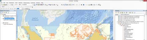
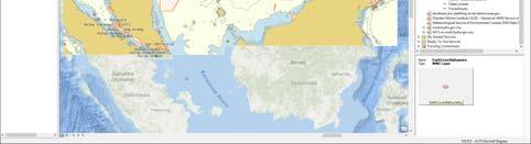
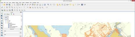
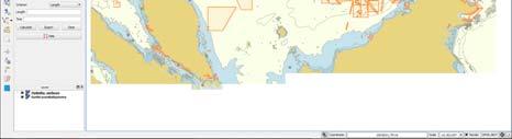
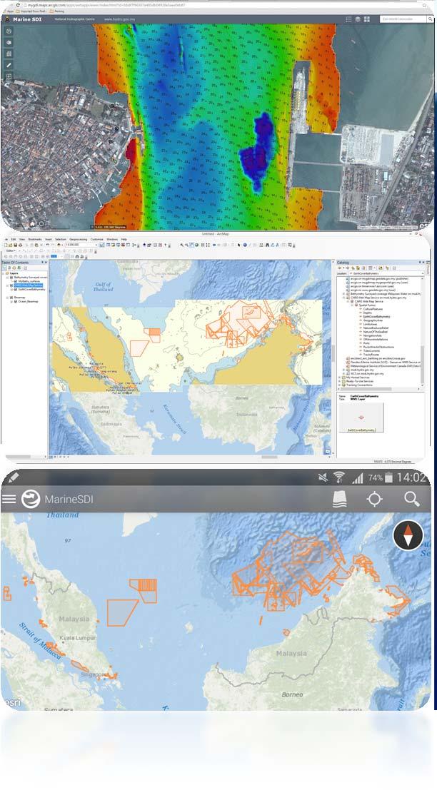
25 WEB - Services Caris Spatial Fusion Enterprise 5.9 Viewer OGC compliant ArcGIS 10.2 for Desktop QGIS Chugiak ArcGIS Online Web Map Web App Explorer for Android


26 CONCLUSION National Hydrograhic Centre the absolute agency to develop Marine SDI Hydrography data - provides the fundamental backdrop The IHO standards are aligned with ISO and OGC standards ICT ready Good governance through National Hydrographic Committee By end 2017 Marine SDI ready!


27 Thank you for your attention
On the front line with Esri Malaysia s dynamic user community: User story - MaCGDI
 On the front line with Esri Malaysia s dynamic user community: User story - MaCGDI Puan Hajah Norizam binti Che Noh, Director MaCGDI MyGDI Current Challenges : Formulating National Geospatial Blueprint
Options in Capacity Building. Underpinning the Blue Economy. Slide 1/78. Derrick R. Peyton. 14 th MACHC Meeting. IIC Technologies. December 9-13, 2013
 Options in Capacity Building Underpinning the Blue Economy Derrick R. Peyton IIC Technologies 14 th MACHC Meeting December 9-13, 2013 Slide 1/78 Overview Blue Economy Defined Challenges (SDI, MSDI, Standards)
From PCGIAP to UN GGIM AP: A Regional Perspective on GGIM
 Regional Committee of United Nations Global Geospatial Information Management for Asia and the Pacific (UN-GGIM-AP) Established by a United Nations Resolution From PCGIAP to UN GGIM AP: A Regional Perspective
Economic and Social Council
 United Nations Economic and Social Council Distr.: General 15 May 2012 Original: English E/CONF.101/4 Tenth United Nations Conference on the Standardization of Geographical Names New York, 31 July 9 August
a national geological survey perspective François ROBIDA BRGM (French Geological Survey)
") a national geological survey perspective François ROBIDA BRGM (French Geological Survey) Pre-Conference Seminar on Socio-Economic Value of Geospatial for National and Regional Development 21 August 2017,
a national geological survey perspective François ROBIDA BRGM (French Geological Survey) Pre-Conference Seminar on Socio-Economic Value of Geospatial for National and Regional Development 21 August 2017,
What is the PCGIAP? Overview on PCGIAP Activities and the Asia/Pacific Region. Membership. Background. Aims. Asia-Pacific SDI
 3rd FIG Regional Conference for Asia and the Pacific Jakarta, Indonesia, 3-7th October 2004 Overview on PCGIAP Activities and the Asia/Pacific Region What is the PCGIAP? Haji Matusin Matasan Surveyor General,
Geospatial Policy Development and Institutional Arrangements *
 HIGH LEVEL FORUM ON GLOBAL GEOSPATIAL MANAGEMENT INFORMATION WORKING PAPER No. 13 First Forum Seoul, Republic of Korea, 24-26 October 2011 Geospatial Policy Development and Institutional Arrangements *
CLICK HERE TO KNOW MORE
 CLICK HERE TO KNOW MORE GeoSpace for Singapore s Whole-of-Government Data Sharing Asia GeoSpatial Forum 17 19 Oct 2011 Lee Kim Haw Singapore Land Authority Introducing Singapore Land Authority Limited
A National Geocentric Datum and the Administration of Marine Spaces in Malaysia 2
 A National Geocentric Datum and the Administration of Marine Spaces in Malaysia 2 CheeHai TEO 3 and Ahmad FAUZI 4 Abstract Malaysia is a country with two primary land masses, Peninsular Malaysia and East
Spatially Enabled Society
 International Seminar on Land Administration Trends and Issues in Asia and the Pacific Region Spatially Enabled Society Abbas Rajabifard Vice Chair PCGIAP-WG3 Vice-President (President Elect), GSDI Association
Ministry of ICT of I.R.IRAN
 The ECO 8/6 mill km 2 10 Slamic countries ~330 mill people Oil, Gas, Industries,Tourism 2 Issue transformation in last decade Problem solving needs more integrated approach More interaction &complexity
UN GGIM and National SDI Strategy
 MSDI Open Forum on 26 th January 2016 Contributing to the successful delivery of MSDI UN GGIM and National SDI Strategy Hiroshi Murakami Deputy Administrator Geospatial Information Authority of Japan Geospatial
Department of Statistics Malaysia
 Department of Statistics Malaysia 1 2 1 2 3 4 5 Introduction Geographic Information Systems (GIS) Geospatial activities for 2020 Modernisation Way Forward 3 Malaysia Population (Millions) Census 2010 2018
Report of the Regional Committee of UN-GGIM for Asia and the Pacific (UN-GGIM-AP)
") Report of the Regional Committee of UN-GGIM for Asia and the Pacific (UN-GGIM-AP) At the Eighth Session of UN-GGIM UN Headquarters, New York, 1 3 August 2018 About UN-GGIM-AP One of the five regional committees
Report of the Regional Committee of UN-GGIM for Asia and the Pacific (UN-GGIM-AP) At the Eighth Session of UN-GGIM UN Headquarters, New York, 1 3 August 2018 About UN-GGIM-AP One of the five regional committees
Upgrade the Datasets in NSDI for Smarter Services with the Cases of China
 Upgrade the Datasets in NSDI for Smarter Services with the Cases of China By Dr. JIANG Jie Dept of GeoInformaiton Service Platform National Geomatics Center of China October 7, 2015 Jeju, Republic of Korea
MARINE SPATIAL PLANNING & MARINE CADASTRE: CHALLENGES AND ISSUES
 MARINE SPATIAL PLANNING & MARINE CADASTRE: CHALLENGES AND ISSUES Roger Longhorn Secretary General, GSDI Association rlonghorn@gsdi.org Member, IHO Marine SDI Working Group ral@alum.mit.edu Member, UNESCO
Geographical Names: Detailing Map and Enhancing GIS
 Geographical Names: Detailing Map and Enhancing GIS Zainal A MAJEED, MALAYSIA Keywords: geographical names, GIS, geographic name standardization, toponymy SUMMARY The necessity of having geographical names
R E P U B L I C O F C Y P R U S NATIONAL REPORT OF CYPRUS TO THE MEDITERRANEAN AND BLACK SEAS HYDROGRAPHIC COMMISSION (MBSHC)
") R E P U B L I C O F C Y P R U S NATIONAL REPORT OF CYPRUS TO THE MEDITERRANEAN AND BLACK SEAS HYDROGRAPHIC COMMISSION (MBSHC) ISTANBUL MEETING 25-27 SEPTEMBER 2013 NATIONAL REPORT OF CYPRUS TO THE MEDITERRANEAN
R E P U B L I C O F C Y P R U S NATIONAL REPORT OF CYPRUS TO THE MEDITERRANEAN AND BLACK SEAS HYDROGRAPHIC COMMISSION (MBSHC) ISTANBUL MEETING 25-27 SEPTEMBER 2013 NATIONAL REPORT OF CYPRUS TO THE MEDITERRANEAN
14 th NIOHC, Myanmar National Report MYANMAR NAVAL HYDROGRAPHIC CENTRE (MNHC) NATIONAL REPORT HYDROGRAPHIC DEPARTMENT, ROYAL THAI NAVY-HDRTN
 NATIONAL REPORT HYDROGRAPHIC DEPARTMENT, ROYAL THAI NAVY-HDRTN") 14 th NIOHC, Myanmar National Report MYANMAR NAVAL HYDROGRAPHIC CENTRE (MNHC) NATIONAL REPORT 14 th NORTH INDIAN OCEAN HYDROGRAPHIC COMMISSION CONFERENCE HYDROGRAPHIC DEPARTMENT, ROYAL THAI NAVY-HDRTN
14 th NIOHC, Myanmar National Report MYANMAR NAVAL HYDROGRAPHIC CENTRE (MNHC) NATIONAL REPORT 14 th NORTH INDIAN OCEAN HYDROGRAPHIC COMMISSION CONFERENCE HYDROGRAPHIC DEPARTMENT, ROYAL THAI NAVY-HDRTN
- West Africa. Abuja, Nigeria May Fredericton Canada Heeswijk The Netherlands Washington DC United States Adelaide Australia
 A Case Study in Land and Sea Data Interoperability Patricia GASPAR(Netherlands), Andrew HOGGARTH(Canade), Gordon JOHNSTON(UK), Charles de JONG(Netherlands) - West Africa Abuja, Nigeria - 6-10 May 2013
SDI and Beyond The Importance of Standards and Interoperability For Good Governance; Selected Examples
 SDI and Beyond The Importance of Standards and Interoperability For Good Governance; Selected Examples Trevor Taylor, Director, Member Services, Asia and the Americas Sao Paulo May 7 th, 2014 Why is Geospatial
Country Report on SDI Activities in Singapore *
 UNITED NATIONS E/CONF.100/CRP.9 ECONOMIC AND SOCIAL COUNCIL Eighteenth United Nations Regional Cartographic Conference for Asia and the Pacific Bangkok, 26-29 October 2009 Item 7(a) of the provisional
Background Document: Report of the Regional Committee of United Nations Global Geospatial Information Management for Asia and the Pacific
 Background Document: Report of the Regional Committee of United Nations Global Geospatial Information Management for Asia and the Pacific 1. Summary 1. This report highlights the activities carried out
EUSAIR on sea topics from Slovenian perspective
 MINISTRY OF FOREIGN AFFAIRS REPUBLIC OF SLOVENIA EUSAIR on sea topics from Slovenian perspective Mag. Andreja Jerina National Coordinator 4 EU MRS: 270 millions of population 19 MS 12 non MS Sea basin
Development of Geospatial Information in Indonesia: Progress & Challenge
 Development of Geospatial Information in Indonesia: Progress & Challenge Dr. Nurwadjedi Sarbini Deputy of Thematic Geospatial Information Geospatial Information Agency (BIG) Geosmart Asia, September 29
ArcGIS for INSPIRE. Marten Hogeweg
 ArcGIS for INSPIRE Marten Hogeweg Please Take Our Survey on the App Download the Esri Events app and find your event Select the session you attended Scroll down to find the feedback section Complete answers
ONSDI Services Enabling GeoSmart Oman
 ONSDI Services Enabling GeoSmart Oman Oman National Spatial Data Infrastructure Enabling GeoSmart Oman Majid AlBusaidi Section Head Technology & Operations, Directorate General of National Spatial Data
SITMUN: Cooperating to Build Local SDIs in the Barcelona Region
 SITMUN: Cooperating to Build Local SDIs in the Barcelona Region Diputació de Barcelona Territory and Sustainability Area Territorial Information Systems Department INSPIRE CONFERENCE Barcelona, September
INSPIRE Basics. Vlado Cetl European Commission Joint Research Centre. https://ec.europa.eu/jrc/
 INSPIRE Basics Vlado Cetl European Commission Joint Research Centre https://ec.europa.eu/jrc/ Serving society Stimulating innovation Supporting legislation Outline SDI? Why European SDI? INSPIRE Policy
Country Report On Sdi Activities In Singapore ( )
") UNITED NATIONS E/CONF.102/IP.4 ECONOMIC AND SOCIAL COUNCIL Nineteenth United Nations Regional Cartographic Conference for Asia and the Pacific Bangkok, 29 October 1 November 2012 Item 6(b) of the provisional
UNITED NATIONS E/CONF.102/IP.4 ECONOMIC AND SOCIAL COUNCIL Nineteenth United Nations Regional Cartographic Conference for Asia and the Pacific Bangkok, 29 October 1 November 2012 Item 6(b) of the provisional
Challenges and Potentials of Place Based Information Management in Nepal"
 Nineteenth United Nations Regional Cartographic Conference for Asia and the Pacific, Bangkok, Thailand, 29 October 1 November 2012 Challenges and Potentials of Place Based Information Management in Nepal"
Areas Beyond National Jurisdiction (ABNJ) 2016 Regional Leaders Program. March 22 to April 1, 2016 United Nations, New York
 2016 Regional Leaders Program. March 22 to April 1, 2016 United Nations, New York") Areas Beyond National Jurisdiction (ABNJ) 2016 Regional Leaders Program March 22 to April 1, 2016 United Nations, New York Welcome and Introductions Biliana Cicin-Sain President, Global Ocean Forum Vladimir
Areas Beyond National Jurisdiction (ABNJ) 2016 Regional Leaders Program March 22 to April 1, 2016 United Nations, New York Welcome and Introductions Biliana Cicin-Sain President, Global Ocean Forum Vladimir
GIS Building Communities beyond National Borders (Building Successful Spatial Data Infrastructures) Nick Land, ESRI Europe
 Nick Land, ESRI Europe") GIS Building Communities beyond National Borders (Building Successful Spatial Data Infrastructures) Nick Land, ESRI Europe UK worst flooding in the last 60 years 350,000 households without drinking water
GIS Building Communities beyond National Borders (Building Successful Spatial Data Infrastructures) Nick Land, ESRI Europe UK worst flooding in the last 60 years 350,000 households without drinking water
Cooperation is the key, FIG can facilitate
 Cooperation is the key, FIG can facilitate Mikael Lilje Vice President 2017-2020 Head, Geodetic infrastructure, Swedish mapping, cadastral and land registration authority Presented at the GIS/RS Conference
Spatial Data Availability Energizes Florida s Citizens
 NASCIO 2016 Recognition Awards Nomination Spatial Data Availability Energizes Florida s Citizens State of Florida Agency for State Technology & Department of Environmental Protection Category: ICT Innovations
REGIONAL SDI DEVELOPMENT
 REGIONAL SDI DEVELOPMENT Abbas Rajabifard 1 and Ian P. Williamson 2 1 Deputy Director and Senior Research Fellow Email: abbas.r@unimelb.edu.au 2 Director, Professor of Surveying and Land Information, Email:
INTEGRATION OF BUILT AND NATURAL ENVIRONMENTAL DATASETS WITHIN NATIONAL SDI INITIATIVES
 UNITED NATIONS E/CONF.97/6/IP. 38 and IP. 39 ECONOMIC AND SOCIAL COUNCIL Seventeenth United Nations Regional Cartographic Conference for Asia and the Pacific Bangkok, 18-22 September 2006 Item 7 of the
MARINE ACTIVITIES AND DELINEATION ZONES: IN THE CONTEXT OF MALAYSIA MARINE GEOSPATIAL DATA INFRASTRUCTURE (MGDI) DECISION (6890)
 DECISION (6890)") MARINE ACTIVITIES AND DELINEATION ZONES: IN THE CONTEXT OF MALAYSIA MARINE GEOSPATIAL DATA INFRASTRUCTURE (MGDI) DECISION (6890) by HAMID-MOSAKU, Adekunle Isa OTHER AUTHORS Professor Dr. Mohd Razali Mahmud
MARINE ACTIVITIES AND DELINEATION ZONES: IN THE CONTEXT OF MALAYSIA MARINE GEOSPATIAL DATA INFRASTRUCTURE (MGDI) DECISION (6890) by HAMID-MOSAKU, Adekunle Isa OTHER AUTHORS Professor Dr. Mohd Razali Mahmud
Global Geospatial Information Management Country Report Finland. Submitted by Director General Jarmo Ratia, National Land Survey
 Global Geospatial Information Management Country Report Finland Submitted by Director General Jarmo Ratia, National Land Survey Global Geospatial Information Management Country Report Finland Background
ESTABLISHMENT OF KARNATAKA GEOPORTAL AND ITS ROLE IN PLANNING
 ESTABLISHMENT OF KARNATAKA GEOPORTAL AND ITS ROLE IN PLANNING By H. Hemanth Kumar Karnataka State Council for Science & Technology (KSCST), Indian Institute of Science, Bangalore, India Abstract Natural
IMA s ROLE IN COASTAL AND OCEAN GOVERNANCE IN TRINIDAD AND TOBAGO
 IMA s ROLE IN COASTAL AND OCEAN GOVERNANCE IN TRINIDAD AND TOBAGO Presented by Rahanna Juman, Deputy Director (Ag.) About the Institute of Marine Affairs Institute of Marine Affairs (IMA) was established,
IHO MSDI Forum 30 January 2013 The IHO perspective - Is there a new role for national HO and IHO?
 International Hydrographic Organization IHO MSDI Forum 30 January 2013 The IHO perspective - Is there a new role for national HO and IHO? Michel Huet IHB XVIIIth IHC, Monaco, Apr. 2012 The main aim for
Interest for HOs to cooperate with EU Commission:
 Plenary session of the European IHO Network Working Group (IENWG) Interest for HOs to cooperate with EU Commission: Why HOs and the EU Commission need a closer cooperation Rear Admiral (N) Luigi SINAPI
The development of Thailand Spatial Data Infrastructure (NSDI)
") Ministry of Science and Technology Geo-Informatics and Space Technology Development Agency (Public Organization) The development of Thailand Spatial Data Infrastructure (NSDI) Present by WIENTIAN KODCHABUDTHADA
Ministry of Science and Technology Geo-Informatics and Space Technology Development Agency (Public Organization) The development of Thailand Spatial Data Infrastructure (NSDI) Present by WIENTIAN KODCHABUDTHADA
Standards in support of UN-GGIM and sustainable development
 2 nd High 2Level nd High Forum Level on GGIM, Forum QNCC, on GGIM Doha, Qatar, 6 February 2013 QNCC, Doha, Qatar, 6 February 2013 Standards in support of UN-GGIM and sustainable development Olaf Østensen
Arctic Spatial Data Infrastructure Enabling Access to Arctic Location-Based Information
 Arctic Spatial Data Infrastructure Enabling Access to Arctic Location-Based Information Arctic SDI Side Event Co-Chairs: Arvo Kokkonen Arctic SDI Board Chair & Director General, National Land Survey of
Spatial data interoperability and INSPIRE compliance the platform approach BAGIS
 Spatial data interoperability and INSPIRE compliance the platform approach BAGIS BAGIS Voluntary, independent, public, non-profit organization; Organization with main mission to promote the growth of the
Oman NSDI Supporting Economic Development. Saud Al-Nofli Director of Spatial Data Directorate General of NSDI, NCSI
 Oman NSDI Supporting Economic Development 2017 Saud Al-Nofli Director of Spatial Data Directorate General of NSDI, NCSI "It s critical to make correct decisions the first time to optimize the Investments
Session 3: Marine/Coastal Spatial Data Infrastructure Best Practice
 Session 3: Marine/Coastal Spatial Data Infrastructure Best Practice Roger Longhorn Information Policy Adviser, Coastal and Marine Union (EUCC), the Netherlands Marine Information Expert, UNESCO IOC-IODE
Seabed knowledge In support of UN SDGs
 Seabed knowledge In support of UN SDGs Evert Flier Fiskerifaglig forum 2. november 2017 Hydrography & small scale fishing Hydrography in Transition Serving the Maritime Community Hydrography in Transition
8 th Arctic Regional Hydrographic Commission Meeting September 2018, Longyearbyen, Svalbard Norway
 8 th Arctic Regional Hydrographic Commission Meeting 11-13 September 2018, Longyearbyen, Svalbard Norway Status Report of the Arctic Regional Marine Spatial Data Infrastructures Working Group (ARMSDIWG)
Norwegian spatial data infrastructure supporting disaster risk management Norwegian Mapping Authority
 Norwegian spatial data infrastructure supporting disaster risk management Norwegian Mapping Authority Arvid Lillethun, Norwegian Mapping Authority Land and Poverty 2018 Conference, World Bank 19.-23. March
National Spatial Data Infrastructure International workshop 9 th June, 2015 Terelj Hotel, Mongolia
 1 st session: NSDI policy, planning and the legal framework Formation of NSDI policy and legal framework in Mongolia Khurelshagai Ayurzana, Director General, Administration of Land Affairs, Geodesy and
Realizing benefits of Spatial Data Infrastructure A user s perspective from Environment Agency - Abu Dhabi
 Realizing benefits of Spatial Data Infrastructure A user s perspective from Environment Agency - Abu Dhabi Anil Kumar Director, Environment Information Management 26 April 2012 Geospatial World Forum,
Overview of Technical Advisory Missions
 Expert Group Meeting (EGM) on Georeferenced Information Systems for Disaster Risk Management (Geo-DRM) and sustaining the Community of Practice (COP) 23-25 April 2014 Bangkok Overview of Technical Advisory
EXPECTATIONS OF TURKISH ENVIRONMENTAL SECTOR FROM INSPIRE
 EXPECTATIONS OF TURKISH ENVIRONMENTAL SECTOR FROM INSPIRE June, 2010 Ahmet ÇİVİ Tuncay DEMİR INSPIRE in the Eyes of MoEF Handling of Geodata by MoEF Benefits Expected TEIEN First Steps for INSPIRE Final
CHAPTER 22 GEOGRAPHIC INFORMATION SYSTEMS
 CHAPTER 22 GEOGRAPHIC INFORMATION SYSTEMS PURPOSE: This chapter establishes the administration and use of to improve the quality and accessibility of Department s spatial information and support graphical
2007 / 2008 GeoNOVA Secretariat Annual Report
 2007 / 2008 GeoNOVA Secretariat Annual Report Prepared for: Assistant Deputy Minister and Deputy Minister of Service Nova Scotia and Municipal Relations BACKGROUND This report reflects GeoNOVA s ongoing
R E P U B L I C O F C Y P R U S. NATIONAL REPORT OF CYPRUS TO THE 19 th MEDITERRANEAN AND BLACK SEAS HYDROGRAPHIC COMMISSION (MBSHC)
") R E P U B L I C O F C Y P R U S NATIONAL REPORT OF CYPRUS TO THE 19 th MEDITERRANEAN AND BLACK SEAS HYDROGRAPHIC COMMISSION (MBSHC) BATUMI MEETING 30 JUNE TO 02 JULY 2015 NATIONAL REPORT OF CYPRUS TO THE
R E P U B L I C O F C Y P R U S NATIONAL REPORT OF CYPRUS TO THE 19 th MEDITERRANEAN AND BLACK SEAS HYDROGRAPHIC COMMISSION (MBSHC) BATUMI MEETING 30 JUNE TO 02 JULY 2015 NATIONAL REPORT OF CYPRUS TO THE
The future of SDIs. Ian Masser
 The future of SDIs Ian Masser Presentation Considers two questions relating to the future development of SDIs throughout the world Where have we got to now? Where should we go from here? Identifies four
Real GDP Growth to Clock 6.75 Percent this Fiscal. Economic Survey Predicts Percent Growth in
 ETEN Enlightens-Daily current capsules (Prelims Prominence) 30 th Jan 2018 Economic Survey 2017-18 Real GDP Growth to Clock 6.75 Percent this Fiscal Economic Survey Predicts 7-7.5 Percent Growth in 2018-19
Report of PCGIAP to the 18 th United Nations Regional Cartographic Conference for Asia and the Pacific (UNRCC-AP) for the period
 for the period") Permanent Committee on GIS Infrastructure for Asia and the Pacific (PCGIAP) Established in 1995 by a United Nations Resolution Report of PCGIAP to the 18 th United Nations Regional Cartographic Conference
Permanent Committee on GIS Infrastructure for Asia and the Pacific (PCGIAP) Established in 1995 by a United Nations Resolution Report of PCGIAP to the 18 th United Nations Regional Cartographic Conference
Proposal for a DIRECTIVE OF THE EUROPEAN PARLIAMENT AND OF THE COUNCIL. establishing an infrastructure for spatial information in the Community
 Proposal for a DIRECTIVE OF THE EUROPEAN PARLIAMENT AND OF THE COUNCIL establishing an infrastructure for spatial information in the Community INSPIRE http://inspire.jrc.it/ Alessandro Annoni 1 EU Commission
INDONESIA S S UPDATE: GEOSPATIAL INFORMATION FOR SUSTAINABLE DEVELOPMENT RELATED TO INA SDI Dr. Asep Karsidi, M.Sc
 INDONESIA S S UPDATE: GEOSPATIAL INFORMATION FOR SUSTAINABLE DEVELOPMENT RELATED TO INA SDI Dr. Asep Karsidi, M.Sc GEOSPATIAL INFORMATION AGENCY 08 August, 2012 OUTLINE 1. Transformation Bakosurtanal into
Esri and GIS Education
 Esri and GIS Education Organizations Esri Users 1,200 National Government Agencies 11,500 States & Regional Agencies 30,800 Cities & Local Governments 32,000 Businesses 8,500 Utilities 12,600 NGOs 11,000
Introduction of the Asia-Oceania Global Earth Observation System of Systems (AOGEOSS) GEO Initiative(GI-22 )
 GEO Initiative(GI-22 )") Introduction of the Asia-Oceania Global Earth Observation System of Systems (AOGEOSS) GEO Initiative(GI-22 ) Prof. Xiang ZHOU Institute of Remote Sensing and Digital Earth, CAS 11 May 2017 Kunming, China
Introduction of the Asia-Oceania Global Earth Observation System of Systems (AOGEOSS) GEO Initiative(GI-22 ) Prof. Xiang ZHOU Institute of Remote Sensing and Digital Earth, CAS 11 May 2017 Kunming, China
Voices from Private Sector: Insights for Future NSDI Development in Indonesia
 Voices from Private Sector: Insights for Future NSDI Development in Indonesia Ta n d a n g Yu l i a d i D w i P u t ra, Ryosuke S h i b a s a k i I n st i t u t e o f I n d u st r i a l S c i e n c e,
A National Ocean Policy for Malaysia: Rationale and Proposed Components. Mohd Nizam Basiron and Cheryl Rita Kaur Maritime Institute of Malaysia
 A National Ocean Policy for Malaysia: Rationale and Proposed Components Mohd Nizam Basiron and Cheryl Rita Kaur Maritime Institute of Malaysia Outline of Presentation Objectives of Presentation Introduction
IHO Input to the Report of the UN Secretary General on Oceans and Law of the Sea Executive Summary General
 IHO Input to the Report of the UN Secretary General on Oceans and Law of the Sea The following notes provide information on activities of the International Hydrographic Organization that are relevant to
The Danish Maritime Spatial Data Infrastructure (MSDI) Geodata of the Sea
 Geodata of the Sea") MSDI/MSP The Danish Maritime Spatial Data Infrastructure (MSDI) Geodata of the Sea Components of an infrastructure: DATA - metadata, datasets FUNCTIONALITY - spatial data services, web services and other
MSDI/MSP The Danish Maritime Spatial Data Infrastructure (MSDI) Geodata of the Sea Components of an infrastructure: DATA - metadata, datasets FUNCTIONALITY - spatial data services, web services and other
Status of implementation of the INSPIRE Directive 2016 Country Fiches. COUNTRY FICHE Malta
 Status of implementation of the INSPIRE Directive 2016 Country Fiches COUNTRY FICHE Malta Introduction... 1 1. State of Play... 2 1.1 Coordination... 2 1.2 Functioning and coordination of the infrastructure...
S-100 the geospatial standard for Hydrographic Data
 International Hydrographic Organisation S-100 the geospatial standard for Hydrographic Data John G Pepper Head of GI Strategy & Policy United Kingdom Hydrographic Office www.iho.org About the IHO The IHO
Contents: LEVANTE DE ALMERÍA A INFORMATION SYSTEM OBJECTIVES AND ACTIONS GEOGRAPHIC INFORMATION SYSTEM RESULTS
 Contents: LEGAL FRAMEWORK: BARCELONA CONVENTION AND ICZM PROTOCOL; COASTAL AREAS MANAGEMENT PROGRAMME; CAMP LEVANTE DE ALMERIA; OVERALL AIM AND KEY IDEAS AREA PHASES PROJECT STRUCTURE ACTIVITIES INSTITUTIONAL
Implementation of Inspire in Denmark - How we get it flying! Olav Eggers National Survey & Cadastre -Denmark
 Implementation of Inspire in Denmark - How we get it flying! Olav Eggers oe@kms.dk National Survey & Cadastre -Denmark Introduction Overview Infrastructure for Spatial Information Act National Survey and
Oman NSDI Business Values and Future Directions. Hassan Alawi Alghazali Acting Director General National Spatial Data Infrastructure
 Oman NSDI Business Values and Future Directions Hassan Alawi Alghazali Acting Director General National Spatial Data Infrastructure Presentation Outline Geospatial Maturity Current Challenges NCSI s Role
Council conclusions on Arctic issues. 2985th FOREIGN AFFAIRS Council meeting Brussels, 8 December 2009
 COU CIL OF THE EUROPEA U IO EN Council conclusions on Arctic issues 2985th FOREIGN AFFAIRS Council meeting Brussels, 8 December 2009 The Council adopted the following conclusions: The Council recalls its
Ocean Governance and the Japanese Basic Act on Ocean Policy
 Ocean Governance and the Japanese Basic Act on Ocean Policy Hiroshi Terashima Executive Director Ocean Policy Research Foundation 14 April 2009 The United Nations Nippon Foundation Fellowship Programme
The Integration of Land and Marine Spatial Data Set As Part of Indonesian Spatial Data Infrastructure Development
 UNITED NATIONS E/CONF.97/6/IP. 46 ECONOMIC AND SOCIAL COUNCIL Seventeenth United Nations Regional Cartographic Conference for Asia and the Pacific Bangkok, 18-22 September 2006 Item 7 of the provisional
INSPIREd solutions for Air Quality problems Alexander Kotsev
 INSPIREd solutions for Air Quality problems Alexander Kotsev www.jrc.ec.europa.eu Serving society Stimulating innovation Supporting legislation The European data puzzle The European data puzzle 24 official
Spatially enabling e-government through geo-services
 Spatially enabling e-government through geo-services Mauro Salvemini EUROGI PRESIDENT Professor at Sapienza Università di Roma (IT) 1 About the presentation Few information about Eurogi ; Some essential
Marine Spatial Management Tool
 Marine Spatial Management Tool Marine Spatial Management Tool Support the marine spatial planning process with updated and reliable geospatial information Marine management is important to Norway with
INSPIRATION results and benefits for the Agency for Real Estate Cadastre
 JOINT RESEARCH CENTER - E&I WORKSHOP INSPIRATION results and benefits for the Agency for Real Estate Cadastre Sonja Dimova, state advisor AGENCY FOR REAL ESTATE CADASTRE REPUBLIC OF MACEDONIA Wednesday,
SDI Development in Georgia. Mari Khardziani Head of International Relations Unit National Agency of Public Registry
 SDI Development in Georgia Mari Khardziani Head of International Relations Unit National Agency of Public Registry Kehl, Germany September 5, 2017 2 National Agency of Public Registry Legal Entity of Public
Brazil Paper for the. Second Preparatory Meeting of the Proposed United Nations Committee of Experts on Global Geographic Information Management
 Brazil Paper for the Second Preparatory Meeting of the Proposed United Nations Committee of Experts on Global Geographic Information Management on Data Integration Introduction The quick development of
Working Group 1. Geodetic Reference Frame. Activity Report. for. The UN-GGIM-AP Plenary Meeting
 Regional Committee of United Nations Global Geospatial Information Management for Asia and the Pacific (UN-GGIM-AP) Established by a United Nations Resolution Working Group 1 Geodetic Reference Frame Activity
Some Thoughts on Maritime Delimitation among the Northeast Asian States
 Some Thoughts on Maritime Delimitation among the Northeast Asian States Seokwoo LEE Assistant Professor College of Law INHA University Korea leeseokwoo@inha.ac.kr 1 I. Common geographical features II.
The Relevance of Hydrography to UNCLOS; an Indonesian Perspective By: Prof. Dr. Hasjim Djalal, MA*
 The Relevance of Hydrography to UNCLOS; an Indonesian Perspective By: Prof. Dr. Hasjim Djalal, MA* As I understand it, the theme of this 6 th ABLOS Conference 2010 is Contentious Issues in UNCLOS- surely
INSPIRE General Introduction & Service Architecture
 INSPIRATION Spatial Data Infrastructure in the Western Balkans INSPIRE General Introduction & Service Architecture 1st National INSPIRATION Workshop Croatia November 21-22, 2012 A multi-countryprojectfunded
Issues and Challenges in NSDI Implementation
 Issues and Challenges in NSDI Implementation NOOR HABIBAH ARSHAD, FUZIAH ABU HANIFAH Faculty of Computer and Mathematical Sciences Universiti Teknologi MARA 40450 Shah Alam, Selangor MALAYSIA habibah@tmsk.uitm.edu.my
Technical Framework Methodology as a core of building up the NSDI NSDI Implementation Specifics in Serbia
 Technical Framework Methodology as a core of building up the NSDI NSDI Implementation Specifics in Serbia Luka Jovičić SDI Consultant@ Gramont Ltd. Aleksandar Dedić RGA NSDI department Dragica Pajić RGA
Outreach Activities for Promoting a Wider Use of Marine Geographical Names *
 UNITED NATIONS GROUP OF EXPERTS Working Paper ON GEOGRAPHICAL NAMES No. 62/13 Twenty-ninth Session Bangkok, Thailand, 25 to 29 April 2016 Item 13 of the provisional agenda Activities relating to the Working
ECONOMIC AND SOCIAL COUNCIL
 UNITED NATIONS E/CONF.102/3 ECONOMIC AND SOCIAL COUNCIL Nineteenth United Nations Regional Cartographic Conference for Asia and the Pacific Bangkok, 29 October 1 November 2012 Item 4 of the provisional
Turkey s National SDI Implementation
 Onur PAŞAOĞULLARI Head of Department Turkey s National SDI Implementation Presentation Plan NSDI Background General Directorate of Geographic Information Systems NSDI Project INSPIRE Directive Urban Information
Status of implementation of the INSPIRE Directive 2016 Country Fiches. COUNTRY FICHE Ireland
 Status of implementation of the INSPIRE Directive 2016 Country Fiches COUNTRY FICHE Ireland Introduction... 1 1. State of Play... 2 1.1 Coordination... 2 1.2 Functioning and coordination of the infrastructure...
Aboriginal communities strengthen governance with location-based tools in the 21st century
 Aboriginal communities strengthen governance with location-based tools in the 21st century Today, Aboriginal communities are taking advantage of the geomatics technologies that underpin popular online
Emerging Trends in Institutional Arrangements Europe - Finland
 Emerging Trends in Institutional Arrangements Europe - Finland Arvo Kokkonen Deputy Director General National Land Survey of Finland 1 Contents Facts about Finland National Land Survey of Finland European
Technical and Administrative Challenges in Collecting Geoinformation to Function as a Flexible Regional Geoinformation Base.
 Technical and Administrative Challenges in Collecting Geoinformation to Function as a Flexible Regional Geoinformation Base. S.D.P.J. Dampegama Additional Surveyor General Survey Department of Sri Lanka
INSPIRE - A Legal framework for environmental and land administration data in Europe
 INSPIRE - A Legal framework for environmental and land administration data in Europe Dr. Markus Seifert Bavarian Administration for Surveying and Cadastre Head of the SDI Office Bavaria Delegate of Germany
KUNMING FORUM ON UNITED NATIONS GLOBAL GEOSPATIAL INFORMATION MANAGEMENT CITIES OF THE FUTURE: SMART, RESILIENT
 KUNMING FORUM ON UNITED NATIONS GLOBAL GEOSPATIAL INFORMATION MANAGEMENT CITIES OF THE FUTURE: SMART, RESILIENT and SUSTAINABLE Yunnan Zhenzhuang Guest House, Kunming, China 10 12 May 2017 BACKGROUND CONCEPT
Harmonizing spatial databases and services at local and regional level
 Harmonizing spatial databases and services at local and regional level A. Ionita 1, M. Caian 2, V. Vassilev 3, V. Craciunescu 2, I. Nedelcu 4 1 Research Institute for Artificial Intelligence, Bucuresti,