Introduction. Axel Borsdorf, Innsbruck Co-ordinator. Ulrike Tappeiner Bozen/Bolzano Innsbruck Scientific Director
|
|
|
- Jocelyn Norman
- 5 years ago
- Views:
Transcription
1 Introduction Axel Borsdorf, Innsbruck Co-ordinator Ulrike Tappeiner Bozen/Bolzano Innsbruck Scientific Director Data Infrastructure for the Alps: Mountain Orientated Network Technology
2 Basic information Funds: Interreg IIIb, Alpine Space and co-funding Duration: Costs: 2,2 Mio Euro Outcome: Publication series DIAMONT with five books; Atlas of the Alps; Database on steering instruments for regional sustainable development and best practice models; 2 DIAMONT international and 2 national conferences; participation in 2 international conferences; many posters; scientific articles in international journals; 9 newsletters; WP-flyers; video; website; high impact in media (press and broadcasting).
3 Consortium OPERATIVE LEVEL Managing Committee UIBK Universität Innsbruck Co-ordinator: Axel Borsdorf EURAC - Accademia Europea di Bolzano Scientific Director: Ulrike Tappeiner OBSERVER LEVEL Alpine Convention Umweltbundesamt Berlin Benno Hain Information and Publicity (WP4) Survey of Experts Estimations (WP6) UIBK Universität Innsbruck Co-ordinator: Axel Borsdorf CEMAGREF Vincent Briquel FWR-HSG Wirtschaftsgeographie & Raumordnungspolitik Martin Boesch Bosch & Partner Konstanze Schönthaler Impact of Cultural Differences (WP5) Identification and Selection of Indicators (WP7) BM Land- & Forstwirtschaft, Umwelt- & Wasserwirtschaft Ewald Galle CAA Club Arc Alpin Peter Haßlacher CIPRA Michel Revaz TEO - Institut de Géographie Alpine Marie-Christine Fourny-Kober ANPA BZ Agenzia provinziale per la protezione dell ambiente Walter Huber BAS - Bundesamt für Statistik Neuchâtel Peter Glauser Data Tests (WP 8); Collaboration with SOIA (WP12) EURAC - Accademia Europea di Bolzano Scientific Director: Ulrike Tappeiner Ifuplan Stefan Marzelli Regional Development Instruments (WP 9) RAEP - Réseau Alpin des Espaces Protégés Guido Plassmann ASCOMALP Associazione Commercianti Alpini Ettore Bonazza 1st Confrontation of Theory and Practice (WP10) AMGI - Anton Melik Geographical Institute Drago Perko Project Steering Group UNCEM UnioneNazionale Comuni Comunità Enti Montani Tommaso Dal Bosco 2nd Confrontation of Theory and Practice (WP11) StMUGV, Bayer. Staatsministerium für Umwelt etc. Erich Weihs Allianz in den Alpen Gemeindenetzwerk Elke Klien
4 Objectives Scientific Expertise Practical Experience Participation Conceptual & Structural Support to SOIA Stimulation and Steering of Sustainable Regional Development

5 Permanent Secretary SOIA Alpine Convention UIBK, EURAC, FWR, CEMAGREF, AMGI, IGF, IMONT Scientists Public Authorities Networking UNCEM BM Land-& Forstwirtschaft UBA StMUGV ANPA BAS CAA CIPRA RAEP Alliance in the Alps ASCOMALP Alpine Organisations & Networks Bosch&Partner ifuplan Private Corporations Stakeholders & Citizens of the test region communities
6 Integration of Public Authorities International level National level Regional & local level Permanent Secretary AC SOIA CIPRA RAEP AiA Information Consultation Collaboration UNCEM UBA BMLF ANPA BAS Information Consultation Collaboration StMUGV Communities of the test regions Local & regional authorities Information Support Participation
7 Activities WP 5 Cultural differences WP 6 Experts estimations WP 12 SOIA-DIAMONT interface: Permanent collaboration and adaptation WP 8 Data specification, Database WP 7 Indicators WP 9 Regional development tools, Database WP 10 Participative application and fine-tuning in test regions WP 11 Strategies for conflict solution within the regions

8 Tasks and organisation Task 1: Data infrastructure DIAMONT databases on the complete Alpine arc indicators classification maps atlas Task 2: Networking DIAMONT network partners from 5 countries exchange with alpine institutions permanent contact with SOIA Alpine Convention Task 3: Steering sustainable development, based on participation DIAMONT work in test regions participation technology new initiatives for regional development strategies
9 top down up bottom Main idea The DIAMONT bottom-up approach elaborates databases orientated on the expectations, hopes and interests of the population. It also facilitates the identification of the alpine population with their region, with the objectives of the Alpine Convention and sensibilises for sustainable regional development.
10 Instruments Identification of cultural diversity and different planning milieus DELPHI enquiry detecting the key questions of Alpine development Indicator definition and database elaboration orientated to the real needs of the population and of planning practice (quantitative and qualitative data) Publications for the scientific community (monographs and articles) and for the public (atlas) Video production for the public
11 Co-ordination The job of the co-ordinating institution (UIBK: Axel Borsdorf, Sigrun Lange, Valerie Braun, Brigitte Scott, Vinzenz Mell) was: to facilitate the ongoing work to prepare the reports for the JTS (work done, cost-statements) to co-ordinate the working groups to organize the conferences and to guarantee a wide-spread public dissemination in press media and broadcasting


12 Outputs and products


13 Dissemination 11 Newsletters, each in five languages
14 Not feasible! Data delivery by AC EURAC WP 8: Data handling, Data base Problems Data by former EURAC projects Only indicators to partners, no access to the basic data No basic data delivery to the AC! All data processing at EURAC No Copyrights for DIAMONT! A consequence of copyright and data protection law in Europe!


15 DIAMONT results
16 Influence of cultural differences on RD Main issues in Alpine development Main trend, Phenomena, indicators Data infrastructure Steering sustainable development in workshops Instruments for steering RD Typology of the Alps

17 Method: Expert interviews to identify cultural planning milieus and to better understand them Influence of cultural differences on RD Main result: Decreasing impacts of cultural differences on regional development, although still present in our perception
18 DELPHI-survey Main issues in Alpine development Key questions future Alpine development Urbanization processes Marginalization of rural peripheral areas Tourism sustainability Transport pressures Innovative and competitive economic activities Maintenance and development of natural and cultural heritage Climate change effects Maintenance of Alpine forests
19 Indicators of regional development Main trend, phenomena, indicators Theory-driven approach Indicator development: Indicator set for 4 main trends (urbanization, transport, agriculture, energy) Environment Main Trends Economy Dimensions Phenomena Society / Culture Documentation in a webbased XML-database Indicators Evaluation: Test (urbanization) German Alpine Convention Area Identification indicators for the identification of main trends Evaluation indicators for evaluating if the main trend is sustainable or not

20 Problem: Alpine-wide data availability and harmonization Data infrastructure Solution: Data driven approach, based on theorydriven indicator development Results: 81 indicators 12 aggregated features


21 Data pool: 81 indicators Aggregation Data infrastructure Factor analysis Gender integration Factors Tourism Labour market Fragmentation Household structure Labour market dynamics Ageing Cultural landscape diversity Transport connection Remoteness Gender integration

22 Documentation of DIAMONT results on indicators, instruments and maps in different data base classes Online data base Results from data analyses are documented with basic metadata Link to Alpine Convention / SOIA will be established DATA BASE Data Infrastructure for the Alps Moutain Orientated Network Technology Data infrastructure Database Indicator Instruments Maps Metadata


23 Typology of the Alps intensity; decline of agriculture; negative commuter balance; no overaging Task: to identify regions of similar development based on economic, environmental and social aspects Important tourist centres: rural municipalities with very well developed accommodation facilities; good employment situation in the service sector and intact cultural landscape Standard Alpine regions: low tourist Residential municipalities: close to large Dynamic rural areas: rural municipalities employment hubs; high out-commuter rate; with a good dynamic transport labour infrastructure market; good employment situation; intact agriculture Employment hubs: high positive commuter balance; good transport infrastructure; good supply of jobs Rural retreats: good transport links; residents commute to work out, but retain the centre of their life in the rural hinterland; large retreat of agriculture; little fragmentation, diverse landscape Forgotten rural areas: distinct overaging, sharp decline in farming; poor transport infrastructure, depopulation Traditional agricultural regions: severe overaging; poor transport infrastructure; not retreating but extensive agriculture; rich traditional landscape Poster


")
24 Main trend: urbanization Task: defining Labour Market Regions (LMR s) as Typology of the Alps starting point for the selection of test regions Waidhofen an der Ybbs LMC: > 10,000 inhabitants, or > 5,000 jobs, and a positive commuter balance TraunsteinTraunreut ImmenstadtSonthofen Idrija LMR: Labour Market Centre (LMC) and the respective hinterland municipalities Tolmezzo Gap Poster

25 Managing alpine land resources approaches and instruments Instruments for steering RD Deepening the focus for the workshops in the test regions Alpine wide collection of 110 instruments for land resource management, assessment of instruments and data input in an online data base feed back on instrument categories from an Alpine wide survey of mayors and from workshops


26 Task: Steering sustainable development, based on participation Steering sustainable development in workshops Development of participative workshop methods, incorporating the expectations, hopes and fears of stakeholders and citizens and Benefit from their detailed knowledge for sustainable regional development policies 12 workshops in 6 test regions in 5 Alpine countries Poster
27 Conclusions A new insight into cultural differences and planning milieus over the Alpine bow Definition of key questions about future Alpine development Set of indicators for monitoring sustainable development in the Alps Classification of the Alps into regions of similar development Overview of instruments for steering regional development and best practices Insight into the importance of participative decision processes and governance systems
28 Wrapping up our results What has been achieved? Challenges for the future? In-depth knowledge on transnational data treatment Transformation of statistical analyses into geographic entities (LMR-regions) Systematic overview of instruments Feedback mechanism to establish a counter flow principle Online data base until 2012 Future Alpine activities How do functionalities work in and between regions Capitalization of Alpine wide data sets Identification of Functionally Coherent Regions (FCR) Common instruments between Alpine countries in view of other problem areas Revitalization of participation culture with regional stakeholders
29 Thanks To the Managing Authority and the Joint Technical Secretariat of Alpine Space for all their support To the Secretariat of the Alpine Convention for their kind attention and valuable inputs To all partners of DIAMONT for their enthusiasm, their many contributions, and always reliable and punctual collaboration To Dipl. Biol. Sigrun Lange and Dr. Valerie Braun, who took care for the perfect administration of the project To the Scientific Director of DIAMONT, Prof. Ulrike Tappeiner, for her engagement to secure the scientific value of the project.
Atlas on spatial structures and processes in the Alps
 Atlas on spatial structures and processes in the Alps Third project meeting in Grenoble on 25 th -27 th of January 2007 Content Overall goals / Addressed persons Basic conditions (financial and time conditions,
Measured & Perceived Sustainability
 DIAMONT: Data Infrastructure for the Alps - Mountain Orientated Network Technology Interreg IIIB Project, Alpine Space Programme, EU Measured & Perceived Sustainability Alpine municipalities under scrutiny.
Key issues of regional development: DIAMONT WP6 experience. Vincent Briquel, Cemagref, France
 Key issues of regional development: DIAMONT WP6 experience Vincent Briquel, Cemagref, France WP6 objectives DIAMONT: provide with a basis for monitoring the sustainability of regional development in the
From individual perceptions and statistical data to instruments for land resource management
 From individual s and statistical data to instruments for land Land Ulrike Tappeiner, Innsbruck / Bolzano Status quo versus Stefan Marzelli, München Instruments Status quo versus The two sides of the same
Monitoring of regional development in the Alps by means of indicators
 DIAMONT: Data Infrastructure for the Alps - Mountain Orientated Network Technology Interreg IIIB Project, Alpine Space Programme, EU Monitoring of regional development in the Alps by means of indicators
Declaration Population and culture
 Declaration Population and culture The ministers of the parties to the Alpine Convention regard the socio-economic and socio-cultural aspects mentioned in Article 2, Paragraph 2, Item a., as being central
New Prospects for Peripheral Rural Regions Helmut Hiess Glasgow, 19th of May 2010
 New Prospects for Peripheral Rural Regions Helmut Hiess Glasgow, 19th of May 2010 ÖROK: Organisation & Tasks Austrian Conference on Spatial Planning (ÖROK, since 1971): Joint organisation by Federal level,
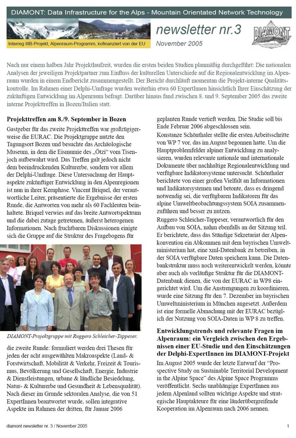
newsletter no.3 November 2005 Project meeting on September 8 th /9 th in Bolzano
 DIAMONT: Data Infrastructure for the Alps - Mountain Orientated Network Technology Interreg IIIB Project, Alpine Space Programme, co-financed by the EU newsletter no.3 November 2005 After the first half
CEMAT results - over the years
 CEMAT results - over the years Technical Conference on Functional Areas capitalization of local potential within the territorial development policies in Europe European Conference of Ministers responsible
The National Spatial Strategy
 Purpose of this Consultation Paper This paper seeks the views of a wide range of bodies, interests and members of the public on the issues which the National Spatial Strategy should address. These views
Reporting LJ-meeting
 Work Package 5: Analysing the Influence of Cultural Differences on Regional Development in the Alps Reporting LJ-meeting 060310 1. Methodological considerations 2. Enquiry & national reports 3. Results
Alps Results from the ESPON Project. Common spatial perspectives for the Alpine area. Towards a common vision
 Results from the ESPON Project Alps 2050 Common spatial perspectives for the Alpine area. Towards a common vision Tobias Chilla, University of Erlangen Cooperation Alps 2020+ 1 & 2 October 2018 Salzburg
RURAL-URBAN PARTNERSHIPS: AN INTEGRATED APPROACH TO ECONOMIC DEVELOPMENT
 RURAL-URBAN PARTNERSHIPS: AN INTEGRATED APPROACH TO ECONOMIC DEVELOPMENT William Tompson Head of the Urban Development Programme OECD Public Governance and Territorial Development Directorate JAHRESTAGUNG
Poland, European Territory, ESPON Programme Warsaw, 2 July 2007 STRATEGY OF THE ESPON 2013 PROGRAMME
 Poland, European Territory, ESPON Programme 2007-2013 Warsaw, 2 July 2007 STRATEGY OF THE ESPON 2013 PROGRAMME Territory matters Regional diversity as asset Territorial potentials increasing in importance
COUNCIL OF THE EUROPEAN UNION. Brussels, 2 May /14 CULT 68
 COUNCIL OF THE EUROPEAN UNION Brussels, 2 May 2014 9129/14 CULT 68 NOTE from: General Secretariat of the Council to: Permanent Representatives Committee (Part 1) / Council No. prev. doc.: 8892/14 CULT
MEMORANDUM OF UNDERSTANDING FOR THE ESTABLISHMENT OF A CARPATHIAN INTEGRATED BIODIVERSITY INFORMATION SYSTEM
 MEMORUM OF UNDERSTING FOR THE ESTABLISHMENT OF A CARPATHIAN INTEGRATED BIODIVERSITY INFORMATION SYSTEM BETWEEN DAPHNE - INSTITUTE OF APPLIED ECOLOGY (hereinafter referred to DAPHNE) EUROPEAN ACADEMY BOLZANO
INTEGRATED HEAVY RAIN RISK MANAGEMENT
 INTEGRATED HEAVY RAIN RISK MANAGEMENT Newsletter #1 June 2017 November 2017 RAINMAN finally started 2 What do we plan to do 3 Kick-off meeting in Vienna 5 Scoping workshop on risk assessment and mapping
Transnational SWOT Analysis
 Transnational SWOT Analysis THETRIS PROJECT WP3.4.1 PP6 - LAMORO Development Agency This project is implemented through the CENTRAL EUROPE Programme co-financed by the ERDF 1 Table of Contents Introduction:
Institut für Interdisziplinäre Gebirgsforschung (Institute of Mountaun Research) The authors
 The authors") Oliver Bender. Priv.-Doz. Dr., geography. Senior scientist at the Institute of Mountain Research: Man & Environment of the Austrian Academy of Sciences (IGF): Special interests: cultural landscape research,
Oliver Bender. Priv.-Doz. Dr., geography. Senior scientist at the Institute of Mountain Research: Man & Environment of the Austrian Academy of Sciences (IGF): Special interests: cultural landscape research,
newsletter Nr.12 February 2008 DIAMONT: Data Infrastructure for the Alps - Mountain Orientated Network Technology
 DIAMONT: Data Infrastructure for the Alps - Mountain Orientated Network Technology Interreg IIIB-Project, Alpine Space Programme, co-financed by the EU newsletter Nr.12 February 2008 In the last of the
Local Development Pilot Project: Island of Cres. Ranka Saračević Würth, Ministry of Culture, Republic of Croatia
 Local Development Pilot Project: Island of Cres Ranka Saračević Würth, Ministry of Culture, Republic of Croatia BACKGROUND, RATIFICATION OF THE FARO CONVENTION BY REPUBLIC OF CROATIA The Framework Convention
KUNMING FORUM ON UNITED NATIONS GLOBAL GEOSPATIAL INFORMATION MANAGEMENT CITIES OF THE FUTURE: SMART, RESILIENT
 KUNMING FORUM ON UNITED NATIONS GLOBAL GEOSPATIAL INFORMATION MANAGEMENT CITIES OF THE FUTURE: SMART, RESILIENT and SUSTAINABLE Yunnan Zhenzhuang Guest House, Kunming, China 10 12 May 2017 BACKGROUND CONCEPT
Community Engagement in Cultural Routes SiTI Higher Institute on Territorial Systems for Innovation Sara Levi Sacerdotti
 Transnational Workshop Wroclaw, 7th-8th December 2016 Community Engagement in Cultural Routes SiTI Higher Institute on Territorial Systems for Innovation Sara Levi Sacerdotti levi@siti.polito.it TAKING
PURR: POTENTIAL OF RURAL REGIONS UK ESPON WORKSHOP Newcastle 23 rd November Neil Adams
 PURR: POTENTIAL OF RURAL REGIONS UK ESPON WORKSHOP Newcastle 23 rd November 2012 Neil Adams PURR: Potential of Rural Regions Introduction Context for the project A spectrum of knowledge Rural Potentials
Key Indicators for Territorial Cohesion & Spatial Planning Stakeholder Workshop - Project Update. 13 th December 2012 San Sebastián, Basque Country
 Key Indicators for Territorial Cohesion & Spatial Planning Stakeholder Workshop - Project Update 13 th December 2012 San Sebastián, Basque Country Key Aims Explore the use of territorial data in developing
European Regional and Urban Statistics
 European Regional and Urban Statistics Dr. Berthold Feldmann berthold.feldmann@ec.europa.eu Eurostat Structure of the talk Regional statistics in the EU The tasks of Eurostat Regional statistics Urban
Low Density Areas : Places of Opportunity. Enrique Garcilazo, OECD Directorate for Public Governance and Territorial Development
 Low Density Areas : Places of Opportunity Enrique Garcilazo, OECD Directorate for Public Governance and Territorial Development Open Days, Brussels, 11 th October, 2016 Outline 1. Performance low density
16540/14 EE/cm 1 DG E 1A
 Council of the European Union Brussels, 5 December 2014 (OR. en) 16540/14 ENV 965 CULT 139 NOTE From: To: Subject: General Secretariat of the Council Delegations Charter of Rome on Natural and Cultural
CAMP SLOVENIA. Mezek Slavko RRC Koper. Project coordinator November 2005
 CAMP SLOVENIA Mezek Slavko RRC Koper Project coordinator November 2005 http://camp.rrc-kp.si/ Content About MAP CAMP programme CAMP Slovenia Project background CAMP Slovenia Project area CAMP Slovenia
The ESPON Programme. Goals Main Results Future
 The ESPON Programme Goals Main Results Future Structure 1. Goals Objectives and expectations Participation, organisation and networking Themes addressed in the applied research undertaken in ESPON projects
European spatial policy and regionalised approaches
 Findings of the ESPON 2006 Programme COMMIN Final Conference 26-27 April 2007 European spatial policy and regionalised approaches by Dr. Kai BöhmeB ! Territory matters Structure of presentation! Territorial
The European territory: Strategic developmentd
 The European territory: Strategic developmentd Peter Mehlbye Workshop Strategic Development Catalonia 11 June 2002 THE LECTURE Structure I. Territorial trends II. Strategy for European spatial development
AMS E-GOS Local governance and performance of open data policies at municipal level
 AMS E-GOS Local governance and performance of open data policies at municipal level Frederika Welle Donker Knowledge Centre Open Data TU Delft f.m.welledonker@tudelft.nl 1 Knowledge Centre Open Data Research
Contribution of Swiss mountain lakes to the well-being of tourists and day-trippers
 Contribution of Swiss mountain lakes to the well-being of tourists and day-trippers Rafael Matos-Wasem & Gilles Rudaz, WG2, 4 September 2013 Tourism, Wellbeing and Ecosystem Services COST Action TObeWELL
Plan4all (econtentplus project)
") Plan4all (econtentplus project) Karel CHARVAT 1, Tomáš MILDORF 2 1 Help service remote sensing, Ltd., Černoleská 1600, 256 01 Benešov u Prahy, Czech Republic charvat@bnhelp.cz 2 Department of Mathematics
Plan4all (econtentplus project) Karel CHARVAT 1, Tomáš MILDORF 2 1 Help service remote sensing, Ltd., Černoleská 1600, 256 01 Benešov u Prahy, Czech Republic charvat@bnhelp.cz 2 Department of Mathematics
ACTION PLAN FOR WORLD HERITAGE IN LATIN AMERICA AND THE CARIBBEAN ( )
") Annex ACTION PLAN FOR WORLD HERITAGE IN LATIN AMERICA AND THE CARIBBEAN (2014-2024) The current Regional Action Plan for Latin America and the Caribbean for 2014-2024 has been elaborated by the State Parties
Annex ACTION PLAN FOR WORLD HERITAGE IN LATIN AMERICA AND THE CARIBBEAN (2014-2024) The current Regional Action Plan for Latin America and the Caribbean for 2014-2024 has been elaborated by the State Parties
Implementation of the ESPON 2020 cooperation program. 16 January 2017 Anneloes van Noordt
 Implementation of the ESPON 2020 cooperation program 16 January 2017 Anneloes van Noordt Outline! ESPON Cooperation Program! Specific Objectives! Applied Research! Targeted Analysis! Database & Tools!
Economic Benefit Study on Value of Spatial Information Australian Experience
 Economic Benefit Study on Value of Spatial Information Australian Experience Dr Zaffar Sadiq Mohamed-Ghouse Director, International Relations Cooperative Research Centre for Spatial Information zsadiq@crcsi.com.au
CLLD Cooperation OFFER
 Title of the proposed project (English) CLLD Cooperation OFFER PARKS PROTECTION III - Management, Protection and Economic Development in Protected Areas Type of project (select as many as you want) Cooperation
Urbanization and Sustainable Development of Cities: A Ready Engine to Promote Economic Growth and Cooperation
 Urbanization and Sustainable Development of Cities: A Ready Engine to Promote Economic Growth and Cooperation Wan Portia Hamzah Institute of Strategic and International Studies (ISIS) Malaysia 10 September
The Governance of Land Use
 The planning system Levels of government and their responsibilities The Governance of Land Use COUNTRY FACT SHEET NORWAY Norway is a unitary state with three levels of government; the national level, 19
Mediterranean Sea and Territorial Development, Opportunities and Risks
 EESC Hearing Towards an EU Macro-Regional Strategy for the Mediterranean Mediterranean Sea and Territorial Development, Opportunities and Risks Michaela Gensheimer Structure of Intervention Part I: What
Geographical Information Systems Energy Database Report. WP1 T1.3- Deliverable 1.9
 Geographical Information Systems Energy Database Report WP1 T1.3- Deliverable 1.9 March 2015 1 314164 (ENER/FP7/314164) Project acronym: InSMART Project full title: Integrative Smart City Planning Coordination
Strengthening the cooperation in the region: Carpathian, Tisa,, Danube and Black Sea areas
 Strengthening the cooperation in the region: Carpathian, Tisa,, Danube and Black Sea areas 14th October 2009 SEE Annual Conference Advancing development through transnational cooperation in South East
Launch of the ESPON 2013 Programme. European observation network on territorial development and cohesion
 Launch of the ESPON 2013 Programme European observation network on territorial development and cohesion Framework conditions for the ESPON 2013 Programme Policy development in use of territorial evidence
Vincent Goodstadt. Head of European Affairs METREX European Network
 Vincent Goodstadt Head of European Affairs METREX European Network METREX (Network of 50 European Metropolitan Regions and Areas ) Exchanging Knowledge (e.g. Benchmarking) Climate Change CO2/80/50 Expertise
Department of Regional Development and Spatial Planning
 Department of Regional Development and Spatial Planning Applied Research in the field of Regional Development and Spatial Planning delivers the scientific background for a sustainable socio-economic development
Regional Plan 4: Integrating Ecosystem Services Mapping into Regional Land Use Planning
 Rural-Urban Outlooks: Unlocking Synergies (ROBUST) ROBUST receives funding from the European Union s Horizon 2020 research and innovation programme under grant agreement No 727988.* October 2018 Natural
Contract title: Technical assistance for multi-annual programming of future cross border cooperation programme in the Romania-Serbia cooperation area
 GOVERNMENT OF ROMANIA SERBIAN GOVERNMENT Contract title: Technical assistance for multi-annual programming of future cross border cooperation programme in the Romania-Serbia cooperation area Reference:
CHAPTER 4 HIGH LEVEL SPATIAL DEVELOPMENT FRAMEWORK (SDF) Page 95
 Page 95") CHAPTER 4 HIGH LEVEL SPATIAL DEVELOPMENT FRAMEWORK (SDF) Page 95 CHAPTER 4 HIGH LEVEL SPATIAL DEVELOPMENT FRAMEWORK 4.1 INTRODUCTION This chapter provides a high level overview of George Municipality s
CHAPTER 4 HIGH LEVEL SPATIAL DEVELOPMENT FRAMEWORK (SDF) Page 95 CHAPTER 4 HIGH LEVEL SPATIAL DEVELOPMENT FRAMEWORK 4.1 INTRODUCTION This chapter provides a high level overview of George Municipality s
Compact guides GISCO. Geographic information system of the Commission
 Compact guides GISCO Geographic information system of the Commission What is GISCO? GISCO, the Geographic Information System of the COmmission, is a permanent service of Eurostat that fulfils the requirements
SPLAN-Natura Towards an integrated spatial planning approach for Natura th January, 2017 Brussels. Commissioned by DG Environment
 SPLAN-Natura 2000 Towards an integrated spatial planning approach for Natura 2000 Commissioned by DG Environment 17 th January, 2017 Brussels V. Simeonova (Ph.D.) Drivers towards integrating Biodiversity
GOVERNMENT MAPPING WORKSHOP RECOVER Edmonton s Urban Wellness Plan Mapping Workshop December 4, 2017
 GOVERNMENT MAPPING WORKSHOP 12.4.17 RECOVER Edmonton s Urban Wellness Plan Mapping Workshop December 4, 2017 In July of 2017, City Council directed administration to develop RECOVER, Edmonton s Urban Wellness
OPEN DAYS 2011 LOCAL EVENTS COUNTRY LEAFLET. Bratislava Region Košice Region Nitra Region Trenčin Region SLOVAKIA
 OPEN DAYS 2011 LOCAL EVENTS COUNTRY LEAFLET Bratislava Region Košice Region Nitra Region Trenčin Region SLOVAKIA INDEX I. Regional Partnerships Official Partners of the OPEN DAYS 2011 Bratislava Region...
Foundation Geospatial Information to serve National and Global Priorities
 Foundation Geospatial Information to serve National and Global Priorities Greg Scott Inter-Regional Advisor Global Geospatial Information Management United Nations Statistics Division UN-GGIM: A global
Tackling urban sprawl: towards a compact model of cities? David Ludlow University of the West of England (UWE) 19 June 2014
 19 June 2014") Tackling urban sprawl: towards a compact model of cities? David Ludlow University of the West of England (UWE) 19 June 2014 Impacts on Natural & Protected Areas why sprawl matters? Sprawl creates environmental,
Tackling urban sprawl: towards a compact model of cities? David Ludlow University of the West of England (UWE) 19 June 2014 Impacts on Natural & Protected Areas why sprawl matters? Sprawl creates environmental,
TERRITORIAL IMPACT ASSESSMENT: AN APPROACH TO IMPROVE THE VERTICAL AND HORIZONTAL INTEGRATION OF EU POLICIES
 TERRITORIAL IMPACT ASSESSMENT: AN APPROACH TO IMPROVE THE VERTICAL AND HORIZONTAL INTEGRATION OF EU POLICIES Naja Marot & Mojca Golobič Biotehnical Faculty, University of Ljubljana, Slovenia RSA Workshop
Workshop B Spatial positioning and definition of characteristics
 This presentation expresses the author's views. It does not necessarily reflect the opinion of the ESPON Monitoring Committee, which is not liable for any use that may be made of the information provided.
Development of Nature Parks as Chance for Rural Development and Maintenance of Rural Heritage
 AWI 49th Georgicon Conference Development of Nature Parks as Chance for Rural Development and Maintenance of Rural Heritage Klaus Wagner 1, Jozsef Antal 2 Keszthely 2007_09_20, 1 1) Federal Institute of
6 th GLOBAL SUMMIT ON URBAN TOURISM 4 6 December 2017, Kuala Lumpur (Malaysia)
") 6 th GLOBAL SUMMIT ON URBAN TOURISM 4 6 December 2017, Kuala Lumpur (Malaysia) SUMMARY/CONCLUSIONS Esencan TERZIBASOGLU Director Destination Management and Quality eterzibasoglu@unwto.org 6TH GLOBAL SUMMIT
6 th GLOBAL SUMMIT ON URBAN TOURISM 4 6 December 2017, Kuala Lumpur (Malaysia) SUMMARY/CONCLUSIONS Esencan TERZIBASOGLU Director Destination Management and Quality eterzibasoglu@unwto.org 6TH GLOBAL SUMMIT
D2. Addressing tourism related mobility
 14-15 MAY 2018 NICOSIA, CYPRUS D2. Addressing tourism related mobility FROM SUMP TO SRTMP ALONG DANUBE Prof. Lucia Ilieva CSDCS, Bulgaria Agnes Kurzweil Environmental Agency, Austria, Andreas Friedwagner
CONFERENCE STATEMENT
 CONFERENCE STATEMENT We, the elected representatives from Canada, Denmark/Greenland, Finland, Iceland, Norway, Russia, Sweden and the United States of America; In collaboration with the indigenous peoples
Management Planning & Implementation of Communication Measures for Terrestrial Natura 2000 Sites in the Maltese Islands Epsilon-Adi Consortium
 Management Planning & Implementation of Communication Measures for Terrestrial Natura 2000 Sites in the Maltese Islands Epsilon-Adi Consortium Briefing Meetings, February 2013 CT3101/2011, MEPA, Malta
Title: Attracting and retaining knowledge workers: the strengths and weaknesses of Northern-European cities
 Title: Attracting and retaining knowledge workers: the strengths and weaknesses of Northern-European cities Bart Sleutjes, University of Amsterdam General theme: S Regional economic modeling --------------------------------------------------------------------------------------------------------------------------------------
DRAFT CONCEPT NOTE. WDR 2008: Agriculture for Development WDR 2007: Development and the Next Generation WDR 2006: Equity and Development
 WORLD DEVELOPMENT REPORT, WDR 2009 RESHAPING ECONOMIC GEOGRAPHY CONSULTATION - MENA REGION MAY 5-6, 2008 DRAFT CONCEPT NOTE The World Bank publishes each year a World Development Report (WDR) focusing
Role of SF-MST. A summary of SF-MST
 A summary of SF-MST UNWTO Committee on Statistics and TSA Madrid, 27 & 28 February 2018 Carl Obst, IDEEA Group Consultant to UNWTO Role of SF-MST Respond to the significant demand for robust measures of
National Spatial Development Perspective (NSDP) Policy Coordination and Advisory Service
 Policy Coordination and Advisory Service") National Spatial Development Perspective (NSDP) Policy Coordination and Advisory Service 1 BACKGROUND The advances made in the First Decade by far supersede the weaknesses. Yet, if all indicators were
National Spatial Development Perspective (NSDP) Policy Coordination and Advisory Service 1 BACKGROUND The advances made in the First Decade by far supersede the weaknesses. Yet, if all indicators were
EUSAIR on sea topics from Slovenian perspective
 MINISTRY OF FOREIGN AFFAIRS REPUBLIC OF SLOVENIA EUSAIR on sea topics from Slovenian perspective Mag. Andreja Jerina National Coordinator 4 EU MRS: 270 millions of population 19 MS 12 non MS Sea basin
Natura 2000 and spatial planning. Executive summary
 Natura 2000 and spatial planning Executive summary DISCLAIMER The information and views set out in this study are those of the author(s) and do not necessarily reflect the official opinion of the Commission.
Land Use in the context of sustainable, smart and inclusive growth
 Land Use in the context of sustainable, smart and inclusive growth François Salgé Ministry of sustainable development France facilitator EUROGI vice president AFIGéO board member 1 Introduction e-content+
Council Workshop on Neighbourhoods Thursday, October 4 th, :00 to 4:00 p.m. Burlington Performing Arts Centre
 Council Workshop on Neighbourhoods Thursday, October 4 th, 2012 1:00 to 4:00 p.m. Burlington Performing Arts Centre Agenda Introductions Warm-Up Exercise Presentation Exercise Neighbourhood Planning Break
Ireland 2040 Our Plan. National Planning Framework
 Ireland 2040 Our Plan National Planning Framework Submission on behalf of Waterford City and County Council Waterford City SE Regional Economic Driver (2040) 1 INTRODUCTION The National Planning Framework
OPINION. Results of EU Structural Policy in NSPA
 OPINION on the future European Cohesion Policy of the Northern Sparsely Populated Areas (NSPA) of Finland and Sweden with the contribution of North Norway The remote Northern Sparsely Populated Areas (NSPA)
Citation for published version (APA): Terluin, I. J. (2001). Rural regions in the EU: exploring differences in economic development s.n.
: Terluin, I. J. (2001). Rural regions in the EU: exploring differences in economic development s.n.") University of Groningen Rural regions in the EU Terluin, Ida Joke IMPORTANT NOTE: You are advised to consult the publisher's version (publisher's PDF) if you wish to cite from it. Please check the document
University of Groningen Rural regions in the EU Terluin, Ida Joke IMPORTANT NOTE: You are advised to consult the publisher's version (publisher's PDF) if you wish to cite from it. Please check the document
Tackling MSP integration challenges in the BSR
 Towards sustainable governance of Baltic marine space 2015 2018 BALTSPACE Towards sustainable governance of Baltic marine space Tackling MSP integration challenges in the BSR Michael Gilek, Södertörn University,
Economic development in rural regions in the EU: empirical findings and theories
 Economic development in rural regions in the EU: empirical findings and theories Presentation at the IAMO Forum 2013 Rural areas in transition, June 19-21, 2013 Dr. Ida Terluin, Agricultural Economics
Experience and perspectives of using EU funds and other funding for the implementation of district renovation projects
 Experience and perspectives of using EU funds and other funding for the implementation of district renovation projects Ministry of the Interior of Lithuania Regional policy department Administration, coordination,
Advancing Geoscientific Capability. Geological Survey of Finland
 Advancing Geoscientific Capability Geological Survey of Finland GTK in brief The Geological Survey of Finland (GTK) is one of the largest European centres of excellence in assessment, research and the
INSPIRE Basics. Vlado Cetl European Commission Joint Research Centre. https://ec.europa.eu/jrc/
 INSPIRE Basics Vlado Cetl European Commission Joint Research Centre https://ec.europa.eu/jrc/ Serving society Stimulating innovation Supporting legislation Outline SDI? Why European SDI? INSPIRE Policy
Belfairs Academy GEOGRAPHY Fundamentals Map
 YEAR 12 Fundamentals Unit 1 Contemporary Urban Places Urbanisation Urbanisation and its importance in human affairs. Global patterns of urbanisation since 1945. Urbanisation, suburbanisation, counter-urbanisation,
City and SUMP of Ravenna
 City and SUMP of Ravenna Nicola Scanferla Head of Mobility Planning Unit, Municipality of Ravenna nscanferla@comune.ra.it place your logo here 19 April, 2017 1st Steering Committee Meeting, Nicosia, Cyprus
Economic and Social Council
 United Nations Economic and Social Council Distr.: General 2 July 2012 E/C.20/2012/10/Add.1 Original: English Committee of Experts on Global Geospatial Information Management Second session New York, 13-15
WP 7: Identification and Selection of Indicators
 WP 7: Identification and Selection of Indicators WP 6 Delphi survey Analysis of relevant political documents Analysis of relevant research projects Documentation of indicators: factsheets Main problem
Earth Observation and GEOSS in Horizon Copernicus for Raw Material Workshop 5 th September 2016
 Earth Observation and GEOSS in Horizon 2020 Copernicus for Raw Material Workshop 5 th September 2016 Gilles OLLIER Head of Sector -Earth observation Directorate Environment Unit I.4 Climate Actions and
Indicator: Proportion of the rural population who live within 2 km of an all-season road
 Goal: 9 Build resilient infrastructure, promote inclusive and sustainable industrialization and foster innovation Target: 9.1 Develop quality, reliable, sustainable and resilient infrastructure, including
The Governance of Land Use
 The planning system Levels of government and their responsibilities The Governance of Land Use Country fact sheet Germany Germany is a federal country with four levels of government. Below the national
Geospatial Policy Development and Institutional Arrangements *
 HIGH LEVEL FORUM ON GLOBAL GEOSPATIAL MANAGEMENT INFORMATION WORKING PAPER No. 13 First Forum Seoul, Republic of Korea, 24-26 October 2011 Geospatial Policy Development and Institutional Arrangements *
Difference in regional productivity and unbalance in regional growth
 Difference in regional productivity and unbalance in regional growth Nino Javakhishvili-Larsen and Jie Zhang - CRT, Denmark, Presentation at 26 th International input-output conference in Brazil Aim of
Lombardy Region Territorial Context and Planning Structures
 Lombardy Region Territorial Context and Planning Structures Carlo Palazzoli RUMORE project manager carlo_palazzoli@regione.lombardia.it 15th May 2018 / RUMORE Third Partner Meeting Lombardy Region in Europe
CONFERENCE STATEMENT
 Final draft CONFERENCE STATEMENT We, the elected representatives of Canada, Denmark/Greenland, the European Parliament, Finland, Iceland, Norway, Russia, Sweden and the United States of America; In collaboration
Territorial Cooperation within the Northern Periphery and the Arctic
 Territorial Cooperation within the Northern Periphery and the Arctic 12 March 2013 / By Silvia Curbelo Betancort North charr project, Landösjön lake, Sweden. Source: North Periphery Programme Today we
SPATIALIST: Describing and Analysing the current SDI-status in Flanders (Belgium)
") SPATIALIST: Describing and Analysing the current SDI-status in Flanders (Belgium) J. Crompvoets, E. Dessers, K. Janssen, D. Vandenbroucke, G. Vancauwenberghe, T. Geudens - SPATIALIST - Zero measurement
SPATIALIST: Describing and Analysing the current SDI-status in Flanders (Belgium) J. Crompvoets, E. Dessers, K. Janssen, D. Vandenbroucke, G. Vancauwenberghe, T. Geudens - SPATIALIST - Zero measurement
Oman NSDI Business Values and Future Directions. Hassan Alawi Alghazali Acting Director General National Spatial Data Infrastructure
 Oman NSDI Business Values and Future Directions Hassan Alawi Alghazali Acting Director General National Spatial Data Infrastructure Presentation Outline Geospatial Maturity Current Challenges NCSI s Role
The ESPON Programme and the use of spatial data on the European level
 The ESPON Programme and the use of spatial data on the European level Plan4Business project ISOCARP Brussels Liaison Office 29 November 2013 Marjan van Herwijnen Project Expert - ESPON Coordination Unit
The purpose of this report is to recommend a Geographic Information System (GIS) Strategy for the Town of Richmond Hill.
 Strategy for the Town of Richmond Hill.") Staff Report for Committee of the Whole Meeting Department: Division: Subject: Office of the Chief Administrative Officer Strategic Initiatives SRCAO.18.12 GIS Strategy Purpose: The purpose of this report
Staff Report for Committee of the Whole Meeting Department: Division: Subject: Office of the Chief Administrative Officer Strategic Initiatives SRCAO.18.12 GIS Strategy Purpose: The purpose of this report
CLUDs for regenerating small historical centres
 Commercial Local Urban District project 7FP Marie Curie IRSES Open Days, Reggio Calabria - 4 and 5 July 2011 CLUDs for regenerating small historical centres Manuela RICCI Fo.Cu.S. Research Centre Sapienza
The World Bank Local and Regional Competitiveness Project (P154263)
") Public Disclosure Authorized EUROPE AND CENTRAL ASIA Macedonia, former Yugoslav Republic of Trade & Competitiveness Global Practice Recipient Executed Activities Investment Project Financing FY 2016 Seq
Public Disclosure Authorized EUROPE AND CENTRAL ASIA Macedonia, former Yugoslav Republic of Trade & Competitiveness Global Practice Recipient Executed Activities Investment Project Financing FY 2016 Seq
Land Use Planning and Agriculture: Austrian Experiences and Challenges I
 Land Use Planning and Agriculture: Austrian Experiences and Challenges I SULANET Summer School 2016 Walter Seher BOKU Vienna 1 Land Use Planning and Agriculture 2 Land Use Planning and Agriculture Agriculture
Economic and Social Council
 United Nations Economic and Social Council Distr.: General 18 July 2016 Original: English Committee of Experts on Global Geospatial Information Management Sixth session New York, 3-5 August 2016 Item 2
Frans Thissen Department of Geography, Planning and International Development Studies Rural Poverty in Flanders
 Frans Thissen Department of Geography, Planning and International Development Studies Rural Poverty in Flanders a diversity of poverty in a diversity of places Rural poverty research in Flanders Henk Meert