CAMP SLOVENIA. Mezek Slavko RRC Koper. Project coordinator November 2005
|
|
|
- Gloria O’Neal’
- 6 years ago
- Views:
Transcription

1 CAMP SLOVENIA Mezek Slavko RRC Koper Project coordinator November
2 Content About MAP CAMP programme CAMP Slovenia Project background CAMP Slovenia Project area CAMP Slovenia Poject area problems CAMP Slovenia project - objectives CAMP Slovenia project - Institutional arrangements an staffing CAMP Slovenia project - horizontal and individual projects Objectives, outputs; Further steps
3 MAP CAMP programme a programme for sustainable coastal management integrates environmental concerns into development planning oriented at practical environmental, development and management problems at local and national levels in Mediterranean coastal areas. to be integrated in the process of formulation and implementation of national and regional development policies
4 MAP CAMP programme - a multi-level nature: a) local level solving priority environment and development related problems in selected areas; b) national level contributing to the formulation and implementation of national policies and strategies testing methodologies and procedures under national and local conditions; c) regional level disseminating experience, contributing to regional policies and strategies; d) wider international level offering results, methodologies and procedures to other regions (within UNEP's Regional Seas Programme).
5 CAMP Slovenia Project background Montpellier, 1996, Extraordinary Meeting of the Contracting Parties to the Barcelona Convention, approved the decision to carry out a CAMP Project for Slovenia, Ljubljana, 2003, Agreement was signed, 2004, Start of the project; 2006, End of the implementation phase,
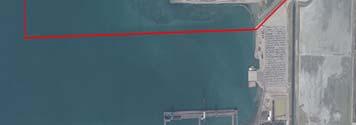
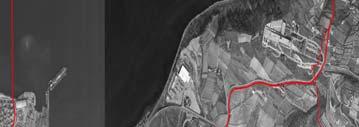
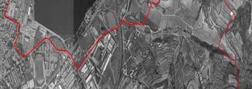
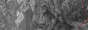
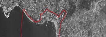
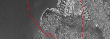
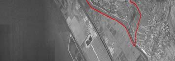
6 CAMP Slovenia Project area CAMP Slovenia area is being implemented in the South Primorska planning region: Municipalities: Koper, Izola, Piran, Sezana, Hrpelje-Kozina, Divaca, Komen, Ilirska Bistrica; Surface: 1,524 km2, Population: 118,208 (2001). Population density: 77 inhabitants/ km2. GDP per capita: 103.5% of the Slovene average (2001), The economic structure: service sector is prevailing, industry and agriculture economically less important;
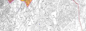
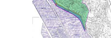
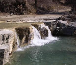
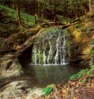
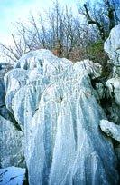
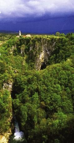
7 South Primorska planning region
8 CAMP Slovenia area: problems related to sustainable development conflicts between the environment/spatial planning and development; pressures to coastal strip and its assets/urban, tourism development patterns; degradation of cultural heritage, landscape; unsustainable mobility/transport pattern; development conflicts in nature protected areas; insufficient and disproportionate infrastructure for environmental protection ; pressures on the environment (the sea, waters, air, nature, cultural heritage).
9 CAMP Slovenia project: objectives sustainable spatial development on South Primorska regonal level, by spatial integration of urban, infrastructure, landscape development; sustainable spatial development of coastal strip, by coordinated municipal spatial planning; enhancing sustainable character of tourism development; nature protection by upgrading management of nature protected areas, water resources protection by upgrading municipal investment programming; more efficient protection of the marine environment, by provision of a tool for developing proper spill response strategies and tactics
10 CAMP Slovenia project: objectives to upgrade of institutions for sustainable development and management at the regional level; to contribute to the development of human capacities at the regional and national levels; to raise the environmental and sustainable development awareness an the regional level; to reinforce public participation in development planning and management process; to apply methodologies, tools and practices of sustainable development (Strategic Environmental Impact Assessment and Scenario Planning); to generate project results to be used in posproject period; to develop planning, management and implementation approaches at regional and municipal levels, applicable to other areas.
11 CAMP Slovenia project - Institutional arrangements an staffing MAP component: the Co-ordinating Unit of MAP acts as the overall Project Coordinator, PAP/RAC as the MAP Project Implementing Centre, BP/RAC supports Systemic and Prospective sustainability analysis, REMPEC supports sensitivity maps (Regional Spatial Information System) SPA/RAC supports Management of protected areas; PAP/RAC supports Co-ordination, integration and projects implementation; MAP Project Co-ordinator,
12 CAMP Slovenia project National Institutional arrangements Ministry of the Environment and Spatial Planning, the National Focal Point of MAP, exercises the overall co-ordination and supervision of the project, Project Steering Committee, Project Advisory Board, Project Co-ordinator, Project Secretariat (RDA of South Primorska), Team Leaders, expert teams, National authorities/institutions responsible for implementation of individual activities.
13 CAMP Slovenia project horizontal and individual projects: Horizontal projects: Regional spatial information system Participatory, awareness raising, training programme, Systemic and prospective sustainability analysis Individual projects: Regional conception of spatial development; Detailed conception of spatial plan related to coastal strip; Regional sustainable tourist development strategy; Management of protected areas; Regional programme water resources protection; Sensivity maps;
14 Horizontal project: Regional spatial information system (RSIS) Objectives: to establish a system of collection and exchange of spatial data at all levels to establish a metadata system (information on available data) in accordance with the European standards; to provide the existing data bases, spatial data, and make them available to project partners and other subjects; Outputs: relevant data bases available to project partners; set of sustainable development indicators identified; relevant data bases for indicators provided; basic data bases needed for functioning of the RSIS identified; Minimum standards for acquisition and exchange of data defined; RSIS portal being tested; Promotional activities implemented (articles);
15 Horizontal project Participatory, awareness raising, training programme Objectives to establish active participation through involvement in preparation of spatial and development documents at various levels; to raise the public awareness about the significance of environmental protection and spatial values in the context of economic and general social development; to promote the issues of sustainable development and sustainable (spatial) planning; to inform and train the key actors on new approaches and tools. Outputs: A number of workshops implemented, An internet site established and regularly updated ( A numer of press conferences organised, Information for media provided (articles, radio, TV) Training courses for Scenario planning (SPSA project) and Strategic Environmental Impact Assessment organised;

16 CAMP Horizontal project Participatory, awareness raising, training programme internet site /home page


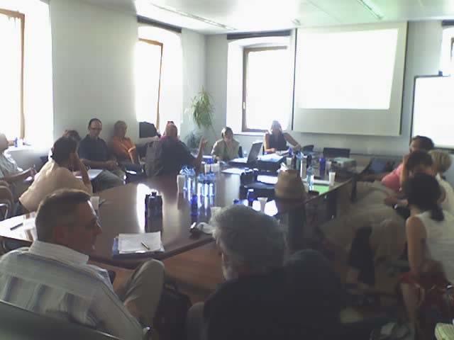
17 Training course Comprehensive Environmental Impact Assessment Koper, June 2005
18 Horizontal project Systemic and prospective sustainability analysis (SPSA) Objectives: to prepare a set of sustainability indicators and a systemic, participatory prospective sustainability analysis, to introduce and apply the systemic and prospective sustainability analysis as a specific tool for sustainable management, future vision and participation in the coastal and marine areas; To assist with the development of information systems effectiveness in all matters relating to sustainability (indicators and their use by people); to contribute to the preparation of integrated final documents, Outputs: A first list of indicators describing measurable elements (qualitative or quantitative) of the system defined; Guidance of the key information issues (spatial development, coastal strip development, tourism development) proposed, key indicators defined and agreed, the band of equilibrium for key indicators defined and agreed (amoeba diagrams), future trends and desirable outcomes for selected themes defined; a proposal for a monitoring program according to the key indicators defined.


19 Horizontal project Systemic and prospective sustainability analysis (SPSA Rich picture Workshops: 5 workshops organised in the period January June 2005 More than 50 representatives from ministries, municipalities, economic actors and NGO s participated Amoeba diagram Workshop SPSA, Koper,
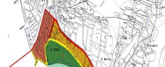
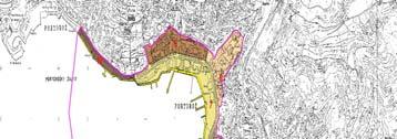
20 Individual project: Regional conception of spatial development (RCSD) Objectives: To draw up the regional conceptions of spatial distribution of selected activities, To formulate the conception of detailed spatial arrangement of the coastal strip; To prepare the guidelines for municipal spatial planning documents and national detailed plans; To define the measures for implementation of the RCSD, To promote sustainable spatial development and planning in the public. Outputs: Preparatory program prepared, presented to partners and adopted at all municipalities and MESP; Context for sustainable spatial development defined; Basic expert groundwork compiled, Relavant maps prepared, Additional expert groundwork (vulnerability study) prepared, Scenarios formulated, Tentative vision, goals formulated,
21 Individual project: Regional conception of spatial development (RCSD) Road network Landscape units Forests, agricultural land Cultural heritage, landscapes
22 Individual project: Regional conception of spatial development (RCSD) Problem map: Urban development Problem map: Transport infrastructure Problem map: Landscapes Problem map: Public Infrastructure
23 Vulnerability Assessment Tentative vision Spatial Development
24 Individual project: Regional conception of spatial development (RCSD) Obstacles encountered: Late adoption of Preparatory program (by all participating municipalities, compulsory by national spatial planning legislation); Late start of SEA Comprehensive Environmental Impact Assessment, according to national legislation; Delays slowed down implementation of other individual projects; Delays do not threaten the final time table of CAMP Slovenia; the problem already discussed by Steering Committee;
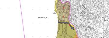
25 Individual project: Detailed conception of spatial plan related to coastal strip Objectives: to prepare a vision, goals and strategy of coastal zone spatial development; to prepare detailed conception of spatial plan related to coastal strip; to prepare recommendations for institutional arrangement for coastal zone management; to provide guidelines for national and municipal spatial development documents; to prepare programme of implementation (projects, financial frame, partners); Outputs: Context for sustainable spatial development of coastal strip defined; Basic expert groundwork compiled and prepared, Relavant maps prepared, Tentative vision, goals and strategy formulated, Alternative models for spatial development of selected areas prepared, Spatial development guidelines prepared,
26 Individual project: Detailed conception of spatial plan related to coastal strip Ownership of the castal strip Land use of the coastal strip


27 Proposed Spatial Development Concept Proposed Areas for detailed elaboration


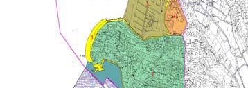
28 Proposed Land Use for selected areas


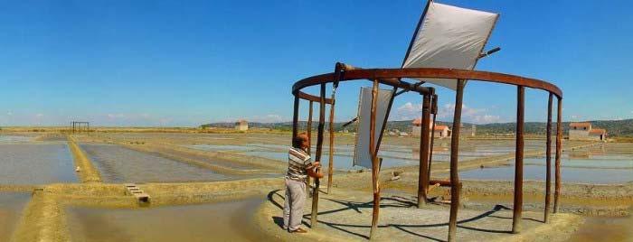
29 Workship: Koper, August 2005
30 Individual project: Regional sustainable tourist development strategy Objectives: to prepare a common vision, goals and strategy for sustainable tourism development, to prepare a regional programme with priority projects, to propose a set of SD indicators, To prepare CCA for tourism, to stimulate establishment of»forum for sustainable tourism development«. Outputs: An overview of current state of tourism development in the region prepared, Trends in tourism development identified, Scenarios of further tourism development prepared and assessed, Tentative Dev. guidelines for tourism development prepared, An organisational model destination management organisation formulated, Means and tools for SD of tourism defined


31 Individual project: Regional sustainable tourist development strategy 36 develop. goals (cca) 3 areas of SD 12 groups of actors of sustain. development 6-9 develop. priorities (2-3 per factor) MEASURABLE SUSTAINABLE TOURISM DESTINATION MANAGEMENT


32 Individual project: Management of protected areas; Objectives: Outputs: to prepare database of coastal habitat types; to formulate nature protected areas management models; to motivate new partners for management. nature protected areas management models formulated, Training course for new partners implemented

33 Individual project: Management of protected areas; Slovene Istra

34 Kras


35 Ilirska Bistrica area


36 Individual project: Management of protected areas; Training course, Sečovlje October 2005
37 Individual project: Regional programme water resources protection Objectives: support to public service operators and municipalities in preparation of the programme of collection and treatment of urban waste and meteoric water; integration of programmes of collection and treatment of urban waste water and meteoric water with other CAMP Project activities; Elaboration of a an analitical monitoring model, which will facilitate a feasibility assessment of planned investments Outputs: Consultation with representatives of municipalities and public service operators, an analitical monitoring model, for a feasibility assessment of planned investments and tariff rules, in municipal investment programming prepared.
38 Individual project: Regional programme water resources protection Hierarchy of the financial model for investments
39 Individual project: Sensivity maps of the slovenian coast and territorial sea Objectives: to provide Slovenian authorities with a set of sensitivity maps which could be subsequently used, maintained, updated and reproduced, as necessary, by national experts or centers of expertise. Outputs: Environmental data, necessary for the evaluation of the sensitivity to pollution by oil or other HNS of marine and coastal environment of Slovenia compiled; the list of economically important resources prepared, the list of coastal sites of ecological and biodiversity importance prepared, the list of coastal sites of interest from historical and cultural point of view prepared, information for the integration into a GIS and for the preparation of the sensitivity maps processed; sample maps using a GIS developed; a set of sensitivity maps covering Slovenian coasts and territorial waters prepared;

40 Individual project: Sensivity maps of the slovenian coast and territorial sea

41 Individual project: Sensivity maps of the slovenian coast and territorial sea
42 Further steps Individual projects will be finished by march 2006 Integration of results achieved by individual project will be finished by the end of April 2006, follow-up proposals and urgent investment portfolio will be prepared by the end of April 2006, Final conference will be organised by the end of April 2006, Terminal report will be prepared by the end of June 2006
THE SEVILLE STRATEGY ON BIOSPHERE RESERVES
 THE SEVILLE STRATEGY ON BIOSPHERE RESERVES 1 VISION FOR BIOSPHERE RESERVES IN THE 21 ST CENTURY The international Seville Conference on Biosphere Reserves, organised by UNESCO, adopted a two-pronged approach,
The Governance of Land Use
 The planning system Levels of government and their responsibilities The Governance of Land Use COUNTRY FACT SHEET NORWAY Norway is a unitary state with three levels of government; the national level, 19
SPLAN-Natura Towards an integrated spatial planning approach for Natura th January, 2017 Brussels. Commissioned by DG Environment
 SPLAN-Natura 2000 Towards an integrated spatial planning approach for Natura 2000 Commissioned by DG Environment 17 th January, 2017 Brussels V. Simeonova (Ph.D.) Drivers towards integrating Biodiversity
ACTION PLAN FOR WORLD HERITAGE IN LATIN AMERICA AND THE CARIBBEAN ( )
") Annex ACTION PLAN FOR WORLD HERITAGE IN LATIN AMERICA AND THE CARIBBEAN (2014-2024) The current Regional Action Plan for Latin America and the Caribbean for 2014-2024 has been elaborated by the State Parties
Annex ACTION PLAN FOR WORLD HERITAGE IN LATIN AMERICA AND THE CARIBBEAN (2014-2024) The current Regional Action Plan for Latin America and the Caribbean for 2014-2024 has been elaborated by the State Parties
Management Planning & Implementation of Communication Measures for Terrestrial Natura 2000 Sites in the Maltese Islands Epsilon-Adi Consortium
 Management Planning & Implementation of Communication Measures for Terrestrial Natura 2000 Sites in the Maltese Islands Epsilon-Adi Consortium Briefing Meetings, February 2013 CT3101/2011, MEPA, Malta
Contents: LEVANTE DE ALMERÍA A INFORMATION SYSTEM OBJECTIVES AND ACTIONS GEOGRAPHIC INFORMATION SYSTEM RESULTS
 Contents: LEGAL FRAMEWORK: BARCELONA CONVENTION AND ICZM PROTOCOL; COASTAL AREAS MANAGEMENT PROGRAMME; CAMP LEVANTE DE ALMERIA; OVERALL AIM AND KEY IDEAS AREA PHASES PROJECT STRUCTURE ACTIVITIES INSTITUTIONAL
RETA 6422: Mainstreaming Environment for Poverty Reduction Category 2 Subproject
 RETA 6422: Mainstreaming Environment for Poverty Reduction Category 2 Subproject A. Basic Data 1. Subproject Title: Poverty-Environment Mapping to Support Decision Making 2. Country Director: Adrian Ruthenberg
Economic and Social Council
 United Nations Economic and Social Council Distr.: General 18 July 2016 Original: English Committee of Experts on Global Geospatial Information Management Sixth session New York, 3-5 August 2016 Item 2
Tourism and Environmental Protection
 Tourism and Environmental Protection Janez Mekinc University of Primorska, Faculty of Tourism Studies Portorož - Turistica Helena Cvikl University of Primorska, Faculty of Tourism Studies Portorož Turistica
TERRITORIAL IMPACT ASSESSMENT: AN APPROACH TO IMPROVE THE VERTICAL AND HORIZONTAL INTEGRATION OF EU POLICIES
 TERRITORIAL IMPACT ASSESSMENT: AN APPROACH TO IMPROVE THE VERTICAL AND HORIZONTAL INTEGRATION OF EU POLICIES Naja Marot & Mojca Golobič Biotehnical Faculty, University of Ljubljana, Slovenia RSA Workshop
The Governance of Land Use
 The planning system Levels of government and their responsibilities The Governance of Land Use Country fact sheet Germany Germany is a federal country with four levels of government. Below the national
The Swedish National Geodata Strategy and the Geodata Project
 The Swedish National Geodata Strategy and the Geodata Project Ewa Rannestig, Head of NSDI Co-ordination Unit, Lantmäteriet, ewa.rannstig@lm.se Ulf Sandgren, Project Manager Geodata Project, Lantmäteriet,
Country Fiche Estonia
 Country Fiche Estonia Deleted: October Updated May 2018 Deleted: 7 1. General information Size of internal waters (to the baseline) and territorial sea (12-nm zone from the baseline) approximately 25 200
Mediteranean sea issues in the view of ESPON ESaTDOR project and Marine Spatial Planning in Slovenia
 DIREKTORAT ZA PROSTOR, GRADITEV IN STANOVANJA Mediteranean sea issues in the view of ESPON ESaTDOR project and Marine Spatial Planning in Slovenia BlueMed meeting of stakeholders on a micro-regional level
THE ROLE OF SPATIAL PLANNING IN INTEGRATED COASTAL ZONE MANAGEMENT RECOMMENDATIONS FROM THE INTERREG III B BALTCOAST PROJECT
 THE ROLE OF SPATIAL PLANNING IN INTEGRATED COASTAL ZONE MANAGEMENT RECOMMENDATIONS FROM THE INTERREG III B BALTCOAST PROJECT DISCUSSION PAPER FOR THE TRANSNATIONAL WORKING GROUP DECEMBER 2004 CONTENT 1.
Margarita Stancheva Hristo Stanchev & Robert Young 2. MEDCOAST JUBILEE WORKSHOP May 2015, Iberotel Sarigerme Park, Dalaman, Turkey
 Margarita Stancheva Hristo Stanchev & Robert Young 2 INTRODUCTION: Bulgarian Black Sea coast INTRODUCTION: Increasing pressure on Bulgarian coastal zone In 2011, of the 7 364 570 people that lived in Bulgaria,
Natura 2000 and spatial planning. Executive summary
 Natura 2000 and spatial planning Executive summary DISCLAIMER The information and views set out in this study are those of the author(s) and do not necessarily reflect the official opinion of the Commission.
CEMAT results - over the years
 CEMAT results - over the years Technical Conference on Functional Areas capitalization of local potential within the territorial development policies in Europe European Conference of Ministers responsible
City and SUMP of Ravenna
 City and SUMP of Ravenna Nicola Scanferla Head of Mobility Planning Unit, Municipality of Ravenna nscanferla@comune.ra.it place your logo here 19 April, 2017 1st Steering Committee Meeting, Nicosia, Cyprus
Country Fiche Estonia
 Country Fiche Estonia Updated October 2017 1. General information Size of internal waters (to the baseline) and territorial sea (12-nm zone from the baseline) approximately 25 200 km 2. Exclusive economic
Evaluation Model for the Sustainable Development of European Coastal Zones
 Evaluation Model for the Sustainable Development of European Coastal Zones SUMMARY Interreg IIIC - South 2 INDEX 1.- INTRODUCTION... 3 2.- CONTEXT OF DEDUCE... 4 3.- CURRENT SITUATION AND CHALLENGES...
HELSINKI COMMISSION Baltic Marine Environment Protection Commission
 HELSINKI COMMISSION Baltic Marine Environment Protection Commission HELCOM RECOMMENDATION 24/10 Adopted 25 June 2003, having regard to Article 20, Paragraph 1 b) of the 1992 Helsinki Convention IMPLEMENTATION
SWEDISH SDI DEVELOPMENT & IMPLEMENTATION OF INSPIRE
 SWEDISH SDI DEVELOPMENT & IMPLEMENTATION OF INSPIRE Christina Wasström, Lantmäteriet, 801 82 Gävle, Sweden, christina.wasstrom@lm.se ABSTRACT The Swedish Government and Parliament has given Lantmäteriet
16540/14 EE/cm 1 DG E 1A
 Council of the European Union Brussels, 5 December 2014 (OR. en) 16540/14 ENV 965 CULT 139 NOTE From: To: Subject: General Secretariat of the Council Delegations Charter of Rome on Natural and Cultural
Al Ain Cultural Heritage Management Strategy 1/102
 AL AIN CULTURAL HERITAGE MANAGEMENT STRATEGY EXECUTIVE SUMMARY The cultural heritage of Al Ain is rich and varied; it consists of tangible and intangible resources and incorporates archaeological sites,
Proposal for a DIRECTIVE OF THE EUROPEAN PARLIAMENT AND OF THE COUNCIL. establishing an infrastructure for spatial information in the Community
 Proposal for a DIRECTIVE OF THE EUROPEAN PARLIAMENT AND OF THE COUNCIL establishing an infrastructure for spatial information in the Community INSPIRE http://inspire.jrc.it/ Alessandro Annoni 1 EU Commission
Land Use in the context of sustainable, smart and inclusive growth
 Land Use in the context of sustainable, smart and inclusive growth François Salgé Ministry of sustainable development France facilitator EUROGI vice president AFIGéO board member 1 Introduction e-content+
ACTION PLAN FOR WORLD HERITAGE IN LATIN AMERICA AND THE CARIBBEAN
 Final version-to send to the ACTION PLAN FOR WORLD HERITAGE IN LATIN AMERICA AND THE CARIBBEAN 2014-2024 The current Regional Action Plan for Latin America and the Caribbean has been elaborated by the
Mediterranean Sea and Territorial Development, Opportunities and Risks
 EESC Hearing Towards an EU Macro-Regional Strategy for the Mediterranean Mediterranean Sea and Territorial Development, Opportunities and Risks Michaela Gensheimer Structure of Intervention Part I: What
UNESCO World Heritage Centre - Arab States Unit
 UNESCO World Heritage Centre - Arab States Unit Post-Conflict Reconstruction in the Middle East Context and in the Old City of Aleppo in Particular UNESCO Headquarter, 18-19 June 2015 ACTION PLAN resulting
Launch of the ESPON 2013 Programme. European observation network on territorial development and cohesion
 Launch of the ESPON 2013 Programme European observation network on territorial development and cohesion Framework conditions for the ESPON 2013 Programme Policy development in use of territorial evidence
GeoparkLIFE: Tourism for Conservation. Reviewing Policy towards the Integration of Sustainable Tourism and Conservation Management Executive Summary
 Reviewing Policy towards the Integration of Sustainable Tourism and Conservation Management Executive Summary Gabriel Cooney and Joanne Gaffrey UCD School of Archaeology GeoparkLIFE: Tourism for Conservation
Norwegian spatial data infrastructure supporting disaster risk management Norwegian Mapping Authority
 Norwegian spatial data infrastructure supporting disaster risk management Norwegian Mapping Authority Arvid Lillethun, Norwegian Mapping Authority Land and Poverty 2018 Conference, World Bank 19.-23. March
Statutory framework of the world network of biosphere reserves UNESCO General Conference 1996
 Statutory framework of the world network of biosphere reserves UNESCO General Conference 1996 Keywords: conservation, protected areas, biosphere reserves, policies, strategies. For the Mountain Forum's
Ministry of Health and Long-Term Care Geographic Information System (GIS) Strategy An Overview of the Strategy Implementation Plan November 2009
 Strategy An Overview of the Strategy Implementation Plan November 2009") Ministry of Health and Long-Term Care Geographic Information System (GIS) Strategy An Overview of the Strategy Implementation Plan November 2009 John Hill, Health Analytics Branch Health System Information
Ministry of Health and Long-Term Care Geographic Information System (GIS) Strategy An Overview of the Strategy Implementation Plan November 2009 John Hill, Health Analytics Branch Health System Information
National Land Use Policy and National Integrated Planning Framework for Land Resource Development
 Title National Land Use Policy and National Integrated Planning Framework for Land Resource Development Duration: 32 Weeks Objective: Adoption of appropriate land use planning approaches to: Maintain the
Community Engagement in Cultural Routes SiTI Higher Institute on Territorial Systems for Innovation Sara Levi Sacerdotti
 Transnational Workshop Wroclaw, 7th-8th December 2016 Community Engagement in Cultural Routes SiTI Higher Institute on Territorial Systems for Innovation Sara Levi Sacerdotti levi@siti.polito.it TAKING
Realizing benefits of Spatial Data Infrastructure A user s perspective from Environment Agency - Abu Dhabi
 Realizing benefits of Spatial Data Infrastructure A user s perspective from Environment Agency - Abu Dhabi Anil Kumar Director, Environment Information Management 26 April 2012 Geospatial World Forum,
The Governance of Land Use
 The planning system The Governance of Land Use United Kingdom Levels of government and their responsibilities The United Kingdom is a unitary state with three devolved governments in Northern Ireland,
TOWARDS STRATEGIC SPATIAL PLANNING IN JAMAICA: THE NATIONAL SPATIAL PLAN
 TOWARDS STRATEGIC SPATIAL PLANNING IN JAMAICA: THE NATIONAL SPATIAL PLAN JIEP 5th Biennial Conference on the Environment: Balancing National Development and Environmental Protection June 6, 2011 Jamaica
ICZM and MSP in the Black Sea Region
 ICZM and MSP in the Black Sea Region Drd. Claudia Coman, Environmental engineer AG ICZM Focal Point, Romania Black Sea Commission Black Sea Commission on the Protection of the Black Sea against Pollution
Local Development Pilot Project: Island of Cres. Ranka Saračević Würth, Ministry of Culture, Republic of Croatia
 Local Development Pilot Project: Island of Cres Ranka Saračević Würth, Ministry of Culture, Republic of Croatia BACKGROUND, RATIFICATION OF THE FARO CONVENTION BY REPUBLIC OF CROATIA The Framework Convention
Country Fiche Lithuania
 Country Fiche Lithuania Updated June 2018 1. General information The Lithuanian maritime space is delimited by the Decree of the Government of the Republic of Lithuania of 6 December, 2004, No. 1597 and
MR. George ALEXAKIS, parallel session 3. "Mediterranean Sea Region. laying the conditions. for sustainable growth and jobs"
 parallel session 3 "Mediterranean Sea Region laying the conditions for sustainable growth and jobs" MR. George ALEXAKIS, elected Regional Councillor of Crete, Greece and representative of Crete in CRPM.
Appropriation Directions for 2007
 INSPIRE in Sweden An Important Part of the National Geodata Strategy Monica Lagerqvist Nilsson Appropriation Directions for 2007 A commission to investigate the necessity to adjust the Swedish legislation
GIS Geographical Information Systems. GIS Management
 GIS Geographical Information Systems GIS Management Difficulties on establishing a GIS Funding GIS Determining Project Standards Data Gathering Map Development Recruiting GIS Professionals Educating Staff
MEMORANDUM OF UNDERSTANDING FOR THE ESTABLISHMENT OF A CARPATHIAN INTEGRATED BIODIVERSITY INFORMATION SYSTEM
 MEMORUM OF UNDERSTING FOR THE ESTABLISHMENT OF A CARPATHIAN INTEGRATED BIODIVERSITY INFORMATION SYSTEM BETWEEN DAPHNE - INSTITUTE OF APPLIED ECOLOGY (hereinafter referred to DAPHNE) EUROPEAN ACADEMY BOLZANO
Key Indicators for Territorial Cohesion & Spatial Planning Stakeholder Workshop - Project Update. 13 th December 2012 San Sebastián, Basque Country
 Key Indicators for Territorial Cohesion & Spatial Planning Stakeholder Workshop - Project Update 13 th December 2012 San Sebastián, Basque Country Key Aims Explore the use of territorial data in developing
Regional stakeholders strategy of Donegal County Council
 Regional stakeholders strategy of Donegal County Council Table of contents The template comprised five steps in the creation of this communication strategy: 1 Starting point. Communication objectives...
International Guidelines on Access to Basic Services for All
 International Guidelines on Access to Basic Services for All Presentation and initials lessons from implementation Accessibility to services in regions and cities : measures and policies, OECD 18 June
EUSAIR on sea topics from Slovenian perspective
 MINISTRY OF FOREIGN AFFAIRS REPUBLIC OF SLOVENIA EUSAIR on sea topics from Slovenian perspective Mag. Andreja Jerina National Coordinator 4 EU MRS: 270 millions of population 19 MS 12 non MS Sea basin
COUNCIL OF THE EUROPEAN UNION. Brussels, 2 May /14 CULT 68
 COUNCIL OF THE EUROPEAN UNION Brussels, 2 May 2014 9129/14 CULT 68 NOTE from: General Secretariat of the Council to: Permanent Representatives Committee (Part 1) / Council No. prev. doc.: 8892/14 CULT
Work Packages. RECROS Project development workshop. Prague, 30 th April 2015
 Work Packages Prague, 30 th April 2015 Main principles - remarks Protected areas, regions, cities, not only comparison cities/rural areas HU most of cities have their climate strategies good contacts to
Country Fiche Latvia Updated October 2016
 Country Fiche Latvia Updated October 2016 1. General information Marine area under Latvian jurisdiction includes inland sea waters, Territorial sea (12 nautical miles from the baseline) and exclusive economic
European Landscape Convention in the Slovak Republic
 13th COUNCIL OF EUROPE MEETING OF THE WORKSHOPS FOR THE EUROPEAN LANDSCAPE CONVENTION European Landscape Convention in the Slovak Republic Mrs. Ida Vanáková, state advisor, Department of Spatial Planning
CHAPTER 4 HIGH LEVEL SPATIAL DEVELOPMENT FRAMEWORK (SDF) Page 95
 Page 95") CHAPTER 4 HIGH LEVEL SPATIAL DEVELOPMENT FRAMEWORK (SDF) Page 95 CHAPTER 4 HIGH LEVEL SPATIAL DEVELOPMENT FRAMEWORK 4.1 INTRODUCTION This chapter provides a high level overview of George Municipality s
CHAPTER 4 HIGH LEVEL SPATIAL DEVELOPMENT FRAMEWORK (SDF) Page 95 CHAPTER 4 HIGH LEVEL SPATIAL DEVELOPMENT FRAMEWORK 4.1 INTRODUCTION This chapter provides a high level overview of George Municipality s
INTERNATIONAL CULTURAL TOURISM CHARTER Managing Tourism at Places of Heritage Significance (1999)
") INTERNATIONAL CULTURAL TOURISM CHARTER Managing Tourism at Places of Heritage Significance (1999) Adopted by ICOMOS at the 12th General Assembly in Mexico, October 1999. INTRODUCTION The Charter Ethos
INTERNATIONAL CULTURAL TOURISM CHARTER Managing Tourism at Places of Heritage Significance (1999) Adopted by ICOMOS at the 12th General Assembly in Mexico, October 1999. INTRODUCTION The Charter Ethos
Towards Reliable Spatial Database of Informal Areas in Greater Cairo Region
 KEYWORDS informal areas, unreliable spatial data, spatial data collecting, capacity building SUMMARY The uncontrolled and rapid increase of Egypt s cities is a major problem of the country. More than the
SHARE. Structured Humanitarian Assistance Reporting
 SHARE Structured Humanitarian Assistance Reporting A Summary Description and Requirements for Geo-referenced Data Collection and Mapping to Support Humanitarian Assistance Operations Geographic Information
ACRONYMS AREAS COUNTRIES MARINE TERMS
 Natura 2000 ACRONYMS AREAS COUNTRIES MARINE TERMS DEFINITION A European network of protected sites under the European Habitats and Birds Directives, aiming to protect the most valuable and threatened European
Towards coherent maritime spatial planning in the Baltic Sea Region, transnational and project perspective Talis Linkaits Head of VASAB Secretariat
 3 June 2013 Riga PartiSEApate Workshop MSP as Tool for Underwater Cultural Heritage Management in the Baltic Sea Towards coherent maritime spatial planning in the Baltic Sea Region, transnational and project
Jordan's Strategic Research Agenda in cultural heritage
 Jordan's Strategic Research Agenda in cultural heritage Analysis of main results Alessandra Gandini Amman, Jordan 3 rd November 2013 Main objectives The work performed had the main objective of giving
The Governance of Land Use
 The Governance of Land Use Country fact sheet Czech Republic The planning system Levels of government and their responsibilities The Czech Republic is a unitary state with 3 levels of government: the national
Economic and Social Council
 United Nations Economic and Social Council Distr.: General 2 July 2012 E/C.20/2012/10/Add.1 Original: English Committee of Experts on Global Geospatial Information Management Second session New York, 13-15
BURGAS CASE STUDY: LAND-SEA INTERACTIONS. Dr. Margarita Stancheva
 BURGAS CASE STUDY: LAND-SEA INTERACTIONS Dr. Margarita Stancheva Name of presentation NEED FOR COHERENCE BETWEEN LAND AND SEA ACTIVITIES Name presenter Burgas is the fourth largest city in Bulgaria and
Marine Spatial Planning as an important tool for implementing the MSFD
 Marine Spatial Planning as an important tool for implementing the MSFD Risto Kalliola Tallinn, Nov. 16 th 2012 DEPARTMENT OF GEOGRAPHY AND GEOLOGY University of Turku, Finland Ten principles to provide
The ESPON Programme. Goals Main Results Future
 The ESPON Programme Goals Main Results Future Structure 1. Goals Objectives and expectations Participation, organisation and networking Themes addressed in the applied research undertaken in ESPON projects
Implementation of the ESPON 2020 cooperation program. 16 January 2017 Anneloes van Noordt
 Implementation of the ESPON 2020 cooperation program 16 January 2017 Anneloes van Noordt Outline! ESPON Cooperation Program! Specific Objectives! Applied Research! Targeted Analysis! Database & Tools!
NEPAL: FCPF READINESS GRANT FCPFR - FOREST CARBON PARTNERSHIP FACILITY
 Assignment: TF094724 NEPAL: FCPF READINESS GRANT FCPFR - FOREST CARBON PARTNERSHIP FACILITY Task Team Leader: 00000240969 Approving Manager: 00000082671 - Abdelaziz Lagnaoui - Kseniya Lvovsky Summary Information
Heritage and Cultural Tourism Management
 Unit 34: Heritage and Cultural Tourism Management Unit code: L/601/1757 QCF level: 4 Credit value: 15 Aim The aim of this unit is to enable learners to gain understanding of the heritage and cultural,
Application for Geotourism Charter
 Application for Geotourism Charter Thank you for the interest in geotourism as a long-term strategy to foster wisely managed tourism and enlightened destination stewardship. National Geographic s Center
Cross-border Maritime Spatial Plan for the Black sea - Romania and Bulgaria project
 Cross-border Maritime Spatial Plan for the Black sea - Romania and Bulgaria project in Romania and Bulgaria Plan Presentation A first step in the management of the marine areas of Romania and Bulgaria
Global Geoparks focus on developing their regions as Sustainable Tourism Destinations.
 The Burren & Cliffs of Moher region has achieved UNESCOsupported Global Geopark Status in recognition of the region s significant geological, ecological and cultural value, as well as its sustainable tourism
The National Spatial Strategy
 Purpose of this Consultation Paper This paper seeks the views of a wide range of bodies, interests and members of the public on the issues which the National Spatial Strategy should address. These views
Declaration Population and culture
 Declaration Population and culture The ministers of the parties to the Alpine Convention regard the socio-economic and socio-cultural aspects mentioned in Article 2, Paragraph 2, Item a., as being central
Exploring GIS Potential for Northwestern Ontario Land Information Ontario
 Exploring GIS Potential for Northwestern Ontario Land Information Ontario May 13, 2015 The LIO Vision LIO Vision: That all geographic information about Ontario is fully integrated and accessible LIO Goal:
Urban Climate Resilience
 Urban Climate Resilience in Southeast Asia Partnership Project Introduction Planning for climate change is a daunting challenge for governments in the Mekong Region. Limited capacity at the municipal level,
The European territory: Strategic developmentd
 The European territory: Strategic developmentd Peter Mehlbye Workshop Strategic Development Catalonia 11 June 2002 THE LECTURE Structure I. Territorial trends II. Strategy for European spatial development
Spatial Planning in the Republic of Armenia
 Spatial Planning in the Republic of Armenia According to the Law of the Republic of Armenia on Urban Development, the main issues of the Republic s spatial development and actions for their solution are
2018/1 The integration of statistical and geospatial information. The Regional Committee of UN-GGIM: Americas:
 The following are the conclusions and recommendations of the Regional Committee of the United Nations on Global Geospatial Information Management for the Americas, during its Fifth Session, Thursday 8
Plan4all (econtentplus project)
") Plan4all (econtentplus project) Karel CHARVAT 1, Tomáš MILDORF 2 1 Help service remote sensing, Ltd., Černoleská 1600, 256 01 Benešov u Prahy, Czech Republic charvat@bnhelp.cz 2 Department of Mathematics
Plan4all (econtentplus project) Karel CHARVAT 1, Tomáš MILDORF 2 1 Help service remote sensing, Ltd., Černoleská 1600, 256 01 Benešov u Prahy, Czech Republic charvat@bnhelp.cz 2 Department of Mathematics
THE SEVILLE STRATEGY FOR BIOSPHERE RESERVES
 THE SEVILLE STRATEGY FOR BIOSPHERE RESERVES BIOSPHERE RESERVES: THE FIRST TWENTY YEARS Biosphere reserves are designed to deal with one of the most important questions the World faces today: How can we
Statutory Framework of Biosphere Reserves. The Statutory Framework of the World Network of Biosphere Reserves
 Page 1 of 5 The Statutory Framework of the World Network of Biosphere Reserves Introduction Article 1 - Definition Article 2 - World Network of Biosphere Reserves Article 3 - Functions Article 4 - Criteria
TOWARDS CLIMATE-RESILIENT COASTAL MANAGEMENT: OPPORTUNITIES FOR IMPROVED ICZM IN BELIZE
 TOWARDS CLIMATE-RESILIENT COASTAL MANAGEMENT: OPPORTUNITIES FOR IMPROVED ICZM IN BELIZE CHANTALLE SAMUELS Coastal Zone Management Authority and Institute The Caribbean Community Climate Change Centre VULNERABILITY
INSPIRE in Sweden - an Important Part of the National Geodata Strategy
 INSPIRE in Sweden - an Important Part of the National Geodata Strategy Ewa RANNESTIG and Monica LAGERQVIST NILSSON, Sweden Key words: National Geodata Strategy, National Infrastructure for Spatial Information,
The IUCN Facilitated Independent Advisory Panel on Remediation and Rehabilitation of Biodiversity and Habitats of Oil Spill Sites in the Niger Delta
 World Conservation Congress, Jeju, Korea, September 2012 The IUCN Facilitated Independent Advisory Panel on Remediation and Rehabilitation of Biodiversity and Habitats of Oil Spill Sites in the Niger Delta
Maritime Spatial Planning in the Baltic Sea Region
 Maritime Spatial Planning in the Baltic Sea Region Talis Linkaits Head of VASAB Secretariat 20 May 2015 Helsinki A cooperation of ministers of the 11 Baltic Sea Region countries responsible for spatial
Programme for integrated coastal zone management : the case of the Cyclades (PICAMCY)
") Programme for integrated coastal zone management : the case of the Cyclades (PICAMCY) Coccossis H., Mexa A. in Camarda D. (ed.), Grassini L. (ed.). Coastal zone management in the Mediterranean region Bari
Programme for integrated coastal zone management : the case of the Cyclades (PICAMCY) Coccossis H., Mexa A. in Camarda D. (ed.), Grassini L. (ed.). Coastal zone management in the Mediterranean region Bari
UN-GGIM: Strengthening Geospatial Capability
 Fifth Plenary Meeting of UN-GGIM: Europe Brussels, 6-7 June 2018 UN-GGIM: Strengthening Geospatial Capability Walking the talk to leave no one behind Greg Scott, UN-GGIM Secretariat Environmental Statistics
Public Participatory GIS (ppgis), training & webgis in Mare Nostrum. Anna Spiteri, IRMCo Haifa, Israel, 5th March 2013
, training & webgis in Mare Nostrum. Anna Spiteri, IRMCo Haifa, Israel, 5th March 2013") Public Participatory GIS (ppgis), training & webgis in Mare Nostrum Anna Spiteri, IRMCo Haifa, Israel, 5th March 2013 What is ppgis? Why do we need it? Who participates? Where do we do it? When do we do
Public Participatory GIS (ppgis), training & webgis in Mare Nostrum Anna Spiteri, IRMCo Haifa, Israel, 5th March 2013 What is ppgis? Why do we need it? Who participates? Where do we do it? When do we do
KUNMING FORUM ON UNITED NATIONS GLOBAL GEOSPATIAL INFORMATION MANAGEMENT CITIES OF THE FUTURE: SMART, RESILIENT
 KUNMING FORUM ON UNITED NATIONS GLOBAL GEOSPATIAL INFORMATION MANAGEMENT CITIES OF THE FUTURE: SMART, RESILIENT and SUSTAINABLE Yunnan Zhenzhuang Guest House, Kunming, China 10 12 May 2017 BACKGROUND CONCEPT
Environmental Management Information System (EMIS)
") United Nations Human Settlements Programme (UN-HABITAT) United Nations Environment Programme (UNEP) Environmental Management Information System (EMIS) a tool for Environmental Planning and Management (EPM)
United Nations Human Settlements Programme (UN-HABITAT) United Nations Environment Programme (UNEP) Environmental Management Information System (EMIS) a tool for Environmental Planning and Management (EPM)
Overview of LEDDRA. Three years of research on responses to LEDD
 Overview of LEDDRA Three years of research on responses to LEDD, Coordinating institution (Greece) Project partners Agricultural University of Athens (Greece) 3D-Environmental Change (The Netherlands)
LEDDRA an overview. Helen Briassoulis Department of Geography, University of the Aegean Mytilini, Greece
 LEDDRA an overview, and Ecology Harokopion University, Athens, Greece Outline LEDDRA philosophy LEDDRA approach LEDDRA objectives LEDDRA conceptual framework LEDDRA theoretical framework LEDDRA methodological
UNITED NATIONS ECONOMIC COMMISSION FOR EUROPE. Road Maps for Mainstreaming Ageing
 UNITED NATIONS ECONOMIC COMMISSION FOR EUROPE Population Unit www.unece.org/pau Road Maps for Mainstreaming Ageing Fiona Willis Núñez fiona.willis nunez@unece.org Sub-Regional Capacity Development Workshop
Resolution XIII.23. Wetlands in the Arctic and sub-arctic
 13th Meeting of the Conference of the Contracting Parties to the Ramsar Convention on Wetlands Wetlands for a Sustainable Urban Future Dubai, United Arab Emirates, 21-29 October 2018 Resolution XIII.23
Applying GIS to Coastal Management in Cork Harbour: the Corepoint experience
 Applying GIS to Coastal Management in Cork Harbour: the Corepoint experience Kathrin Köpke University College Cork, Ireland Thematic Conference: THE WATERFRONT MANAGEMENT AND GI (IT), 14 th -18 th November
ALTER ECO Alternative tourist strategies to enhance the local sustainable development of tourism by promoting Mediterranean identity Module 2: Testing
 ALTER ECO Alternative tourist strategies to enhance the local sustainable development of tourism by promoting Mediterranean identity Module 2: Testing WHY? Areas of high tourism attraction in coastal cities
The Governance of Land Use
 The Governance of Land Use COUNTRY FACT SHEET SPAIN The planning system Levels of government and their responsibilities Spain is defined by the OECD as a quasi-federal state with 4 levels of government;
IMA s ROLE IN COASTAL AND OCEAN GOVERNANCE IN TRINIDAD AND TOBAGO
 IMA s ROLE IN COASTAL AND OCEAN GOVERNANCE IN TRINIDAD AND TOBAGO Presented by Rahanna Juman, Deputy Director (Ag.) About the Institute of Marine Affairs Institute of Marine Affairs (IMA) was established,